deed of conservation easement -...
TRANSCRIPT
1
NOTICE: THIS DEED OF CONSERVATION EASEMENT CONTAINS COVENANTS THAT INCLUDE RESTRICTIONS ON USE, SUBDIVISION, AND SALE OF LAND AND REQUIRES SPECIFIC REFERENCE IN A SEPARATE PARAGRAPH OF ANY SUBSEQUENT DEED OR OTHER LEGAL INSTRUMENT BY WHICH ANY INTEREST IN THE PROPERTY IS CONVEYED.
DEED OF CONSERVATION EASEMENT
THIS DEED OF CONSERVATION EASEMENT ("Conservation Easement") made this
_____ day of ______________, 2009, by and between ___________ and ______________, having an address at _________________________ (collectively, "Grantors") and the STATE OF MARYLAND, TO THE USE OF THE DEPARTMENT OF NATURAL RESOURCES and _________________________________, a Maryland nonprofit corporation, _______________________________________ (collectively, "Grantees").
WHEREAS, this Conservation Easement is based upon a form that assumes there are
multiple Grantors and multiple Grantees. In the event that this assumption is wrong for this Conservation Easement, then, as appropriate, any Provision assuming multiple Grantors or Grantees shall be interpreted to mean only one Grantor or Grantee, as the case may be. In addition, Art. VI. D shall be disregarded when there is only one Grantee. WHEREAS, the Department of Natural Resources is a body corporate and an instrumentality of the state of Maryland created pursuant to the Natural Resources Article of the Annotated Code of Maryland (2000 Replacement Volume as amended) for the purpose generally of preserving and maintaining the natural resources of the State; [other changes as needed to reflect named Grantees]
WHEREAS, the Grantors own in fee simple ____ acres, more or less, of certain real
property in ________ County, Maryland, and more particularly described in Exhibit A attached hereto, which was conveyed to the Grantors by ____________ by Deed dated __________ and recorded among the Land Records of _______ County, Maryland in Liber ____, Folio ____ (the "Property"). The address of the Property is ______________________. The Property is identified on tax map ____, parcel ____;
WHEREAS, the Property consists of _____ acres of [agricultural land, woodlands, open
fields, etc…]; a portion of the [stream or river]; shoreline on the [Chesapeake Bay, Deep Creek Lake, etc…]; relatively natural habitat for [significant flora or fauna]; scenic value of significant public benefit [along road, street, highway, or navigable waterway];
WHEREAS, in recognition of the Conservation Attributes defined below, Grantors intend hereby to grant a perpetual Conservation Easement over the Property, thereby restricting and limiting the use of the Property as provided in this Conservation Easement for the purposes set

2
forth below.
ARTICLE I. GRANT AND DURATION OF EASEMENT
The above paragraphs are incorporated as if more fully set forth herein.
WHEREAS, the Rural Legacy Board established in the Department of Natural Resources has been authorized under Title 5, Subtitle 9A, Natural Resources Article of the Annotated Code of Maryland, to provide grants to Sponsors of Rural Legacy Areas to acquire conservation easements in designated Rural Legacy Areas, and has agreed, with the approval of the Maryland Board of Public Works, to pay the sum of Dollars ($ ) to Grantors as full monetary consideration for granting this Conservation Easement. [Insert paragraph if County or other monies are being contributed to easement value] NOW, THEREFORE, in consideration of Dollars ($_____), the facts stated in the above paragraphs and the covenants, terms, conditions and restrictions (the “Terms”) hereinafter set forth, the receipt and sufficiency of which are hereby acknowledged by the parties, Grantors unconditionally and irrevocably hereby grant and convey unto Grantees, their successors and assigns, forever and in perpetuity a Conservation Easement of the nature and character and to the extent hereinafter set forth, with respect to the Property;
This Conservation Easement shall be perpetual. It is an easement in gross and as such it
is inheritable and assignable in accordance with Article XI, runs with the land as an incorporeal interest in the Property, and is enforceable with respect to the Property by Grantees and by the State of Maryland, acting by and through the Rural Legacy Board (“RLB”) or the Office of the Attorney General (“OAG”) against Grantors and their personal representatives, heirs, successors and assigns.
ARTICLE II. CONSERVATION PURPOSE
The conservation of the Property will protect the following Conservation Attributes, as further set forth in Exhibit B and which include certain natural, agricultural, forestry, environmental, scenic, cultural, rural, [Optional when offered for no consideration, or when purchased without Rural Legacy Funds: historical, archeological,] woodland and wetland characteristics of the Property, and which seek to maintain viable resource-based land use and proper management of tillable and wooded areas of the Property, and, to the extent hereinafter provided, prevent the use or development of the Property for any purpose or in any manner that would conflict with the maintenance of the Property in its open-space condition: (1) the preservation of land areas for outdoor recreation by or the education of the general public; (2) the protection of relatively natural habitat of fish, wildlife or plants, or similar ecosystems; (3) the preservation of open space for the scenic enjoyment of the general public and which yields a

3
significant public benefit, or pursuant to a clearly delineated Federal, State, or local governmental conservation policy and which yields a significant public benefit; and (4) the preservation of historically important land areas or certified historic structures (“Conservation Attributes”). [Note to drafter: remove items 1-4 as applicable].
The purpose of this Conservation Easement is to preserve and protect in perpetuity the Conservation Attributes of the Property identified above and further described in Exhibit B, and to prevent the use or further development of the Property in any manner that would conflict with these Conservation Attributes (“Conservation Purpose”). The Conservation Attributes are not likely to be adversely affected to any substantial extent by the continued use of the Property as authorized herein or by the use, maintenance or construction of those Structures (as defined below) that exist on the Property or are permitted herein.
ARTICLE III. LAND USE AND STRUCTURES
A. General. This Article sets forth certain specific restrictions, prohibitions, and
permitted activities, uses, and Structures under this Conservation Easement. Other than the specifically enumerated Provisions described below, any activity on or use of the Property that is otherwise consistent with the Conservation Purpose of this Conservation Easement is permitted. All manner of industrial activities and uses is prohibited. If Grantors believe or reasonably should believe that an activity not expressly prohibited by this Conservation Easement may have a significant adverse effect on the Conservation Purpose of this Conservation Easement, Grantors shall notify Grantees in writing before undertaking such activity.
B. Agricultural Uses and Activities. “Agriculture,” or “Agricultural” as the context requires, means production and/or management of products such as livestock, poultry, crops, trees, shrubs, plants and other vegetation, and aquaculture, but not surface, sub-surface, or spring water. This includes, by way of example and not limitation, the related activities of tillage, fertilization, application of pesticides, herbicides and other chemicals, harvesting and mowing, and the feeding, housing, breeding, raising, boarding, training and maintaining of animals such as horses, ponies, cattle, sheep, goats, hogs, and poultry. [If CAFO prohibition Option is used, include reference here (see Article III.Q)] Agricultural uses and activities are permitted on the Property on a Commercial (as defined below) or non-Commercial basis. C. Commercial Uses and Activities. “Commercial” means any use or activity conducted by Grantors or a third party for the purpose of realizing a profit or other benefit to Grantors, their designees, or such third party from the exchange of goods or services by sale, barter, or trade. In instances in which the Grantors are a nonprofit corporation, Grantors may conduct only those Commercial uses or activities that are (i) directly related to Grantors’ mission and (ii) do not harm the Conservation Attributes. Commercial activities and uses that are permitted shall be

4
limited in scale to those appropriate to the size and location of the Property. The following Commercial activities and uses are permitted:
(1) Commercial activities within Dwelling Units (as defined below) (for example:
ongoing activities such as a professional office, at-home child day care, or, subject to Grantees’ approval, bed and breakfast; or occasional activities such as fundraisers or benefits);
(2) Commercial activities related to Agriculture inside of structures used for Agriculture (for example: farm machine repair shop or seed and mineral shop);
(3) seasonal or occasional outdoor Commercial activities that are accessory to the
Agricultural uses of the Property (for example: hay rides, corn maze, farm animal petting zoo, pick your own produce) and sale of Agricultural products produced off of the Property but associated with such seasonal or occasional activities (for example, the sale of apple cider on a hay ride);
(4) production/processing (within a permitted Structure (as that term is defined
below)) of Agricultural products (as listed in Article III.B above), a majority of which are produced on the Property or another property owned by Grantors, into derivatives thereof.
(5) the Commercial retail and/or non-retail sale of (i) Agricultural products (as
listed in Article III.B above), a majority of which are produced on the Property or on a property owned by Grantors; or (ii) derivatives produced pursuant to III.C.(4) above; (6) Commercial services related to Agriculture limited to equestrian sports, events, and shows, boarding, the training of horses/ponies and riders, and the provision of recreational or therapeutic riding opportunities; and
(7) Commercial Passive Recreational (as defined below) uses operated by a resident of a Dwelling Unit on the Property, or by the Grantors. Structures associated with these uses must be permitted according to Article III.E (3) below
D. Private Passive Recreational Uses and Activities. “Private” means the intensity of activity that could reasonably be expected in proportion to the number of residents that would typically occupy the permitted Dwelling Units (as defined below) on the Property. “Passive Recreation,” or “Passive Recreational” as the context may require, means low-impact activities conducted outdoors, including, by way of example and not by way of limitation, nature study, orienteering, hunting, fishing, hiking, kayaking, canoeing, sailing, boating, horseback riding, camping, and cross country skiing. Private Passive Recreational uses are permitted on the Property but shall be limited in scale to those appropriate to the size and location of the Property. Athletic fields, golf courses,
5
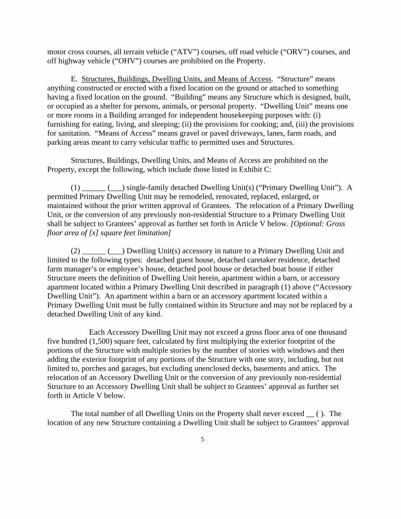
motor cross courses, all terrain vehicle (“ATV”) courses, off road vehicle (“ORV”) courses, and off highway vehicle (“OHV”) courses are prohibited on the Property. E. Structures, Buildings, Dwelling Units, and Means of Access. “Structure” means anything constructed or erected with a fixed location on the ground or attached to something having a fixed location on the ground. “Building” means any Structure which is designed, built, or occupied as a shelter for persons, animals, or personal property. “Dwelling Unit” means one or more rooms in a Building arranged for independent housekeeping purposes with: (i) furnishing for eating, living, and sleeping; (ii) the provisions for cooking; and, (iii) the provisions for sanitation. “Means of Access” means gravel or paved driveways, lanes, farm roads, and parking areas meant to carry vehicular traffic to permitted uses and Structures. Structures, Buildings, Dwelling Units, and Means of Access are prohibited on the Property, except the following, which include those listed in Exhibit C:
(1) ______ (___) single-family detached Dwelling Unit(s) (“Primary Dwelling Unit”). A permitted Primary Dwelling Unit may be remodeled, renovated, replaced, enlarged, or maintained without the prior written approval of Grantees. The relocation of a Primary Dwelling Unit, or the conversion of any previously non-residential Structure to a Primary Dwelling Unit shall be subject to Grantees’ approval as further set forth in Article V below. [Optional: Gross floor area of [x] square feet limitation]
(2) ______ (___) Dwelling Unit(s) accessory in nature to a Primary Dwelling Unit and
limited to the following types: detached guest house, detached caretaker residence, detached farm manager’s or employee’s house, detached pool house or detached boat house if either Structure meets the definition of Dwelling Unit herein, apartment within a barn, or accessory apartment located within a Primary Dwelling Unit described in paragraph (1) above (“Accessory Dwelling Unit”). An apartment within a barn or an accessory apartment located within a Primary Dwelling Unit must be fully contained within its Structure and may not be replaced by a detached Dwelling Unit of any kind.
Each Accessory Dwelling Unit may not exceed a gross floor area of one thousand
five hundred (1,500) square feet, calculated by first multiplying the exterior footprint of the portions of the Structure with multiple stories by the number of stories with windows and then adding the exterior footprint of any portions of the Structure with one story, including, but not limited to, porches and garages, but excluding unenclosed decks, basements and attics. The relocation of an Accessory Dwelling Unit or the conversion of any previously non-residential Structure to an Accessory Dwelling Unit shall be subject to Grantees’ approval as further set forth in Article V below. The total number of all Dwelling Units on the Property shall never exceed __ ( ). The location of any new Structure containing a Dwelling Unit shall be subject to Grantees’ approval

6
as further set forth in Article V below. (3) Non-residential accessory Structures designed, constructed and utilized for the purpose of serving each Primary Dwelling Unit (for example: detached garage; well house; boat house; pool house; swimming pool; pier; Structures related to hunting such as deer stands or waterfowl blinds); (4) Non-residential Structures designed, constructed and utilized in connection with the Agricultural uses of the Property. This Provision shall not be construed to permit what is otherwise defined herein as a Dwelling Unit, even if the structure is designed, constructed or utilized for dwelling or residential purposes associated or in conjunction with the Agricultural uses of the Property; (5) Reasonable Means of Access serving the Structures set forth above in III.E and other permitted uses; provided, however, that reasonable Means of Access to a Structure or use permitted by Art. III.C (3) and/or Art. III.E (1) and (2) is subject to Grantees’ approval in accordance with the provisions of Article V below; and (6) Fencing, fences, and gates, which may be constructed, maintained, improved, removed, or replaced to mark boundaries, to secure the Property, or as needed in carrying out activities permitted by this Conservation Easement.
Optional: The total Impervious Surface on the Property shall never exceed two percent (2%) of the Property or [ ] square feet. “Impervious Surface” means any surface composed of man-made materials that significantly impedes or prevents natural infiltration of water into the soil, such as rooftops, concrete, and asphalt. F. Utilities. Grantor may repair and replace existing Utilities (as defined below) and may install new Utilities as set forth herein. Utilities must be sized and designed to serve the Property and shall not be installed for the purpose of facilitating development, use, or activities on an adjacent or other property. “Utilities” includes, but is not limited to, satellite dishes, electric power lines and facilities, sanitary and storm sewers, septic systems, cisterns, wells, water storage and delivery systems, telephone and communication systems and renewable energy systems (including but not limited to solar energy devices on a Structure; geothermal heating and cooling systems, also known as ground source heat pump; wind energy devices; systems based on the use of Agricultural byproducts and waste products from the Property to the extent not prohibited by governmental regulations; and other renewable energy systems that are not prohibited by governmental regulations), but does not include cellular communication structures and systems. To the extent allowed by law, any net excess generation produced by such renewable energy installation(s) may be credited to the Grantors’ utility bill or sold to the utility and shall not constitute Commercial activity.

7
G. Access Across the Property. No right-of-way for utilities or roadways shall be granted across the Property in conjunction with any industrial, commercial, or residential use or development of an adjacent or other property not protected by this Conservation Easement without the prior written approval of both Grantees, as per Article V.
H. Subdivision. The division, partition or subdivision (“Division”) of the Property, including the lease of any portion less than one hundred percent (100%) of the Property for a term in excess of twenty (20) years, into more than the ____ ( ) parcels of land that constitute the Property, for any purpose, is prohibited. [Where Property consists of more than one parcel: In addition, said parcels shall remain in common ownership as if the Property was only one (1) parcel.] The Property may not be consolidated into a larger parcel, and the boundary lines of the Property may not be adjusted. Notwithstanding the two previous sentences, with at least sixty (60) days written notice to Grantees, Grantors may: [Note: This language is a guideline for instances when Grantors wish to have the right to subdivide and there is no significant impact upon the purpose of the conservation easement. The subdivision language here is not meant to advocate negotiating additional subdivision of properties to be protected by Rural Legacy conservation easements.]
1. Divide or subdivide the Property into ___ residential lots (plus the original
parcel from which the ____ residential lots were created), which may be separately owned, so long as the size of such lots is at the minimum size permitted by State and local government; and
[optional: 2. Divide or subdivide the Property into ____ Agricultural lots (plus the
original parcel from which the ___ Agricultural lots were created), which may be separately owned.]
[In Addition OR However] Grantees may approve the Division of the Property for
reasons which Grantees determine, in their sole discretion, are sufficiently extraordinary to justify an exception to the prohibition, in accordance with the provisions of Article V below.
I. Buffer Requirements. A one-hundred (100) foot vegetative buffer strip along each side of the _______________ River (Creek, etc…) is required on the Property. Grantors shall maintain such buffer strip if it currently exists, or allow it to naturally revegetate or plant such buffer strip with native species. Once established, Grantors shall not disturb such buffer, except when reasonably required for: (1) erosion control; (2) Passive Recreational uses which require water access, subject to Grantees’ approval, per Article V; (3) access to the water for irrigation of the Property; (4) control of non-native and invasive species or removal of dead, diseased, or infected trees as provided for in Article III.L below; (5) access to portions of the Property which are accessible only by crossing said water body; (6) livestock stream crossings in accordance with an approved Soil and Water Conservation Plan prepared by the Soil Conservation District; (7) enhancement of Wetlands (as defined below), wildlife habitat or water quality; (8) the
8
existing ___________ (list existing Structure(s) located within the buffer), as described in Exhibit C. Grantors shall not store manure or compost nor use or deposit pesticides, insecticides, herbicides or fertilizers (except for revegetation or planting of native species, or control of invasive or diseased species) within the buffer strip.
J. Wetlands. “Wetlands” means portions of the Property defined by Maryland state law or federal law as wetlands at the time of the proposed activity. Other than the creation and maintenance of man-made ponds with all necessary and appropriate permits, and the maintenance of Agricultural drainage ditches, the diking, draining, filling, dredging or removal of Wetlands is prohibited.
K. Soil Conservation and Water Quality Plan Within one (1) year of the date of this Conservation Easement, Grantors shall have a Soil Conservation and Water Quality Plan (the “Soil and Water Plan”) prepared and approved by the local Soil Conservation District which lists soil erosion and water quality problems on the land and shall include a schedule of implementation to address the problems identified. Revisions to the Soil and Water Plan, including the schedule of implementation, may be made by Grantors and the local Soil Conservation District as land use practices or management changes, however, Grantors shall be in full compliance with the Soil and Water Plan within six (6) years of the date of this Conservation Easement. Exceptions may be considered by Grantees on a case by case basis. Grantors shall provide a copy of the Soil and Water Plan and any revisions to the Soil and Water Plan to Grantees. [In the event that the Property is wooded or where agriculture will be prohibited, this type of provision may not be necessary. Rather, reference is made to the Forest Management paragraph.]
L. Forest Management. [Where contiguous Woodland area consists of 5 acres or less]: Management and harvesting of all forests on the Property shall be consistent with the Soil Erosion and Sediment Control Guidelines for Forest Harvest Operations in Maryland, prepared by the Maryland Department of Environment (the “Guidelines”), or comparable provisions of any guidelines or regulations which may replace the Guidelines in the future and as they may be amended from time to time. [Where Property contains more than 5 acres of contiguous “Woodland” (as defined below), a Forest Stewardship Plan is required. Please note, contiguity is not considered “broken” by things such as a utility line or a fireline. Use a reasonableness standard]: The Grantor shall implement a Forest Stewardship Plan (“the Plan”) in the Woodland Areas (as hereinafter defined), prepared by a licensed, registered forester and approved by the Maryland Department of Natural Resources, in accordance with the Management Practice Schedule of the Plan, within one (1) year of the date of this Conservation Easement. Revisions to the Plan, including the schedule of implementation, may be made by Grantors and a licensed,

9
registered forester, as land use practices or management changes, however, Grantors shall be in full compliance with the Plan within six (6) years of the date of this Conservation Easement. Exceptions may be considered by Grantees on a case by case basis. Grantors shall provide a copy of the Plan and any revisions to the Plan to Grantees. [Drafter – use one of Options listed below] Option #1 The Plan’s primary objective is [here insert an objective from the list below], and the Plan’s secondary objective is [here insert an objective from the list below, if there is one]. At a minimum, the Plan shall include: (1) an inventory of any physical and natural features of the land (including wetlands, streams, water bodies, roads, trails, public use areas, special plant and wildlife habitats, rare or unique species and communities, and other environmentally sensitive features) including any features identified in this Conservation Easement; (2) a vegetation map, a soils map and a topographic map; (3) an access plan for the Property, including all areas to be commercially managed; (4) erosion control measures, specifically addressing water bodies and wetland areas; and (5) management strategies for sensitive habitats such as riparian areas (including the need to leave cover over streams and water bodies), endangered or threatened species habitat, steep slopes, and the features identified in the inventory described in (1) above; [Optional: (6) strategies to minimize the effects of structures in the Forest Area.] “Woodland Areas” is hereby defined as land Grantee determines, in its discretion, one (1) acre in size or greater that is at least ten percent (10%) stocked with trees of any size, or that had such tree cover prior to a recent harvest and is not currently developed for a non-forest use. In the Woodland Areas, there shall be no burning, mowing, cutting, removal, grazing, livestock access, plowing, tilling or destruction of trees, shrubs grasses or other vegetation (collectively, “Vegetation”) unless: (i) Grantor and said activity are in full compliance with the Plan; (ii) said activity is in compliance with the Soil Erosion and Sediment Control Guidelines for Forest Harvest Operations in Maryland, prepared by the Maryland Department of Environment, as they may be amended from time to time (the “Guidelines”), or comparable provisions of any guidelines, regulations or other requirements which may replace the Guidelines in the future. In no event is conversion of a forest to non-forest land permitted in the Woodland Areas. Clear-cutting may be permitted in order to regenerate a forest pursuant to the Forest Stewardship Plan. [For the drafter: Here are the objectives to be inserted above: 1. Timber production

10
2. Management of habitat for fish and wildlife game species 3. Trail and passive recreation management 4. Natural heritage protection (Species listed by the Federal government or Maryland as endangered, threatened or rare species) 5. Soil conservation and water protection 6. [Establishment and ]Maintenance of a ___________ forest [see a forester to describe the forest type to be maintained] 7. Establishment and maintenance of an old growth forest ecosystem] Option #2 In the Woodland Areas (as defined below), there shall be no burning, mowing, cutting, removal, grazing, livestock access, plowing, tilling or destruction of trees or other vegetation except for (1) trees that are non-native, invasive, diseased or insect infected; and (2) trees, in full compliance with a management plan prepared by the Maryland Department of Natural Resources to protect the long term ecological health of the Woodland Areas or to protect species listed by Maryland or the federal government as endangered or threatened. “Woodland Areas” is hereby defined as land Grantee determines, in its discretion, one (1) acre in size or greater that is at least ten percent (10%) stocked with trees of any size, or that had such tree cover prior to a recent harvest and is not currently developed for a non-forest use. In no event is conversion of a forest to non-forest land permitted in the Woodland Areas. Clear-cutting may be permitted in order to regenerate a forest pursuant to the Forest Stewardship Plan. Note to drafters: It is recommended that structures or means of access should be avoided in the Woodland Areas. Nonetheless, if there are structures or means of access that are currently in the Woodland Areas or that may be constructed in the Woodland Areas, then the drafter should add another exception for “Trees within ____ feet of the structure or means of access.” If structures or means of access are not to be allowed in the Woodland Areas or are to be limited in their number or size, then the Easement will need to provide for that. Probably the best place would be in the paragraph limiting structures and means of access. Option #3 (for Forest Interior Dwelling Species) In the Woodland Areas (as defined below), Grantor shall be in compliance with (i) the FIDS/Forestry Task Force Chesapeake Bay Critical Area Timber Harvest Plan Guidelines (the “FIDS Guidelines”) and(ii) a Plan whose objective is establishment and maintenance of a forest ecosystem for species of birds (FIDS) that require relatively large blocks of undisturbed forest land to successfully nest. At a minimum, the Plan shall include:
(1) an inventory of any physical and natural features of the land (including wetlands,

11
streams, water bodies, roads, trails, public use areas, special plant and wildlife habitats, rare or unique species and communities, and other environmentally sensitive features) including any features identified in this Conservation Easement;
(2) a vegetation map, a soils map and a topographic map; (3) an access plan for the Property, including all areas to be commercially managed; (4) erosion control measures, specifically addressing water bodies and wetland areas;
and (5) management strategies for sensitive habitats such as riparian areas (including the need to leave cover over streams and water bodies), endangered or threatened species habitat, steep slopes, and the features identified in the inventory described in (1) above; [Optional: (6) strategies to minimize the effects of structures in the Woodland Areas.] In the Woodland Areas, there shall be no burning, mowing, cutting, removal, grazing, livestock access, plowing, tilling or destruction (collectively, “Destruction”) of trees, shrubs, grasses or other vegetation (collectively, “Vegetation”) unless: (i) Grantor and said activity are in compliance with the Plan and the FIDS Guidelines and (ii) said activity is in compliance with the Soil Erosion and Sediment Control Guidelines for Forest Harvest Operations in Maryland (the “Guidelines”) prepared by the Maryland Department of Environment, as they may be amended from time to time, or comparable provisions of any guidelines, regulations or other requirements which may replace the Guidelines in the future. Notwithstanding the Terms of this Article _____, Destruction of Vegetation is prohibited during the April to July breeding season except by approval of Grantees. “Woodland Areas” is hereby defined as land Grantee determines, in its discretion, one (1) acre in size or greater that is at least ten percent (10%) stocked with trees of any size, or that had such tree cover prior to a recent harvest and is not currently developed for a non-forest use. In no event is conversion of a forest to non-forest land permitted in the Woodland Areas. Clear-cutting may be permitted in order to regenerate a forest pursuant to the Forest Stewardship Plan. Note to drafters: It is recommended that structures or means of access should be avoided in the Woodland Areas. Nonetheless, if there are structures or means of access that are currently in the Woodland Areas or that may be constructed in the Woodland Areas then the drafter should add the sixth item in italics to the list above. If structures or means of access are not to be allowed in the Woodland Areas or are to be limited in their number or size, then the Easement will need to provide for that. Probably the best place would be in the paragraph limiting structures and means of access.
M. Dumping. Dumping or placing of soil or other substance or material as landfill, or dumping or placing of trash, ashes, garbage, waste, abandoned vehicles, appliances, machinery, hazardous or toxic substances, dredge spoils, industrial and commercial byproducts, effluent and

12
other materials on the Property is prohibited, whether by Grantors or third parties. Soil, rock, other earth materials, vegetative matter, or compost may not be placed except when reasonably required for: (1) Agriculture or other permitted uses on the Property; or (2) the construction and/or maintenance of Structures, Buildings, Dwelling Units, and Means of Access permitted under this Conservation Easement. This Conservation Easement does not permit or require Grantees to become an operator or to control any use of the Property that may result in the treatment, storage, disposal, or release of hazardous materials within the meaning of the Comprehensive Environmental Response, Compensation, and Liability Act of 1980, as amended.
N. Excavation; Surface and Sub-surface Extraction. Excavation, dredging, or removal of loam, peat, gravel, soil, rock, sand, surface or sub-surface water or other material substance in a manner as to affect the surface or otherwise alter the topography of the Property is prohibited, whether by Grantors or third parties, except for: (1) the purpose of combating erosion or flooding, (2) Agriculture or other permitted uses on the Property, (3) Wetlands or stream bank restoration, or (4) the construction and/or maintenance of permitted Structures and associated Utilities, Means of Access, man-made ponds and wildlife habitat. Grantors shall not sell, transfer, lease, or otherwise separate any mineral rights, currently owned or later acquired, from the surface of the Property. All manner of surface mining is prohibited. Sub-surface mining or drilling is permitted only in accordance with Treasury Regulation 1.170A-14(g)(4) and subject to Grantees’ approval, pursuant to Article V below. In addition to the requirements of Article V, Grantees shall consider whether the impact will be limited, localized, and irremediably destructive of Conservation Attributes.
O. Signage. Display of billboards, signs or advertisements is prohibited on or over the Property, except to: (1) state solely the name and/or address of the Property and/or the owners; (2) advertise the sale or lease of the Property; (3) advertise the Agricultural uses of the Property; (4) advertise the goods or services sold or produced in accordance with permitted Commercial uses of the Property; (5) commemorate the history of the Property, its recognition under local, state or federal historical registers, or its protection under this Conservation Easement or federal, state or local environmental or game laws; (6) provide directions to permitted uses and Structures on the Property; and/or (7) address hunting, fishing, or trespassing (including signs or blazes on trees, the latter of which may be unlimited in number, for the purpose of delineating Property boundaries, which Grantees encourage in order to prevent encroachments). No billboard, sign, or advertisement on or over the Property shall exceed four (4) feet by four (4) feet. Multiple signs shall be limited to a reasonable number, shall be placed at least five hundred (500) feet apart, and shall be placed in accordance with applicable local regulations, except that signs permitted under exceptions (5) and (7) may be placed the lesser of one hundred (100) feet apart or the distance required by law.
13
P. Reserved Rights Exercised to Minimize Damage. All rights reserved by Grantors or activities not prohibited by this Conservation Easement shall be exercised so as to prevent or to minimize damage to the Conservation Attributes identified above and water quality, air quality, land/soil stability and productivity, wildlife habitat, scenic and cultural values, and the natural topographic and open space character of the Property. Optional: Q. Chesapeake Bay Water Quality and Concentrated Animal Feeding Operations (CAFOs). CAFOs are prohibited on the Property. For purposes of this paragraph, a CAFO is defined as any operation that either: (1) meets the regulatory definition of a CAFO (pursuant to State or Federal regulations) or (2) the permitting authority (the Maryland Department of the Environment or the U.S. Environmental Protection Agency) has designated as a CAFO. R. Authorization. Grantors authorize the Soil Conservation District and any other entities or government agencies to release to Grantees information contained in Grantors Soil Conservation and Water Quality Plan, Forest Stewardship Plan, Forest Management Plan or any other information applicable to the Terms of this Conservation Easement.
ARTICLE IV. GRANT OF UNRESERVED PROPERTY RIGHTS Grantors retain the right to sell, devise, transfer, lease, mortgage or otherwise encumber the Property subject to the provisions of this Conservation Easement. Grantors retain the right to sell, trade, or exchange credits allocated to Agricultural products produced on the Property. Grantors hereby grant to Grantees all rights (except as specifically reserved herein) that are now or hereafter allocated to, implied, reserved or inherent in the Property, and the parties agree that such rights are terminated and extinguished and may not be used or transferred to any other property adjacent or otherwise, and may not be used for the purpose of calculating permissible lot yield of the Property or any other property. Grantors further agree that the Property shall not be used to provide required open space for the development or subdivision of another property, nor shall it be used in determining any other permissible residential, commercial or agricultural uses of another property.
ARTICLE V. GRANTEE APPROVAL PROCESS
A. This Conservation Easement provides that, in specified circumstances, before
Grantors can take certain actions Grantees must first give their permission, consent or approval. These specified circumstances include, but are not limited to:
operation of a bed and breakfast, as per Article III.C(1); location of any new Structure containing a Dwelling Unit, as per Article III.E(2);

14
location of any replacement Dwelling Unit if different from the location of the replaced Dwelling Unit, as per Article III.E(1) and (2);
conversion of any previously non-residential Structure to be or include a Dwelling Unit, as per Article III.E(1) and (2);
location of a new Means of Access to a Dwelling Unit, as per Article III.E(5); size of a parking area and Means of Access for a small-scale seasonal or
occasional outdoor Commercial use or activity accessory to Agriculture, as per Article III.E(5);
access across the Property for utilities or roadways serving another property, as per Article III.G;
Subdivision of the Property, as per Article III.H; and sub-surface mining or drilling, as per Article III.N.
B. Whenever the Provisions of this Conservation Easement require the permission, consent or approval of Grantees, Grantors shall submit to Grantees a written and visual description of the request for which approval is sought, accompanied by such plats, maps, Subdivision plans, drawings, photographs, written specifications, or other materials as Grantees may need to consider the request. Said materials shall be submitted prior to any start of construction and in advance of, or concurrent with, application for permits from federal, state, or local governments. Grantees shall evaluate the submission for completion and may require of Grantors additional information necessary for a complete submission. When Grantees deem the submission complete (“Request”), Grantees shall act on the Request within the timeframe provided for in Article V.C below. In evaluating the Request, each Grantee shall consider the specific Provision of this Conservation Easement requiring the approval, and said approval shall be granted or denied based on such Grantee’s sole discretion as to whether the Request conforms to the Conservation Attributes listed in Article I and Exhibit B of this Conservation Easement and the Conservation Purpose of this Conservation Easement. Approval is required by both Grantees. If Grantors, with the support of a state or local government, are seeking approval of access across the Property for utilities or roadways as referenced in Article III.G, Grantees shall consider, in addition to the Conservation Attributes listed in Article I and Exhibit B of this Conservation Easement and the Conservation Purpose of this Conservation Easement, the following:
1. Does the project serve a valid public purpose, promote the public interest, or provide a public benefit;
2. Can the project be located in an alternative site without significant expense to a public agency;
3. Has the project received the written support of a state or local government; 4. Does the project maximize the use of concealment methods, if applicable;

15
5. Is the location of the project acceptable to Grantees; 6. Will the project provide a private benefit to Grantors; 7. Will the party making the Request compensate Grantees for Grantees’ actual
administrative costs and/or attorneys’ fees (including but not limited to outside counsel fees) related to its review of the Request (whether or not such Request is approved), and, if approved, inspection of installation of the project, monitoring for violations and enforcement related to the project;
8. Has the party making the Request proffered acceptable mitigation, on or off the Property, to address the adverse impacts of the project and provide a net gain in Conservation Attributes, if feasible (for example, additional plantings, the grant of additional land, or a monetary payment).
If Grantors are seeking location approval for a permitted Dwelling Unit or are seeking approval of a reserved Subdivision right, all Grantors who have a real property interest in the portion of the Property at issue must join in the submission before it will be deemed a Request. If Grantors are seeking location approval for a permitted Dwelling Unit and the requested Dwelling Unit is to be situated on a newly Subdivided lot, Grantors shall submit a Request for such Subdivision at the same time.
C. Grantees shall each provide to Grantors a written decision regarding the Request within ninety (90) days after receipt of the Request, unless the time for consideration is extended by mutual agreement of the parties. Failure of either Grantee to act within the time provided shall be deemed an approval by such Grantee.
D. If an expert within the Maryland Department of Natural Resources advises Grantees of an occurrence of a rare, threatened, or endangered species that was not previously recognized on the Property, and that the habitat, survivability, or fitness for such species could be enhanced by a practice or activity which would otherwise result in a violation of a Provision of this Conservation Easement, Grantees, in their sole discretion, may approve of such a practice or activity.
ARTICLE VI. ENFORCEMENT AND REMEDIES
A. Grantees or the RLB or the OAG (“Enforcers”), and their employees and agents, shall
have the right to enter the Property at reasonable times for the purpose of inspecting and surveying the Property to determine whether Grantors are complying with the Provisions of this Conservation Easement. Enforcers shall provide prior notice to Grantors at their last known address, unless Enforcers determine that immediate entry is required to prevent, terminate, or mitigate a suspected or actual violation of this Conservation Easement which poses a serious or potentially permanent threat to Conservation Attributes, in which latter case prior reasonable notice is not required.

16
In the course of such inspection, Enforcers may inspect the interior of Buildings and Structures permitted by Article III.E (3) and III.E (4) for the purpose of determining compliance with this Conservation Easement. In the event that a dispute arises between Enforcers and Grantors as to whether a Building or Structure is a Dwelling Unit which would not otherwise be permitted by this Conservation Easement, such Building or Structure shall be deemed to contain a Dwelling Unit unless proven otherwise by the Grantors. B. Upon any breach of a Provision of this Conservation Easement by Grantors, Enforcers may institute suit to enjoin any such breach or enforce any Provision by temporary, ex parte and/or permanent injunction, either prohibitive or mandatory, including a temporary restraining order, whether by in rem, quasi in rem or in personam jurisdiction; and require that the Property be restored promptly to the condition required by this Conservation Easement at the expense of Grantors. Before instituting such suit, Enforcers shall give notice to Grantors and provide a reasonable time for cure; provided, however, that Enforcers need not provide such notice and cure period if Enforcers determine that immediate action is required to prevent, terminate or mitigate a suspected or actual breach of this Conservation Easement.
Enforcers’ remedies shall be cumulative and shall be in addition to all appropriate legal
proceedings and any other rights and remedies available to Enforcers at law or equity. If Grantors are found to have breached any of Grantors’ obligations under this Conservation Easement, Grantors shall reimburse Enforcers for any costs or expenses incurred by Enforcers, including court costs and reasonable attorneys’ fees.
C. No failure or delay on the part of Enforcers to enforce any Provision of this Conservation Easement shall discharge or invalidate such Provision or any other Provision or affect the right of Enforcers to enforce the same in the event of a subsequent breach or default.
D. Each Enforcer has independent authority to enforce the Provisions of this
Conservation Easement. In the event that the Enforcers do not agree as to whether the Grantors are complying with the Provisions, each Enforcer may proceed with enforcement actions without the consent of any other Enforcer.
ARTICLE VII. PUBLIC ACCESS Although this Conservation Easement will benefit the public in the ways recited above, the granting of this Conservation Easement does not convey to the public the right to enter the Property for any purpose whatsoever. Or Grantor shall provide public access for passive recreation [fill in description of public access].

17
With the approval of Grantees, the Grantor shall have the right, , to make rules and regulations for different types of public uses, and to control or limit any such public access, by posting or other means, to assure compliance with the purposes and limitations of this instrument and in order to prevent unreasonable interference with Grantor’s reserved rights hereunder and other lawful uses of the Property. Grantor claims all of the rights and immunities against liability for injury to the public to the fullest extent of the law under Maryland Annotated. Code, Natural Resources, Section 5-1101, et seq. (2005 Repl. Vol.).
ARTICLE VIII. BASELINE DOCUMENTATION
The parties acknowledge that Exhibits A – E (collectively, the “Baseline Documentation”) reflect the legal description of the Property, existing uses, location, Conservation Attributes and Structures, Buildings, and Dwelling Units on the Property as of the date of this Conservation Easement. Grantors hereby certify that the attached Exhibits are sufficient to establish the condition of the Property at the time of the granting of this Conservation Easement. All Exhibits are hereby made a part of this Conservation Easement:
A. Exhibit A: Boundary Description and Property Reference is attached hereto and made a part hereof. Exhibit A consists of ____ (___) pages.
B. Exhibit B: Conservation Attributes is attached hereto and made a part hereof. Exhibit B consists of ____ (___) pages.
C. Exhibit C: Inventory of Existing Structures is attached hereto and made a part hereof. Exhibit C consists of ____ (___) pages. D. Exhibit D: Color Digital Images of the Property are not recorded herewith but are kept on file at the principal office of [ ] and are fully and completely incorporated into this Conservation Easement as though attached hereto and made a part hereof. A list of the vantage points, image captions, and image numbers is recorded herewith. Exhibit D consists of ____ (___) color digital images and ____ (___) pages. E. Exhibit E: Aerial Photograph of the Property is not recorded herewith but kept on file at the principal office of the [ ] and is fully and completely incorporated into this Conservation Easement as though attached hereto and made a part hereof. Exhibit E consists of one (1) page. F. Exhibit F: Tax Map Showing Approximate Location of Property is attached hereto. This is to be used only by Grantees as an aid for locating the Property. It is not a plat or

18
legal description of the Property. Exhibit F consists of one (1) page.
ARTICLE IX. DUTIES AND WARRANTIES OF GRANTORS
A. Change of Ownership. In order to provide Grantees with notice of a change in ownership or other transfer of an interest in the Property, Grantors agree to notify Grantees in writing of the names and addresses of any party to whom the Property, or any part thereof, is transferred in accordance with Section 10-705 of Real Property Article, Ann. Code of Maryland, or such other comparable provision as it may be amended from time to time. Grantors, their personal representatives, heirs, successors and assigns further agree to make specific reference to this Conservation Easement in a separate paragraph of any subsequent deed or other legal instrument by which any interest in the Property is conveyed.
B. Subordination. Grantors certify that all mortgages, deeds of trust, or other liens (collectively “Liens”), if any, affecting the Property are subordinate to, or shall at time of recordation become subordinate to, the rights of Grantees under this Conservation Easement. Grantors have provided, or shall provide, a copy of this Conservation Easement to all mortgagees of mortgages and to all beneficiaries and/or trustees of deeds of trust (collectively “Lienholders”) already affecting the Property or which will affect the Property prior to the recording of this Conservation Easement, and shall also provide notice to Grantees of all such Liens. Each of the Lienholders has subordinated, or shall subordinate prior to recordation of this Conservation Easement, its Lien to this Conservation Easement either by signing a subordination instrument contained at the end of this Conservation Easement which shall become a part of this Conservation Easement and recorded with it, or by recording a separate subordination agreement pertaining to any such Lien.
C. Real Property Taxes. Except to the extent provided for by State or local law, nothing in this Conservation Easement shall relieve Grantors of the obligation to pay taxes in connection with the ownership or transfer of the Property.
D. Warranties. The grantors who signed this Conservation Easement on the date set
forth above (“Original Grantors”) are the sole owner(s) of the Property in fee simple and have the right and ability to convey this Conservation Easement to Grantees. The Original Grantors warrant that the Property is free and clear of all rights, restrictions, and encumbrances other than those subordinated to this Conservation Easement or otherwise specifically agreed to in writing by the Grantees. The Original Grantors warrant that they have no actual knowledge of any use or release of hazardous waste or toxic substances on the Property that is in violation of a federal, state, or local environmental law and will defend, indemnify, and hold Grantees harmless against any claims of contamination from such substances. The Original Grantors warrant that Exhibit C is an exhaustive list of all Dwelling Units on the Property.
E. Continuing Duties of Grantors. For purposes of this Conservation Easement,
“Grantors” shall mean only, at any given time, the then current fee simple owner(s) of the
19
Property and shall not include the Original Grantors or other successor owners preceding the current fee simple owner(s) of the Property, except that if any such preceding owners have violated any term of this Conservation Easement, they shall continue to be liable therefor.
ARTICLE X. CONDEMNATION By acceptance of this Conservation Easement by Grantees and the Maryland Board of Public Works, the purposes of the Property as restricted for Agricultural, natural and cultural resource preservation are hereby considered to be the highest public use of the Property. Whenever all or part of the Property is taken in the exercise of eminent domain, so as to abrogate, in whole or in part, the restrictions imposed by this Conservation Easement, or this Conservation Easement is extinguished, in whole or in part, by other judicial proceeding, Grantors and Grantees shall be entitled to proceeds payable in connection with the condemnation or other judicial proceedings in an amount equal to the current fair market value of their relative real estate interests. [If only Rural Legacy Funds were used to purchase this easement, insert the following sentence: “In the event Grantees did not contribute funds to the purchase of this Conservation Easement, then the Rural Legacy Board shall be entitled to the aforementioned proceeds.”] [In the event that non Rural Legacy funds were used to purchase the easement, Grantees should receive proceeds representing their relative contributions, so add language similar to the following example: “Grantees shall then divide the proceeds as follows: The Rural Legacy Board shall receive seventy percent (70%) of the proceeds and _______ County shall receive thirty percent (30%) of the proceeds.”] Any costs of a judicial proceeding allocated by a court to Grantors and Grantees shall be allocated in the same manner as the proceeds are allocated.
ARTICLE XI. MISCELLANEOUS
A. Assignment. Each Grantee may assign, upon prior written notice to Grantors, its rights under this Conservation Easement to any "qualified organization" within the meaning of Section 170(h)(3) of the IRC or the comparable provision in any subsequent revision of the IRC and only with assurances that the Conservation Purpose will be maintained. If any such assignee shall be dissolved or shall abandon this Conservation Easement or the rights and duties of enforcement herein set forth, or if proceedings are instituted for condemnation of this Conservation Easement, this Conservation Easement and rights of enforcement shall revert to the assigning Grantee. If said assigning Grantee shall be dissolved and if the terms of the dissolution fail to provide a successor, and if there are no other Grantees in place, then Grantors shall institute in a court of competent jurisdiction a proceeding to appoint an appropriate successor as Grantee. Any such successor shall be a "qualified organization" within the meaning of Section 170(h)(3) of the Internal Revenue Code (“IRC”) or the comparable provision in any subsequent revision of the IRC. No assignment may be made by any Grantee of its rights under this Conservation Easement unless Grantee, as a condition of such assignment, requires the assignee to carry out the Conservation Purpose.

20
B. Amendment. Grantors and Grantees recognize that circumstances could arise that
justify an amendment of certain of the Provisions contained in this Conservation Easement. To this end, and subject to approval by the Rural Legacy Board, Grantors and Grantees have the right to agree to amendments to this Conservation Easement; provided, however, that:
(1) The amendment must be approved in writing by the Rural Legacy Board, and such approval shall accompany or be attached to the recorded amendment.
(2) No amendment shall be allowed if it would create an impermissible private inurement or private benefit; (3) Proposed amendments will not be approved unless, in the opinion of each Grantee, the requested amendment satisfies the more stringent of the following: (A) (i) the amendment either enhances or has no adverse effect on the Conservation Purpose protected by this Conservation Easement and (ii) the amendment upholds the intent of the original Grantors and the fiduciary obligation of the Grantees to protect the Property for the benefit of the public in perpetuity; or (B) the amendment complies with such Grantee’s amendment policy at the time that the amendment is requested. (4) The amendment must be in conformity with all of each Grantee’s policies in effect at
the time of the amendment; (5) The amendment is subject to and dependent upon approval of the Maryland Board of Public Works; and (6) The amendment must be recorded among the Land Records in the county or counties
where this Conservation Easement is recorded.
Grantors and Grantees may agree to an amendment in lieu of engaging in full condemnation proceedings; provided that Grantees determine that the exercise of condemnation would be lawful, the best interest of all parties would be better served by negotiating a settlement with the condemning authority, and the Grantees receive and use compensation as set forth in Art. X. above. In such event, an amendment shall only be required to satisfy Art. XI.B(5) and (6).
C. Compliance with Other Laws. The Provisions of this Conservation Easement do not replace, abrogate or otherwise set aside any local, state or federal laws, requirements or restrictions imposing limitations on the use of the Property.
In the event that any applicable state or federal law imposes affirmative obligations on owners of land which if complied with by Grantors would be a violation of a Provision of this

21
Conservation Easement, Grantors shall: (i) if said law requires a specific act without any discretion on the part of Grantor, comply with said law and give Grantees written notice of Grantors’ compliance as soon as reasonably possible, but in no event more than thirty (30) days from the time Grantors begins to comply; or (ii) if said law leaves to Grantors’ discretion how to comply with said law, use the method most protective of the Conservation Attributes of the Property listed herein and in Exhibit B and give Grantees written notice of Grantors’ compliance as soon as reasonably possible, but in no event more than thirty (30) days from the time Grantors begin to comply.
D. Construction. This Conservation Easement shall be construed to promote the
purposes of the statutes creating and governing the Rural Legacy Program, the purposes of Section 2-118 of Real Property Article, Ann. Code of Maryland, and the Conservation Purpose, including such purposes as are defined in Section 170(h)(4)(A) of the IRC. This Conservation Easement shall be interpreted under the laws of the State of Maryland, resolving any ambiguities and questions of the validity of specific provisions in a manner consistent with the Conservation Purpose.
E. Entire Agreement and Severability. This instrument sets forth the entire agreement of
the parties with respect to the Conservation Easement and supersedes all prior discussions, negotiations, understandings or agreements relating to this Conservation Easement. If any Provision is found to be invalid, the remainder of the Provisions of this Conservation Easement, and the application of such Provision to persons or circumstances other than those as to which it is found to be invalid, shall not be affected thereby.
F. Joint and Several. If Grantors at any time own the Property in joint tenancy, tenancy by the entireties or tenancy in common, all such tenants shall be jointly and severally liable for all obligations set forth in this Conservation Easement.
G. Recordation. Grantees shall record this instrument in a timely fashion among the
Land Records of _________________ County, Maryland, and may re-record it at any time as may be required to preserve their rights under this Conservation Easement.
H. Notice to Grantees. Any notices by Grantors to Grantees pursuant to any Provision hereof shall be sent by registered or certified mail, return receipt requested, addressed to:
DNR address here and to XYZ Land Trust, Inc. 123 Fake Street Anytown, Maryland 21658

22
or to such other addresses as Grantees may establish in writing on notification to Grantors, or to such other address as Grantors know to be the actual location(s) of Grantees.
I. Counterpart Signatures. The parties may execute this Conservation Easement in two
or more counterparts, which shall, in the aggregate, be signed by all parties; each counterpart shall be deemed an original instrument as against any party who has signed it. In the event of any disparity between the counterparts produced, the recorded counterpart shall be controlling.
J. Captions. The captions in this Conservation Easement have been inserted solely for
convenience of reference and are not a part of this instrument. Accordingly, the captions shall have no effect upon the construction or interpretation of the Provisions of this Conservation Easement.
[Option if there is a District Agreement recorded]: K. District Agreement. In the event of a conflict between this Conservation Easement
and any District Agreement with the Maryland Agricultural Land Preservation Foundation, the Terms of this Conservation Easement shall prevail.
TO HAVE AND TO HOLD unto [County]_________________________________________, their successors and assigns,
forever. The covenants agreed to and the terms, conditions, and restrictions imposed as aforesaid shall be binding upon Grantors, their survivors, agents, personal representatives, heirs, assigns and all other successors to them in interest, and shall continue as a servitude running in perpetuity with the Property.
AND Grantors covenant that they have not done or suffered to be done any act, matter or
thing whatsoever, to encumber the interest in the Property hereby conveyed; that they will warrant specially the Property granted and that they will execute such further assurances of the same as may be requisite. IN WITNESS WHEREOF, Grantors and Grantees have hereunto set their hands and seals the day and year above written.
GRANTOR: _______________________________(SEAL)
NAME

23
STATE OF MARYLAND, __________ of _______________, TO WIT:
I HEREBY CERTIFY, that on this _____ day of _______________, 2009, before me the
subscriber, a Notary Public of the State aforesaid, personally appeared ________, known to me (or satisfactorily proven) to be a Grantor of the foregoing Deed of Conservation Easement and acknowledged that he/she/it executed the same for the purposes therein contained and in my presence signed and sealed the same.
WITNESS my hand and Notarial Seal.
________________________________ Notary Public My Commission Expires: ___________ ACCEPTED BY GRANTEES: [INSERT COUNTY SIGNATURE] COUNTY ATTY:
I hereby certify this deed was prepared by or under the supervision of ___________________________, an attorney admitted to practice by the Court of Appeals of Maryland. _______________________________