daventry district council saved policies from · pdf filedaventry district council saved...
TRANSCRIPT
1
DAVENTRY DISTRICT COUNCIL
SAVED POLICIES FROM THE DAVENTRY DISTRICT
LOCAL PLAN (JUNE 1997)
SAVED 28TH
SEPTEMBER 2007
REVISED POST ADOPTION OF WEST NORTHAMPTONSHIRE JOINT CORE STRATEGY
LOCAL PLAN (DECEMBER 2015)
Published February 2015

2
INDEX Page Number
PURPOSE OF THIS DOCUMENT 4
EXTRACTS FROM THE LOCAL PLAN INCLUDING SAVED POLICIES:
Chapter 1 Introduction 5
Chapter 2 General Policies 12
GN1 General
12
GN2 General 12
Chapter 3 The Environment 14
EN1 Special Landscape Areas 14
EN2 Conservation Areas 17
EN3 Conservation Areas — Shopfronts 18
EN8 Listed Buildings — Long Straw Thatch 18
EN10 Green Wedges 18
EN11 Rural Access Areas 19
EN12 Green Links 20
EN14 Advertisement Control 20
EN18 Existing Buildings Within Villages 21
EN19 Conversions and/or Change of use of Buildings in the Open Countryside
23
EN20 Conversions and/or Change of use of Farm Buildings 24
EN21 Conversions and/or Change of Use of traditional Buildings 25
EN25 Comprehensive Landscaping Schemes 27
EN26 Landscaping 27
EN35 Ecologically Important Sites in Daventry 27
EN38 Agricultural Development 28
EN39 Stables and Riding Schools 28
EN42 Design 29
Chapter 4 Housing Policies 31
HS4 Housing Provision in Daventry Town 31
HS6 Residential development outside of Daventry 33
HS9 Upper Floors in the Town Centre 33
HS11 Limited Development in Villages 35
HS14 Brixworth 36
HS16 Crick 36
HS18 Long Buckby 36
HS21 West Haddon 37
HS22 Restricted Infill Villages 37
HS23 Restraint Villages 40
HS24 Open Countryside 41
HS33 Residential Caravans, Mobile Homes and Chalets 43
HS34 Residential Canal Moorings 43
HS36 Backland Development 43

3
Page Number
Chapter 5 Industrial & Commercial 45
EM3 Limits Development to Existing Estates & Those Allocated 45
EM7 Upper Floors of Town Centre Properties for Offices 45
EM9 Limited Development Villages 47
EM10 Limited Development Villages 47
EM11 Restricted Infill Villages 49
EM12 Restricted Infill Villages 49
EM13 Restricted Infill Villages 49
EM14 Restricted Infill Villages 50
EM15 Restraint Villages 50
EM16 Open Countryside 51
EM17 Creaton Road 51
Chapter 6 Retail 53
RT4 Retail from Industrial Premises 53
RT6 High Street Frontage Policy 54
RT8 Retention of Village Shops 55
RT9 New Village Shops 55
Chapter 7 Communications 56
CM3 The A14 Service Area 56
CM4 The A14 Service Area 57
CM5 The A14 Service Area 57
CM6 Roadside Services 58
CM11 Environmental Improvement Schemes for Daventry 58
Chapter 8 Tourism 60
TM2 Tourist Attractions 60
TM4 Lay By Facilities 61
TM5 Camping and Caravans 61
Chapter 9 Recreation & Leisure 62
RC1 Standards of Open Space Provision 63
RC6 Informal Recreation 64
RC7 Golf Courses 64
RC8 Canal Based Facilities 65
RC12 Playing Field Provision in Daventry 65
RC14 Contributions to Playing Fields in Daventry 65
RC16 Footpaths around Country Park. 66
RC17 Daventry - Braunston Footpath Link 66
RC18 Borough Hill 66
RC25 School at Middlemore 67
Saving Direction 68

4
Purpose of this Document
This document has been produced to set out those policies and the supporting text, which were saved as a result of a direction from the Secretary of State under paragraph 1 (3) of schedule 8 to the Planning and Compulsory Purchase Act 2004.
The document was revised in February 2015 to remove the policies that were replaced by the Adopted West Northamptonshire Joint Core Strategy Local Plan (December 2014). Appendix 5 of that document sets out a list of the policies that were replaced.
This document firstly sets out the saved policies, and then the direction. The saved policies section is broken down by chapter as per the Local Plan.

5
CHAPTER 1 - INTRODUCTION THE DAVENTRY DISTRICT
1.1 Daventry District is a predominantly rural area, the larger and most northerly
section of which occupies that part of the Northamptonshire Uplands lying to the east of the Watford Gap section of the M1 Motorway. This northern part of the District stretches from Northampton in the south to Market Harborough and the Leicestershire border in the north; from the Warwickshire town of Rugby in the west almost to Kettering and the A6 Towns in the east. A smaller part of the District is situated to the south-west of the M1 Motorway, with its southern most boundary coming to within 6 miles of the Oxfordshire border at Banbury. The population of the District was estimated in mid 1995 to number some 64,800 people.
1.2 The administrative centre of the District, Daventry town itself, is located within this southern area, some 8 miles from Junction 16 of the M1. The town has grown steadily since the early sixties, having been the subject of an expansion scheme designed to cater for Birmingham people needing alternative housing accommodation. The population at mid 1996 was approximately 19,100 and the town is continuing to grow as an employment, shopping and recreational center for the surrounding rural area. Whilst the town has become well known as an ideal location for warehousing, not least as the home of Ford Motor Company's major distribution centre, it has gradually acquired a wide range of manufacturing and service industries, located on three industrial estates. It goes without saying that both the town and the District are well located in respect of the national road and rail communications.
1.3 The rural part of the District comprises a network of small to medium sized villages set in a mixed agricultural landscape which has escaped the worst ravages of recent times. There are a number of country houses of national importance, often in attractive parkland settings, and the area is of particular historical significance in respect of the English Civil War. This combination of easy access and interesting venues has led to an increasing number of visitors over the last few years and the economic importance of tourism to the local economy has been recognised by both the District and the County Councils.
THE PURPOSE OF THE LOCAL PLAN
1.4 The purpose of the Local Plan is
1 To set out the District Council's policies for the control of development and, where appropriate, to make specific proposals for the use of land. It is based upon the provisions of the Northamptonshire County Structure Plan, as approved by the Secretary of State in February 1989, and takes account of Alteration No. 1 to that Plan, as approved by the Secretary of State in February 1992. The plan will deal with the period 1991 to 2006 and will, with the Northamptonshire County Structure Plan, constitute the statutory development plan for the District.
2 To supersede various formal and informal local plans and supplementary planning guidance prepared by the District Council since 1974. There has been no previous District-wide Local Plan and these previous plans relate to various villages and to Daventry.
6
3 To examine the strategic proposals of the approved Northamptonshire County Structure Plan together with Alteration No. 1 to that document, with particular reference to population and employment policies and proposals affecting the Daventry District Council area, and to relate these to the local situation, including the making of specific land use proposals where appropriate;
4 To provide a detailed basis for the control of development by setting a guide in terms of land use proposals and standards against which planning applications will be assessed;
5 To provide a basis for co-ordinating development, including the phasing of proposals and examining the provision of the necessary services and other facilities;
And 6 To bring local and detailed planning issues before the public and
others who may be affected by the Plan.
STAGES IN THE PREPARATION OF THE LOCAL PLAN
1.5 Daventry District Council resolved to adopt the Local Plan on May 15th 1997. Notices of this decision were made and the plan was formally adopted on June 26th 1997.
1.6 The previous edition, the Deposit Draft Local Plan was subjected to a
public inquiry from September 1994 to June 1995. Representations were considered by the Inspectors, who made a series of recommendations to the District Council. These were considered and a series of modifications were proposed by the District Council in October 1996. Further consultations were made on the proposed modifications and representations received were again considered before the Local Plan was adopted.
FORMAT OF THE LOCAL PLAN
1.7 The Local Plan is in two parts: the WRITTEN STATEMENT and the PROPOSALS MAP. The Written Statement is divided into sections dealing with specific topics, as set out under "Contents" at the beginning of this document. Each section has an introduction explaining the Council's objectives.
1.8 Planning policies are written in BOLD UPPER CASE LETTERING and are accompanied by explanations where appropriate. Statements of Intent and other important parts of the explanatory text are printed in bold type. In addition to the general topics, there are specific policies relating to the development of land on the periphery of Northampton, in Daventry Town, at Junction 18 of the M1 and each of the District's Limited Development Villages.
1.9 Appendices attached to the end of the Written Statement set out current Planning Standards and other relevant information.
1.10 The Proposals Map covers the entire District and identifies Policy Areas it is based on the Ordnance Survey 1:50,000 map. Policy numbers in the Written Statement are cross referenced with the Proposals Map.

7
1.11 Inset maps at a larger scale are included so as to indicate in more detail the
proposed land uses and policies covering development on the periphery of
Northampton, in Daventry Town, near to junction 18 of the M1 Motorway and in the Limited Development Villages. There are also Inset Maps for all the Conservation Areas that do not appear on the previously referred to Inset Maps.
AIMS AND OBJECTIVES OF THE LOCAL PLAN
The aims and objectives of the Local Plan are:
1. To safeguard the natural resources of the District,
2. To protect and enhance the natural and built environment of the District
3 To make proper use of disused or under utilised land and buildings
4. To concentrate new development in or closely associated with the urban areas on sites identified in this Local Plan.
5. Where development is necessary in the rural areas, to concentrate
this in or closely related to the Limit Development Villages
identified in this Local Plan and to restrict development in other villages.
6. To severely restrain development in the Open Countryside
7. To ensure that new development is sustainable and offers the choice of means of transport by being accessible by Public Transport.
RELATIONSHIP OF THE PLAN TO OTHER DEVELOPMENT PLANS
The Approved Northamptonshire County Structure Plan and Alteration No. 1
1.13 The first Structure Plan for Northamptonshire, which related to the period 1976 - 1991, was submitted to the Secretary of State for the Environment in 1977. It received approval in 1980 following an Examination in Public. In January 1986 proposals for the Repeal and Replacement of the County Structure Plan were submitted to the Secretary of State for his approval. An Examination in Public was held in July 1986. The Secretary of State issued his proposed modifications to the Plan in May 1988. The final approval of the Replacement County Structure Plan, which relates to the period 1983 - 2001, was given on 13th February 1989.
1.14 In approving the Structure Plan, the Secretary of State stated that he expected that the County Council would wish to undertake an early review of the Plan's housing policies and consider whether provision should be increased in the light of the 1985 based projections and pressure for development in the County. He also expected that the County Council would wish to monitor the industrial land provision in the County and its distribution between the Districts, having particular regard to policies and proposals in emerging Local Plans.

8
1.15 The County Council subsequently carried out this review and published
"Proposed Alteration No. 1 to the County Structure Plan" as a consultation draft in June 1989. The Alteration is concerned only with those policies and proposals requiring review and is restricted to the Residential, Industrial and Commercial elements of the Structure Plan. The County Council did not consider that the remaining approved policies and proposals of the Structure Plan required alteration at that stage.
1.16 Alteration No 1 to the Northamptonshire County Structure Plan was approved for submission to the Secretary of State in February 1990. It received approval in January 1992 and became operative in February 1992.
1.17 The County Structure Plan for Northamptonshire currently comprises the County Structure Plan (February 1989) together with Alteration No 1 (January 1992) and the District Council has had regard to the provisions set out in these documents when preparing this Local Plan.
1.18 A review of the County Structure Plan was commenced in October 1996.
Formal and Informal Plans for Daventry Town
1.19 During the 1960's, Daventry was the subject of an Overspill Agreement with the City of Birmingham under which the town was to be expanded from its then population of 6,000 to one of 36,000 by 1981. An expansion scheme was drawn up and the necessary land acquired by the City Council. The statutory plan giving effect to these proposals was the Daventry Town Map, prepared by the Northamptonshire County Council and approved by the then Secretary of State for the Environment in 1972.
1.20 By the mid-1970's the influx of overspill population had slowed and the role
of the town began to revert to that of a service and employment centre for the surrounding rural area. This change was recognised in the first County Structure Plan (See Paragraph 1.16), which anticipated a population of 26,000 by 1991 and a revised Local Plan was prepared by the District Council. This plan, known as the Daventry Town District Plan, was certificated by the County Council in 1981 as being in general conformity with the Structure Plan. However, the changing situation in the town at that time, especially in respect of employment land, led to the need for a further review and the plan was never formally adopted.
1.21 The Replacement County Structure Plan (first published in 1985, see Paragraph 1.16) envisaged a continuing programme of expansion and proposed an additional 3,000 dwellings and 77 hectares of employment landduring the 1983 to 2001 plan period, specifying that these developments were to be in the Northern Area of the town.
1.22 The present County Structure Plan (see Paragraph 1.13) contains no specific requirements in respect of further residential or industrial development at Daventry. The District Council has therefore developed its own policy in respect of the general location of development in the Daventry District. In line with current government advice, this policy is urban oriented and the continuing expansion of Daventry Town is provided for in this Local Plan.

9
Formal and Informal Plans for Brixworth
1.23 In 1964, the County Council published a review of the County Development Plan. In order to limit further development in the villages immediately surrounding Northampton, four "key development centres" were designated
on the outer edge of a green area around the town. Brixworth was one
of the villages designated as a key centre; it was considered suitable because it was a large village with established industry, good public services and good communications with Northampton. A detailed informal plan was prepared to guide the growth of the village. This was known as the Brixworth Key Centre Plan and was approved in 1971. It provided for the expansion of the village to an estimated population of 5,200.
1.24 The first County Structure Plan, approved by the Secretary of State in 1980,
made provision for an additional 600 dwellings in Brixworth in the period 1976 to 1991. The Structure Plan also required provision to be made for an additional 330 jobs.
1.25 In order to give effect to the County Structure Plan proposals, a formal
LocalPlan was prepared by the District Council and adopted in 1982. In preparing this Plan it was found that enough land had either been developed or was the subject of planning permission, to meet the County Structure Plan proposals for both additional housing and employment and no additional land allocations were made. This Plan covered the period up to 1991 and has thus now been withdrawn.
1.26 The designation of Brixworth as a Limited Development Village was
confirmed in the Replacement County Structure Plan approved in February 1989 and the previous version of the Draft Daventry District Local Plan therefore contained a number of policies dealing with additional residentialand industrial development in the village.
1.27 Following the approval of Alteration No 1 to the County Structure Plan in January 1992 it became necessary to review these policies and proposals for inclusion in this revised version of the Local Plan. This review has confirmed the status of Brixworth as a Limited Development Village, but does not propose additional residential or industrial development in the village beyond that allowed for in the previous Draft Daventry District Local Plan.
1.28 This revised Daventry District Local Plan will replace the withdrawn Brixworth Local Plan.
The Woodford Halse Local Plan
1.29 The County Council's 1964 review of the County Development Plan also Designated, Woodford Halse as a "key centre" suitable for the accommodation of additional housing and industry. A "Key Centre Plan" was prepared which merely delineated the limits of village development by means of a "village envelope".

10
1.30 The first County Structure Plan confirmed Woodford Halse's suitability for continuing development by designating the village as a "Rural Service Centre". A combination of this designation and the need to address the problems associated with disused railway land in or near the village led to the preparation of a formal Local Plan during the mid 1970's. This plan was formally adopted by the District Council in 1984. This plan covered the period up to 1991 and has thus been withdrawn.
1.31 The designation of Woodford Halse as a Limited Development Village was
confirmed in the Replacement County Structure Plan approved in February 1989 and the previous version of the Draft Daventry District Local Plan therefore contained a number of policies dealing with residential and industrial development in the village.
1.32 Following the approval of Alteration No 1 to the County Structure Plan in January 1992 it became necessary to review these policies and proposals for inclusion in this revised version of the Local Plan. The review confirmed the status of Woodford Halse as a Limited Development Village, but did not propose additional residential or industrial development in the village beyond that allowed for in the previous Draft Daventry District Local Plan.
1.33 Following the comments made by the Inspector at the Local Plan Inquiry, to the effect that Woodford Halse is not a location that he would recommend for further development, together with the completion of the existing allocations, the District Council have decided to re classify the village as a Restricted Infill Village.
1.34 This revised Daventry District Local Plan will replace the withdrawn Woodford Halse Local Plan.
The Informal Local Plans for Crick, Naseby and West Haddon
1.35 The Draft Replacement County Structure Plan, published in 1985, designated Crick, Naseby and West Haddon as Limited Development Villages suitable for further development. Under the requirements of this Draft, provision was to be made in each of these three villages for 50 additional dwellings in accordance with a Local Plan to be prepared by the District Council.
1.36 Informal Local Plans were therefore prepared by this Council, allocating suitable sites for the additional development. These plans were the subject of extensive public consultation and were formally approved by the District Council in 1987 and 1988.
1.37 The designation of Crick, Naseby and West Haddon as Limited Development Villages was confirmed in the Replacement County Structure Plan approved in February 1989 and the previous version of the Draft Daventry District Local Plan therefore contained a number of policies dealing with residential development in the villages

11
1.38 Following the approval of Alteration No 1 to the County Structure Plan in January 1992 it became necessary to review these policies and proposals for inclusion in this revised version of the Local Plan. This review confirmed the status of Crick and West Haddon as Limited Development Villages, but suggested that Naseby should be re-designated as a Restricted Infill Village. This Local Plan reflects this review and Naseby is included in the Restricted infill Village category. Policies for further residential development in Crick and West Haddon are set out in the Daventry District Local Plan which replaces the previous Draft District Local Plan and the former Informal Local Plans.
MODIFICATIONS TO THE DEPOSIT DRAFT
1.39 The main modifications to the Deposit Draft version of the Local Plan published in August 1993 are as follows:-
Housing Allocations
1.40 A flexibility allowance of 10% has been added to the overall housing allocations.
Housing allocations "related to the growth of Northampton".
1.41 In the Deposit Draft of the Local Plan, the 1000 dwellings were allocated on four sites: Whitehills 520 dwellings, Round Spinney 300 dwellings, Boughton Green Road 100 dwellings, Park View 80 dwellings. This has been modified to Whitehills 1000 dwellings and Boughton Green Road 100 dwellings.
Housing allocations at Daventry Town
1.42 In the Deposit Draft, allocations were made for 2353 dwellings at: Northern Area 1333 dwellings, Burnt Walls Park 750 dwellings, Middlemore 270 dwellings. This has been modified to Northern Area (including Middlemore) 1775 dwellings, British Timken Site 665 dwellings.

12
2.1
CHAPTER 2 – GENERAL POLICIES
The detailed policies and provisions of the Daventry District Local Plan are based on the need to conserve and enhance the urban and rural environments and concentrate provision for new development in Daventry Town and selected villages. In addition, provision must be made for 1000 houses new dwellings related to the growth of Northampton. The Local Plan builds on the principles of this strategy as set out in the County Structure Plan and Alteration No 1 to that plan, endorsed by the Secretary of State when he approved that Plan in February 1989 and February 1992 respectively.
POLICY GN1
THE GRANTING OF PLANNING PERMISSION FOR DEVELOPMENT WILL BE GUIDED BY THE NEED TO
A. SAFEGUARD THE NATURAL RESOURCES OF THE DISTRICT
B. PROTECT AND ENHANCE THE ENVIRONMENT
C. MAKE PROPER USE OF DISUSED OR UNDER UTILISED LAND AND BUILDINGS
D. CONCENTRATE DEVELOPMENT IN OR CLOSELY ASSOCIATED WITH THE LARGE AND SMALL TOWNS.
E. LIMIT DEVELOPMENT IN THE VILLAGES
F. SEVERELY RESTRAIN DEVELOPMENT IN THE OPEN COUNTRYSIDE
G. ENSURE THAT IT IS ACCESSIBLE BY PUBLIC TRANSPORT WHERE APPROPRIATE.
2.2 In order to conform with the broad strategy of the Northamptonshire County Structure Plan, proposals for development within the Daventry District will be considered in the light of the above criteria, together with the detailed provisions and policies of this District Plan as set out in the ensuing chapters. However, all such proposals will also need to conform with the following general policy
POLICY GN2
UNDER THE PROPOSALS AND POLICIES OF THIS LOCAL PLAN, PLANNING PERMISSION WILL NORMALLY BE GRANTED FOR DEVELOPMENT PROVIDED IT:
A. IS OF A TYPE, SCALE AND DESIGN IN KEEPING WITH THE LOCALITY AND DOES NOT DETRACT FROM ITS AMENITIES
B. HAS SATISFACTORY MEANS OF ACCESS AND HAS SUFFICIENT PARKING FACILITIES
C. WILL NOT HAVE AN ADVERSE IMPACT ON THE ROAD NETWORK

13
D. CAN BE PROVIDED WITH THE NECESSARY INFRASTRUCTURE AND PUBLIC SERVICES AND BE SERVED BY PUBLIC TRANSPORT WHERE APPROPRIATE
E. WILL NOT ADVERSELY AFFECT A CONSERVATION AREA OR A BUILDING LISTED AS BEING OF ARCHITECTURAL OR HISTORIC INTEREST AND THEIR SETTING
F. WILL NOT ADVERSELY AFFECT SITES OF NATURE CONSERVATION, GEOLOGICAL OR ARCHAEOLOGICAL IMPORTANCE OR THE SETTINGS OF ARCHAEOLOGICAL SITES.
G. WILL NOT ADVERSELY AFFECT A SPECIAL LANDSCAPE AREA.
H. HAS FULL REGARD TO THE REQUIREMENTS OF AGRICULTURE AND THE NEED TO PROTECT THE BEST AND MOST VERSATILE AGRICULTURAL LAND FROM DEVELOPMENT WHICH IS IRREVERSIBLE
2.3 This policy sets out criteria which seek to ensure that new development is
compatible with the Council's aim of conserving and enhancing the environment of the District. In particular, new development should:
(a) conform to accepted safety standards, particularly in relation to the use of motor vehicles
(b) respect the existing character of the locality, especially where this has been formally recognised by the designation of conservation areas, listed buildings or sites for nature conservation, or special landscape areas.
(c) minimise the loss of the best and most versatile agricultural land, and
(d) avoid imposing an undue strain on local infrastructure and public services.
However, when applying this policy the Council will also seek to protect sites of local nature conservation importance, which are not officially designated.

14
3.4
3.5
CHAPTER 3 – THE ENVIRONMENT GENERAL
The District Council is concerned to ensure that new development and redevelopment do not adversely affect the essential rural character of the District. In considering applications for planning permission and other consents to carry out development, the District Council will have regard to the extent the proposals respect the amenity and character of settlements and the landscape of the District. To this end, development proposals should seek to retain or replace, as appropriate, trees, hedges, woodlands, ponds and marshlands as well as adding to and enhancing these features with carefully designed landscaping features. The design, materials and layout of new developments should reflect as far as possible the existing vernacular of the District, particularly in the Special Landscape Areas and Conservation Areas. It is also important to ensure that new development does not intrude into the settings of important buildings or groups of buildings, or into prominent landscape features and views. The Council will also seek to conserve those open spaces within settlements which contribute significantly to the character and appearance of the locality.
SPECIAL LANDSCAPE AREAS
POLICY EN1 IN RECOGNITION OF THEIR SPECIAL ENVIRONMENTAL QUALITIES,
CERTAIN AREAS ARE DESIGNATED ON THE PROPOSALS MAP AS SPECIAL LANDSCAPE AREAS. IN THESE AREAS PLANNING PERMISSION WILL NORMALLY BE GRANTED FOR DEVELOPMENT PROVIDED THAT:
A. IT COMPRISES AGRICULTURAL, FORESTRY, RECREATION OR TOURISM DEVELOPMENT; OR
B. IT RELATES TO SETTLEMENTS WITHIN THESE AREAS. IN ASSESSING SUCH PROPOSALS DETAILED DESIGN, MATERIALS, SITING AND IN PARTICULAR, LANDSCAPING, WILL BE MATERIAL CONSIDERATIONS FUNDAMENTAL TO THE GRANTING OF PLANNING PERMISSION; OR
C. IT RELATES TO THE RE-USE OR ADAPTATION OF RURAL BUILDINGS PROVIDED THEIR FINISHED FORM, BULK AND GENERAL DESIGN ARE IN KEEPING WITH THEIR SURROUNDINGS
D. IT DOES NOT ADVERSELY AFFECT THE CHARACTER OF THE LOCAL LANDSCAPE.

15
3.6
3.7
These areas were originally designated in the first County Structure Plan. They have been amended since that time but the present areas were supported by the Secretary of State through his approval of the Structure Plan in 1989. The present boundaries of the areas are indicated on the Proposals Map.
Whilst new development for the purposes of agriculture, forestry, recreation or tourism may from time to time be necessary in the Special Landscape Areas, the specific policies for these types of proposals set out in the appropriate sections of this Local Plan will be strictly enforced. The District Council will seek to ensure that such development does not adversely affect the character of the local landscape.
3.8 Proposals for the re-use or adaptation of buildings will need to take account of the policies EN19 to EN22, which deal specifically with this issue.
3.9 The District Council considers that the villages situated within the Special Landscape Areas make their own contributions to the quality of those areas and proposals within such villages will be required to demonstrate that they are not harmful to that quality.

16
CONSERVATION AREAS
3.10 Local Planning Authorities have a statutory duty to define areas of special architectural or historic interest, the character of which it is desirable to preserve or enhance, and formally to designate these as Conservation Areas. Such areas will usually be based upon groups of buildings but may also include landscape features such as trees, ponds, greens and open spaces which make their own special contributions to the overall scene. Subject to minor exceptions, no building or wall within a Conservation Area may be demolished without the written consent of the District Council, and trees within such areas area also given additional protection. Proposals for development that are likely to affect the character or appearance of a Conservation Area may be of public concern and must therefore be advertised. There are Conservation Areas in the following locations, as indicated on the appropriate Proposals Map Inset Maps.
Ashby St Ledgers
Badby
Boughton
Braunston
Brixworth
Brockhall
Canons Ashby
Chapel Brampton
Creaton
Daventry
Everdon
Grand Union and Oxford Canal
Hellidon
Holdenby
Lower Harlestone
Moulton
Newnham
Pitsford
Preston Capes
Scaldwell
Staverton
17
POLICY EN2
PLANNING PERMISSION FOR DEVELOPMENT WITHIN CONSERVATION AREAS WILL BE GRANTED PROVIDED THAT THE DEVELOPMENT PRESERVES OR ENHANCES THE CHARACTER OF THE AREA. SPECIAL CONSIDERATION WILL BE GIVEN TO THE ENVIRONMENTAL IMPLICATIONS OF THE DEVELOPMENT OF VACANT SITES AND THE REDEVELOPMENT OF EXISTING BUILDINGS. PROPOSALS FOR DEVELOPMENT SHOULD NOT INTRUDE INTO THE SETTING OF IMPORTANT BUILDINGS. DEVELOPMENT WILL ONLY BE FAVOURABLY CONSIDERED IF THE FOLLOWING CRITERIA ARE MET:
A. DEVELOPMENT SHOULD REFLECT THE GENERAL ARCHITECTURAL CHARACTER OF THE EXISTING BUILDINGS.
B. BUILDINGS SHOULD BE CLOSELY RELATED TO THE CHARACTER OF THE CONSERVATION AREA IN SCALE.
C. ATTENTION SHOULD BE GIVEN TO DETAILING IN ORDER TO ADD INTEREST IN GENERAL TO NEW BUILDINGS.
D. TRADITIONAL MATERIALS APPROPRIATE TO THE AREA SHOULD BE USED FOR WALLS, ROOFS AND ALL EXTERNAL JOINERY
E. PROPOSALS FOR THE ALTERATION OR REPAIR OF BUILDINGS SHOULD BE SYMPATHETIC TO THE CHARACTER AND APPEARANCE OF THE BUILDING AND THE CONSERVATION AREA.
3.11 In considering proposals for development, the Council will seek to ensure that they make a positive contribution to the character of the Conservation Area or that they leave the character and appearance unharmed. The Council will use the provisions of Article 3 of the Town and Country Planning (General Development Procedure) Order 1995 to require the submission of detailed schemes to support applications for outline planning permission in Conservation Areas, this will include details of hard and soft landscaping schemes. The Council is particularly keen to ensure that thatched roofs are retained on buildings within Conservation Areas and also to ensure that service cables are placed underground wherever possible. Applicants should also note that access for the disabled may be required in buildings to which the public has access.

18
POLICY EN3
PLANNING PERMISSION WILL NORMALLY BE GRANTED FOR NEW SHOP FRONTS AND SHOP FRONT ALTERATIONS IN CONSERVATION AREAS PROVIDED THAT THEY PRESERVE OR ENHANCE THE CHARACTER AND APPEARANCE OF THOSE AREAS. SUCH DEVELOPMENT SHALL HAVE REGARD TO DESIGN GUIDANCE PREPARED BY THE DISTRICT COUNCIL
3.12 The District Council is concerned to ensure that the shopping centres of its Conservation Areas are attractive to shoppers whilst retaining the historic and architectural character and appearance for which they have been recognised. Shop fronts are prominent elements of such character and appearance so proposals for their alteration are required to preserve or enhance it. The District Council has produced design guides, issued as supplementary planning guidance: "Shop Front Design Guide for Daventry Conservation Area" and Shop Front Security, to assist developers in achieving this objective.
POLICY EN8
THE DISTRICT COUNCIL WILL NORMALLY REQUIRE THAT LONG STRAW THATCH WHERE CURRENTLY IN USE ON LISTED BUILDINGS, EITHER AS A PRIMARY ROOF COVERING OR AS A REMNANT COAT UNDER A LATER COVERING, SHALL BE RETAINED BY REPLACEMENT, REPAIR OR REINSTATEMENT WHERE PRACTICAL.
3.24 Long straw thatch is generally accepted as being the vernacular thatch type for Northamptonshire. It has a distinctive character and appearance and is traditionally finished with a plain flush wrap over ridge. Roof shape, style and covering are essential to the character of Listed Buildings, which it is important to retain
GREEN WEDGES, RURAL ACCESS AREAS AND GREEN LINKS
POLICY EN10
PLANNING PERMISSION WILL NOT BE GRANTED FOR
DEVELOPMENT IN GREEN WEDGES AS IDENTIFIED ON THE PROPOSALS MAP UNLESS IT WOULD NOT: -
A. BE DISCORDANT WITH THE PREDOMINANTLY OPEN/GREEN NATURE OF A GREEN WEDGE BY REASON OF APPEARANCE OR USE; OR
B. REDUCE THE PHYSICAL SEPARATION BETWEEN SETTLEMENTS; OR
C. COMPROMISE AGRICULTURAL OR FORESTRY OPERATIONS, RECREATION USE OR WILDLIFE VALUE IN A GREEN WEDGE; OR
D. IMPAIR PUBLIC ACCESS TO A GREEN WEDGE.

19
3.31 "Green wedges" are extensive areas of predominantly open/green spaces which flank large settlements and act as buffers between built-up areas and prevent their coalescence, as on the fringe of Northampton, and as settings for established landscape features, such as the countryside setting for Daventry Country Park. The District Council considers that their greatest value is as undeveloped open space areas for recreation, as agricultural land, as land of high ecological or landscape importance and/or as land providing separation between existing settlements. In all cases, their open and undeveloped character helps to give identity to, or retain identity of, settlements and landscape features. These identities are considered important to sustain. It should be noted that valid minerals planning consents exist on sites within the green wedge. These date from the 1950s and relate to ironstone extraction but also permit the extraction of overlying minerals. The Environment Act 1995 introduced new requirements for the review and updating of the old mineral planning permissions. The ironstone permission at Pitsford and Boughton has been classified as an Active Phase 1 site. Land and mineral owners of Active Phase 1 sites must submit new conditions to the County Council, as the Minerals Planning Authority.
3.32 As well as protecting green wedges, the District Council will seek to enhance them and improve access to them so that the public have both attractive and useable countryside and parks near to their homes.
3.33 With increased pressure for development on the fringes of urban areas, therefore, it is prudent to define these open/green spaces in this Plan so that developers and the public are aware of the District Council's desire to protect them from inappropriate development and can plan investment accordingly. Green wedges are identified on the Proposals Map.
POLICY EN11
PLANNING PERMISSION WILL BE NOT BE GRANTED FOR DEVELOPMENT ON LAND IN RURAL ACCESS AREAS, AS IDENTIFIED ON THE PROPOSALS MAP, UNLESS IT WOULD: -
A. NOT BE DISCORDANT WITH THE PREDOMINANTLY OPEN/GREEN NATURE AND CHARACTER OF A RURAL ACCESS AREA BY REASON OF APPEARANCE OR USE; AND
B. NOT COMPROMISE THE WILDLIFE VALUE OF A RURAL ACCESS AREA; AND
C. INCREASE PUBLIC ACCESS TO A RURAL ACCESS AREA, AND SECURE LAND USE MANAGEMENT ARRANGEMENTS ARE MADE TO SUSTAIN PUBLIC ACCESS IN TANDEM WITH THE DEVELOPMENT’S OPERATIONAL USE.
3.34 Rural Access Areas are extensive areas of predominantly open/green spaces which flank large settlements. Although not as structurally important as green wedges, they too are not required for development and are subject to policies severely restraining development in the open countryside. However, their proximity to large urban populations desires the publics positive use and appreciation, as it is the countryside that is nearest to them. The District Council therefore seeks to encourage development that provides opportunities for diversifying land use whilst increasing and then sustaining public use of such land - yet which is respectful of the open and green character of the urban fringes.

20
3.35 A Northampton North West Bypass is identified by the Highway Authority as necessary to assist in relieving existing and future traffic conditions in Northampton. Phase 1 has been the subject of a planning application and a line has already been safeguarded - that current line is suitably shown on the Proposals Map.
POLICY EN12
PLANNING PERMISSION WILL NOT NORMALLY BE GRANTED FOR DEVELOPMENT WHICH WOULD ENCROACH UPON GREEN LINKS, AS IDENTIFIED ON THE PROPOSALS MAP (DAVENTRY INSET AND DAVENTRY TOWN CENTRE INSET). WHERE THE DISTRICT COUNCIL CONSIDERS IT APPROPRIATE TO ALLOW DEVELOPMENT OR THE EXTENSION OR WIDENING OF EXISTING BUILDINGS OR HIGHWAYS IN GREEN LINKS, PLANNING PERMISSION WILL NORMALLY ONLY BE GRANTED WHERE THE GREEN AND OPEN CHARACTER OF GREEN LINKS CONTINUES TO DOMINATE.
3.36 It is considered important to promote a continuous thread of greenery through and around the largest urban area so that the impact of countryside or parkland is penetrating and continuous, the "softening" qualities of trees and shrubbery are able to counter the "hardness" of built development as frequently as possible and the distinct identities of divided areas are sustained. These threads should act as "green links" between green wedges and public open space wherever possible to achieve the continuity. Development within green links should not be permitted unless there are overriding and exceptional reasons of strategic importance. As well as protection, there is much potential for enhancement in Daventry where wide highway verges are often green but bland expanses of grass; with extensive planting, these would more obviously thread greenery from countryside and parks into the heart of the town. The Secretary of State for Transport is the Highway Authority for the A45(T) and the Highway Agency is the responsible body for any improvements within the trunk road boundary east of Daventry's orbital road.
3.37 Green links are defined on the Proposals Map (Daventry Inset and Daventry Town Centre Inset).
ADVERTISEMENT CONTROL (SPECIAL LANDSCAPE AREAS AND CONSERVATION AREAS).
POLICY EN14 CONSENT WILL NOT NORMALLY BE GRANTED FOR
ADVERTISEMENTS IN EXCESS OF THOSE PERMITTED BY DEEMED CONSENT, EXCEPT FOR PROPOSALS FOR EXTERNALLY ILLUMINATED ADVERTISEMENTS ON SHOPS AND OTHER COMMERCIAL PREMISES RELYING ON FREQUENT PATRONAGE WHICH WILL NORMALLY RECEIVE CONSENT, PROVIDED THAT THE ILLUMINATION IS DOWNWARD AND ORIGINATES FROM STRIP LIGHTS OR SPOTLIGHTS THAT HARMONISE WITH THE SPECIAL CHARACTER OF THE BUILDING AND AREA. INTERNALLY ILLUMINATED SIGNS WILL NOT NORMALLY RECEIVE CONSENT EXCEPT WHERE EXTERNAL ILLUMINATION IS IMPRACTICAL AND THE ILLUMINATION IS ONLY OF INDIVIDUAL LETTERS (NOT INCLUDING THEIR RETURNS).

21
3.38 The District Council is concerned to ensure that advertisement proposals have regard to two fundamental principles, namely:
(a) The maintenance and improvement of local amenity,
(b) The interests of public safety. 3.39 In applying these criteria regard will be paid to the general characteristics of
the locality including the presence of any feature of historic, architectural, cultural or similar interest. The second principle relates to the safety of any person who may use road, rail, waterways, docks, harbours or airfields and the effect of any advertisement which would obscure or hinder any traffic sign, railway signal or aid to navigation by water or air. Applicants are advised that the Council has issued supplementary planning guidance on shop front design in Conservation Areas. Whilst the policies of the Local Plan are overriding in determining applications, the guidance will be a material consideration and should be consulted.
Areas of Special Advertisement Control
3.40 The District Council will seek the Secretary of State’s approval to the designation of Special Landscape Area as Areas of Special Control of Advertisements.
3.41 The District Council considers that the additional environmental protection represented by the designation of areas of special advertisement control should apply to those areas recognised in this Local Plan as Special Landscape Areas, which are indicated on the Proposals Map.
THE REDEVELOPMENT, RENOVATION AND CONVERSION OF EXISTING BUILDINGS WITHIN VILLAGES
POLICY EN18
PLANNING PERMISSION FOR THE REDEVELOPMENT, RENOVATION
OR CONVERSION OF EXISTING BUILDINGS WITHIN THE EXISTING CONFINES OF VILLAGES WILL NORMALLY BE GRANTED PROVIDED THE PROPOSAL RESPECTS THE DISTINCTIVE NATURE AND QUALITY OF ITS SURROUNDINGS. IN DETERMINING APPLICATIONS IN RESPECT OF THE RENOVATION OR CONVERSION OF SUCH BUILDINGS, REGARD WILL BE PAID TO THE FOLLOWING CRITERIA:
A. THE BUILDING(S) MUST BE CAPABLE OF RENOVATION OR CONVERSION WITHOUT SUBSTANTIAL CHANGES IN APPEARANCE OR DIMENSIONS.
B. THE CHARACTER AND APPEARANCE OF THE ORIGINAL BUILDING(S) WHICH MAKE A CONTRIBUTION TO THE ENVIRONMENT MUST BE SUBSTANTIALLY REFLECTED IN THE PROPOSAL AND THE APPLICANT WILL BE REQUIRED TO DEMONSTRATE THAT THE INHERENT QUALITIES OF THE BUILDING(S) HAVE BEEN RETAINED AND ENHANCED THROUGH SENSITIVE DESIGN AND THE USE OF APPROPRIATE MATERIALS.

22
C. THE RENOVATION OR CONVERSION OF THE BUILDING(S) SHOULD NOT REQUIRE SUBSTANTIAL PUBLIC SERVICE COSTS OR INVOLVE THE INTRODUCTION OF VISUALLY INTRUSIVE SERVICES SUCH AS OVERHEAD POWER CABLES OR TELEPHONE LINES.
D. PROVISION SHOULD BE MADE FOR ON-SITE PARKING IN ACCORDANCE WITH THE COUNCIL'S PARKING POLICY AS SET OUT IN THIS LOCAL PLAN. SUCH PROVISION SHOULD PROPERLY RELATE TO THE CONVERTED BUILDING(S) IN TERMS OF DESIGN, MATERIALS AND SITING.
E. IN ORDER TO ENABLE A PROPER ASSESSMENT TO BE MADE OF THE IMPACT OF THE PROPOSED RENOVATION OR CONVERSION, APPLICATIONS WILL ONLY BE CONSIDERED WHERE THEY ARE ACCOMPANIED BY DETAILED DRAWINGS OF THE PROPOSAL ILLUSTRATING THE EXTENT OF THE RENOVATION OR CONVERSION AND ALL PHYSICAL AND STRUCTURAL ALTERATIONS.
F. PROPOSALS FOR THE RENOVATION OR CONVERSION OF BUILDINGS HAVING A GROUP VALUE, SUCH AS THOSE IN SQUARES, TERRACES OR FARMYARDS, SHOULD REFLECT THAT VALUE.
G. PROPOSALS FOR THE RENOVATION OR CONVERSION OF BUILDINGS WHICH MAKE AN IMPORTANT CONTRIBUTION TO THE VILLAGE OR STREET SCENE, SHOULD REFLECT THAT CONTRIBUTION.
H. ACCESS TO THE SITE IS OF A SAFE STANDARD WITHOUT DETRIMENT TO THE APPEARANCE OF THE AREA.
3.44 The District Council consider that existing buildings within the confines of villages should be retained wherever possible. The Council is also concerned to ensure that the simple replacement of outworn, dilapidated or untidy buildings does not lead to residential or other developments which are unsuitable in scale or character. Under this policy applications for such replacements will only be taken to represent an environmental gain of sufficient worth to merit the granting of planning permission where the proposal can demonstrate that it respects the distinctive nature and quality of the village environment.
3.45 In the case of redevelopment proposals involving the demolition of buildings, or groups of buildings, which presently make a significant contribution to the character of the village or street, the new development will be expected to acknowledge and reflect that former contribution in terms of design, layout and materials. Farmyards in particular form an integral part of many villages and the Council is concerned to discourage the assumption that the redevelopment of these features will always be considered as an environmental gain.
3.46 The access from any building onto the public highway should be capable of use by the size of vehicle which will be used to service the building in its proposed use. If works are required to improve the access then these should be carried out without removing large sections of a wall or hedge, native trees or large numbers of trees. If any trees or hedges are removed to enable safety improvements to be carried out, then the District Council will require suitable replacement.

23
CONVERSION AND/OR CHANGE OF USE OF BUILDINGS IN THE OPEN COUNTRYSIDE
3.47 In Planning Policy Guidance Note No. 7(February 1997) the government sets out its advice on the re-use and adaptation of rural buildings. In this guidance the Government is seeking to protect the open countryside from development yet release opportunities for economic development to boost and sustain the economy in rural areas.
3.48 In this Local Plan the open countryside policies for residential and industrial/commercial development set out the basic policies seeking to encourage commercial uses whilst restricting residential development in the open countryside.
3.49 Changes in agricultural practices and the need to produce less foodstuffs from farms will have serious effect on the economy of rural areas where job losses will occur. The District Council supports the Government in creating opportunities for the replacement of lost jobs and economic activity by allowing the re-use of rural buildings for uses suitable to their size, nature and location.
3.50 The following policies are designed to ensure that the character of the traditional buildings are retained and that development does not harm the countryside in terms of its general nature and appearance.
POLICY EN19
PLANNING PERMISSION WILL NORMALLY BE GRANTED FOR THE CONVERSION OR THE ADAPTATION OF RURAL BUILDINGS PROVIDED THAT:
A THEY ARE OF PERMANENT AND SUBSTANTIAL CONSTRUCTION AND ARE IN A SOUND CONDITION.
B THEY ARE PHYSICALLY CAPABLE OF CONVERSION WITHOUT MAJOR REPAIRS OR ALTERATIONS TO THEIR EXISTING STRUCTURES AND IN THE CASE OF RESIDENTIAL CONVERSIONS, WITHOUT EXTENSIVE EXTENSION AND BE CAPABLE OF COMPLYING WITH THE BUILDING REGULATIONS WITHOUT MAJOR ALTERATIONS OR OTHER MAJOR WORKS.
C THEIR FORM, BULK AND GENERAL DESIGN ARE IN KEEPING WITH THEIR SURROUNDINGS
D A STRUCTURAL SURVEY RELATING TO THE CONDITION OF THE BUILDINGS IS SUBMITTED WITH THE APPLICATION.
E ACCESS TO THE SITE IS OF A SAFE STANDARD WITHOUT DETRIMENT TO THE APPEARANCE OF THE AREA.
F SATISFACTORY STANDARDS OF ACCOMMODATION AND AMENITY ARE ACHIEVABLE.
3.51 Rural buildings which are so derelict that they could be brought back into use only by a complete or substantial reconstruction should normally be demolished except where such buildings are listed as being of architectural or historic merit.

24
3.52 In many cases the conversion or adaptation of the building may require the virtual demolition and rebuilding of the structure, which will amount to a newly built property. In this case, the development will be considered as a new building and the relevant policies of this Local Plan will apply.
3.53 Attention is drawn to the provisions of Policy HS24 which permits the residential conversion of a rural building in the open countryside only if it is justified as accommodation for agricultural workers.
3.54 In the case of a "traditional" farm building one of the major concerns is to retain the building in its setting. This is particularly relevant in Special Landscape Areas. The Council is also concerned to ensure that every opportunity is taken to use the existing space within the building rather than adding to it. In rural areas the general policy of the District Council is to resist development in the open countryside, and therefore extensions are regarded as new build space.
3.55 To avoid inappropriate extensions to the building, the District Council will exercise their power to remove Permitted Development Rights if it is considered appropriate.
3.56 The access from any building onto the public highway should be capable of use by the size of vehicle which will be used to service the building in its proposed use. If works are required to improve the access then these should be carried out without removing large sections of a wall or hedge, native trees or large numbers of trees. If any trees or hedges are removed to enable safety improvements to be carried out, then the District Council will require suitable replacement. All services from the nearest public highway to the converted building should be underground to retain the rural appearance of the area.
3.57 Where conversions take place on working agricultural units it is important that the new use is not adversely affected by the operation of the farm unit. This will be particularly important where the new use is residential. Care should be taken to avoid juxtaposing residential uses with livestock units, silage clamps, grain dryers or other such agricultural operations.
3.58 The space and layout problems inherent in conversion schemes will not be accepted as reasons for reducing the normally required standards of accommodation in residential development. These are set out in Supplementary Planning Guidance.
POLICY EN20
PLANNING PERMISSION FOR THE REUSE OR ADAPTATION OF FARM BUILDINGS CONSTRUCTED SINCE 1948 WILL BE GRANTED PROVIDED THAT:
A THE HISTORY OF THE BUILDING INDICATES THAT IT WAS USED FOR THE PURPOSE FOR WHICH IT WAS BUILT.
AND
B WHERE THE COUNCIL CONSIDER THE BUILDING, TO HAVE A SIGNIFICANT ADVERSE EFFECT ON THE LANDSCAPE, MODIFICATIONS TO THE BUILDING FABRIC AND LANDSCAPING WILL BE REQUIRED

25
3.59 The District Council is seeking to control new development in open countryside and protect the character of the district by directing new build to existing built up areas. The conversion of buildings not genuinely used for agriculture would lead to sporadic new build developments in the open countryside and is therefore contrary to policy. The history of the building will be investigated by the District Council to ensure that it was genuinely used for its original purpose for an appropriate length of time, before the application for change of use was made.
3.60 Where the proliferation of new farm buildings to replace those permitted to be reused or adapted would result in a serious detrimental effect on the landscape the District Council may remove permitted development rights in respect of those buildings, the agricultural unit or in certain key Landscape Areas of the holding.
3.61 Some modern farm buildings that could accommodate other uses are poorly designed in terms of finishes and are often inappropriately sited. These defects can be mitigated by changes in the external finish and/or the careful use of landscaping.
POLICY EN21
PLANNING PERMISSION FOR THE CONVERSION OR ADAPTATION OF TRADITIONAL BUILDINGS WILL NORMALLY BE GRANTED PROVIDED THAT:
A THE ESSENTIAL CHARACTER OF THE ORIGINAL BUILDING IS RETAINED
B EXISTING WALL OPENINGS ARE RETAINED OR PUT BACK TO THEIR ORIGINAL FORM.
C THE ORIGINAL OR EXISTING ROOF LINE IS RETAINED WITH NO ADDITIONS.
D ALL EXISTING ARCHITECTURAL FEATURES OF THE BUILDING ARE REPAIRED AND RETAINED.
E NEW OPENINGS IN WALLS ARE ONLY MADE WHERE ABSOLUTELY NECESSARY AND REFLECT THE CHARACTER OF THE EXISTING OPENINGS IN FORM, SIZE AND SPACING.
F IN CONVERSIONS TO RESIDENTIAL USE, NO FEATURES OF A DOMESTIC CHARACTER CHANGE THE EXTERNAL APPEARANCE OF THE BUILDING.
3.62 A “Traditional” building is defined as being of traditional construction in the local vernacular and being at least 10 years old.
3.63 Existing wall openings may be adapted for new uses but should retain their existing or original shape, size and placement. Whilst roof lights for lighting the upper areas of the building may be appropriate, features such as dormer windows or chimneys which intrude into the original roof line will not be permitted. Heating systems requiring fume extractors should use balanced flues where appropriate.
3.64 The proliferation of microwave/satellite dishes and other aspects of permitted development such as cladding, change of window type, shutters and porches can create an intrusion into the rural scene. The District Council will therefore consider the imposition of conditions removing Permitted Development Rights in appropriate cases.

26
3.65 In making applications for conversion, applicants will be expected to provide full working drawings of their proposals including such drawings as necessary to indicate layout, design and external appearance, structural details and a schedule of proposed works will also be required. Along with details of means of access and any proposed hard or soft landscaping, screen walls or fences. This is to ensure that the conversion as proposed is practical in terms of use and detail, careful consideration is required to the applicant to avoid conflict between the Planning Authority and Building Control requirements.
POLICY EN25
THE GRANTING OF DETAILED PLANNING PERMISSION FOR A PROPOSAL WILL BE DEPENDANT ON THE SUBMISSION OF A COMPREHENSIVE LANDSCAPING SCHEME. SUCH SCHEMES SHOULD PROVIDE FOR THE PROTECTION AND INCORPORATION OF EXISTING TREES, HEDGES AND OTHER FEATURES OF THE SITE TOGETHER WITH PROPOSALS FOR NEW PLANTING, RESPECT THE UNIQUE DISTINCTIVENESS OF THE SITE, BE DESIGNED TO SOFTEN AND ENHANCE THE PERMITTED DEVELOPMENT AND HAVE REGARD TO THE FOLLOWING PROVISIONS:
A ON INDUSTRIAL SITES, IN ADDITION TO THE LANDSCAPING PROPOSALS, HEDGING OR BOUNDARY PLANTING NOT LESS THAN 2.0 METRES WIDE SHOULD BE PROVIDED
B BUNDING OR MOUNDING WILL BE PERMITTED ONLY WHERE IT IS APPROPRIATE TO THE DEVELOPMENT SITE OR ITS SURROUNDS.
C BLOCK SCREENING WILL BE PERMITTED ONLY WHERE IT IS APPROPRIATE TO THE DEVELOPMENT SITE OR ITS SURROUNDS. TREE AND SHRUB PLANTING SHOULD BE VARIED BOTH IN HEIGHT RANGE AND IN SPECIES, WHICH SHOULD BE PREDOMINANTLY OF NATIVE ORIGIN.
D OFF SITE PLANTING SHOULD BE PROVIDED WHERE POSSIBLE AND APPROPRIATE.
E EXISTING TREES, HEDGEROWS AND WOODLANDS SHOULD BE RETAINED WHERE POSSIBLE AND MEASURES FOR THEIR PROTECTION SHOULD BE INCORPORATED IN THE SCHEME.
F SCHEMES SHOULD SET OUT APPROPRIATE MEASURES FOR THE FUTURE MAINTENANCE OF THE PLANTING.
3.72 The District Council considers that appropriate landscaping is an integral part of most development proposals. A detailed and comprehensive landscaping scheme to the satisfaction of the council should be submitted as part of the full planning application and will be considered as part of the development. This requirement may not apply to smaller proposals such as domestic extensions, or to outline planning applications, where indicative landscaping schemes will suffice.

27
3.73 Landscaping schemes should soften development, minimising impact and enhancing the area. Landmark developments or buildings should be framed rather than hidden. Structural landscaping should be composed of native species, and where possible should take place in advance of development. Consideration should be given to the future maintenance of new landscaping, and areas which are to be adopted by the Council, the Highways Authority or Parish Council should comply with the requirements of the adopting body.
3.74
Developers should refer to supplementary planning guidance on landscaping which is being prepared by the Council.
POLICY EN26
WHERE PLANNING PERMISSION IS GRANTED, DEVELOPERS WILL BE REQUIRED TO IMPLEMENT LANDSCAPING SCHEMES NO LATER THAN THE PLANTING SEASON FOLLOWING THE COMPLETION OF THE DEVELOPMENT OR RECOGNISED PHASE OF IT.
3.75
Landscaping and open spaces form an integral part of new development and the implementation of approved schemes should take place as soon as possible. On larger housing estates a phasing programme will be necessary. In all cases developers will be required to make provision for replacing any dead or dying trees and shrubs for a period of 5 years.
Sites in Daventry Town
POLICY EN35 PLANNING PERMISSION WILL NOT BE GRANTED FOR
DEVELOPMENT THAT WOULD ADVERSELY AFFECT THE FOLLOWING ECOLOGICALLY IMPORTANT SITES.
A DAVENTRY RESERVOIR
B DRAYTON RESERVOIR
C DISUSED DAVENTRY/BRAUNSTON RAILWAY LINE, NORTH OF DRAYTON WAY
D STAVERTON VALLEY
E GRAND UNION AND OXFORD CANALS
3.92 In recognition of their ecological value, the District Council will seek to ensure that proposals for new development have no detrimental environmental effects and that the sites are managed in such a way as to ensure public access where practical. The area referred to as the "Grand Union Canal" includes the important area over the Braunston Tunnel.

28
Agricultural Development
POLICY EN38
PLANNING PERMISSION FOR AGRICULTURAL DEVELOPMENT WILL BE GRANTED IF THE DESIGN, SITING AND EXTERNAL APPEARANCE OF THE PROPOSED DEVELOPMENT IS NOT DAMAGING TO THE APPEARANCE OF THE LANDSCAPE OR THE AMENITY OF RESIDENTIAL AREAS
3.97 The Council's current criteria applicable to this policy are set out in supplementary planning guidance "The Design and Location of Agricultural Buildings". By definition, agricultural buildings requiring planning permission tend to be bulky or tall or near to roads or near to dwellings, or a combination of these characteristics. In addition many agricultural developments which may be permitted development require prior notification to the Local Planning Authority, which then has to decide whether to allow the proposal to proceed or whether to require a "prior approval". In all cases, the proposals must comply with the District Council's adopted criteria.
3.98 The siting, design and external appearance of the development are of particular importance. The District Council is concerned to ensure that such buildings are well located with regard to the surrounding landscape, present acceptable outlines when seen from a distance and appropriate detailing to the close observer and are of suitable materials and colours. The council is particularly concerned to prevent the development of intensive food production units where they would have an adverse environmental impact on either the open countryside or on residential areas.
Stables and Riding Schools
POLICY EN39
PLANNING PERMISSION WILL NORMALLY BE GRANTED FOR
STABLES AND RIDING SCHOOLS PROVIDED THAT
A THEY ARE ASSOCIATED WITH EXISTING SETTLEMENTS. EXCEPTIONS MAY INCLUDE PROPOSALS ASSOCIATED WITH EXISTING FARMSTEADS.
B THEY ARE OUTSIDE OF THE SPECIAL LANDSCAPE AREAS
C THE DESIGN, SITING AND EXTERNAL APPEARANCE OF THE PROPOSED DEVELOPMENT IS NOT DAMAGING TO THE LANDSCAPE
D THEY ARE LOCATED CLOSE TO EXISTING BRIDLEWAYS OR OTHER LAND MADE AVAILABLE FOR RIDING.

29
3.99 In recent years there has been a steady increase in the number of applications for permission for facilities connected with horse riding as a leisure activity. The keeping and breeding of horses is not an agricultural activity in planning terms and thus requires planning permission. Proposals for such developments are frequently made in open countryside, immediately adjoining towns and villages and often relate to stables, paddocks and jumps which can be unsightly. The District Council is concerned to ensure that the integrity of its open countryside policy particularly in the Special Landscape Areas is not undermined by the cumulative effect of a series of small, unsuitable developments. The Council considers that suitable locations for these facilities will normally be within existing settlements or associated with existing farm buildings. The Council's current criteria applicable to this policy are set out in supplementary planning guidance "The Design and Location of Agricultural Buildings".
3.100 The District Council consider that stables and riding schools should be accessible to the bridleway network or have sufficient land available for riding. In the latter case, proposals for development, will be required to demonstrate that such land is available on a permanent basis.
DESIGN OF DEVELOPMENT
POLICY EN42
PLANNING PERMISSION WILL BE GRANTED FOR DEVELOPMENT
PROVIDED THAT:-
A DESIGNS PROMOTE OR REINFORCE LOCAL DISTINCTIVENESS AND ENHANCE THEIR SURROUNDINGS; AND
B DESIGNS TAKE ACCOUNT OF LOCAL BUILDING TRADITIONS AND MATERIALS; AND
C THE SCALE, DENSITY, MASSING, HEIGHT, LANDSCAPE, LAYOUT AND ACCESS OF THE PROPOSAL COMBINE TO ENSURE THAT THE DEVELOPMENT BLENDS WELL WITHIN THE SITE AND WITH ITS SURROUNDINGS; AND
D CRIME PREVENTION MEASURES ARE INCORPORATED IN THE SITE LAYOUT AND BUILDING DESIGN; AND
E EXISTING LANDSCAPE ATTRIBUTES OF THE SITE ARE INCORPORATED WITHIN THE LAYOUT WHEREVER PRACTICABLE, AND COMBINE WITH PROPOSED LANDSCAPING AND OPEN SPACE TO ENSURE THAT THE DEVELOPMENTS ENVIRONMENTAL IMPACT IS MINIMISED.
3.111 The District Council is keen to promote high quality design. Innovative design is encouraged so as to create new local distinctiveness provided that it is appropriate to its context. Developers are advised that proposals should have regard to supplementary planning guidance issued by the District Council as these will be material considerations. These elucidate policies and can be in the form of development briefs, village design guidelines, shop front design guidance for example which have already been issued for some sites and areas and which will be added to over time.

30
3.113 The District Council has noted with concern that there have been several cases of the insensitive location of garages in front of dwellings they serve. The District Council will therefore seek to prevent such problems arising in the future and thereby halt the gradual reduction in street character that would otherwise result.

31
CHAPTER 4 – HOUSING POLICIES
DAVENTRY TOWN
4.21 The Consultation Draft Version of the Local Plan identified sites for residential development in the Northern Area of the Town, as specifically required by the then current version of Alteration No 1 to the County Structure Plan. In giving his approval to Alteration No 1, the Secretary of State for the Environment allocated additional housing to the District but removed the former Structure Plan statement that half of the total housing allocation should be in Daventry and half in the rural areas.
4.22 In the absence of a specific Structure Plan requirement that half of the housing allocation should be in Daventry, the District Council considered it necessary to review the land allocations in the previous Consultation Draft Version of the Local Plan. Having carried out this review, the Council is satisfied that the sites identified in that Plan, in the Northern Area of the town, meet all location criteria established in national policy guidance and the County Structure Plan. It is considered that the continued progression of development of uncommitted sites in this area represents good planning and will help to meet the housing allocation for the District. As set out in the introduction to this Chapter, these sites are expected to accommodate around 1775 dwellings, and their location is indicated in Policy HS4 below.
4.23 In addressing where the additional housing allocation to the District should be located, the Council has been concerned to follow Government advice to guide new development to locations, which reduce the need for car journeys and the distances driven. Daventry is clearly the major employment and service centre within the district and the Council has concluded that this advice would best be met by allocating further land for housing in the town.
4.24 In identifying areas of search around Daventry for such additional housing development, options were limited by physical and landscape considerations. Consequently, areas to the north and north-east of the town were initially designated as the areas of search. More detailed analysis led to sites at Middlemore for 676 homes and Eastern Way for 395 homes being included in the previous Consultation Draft.
4.25 Interpreting responses to the public consultation, the Council considered that the setting of Daventry Country Park should be protected and the impact of development on Drayton Reservoir should be reduced. It therefore decided to delete the Eastern Way site, retain the Middlemore site for the time being and extend the area of search to include the Burnt Walls Park site at Newnham Park and any other additional sites as appropriate. Sites at Burnt Walls Park for 750 homes, Daneholme West for 20 homes, Daventry Business Park for 670 homes, Drayton Fields Farm for 520 homes, Drayton Park East for 30 homes, Malabar Farm for 1070 homes and Middlemore for 270 homes were selected for the second public consultation on this Local Plan. All other known sites were excluded as they were considered to be environmentally unsuitable.

32
4.26 Interpreting responses to this second consultation, the Council considered that the said sites at Burnt Walls Park, Daneholme West, Drayton Park East and Middlemore (for 270 homes) should be included in the Deposit Draft of the Local Plan. It considered that these sites were preferable to all other sites around Daventry as they were not within specially protected areas, nor within the setting of the town's valued water features nor associated with industrial development.
4.27 A duly held Public Inquiry heard representations on the deposited Local Plan and the Inquiry Inspectors commended to the Council alternative sites in the district to replace one of the Northern Area sites (Middlemore) and the site to the east of the town (Burnt Walls). The District Council duly considered the Inspectors= recommendations and proposed modifications which comprise the extant policies of the Local Plan.
4.28 The Council is satisfied that the resultant sites identified in this Plan, at an enlarged Middlemore and at British Timken (replacing Burnt Walls and accommodating additional housing demand) meet location criteria established in national policy guidance and the County Structure Plan and respond appropriately to local environmental circumstances. It is considered that the development of these sites in this area represents good planning and will help to meet the housing allocation for the District. As set out in the introduction to this Chapter, these sites are expected to accommodate around 2440 dwellings, and their location is indicated in Policy HS4 and Policy HS5 below.
4.29 It will be necessary to monitor the rate of take up of residential land over the Plan Period and the densities which are being achieved in order to ensure a balanced supply of housing land.
POLICY HS4
PLANNING PERMISSION WILL BE GRANTED FOR RESIDENTIAL DEVELOPMENT ON LAND IN THE NORTHERN AREA OF DAVENTRY, AS IDENTIFIED ON THE PROPOSALS MAP (DAVENTRY INSET), IN ACCORDANCE WITH THE FOLLOWING PHASING SCHEDULE;
A ANYTIME;
LAND AT ASHBY FIELDS
LAND AT LANG FARM
B AFTER SUBSTANTIAL COMPLETION OF SITES REFERRED TO IN “A”
LAND AT MIDDLEMORE (23.5 HECTARES)
4.30 Development of these sites will have regard to Development Briefs issued by the District Council
4.31 Additional housing land required to meet the Structure Plan allocation has been identified in the Northern Area following an investigation of potential development sites. The selected areas are well defined by natural features and the communications network and are considered to represent a logical extension northwards of the existing built up area.

33
4.32
So as to secure an orderly sequence of development and maximise the provision of infrastructure, it is intended that the housing sites of Ashby Fields and Lang Farm should be completed before permission is granted for residential development at Middlemore.
4.33 The District Council has successfully promoted and secured housing development that create good standards of environment via its issue of development briefs. This good practice shall continue with the co-operation of prospective developers, owners and the public who are advised that such briefs will be material considerations in determining planning applications.
POLICY HS6
PLANNING PERMISSION WILL NOT NORMALLY BE GRANTED FOR DEVELOPMENT ON SITES OUTSIDE OF THE EXISTING BUILT UP AREAS OF DAVENTRY OTHER THAN THOSE SPECIFICALLY IDENTIFIED IN THIS LOCAL PLAN.
4.35 The specific land allocation for residential development at Daventry in this Plan has been identified following an analysis of potential development sites. No other land is considered suitable for this purpose and further development outside of the existing built up area of the town will be considered to be an encroachment into open countryside.
4.36 The rural hinterland is an important characteristic of Daventry which the restriction of development to identified sites will retain.
POLICY HS9
PLANNING PERMISSION WILL NORMALLY BE GRANTED FOR THE RESIDENTIAL USE OF UPPER FLOORS IN COMMERCIAL BUILDINGS WITHIN THE TOWN CENTRE.
4.42 Vacant upper storeys represent an under use of resources and can lead to future maintenance problems. There are a number of factors which may discourage the use of upper storeys, including financial considerations, security, insurance difficulties and fire regulations. The issue is a complex one and largely outside the control of the Local Planning Authority. However, it is considered that insistence on normal standards of parking provision and open space for residential development is inappropriate in relation to the need to secure a use for upper storeys. Such accommodation is unlikely to be suitable for families and it is expected that it will normally be restricted (by its design) to non-family households.

34
RURAL AREAS
4.43 In approving Alteration No 1 to the County Structure Plan, the Secretary of State for the Environment retained the direction that "the provision for new residential development in the rural areas will be made primarily in Limited Development Villages as defined in Local Plans" but removed the former statement specifying which villages were deemed to be in this category. The Council has therefore carried out an analysis of all settlements within the District and considers that the following villages should be designated in this Local Plan as Limited Development Villages: BRIXWORTH, CRICK, LONG BUCKBY AND WEST HADDON (See Proposals Map). The Structure Plan does not restrict new development in these villages to infill sites only, although all proposals need to meet certain criteria in respect of the existing character of the village and environmentally important open space. Development in all of the remaining villages of the District is restricted to that permitted by the relevant policies of this Local Plan.
4.44 The District Council's interpretation of the Structure Plan requirement is that, whilst the Local Plan should put forward policies and proposals to ensure that the additional housing provision is made first and foremost in the Limited Development Villages, allowance must also be made for the fact that residential development will continue to take place in the other villages in accordance with the policies covering those villages.
4.45 In seeking to make provision for additional housing as required by the Structure Plan, therefore, the District Council considers it appropriate to make specific allocations of land for residential development in the Limited Development Villages with a view to securing the orderly development of the most suitable sites, phased in with the provision of the necessary infrastructure and community facilities.
4.46 The policies controlling the development of these sites are set out in the relevant sections of this Written Statement and the sites themselves are identified on the accompanying inset maps.

35
LIMITED DEVELOPMENT VILLAGES
POLICY HS11
PLANNING PERMISSION WILL BE GRANTED FOR RESIDENTIAL
DEVELOPMENT IN LIMITED DEVELOPMENT VILLAGES PROVIDED THAT;
A IT IS ON SITES SPECIFICALLY IDENTIFIED FOR ADDITIONAL RESIDENTIAL DEVELOPMENT IN THIS LOCAL PLAN, OR
B IT COMPRISES SMALL SCALE DEVELOPMENT WITHIN THE EXISTING CONFINES OF THE VILLAGE AS DEFINED ON THE PROPOSALS MAP, VILLAGE INSETS AND,
C IT DOES NOT AFFECT OPEN LAND WHICH IS OF PARTICULAR SIGNIFICANCE TO THE FORM AND CHARACTER OF THE VILLAGE. OR,
D IT COMPRISES THE RENOVATION, ADAPTATION OR THE CONVERSION OF BUILDINGS FOR RESIDENTIAL PURPOSES.
FOR THE PURPOSES OF THE POLICIES IN THIS LOCAL PLAN, THE LIMITED DEVELOPMENT VILLAGES COMPRISE BRIXWORTH, CRICK, LONG BUCKBY AND WEST HADDON
4.49 The County Structure Plan requires that provision for residential development in the rural areas of the District should be made primarily in these villages. In making such provision the Structure Plan requires that consideration is given to the impact of the specific proposals on the size, form, character and setting of the villages, their communities and the local environment; the adequacy of local services; the requirements of agriculture; and the need to protect open land which is of particular significance to the form and character of the village.
4.50 Using these criteria, an analysis of residential opportunities and constraints has been carried out in respect of each Limited Development Village, either specifically as part of the preparation of this Draft Local Plan or at an earlier stage during the preparation of the formal and informal local plans prepared for individual villages. These analyses have enabled appropriate sites for residential development to be identified in each village. In assessing the appropriate scale of development in each village during the Plan period, regard has been paid to the level of housing completions in previous years and the consequential need to phase new developments in such a way as to assist in the social integration of the new residents and to provide a supply of new housing over the whole Local Plan period. Regard has also been paid to the need to achieve a reasonable distribution of these larger housing sites across the District.
4.51 Details of the specific sites identified are set out in Paragraphs 4.53 to 4.85 of this Plan. It should be noted that the situation in respect of these sites, as set out in this Local Plan, is that which prevailed in mid-1995 (the start date of the Plan). In certain circumstances, therefore, the development allowed for in the policy may already have planning permission and even have taken place.
4.52 Having specifically identified appropriate sites for future residential development, the District Council is concerned to ensure that the existing built up areas of Limited Development Villages are not the subject of additional development or redevelopment proposals which are inappropriate in scale or character.
36
BRIXWORTH
POLICY HS14
PLANNING PERMISSION FOR RESIDENTIAL DEVELOPMENT WILL NOT NORMALLY BE GRANTED ON SITES OUTSIDE OF THE EXISTING CONFINES OF THE VILLAGE AS DEFINED ON THE PROPOSALS MAP (BRIXWORTH INSET) OTHER THAN ON SITES SPECIFICALLY IDENTIFIED IN THIS LOCAL PLAN.
4.61 The bypass forms a logical new boundary to the east of Brixworth and the edge of the village to the west is already well defined. The village is surrounded by attractive open countryside, particularly in the foreground of the historic church. There is sufficient land on sites identified in the previous policies without further need to encroach in to the open countryside.
CRICK
POLICY HS16
PLANNING PERMISSION FOR RESIDENTIAL DEVELOPMENT WILL NOT NORMALLY BE GRANTED ON SITES OUTSIDE OF THE EXISTING CONFINES OF THE VILLAGE AS DEFINED ON THE PROPOSALS MAP (CRICK INSET) OTHER THAN ON SITES SPECIFICALLY IDENTIFIED IN THIS LOCAL PLAN.
4.65 The specific land allocated for residential development at Crick in this Plan has been identified following an analysis of potential development sites in accordance with the criteria set out in Paragraph 4.50. No other land is considered suitable for this purpose and further development outside of the existing confines of the village will be considered to be an encroachment into open countryside.
LONG BUCKBY
POLICY HS18
PLANNING PERMISSION FOR RESIDENTIAL DEVELOPMENT WILL NOT NORMALLY BE GRANTED ON SITES OUTSIDE OF THE EXISTING CONFINES OF THE VILLAGE AS DEFINED ON THE PROPOSALS MAP (LONG BUCKBY INSET) OTHER THAN ON SITES SPECIFICALLY IDENTIFIED IN THIS LOCAL PLAN.
4.76 The specific land allocated for residential development at Long Buckby in this Plan has been identified following an analysis of potential development sites in accordance with the criteria set out in Paragraph 4.50. No other land is considered suitable for this purpose and further development outside of the existing confines of the village will be considered to be an encroachment into open countryside.

37
WEST HADDON
POLICY HS21
PLANNING PERMISSION FOR RESIDENTIAL DEVELOPMENT WILL NOT NORMALLY BE GRANTED ON SITES OUTSIDE OF THE EXISTING CONFINES OF THE VILLAGE AS DEFINED ON THE PROPOSALS MAP (WEST HADDON INSET) OTHER THAN ON SITES SPECIFICALLY IDENTIFIED IN THIS LOCAL PLAN.
4.85 The specific land allocated for residential development in West Haddon in this Plan has been identified following an analysis of potential development sites in accordance with the criteria set out in Paragraph 4.50. No other land is considered suitable for this purpose and further development outside of the existing confines of the village will be considered to be an encroachment into open countryside.
WOODFORD HALSE
4.86 The Local Inquiry Inspector commented, in response to objections regarding further housing land at Woodford Halse, that it was not a settlement that fitted the latest government advice with regard to the location of residential development. The District Council agree with this assessment and, as the allocations made in that village in previous Local Plans are now virtually completed, there is little purpose in retaining Woodford Halse as a Limited Development Village in this Local Plan. It has therefore been re-classified as a Restricted Infill Village. The Woodford Halse Inset Map has also been deleted from the Proposals Map. Future applications for development will be considered against the relevant policies dealing with Restricted Infill Villages.
4.87 The District Council are aware that the former railway land at the centre of the village offers opportunities for benefiting the village and this will be addressed by future plans.
RESTRICTED INFILL VILLAGES
POLICY HS22 PLANNING PERMISSION WILL NORMALLY BE GRANTED FOR
RESIDENTIAL DEVELOPMENT IN THE RESTRICTED INFILL VILLAGES PROVIDED THAT:
A IT IS ON A SMALL SCALE , AND
B IT IS WITHIN THE EXISTING CONFINES OF THE VILLAGE, AND
C IT DOES NOT AFFECT OPEN LAND WHICH IS OF PARTICULAR SIGNIFICANCE TO THE FORM AND CHARACTER OF THE VILLAGE, OR
D IT COMPRISES THE RENOVATION OR CONVERSION OF EXISTING BUILDINGS FOR RESIDENTIAL PURPOSES PROVIDED THAT THE PROPOSAL IS IN KEEPING WITH THE CHARACTER AND QUALITY OF THE VILLAGE ENVIRONMENT.

38
FOR THE PURPOSE OF THE POLICIES IN THIS LOCAL PLAN, THE RESTRICTED INFILL VILLAGES COMPRISE:
ARTHINGWORTH BADBY BARBY BRAUNSTON BOUGHTON BYFIELD CHAPEL BRAMPTON CHARWELTON CHURCH BRAMPTON CHURCH STOWE CLIPSTON COLD ASHBY CREATON DODFORD DRAUGHTON EAST FARNDON EAST HADDON EVERDON FARTHINGSTONE FLORE GUILSBOROUGH GREAT BRINGTON GREAT OXENDON HANGING HOUGHTON HANNINGTON HELLIDON HOLCOT HOLLOWELL KILSBY LILBOURNE LITTLE BRINGTON MAIDWELL MARSTON TRUSSELL MOULTON NASEBY NEWNHAM NORTON OLD OVERSTONE PITSFORD RAVENSTHORPE SCALDWELL SIBBERTOFT SPRATTON STAVERTON THORNBY WALGRAVE WATFORD WEEDON BEC WELFORD WELTON WHILTON WOODFORD HALSE YELVERTOFT
4.88 The objectives of the District Council’s planning policies in respect of these
villages are as follows:
a to ensure that new development does not bring about the extension of the village into open countryside,
b to ensure that existing buildings are retained as far as possible,
c to ensure that the scale, character, design and density of new development and redevelopment within the village is sympathetic to the existing built environment, and
d to ensure that such important open spaces as now remain in these villages do not become the subject of unsuitable infill development.
Small Scale
4.89 In determining what constitutes "small scale" for the purposes of this policy, the District Council will not attempt to impose arbitrary upper limits on the number of dwelling units included in any application but will rather judge each case on its merits with particular regard to:
a the scale of the proposal in relation to the character of the immediately adjoining area,

39
b the scale of the proposal in relation to the size of the village as a whole, bearing in mind the need to maintain a balanced housing stock and assist in the social integration of the new residents.
c the scale of the proposal relative to other current and recent infill proposals, bearing in mind the need to ensure that the cumulative effects of successive developments do not damage the character and amenity of established residential areas.
d the impact of the proposal on local services.
The Existing Confines
4.90 For the purposes of this policy, "existing confines of the village" will be taken to mean that area of the village defined by the existing main built-up area but excluding those peripheral buildings such as free-standing individual or groups of dwellings, nearby farm buildings or other structures which are not closely related thereto. Gardens, or former gardens, within the curtilages of dwelling houses, will not necessarily be assumed to fall within the existing confines of the village. The construction of a bypass around a Restricted Infill Village will not be regarded as an extension to the confines of the village and land between the existing built up area and the new Road will be considered as open countryside.
Important Open Land
4.91 Such sites will normally comprise large open frontages whose contribution to the character of the village is of acknowledged importance. However, private gardens and orchards can also make significant contributions to the local environment, both within and on the edge of the village, and the development of these will be resisted under this policy where appropriate. The development of private gardens which do not make an immediate contribution to the character of the local environment will also be resisted where they form important settings for listed buildings or other buildings of quality.
Conversions
4.92 In order to retain the attractive character of village streets, squares and other open spaces, the District Council will resist unsuitable changes to the individual buildings which make up these features. Conversion and renovation schemes should not involve substantial changes to the size or appearance of buildings and the character of the original building should be respected in the proposal. In assessing proposals for the conversion of buildings, regard will be paid to the criteria set out in the Environment Chapter.
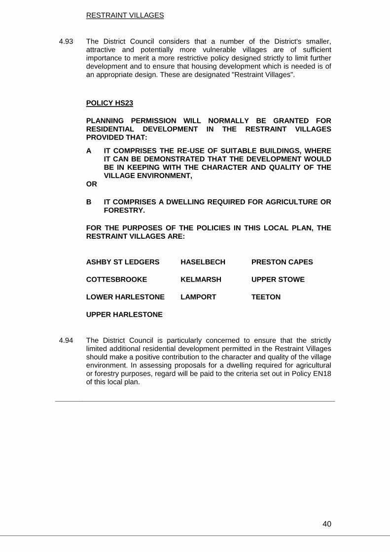
40
RESTRAINT VILLAGES
4.93 The District Council considers that a number of the District's smaller,
attractive and potentially more vulnerable villages are of sufficient importance to merit a more restrictive policy designed strictly to limit further development and to ensure that housing development which is needed is of an appropriate design. These are designated "Restraint Villages".
POLICY HS23
PLANNING PERMISSION WILL NORMALLY BE GRANTED FOR RESIDENTIAL DEVELOPMENT IN THE RESTRAINT VILLAGES PROVIDED THAT:
A IT COMPRISES THE RE-USE OF SUITABLE BUILDINGS, WHERE IT CAN BE DEMONSTRATED THAT THE DEVELOPMENT WOULD BE IN KEEPING WITH THE CHARACTER AND QUALITY OF THE VILLAGE ENVIRONMENT,
OR
B IT COMPRISES A DWELLING REQUIRED FOR AGRICULTURE OR FORESTRY.
FOR THE PURPOSES OF THE POLICIES IN THIS LOCAL PLAN, THE RESTRAINT VILLAGES ARE:
ASHBY ST LEDGERS HASELBECH PRESTON CAPES
COTTESBROOKE KELMARSH UPPER STOWE
LOWER HARLESTONE LAMPORT TEETON
UPPER HARLESTONE
4.94
The District Council is particularly concerned to ensure that the strictly limited additional residential development permitted in the Restraint Villages should make a positive contribution to the character and quality of the village environment. In assessing proposals for a dwelling required for agricultural or forestry purposes, regard will be paid to the criteria set out in Policy EN18 of this local plan.
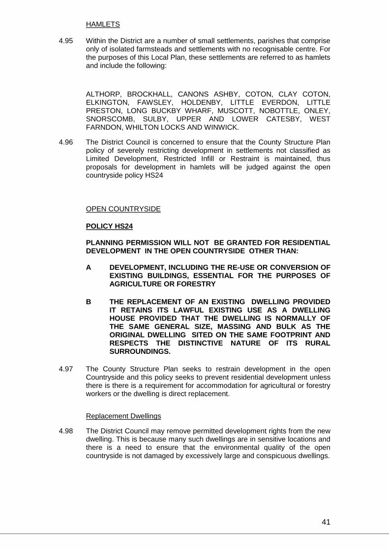
41
HAMLETS 4.95 Within the District are a number of small settlements, parishes that comprise
only of isolated farmsteads and settlements with no recognisable centre. For the purposes of this Local Plan, these settlements are referred to as hamlets and include the following:
ALTHORP, BROCKHALL, CANONS ASHBY, COTON, CLAY COTON,
ELKINGTON, FAWSLEY, HOLDENBY, LITTLE EVERDON, LITTLE PRESTON, LONG BUCKBY WHARF, MUSCOTT, NOBOTTLE, ONLEY, SNORSCOMB, SULBY, UPPER AND LOWER CATESBY, WEST FARNDON, WHILTON LOCKS AND WINWICK.
4.96 The District Council is concerned to ensure that the County Structure Plan policy of severely restricting development in settlements not classified as Limited Development, Restricted Infill or Restraint is maintained, thus proposals for development in hamlets will be judged against the open countryside policy HS24
OPEN COUNTRYSIDE
POLICY HS24 PLANNING PERMISSION WILL NOT BE GRANTED FOR RESIDENTIAL
DEVELOPMENT IN THE OPEN COUNTRYSIDE OTHER THAN:
A DEVELOPMENT, INCLUDING THE RE-USE OR CONVERSION OF EXISTING BUILDINGS, ESSENTIAL FOR THE PURPOSES OF AGRICULTURE OR FORESTRY
B THE REPLACEMENT OF AN EXISTING DWELLING PROVIDED IT RETAINS ITS LAWFUL EXISTING USE AS A DWELLING HOUSE PROVIDED THAT THE DWELLING IS NORMALLY OF THE SAME GENERAL SIZE, MASSING AND BULK AS THE ORIGINAL DWELLING SITED ON THE SAME FOOTPRINT AND RESPECTS THE DISTINCTIVE NATURE OF ITS RURAL SURROUNDINGS.
4.97 The County Structure Plan seeks to restrain development in the open Countryside and this policy seeks to prevent residential development unless there is there is a requirement for accommodation for agricultural or forestry workers or the dwelling is direct replacement.
Replacement Dwellings
4.98 The District Council may remove permitted development rights from the new dwelling. This is because many such dwellings are in sensitive locations and there is a need to ensure that the environmental quality of the open countryside is not damaged by excessively large and conspicuous dwellings.

42
4.99 In design and materials, the new building should reflect the local style of buildings. The District Council will apply the normal standards, as described elsewhere in this local plan, with regard to the provision of vehicular access, parking and amenity space.
Extensions to existing dwellings
4.100 Extensions to existing dwellings in the open countryside, which exceed the permitted development rights, should respect the scale and character of the original dwelling which should still be a recognised part of the extended building.

43

44
SITES FOR RESIDENTIAL CARAVANS, MOBILE HOMES, CHALETS AND CANAL SIDE MOORINGS IN OPEN COUNTRYSIDE
POLICY HS33
PLANNING PERMISSION WILL NOT BE GRANTED FOR THE DEVELOPMENT OF ADDITIONAL SITES FOR HOLIDAY VILLAGES, RESIDENTIAL CARAVANS, MOBILE HOMES AND CHALETS IN THE OPEN COUNTRYSIDE.
4.142 The District Council is concerned to ensure that any adverse environmental
impact associated with the location of essentially temporary residential accommodation is minimised by extending the general presumption against residential development in open countryside to cover residential caravans, mobile homes and chalets.
POLICY HS34
PLANNING PERMISSION WILL NORMALLY BE GIVEN FOR FACILITIES FOR THE PERMANENT RESIDENTIAL MOORINGS ON THE CANAL SYSTEM PROVIDED THAT THEY ARE LOCATED WITHIN EXISTING SETTLEMENTS AND NOT IN OPEN COUNTRYSIDE
4.143 The District Council is concerned to ensure that facilities for permanent residential moorings are confined to the existing built up areas and do not create an unwarranted intrusion into the open countryside.
BACKLAND DEVELOPMENT
4.145 Backland development usually involves the re-use of parts of a number of rear gardens to existing houses for further residential development. Whilst such development may be acceptable under certain circumstances, it can have a considerable impact on the amenities of existing residential areas and all such proposals require careful assessment in respect of a number of important criteria, as set out in the following policies:
POLICY HS36
PLANNING PERMISSION FOR BACKLAND RESIDENTIAL DEVELOPMENT WILL NORMALLY BE GRANTED PROVIDED THAT THE FOLLOWING CRITERIA ARE MET:-
A THE FUTURE DEVELOPMENT OF THE ADJOINING LAND WILL NOT BE PREJUDICED
B WHERE APPROPRIATE, ACCESSES TO SITES SHALL BE DESIGNED SO AS TO BE CAPABLE OF FURTHER EXTENSION TO SERVE ADJOINING AREAS.
C THE DESIGN SHALL BE OF A HIGH STANDARD, RECOGNISING THE CHARACTER OF THE EXISTING BUILDINGS AND OPEN SPACES.

45
D SUFFICIENT SPACE SHALL BE RETAINED BETWEEN AND AROUND BUILDINGS TO ENSURE ADEQUATE LEVELS OF AMENITY IN RESPECT OF BOTH NEW AND EXISTING DWELLINGS. THE ORIENTATION AND RELATIVE LEVELS OF NEW BUILDINGS, TOGETHER WITH THE POSITION OF WINDOWS AND DOORS, SHALL BE SUCH AS TO ENSURE A SUITABLE DEGREE OF PRIVACY TO ALL OCCUPANTS.
E PROPOSED BUILDINGS SHOULD BE SINGLE STOREY IN HEIGHT, UNLESS IT CAN BE DEMONSTRATED THAT HIGHER BUILDINGS WOULD NOT UNDULY AFFECT THE AMENITY OF EXISTING DWELLINGS NOR APPEAR VISUALLY DISCORDANT IN VIEWS FROM PUBLIC SPACE.
F CONDITIONS LIMITING THE FURTHER EXTENSION OF INDIVIDUAL DWELLINGS WHICH ARE PART OF BACKLAND DEVELOPMENTS WILL BE IMPOSED WHERE NECESSARY.
4.146 The District Council is concerned to avoid piecemeal development and the prevention of access to adjoining sites which may also be appropriate for residential development. A layout plan for the whole area which is potentially suitable for development will be required, even if it is proposed that such development will take place in a number of phases.
4.147 Proper access to the site and potential adjoining sites must be maintained for both residents' and service vehicles.
4.148 By its nature, backland development will have a considerable impact on the immediately surrounding residential area. Plots are frequently difficult in shape and limited in size, with additional problems of levels and access. Good design will therefore be of paramount importance
4.149 The District Council is concerned to ensure the maintenance of adequate levels of amenity for both existing and new residents. In this context, detailed attention to fencing and screening will also be important, and single storey dwellings may be more appropriate in some circumstances. Where proposals involve a new access road alongside existing rear gardens, particular care should be taken to ensure the retention of privacy and the avoidance of disturbance.
4.150 Within backland developments it is frequently the case that densities are high, gardens small and space between buildings reduced to a minimum. Under the provisions of the General Development Order certain alterations, such as extensions up to a maximum size and the insertion of new windows, can be carried out without the need to obtain further planning permission. The District Council is concerned to ensure that insensitively designed extensions or alterations, for example, the insertion of windows without due regard for privacy, do not take place. Where necessary, therefore, the Council will remove or restrict permitted development rights by means of conditions imposed on the original planning consent for development or subsequently by means of an Article 4 Direction. In general, however, a lot of such problems will be averted by restricting the height of new dwellings which, in turn, will reduce the discordant prominence in the residential scene that often can arise otherwise.

46
CHAPTER 5 – INDUSTRIAL AND COMMERCIAL
DAVENTRY TOWN
POLICY EM3
PLANNING PERMISSION WILL NOT BE GRANTED FOR DEVELOPMENT WHICH FALLS WITHIN USE CLASSES B2 AND B8 ON SITES IN DAVENTRY TOWN OUTSIDE THE EXISTING INDUSTRIAL ESTATES AND THE PROPOSED ADDITION TO THE DRAYTON FIELDS INDUSTRIAL ESTATE AND HEARTLANDS AS SHOWN ON THE PROPOSALS MAP (DAVENTRY INSET).
5.16 The District Council considers that this Local Plan makes adequate provision for industrial and commercial development on properly laid out industrial estates with adequate infrastructure. Such development elsewhere in Daventry Town would be environmentally undesirable and will therefore be discouraged. The Policy does not restrict all business development to industrial estates; B1 uses can continue to be accommodated elsewhere where they would not be detrimental to residential amenity.
POLICY EM7
PLANNING PERMISSION WILL NORMALLY BE GRANTED FOR THE USE OF UPPER FLOORS IN EXISTING COMMERCIAL BUILDINGS FOR OFFICE PURPOSES (USE CLASS B1(a)).
5.22 The District Council is concerned to encourage the use of upper floors of existing buildings in the Town Centre. This helps to maintain the fabric of the buildings and provides valuable floor-space for small businesses.

47
RURAL AREAS
5.23 The Draft Local Plan seeks to balance the provision and maintenance of employment opportunities with the aims of countryside conservation and the need to guard against any deterioration in the living environments of residents of the District. With this in mind, land for additional industrial development is specifically identified at Daventry and in a limited number of other key locations in the District. In the Rural Areas, applications for industrial or commercial development will be determined in the light of the following policies:
48
LIMITED DEVELOPMENT VILLAGES
5.24 Whilst accepting that in the rural areas the County Structure Plan directs new business and general industrial development mainly to the Limited Development Villages, the District Council is concerned to ensure that such development is as far as possible confined to properly designed industrial estates. An analysis of opportunities for industrial estate development has therefore been undertaken, together with an assessment of the need for additional employment in each case. In carrying out this analysis, regard has been paid to the impact of the potential development on the size, form, character and setting of the villages, their communities and the local environment; the adequacy of local services; the requirements of agriculture; and the need to protect open land which is of particular significance to the form and character of the village.
Limited Development Villages, General
POLICY EM9
PLANNING PERMISSION WILL NORMALLY BE GRANTED FOR INDUSTRIAL OR COMMERCIAL DEVELOPMENT ON INDUSTRIAL ESTATES WITHIN THE LIMITED DEVELOPMENT VILLAGES, PROVIDED THE NATURE OF THE PROPOSAL IS COMPATIBLE WITH EXISTING DEVELOPMENT IN THE VICINITY OF THE SITE.
5.34 The District Council is concerned to ensure that new industrial and commercial developments in Limited Development Villages are directed to industrial estates as far as possible and that individual proposals respect the scale and character of existing of existing buildings.
POLICY EM10
PLANNING PERMISSION WILL NORMALLY BE GRANTED FOR INDUSTRIAL AND COMMERCIAL DEVELOPMENT IN THE LIMITED DEVELOPMENT VILLAGES;
A ON THE SITES SPECIFICALLY IDENTIFIED FOR ADDITIONAL INDUSTRIAL AND COMMERCIAL DEVELOPMENT IN THIS LOCAL PLAN
B FOR SMALL SCALE DEVELOPMENT WITHIN THE EXISTING CONFINES OF THE VILLAGE AS DEFINED ON THE PROPOSALS MAP VILLAGE INSETS, PROVIDED THAT IT DOES NOT TAKE UP OPEN LAND WHICH IS OF PARTICULAR SIGNIFICANCE TO THE FORM AND CHARACTER OF THE VILLAGE.
C FOR THE RENOVATION OR CONVERSION OF BUILDINGS FOR INDUSTRIAL OR COMMERCIAL PURPOSES.
5.35
Having specifically identified appropriate sites for future industrial and commercial development, the District Council is concerned to ensure that the existing built up areas of Limited Development Villages are not the subject of additional development or redevelopment proposals which are inappropriate in scale or character.

49
RESTRICTED INFILL VILLAGES
5.36 In support of the County Structure Plan, Policy HS22 identifies certain settlements as RESTRICTED INFILL VILLAGES in this Local Plan. These villages are:
ARTHINGWORTH HOLLOWELL BADBY KILSBY BARBY LILBOURNE BRAUNSTON MAIDWELL GREAT BRINGTON MARSTON TRUSSELL LITTLE BRINGTON MOULTON BOUGHTON NASEBY BYFIELD NEWNHAM CHAPEL BRAMPTON NORTON CHARWELTON OLD CHURCH BRAMPTON OVERSTONE CHURCH STOWE GREAT OXENDON CLIPSTON PITSFORD COLD ASHBY RAVENSTHORPE CREATON SCALDWELL DODFORD SIBBERTOFT DRAUGHTON SPRATTON EAST FARNDON STAVERTON EAST HADDON THORNBY GREAT EVERDON WALGRAVE FARTHINGSTONE WATFORD FLORE WEEDON BEC GUILSBOROUGH WELFORD HANGING HOUGHTON WELTON HANNINGTON WHILTON HELLIDON WOODFORD HALSE HOLCOT YELVERTOFT
5.37 In the Restricted Infill Villages, the District Council will seek to restrict new industrial and business development to that which is of an appropriately small scale and which is within the confines of the village. In particular, proposals will be considered in relation to their impact on the form, character and setting of the village and on the community and its local environment and the need to protect open land which is of particular significance to the form and character of the village.

50
POLICY EM11
IN THE RESTRICTED INFILL VILLAGES PLANNING PERMISSION FOR NEW BUSINESS AND INDUSTRIAL DEVELOPMENT WILL NORMALLY BE GRANTED PROVIDED THE SCALE AND CHARACTER OF THE PROPOSAL REFLECTS THE RESIDENTIAL NATURE OF THE SURROUNDINGS.
5.38 Whilst the District Council appreciates that suitable modern businesses can be successfully integrated into the smaller villages and welcomes the employment opportunities which they represent, it is concerned to ensure that the scale of the operation and the size and type of the buildings do not detract from the character of the settlement or the amenities of the residents. In assessing applications, particular attention will be paid to the likely volumes of traffic generated by the proposal.
POLICY EM12
IN THE RESTRICTED INFILL VILLAGES PLANNING PERMISSION FOR NEW BUSINESS AND INDUSTRIAL DEVELOPMENT WILL NORMALLY BE GRANTED PROVIDED IT IS WITHIN THE EXISTING CONFINES OF THE VILLAGE.
5.39 For the purposes of this policy, "existing confines of the village" will be taken to mean that area of the village delimited by the existing main built-up area but excluding those peripheral buildings such as free-standing individual or groups of dwellings, nearby farm buildings or other structures which are not closely related thereto. Gardens, or former gardens, within the curtilages of dwelling houses, will not necessarily be assumed to fall within the existing confines of the village. The construction of a bypass around a Restricted Infill Village will not be regarded as an extension to the confines of the village and land between the existing built up area and the new road will be considered as open countryside.
POLICY EM13
IN THE RESTRICTED INFILL VILLAGES PLANNING PERMISSION WILL NOT NORMALLY BE GRANTED FOR NEW BUSINESS AND INDUSTRIAL DEVELOPMENT ON OPEN LAND WHICH IS OF PARTICULAR SIGNIFICANCE TO THE FORM AND CHARACTER OF THE VILLAGE.
5.40 Such sites will normally comprise large open frontages whose contribution to the character of the village is of acknowledged importance. However, private gardens and orchards can also make significant contributions to the local environment, both within and on the edge of the village, and the development of these will be resisted under this policy where appropriate.

51
POLICY EM14
IN THE RESTRICTED INFILL VILLAGES PLANNING PERMISSION FOR THE RENOVATION OR CONVERSION OF EXISTING BUILDINGS FOR INDUSTRIAL OR COMMERCIAL PURPOSES WILL NORMALLY BE GRANTED PROVIDED THE PROPOSAL IS IN KEEPING WITH THE CHARACTER AND QUALITY OF THE VILLAGE ENVIRONMENT. IN ASSESSING PROPOSALS FOR THE PURPOSE OF THIS POLICY, REGARD WILL BE PAID TO THE CRITERIA SET OUT IN POLICY EN18 OF THIS LOCAL PLAN.
5.41 For the purpose of this policy, the simple replacement of outworn, dilapidated or untidy buildings, yards or other open spaces, will only be taken to represent an environmental gain of sufficient worth to merit the granting of planning permission where the proposal can demonstrate a positive contribution to the character and quality of the village environment.
RESTRAINT VILLAGES
5.42 The District Council considers that a number of the District's smaller, attractive and potentially more vulnerable villages are of sufficient importance to merit a more restrictive policy designed strictly to limit industrial and commercial development to the re-use of suitable redundant buildings for uses appropriate to the area. These villages are defined in Policy HS23 and are:
ASHBY ST LEDGERS KELMARSH
COTTESBROOKE LAMPORT
LOWER HARLESTONE PRESTON CAPES
UPPER HARLESTONE UPPER STOWE
HASELBECH TEETON
POLICY EM15
IN THE RESTRAINT VILLAGES PLANNING PERMISSION WILL NOT NORMALLY BE GRANTED FOR BUSINESS AND GENERAL INDUSTRIAL DEVELOPMENT. EXCEPTIONS MAY INCLUDE PROPOSALS FOR SMALL SCALE DEVELOPMENT RELATED TO THE RE- USE OF BUILDINGS FOR USES APPROPRIATE TO SMALL VILLAGES IN RURAL AREAS. IN ORDER TO MERIT CONSIDERATION FOR RE-USE UNDER THIS POLICY, THE BUILDING MUST HAVE A CHARACTER WHICH RENDERS IT WORTHY OF RETENTION AND THE PROPOSED USE, FORM, BULK AND GENERAL DESIGN OF THE CONVERTED BUILDING MUST BE IN KEEPING WITH ITS SURROUNDINGS.
5.43 In assessing applications for the purposes of this policy, regard will be paid to the criteria set out in respect of the conversion of buildings in the open countryside, set out in Policies EN19 to EN22.
52
HAMLETS AND OPEN COUNTRYSIDE
POLICY EM16 PLANNING PERMISSION WILL NOT NORMALLY BE GRANTED FOR
BUSINESS AND GENERAL INDUSTRIAL DEVELOPMENT IN THE HAMLETS AND OPEN COUNTRYSIDE. EXCEPTIONS MAY INCLUDE PROPOSALS FOR SMALL SCALE DEVELOPMENT RELATED TO THE RE-USE OF BUILDINGS UNDER THE RELEVANT POLICIES OF THIS LOCAL PLAN.
5.44
The District Council is concerned to ensure that the County Structure Plan policy of severely restricting development in open countryside is maintained. Hamlets are small settlements described and listed in Para 4.95.
5.45 The District Council are keen to promote the use of buildings in the countryside for employment purposes to assist the economy of these areas. Proposals for conversion should comply with the policies in this Local Plan while ensuring that the converted building retains its essential character both in building design and site layout.
CREATON ROAD INDUSTRIAL ESTATE
5.46 The general aim of the Local Plan is to concentrate new development within existing settlements and to restrict development in the open countryside. However, the Creaton Road Industrial Estate near Brixworth as shown on the Proposals Map (Creaton Road Inset), has been in commercial use for many years and the existing buildings have established industrial or commercial uses. The site was originally a seed mill which closed in 1967, and since that time the County and District Councils have restricted new development to that related to agriculture. Policies to this effect were included in the Brixworth Local Plan of 1982, which also proposed a limited amount of development to attempt to improve the appearance of the area.
5.47 The District Council consider that there is capacity for a small amount of appropriate development on the site, but this will need to be carefully controlled.
POLICY EM17
PLANNING PERMISSION WILL NORMALLY BE GRANTED FOR NEW BUSINESS AND GENERAL INDUSTRIAL DEVELOPMENTS AT CREATON ROAD INDUSTRIAL ESTATE (SEE PROPOSALS MAP, CREATON ROAD INSET) PROVIDED THAT:
A THEY ARE RESTRICTED TO AN AREA OF ABOUT 2.5 HECTARES ON THE SOUTH EAST CORNER OF THE SITE.
B THE USE OF THE PREMISES WILL NORMALLY BE RELATED TO AGRICULTURE OR HORTICULTURE. EXCEPTIONS MAY BE PERMITTED WHERE THE PROPOSAL INVOLVES THE RELOCATION OF A BUSINESS FROM AN ADJOINING VILLAGE BECAUSE OF ENVIRONMENTAL PROBLEMS AND WHICH CANNOT BE ACCOMMODATED ON AN INDUSTRIAL ESTATE.

53
C ADEQUATE LANDSCAPING AND SCREENING IS PROVIDED ALL PROPOSALS FOR DEVELOPMENT WILL BE CONSIDERED WITH PARTICULAR REGARD TO THE EFFECT OF THE PROJECTED TRAFFIC LEVELS ON THE ADJOINING ROADS AND SURROUNDING VILLAGES.
5.48 Adequate provision has been made within the existing settlements for
general industrial development. However, the location of the site makes it suitable for small scale developments related to agriculture. If there are uses in the surrounding villages, which are causing environmental problems and they cannot be accommodated on existing industrial estates, then they may be permitted to move on to this site. The three roads leading to the site are class C minor roads, two of which pass through the Conservation Areas of Creaton and Brixworth and are all unsuitable for heavy traffic.

54
CHAPTER 6 – RETAIL DEVELOPMENT
POLICY RT4
PLANNING PERMISSION WILL NOT NORMALLY BE GRANTED FOR THE RETAILING OF GOODS FROM INDUSTRIAL PREMISES EXCEPT WHERE:
A THE GOODS ARE THOSE WHICH ARE MANUFACTURED, ASSEMBLED OR DISTRIBUTED AS PART OF THE NORMAL BUSINESS OF THE FIRM
AND
B THE GOODS ARE D.I.Y./BUILDING MATERIALS, GARDEN CENTRE GOODS OR OTHER SPECIALIST GOODS NOT GENERALLY AVAILABLE FROM A NEARBY CENTRE.
AND WHERE EACH OF THE FOLLOWING CRITERIA ARE SATISFIED:
C THE RETAILING USE IS CLEARLY ANCILLARY TO THE INDUSTRIAL USE
D SAFE ACCESS TO THE PREMISES CAN BE PROVIDED FOR THE PUBLIC BOTH IN VEHICLES AND ON FOOT
E ADEQUATE ON-SITE CAR PARKING PROVISION CAN BE MADE FOR BOTH EMPLOYEES AND CUSTOMERS
F SERVICING ARRANGEMENTS FOR THE INDUSTRIAL PREMISES ARE NOT PREJUDICED.
6.14 This policy recognises the desire of some industrialists to retail their products directly to the public. It regards such retailing as acceptable within certain broad criteria which are designed to avoid an adverse affect on shopping centres in Daventry and the villages and to achieve proper standards for access, car parking and servicing.
6.15 For the purpose of this policy, industrial premises include those where goods are manufactured or assembled and wholesale distribution and cash and carry warehouses. The retail use should remain ancillary to the main use of the site for industrial purposes.

55
Daventry Town Centre
6.16 Daventry Town Centre fulfils an important role as a shopping centre for the western part of Northamptonshire. It serves catchment areas currently estimated to total some 50,000 people. The County Structure Plan recognises this role and lists Daventry as one of the town centres whose vitality and viability needs to be protected.
6.17 Shopping policy cannot be considered independently of environmental considerations in the town centre. In the historic core comprising High Street and Sheaf Street, which form part of a designated Conservation Area, there is a clear need for shopping policy to be directed towards the maintenance of the shopping vitality of these streets.
6.18 Shopping policy must also ensure the viability of recent and proposed shopping developments in the Bowen Square Area. Any new developments should enhance the range and quality of shopping in the town centre, particularly by the provision of durable goods sales floorspace. Whilst competition between individual traders is not a planning matter, developers should be able to demonstrate that their proposals will not unduly affect the viability of existing shopping areas.
6.19 Service uses, such as banks, building societies, and estate agents have become predominant on the north side of High Street. It is considered undesirable for the "dead" shopping frontages so created to be allowed to increase in High Street, Sheaf Street, Bowen Square and other predominantly shopping areas.
POLICY RT6
PLANNING PERMISSION WILL NOT BE GRANTED FOR CHANGES OF USE FROM SHOPPING (USE CLASS A1) TO FINANCIAL AND PROFESSIONAL SERVICES OR OFFICES (USE CLASSES A2 OR B1) ON THE GROUND FLOOR PREMISES IN BOWEN SQUARE, SHEAF STREET AND HIGH STREET. EXCEPTIONS MAY BE MADE FOR USES FALLING WITHIN CLASS A2 (FINANCIAL AND PROFESSIONAL SERVICES) OF THE 1987 USE CLASSES ORDER IF ALL THE FOLLOWING CIRCUMSTANCES APPLY :
A THE PROPOSAL DOES NOT FORM A PROMINENT PART OF THE SHOPPING FRONTAGE OR AN IMPORTANT LINK BETWEEN SHOPPING FRONTAGES;
B THE PROPOSAL DOES NOT FORM A CONTINUOUS FRONTAGE WITH ONE OR MORE EXISTING NON-RETAIL USES.
WHEN ASSESSING SUCH PROPOSALS CONSIDERATION WILL ALSO
BE GIVEN TO THE PROPORTION OF NON-RETAIL FRONTAGE EXISTING IN THE SPECIFIED AREA.
6.25 Bowen Square, Sheaf Street, and High Street form the established pedestrian shopping circuit in the town centre. The interruption of this circuit with "dead" frontage resulting from changes of use from shops to offices and services should be resisted so as to maintain the vitality of these streets and the shopping function of Daventry Town Centre.

56
Rural Areas
POLICY RT8 PLANNING PERMISSION WILL NOT NORMALLY BE GRANTED FOR
THE CHANGE OF USE FROM VILLAGE SHOPS AND POST OFFICES EXCEPT WHERE IT CAN BE CLEARLY DEMONSTRATED THAT THE BUSINESS IS NO LONGER COMMERCIALLY VIABLE AND THAT ALL POSSIBLE MEANS OF RETAINING THE FACILITY HAVE BEEN EXPLORED.
6.27 The District Council considers it important that rural communities have the benefit of a local shop and post office and will seek to retain these if at all possible. If, however, it can be clearly demonstrated that the business is no longer commercially viable and that all possible means of retaining the facility have been explored, then a change of use may be permitted
POLICY RT9
PLANNING PERMISSION WILL NORMALLY BE GRANTED FOR SHOPS SERVING LOCAL COMMUNITIES PROVIDED THAT:
A THEY PROVIDE A LOCAL SERVICE
B THEY ARE WITHIN THE CONFINES OF THE SETTLEMENT. 6.28 The District Council will generally support proposals for new shops in
villages provided that they meet local community requirements and conform with other policies in this Local Plan.

57
CHAPTER 7 – COMMUNICATIONS
A14 SERVICE AREAS
7.28 Following the confirmation of the route of the proposed Link Road connecting the M1 Motorway at its junction with the M6 to the A1 Trunk Road and A604 at Huntingdon now open to traffic as the A14 Trunk Road, the local planning authorities whose areas are traversed by this road jointly agreed to take positive action by formulating a policy regarding the provision of service area facilities. The authorities involved are:
Corby District Council;
Daventry District Council;
Harborough District Council
Huntingdon District Council;
Kettering Borough Council;
Northamptonshire County Council
7.29 The Department of Transport, whilst not a signatory to this policy statement, has been party to its formulation and supports the stance adopted since it considers that it accords with its own policy outlined in Planning Policy Guidance Note No. 13 "Transport" and in Department of Transport Circular 4/88 "The Control of Development on Trunk Roads".
7.30 This policy statement has been the subject of consultation with the general public, Parish and Town Councils, statutory undertakers, organisations involved in the development and implementation of service areas and bodies representing the users of such facilities. The interests of both the private and the public sector have been recognised and taken into account.
7.31 The local authorities Joint Policy Statement limits the development of Link Road Service Areas in the Daventry District to one only, at the junction of the A14, and the A5199 (formerly the A50) Northampton to Leicester Road, between the villages of Welford and Thornby (See Proposals Map).
7.32 An analysis of the four quadrants of the junction indicated that service area development should be restricted to the south west quadrant on the basis of agricultural and landscape considerations.
POLICY CM3
PLANNING PERMISSION WILL NOT NORMALLY BE GRANTED FOR DEVELOPMENT IN THE VICINITY OF THE A14 WITH THE EXCEPTION OF ONE SERVICE AREA AT THE JUNCTION OF THE LINK ROAD WITH THE A5199 NORTHAMPTON TO LEICESTER ROAD TO SERVE THE NEEDS OF USERS OF THE A14.

58
7.33 Structure Plan policies are generally intended to direct new development to the Towns and the Limited Development Villages. Except in very special circumstances, development is not allowed in the open countryside. A service area to meet the needs of the traveller is considered to be such a special case. Other forms of development will not be permitted except in strict accordance with the policies of the approved County Structure Plan and this Local Plan.
POLICY CM4
PLANNING PERMISSION WILL NORMALLY BE GRANTED FOR A SERVICE AREA AT THE A14/A5199 JUNCTION PROVIDED THAT:
A IT IS LOCATED IN THE SOUTH-WEST QUADRANT OF THE JUNCTION
B IT HAS A HIGH STANDARD OF DESIGN USING MAINLY TRADITIONAL MATERIALS.
C BUILDINGS ARE NO MORE THAN TWO STORIES IN HEIGHT WITH PITCHED ROOFS.
D STORAGE AREAS TO BE EITHER INTERNAL TO THE BUILDINGS OR, IF EXTERNAL, SCREENED FROM GENERAL VIEW.
E THE IMPACT OF PARKING AREAS IS TO BE MINIMISED BY SUBSTANTIAL PERIMETER AND INTERNAL PLANTING.
F THE WHOLE DEVELOPMENT MUST BE WELL LANDSCAPED USING MAINLY NATIVE PLANT SPECIES.
7.34 An assessment has been made of all four quadrants of the junction.
Development in the south-west quadrant would not involve the loss of productive agricultural land nor the loss of existing landscape features through the removal of trees and hedgerows and the significant modification of the existing landform. The south-west quadrant has been despoiled by mineral working and its restoration to a service area rather than agricultural land would be appropriate
7.35 The location for the service areas is in an area of open countryside close to an area defined as being of Special Landscape Value. It is also very visible to motorists on the A5199 and the A14.
POLICY CM5
PLANNING PERMISSION WILL NORMALLY BE GRANTED WITHIN THE SERVICE AREA FOR USES LIMITED TO THOSE REQUIRED TO MEET THE NEEDS OF THE MOTORIST
7.36 The service area shall include only those facilities required by the traveller en route to his or her destination, namely car, coach and lorry parking, overnight accommodation, restaurant and takeaway food facilities, fuelling point, provision for emergency and breakdown vehicles and tourist information. In this location it is not appropriate to include general vehicle repair facilities or retail uses.
59
Roadside Service Areas
POLICY CM6 PLANNING PERMISSION WILL NOT NORMALLY BE GRANTED FOR
SERVICE FACILITIES ON THE PRIMARY ROAD NETWORK IN THE OPEN COUNTRYSIDE EXCEPT WHERE:
A THERE IS NO SUITABLE ALTERNATIVE LOCATION WITHIN A NEARBY SETTLEMENT.
B THERE IS A RANGE OF FACILITIES TO SERVE THE NEEDS OF THE TRAVELLING PUBLIC AND NO OTHER USES.
C THE SITE IS NOT WITHIN A SPECIAL LANDSCAPE AREA, GREEN WEDGE OR RURAL ACCESS AREA.
7.37 The District Council accept that there may be a need for further roadside facilities but are keen to avoid a proliferation of such developments in open countryside and, in particularly, areas of special control. Applicants will thus be required to demonstrate that there are no similar facilities in the locality and that no suitable location is available within a nearby settlement. Department of Transport Circular 4/88 and Planning Policy Guidance Note No 13 give guidance on the distribution of roadside services. There are no standard rules but the guidance suggests that a distance of 12 miles is reasonable with 25 miles as a maximum distance between facilities.
7.38 Proposals should be comprehensive with full landscaping and operational details. The plans should include a full range of facilities to serve the travelling public, that is fuel, refreshments, parking and accommodation. No other uses will be permitted on the site.
POLICY CM11
THE DISTRICT COUNCIL WILL IMPLEMENT THE FOLLOWING ENVIRONMENTAL IMPROVEMENT / TRAFFIC CALMING SCHEMES IN DAVENTRY, AS SHOWN ON THE PROPOSALS MAP (DAVENTRY INSET AND DAVENTRY TOWN CENTRE INSET):-
A ABBEY STREET - VEHICLE SPEED REDUCTION, JUNCTION IMPROVEMENT
B HIGH STREET PEDESTRIAN PRIORITY INCLUDING SELECTIVE CLOSURE TO VEHICLES, VEHICLE SPEED REDUCTION, UPGRADED SURFACE MATERIALS, SHARED SURFACES, STREET FURNITURE, PLANTING
C NORTH STREET - NEW VEHICLE LINK TO EASTERN WAY
D MARKET SQUARE - PEDESTRIAN PRIORITY, VEHICLE SPEED REDUCTION, UPGRADED SURFACE MATERIALS, SHARED SURFACES, NEW STREET FURNITURE
E ASHBY ROAD - PROHIBITION OF HEAVY GOODS VEHICLES, VEHICLE SPEED REDUCTION IN HE VICINITY OF WILLIAM PARKER SCHOOL
F WARWICK STREET - CARRIAGEWAY NARROWING, VEHICLE SPEED REDUCTION, UPGRADED SURFACE MATERIALS, STREET FURNITURE, PLANTING.

60
G THE HOLLOWS - VEHICLE SPEED REDUCTION
H ST. JAMES STREET - CARRIAGEWAY NARROWING, VEHICLE SPEED REDUCTION, UPGRADED SURFACE MATERIALS,
I BROOK STREET (SOUTH) - PEDESTRIAN PRIORITY, UPGRADED SURFACE MATERIALS
J LODGE ROAD - CARRIAGEWAY NARROWING, VEHICLE SPEED REDUCTION, UPGRADED SURFACE MATERIALS,
7.50 There have been considerable improvements to pedestrian circulation areas in Daventry in recent years, including the complete removal of traffic from Sheaf Street and the widening of pavements in High Street together with the implementation of a one- way system. These measures have reduced the conflicts between pedestrians and vehicles and have improved the environment of the District's shopping and visitor focus, but more could be achieved particularly in Market Square and High Street. The schemes listed in the policy greatly expand this initiative. As part of the initiative, the District Council will particularly review whether pedestrianisation of High Street is appropriate, particularly the North Street link to Eastern Way which would be a direct consequence. Such reviews will involve consultations with the business community and have particular regard to the questions of access and security of premises which might be affected.

61
CHAPTER 8 – TOURISM
POLICY TM2
PLANNING PERMISSION WILL NORMALLY BE GRANTED FOR TOURIST ATTRACTIONS COMPRISING ENTERTAINMENT FACILITIES, PLACES OF TOURIST INTEREST, CONFERENCE CENTRES AND TOURIST ACCOMMODATION, INCLUDING HOTELS, GUEST HOUSES, SELF CATERING AND FARM-BASED ACCOMMODATION, BUT EXCLUDING CARAVANS AND CAMPING SITES, PROVIDED THAT:
A IN THE OPEN COUNTRYSIDE SUCH DEVELOPMENT DOES NOT
COMPRISE NEW BUILDINGS
B IN THE RESTRAINT VILLAGES RELATES TO THE RE-USE OF BUILDINGS WHERE THE DEVELOPMENT WOULD BE OF BENEFIT TO THE VILLAGE ENVIRONMENT
C IN THE REMAINDER OF THE RURAL SETTLEMENTS OF THE DISTRICT RELATES TO THE REINSTATEMENT OR CONVERSION OF EXISTING BUILDINGS AND TO SMALL SCALE PURPOSE BUILT FACILITIES WHICH FALL WITHIN THE EXISTING CONFINES OF THE SETTLEMENT
D IN THE TOWN OF DAVENTRY RELATES TO FACILITIES WITHIN THE TOWN OR TO PURPOSE-BUILT FACILITIES WHICH LIE ON APPROPRIATE EDGE OF TOWN SITES.
8.8 The District Council is concerned to ensure that the development of tourism related facilities does not lead to a proliferation of unsuitable new elements in the open countryside. Proposals should therefore normally relate to existing settlements or, in the open countryside, comprise the re-use of suitable redundant buildings. Proposals for new buildings in the open countryside will not normally receive planning permission.
8.9 Proposals for the reuse of buildings in the open countryside will be expected to comply with the guidelines set out in Policies EN19 to EN23 of this Local Plan while ensuring that the converted building retains its essential character both in building design and layout and complies with the general standards of the District Council in respect of traffic, parking and environmental protection'.
8.10 In assessing proposals for tourism related developments in villages, the District Council will apply the criteria in respect of "small scale" and "confines" which are set out in Policy HS22 of this Local Plan

62
POLICY TM4
PLANNING PERMISSION WILL NORMALLY BE GRANTED FOR NEW LAY-BY FACILITIES PROVIDED THEY COMPRISE NO MORE THAN ONE MOBILE CANTEEN (MAXIMUM FLOOR SPACE 50 SQUARE METRES), LITTER BINS, SEATS, TOURIST INFORMATION BOARDS AND OTHER INTERPRETATION FACILITIES. NO OTHER RETAIL OR OTHER DEVELOPMENTS WILL BE PERMITTED.
8.13 The District Council will assist in the provision of lay-by facilities for the benefit of highway users on appropriate sites to be identified by the district council along principal roads. The District Council is anxious to avoid the proliferation of uncontrolled mobile refreshment facilities in inappropriate lay-by locations. With the County Council, a review has been undertaken with the aim of identifying suitable locations for properly established and controlled facilities. The only site considered suitable at the time of preparing this plan is the lay-by on the A43 near Hannington (see Proposals Map). All other sections of principal roads will be designated as prohibited streets.
Camping and caravanning
POLICY TM5
PLANNING PERMISSION WILL NORMALLY BE GRANTED FOR TOURIST CAMPING AND CARAVAN SITES PROVIDED THE DEVELOPMENT IS CLOSELY ASSOCIATED WITH A PARTICULAR RECREATIONAL FACILITY OR TOURIST ATTRACTION AND WHERE THE DEVELOPMENT IS VISUALLY UNOBTRUSIVE AND LIES OUTSIDE THE SPECIAL LANDSCAPE AREAS.
8.14 Whilst appreciating that the provision of properly planned and well maintained camping and caravan sites provide a valuable service for visitors, the District Council is concerned to ensure that such sites are well related to existing developments and do not impinge upon the open countryside. In order to comply with other policies in this Local Plan, such developments will not normally be permitted within Conservation Areas or in close proximity to Listed Buildings.

63
9.1
CHAPTER 9– RECREATION AND LEISURE
Introduction
The demand for recreational facilities is likely to grow over the Local Plan period as the changing lifestyles of the population lead to a greater awareness of the benefits of exercise and the constructive use of leisure time. The District Council supports the strategy of the Sports Council in encouraging greater participation amongst those groups where increased leisure time is, or will become, available. The District Council is concerned also to ensure that adequate community facilities are available for both the existing population and the residents of new housing developments.
9.2 The general issues considered in this section of the Local Plan are
a. The provision of adequate facilities for formal sports, recreation, leisure and other community activities through direct provision, partnership schemes and by encouraging the private sector to contribute.
b. Maximising the use of existing facilities including the dual use of public and private sector provision, and by increasing public awareness of the available facilities.
c. Ensuring that at least the basic recreational and community facilities are available to the rural population.
d. Improving access to the countryside.
e. Achieving increased recreation, leisure and community provision without damaging the environment.
9.3 The District Council is directly involved in the provision of recreation facilities
in the town of Daventry and assists in other parts of the District through grant aiding individual projects and taking part in joint schemes with the Northamptonshire County Council. The District Council also actively encourages enjoyment of and participation in the arts.
General
9.4 The District Council will seek to ensure the adequate provision of indoor and outdoor recreation facilities throughout the district.
9.5 A need has been identified for a Sports Hall in the rural parts of the District
to compliment that found in Daventry. 9.6 Outdoor recreational provision in the form of Public Open Space is an
important element in meeting a broad range of recreational requirements as it caters for all sections of the community and fulfils a variety of functions. Within Daventry, the District Council is responsible for the provision of playing fields but the Parish
Councils provide these in the villages.
9.7 The District Council will promote leisure and recreation opportunities through provision for entertainment and cultural facilities as these are considered to be an important aspect of leisure and recreation. They will thus seek to improve the facilities available throughout the District.
64
9.8 The District Council will pursue opportunities for the joint provision and dual use of indoor and outdoor recreation facilities with the local education authority and with the private sector. The District Council have successfully co-operated with the Northamptonshire County Council in providing sports and leisure facilities at the former Daventry Leisure Centre on the site of The Daventry Tertiary College and at Moulton Comprehensive School. Opportunities for further joint facilities exist in other parts of the District, particularly at the Comprehensive School at Guilsborough. In addition, there are opportunities for the joint use of facilities provided by the private sector.
Provision of open space in new developments
POLICY RC1
PLANNING PERMISSION FOR RESIDENTIAL DEVELOPMENTS WILL NORMALLY BE GRANTED PROVIDED THAT PROVISION IS MADE FOR INFORMAL PUBLIC OPEN SPACE AT A STANDARD OF AT LEAST 10% OF THE DEVELOPMENT AREA OR 0.2 HECTARES PER 50 HOUSES, WHICHEVER IS THE GREATER. THIS SHALL INCLUDE PROVISION FOR BOTH AMENITY OPEN SPACE AND CHILDREN'S PLAY AREAS, WHICH WILL NORMALLY BE IN PLOTS OF NOT LESS THAN 0.2 HECTARES IN LOCATIONS THAT ARE EASILY ACCESSIBLE TO RESIDENTS. DEVELOPERS WILL BE REQUIRED TO PROVIDE PLAY EQUIPMENT TO THE SATISFACTION OF THE DISTRICT COUNCIL.
9.9 The District Council is concerned to ensure that at least 10% of new housing areas comprises informal open space accessible to the public. This should be divided equally between children's play areas and amenity open space. On developments of over 4 hectares (10 acres) this play space should be in plots of at least 0.2 hectares (0.5 acres) to provide more versatile areas which can be used for a wider variety of uses and are more easily maintained. These areas should be easily accessible to residents and should be linked by way of a pedestrian network integrated into the amenity open space.
9.10 Proposals for sheltered housing for the elderly will not be required to provide public open space but provision should be made for communal amenity area provision as an integral part of the development.

65
POLICY RC6
PLANNING PERMISSION WILL BE GRANTED FOR INFORMAL RECREATION DEVELOPMENTS IN THE SPECIAL LANDSCAPE AREAS
9.22 The environmental qualities of the Special Landscape Areas (designated in Policy EN1) are such as to need protection from unsuitable developments, particularly those involving substantial built facilities. The District Council considers that only limited informal recreation which relates to the countryside is suitable for these areas. Such facilities will include country parks, pocket parks and picnic sites. Playing fields associated with settlements which lie within the Special Landscape Area will be permitted.
POLICY RC7
PLANNING PERMISSION FOR NEW GOLF COURSES AND ADDITIONS TO EXISTING COURSES WILL NORMALLY BE GRANTED PROVIDED THAT THE PROPOSAL IS NOT SITUATED WITHIN THE SPECIAL LANDSCAPE AREAS AND:
A THE PROPOSAL IS LOCATED AND DESIGNED TO ENSURE HARMONY AND COMPATIBILITY WITH THE SURROUNDING COUNTRYSIDE INCLUDING ANY HISTORIC FEATURES AS MAY EXIST.
B THE PROPOSAL TAKES ACCOUNT OF EXISTING WILDLIFE HABITATS AND POSITIVELY CONTRIBUTES TO WILDLIFE CONSERVATION.
C THE PROPOSAL MAKES A POSITIVE CONTRIBUTION TO THE LOCAL ENVIRONMENT THROUGH LANDSCAPING.
D THE PROPOSAL DOES NOT INVOLVE ADDITIONAL BUILT FACILITIES NOT DIRECTLY RELATED TO THE GOLF COURSE.
E THE LOCAL ROAD NETWORK IS ABLE TO ACCOMMODATE THE PROJECTED TRAFFIC FLOWS WITHOUT RECOURSE TO EXTENSIVE ROADWORKS.
F THE PROPOSAL DOES NOT RESULT IN THE IRREVERSIBLE LOSS OF THE BEST AND MOST VERSATILE AGRICULTURAL LAND
9.23 The District Council are keen to encourage the development of sporting facilities within the District but these must not detract from the amenities of the countryside. Golf courses need not be intrusive in the open countryside provided that they are designed to blend in with the surrounding area and utilise extensive landscaping, they are particularly suitable for "urban fringe" locations on the edges of major towns. They can benefit some wildlife if existing habitats are protected and new ones created but many creatures and plants are bound to be disturbed by the introduction of large numbers of people and the different environment that is created.
9.24 The artificial landscape which is the result of mown fairways, planting, elevated tees, greens, bunkers etc which do not relate to existing field patterns, does not complement the natural qualities of the Special Landscape Areas and permission will not normally be granted in these areas.

66
9.25 Where proposals affect the best and most versatile agricultural land the applicant will be required to submit the details of the construction of the course to demonstrate that the loss is not irreversible. Provision should be made for the maintenance or re-routing of any affected rights of way.
9.26 The District Council recognises that there is a continued demand for golf courses but notes that the existing and committed provision in the District is way above the Sports Council's and the Royal and Ancient Golf Club's requirements for its own population and is therefore providing facilities for a wide catchment area. The District Council therefore wish to control the development of further courses and extensions to courses to ensure that they are needed and are directed towards resilient locations.
9.27 The policies in this Local Plan seek to concentrate built development to the urban areas and to prevent development in the rural areas. In line with the advice in Planning Policy Guidance Note No 17, Sport and Recreation, applications for significant associated developments such as hotels will be judged on their own merits against the relevant policies in this Local Plan. (Policy TM2)
POLICY RC8
PLANNING PERMISSION WILL NORMALLY BE GRANTED FOR CANAL BASED RECREATION FACILITIES PROVIDED THAT NEW BOAT BASES AND MOORINGS TOGETHER WITH FACILITIES INVOLVING SUBSTANTIAL NEW BUILDINGS ARE CLOSELY RELATED TO EXISTING SETTLEMENTS.
9.28 The Canal system is an important source of water based recreation and it is likely that activities related to these will increase. It is important that recreation development does not destroy the amenity and nature conservation value of the canals. The District Council therefore considers that built facilities should be closely related to the existing settlements.
POLICY RC12
NEW PLAYING FIELD PROVISION IN DAVENTRY WILL BE MADE ON THE BASIS OF 1.6 HECTARES FOR EVERY 1000 PEOPLE.
9.32 The analysis of participation rates in sport and of existing demand for pitches in Daventry has shown that a standard of 1.6 hectares (3 acres) of playing fields for every 1000 people is appropriate. Account has been taken of the likely changes in the population structure, but this standard will be continuously monitored to ensure a balance of supply against demand.
POLICY RC14
THE GRANTING OF PLANNING PERMISSION FOR RESIDENTIAL DEVELOPMENT IN DAVENTRY WILL BE DEPENDANT ON CONTRIBUTIONS TO THE COST OF RECREATIONAL FACILITIES THAT ARE, OR ARE TO BE, PROVIDED TO SATISFY NEEDS ARISING FROM THE DEVELOPMENT PROPOSED.
9.34 This policy seeks to ensure that appropriate recreation facilities are available to match any increase in demand. It recognises the developers responsibility to contribute towards them if its development generates need for them.

67
POLICY RC16
PLANNING PERMISSION WILL BE GRANTED FOR THE DEVELOPMENT OF THE FOOTPATH AND BRIDLEWAY NETWORK IN AND AROUND DAVENTRY COUNTRY PARK, AS IDENTIFIED ON THE PROPOSALS MAP (DAVENTRY INSET).
9.36 Daventry Country Park attracts thousands of visitors each year. Such patronage needs careful management to protect the Park's natural features yet allow full enjoyment of them. Several footpaths already exist but there is scope to improve this network and to add a bridleway that can encircle the Park and link to tracks outside.
POLICY RC17
PLANNING PERMISSION WILL BE GRANTED FOR THE CREATION OF AN INFORMAL FOOTPATH LINK BETWEEN THE FORMER DAVENTRY-BRAUNSTON RAILWAY LINE AND THE GRAND UNION CANAL AS AN EXTENSION OF THE EXISTING FOOTPATH NETWORK.
9.37 Great potential exists to provide a circular public footpath route that links Daventry town with the canal via Daventry Country Park and the former railway line. Much of this route already exists in the form of town footpaths and the canal towpath. The missing links in the network are a path between the canal and the former railway line and a path between the canal and the Country Park. As part of the green wedge philosophy (Policy EN10), access to the countryside is already promoted between the Country Park and the canal though precise footpath routes have to be agreed with landowner co-operation. Similarly, the precise route for the link between the former railway and the canal will be determined with the co-operation of landowners.
POLICY RC18
PLANNING PERMISSION WILL NORMALLY BE GRANTED FOR THE CHANGE OF USE OF LAND ON BOROUGH HILL (BBC STATION) AND LAND ON THE WESTERN SLOPES OF BOROUGH HILL, BETWEEN ADMIRALS WAY, LONG MARCH INDUSTRIAL ESTATE AND THE BBC STATION, IDENTIFIED ON THE PROPOSALS MAP (DAVENTRY INSET), TO INFORMAL PUBLIC OPEN SPACE WITH INTERPRETATION FACILITIES APPROPRIATE TO THIS HISTORIC SITE AND IMPORTANT VIEWPOINT.
9.38 With the cessation of transmissions from the BBC's Daventry station, there is an opportunity to secure the availability of much of the site for open space with low-key public access. The site's historic setting for a hill-top fort has resulted in its recognition as a Scheduled Ancient Monument and therefore any use of the land must not damage the underlying archaeology. This history as a vantage point for viewing Daventry town and its rural surroundings makes it particularly desirable to return the site to some form of public open space, accommodating visitors and offering them information on former settlers, BBC broadcasting and local views.

68
Daventry Town (continued)
POLICY RC25
IT IS PROPOSED THAT A SITE OF 1.35 HECTARES IS RESERVED FOR EDUCATIONAL PURPOSES AT MIDDLEMORE AS SHOWN ON THE PROPOSALS MAP (DAVENTRY INSET)
9.46 The educational facility at Middlemore is desirable to give an added community distinction to this proposed development and to provide a desirably shorter distance to travel for primary school children.

69
Mr Richard Wood Planning Policy & Housing Strategy Manager Daventry District Council Lodge Road Daventry Northamptonshire NN11 5FP
The Belgrave Centre
Stanley Place
Talbot Street
Nottingham NG1 5GG
Switchboard: 0115 971 9971
Direct Line: 0115 971 2661
Fax: 0115 971 2404 Email: [email protected]
Website: www.go-em.gov.uk
Our Ref: EMP 2810/475/12 Date: 21 September 2007 Dear Sir I am writing with reference to your application of 22 March 2007 and further correspondence applying for a direction under paragraph 1(3) of Schedule 8 to the Planning and Compulsory Purchase Act 2004 in respect of policies in the Daventry District Local Plan (adopted June 1997). The Secretary of State’s Direction is attached. Those policies not listed in the Direction will expire on 27th September 2007. The Secretary of State’s assessment of whether saved policies should be extended is based upon the criteria set out in Planning Policy Statement 12 and the Department for Communities and Local Government Protocol on saving policies. The Secretary of State's decisions concern some policies where there have been representations from a third party expressing views that differ from those of your authority. Also, her decisions in respect of some policies have the effect of saving policies that your authority requested should not be extended. For clarity, where either or both of these two circumstances apply the Secretary of State's reasons are set out in the table at the end of this letter. The extension of saved policies listed in this Direction does not indicate that the Secretary of State would endorse these policies if presented to her as new policy. It is intended to ensure continuity in the plan-led system and a stable planning framework locally, and in particular, a continual supply of land for development. Local planning authorities should not suppose that a regulatory local plan style approach will be supported in forthcoming Development Plan Documents. LPAs should adopt a positive spatial strategy led approach to DPD preparation and not seek to reintroduce the numerous policies of many local plans. The exercise of extending saved policies is not an opportunity to delay DPD preparation. LPAs should make good progress with local development frameworks according to the timetables in their local development schemes. Policies have been extended in the expectation that they will be replaced

70
promptly and by fewer policies in DPDs. Maximum use should be made of national and regional policy especially given the advanced position of many regional spatial strategies and the development plan status of the Regional Spatial Strategy/Spatial Development Strategy. Following 27 September 2007 the extended policies should be read in context. Where policies were adopted some time ago, it is likely that material considerations, in particular the emergence of new national and regional policy and also new evidence, will be afforded considerable weight in decisions. In particular, we would draw your attention to the importance of reflecting policy in Planning Policy Statement 3 Housing and Strategic Housing Land Availability Assessments in relevant decisions..
Policy Ref Reason Extended Not Extended
HS2: Housing Related to the Growth of Northampton
A third party representation was submitted expressing views that differ from those of your authority in relation to your application to not save Policy HS2. The policy allocates land to the north of the Whitehills Area of Northampton, south of Brampton Lane and to the West of the A508, Northampton Area for residential development. The policy covers housing allocations and supports the delivery of housing within the Milton Keynes South Midlands Growth Area. The policy is therefore extended.
Signed by authority of the Secretary of State Lesley Flint (Mrs) Head of Housing, Planning & Urban Policy

71
DIRECTION UNDER PARAGRAPH 1(3) OF SCHEDULE 8 TO THE
PLANNING AND COMPULSORY PURCHASE ACT 2004
POLICIES CONTAINED IN THE DAVENTRY DISTRICT LOCAL PLAN
ADOPTED JUNE 1997
The Secretary of State for Communities and Local Government in exercise of
the power conferred by paragraph 1(3) of Schedule 8 to the Planning and
Compulsory Purchase Act 2004 directs that for the purposes of the policies
specified in the Schedule to this direction, paragraph 1(2)(a) of Schedule 8 to
the Planning and Compulsory Purchase Act 2004 does not apply.
Signed by authority of the Secretary of State
Lesley Flint
Head of Housing, Planning &
Urban Policy
Government Office for the East Midlands
21 September 2007

72
SCHEDULE
POLICIES CONTAINED IN THE DAVENTRY DISTRICT LOCAL PLAN
ADOPTED JUNE 1997
(The polices that are shaded have subsequently been replaced by the West
Northamptonshire Joint Core Strategy – December 2014)
POLICY NUMBER
POLICY NAME/DESCRIPTION
GN1 General
GN2 General
GN3 General
EN1 Special Landscape Areas
EN2 Conservation Areas
EN3 Conservation Areas — Shopfronts
EN8 Listed Buildings — Long Straw Thatch
ENI0 Green Wedges
EN11 Rural Access Areas
EN12 Green Links
EN14 Advertisement Control
EN18 Existing Buildings Within Villages
EN19 Conversions and/or Change of use of Buildings in the Open Countryside
EN20 Conversions and/or Change of use of Farm Buildings
EN21 Conversions and/or Change of Use of traditional Buildings
EN25 Comprehensive Landscaping Schemes
EN26 Landscaping
EN35 Ecologically Important Sites in Daventry
EN38 Agricultural Development
EN39 Stables and Riding Schools
EN42 Design
HS2 Housing related to the growth of Northampton
HS4 Housing Provision in Daventry Town
HS6 Residential development outside of Daventry
HS9 Upper Floors in the Town Centre
HS10 New Settlements
HS11 Limited Development in Villages
HS14 Brixworth
HS16 Crick
HS18 Long Buckby
HS21 West Haddon
HS22 Restricted Infill Villages
HS23 Restraint Villages
HS24 Open Countryside
HS25 Affordable Housing
HS26 Affordable Housing
HS27 Affordable Housing
HS33 Residential Caravans, Mobile Homes and Chalets
HS34 Residential Canal Moorings
HS36 Backland Development

73
POLICY NUMBER
POLICY NAME/DESCRIPTION
EM3 Limits Development to Existing Estates & Those Allocated
EM4 Changes of Use on Industrial Estates
EM7 Upper Floors of Town Centre Properties for Offices
EM9 Limited Development Villages
EMI 0 Limited Development Villages
EM11 Restricted Infill Villages
EM12 Restricted Infill Villages
EM13 Restricted Infill Villages
EM14 Restricted Infill Villages
EM15 Restraint Villages
EM16 Open Countryside
EM17 Creaton Road
RT4 Retail from Industrial Premises
RT6 High Street Frontage Policy
RT8 Retention of Village Shops
RT9 New Village Shops
CM3 The A14 Service Area
CM4 The A14 Service Area
CM5 The A14 Service Area
CM6 Roadside Services
CM7 Public Transport Provisions
CM8 Cyclists and Pedestrians
CM11 Environmental Improvement Schemes for Daventry
TM2 Tourist Attractions
TM4 Lay By Facilities
TM5 Camping and Caravans
RC1 Standards of Open Space Provision
RC2 Retention of Open Space
RC6 Informal Recreation
RC7 Golf Courses
RC8 Canal Based Facilities
RC12 Playing Field Provision in Daventry
RC14 Contributions to Playing Fields in Daventry
RC16 Footpaths around Country Park.
RC17 Daventry - Braunston Footpath Link
RC18 Borough Hill
RC25 School at Middlemore