data management in emergency prevention and response
TRANSCRIPT
Data Management in Emergency Prevention and Response
NEARC Spring Conference - 2015
Michael Funaro, Latitude Geographics
GIS is frequently used to assemble the "big picture" in a disaster. Among other things, it is essential for a GIS system to help decision makers understand where first responder resources are located and where help is needed.
GEOG 588Planning GIS for Emergency ManagementPENN StateDept of Geographyhttps://www.e-education.psu.edu/geog588/l6_p5.html

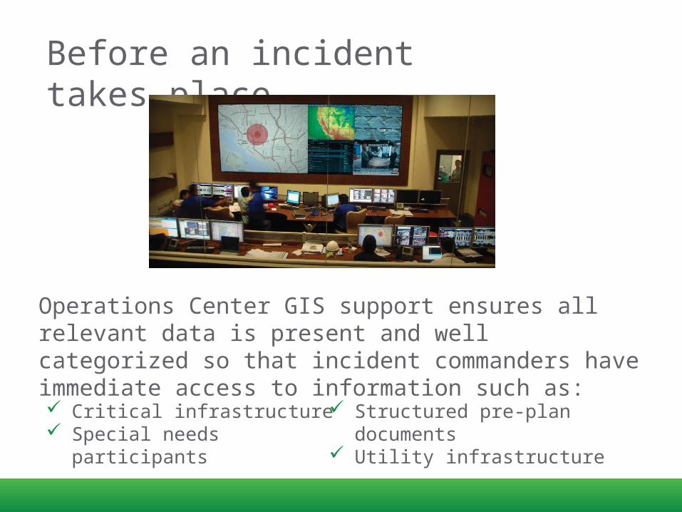
Before an incident takes place..
48° 25’ 32 N123° 22’ 11”
W
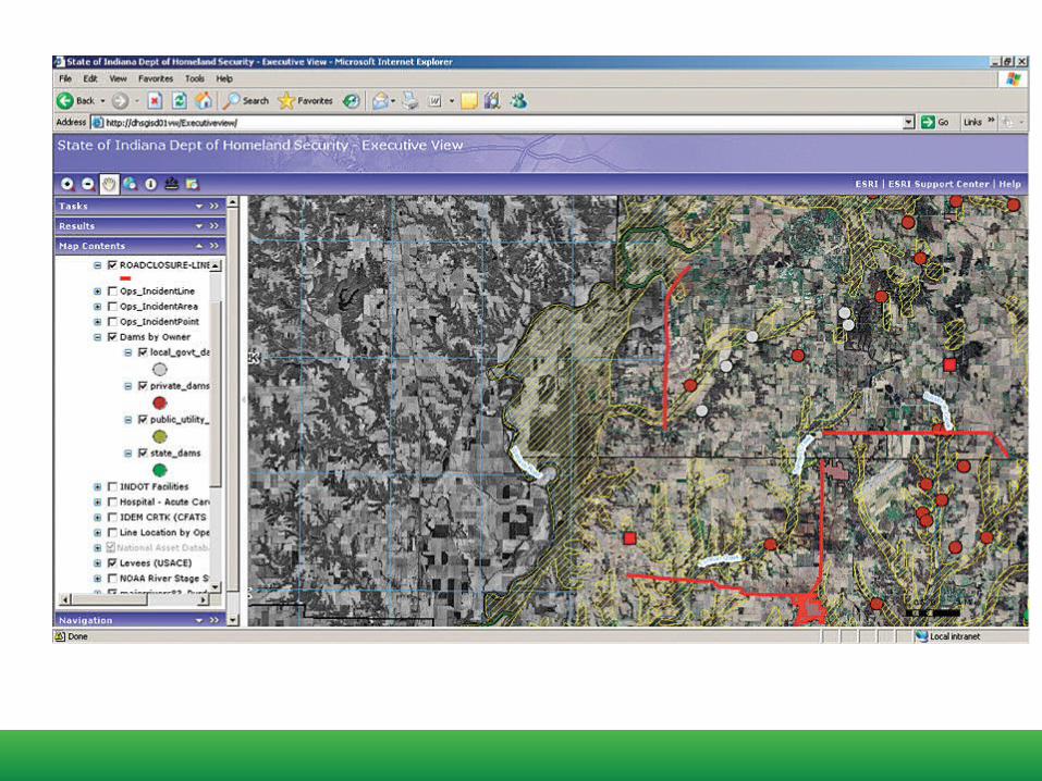
Operations Center GIS support ensures all relevant data is present and well categorized so that incident commanders have immediate access to information such as: Critical infrastructure Special needs participants
Structured pre-plan documents
Utility infrastructure
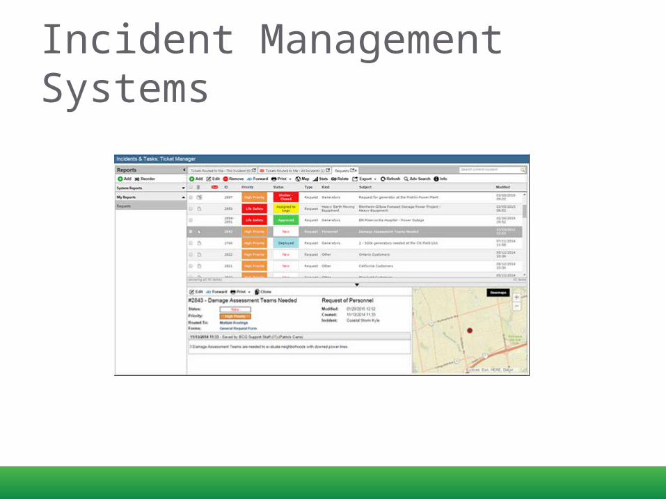
Incident Management Systems
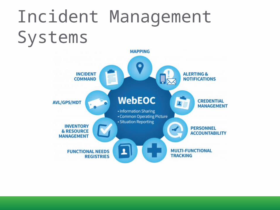
Incident Management Systems


GEOG 588
Effective response to a disaster depends on quickly synthesizing actionable information and disseminating that information to responders in the field.
https://www.e-education.psu.edu/geog588/l6_p5.html

Today…
1. Trends for web technologies2. Strategies for building web
applications

GEOG 588
A persistent issue with the application of GIS to emergency management is that there is often a significant knowledge gap between the GIS experts who know and understand the tools and intricacies of geographic data and the decision makers who have
to act on information derived from GIS systems.
Training decision makers on the use of GIS is not practical in most circumstances (and during a crisis situation, it's already too late)

GEOG 588
Some design criteria for GIS-enabled dashboards could include: The system must allow non-programmer analysts to quickly
customize the map/app Tools and graphics must be readily understandable by
decision makers who have no GIS training. Tools and graphics should focus on strategic objectives and
the "big picture.

Future COP designs must solve a different problem: how to dynamically collect and situationally organize information in a way that is relevant to the commander’s decision process
Hence, future COP designs will be “concept-driven” as much as they are “data-driven”
Dennis K. Leedom, Ph.D. Evidence Based Research, Inc
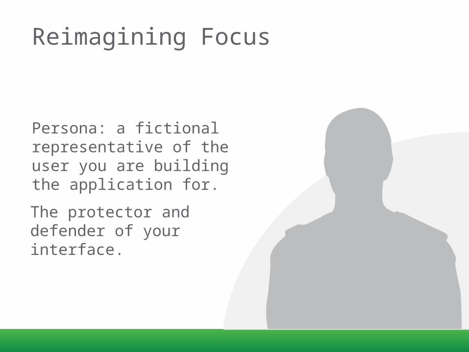
Reimagining Focus
Persona: a fictional representative of the user you are building the application for.
The protector and defender of your interface.

Incident Commanders
What are their capabilities?
What are their biases?
What are their goals?
What tasks do they regularly perform?

For example…
Users should be allowed to add map data directly within the
Incident Response Application interface!
I don’t have time to add map data during an incident;
I only want the tools that I need.

How do incident commanders and responders locate and access data?
Don’t make me hunt for information.
Offer what you have available and make me
aware of important information.

Newer Web Technologies

GeoEvent Extension
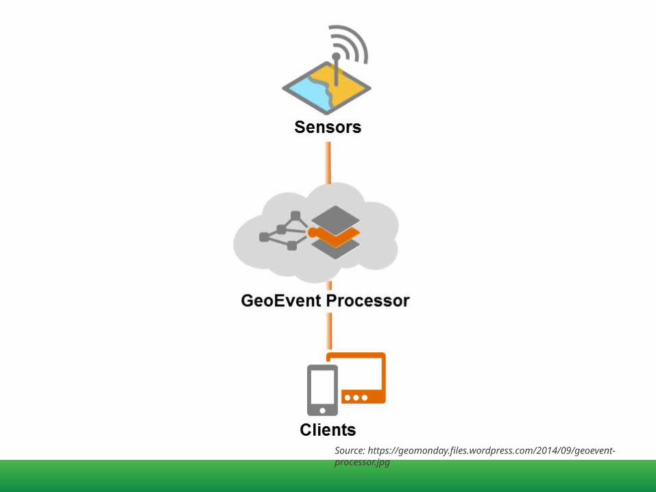
Source: https://geomonday.files.wordpress.com/2014/09/geoevent-processor.jpg

Connect with Any Type of Streaming Data FeedIn Vehicle GPSMobile DevicesSocial Media ProvidersOther Web Services
Detect and focus on IMPORTANT event, locations, thresholds
Track dynamic assets (Vehicles, People); or stationary assets (Weather, Environmental Monitors)
Send ALERTS, update map, append database, interact with other systems
GeoEvent Extension for Server

Input Connectors create a standard integration interface specification for:
• EM Systems (WebEOC, NC4, Disaster LAN) • Dispatch (CAD) Systems (Intrado, …) • EM Network feeds (MASAS-X, UCIDS) • Vehicle GPS Systems (Vehicles) • Radio GPS Systems (Responders) • Sensors (wind, water level, etc.) • GeoRSS feeds • Social Media (Twitter, Instagram, DataSift)
GeoEvent Extension for Server

Real time data and interactions
• Stream Services• WebSockets
I can see what you are doing
-Michael
Social FeedsMultiplayer Games
Collaborative editing/codingClickstream DataFinancial TickersSports UpdatesMultimedia ChatOnline Education
Location-based Apps
Determining whether to use WebSockets for the Job at hand:
• Does your app involve multiple users communicating with each other?
• Is your app a window into server-side data that’s constantly changing?


In Person Map InteractionSee this block here?
Yes
I need you to approach through the park from the west
and look for any injured. OK
Check in when you
arrive here.
OK
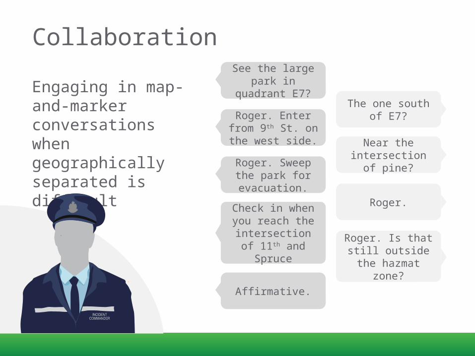
Collaboration
Engaging in map-and-marker conversations when geographically separated is difficult
See the large park in quadrant
E7?The one south of
E7?Roger. Enter from 9th St. on the west side. Near the
intersection of pine?Roger. Sweep the
park for evacuation.
Roger.Check in when you reach the intersection of
11th and SpruceRoger. Is that still
outside the hazmat zone?
Affirmative.
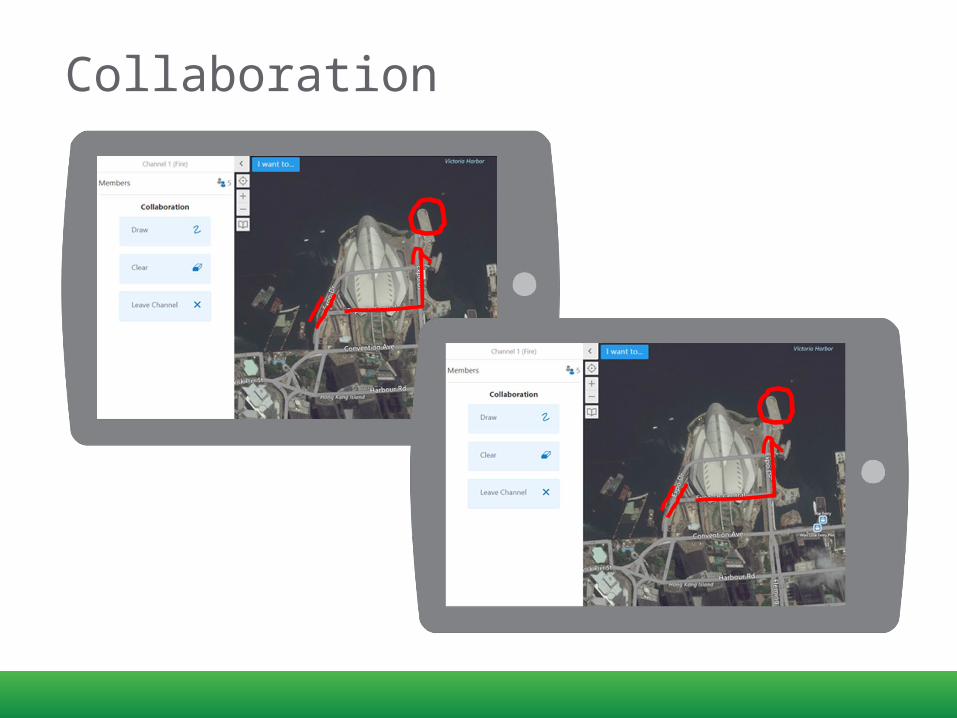
Collaboration
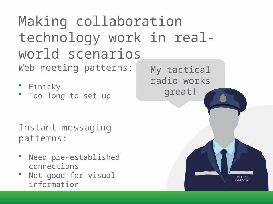
Making collaboration technology work in real-world scenariosWeb meeting patterns:
Finicky Too long to set up
Instant messaging patterns:
Need pre-established connections
Not good for visual information
My tactical radio works great!

Collaboration Channels
Same “feel” as tactical radio
Can support many participants Map immediately shows same extent and scale that others see in the channel
Members can observe while listening to radio and participate with the draw tool when needed

DemoAOP – Active Operating
Picture

Strategies

Advantages of Configurable Software
Faster development/deployment
Less $$ (both immediate and long-
term)
Esri Configurable Resources
Esri - Emergency Management Response
ArcGIS for Emergency Mangement App Gallery
Geocortex A Configurable Platform
Do more than just map data
Real-time dataData Feeds
Visualize, Report, Charts