data acquisition chapter 2. data acquisition 1 st step: get data 1 st step: get data – usually...
TRANSCRIPT
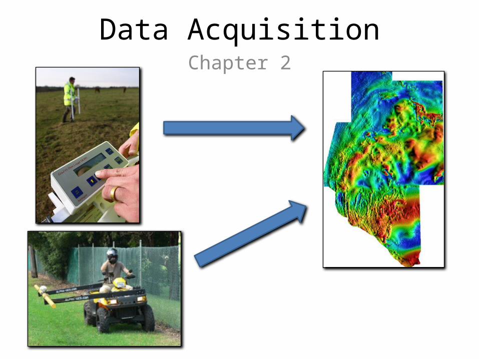
Data AcquisitionChapter 2
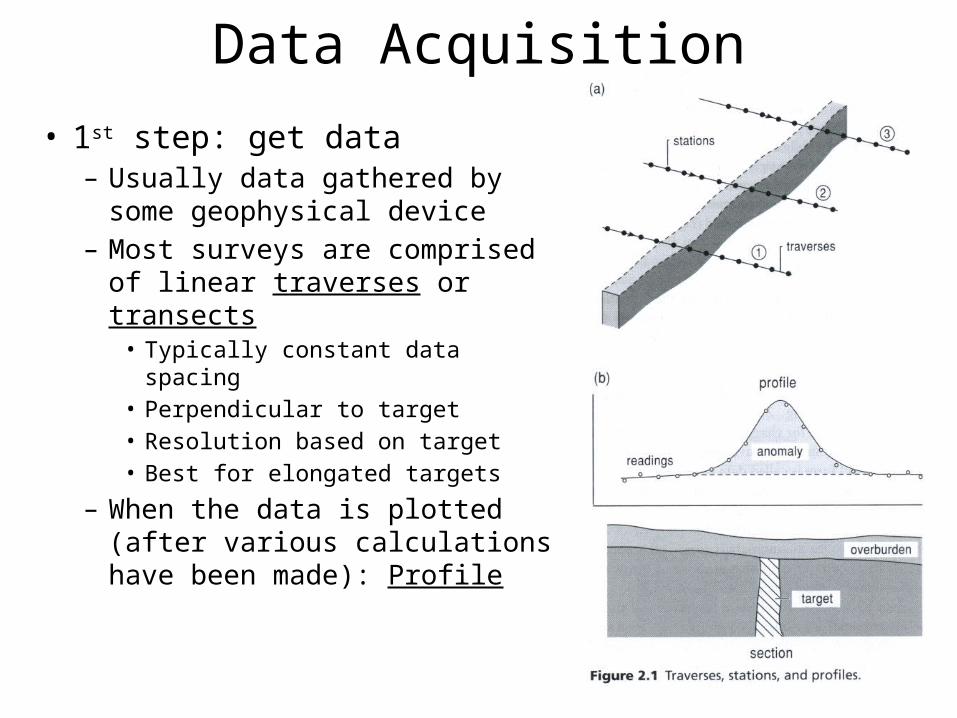
Data Acquisition• 1st step: get data– Usually data gathered by some
geophysical device– Most surveys are comprised of
linear traverses or transects• Typically constant data spacing• Perpendicular to target• Resolution based on target• Best for elongated targets
– When the data is plotted (after various calculations have been made): Profile
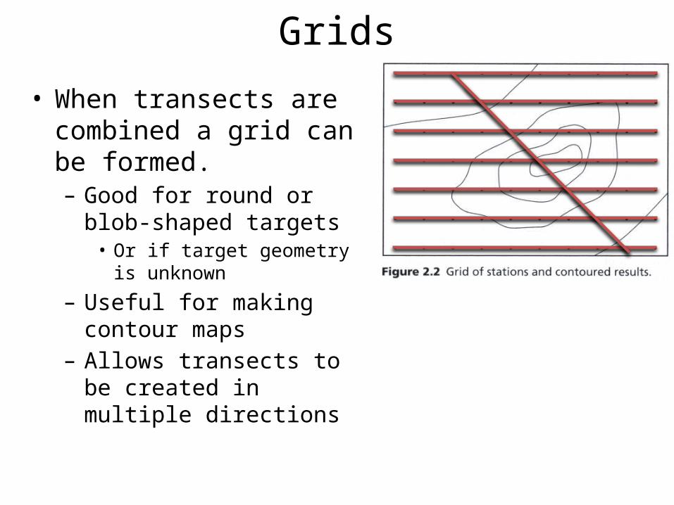
Grids• When transects are combined
a grid can be formed.– Good for round or blob-shaped
targets• Or if target geometry is unknown
– Useful for making contour maps
– Allows transects to be created in multiple directions
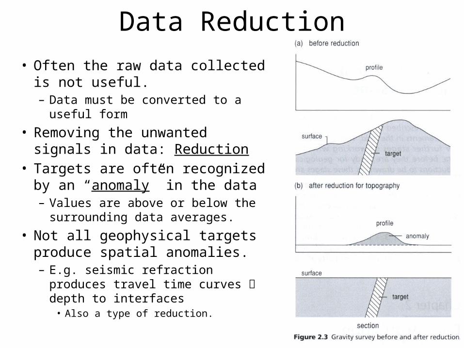
Data Reduction• Often the raw data collected is not
useful.– Data must be converted to a useful
form
• Removing the unwanted signals in data: Reduction
• Targets are often recognized by an “anomaly” in the data– Values are above or below the
surrounding data averages.
• Not all geophysical targets produce spatial anomalies.– E.g. seismic refraction produces travel
time curves depth to interfaces• Also a type of reduction.
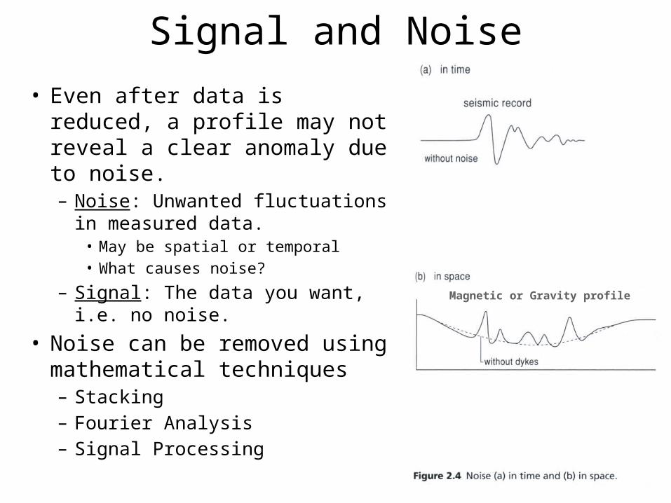
Signal and Noise• Even after data is reduced, a
profile may not reveal a clear anomaly due to noise.– Noise: Unwanted fluctuations in
measured data.• May be spatial or temporal• What causes noise?
– Signal: The data you want, i.e. no noise.
• Noise can be removed using mathematical techniques– Stacking– Fourier Analysis– Signal Processing
Magnetic or Gravity profile
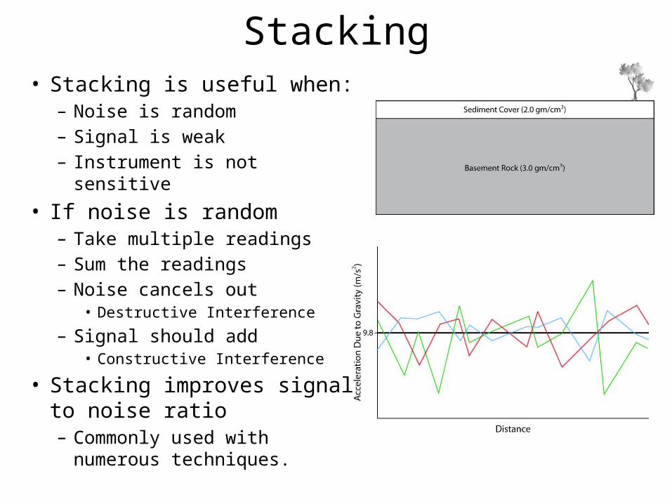
Stacking• Stacking is useful when:
– Noise is random– Signal is weak– Instrument is not sensitive
• If noise is random– Take multiple readings– Sum the readings– Noise cancels out
• Destructive Interference
– Signal should add• Constructive Interference
• Stacking improves signal to noise ratio– Commonly used with numerous
techniques.
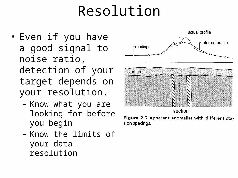
Resolution
• Even if you have a good signal to noise ratio, detection of your target depends on your resolution.– Know what you are looking
for before you begin– Know the limits of your
data resolution
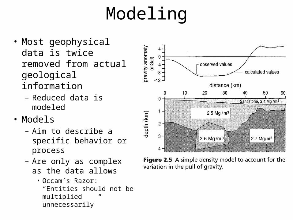
Modeling• Most geophysical data is
twice removed from actual geological information– Reduced data is modeled
• Models– Aim to describe a specific
behavior or process– Are only as complex as
the data allows• Occam’s Razor: “Entities
should not be multiplied unnecessarily”
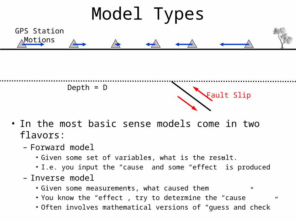
Model Types
• In the most basic sense models come in two flavors:– Forward model
• Given some set of variables, what is the result. • I.e. you input the “cause” and some “effect” is produced
– Inverse model• Given some measurements, what caused them• You know the “effect”, try to determine the “cause”• Often involves mathematical versions of “guess and check”
Depth = DFault Slip
GPS Station Motions
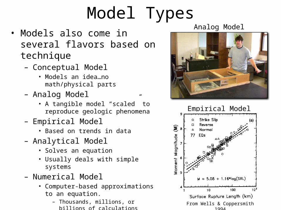
Model Types• Models also come in several flavors
based on technique– Conceptual Model
• Models an idea…no math/physical parts
– Analog Model• A tangible model “scaled” to reproduce
geologic phenomena
– Empirical Model• Based on trends in data
– Analytical Model• Solves an equation• Usually deals with simple systems
– Numerical Model• Computer-based approximations to an
equation. – Thousands, millions, or billions of
calculations• Can handle complex systems.
Analog Model
Empirical Model
From Wells & Coppersmith 1994
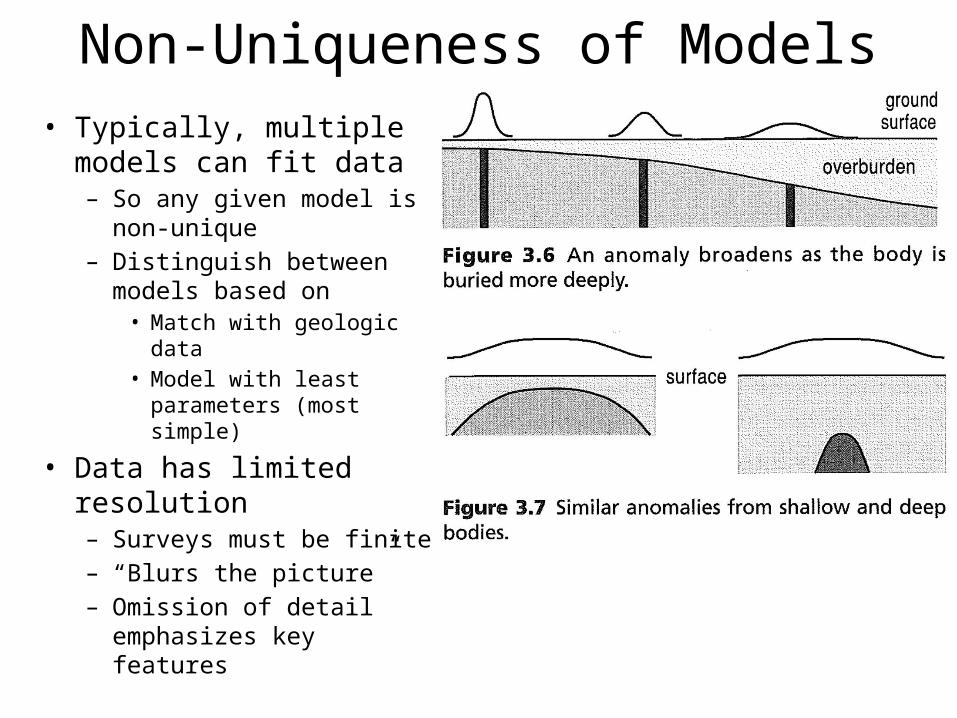
Non-Uniqueness of Models• Typically, multiple models
can fit data– So any given model is non-
unique– Distinguish between models
based on• Match with geologic data• Model with least
parameters (most simple)
• Data has limited resolution– Surveys must be finite– “Blurs the picture”– Omission of detail
emphasizes key features
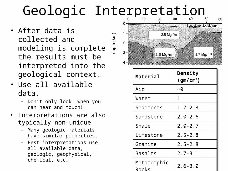
Geologic Interpretation• After data is collected and
modeling is complete the results must be interpreted into the geological context.
• Use all available data.– Don’t only look, when you can hear
and touch!
• Interpretations are also typically non-unique– Many geologic materials have similar
properties.– Best interpretations use all available
data, geologic, geophysical, chemical, etc…
Material Density (gm/cm3)
Air ~0
Water 1
Sediments 1.7-2.3
Sandstone 2.0-2.6
Shale 2.0-2.7
Limestone 2.5-2.8
Granite 2.5-2.8
Basalts 2.7-3.1
Metamorphic Rocks 2.6-3.0