cosmic: constellation observing system for meteorology, ionosphere
TRANSCRIPT
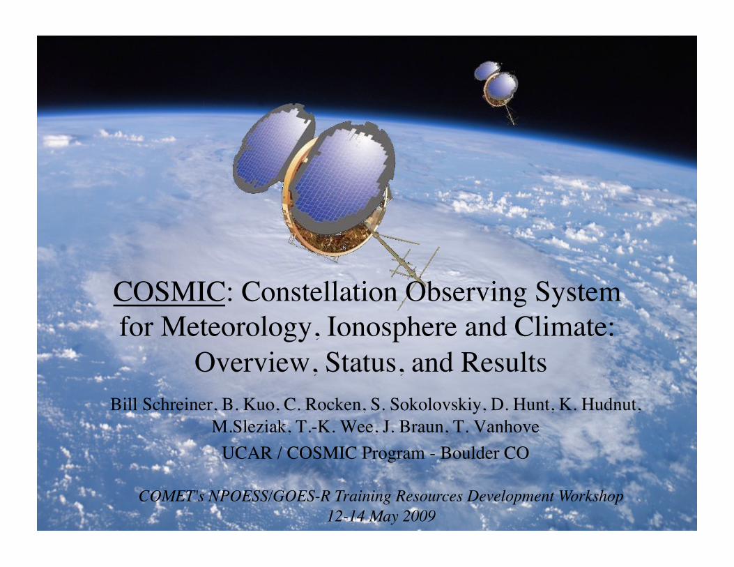
COSMIC: Constellation Observing System for Meteorology, Ionosphere and Climate:
Overview, Status, and Results Bill Schreiner, B. Kuo, C. Rocken, S. Sokolovskiy, D. Hunt, K. Hudnut,
M.Sleziak, T.-K. Wee, J. Braun, T. Vanhove UCAR / COSMIC Program - Boulder CO
COMET's NPOESS/GOES-R Training Resources Development Workshop12-14 May 2009

Overview
• Radio Occultation (RO) introduction • COSMIC Program Overview • Research/Operational Highlights • Ground Based GPS Water Vapor Observations

RO Technique

GNSS (Global Navigation Satellite System)
• GPS (USA), GLONASS (Russia), GALILEO (EU), COMPASS (China) Yunck, 2004

Radio Occultation Presentation of first results from COSMIC/ FORMOSAT-3 appears in Bulletin of American Meteorological Society, March 2008
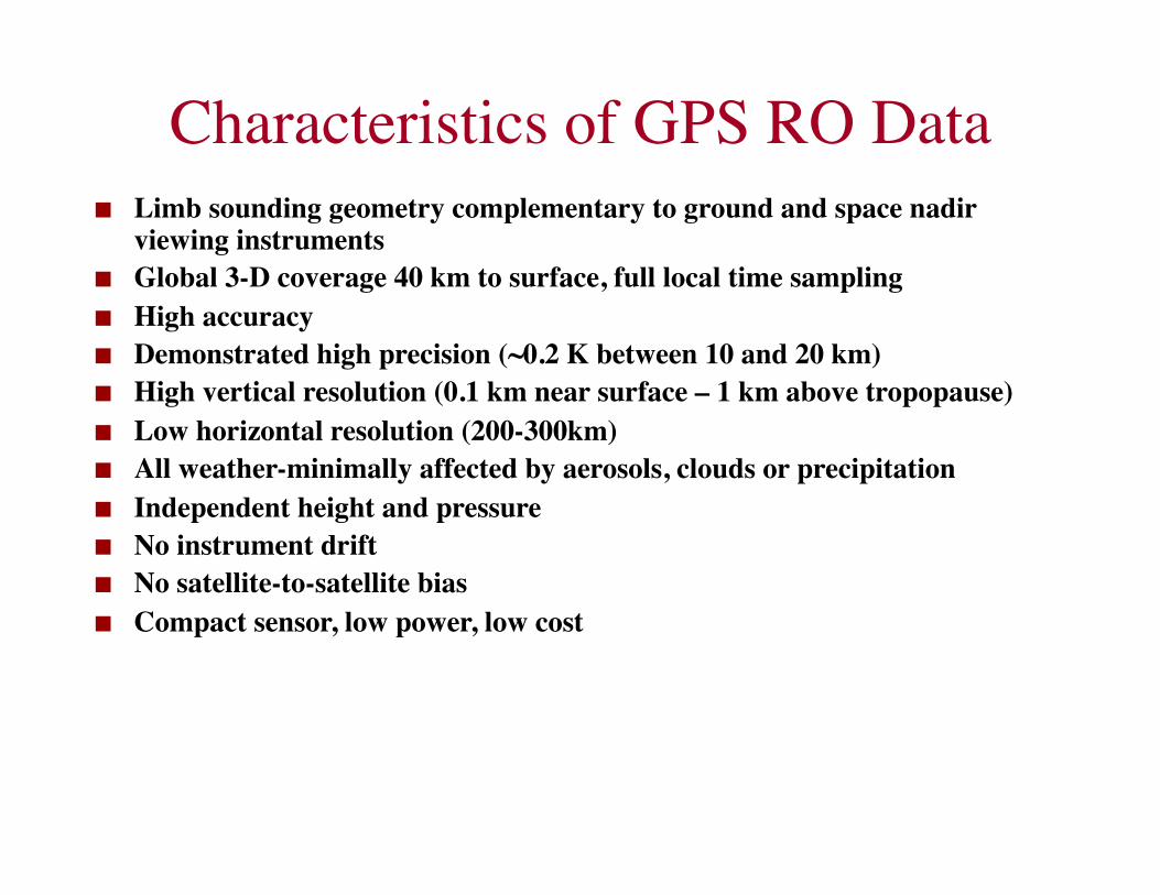
Characteristics of GPS RO Data Limb sounding geometry complementary to ground and space nadir
viewing instruments Global 3-D coverage 40 km to surface, full local time sampling High accuracy Demonstrated high precision (~0.2 K between 10 and 20 km) High vertical resolution (0.1 km near surface – 1 km above tropopause) Low horizontal resolution (200-300km) All weather-minimally affected by aerosols, clouds or precipitation Independent height and pressure No instrument drift No satellite-to-satellite bias Compact sensor, low power, low cost

COSMIC Program Overview

COSMIC at a Glance Constellation Observing System for Meteorology
Ionosphere and Climate Joint US, Taiwan Mission (FORMOSAT-3) 6 Satellites launched in Apr 2006 Orbits: alt=800km, Inc=72deg, ecc=0, ∆Ω=30deg Weather + Space Weather data Global observations of:
Pressure, Temperature, Humidity Refractivity TEC, Ionospheric Electron Density Ionospheric Scintillation
Demonstrate quasi-operational GPS limb sounding with global coverage in near-real time
Climate Monitoring Useful for CAL/VAL studies (Rsondes, AMSU, SSMI,
NWPs)

Input
Data
CDAAC
NESDIS
GTS
NCEP
ECMWF
CWB
UKMO
Canada Met.
JMA
BUFR Files WMO standard 1 file / sounding
Getting COSMIC Results to Weather Centers
Data available to weather centers within < 180 minutes of on-orbit collection
JCSDA
NRL
COSMIC Operational Processing
Science & Archive
TACC
Unidata LDM

Saturday Apr 12, 2008 Global coverage in all weather
2458 soundings

1.7 Million Profiles in Real Time4/21/06 – 5/6/2009
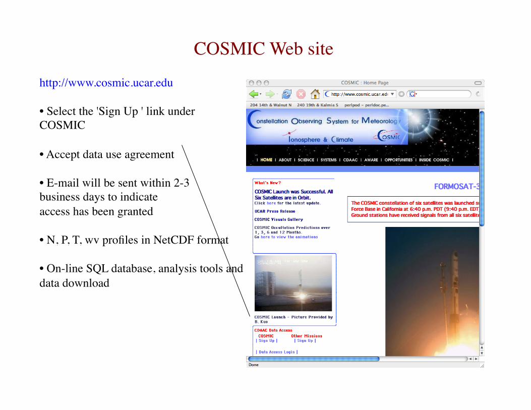
http://www.cosmic.ucar.edu
• Select the 'Sign Up ' link under COSMIC
• Accept data use agreement
• E-mail will be sent within 2-3 business days to indicate access has been granted
• N, P, T, wv profiles in NetCDF format
• On-line SQL database, analysis tools and data download
COSMIC Data Access COSMIC Web site

Research/Operational Highlights

1
10
100
1000200 220 240 260 280 300
Temperature profiles near England
Occultation at 52.6N. 355 E.
Radiosonde at 54.5 N. 353.9 E.
Radiosonde at 53.5 N. 357 E.Pres
sure
, mba
r
Temperature, K
At about 95-4-25:00:00 UTC
RO and Radiosonde Profiles

Comparison of Collocated Profiles

Statistical comparison of FM3-FM4 Soundingsseparation < 10 km
Schreiner et al. 2007 GRL
0.2% precision between 10-20 km

Detection Of Boundary Layer With RO
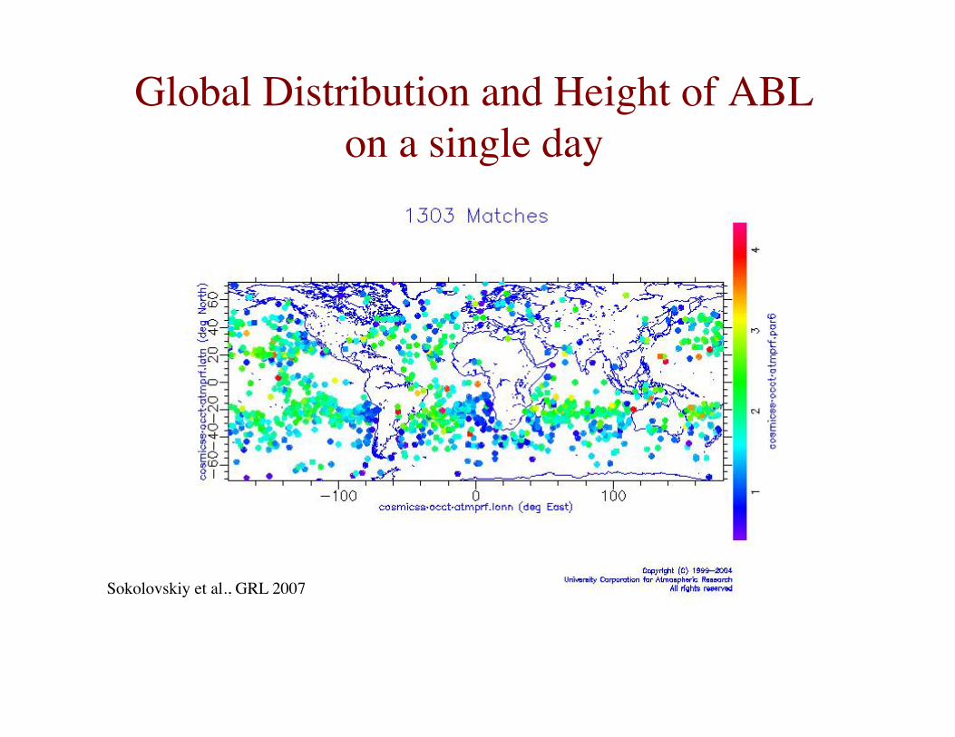
Global Distribution and Height of ABLon a single day
Sokolovskiy et al., GRL 2007

Impact of COSMIC on HurricaneErnesto (2006) Forecast
Without COSMIC With COSMIC
Results from Hui Liu, NCAR

Impact of COSMIC on HurricaneErnesto (2006) Forecast
GOES Image With COSMIC
GOES Image from Tim Schmitt, SSEC

ECMWF Operational implementation of GPSRO on Dec 12, 2006
Neutral in the troposphere, but some improvement in the stratospheric temperature scores. Obvious improvement in time series for operational ECMWF model.
Dec 12, 2006 Operational implementation represented a quite conservative use of data. No measurements assimilated below 4 km, no rising occultations.
Nov 6, 2007 Operational assimilation of rising and setting occultations down to surface
↑
Sean Healy, ECMWF

NCEP Impact study with COSMIC
500 hPa geopotential heights anomaly correlation (the higher the better) as a function of forecast day for two different experiments: – PRYnc (assimilation of operational obs ), – PRYc (PRYnc + COSMIC)
Assimilated ~1,000 COSMIC profiles per day Assimilated operationally at NCEP 1 May 2007 Assimilating refractivities from rising and setting
occultations at all levels (including low level), provided they pass QC
Results with COSMIC “very encouraging”
Lidia Cucurull, JCSDA

First collocated Ionospheric profiles From presentation by Stig Syndergaard, UCAR/COSMIC

3-D structure of the feature during daytime (constant LT)
Weaker EIA Stronger EIA Weaker EIA Weaker EIA Stronger EIA
12:00 LT
↑
Tiger Liu, NCU

Main Results So Far from COSMIC General
– 1500–2500 globally distributed profiles per day – 80% observations available within 3 hr – 1.74M Neutral Atmospheric profiles, 1.89M Ionospheric profiles – All spacecraft and payloads functioning with minor degradation – Operations funded through 2011 – Working with NOAA on planning for COSMIC-II
Weather/Ionosphere/Climate: – Significant positive impact on skill scores of operational NWP – Large impact in individual forecasts (e.g. Hurricane Ernesto 2006) – Observations of tropical boundary layer from space for 1st time – Ionospheric DA and modelling studies – Conducting inter-agency climate trend study, ~0.03%/5 years
Community – Free and open data policy – 1043 registered users from 50 countries as of May 8, 2009 – With EOL, COSMIC making near real-time and predicted data available for field
campaigns (VOCALS, T-PARC, TiMREX) – Planning 4th COSMIC Data Users WS, 27-29 October 2009, in collaboration with JOSS

Ground-based GPS

Precipitable Water Vapor (PWV) and Slant Water Vapor
SW is the integrated water vapor along single GPS ray paths
PWV is “the average of all SW observations in a cone scaled to zenith” Simultaneous observations along 8-12 GPS ray paths
GPS and WVR sensed SW and PWV agree to ~1.5 mm rms

COSMIC PWV Networks

Six-Hour Forecast Using GPS PW
GFS BMB+PW Observations
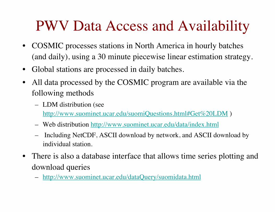
PWV Data Access and Availability • COSMIC processes stations in North America in hourly batches
(and daily), using a 30 minute piecewise linear estimation strategy. • Global stations are processed in daily batches. • All data processed by the COSMIC program are available via the
following methods – LDM distribution (see
http://www.suominet.ucar.edu/suomiQuestions.html#Get%20LDM ) – Web distribution http://www.suominet.ucar.edu/data/index.html – Including NetCDF, ASCII download by network, and ASCII download by
individual station.
• There is also a database interface that allows time series plotting and download queries – http://www.suominet.ucar.edu/dataQuery/suomidata.html