connecting to opportunities nwt transportation corridors · sgp corridor – access to resources...
TRANSCRIPT

NWT Transportation Corridors NWT Geoscience Forum - November 2019
CONNECTING TO OPPORTUNITIES
1
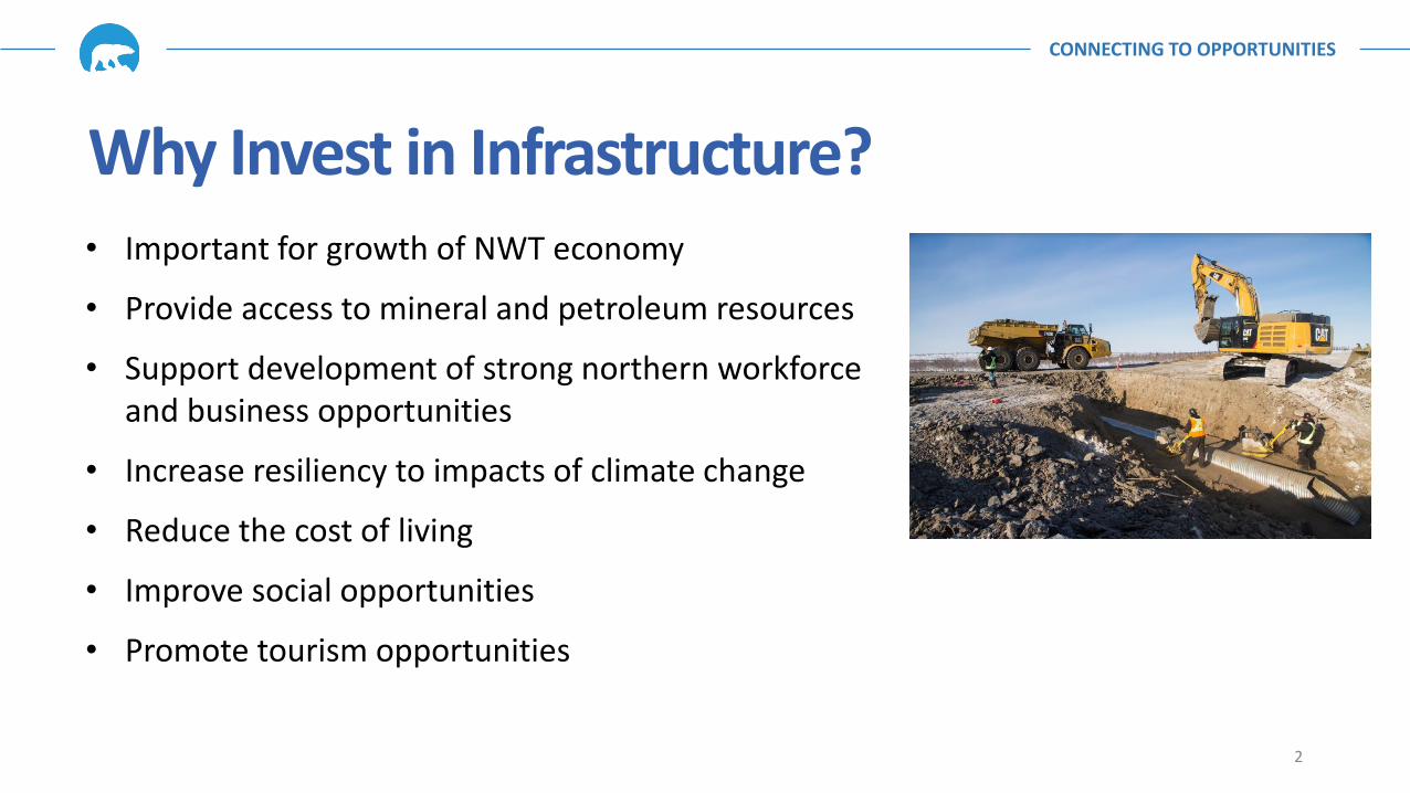
Why Invest in Infrastructure? • Important for growth of NWT economy
• Provide access to mineral and petroleum resources
• Support development of strong northern workforce and business opportunities
• Increase resiliency to impacts of climate change
• Reduce the cost of living
• Improve social opportunities
• Promote tourism opportunities
CONNECTING TO OPPORTUNITIES
2
CONNECTING TO OPPORTUNITIES
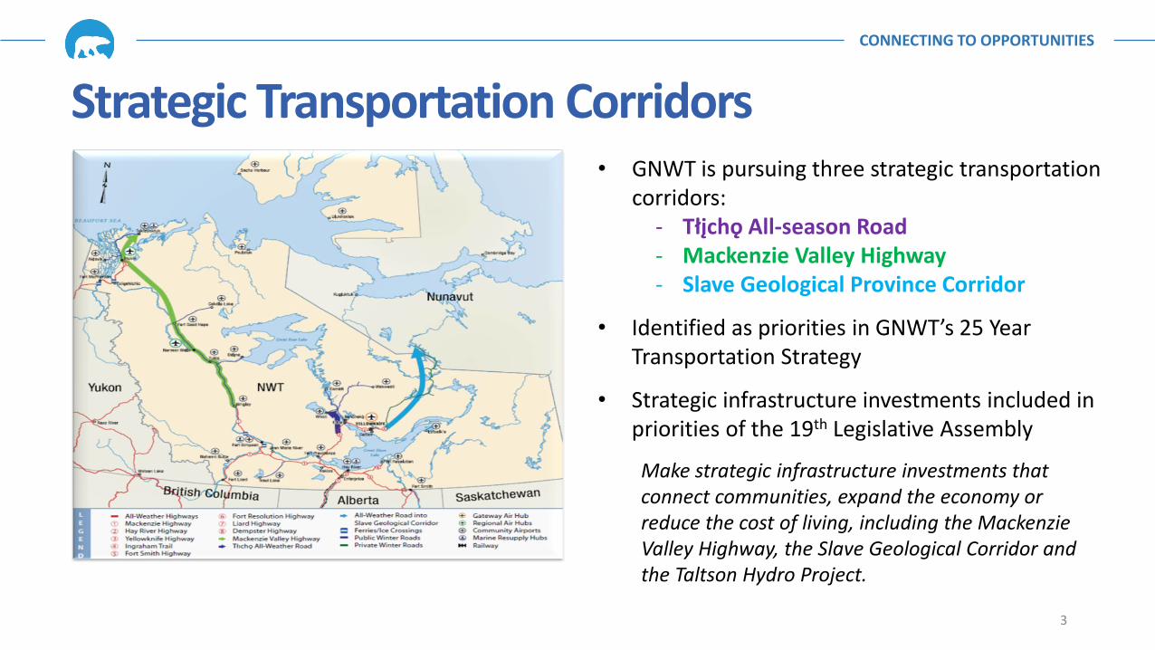
• GNWT is pursuing three strategic transportation corridors:
- Tłįchǫ All-season Road - Mackenzie Valley Highway - Slave Geological Province Corridor
• Identified as priorities in GNWT’s 25 Year Transportation Strategy
• Strategic infrastructure investments included in priorities of the 19th Legislative Assembly
Make strategic infrastructure investments that connect communities, expand the economy or reduce the cost of living, including the Mackenzie Valley Highway, the Slave Geological Corridor and the Taltson Hydro Project.
Strategic Transportation Corridors
3
CONNECTING TO OPPORTUNITIES
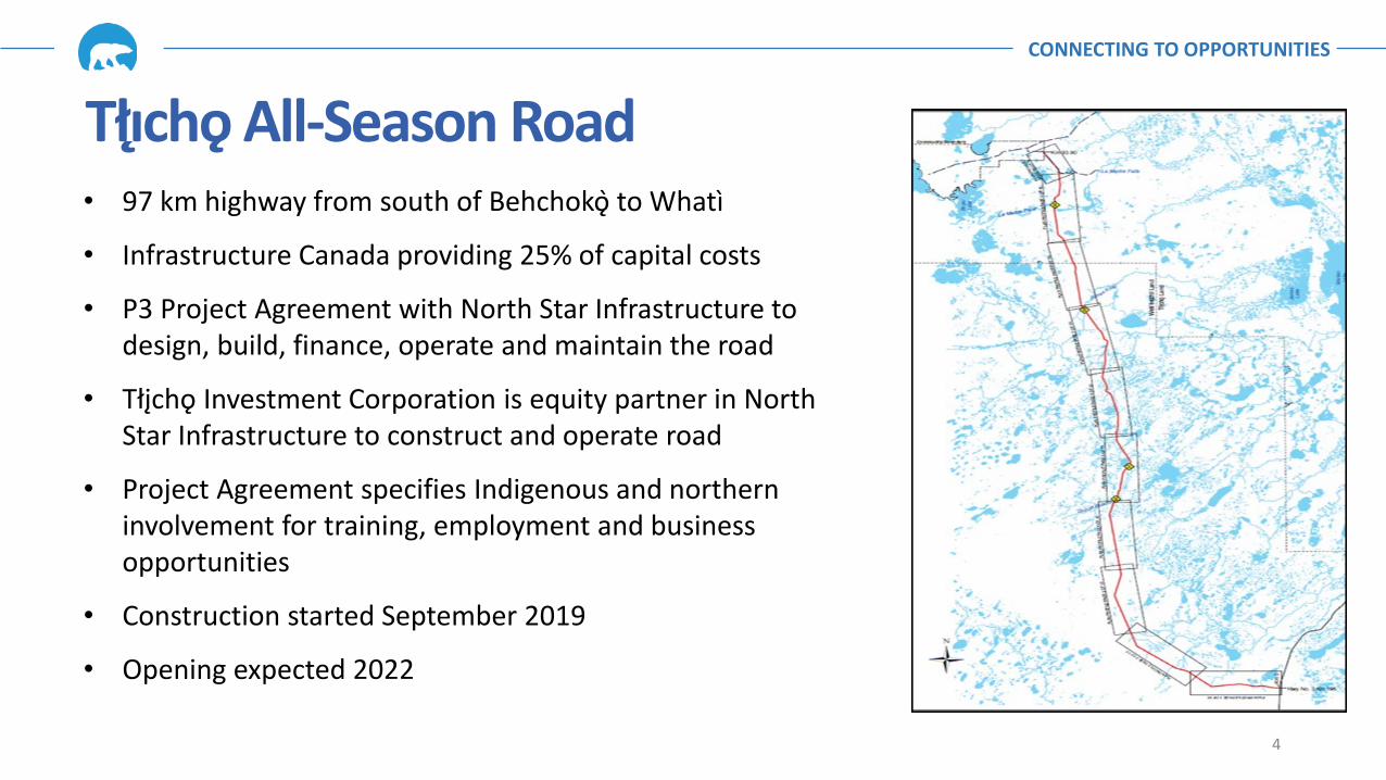
• 97 km highway from south of Behchoko to Whatì
• Infrastructure Canada providing 25% of capital costs
• P3 Project Agreement with North Star Infrastructure to design, build, finance, operate and maintain the road
• Tłįchǫ Investment Corporation is equity partner in North Star Infrastructure to construct and operate road
• Project Agreement specifies Indigenous and northern involvement for training, employment and business opportunities
• Construction started September 2019
• Opening expected 2022
4
Tłıcho All-Season Road
CONNECTING TO OPPORTUNITIES
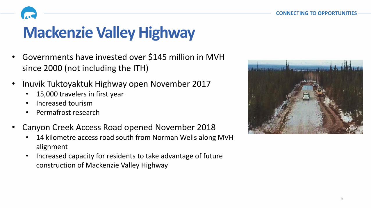
• Governments have invested over $145 million in MVH since 2000 (not including the ITH)
• Inuvik Tuktoyaktuk Highway open November 2017 • 15,000 travelers in first year • Increased tourism • Permafrost research
• Canyon Creek Access Road opened November 2018 • 14 kilometre access road south from Norman Wells along MVH
alignment • Increased capacity for residents to take advantage of future
construction of Mackenzie Valley Highway
5
Mackenzie Valley Highway

CONNECTING TO OPPORTUNITIES
• Additional $140 million announced June 2018 • Great Bear River Bridge • Mount Gaudet Access Road • Planning and Environmental Assessment (Wrigley to Norman
Wells) • Focus of EA now on 307 kms between Wrigley and Norman
Wells • Partnership approach with Indigenous organizations • Key milestones:
• Prepare and submit Developer’s Assessment Report—September 2021 • Complete Environmental Assessment—September 2022 • Regulatory approvals—September 2023 • Potential construction date—September 2023 • Construction timeline subject to funding and contracting
6
Mackenzie Valley Highway
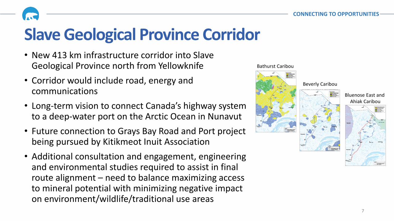
• New 413 km infrastructure corridor into Slave Geological Province north from Yellowknife
• Corridor would include road, energy and communications
• Long-term vision to connect Canada’s highway system to a deep-water port on the Arctic Ocean in Nunavut
• Future connection to Grays Bay Road and Port project being pursued by Kitikmeot Inuit Association
• Additional consultation and engagement, engineering and environmental studies required to assist in final route alignment – need to balance maximizing access to mineral potential with minimizing negative impact on environment/wildlife/traditional use areas 7
Bathurst Caribou
Beverly Caribou
Bluenose East and Ahiak Caribou
CONNECTING TO OPPORTUNITIES
Slave Geological Province Corridor

• Mineral development is a significant contributor to the NWT economy (approximately one-third of the NWT economy)
• Existing mines are maturing and need to be replaced to maintain NWT economy
• Lack of infrastructure is consistently identified as a significant challenge to the exploration and mining industry
• Improved access into the Slave Geological Province would facilitate both mineral exploration and development activities
• Important for the future of the NWT
8
CONNECTING TO OPPORTUNITIES
SGP Corridor – Access to Resources
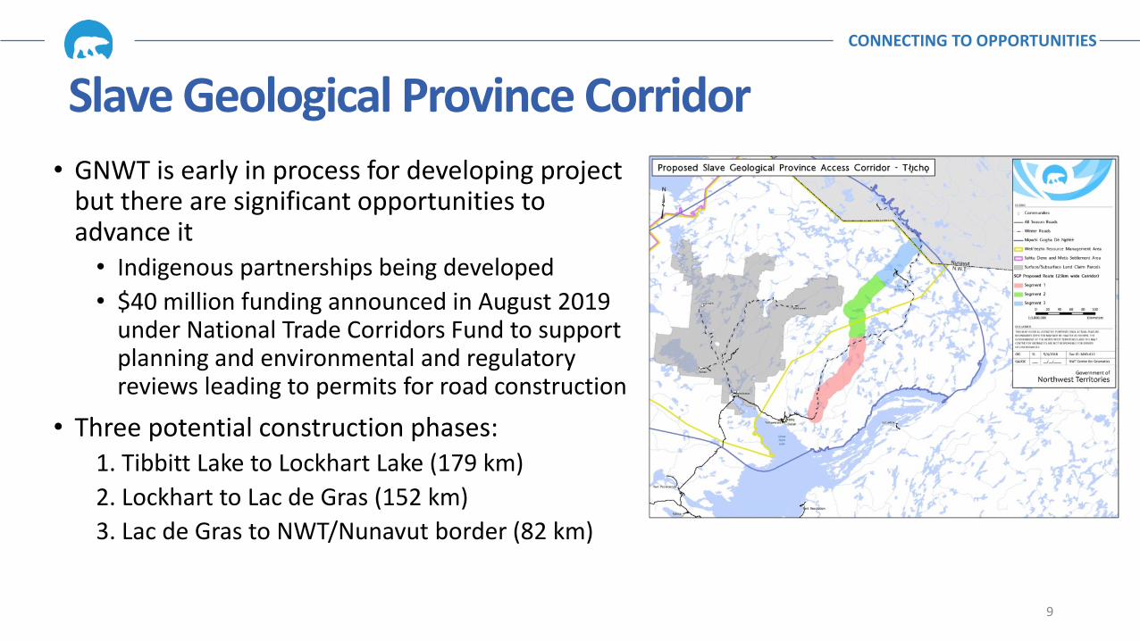
• GNWT is early in process for developing project but there are significant opportunities to advance it
• Indigenous partnerships being developed • $40 million funding announced in August 2019
under National Trade Corridors Fund to support planning and environmental and regulatory reviews leading to permits for road construction
• Three potential construction phases: 1. Tibbitt Lake to Lockhart Lake (179 km) 2. Lockhart to Lac de Gras (152 km) 3. Lac de Gras to NWT/Nunavut border (82 km)
9
CONNECTING TO OPPORTUNITIES
Slave Geological Province Corridor
Route Selection ― Tłıchǫ and SGP Corridors
• Tłıchǫ All-Season Road: • Route selection for the Tłıchǫ access corridor driven by community location (Whatì)
and engineering • Route will facilitate access to the NICO project and by-pass the problematic southern
end of the Tłıchǫ winter road system
• SGP Corridor: • Will assist mineral exploration and development projects in the western SGP and
Bear structural provinces which have used this winter road system (e.g. Colomac Mine)
• Multiple considerations for SGP: Mineral deposit, caribou, technical feasibility, cost
CONNECTING TO OPPORTUNITIES
10

Mineral Potential Map Tool
• GIS Mapping Project designed by Aurora Geosciences in conjunction with GNWT
• Four variables of mineral quality: bedrock
geology, mineral tenure, mineral occurrences, faults/structures
• Areas in red are high, blue are low potential
• Main influencers are geology and mineral
occurrences
• Some areas have very little data available
CONNECTING TO OPPORTUNITIES
11

SGP ― Mineral Potential Route Selection • New corridor identified follows greenstone belts
• Main point of interest is that this route selection angles through the Cameron/Beaulieu River Greenstone Belts (CBRGB) as opposed to north through the Yellowknife Greenstone belt
• This was driven by a combination of mineral deposit modeling, engineering (avoidance of large lakes etc.), and the existing Tibbitt Lake road terminus being a preferred start point
• Exercise will be done again using sensitive caribou and other wildlife/species at risk habitat
CONNECTING TO OPPORTUNITIES
12
• Environmental impact assessment and regulatory authorizations for the construction of the proposed Lockhart All-Season Road (LASR) • Prepare and submit Project Description Report for LASR to initiate environmental impact
assessment process (March 2021) • Technical studies to investigate engineering, land use, archaeological and environmental
issues • Confirm routing for alignment
- Alternate routing options developed based on caribou usage patterns - Terrain analysis and initial borrow source analysis to km 179 complete - LIDAR to km 320 being completed - Traditional Knowledge studies on initial borrow sources - Geotech program on preliminary borrow sources in March 2020 - Partnerships with Indigenous governments - Community consultation and engagement
• Planning studies for future development from Lockhart Lake to Nunavut border
SGP Corridor - Next Steps CONNECTING TO OPPORTUNITIES
13

LASR – Anticipated Timeline CONNECTING TO OPPORTUNITIES
14
0 1 2 3 4 5 6 7 8
Completion of Project Description Report (June 2021)
Completion of Developer's Assessment Report (December2022)
Completion of Environmental Assessment (December 2023)
Regulatory Approvals (December 2024)
Construction timeline subject to funding and contracting
November 2019 Years to Completion
Thank you.
www.inf.gov.nt.ca/projects
15