city of rainier railroad crossings 1. project # 2 team members portland state university city of...
TRANSCRIPT
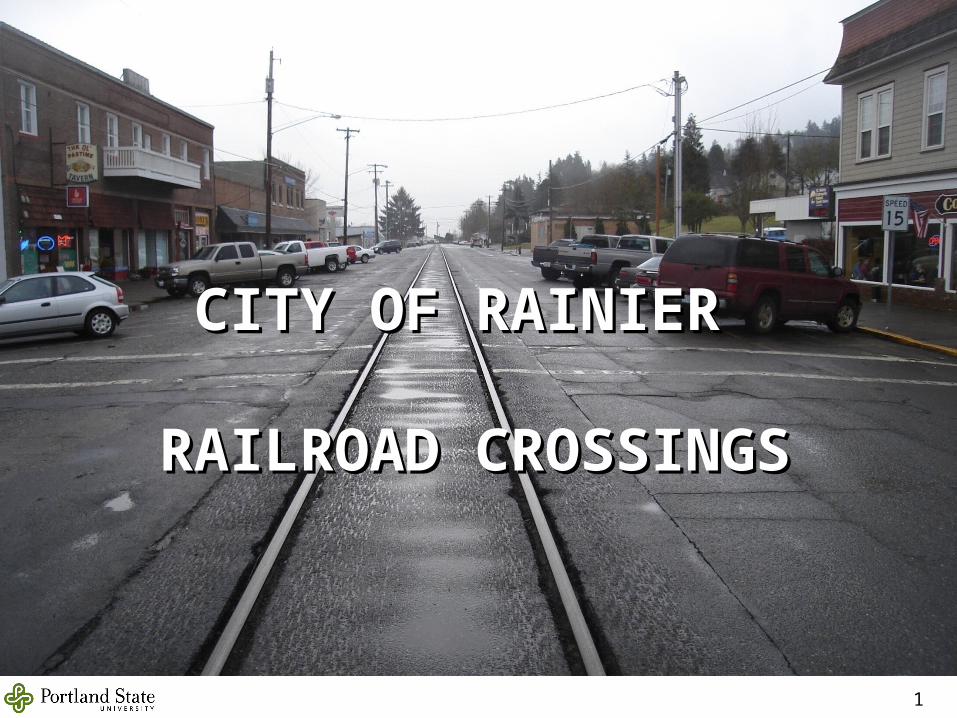
CITY OF RAINIER CITY OF RAINIER
RAILROAD CROSSINGSRAILROAD CROSSINGS
1
Project # 2 Team Members Portland State University
City of Rainier• Lars Gare, City Administrator
ODOT Rail• David Lanning, Crossing Safety/Compliance
• Matthew DeGeorge
• Robert Acevedo
• Josh Crain
• Heather Wenstrand
• Jim Harvey
2
Presentation Outline
• Introduction
• Existing Conditions
• Future Conditions
• Intersection Designs
• Cost Estimates
• Conclusion
3
Scope
1. To design safe railroad crossings that maximizes the movement of people and goods.
2. Design safe pedestrian crossing across the railroad tracks.
3. To design effective intersection closures that minimizes the impact on traffic and the community.
4
Background• The City of Rainier is on the south bank of the Columbia River across
from Longview, Washington.
• This project is part of the Rainier Waterfront Urban Renewal Plan.
• The closing of the Trojan nuclear power plant set off a decline in the number of businesses in the city.
• The current population is around 2,000 people.
• Freight trains with 110 railcars pass through downtown Rainier along A Street.
• On average there are 4 trains per week traveling in either direction
5
Project Overview• Project consisted of:
– Design closing for 3 crossings– Redesign 4 crossings
• The City of Rainier has no dedicated engineering staff.– Lars Gare, City Administrator
• ODOT Rail has final design approval– Dave Lanning, Crossing Safety/Compliance
6
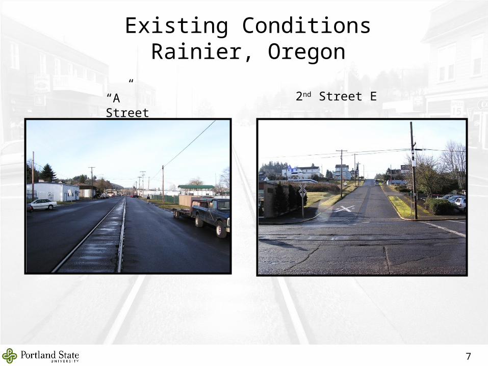
Existing ConditionsRainier, Oregon
7
“A” Street 2nd Street E
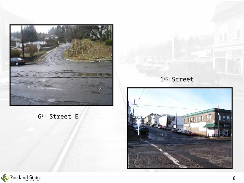
1st Street
6th Street E
8
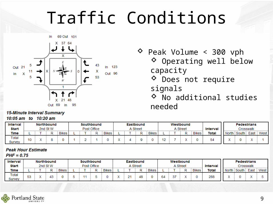
Traffic Conditions
9
Peak Volume < 300 vph Operating well below capacity Does not require signals No additional studies needed
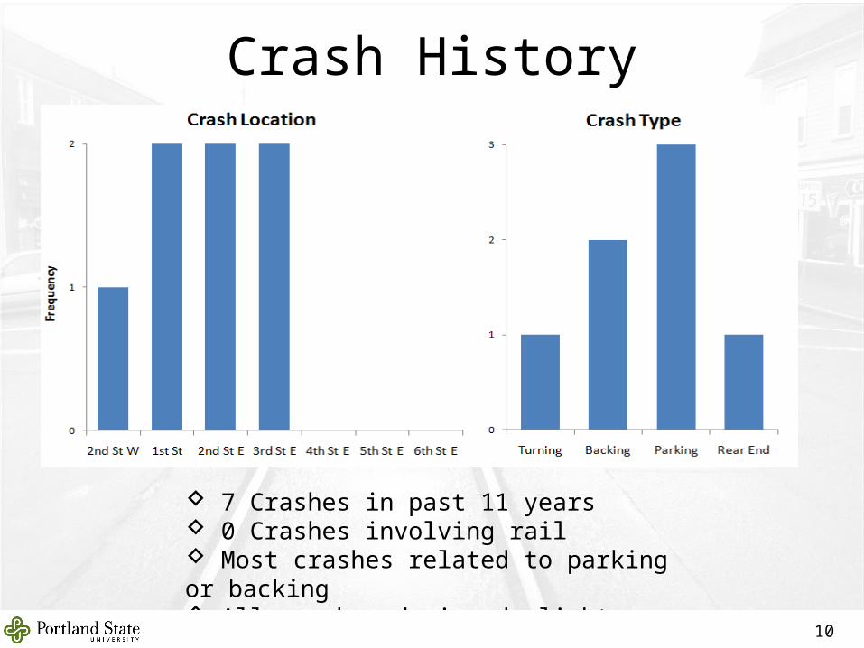
7 Crashes in past 11 years 0 Crashes involving rail Most crashes related to parking or backing All crashes during daylight hours
Crash History
10
Time Intersection Collision Type Cause Severity Weather Conditions
11 AM 2nd St W Parking No Yield PDO Clear Dry
11 AM 1st St Backing Too Fast Injury "C" Cloudy Wet
9 AM 1st St Parking Other PDO Clear Dry
1 PM 2nd St E Parking Other PDO Clear Dry
12 PM 2nd St E Backing No Yield PDO Rain Wet
4 PM 3rd St E Turning Other PDO Clear Dry
2 PM 3rd St E Rear End Too Close PDO Clear Dry
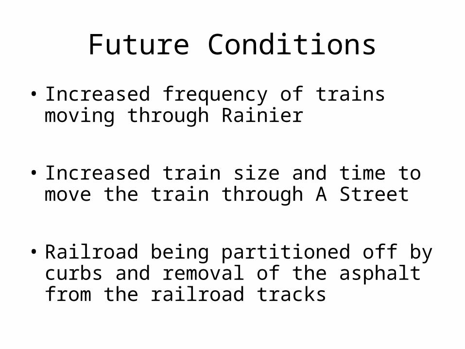
• Increased frequency of trains moving through Rainier
• Increased train size and time to move the train through A Street
• Railroad being partitioned off by curbs and removal of the asphalt from the railroad tracks
Future Conditions
12
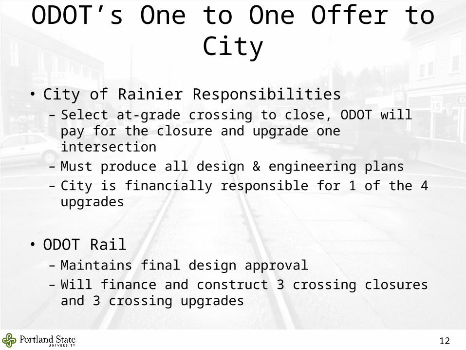
ODOT’s One to One Offer to City
• City of Rainier Responsibilities– Select at-grade crossing to close, ODOT will pay for
the closure and upgrade one intersection– Must produce all design & engineering plans– City is financially responsible for 1 of the 4 upgrades
• ODOT Rail– Maintains final design approval– Will finance and construct 3 crossing closures and 3
crossing upgrades
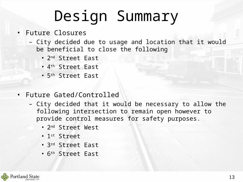
• Future Closures– City decided due to usage and location that it would be beneficial to
close the following
• 2nd Street East
• 4th Street East
• 5th Street East
• Future Gated/Controlled– City decided that it would be necessary to allow the following
intersection to remain open however to provide control measures for safety purposes.
• 2nd Street West
• 1st Street
• 3rd Street East
• 6th Street East
13
Design Summary
14
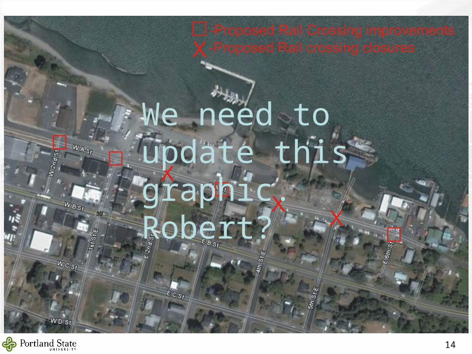
We need to update this graphic. Robert?
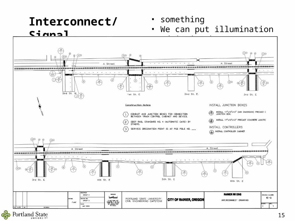
Interconnect/Signal • something• We can put illumination conduit in the interconnect trenches
15
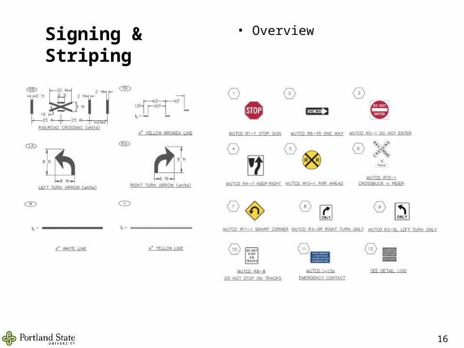
Signing & Striping • Overview
16
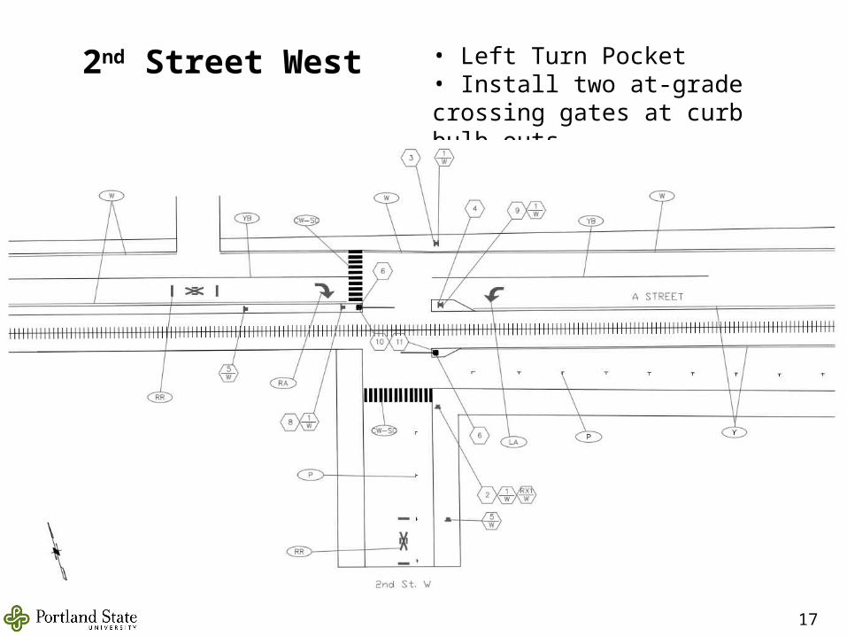
2nd Street West • Left Turn Pocket• Install two at-grade crossing gates at curb bulb outs
17
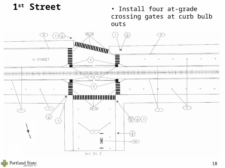
1st Street • Install four at-grade crossing gates at curb bulb outs
18
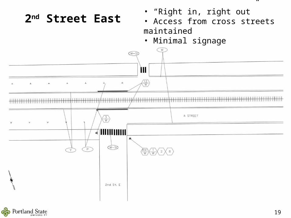
2nd Street East• “Right in, right out”• Access from cross streets maintained• Minimal signage
19
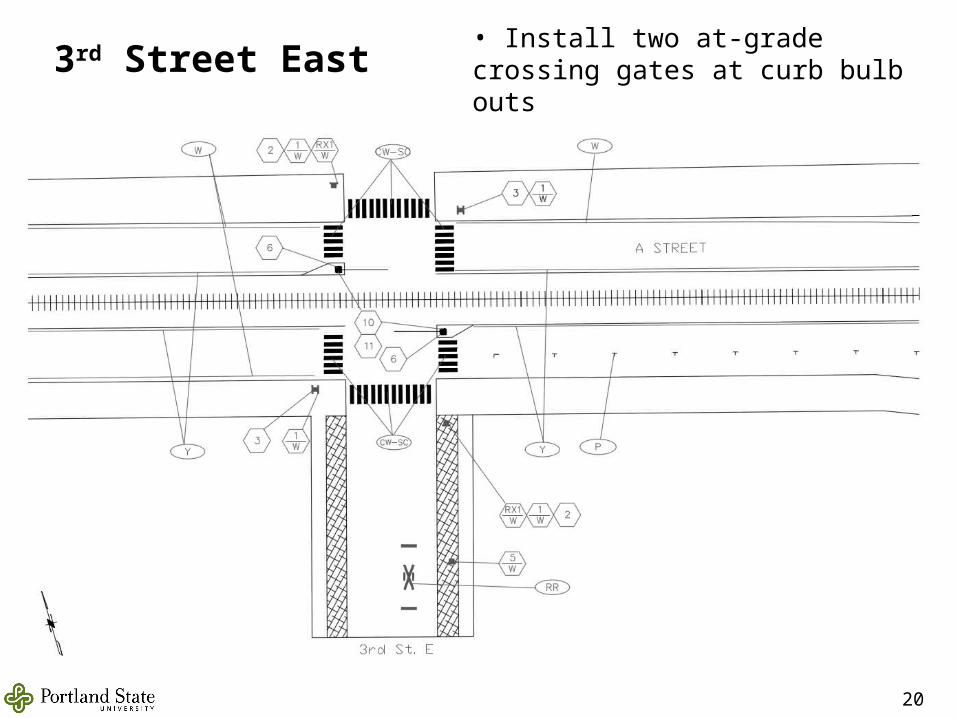
3rd Street East• Install two at-grade crossing gates at curb bulb outs
20
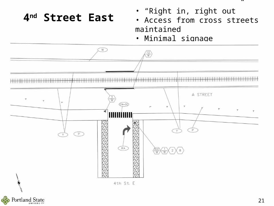
4nd Street East• “Right in, right out”• Access from cross streets maintained• Minimal signage
21
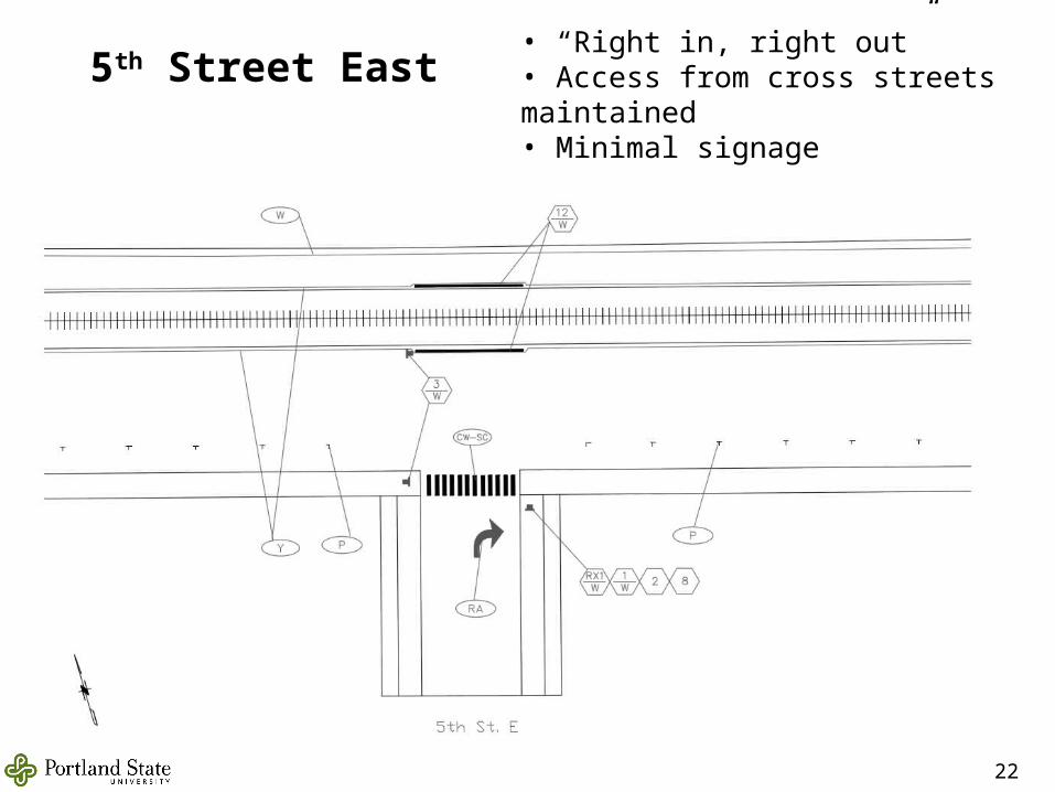
5th Street East• “Right in, right out”• Access from cross streets maintained• Minimal signage
22
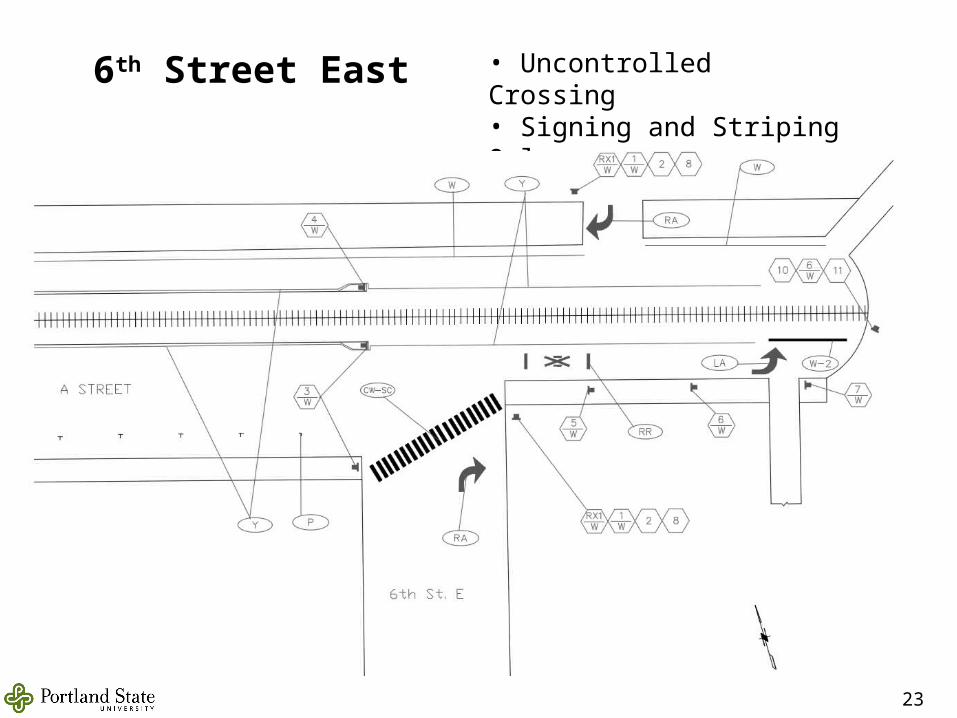
6th Street East • Uncontrolled Crossing • Signing and Striping Only• 150-feet of Open Track
23
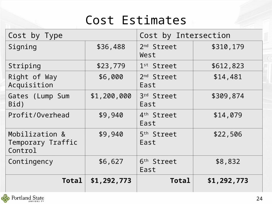
Cost EstimatesCost by Type Cost by Intersection
Signing $36,488 2nd Street West $310,179
Striping $23,779 1st Street $612,823
Right of Way Acquisition $6,000 2nd Street East $14,481
Gates (Lump Sum Bid) $1,200,000 3rd Street East $309,874
Profit/Overhead $9,940 4th Street East $14,079
Mobilization & Temporary Traffic Control
$9,940 5th Street East $22,506
Contingency $6,627 6th Street East $8,832
Total $1,292,773 Total $1,292,773
24
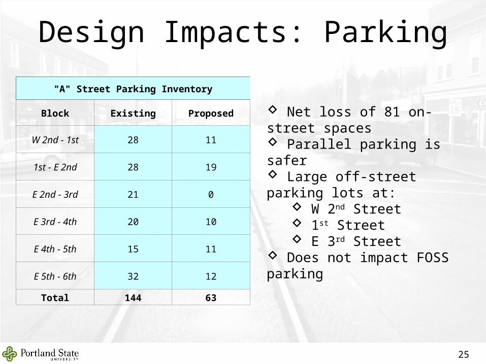
Net loss of 81 on-street spaces Parallel parking is safer Large off-street parking lots at:
W 2nd Street 1st Street E 3rd Street
Does not impact FOSS parking
Design Impacts: Parking
25
"A" Street Parking Inventory
Block Existing Proposed
W 2nd - 1st 28 11
1st - E 2nd 28 19
E 2nd - 3rd 21 0
E 3rd - 4th 20 10
E 4th - 5th 15 11
E 5th - 6th 32 12
Total 144 63
Design Impacts: Anything else?
26
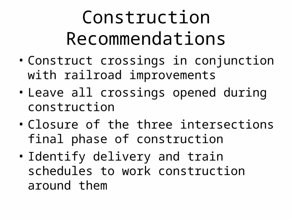
Construction Recommendations
• Construct crossings in conjunction with railroad improvements
• Leave all crossings opened during construction
• Closure of the three intersections final phase of construction
• Identify delivery and train schedules to work construction around them
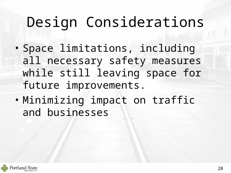
Design Considerations
• Space limitations, including all necessary safety measures while still leaving space for future improvements.
• Minimizing impact on traffic and businesses
28
Some sort of project conclusion here…
“Lessons Learned” – what would we have done differently?
Prepare a schedule at the beginning of the project including all key dates
Better accountability of group members
Better communication between our group and our contact
29
Questions?Questions?
30