city of pearland 2017 map
TRANSCRIPT

M A N V E LM A N V E L
FR
IEN
DS
WO
OD
FR
I EN
DS
WO
OD
B R O O K S I D EB R O O K S I D EV I L L A G EV I L L A G E
H O U S T O NH O U S T O N
A R C O L AA R C O L A
I O W AI O W AC O L O N YC O L O N Y
PearlandPearlandEconomicEconomic
DevelopmentDevelopmentCorporationCorporation
NatureNatureTrailTrail
CR 430
POST RD
McHARD RD (extension)
Shirley DillBrothersElementary(Fall 2017)
Alvin ISDFutureSchool FireFire
Station 3Station 3
ShadowShadowCreekCreek
MarketplaceMarketplace
El FrancoLee Park
Tom BassRegional Park
Christa V.AdairPark Future FireFuture Fire
Station 1Station 1
Veteran SportsVeteran SportsComplexComplex
Lower KirbyDevelopment
District
PearlandPearlandCity HallCity Hall
PublicPublicWorksWorks
WestsideWestsideEventEventCenterCenter
Chamber ofChamber ofCommerceCommerce
Fire DeptFire DeptAdministrationAdministration
HillhouseHillhouseAnnexAnnex
PostPostOfficeOfficePost OfficePost Office
John HargroveJohn HargroveEnvironmentalEnvironmentalComplexComplex
Melvin KnappMelvin KnappActivity CTRActivity CTR
RecycleRecycleCenterCenter
WestsideWestsideLibraryLibrary
Tom ReidTom ReidLibraryLibrary
Rec Center &Rec Center &NatatoriumNatatorium
Public Safety,Public Safety,Municipal CourtMunicipal Court& Utility Billing& Utility Billing
AnimalAnimalServicesServices
Visitor CenterVisitor Center
FireFireStation 1Station 1
FireFireStation 2Station 2
FireFireStation 4Station 4
FireFireStation 6Station 6
FireFireStation 5Station 5
University ofHouston-Clear Lake,
Pearland Campus
MasseyRanch
Elementary
Berry MillerJunior High
PearlandHigh
School
C.J. HarrisElementary
Rustic OakElementary
ShadycrestElementary
E. A.LawhonElementary
Silvercrest Elementary
SilverlakeElementary
ChallengerElementary
H.C.Carleston
Elementary
RogersMiddleSchool
Leon SablaturaMiddle School
Pearland Jr. HighWest
PearlandJr. HighEast
PACECenter
BarbaraCockrellElementary
GlendaDawson High
School
AlexanderMiddleSchool
MagnoliaElementary
JamisonMiddleSchool
Sheryl SearcyNinth Grade
Center
Pearland Jr.HighSouth
RobertTurnerHigh School
Laura IngallsWilderElementary
Mary BurksMarekElementary
Nolan RyanJunior High
Savannah LakesElementary
Don JeterElementary
Glenn YorkElementary
Manvel Jr.High atRodeo Palms
ShadowCreek High
School
Dr. JamesRed DukeElementary
South BeltElementary
MooreElementary
Dr. DixieMelilloMiddle School
Robert BevisFrazierElementary
ThompsonIntermediate
StuchberyElementary
DobieHighSchool
AlmedaElementary
WeberElementary
Pearland RegionalPearland RegionalAirportAirport
(Formerly Clover Field)(Formerly Clover Field)
FORT BEND COUNTY
GA
LV
ES
TO
N C
OU
NT
Y
FO
RT
BE
ND
CO
UN
TY
HARRIS COUNTY
HARRIS COUNTY
BR
AZ
OR
IA C
OU
NT
Y
BR
AZ
OR
IA C
OU
NT
Y
BRAZORIA COUNTY
Old CanalOld Canal
CanalCanal
Ditch
Ditch
CanalCanal
Briscoe CanalBriscoe Canal
American CanalAmerican Canal
CClleeaarr CCrreeeekk
DDiittcchh
CClleeaarr CCrr eeeekk
Marys CreekMarys Creek
CCoowwaarrtt CCrreeeekk
MMuussttaanngg BBaayyoouu
Mud Gully
Mud Gully
DitchDitch
MMaarr yyss CC rree eekk BByy ppaass ss
CCoowwaarrtt CCrreeeekk DDiivveerrssiioonn
DitchDitch
CChhiiggggeerr CCrreeeekk
HHiicckkoorryy SSlloouugghh
MMuussttaanngg BBaayyoouu
SOUTHWYCKSOUTHWYCKGOLF COURSEGOLF COURSE
COUNTRYCOUNTRYPLACE GOLFPLACE GOLF
COURSECOURSE
CLEARCLEARCREEK GOLFCREEK GOLF
COURSECOURSE
GOLFCRESTGOLFCRESTCOUNTRYCOUNTRY
CLUBCLUB
CentennialPark
Dixie FarmRoad Park
HickorySlough
Sportsplex
Shadow CreekSports Complex
IndependencePark
PearlandDad'sClub
Silverlake VillageSilverlake VillageShopping CenterShopping CenterPearlandPearland
Town CenterTown Center
ShadowShadowCreek RanchCreek RanchTown CenterTown Center
CrossingCrossing@ 288@ 288
Center atCenter atPearlandPearland
PkwyPkwy
!©
!©
!©
!!k
"®|
!!$!!\
!!\
KJ
!©
!©!©
"Æc
"Æc
!!a
_
®f
!©
!!\
!!\
JHEC Trails
¡M A P P R E P A R E D : O C T O B E R 2 0 1 6
C I T Y O F P E A R L A N D G I S D E P A R T M E N T
This product is for informational purposes and may not have beenprepared for or be suitable for legal, engineering, or surveyingpurposes. It does not represent an on-the-ground survey and
represents only the approximate relative location of property boundaries
0 0.5 1
Miles
!© Fire Station
Pearland City Hall!!k
Chamber of Commerce!!$
!!\ Other City Facilities
_ Animal Services
¦!G Fire Dept Administration
Primary Roads
Streets
Rail Roads
County Line
Canals
Creeks
Future Roads
CITY OF PEARLANDGeneral Reference Map
!!a Public Safety Building
"®| Public WorksPost Office
"Æc Westside Library
"Æc Tom Reid Library
Parks Facility
Recycle Center
KJJHEC (John HargroveEnvironmental Complex)
Schools:
!!X" K Higher Education
!!n Clear Creek ISD
!!n Fort Bend ISD
!!n Houston ISD
!!n Alvin ISD
!!n Pasadena ISD
!!n Pearland ISD
Golf Courses
Other Cities
Pearland ETJ
Pearland City Limits
Retail Developments
Old Town Site
Parks
CITY OF PEARLAND 2017 MAP
59
59
90
90
288TEXAS
35TEXAS
6TEXAS
8BELTWAY
225TEXAS
146TEXAS
330TEXAS
8BELTWAY
8BELTWAY
NASA BYPASS
6TEXAS
1010
PEARLAND
William P. Hobby(HOU)
Ellington Field(EFD)
George Bush Intercontinental
(IAH)
Pearland Rgnl(LVJ)
HOUSTON
Museum District
Energy Corridor
Medical Center
NRG Stadium
Rice University
Battleship Texas
San Jacinto Monument
Universityof Houston
Port of HoustonAuthority
BBVA Compass Stadium
Toyota Center
George R. Brown Convention Center
Minute Maid Park
Downtown Galleria/
Uptown Park
Houston Ship Channel
Port of
Houston
310 2
1211
8
1
9
7Lyndon B. Johnson
Space Center
Port of Freeport
University of Houston Clear Lake -
Main Campus13
METROLight Rail
Moody Gardens6
Kemah Boardwalk4
5
Galveston
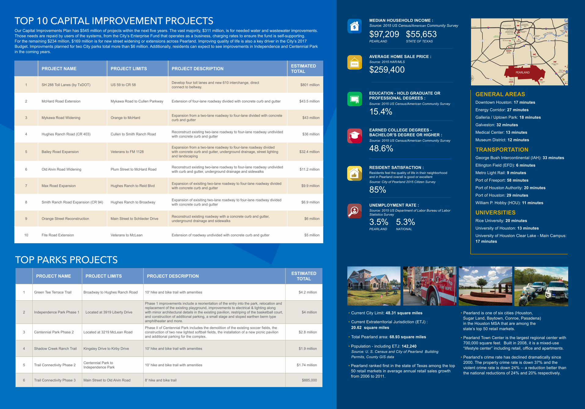
General Areas
Downtown: 17 minutesEnergy Corridor: 27 minutesGalleria / Uptown Park: 18 minutesGalveston: 32 minutesMedical Center: 13 minutesMuseum District: 12 minutes
Attractions1. Battleship Texas: 23 minutes2. BBVA Compass Stadium: 14 minutes 3. George R. Brown Convention Center: 14 minutes4. Kemah Boardwalk: 26 minutes5. Minute Maid Park: 14 minutes6. Moody Gardens: 37 minutes
7. NASA Johnson Space Center: 16 minutes8. NRG Stadium: 9 minutes9. San Jacinto Monument: 22 minutes10. Toyota Center: 13 minutes
Universities 11. Rice University: 20 minutes12. University of Houston: 13 minutes 13. University of Houston Clear Lake - Main Campus: 17 minutes
TransportationGeorge Bush Intercontinental (IAH): 33 minutesEllington Field (EFD): 6 minutesMetro Light Rail: 9 minutesPearland Regional (LVJ): in PearlandPort of Freeport: 58 minutesPort of Houston Authority: 20 minutesPort of Houston: 29 minutesWilliam P. Hobby (HOU): 11 minutes
• Current City Limit: 48.31 square miles
• Current Extraterritorial Jurisdiction (ETJ) : 20.62 square miles
• Total Pearland area: 68.93 square miles
• Population - including ETJ: 142,240 Source: U. S. Census and City of Pearland Building Permits, County GIS data
• Pearland ranked first in the state of Texas among the top 50 retail markets in average annual retail sales growth from 2006 to 2011.
• Pearland is one of six cities (Houston, Sugar Land, Baytown, Conroe, Pasadena) in the Houston MSA that are among the state’s top 50 retail markets.
• Pearland Town Center is the largest regional center with 700,000 square feet. Built in 2008, it is a mixed-use “lifestyle center” including retail, office and apartments.
• Pearland’s crime rate has declined dramatically since 2000. The property crime rate is down 37% and the violent crime rate is down 24% -- a reduction better than the national reductions of 24% and 20% respectively.
MEDIAN HOUSEHOLD INCOME :Source: 2015 US Census/American Community Survey
$97,209 PEARLAND
$55,653 STATE OF TEXAS
AVERAGE HOME SALE PRICE :Source: 2015 HAR/MLS
$259,400
EDUCATION - HOLD GRADUATE OR PROFESSIONAL DEGREES :Source: 2015 US Census/American Community Survey
15.4%
UNEMPLOYMENT RATE :Source: 2015 US Department of Labor Bureau of Labor Statistics Survey
3.5% PEARLAND
5.3% NATIONAL
EARNED COLLEGE DEGREES - BACHELOR’S DEGREE OR HIGHER :Source: 2015 US Census/American Community Survey
48.6%
RESIDENT SATISFACTION : Residents feel the quality of life in their neighborhood and in Pearland overall is good or excellentSource: City of Pearland 2015 Citizen Survey
85%
PROJECT NAME PROJECT LIMITS PROJECT DESCRIPTION ESTIMATED TOTAL
1 SH 288 Toll Lanes (by TxDOT) US 59 to CR 58 Develop four toll lanes and new 610 interchange, direct connect to beltway. $801 million
2 McHard Road Extension Mykawa Road to Cullen Parkway Extension of four-lane roadway divided with concrete curb and gutter $43.5 million
3 Mykawa Road Widening Orange to McHard Expansion from a two-lane roadway to four-lane divided with concrete curb and gutter $43 million
4 Hughes Ranch Road (CR 403) Cullen to Smith Ranch Road Reconstruct existing two-lane roadway to four-lane roadway undivided with concrete curb and gutter $36 million
5 Bailey Road Expansion Veterans to FM 1128Expansion from a two-lane roadway to four-lane roadway divided with concrete curb and gutter, underground drainage, street lighting and landscaping
$32.4 million
6 Old Alvin Road Widening Plum Street to McHard Road Reconstruct existing two-lane roadway to four-lane roadway undivided with curb and gutter, underground drainage and sidewalks $11.2 million
7 Max Road Expansion Hughes Ranch to Reid Blvd Expansion of exisiting two-lane roadway to four-lane roadway divided with concrete curb and gutter $9.9 million
8 Smith Ranch Road Expansion (CR 94) Hughes Ranch to Broadway Expansion of exisiting two-lane roadway to four-lane roadway divided with concrete curb and gutter $6.9 million
9 Orange Street Reconstruction Main Street to Schlieder Drive Reconstruct existing roadway with a concrete curb and gutter, underground drainage and sidewalks $6 million
10 Fite Road Extension Veterans to McLean Extension of roadway undivided with concrete curb and gutter $5 million
PROJECT NAME PROJECT LIMITS PROJECT DESCRIPTION ESTIMATED TOTAL
1 Green Tee Terrace Trail Broadway to Hughes Ranch Road 10' hike and bike trail with amenities $4.2 million
2 Independence Park Phase 1 Located at 3919 Liberty Drive
Phase 1 improvements include a reorientation of the entry into the park, relocation and replacement of the existing playground, improvements to electrical & lighting along with minor architectural details in the existing pavilion, restriping of the basketball court, and construction of additional parking, a small stage and sloped earthen berm type amphitheater and more.
$4 million
3 Centennial Park Phase 2 Located at 3219 McLean RoadPhase II of Centennial Park includes the demolition of the existing soccer fields, the construction of two new lighted softball fields, the installation of a new picnic pavilion and additional parking for the complex.
$2.8 million
4 Shadow Creek Ranch Trail Kingsley Drive to Kirby Drive 10' hike and bike trail with amenities $1.9 million
5 Trail Connectivity Phase 2 Centennial Park to Independence Park 10' hike and bike trail with amenities $1.74 million
6 Trail Connectivity Phase 3 Main Street to Old Alvin Road 8' hike and bike trail $885,000
TOP PARKS PROJECTS
TOP 10 CAPITAL IMPROVEMENT PROJECTS
GENERAL AREASDowntown Houston: 17 minutes
Energy Corridor: 27 minutes
Galleria / Uptown Park: 18 minutes
Galveston: 32 minutes
Medical Center: 13 minutes
Museum District: 12 minutes
TRANSPORTATIONGeorge Bush Intercontinental (IAH): 33 minutes
Ellington Field (EFD): 6 minutes
Metro Light Rail: 9 minutes
Port of Freeport: 58 minutes
Port of Houston Authority: 20 minutes
Port of Houston: 29 minutes
William P. Hobby (HOU): 11 minutes
UNIVERSITIESRice University: 20 minutes
University of Houston: 13 minutes
University of Houston Clear Lake - Main Campus: 17 minutes
Our Capital Improvements Plan has $545 million of projects within the next five years. The vast majority, $311 million, is for needed water and wastewater improvements. Those needs are repaid by users of the systems, from the City’s Enterprise Fund that operates as a business, charging rates to ensure the fund is self-supporting. For the remaining $234 million, $169 million is for new street widening or extensions across Pearland. Improving quality of life is also a key driver in the City’s 2017 Budget. Improvments planned for two City parks total more than $6 million. Additionally, residents can expect to see improvements in Independence and Centennial Park in the coming years.