city observer_december 2015
DESCRIPTION
A Biannual Journal on Cities published by Urban Design Collective | Volume 1_Issue 2TRANSCRIPT

Volume 1
Issue2
UrbanDesi
gnCollective
A BIANNUAL JOURNAL ON CITIES PUBLISHED BY URBAN DESIGN COLLECTIVE
PLACEMAKING FOR THE INNOVATION ECONOMY
BIENNALE CALLING!
CHANDIGARH UNBUILT: WINNING ENTRIESINSIDE
CITY OBSERVERe
*
*
DECEMBER2015

Copyrights of images lie with the person/party mentioned in the image caption.This magazine cannot be republished or reproduced without the permission of the publisher.
EDITORIAL TEAMShruti Shankar
Sunjana Thirumala Sridhar
Vidhya Mohankumar
COVER ILLUSTRATIONAithihya Ashok Kumar
LAYOUT DESIGNVidhya Mohankumar
CITY OBSERVERVolume 01 | Issue 02 | December 2015
Free Publication
City Observer is a biannual journal which aims to create a conversation on cities and to collaboratively interrogate our urban world.
City Observer is published by the Urban Design Collective.
Urban Design Collective (UDC) is a non-profit organization that works as a collaborative platform towards the creation of livable & sustainable cities through community engagement.
www.urbandesigncollective.org

To Cities and People

Contents
10
94
62
42
EDITORIALVidhya Mohankumar8
140 CLOSING SCENEDhivya Ravishankar
FEATURE ARTICLEPlacemaking for the Innovation
EconomyShruti Shankar
MOBILITY AND THE CITYLess than 40Madhav Pai
FEATURE ARTICLEThink DelhiNishant Lall
ON LOCATIONWaterfronts that save the City,
not drown it Sunjana Thirumala Sridhar

50
68
102
78
56
3426
COMMUNITY ENGAGEMENTAmsterdam: WASTED Shapes Tomorrow’s
Cities with Plastic Mehdi Comeau
CITY TRAILSJane Jacobs Walk
Chelsea Gauthier
FEATURE ARTICLEBangalore’s Urban Fringe
Shanthala. V
ART AND THE CITYBiennale Calling!
Bose Krishnamachari
MOTION CAPTUREDFerropolis
Vidhya Mohankumar
LEARNING FROM CITIES10 Urban Design Lessons from Singapore
Seetha Raghupathy
SPECIAL FEATUREChandigarh Unbuilt: Winning Entries
Archasm
TEACHING URBAN DESIGNUrban Boundaries: Exploring Constructs
in Time at MattancherryAnitha Suseelan
126

CITY OBSERVER
Malmö
Amsterdam
New York City

Kochi
Mathura
Istanbul
Selçuk
BursaMumbai
Trivandrum
Chennai
Pondicherry
Bangalore
Hyderabad
DelhiChandigarh
Singapore
Dessau
Cities profiled thus far...
Current Issue
Past Issues

8 CITY OBSERVER | December 2015
It’s December. It’s that time of the year when we look back and reflect and 2015 has indeed been the year of the ‘City’. I don’t quite remember another year when cities were in the news so much simply for being cities. Not to mention the number of times each of us would have encountered a piece of writing that started with the line ‘By 2050, 70% of the world’s population will be urban’. There, I said it.
In India, the discourse on cities was fuelled and dominated by the incumbent central government’s ‘Smart Cities’ mission. The media in all forms- TV, radio, print and online- frantically ran features which usually always led to heated debates. Suddenly everyone had an opinion about what cities should or shouldn’t be like. Despite its pros and cons, the Smart City debate has been a landmark moment because it made everyone pay attention to the nature of Indian cities in the post-independence era and ponder over what we want them to be from this point on. In other words, for the first time ever, the discourse on cities became visible and accessible to the common man.
Meanwhile in Southern India, the bifurcation of the state of Andhra Pradesh resulted in the creation of a new capital city- Amaravati. Though this did not catch media attention with as much of a frenzy as the ‘Smart Cities’ mission, it definitely made the architecture and planning fraternity sit up and pay attention, albeit with dubiousness, for two reasons. First, for the out-of-the-blue appointment of a Singapore-based firm to prepare the Capital Region plan and second, for the shortlisting of starchitects Norman Foster, Richard Rogers and Rem Koolhaas to design the capitol complex. When Koolhaas declined to participate in the competition, the state government contacted Frank Gehry to come on board. No offense to the work of these geniuses, but what will it take for us to get our priorities right with regard to designing cities? In other words, how many attempts before we learn that the primary purpose of cities is not to attract investment but to attract people?
Outside of India, terror attacks continued to expose the vulnerability of cities. The deliberate erasure of large swathes of urban fabric in Syria including UNESCO
heritage sites at Palmyra and Aleppo has indelibly destroyed the culture and heritage of this nation. The consequent refugee influx to various neighbouring cities has not only stretched the socio-political frameworks of these cities over the last three years but has now also spurred attempts to find solutions through adaptive reuse of sections of their urban cores. This has certainly brought to attention another dimension for consideration in the planning and design of cities.
On a personal level, I was thrilled and fortunate to have been invited to be a part of two initiatives with the aim of consolidating efforts and learnings from cities around the world towards better futures. One was a diagnostics workshop as part of the Rockefeller Foundation’s 100 Resilient Cities initiative to choose areas that needed action plans for the city of Chennai. The lack of high quality sustainable infrastructure and the absence of decentralized and democratic governance models were the two major areas of concern that were identified. The second was a lab hosted by the Institute for Advanced Sustainability Studies in Berlin to critique the upcoming Habitat III’s urban agenda where I also had the opportunity to meet and learn from the experiences of changemakers from various cities of the world.
The year end for home base was swallowed (literally too) by the floods in Chennai... a manmade disaster caused by negligence towards regulatory and sustainable planning frameworks and an overall lack of preparedness against disaster. Simply put, Chennai paid the price for its greed-induced designs against nature. The silver lining of course was the widespread awareness about the perils of ad hoc planning of cities and the revelation that during times of distress, citizens can demonstrate the ability to self-organize into hyper productive volunteer groups at an unprecedented scale to provide relief to affected victims. Both these outcomes flip our perceptions to the ‘glass is half full’ sort and bode well for a renewed and more resilient Chennai. Call it wishful thinking but if we could use this as impetus to devise mechanisms for citizen groups to work alongside government agencies, the floods could very well be credited for
EDITORIAL

9December 2015 | CITY OBSERVER
By 2050, 70% of the world’s population...
enough already!
birthing the ‘collaborative city’ model in this country. Oh well!
Incidentally, at exactly the same time as the Chennai floods, history was made in Paris. The COP21 agreement was signed by 196 nations with the aim of keeping global warming below 2 degree Celsius after acknowledging that climate change is indeed a real and irreversible threat. The agreement is definitely not a solution to the Gordian knot that climate change is, but commitment is itself a great start to build
momentum for cities to arrive at localized urban agendas for a future that is more sustainable and livable.
And on that positive note, here’s wishing you all a happy 2016!
Vidhya MohankumarOn behalf of the Editorial Team
© Urban Design Collective

10 CITY OBSERVER | December 2015
FEATURE ARTICLE
PLACEMAKING FOR THE INNOVATION ECONOMY
by Shruti Shankar

11December 2015 | CITY OBSERVER
Over the past decade, many cities and development agencies have opted to invest in building vibrant places as a means to generate economic development. One of the big drivers for this is a growing interest in the innovation economy, and the perceived need for diverse, complex urban environments to attract and retain it. From Boston to Shanghai, Barcelona to Singapore, an emerging new typology of the ‘Innovation District’ is tying the conversation on economic development to the creation of great urban environments for people.
Industry City, Brooklyn, NYC. Image Source – http://industrycity.com/

12 CITY OBSERVER | December 2015
FEATURE ARTICLE
ON THE RISE OF THE INNOVATION ECONOMYIn our increasingly urban world, cities are tied to their economies and patterns of spaces in urban areas are often dictated by the logic of the industries they foster. Different types of industries leave different spatial patterns on the cities they occupy. Historically, this has been particularly true of production economies - consider the automobile industry in Detroit or the cotton mills in Mumbai, which were geared towards creating spaces that were efficient for the production of cars and the working of mills respectively.
Early industrial cities were thus clusters of manufacturing activity, creating jobs, a rapid inflow of labour into urban areas, and enabling a live-work environment that prioritized manufacturing efficiency. However, progress in technologies for energy, communication and transportation, combined with constraints of space, the rising cost of land and increasing environmental awareness, dispersed manufacturing industries to regions with cheaper labour, less regulation and more available space. This led to a paradigm shift in economic trends for cities. Many of them were unable to recover from the loss of manufacturing as a primary source of employment and suffered large losses in population and reduction in vitality. However, cities that were able to adapt to this change managed to reinvent their economies by moving towards a knowledge and services sector, focusing on attracting skilled labour to retain jobs and growth.1
Over time there has also been a generational change in the workforce and the emergence of a working class that is highly educated and provides value through creativity. This set of workers, described by Richard Florida in his book ‘The Rise of the Creative Class’, consists of those who are engaged in the act of creating
1 Paul Swinney & Elli Thomas, A Century of Cities – Urban economic change since 1911 (London: Centre for Cities, 2015), accessed October 14,2015, <http://www.centreforcities.org/wp-content/uploads/2015/03/15-03-04-A-Century-of-Cities.pdf>
Global Innovation Index 2012. Source - UserZuanzuanfuwa on Wikimedia commons used under a CC BY-SA 3.0 license

13December 2015 | CITY OBSERVER
Global Innovation Index (GII) scores and GDP per capita
in Purchasing Power Parity$ (PPP$). Source – Report on the
Global Innovation Index 2015, courtesy World Intellectual
Property Organization
(products or services) for a living - artists, designers, researchers, journalists, engineers and also professionals in management, business and finance etc.2 These new types of workers participate in generating ideas as the key driver of economic growth. This kind of activity is called the Innovation Economy.
In a post-industrial, globalized world that shows immense potential for growth through the Innovation (or Knowledge) economy, urban areas are finding that they cannot rely on older models of economic development alone.3 There is a growing body of research validating the fact that growth is driven by innovation, not capital accumulation.4 There have also been investigations into the positive
2 Richard L. Florida, The Rise of the Creative Class: And How It’s Transforming Work, Leisure, Community and Everyday Life (New York, NY: Basic Books, 2002)3 Swinney & Thomas, A Century of Cities4 William Easterly and Ross Levine, It’s Not Factor Accumulation: Stylized Facts and Growth Models (World Bank Economic Review 15 (2001): 177-219), accessed October 14, 2015, <https://williameasterly.files.wordpress.com/2010/08/8_easterly_levine_itsnotfactoraccumulation_bc.pdf>

14 CITY OBSERVER | December 2015
FEATURE ARTICLE
effects of economic clusters on innovation5 and the direct correlations between innovative growth and entrepreneurial activity.6
Cities across the world are therefore actively trying to foster entrepreneurial activity in an attempt to stay relevant in the competition for economic growth. And just as manufacturing activities in industrial cities generated certain spatial models tied to their logic, the emerging Innovation economies are also tied to spatial patterns that suit the new circumstances of production and consumption in urban areas today.
ON THE CHANGING SPATIAL MODEL OF INNOVATIONCities in the global North - specifically in the US and Europe – experienced the shift to a services-based economy early. This led to the emergence of the Knowledge economy in these cities, which coincided with another paradigm change that was happening in the US in the mid-20th century - that of
5 Aaron Chatterji, Edward Glaeser& William Kerr, Clusters of Entrepreneurship and Innovation, (paper presented at the Innovation Policy and the Economic Forum, April 2013), accessed October 5, 2015, <http://www.hbs.edu/faculty/Publication%20Files/130424-CGK-IPE_45be2057-0f20-4dc2-98d4-e422198bd55c.pdf>6 Robert D. Atkinson, Innovation in Cities and Innovation by Cities, (The Information Technology and Innovation Foundation, February 2012), accessed October 15,2015, <http://www.itif.org/files/2012-innovation-in-cities-by-cities.pdf>
suburbanization. Cheap fossil fuel, easy availability of land outside the city and a vast network of highway infrastructure that was built to enable middle-class families to move to the suburbs in search of a better lifestyle, also affected the pattern of the emerging new workspace in the service sector. One of the results of this move is the genesis of the ‘science park’ or ‘research park’ as the predominant typologies to house the new knowledge economy. Their origins in the spatial trend of suburbanization is evident in the use of the term ‘park’.7
These suburban office ‘parks’ were for the most part isolated enclaves facilitated by an automobile-centric development paradigm that set them in sprawling insulated campuses on greenfield sites, away from existing urbanized areas. Their insulation from the core of the city is described by Ethan Kent of Project for Public Spaces - “In these ‘knowledge clusters’, the entities that are responsible for driving innovation and economic growth removed themselves from the life and energy of the city and also from the spontaneous transfer of skills and spillovers of ideas that the proximities in urban areas is expected to afford. While focusing exclusively on research, output, and the isolated production of knowledge, these suburban complexes assigned little value to the importance of community, connectivity, or personal investment. In
7 Ali Madanipour, Knowledge Economy and the City: Spaces of Knowledge, (London: Routledge, March 2013), 161
Auto-centric and insulated suburban development form, Silicon Valley. Source – Google Earth

15December 2015 | CITY OBSERVER
Typology of the suburban office park, San Mateo, California.
Source – Broken Sphere/ Wikimedia Commons used under
a CC BY-SA 3.0 license.
short, they lacked a focus on place.” 8
While this was initially a largely North-American and European model of development, cities in other parts of the world also adopted it over time. Thanks to the rapidity of technological advancement, more
8 Ethan Kent, Placemaking as a fulcrum for Innovation, (The Intersector Project, posted on October 15, 2015 at 04.55 pm), accessed on October 21, 2015, <http://intersector.com/placemaking-as-a-fulcrum-for-innovation/>
recently industrialized cities in the developing world - in places like Shanghai, Mumbai and Seoul - were already moving into the post-industrial era towards the end of the century and shifting to a predominantly services-based economy.9 In these places, the ideal image of development from the west led to the large-scale adoption of the suburban business park as the
9 John Rennie Short, Urban Theory: A critical assessment, (London: Palgrave Macmillan, 2014), 106
International Technology Park Limited (ITPL), Bangalore. Source: Ramakrishna.hd - Own work. Licensed under Public Domain via Wikimedia Commons - https://commons.wikimedia.org/wiki/File:ITPL11.jpg#/media/File:ITPL11.jpg

16 CITY OBSERVER | December 2015
FEATURE ARTICLE
preferred model of development. Suburban enclaves - inspired by prototypes in the US such as Silicon Valley - therefore became an accepted universal spatial model for clusters of corporations, be they in India, Singapore or elsewhere in the developing world.
However, while the evolving innovation economy is still holding strong today as the development option of choice for cities, the parameters shaping the spatial typology of the science park are once again changing, especially in the United States and other countries in the west. Important among these is the emergence of the ‘creative class’ mentioned before, who increasingly prefer to locate themselves in places connected to transit, housing, retail and leisure environments. The places that these workers are choosing, tend to leave them less dependent on the car or subject to long commutes. Compact walkable and bikeable districts are in greater demand, and proximity to other creative minds, diversity and ideas of ‘open innovation’ through the sharing of ideas are in vogue.10
Since the turn of the millennium, this trend has been picked up by city governments, businesses as well as real estate developers in cities like Singapore, Barcelona and Boston to pave the way for a changing approach towards attracting economic potential. Their proposed new models are all about clustering - about density and proximity, about restoring the energy and transactional capacity of inner city areas for living as well as working – to attract talent and foster innovation. These new development typologies are now popping up in urban centres as varied as Montreal, Seoul, Medellin, Seattle, Stockholm and London and are broadly termed ‘Innovation Districts’.
10 Bruce Katz & Julie Wagner, The Rise of Innovation Districts: A New Geography of Innovation in America, (The Brookings Institute, May 2014), accessed October 13, 2015, <http://www.brookings.edu/about/programs/metro/innovation-districts>
ON INNOVATION DISTRICTS AND THE EMERGING IMPORTANCE OF ‘PLACE’In 2014, the Brookings Institute conducted a study on the growing prevalence of innovation districts in America. From this and other research, a set of parameters have emerged as being critical to the process of creating and sustaining innovation districts, some of which are - strong leadership, access to capital, diversity, networking assets and inclusive growth. However, one other factor that is increasingly seen as being important, is the creation of great urban ‘places’ that are becoming the location of choice for a creative working class engaging in ‘open innovation’.
In conventional economic development models of the past century, tactics to attract growth and capital to regions typically did not involve attempts at urban placemaking. As seen earlier, this led to the creation of insulated and auto-centric corporate developments, stripped of the vitality and variety of human occupation of the public sphere. Therefore, while it is certainly not the only critical factor, the emphasis on good urban places in a conversation on economic development for cities today is a welcome change as it is recognizing the potential of the built fabric in nurturing economic as well as social capital in cities.
To understand this role of urban space in the making of innovation districts, it is useful to consider a few examples of successful developments from around the world. The Brookings Institute study is helpful here as it classifies emerging innovation districts into broad categories - the Anchor plus model, the Reimagined Urban Areas model and the Urbanized Science Park model. While this classification is based on observations from developments in the USA, it suffices to describe other projects around the world as well.
The emphasis on good urban places in a conversation on economic development for cities today is a welcome change as it is recognizing the potential of the built fabric in nurturing economic as well as social capital in cities.‘‘

17December 2015 | CITY OBSERVER
The Anchor Plus Model
An example of the Anchor Plus model is Kendall Square in Cambridge, MA. This model identifies developments that have grown and clustered around major anchor institutions in downtown and midtown areas. In the case of Kendall Square, the growth of an innovation district was spurred by the presence of the Massachusetts Institute of Technology (MIT). MIT has always emphasized partnerships with industry and the commercialization of ideas, and since the 1950’s has deployed its own land to support this goal. 11Due to this, Kendall Square next to the MIT campus, which once used to be an industrial zone is today a hotbed of technology firms and start-ups that are highly competitive and productive, creating an ecosystem of talent and innovation that are driven, to a great extent, by entrepreneurial ventures of MIT graduates and others.
A study conducted into the nature of this success highlights the phenomenon of ‘third spaces’ in Kendall Square as being one of the aspects critical to the process of fostering talent.12 ‘Third spaces’ were originally used in the context of social / gathering spaces after the home (first) and office (second)
11 Kendall Square: Anchor Plus, Cambridge, The Brookings Institute, accessed October 13, 2015, <http://www.brookings.edu/about/programs/metro/innovation-districts>12 Minjee Kim, Spatial qualities of Innovation Districts: How Third Places are changing the Innovation Ecosystem in Kendall Square, (MCP Thesis, MIT, 2013), accessed on October 24, 2015, <http://dspace.mit.edu/handle/1721.1/81653>
as regular spaces of occupation in the city.13 More recently, they have been defined as the blurred social spaces that signify the extension of the conventional office into a new workplace environment that includes urban public spaces including retail zones such as cafés and restaurants, as well as open spaces of the streets, sidewalks and public plazas, allowing a flexible and highly social working environment. The popularity of these spaces generate as well as reinforce the observation that today, innovation is seen to happen not in the conventional workspace of an isolated workstation, but through casual conversation, chance encounters and social activity that can extend well beyond rigidly defined ‘office hours’. The belief is that innovation happens in the places where people come together. Pending universal empirical proof, it has been shown in the case of Kendall Square that the availability of such ‘third spaces’ motivates people to locate themselves here, and has been an active part of the area’s perceived vibrancy and energy.14
Today, the area has over 150 high-tech companies located in its ecosystem, including celebrated names such as Novartis, Google and Microsoft.15 In addition, a Boston Consulting Group study in 2010 stated that Kendall Square has the highest number of biotech and information technology workers per square mile
13 Ray Oldenburg, The Great Good Place, (New York: Paragon House, 1989)14 Kim, Spatial Qualities of Innovation Districts, (MIT, 2013)15 Liz Karagianis, Kendall Square: A global centre for Innovation grows alongside MIT, (MIT news, May 7, 2015), accessed October 23, 2015, <http://news.mit.edu/2015/kendall-square-global-center-innovation-grows-alongside-mit-0507>
North Plaza, Kendall Square.Source: Google Earth

18 CITY OBSERVER | December 2015
FEATURE ARTICLE
Cambridge Innovation Cluster. Source: kendallsquare.org
Kendall Square. Source - https://cbrenewenglandblog.wordpress.com/tag/kendall-square/

19December 2015 | CITY OBSERVER
in the world.16 These incredible levels of growth have led to increasing value of rental spaces for housing as well as commerce and spurred MIT into investing $1.2 billion to redevelop a portion of Kendall Square and add additional infrastructure.17 These will include academic and innovation spaces, dorms and high-rise housing, a child-care centre, and retail and commercial spaces - all of which are perceived as the logical next-steps to continue the fostering of innovation. This is an example of the organic growth of an innovative and productive district, tied to the flexibility of its urban open spaces and the innovative and forward-thinking policies of one anchor organization which acted as facilitator as well as developer in the region. Other cities are now attempting to replicate this model of Innovation, such as St. Louis with the setting up of the Cortex Innovation district.
The Reimagined Urban Areas model
An example of a successful Innovation District which falls under the ‘Reimagined urban areas’ model is the 22@ district in Barcelona. Considered to be one of the pioneering projects in the planned creation of an innovation district, the mechanics of this development are very different from that of Kendall Square. 22@ was one of the first developments to create strategic plans to foster the knowledge economy, set in motion
16 Kim, Spatial Qualities of Innovation Districts, (MIT, 2013)17 Tim Logan, A New Kendall Square envisioned in $1.2b MIT plan, (Boston Globe, July 28, 2015), accessed October 24, 2015, <https://www.bostonglobe.com/business/2015/07/28/mit-unveiling-billion-plan-for-kendall-square/fd4DRGIeKkYDkvwVn6cFRM/story.html>
by the city government in Barcelona. Since 2000, an under-utilized industrial brownfield site on the waterfront within the Sant Marti district has been purposefully developed to create ‘a great technological neighbourhood’ rooted in the information and knowledge economy. However, in contrast to the process at Kendall Square, the genesis of the project was in master-planning and construction of physical infrastructure necessary to create a district which would be a magnet for talent due to the quality of life and urban experience it could offer.
Therefore, in this instance, the objective of creating a good urban environment was the generator of the plan for the 22@ district. The plan emphasizes the need to create density, diversity/complexity and flexibility18 of spaces (both private and public) within the district to generate a compact urban form that would encourage social interaction. The master plan for redevelopment also facilitates a mix of uses within the district. Productive activities coexist with service industries, workspaces, living and leisure spaces. Rather than approach the building of an innovation district as a greenfield project, the existing industrial heritage is retained and allowed to co-exist with newer developments, providing a distinctive visual and material identity that nevertheless ties the district to the existing urban fabric. About 10% of the
18 What is 22@Barcelona?,22 ARROBA BCN, S.A.U (The municipal society of the Barcelona City Council), 2006, accessed October 29, 2015,<http://www.22barcelona.com/>
Conceptual model of 22@ district, Barcelona.
Source: 22barcelona.com

20 CITY OBSERVER | December 2015
FEATURE ARTICLE
transformed land is reserved for public amenities including socio-cultural facilities. The entire district is also connected together by biking and public transit infrastructure.19
22@ was founded on the recognition that to maximize the potential of knowledge sharing, the means to capture the overflow of knowledge needs to be created.20 To this end, the district incorporates a great variety of public spaces that act as destinations but also as places of interaction and collaboration to increase innovation, acknowledging the potential of great urban places in anchoring our shared experience of the city. Streets are reframed as the backbone of the network of public spaces and are deliberately designed to encourage pedestrian flow and spillover of activity onto the sidewalks. In all aspects of the development of the project, the building up of the physical infrastructure including planned public spaces was considered a precursor to the establishment of a vibrant innovation ecosystem.
It speaks to the economic success of the project that since its foundation in 2000, the innovation district has managed to attract more than 1,400 firms in the fields of NTIC, biotechnology, multimedia and energy, and also a host of educational and research institutions that find the district to be fertile ground for
19 Ibid.20 Case Study: 22@ Barcelona Innovation District, (Sustainable Cities Collective, July 26, 2011), accessed October 29, 2015, <http://www.sustainablecitiescollective.com/ecpa-urban-planning/27601/case-study-22-barcelona-innovation-district>
the development of ideas and knowledge.21 22@ today is a thriving and growing urban neighbourhood with a great amount of diversity and economic opportunity, pioneering in its efforts at first making a great place for living and working. Other examples in this model of innovation districts include organically growing examples such as the South Lake Union district in Seattle and DUMBO in Brooklyn, New York, both of which were revitalized to become creative, thriving neighbourhoods through the efforts of local real estate developers invested in the area.
The Urbanized Science Park model
An innovation district that exemplifies the ‘Urbanized Science Park’ model is the ‘One-North’ project in Singapore. The One-North district was created in 1996 as a destination for the knowledge economy, focusing on three purpose-built hubs to house biomedical research, Information and Communication industries as well as a digital media cluster. However, in a departure from the then accepted suburban model of research parks, One North was strategically located in close proximity to National University of Singapore, National University Hospital, and Singapore Polytechnic and planned along the existing public transit corridors to maximize connectivity to the urban
21 Angelo Battaglia& Diane-Gabrielle Tremblay, 22@ and the Innovation District in Barcelona and Montreal: a process of clustering development between urban regeneration and economic competitiveness, (Urban Studies Research, vol 2011), accessed on October 29, 2015, <http://www.hindawi.com/journals/usr/2011/568159/cta/>
Street infrastructure and pedestrian spaces, Poblenou, Barcelona. Source: Google Street View

21December 2015 | CITY OBSERVER
Mapping industrial heritage for reuse. Source: 22@Barcelona Plan Report, Ajuntament de Barcelona

22 CITY OBSERVER | December 2015
FEATURE ARTICLE
One North Metro Station. Source: Aedas Architects
Ground floor retail opening onto public plaza, Biopolis. Source: Google Street View
Urban form, One North. Source: Google Street View

23December 2015 | CITY OBSERVER
centre and densify the existing cluster of activities. With a specific emphasis on employing a fine mix of ‘work, live, play and learn’, the project’s aim itself was to reverse the idea of the isolated research park as seen in other locations within Singapore, and create the mix of activities and shared spaces necessary for a vibrant urban community. The plan for One-North was formulated to offer a range of parcel sizes to attract large as well as small companies, create a fine grained and diverse urban environment and to encourage a sustainable business ecology.22
These strategies to mix activities and densify clusters with connectivity to the city centre, have set One-North apart from other research park type developments such as the Singapore Science Park (SSP) which were planned as suburban corporate estates. Based
22 Arthur Aw, Singapore: The One-North Project, (keynote presentation at the 41st ISOCARP congress, Bilbao, Spain, 2005), accessed on October 28, 2015, <http://isocarp.org/app/uploads/2015/02/Bilbao-2005-Keynote-Arthur-Aw.pdf>
off its success, the One-North district in Singapore, initially focused on supporting the pharmaceuticals and biologics industry, is now diversifying to leverage new areas which are fast-growing in the Asia Pacific region such as medical technology (MedTech), personal care, and food and nutrition.23 Since 2011, the district has also become home to Block 71 - one of the largest start-up accelerator complexes in Singapore that encourages entrepreneurial growth and commercialization of R&D into technology start-ups. Block 71 is slated to expand by 2017 to accommodate the increased demand for incubation that the district is seeing today.24
23 Singapore’s Biopolis: A success story, (press release by the Agency for Science, Technology and Research, Singapore, October 16, 2013), accessed on October 28, 2015, <http://www.a-star.edu.sg/Media/News/Press-Releases/ID/1893/Singapores-Biopolis-A-Success-Story.aspx>24 Terence Lee, Singapore’s Block 71 to expand again, house 750 startups by 2017, (Tech In Asia, January 23, 2015), accessed on October 28, 2015, <https://www.techinasia.com/singapores-block-71-expand-house-750-startups-2017>
Old Town, Medellin. Source: Project for Public Spaces (PPS)

24 CITY OBSERVER | December 2015
FEATURE ARTICLE
Similar to these examples, there are a host of other innovation districts mushrooming in cities across the world, that are likewise exploring the economic development agenda in spatial terms – on reframing urban environments in new and unique ways to achieve density, proximity and connectivity. The South Boston Innovation district is creating new models of housing specifically for the demography of young entrepreneurs to encourage a mixed use district on a reimagined industrial waterfront in Boston. The Downtown Vegas project in Las Vegas was initiated on the premise of 3C’s – collisions, co-learning and connectedness. Started by entrepreneur Tony Hsieh with a large investment towards real estate, residential development, education and entrepreneurship to turn downtown Las Vegas into a dense district that can encourage ‘collisions’ between people and ideas, the project focuses on creating ‘ground-level spaces’ and urban public areas to facilitate sharing of ideas and community building. Even in more varied circumstances like the city of Medellin in Colombia, one of the poorest and highly crime ridden urban areas in the world was transformed through creative planning and innovative solutions for transportation, connectivity and community building, resulting in improved economic growth and innovative development with a social focus.
These examples serve to illustrate the role that vibrant urban areas can play in fostering innovative economic growth and the fact that analysts, developers as well as policy makers, are now recognizing this trend and attempting to plan for it. These agencies are choosing to invest in building physical assets within communities, over and above basic infrastructural needs, to create great urban places for people. The new districts are acknowledging the need for well-designed public realms that can be the shared space of collaboration, driving innovation and the exchange of ideas. They are now exploring new kinds of work environments, addressing preferences of where people
want to be when they are not at work, what living spaces these preferences are creating, how the nature of shared public space is evolving, what that means for collaboration, social capital and community building and how it all ties back to fostering innovation and economic growth.
Which attempts shall succeed? That can be answered only through the test of time and the necessary feedback that is already beginning to come in from many different quarters. However, it should be acknowledged that the ideal of creating urban clusters with great ‘places’ does have the potential to be the catalyst that sparks the process of economic growth, as seen in Barcelona, or an agent that maximizes a growing opportunity as can be seen in Cambridge. Where innovation districts are concerned, the urban fabric is not just a spatial by-product of economic development. Today, the shaping of specific spatial qualities of the city – of density, connectivity and diversity – itself has the potential to accelerate the process of economic growth and innovation and contribute to the building of clusters of innovation.
ON PLANNING AHEADThe variety of the examples discussed above emphasizes that unlike the suburban office park of the previous decades, the innovation district is not a fixed model that can be stamped in disparate locations as a formula for economic success. Instead, these districts are grown from their respective contexts and are specific in their physical, social as well as economic character. These success stories have been developed by local actors rooted in the community – be it developers, civic agencies, institutions or entrepreneurs. In many ways, they reflect the effectiveness of innovation by places in encouraging the further growth of innovation in them.
Having said that, a move to harness existing latent potential within the development areas is also an
Today, the shaping of specific spatial qualities of the city – of density, connectivity and diversity – itself has the potential to accelerate the process of economic growth and contribute to the building of clusters of innovation.‘‘

25December 2015 | CITY OBSERVER
About the Author
Shruti Shankar is an Urban Designer and Fulbright fellow with professional experience in urban development and architectural design projects. Her portfolio includes master planning, strategy development, design for sustainability, infrastructure, landscape and environmental systems in urban areas, as well as data-driven design including public life surveying and performance metrics. She enjoys drawing and writing about the making of cities. As a core team member of the UDC, she wears many hats (often literally). Shruti currently lives in California and is always up for a cup of chai, conversation and board games. Connect with Shruti: https://www.linkedin.com/in/shankarshruti
underlying commonality in these Innovation districts. Be it in densifying emerging clusters through more connectivity and investment, or putting existing infrastructure to greater intensity of use to increase its output, the strategies to foster innovative growth seem to work best when they identify and build on existing cues within the city. This argument can also be extended to include community – when these districts are planned in an inclusive manner to benefit existing local communities and empower them, rather than replace them through gentrification, they have the potential to be more sustainable and have greater economic and social impact.
These characteristics are then important considerations in the planning of future innovation districts. Especially for cities across the world where the social and cultural milieus of the innovation economy are still nascent, innovation districts will have to be much more than just physical copies - real-estate development plans that can repackage space with the latest jargon to promote sales, or an urban typology that can check off a list of predetermined
features. They should be planned as holistic developments that inspire local innovation. They undoubtedly need to focus on contextual initiatives, local leadership, financial and networking assets and the creation of a community. But to achieve all of this, they also need to be anchored in great urban places that promote interaction, collaboration and the sharing of ideas and knowledge between a diverse group of people.
Throughout the history of human settlement, the distinction given to a city was not merely on the basis of size. The earliest city-states were founded around the notion of creating shared space where strangers could meet, spaces that facilitated the exchange of goods, as well as new ideas through conversation – a common ground. For future innovation districts, the re-adoption of this idea of the city – as dynamic urban ‘places’ of exchange between people – will ultimately be the catalyst that enables them to harness and cultivate their own potentials and become centres of sustained economic productivity through innovation.

26 CITY OBSERVER | December 2015
COMMUNITY ENGAGEMENT
AMSTERDAM: WASTED SHAPES TOMORROW’S CITIES WITH PLASTIC
by Mehdi Comeau
Localized Urban Solutions for Managing Plastic Waste
27December 2015 | CITY OBSERVER
Cities are growing. This is clear. You’ve likely read the projections countless times: by 2050, over 70% of the world’s population will live in urban areas. What’s not so clear is how exactly our future cities will look and function, or in what ways innovations today will phase out yesterday’s less resilient practices and lifestyles. In the past, more concrete top-down city making dominated. Today, traditional master planning is fast falling out of favour as more holistic principles infiltrate. People and planet are at the fore, and open technology is an increasingly influential tool. Through these advancements, planning is better suited to play a part in supporting requisite shifts in human perception and behaviour – foundational precursors of greater change.
Today’s diverse challenges pose a wealth of opportunity to implement and test new strategies. And there is no lack in effort. Rather, there is an apparent explosion of experimental, forward thinking action by diverse individuals and entities.
But where and how do we start? How do we approach new methods in urban development? How do we bring people into the process? How do we get users involved in co-creating the systems that cultivate and nourish more resilient lifestyles, and how do we achieve such ends with greater harmony between planners and citizens?
CITIES Foundation asked these questions before launching WASTED, a multi-faceted neighbourhood scheme tackling plastic waste in their home city of Amsterdam, the Netherlands. As many people worldwide are asking similar questions and delivering a sizable density of answers, we are all still learning. For this reason, the aim of this article is to share CITIES’ approach to implementing community-based local projects while offering practical insights through the example of WASTED.
LOCAL SYSTEMS THINKING FOR GREATER LONG-TERM IMPACTCITIES Foundation is an independent research organization based in Amsterdam Noord. Their working methodology begins by researching pressing global issues in order to devise and implement scalable solutions on the local level. Emphasis is laid upon community involvement and activation, as well as balancing social, environmental and economic transformations. Through this work, CITIES’ projects aim to help not only communicate, but tangibly show alternative approaches to urban development that place people in the process. They believe this method helps lead to behavioural change in both citizens and professionals, advancing more resilient, future-functional cities.
Why local implementation? Because it is more feasible; allows for the formation of tighter-knit partnerships and encourages people to be engaged in the process through community activated participation –marking CITIES’ motivation to co-generate structurally supported behavioural change.
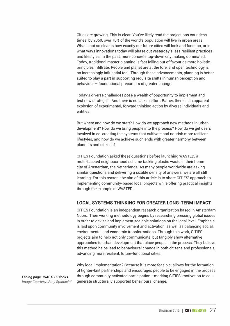
Facing page- WASTED Blocks Image Courtesy: Amy Spadacini

28 CITY OBSERVER | December 2015
WASTED Bakfiets, used to collect plastic waste in Amsterdam Noord. Image Courtesy: CITIES Foundation.
There are five central pillars to CITIES’ approach:
1. Address a global urban phenomenon
2. Research locally and engage multiple actors
3. Co-develop local innovation with community and professionals
4. Implement replicable project plan locally
5. Communicate project
Accordingly, WASTED’s central activities synergistically enforce aims of integrating community in giving new value to plastic waste. Beyond the community itself, WASTED strives to reduce the impacts of resource misuse involved in the production, consumption and international logistics of plastic waste management. Such lofty goals can be approached from the neighbourhood scale, which is an increasingly significant change agent within larger systems. WASTED follows this logic, seeking to provide a real-world local solution implemented at the neighbourhood level that begins to address social, environmental and economic development, as well as
design and lifestyle choices that define and shape our cities.
WASTED is composed of three central components:
1) Plastic waste collection and upcycling,
2) an Education Package, and
3) a Reward System.
In practice, local plastic is collected and reprocessed into modular blocks during workshops at WASTED’s neighbourhood plastic waste Laboratory. Blocks are then used to build new objects by and for the community, such as planters for the park; the Education Package spreads awareness on both plastic’s problems and possibilities; and the Reward System gives residents plastic coins in exchange for their plastic waste, which they can spend at participating local businesses for deals and discounts to advance a new local currency valued on waste.
To raise further awareness, CITIES also implemented a Summer Program, where WASTED participated in number of local events and festivals and hosted
COMMUNITY ENGAGEMENT

29December 2015 | CITY OBSERVER
their own WASTED Plastic Night: an event dedicated to plastic waste that brought together a family-friendly program alongside diverse plastic projects. For instance, Perpetual Plastic Project gave a 3D printing demonstration with recycled plastic filament; Plastic Whale took visitors on boat trips along the canal to fish plastic waste from the water; DUS Architects showcased their 3D printed plastic stools; Thisisarobot hosted a plastic crochet workshop; and together with Klik! Amsterdam Animation and Outdoor Cinema a movie program on the theme of waste was curated and screened.
WASTED began as a pilot project. Pilots, strategically put into effect, accelerate informed development and help instil new ideas that transform old urban ecologies. The project’s initial pilot ran January through August 2015, experimenting with the aforementioned three-part system in Amsterdam Noord. At the end of the pilot, WASTED had 23 businesses participating in the Reward System, offering deals and discounts in exchange for WASTED
Coins, and collected roughly 2.890 kilograms of plastic waste, 1.408 bags of which came from 249 registered households. With this plastic, they could build 1.324 WASTED Blocks.
MULTI-ACTOR COLLABORATIONIn 2014, CITIES published WeOwnTheCity: Enabling Community Practice in Urban Planning and Architecture. The book examines bottom-up initiatives in five global cities in order to spotlight practical actions that more traditional actors can take to support and co-create with citizens. A central message is that certain entities can be influential in stimulating more citizen-engaged development from both the ‘top’ and the ‘bottom’. CITIES plays this role in the WASTED project, as they better understand both community needs and those of more influential parties such as local government, organizations and architectural firms. This ‘bilingualism’ appears very much an asset in today’s urbanization.
“Give us your Plastic”, WASTED connecting with community. Image Courtesy: Amy Spadacini
30 CITY OBSERVER | December 2015
COMMUNITY ENGAGEMENT
Serving as a mediator, CITIES conducted neighbourhood research at the project’s start to better understand peoples’ needs in WASTED’s locale. Before this action,they obtained support from a few sources: the Netherlands based DOEN Foundation (translated Do Foundation), which supports leaders in the field of sustainable, cultural and social innovation; the City of Amsterdam;ASN Bank, working to advance a more social and sustainable world; and Fred Foundation, which supports projects with a systemic vision of sustainability, who contributed both financial and human resources to WASTED. CITIES also partnered with a local ‘green’ secondary school, Clusius College, Overtreders W design studio, Bureau SLA architectural firm and the neighbourhood resident company Noorderpark Trust.
These local partners were key actors in the project. For example, Clusius College keeps WASTED’s plastic collection depot on their school grounds and the City of Amsterdam offers their recycling facilities to properly recycle the plastic WASTED does not use. The city is also exploring more technologically innovative ways to integrate WASTED’s Reward System in advancing recycling citywide to help meet their sustainability goals. As the project continues past the initial pilot, multi-actor collaboration continues to prove essential. For instance, the Dutch Ministry of Environment and Infrastructure is supporting the Education Package’s national expansion.
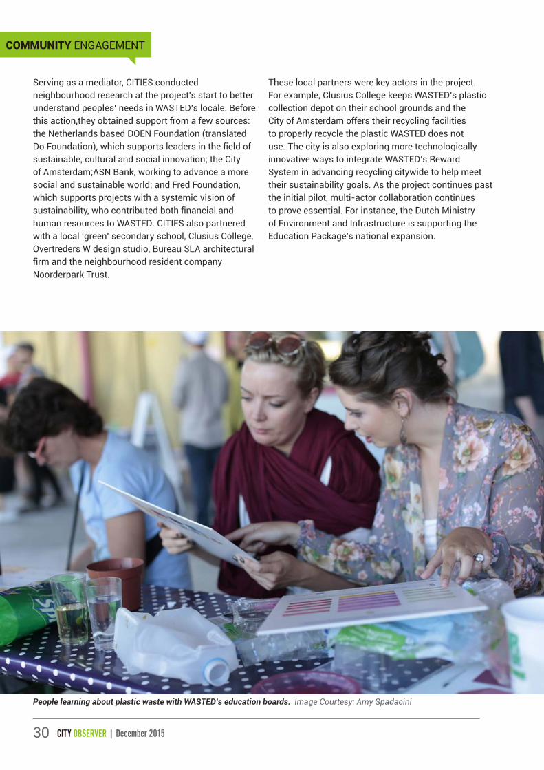
People learning about plastic waste with WASTED’s education boards. Image Courtesy: Amy Spadacini

31December 2015 | CITY OBSERVER
Interactive WASTED design workshop at WASTED Plastic Night. Image Courtesy: Amy Spadacini

32 CITY OBSERVER | December 2015
COMMUNITY ENGAGEMENT
MAKE LOCAL PROJECTS REPLICABLECities worldwide can benefit from raised plastic awareness and new methods of recycling, upcycling and waste management in their neighbourhoods. The WASTED Laboratory is therefore designed in a way that can be replicated in other cities relatively easily.
What makes it replicable? For one thing, WASTED’s system is very low-tech. For instance, they collect plastic using a cargo-bike and LDPE is transformed into Blocks using heat combined with a mechanical press and mold. Designs were realized in this way in order to make the project easier for others to implement, as well as to offer a more simplified hands-on educational experience for school children
and adults alike. These conditions were explicit in WASTED’s initial design brief given to two sets of designers: an initial Design Club consisting of five material and design practitioners realized the first blueprints that a separate WASTED Design Team trio of knowledgeable makers then used to bring Blocks, machines and process to life.
On the WASTED website, there is a ‘Build Your Own Lab’ page where people are free to read and download the project’s Open Source Report. Covering everything from material considerations to the process of turning plastic waste into a finalized WASTED Block, the report documents all one needs to know in order to implement their own lab.
WASTED Laboratory. Image Courtesy: CITIES Foundation.

33December 2015 | CITY OBSERVER
About the Author
Mehdi Comeau is an American/French urban sociologist with a background in international environment and development. Based in Amsterdam, the Netherlands, Mehdi works freelance. For over two years, he has been managing communications at CITIES Foundation. Currently, he is also working on an architecture and urban development book about City Gaming; supporting an urban and community focused social design company; and pursuing diverse interests from climate and community to mobility and smart urbanism to advance more future-functional cities. Connect with Mehdi: www.linkedin.com/in/mrcomeau
COMMUNICATING THE PROJECTCITIES strives to maintain project transparency with the communities they work with and beyond. This is evident in WASTED’s communication. The project’s progression through four phases are documented on CITIES’ website (www.citiesfoundation.org), updates are shared in their newsletters and wider network via Twitter and Facebook, and they created a dedicated WASTED website (www.wastedlab.nl). The WASTED site offers locals personal online accounts to do things like track their plastic contribution and see what rewards local businesses are offering in exchange for WASTED Coins, while providing everyone with specific project information. Further, as mentioned, the Open Source Reports and the project’s Pilot Reportare shared online. In raising awareness, communication is also key. Spreading the message through the web opens more eyes to the possibilities of new-found plastic use and value. In these ways, applying technology to create more robust communication around WASTED served as a supporting pillar for the project’s success both locally and beyond.
Good old-fashioned (read offline) communication is also important. For WASTED, it was essential to reaching more locals, as the implementation area in Amsterdam Noord has a higher percentage of
residents with little to no internet connection. The WASTED team used offline communication techniques such as fliers, collaboration with local events, a local community centre, word of mouth and setting up at a local street market once a week.
THE WASTED CITYThe WASTED city is a future imaginary. It both cultivates sustainable behaviour and is a product of it. The city emphasizes localized closed-loop systems. Here, plastic is not a burden; plastic is re-utilized as the valuable resource it is rather than the detrimental material it has become. In this city, built, social and economic systems around waste management comprise a resilient balance.
Will this city ever exist? Unlikely. The vision and project are idealistic. But they are no less significant. WASTED is real and growing in Amsterdam. It is raising awareness and catalyzing behavioural change from school children at the household level to professionals at levels of the local government and national Ministry. It is furthering Amsterdam’s sustainability goals by contributing to increased recycling. It is beginning to inspire more plastic and waste based initiatives in the Netherlands and worldwide. Where will your WASTED Laboratory be?
Beyond the community itself, WASTED strives to reduce the impacts of resource misuse involved in the production, consumption and international logistics of plastic waste management. Such lofty goals can be approached from the neighbourhood, which is an increasingly significant change agent within larger systems.‘‘

34 CITY OBSERVER | December 2015
BIENNALE CALLING!An Interview with Bose Krishnamachari
ART AND THE CITY

35December 2015 | CITY OBSERVER
12/12/12 was a milestone for the world of art in India. It was the date when the country’s first ever biennale of international contemporary art- Kochi-Muziris Biennale- was thrown open to the public at Fort Kochi. The three month long exhibition and cultural programme unfolded across a string of venues in Fort Kochi and housed the works of 90 artists from around the world including Sudarshan Shetty (India), Subodh Gupta (India), Vivan Sundaram (India), Sheela Gowda (India), Atul Dodiya (India), Rigo 23 (Portugal), Jonas Staal (Netherlands), Ernesto Neto (Brazil) and Mathangi Arulpragasam (M.I.A.) (UK).
Co-curated by artists Riyas Komu and Bose Krishnamachari, the 2012 edition saw 4,00,000 visitors and was embraced by local communities as a turning point in the history of the Kochi region. The phenomenal success of the first edition was repeated with the 2014 edition curated by Jitish Kallat and titled ‘Whorled Explorations’.
Interestingly, the Kochi-Muziris Biennale (KMB) began as a government initiative, when the Department of Cultural Affairs of Government of Kerala approached Riyas Komu and Bose Krishnamachari to help organize an international platform for art in India. What transpired next is a saga of ambition, grit, perseverance, awe and sheer brilliance. With the support of the government, private patrons and local businesses, spaces were identified in Fort Kochi and transformed into venues for art. KMB venues at Fort Kochi include David Hall, a restored Dutch bungalow in Fort Kochi; Aspinwall House, a large sea-facing heritage property; Pepper House, a historic spice godown; spice warehouses, heritage structures, theatres, halls and public open spaces. Art had indeed seeped into every possible kind of space and gave new identity and meaning to the unused parts of Fort Kochi’s urban fabric. In downtown Kochi, the 150-year-old Durbar Hall too was renovated to serve as a KMB venue and mimicked the inseparable ties that Fort Kochi itself has with the mainland.
While Kochi continues to draw its identity from the pre-colonial traditions of cultural pluralism, the Kochi Muziris Biennale aims to add another layer- the myth of the Muziris- and in doing so dares to blur the boundaries further in an effort to create a new urban milieu that is capable of generating exciting responses. Indeed, KMB has a no holds barred approach to make Kochi a repository of emerging ideas and ideologies, and thereby create different histories that can define the city from this point onwards.
Read on for more insights from Bose Krishnamachari, co-founder of the Kochi Muziris Biennale Foundation as interviewed by UDC founder, Vidhya Mohankumar-
Hello Bose! Firstly, thank you so much for giving us all a phenomenal Biennale experience at Fort Kochi and also for agreeing to share your experience with us. To start with, what was the inspiration and thought process involved in conceptualizing India’s first ever art biennale?
Indian art and artists had become known the world over, but were being represented and promoted by museums and curators abroad. There was an
Image Courtesy: Kochi Biennale Foundation.

36 CITY OBSERVER | December 2015
ART AND THE CITY
Aspinwall House, a large sea-facing heritage property at Fort Kochi, comprising of offices, warehouses and a residential bungalow, over 160,000 square feet is a primary venue for the biennale. Aspinwall House has been loaned to Kochi-Muziris Biennale by DLF Limited in association with the Gujral Foundation.
Image Courtesy: Vidhya Mohankumar

37December 2015 | CITY OBSERVER
urgency for a purposeful platform in India that responded to the needs and condition of contemporary art.
The Triennale-India that used to take place in Delhi had lost its energy many editions before it finally folded. There was an attempt towards a biennale in Delhi in 2005, which didn’t take off because there was no support forthcoming from the State.
So when the then Minister for Culture of Kerala, MA Baby, asked Riyas and me about doing something for contemporary art in the state, we proposed the Biennale. The government encouraged and supported the project, and with the help of the artists community in India, the Kochi-Muziris Biennale was realised.
Why Kochi? What were the parameters you had in mind with regards to the choice of a city for the biennale?
We did not choose Kochi: to conceive of such a biennial was to already find its residence. The Kochi-Muziris Biennale could not have been elsewhere.
In Kochi we can read a model for another cosmopolitanism. One that does not effect a flattening of differences, but signifies a multiple existence. It is the civilisational depth of Kochi as a site that we hope will allow the Biennale to grow roots there. Kerala’s history of public action and engagement through art also affirm the located nature of the Kochi-Muziris Biennale.
It is these legacies, rather than the presence of art markets like in Bombay or Delhi, that the Kochi-Muziris Biennale wants to inherit.
Inconspicuous and casual wall art at the ferry docking point at Fort Kochi.The Biennale has allowed for artists to reclaim public spaces and various unusual spots in the city to make art a part of the everyday experience of the residents of Kochi.
Image Courtesy: Vidhya Mohankumar

38 CITY OBSERVER | December 2015
Kochi Muziris Biennale has undoubtedly become a key marker in the timeline of Kochi’s development. What is your impression of Kochi from the pre-biennale era and the post-biennale era? In other words, can you share your insights on the power of art to revitalize cities?
I don’t know if Kochi needs revitalisation. The Biennale has, in fact, drawn on Kochi’s energy, its hospitality. We are privileged that we’ve been able to participate in and extend this vitality of Kochi.
There is, I think, a greater confidence now that not just contemporary art, but other inventive projects can flourish in this atmosphere. The presence of artistic and creative activities signal something beyond a merely functional city.
In his 2002 book ‘The Rise of the Creative Class. And How It’s Transforming Work, Leisure and Everyday Life’, American sociologist and economist Richard Florida postulated that creativity will be the emergent driving force of the 21st century and that cities that want to stay ahead in the race must aim to attract the ‘creative types’. Incidentally, the first edition of Kochi Muziris Biennale unfolded exactly ten years after this book was published! From your experience with the Biennale, what are your thoughts on Florida’s thesis with regard to Indian cities?
I haven’t read this book, so I can’t comment on the ideas there. The reason for people to live in a city, the reason for a city to exist must include its capacity to nourish and stimulate the human spirit.
Do you think the Kochi Muziris Biennale would have been as well received if it was 10 years earlier?
Yes.
What are the various ways in which the local communities of Kochi are involved in the Kochi Muziris Biennale?
We did years of work prior to the first biennial to let ourselves grow in Kochi. We’ve had people who are not artists but who have lived in Kochi and knows its rhythms and its textures on the decision-making team of the Biennale. We’ve been received by schools and by cultural organisations in Kochi in their enthusiasm to learn about new developments in art. Workers’ union in Fort Kochi and Mattancherry have extended their complete support for building the Biennale.
Most importantly: we’ve seen ourselves and we’ve received reports from artists and curators about the remarkable number of local people visiting the Biennale exhibition itself.
What has been the biggest challenge yet in realizing the Kochi Muziris Biennale?
There have been several challenges. Financial problems have troubled us from the beginning. There had also been at the time of the first Biennale some malicious attacks on the project. The Biennale has had to build infrastructure for contemporary art simultaneously with its realisation. But a project like this can happen only if risks are taken.
ART AND THE CITY
Facing page- ‘Chronicles of the Shores Foretold’; Installation by Gigi Scaria for Kochi-Muziris Biennale 2014 at Pepper House.Pepper House is a historic spice godown with Dutch-style clay roofs and a large courtyard, once used to store goods for loading onto ships anchored in Kochi harbour. Pepper House in its new avatar provides with 16,000 square feet of exhibition space and artist residency studios.
Image Courtesy: Vidhya Mohankumar
39December 2015 | CITY OBSERVER

40 CITY OBSERVER | December 2015
In Kochi, we can read a model for another cosmopolitanism. One that does not effect a flattening of differences, but signifies a multiple existence. It is the civilisational depth of Kochi as a site that we hope will allow the Biennale to grow roots there.‘‘
ART AND THE CITY
Bose Krishnamachari and Riyas Komu, the co-curators of Kochi-Muziris Biennale 2012, hoist the flag with Feroze Gujral from the Gujral Foundation at Aspinwall House, Fort Kochi. Image Courtesy: Kochi Biennale Foundation.

41December 2015 | CITY OBSERVER
About the Artist
Artist and independent curator, Bose Krishnamachari’s diverse artistic and curatorial practice includes drawing, painting, sculpture, design, installation and architecture. Bose Krishnamachari has exhibited in several important solo and group exhibitions including ‘”Bombay Maximum City”, Lille 3000 curated by Caroline Naphegyi-2006, “The Shape That Is,” Jendela and Concourse, Esplanade, Singapore-2006, Indian Art at the Swarovski ‘Crystal World, Innsbruck, Austria-2007, ‘Gateway Bombay’ at the Peabody Essex Museum-2007, India Art Now: Spazio Oberdan, Milan-2007, ‘Indian Highway’ at the Serpentine Gallery2009, the Astrup Fearnley Museum, Norway-2009, the Herning Museum of Contemporary Art, Denmark-2010, the Lyon Contemporary Art Museum, the Fondazione MAXXI, Rome-2011, and the ARTZUID Amsterdam-2011. His curatorial projects include the seminal exhibition ‘The Bombay Boys’, New Delhi-2004, ‘Double‐Enders,’ A travelling show - Mumbai, New Delhi, Bangalore and Kochi-2005, “AF-FAIR,” 1X1 Contemporary and 1X1 Gallery, Dubai-2008, guest curator at the Indian pavilion of ARCO‐Madrid-2009, and the travelling project, LaVA (Laboratory of Audio Visual Arts)-2007-2011. In 2009, Krishnamachari created Gallery BMB in South Mumbai with a vision to bring the best national and international art to India. Bose was Artistic Director and Co-Curator of India’s first Biennale – The Kochi Muziris Biennale 2012, Director of Kochi-Muziris Biennale 2014, and is President of the Kochi Biennale Foundation.
Comparisons with the Venice Biennale have been inevitable. This is more so because the nature of some of the spaces where artwork is exhibited for the Kochi Muziris Biennale vividly evokes the memory of spaces where artwork is exhibited for the Venice Biennale. The Venice Biennale however, has an architecture component as well. Do you foresee the same for the Kochi Muziris Biennale?
We don’t compare ourselves to other biennials. Having said that, the Kochi-Muziris Biennale already has a heavy architectural component. But no, there are no plans to have a separate architecture biennial.
It is one thing to host an event with the scale of the biennale but there is also an emerging trend of art in the public realm of cities thanks to the initiatives of individual artists, artist collectives and cultural organizations such as St+Art India Foundation, the Goethe Institut, Kerala Lalithakala Akademi and others. What is your advice to cities that are stepping forward to gradually embrace the inclusion of art in the public realm in a way that maximizes its impact especially with regard to activating public spaces/derelict spaces in a city?
I’ve already indicated that our Biennale has been animated by its location. Creative actions should recognise that there’s already something there. Also, there is a danger that art goes and gentrifies a place. The effort should be for art to work in and with a place, rather than take over the place.
Lastly, if you had to chose another city in India to host an art biennale, which one would it be and why?
Kochi has done the choosing for us. Another city might choose another person.
Thank you so much for your time. UDC would like to take this opportunity to wish the KMB team yet another amazing biennale edition in 2016! See you there!
42 CITY OBSERVER | December 2015
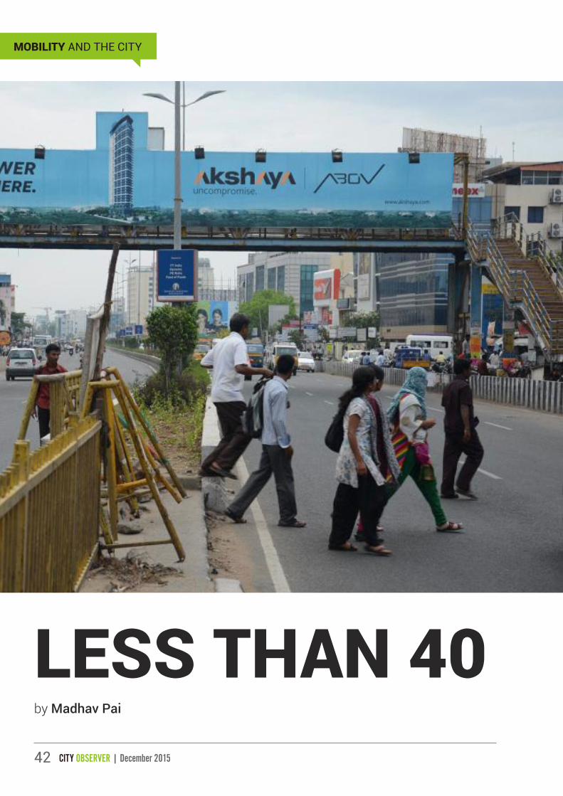
LESS THAN 40by Madhav Pai
MOBILITY AND THE CITY

43December 2015 | CITY OBSERVER
Contrary to popular belief, there is a magic answer to solve the mobility problems in all our cities... “Less than 40”. No city street wider than 40 metres, no city street faster than 40 km per hour. If we follow these two rules, modal shares of public transport and walking bicycling will both increase to 40%. Accessibility and mobility for all citizen’s rich and poor will be excellent. If you accept my argument – this can be easily achieved in the next 5 years. And these design principles can become the norm for designing mobility for cities business by 2040.
WALKING IN INDIAN CITIESWalking in Indian cities can range from unpleasant to extremely unsafe. Adequate footpaths are missing in most places. Footpaths are heavily encroached by parking and vendors. Noise pollution is very high people, are constantly honked at. Crossing the road is a big challenge. It is extremely unsafe. 19% of the road fatalities in Indian cities are pedestrians (NCRB, 2010). Major and minor injuries are 30 to 50 times the number of road fatalities (Gururaj, 2009).
Walking on the streets is akin to being in a hurdles race. And if you cannot compete, you just stop walking. Our cities clearly don’t address these problems.
Facing page- Pedestrians opting to cross a street at
grade as opposed to using the foot-over-bridge.
Above left- How the road appears to a vehicle user.
Above right- How a road appears to a pedestrian.Image Source: EMBARQ.
WHO WALKS IN OUR CITIES?Everyone. All Indian cities are walking cities. Walking is the primary mode of transport for 52% of Mumbaikars. In the case of Chennai, Delhi, Ahmedabad for example, pedestrians comprise almost one-fourth the trips. In smaller cities like Surat, Jaipur and Bhopal, walking makes up to 45-50% of trips. Figure 1 shows modal share data from 12 Indian cities (EMBARQ, 2008).

44 CITY OBSERVER | December 2015
THE PROBLEMS IN THE EXISTING SETUPUnsafe & Unsustainable by Design
The current approach to design and build transport systems in a City is an approach for inter-city highways. These design ideas, guidelines and standards are unsafe for city streets. Our city streets are unsafe by design.
Flyovers, elevated roads, expressways have become common place in our cities. As an example, since 1999, Mumbai has built over 60 flyovers in and around
the city with a bid to ease congestion, including the Bandra-Worli Sea Link, Eastern Expressway, in addition to the two East-West connectors, Jogeshwari-Vikhroli Link Road and Santa Cruz-Chembur Link Road. The city has already spent over 20,000 crore rupees to build this infrastructure. To further maintain this infrastructure, the city spends around 2000-3000 crore rupees - almost equivalent to the annual budget of some medium-sized municipal corporations like Ahmedabad. In spite of these large investments,traffic congestion has not been eliminated nor have the needs of the majority people walking been met.
MOBILITY AND THE CITY
Pedestrian plight in Indian Cities. Image Source: EMBARQ.
In Mumbai, 78% use trains and buses. And to access the trains and buses majority of people walk to the train stations. Image Source: EMBARQ.
MagVolcano.com

45December 2015 | CITY OBSERVER
Safer by Design – Speed and road width
Speed limit considerably reduces the risk of fatality during accidents. Studies have found that a speed limit of 30 km/hr significantly reduces the risk of fatality (Rosen and Sander 2009). An advertising campaign for road safety launched in New York City appropriately explains the difference in speed limits and the effects
on pedestrian safety. When a pedestrian is hit at 40 mph (64 km/hr), there is a 70% chance they will survive; when they are hit at 30 mph (48 km/hr), this increases to an 80% chance of survival. Safer vehicle speeds have a great impact on road fatalities and streets should be designed to ensure a speed limit.
Non-motorized Transport Mode Share in Indian Cities. All cities show an extremely high use of non-motorized transport. Except for the 5.6 km busway in Delhi and 10 km exclusive bikeways in Pune there is no dedicated infrastructure for bicyclists in any of the cities. Wherever provided footpaths are not continuous and encroached upon. Indore is a good example for a city with no footpaths. Most cities in the “now exploding” category have no footpaths at all. Source: (India Transport Indicators, Madhav Pai, 2009)
An advertising campaign in New York City showing the impacts of speed limits. Source: US Department of Transport 2011

46 CITY OBSERVER | December 2015
Road Widths Road Fatality data from around the world indicate that pedestrians are the most vulnerable road users and they comprise the most number of fatalities. Further investigation shows us that a significant number of these accidents take place at intersections and at mid-block crossings. This indicates a clear requirement to focus on roads that pedestrians can cross, rather than wider footpaths. Streets should not be designed with open, wide intersections that force pedestrians to transform into an Olympic runner to cross in time. Streets need to be easy to navigate for the common pedestrian. Smaller intersections, narrow roads that are easy to cross, and mid-block crossings that provide the shortest and most direct path can easily be designed on a less than 40 metres road.
We need to question the usability of our roads. Can an 80-year old cross the road in a comfortable manner? Would we allow an 8-year old child to cross our roads unsupervised? Well-designed roads are accessible and easy-to-use universally, by the old and the young who make up the most vulnerable. A road width of well within 40 metres can successfully achieve this.
HOW DO WE IMPROVE WALKING AND ACCOMMODATE THE REST?We need mobility in our cities. We want people to get to their jobs. We need commerce to thrive. Here’s how we can do it by building inclusive urban roads. An Urban Road Agenda for Cities should satisfy three critical principles for our roads to be successful in addressing urban mobility.
1. 40:40 principle to ensure access for all
2. Complete the Network
3. Multiply Capacity by giving priority to Mass transit
40:40 Principle to ensure access for All
All roads inside a city should be designed for universal access. Designing roads to operate at speeds below 40 km/hr and are less than 40 metres wide is an optimal solution.
It is important that the speed isn’t managed through the placement of speed posts specifying the limit or cameras. Instead, we must design roads that ensure the desired speed – the design speed. This can be achieved through urban design elements such as barriers, chicanes, lesser kerb radii, and reduced lane widths that slow down vehicle speed, and protected footpaths and bicycle lanes that safeguard vulnerable users. Urban design can also reduce the troublesome pedestrian crossings that force people to dart across and dodge vehicles. Pedestrians are often seen dodging cars. Wider streets should be designed to minimise the need for pedestrians to run across. The use of pedestrian refuge islands, bulb-outs, direct and shortest crosswalks will facilitate safe pedestrian movement.
Street design has changed as a science, from highway-centric designing to building for people. Design manuals being launched by cities like New York have shifted their focus to the equitable distribution of road space. From July 2006 to June 2009, New York has constructed over 200 mi (320 kms) of bicycle tracks. In Delhi, the UTTIPEC design guidelines also conveys some good practices in street design; however, we are yet to see how this translates into implementation. The Indian Roads Congress (IRC) 103 provides good detailing on footpath design, the use of bollards and other traffic-calming measures. The manual includes street design elements appropriate to the context.
No city street wider than 40 metres, no city street faster than 40 km per hour... Less than 40, for 40, by 2040.‘‘
MOBILITY AND THE CITY

47December 2015 | CITY OBSERVER
Complete the Network
Our cities don’t need wider roads, flyovers. Our cities need roads to complete the network. For example, Ahmedabad, which is divided by the Sabarmati River, has over ten bridges to facilitate movement. The inner and outer rings are complete, and the network is fairly good and complete. A classic indicator of a fairly well-established network is the relatively low average trip length of 5 kms for a 6.5 million people city. Bangalore on the other hand has an average trip length of around 9 kms. The city has major arterials (indicated
in blue in the image below) but is missing an inner ring. Everyone traveling from North to South has to go through roads in the centre of town - Richmond Road, M G Road and Residency Road. These lively city centre boulevards have been transformed into one-way fast-moving thoroughfares, where no one wants to live. Businesses too are gradually moving away from this type of environment which is not conducive to development. To complete its network, Bangalore needs an inner ring road that will provide multiple options for improved mobility.
Ahmedabad’s road network provides for good connectivity as well as alternate route options. Image Credit: Shruti Shankar
Bangalore’s major arterials force travel through the most congested parts of the city centre. Image Credit: Shruti Shankar

48 CITY OBSERVER | December 2015
MOBILITY AND THE CITY
Multiply Capacity by giving priority to Mass transit
Priority to buses or Bus Rapid Transit is a great way to increase capacity. On a 40 metre wide arterial. Two lanes of 2.75 metres in each direction will equate to an 11 metres roadway. An additional three lanes of 3.5 metres each (two lanes in each direction with an overtaking lane) is required to facilitate the high
speeds and high throughput of the BRT. A further 18 metre space designed for pedestrian footpaths and cycle tracks will complete the road section. Images below show how Mexico City tripled capacity on Avenida Insurgentes a North South Boulevard running through the centre of the City. Mexico City has implemented 125km of bus rapid transit since 2005.
New York City reduced its lane widths from 3.5 m to 2.75 m to prevent speeding. Image Source: NYC DOT
Carrying capacity of BRT versus private vehicles. Image Source: EMBARQ.
15000 persons per hour
4000 persons per hour

49December 2015 | CITY OBSERVER
About the Author
Madhav Pai is the Director of EMBARQ India. He is based in Mumbai and provides overall leadership and management to this program he co-started 5 years ago. Madhav has over 12 years experience leading, designing and managing urban transport programs and projects in India, Asia and United states. Prior to joining EMBARQ India he was Regional Director at Citilabs, a transport planning Software Company and headed operations in South and South East Asia. He has delivered training courses on Transport Modeling and Demand estimation in India, Hong Kong, Thailand, Malaysia and USA. In the San Francisco Bay Area, he spent four year working at Dowling Associates Inc. managing and executing several transport planning, demand estimation, transport modeling and traffic engineering projects. He spent two years as a researcher at the Institute of Transport Studies at the University of California Berkeley, where he was involved in assessing the short and medium term impacts of City Car Share on travel behaviour in the City of San Francisco. Madhav is a Civil Engineer from Mumbai and holds a Master’s Degree in Transport Planning from University of California Berkeley.
WHY DO WE NEED TO WALK?Evidence from the public health community highlights the need to walk. Public health organization from across the globe including the Centre for Disease Control and Prevention, USA guidelines recommends that everyone walks 150 minutes a week. 150 minutes a week of walking reduces the propensity for life style diseases like diabetes, high blood pressure by up to 70%. There is also research that shows having good walking infrastructure is strongly linked to people walking 150 minutes to do utilitarian activities like shopping for daily needs, going to school, going to work. Enrique Penalosa Mayor of Bogotá always speaks about humans being designed to walk, just like birds fly and fish swim. For our metabolism, circulatory systems, respiratory systems to work properly we need to walk.
JOIN THE MOVEMENT - LESS THAN 40If you accept my arguments, start to walk and bicycle wherever possible and advocate for narrower, slower roads in our cities. Demand bus rapid transit and better buses for your city. Several people agree this needs to be done but argue that the government needs to implement high quality public transport and bicycling lanes first. It’s a chicken and egg problem. The incumbents want to build roads for cars, flyovers and elevated roads. 3 to 5 % of the city population have or aspire to buy cars to drive on these fast roads.
However, we know that we can never build our way out of congestion. And we can never provide honourable mobility to the majority of the city walking.
The choice is ours, we begin to suffer from life styles diseases before we turn 40, spend 40 minutes on the tread mill every day or we join this movement to design our cities that allow mobility for all and allows us to do our necessary physical activity as utilitarian activity. Join the Movement - Less than 40, for 40, by 2040.

50 CITY OBSERVER | December 2015
FEATURE ARTICLE
BANGALORE’S URBAN FRINGEby Shanthala. V

51December 2015 | CITY OBSERVER
INTRODUCTIONIndia is urbanising at an accelerated pace. 2011 Census has recorded 53 cities with over million population accounting for 43% of India’s urban population. The numbers of towns have increased from 5161 in 2001 to 7935 in 2011. 31.16% of Indian population i.e. 377 million people live in urban areas (Census 2011). The projections of the planning commission indicate 600 million Indians would be living in urban areas by 2031.
To accommodate this additional population, it becomes imperative for the cities to expand and grow by extending their boundaries. The extension of the city is critical for the growth of the city and the pattern of extension determines the future prospects of the city.
BANGALORE- A GROWING CITYBangalore has seen accelerated growth rate during the last few decades. It is experiencing a steady increase in its population recording an increment of 3.25% annually. The population of Bangalore increased from 4.13million to 5.68 million during 1991-2001, with a decadal growth of 37.7%, which made Bangalore one of the fastest-growing Indian metropolises, after New Delhi (51.93%).In the next decade Bangalore added another 2.72 million recording 8.4 million in 2011. Bangalore Urban Area has recorded a decadal growth rate of 51.39% (Source: Census India).
CITY’S EVOLUTIONBangalore has evolved through centuries from a mud fort in 1537 to twin city during the colonial period. A pensioner’s paradise and a garden city has transformed into today’s ‘Silicon Valley of India’.
Public sector units located in Bangalore during the post independence period resulted in leap frog development with these units located outside the then perceived city limits. Further, the setting up of Electronic city in 1984 again on the southern fringe of Bangalore resulted in growth of IT related industries in the south and south-eastern parts of the city. The International Airport in the north has lent potential to the city’s expansion in the northern direction. These magnets located periodically at distances farther away have reiterated the leap frog development model. The city expands from the core to the magnet as an infill largely guided by market forces rather than planned interventions. Growth of the city in this pattern encourages sprawl and results in a compact city.
Facing page- Spatial representation of population growth in Bangalore 2001-2011. Darkest colour indicates more than 250% increase in ten years. Image Source: http://bangalore.urbanmetabolism.asia/geoportal
The planning authority functioning as an implementation agency has distorted its focus in delivering the responsibilities of a planning agency.‘
‘

52 CITY OBSERVER | December 2015
FEATURE ARTICLE
INSTITUTIONAL FRAMEWORK AND EXISTING PLANNING MECHANISM The Bangalore Metropolitan Region Development Authority (BMRDA) prepares the structure plan for the entire region i.e., Bangalore Metropolitan Region of 8005 Sq Km. The BMRDA area includes the BMA, 5 Area planning zones and 6 Interstitial Zones. The Local Planning Authorities prepare the Master plan for the respective planning zones.
The Bangalore Development Authority carries out the responsibility of city plan preparation, enforcement and implementation. To guide the growth of Bangalore city, Bangalore Development Authority prepares the Comprehensive Development Plan for the Bangalore Metropolitan Area (BMA) once in every 10 years. The city is divided into planning districts for which the planning authority recommends the Land use and Zonal regulations.
The Master plan prepared by the BDA is approved and considered as a legal document which regulates the growth of the city. The Master plan 2015 for the BMA covers 1306 Sq km area. BDA not only functions as the planning authority but also as development agency. The planning authority functioning as an implementation agency has distorted its focus in delivering the responsibilities of a planning agency.
Bruhat Bengaluru Mahanagara Palike (BBMP) is the local Municipal body which provides the basic civic amenities and enforces the provisions of the Master plan laid down by the BDA. The jurisdiction extends to an area of 793.47 Sq km. It was formed in 2007 by merging 100 wards of Bengaluru Mahanagar Palike (BMP) with 7 City Municipal Councils and 1 Town Municipal Council and 110 villages around the Bangalore region. The BMA area is divided into 198 wards which are managed by the BBMP. The implementation of the provisions of 74th Amendment in terms of the local body taking the responsibility of ward level planning remains without attempt.
GAP ASSESSMENTThe physical extent of the city is increasing to accommodate the increasing population. In the process of this extension, large tracts of land are
introduced by the planning authorities as urbanisable land in the third ring planning districts. These areas comprise the third ring of planning districts in the Master plan 2015 in the BMA and beyond into the BMRDA area. Microlevel planning is lacking in the existing planning mechanism. The institutional framework is ambiguous, where there are multiple jurisdictions governing these peripheries.
The intention of the planning authority which is enforced only through the Master plan does not suffice in defining the nature of development that should take place in these peripheral urban districts. The increment in population in third ring planning districts is between 100% -300% according to 2011 Census data. This clearly indicates extensive urbanisation in these areas without definition of transport networks, non-provision of serviced urban land and neglect of existing natural spaces.
THE PERI-URBAN AREASUrban activities extend into rural areas around the edge of the city forming a transition zone between urban and rural. This transition zone called the urban fringe or the peri-urban area is dynamic, ambiguous and characterised by significant changes.
The nature of development which takes place in the peri-urban area is crucial for the development prospects of the city itself. A planned extension to the city would serve positively to city’s needs while disorganised development in the urban periphery would disturb the existing balance in the periphery and make the city economically, socially and ecologically unsustainable.
IMPORTANCE OF PERI-URBAN AREAThe Urban and the peri-urban linkages are reinforced predominantly by the movement of commodities, capital, natural resources, people and pollution. These linkages bring conflict over land, water, natural spaces and infrastructure.
The proportion of these movements especially commodities, capital and people define the rate at which the peri-urban is transforming itself into an urban area. The transformation of the peri-urban to urban happens by change in the land uses- the

53December 2015 | CITY OBSERVER
Third Ring Planning Districts of Bangalore Master Plan 2015. Image Source: Bangalore Master Plan 2015.

54 CITY OBSERVER | December 2015
FEATURE ARTICLE
physical component, change in the occupation pattern- the economy component and new social groups emerging- the social component.
Micro level planning and effective integration with the city level components should guide the pattern in which development should happen through adequate infrastructure allocation, integration of transport, provision of serviced lands, ecologically sustainable developments considering the carrying capacity of the land.
The extension of urban activities into these areas results in social inequality. They become contested spaces in terms of natural resources, urban processes and agriculture. The disagreement is further intensified by institutional fragmentation, conflicting regulations, regulatory void, absence of management mechanism, multiple jurisdictions. “Regulatory weakness is a means of transferring environmental costs, incurred by production and consumption patterns in the city, to the surrounding peri-urban areas” Satterthwaite (2007).
Another condition is when the periphery provides for the services required for the urban area and in the process gets degraded depriving the original residents of their land and resources. The movement of pollution from the urban to peri-urban in the form of solid waste to landfill sites, waste water treatment plants define the degenerated periphery.
Example- the Mandur landfill sites in the periphery of Bangalore has degraded the environment quality in the existing rural settlements by polluting the land and water sources. The liveability and agrarian economy of the place is at stake.
The movement of natural resources from the peri-urban to the urban further depletes the peri-urban of its resources. For example- many brick industries have mushroomed in most of the peri-urban areas of Bangalore (close to Ramanagar, Nelamangla) to cater to the demand for construction material in the city. In the process, this activity depletes the precious top soil in the brick manufacturing areas which were productive agricultural lands.
Further, in the planning districts of Varthur, ground water is extensively harvested and sold to the residential neighbourhoods of Whitefield and Varthur which largely lack water supply. Large parts of Varthur planning district still practice agriculture, but contest for water between agricultural need and urban requirement make agriculture not lucrative enough. This makes the city depend on its daily needs for agricultural supplies from farther areas, hence disturbing the equilibrium to a large extent and making our urban systems more economically and ecologically unsustainable.
Transition zone in Varthur – a contested space. Image Courtesy: Author

55December 2015 | CITY OBSERVER
About the Author
Shanthala. V is an Architect and Habitat Designer. She is presently pursuing her Doctoral Research in the field of Peri-Urban Dynamics. She is practicing and teaching Architecture at Department of Architecture BMS College of Engineering, Bangalore. She specialises in handling design studios in early semesters apart from courses in landscape and acoustics. Her interests are Urban sociology, Heritage and Landscape Systems.
PLANNING MECHANISMThe Master plan makes broad brush recommendations regarding the nature of development. These recommendations are not adequate to bring lands in the peri-urban area of the third ring planning districts as serviced lands for urban use.
There is a strong need for micro-level planning which is crucial to understand the ground realities and arrive at relevant planning strategies to respond to the situation. The Karnataka Town and Country planning Act 1961 prescribes preparation of Town Planning Schemes to provide serviced land for urban development. This provision is never explored in the context of Bangalore. Hence the Master plan which is ambiguous at the micro level, its restrictions misunderstood and the provisions exploited. Microlevel planning should be carried out for an area of approximately 2-3km to effectively understand the provisions of the Master plan in response to the context.
The existing rural settlements are neglected; natural spaces are not dealt with at the micro level. Infrastructure provision is not conceived before which the market forces drive the growth of the city which is unorganised. Largely speculative growth results in sprawl. Planning as a tool to guide the growth lags behind growth. This results in uneconomical, unsuccessful models of cities which may not address the issues such as energy efficiency, sustainability, equity.
Hence there is a need to address the system of planning along with a clearly defined institutional framework to prevent ambiguity.
CONCLUSIONThere is a need to evolve a hierarchical system of planning to achieve optimum urban growth in the peripheral areas. The Peri-urban areas along with the rural settlements dispersed amidst agricultural lands experience equilibrium in terms of economy and ecology at regional level. The sustenance of this equilibrium is crucial.
Hence the planning of the peri-urban area cannot be addressed by considering the region at the edge of the city all the time, with the city centre always being the focus. The peri-urban region should also be considered at the regional level. This would enable a significant benefit for the peri-urban land through urbanisation and the city benefiting from the resources of the peri-urban land.
This would call for a multi-tiered planning mechanism to successfully provide an enabling environment with the jurisdictions of the planning, implementing and managing authorities, clearly defined.
REFERENCES1. Adell, G. (1999, March). Theories and Models of the
Peri-urban Interface. University College, London: Development Planning Unit.
2. (2005). Bangalore Master plan 2015. Bangalore.3. Bertaud, A. (2002, April). Transportation and Urban
Spatial Structure. Washington: ABCDE conference.4. CSH Occasional Paper, E. b. (2006, November). www.
cshdelhi.com/publications/downloads/ops/OP1.pdf. Retrieved March 04, 2011, from www.csh-delhi.com.
5. Heitzman, J. (2004). Network cities. Oxford University Press, USA.
6. Paper, C. O.-U. (2005). http://www.csh-delhi.com/ops.php. Retrieved February 15, 2011, from www.csh-delhi.com.

56 CITY OBSERVER | December 2015
JANE JACOBS WALKby Chelsea Gauthier
Celebrating Cities through an Urban Ecological lens
CITY TRAILS

57December 2015 | CITY OBSERVER
Cities around the world are unique, with their own geography, identity of place and histories that impact who we are. While our professions play a large part in defining our roles in the urban ecosystem, the way in which we live our daily lives shape the chapters of a city’s embodied story, history, and health passed from one generation to another. If you take a moment to step back and look past the boundaries of yourself, you’ll experience the wonders of your city through interrelationships of the urban ecosystem. Journalist and urban critic Jane Jacobs, famed for her book Death and Life of Great American Cities, observed these many relationships within the ecology of cities; the interrelated social, environmental, and economic systems.
“A natural ecosystem is defined as ‘composed of physical-chemical-biological processes active within a space-time unit of any magnitude.’ A city ecosystem is composed of physical-economic-ethical processes active at a given time within a city and its close dependencies.”
-Jane Jacobs, ‘93 Foreword in Modern Library Edition of Death and Life of Great American Cities
With the support of Jane Jacobs, the Center for the Living City was founded to enhance the understanding of the complexity of contemporary urban life and through it, promote increased civic engagement among people who care deeply for their communities. Jane Jacobs encouraged people to truly get to know their cities, to observe them, experience them in all their glory, and to actively be a part of the community. In the 1993 edition of Death and Life of Great American Cities, Jane Jacobs urges us to “…become interested in city ecology, respect its marvels, and discover more.” And so, our work focuses on providing portals of community engagement in cities through the lens of urban ecology. Through this dynamic lens, there are endless avenues to walk and explore; each person, community, and environment bringing a different story layered within the city’s walls. What does this path look like to you in your city?
Jane Jacobs Walk, one of our year-round programs, encourages people to celebrate and investigate the people and places that make a city great. Jane Jacobs Walk provides the encouragement and framework for anyone to get to know their cities and each other. These walks are self-organizing urban explorations led by locals worldwide throughout the year. Walks inspire people to make a difference because they enable members of a community to discover and respond to the complexities of their city and environment through personal and shared observation.
Facing page- Tucson ’s first Jane Jacobs Walk, discussing
the past, present, and future of its downtown.
Photo Credit: Ladd Keith

58 CITY OBSERVER | December 2015
In Mazagaon, Maharashtra, India, walkers stop and read excerpts of Jane Jacobs’ Death and Life of Great American Cities. Photo Credit: Himanshu Rohilla
THE PATH OF OUR CITIES SEEN THROUGH AN URBAN ECOLOGICAL LENSJane Jacobs observed the city as an organic ecosystem, webbed with dynamic interconnections. Her words represent a larger and more integrated understanding of ecology as an alternative model for human development. If you begin to observe cities on the ground, you’ll be able to recognize the fluidity of city life and the temporality within city design. By engaging in a deeper human understanding of cities, the acknowledgement of intricate interconnections can begin to catalyze comprehensive change. This recognition of complexity and connection inherent in an urban ecological approach is vital to the wide-ranging approaches of public design, policy and environmental practices, and is pertinent to the way everyone experiences our cities. As experts in your city, you have the opportunity to lead the way in the future of your community.
Each year we are taking steps to bring the insights, community connections and power of observation to a diversity of neighbourhoods in cities throughout the world. Jane Jacobs Walk becomes a great case study illustrating an urban ecological approach through on-the-ground urban explorations. Jane Jacobs Walk invites us all to become urban ecologists through explorations of our cities and neighbourhoods. Each walk is an instance to inspire creative responses to the current challenges, questions, and ideas of our time. Walks are self-organized and focus on many areas within the built and natural environment. Cultivating opportunities for people to explore their cities through an urban ecological lens will involve us in fostering more collaborative and holistic interventions within our cities.
Often led by locals or local organizations, these Walks become walking conversations on an array of topics, inviting local experts, community members, and
CITY TRAILS

59December 2015 | CITY OBSERVER
visitors alike to join the urban exploration. Through this, participants are able to experience cities as ecosystems while learning and gaining knowledge of the way people impact cities through activities, urban design and development patterns. The following examples give a glimpse of some walks around the world.
In Indianapolis, Indiana, USA, non-profit arts organization, Big Car Collaborative, hosts Walks in their community yearly focusing on place making and creative community building. They state, “We
see walking as a great way to build community and develop personal bonds, enjoy deeper conversations with each other, explore neighbourhoods and look closely at places, and think of and share ideas for making communities better and more pedestrian friendly — all while using our bodies for something we were built to do” (Big Car Collaborative 2015). In 2015, they hosted a Walk that explored opportunities presented through their project Reconnecting to our Waterways,that took participants on a journey exploring design opportunities with two nearby waterways to the community.
Walkers explore areas for community interventions along a local waterway. Photo courtesy: Big Car Collaborative.
By engaging in a deeper human understanding of cities, the acknowledgement of intricate interconnections can begin to catalyze comprehensive change. This recognition of complexity and connection inherent in an urban ecological approach is vital to the wide-ranging approaches of public design, policy and environmental practices, and is pertinent to the way everyone experiences our cities. ‘
‘

60 CITY OBSERVER | December 2015
In India, Vidhya Mohankumar with the Urban Design Collective, hosted a series of walks around the history of neighbourhoods and their development over time. Many of their walks involved conversations of local histories with long-time residents and businesses (Mohankumar, 2013). Their Walk participants were of a wide age-group with varying professional backgrounds, which gave interesting perspectives at the end of their walks, where “participants were asked to trace back the route taken through mental map drawings” (ibid).
Walks often provide explorations into the dynamic social systems within cities. For example, in Cambridge, Massachusetts, USA, visual artist Glenna Lang and some of her community colleagues lead Jane Jacobs Walks annually. In a recent interview, Glenna reminisced that her favourite part of the Walks were the chance encounters (Lang 2015). One of her most memorable walks with Michael Kenney, former Boston Globe reporter and freelance writer,
was inspired by Central Square’s sixty places of worship within one square mile. This particular walk brought together one of the largest groups of diverse individuals and highlighted the inclusive philosophy behind Jane Jacobs Walk.
Walks also can take people on an exploration of making the invisible visible. For example, in Florianópolis, Brazil, Gustavo Pires de Andrade Neto hosted a Walk that focused on rivers that became invisible because of urbanization in the city. The route for this Walk came to life with the intention of making these invisible old rivers visible again. Similar to the Brazil Walk, Brian Tonetti with the Seven Canyons Trust in Salt Lake City, Utah, USA has been leading Walks with local community members to rediscover the seven hidden creeks of the Salt Lake Valley. During these walks, participants discuss ideas, challenges, and share stories of what the area once was and what it could be.
CITY TRAILS
In Pondicherry, India. “Speed dating session for participants to get to know each other before the walk commences!”
Photo Courtesy: Devangi Ramakrishnan

61December 2015 | CITY OBSERVER
About the Author
Chelsea Gauthier, Associate Director of the Center for the Living City, assists in managing the Jane Jacobs Walk program, community outreach, and other Center development. She holds a Master’s degree in City & Metropolitan Planning, a Graduate Certificate in Historic Preservation, and a Bachelor’s in Urban Planning from the University of Utah. Chelsea’s interests and experience include urban ecology, environmental planning, historic preservation, and community engagement projects that create a platform for citizen activists to create change in their communities. She believes in the power of small scale interventions in cities to make big impacts within a community.
CELEBRATE YOUR CITY!2016 marks Jane Jacobs’ 100 year anniversary. We are gearing up for an exciting year celebrating our cities through Jane’s urban ecological lens. To see how you can be involved, visit janes100th.org. Consider celebrating your community with a gift to Jane by hosting or attending a walk. Your walk can focus around any topic; a place you value, fear, or are inspired by. We then urge you to take it a step further. What can you begin to do to preserve, change, or enhance the particular section of the urban ecosystem? See where the conversations take you as you listen and engage with others on your urban exploration to address the pressing issues, questions, and next steps that need to be taken in your community. We look forward to sharing these gifts to our cities around the world.
For more information on walks, visit janejacobswalk.org and Center for the Living City, centerforthelivingcity.org
To join the 100th year Jane Jacobs’ Anniversary celebrations, visit janes100th.org #janes100th
REFERENCES1. Big Car Collaborative. “Jane Jacobs Walks”. 2015.
Available at, http://www.bigcar.org/project/jw-jane-jacobs-walks/
2. Jacobs, Jane. 1993. Death & Life Of Great American Cities, Modern Library Edition foreword
3. Lang, Glenna (2015) Interviewed by Chelsea Gauthier April 29.
4. Mohankumar, Vidhya. “Windows of Georgetown”. Urban Design Collective. 2013. Available at, http://issuu.com/urbandesigncollective/docs/windows_of_georgetown-_jane_jacobs_/17?e=11543008/7450583.
On one walk, youth were compelled to pick up trash and imagine the future of a fishing dock in their neighbourhood. Photo courtesy: Chelsea Gauthier.

62 CITY OBSERVER | December 2015
FEATURE ARTICLE
THINK DELHI
by Nishant Lall
Engagements in Understanding Emerging Urbanism

63December 2015 | CITY OBSERVER
“Immersion in the City with new eyes means walking through it, entering its flux, encountering its emergent phenomena, recognizing them as manifestations of proto-urban conditions, sorting them into boxes .”
CHORA/ Raoul Bunschoten, Takuro Hoshino, Helene Binet. Urban Flotsam- Stirring the City. 010 Publishers , Rotterdam. 2001
FRAGMENTARY URBANITY Less than a decade ago landing in Delhi was akin to a visual exercise of understanding familiar landscape from above, and reinforcing the mental map of the city from a privileged location. Now, however, this innate familiarity eludes us and we witness an endless sprawl more akin to US cities like Los Angeles, Atlanta and Houston. Delhi has grown into a congested mega-city conglomeration over the last decade . . A quietly decaying spirit seems to have permeated its ranks, and along with civic apathy has left the great city grasping at its existence and sustenance. The emerging global and urban way of life is moving away from a singular solution to problems and issues, instead opting to play host to multiple potential solutions. Notions of urbanity operate at the extremities of surplus and scarcity. Urban development in India, driven predominantly by capital investments is a direct result of the real estate forces at play. Such growth is similar to a patchwork of disparate developments which could entertain almost any form of a public realm.
“For if growth were the paradigm of the twentieth century, so scarcity looks like-ly to be the pre-eminent condition of the twenty first century”
Justin Mcguirk, Radical Cities, Verso Books London 2014
Think Delhi is a set of thought probes that have emerged over five years of my teaching urban design in the Delhi and engaging in the vivid canvas the city supports for the pedagogy of emerging urbanism. They have been informed by the early forays into urban research –Learning from Las Vegas (Venturi/Scott Brown) to the typological studies in Made in Tokyo and Pet Architecture guidebooks by Atelier Bow-Wow and the wonderfully illustrated Infinite City- San Francisco Atlas by Rebecca Solnit.
“Looking at Los Angles from the inside, introspectively, one tends to see only fragments and immediacies, fixed sites of myopic understanding impulsively generalized to represent the whole. To the far sighted outsider, the visible ag-gregate of the whole of Los Angeles churns so confusingly that it induces little more that illusionary stereotypes or self- serving caricatures – if its reality is ever seen at all.”
Edward W Soja, Post modern Geographies, Verso London, 1989 pg 222

64 CITY OBSERVER | December 2015
FEATURE ARTICLE
REGENERATIVE URBANISMMany things necessitate the urgency to create respect for the city - ecological concerns; the relentless pace of city life which creates a culture of indifference and unchecked urban growth . The urban condition that has evolved over the last few decades has reorganized the industrial set-ups that were the erstwhile generators of the Fordist economy. Following the tech economy, these defunct infrastructural tracts lie strewn across the urban fabric with a strange consistency: hogging the waterfronts and marginalizing strategic development nodes. The thrust here focuses on an emerging field of urbanism (and now redevelopment) and architecture which strategizes and reconnects these derelict landscapes into the active fabric of the city. These industrial sites/lost places hold the key to regenerating urban districts, providing much needed housing in the city and attempt to counter suburbia and unrestrained sprawl.
Collage of Delhi’s industrial sites/ lost places. Photo credits: NilaA
The idea of these probes is also to take us outside the formal discipline of urban design and comprehend trade ecologies, daily labour and deconstruct the notion of urbanity, or urban life, in a mega-region. ‘
‘

65December 2015 | CITY OBSERVER
OPERATIVE TYPOLOGY With its eight older cities (older imperial settlements) and the 20th century Lutyen’s Delhi, contemporary Delhi exists in an overlapping state of existences. Its multiple histories set up a framework for highly dynamic conditions which are intertwined with the cultural milieu of a bustling metropolis. Urban villages nestled between planned urban structures; and megascale-corporate institutions straddled between historic sites manifest a discontinuous urban landscape -one which strips the traditional hierarchical distinction between centre/periphery, new/old and planned/unplanned. My studio research over the last two years focuses on typology as a dominant ground to engage the city of flows and continuity, through a hybrid construct which overlaps the fields of architecture, urbanism and landscape.
Courtyard and high-rise typologies in Delhi’s Connaught Place zone. Photo credits: NilaA

66 CITY OBSERVER | December 2015
FEATURE ARTICLE
Type of hawkers in intense hawking zones. Photo credits: NilaA

67December 2015 | CITY OBSERVER
MICRO URBAN PHENOMENON/ EVERYDAY URBANITY “How to jumpstart the sense of history so that it begins again to transmit feeble signals of time, of otherness, of change, of Utopia. The problem to be solved is that of breaking out of the windless present of the postmodern back into real historical time, and a history made by human beings.”
Fredric Jameson, Future City, New Left Review 21, May-June 2003, http://newleftreview.org/
Delhi is a city of many things, many places and many people. The historical overlays provide a dynamic terrain for multiple paces of urban life. Various urban entities have organized themselves in this terrain and operate as urban forces that are unique to the nature of being Delhi. The focus here is on shifting forms of territory and trade evident in the vibrant weekly markets, strategic vendor crossings, Dharna chowks and non-formal occupation of urban territory. The interstitial urban spaces are transformed by people and begin to characterize the urban territory with a distinct vigour and vitality.
The idea of these probes is also to take us outside the formal discipline of urban design and comprehend trade ecologies, daily labour and deconstruct the notion of urbanity, or urban life, in a mega-region. They also provide an evolving set of tools at the disposal of urban designers.
Tooti Chowk – Transformation of a parking lot into an intense evening bazaar. Photo credits:
NilaA
About the Author
Nishant Lall is architect and urban designer based in New Delhi and is a visiting faculty to the Department of Urban Design at SPA, Delhi. After working and teaching for a decade in Los Angeles and Boston till 2009, he founded NilaA Architecture and Urban Design, a design studio in New Delhi. His key interests are in urban ecology and regeneration of cities/ www.nila-a.com

68 CITY OBSERVER | December 2015
Ferropolis, “The City of Iron” is an open-air museum of huge disused industrial machines in Gräfenhainichen, a city between Wittenberg and Dessau in Germany. Bucket wheel excavators, continuous bucket dredgers as well as stackers, each up to 130 meters long and 30 meters high, are located like gigantic sculptures on a peninsula in the lake Gremmin. Together, these 7000 tonnes of industrial machinery account for almost 100 years of industrial heritage!
FERROPOLIS
by Vidhya Mohankumar
MOTION CAPTURED

69December 2015 | CITY OBSERVER
On board the ‘Gemini’

70 CITY OBSERVER | December 2015
MOTION CAPTURED
Until 1991, when environmental concerns forced the shutdown of the brown coal extraction industry in Central Germany, Gräfenhainichen was a centre of unbridled industrial power. Post-shutdown, designers from Bauhaus-Dessau came up with a vision to salvage the machines and group them into an impressive monumental ensemble- a vision for Ferropolis.

71December 2015 | CITY OBSERVER
‘Mad Max’ with ‘Mosquito’ in the foreground

72 CITY OBSERVER | December 2015
‘Medusa’, up close and personal.
MOTION CAPTURED

73December 2015 | CITY OBSERVER
‘Medusa’
Ferropolis in today’s context serves as an unparalleled ‘event city’ for operas; concerts; music festivals such as the Splash Festival, Melt Festival and the “Ferropolis in Flammen” (“Ferropolis in flames”) and much more. Moreover, it has catalyzed the renewal of the region with the setting up of small businesses, recreational swimming baths and a holiday village supported by the longest solar power station in Europe. Ferropolis is both a journey into the past and the future.

74 CITY OBSERVER | December 2015
MOTION CAPTURED
The idea is born for an excavator museum
The vision for the ‘City of Iron’ takes shape
A design for Ferropolis emerges from a diploma
Five enormous historical excavators for open-cast mining are preserved as the future core of the ‘City of Iron’
An activity day with the excavators being moved officially toward their later positions
Dec. 14: The ‘City of Iron’ is founded by the Minister for Economic Affairs of the Land of Saxony-Anhalt
Excavators are in position, the arena is constructed
The project is confirmed as an EXPO project
Ferropolis GmbH is founded as the future owner
The topping-out is celebrated on September 19
The Freiherr-vom-Stein-Prize is awarded to the initiators of the Bauhaus project
The logistics are completed
Millennium celebration on December 31 in the ‘City of Iron’
Ferropolis is integrated into the ‘European Route of Industrial Heritage’
1991
1992
1993
1995
1996
1997
1999
2005

75December 2015 | CITY OBSERVER
‘Gemini’ and the arena

76 CITY OBSERVER | December 2015
MOTION CAPTUREDMOTION CAPTURED
Spielplatz and the ‘Big Wheel’

77December 2015 | CITY OBSERVER
‘Unauthorized stay is forbidden’
About the Author
Vidhya Mohankumar is an architect and urban designer with over a decade of work experience in India, Ireland and the United States and also the founder of Urban Design Collective (UDC). She is passionate about creating livable and sustainable cities and advocates the same through training and capacity building programmes for staff from various government agencies and also within academia through her association with a number of universities as guest faculty. While she finds travel to be a constant source of exhilaration, over the years Vidhya’s interests have oscillated between photography, installation art, gardening and most recently cooking.
All images courtesy the author.
REFERENCES:1. http://industrielles-gartenreich.com/english/03_projekte/316_ferropolis.htm2. http://www.ferropolis.de/

78 CITY OBSERVER | December 2015
10 URBAN DESIGN LESSONS FROM SINGAPOREby Seetha Raghupathy
LEARNING FROM CITIES

79December 2015 | CITY OBSERVER
Aerial View of Singapore’s Central Business District
Photo Credit: Frank Pincker
Singapore exemplifies the notion of an ideal city in many ways. Its enviable track record and remarkable transformation from a nondescript island nation struggling to carve an identity for itself to a “Tropical City of Excellence” within a short span of 50 years is worthy of emulation.
A city’s success is often predicated on a robust urban realm efficiently managed through innovative, forward-thinking policy and Singapore is no exception. A healthy combination of clairvoyant planning coupled with a responsible, responsive and collaborative approach to implementation has ensured that compelling ideas are effectively translated into reality.
While particular socio-political and cultural underpinnings may vary, proven models help glean a taxonomy of new ways for cities to grow, adapt and reinvent themselves. Urban design best practices in Singapore have synergies and correlations with other thriving global cities, from which multiple pedagogical approaches can be distilled.. While research methods offer several lenses to explore such stories, this article aims to reposition and reflect on a city as a repository of people’s dreams, hopes and aspirations. Using relatively common terms to structure the 10 principles, this essay attempts to capture the extraordinary interventions that have gone into making people’s everyday lives in Singapore desirable, engaging and memorable.

80 CITY OBSERVER | December 2015
Singapore’s Housing and Development Board (HDB) is world renowned for providing low cost, high quality affordable homes. A holistic approach resting on a solid foundation focusing on building communities and creating a sense of place has made what is a social stigma in other countries, this nation’s pride. The HDB places great importance on providing quality built environments while keeping costs low thereby contributing to a highly dense yet very livable experience.
Compact and self-contained neighbourhoods define a new paradigm in public housing, making it an attractive alternative, defying prevalent notions that these developments need to be relegated to the city’s fringes and barely provide for basic necessities, let alone a high quality of life. A range of amenities from schools to shopping areas to workplaces are carefully and equitably distributed across the various housing estates. In addition, favourable government policies which make HDBs affordable and accessible have enabled a record home ownership of 94%.
1 LIVE
LEARNING FROM CITIES
Pinnacle@Duxton: Singapore’s first 50-storey public housing project. Image Credit: Someformofhuman. (Own work.) [GFDL (http://www.gnu.org/copyleft/fdl.html) or CC BY-SA 3.0 (http://creativecommons.org/licenses/by-sa/3.0)], via Wikimedia Commons

81December 2015 | CITY OBSERVER
SkyTerrace@Dawson: Multi-generational living spaces. Image Source: http://www.channelnewsasia.com/blob/2142918/1442924455000/hdb-design-awards-data.jpg
Treelodge@Punggol : Singapore’s first Green Mark Platinum award public housing project. Image Source: www.skyrisegreenery.com

82 CITY OBSERVER | December 2015
Cities are gauged by their ability to provide safe, convenient and affordable means of transportation. In Singapore, an extensive infrastructure of rail lines is layered onto a comprehensive bus network that aims to ensure all residential neighbourhoods are within a 5 to 10 minute walk from transit stops. While the city’s tropical environment is not conducive to cycling, an existing system of park connectors along open spaces, and future plans to include more bike lanes on roads could make this mode a more popular choice in the years to come.
Singapore has always sought to future-proof its plans. In tandem with alternate mobility solutions (such as on-demand mobility and Automated Vehicles)being piloted across the globe, the City’s plans have been reviewed to accommodate such possibilities, particularly in newer developments.
Air travel is another key component to consider. Tourists get their first impression of a city as they exit the airport and Changi offers a world-class experience. Efficiently planned terminals coupled with innovative elements such as butterfly gardens within the airport precinct make this airport a destination in and of itself. Furthermore, as one drives down the airport boulevard into the city, the tree-lined East Coast Parkway creates a “City in the Garden” experience for visitors.
2 COMMUTE
LEARNING FROM CITIES
Changi T3 Terminal Interior: unique roof structure allows natural light into the building. Image Source: http://www.tierradesign.com.sg

83December 2015 | CITY OBSERVER
Automated Vehicle@One-North: alternate mobility solution.Image Source: http://www.todayonline.com/sites/default/files/styles/photo_gallery_image_lightbox/public/20479893_0.JPG?itok=D6s1L__2
Singapore’s growth economy necessitates the provision of adequate, attractive and convenient workspaces. Like most prosperous cities, it has a well-planned Central Business District (CBD) with a favourable business environment and easy access to public transit, food and shopping. Future plans to utilize reclaimed land in the Marina Bay district towards commercial uses will make certain that the downtown area retains its charm as a preferred office location in the years to come.
However, in order to alleviate traffic and congestion in the city centre and to allow for flexible options which cater to the different needs of users, four other regional centres have been provided in the sub-urban districts. Decentralization has met with its critics given challenge regarding the attractiveness of fringe areas. This has been further bolstered by the Government’s infrastructure investments and catalytic projects which have
WORK3
Raffles Place: Office buildings in the Central Business District. Image Credit: RamirBorja at English Wikipedia. Licensed under CC BY-SA 3.0 via Commons - https://commons.wikimedia.org/wiki/File:Raffles_Place.jpg#/media/File:Raffles_Place.jpg

84 CITY OBSERVER | December 2015
Changi Business Park: sub-urban office location. Image Source: http://www.businesstimes.com.sg/sites/default/files/styles/large_popup/public/image/2014/11/03/2781024667788_0.jpg?itok=ox8dI1bM
LEARNING FROM CITIES
contributed toward making them viable development options. Commercial developments in these non-CBD areas have their own unique positioning. For example, the Harbourfront area finds favour with shipping and logistics firms while One-North, a 200 hectare business park master planned by Zaha Hadid is ideal for R&D setups catering to biomedical, media and engineering industries. Changi Business Park and International Science Parks 1 & 2 offer lower rents and larger floor plates while Tampines is emerging as the commercial hub of the East .
Cities with high-densities could adopt this method of dispersion to ensure balanced growth and holistic live-work opportunities in the decades to come.
High quality educational establishments enhance a city’s competitiveness - Boston, New York and London all pride themselves in fostering an environment of research, exploration and innovation. Singapore’s strategic focus on developing world-renowned institutions has made it a popular choice for students across South-East Asia.
From a physical planning standpoint, campuses of the National University of Singapore (NUS) and Nanyang Technical University (NTU) have been located adjacent to complementary uses such as industrial and research sectors to nurture a collaborative ethos. Singapore’s Management University (SMU) is also a noteworthy
4 LEARN

85December 2015 | CITY OBSERVER
example of an urban campus well-integrated with the functioning of the City. In addition, Singapore Institute of Technology (SIT) will feature a campus in the newly developed residential district of Punggol . Here, a creative industry cluster is set to be built on a foundation of synergistic spaces so as to catalyze and sustain a community of practitioners who create and share knowledge across boundaries.
Singapore Management University: an urban campus. Image Source: http://admissions.smu.edu.sg/
Shopping in Singapore is synonymous with Orchard Road which has earned the reputation of being a signature retail streetscape on par with famous other examples such as Rodeo Drive in Los Angles, Fifth Avenue in New York and Bahnhofstrasse in Zurich, to name a few.
Orchard Road traversing the city centre owes its evolution as a commercial spine and as a people’s magnet to comprehensive urban design guidelines crafted by the Urban Redevelopment Authority (URA) which structures and carefully regulates developments along it. In particular, a tree-lined pedestrian mall resting on generous sidewalks connects key uses, public open spaces and transit stations while doubling up as a vibrant staging ground for outdoor events and refreshment areas. Easements between complexes and all-weather connectivity further promote easy navigation by foot. Innovative designs with unique building form and massing variations generate an attractive streetscape. For instance, in order to have a coherent public realm that does not compromise the pedestrian experience, buildings are required to be set back approximately 7-10m from the road reserve while 50% of the podium façade area can be projected within the setback in the form of urban verandahs or articulations.
5 SHOP

86 CITY OBSERVER | December 2015
LEARNING FROM CITIES
Orchard Road- Public Space: staging ground for outdoor activities and events. Image Source: https://lightslant.files.wordpress.com/2014/01/dpp_0819v2.jpg
Orchard Road Sidewalks: Tree-lined pedestrian mall Image Source: http://static.asiawebdirect.com/m/phuket/portals/www-singapore-com/homepage/attractions/1day-singapore/allParagraphs/02/image/orchard-road-area-guide-1000.jpg
In a land-constrained setting like Singapore, urban space is the ultimate currency. Given public spaces are a premium, it is imperative that they fulfil multi-faceted purposes- functional, recreational as well as didactic.
Unlocking the value of otherwise underutilized spaces by introducing less explored combinatory possibilities, such as converting areas under and along infrastructural elements into open spaces for people to congregate, is one such primary driver. Additionally, adapting utilitarian elements such as reservoirs into lakefronts for people to enjoy addresses the recreational needs of a city, with Singapore’s MacRitchie Reservoir being a case in point.
Furthermore, damming the mouth of the Marina channel has created the city’s 15th reservoir, Marina Barrage. Its
6 PLAY

87December 2015 | CITY OBSERVER
triple role as a source of fresh water, state-of-the-art mechanism for flood control and canvas for a new lifestyle attraction has been lauded by many urban experts as a significant technological and spatial intervention in the heart of the city.
MacRitchie Reservoir: A utilitarian and recreational amenity. Image Source: https://farm9.staticflickr.com/8684/16852619785_b842ada8d3_h.jpg
Marina Barrage: Technological and spatial intervention in the heart of the city. Image Source: https://i.ytimg.com/vi/ith1yDFzVcc/maxresdefault.jpg

88 CITY OBSERVER | December 2015
People make a city. While predominant notions of Singapore allude to a regulated environment, it offers numerous opportunities for its inhabitants to spontaneously revel and rejoice. The Singapore River is an ideal backdrop for vibrant nightlife. The three quays- Boat Quay, Robertson Quay and Clarke Quay each have their distinct identities and anchor the 3.2km riverfront stretch. An eclectic mix of restaurants and clubs replete with alfresco dining reinforce the story of the river’s rebirth from a polluted waterway to a prime public amenity. This has been made possible by a three-pronged approach adopted by government agencies to boost the river’s standing as an iconic 24-hour waterfront lifestyle destination – which includes (a) improving the infrastructural developments in these areas (b) enhancing the ‘software’ through events and activities and (c) playing an enabling and facilitating role by working with the private sector to promote more activities.
Another popular destination for locals and tourists alike is Haji Lane tucked away in the historic Muslim quarter. Independent boutiques occupy traditional shop-houses, middle-eastern cafés with shisha bars attract hippie crowds and colourful murals add to the quirky atmosphere. It is here that one finds snatches of collective expression- a place where style and art meet food, fashion and nightlife.
7 REVEL
LEARNING FROM CITIES
Haji Lane: Space for collective expression. Image Source: https://unoemilio.files.wordpress.com/2013/07/haji-2.jpg

89December 2015 | CITY OBSERVER
Clarke Quay along the Singapore River: Vibrant Night Life Amenity. Image Source: http://www.parkhotelgroup.com/d/clarkequay/media/Local_Attractions/__thumbs_1600_900_crop/shutterstock_95819713.jpg?1397116365
8 REFLECT
The transformation of modern day Singapore from a tidal creek to a thriving port and commercial centre has assured it a prominent place on the world map. This journey has been fraught with many challenges as the city has had to guarantee that the process of massive urban renewal and reform required to address pressing issues such as overcrowding will not compromise on the city’s shared memory. Singapore’s compelling case for preservation stems from its cultural basis of a multi-racial society built on immigration since the turn of the century.
Graze@Rochester: colonial architecture restoration. Image Source: http://www.jason-dell.com/wp-content/uploads/2013/06/[email protected]

90 CITY OBSERVER | December 2015
LEARNING FROM CITIES
National Gallery: Heritage preservation. Image Source: http://hyperallergic.com/wp-content/uploads/2015/06/nationalgallerysingapore05.jpg
Studying Singapore’s approach to conservation reveals a layered undertaking that considers aspects from across the city level to the monumental scale down to the individual buildings. Concept and Structure Plans reinforce the need to create a canvas that physically embodies complex social meanings while retaining a delicate balance between development pressures and preservation . Furthermore, key monuments that reflect the city’s rich architectural heritage are reinvented to fit with modernity. A recent example is the renovation of the Former Supreme Court Building and City Hall into the National Art Gallery. Reopened in 2015, it creatively engages in the discourse on conservation by tactfully minimizing architectural intervention (a sweeping glass and steel roof structure in interstitial spaces) to simply connect the old buildings while crafting a lively, modern public space for visitors to pause and reflect.
A more granular series of projects including the refurbishment of historic shop-houses and townhouses stitches the fabric of Singapore into a coherent whole, where the old and the new not only co-exist, but complement and elevate each other’s presence.
Rapid urbanization trends and the pressure it exerts on limited assets has caused many cities to explore land optimization . While increasing density is a time-tested approach, Singapore has embarked on a drive to tap into the potential of underground spaces in order to strategically maximize resources.
9 DREAM

91December 2015 | CITY OBSERVER
Along the lines of other thriving south-east Asian cities such as Hong Kong and Tokyo, Singapore has built an extensive network of underground spaces to connect transit stations and in one case more than 50 retail outlets are spread across a 60,000 square feet labyrinth of subterranean walkways.
Larger efforts are still in nascent stages with national level mandates focused on exploring exciting possibilities inspired by other cities such as the comprehensive system of tunnels connecting central Montreal and the use of underground spaces to locate utility plants, swimming complexes and concert halls in Scandinavia.
In particular, two signature projects have the potential to herald a new era in urban planning. One is the Jurong Rock Caverns, the first commercial facility in South East Asia to store liquid hydrocarbons 150 meters below ground. The other engineering effort currently under study is the Deep Tunnel Sewerage System which will have conduits traversing the entire island underground to transport used water to the city’s three water reclamation plants.
Jurong Rock Caverns: Underground commercial facility to store liquid hydrocarbons. Image Source: http://news.asiaone.com/sites/default/files/original_images/Sep2014/20140902-jurong-jtc.jpg
Marina Bay Link Mall: Maximizing underground spaces. Image Source: http://www.herworldplus.com/sites/default/files/articles/fashion-shopping/reports/IMG_3794.jpg

92 CITY OBSERVER | December 2015
LEARNING FROM CITIES
The integrated Resorts World Sentosa , with its range of offerings from theme parks to the world’s largest oceanarium to the more organically designed attractions such as the Jurong Bird Park is an example in the spectrum of options which Singapore offers. Another key example is the iconic landscape of Gardens by the Bay which serves a dual purpose of creating green spaces in the middle of the city to relax and unwind while bolstering Singapore’s image of being a “City in a Garden” thereby enhancing the quality of life.
Resorts World Sentosa: An integrated resort destination. Image Source: http://www.sentosa.gov.sg/sentosaAR09_10/images/think-different/Resorts-World-Sentosa-Opens.jpg
Urban environments exude an energy that has magnetic appeal - a 24X7 lifestyle, an action-packed work life and the allure of upward mobility are some of the many contributing factors. However, cities also need moments of respite to allow for its inhabitants to recharge themselves in an increasingly fast-paced world. Singapore has a range of attractions from large-scale themed environments to smaller pockets of recreational amenities which attract residents as well as tourists.
10 UNWIND

93December 2015 | CITY OBSERVER
About the Author
Seetha Raghupathy received her Master of Architecture in Urban Design from Harvard University’s Graduate School of Design and her Bachelor of Architecture from Anna University, India. As a Senior Urban Designer in AECOM’s Singapore studio, she has worked on several key projects in the region including Tengah New Town for the Housing and Development Board, Singapore; Changi Airport Land Use Study that addressed its expansion and the River of Life project in Kuala Lumpur that will transform the Klang River into an active and liveable riverfront apart from other mixed use projects. Her expertise includes master planning, urban design, architecture and participatory planning.
Prior to joining AECOM, she worked at Skidmore Owings and Merrill and for the University of California at Santa Barbara. At cultureNOW, she was the Project Designer for the Museum Without Walls Project and co-curated the exhibition ‘Mapping the Cityscape’ at the Center for Architecture in New York.
LAST WORDSingapore offers a myriad of lessons in urban planning and design; however it has equally come under criticism for its sterile environment compared to some of the world’s most livable cities and its consequent challenge of developing a culture of social entrepreneurship and civic engagement. It is also important to note that Singapore’s success story is largely attributable to unique characteristics such as its small size and stable government, aspects that are difficult to replicate globally given the particularities of local contexts. Nevertheless, adopting and adapting some of Singapore’s thoughtfully crafted urban design principles will help other cities respond well to unprecedented forms of urbanity and issues of transition as they leapfrog into future decades of growth and development.
Gardens by the Bay: Green lungs of the city. Image Source: https://harrytanphoto.files.wordpress.com/2012/11/gbtb002_stitchweb1.jpg

94 CITY OBSERVER | December 2015
WATERFRONTS THAT SAVE THE CITY, NOT DROWN ITby Sunjana Thirumala Sridhar
ON LOCATION

95December 2015 | CITY OBSERVER
A walk on the waterfront draws memories and experiences from cities all over the world; from Bombay to Brooklyn or from Madras to Manhattan. In the last ten years, cities and critically its citizens, are actively taking up the cause of creating resilient and fascinating waterfronts for their community. What comes into play is a myriad of design, political and social factors which contribute to the likeability, attractiveness and the frequency of activity on these locations. No longer viewed as merely historic and industrial ports, waterfronts are now all about the people using it and the ones around it. As urban design rightfully should be.
WHERE AM I?A thought often advocated by the world’s foremost design thinkers, is that extraordinary public spaces are subtle and dramatic all at once, in seemingly orgasmic gasps. Let’s paint our picture – imagine the walk along a cobblestone path, which draws your attention to the texture of the floor, the smoothness of the gravel and the hardness below your soles – only to be thrust into a stunning overlook, one which catches your breath in your throat, and makes you pause for perhaps the slightest of a moment. New York City unfolds before you in a breathtaking vista, throwing bare the view that future visitors of the waterfront will enjoy – or, more likely here in Brooklyn, the view that international investors will use as a selling point when they put their condo on the market after a few years of not living in it. Yes, it is chilly, the 2 degree Celsius gust will bring tears to your eyes, and moving your hands from the warm confines of the double insulated Zara fall jacket to snap a picture on your new iPhone6, is an arduous task in itself, but then again, venturing outside without being fully protected against the elements in New York, well, that’s a fool’s errand. Where I began my exploration was at the Bushwick Inlet Park, a part of the Williamsburg Waterfront, and a site which offers no wind-breakers for pedestrians, only tall reed-like lamp
Facing page image: The Bushwick Inlet Park
waterfrontImage courtesy: Author
Access to the Bushwick Inlet Park in Greenpoint-Williamsburg Image courtesy: Google street view

96 CITY OBSERVER | December 2015
posts clearly designed to reveal much more of the expansive site than obstruct. The posts blend in with benches which seem carelessly placed, littering the sides of the main pathway. The material vocabulary of the Bushwick Inlet Park has a heavy duty, last-for-a-lifetime, I-will-never-find-my-book-reading-nook-here, homeless comfort be dammed attitude. A bone of contention I’ll always carry with me is the use of materials for a majority of public seating projects – hard, unrelentingly cold and uncomfortable to sit on without shifting around irritably after a few minutes. Advocates of these material choices will undoubtedly argue for the resilience of the material, its sculptural quality and stylish ability to be modular – a buzzword which I personally hope grows out of style soon.
IS THIS PLACE SPECIAL? WHAT’S THE BIG FUSS?A brief fact check of the Greenpoint and Williamsburg’s waterfronts places it at a current juncture in time where accelerated revitalization is being seen. The waterfront was once an incredibly active zone, having seen the rise of rapid industrialization, and its subsequent demise due to shifting land development patterns, underutilization and alarming vacancy. While historically used as an industrial centre with facilities catering to worker housing and manufacturing services, it must be remembered that this area was, and continues to retain the bare bones of salt and tidal marshes, and wetlands. Rich fresh and salt-water riparian ecosystems were supported by the East
ON LOCATION
Context map for the Greenpoint-Williamsburg Waterfront Image Courtesy: City Planning Department

97December 2015 | CITY OBSERVER
Greenpoint-Williamsburg Waterfront Image Courtesy: City
Planning Department
What does come shining through is that the site is a carefully designed place of interaction, both subtle and dramatic in making its impression on visitors.‘
‘
River, Newtown Creek and Bushwick Creek. Native Americans, including the Algonquians, inhabited this area during summer months, when they were able to hunt, fish, and later farm. When Dutch and French Huguenot settlers arrived in the 1600 and 1700’s, they transformed the area into a predominantly agricultural landscape. Much of the native woodland and meadow landscapes were cleared and planted. Fertile soils and easy shipping access to Manhattan’s markets allowed farming to remain the most prevalent land use until
the mid-19th century,when population and economic growth in Manhattan forced shipbuilders to move across the East River to Brooklyn. Accommodating the thriving industries of the 1900’s resulted in the Williamsburg shoreline being weaned beyond its natural boundaries, a tactic common to a majority of coastal developments all around the world. In addition to this pushing of the shoreline, perhaps poetically in retaliation, or merely a natural force, the East River’s currents have been a strong erosive force, continually

98 CITY OBSERVER | December 2015
affecting and eroding the shoreline. In response to this constant threat of flooding and erosion, owners of the waterfront parcels have employed a variety of techniques to reinforce their shorelines. Community involvement, as I find out after a chat with a few locals, has been a driver of this area’s redevelopment ventures adopted by the City.
Thus, in response to what the waterfront once was, and the potential of redevelopment and revitalization it holds, the City legislated a new and touted to be dramatically different vision for the Greenpoint-Williamsburg Waterfront through the 2005 Greenpoint-Williamsburg Zoning Amendment. Heralded as the sixth borough of New York City, the water and waterfronts are being developed by the City, the neighbourhood,and the development community – where they explore and implement a new vision, with the role of existing and planned open spaces being tested in defining the character, ecological sensitivity, resilience and vitality of the waterfront.
The plan proposes the reclamation of two miles of long-neglected East River waterfront to create over 50 acres of open space, including a continuous public esplanade and a new 28- acre park surrounding the Newtown Creek and Bushwick Inlet. The plan is touted to create new opportunities for thousands of units of much-needed housing, including affordable housing,
which plays into both the former Mayor Bloomberg’s New Housing Marketplace Plan and the current Mayor de Blasio’s push for creating 200,000affordable housing units. The plan also has a grand focus on recreational activity, which given the weather in New York, is seasonal. I will be back for my second piece on the waterfront during summer to report on that!
A WALK ALONG THE EDGE - MEMORABLE, OR WAS IT?With a stroll that began at the Bushwick Inlet Park, I then made my way across massive construction sites, and came across an unassuming, easy-to-miss sign for the East River Ferry. The walk across the construction expanse extends easily over 4 city grid blocks. While some brave souls on cycles were weathering the growing chill, most of the folks I observed on the day were making their way to the subway stop, (a short 8 minute walk away) and the ones with perhaps a different destination in mind made their way to the ferry jetty beyond the Edge Park. From Kent Avenue, there were no obvious signs leading me to the ferry station. There were however overbearing blockades of scaffolding miring the way to what turned out to be a gorgeous park, with design elements fashioned to excite, entice, relax and serenely enjoy the space and views. The park is adjacent, and almost grows out of one edge of a tall residential tower, which I imagine would be an absolute delight
ON LOCATION
Entrance to the Edge Park Image Courtesy: Google Street view

99December 2015 | CITY OBSERVER
to reside in - what with the views of the East River and Manhattan, proximity to varied transit options and a green waterfront getaway literally a stone’s throw from each balcony.
Designers – W-Architects have made an interesting study of the ecological connections of the park site and water edge, with the help of extensive coastline studies and research put forth by the City’s planning department. What does come shining through is that the site is a carefully designed place of interaction, both subtle and dramatic in making its impression on visitors. If the goal was to create an apparent connection between user and their environment, the park gleefully achieves that. For me, it was the sloped careening while making my way to the bouncing jetty on the water edge which I loved. The walk itself was forceful, directional and at every gentle slope, adequate provision has been made to rest, observe and appreciate the surroundings. There is a decidedly marked confrontation of natural elements
and manmade elements, one where the stricter city grid and the undulating river ecosystem conflux, converge, intervene and clash! Where nature melts into manmade, there are conscious material contrasts – smooth stone riverbanks and brutal concrete bulkheads.
Public activity is not merely encouraged, it is designed for. The regular concrete streets morph into a pedestrian greenway, replete with sloping lawns (which cover a parking structure below), while the piers glide effortlessly into the water from the origins of the pathways. Even the stylishly designed ‘river’ benches are organized as though their arrangement is a result of scattering by the river currents. I love that the benches are oriented such that the Empire State is always in your sight-line, and a stunning view at that.
This blurring of boundary edges between land and water in addition to restoring the waterfront, is an exercise in positioning the community as an integral
The Edge Park Image Courtesy: W-Architects

100 CITY OBSERVER | December 2015
ON LOCATION
and invisible part of the restoration process. The intention of merging private and public space is a key driver for the relationship between the derived architecture and the natural ecology. It grows from an understanding of community needs, and a concerted effort to foster collaboration between community groups, developers, the City Government, the Parks and Recreation department and the many engineers who have and continue to make the waterfront development a reality for its many users. To quote a City Planning official, “The park was a critical part of the approval for the adjacent residential towers project, as part of NYC Mayor Bloomberg’s vision of ‘transforming’ the waterfront into the sixth borough, giving the previously inaccessible rundown industrial sites back to the community.”
The sloped lawns and pathways are designed to enhance site permeability by directing and providing for natural storm water management systems. In addition, a substantial portion of the soft landscape has been selected from local species, which are
hardier for the weather, require minimal watering and subsequently imply lesser maintenance in the years ahead. These grasses and shrubs are specifically adapted for inundation and brackish water. The remaining species selection are from a diversity of landscape types, from formal riverside plazas to restored wetland gardens - to ensure that all landscape types,including the “urban” types, provide ecological benefit and habitat value. Hard surfaces are few, with grass being a predominant material of choice. What was originally a hard shoreline - littered by factories, loading docks and paved paths which were inaccessible to pedestrians - has been replaced by the shore’s natural rock edge and highly pervious green surfaces. An online search certifies the park’s LEED silver rating, which would popularly imply a number of sustainable green practices have been incorporated into the design.
The Edge Park is quickly becoming a go-to destination in Brooklyn, thus extending the allure of Brooklyn, with its weekly Flea Market, Smorgasbord and Mercer Park
Section of the Edge Park Image Courtesy: W-Architects

101December 2015 | CITY OBSERVER
About the Author
Sunjana Thirumala Sridhar is an urban designer and architect, with a keen interest in understanding the way design and research impacts our socio-economic lifestyles. After graduating from Columbia University, and with five years of prior professional experience in the architectural and urban field, she founded Ud-S (United design Studio), a design practice handling urban, architectural and furniture research and design. Her experience spans large scale urban planning, design for communities, architectural design and developing her personal passion of furniture design. She currently lives in New Jersey, and is always up for a good discussion! Connect with her via www.linkedin.com/in/sunjana
– all of which are in proximity to the waterfront. The park is also a stop on the new water transportation line, the East River Ferry. A ride whose end destinations are downtown Wall Street and midtown 34th street. Having made my way initially through the subway, I decided to use the ferry line to make my way back to Manhattan. The ride is $4 either uptown (midtown rather) or downtown. Trying the whole ride was my goal, so a short wait later I made my way into the famed NYC yellow ferry, chose a window seat (I recommend a seat in the middle, away from the window screens) and merrily glided along the East river, enjoying the waterfront rather thoroughly from a different perspective – the water I.e. The seasonal water activities planned are many, and while I will be back to try them during summer, it does grow apparent that the Bloomberg’s proposed vision of water as New York’s next borough is in fact a strong possibility!
WOULD YOU GO BACK A SECOND, THIRD, FOURTH AND FIFTH TIME?What makes an urban waterfront genuinely great, is a hard sell. Some of the worlds most frequented waterfront locales such as Venice, Amsterdam, Sydney, Brighton and Vancouver each boast of enchanting relics to visit, hauntingly beautiful scenic views, local bars which liven the evenings, fine restaurants with mouthwatering cuisine, access to the water on leisurely days and warm summer afternoons, myriad transit options for getting around, and unparalleled entertainment options–to name a few. It highlights the fact that the complexity of elements which are in interplay are beyond a mere checklist. However, as a concerned user, designer, community advocate, developer – where do you draw best practices from?
Does the design succeed as a whole, or are there a smattering of incredibly promising elements, ones which bring you to visit without an effort? Perhaps a simple test to try is the seamless boundary condition. Does the waterfront feel like a different entity from its surroundings? Does it connect easily to the pedestrians walking by? Or is it a mini-excursion of sorts to access and enjoy? Is there a rich historic grandeur to entice out of town-ers? Are your senses heightened by an appreciation of the space or is veiled indifference easily evoked? Is the waterfront a delight to walk along? Would one feel safe if walking along it in the evening, or once it is dark? Would the waterfront provide an adequate barrier or a temporary blockade at least against rising currents? Is it accessible to all? Does it have adequate services to cater to teeming crowds?
The experts have spoken, but the true litmus test of a great waterfront is traveling to it and experiencing it yourself. This piece is but a mere hors d’oeuvres, prodding and hoping to wet your wanderlust appetite! All that said, I’ll be back here in summer to give you an update of the burgeoning waterfront under the sunny skies and teeming Brooklyn coastline! Until then, stay warm from an increasingly chilly NYC!
REFERENCES1. Bloomberg, Harris, Leiber and Benepe. Greenpoint –
Williamsburg Waterfront Open Space Master Plan. New York City Department of parks & Recreation. March 2 2006 http://www.nycgovparks.org/sub_your_park/greenpoint_williamsburg_waterfront/images/greenpoint_williamsburg_waterfront_masterplan.pdf
2. Adams, Eric. 5 steps to revive our industrial waterfront. Crain’s New York Business. March 10 2015
3. Project for Public Spaces. Great Waterfronts of the World. http://www.pps.org/reference/greatwaterfronts/

102 CITY OBSERVER | December 2015
SPECIAL FEATURE
CHANDIGARHUNBUILT
An International Open Ideas Competition hosted by Archasm
Winning Entries Showcase

103December 2015 | CITY OBSERVER
On 1st August 2015, archaism announced the brief for an open ideas competition that was both challenging as well as bold in every way possible. It was titled ‘CHANDIGARH UNBUILT’. And it aimed to explore and unearth the various characteristics of the unbuilt parts of Chandigarh that were conceived by Le Corbusier but remained confined to documents, pictures and archives- particularly the ‘Museum of Knowledge’ (MoK) within the Capitol Complex. ‘Chandigarh Unbuilt’ was an attempt to contemplate the possibilities of turning all these visions into a reality for the city, by accounting for their original context as well as present day scenarios and changes.
The competition sought to debate the relevance and importance of modernistic principles in a contemporary era in the context of a city whose needs have changed drastically since its conception. ‘Chandigarh Unbuilt’ therefore was a quest for a rational and responsible yet fresh approach towards the design of the museum considering its importance to the Corbusian heritage and legacy.
Submissions for ‘Chandigarh Unbuilt’ closed on 31st October and three winners were announced from a whopping 308 submissions on 18th November.
Archasm’s initial apprehension surrounding a competition based on a building of such great importance was put to rest with the variety and creativity seen in defining a new purpose and program for MoK. The jury were particularly elated with the entries and had a difficult time to select the winners’ from among the TOP50 shortlisted proposals.
The top 3 winning entries are presented here in the following pages.

104 CITY OBSERVER | December 2015
SPECIAL FEATURE
FIRST PRIZEHe Dongming, Tong Hubo, Li Dean (China)
The projects displays a certain minimalism from
the outside that fits into the master plan of the Capitol complex for its simplicity,
as well as with the buildings of Le Corbusier. From the inside, it creates a world
in itself that brings natural light into the plaza. The
program is resolved into a free plan arranged around a courtyard. The boldness
of the project has been appreciated by the jury.
Stephane PaumierJuror, Chandigarh Unbuilt
‘‘

105December 2015 | CITY OBSERVER
“The design reconstructs the domino system from the original Le Corbusier theory and replaces the column grid with a tube space that acts as a support system to form a quiet place surrounded by tube space. It forms an open exchange channel with the environment around by cutting the first floor space.
Central surrounded space is the spirit of knowledge museum place, providing people with a diversity of exchange activities, leisure and so on. In the vertical direction, shading is done by overhanging veranda outside, which is connected by vertical ramp, eventually leading to the roof. The roof that is formed by the sunken forest plaza provides people with knowledge exchange and sharing of outdoor venues.
Building space is connected through different basic units while communicating with the outside veranda. Modulus of space is chosen between 10mx10m to 20mx20m and accommodates the diversity of design features.”

106 CITY OBSERVER | December 2015
SPECIAL FEATURE
“The site is a continuation of the skyline of the surrounding Assembly building. Design respects the upper and lower 6 metres and 18 metres construction conditions, and make the functions govern partition, wherein the upper part is four layers, the lower part being one layer. The knowledge centre, social, recreational and other functions are placed on the upper layers and lower main layer provides the museum functions.
The Design utilizes east road and site elevation to form a semi-sunken plaza entrance. The building fully accounts for the climate adaptation strategies. It makes the heat escape through the lower space opening and form a good ventilation environment; the forest garden of the roof adequately play the role of insulation, while on the other hand, the outside veranda satisfies the shading measures. The design adopts traditional concrete as prime material, and different colourful material in local space. It forms a sculptural interface in the interior courtyard. Light is projected through the roof of the forest garden and the surrounding concrete interface, and people shuttling in the courtyard space, by the light of baptism, symbolises knowledge as it enlightens humanity. The design tries to continue reflections on Le Corbusier thinking about dialogue between light and space, interpreting the poetry of light through the material with the change of time.”

107December 2015 | CITY OBSERVER
The design responds with life and maturity to the celebrated Corbusian masterpieces. The introversion of people-collecting
spaces counter argues the value of the plaza in the Indian context. The articulation of the horizontal on the outside and the vertical on the inside is well resolved. It is a genuine and
honest engagement with Le Corbusier.
Madhav RamanJuror, Chandigarh Unbuilt
‘‘

108 CITY OBSERVER | December 2015
SPECIAL FEATURE

109December 2015 | CITY OBSERVER

110 CITY OBSERVER | December 2015
SPECIAL FEATURE

111December 2015 | CITY OBSERVER

112 CITY OBSERVER | December 2015
SPECIAL FEATURE
“The Capitol Complex conceived by Le Corbusier consists of the Secretariat, the Legislative Assembly, the High Court and the ‘Open Hand’ monument – the symbol of Chandigarh which was completed during his time. To this day, Le Corbusier’s vision for the Capitol Complex in Chandigarh remains incomplete - and among those unfinished elements is the Museum of Knowledge.
How does one raise the bar from where Le Corbusier left? And how does one do that without aping the master? The capitol complex was a metaphor of the human being employed in plan – the ‘head’ contained the capitol complex, the ‘heart’ the commercial centre, and the ‘arms’, which were perpendicular to the main axis, had the academic and leisure facilities. The proposed Museum of Knowledge honours Corbusier’s vision by showcasing the existing vestiges of the capitol complex by creating vantage points and visual connections. These landmark structures are thus included as part of the Museum and metaphorically form the main collection of the museum. The plan incorporates Le Corbusier’s principles of light, space and greenery which are still prevalent as of today.
This proposal builds upon and reimagines Le Corbusier’s Five Points of Architecture. This forms the basis for our qualitative program for the site. In this reimagined adaptation of the principles the structure of the building has been pushed below ground allowing for the site surface to be free of structure and double up as a park allowing it to extend itself and be a part of the public realm. The structure is supported by pilotis/columns – which gives opportunity for free design of the ground floor plan. All four sides of full height glazing allows for light to filter in a controlled manner and being underground there are open to sky courtyards and slits within the roof garden that provide additional opportunities for light to permeate.
Le Corbusier’s master plan for Chandigarh was designed keeping in mind the socio-economic conditions and living habits of people. Similarly a Museum of Knowledge in the present times would not be complete if it did not consider the current habits of the people. This proposal gives the power to the people to design and choreograph their own walk through the museum. A non-linear narrative with multiple opportunities to enter and exit rooms gives the user the authority and freedom to move through the space at their own pace. Areas both large and small have been designed to allow for flexibility of programming of exhibits. Transition zones have been interspersed with courtyards and open plazas to provide for break out spaces and moments to pause. Areas within the museum and around have been generously devoted to provide for gathering spaces to encourage people to come spend time at the museum, attend workshops or head to the park with a book and read without any inhibitions.”
SECOND PRIZEHuzefa Rangwala, Jasem Pirani, Namrata Tidke (India)

113December 2015 | CITY OBSERVER

114 CITY OBSERVER | December 2015
SPECIAL FEATURE
Roof Garden with Amphitheatre to the left

115December 2015 | CITY OBSERVER
This project was chosen for its landscape approach and the decision to take the project to a purely subterranean level. The notion of a void and hidden space at the centre of the powerful
monuments around it serves the context well. Though the diagram was strong, the project particularly the low-level
plan, could have been better resolved.
Melissa SmithJuror, Chandigarh Unbuilt
‘‘

116 CITY OBSERVER | December 2015
SPECIAL FEATURE
Roof Garden with Amphitheatre against the Assembly Building
A completely subterranean intervention was a great idea to bring in public interaction and still not disturb the strong
architectural and urban character of the capitol.
Harsimran SinghJuror, Chandigarh Unbuilt
‘‘

117December 2015 | CITY OBSERVER

118 CITY OBSERVER | December 2015
SPECIAL FEATURE

119December 2015 | CITY OBSERVER

120 CITY OBSERVER | December 2015
SPECIAL FEATURE
THIRD PRIZEMarcello Galiotto, Alessandra Rampazzo (Italy)
‘As one enters the temple, it is as though a hand caused it to be. The details, with all this effort, recede in the light of the glorious over all conception. It is only after the wonder of the spaces in their music of light becomes real and settled that the marvellous carving of the details takes over. It is all truly a marvel of architecture and spiritual expression.’
Louis I. Kahn [5th of January, 1964 - From the Visitors book of Ranakpur Temple, India]
“I’ll reach the top. I’ll progressively conquer the view above the city of Chandigarh. I’ll be a step towards the infinite cosmos and nature but still related to what is human. ‘What a museum is supposed to be?’ I asked myself. It’s a sacred place that inspires us because of its contents. So what could be better than an entire city planned to human scale putting that small size in touch with the greatness of nature - earth and cosmos? In the exact place where something is missing from the original Le Corbusier’s master plan, a new volume stands as a blade. High and thin but still massive, it connects us with what is there below us, as a memory of what has been done in the past, as a reference of what can be done in the future. Everything becomes part of the new Museum of Knowledge: what is conceived nowadays necessarily comes out from what is already there, and from what was supposed to be there. Coming down I’ll left my memories behind me, looking for new inspirations. I’ll reach a secret garden. Everything is so regular. But, because of that uniformity, walking through it could be so surprising. A porch surrounds and closes the garden, hosting what is necessary for all human activities. Everything is free there: human beings, in the same way as the wind, can freely experience the space. Again, the artificial shape is related to the human size but looking up you can feel the opening to the immeasurable.”
This entry controversially speaks of the fallibility of Le Corbusier; a difficult proposition in context of his greatest
creation. It is vested in the spirit of iconoclasm that birthed modernism in the first place.
Madhav RamanJuror, Chandigarh Unbuilt
‘‘

121December 2015 | CITY OBSERVER

122 CITY OBSERVER | December 2015
SPECIAL FEATURE

123December 2015 | CITY OBSERVER

124 CITY OBSERVER | December 2015
SPECIAL FEATURE
This project was chosen for its conceptual clarity and the intelligent tone in which it critiqued Le Corbusier as it created a foil for the extreme of his thinking. The tone of the project was particularly appreciated and the reclamatory measures that were taken to un-sever the city from its head, at least
visually. The design could have benefited from a more detailed approach to the design of the garden which as an original
Chandigarh element would have provided opportunities for nuanced critique. This project generated the highest level of
debate in the discussion.
Melissa SmithJuror, Chandigarh Unbuilt
‘‘

125December 2015 | CITY OBSERVER
About archasm
archasm is an online international architectural competition organiser, blog and a comprehensive database. archasm aims to urge the architecture and design fraternity with a portal where they could express their creative talent, passion and vision through open-idea competitions in the fields of architecture and design. archasm welcomes professionals and students from around the world and all spheres and ranks of education (architecture, design, art, engineering etc.) to compete among the brightest and the most creative minds on Earth.
archasm is founded by three alumni of Chandigarh College of Architecture- Anirudh Nanda, Nikhil Pratap Singh and Harmeet Singh Bhalla.
All the TOP 50 shortlisted proposals, including the winners and honourable mentions are up for viewing at: www.archasm.in

126 CITY OBSERVER | December 2015
URBAN BOUNDARIES: EXPLORING CONSTRUCTS IN TIME AT MATTANCHERRY
by Anitha Suseelan
An urban design studio project by 7th Semester undergraduate students of architecture at R V College of Architecture (RVCA)
TEACHING URBAN DESIGN

127December 2015 | CITY OBSERVER
INTRODUCTIONIn the enduring contest for power and resources, social formations or the invisible architecture of cities are constantly being written and rewritten. The visible built environment bears traces and impressions of the multiple ideations of social productions over time. However, static and utopian conceptualisations of city planning and urban design approaches impose limitations to these urban processes and products. Doing so has also resulted in a fragmented understanding of some cities including assumptions about their futures.
In ‘Ordinary Cities’ Jennifer Robinson proposes the value of seeing all cities as ordinary, as part of the same field of analysis. It brings cities outside the loops of the global city (Sassen,1991) and world-city (Olds and Yeung, 2004; Gilbert, 1998; Douglass, 1998) into main stream discussion. She sustains that; first, ordinary cities can be understood as unique assemblages of wider processes – they are all distinctive, in a category of one; and second, ordinary cities exist within a world of interactions and flows. Ofcourse, there are differences among cities, but it is suggested that these are best thought of as distributed promiscuously across cities, rather than neatly allocated according to pre-determined categories. Essentially, in place of the global and world-cities approaches that focus on a small range of economic and political activities, ordinary cities bring together a vast array of networks and circulations of varying spatial reach and assemble many different kinds of social, economic and political processes.(Robinson, 2006)
Cochin, on the coast of Malabar; Engraving by James Forbes, 1813Copyright © The British Library Board

128 CITY OBSERVER | December 2015
Within this premise the urban design studio, conducted at R V College of Architecture in sixteen weeks from August 2015, adopts Mattancherry- a once bustling spice town in the west coast of India - as a social and spatial canvas for an exploration. A close observation of the place raises several questions on its current blight and quaint silence of the spice bazaar. These questions are often subdued by the predominant tourism centric activities of the town and a new aspiration to be part of an international art discourse.
MATTANCHERRY- CONTEXTDisasters are usually accounted as ominous. However, the birth of Mattancherry, popularly known as the Jewish town in Cochin, dates back to 1341 with the great flood of River Periyar resulting in the formation of the natural harbour of Cochin. This led to blurring the boundaries of the settlement and opening trade relations with the Chinese and the Arabs and subsequently with the Portuguese (16th century), the Dutch (17th century) and the British in the 18th century.
TEACHING URBAN DESIGN
Map of Kochi; circa 1955 Courtesy of the University of Texas Libraries, The University of Texas at Austin.
Fort KochiMattancherry
Ernakulam
Willingdon Island
Vypin
Vallarpadam

129December 2015 | CITY OBSERVER
The Vembanad lake region is flanked by Fort Kochi on the west and mainland Ernakulam on the east with the islands of Vypin, Vallarpadam, Bolgatty and Willingdon Island in the middle (D’Cruz, May 2010). The Vembanad Wetlands, a large complex wetland ecosystem, includes a chain of lagoons from Kuttanad on the south to the Kol wetlands of Thrissur on the North.
The Periyar river basin originating from the Western Ghats is synonymous with spice cultivation in the region. The confluence of the Vembanad wetlands and the Periyar River Basin results in an opulent landscape. The then prevailing trade routes from Lisbon to Batavia (Jakarta) added more opportunity to the little town of Mattancherry.
The studio at RVCA, with a panel of architects, urban designers and landscape architects, examined several questions such as–
• What defines these architectural boundaries and do these boundaries have a finite social effect?
• Are these boundaries confined only to the building program, which depicts the people, the flows and the activities? Or is it also in the physical construct of these boundaries and its materiality?
• Can the tactility of these boundaries have a behavioural response?
• Is urban space a result or residue of such multiple architectural boundaries overtime?
• And finally has water played a major role in defining the city’s multiple urban dimensions?
THE PROCESSThe studio was phased across three enquiries-
1. Examining questions on city as an assemblage of the wider social, economic and political processes that result in iconic, contested or obscure identities and resources in time
2. Examining questions on nuances of Indian urban spaces by mapping the various dimensions of urban morphology and its generators
3. Examining questions on the design of new urban boundaries in the process of making inclusive public spaces.
In its efforts to understand complex urban boundaries, each phase of the studio involved several small design and documentary exercises, lecture series and workshops.
PHASE 1- TRACES AND TRAILS: A STUDY OF TRANSECTSThis phase spanning three weeks was used to develop exploratory transects of various dimensions; social, environmental, political, visual, perceptual, emotional and cultural. These transects helped to understand the resultant appropriations, negotiations and conflicts.
A skills development workshop organised during this phase allowed interactive sessions with invited professionals eminent in the fields of cinema, photography, illustration and literature. The transects ranged from three-minute documentaries, illustrations, caricatures, photo essays to poetry, building a critical commentary on urban, cultural and social realities of the place.
Some transects were also mapped along specific trails such as the Jewish trail, Food trail, Craft trail, Spice trail, Water trail etc. They revealed much unexpected destinations, communities and labyrinths of urban realities. These transects were examined for spatial/ morphological relevance in the subsequent phase.
The phase also initiated the development of a manual of spatial typologies prevalent in Mattancherry including street typologies, house typologies, institutional typologies, open space typologies all sourced through primary site surveys and secondary data collection.
It paved way for new enquiries on this ordinary city (Robinson 2006) to learn the processes that lead to its glory and blight historically. A critique of Appendix B of UDPFI guidelines verified the standards (Aug1996) for various functions like public gathering spaces, vehicular parking, public toilets etc. was also included with an intent to develop a toolkit for the later design phase.

130 CITY OBSERVER | December 2015
TEACHING URBAN DESIGN
Transects at Mattancherry. Credits: RVCA Urban Design Studio 2015

131December 2015 | CITY OBSERVER
Musings on the history and evolution of the settlement. Credits: RVCA Urban Design Studio 2015
PHASE 2- DIMENSIONS OF URBAN MORPHOLOGYThe issues identified through phase 1were used to map the dynamics of the urban setting; enduring a qualitative and quantitative analysis of the same. Techniques of mapping urban settings was introduced as a parallel course work at this stage. Critical analysis of the nine chosen precincts around the Bazaar street and the Palace road slowly revealed the dichotomies of the city; Bazaar street as a precinct of wider
presence and Palace Road bounded by a mosaic of strong local cultures in direct contrast. The phase concluded with a vision plan evolved over a series of brainstorm sessions. This phase set the premise to the new argument on whether cities need one overarching vision plan for the entire city or whether a vision could be evolved through a series of incremental additions to identifiable local units. The studio eventually endured the latter idea of a system of collectives rather than one larger resolved whole.

132 CITY OBSERVER | December 2015
TEACHING URBAN DESIGN
Bazaar Street- Aerial image and Nolli Plan.Credits: RVCA Urban Design Studio 2015

133December 2015 | CITY OBSERVER
Key markers in Jew town. Credits: RVCA Urban Design Studio 2015

134 CITY OBSERVER | December 2015
TEACHING URBAN DESIGN
Scale model of Mattancherry. Credits: RVCA Urban Design Studio 2015

135December 2015 | CITY OBSERVER
Studies demonstrating building-street interface, transition spaces and adaptive building typologies along Bazaar Street. Credits: RVCA Urban Design Studio 2015

136 CITY OBSERVER | December 2015
TEACHING URBAN DESIGN
Key Markers along Calvathy Canal. Credits: RVCA Urban Design Studio 2015
Intersection of Bazaar Street and Palace Road Precincts. Credits: RVCA Urban Design Studio 2015

137December 2015 | CITY OBSERVER
Temple as termini for street view corridor. Credits: RVCA Urban Design Studio 2015
Alleys as a repeating type in the street network. These alleys are typically 3 metres wide, flanked by
residences and can be accessed only by pedestrians and two-wheelers.
Credits: RVCA Urban Design Studio 2015
Palace Road precinct emerged as a mosaic of various communities who rely on it as a spine for their everyday needs and activities. Credits: RVCA Urban Design Studio 2015

138 CITY OBSERVER | December 2015
TEACHING URBAN DESIGN
Amman Koil
Strategy diagram for four sites of intervention in Palace Road Precinct. Credits: RVCA Urban Design Studio 2015
Training Institutes Performing Arts Market Forums Workshops Cultural Anchors
TD Temple
TD School Dutch Palace
Street Activities on Palace Road. Credits: RVCA Urban Design Studio 2015

139December 2015 | CITY OBSERVER
PHASE 3-BOUNDARY AS I SEE ITThe previous phase revealed the various genres of negotiations and conflicts at the boundaries of socio-political, economic and environmental realms of this ordinary city. The spatial implications of these engagements or disengagements were varied in terms of scale and characteristics. Individual design explorations took them further to enhance the local characteristics or to render a new dimension of urban dynamics into the existing. Design strategies were proposed to strengthen the interdependencies within the Palace Road precincts, however the Bazaar street was conceived as a corridor of enterprises which varied in the nature and the scale of services that it produced. Programmatic strategies to enhance local collaboratives was one of the unanimous conclusions of the studio.
Students involved: 7th Semester undergraduate students of architecture at R V College of Architecture (RVCA), Bangalore
RVCA faculty members involved: Anitha Suseelan, Mithila Manolkar
Visiting Faculty involved: Ajeetha Ranganathan, Anil Achar, Guru Prasanna. C, Himadri Das, Kiran Keswani, Seema Anand, Sundeep Nagaraj, Vidhya Mohankumar
Duration of the studio: August to November 2015
REFERENCES1. Balakrishnan, P. Hydrogeological and Hydrochemical
studies of the Periyar River Basin,Central Kerala.shodhganga.inflibnet.ac.in, 2011.
2. Borden, Iain.”Thick Edge: Architectural Boundaries in the Postmodern Metropolis.”In Intersections: Architectural Histories and Critical Theories, by Jane Rendel Iain Borden, 221-246. Psychology Press, 2000.
3. D’Cruz, Elza. Understanding Place Experience: A Sensory Urban Design Exploration in Mattancherry. M Arch Urban Design Thesis, Bangalore:R V College of Architecture, May 2010.
4. George, Noble. Maintaining and Enhancing the Diverse Social Characteristics of a Contemporary Settlement: Case Mattancherry. M Arch Urban Design Thesis Project, Ahmedabad: CEPT University, 2013.
5. Robinson, Jennifer. Ordinary Cities: Between Modernity and Development (Questioning Cities). Routledge; New Ed edition,2006.
6. RVCA, 2012 Batch. Journal of Urban Design Collective. UD Studio Report, Bangalore: R V College of Architecture, 2015.
7. UDPFI Guidelines: Urban Development Plans Formulation & Implementation Vol-1.New Delhi: Ministry of Urban Affairs & Employment, Government of India, Aug1996, Appendix B143- 186.
About the Author
With over 18 years of experience in Urban Design studies and Architecture, Anitha Suseelan is Professor at R V College of Architecture. She has been actively involved in researching, teaching and practising sustainable attitudes to Urban Heritage Conservation, Ecological Urbanism and Politics of Urban Design. She has worked extensively on assignments concerning Water and Urbanity for the city of Bangalore. The works are well published and presented at National and International Conferences and journals. With a post-graduation in Urban design from CEPT, she is pursuing doctoral studies at the CEPT University, Ahmedabad, India. She is the recipient of Sir Patrick Geddes & Vastu Shilpa Foundation Awards of Excellence, Prof. J C Alexander memorial endowment Award, Sthapathi Samman etc, travel grants from Zurich University Switzerland, Katholieke University Belgium and York University Toronto. She has represented the School at various National Colloquiums for Urban Design Education. She coordinates the publications Urban Design Journal Collective and Institutional Collective, annual students’ monographs on Urban Studies and Campus Planning.

140 CITY OBSERVER | December 2015
CLOSING SCENE
Photo Credit: Dhivya Ravishankar


Published by