chapter seven east south central states - wordpress.com · the east south central states, kentucky,...
TRANSCRIPT

Introduction
The East South Central States, Kentucky,Tennessee, Mississippi, and Alabama form theheart of the southern part of our country. Duringthe Civil War, business and industry in thesestates were severely damaged, and many of thesestates are still poor. For example, thegovernment recorded in 2007 that Mississippiwas the poorest state in the country in per capitaincome (how much people earn each year). Aswe will learn, foreign car companies haverecently built or are planning to build factoriesin the region, giving hope to the people who areunemployed.
Land and Water
Rivers
The East South Central States are bordered inthe west by the great Mississippi River, andcontinue east to the Appalachian Mountains. Inthe north, the region begins at the Ohio Riverand goes all the way south to the Gulf of Mexico.
The Mississippi River, called the “The Fatherof Waters”, is one of the longest and widestrivers in our country. Its name comes from theNative American language. The “Great River”winds its way for miles along the western bordersof Kentucky, Tennessee, and Mississippi. Overthe years, the river has changed course manytimes. You can see this especially in westernMississippi where the river loops and curvesover many miles. The land along the river is lowand full of swamps and marshes.
Other major rivers in this region include theTennessee River and the Cumberland River. The
Tennessee River begins in eastern Tennessee andeventually touches every state in the regionincluding the northeast border of Mississippi.It ends up at the Ohio River in westernKentucky. The other major river, theCumberland, also flows into the Ohio River atalmost the same spot! In fact, the Tennesseeand Cumberland Rivers flow next to each otherfor several miles in eastern Tennessee andKentucky. This strip of land is called the “LandBetween the Lakes Recreation Area”. The“lakes” are formed because both rivers aredammed up before they enter the Ohio River.
Mountains
On the far eastern edge of the area are theCumberland Plateau and the AppalachianMountains. These highland areas have manybeautiful forests and include the area of theGreat Smoky Mountain National Park in eastern
East South Central StatesChapter Seven
The famous Cumberland Gapis a pass through theAppalachian Mountains inSoutheastern Kentucky.
109

110
Maps.com

111

112
Population Map of theEast South Central States
Alabama - ALKentucky - KYMississippi - MSTennessee - TN

East South Central StatesTennessee. The Cumberland Plateau has hillsand sandstone ridges, as well as the ever presentred soil so well known to the states of thesouthern United States. The soil is red becausethere is so much iron in it.
Many of these states have limestone caves.Limestone is soft rock that is worn away bywater so that huge caves are formed. The mostfamous cave is Mammoth Cave in Kentuckywhere tourists can view stalactites and
stalagmites. A stalactite is a formation thathangs from the ceiling of a cave like a hugeicicle (only it is made of minerals). A stalagmiterises from the ground because of the drippingof the stalactite above. A good way toremember the difference between these twowords is to remember the “tite” in stalactite. Astalactite holds tight (“tite”) to the ceiling ofthe cave. Therefore, a stalagmite is on thebottom.
A large stalagmite inMammoth Cave
113

Climate
The climate of Kentucky and Tennessee ismoderate when compared to states in the north.This means that the summers are hot and humidand the winters are cool but not as cold as farthernorth. Kentucky and Tennessee do receive somesnow, and of the two, Kentucky usually receivesmore rain.
Mississippi and Alabama have a similar climateto Kentucky and Tennessee, but it is much hotterand more humid, often unbearably “sticky”(humid and muggy) in the summer. Hurricanesusually form in late summer and early fall. InAugust of 2003, Hurricane Katrina devastatedMississippi, and widespread floods destroyedmany homes and businesses near the coast.
Tornadoes are common, especially inMississippi and Alabama. These dangerousstorms form in severe thunderstorms and appearas rotating, funnel-shaped clouds with winds upto 300 miles an hour! However, unlike thetornadoes in states further north, tornadoes inMississippi and Alabama often form offhurricanes.
Economy
Farming
East of the “Great River” in Mississippi, we findrich farmland where cotton has been grown formany years. While many people may think thatcotton is still the main crop of the southern partof the region, the government reports thatpoultry and eggs have taken over as the mainmoney producer. In the northern states of theregion, tobacco and corn are important crops.
Industry
As we said before, the East South Central Statescontinue to be some of the poorest states in ourcountry. The government has attempted to help
East South Central States
Lowlands
The southern part of Mississippi and Alabamais the lowland along the Gulf of Mexico. Thisarea is filled with beaches as well as swamplandsthat are well-suited for wildlife. In 2010, thesemarshes suffered from oil pollution caused byan explosion that made a huge oil leak deep inthe Gulf of Mexico. President Barack Obamastated that this oil pollution was the worstenvironmental disaster in the history of ourcountry. An environmental disaster means thatfish, birds, shrimp, plants and other creaturesdied, and that it may take many years for theseanimals and plants to return to the area.
114
The explosion of theDeepwater Horizon oilplatform in April 2010polluted the Gulf ofMexico with oil for months.
Reformed Worldview Perspective: Thinkabout two questions. First, why does Godsend environmental disasters to theworld? And second, Christians arecalled to be good stewards of theenvironment. How could a Christian oilbusinessman prevent oil pollution? Incase that oil is spilled, what should bedone, according to the Bible?

East South Central States
the people here for many years by building damsand providing access to electricity.
The major cities of the region are located inKentucky and Tennessee. The metropolitanareas of Louisville (LOO ih vill), Kentucky, andNashville, Tennessee have large automobilemanufacturing facilities located in the suburbs.Delivery businesses such as UPS and Fed Extake advantage of the central location ofKentucky and Tennessee to help deliverpackages more quickly.
The region also is known for mining, andproduces coal and other minerals, especially inthe Appalachian Mountains and the CumberlandPlateau. Much of the iron mined in themountains is used for steel-production. Oil ispumped off-shore in the Gulf of Mexicoproviding jobs for many in the area. Becausethese states are on the Gulf of Mexico, thefishing and seafood industry is important tothem. The vast forests of these states provideresources for the paper and furniture industries.
Nashville, the capital of Tennessee,is located in the central part of thestate on the Cumberland River.
115

East South Central States
116
North used to try to win the Civil War put theEast South Central States right in the middle ofthe fighting.
First, the North created a ship blockade aroundthe whole sea-coast of the South so that no foodor supplies could get in or out. Second, theNorth wanted to separate the western states bytaking over the important Mississippi River.After a long siege (an army surrounds an enemyto force them to surrender), the Northaccomplished this second goal by capturingVicksburg, Mississippi on July 3, 1863. Thesiege of Vicksburg lasted from May 26 to July3, 1863, after which the Southern army and thepeople of Vicksburg lost hope and surrendered.And third, the North wanted to drive throughTennessee and continue all the way throughGeorgia to the Atlantic Ocean. As a result, thisarea experienced war in a very real way.
History
Exploration and Settlement
This area is also rich in history. Although DeSoto, who explored this area in search of goldin 1581 and 1582 never found the rich goldmines of which the Indians spoke, he is said tobe the first European to see the great MississippiRiver. La Salle (René-Robert Cavelier, Sieur deLa Salle) sailed the length of the Mississippi in1682 and claimed the land for France.
During the late 1700s and the early 1800s, theland of the East South Central States was thefrontier (western edge of settlement) of theUnited States. However, to reach this land,especially in Kentucky and Tennessee, settlershad to make their way across the AppalachianMountains. In 1750, Thomas Walker was thefirst white man to travel on a path through themountains that the Indians called the “Warrior’sPath”. He named the pass found at the pointwhere the borders of Kentucky, Tennessee, andVirginia meet, the Cumberland Gap, after aPrince in England. In the late 1700s, DanielBoone led many settlers into the land ofKentucky through that same mountain pass. Butit was Daniel Boone who first created a narrowroad through the mountains called theWilderness Road. Over the next century,hundreds of thousands of settlers would use thisroad to travel into Kentucky. These settlerswere spurred on by stories of rich, fertile land,but the settlers came into conflict with Indianson numerous occasions, especially during theAmerican Revolution. Later, many young menfrom the region fought in the War of 1812.
Civil War
The East South Central States played a largepart in the Civil War, especially Tennessee andMississippi. We learned earlier that most of thebattles took place in Virginia because the Northwanted to capture Richmond, the capital of theSouth. But the strategy that the generals of the
During the Civil War, soldiers wouldstand behind these walls of dirt,called earthworks, and shoot at theenemy. These are a reconstructionof earthworks at VicksburgNational Military Park.

story that stuck out over the wall. Forts wereused especially during the American Revolution,but later many of the settlers moved out of theforts to farm the land. At this time, Kentuckywas still part of Virginia, but in 1792, theBluegrass State had enough people to join theUnion.
Land
Kentucky gets its name from the bluegrass thatgrows in the state, grass that when allowed togrow to its normal height of over two feet, hasblue flowers. The land of Kentucky graduallyrises in elevation from west to east. In the west,close to the Mississippi River and south of theOhio River, is lowland where much farming isdone. Coal is also mined in this region. The
East South Central States
Kentucky - The Bluegrass State
Introduction
When people think of Kentucky, they oftenthink of Daniel Boone who led the settlers downthe Wilderness Road to Kentucky. He foundedone of the first settlements there, namedBoonesborough, in 1775. In order to protectthemselves from raids, early pioneers built forts,small towns with a stockade (a wall made fromstrong, upright tree trunks attached together).The town was further protected from attack byblock houses that were built on each corner ofthe fort. A block house is a building made ofstrong timbers with openings through whichpeople could shoot at the enemy.Boonesborough’s blockhouses had a second
A view inside of a reconstruction of Boonesborough Fort
117

East South Central States
Tennessee and the Cumberland Rivers runthrough this area, as we mentioned earlier.
In the central part of the state, the BluegrassRegion is known for its many horse farms.Tourists can see huge rolling pastures withthoroughbred horses grazing behind whitefences, especially near Lexington and Frankfort,the capital city. The major river in this area isthe Kentucky River which starts in themountains and flows northwest throughFrankfort, all the way to the Ohio River.Mammoth Cave is also located in this centralregion.
The mountains of eastern Kentucky have manyplaces of scenic beauty where tourists can seethe handiwork of God. Small rivers begin inthis area, cascade down waterfalls, and meanderthrough canyons, eventually feeding into largerrivers such as the Cumberland River. Natural
118
bridges cross canyons, and other beautifulcreations of God can be seen in this area. TheCumberland Gap National Park is particularlybeautiful.
Farming
Kentucky is the leading producer of tobaccoused for cigarettes. In many parts of the stateyou can see fields filled with the wide leaves oftobacco plants. Corn and soybeans alsocontribute to the economy of Kentucky, makingfarming important to the state.
Another type of farm in Kentucky is the well-known horse farms, mentioned earlier in thechapter, which are places where race horses areraised. The horses compete in races such as theKentucky Derby, a race held annually inmetropolitan Louisville.
A tobacco field in rural Kentucky

Internet and then wait for a delivery companyto bring it to their house. Businesses also relyon the speedy service for important documentsor products, many of which can be deliveredcross-country overnight.
East South Central States
Economy
The economy of Kentucky struggles comparedto other states in the country. The per capitaincome of its workers is almost the lowest inthe U.S., and the unemployment rate is higherthan average (as of 2010).
However, the economy has some hopefuldevelopments. The large city of Louisville(population 597,337) is home to majorindustries. The delivery company United ParcelService (UPS) has a hub in the city. A hub isthe central place in an area through which manyairplanes pass. Therefore, downtown Louisvilleresidents often see cargo planes overhead.Delivery businesses such as UPS are growingbecause many people buy products on the
Reformed Worldview Perspective: Horseraces such as the Kentucky Derby showthe grace and power of racing horses.However, the purpose for many of theseraces is gambling. What does the Biblesay about that? The Bible talks abouthorses in Psalm 33:17 in connection withtheir speed and strength in time of war.Discuss how this Psalm applies to horseracing.
Reformed Worldview Perspective: Manycompanies promise delivery overnight.This is astounding compared to deliverytime just 150 years ago when it tookmonths to travel cross-country beforethe train, car, and truck took over. Ourworld is connected in many ways. Witha click on the computer, a customer canbuy something, and it is at their door thenext day. Discuss how these things areone of the signs that Christ is comingsoon.
Georgetown, Kentucky, a suburb of Louisville,is home to the first Toyota car plant in theUnited States (Toyota is a company from Japan).This car plant employs thousands of workersand is a hopeful sign for Kentucky’s economy.
Louisville is a large city in Kentucky located onthe Ohio River.
119
the north with Mississippi and Alabama to thesouth, and North Carolina is on the east.Tennessee broke off from North Carolina in1792, the same year that Kentucky broke offfrom Virginia. Because in the War of 1812 manyyoung men answered the call of duty andvolunteered for battle, Tennessee is called theVolunteer State.
Andrew Jackson, a hero from the War of 1812,was from Tennessee. He became famous byfighting Indians in the South and especially bydefeating the British at the Battle of NewOrleans. Jackson later became President of the
East South Central States
Coal mining has been the mainstay for Kentucky,and for many years it led the country in coalproduction. Coal is essential because we burn itto provide electricity. However, as we mentionedin previous chapters, the industry is dangerousand the burning of coal is often harmful to theenvironment . This is a concern to the stategovernment in Frankfort.
Tennessee - The Volunteer State
Introduction and History
Tennessee is in the center of our country, nestledeast of the Mississippi River. Kentucky lies to
120
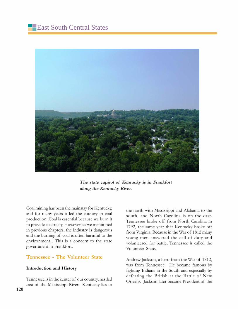
The state capitol of Kentucky is in Frankfortalong the Kentucky River.

leader named Sequoyah had even developed awritten language for the tribe.
East South Central StatesUnited States. Tourists can visit his home named“The Hermitage” near Nashville, Tennessee.
Another Tennessee hero that fought in the Warof 1812 was Davy Crockett. He is alsoremembered as a man who fought and died inthe War against Mexico at the famous Battle ofthe Alamo near San Antonio, Texas.
President Jackson and Davy Crockett wereimportant because they were involved in Indianremoval. Tribes that lived in Tennessee, suchas the Cherokee, were told to move to new landsin the west. You will recall that this forcedremoval is now known as the Trail of Tears. Theremoval of the Cherokee Tribe was especiallysignificant because they had wanted to learn tolive with white people. The noted Cherokee
The Hermitage was Andrew Jackson's homenear Nashville, Tennessee.
Reformed Worldview Perspective:Discuss how Christians should view theremoval of people from their homelandof many generations. Is it right to moveonto land that belongs to others? Shouldwe give the land back to these NativeAmericans?
Land
Tennessee has three grand divisions named EastTennessee, Middle Tennessee, and WestTennessee.
121

East South Central States
East Tennessee is mostly mountainous with theTennessee River running through the middle.Along the eastern border are the Blue RidgeMountains where the famous Great SmokyMountain National Park is located. The park isone of the most popular of all the national parksbecause of the beautiful forested mountains andthe many hiking trails. On the west side of theTennessee River Valley is the CumberlandPlateau, a region with mountains that are not ashigh as the Appalachians.
Middle Tennessee is located west of theCumberland Plateau all the way to the TennesseeRiver as it arches back up north towardKentucky. In this area is the Nashville Basin, alowland with many farms. Surrounding thisbasin is higher land called the Highland Rim.
West Tennessee is the land between theTennessee and Mississippi Rivers. It is part ofthe Gulf Coastal Plain which runs down fromWestern Tennessee along Western Mississippiall the way to the Gulf of Mexico. It’s hard tobelieve that some of the greatest earthquakesin American history happened in this regionalong the Mississippi River in 1811 and 1812.In fact, Reelfoot Lake in western Tennessee was
122
formed when the Mississippi River was naturallydammed by an earthquake during this time.
Farming
Because of the different regions in Tennessee,the farmers there grow three different types ofcrops. Even though eastern Tennessee is mostlymountainous, tobacco farming does occur in thevalley regions, especially in the northeastern areaof the state.
Corn and soybeans are grown in MiddleTennessee. The rich farmland of the NashvilleBasin and other areas here are centers for growthof these crops, especially because there isenough rain to allow crop growth.
West Tennessee is cotton country. During the1800s, steamboats loaded up with bales andbales of cotton in this area. For many years,Memphis, on the Mississippi, was a center forthe distribution of this product. Today, cottonis transported by truck, train, ship, and airplane.Memphis still has a number of companies thatsell cotton throughout the world.
On the left is af l o w e r i n gcotton plant,and the on theright is cottonat harvest.

electricity. It works like this. First, workers builda large dam across a river such as the TennesseeRiver. Second, tubes are built inside the wall ofthe dam so that water can flow throughwhenever the operator of the dam desires.Third, when falling water goes through the tubes,the water turns wheels called turbines. Finally,these turbines create electricity by spinningmagnets past a coil of wire. This hydroelectricpower has made electricity available for manyhomes and in addition has helped the industryof the East South Central States.
Recently, owners of auto manufacturingcompanies have chosen Tennessee as a place todo business. Nissan (another business fromJapan) established its North Americanheadquarters in Franklin, which is just south ofNashville, the capital. Farther south, GeneralMotors has a large auto manufacturing complexin the city of Spring Hill. Although much ofthe factory is not presently used, the residentsare hopeful that the factory will be used againin the near future.
East South Central States
Another significant agricultural industry is theraising of Tennessee walking horses. Thesehorses have been bred through the years to begentle horses for riding.
Economy
Throughout the history of our country,Tennessee has always been a poor state. It wasdevastated by the Civil War. In fact, only thepeople of Virginia saw more battles during thewar than did those who lived in Tennessee duringthis terrible time. Floods on the Tennessee Riveralso have been a constant concern. In addition,many Tennessee residents received electricityin their homes much later than people in otherparts of the country did. During the 1930s,President Franklin D. Roosevelt attempted tohelp the people in Tennessee and neighboringstates by setting up agencies such as theTennessee Valley Authority (TVA). The TVAstill exists today and provides electricity tomillions of residents.
The TVA Dams provide hydroelectric powerby using the falling water from a dam to produce
A Nissan car factory in Tennessee
123

company is a competitor of UPS, which meansthat both companies offer the same services andare constantly trying to get each other’s business.
The city of Knoxville (population 178,874), amajor city in East Tennessee, is the headquartersof the TVA. Its metropolitan area is especiallyknown for the production of aluminum.Chattanooga (population 167,647), the fourthlargest city in Tennessee, is located in the farsoutheastern corner of the state.
East South Central States
Nashville (population 601,222) is a growing citywith a beautiful downtown district along theCumberland River. Home of the “Grand OldOpry”, it has long been known as “Music City,USA” because of the many music recording andpublishing industries found there.
The city of Memphis (population 646,889) islocated on the Mississippi River in thesouthwestern corner of the state. In additionto selling cotton, Memphis is home to the largetransportation company called FedEx. This
124
The sunsphere in Knoxville was constructedfor the world's fair in 1982. The theme of thefair was, "Energy turns the world."

Mississippi - The Magnolia State
Introduction
Mississippi is a southern state with beautifulforests and rich bottomlands along itsnamesake, the mighty Mississippi River.Bottomlands are low-lying lands along a river.This land has long been a source of income forthe people of the state.
However, the state of Mississippi remains thepoorest state in our country when you look atthe per capita income of the residents there.Government officials are especially concernedabout the number of poor people in northwestMississippi, the region known as The Delta. Thepoor economy is caused by various things. Eversince the Civil War, the region has been poor,first, because the Civil War devastated theeconomy of the southern states, and second,because throughout the 1900s the area hadmany floods and other “natural disasters.”Finally, the most important problem of recentyears is that the majority of the workers in theregion do not have the education for jobs in ourmodern world. The workers tend to seek farmjobs, which though plentiful years ago, arebecoming more and more scarce. There are notas many farm jobs because more migrantworkers are doing much of the work and modernmachines are doing what had formerly been doneby hand. The government is very concernedabout the education of the youth of Mississippiand about the poor in the state.
East South Central States
Land
The land of Mississippi is mostly lowland coastalplain, especially along the Mississippi River andthe coast of the Gulf of Mexico. On thenorthwest edge of the state is the MississippiDelta, an alluvial plain, which is low landcovered with deposits of dirt and silt from theriver. The dirt left over is very good for growingcrops. Over the years, the Mississippi River haschanged its course many times. The easternborder of this area is the Yazoo River, whichmany consider to be a former route of theMississippi River. An interesting feature of thisland is an ox-bow lake. This is a crescent or U-shaped lake which once was part of a river. Asthe years pass, large bends from the main stemof a river are cut off when the river changescourse and a lake is formed.
The central and northeastern parts of Mississippihave higher land. Yet, the land of the state doesnot get much higher than 700 feet above sealevel.
Mississippi is a state with much forest land.Especially in the southern part of the state,Spanish moss grows and hangs down from thetrees. This plant is neither Spanish nor a moss,but rather a plant in the pineapple family. TheMagnolia Tree, the state tree of Mississippi, hasbeautiful white flowers that bloom in the spring.A number of regions in the state have pineforests, including the Coastal Pine Meadows,located along the coast of the Gulf of Mexico.
Farming
Mississippi leads the nation in the number oftree farms, because most people live along theGulf or the river, leaving much land availablefor forests which grow rapidly in the southernclimate. Much of the wood from the trees isused for paper production. The pine plantations
Reformed Worldview Perspective: Thepoor in Mississippi receive more moneyfrom our national government perperson than any other state except one.Yet, official government reports statethat Mississippi remains poor, and thatmany people misuse the money.According to Romans 13, what is the dutyof the government? Discuss theChristian’s view of helping the poor. 125

East South Central States
126
provide wood for lumber used in housing, andmany Christmas tree farms are located there.
Cotton has long been and still is very importantto the economy of Mississippi. Much of thecotton is grown in the bottomlands of theMississippi Delta region, along with rice, corn,soybeans, and other crops.
The farmers in the state make most of theirfarming money by selling the meat of broilers(young chickens). Although when travellingthrough Mississippi you first notice the large pinefarms and cotton farms, farmers do raise millionsof chickens which produce meat and eggs inlarge farm buildings, many of which are notnoticeable from the road.
Finally, the state has much aquaculture. Alongthe course of the Mississippi River, large ponds
hold farm-raised catfish which are sold for theirmeat. While you might think that catfish arenot good to eat, many people enjoy eating them,especially the farm-raised fish. Shrimp, a popularseafood delicacy, are also sought by fishermanin the state. As we read in the introduction tothe chapter, shrimp and catfish farmers areconcerned about the impact of the oil pollutionfrom the leak in the Gulf of Mexico thathappened in 2010.
Economy
Mississippi does not have many large cities. Thecapital city of Mississippi, Jackson, has apopulation of 173,514. The next largest city isGulfport (population 67,793), located on thecoast of the Gulf of Mexico.
The state capitol in Jackson, Mississippi

East South Central States
Because Mississippi borders the Gulf of Mexico,an important industry of the state is shipbuildingfor the United States government. The companycalled Northrup Grumman in Pascagoulaemploys a number of residents for this work.The government also runs the Stennis SpaceCenter in southwest Mississippi where rocketengines are tested at large test sites. The workersat this facility are very concerned that they maylose their jobs because the government no longeris going to use the space shuttle. Because theeconomy of the United States was not good inthe years 2008 - 2010, many workers that stillhave jobs worry that they may lose their jobsbecause President Obama, as well as manycitizens in our country, are concerned aboutspending money on rockets. But workers in therocket industry hope that work will continue onthe development of rockets for space travel andexploration. A notable example is work on theAres rockets which NASA believes will be muchsafer and more efficient than the space shuttles.
Many tourists visit Mississippi each year. Thebeaches along the Gulf coast attract manyvisitors. Other tourists go to the cities ofVicksburg and Natchez which have historicalsites that show life during and before the CivilWar. Tourists can also drive the remarkableNatchez Trace, a 444 mile road with nobillboards or traffic lights, which follows an old
trail back to the North through Alabama andTennessee. The trail was used by manyboatmen to get back to the North after they hadfloated on barges down the “Great River” beforethe invention of steam powered boats.
Alabama - The Heart of Dixie
Introduction
The name “Dixie” refers to the southern part ofthe United States. Nobody knows for sure wherethe name came from, but since Alabama is rightin the middle, its nickname is “Heart of Dixie.”Montgomery, the capital of the state, was oncethe capital of the Confederate States. It was onthe steps of this state capitol that JeffersonDavis was inaugurated as the first President ofthe Confederacy.
The Confederacy was formed in 1861 becausethe Southern States wanted to preserve slaveryand they believed that the southern states hadstates’ rights (the belief that powers should begiven to the states to make laws about trade,slavery, and any other things that they believeare left to the states). The election of AbrahamLincoln in 1860, they felt, was a threat to thesegoals. The Civil War took a toll on Alabamabecause many of its young men died in the war.
The Natchez TraceParkway in Mississippi
127

East South Central States
128
Of the 120,000 white men from Alabama whofought in the Civil War, about 30,000 died frombattle wounds or disease! After the war, manychanges took place in the South, and Alabamabecame a center for the civil rights strugglecaused by segregation (separation of whitepeople and African- Americans). A person whofights for civil rights is one who desires that allpeople receive the same treatment under the law,regardless of race or color.
An important person in this struggle wasBooker T. Washington (1856-1915) because hedeveloped the well known Tuskegee University,an African-American University in easternAlabama. Other important people from thisuniversity through the years were GeorgeWashington Carver (whom we’ve studiedbefore) and the Tuskegee Airmen.
While many blacks migrated to northern citiesin the early 1900s for work, many stayed behind.Even though these African-Americans weresupposed to be allowed to vote, white people inthe government stopped them from votingthrough voting laws such as literacy tests (inother words, you had to be able to read to vote).In other instances, the Ku Klux Klan, aninstitution of white men who believe that whitemen are better than people of other races, simplythreatened harm to any black who dared to vote.Throughout the South, blacks had to drink attheir own drinking fountains and had to ride inthe back of the bus. These became known asJim Crow laws. The Tuskegee Airmen,mentioned above, were the first African-American pilots, and they fought withdistinction in World War II in spite of the JimCrow Laws that existed also in the Air Force.
In the 1950s and 1960s, two especiallyimportant civil rights events took place inAlabama. First, a woman named Rosa Parkswas arrested by Montgomery police in 1955because she refused to sit in the back of a city
bus, but rather stayed in the front even whenthe bus driver ordered her to move. Second,Dr. Martin Luther King, Jr., a minister who foughtfor civil rights, led a large group of people in1965 from Selma, Alabama, to Montgomery topetition the governor to allow fair voting. Thegroup was protected by troops sent by PresidentLyndon Johnson. In 1965, he signed a law whichmade it illegal to unfairly block African-American people from voting.
Reformed Worldview Perspective: TheBible says we as Christians should obeythose in authority except when theyrequire us to sin. Then we are called tosubmit and not to rebel. In the light ofthe Civil Rights Movement, discusswhether we as Christians could be a partof the demonstrations and parades. Inyour discussion talk about words suchas submit, rebel, and disobey, inconnection with the Civil RightsMovement and Jim Crow laws.
Land
Alabama’s land is mostly lower than 600 feetabove sea level, except for a few mountainousareas in the northeastern part of the state. Theseare the southern tips of the Cumberland Plateauand the Appalachian Mountains. Flowing fromthese mountains and curving across the northernpart of the state, the Tennessee River provideswater and electricity from the many dams thatthe TVA has built.
The center of the state is a lowland area calledthe Black Belt because of the rich black soil inthe area. The two main rivers that flow throughthis area are the Tombigbee River in the west,and the Alabama River in the center. These tworivers come together to form the Mobile River,which continues to the Gulf Coastal Plain inthe far south. This plain has countless swamps

East South Central States
that contain many different forms of wildlife.In the far southwestern corner is Mobile Bayinto which most of Alabama’s rivers flow.
Farms
As with many other southern states, Alabama’sfarm money comes mostly from raising andselling meat from broilers. The typical familychicken farm in Alabama can have three or fourbroiler chicken houses, each house producing30,000 six-pound chickens every six weeks!Cattle raising is also important, and many youngcattle from Alabama are sold to feed-lots acrossthe United States.
Alabama’s rich Black Belt area is a place wheresoybeans, cotton, and peanuts can be grown.We learned earlier that George WashingtonCarver taught the farmers of the south to plantsoybeans and peanuts to keep the soil rich. Thefarmers still do this by rotating crops, often by
planting cotton in the field one year, and thenext year planting crops such as soybeans orpeanuts in order to put nutrients back into thesoil.
As is true in Mississippi, the Black Belt ofAlabama ranks high in the nation in providinglumber and wood products from the many forestsgrowing there.
Economy
Although the average pay of the people ofAlabama is lower than most people in thecountry, the state does have hope for industryto grow. The city of Huntsville, on the TennesseeRiver, is a center for the production ofequipment for space exploration and travel. Thistown was small until the government built aspace complex, and then the population grewto over 170,000 people.
South of Huntsville is the city of Birmingham.Because this city is near to large iron mines inthe mountains, it has been known as “thePittsburgh of the South.” Even though steelmaking is still important to the area, thedeveloping hospitals in the area are excellentand they offer many jobs. Birmingham has apopulation of 217,237, although many peopleare moving from the city to the suburbs.
Mobile and Mobile Bay
A broiler farm Birmingham, Alabama
129

East South Central States
130
Montgomery (population 205,764), found in thecenter of the state, is the capital where the statebusiness takes place. Far in the southwest nearthe Gulf, is Mobile (mo-beel), which has apopulation of 195,111. This is a port city onMobile Bay which is ranked eleventh in the U.S.in cargo tonnage that passes through the port.Much of the cargo comes down the TombigbeeRiver to Mobile on barges. In the 1980s, the
government built a canal that connected theTennessee River and the Tombigbee River calledThe Tenn-Tom Waterway after both rivers.Most of the barges on this waterway carrylumber, coal, and wood products to the portcities. We have seen that the South has manytree farms. Many of the tree products are carriedon this river system.
The Alabama coast on the Gulf of Mexico