chapter 1 proposed project - solano transportation authority · chapter 1. proposed project final...
TRANSCRIPT
Final Environmental Impact Report/Environmental Impact Statement Interstate 80/Interstate 680/State Route 12 Interchange Project
October 2012 1-1
Chapter 1 Proposed Project
1.1 Introduction
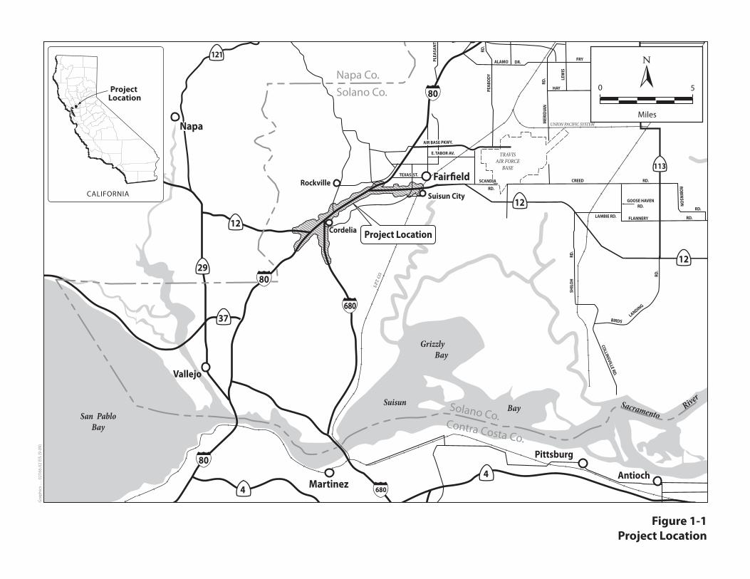
The California Department of Transportation (Department), in cooperation with the Solano Transportation Authority (STA), proposes to improve the Interstate 80 (I-80)/Interstate 680 (I-680)/State Route 12 (SR 12) interchange in the vicinity of the city of Fairfield, Solano County, California. The project area, shown in Figure 1-1, is located along 13 miles of the highways. The temporal and geographic scope of the analysis for each resource area is defined within each resource chapter. The existing I-80/I-680/SR 12 interchange complex was constructed approximately 40 years ago, and current traffic demands result in congestion, delays, and unacceptable levels of service (LOS). The proposed improvements are designed to reduce congestion, accommodate anticipated increases in traffic, and address safety concerns.
The fundable first phase of either alternative of the proposed project is fully funded in the financially constrained Regional Transportation Plan (RTP) Transportation 2035 Plan for the San Francisco Bay Area: Change in Motion (Appendix 1, page 126). The Federal Highway Administration (FHWA) and Federal Transportation Administration (FTA) found the 2009 RTP and the 2009 TIP (Revised) to be in conformity with the SIP on May 29, 2009. The proposed project is also included in the MTC financially constrained 2011 TIP as TIP ID SOL070020. The MTC adopted the 2011 TIP on October 27, 2010, and the FHWA and FTA adopted the 2011 TIP on December 14, 2010. The design concept and scope of the proposed project is consistent with the project description in the 2009 RTP and the 2011 TIP, and the assumptions in the Metropolitan Transportation Commission’s regional emissions analysis.
Table 1-1 presents the proposed funding sources for specific portions for the first phase of either alternative.
Table 1-1. Project Funding Sources (dollars in millions and escalated)
RTP Reference Number
Funding Type and Source Funding Amount
230326 Improve I-80/I-680/SR12 Interchange, including connecting I-680 northbound to Route 12 westbound (Jamieson Canyon), adding connectors and reconstructing local interchanges (Phase 1)
$487.9
22700 Construct Parallel Corridor north of I-80 from Red Top Road to Business Center Drive (portion of funding shown in RTP)
$35.0
230687 I-680/I-80 interchange in Solano County — widen to add an express lane direct connector (portion of funding shown in RTP)
$228.0
Total Funding $750.9
Chapter 1. Proposed Project
Final Environmental Impact Report/Environmental Impact Statement Interstate 80/Interstate 680/State Route 12 Interchange Project
October 2012 1-2
1.2 Purpose and Need
1.2.1 Purpose of the Proposed Project
As described in more detail below, the purpose of the I-80/I-680/SR 12 Interchange Project
(proposed project) is to reduce congestion through the interchange, reduce cut-through traffic on
local roads, encourage the use of high-occupancy vehicle (HOV) lanes and ridesharing, improve
safety conditions, accommodate existing and future traffic volumes on the highways, and
facilitate adequate inspection and enforcement at the I-80 truck scale facilities. The alternatives
presented in this document meet all of the purposes listed below. The fundable first phases of the
alternatives do not include the relocation of the truck scales and therefore, would not address the
purposes specified under 5 and 6 below. However, they would meet the remaining purposes and
would partially meet number 5 by providing congestion relief.
1. Reduce congestion through the I-80/I-680/SR 12 interchange complex: Highway
widening and interchange improvement would accommodate current and future traffic
volumes, including trucks, as well as to reduce congestion and improve travel time reliability
through the I-80/I-680/SR 12 Interchange complex.
2. Reduce the amount of cut-through traffic on local roads: Improvements to the mainline
and highway interchanges would reduce congestion on the highways, thereby making it less
attractive for motorists to use local roads instead of the mainline (as discussed below in
Section 1.3). The proposed project would also improve access to local community resources
and businesses and reduce delays for emergency service vehicles.
3. Encourage the use of HOV lanes and ridesharing: The addition of HOV lane connectors
between I-80 and I-680 and HOV lanes on I-680 would encourage the use of HOV lanes and
thereby encourage ridesharing. Both I-80 and I-680 are part of the planned High Occupancy
Vehicle (HOV) network system (MTC Transportation 2030 Plan for the San Francisco Bay
Area and the MTC Transportation 2035 Plan). Extending limits of HOV lanes increases time
savings for carpool lane users. Similarly express bus routes use HOV lanes to bypass
congestion and provide faster more reliable service.
4. Improve safety conditions: The proposed project would reduce accidents and improve
safety in the I-80, I-680, and SR 12 corridors by relieving congestion through highway
widening and by reducing lane changes over short distances through off- and on-ramp
modifications for interchanges and the relocation of the westbound truck scale.
5. Accommodate current and future truck volumes on highways: The proposed project
would improve the westbound truck scales and access to them from I-80 and SR 12 East (SR
12E). These improvements would accommodate current and future truck volumes on the
mainlines by reducing the number of trucks queuing to exit at the truck scales and by
providing longer on-ramps to allow trucks to gain speed before entering traffic.
6. Facilitate adequate inspection and enforcement at truck scales: The new westbound truck
scale facility would be designed to accommodate anticipated truck traffic growth until at
least 2035, ensuring that all trucks are weighed and inspected according to California
Highway Patrol (CHP) requirements.
Chapter 1. Proposed Project
Final Environmental Impact Report/Environmental Impact Statement Interstate 80/Interstate 680/State Route 12 Interchange Project
October 2012 1-3
1.2.2 Need for the Proposed Project
The I-80/I-680/SR 12 interchange is a point at which two major interstate freeways and one state
highway converge. When it was constructed in the 1960s, the interchange was located in a
relatively rural setting, surrounded by agricultural lands with mountains to the north and the vast
Suisun Marsh to the south.
Since the 1960s, the San Francisco Bay Area and northern California region in general have
experienced rapid population growth. The Bay Area’s population has grown by more than 86%
during this time; Solano County’s population has more than tripled. This tremendous amount of
growth has resulted in substantial increases in regional traffic passing through the interchange
complex area, as well as substantial changes in the immediately surrounding land uses. Societal
and economic trends toward an increased numbers of cars per household, decreased affordability
of housing in the Bay Area, increased distances that people are willing to travel to work, and
increased amounts of discretionary time and income for recreation have also contributed to an
increase in regional traffic.
Eastbound and westbound regional truck scales and inspection facilities are also located within
the I-80/I-680/SR 12 interchange complex. The location of the truck scales within the
interchange complex is ideal for monitoring and enforcing truck weight and safety requirements
because it provides a single location that can monitor truck traffic in both the eastward and
westward directions on I-80, I-680, and SR 12. However, the volume of trucks to be weighed and
inspected has increased dramatically since the 1960s. Trucks must exit the freeway mainline,
then re-enter it after inspection. The exiting and entering of a large number of trucks creates a
severe weaving problem, which is made worse by the size, limited maneuverability, and lower
speeds of large trucks. In response to this issue, STA, in cooperation with the Department and
the CHP, conducted the Cordelia Truck Scales Relocation Study (Solano Transportation
Authority 2005), which was completed in February 2005. The study evaluated alternatives for
relocating and expanding the truck scale facilities and determined that the preferred location for
the expanded truck scale facilities was within the existing interchange complex. The relocation
of the I-80 eastbound Cordelia Truck Scales facility was addressed previously as a separate
project with independent utility. Relocation and expansion of the westbound truck scale facility
are included as part of the proposed project.
The specific deficiencies to be addressed by the proposed project are described below.
Capacity, Transportation Demand and Safety
Traffic Congestion The I-80/I-680/SR 12 interchange is vital to the mobility of both the local area and the entire
northern California region because it serves a multitude of destinations. It is a critical corridor for
local and regional commute travel. During the past ten years, commute travel through the area
has increased substantially in response to the growing Bay Area economy and expansion of
employment centers; these changes have increased housing prices in the Bay Area, pushing
residents farther east in search of affordable housing. By 2030, commute traffic is projected to
constitute between 40% and 75% of the total number of vehicles traveling through the project
area.
Chapter 1. Proposed Project
Final Environmental Impact Report/Environmental Impact Statement Interstate 80/Interstate 680/State Route 12 Interchange Project
October 2012 1-4
The current traffic volumes along segments of I-80 and I-680 in the project area create heavy
traffic congestion. The most congested period occurs during the p.m. peak hour.
During the a.m. peak hour, a queue typically develops on westbound I-80 at the SR 12 West
(SR 12W) connector. This occurs primarily because of trucks that are unable to keep up speed on
the SR 12W grade toward Napa, resulting in slow traffic in the outside lane on I-80. This queue,
combined with trucks entering from the truck scales and weaving vehicles headed to the Suisun
Valley Road off-ramp or southbound I-680 connector, in turn results in slow-moving queues in
the two outermost lanes. The congestion typically extends from the westbound off-ramp from
SR 12W to SR 12E.
During the p.m. peak hour, a bottleneck develops on eastbound I-80 between the Travis
Boulevard on-ramp and the Air Base Parkway off-ramp, resulting in queues that extend back to
the I-80/West Texas Street interchange. The signalized intersections on SR 12E at Beck and
Pennsylvania Avenues also cause some queuing on eastbound SR 12E during the p.m. peak
period.
Currently, the following roadway segments within the project area experience traffic operating
speeds of less than 35 miles per hour (mph) during the peak.
Westbound I-80 (outside lane only) between the I-80/I-680 interchange and SR 12W during
the a.m. peak period.
Westbound I-80 (outside two lanes only) between SR 12E and the Suisun Valley Road off-
ramp during the a.m. peak period.
Northbound I-680 between Central Avenue and I-80 during the p.m. peak period.
Eastbound I-80 between SR 12W and the Cordelia Truck Scales during the p.m. peak period.
Eastbound I-80 between Beck Avenue and Travis Boulevard during the p.m. peak period.
The current average freeway travel speeds through the project area are 46 mph during the a.m.
peak period and 33 mph during the p.m. peak period. These average speeds are well below the
59.7-mph threshold identified in the Highway Capacity Manual as the minimum operating speed
associated with acceptable mainline freeway operations as indicated in the 2009 Traffic
Operation Report prepared for this project. The 2009 Traffic Operations Report indicates that
without the proposed project, travel speeds will drop to 42 mph during the a.m. peak period and
16 mph during the p.m. peak period by 2035. With the freeway system operating at or near
capacity, the duration of congestion would increase from 1–2 hours in the a.m. peak period to
3–4 hours. In the p.m. peak period, the duration of congestion would increase from 1.5 to 2.5
hours to 6–7 hours.
Traffic Diverting to Local Roads The congestion and delays experienced on the freeway system encourage some motorists to exit
the freeways at interchanges within the I-80/I-680/SR 12 interchange complex and use local
surface streets in the vicinity to bypass the congestion on the freeway mainlines. Most notable is
the amount of traffic using surface streets to bypass the congestion experienced at the transition
from northbound I-680 to eastbound I-80. This segment operates poorly during the p.m. peak
Chapter 1. Proposed Project
Final Environmental Impact Report/Environmental Impact Statement Interstate 80/Interstate 680/State Route 12 Interchange Project
October 2012 1-5
period, particularly on Fridays, when long queues develop between the I-80/I-680 interchange
and the I-680/Gold Hill Road interchange. This diversion will increase substantially by 2035
without the proposed project because freeway travel times system-wide are projected to increase
by up to 300% in the p.m. peak hour.
The three primary diversion routes on surface streets are:
Central Way to Pittman Road.
Gold Hill Road to Ramsey Road to Cordelia Road.
Gold Hill Road to Lopes Road to Cordelia Road.
It is estimated in the Traffic Operations Report that up to 1,450 vehicles in the p.m. peak hour
currently divert from the northbound I-680 to eastbound I-80 connector to alternate routes and
re-enter eastbound I-80 or eastbound SR 12 at locations east of the bottleneck location
(Abernathy Road, Chadbourne Road, or Beck Avenue). This cut-through traffic creates a series
of problems along the local street system:
Increased congestion and delays on local roads: Several local street intersections are
currently operating at unacceptable levels of service (as defined in the 2009 Traffic
Operations Report) because of drivers choosing local roads over the freeway system,
including Ramsey Road/Bridgeport Avenue, Lopes Road/I-680 ramp/I-80 ramp, Pittman
Road/Central Way, and Rockville Road/Suisun Valley Road. Several other diversion routes
are anticipated to be used by 2035 without the proposed project, resulting in unacceptable
operations at several locations along local streets such as Business Center Drive and the
planned North Connector roadway that will parallel I-80 along its north side.
Reduced accessibility for local properties: The increased volume of traffic and congestion
on local roadways results in reduced accessibility for adjacent properties. These properties
include important community resources, such as Solano Community College, Rodriguez
High School, and Fairfield Fire Department Station 5.
The surface streets in the vicinity of the interchange project area serve as transit and emergency
vehicle routes for area neighborhoods. Fairfield and Suisun Transit operate ten routes, including
Routes 7 (Cordelia Villages) and 3 (Outer Fairfield Loop), which use surface streets in the
project vicinity. Traffic diverted to local roadways from I-680 and I-80 during peak commute
times creates more traffic on these local streets which can affect emergency vehicle response
times and impedes transit service for area residents and businesses.
Also, within the project area, several interchanges provide access to local businesses and land
uses, including I-680/Gold Hill Road; I-80 at Red Top, Green Valley, Suisun Valley, and
Abernathy Roads; and SR 12/Chadbourne Road. Currently, congestion on I-80 and I-680 results
in queues on several on- and off-ramps that provide local access.
In the a.m. peak period, the following ramps are congested:
Green Valley Road on-ramp to westbound I-80.
Suisun Valley Road off-ramp from westbound I-80.
Chapter 1. Proposed Project
Final Environmental Impact Report/Environmental Impact Statement Interstate 80/Interstate 680/State Route 12 Interchange Project
October 2012 1-6
In the evening peak period, the following ramps are congested.
Green Valley Road off-ramp from eastbound I-80.
Central Way off-ramp from northbound I-680.
Suisun Valley Road on- and off-ramps to and from eastbound I-80.
Travis Boulevard on-ramp to eastbound I-80.
Air Base Parkway off-ramp from eastbound I-80.
In the future, as congestion worsens on I-80 and I-680, additional on- and off-ramps are
projected to have significant queues or delays, including the Red Top Road on- and off-ramps to
and from eastbound I-80 and the Gold Hill Road on- and off-ramps to and from northbound
I-680.
Truck-Related Congestion The Cordelia Truck Scales (known formally as the Cordelia Commercial Vehicle Enforcement
Facility), located on I-80 between Suisun Valley Road and SR 12E, were built in 1958. There are
two truck scale facilities located within the I-80/I-680/SR 12 interchange complex: one serving
the eastbound direction and one serving the westbound direction. Only the facility serving
westbound truck traffic is addressed as part of the proposed project; the relocation and
replacement of the eastbound facility was addressed in a previous project.
Although the truck scales are currently in an optimal location to capture virtually all truck traffic
traveling on I-80, I-680, and SR 12, they also are located along the most congested freeway
segment in Solano County. Trucks slowing to enter the short (approximately 500-foot) off-ramp
to the westbound truck scales, trucks queuing onto the mainline from the short off-ramp to the
facility, and trucks accelerating to enter I-80 on the short on-ramp from the scales exacerbate the
congestion problem. The I-80/I-680/I-780 Major Investment Study/Corridor Study, Segment 1:
I-80/I-680/SR 12 Tier 2 Evaluation Report (MIS) (Solano Transportation Authority 2004) states
that the truck scales cause substantial congestion within this segment of I-80 because of truck
weaving and backup on the mainline facility. The location of the current truck scale facilities
also constrains the widening of I-80 in this segment, requiring that the facilities be relocated
before additional improvements are pursued along this section of I-80.
Currently, congestion develops on I-80 during the commute peak hours because of trucks
weaving with traffic streams to and from the I-680 connector ramps, the Suisun Valley
Road/Green Valley Road ramps, and the SR 12E and SR 12W connector ramps. This congestion
will continue to compound by 2035. The a.m. peak-hour congestion in the westbound direction
extends nearly 4.5 miles, from the I-80/I-680 junction to West Texas Street. Heavy westbound
on-ramp volumes from the I-80/SR 12E and Air Base Parkway interchanges also contribute to
the congestion during the a.m. peak period.
Although the current combination of general vehicle traffic and truck volumes creates
congestion, the I-80 mainline traffic volume is projected to increase by about 2% per year, to
270,000 daily vehicles in 2035. Along with the truck traffic increase described above, the traffic
increases will exacerbate current congestion if the westbound truck scales are not expanded to
Chapter 1. Proposed Project
Final Environmental Impact Report/Environmental Impact Statement Interstate 80/Interstate 680/State Route 12 Interchange Project
October 2012 1-7
accommodate higher truck volumes and moved to a location that provides for maximum weaving
lengths and for braiding of critical traffic streams.
Unreliable Freight Transport Currently, travel times for truck trips through the corridor are unpredictable because of the
queues that develop in the vicinity of the truck scale facility and congestion that is caused
partially by trucks maneuvering into and out of the truck scale facility, as described above.
This unpredictability will increase as general vehicle and truck volumes grow, as described
above.
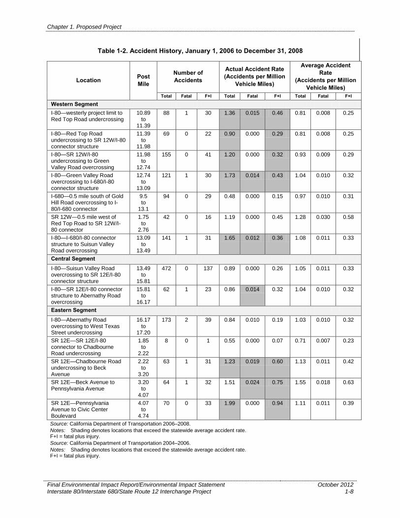
Traffic Safety The Department maintains statistics for all State highway facilities for three types of accident
rates: the total accident rate, accidents involving fatalities and accidents involving fatalities or
injuries. Within the project limits most freeway segments of I-80 experience a higher total
accident rate and higher fatal or injury accident rate compared to the average statewide rate for
similar types of facilities (Table 1-2). Half of the segments experience a higher than average fatal
accident rate than the average statewide rate. Within the project limits of SR-12 East half of the
sections experience higher than average total and fatal accident rates compared to the average
statewide rate for similar types of facilities and most sections experience a higher than average
accident rate for fatal plus injury accidents compared to the average statewide rate for similar
facilities.
In reviewing the accident summary records 65% of the accidents occurred on I-80 during
commute periods, with over 50% of the accidents being rear-end collisions. On SR 12 East over
50% of the accidents occurred during the commute periods, with over 60% of the accidents being
rear-end collisions. On SR 12 West 70% of the accidents occurred during the commute periods,
with 48% of the accidents being rear-end collisions. This combination of high accident rates
during commute periods and a high percentage of rear-end type collisions is likely related to the
congestion observed in these sections.
The effect of slow moving trucks decelerating into, or accelerating out of, the westbound truck
scales combined with already congested lanes is described in Section 3.1.6-6, and in the 2009
Traffic Operations Report. Increased vehicle traffic, and in particular increased truck volumes,
will exacerbate the accident rate based on the general correlation between increased volumes and
congestion and increased accident rates.
The proposed improvements will reduce current and projected congestion as well as braid
several congested weave movements. Therefore, it is anticipated that construction of the
proposed improvements will result in accident rates dropping to, or below, the statewide average
for similar facilities.
Chapter 1. Proposed Project
Final Environmental Impact Report/Environmental Impact Statement Interstate 80/Interstate 680/State Route 12 Interchange Project
October 2012 1-8
Table 1-2. Accident History, January 1, 2006 to December 31, 2008
Location Post
Mile
Number of
Accidents
Actual Accident Rate
(Accidents per Million
Vehicle Miles)
Average Accident
Rate
(Accidents per Million
Vehicle Miles)
Total Fatal F+I Total Fatal F+I Total Fatal F+I
Western Segment
I-80—westerly project limit to Red Top Road undercrossing
10.89 to
11.39
88 1 30 1.36 0.015 0.46 0.81 0.008 0.25
I-80—Red Top Road undercrossing to SR 12W/I-80 connector structure
11.39 to
11.98
69 0 22 0.90 0.000 0.29 0.81 0.008 0.25
I-80—SR 12W/I-80 undercrossing to Green Valley Road overcrossing
11.98 to
12.74
155 0 41 1.20 0.000 0.32 0.93 0.009 0.29
I-80—Green Valley Road overcrossing to I-680/I-80 connector structure
12.74 to
13.09
121 1 30 1.73 0.014 0.43 1.04 0.010 0.32
I-680—0.5 mile south of Gold Hill Road overcrossing to I-80/I-680 connector
9.5 to
13.1
94 0 29 0.48 0.000 0.15 0.97 0.010 0.31
SR 12W—0.5 mile west of Red Top Road to SR 12W/I-80 connector
1.75 to
2.76
42 0 16 1.19 0.000 0.45 1.28 0.030 0.58
I-80—I-680/I-80 connector structure to Suisun Valley Road overcrossing
13.09 to
13.49
141 1 31 1.65 0.012 0.36 1.08 0.011 0.33
Central Segment
I-80—Suisun Valley Road overcrossing to SR 12E/I-80 connector structure
13.49 to
15.81
472 0 137 0.89 0.000 0.26 1.05 0.011 0.33
I-80—SR 12E/I-80 connector structure to Abernathy Road overcrossing
15.81 to
16.17
62 1 23 0.86 0.014 0.32 1.04 0.010 0.32
Eastern Segment
I-80—Abernathy Road overcrossing to West Texas Street undercrossing
16.17 to
17.20
173 2 39 0.84 0.010 0.19 1.03 0.010 0.32
SR 12E—SR 12E/I-80 connector to Chadbourne Road undercrossing
1.85 to
2.22
8 0 1 0.55 0.000 0.07 0.71 0.007 0.23
SR 12E—Chadbourne Road undercrossing to Beck Avenue
2.22 to
3.20
63 1 31 1.23 0.019 0.60 1.13 0.011 0.42
SR 12E—Beck Avenue to Pennsylvania Avenue
3.20 to
4.07
64 1 32 1.51 0.024 0.75 1.55 0.018 0.63
SR 12E—Pennsylvania Avenue to Civic Center Boulevard
4.07 to
4.74
70 0 33 1.99 0.000 0.94 1.11 0.011 0.39
Source: California Department of Transportation 2006–2008.
Notes: Shading denotes locations that exceed the statewide average accident rate. F+I = fatal plus injury.
Source: California Department of Transportation 2004–2006.
Notes: Shading denotes locations that exceed the statewide average accident rate. F+I = fatal plus injury.
Chapter 1. Proposed Project
Final Environmental Impact Report/Environmental Impact Statement Interstate 80/Interstate 680/State Route 12 Interchange Project
October 2012 1-9
Logical Termini and Independent Utility In its memorandum titled The Development of Logical Project Termini, the Federal Highway
Administration provides guidance that establishes the logical termini (end points) and
independent utility of a particular proposed project (Federal Highway Administration November
5, 1993). The proposed project must satisfy an identified need (e.g., safety, rehabilitation,
economic development, or capacity improvements) and should be considered in the context of
the local area (e.g., socioeconomics, topography, future travel demand, and other infrastructure
improvements in the area). The U.S. Department of Transportation (USDOT)/FHWA regulations
identify three general principles used in demonstrating a proposed project’s logical termini and
independent utility (23 Code of Federal Regulations [CFR] 771.111[f]). To ensure meaningful
evaluation of alternatives and to avoid commitments to transportation improvements before they
are evaluated fully, the proposed project must meet the following criteria.
Connect logical termini and be of sufficient length to address environmental matters on
a broad scope: In The Development of Logical Project Termini, logical termini for project
development are defined as: 1) rational end points for a transportation improvement, and
2) rational end points for a review of the environmental impacts. The environmental impact
review frequently covers a broader geographic area than the strict limits of the transportation
improvements. In the past, the most common termini have been points of major traffic
generation, especially intersecting roadways. This is because, in most cases, traffic
generators determine the size and type of facility being proposed. Choosing a corridor of
sufficient length to evaluate all impacts need not preclude staged construction. Construction
may be “staged,” or programmed for shorter sections or discrete construction elements as
funding permits.
Have independent utility or significance: A project that is independent must be usable and
must be a reasonable expenditure, even if no additional transportation improvements in the
area are made. A project is considered “independent” when it can function, or operate, on its
own, without further construction of an adjoining segment. The project must serve a
significant purpose even if a second, related project is not built.
Not restrict consideration of alternatives for other reasonably foreseeable
transportation improvements: A project must not preclude the opportunity to consider
alternatives for a future, related transportation improvement. Project termini must be selected
to prevent a highway improvement from “forcing” further improvements that may have
negative consequences not addressed in environmental studies.
The proposed project meets these criteria, as described here.
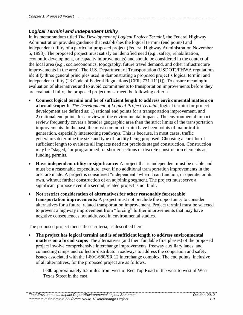
The project has logical termini and is of sufficient length to address environmental
matters on a broad scope: The alternatives (and their fundable first phases) of the proposed
project involve comprehensive interchange improvements, freeway auxiliary lanes, and
connecting ramps and collector-distributor roadways to address the congestion and safety
issues associated with the I-80/I-680/SR 12 interchange complex. The end points, inclusive
of all alternatives, for the proposed project are as follows.
– I-80: approximately 6.2 miles from west of Red Top Road in the west to west of West
Texas Street in the east.
Chapter 1. Proposed Project
Final Environmental Impact Report/Environmental Impact Statement Interstate 80/Interstate 680/State Route 12 Interchange Project
October 2012 1-10
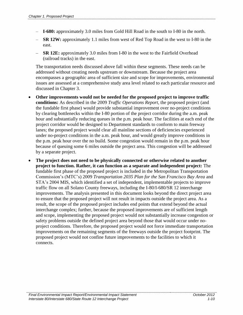
– I-680: approximately 3.0 miles from Gold Hill Road in the south to I-80 in the north.
– SR 12W: approximately 1.1 miles from west of Red Top Road in the west to I-80 in the
east.
– SR 12E: approximately 3.0 miles from I-80 in the west to the Fairfield Overhead
(railroad tracks) in the east.
The transportation needs discussed above fall within these segments. These needs can be
addressed without creating needs upstream or downstream. Because the project area
encompasses a geographic area of sufficient size and scope for improvements, environmental
issues are assessed at a comprehensive study area level related to each particular resource and
discussed in Chapter 3.
Other improvements would not be needed for the proposed project to improve traffic
conditions: As described in the 2009 Traffic Operations Report, the proposed project (and
the fundable first phase) would provide substantial improvement over no-project conditions
by clearing bottlenecks within the I-80 portion of the project corridor during the a.m. peak
hour and substantially reducing queues in the p.m. peak hour. The facilities at each end of the
project corridor would be designed to Department standards to conform to main freeway
lanes; the proposed project would clear all mainline sections of deficiencies experienced
under no-project conditions in the a.m. peak hour, and would greatly improve conditions in
the p.m. peak hour over the no build. Some congestion would remain in the p.m. peak hour
because of queuing some 6 miles outside the project area. This congestion will be addressed
by a separate project.
The project does not need to be physically connected or otherwise related to another
project to function. Rather, it can function as a separate and independent project: The
fundable first phase of the proposed project is included in the Metropolitan Transportation
Commission’s (MTC’s) 2009 Transportation 2035 Plan for the San Francisco Bay Area and
STA’s 2004 MIS, which identified a set of independent, implementable projects to improve
traffic flow on all Solano County freeways, including the I-80/I-680/SR 12 interchange
improvements. The analysis presented in this document looks beyond the direct project area
to ensure that the proposed project will not result in impacts outside the project area. As a
result, the scope of the proposed project includes end points that extend beyond the actual
interchange complex; further, because the proposed improvements are of sufficient length
and scope, implementing the proposed project would not substantially increase congestion or
safety problems outside the defined project area beyond those that would occur under no-
project conditions. Therefore, the proposed project would not force immediate transportation
improvements on the remaining segments of the freeways outside the project footprint. The
proposed project would not confine future improvements to the facilities to which it
connects.
4
4
12
12
113
113
80
80
80
80
505
680
Vacaville
Pittsburg
Dixon
Grizzly Bay
Lake Berryessa
San PabloBay
Suisun Bay
Rio Vista
TRAVISAIR FORCE
BASE
CREED RD.
LAMBIE RD. RD.
RD.
FLANNERY
GOOSE HAVENRD.
SCANDIA
RD.
UNION PACIFIC SYSTEM
SACRAM
ENTO
NORT
HERN RAILR
OAD
S.P.T.
CO.
S.P.T.
CO.
TEXAS ST.
MER
IDIA
N
PEAB
ODY LE
WIS
RD.
RD.
RD.
HAY
FRYALAMO
RD.
RD.DR.
RD.
RD.
RD.
RD.
RD.HAWKINS
BINGHÅMTON
SWAN
DELHI
RD. 155
MIDWAY
DIXON AV.
PLEA
SAN
TS
VALL
EY
RD.
SIKE
S
BULK
LEY
LIB.
ISL.
RD.
ROBIN
SON
AIRPORT RD.
SHIL
OH
RD.
BIRDSLANDING
RD.
COLLINSVILLE RD.
Vacaville
Winters
Martinez
37
29
29
12
121
128
Vallejo
Antioch
680
AIR BASE PKWY.AIR BASE PKWY.
E. TABOR AV.E. TABOR AV.
toSacramento
NapaNapa
SacramentoRiver
toSacramento
Solano Co.Napa Co.
Solano Co.Yolo Co.
Contra Costa Co.
Solano Co.
Fair�eldFair�eld
Suisun CitySuisun CitySuisun City
Cordelia
Rockville
Project Location
CALIFORNIA
Figure 1-1Project Location
Project Location
0
Miles
5
Gra
phic
s … 0
2166
.02
EIS
(9-0
9)

This page intentionally left blank.