channel cross-section analysis in alhambra creek …...channel cross-section analysis in alhambra...
TRANSCRIPT

Channel Cross-Section Analysis in Alhambra Creek
Maureen C. Mason
Abstract Land use in the Alhambra Creek Watershed, located in Contra Costa County, California, has changed over the past 50 years in some areas from cropland and rangeland to residential subdivisions and urban development. The effects of urbanization on watershed hydrology and stream geomorphology have been extensively explored. Streams in urban watersheds tend to increase in cross-sectional area, as changes in runoff-generating mechanisms result in larger peak flows than in non-urban watersheds. These geomorphic changes can have serious detrimental effects on both the quality of aquatic habitat and the stability of infrastructure and bridges. This study investigates historical channel changes in Alhambra Creek, focusing on the question of whether or not channel incision and expansion has occurred due to hydrologic changes since the 1950s. To answer this question, I resurveyed ten channel cross-sections and compared them to 1955, 1962, and 1971 cross-sections. I found that minor channel changes have occurred, including both local channel expansion and contraction. Due to the prevalence of bank revetment in my study reaches, it is difficult to determine if the observed changes in the past 30 to 50 years are a result of changes in hydrologic processes, recent and past efforts to stabilize the channel, or a combination of these factors. Surveying limitations and small sample size also affected the statistical strength of my results. Based on my understanding of the available current and historical cross-section data, I conclude that the Alhambra Creek channel morphology is generally stable, excluding local erosion problems exacerbated by in-stream structures.

Introduction
Urbanization and land development can have a variety of effects on watershed hydrology and
stream geomorphology. Urbanization increases drainage density by replacing natural runoff
routes with impermeable surfaces, streets, and stormwater drains. The more efficient drainage
systems in urbanized watersheds result in an altered runoff regime with shorter lag times and
higher peak discharges than in non-urban watersheds (Dunne and Leopold 1978). The increased
frequency and magnitude of discharges in urbanized watersheds can cause channel enlargement
over a wide range of temporal and spatial scales (Hammer 1972). Channel enlargement can
occur through quasi-equilibrium expansion, where increases in discharge yield approximately
proportional increases in channel width and depth. Channel enlargement can also occur through
incision, or rapid channel deepening disproportional to the increase in discharge (Booth 1990).
Channel incision is a common geomorphic response to increased peak runoff and sediment
yields initiated by intense landscape disturbance; incision enables the channel to transport
increased sediment load by increasing flow velocities and channel gradient (SFEI 2001).
Channel incision can lead to severe ecological and economic consequences. The floodplains
of incised channels are flooded much less frequently than are floodplains of non-incised
channels. Following incision, larger and larger flows are contained in the deepened channel, and
more and more excess hydraulic energy erodes the channel bed and banks, leading to channel
widening. This positive feedback mechanism prevents recovery of the pre-incised channel form.
Incised channels rarely re-occupy their pre-incision floodplain. This reduction in overbank flows
can disturb nutrient transport between the channel and the floodplain, adversely affecting
riparian plant and benthic macro-invertebrate communities (Shields et al. 1994). Sediment
produced from bank failures in incised river systems can affect local and downstream water
quality (Ward and Stanford 1995, Thorne 1999). Incision can also have economic effects. Bank
erosion and slumping can undermine bridges and other structures and threaten homes, creating
an expensive maintenance problem for local government and creek-side property owners.
Watershed History The Alhambra Creek Watershed (Figure 1), in Contra Costa County,
California, like many other San Francisco Bay Area watersheds, has experienced intense
anthropogenic disturbances in the past few centuries. Cattle grazing was the predominant land
use in the watershed during the early 1800’s following the establishment of Mexican Land
Grants (Alhambra Creek WPG 2001). After the City of Martinez incorporated in 1849,

agriculture in the watershed increased in the form of fruit and nut orchards (Holman and
Associates 1999). Following the Industrial Revolution, technology-based infrastructure
improvements allowed the expansion of residential development beyond the city limits. By the
1920’s, industrial, commercial, and residential development had spread south to what is now
Highway 4, and by the 1960’s, housing had extended into Alhambra Valley (Alhambra Creek
WPG 2001).
Project Goals In order to manage the Alhambra Creek Watershed for its ecological,
aesthetic, and economic resources, an understanding of geomorphic processes is necessary.
Geomorphological assessments are important for the design and evaluation of successful stream
restoration projects (Sear et al. 1998, Kondolf 2000a). Several projects are currently being
planned for different locations in the Alhambra Creek Watershed. These projects involve
potential realignment of the stream channel, reconstruction of channel terraces, and removal of
failing bank revetment. The Urban Creeks Council (UCC) is planning a restoration project for
Alhambra Creek along the Martinez Adult Education Campus. In order to produce an
appropriate creek bank design, UCC plans to review hydrologic reports and historical data, and
conduct field data collection (Igor Skaredoff, pers. comm.). As the consequences of failure
Figure 1. Alhambra Creek Watershed

could be severe, an understanding of the geomorphic history and setting of the watershed is
crucial for the proper design of this and other projects.
I hypothesize that urbanization has led to channel incision and widening in Alhambra Creek
in the past 50 years. The goal of my research is to identify if channel incision, as described
above, or other changes in stream geomorphology have occurred because of changes in land use
in the Alhambra Creek Watershed. In this paper, I will apply the method of resurveying
historical cross-sections, a tool of historical channel analysis that is used commonly for
geomorphic watershed assessment. I will measure channel incision in Alhambra Creek by
comparing historical survey data to resurveyed, current channel conditions. Using these channel
morphology data, I will then explain the significance of my findings, and make
recommendations for future studies.
Watershed Characteristics Alhambra Creek drains 16.5 mi2 in northern Contra Costa
County, California, and flows through the City of Martinez before entering the Carquinez Straits.
Flowing north from its source in the Briones Hills at 1,100 feet, Alhambra Creek is joined from
the west by Arroyo del Hambre, which drains 2.5 mi2 of upper Vaca Canyon and Alhambra
Valley, and by Franklin Creek, which drains 5.0 mi2 and traverses Franklin Canyon from the
west. All of the streams in the watershed are intermittent, with flows proportional to seasonal
precipitation (USDA, 1997). Rolling hills and small valleys comprise the basin topography with
elevations ranging from sea level to 1500 feet. The basin geology consists mainly of sandstones
and shales (Haydon, 1995). The regional climate is Mediterranean, with warm dry summers and
mild wet winters. Average annual precipitation ranges from 18 to 22 inches, with 90 percent of
rainfall occurring between November and April (USDA, 1997).
Methods
Historical Channel Analysis Historical channel analysis refers to the use of a variety of
methods to document prior geomorphological conditions and changes in those conditions over
time. Depending on the type of historical data available, the level of precision desired, and the
purpose of the analysis, a wide variety of methods may be applied. Lawler (1993), Kondolf
(1995), and Trimble (1998) provide useful reviews of some of these methods. This research
project focused on the use of resurveyed cross-sections as a primary method of historical channel
analysis. Measuring the magnitude and direction of channel change through repeated cross-
section surveys can help predict future channel stability. In the context of this research project,
my use of historical cross-section survey data requires making two assumptions. First, any
channel changes identified are greater than the error limits of the methods used to detect them.
Lawler (1993) recommended meticulously resurveying each cross-section multiple times in order
to detect these error limits; however this level of precision was not feasible given the time
limitations for this project. Second, resurveyed cross-sections are at the exact location and angle
across the stream as the historical cross-sections. Lawler (1993) stated that in order to ensure the
exact reproducibility of measurement, the cross-section ends should be permanently
monumented by stakes set back approximately one channel width from the bank-top.
Historical Survey Data Collection In order to obtain information on historical creek cross-
sections, I searched the holdings of the UC Berkeley libraries for historical maps, survey notes,
and elevation data for Alhambra Creek. I interviewed staff of the Contra Costa County
Historical Society and the Martinez Museum for relevant historical survey information. I also
interviewed staff of the Contra Costa County Public Works Department, Flood Control Division,
and the City of Martinez Engineering Department and reviewed selected file information in these
offices. Several streamside property owners were interviewed about the particular issues
associated with their local reach, including if any studies or reports existed for that reach.
Historical Survey Data Extraction and Analysis In some historical documents, cross-
sections were graphical plots, but in other historical documents the survey data were only
presented in plan view. In these documents, the decimal points of the elevations were
consistently listed in a straight row across the stream channel. In the absence of actual field
notes, I assumed that this alignment was an intentional indication of the horizontal position of the
sighting for each elevation. I inferred the width of the stream channel, as well as the distance
between different elevations, from the placement of the decimal point in the elevations listed.
This allowed me to create graphical plots that showed cross-section width and depth.
Once the cross-section data were extracted from historical survey documents, they were
numbered, tabulated, and plotted in Excel. Channel width was defined as the horizontal distance
from left bank top to right bank top, and channel depth was defined as the difference in elevation
between right or left bank top (whichever was highest) and the channel thalweg (defined as the
deepest point in the channel). Longitudinal profiles were also plotted from historical documents
based on the channel length between thalweg elevation measurements. These distances were

usually consistent with the stationing on the documents, but were verified with a calibrated map
wheel. I also plotted a longitudinal profile for Alhambra Creek from the USGS 1:24000 map
series (Briones Valley, Benicia, Vine Hill, and Walnut Creek quadrangles) using a map wheel to
trace the creek length and read off elevations. The USGS longitudinal profile was used to verify
channel thalweg elevations from the reach survey data. I also measured the sinuosity of the
creek for each reach. This was done by measuring the length of the channel over the reach (with
a map wheel) and dividing by the length of the valley as described by Gordon et al. (1992).
Longitudinal profiles were fitted with linear regressions in Excel to calculate the slope of each
reach.
Field Surveys Based on the historical survey data that was gathered, two reaches were
identified where historical cross-sections could be resurveyed. Reach 1 extends from the
northern end of Wanda Way approximately 4500 feet north to the western end of Phyllis Terrace.
Reach 2 extends from Tahoe Drive approximately 1600 feet north to Pleasant Hill Road East.
Figure 2 denotes the location of historical cross-sections for each reach, as well as resurveyed
historical cross-sections. An initial reconnaissance of these study sites was conducted to contact
property owners and identify historical survey locations. Field data were collected during
October 2001 and March 2002 for the 11 cross-sections. I selected the most complete cross-
sections represented by the historical data; specifically, those that contained at least five
elevation points.
Cross-sections were identified in the field based on distance from known locations (e.g.
corners of buildings and property lines). Smeltzer et al. (2000) identified lateral control, or the
ability to confirm a cross-section’s exact location, as one of the key limitations in accurately
resurveying historical cross-sections, and recommended field reconnaissance to verify the
accuracy of surveyed benchmarks before actually resurveying the site. In the absence of absolute
benchmarks, I used my best judgment to identify the approximate location of the cross-section,
based upon channel configuration, property boundaries, and distance from houses and other
structures. Some cross-section sites were inaccessible due to either the presence of heavy in-
stream vegetation or the lack of a solid bank for positioning the level. Along with 2-3 field
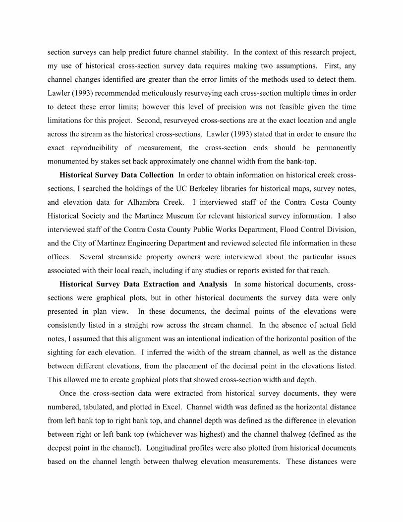
helpers, I surveyed the channel cross-section at each site with a Topcon transit level, stadia rod,
and measuring tape, using survey methods as described by Kondolf (2000b). Channel elevations
were measured at the top of bank, water surface, thalweg, and at any significant slope breaks. At

each cross-section, field sheets were completed with data on channel morphology (surveyed
Figure 2. Reach-scale map showing historical cross-sections and resurveyed historical cross-sections
11
1
6 5 4
3
2
7
8
10 9

elevations), vegetation (in-stream and bank species, as well as canopy cover), bed substrate
(average grain size and appearance), bank composition (natural or revetted), and approximate
bank slope. Photographs were taken at each site, noting the location of the survey tape and level.
The primary goal of my study was to measure changes in channel form by comparing
resurveyed cross-sections with historical cross-sections. Specifically, I assessed changes in
channel width and depth since the historical cross-sections were surveyed, because these changes
can indicate rates of channel incision and widening. Survey elevation data was plotted in
Microsoft Excel© for comparing with historical cross-section data, using either the top of left
bank or the top of right bank as a reference point for comparison, depending on the curvature of
the channel and perceived stability of bank elevation. In order to quantify channel form for
statistical analysis, I calculated channel widths and depths as was done for the historical cross-
section data.
Statistical Analysis I chose the oldest historical data available for each cross-section, and
then grouped the data into two categories: past (1955, 1962, or 1971) and present (2001 or 2002).
For cross-sections 7 and 10, data were available from both 1955 and 1962. However, I chose to
use the older data (from 1955) for my statistical comparison. I used JMP (a SAS Institute Inc.
statistical software package) to plot the distributions of past and present channel dimensions. I
then calculated the change in width and depth for each of the 10 cross-sections. I performed a
Wilcoxon signed-rank test, which is a nonparametric analogue to the paired-sample t-test, to
compare past and present channel dimensions. This nonparametric test is more applicable than
the paired-sample t-test because the cross-section dimension data are not normally distributed.
Results
Historical Survey Data Table 1 lists and describes historical survey documents that
provided direct information for the 2 reaches (11 cross-sections) in this investigation. Historical
cross-sections on as-built bridge documents were also uncovered during this data collection
effort. However, as these bridges are located near the mouth of Alhambra Creek, I excluded
them from my field surveys as they would not be expected to show evidence of incision. As a
result of the gradient of the creek at these bridge locations, aggradation would most likely be
observed. In addition, several of the bridges were located near a recent flood control project in
downtown Martinez, where dredging and channel modifications have taken place recently.

Based on these factors, I excluded the bridge cross-sections from my field surveys, and focused
on the historical data sets that were more extensive. Appendix I contains the results of my
historical data collection efforts, and includes references for historical maps, photographs, and
reports on the Alhambra Creek Watershed, in addition to other sources of channel survey data. Document
No. Title Author Date Description Cross-
sections Scale Reach
no. 1 Alhambra Creek topography from
1000’ downstream of Alhambra Ave, upstream to Wanda Way.
F.B.R. May 1971 Plan view survey. No. R-423.
39 1” = 50’ 1
2 Alhambra Creek topography with contours from 1000’ downstream of Alhambra Ave, upstream to Wanda Way.
F.B.R. May 1971 Plan view survey with predicted flood elevations. No. R-424.
Benchmarks for April & May
surveys
1” = 50’ 1
3 Alhambra Creek from 1000’ downstream of Alhambra Ave, upstream to Sheridan Road.
F.B.R. April 1971 Plotted cross sections, 4 sheets. Nos. S-319-322.
39 1” = 10’ 1
4 Alhambra Creek from Pleasant Hill Rd. upstream 1200’.
H.E.C. June 15, 1955
Plan view survey. No. FC-5-8009-D, FD22.
25 1” = 50’ 2
5 Alhambra Creek from Pleasant Hill Rd. upstream 1600’.
J.T.F. April 1962 Plan view survey. No. FD-1513.
20 1” = 50’ 2
Table 1. Historical Survey Documents (scale: 1” = 50’) All documents obtained from Contra Costa County Flood Control and Water Conservation Department.
Reach Descriptions Reaches 1 and 2 are underlain by younger alluvium (Haydon, 1995).
The drainage area upstream of Reaches 1 and 2 is approximately 9 square miles, slightly more
than half the total Alhambra Creek watershed drainage area. Reach 1 had a greater sinuosity
(2.160) than Reach 2 (1.170) (see Table 2). Several tight meander bends were observed in Reach
1, with necks narrower than the meander points. The channel form is that of a typically
“incised” channel, with steep banks (slopes between 60 and 90 degrees) and a channel bed well
below the floodplain. The slope of Reach 1 is 0.0073, and the slope of Reach 2 is 0.0056. The
surrounding land use is residential, with many houses and structures very close to the creek. Reach Channel
(thalweg) distance (feet)
Downvalley distance (feet)
Sinuosity Index= Channel (thalweg) distance/ Downvalley distance
1 4535 2100 2.160 2 1229 1050 1.170
Table 2. Reach sinuosity Riparian vegetation throughout these reaches consists mainly of oak trees (Quercus sp.),
California buckeye (Aesculus californica), and California bay (Umbellularia californica) with an
understory dominated by English ivy (Hedera helix), periwinkle (Vinca major), and introduced
blackberry (Rubus ulmifolius). Willow trees (Salix sp.) and big-leaf maple (Acer macrophyllum)
as well as poison oak (Toxicodendron diversilobum) and Himalaya berry (Rubus discolor) were
also observed in the upstream portion of Reach 1. At several
locations throughout Reaches 1 and 2, trees had recently
collapsed into the stream, removing the stabilizing effect of
their root masses. Trees on the banks and the adjacent
floodplain had exposed roots.
Cross-Section Surveys Historical survey dates for the 11
cross-sections are listed in Table 3. Cross-section locations
are denoted on Figure 2. Cross-section dimensions are given
in Table 4, and plots are shown in Appendix II. Cross-section
3 (located just downstream of a small driveway bridge) was
excluded from further analysis because the historical survey
data did not extend beyond the bridge foundation to the
natural channel banks. This made it impossible to accurately align the current and historical
data, because I was unable to tell if the channel bed next to the bridge foundation had been
scoured since 1971.
Cross-Section
Reach Year of Historical Survey
Date of Resurvey
1 1 1971 3/19/02 2 1 1971 3/19/02 3 1 1971 3/19/02 4 1 1971 3/3/02 5 1 1971 3/3/02 6 1 1971 3/19/02 7 2 1955, 1962 10/28/01 8 2 1962 10/28/01 9 2 1955 10/28/01 10 2 1955, 1962 10/28/01 11 2 1955 10/21/01
Table 3. Cross-Section Survey Dates Six of the ten cross-sections’ channel morphology were likely influenced by anthropogenic
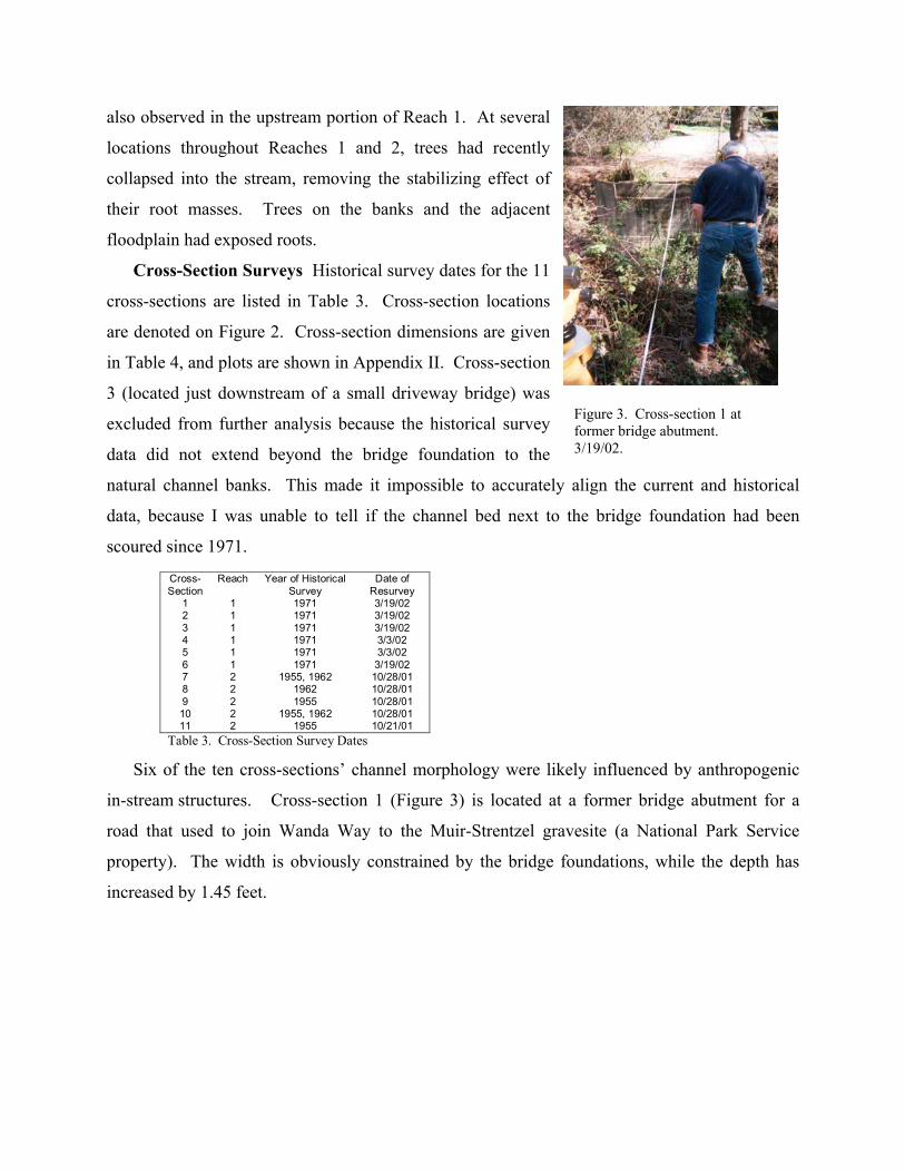
in-stream structures. Cross-section 1 (Figure 3) is located at a former bridge abutment for a
road that used to join Wanda Way to the Muir-Strentzel gravesite (a National Park Service
property). The width is obviously constrained by the bridge foundations, while the depth has
increased by 1.45 feet.
Figure 3. Cross-section 1 at former bridge abutment. 3/19/02.

Cross-Section Past Width (feet)
Present Width (feet)
Change (feet) Past Depth (feet)
Present Depth (feet)
Change (feet)
1 30 28.5 -1.5 14.8 16.25 +1.45 2 41 49 +8 11.8 12.76 +0.96 4 53 55.4 +2.4 15 15.5 +0.5 5 43 36.6 -6.4 16 17.65 +1.65 6 54 56.9 +2.9 13.3 17.54 +4.24 7 30.87 28 -2.87 10.14 11.74 +1.6 8 34.2 38.4 +4.2 10.8 12.55 +1.75 9 32.5 20 -12.5 13.5 11.07 -2.43 10 35 32 -3 16.2 14.47 -1.73 11 43 38 -5 16 12.92 -3.08
Table 4. Cross-section Dimensions Cross-section 6 is located 40 feet downstream of the Alhambra Avenue bridge, which
forms a 10 by 10 feet culvert. Approximately 1.4 feet of erosion was measured at the right bank
bridge foundation on 3 March 2002 (Figure 4). This erosion is most likely due to a combination
of channel adjustment following incision
and the hydraulic effects of the small
culvert. Erosion was evident on both banks,
although the left bank represents more of a
concern for property-owners. Figure 5
shows a temporary solution to this problem,
in the form of a tarp covering secured by
rope and tires. Both the channel width and
depth have increased at this cross-section,
by 2.9 and 4.24 feet, respectively.
Cross-sections 7 and 8 are located farther downstream in
Reach 2, where the use of crib walls and rip-rap to control
bank erosion is prevalent. Sagging wooden crib walls and
scattered chunks of concrete typify the bank composition
in this reach. Figure 6 shows the right bank at cross-
section 8, where four wooden crib walls and pieces of rip-
rap (of unknown installation date) exert an influence on
the channel morphology. Width and depth changes
between these two cross-sections were variable, while
decreases in these dimensions may be attributable to
bank-stabilizing structures.
Figure 4. Erosion at downstream end of Alhambra Avenue bridge, right bank. 3/3/02.
Figure 5. Bank erosion at cross-section 6. 3/19/02

The morphology of cross-sections 9
and 10 appears to be heavily influenced by
the presence of a large wall of concrete
pieces that comprises most of the right
bank in the vicinity of these cross-
sections. Historical survey data for these
locations shows a much wider channel
with a higher right bank. I speculate that
the right bank was graded for development
following the 1955 survey, and then
further reshaped during the construction of
the wall (about 5 years ago). Figure 7
shows the wall on the right bank, looking downstream near the location of cross-section 9. Note
the large concrete chunks in the channel bottom that were placed to stabilize the creek elevation
at that point.
The remaining four cross-sections had
largely natural banks (i.e., without revetment of any
kind) and were fairly stable, with the exception of
cross-section 4, whose shape appears to have been
affected by instability of an oak tree directly
upstream.
Statistical Analysis The channel widths and
depths for both past and present survey dates were
not normally distributed. The null hypothesis of the
Wilcoxon signed-rank test was that present widths
and depths were less than or equal to past widths
and depths. However, this null hypothesis could not
be rejected because for both width and depth, the T-
statistic (34 and 23, respectively) was greater than
the T critical; T (0.05 (1), 10) = 10. These tests
along with observations of the cross-section plots in Appendix II confirm that the channel
Figure 5. Cross-section 6, just downstream of the Alhambra Avenue bridge. 3/19/02.
Figure 6. Crib walls and rip-rap near cross-section 8. 10/28/01
Figure 7. Concrete wall at cross-section 9. 10/28/01.

morphology of Alhambra Creek has remained fairly stable in the past 50 years. The observed
mean difference between present and past channel widths (-1.377 feet) is an artifact of the bank
revetment at the 10 cross-sections, and is especially influenced by cross-section 9, where the
concrete wall greatly reduced channel width. The observed mean difference between present and
past channel depths (0.491 feet) seems more plausible (i.e., a half-foot of systemic channel
incision could have occurred in the past 50 years), but also lacks statistical significance. In
general, the channel morphology of Alhambra Creek appears to have changed very little in the
past 30 to 50 years, with the exception of local erosion problems caused or exacerbated by in-
stream structures (e.g. bridges and bank revetment).
Discussion
Effects of In-stream Structures In-stream structures contributed to both observed changes
in channel morphology over time, as well the uncertainty in assessing systemic channel changes
accurately. For instance, the Alhambra Avenue bridge appears to play a significant role in
channel incision and widening at cross-section 6. The culvert causes a downstream scouring
effect, as evidenced by the large pool just beneath the bridge spillway. The bank and bed erosion
at cross-section 6, therefore, might simply be an result of the bridge-induced hydraulics and not a
reflection of systemic channel adjustments following changes in watershed land use and
hydrology. Similarly, constrained channel banks (due to either abandoned bridge abutments,
crib walls, rip-rap, or concrete retaining walls) might lead to localized incision by redirecting the
flow of water; therefore the origin of this incision cannot be attributed solely to changes in
watershed hydrology.
Difficulties and Limitations of Historical Data Comparison Results of this study largely
depended on the accuracy and validity of historical survey data. However, this requirement for
accurate and valid data was not precisely met. An example of unreliable historical data pertained
to Documents 4 (1955) and 5 (1962). Since the two survey maps covered the same reach of
Alhambra Creek, I assumed that the channel configurations would align well if they were
overlaid in plan view. Yet, when I superimposed the two maps, certain meander bends in the
creek were up to 15 feet apart. One explanation is that the creek meandered greatly during this
period of seven years, carving out a new configuration. Another explanation is that one or both
of the survey documents contain erroneous survey elevations.
Another discrepancy was identified while plotting longitudinal profiles for the available
historical data. The thalweg elevations at the downstream end of Reach 1 (as extracted from
Documents 1, 2, and 3) were 10 feet lower than the thalweg elevations at the upstream end of
Reach 2 (as extracted from Documents 4 and 5). This leads to the assumption that all surveyed
elevations in both documents are suspect, despite the fact that both documents referenced their
survey stationing to established features (e.g., road crossings). Document 1 elevations aligned
closely with a long profile plotted from USGS quadrangles, while Document 4 thalweg
elevations averaged 10 to 20 feet higher than the USGS channel elevations. This leads me to
believe that Documents 1, 2, and 3 are reasonably accurate and more trustworthy, while
Documents 4 and 5 contain arbitrary elevations. For the purposes of this project, however,
arbitrary elevations can still offer useful survey data for width and depth comparisons.
Effects of Cattle Grazing Based on the results of my research project, urbanization and
recent land use changes are likely not the cause of the incised channel form visible in Alhambra
Creek today. More likely is that the channel is recovering from the effects of intense cattle
grazing in the 18th and 19th centuries. Intense grazing modifies or temporarily removes
vegetative cover that would reduce and delay fluvial transport of rainfall and sediment to major
river channels during rainstorms. A heavily grazed landscape thus transports more water and
more sediment to the channel more quickly. The effect is increased instantaneous peak runoff for
a given storm. Concentrated runoff initiates channel head advance, gullying, and drainage
network expansion, all of which reinforce increased runoff peaks and fluvial transport of
sediment from hillsides to the alluvial channel network.
Urbanization might have caused further incision beyond that caused by cattle grazing, but not
of a magnitude that I was able to detect with my research. Localized erosion, however, is a
significant problem, and may be correlated with in-stream structures as well as the high sinuosity
in the middle reaches of Alhambra Creek. Darby and Simon (1999) indicated that increased
meandering in the middle reaches of streams is a common byproduct of channel adjustment
following incision. The sinuosity of Reach 1 (2.160) probably plays a significant role in the
active channel erosion (eroding meander bends and tree falls) observed between cross-sections 1
and 6. The migration rate in bends tends to reach a maximum where the ratio of radius of
curvature to channel width (or sinuosity) falls in the range of 2-3 (Nanson and Hickin, 1986).
This high sinuosity implies that the channel is adjusting to a much earlier, rather than a recent,

source of incision. I speculate that this earlier incision was caused by cattle grazing and began
well before urbanization influenced watershed hydrology.
Recommendations Dating the observed channel incision would provide an indication of
where Alhambra Creek lies in standard “channel evolution” models, and how long it will take
before the channel can sustain riparian habitat comparable to pre-disturbance conditions. To
determine exactly when the onset of this incision occurred, historical data for the Alhambra
Creek watershed should probably not be relied upon as the main source of evidence. Instead, a
comprehensive assessment of channel condition, using field-based evidence of channel changes,
would be more useful. Methods include dating riparian vegetation, analyzing bank stratigraphy
and bed surface grain size distributions, and locating former floodplains and terraces through
vegetative analysis.
Conclusions Based on the results of my limited historical cross-section analysis, I conclude
that the overall channel morphology of Alhambra Creek has changed very little in the past 30 to
50 years, with the exception of local erosion problems caused or exacerbated by in-stream
structures (e.g. bridges and bank revetment). The original premise of my research project was
that changes in runoff-generating mechanisms (caused by urbanization) would lead to changes in
channel morphology, and that these changes could be detected by resurveying historical cross-
sections. Limitations of historical data sources constrained the spatial scope of this resurveying
effort. A tremendous variety of in-stream structures also complicated any interpretations of
changes in channel morphology in the past 30-50 years. The inability to detect significant
channel incision, however, indicates that the incision probably occurred 100 to 200 years ago,
and that Alhambra Creek is currently adjusting to this historic land use change as well as the
geomorphic effects of in-stream structures.
Acknowledgements
I thank Matt Orr, John Latto, Justin Remais, and Manish Desai for their insightful questions
informative discussion on the research project. I thank Renee Hutchins and Rachael Canapa,
(Contra Costa County Public Works Records Division), Vern Segelke (Zumwalt Engineering
Group), and Tim Tucker (City of Martinez) for assistance with historical records. I thank Igor
Skaredoff and the Friends of Alhambra Creek for comments made during the planning stages of
this project. I also thank the following individuals for their willingness to grant me creek access

from their properties: Dan Blockus, Dan and Carmen Upshaw, Ernest and Thelma Bettencourt,
Ron and Athena Dalton, and Bill Stone. I thank the following people for their dedicated field
work: Ariel Ambruster, Sayaka Araki, Annette Cayot, Alexander Ford, Fred Liebault, Theresa
Mason. I also thank Annette Cayot, Sarah Brownell, and Mike Herrin for their review of earlier
drafts of this manuscript. I thank my mentor G. Mathias Kondolf for providing the inspiration to
keep motivated throughout the course of this project. Lastly, I thank my parents Peter and Anne
Mason for their constant encouragement.
References
Alhambra Creek Watershed Planning Group. 2001. Alhambra Creek Watershed management plan: A users manual. First Edition, April 2001. Appendices.
Booth, D.B. 1990. Stream channel incision following drainage-basin urbanization. Journal of
the American Water Resources Association. 26(3): 407-417. Darby, S.E. and A. Simon, eds. 1999. Incised River Channels: Processes, Forms, Engineering
and Management. John Wiley and Sons, Chichester. Dunne, T., and L.B. Leopold. 1978. Water in environmental planning. W. H. Freeman, San
Francisco. Gordon, N.D., McMahon, T.A., and B.L. Finlayson. 1992. Stream Hydrology : an Introduction
for Ecologists. Centre for Environmental Applied Hydrology, University of Melbourne. John Wiley and Sons, Chichester.
Hammer, T. R. 1972. Stream and channel enlargement due to urbanization. Water Resources
Research. 8:1530-1540. Haydon, W.D. 1995. Landslide Hazards in the Martinez-Orinda-Walnut Creek Area. California
Department of Conservation, Division of Mines and Geology. Open File Report 95-12. Holman and Associates. 1999. An Evaluation of Potential Historic Properties within the
Alhambra Creek Bank Stabilization Project, Martinez, California. Submitted to Ms. Tina Bartunek, City of Martinez. June 1999.
Kondolf, G.M. 1995. Historical channel analysis and its application to riparian and aquatic
habitat restoration. Aquatic Conservation: Marine and Freshwater Ecosystems 5: 109-126. Kondolf, G.M. 2000a. Some suggested guidelines for geomorphic aspects of anadromous
salmonid habitat restoration proposals. Restoration Ecology 8(1): 48-56. Kondolf, G.M. 2000b. Laboratory Manual for LA 222 (Hydrology for Planners), Spring 2000.

University of California, Berkeley. Lawler, D.M. 1993. Measurement of river bank erosion and lateral channel change: a review.
Earth Surface Processes and Landforms 18, 777-821. Nanson, G.C. and Hickin, E.J. 1986. A statistical examination of bank erosion and channel
migration in western Canada. Bulletin of the Geological Society of America 97, 497-504 San Francisco Estuary Institute. 2001. Wildcat Creek Watershed: A Scientific Study of Physical
Processes and Land Use Effects. Prepared June 2001. CD-ROM. Also available for download at http://www.sfei.org.
Sear D.A., Briggs A., Brookes A. 1998. A preliminary analysis of the morphological adjustment
within and downstream of a lowland river subject to river restoration. Aquatic Conservation: Marine and Freshwater Ecosystems 8 (1): 167-183 Jan-Feb 1998.
Shields, F.D. Jr., Knight, S.S. and Cooper, C.M. 1994. Effects of channel incision on base flow
stream habitats and fishes. Environmental Management 18: 43-57. Smeltzer, M., J. Reilly, and D. Dawdy. 2000. Geomorphic Assessment of the Corte Madera
Creek Watershed, Final Report. Stetson Engineers Inc. in association with David Dawdy, Consulting Hydrologist. Prepared for: Friends of Corte Madera Creek Watershed and Marin County Department of Public Works.
Thorne, C. R. 1999. Bank processes and channel evolution in the incised rivers of North-
Central Mississippi. Incised River Channels. Pp. 97-122. Trimble, S.W. 1998. Dating fluvial processes from historical data and artifacts. Catena 31
(1998): 283-304. United States Department of Agriculture, Natural Resources Conservation Service, and US
Forest Service. 1997. Alhambra Creek Watershed Resources Inventory. Contra Costa Resource Conservation District.
Ward, J.V. and J.A. Stanford. 1995. Ecological connectivity in alluvial river ecosystems and its
disruption by flow regulation. Regulated rivers, research and management 11(1): 1-15.

*Not reviewed by the author.
Appendix I. Partial Bibliography of Alhambra Creek Watershed Historical Information. Alhambra Creek, California. Letter from the Secretary of the Army, transmitting a letter from the Chief of
Engineers, Department of the Army, dated May 7, 1968, submitting a report , together with accompanying papers and illustrations, on Alhambra Creek, California, requested by a resolution of the Committee on Public Works, House of Representatives, Adopted July 1, 1958. [UCB WRCA G4485 J8]
*Arnold, R. R., County Surveyor. Map of Martinez & vicinity : Contra Costa Co., California /, compiled by R.R. Arnold, County surveyor. Oakland, San Francisco : Thomas Bros., 1928. Scale [ca. 1:10,000]. 1 map ; 46 x 40 cm., folded to 25 x 11 cm. [UCB Earth Sci MICROFICHE 2155]
*Arnold, R. R., County Surveyor. Map of Martinez & vicinity, Contra Costa Co., California /, compiled by
R.R. Arnold, County Surveyor. Martinez : Chamber of Commerce, [1930?] Scale [ca. 1:11,000] 1 map ; 46 x 40 cm., folded to 24 x 11 cm. [UCB Earth Sci G4364.M38 1930 .M3 Case D]
*Barclay Maps. 1968. Map of Martinez, California /, Compliments of Martinez Area Chamber of
Commerce. San Jose, Calif. : Barclay Maps, [1968] Scale [ca. 1:19,500] 1 map ; 56 x 48 cm., folded to 20 x 10 cm. [UCB Earth Sci G4364.M38 1968 .B3 Case D]
Beugler & Boardman, Civil Engineers, Oakland, CA and Lauritz Lauritzen, Constr. Engineer, San Francisco. 1924. Town of Martinez: Reinforced Concrete Bridge, Escobar Street. As-built bridge document. Scale: 1/8” = 1’. February 1924.
Beugler & Boardman, Civil Engineers, Oakland, CA and Lauritz Lauritzen, Constr. Engineer, San
Francisco. 1924. Town of Martinez: Reinforced Concrete Bridge, Howard and Castro Sts. As-built bridge document. Scale: 1/8” = 1’. February 1924.
Bissell & Karn, Inc. 1971. Flood insurance study: Martinez, California, Contra Costa County. Prepared for
Federal Insurance Administration; under contract to U.S. Army Engineer District, San Francisco Corps of Engineers. San Francisco, Calif. 2, 8 leaves, 6 folded leaves of plates : ill., maps ; 27 cm. [UCB WRCA G40512 Y no.10 1971]
Brown, Elam C. 1895. Map of the original and additional surveys of the town of Martinez : [Calif.], 1873
and 1892 /, Elam C. Brown, Licensed and County Surveyor. [Martinez, Calif. : Contra Costa County Surveyor], 1895. Scale [1:2,400]. 200 ft. to 1 in. 1 map on 2 sheets : photocopy ; 130 x 86 cm. [UCB Bancroft G4364.M38 1895 .B7 Case XD]
Brown, Warren [Martinez, Calif.: Contra Costa County Surveyor]. 1851. Plan of Martines[z], representing
the plans of survey on the two sides of the creek Alhambra and also the water lots as surveyed in June 1851. Map. [UCB Bancroft G4364.M38 1851; .B7; Case XD]
Brown and Caldwell. 1957. Study of water system improvements, a report prepared for the city of
Martinez, California. San Francisco : Brown and Caldwell, [1957] 77 p. : ill., maps ; 28 cm. [UCB WRCA G4485 H7]
Cary, E. S. 1948. In the matter of application from the city of Martinez for permit to construct and operate a sewage treatment works, consisting of a pumping station, combined flocculation and clarifier, two digesters, sludge beds and ponds, to be located on Associated Oil Co. property northeast of

*Not reviewed by the author.
the city, with disposal of settled effluent to San Francisco Bay /, by E.S. Cary. [Berkeley] : State of California, Dept. of Public Health, Bureau of Sanitary Engineering, [1948] 1 v. : maps ; 29 cm. [UCB WRCA MS 80/3 49.3]
*The Chamber, [1939?] Acquaint yourself with facts and statistical information about Martinez, California
/, compliments of Martinez Chamber of Commerce. Martinez, Calif.: 19 p. (incl. covers) : maps ; 23 cm. [UCB Bancroft p F869.M15 A3 1939]
City of Martinez Engineering Department. 1940. General Layout of Alhambra Creek at Brown Street with
Proposed Improvement Plan Approved by City Council. Document no. 110 200. Scale: 1” = 10’. 4 Cross-sections. October 2, 1940.
*Contra Costa County (Calif.). County Assessor's Office. Martinez and vicinity : Contra Costa County,
California /, Prepared by County Assessor's Office. June 1952. [Martinez, Calif.] : County Assessor's Office, 1952. Scale [ca. 1:9,500] 1 map : photocopy ; on sheet 130 x 108 cm. [UCB Earth Sci G4364.M38 1952 .M3 Case B]
Contra Costa County Flood Control and Water Conservation District. 1955. Alhambra Creek from Pleasant Hill Rd. upstream 1200’. Drawing. June 15, 1955. FC-5-8009-D. FD22.
Contra Costa County Flood Control and Water Conservation District. 1962. Alhambra Creek from
Pleasant Hill Rd. upstream 1600’. Drawing. April 1962. FD-1513. Scale: 1” = 50’. Contra Costa County Flood Control and Water Conservation District. 1971. Alhambra Creek from 1000’
downstream of Alhambra Ave, upstream to Sheridan Road. Cross Sections. 4 Sheets. April 1971. S-319-322. Scale: 1” = 10’.
Contra Costa County Flood Control and Water Conservation District. 1971. Alhambra Creek topography
from 1000’ downstream of Alhambra Ave, upstream to Wanda Way. May 1971. R-423. Scale: 1” = 50’.
Contra Costa County Flood Control and Water Conservation District. 1971. Alhambra Creek topography
with contours from 1000’ downstream of Alhambra Ave, upstream to Wanda Way. May 1971. R-424. Scale: 1” = 50’.
Contra Costa County Flood Control and Water Conservation District. 1973. Alhambra Creek FCZ #5
Proposed Interim Channel Improvements from Carquinez Strait to Marina Vista. Drawing. April 1973. Plate #1 FD-2510.
*Davis, William E. 1981. Management recommendations for the removal of introduced perennials along
Franklin Creek, John Muir National Historic Site, Martinez, California. Cooperative National Park Resources Studies Unit, University of California ; San Francisco, Calif. : Western Region, National Park Service, Dept. of the Interior, [1981] [UCB Bioscience SB481; .D48 1981]
Department of the Army, San Francisco District, Corps of Engineers. 1980. Alhambra Creek Study of
Alternatives. Appendices. September 1980. Obtained from the City of Martinez Engineering Department.
*Department of the Interior, United States Geological Survey. 1980. Preliminary geologic map of the
Briones Valley quadrangle, Alameda and Contra Costa Counties, California. Author: Dibblee, T. W. (Thomas Wilson), 1911- Published: [Menlo Park?] :. [UCB Earth Sci G4363.C6C5 1980; .D5; Map Case 2]

*Not reviewed by the author.
Greene, B.H., City Engineer. 1928. Plan for Reinforced Concrete Culvert in Alhambra Creek at the junction of Brown and Robinson Streets, Martinez CA. Drawing 6 Sec. 1, No. 71. Scale: 1” = 10’. June 27, 1928. 2 Cross-sections. Source: City of Martinez Engineering Department.
Katre, A. and M. Mason. 2000. Impacts of land use on stream conditions in the Alhambra Creek
Watershed. LA 222, Hydrology for Planners, Spring 2000. University of California, Berkeley. Copies on file at the Contra Costa Resource Conservation District and the UC Berkeley Water Resources Center Archives.
Leptien-Cronin-Cooper Civil Engineers. 1960. Alhambra Valley Orchards, City of Martinez. Construction
Plans. Tract 2875, Unit No. 2. Drawing. File No. 507-23. Scale: 1” = 40’. (Drawn by Leptien, approved by Cooper). August 1960. Source: City of Martinez Engineering Department.
*[Map of Martinez, California and vicinity]. [187-?] Scale [ca. 1:8,000] 1 ms. map: col.; on sheet 44 x 37
cm. [UCB Bancroft G4364.M38 1870 .M3 Case XB]
Martinez (Calif.). City Council. 1964. Martinez General Plan, 1980.<1964> [Martinez, Calif. : City
Council?, 1964?] [UCB Environ DsgnHT168.M34; M36 1964]
Martinez (Calif.). City Council. 1970. Martinez waterfront development program. [Martinez, Calif.] : The
Council, [1970] [UCB Environ DsgnHT168.M34; M36 1970] [Storage Info: C 3 102 364]
Meyer, R.W. 1993. Water-Resources Investigation 93-4009: Potential hazards from floodflows within the
John Muir House National Historic Site, Franklin Creek Drainage Basin, California. Available from USGS, Earth Science Information Center, Open-File Reports Section, Box 25286, MS 517, Denver, CO 80225, USGS Water-Resources Investigations Report 93-4009, 1993, 9 p, 6 fig, 3 tab, 5 ref.
McClure, James G. 1972. Silting in the Martinez Marina. [S.l. : s.n.], 20-23 p. ; 28 cm.
[UCB WRCA G4485 K2]
McMahon, T. A. 1880. Map of proposed reservoir & pipe for water supply for the Town of Martinez, Contra Costa Co., Cal. /, surveyed and drawn by Thos. A. McMahon. [188-?] Scale [1:6,000]. 500 ft. to an in. 1 ms. map on 2 sheets: col.; 103 x 141 cm. [UCB Bancroft G4364.M38N44 1880 .M3 Case XD]
*McMahon, T. A. 1885. Official map of Contra Costa County, California /, by T.A. McMahon, County Surveyor ; and Wm. Minto, Civil Engineer. Feb. 4, 1885. S[an] F[rancisco] : A.J. Leary, 1885 (S[an] F[rancisco] : Britton & Rey) Scale [1:31,680]. 40.00 chains to an in. 1 map on 6 sheets : col. ; mounted on cloth and fitted with rods ; 139 x 262 cm. [UCB Bancroft G4363.C6 1885 .M3 rolled]
Murray-McCormick Aerial Surveys, Inc. 1980. Aerial Surveys of the City of Martinez. Aerial photography
with 5-foot contour lines. Scale: 1” = 300’. Source: City of Martinez Engineering Department. *[Panorama of Martinez, Calif. and the Carquinez Strait] [190-?] 1 photographic panorama comprised of 3
connected photographic prints : b&w ; 16 x 62 cm. [UCB Bancroft BANC PIC 19xx.414—C]
Perry, C. et al . 1986. Martinez, a California town /, [.]. Martinez, Calif. : RSI Publications, inc., c1986. 96
p. : ill. ; 28 cm. [UCB Bancroft pf F869.M385 M371 1986]

*Not reviewed by the author.
*Plan of Martinez: [Calif.] [California : s.n., 1872?] Scale not given. 1 map on 2 sheets : photocopy ; on
sheets 59 x 84 cm. [UCB Earth Sci G4364.M38 1872 .P5 Case D]
*Sanborn Map Company. 1884. Martinez, Cal. New York : Sanborn Map & Publishing Co., c1884. Scale
[ca. 1:740] 2 maps : photocopies ; 53 x 45 cm. [UCB Earth Sci G4364.M38G475 1884 .S3 Case D]
*Sanborn Map Company. 1888. Martinez, Cal. New York : Sanborn Map & Publishing Co., c1888. Scale [ca. 1:740] 3 maps : photocopies ; 53 x 45 cm. [UCB Earth Sci G4364.M38G475 1888 .S3 Case D]
*Sanborn Map Company. 1912. Martinez, Contra Costa Co., Cal. /, Sanborn Map Company. January
1908. Corr. Feb. 1912. New York : The Company, 1912, 1908. Scale [1:600] 50 ft. to an in. 13 maps : col. ; sheets 65 x 55 cm. [UCB Bancroft ff G1529.M3 S3 1908]
*Sanborn-Perris Map Company. 1891. Martinez, Contra Costa Co., Cal., Sanborn-Perris Map Co. New
York : The Co., 1891. Scale [1:600]. 50 ft. to an in. 5 maps : col. [UCB Earth Sci Microfiche 447G]
*Sanborn-Perris Map Company. 1897. Martinez, Contra Costa County, Cal., Sanborn-Perris Map Co.
New York : The Co., 1897. Scale [1:600]. 50 ft. to an in. 5 maps : col. [UCB Earth Sci Microfiche 448G]
*Sanborn-Perris Map Company. 1905. Martinez, Contra Costa County, Cal. Sanborn-Perris Map Co.,
Limited. 1897. Corrected Oct. 1905. New York : The Company, 1905. Scale [1:600] 50 ft. to an in. 7 maps : col. ; 65 x 55 cm. [UCB Bancroft ff G1529.M3 S3 1897]
Sedway/Cooke. 1972. Open space conservation, seismic safety, scenic roadways : General Plan
elements. San Francisco: Sedway/Cooke, [1972?] [UCB Environ DsgnHT168; .M34 1972]
Smith, Clyde F. 1918. In the matter of the application of the city of Martinez for permit to construct a sewer outfall and disposal system /, by Clyde F. Smith. [Berkeley] : State of California, Dept. of Public Health, Bureau of Sanitary Engineering, [1918] 1 v. : photos. ; 29 cm. [UCB WRCA MS 80/3 49.2]
Taylor, K. W. 1968. Plat of that portion of the town of Martinez in the Rancho El Pinole : [Calif.] /,
surveyed by K.W. Taylor, November 1873 ; copied by George C. Collier, May 2, 1968. Scale not given. 1 ms. map ; on Sheet 111 x 81 cm. [UCB Bancroft G4364.M38 1873 .T3 1968 Case XD Gift of George Collier, March 1969]
Transcripts of public hearings and meetings conducted. Public Hearing, City of Martinez, 1964 (Flood
Control) [UCB WRCA MS 97/1 A44 1962, 1964]
United States Department of Agriculture, Natural Resources Conservation Service, and US Forest
Service. 1997. Alhambra Creek Watershed Resources Inventory. Contra Costa Resource Conservation District.
[UCB WRCA G4485 N7]

*Not reviewed by the author.
United States Federal Insurance Administration. 1977. Flood insurance study : city of Martinez, California, Contra Costa County. [Washington] : Dept. of Housing and Urban Development, Federal Insurance Administration. ii, 10 p., 5 fold. leaves of plates : ill., maps ; 28 cm. [UCB WRCA G40512 Y no.10]
[UCB WRCA G40512 Y no.15] United States National Park Service Western Regional Office. 1963. John Muir home and Vicente
Martinez adobe, Martinez, California. Prepared by John Hussey [and others. San Francisco?]. 43 l. illus., maps (1 fold.) 27 cm. [UCB Bancroft F869.M15U4]
United States National Park Service. 1970. John Muir National Historic Site, California. [Rev.
Washington, D.C., U.S. Govt. Print. Off., 1970]. 1 folder ([6] p.) illus., map. 24 cm. [UCB BANC F869.M15U42.1970]
United States National Park Service, Denver Service Center. 1975. Environmental assessment: master
plan John Muir National Historic Site / prepared by Denver Service Center, National Park. [Washington : U.S. Govt. Print Off.].
[UCB Bancroft pfF869.M15U37] *United States Work Projects Administration (Calif.). 1940. Martinez waterfront ..., Compiled as a report,
Official project no. 65-1-08-146, unit 2. Sponsored by City of Martinez in cooperation with Contra Costa County and represented By O.K. Smith, city engineer. Martinez, Calif., 1940. 2 v. illus., plates (part col.) maps (part fold.) facsims. 29 cm. [UCB Bancroft F869.M15U5 v.1-2]
Wagstaff and Brady in association with Brown and Caldwell ... [et al.]. 1985. Alhambra Hills specific plan
implementation element and environmental Impact report /, prepared for the city of Martinez by [California] : Wagstaff and Brady, [1985] 1 v. (various pagings) : maps ; 28 cm.
*White, Ellen R. 1990. Contra Costa County, California, selected earth sciences references. U.S. Dept.
of the Interior, U.S. Geological Survey ; [Denver, Colo. : Books and Open-File Reports Section, distributor], 1990. [UCB Earth Sci QE90.C67A12; W49 1990a]

Appendix II. Cross-section Plots. Cross-Section 1 (STA 216+90, Document 3)
165
170
175180
185
190
195
-60 -40 -20 0 20 40 60 80 100
Distance from top of left bank (feet)
Elev
atio
n ab
ove
arbi
trary
datu
m (f
eet)
1971 Survey 2002 Survey
Cross-Section 2 (STA 213+35, Document 3)
160
165
170
175
180
185
190
-100 -80 -60 -40 -20 0 20 40
Distance from top of left bank (feet)
Elev
atio
n ab
ove
arbi
trary
datu
m (f
eet)
1971 Survey 2002 Survey
Cross-Section 4 (STA 189+65, Document 3)
150155160165170175180
-60 -40 -20 0 20 40 60 80 100
Distance from top of left bank (feet)
Elev
atio
n ab
ove
arbi
trary
datu
m (f
eet)
1971 Survey 2002 Survey
Cross-Section 5 (STA 187+80, Document 3)
145150155160165170175
-80 -60 -40 -20 0 20 40 60 80
Distance from top of right bank (feet)
Elev
atio
n ab
ove
arbi
trary
datu
m (f
eet)
1971 Survey 2002 Survey
Cross-Section 6 (STA 185+95, Document 3)
140145150155160165170
-60 -40 -20 0 20 40 60 80 100
Distance from top of left bank (feet)
Elev
atio
n ab
ove
arbi
trary
datu
m (f
eet)
1971 Survey 2002 Survey
Cross-Section 7 (Number 17, Documents 4 and 5)
155160165170175180185190
-40 -20 0 20 40 60 80 100 120
Distance from top of left bank (feet)
Elev
atio
n ab
ove
arbi
trary
datu
m (f
eet)
2001 Survey 1962 Survey 1955 Survey

Cross-Section 8 (STA 11+23.59, Document 5)
155160165170175180185190
-40 -20 0 20 40 60 80 100 120
Distance from top of left bank (feet)
Elev
atio
n ab
ove
arbi
trary
datu
m (f
eet)
1962 Survey 2001 Survey
Cross-Section 9 (Number 15, Document 4)
155
160165
170175
180185
190
-100 -80 -60 -40 -20 0 20 40 60
Distance from top of left bank (feet)
Elev
atio
n ab
ove
arbi
trary
dat
um(fe
et)
1955 Survey 2001 Survey
Cross-Section 10 (STA 6+06.36, Document
4 and STA 5+54.01, Document 5)
150155160165170175180185
-80 -60 -40 -20 0 20 40 60 80 100Distance from top of right bank (feet)
Elev
atio
n ab
ove
arbi
trary
datu
m (f
eet)
2001 Survey 1962 Survey 1955 Survey
Cross-Section 11 (6th Cross-Section, Document 4)
150155160165170175180185
-80 -60 -40 -20 0 20 40 60 80 100
Distance from top of left bank (feet)
Elev
atio
n ab
ove
arbi
trary
datu
m (f
eet)
1955 Survey 2001 Survey