base mapping week 2 erin forbes
TRANSCRIPT
Base Mapping, Sectors,& Permaculture Principles
By Erin ForbesBackyard Homesteading

Sectors• “The shaping of productive environments for people that work
within nature’s limits will be the central project of the next era of human history.” – Peter Bane
• Sun - In effort to provide the best location for our bees to thrive, we placed our beehives with the entrance facing in the direction of the morning and afternoon sun.
• Wind – To protect the bees from the wind, we placed them behind a large thicket of bushes. This natural windbreak protects the hives from draft during all seasons.
• Wildlife - We notice the largest population of wildlife on the northeast area of the homestead. Therefore, we keep our livestock and gardens on the opposite side of the farm.
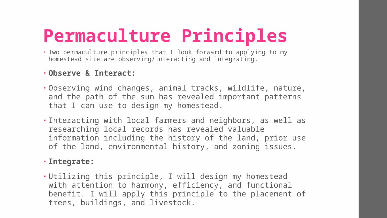
Permaculture Principles• Two permaculture principles that I look forward to applying to my homestead site
are observing/interacting and integrating.
• Observe & Interact: • Observing wind changes, animal tracks, wildlife, nature, and the
path of the sun has revealed important patterns that I can use to design my homestead.
• Interacting with local farmers and neighbors, as well as researching local records has revealed valuable information including the history of the land, prior use of the land, environmental history, and zoning issues.
• Integrate:• Utilizing this principle, I will design my homestead with attention
to harmony, efficiency, and functional benefit. I will apply this principle to the placement of trees, buildings, and livestock.

Water Analysis: Background• Red Hook, NY receives an average of 48.6 inches in rainfall
annually, which is a bit more than the U.S average of 39.2 inches.
• Winter precipitation includes 51 inches of snowfall. The month with the lowest average precipitation is February, with 2.48”. The month with the highest precipitation is May, with an average of 4.38”. http://www.intellicast.com/Local/History.aspx?location=USNY1204
• Our local watershed is the Saw Kill Watershed. (redhook.org)• A recent soil analysis conducted in April, 2016, via Dutchess
County Cornell Cooperative revealed that our soil is loamy and well drained.

Water Analysis: Entrance & Exits• Water enters our site through precipitation and occasional
flooding of a neighboring pond. The site does not have a public water supply, as it is part of a rural community. We receive the majority of our household water supply from our well.
• Water exits our site as it infiltrates into the soil. Runoff from our site flows west toward a neighboring wetland. We also have a drain that runs under our driveway and toward the garden.
• The house does not yet have any gutters, as it is still under construction. Please keep that in mind when looking at the base map.

Water Analysis: High & Low Points
• The homestead is located in a meadow of rolling hills; therefore, we have several low areas that provide an opportunity to develop small ponds for surface water storage.
• The highest points of our site are located at the house, paddock, and a large patch of trees that are in close proximity to the driveway.
• Our property is a flag lot; therefore, it has minimal exposure to pollution from the road.

Map Layer

Water Layer

Resources / Work Cited:• “The Permaculture Handbook” by Peter Bane (Chapters 5,6 &
10)• http://www.intellicast.com/Local/History.aspx?
location=USNY1204• redhook.org