balkan geodetic observing system - a scientific challenge...
TRANSCRIPT

BALkan GEodetic Observing System -a scientific challenge for the Balkan
countries (BALGEOS)
BALGEOS results
INSTITUTE OF GEODESY AND GEOPHYSICSVIENNA UNIVERSITY OF TECHNOLOGY
CENTRAL LABORATORY OF GEODESYBULGARIAN ACADEMY OF SCIENCES
GEODESY DEPARTMENTSARAJEVO UNIVERSITY
FACULTY OF CIVIL ENGINEERINGUNIVERSITY”SS CYRIL AND METHODIUS
3rd BALGEOS Workshop26 - 27 February 2009Sarajevo – Bosnia & Herzegovina
3rd BALGEOS Workshop26 - 27 February 2009Sarajevo – Bosnia & Herzegovina
BALGEOS 2
• The ASO call aims to intensify the cooperation with research organisations in South Eastern Europe in the field “South Eastern Europe's Scientific Response to: Biodiversity protection, climate change and energy scarcity”
with the aim to support the development of long-term scientific collaboration
Results are considered to form the basis for future establishment of a Global Navigation Natellite Nystem network in the region
THE IDEA FOR THE PROJECT

3
3rd BALGEOS Workshop26 - 27 February 2009Sarajevo – Bosnia & Herzegovina
BALGEOS
The Global Geodetic Observing System: Empowering with geodesy the advancement of society ..
Central Goal:An integrated, consistent observing and analysis system
• Balkan countries has progress significantly towards establishing an infrastructure for geodetic observations
• A scientific challenge - of establishing GGOS - exceeds the capabilities of any one nation
• An international collaboration and a coordinated approach are needed
GG S 2020

4
3rd BALGEOS Workshop26 - 27 February 2009Sarajevo – Bosnia & Herzegovina
BALGEOS
WORK AND TIME SCHEDULEContract: 4-12-2008Project Dates: Starting date: 1 June 2008
End of project: 28 February 2009
Duration of project (months): nine monthsOrganization: Research Group Advanced Geodesy (128-1)
Institute of Geodesy and GeophysicsVienna University of TechnologyVienna, AUSTRIA
Project co-ordinator: Prof. Dr. Harald Schuh
Communications: almost entirely by E-mailusing BALGEOS web site

5
3rd BALGEOS Workshop26 - 27 February 2009Sarajevo – Bosnia & Herzegovina
BALGEOS
MAIN PURPOSES• to establish and to strengthen the good scientific relationships
between the partners and individual scientists;• to provide a platform for a long-term interregional co-operation in the
field of space geodesy to further partners’ integration in GGOS;• to fortify advance in geodetic science in Bulgaria,
Bosnia&Herzegovina and Macedonia; • to maintain the level of information and consultation at the topmost
level;• to develop technology through regional bilateral and multilateral
cooperation, training meetings, mobility of scientists and PhD students;
• to develop a web site;• results will form the basis for future establishment of GNSS
permanent network in the region;• To prepare a proposal for long-term co-operation (FP7, COST, etc.)

6
3rd BALGEOS Workshop26 - 27 February 2009Sarajevo – Bosnia & Herzegovina
BALGEOS
Studies are focused on determination of the Earth’s geometry and orientation combining of the GNSS and VLBI observations;
troposphere and ionosphere parameters using and combining data from different space geodetic techniques;
combination of data from different space geodetic techniques for global ionosphere modelling;
very good cooperation with Austrian partners – joint establishing of more than 40 active GPS+GLONASS reference stations operating in real time mode to serve geodetic, geodynamic and navigation needs;
co-operation with the Analysis Centres of the IGS (International GNSS Service
PARTNER PRIORITIESPROJECT PARTNER: INSTITUTE OF GEODESY AND GEOPHYSICS
VIENNA UNIVERSITY OF TECHNOLOGY

3rd BALGEOS Workshop26 - 27 February 2009Sarajevo – Bosnia & Herzegovina
BALGEOS 7
PROJECT PARTNER: CENTRAL LABORATORY OF GEODESYBULGARIAN ACADEMY OF SCIENCES
Studies are focused on determination of the Earth’s gravity field, dynamics of the level and topography of the Black Sea;
Development and adapting of mathematical models for processing and analysis of classical and satellite observations;
Analysis of satellite observations for receiving estimates of basic geodetic, geophysical and geodynamic parameters of the Earth, for determining the global terrestrial reference frame and the orientation of the Earth in space;
Coordinate systems and comform images (projections) in geodesy;Investigation of seismic-tectonic phenomena in seismogenic zones
by means of geodetic methods and mathematical modeling;Interdisciplinary investigations on the development and use of GPS,
GLONASS, EGNOS and Galileo systems
PARTNER PRIORITIES

8
3rd BALGEOS Workshop26 - 27 February 2009Sarajevo – Bosnia & Herzegovina
BALGEOS
PROJECT PARTNER: GEODESY DEPARTMENTSARAJEVO UNIVERSITY
Higher-education institution in the filed of civil engineering and geodesy.
Studies are focused on:1. GPS positioning;2. Terrain deformation caused by salt mine exploitation;3. Joint project of developing GNSS network in B&H.
GD FCE has on its disposal the following technical equipment:• five GPS receivers – Trimble 4000SSI• geodetic instruments – theodolites, leveling instruments and EDMs.
The Faculty of Civil Engineering has licenses to use the following software applications: TOPOCAD, SCOPE, LEICA SKI Pro GPS, Leica GEO OFFICE, AutoCAD, ARC VIEW, ARC INFO, PLATEIA, VIA 2002, STRESS, SAP 2002, PANEL PRO, TOWER, ARMCAD.
PARTNER PRIORITIES
9
3rd BALGEOS Workshop26 - 27 February 2009Sarajevo – Bosnia & Herzegovina
BALGEOS
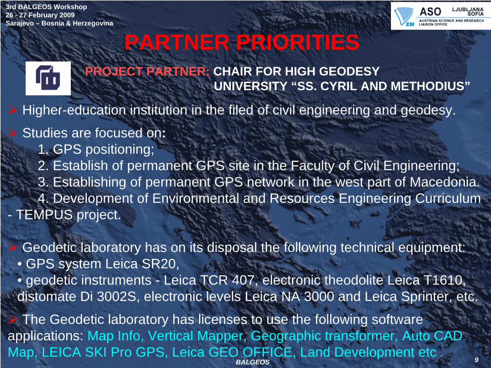
PROJECT PARTNER: CHAIR FOR HIGH GEODESYUNIVERSITY “SS. CYRIL AND METHODIUS”
PARTNER PRIORITIES
Higher-education institution in the filed of civil engineering and geodesy.
Studies are focused on:1. GPS positioning;2. Establish of permanent GPS site in the Faculty of Civil Engineering;3. Establishing of permanent GPS network in the west part of Macedonia.4. Development of Environmental and Resources Engineering Curriculum
- TEMPUS project.
Geodetic laboratory has on its disposal the following technical equipment:• GPS system Leica SR20, • geodetic instruments - Leica TCR 407, electronic theodolite Leica T1610, distomate Di 3002S, electronic levels Leica NA 3000 and Leica Sprinter, etc.
The Geodetic laboratory has licenses to use the following software applications: Map Info, Vertical Mapper, Geographic transformer, Auto CAD Map, LEICA SKI Pro GPS, Leica GEO OFFICE, Land Development etc .

10
3rd BALGEOS Workshop26 - 27 February 2009Sarajevo – Bosnia & Herzegovina
BALGEOS
WPS WORK PACKAGE SUBJECT RESPONSIBLE PARTNER WP LEADER
WP1 Project Management and coordination IGG, TUV, AU team Prof. Dr. H. Schuh
WP2 Analysis of the state-of-art of geodesy from the partner institutions
SsCMU, FCE, MK team
Prof. Z. Srbinoski
WP3 Studying Austrian experience, and in particularly in the field of GGOS
IGG, TUV, AU team Prof. Dr. R. Weber
WP4 Large-scale information exchange and training
GD FCE, SU, BA team Prof. Dr. A. Bilajbegovic
WP5 Processing exchanged space geodetic measurements
CLG, BAS, BG team Assoc. Prof. Dr. Iv. Georgiev
WP6 Assessment the potential location of GNSS sites and proposal for permanent GNSS in Southeast Europe
AU, BG, BA and MK teams
All team leaders
WP7 Develop, operate and support a webpage for SE Europe GNSS Networks
CLG, BAS, BG team Assoc. Prof. Dr.Iv. Georgiev
WP8 Preparing proposal for long-term co- operation (FP7, COST or other multilateral programs)
AU, BG, BA and MK teams
All team leaders
WORKING PROGRAMME

11
3rd BALGEOS Workshop26 - 27 February 2009Sarajevo – Bosnia & Herzegovina
BALGEOS
ORGANIZATION OF THE JOINT WORK3 months batches
First three months1.1. Compilation of a report of the available GPS networks;1.2. Inquiring the experience of the Austrian team in establishing and
maintenance of Earth observation systems;1.3. State-of-art of geodetic activities in the partner’ countries.
Second three months2.1. Tests for geodetic data exchange between agreed partners;2.2. Organizing of a workshop in Sofia;2.3. Testing different models of simultaneously processing of GPS
measurements including PhD students;2.4. Mid-term report.
Last three months3.1. Integration of GPS results obtained from previous geodetic studies;3.2. Recommendations for permanent GNSS sites in the SE Europe;3.3. Training of PhD students;3.4. Final workshop in Bosnia and Herzegovina;3.5. Proposal for regional implementations of the GGOS in SE;3.6. Final report.
WP 1. PROJECT MANAGEMENT AND COORDINATION
Responsible partner: IGG, TUV, AU team
Project and task coordinator: Prof. Dr. H. Schuh
Objectives: To ensure successfully implementation of the project.
Task Input: Successful management and realization of the Project.
Interim (15 November 2008) and Final Report.
3rd BALGEOS Workshop26 - 27 February 2009Sarajevo – Bosnia & Herzegovina
BALGEOS 12
IMPLEMENTATION – IN PROGRESS

13
3rd BALGEOS Workshop26 - 27 February 2009Sarajevo – Bosnia & Herzegovina
BALGEOS
WP 2. ANALYSIS OF THE STATE-OF-ART OF GEODESY FROM THE PARTNER INSTITUTION
Responsible partner: SsCMU, FCE, MK team
Task coordinator : Prof. Dr. Zl. SrbinoskiObjectives: To compile individual reports for each partner country on existing geodetic activities related to GNSS. To compile an overall report on GPS data and results exchange with future plans and recommendations.Task Input: Reports on current state of geodetic activities in each individual partner country.Milestones : Individual reports. Recommendation about geodetic strategy in SE Europe.
IMPLEMENTATION

14
3rd BALGEOS Workshop26 - 27 February 2009Sarajevo – Bosnia & Herzegovina
BALGEOS
WP 3. STUDYING AUSTRIAN EXPERIENCE, AND IN PARTICULARLY IN THE FIELD OF GGOS
Responsible partner: IGG, TUV, AU team
Task coordinator : Assoc. Prof. Dr. R. WeberObjectives: To compile an overall report on GPS data and results exchange with future plans and recommendations .Task Input: Thematic presentation of the Austrian team, related to the GGOS activity.Milestones : Overall review report - Recommendations for future geodetic data and results exchange .
IMPLEMENTATION – IN PROGRESS

15
3rd BALGEOS Workshop26 - 27 February 2009Sarajevo – Bosnia & Herzegovina
BALGEOS
WP 4. LARGE-SCALE INFORMATION EXCHANGEAND TRAINING
Responsible partner: GD FCE, SU, BA team
Task coordinator: Prof. Dr. A. BilajbegovicObjectives: To test geodetic data exchange between partner countries. Establishing a database of GPS data for SE Europe.Task Input: The task is depending on : Analysis of the state-of- art of geodesy at each partner country. Available databases of individual partners with GPS measurements in SE Europe.Milestones : Geodetic data exchange of individual billateral or multilateral links.
IMPLEMENTATION – IN PROGRESS

16
3rd BALGEOS Workshop26 - 27 February 2009Sarajevo – Bosnia & Herzegovina
BALGEOS
WP 5. PROCESSING EXCHANGED SPACE GEODETIC MEASUREMENTS
Responsible partner: CLG, BAS
Task coordinator: Assoc.Prof. Dr. Ivan Georgiev Objectives: test of different models for GPS data processing. Using the obtained results for the future geodynamic analysis.Task Input: The task is depending on : Geodetic data exchange. The partners own the state-of-art software and facilities to analyze and test available and new GPS data.Milestones: Comparison of different mathematical models. Training of scientific teams. Report, Publications..
IMPLEMENTATION

17
3rd BALGEOS Workshop26 - 27 February 2009Sarajevo – Bosnia & Herzegovina
BALGEOS
WP 6. ASSESSMENT THE POTENTIAL LOCATION OF GNSS SITES AND PROPOSAL FOR PERMANENT GNSS IN SE EUROPE
Responsible partner: AU, BG, BA and MK teams
Task coordinator: All team leadersObjectives: Provide recommendations for appropriate location of GNSS sites.Task Input: The task is depending on:: Analysis of the geodynamic settings in Balkan countries. Milestones: Proposal for GNSS site locations in Southeast Europe. Publications.
IMPLEMENTATION – IN PROGRESS

18
3rd BALGEOS Workshop26 - 27 February 2009Sarajevo – Bosnia & Herzegovina
BALGEOS
WP 7. DEVELOP, OPERATE AND SUPPORT A WEBPAGE FOR SE EUROPE GNSS NETWORKS
Responsible partner: CLG, BAS
Task coordinator: Assoc.Prof. Dr. Ivan GeorgievObjectives: Develop a webpage for the project.Task Input: Information and data from individual partnersDynamic links to partners' webpagesMilestones : A webpage for the geodetic GNSS in SE Europe.
IMPLEMENTATION – IN PROGRESS

19
3rd BALGEOS Workshop26 - 27 February 2009Sarajevo – Bosnia & Herzegovina
BALGEOS
Project website was developed, which is active since October 2008http://balgeos.cc.bas.bg

20
3rd BALGEOS Workshop26 - 27 February 2009Sarajevo – Bosnia & Herzegovina
BALGEOS
RESULTS

21
3rd BALGEOS Workshop26 - 27 February 2009Sarajevo – Bosnia & Herzegovina
BALGEOS
WP 8. PREPARING A PROPOSAL FOR LONG-TERMCO-OPERATIONResponsible partner: AU, BG, BA and MK teams
Task coordinator: All team leadersObjectives: To prepare a proposal for long-term co- operation.Task Input: Preparing a project proposal for long-term co- operation for establishing a permanent GNSS in the Balkan region. This proposal will be addressed to institutions of all Balkan countries and will significantly improve the status and role in the partners involved.Milestones: Proposal for long-term co-operation.
Agreement for long-term cooperation.
WP IN PROGRESS

3rd BALGEOS Workshop26 - 27 February 2009Sarajevo – Bosnia & Herzegovina
BALGEOS 22
RESULTS
1. Presentation meeting of the ASO-Call 2007/2008 in Vienna on 5 May 2008
2. Kick-off meeting in Vienna (7-9 July 2008)– Presentations – from each partner; – Project committee from each partner Leaders;– Discussion of mechanisms of internal and external
geodetic data and information exchange;– Communication with other European Infrastructures?– Design of web page;– Planing a workshop in Sofia at the middle time period.

23
3rd BALGEOS Workshop26 - 27 February 2009Sarajevo – Bosnia & Herzegovina
BALGEOS
RESULTS3. Second BALGEOS workshop in Sofia (3-5 December 2008)
• Presentations:1. IAG's GGOS and its Relation to the IAG Commissions and Services;2. Scientific aspects of GALILEO and geodetic applications;3. Datum transformations issues;4. PPP as a technique for large national reference networks;5. Using the GNSS for ionosphere modelling6. Establishing permanent GNSS array in Bulgaria7. Parameters evaluation in the SLRP software complex8. Multipath-effect investigations for improving quality of BIHPOS9. Analysis of the state of art of geodesy from the partner institutions10. Active GNSS network in Macedonia.
• Discussion of GPS data exchange between the partners;• Discussion of making “Recommendations for permanent GNSS
stations in the Balkan region”;• Discussion of BALGEOS logo;• Planing a workshop in SARAJEVO at the end of time period.

24
3rd BALGEOS Workshop26 - 27 February 2009Sarajevo – Bosnia & Herzegovina
BALGEOS
As a result of the workshops scientific and practical experience is exchanged in:
usage of Global Navigation Satellite Systems (GNSS); establishing GNSS networks in partner countries and
using them efficiently;usage of the Austrian GNSS networks for weather
forecasting; applications of the positioning systems EGNOS/SISNET;
GNSS applications for the purposes of industry, energy, cadastre, etc,
scientific aspects of the Galileo system and its geodetic applications;
development of a pilot project for the IGS real-time and scientific and applied aspects of GGOS.
RESULTS

25
3rd BALGEOS Workshop26 - 27 February 2009Sarajevo – Bosnia & Herzegovina
BALGEOS
RESULTS
Publications:
Georgiev, I., L. Pashova and H. Schuh (2008) “BALkan GEodeticObserving System - a scientific challenge for the Balkan countries (BALGEOS)” – submitted to NEWS - Monthly informational bulletin about science and technologies of BAS, ISSN 1312-2436;
BALGEOS data processing – first test results (under preparation) )

26
3rd BALGEOS Workshop26 - 27 February 2009Sarajevo – Bosnia & Herzegovina
BALGEOS
BENEFITS:1. Establishment and evolution of good relationships;
2. Fruitful exchange of scientific experience - beneficial to the all partners;
3. Improving technology transfer and access to knowledge;
4. Improving the professional capacity of Balkan partners;
5. Speeding up elaboration of program and methodological aspects to establish GNSS sites in other SE countries;
6. Contribution to the EU policy of integration of SE countries especially those which are not members of the EU
7. Contribution to the geodetic strategy for development of Earth observation systems in SE Europe Programme Global Monitoring for Environment and Security (GMES) of EC and ESA - a major driver for the development of observation networks and applications over the next decade as the GGOS.

27
3rd BALGEOS Workshop26 - 27 February 2009Sarajevo – Bosnia & Herzegovina
BALGEOS
Thank you for your contribution!Thank you for your attention!