appendix a: results of community consultation (wbm, … · figure a5 locations of waterway use for...
TRANSCRIPT

DRAFT TUROSS ESTUARY AND COILA LAKE WATERWAY USAGE MANAGEMENT PLAN E-10
I:\N0693 TUROSS - COILA EMP\DOCS\R.N0693.005.02.EMP.DOC 24/2/05 15:02
TUROSS ESTUARY AND COILA LAKE
WATERWAY USAGE MANAGEMENT PLAN
Appendix A: Results of Community Consultation (WBM, 2002a)
Results from community consultation carried out by WBM as part of the Estuary Management Study provide an appreciation for waterway usage within the Tuross Estuary and Coila Lake. The consultation involved a detailed survey of residents and (Easter holidays) visitors to the area. The information presented herein has been taken from the survey results, totalling some 266 questionnaire responses. The information provided in the questionnaire does not necessarily reflect actual usage within the waterways at all times during the year, nor does it necessarily reflect a true cross-section of the local community. As such, the information presented below should be interpreted with caution.
Figure A1 shows the different activities carried out within and around the estuaries, and the percentage of questionnaire respondents that undertake these activities. From this figure, it can be seen that the waterway usage of the Tuross Estuary and Coila Lake are quite different. Apart from prawning, Coila Lake is predominantly used for passive purposes (i.e. walking and view appreciation from the foreshores). While the Tuross Estuary too, is heavily used for walking and view appreciation from the foreshore, it is also utilised by more active pursuits, including fishing (from both boat and shore) and swimming.
Figure A1 Breakdown of Waterway Usage by Activity

DRAFT TUROSS ESTUARY AND COILA LAKE WATERWAY USAGE MANAGEMENT PLAN E-11
I:\N0693 TUROSS - COILA EMP\DOCS\R.N0693.005.02.EMP.DOC 24/2/05 15:02
Figure A2 shows how frequently these activities are carried out by the questionnaire respondents, measured in number of days per year the activity is carried out. This figure clearly indicates the high level of utilisation of the estuaries for the more passive pursuits, including walking, birdwatching and view appreciation (all carried out predominantly from the foreshore).
Figure A2 Level of Utilisation of Waterways for Activities
View appreciation is carried out from the foreshore and generally covers all parts of the two waterways. Similarly, riding / walking is an activity carried out along foreshore areas, however, the extent is generally restricted to the availability of public paths and walking tracks.
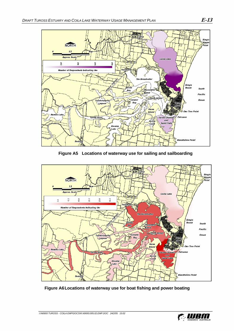
The areas of the estuaries utilised for remaining activities, as determined through the community consultation process, are defined within the following figures:
Figure A3: Boat and shore fishing
Figure A4: Prawning
Figure A5:Sailing and Sailboarding
Figure A6: Boat fishing and power boating
Figure A7: Canoeing / Kayaking
Figure A8: Swimming
Figure A9: Birdwatching
Figure A10: Picnicking

DRAFT TUROSS ESTUARY AND COILA LAKE WATERWAY USAGE MANAGEMENT PLAN E-12
I:\N0693 TUROSS - COILA EMP\DOCS\R.N0693.005.02.EMP.DOC 24/2/05 15:02
Figure A3 Locations of waterway use for boat and shore fishing
Figure A4 Locations of waterway use for prawning
DRAFT TUROSS ESTUARY AND COILA LAKE WATERWAY USAGE MANAGEMENT PLAN E-13
I:\N0693 TUROSS - COILA EMP\DOCS\R.N0693.005.02.EMP.DOC 24/2/05 15:02
Figure A5 Locations of waterway use for sailing and sailboarding
Figure A6 Locations of waterway use for boat fishing and power boating