announcement need hazus-mh training now? - mn it …€¦ · of hazus-mh training, go to ......
TRANSCRIPT

www.fema.gov/plan/prevent/hazus1
Need HAZUS-MH Training Now?New ESRI Virtual Courses Let You Master HAZUS-MH on Your TimelineIf you are a state/community planner or GIS user and haven’t tried HAZUS-MH yet, you should. If you’ve tried an older version of HAZUS-MH and were frustrated with technical or accuracy issues, you owe it to your community to give HAZUS-MH MR3 a second look.
After 17 years of tuning by the best scientific minds led by the National Institute of Building Sciences, HAZUS-MH is the among the most powerful disaster loss estimation methodology available in the world. It is multi-hazard (earthquake-flood-wind)…
And HAZUS-MH is free.
Now, new virtual training courses make it easy for you to harness the power of HAZUS-MH to get a quantified and geospatial view of the potential risks your community faces. Once you know what could happen, your community can make informed decisions to prevent losses and protect its citizens.
Get started today. Go to: www.esri.com/hazusmhtraining
Virtual HAZUS-MH CoursesSeven virtual courses are available for HAZUS-MH. These on-line courses compliment the classroom training held throughout the year around the nation. For a full listing of HAZUS-MH training, go to www.FEMA.gov/plan/prevent/hazus/hz_trngconf.shtm.
1. HAZUS-MH for Decision Makers – Available Now! FREE
This course reviews the capabilities and benefits of using HAZUS-MH. The Flood, Earthquake, and Hurricane Models and their corresponding outputs are reviewed. Additional resources and training opportunities are provided for those interested in more in depth training. (Length: 80 minutes).
Benefits: This seminar provides an overall understanding of the capabilities of HAZUS-MH and how it can support mitigation, response, and recovery efforts.
Prerequisites: none.
FREE!
A n n o u n c e m e n t
www.fema.gov/plan/prevent/hazus2
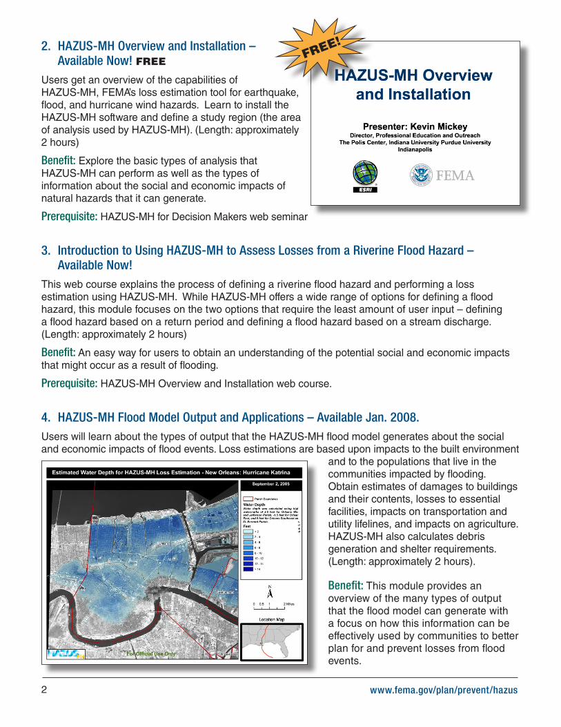
2. HAZUS-MH Overview and Installation – Available Now! FREE
Users get an overview of the capabilities of HAZUS-MH, FEMA’s loss estimation tool for earthquake, flood, and hurricane wind hazards. Learn to install the HAZUS-MH software and define a study region (the area of analysis used by HAZUS-MH). (Length: approximately 2 hours)
Benefit: Explore the basic types of analysis that HAZUS-MH can perform as well as the types of information about the social and economic impacts of natural hazards that it can generate.
Prerequisite: HAZUS-MH for Decision Makers web seminar
3. Introduction to Using HAZUS-MH to Assess Losses from a Riverine Flood Hazard – Available Now!
This web course explains the process of defining a riverine flood hazard and performing a loss estimation using HAZUS-MH. While HAZUS-MH offers a wide range of options for defining a flood hazard, this module focuses on the two options that require the least amount of user input – defining a flood hazard based on a return period and defining a flood hazard based on a stream discharge. (Length: approximately 2 hours)
Benefit: An easy way for users to obtain an understanding of the potential social and economic impacts that might occur as a result of flooding.
Prerequisite: HAZUS-MH Overview and Installation web course.
4. HAZUS-MH Flood Model Output and Applications – Available Jan. 2008. Users will learn about the types of output that the HAZUS-MH flood model generates about the social and economic impacts of flood events. Loss estimations are based upon impacts to the built environment
and to the populations that live in the communities impacted by flooding. Obtain estimates of damages to buildings and their contents, losses to essential facilities, impacts on transportation and utility lifelines, and impacts on agriculture. HAZUS-MH also calculates debris generation and shelter requirements. (Length: approximately 2 hours).
Benefit: This module provides an overview of the many types of output that the flood model can generate with a focus on how this information can be effectively used by communities to better plan for and prevent losses from flood events.
FREE!
www.fema.gov/plan/prevent/hazus3
Prerequisite: Introduction to Using HAZUS-MH to Assess Losses from a Riverine Flood Hazard web course recommended.
5. Integrating User Supplied Hazard Data into the HAZUS-MH Flood Model – Available Jan. 2008.
Shows users how to integrate hazard data developed in sophisticated flood engineering models into HAZUS-MH for the purpose of performing a more precise flood loss estimation study than is typically possible in a basic HAZUS-MH analysis. This module addresses two of the options for integrating flood hazard data created in other modeling applications into a HAZUS-MH flood study:
Option 1: User provides a user-defined flood boundary, digital elevation model, and information about a flood surface.
Option 2: User provides only a flood depth grid in an ESRI® Grid format. (Length: approximately 2 hours).
Benefit: Enables a scientifically-based loss estimation to be generated on flood hazard data created in other models. This is especially important to those individuals who plan to use HAZUS-MH to support flood insurance studies or community planning goals. Products generated by programs such as the FEMA Map Modernization Program give communities across the United States the inputs required to use the options noted above. The module includes an exercise that explores these techniques and prepares users to conduct these types of flood loss estimation studies within their own communities.
Prerequisite: Familiarity with HAZUS-MH Flood Model.
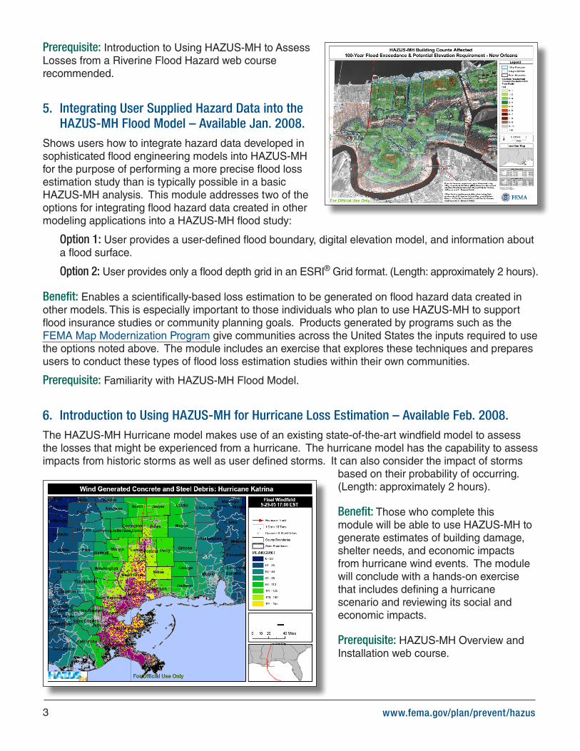
6. Introduction to Using HAZUS-MH for Hurricane Loss Estimation – Available Feb. 2008.The HAZUS-MH Hurricane model makes use of an existing state-of-the-art windfield model to assess the losses that might be experienced from a hurricane. The hurricane model has the capability to assess impacts from historic storms as well as user defined storms. It can also consider the impact of storms
based on their probability of occurring. (Length: approximately 2 hours).
Benefit: Those who complete this module will be able to use HAZUS-MH to generate estimates of building damage, shelter needs, and economic impacts from hurricane wind events. The module will conclude with a hands-on exercise that includes defining a hurricane scenario and reviewing its social and economic impacts.
Prerequisite: HAZUS-MH Overview and Installation web course.
www.fema.gov/plan/prevent/hazus
FEMA4
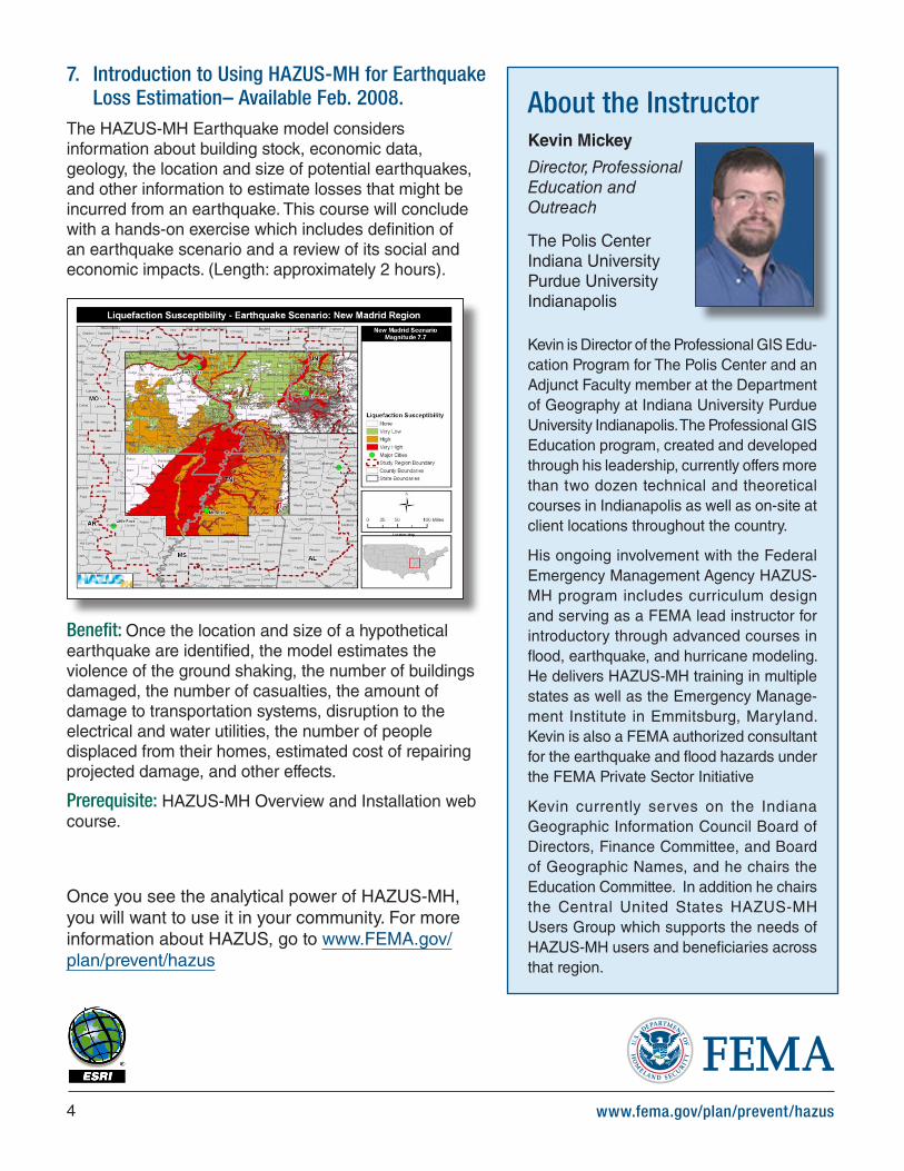
7. Introduction to Using HAZUS-MH for Earthquake Loss Estimation– Available Feb. 2008.
The HAZUS-MH Earthquake model considers information about building stock, economic data, geology, the location and size of potential earthquakes, and other information to estimate losses that might be incurred from an earthquake. This course will conclude with a hands-on exercise which includes definition of an earthquake scenario and a review of its social and economic impacts. (Length: approximately 2 hours).
Benefit: Once the location and size of a hypothetical earthquake are identified, the model estimates the violence of the ground shaking, the number of buildings damaged, the number of casualties, the amount of damage to transportation systems, disruption to the electrical and water utilities, the number of people displaced from their homes, estimated cost of repairing projected damage, and other effects.
Prerequisite: HAZUS-MH Overview and Installation web course.
Once you see the analytical power of HAZUS-MH, you will want to use it in your community. For more information about HAZUS, go to www.FEMA.gov/plan/prevent/hazus
About the InstructorKevin Mickey
Director, Professional Education and Outreach
The Polis CenterIndiana University Purdue University Indianapolis
Kevin is Director of the Professional GIS Edu-cation Program for The Polis Center and an Adjunct Faculty member at the Department of Geography at Indiana University Purdue University Indianapolis. The Professional GIS Education program, created and developed through his leadership, currently offers more than two dozen technical and theoretical courses in Indianapolis as well as on-site at client locations throughout the country.
His ongoing involvement with the Federal Emergency Management Agency HAZUS-MH program includes curriculum design and serving as a FEMA lead instructor for introductory through advanced courses in flood, earthquake, and hurricane modeling. He delivers HAZUS-MH training in multiple states as well as the Emergency Manage-ment Institute in Emmitsburg, Maryland. Kevin is also a FEMA authorized consultant for the earthquake and flood hazards under the FEMA Private Sector Initiative
Kevin currently serves on the Indiana Geographic Information Council Board of Directors, Finance Committee, and Board of Geographic Names, and he chairs the Education Committee. In addition he chairs the Central United States HAZUS-MH Users Group which supports the needs of HAZUS-MH users and beneficiaries across that region.