an introduction to the geotechnical module
TRANSCRIPT

© 2016 Autodesk© 2016 Autodesk Join the conversation #AU2016
An Introduction to the Geotechnical Module
Gary Morin: [email protected]: Keynetix
LinkedIn: www.linkedin.com/in/garymorin63
© 2016 Autodesk© 2016 Autodesk
The Geotechnical Module 2017 is now available to all AutoCAD Civil 3D
subscription orders. This hands-on lab will show you the basis of getting
started with the Geotechnical Module in AutoCAD Civil 3D 17. Within
minutes of starting the class you will see how to access and import
subsurface geology data in AutoCAD Civil 3D. The class will go on to show
you how quickly you can visualize boreholes in context of your site, create
multiple strata surfaces and even generate geotechnical profile views
containing borehole log strips all in a few minutes. This is work which would
normally take many hours. By the end of the session you will have a greater
understanding of how the Geotechnical Module works, allowing you to
incorporate geotechnical subsurface data in your infrastructure designs,
using AutoCAD Civil 3D.
Class summary

© 2016 Autodesk© 2016 Autodesk
At the end of this class, you will be able to:
Understand the fundamentals of the Geotechnical Module
Create a project and import geotechnical data into AutoCAD
Civil 3D
Create and visualize 3D boreholes and geology strata
surfaces
Create dynamic Geotechnical profile views which display
borehole log strips
Key learning objectives

© 2016 Autodesk© 2016 Autodesk
Who wants free geotechnical modeling training?
Hold up your
business card

© 2016 Autodesk© 2016 Autodesk
Understand the fundamentals of
the Geotechnical Module

© 2016 Autodesk© 2016 Autodesk
An enhancement for AutoCAD Civil 3D
What is the Geotechnical Module?

© 2016 Autodesk© 2016 Autodesk
CVS and AGS
Project Management and Import
© 2016 Autodesk© 2016 Autodesk
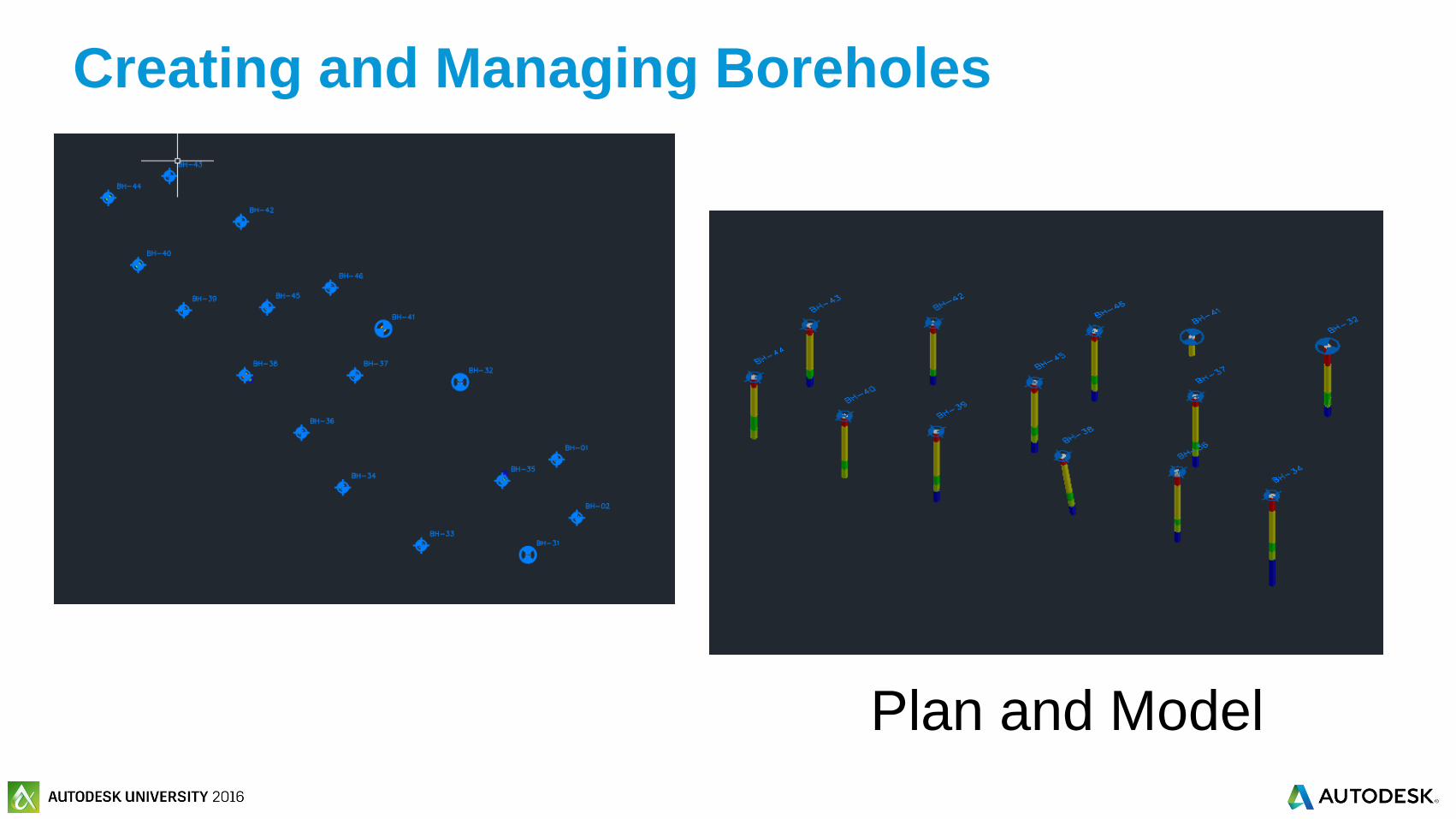
Plan and Model
Creating and Managing Boreholes

© 2016 Autodesk© 2016 Autodesk
Creating and Managing Sub Strata Surfaces
© 2016 Autodesk© 2016 Autodesk
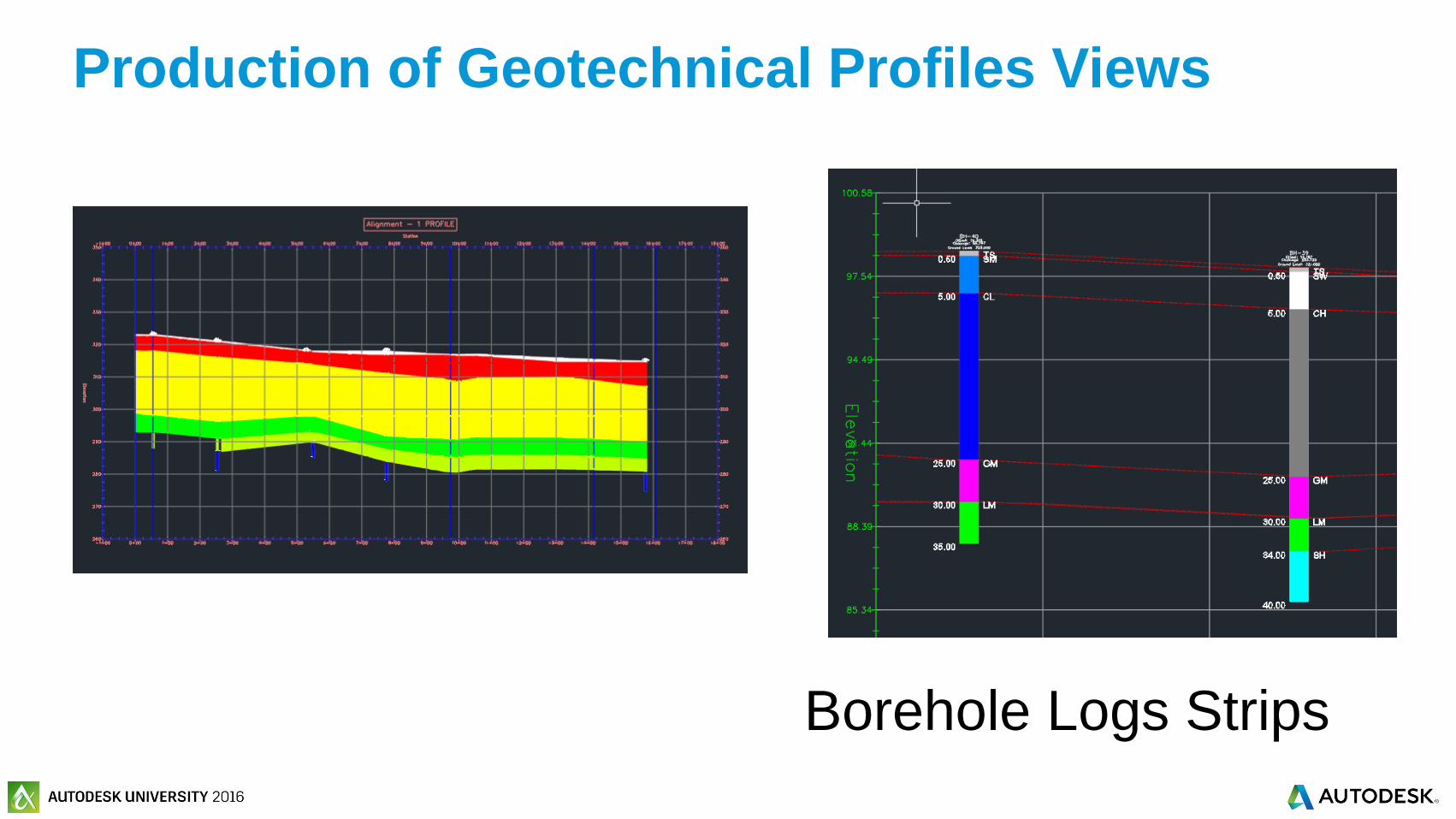
Borehole Logs Strips
Production of Geotechnical Profiles Views

© 2016 Autodesk© 2016 Autodesk
Geotechnical Hatch and Style Management
© 2016 Autodesk© 2016 Autodesk
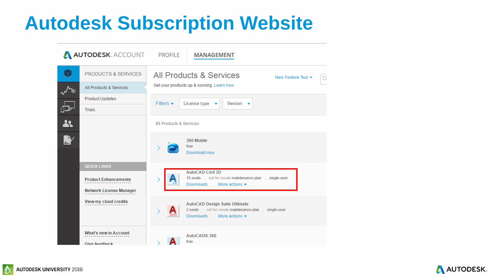
Autodesk Subscription Website
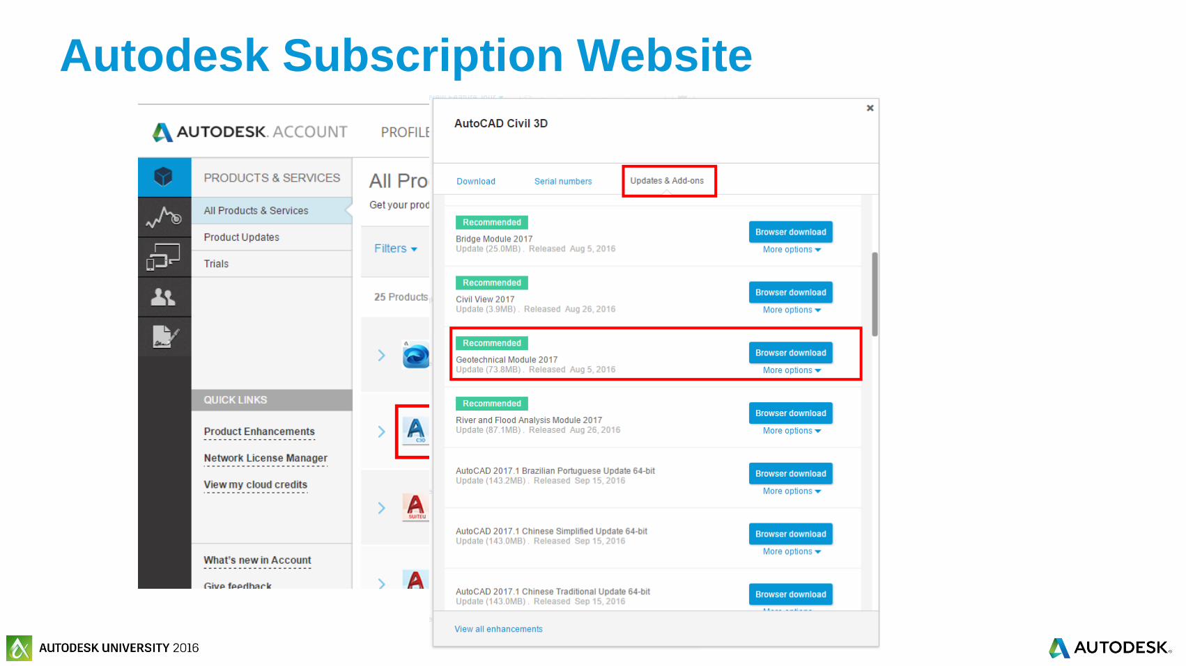
© 2016 Autodesk© 2016 Autodesk
Autodesk Subscription Website
© 2016 Autodesk© 2016 Autodesk
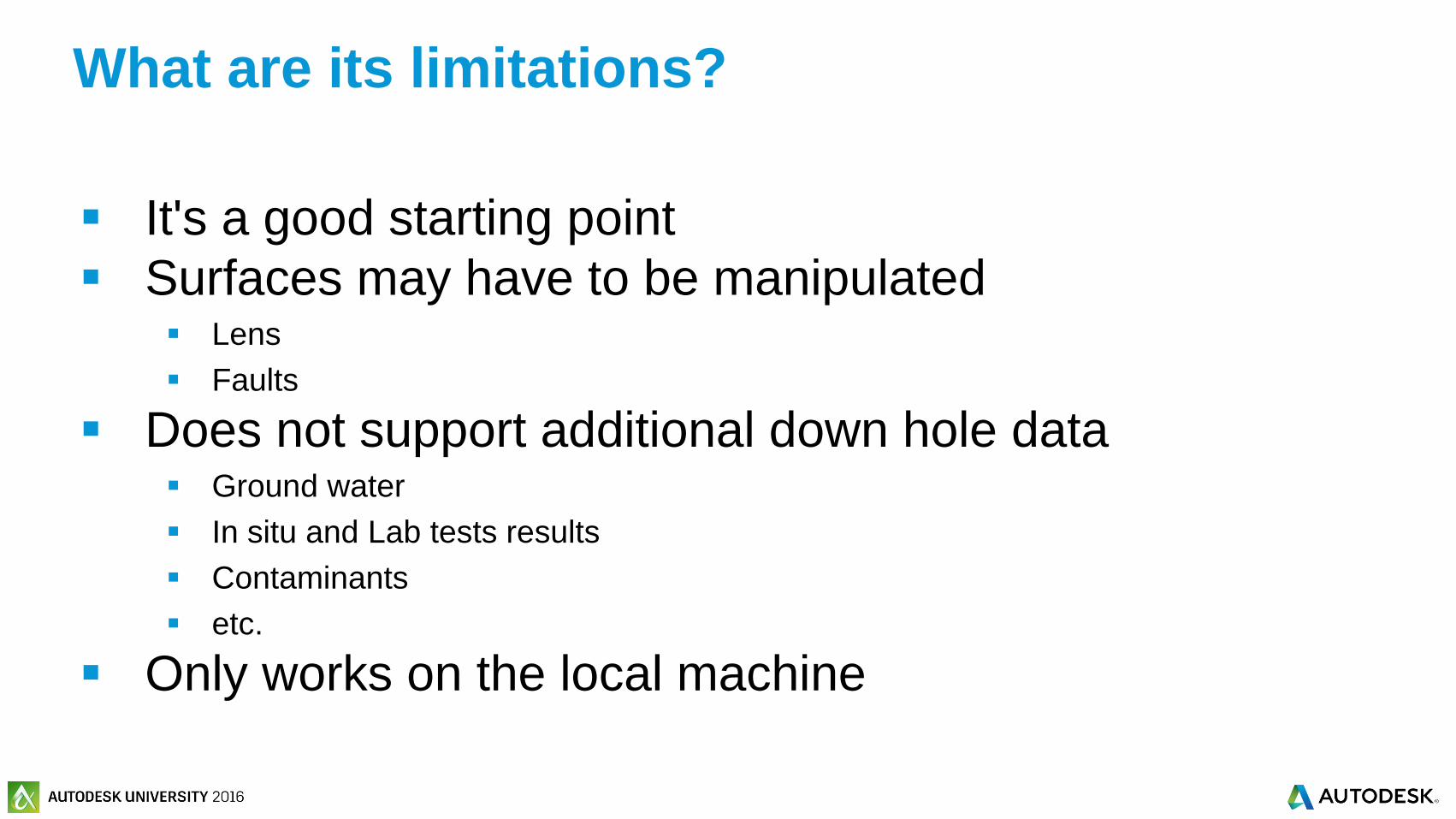
It's a good starting point
Surfaces may have to be manipulated Lens
Faults
Does not support additional down hole data Ground water
In situ and Lab tests results
Contaminants
etc.
Only works on the local machine
What are its limitations?
© 2016 Autodesk© 2016 Autodesk
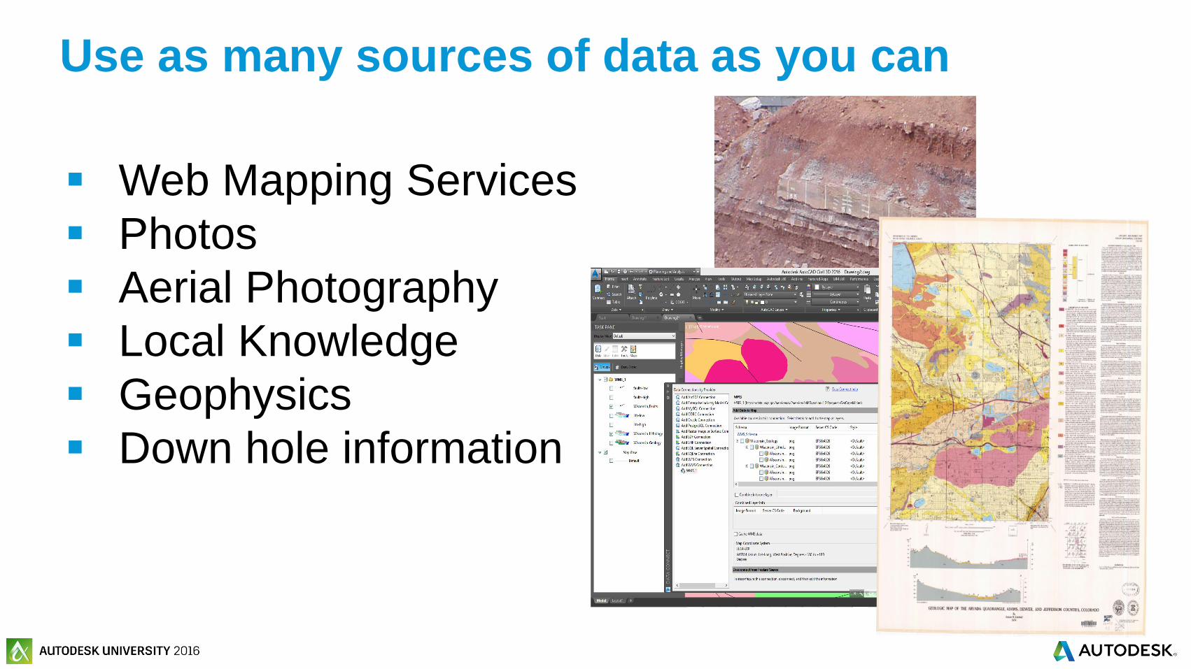
Web Mapping Services
Photos
Aerial Photography
Local Knowledge
Geophysics
Down hole information
Use as many sources of data as you can

© 2016 Autodesk© 2016 Autodesk
Not a replacement for geotechnical knowledge
and experience
© 2016 Autodesk© 2016 Autodesk
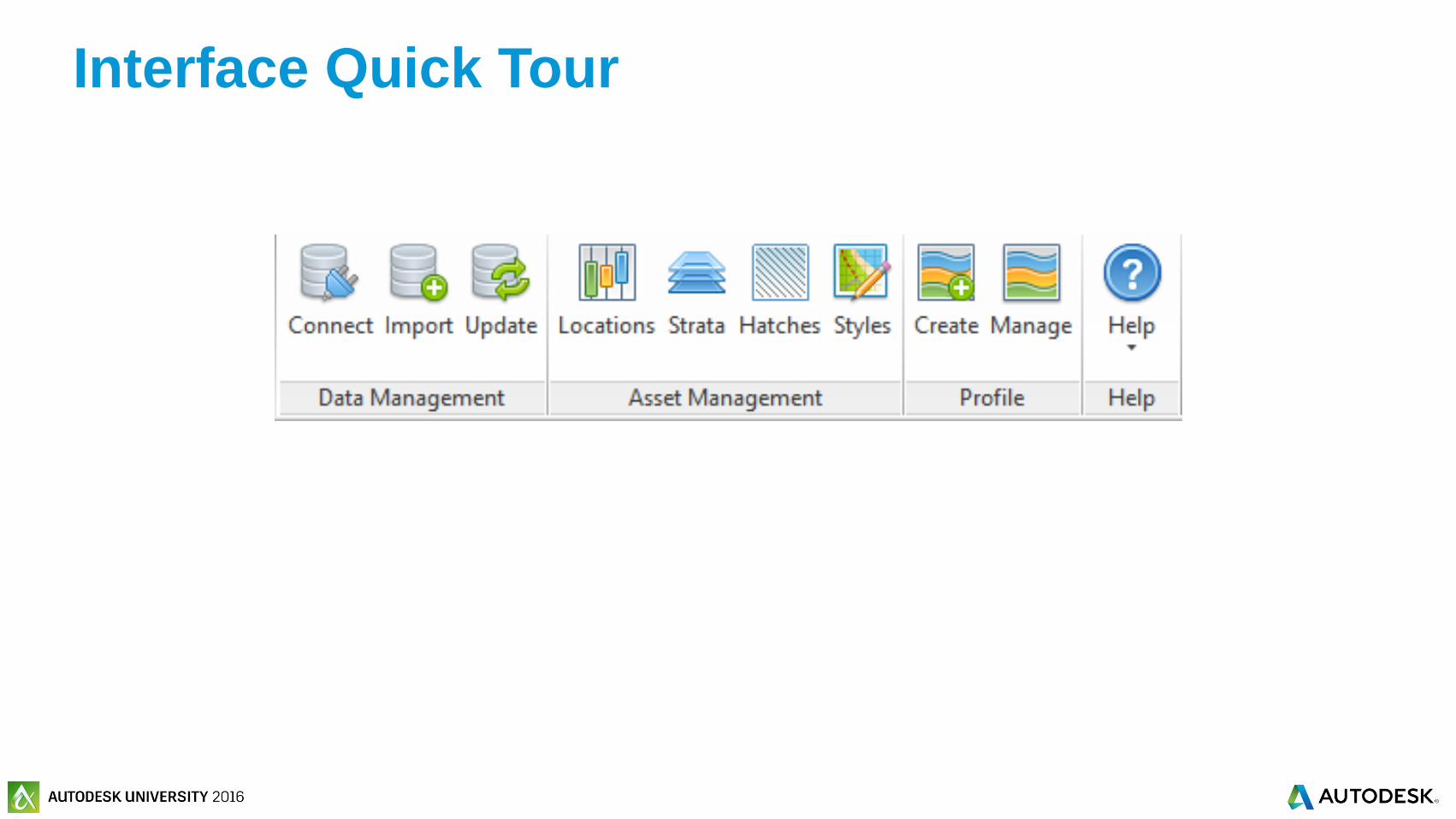
Interface Quick Tour
© 2016 Autodesk© 2016 Autodesk
Create a project and import
geotechnical data into AutoCAD Civil 3D
© 2016 Autodesk© 2016 Autodesk
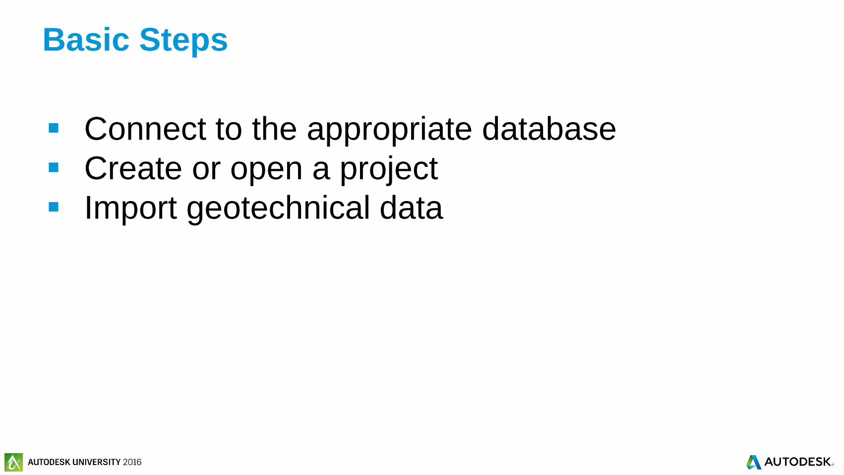
Connect to the appropriate database
Create or open a project
Import geotechnical data
Basic Steps
© 2016 Autodesk© 2016 Autodesk
Exercise 1: Connecting to a Database

© 2016 Autodesk© 2016 Autodesk
Connecting to the database and creating a
project

© 2016 Autodesk© 2016 Autodesk
AGS
Association of Geotechnical and Geo-
Environmental Specialists http://www.ags.org.uk
Used in UK, Australia, increasing usage
Supports 3.1 and 4
Geotechnical Data Import formats
© 2016 Autodesk© 2016 Autodesk
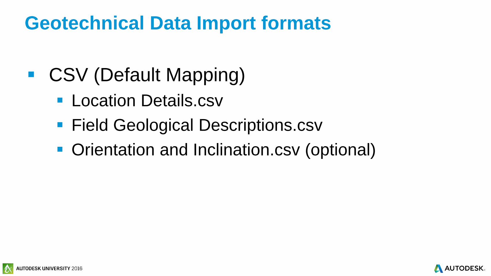
CSV (Default Mapping)
Location Details.csv
Field Geological Descriptions.csv
Orientation and Inclination.csv (optional)
Geotechnical Data Import formats

© 2016 Autodesk© 2016 Autodesk
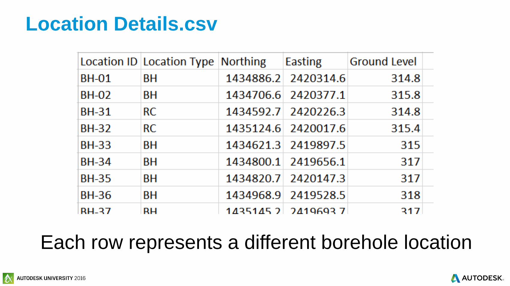
Column Heading Description Mandatory Example
Location ID Location unique ID Yes BH0001
Location Type Type of activity at location Yes RC
Easting Easting or longitude of the location
of hole
Yes 123456.4
Northing Northing or latitude of the location Yes 232467.3
Ground Level Ground level relative to datum of
location or start of traverse
Yes 35.43
Location Details.csv
© 2016 Autodesk© 2016 Autodesk
Location Details.csv
Each row represents a different borehole location

© 2016 Autodesk© 2016 Autodesk
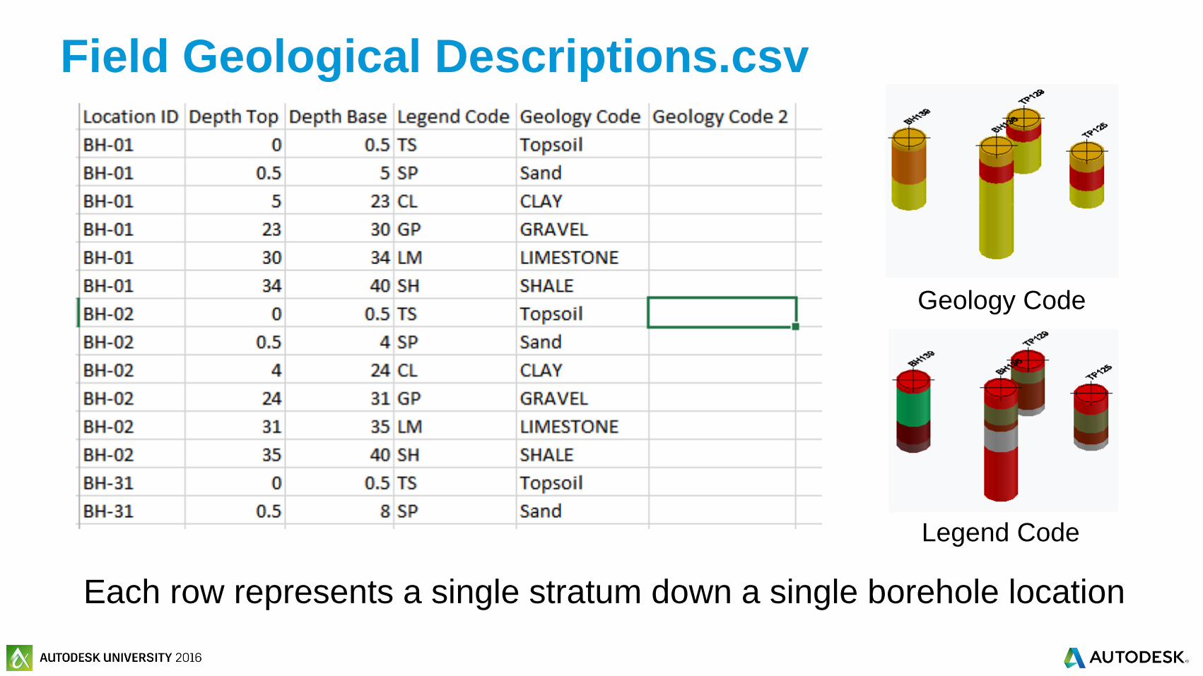
Column Heading Description Mandatory Example
Location ID Location identifier Yes BH001
Depth Top Depth to the TOP of stratum Yes 7.43
Depth Base Depth to the BASE of description Yes 8.12
Legend Code Legend code 102
Geology Code Geology code LC
Geology Code2 Second geology code SAND
Field Geological Descriptions.csv
One must be set
© 2016 Autodesk© 2016 Autodesk
Field Geological Descriptions.csv
Each row represents a single stratum down a single borehole location
Geology Code
Legend Code

© 2016 Autodesk© 2016 Autodesk
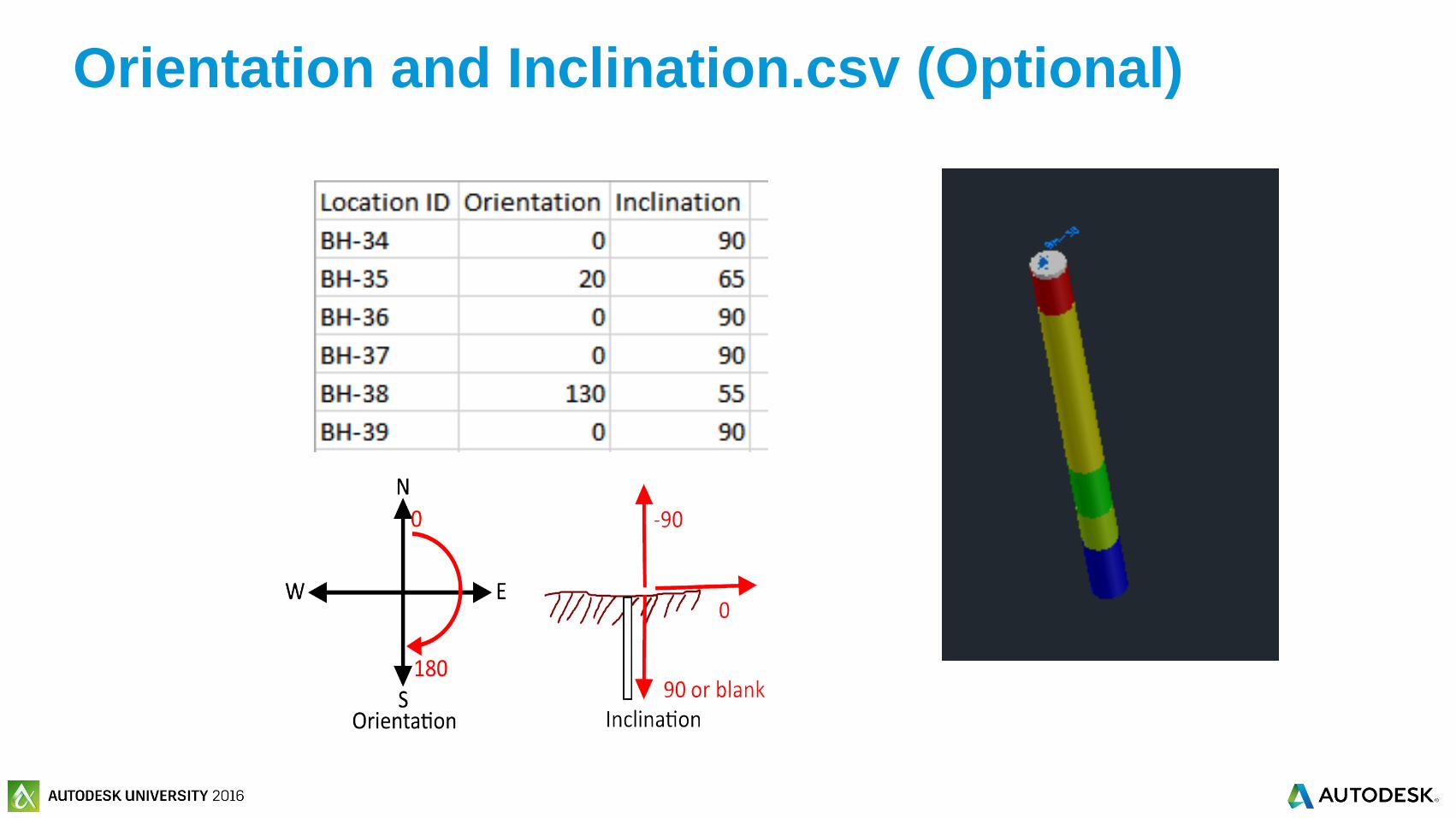
Column Heading Description Mandatory Example
Location ID Location identifier Yes BH001
OrientationOrientation of hole (degrees Clockwise from
north)135
InclinationInclination of hole (measured positively down
from horizontal in deg)75
Orientation and Inclination.csv (Optional)
© 2016 Autodesk© 2016 Autodesk
Orientation and Inclination.csv (Optional)

© 2016 Autodesk© 2016 Autodesk
Exercise 2: Import Geotechnical Data
© 2016 Autodesk© 2016 Autodesk
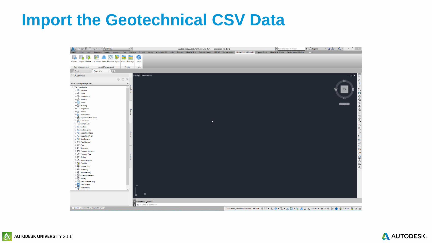
Import the Geotechnical CSV Data
© 2016 Autodesk© 2016 Autodesk
Create and visualize 3D boreholes and
geology strata surfaces

© 2016 Autodesk© 2016 Autodesk
Quick Tour of the Location Manager
© 2016 Autodesk© 2016 Autodesk
Exercise 3: Visualizing the
Borehole Locations

© 2016 Autodesk© 2016 Autodesk
Visualizing the required Borehole Locations
© 2016 Autodesk© 2016 Autodesk
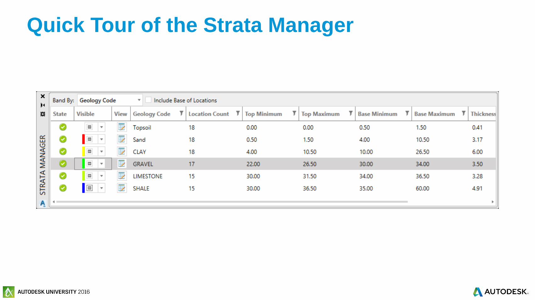
Quick Tour of the Strata Manager
© 2016 Autodesk© 2016 Autodesk
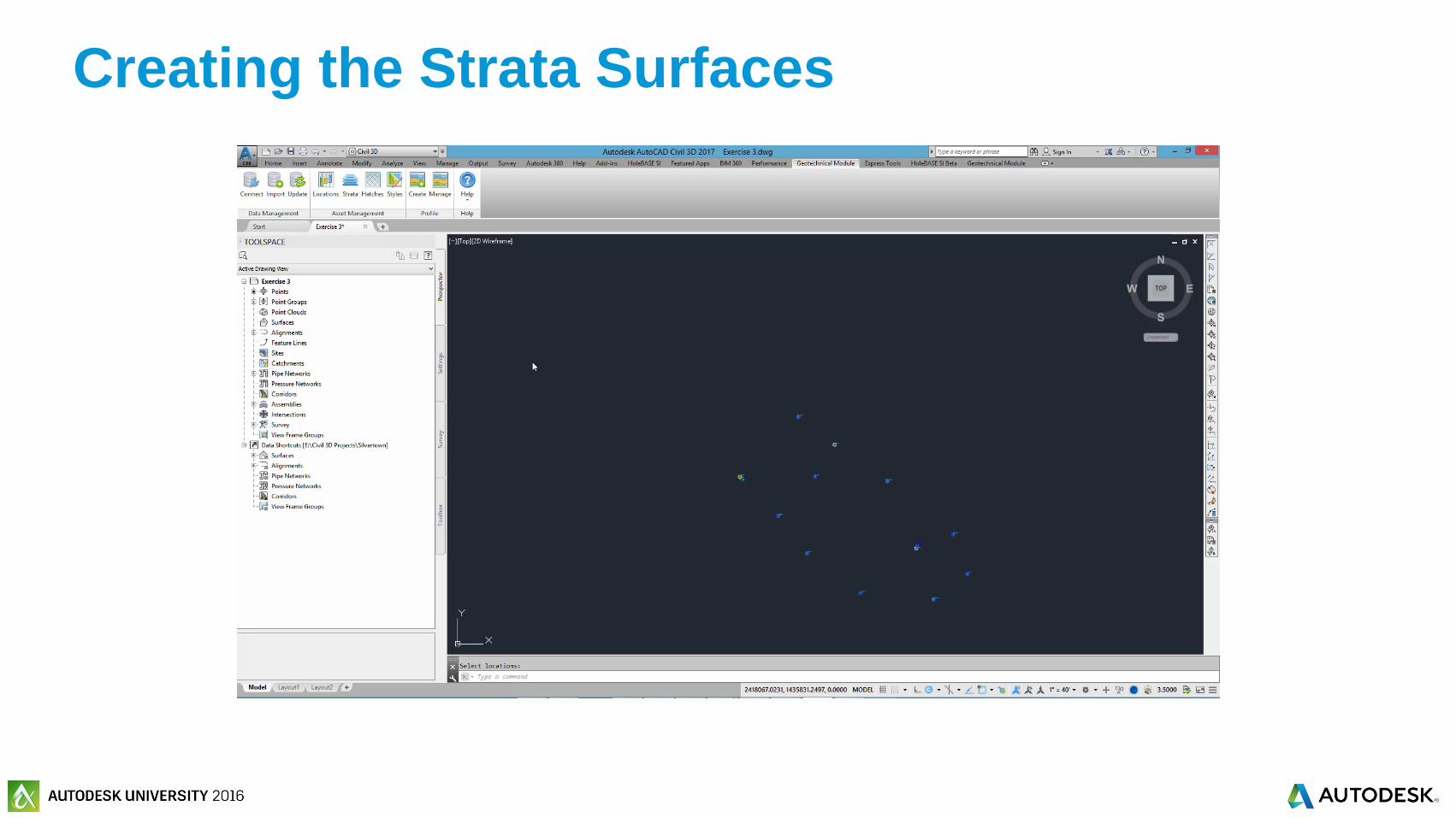
Exercise 4: Creating the Strata Surfaces
© 2016 Autodesk© 2016 Autodesk
Creating the Strata Surfaces

© 2016 Autodesk© 2016 Autodesk
Create Dynamic Geotechnical Profile
Views with Borehole Log Strips
© 2016 Autodesk© 2016 Autodesk
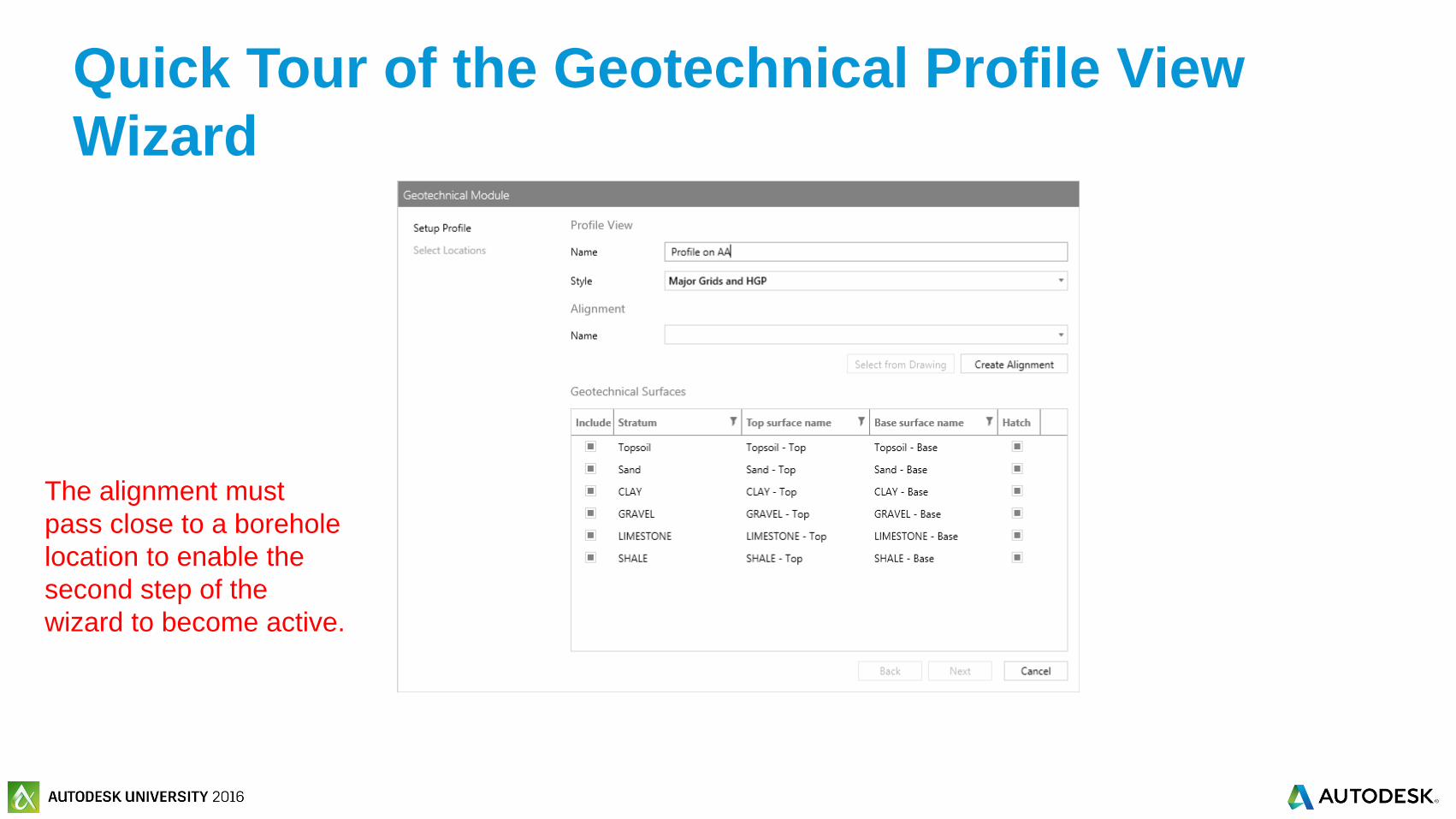
Quick Tour of the Geotechnical Profile View
Wizard
The alignment must
pass close to a borehole
location to enable the
second step of the
wizard to become active.

© 2016 Autodesk© 2016 Autodesk
Exercise 5: Creating a Geotechnical
Profile View

© 2016 Autodesk© 2016 Autodesk
Creating a Geotechnical Profile View
© 2016 Autodesk© 2016 Autodesk
Exercise 6: Update Strata Surfaces and
Profiles

© 2016 Autodesk© 2016 Autodesk
Update Strata Surfaces and Profiles


© 2016 Autodesk© 2016 Autodesk
Who wants free geotechnical modeling training?
Hold up your
business card

© 2016 Autodesk© 2016 Autodesk
Your class feedback is critical. Fill out a class survey now.
Use the AU mobile app or fill out a class survey online.
Give feedback after each session.
AU speakers will get feedback
in real-time.
Your feedback results in better
classes and a better AU experience.
How did I do?

Autodesk is a registered trademark of Autodesk, Inc., and/or its subsidiaries and/or affiliates in the USA and/or other countries. All other brand names, product names, or trademarks belong to their respective holders. Autodesk reserves the right to alter product and services offerings, and
specifications and pricing at any time without notice, and is not responsible for typographical or graphical errors that may appear in this document. © 2016 Autodesk, Inc. All rights reserved.
© 2016 Autodesk. All rights reserved.