aim: how did environmental conditions shape life in india ? do now: document 6 – answer in...
TRANSCRIPT
Aim: How did environmental conditions shape life in India ?
Do Now: Document 6 – Answer in notebooks
1) How does the author compare India to Mesopotamia and Egypt?
2) How does the document provide evidence of the high level of development of the Indus
Valley people?

Geography
• The Indian subcontinent includes India, Pakistan and Bangladesh.
• A the highest mountains in the world, Hindu Kush, Karakorum and Himalayan ranges separate this region from the rest of India.

Physical GeographyThe Indian subcontinent extends south from central Asia into the Indian Ocean
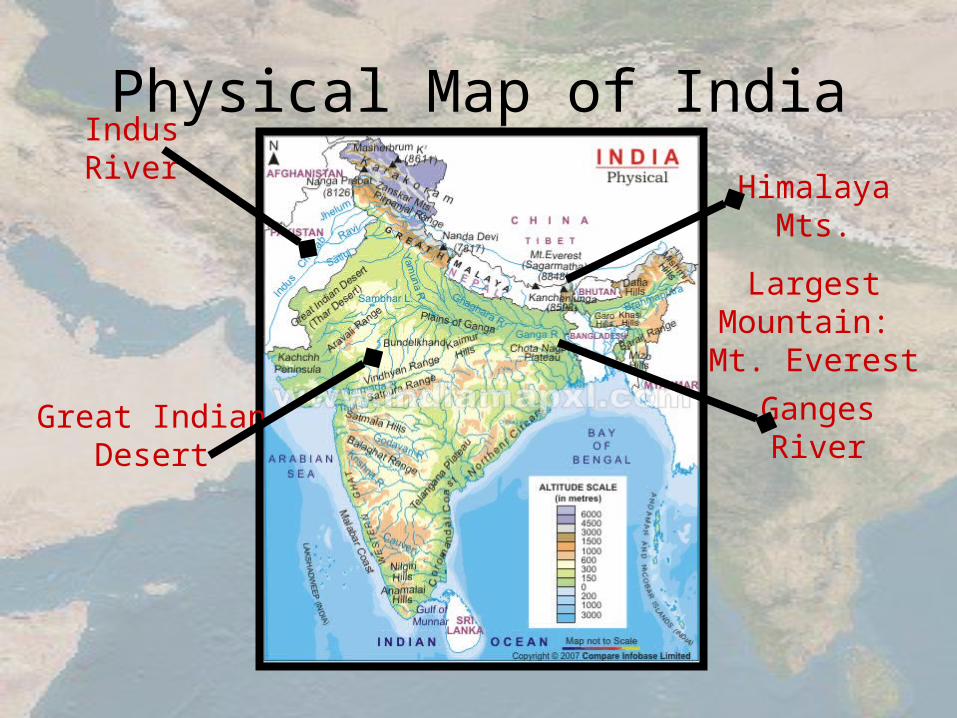
Physical Map of India
Himalaya Mts.
Largest Mountain: Mt.
Everest
Great Indian Desert
Ganges River
Indus River
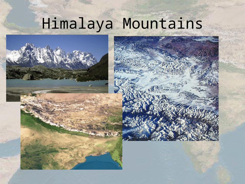
Himalaya Mountains
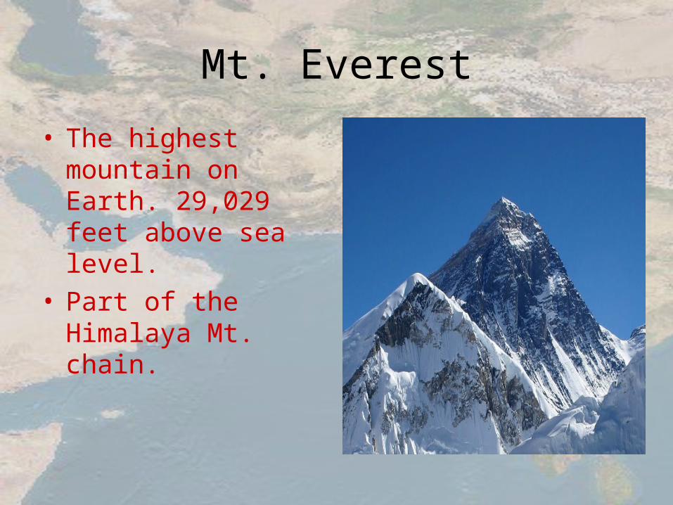
Mt. Everest
• The highest mountain on Earth. 29,029 feet above sea level.
• Part of the Himalaya Mt. chain.

Why would you want to climb Mt. Everest?
• Because it was there!!• 1953: Edmond Hillary
and Tenzing Norgay were the first men to climb to the top of Mt. Everest.

Regions
Two great rivers - the Ganges and Indus – risein the mountains and drain Indo-Gangetic Plain

Regions
South of the I-G Plain is the Deccan Plateau, bordered by the Eastern and Western Ghats

Regions
Narrow coastal plains lie along the Arabian Sea and the Bay of Bengal

RegionsThe peoples of these coastal plains became sea traders

Monsoons
• Seasonal winds that dominate India’s climate.
• From October to February, they blow dry air.
• From June to October the winds shift and bring lots and lots of rain.

MonsoonsMonsoons - seasonal winds that blow from the NE Nov. to Mar. and from the SW June to Oct.
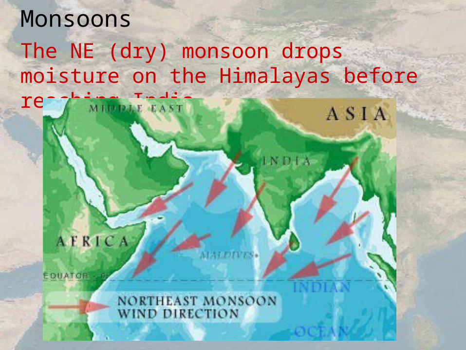
MonsoonsThe NE (dry) monsoon drops moisture on the Himalayas before reaching India
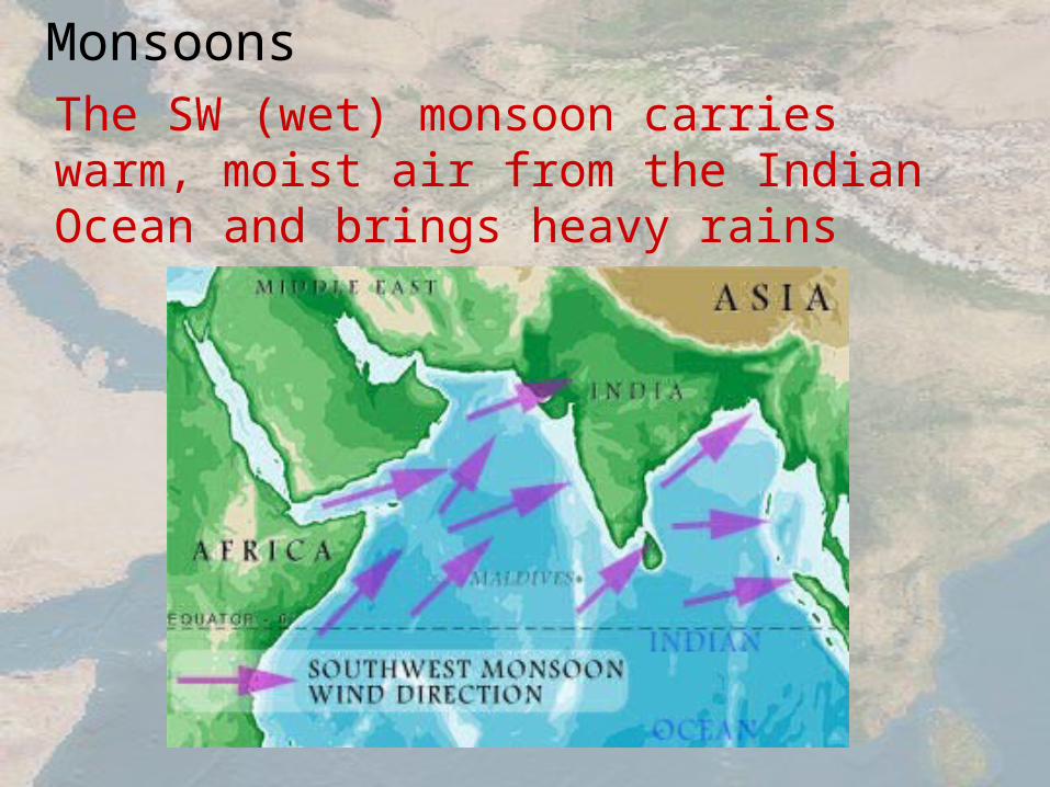
MonsoonsThe SW (wet) monsoon carries warm, moist air from the Indian Ocean and brings heavy rains

MonsoonsThe wet monsoon brings most of the year’s rainfall and is important for agriculture
20cm = 7.9in
100cm = 39.4in
400cm = 13.2ft
800cm = 26.3ft
1000cm = 32.8ft
Monsoons
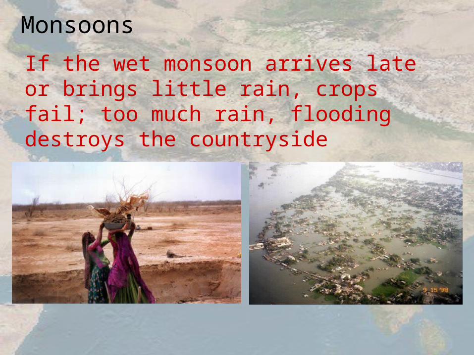
If the wet monsoon arrives late or brings little rain, crops fail; too much rain, flooding destroys the countryside

Effects of the Monsoon Rains

TemperatureTemperatures can reach 120ºF in the Indo-Gangetic Plain
Aurangabad, India 15 C = 59 F 30 C = 86 F
45 C = 113 F
Question
• What made the Indus Valley a good place for a civilization?
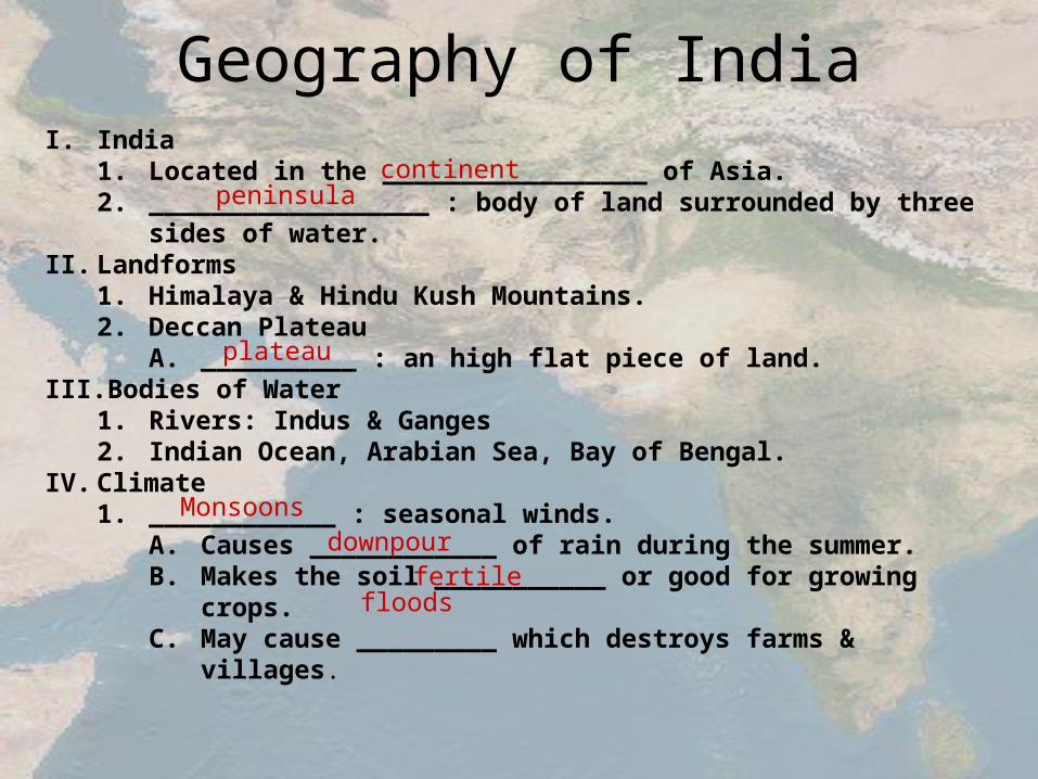
Geography of IndiaI. India
1. Located in the _________________ of Asia.2. __________________ : body of land surrounded by three sides of
water.II. Landforms
1. Himalaya & Hindu Kush Mountains.2. Deccan Plateau
A. __________ : an high flat piece of land.III. Bodies of Water
1. Rivers: Indus & Ganges2. Indian Ocean, Arabian Sea, Bay of Bengal.
IV. Climate1. ____________ : seasonal winds.
A. Causes ____________ of rain during the summer.B. Makes the soil ___________ or good for growing crops.C. May cause _________ which destroys farms & villages.
continentpeninsula
plateau
Monsoonsdownpour
fertilefloods