agent-based modeling for community resource management ...agent-based modeling for community...
TRANSCRIPT

Agent-Based Modeling for Community Resource Management: Acequia-based Agriculture
Abstract Water management is a major concern across the world. From northern China to the Middle East to Africa to the United States, growing populations can stress local water resources as they demand more water for both direct consumption and agriculture. Irrigation based agriculture draws especially heavily on these resources and usually cannot survive without them; however, irrigation systems must be maintained, a task individual agriculturalists cannot bear alone. We have constructed an agent-based model to investigate the significant interaction and cumulative impact of the physical water system, local social and institutional structures which regulate water use, and the real estate market on the sustainability of traditional farming as a lifestyle in the northern New Mexico area. The regional term for the coupled social organization and physical system of irrigation is “acequias”. The results of the model show that depending on the future patterns of weather and government regulations, acequia-based farming may continue at near current rates, shrink significantly but continue to exist, or disappear altogether. Keywords: agent-based modeling, land-use, integrated models
1 Introduction Water has been an important resource throughout human history. It is crucial not only for
direct human consumption but also for agriculture, especially in marginally arable
regions. Irrigation is correlated with social complexity, as everything from government
bureaucracies (Lees, 1994) to new legal formalisms (Butzer et al., 1985) have sprung up
to maintain and manage water systems. Ancient Egyptian irrigation was quite
sophisticated, and China has records of irrigation from as far back as 1600 BCE (Chang-
Qun et al., 1998). The need for these systems continues into the present day and across
the world. In modern China, (Jowett, 1986) widely across the Middle East and Africa,
(Giordano et al., 2002) and various places within the United States (Postel, 2000)
growing populations are placing enormous stress on local water resources. Irrigation
based agriculture draws heavily on these resources; however, irrigation systems must be
maintained, a task individual agriculturalists cannot bear alone. A great deal of research
has been devoted to the problem of irrigation management and water usage (e.g. Schluter
& Pahl-Wostl, 2007; Janssen, 2007; van Oel, 2009).
In arid northern New Mexico, water is a scarce and precious commodity. A traditional

local system of water management has evolved, which involves landowners collectively
maintaining and managing ditches which distribute water among the properties. This
system of the physical ditches and the maintaining organization together is known as an
acequia, and the landowners who maintain it are called parciantes. Acequias are
especially interesting to researchers because of the developed common property regimes
they require to function.
The water carried by the ditches is a shared resource, and the complex management
system of the acequia has evolved to avoid Hardin’s Tragedy of the Commons with
regard to natural resources in the sense that it prevents the resource from being overused
or under-maintained to the detriment of everyone (Hardin, 1968). Ostrom (1990) has
extensively studied the process of sharing such resources, investigating the structures set
in place to preserve them. In “Governing the Commons”, her book on common pool
resources and human-ecosystem interactions, she suggests a set of characteristics that
define stable communal social mechanisms. These characteristics include the presence of
environment-appropriate rules governing the use of collective goods and the efficacy of
individuals in the system. These rules do exist in the acequia system, although there have
of late been legal battles to define the distinction between owning land and owning water
and how this distinction impacts the right of an individual to participate in the community
decision-making process. Brown and Rivera (2000) in particular highlight how changes
in the social and political environment have lead to tensions between the collective nature
of acequias and private property rights.
Despite the historical strengths of the system, parciantes are increasingly pressured to
convert farmland into residential space. Any effort to protect this traditional form of
agriculture relies on researchers and policy makers developing an understanding how the
different parts of the system interact and how rigorous the system is to perturbation. The
simulation presented here seeks to model land-use in acequia-dependent areas as it is
determined by a combination of physical, economic, and social factors. The goal of this
paper is to construct a tool that will help explore these relationships and their
interdependencies, allowing a researcher or policy-maker to interact with the systems and

understand them in an intuitive fashion. To this end, an agent-based model of the
acequia-irrigated land around the county of Taos, New Mexico, has been constructed.
Roughly 40km2 of the 400km2 of land in the Taos valley is acequia irrigated (Cox &
Ross, 2011). Figure 1 displays a map of some of the tracts of land associated with this
form of agriculture to give a sense of the interplay between and morphology of acequia
tracts and the water system. Local pressure to use farmland for non-agricultural purposes
is mainly the result of in-migration and the building of single-family residences,
condominiums, and mobile homes (Cox & Ross, 2011).
The remainder of this paper is structured as follows. Section 2 outlines the rationale for
creating an agent-based model (ABM) loosely coupled to GIS in order to study acequia-
based agriculture; with this justification, Section 3 describes the model as it is
implemented. Results from this model are discussed in Section 4. Section 5 provides a a
summary of what has been presented and identifies further avenues of research.
2 Background Acequias have been the focus of a great deal of research because of their importance to
agriculture in New Mexico’s otherwise arid environment. Past research has focused upon
many different aspects of their persistence, building toward an understanding of the
social, political, legal, and physical structures which make up this complex environment
(see Cox, 2010; Cox & Ross, 2011 for reviews). To date, no other studies have focused
upon modeling such a system, but previous work highlights the complex nature of the
acequias system and motivates this research.
The simulation presented in this paper utilizes ideas from complexity theory within an
agent-based modeling context. This is particularly appealing in understanding acequias in
the sense that the processes involved in acequia use are not neatly decomposable into
separate subprocesses because of the critical importance of interactions and feedbacks
among them. This interplay between humans and the environment is a feature of many
complex social systems (Epstein & Axtell, 1996). The most important agents in the
system are the parciantes, who are farmers as well as land and water right holders who

utilize traditional forms of irrigation. Parciantes’ ability to grow crops depends upon the
maintenance of local acequias, and so their economic decisions directly shape the
morphology of the water network. Parciantes are also under pressure from developers
who want to convert agricultural land into residential space, which is in high demand
locally (Cox & Ross, 2011). Their choices about whether and when to sell land have long
term ramifications: land is a finite resource and, once converted from rural agricultural to
residential purposes, is difficult to convert back (it is easy to build a house on a flat field,
but more difficult to dig out the foundations of a building and reconnect it to a decayed
water network). Additionally, breaking up the land to use it for residential purposes tends
to subdivide the land, making it difficult to gather up all of the now-residential pieces and
forge them back into a piece of farmland large enough to justify farming again. The cost
of land conversion is therefore high when one is turning residential land into farmland
and quite low when moving in the opposite direction (Cox & Ross, 2011).
The functioning of the physical water network, the actions of parciantes, and the impact
of either of these processes on the other necessitate building an integrated model of the
acequia system. In the model described in Section 2, an economic model of land holders
rests atop the physical water flow model of the acequias themselves; this layering is
motivated by the fact that in the “real world”, land can be subdivided and subsequently
sold, sometimes without water rights to the acequias connected to it (Brown & Rivera,
2000). If the land is sold without water rights, it is impossible for the tenant of the land to
carry out agricultural work.
To capture the complexity of the system, we create an ABM. Agent-based modeling
focuses on representing heterogeneous populations of individuals and their interactions
with their environment or one another which result in emergent phenomena (Epstein &
Axtell, 1996). This approach relates to the notion of generative social science (Epstein,
2007) wherein we can exploit controlled “laboratory” conditions and grow a system from
the bottom up in order to isolate the sources of aggregate phenomena. Such a modeling
technique has been used in many disciplines, ranging from archaeology, economics,
ecology, geography, to political science, to name but a few (Crooks & Castle, 2012).

Agent-based modeling has the notable advantage of being one of the few modeling
techniques that allows researchers to incorporate the true heterogeneity of humans into
models (Axtell, 2000). With respect to this paper, this is to our knowledge the first model
to explore acequias; it builds upon a growing body of literature documenting the use of
ABMs to study agricultural practices (e.g. Parker et al., 2003; Schluter & Pahl-Wostl,
2007; van Oel, 2009). These ABMs have grown from more formal treatment of such
systems using statistical models, equation-based models, system models, expert models,
evolutionary models, cellular models, and hybrid models which explore farming and its
impact on the environment (e.g. Angelsen & Kaimowitz, 1999; Chuvieco, 1993;
Balmann, 1997, Briassoulis, 2000, Maatman et al., 2002). However, many such models
do not focus on human behavior per se. For example, statistical models play down the
role of individual decision making while equation-based models seek static or
equilibrium solutions, which can be problematic because systems tend to be far from such
states (Parker et al., 2003). Researchers have employed cellular automata to simulate
similar socially driven processes (e.g. Hegselmann, 1998; Balmann, 1997) or genetic
algorithms to tackle agricultural land market auction asking prices (Balmann & Happe,
2000). But when heterogeneous human behavior drives a system in constant flux, these
techniques are unable to capture the critical dynamics of human-environmental
interactions.
One of the advantages of using ABMs is that researchers can model processes at a variety
of different spatial and temporal scales, selecting the level of abstraction appropriate to
the question being answered. For example, models of the economic decision-making
process of farmers have been studied across a broad range of scales. Evans et al. (2001)
focused on household decision-making, wherein the agents make annual choices about
labor allocation. Berger (2001) explored how farmers adopt new technology at a regional
scale, and Gotts and Parker (2004) explore the distribution of farm sizes at the national
level. In studying acequias, however, it is not just the behavior of parciantes that interests
us. It is also the competition between different land-uses (e.g. agricultural versus urban),
which results in the development of urban land markets. This competition plays out at the
level of individual agents, necessitating an understanding of land market models from the

agent perspective (e.g. Filatova et al., 2009, Magliocca et al., 2011). In a sense, these
models build upon the classic work of von Thünen (1826) and Alonso (1964). In addition
to the importance of the economic and water network systems, the spatial environment is
critical to the long-term dynamics surrounding acequias. Within agent-based models,
space serves two purposes: it contains the agents and it defines the spatial relationships
between agents, which controls their interactions. By linking ABM and GIS in a model,
agents are situated within actual geographic locations, making their interactions more
representative of the real world (Crooks & Castle, 2012). Such integration has been
applied from the study of micro phenomena ranging from scales as small as pedestrian
movement (e.g. Haklay et al., 2001) to meso-scale issues such as residential segregation
(e.g. Benenson et al., 2002) to more macro scale issues such as urban growth and sprawl
(Xie et al., 2007). The linkage of the two is considered important because the generative
nature of agent-based modeling provides a mechanism to discover new decision making
frameworks, a capacity traditional GIS analysis lacks (Robinson et al., 2007).
By creating an integrated model, we can potentially provide new insights into the spatio-
temporal dynamics of acequias. Agent-based modeling provides us the ability to
incorporate behavior, an explicit spatial environment through GIS, and a basic
hydrological model to simulate water and sedimentation through the system. The use of
integrated models is not new in the geographical sciences (e.g. Engelen et al., 2003; Tang
et al., 2005), however, many of such models do not focus on the land-use decisions of
individual farmers, let alone the purposive impact of those farmers on regional
hydrology. For example Tang et al. (2005) integrate a cellular automata model of urban
growth and a stream flow model to explore the impact of this growth with respect to
increased levels of pollution.
3 The Model The following description is loosely based upon the Grimm et al. (2006) Overview
Design Details protocol, which is advocated in the land-use/cover change community and
the modeling community more generally to highlight the underlying mechanisms of the
designed system. We will first present a brief overview of the model, including its

purpose, its underlying technology, and its parameters with their associated ranges. The
sources of the data are discussed next, followed by a description of the overarching
structure of the objects’ internal structure, interactions, and scheduling. The model and
data are available for download at http://www.css.gmu.edu/acequia.
3.1 Purpose The purpose of the model in the short term is to study the viability of acequia-based
agriculture with regard to either fluctuations or persistent trends in patterns of population
pressure, climate, and cultural valuation. The ultimate goal in developing such a model is
to inform policy work about the sustainability of acequia-based agriculture under
different conditions. By allowing policy makers to compare side-by-side counterfactual
histories, the model can help estimate the effectiveness of different policies across a wide
range of futures.
3.2 Methodology The simulation is a spatially explicit ABM programmed in Java utilizing and extending
the MASON Simulation Toolkit (Luke et al., 2005) and its GeoMason extension
(Sullivan et al., 2010). It consists of a number of modules that capture the physical,
economic, and social processes that impact land-use patterns in the northern New Mexico
area. The model is designed to be a tool for researchers, so it includes a series of overlaid
maps showing various attributes of the spatial environment, graphs which track the
number of Parciantes and compare the number of urbanized and agricultural tiles, and an
interface which allows to user to hide layers of information or modify the parameters of
the environment mid-run. The layers of information displayed include land-use, river
location, acequia location, transportation networks, the locations of tracts of farmland,
urbanization levels, and elevation. The model includes a number of parameters which can
be adjusted to suit the underlying assumptions of the researcher, as presented in Table 1
and discussed further in Section 4.
The model includes a graphical user interface, one configuration of which is displayed in
Figure 2. Clockwise from the top left, the graphical user interface (GUI) features a map

with the option to activate or deactivate any layer of data, the model controller, a panel of
adjustable parameters, and a series of graphs. The graphs summarize the dynamics of
important system statistics over time. Such an interface allows for ease of use in
understanding and debugging the model (Grimm, 2002).
3.3 Data Data utilized within the model comes from the work of Cox (2010) and is supplemented
with GIS information from the United States Geological Survey’s EarthExplorer (2011).
The data represent the county of Taos and its surrounding area. The shapefiles were
processed with ArcGIS into 30m2 raster grid cells because this was the finest grain
resolution at which data was available for all of the necessary layers. The land-use
classification utilized here is that which is described in the work of Homer et al. (2007).
3.4 Objects Acequias are a complex system, and changes in the low-level dynamics associated with
that system make it difficult to understand the macro-trends in local development. In this
simulation, there are four major spatial, temporal, and behavioral processes represented:
the cultivation and sale of crops, the hydrological system, the functioning of a real estate
market, and acequia participation. Water, land, parciantes, and real estate agents are all
simulated to try to understand the interplay of these processes and to capture the turnover
of agricultural land into urbanized, residential space as that turnover is impacted by the
ever-critical access to water. An overview of the relationships between the types of
objects and the attributes of the objects is given in Figure 3, and a flowchart of the
process by which the different objects are scheduled is given in Figure 4. Every iteration
through the flowchart, or “tick”, represents a year in simulation time. A year was selected
because it provided an appropriate granularity of time during which the agents could
interact and make decisions. Simulations are typically run for a period of 50 years, a
number that reflects a reasonable time horizon for the utility of our results.
Water: Climate is abstractly simulated in this context by controlling rainfall and
therefore the amount of water available in the system for use in agriculture. Rainfall is

modeled on an annual scale, so the distribution of rain throughout the year is not
considered. The propagation of water throughout the environment is accomplished by a
network of rivers and acequias. This distinction between rivers and acequias is important
because acequias experience sedimentation at a rapid rate, while rivers typically do not
experience significant sedimentation over a 50 year period. The network represents the
waterways as directed links between the raster cells of the environment. At the beginning
of every year, a user-defined amount of rain is added across the network; the water moves
down the elevation gradient until no further movement is possible. Figure 5A shows the
elevation gradient overlaid with the water network, with the acequias in red. A closer
view of acequias and rivers is shown in Figure 5B. Acequias build up sedimentation –
that is, experience a decay in water system link weight - every year unless they are
maintained. A fraction of the water that flows through the decayed link is lost, in inverse
proportion to the link’s weight. An unmaintained section of acequia can eventually cut
off all ”downstream” nodes from access to hydration (discussed further in Section 4.1).
Land: Within the model land is a passive object, in that it is irrigated by the water
network and cultivated by Parciantes. Parciantes can choose to grow various kinds of
crops on their tracts of land tiles. The income (I) from a tract of land of size (P) on which
is planted a crop that brings in (C) units of money per unit of planted land is given by:
I = C ∗ P (1) The income derived from various crops is user-determined, and a range of crops can be
made available to the Parciantes in any given simulation. In fact, because Parciantes hold
multiple units of land as part of their land tract, it is possible for a Parciante to plant a
different crop on each of his units of land. This functionality would not be possible in a
cellular automata. Figure 1 shows a subset of the tracts of land included in the simulation,
and demonstrates the range in tract size and shape. Land becomes urbanized and unfit for
farming after it is sold. Figure 5C shows the initial pattern of urbanization relative to
acequias and roads, while Figure 5D contextualizes the land-use patterns relative to the
surrounding area.

Parciantes: The Parciante agents represent the individual acequia owners who make
land-use and acequia maintenance choices in the real world. In the context of the
simulation, Parciantes choose whether to maintain their acequias, plant crops, or sell their
land. A flowchart summarizing the choices of Parciantes and the order in which those
choices are made is shown in Figure 6. They have a number of attributes, including a set
of tiles of land (collectively, the tract), a reserve of money, and a “strategy” (discussed at
length below). Different tiles of land can be planted with different crops or even sold off
based on economic need, a capability not often present in land-use or land cover change
models. In the simulation described here, the reserve of money represents agent
resources, and if its value dips below zero the Parciante is forced to sell his land to any
bidder. Money is expended when the agent helps maintain his acequia, a cost burden (B)
which is determined by the length of the acequia (A), the number of Parciantes associated
with a given acequia (N), the number of rights (R) the agent has, and a weighting factor
(W) such that:
B = A ∗ R ∗ W/N (2) In this model, the parameter W is used to capture the cost of acequia-maintenance labor,
and can be lessened to simulate the reception of aid or raised to emulate labor becoming
more expensive. To reflect the importance of cultural heterogeneity and personal
preference in these decisions, Parciante agents are further endowed with a “strategy” that
defines their approach to land-use decisions. One example of such a strategy is the
Traditionalist, who values his land above all else and will hold onto it for as long as his
money holds out. A different strategy, the Follower, leads the Parciante to observe what
his neighbors are doing, and emulate the behavior of the majority. A third implemented
strategy is that of the Prodigal Son, who detests farming and will sell his land as soon as
some minimal price is offered to him. These simple policies represent only a fraction of
the behavioral complexity that Parciante agents could display. Parciante interaction and
influence happen either through the emulation of other Parciante choices, as in the
Follower strategy, or as Parciantes retire from farming and stop maintaining their
acequias, placing greater maintenance burdens on their fellow Parciantes.

Real Estate Agents: The Real Estate Agents represent the rising demand for housing in
the area, and their goal is to buy and develop as much land as possible. These agents are
endowed with a certain budget and randomly contact Parciantes to offer them a sum of
money in exchange for their particular tract of land. The offer prices follow the model
proposed by Filatova et al. (2009) and consist of a budget constraint (Y), a utility
constraint (U), and a final offer price (O) that is based on both the budget and utility. An
agent with budget (B) bidding on a tract with transport cost (T, proportional to the
distance of the tract from the road) has a constraint that he cannot bid more money than
he has, so his budget constraint is his budget less the transport costs. The utility (U) is a
function of the amenity (A - here, the utility of the land is assumed to be equivalent to the
tract size) and the normalized distance of the tract from the economic center (P). The
offer price (O) is calculated relative to the agent’s budget, the utility of the tract, and a
weighting factor (b). This weighting factor is based on the work of Filatova et al. (2009)
and reflects the affordability of housing relative to other goods, for example the cost of
crops. These can be summarized as follows:
Y = B−T (3) U = Aα Pβ (4) O = Y U2 (5)
(b2 + U2) If the Parciante agent accepts the Real Estate Agent’s offering price, the tract of land is
urbanized and the Parciante removed from the simulation. The distribution of Real Estate
Agent budgets is determined by the user and can be modified mid-run. The scheduling of
Real Estate Agents in the simulation is shown in Figure 7.
4 Results Given the richness of this model, only a sample of our results will be presented here. We
have selected a series of case studies that are representative of the capabilities of the
model. For interested readers, an executable of the model along with the source code and
data are available at the project website (http://www.css.gmu.edu/acequia). We do this
for the sake of replication and docking, because if a model cannot be meaningfully
compared to other work its credibility is unverifiable and its ramifications necessarily
proscribed (Axtell et al., 1996). Before we can present the results, however, we turn to

verification and validation of the model.
4.1 Verification and Validation Within this paper we refer to “verification” as the process of ensuring that the
implemented model matches the designed model (North & Macal, 2007). This process
involved checking that the components of the model behave as expected, a feature which
is often taken for granted. Performing this type of verification is sometimes referred to as
testing the “inner validity” of the model (Brown, 2006). The model was built in an
iterative fashion, and we ensured that each of the submodules demonstrates the
appropriate behavior over the space of acceptable inputs, stepping through the code as
advocated by Gilbert and Troitzsch (2005). To test that the water network functioned
correctly, for example, we deactivated all of the Parciantes and allowed the acequias to
go unmaintained for several decades. We then compared this unmaintained environment
with one filled with eternally vigilant Parciantes, and found that the decaying and
maintenance functionalities produced the logical and expected results. Figure 8 compares
the result of these two tests side-by-side, with Figure 8A showing the acequias flowing
freely after 100 years of regular maintenance and Figure 8B showing the unmaintained
tracts carrying substantially less flow after the same amount of time.
To validate the assumption that the included parameters had reasonable impacts on the
model outcome, a parameter sweep was carried out. Each input parameter was varied to
explore its effect on the simulation outcome, and especially on final land-use patterns.
Varying each of the parameters did produce a statistically significant and reasonable
impact on the number of surviving Parciantes at the end of a 50-year period. As an
example, we present here two such comparisons, varying either the amount of rainfall or
the number of real estate agents in the system. The results of the simulation are presented
here in terms of the number of agricultural tiles that were ultimately urbanized, the total
number of Parciantes who sold their land, and the total number of acequias which were
no longer being cared for by the end of the simulation. Each of the scenarios described
was run 30 times, and the reported statistics represent the averages of the measured
variables over all of the runs. In each of these verification efforts, 80% of the Parciantes

were assigned to be “Followers” while the remaining population was evenly divided
between Prodigal Sons and Traditionalists.
4.1.1 Rainfall In the case of variation of amount of rainfall, the “Drought” scenario corresponds to a
rainfall of 1 unit annually while the “Flood” scenario indicates rainfall of 50. The base
case used as a point of comparison here is the “Default” scenario, which has a rainfall of
15 units. As seen in Table 2, the effects of varying the rainfall are noticeable. In the
default scenario, 506.1 tiles of agricultural land were lost by Parciantes over the course of
the simulation, a number massively less that that associated with the drought scenario and
noticeably greater than that associated with flooding. The variation in the number of
Parciantes lost is informative in light of this fact, as we see roughly equivalent numbers
of farmers lost in the Default and Drought scenarios while the Flood scenario produces
much higher rates of retention. Because the number and budgets of Real Estate Agents
are constant, the loss of Parciantes is capped by the limited demand for land. However,
the Real Estate Agents can afford to buy bigger tracts of land as Parciantes are squeezed
out by low crop yields. We can compare these with the Flood scenario, in which
Parciantes can grow crops without being thwarted by the weather and fewer farmers
either choose or are forced to leave.
4.1.2 Real Estate Agents The results of varying the number of Real Estate Agents are summarized in Table 3. The
Default scenario with 10 Real Estate Agents is compared to simulations with either 0 or
100 Real Estate Agents. Again, the impact of the variation is noticeable and reasonable:
when demand increases, more Parciantes’ land is “consumed”. Likewise, when demand
decreases to the point of not existing, no land is consumed. We can use these results to
further verify the correct functioning of the model. Even when demand is completely
absent and no land is being urbanized, some acequias are lost. This is due to the fact that
some acequias were not associated with any Parciantes at the beginning of the simulation
because either the land had been urbanized before the simulation began or the acequias
are not near any land currently being used for agricultural work. However, as the number
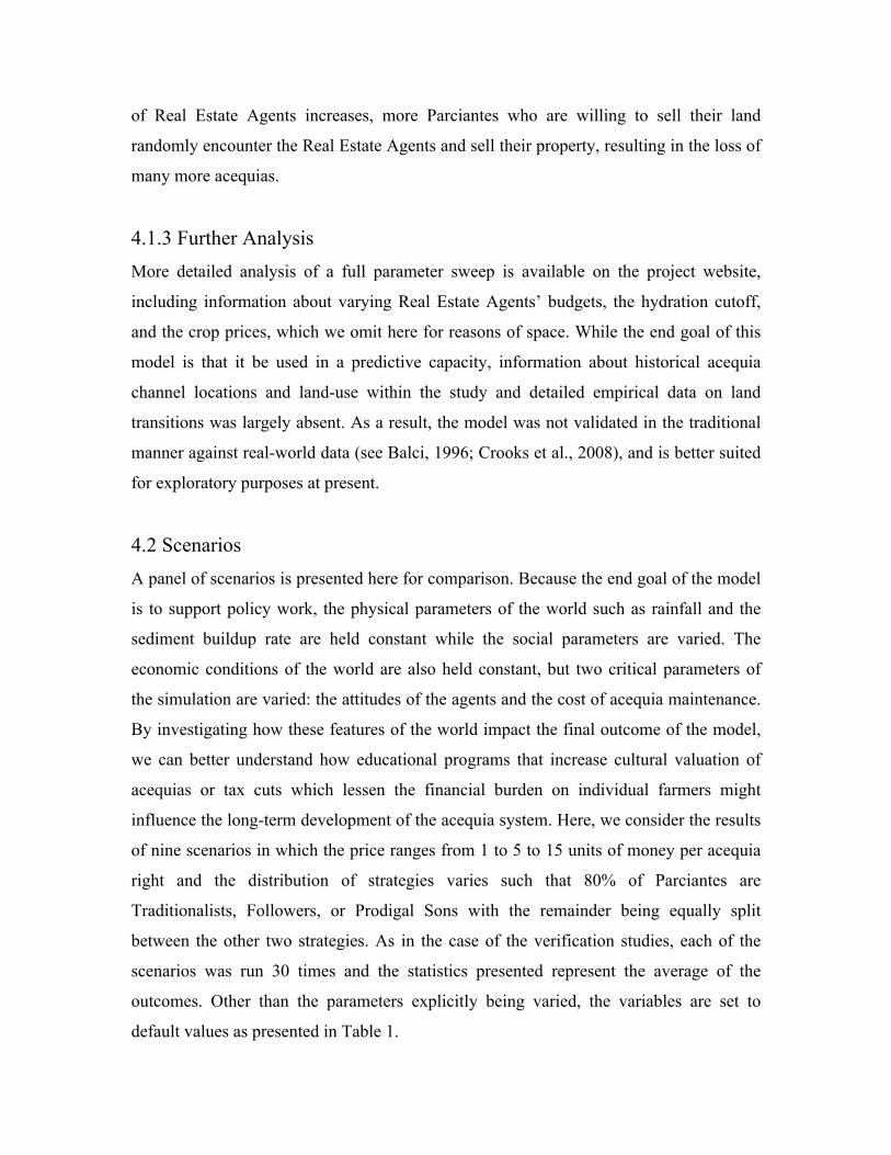
of Real Estate Agents increases, more Parciantes who are willing to sell their land
randomly encounter the Real Estate Agents and sell their property, resulting in the loss of
many more acequias.
4.1.3 Further Analysis More detailed analysis of a full parameter sweep is available on the project website,
including information about varying Real Estate Agents’ budgets, the hydration cutoff,
and the crop prices, which we omit here for reasons of space. While the end goal of this
model is that it be used in a predictive capacity, information about historical acequia
channel locations and land-use within the study and detailed empirical data on land
transitions was largely absent. As a result, the model was not validated in the traditional
manner against real-world data (see Balci, 1996; Crooks et al., 2008), and is better suited
for exploratory purposes at present.
4.2 Scenarios
A panel of scenarios is presented here for comparison. Because the end goal of the model
is to support policy work, the physical parameters of the world such as rainfall and the
sediment buildup rate are held constant while the social parameters are varied. The
economic conditions of the world are also held constant, but two critical parameters of
the simulation are varied: the attitudes of the agents and the cost of acequia maintenance.
By investigating how these features of the world impact the final outcome of the model,
we can better understand how educational programs that increase cultural valuation of
acequias or tax cuts which lessen the financial burden on individual farmers might
influence the long-term development of the acequia system. Here, we consider the results
of nine scenarios in which the price ranges from 1 to 5 to 15 units of money per acequia
right and the distribution of strategies varies such that 80% of Parciantes are
Traditionalists, Followers, or Prodigal Sons with the remainder being equally split
between the other two strategies. As in the case of the verification studies, each of the
scenarios was run 30 times and the statistics presented represent the average of the
outcomes. Other than the parameters explicitly being varied, the variables are set to
default values as presented in Table 1.
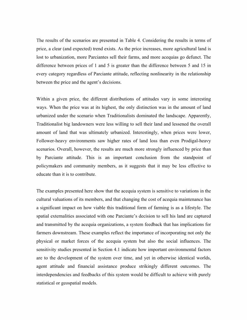
The results of the scenarios are presented in Table 4. Considering the results in terms of
price, a clear (and expected) trend exists. As the price increases, more agricultural land is
lost to urbanization, more Parciantes sell their farms, and more acequias go defunct. The
difference between prices of 1 and 5 is greater than the difference between 5 and 15 in
every category regardless of Parciante attitude, reflecting nonlinearity in the relationship
between the price and the agent’s decisions.
Within a given price, the different distributions of attitudes vary in some interesting
ways. When the price was at its highest, the only distinction was in the amount of land
urbanized under the scenario when Traditionalists dominated the landscape. Apparently,
Traditionalist big landowners were less willing to sell their land and lessened the overall
amount of land that was ultimately urbanized. Interestingly, when prices were lower,
Follower-heavy environments saw higher rates of land loss than even Prodigal-heavy
scenarios. Overall, however, the results are much more strongly influenced by price than
by Parciante attitude. This is an important conclusion from the standpoint of
policymakers and community members, as it suggests that it may be less effective to
educate than it is to contribute.
The examples presented here show that the acequia system is sensitive to variations in the
cultural valuations of its members, and that changing the cost of acequia maintenance has
a significant impact on how viable this traditional form of farming is as a lifestyle. The
spatial externalities associated with one Parciante’s decision to sell his land are captured
and transmitted by the acequia organizations, a system feedback that has implications for
farmers downstream. These examples reflect the importance of incorporating not only the
physical or market forces of the acequia system but also the social influences. The
sensitivity studies presented in Section 4.1 indicate how important environmental factors
are to the development of the system over time, and yet in otherwise identical worlds,
agent attitude and financial assistance produce strikingly different outcomes. The
interdependencies and feedbacks of this system would be difficult to achieve with purely
statistical or geospatial models.

5 Conclusion The model presented here uses empirical GIS data to build a realistic model of a complex
socio-physical system. By representing the interacting modules of physical, economic,
and social processes, the interconnected nature of the acequia system is more precisely
represented. The results highlight the importance of this unified approach; the scenarios
presented above show that largely similar environments can result in very different trends
of land-use and development in terms of the number of urbanized tiles or functioning
acequias at the end of 50 years. The use of an agent-based model to understand the
interaction of the different stakeholders and the environment from the bottom up was
crucially important for representing interaction among the agents, social influence, and
the way individual choices can impact the environment and thus propagate forward to
impact others.
As with all models, the purpose of this simulation is to consider a selection of the
different ways the system might evolve. We study the ways in which these different
futures may come about, in order to better understand the interplay of dynamics which
might make certain efforts on the part of individuals, communities, or government
anywhere from highly effective to completely meaningless. We would argue that this is
the function of models, to inform debate by formalizing ideas (Batty, 2012). Moreover,
Epstein (2008) discusses various reasons for building models independent of prediction.
These include explanation, the illumination of core uncertainties, and education. We
believe our model is useful in these varying capacities, as it forces researchers to consider
the systems being modeled in formal, explicit terms.
In the future we hope to validate the model further by comparing the land-use patterns
projected by the model with the real land-use patterns of the area derived from land cover
data collected in 2008. It is the authors’ hope that this model will be used by researchers
seeking to answer questions about the rigorousness of this community resource
management system, its specific strengths and critical weaknesses, and how to protect
this traditional way of life. The work also potentially lays the foundation for further

investigations into the relationship between climate change and acequias, and could build
upon previous studies looking at addressing everything from seepage and groundwater
(e.g. Fernald et al., 2007) to the interactions of acequias and aquifers (e.g. Fernald et al.,
2010) to water flow as a result of rising temperatures in the mountain ranges surrounding
the area (Harding, 2010). While the model at this time does not allow farmers to sell or
rent portions of their land, it would be easy to add this capability, giving researchers an
even more detailed understanding of the dynamics of micro-scale land-use change. These
changes occur at a lower level than most forms of modeling can represent, yet their
impact on the unit of analysis is crucial. The nuance of an individual farmer’s bankruptcy
influencing his neighbors and perhaps touching off a local exodus is a subtlety that
cannot be captured by microsimulation or system dynamics models (Gilbert & Troitzsch,
2005). Even neighboring farmers are influenced by an individual parciante’s choice to
rent land for residential use, making the importance of capturing this interaction even
more critical. Through a nuanced understanding of the system and the ways it might
evolve over time, it may yet be possible to prevent a tragedy of the commons.
6 References Alonso, W. (1964), Location and Land Use: Toward a General Theory of Land Rent, Harvard
University Press, Cambridge, MA. Angelsen, A. and Kaimowitz, D. (1999), ‘Rethinking the Causes of Deforestation: Lessons from
Economic Models’, The World Bank Research Observer, 14(1): 73-98. Axtell, R. (2000), Why Agents? On the Varied Motivations for Agent Computing in the Social
Sciences, Center on Social and Economic Dynamics (The Brookings Institute): Working Paper 17, Washington DC.
Axtell, R., Axelrod, R., Epstein, J., Cohen, M. (1996) ‘Aligning Simulation Models: A Case Study and Results’, Computational and Mathematical Organization Theory, 1(2): 123-141.
Balci, O. (1996), ‘Verification, Validation, and Testing’, in Banks, J. (ed.) Handbook of Simulation: Principles, Methodology, Advances, Applications, and Practice, John Wiley & Sons, New York, NY, pp. 335-393.
Balmann, A. (1997), ‘Farm-Based Modelling of Regional Structural Change: A Cellular Automata Approach’, European Review of Agricultural Economics, 25(1): 85-108.
Balmann, A. and Happe, K. (2000), ‘Applying Parallel Genetic Algorithms to Economic Problems: The Case of Agricultural Land Markets’, in Johnston, R.S. (ed.), Microbehavior and Macroresults: Proceedings of the Tenth Biennial Conference of the International Institute of Fisheries Economics and Trade Presentations, Corvallis, OR.
Batty, M. (2012), 'A Generic Framework for Computational Spatial Modelling', in Heppenstall, A., Crooks, A.T., See, L.M. and Batty, M. (eds.), Agent-based Models of Geographical Systems, Springer, New York, NY, pp. 19-50.
Benenson, I., Omer, I. and Hatna, E. (2002), ‘Entity-Based Modelling of Urban Residential Dynamics: The Case of Yaffo, Tel Aviv’, Environment and Planning B, 29(4): 491-512.

Berger, T. (2001), ‘Agent-Based Spatial Models Applied To Agriculture: A Simulation Tool For Technology Diffusion, Resource Use Changes And Policy Analysis’, Agricultural Economics, 25(2-3): 245-260.
Briassoulis, H. (2000), Analysis of Land Use Change: Theoretical and Modelling Approaches, Regional Research Institute, West Virginia University, Regional Research Institute, West Virginia University, Morgantown, WV, Available at http://www.rri.wvu.edu/WebBook/Briassoulis/contents.htm.
Brown, D.G. (2006), ‘Agent-Based Models’, in Geist, H. (ed.) The Earth’s Changing Land: An Encyclopaedia of Land-Use and Land-Cover Change, Greenwood Publishing Group, Westport, CT, pp. 7-13.
Brown, J. and Rivera, J. (2000), ‘Acequias de Comu ́n: The Tension between Collective Action and Private Property Rights’, Constituting the Commons: Crafting Sustainable Commons in the New Millennium, the Eighth Biennial Conference of the International Association for the Study of Common Property, Bloomington, IN, Available at http://hdl.handle.net/10535/1869.
Butzer, K. Mateu, J., Butzer, E., Kraus, P. (1985) ‘Irrigation Agrosystems in Eastern Spain: Roman or Islamic Origins?’ Annals of the Association of American Geographers, 75(4): 479-509.
Chang-Qun, D., Xue-Chun, G., Wang, J., Chien, P. (1998) ‘Relocation of Civilization Centers in Ancient China: Environmental Factors’ Ambio, 27(7): 572-575.
Chuvieco, E. (1993), ‘Integration of Linear Programming and GIS for Land-use Modelling’, International Journal of Geographical Information Science, 7(1): 71-83.
Cox, M. (2010), Exploring the Dynamics of Social-Ecological Systems: The Case of the Taos Valley Acequias, Ph.D Thesis, School of Public and Environmental Affairs, Indiana University, Bloomington, IN.
Cox, M. and Ross, J.M. (2011), ‘Robustness and Vulnerability of Community Irrigation Systems: The Case of the Taos Valley Acequias’, Journal of Environmental Economics and Management, 61(3): 254-266.
Crooks, A.T. and Castle, C. (2012), 'The Integration of Agent-Based Modelling and Geographical Information for Geospatial Simulation', in Heppenstall, A., Crooks, A.T., See, L.M. and Batty, M. (eds.), Agent-based Models of Geographical Systems, Springer, New York, NY, pp. 219-252.
Crooks, A.T., Castle, C.J.E. and Batty, M. (2008), ‘Key Challenges in Agent-Based Modelling for Geo-spatial Simulation’, Computers, Environment and Urban Systems, 32(6): 417-430.
Engelen, G., White, R. and Nijs, T. (2003), ‘Environment Explorer: Spatial Support System for the Integrated Assessment of Socio-Economic and Environmental Policies in the Netherlands’, Integrated Assessment, 4(2): 97-105.
Epstein, J.M. (2007), Generative Social Science, Princeton University Press, Princeton, NJ. Epstein, J.M. (2008), 'Why Model?' Journal of Artificial Societies and Social Simulation, 11(4),
Available at http://jasss.soc.surrey.ac.uk/11/4/12.html. Epstein, J.M. and Axtell, R. (1996), Growing Artificial Societies: Social Science from the Bottom Up,
MIT Press, Cambridge, MA. Evans, T.P., Manire, A., de Castro, F., Brondizio, E. and McCracken, S. (2001), ‘A Dynamic Model
of Household Decision-making and Parcel Level Landcover Change in the Eastern Amazon’, Ecological Modelling, 143(1-2): 95-113.
Fernald, A., Baker, T. and Guldan, S. (2007), ‘Hydrologic, Riparian, and Agroecosystem Functions of Traditional Acequia Irrigation Systems’, Journal of Sustainable Agriculture, 30(2): 147-171.
Fernald, A., Guldan, S. and Ochoa, C. (2010), Hydrological Impacts of Traditional Community Irrigation Systems in New Mexico, Rural Connections, Western Rural Development Center (May), Logan, UT. Available at
http://aces.nmsu.edu/academics/waterresearch/documents/hydrologicalimpacts.pdf Filatova, T., Parker, D. and van der Veen, A. (2009), ‘Agent-Based Urban Land Markets: Agent’s
Pricing Behavior, Land Prices and Urban Land Use Change’, Journal of Artificial Societies and Social Simulation, 12(1), Available at http://jasss.soc.surrey.ac.uk/12/1/3.html.
Gilbert, N. and Troitzsch, K. (2005), Simulation for the Social Scientist, Open University Press,

Berkshire, England. Giordano, M., Giordano, M., Wolf, A. (2002) ‘The Geography of Water Conflict and Cooperation:
Internal Pressures and International Manifestations’ The Geographical Journal, 168(4): 293-312.
Gotts, N. and Parker, D.C. (2004), ‘Size Distributions of Land Holdings in an Agent-based Model of Rural Land Use’, in Macal, C.M., Sallach, D. and North, M.J. (eds.), Proceedings of the Agent 2004 Conference on Social Dynamics: Interaction, Reflexivity and Emergence, Chicago, IL, pp. 615-632.
Grimm, V. (2002), ‘Visual Debugging: A Way of Analyzing, Understanding, and Communicating Bottom-up Simulation Models in Ecology’, Natural Resource Modeling, 15(1): 23 - 38.
Grimm, V., Berger, U., Bastiansen, F., Eliassen, S., Ginot, V., Giske, J., Goss- Custard, J., Grand, T., Heinz, S., Huse, G., Huth, A., Jepsen, J., Jørgensen, C., Mooij, W., Muller, B., Pe’er, G., Piou, C., Railsback, S., Robbins, A., Robbins, M., Rossmanith, E., Ruger, N., Strand, E., Souissi, S., Stillman, R., Vabø, R., Visser, U., DeAngelis, D. (2006), ‘A standard protocol for describing individual- based and agent-based models’, Ecological Modelling 198(1-2): 115–126.
Haklay, M., O’Sullivan, D., Thurstain-Goodwin, M. and Schelhorn, T. (2001), ‘”So Go Downtown”: Simulating Pedestrian Movement in Town Centres’, Environment and Planning B, 28(3): 343-359.
Hardin, G. (1968), ‘The Tragedy of the Commons’, Science, 162(3859): 1243- 1248. Harding, J. (2010), ‘Linking Mountains to Valleys: Exploring the Influence of Mountain Hydrology
on Traditional Acequia Irrigation Systems’, 2010 Geological Society of America Denver Annual Meeting., Colorado, CO.
Hegselmann, R. (1998), ‘Modeling Social Dynamics by Cellular Automata’, in Liebrand, W.B.G., Nowak, A. and Hegselmann, R. (eds.), Computer Modeling of Social Processes, SAGE Publications, London, England, pp. 37-64.
Homer, C., Dewitz, J., Fry, J., Coan, M., Hossain, N., Larson, C., Herold, N., McKerrow, A., VanDriel, J., Wickham, J. (2007), ‘Completion of the 2001 National Land Cover Database for the Conterminous United States’, Photogrammetric Engineering & Remote Sensing. 73(4): 337-341.
Janssen, M.A. (2007). ‘Coordination in irrigation systems: An analysis of the Lansing-Kremer model of Bali’, Agricultural Systems, 93(1-3): 170-190.
Jowett, A.J. (1986) ‘China’s Water Crisis: The Case of Tianjin (Tientsin)’ The Geographical Journal, 152(1): 9-18.
Lees, S. (1994) ‘Irrigation and Society’, Journal of Archaeological Research, 2(4): 361-378. Luke, S., Cioffi-Revilla, C., Panait, L., Sullivan, K., Balan, G., 2005. MASON: A Multi-Agent
Simulation Environment. In Simulation: Transactions of the society for Modeling and Simulation International. 82 (7). 517-527.
Maatman, A., Schweigman, C., Ruijs, A. and van Der Vlerk, M.H. (2002), ‘Modeling Farmers’ Response to Uncertain Rainfall in Burkina Faso: A Stochastic Programming Approach’, Operations Research, 50(3): 399-414.
Magliocca, N., Safirova, E., McConnell, V. and Walls, M. (2011), ‘An Economic Agent-based Model of Coupled Housing and Land Markets (CHALMS)’, Computers, Environment and Urban Systems, 35(3): 183-191.
North, M.J. and Macal, C.M. (2007), Managing Business Complexity: Discovering Strategic Solutions with Agent-Based Modelling and Simulation, Oxford University Press, New York, NY.
Ostrom, E., 1990. Governing the Commons: The Evolution of Institutions for Collective Action, Cambridge University Press, New York, NY.
Parker, D.C., Manson, S.M., Janssen, M.A., Hoffmann, M.J. and Deadman, P. (2003), ‘Multi-Agent Systems for the Simulation of Land-Use and Land-Cover Change: A Review’, Annals of the Association of American Geographers, 93(2): 314-337.
Postel, S. (2000) ‘Entering an Era of Water Scarcity: The Challenges Ahead’ Ecological Applications, 10(4): 941-948

Robinson, D.T., Brown, D., Parker, D.C., Schreinemachers, P., Janssen, M.A., Huigen, M., Wittmer, H., Gotts, N., Promburom, P., Irwin, E., Berger, T., Gatzweiler, F. and Barnaud, C. (2007), ‘Comparison of Empirical Methods for Building Agent-based Models in Land Use Science’, Journal of Land Use Science, 2(1): 31–55.
Schluter, M. and Pahl-Wostl, C. (2007). ‘Mechanisms of resilience in common-pool resource management systems: an agent-based model of water use in a river basin’, Ecology and Society, 12(2).
Sullivan, K., Coletti, M. and Luke, S. (2010), GeoMason: GeoSpatial Support for MASON, Department of Computer Science, George Mason University, Technical Report Series, Fairfax, VA.
Tang, Z., Engel, B.A., Pijanowski, B.C. and Lim, K.J. (2005), ‘Forecasting Land Use Change and Its Environmental Impact at a Watershed Scale’, Journal of Environmental Management, 76(1): 35-45.
Thünen, J.H., von. (1826), Der Isolierte Staat in Beziehung auf Landwirtschaft und Nationalokonomie, Gustav Fisher, Stuttgart, Germany.
United States Geological Survey. EarthExplorer, Accessed May 2011. http://edcsns17.cr.usgs.gov/NewEarthExplorer/
van Oel, P.R. (2009), Water-scarcity Patterns: Spatiotemporal Interdependencies Between Water Use And Water Availability In A Semi-arid River Basin, PhD Thesis, University of Twente, Enschede, The Netherlands.
Xie, Y., Batty, M. and Zhao, K. (2007), ‘Simulating Emergent Urban Form: Desakota in China’, Annals of the Association of American Geographers, 97(3): 477-495.
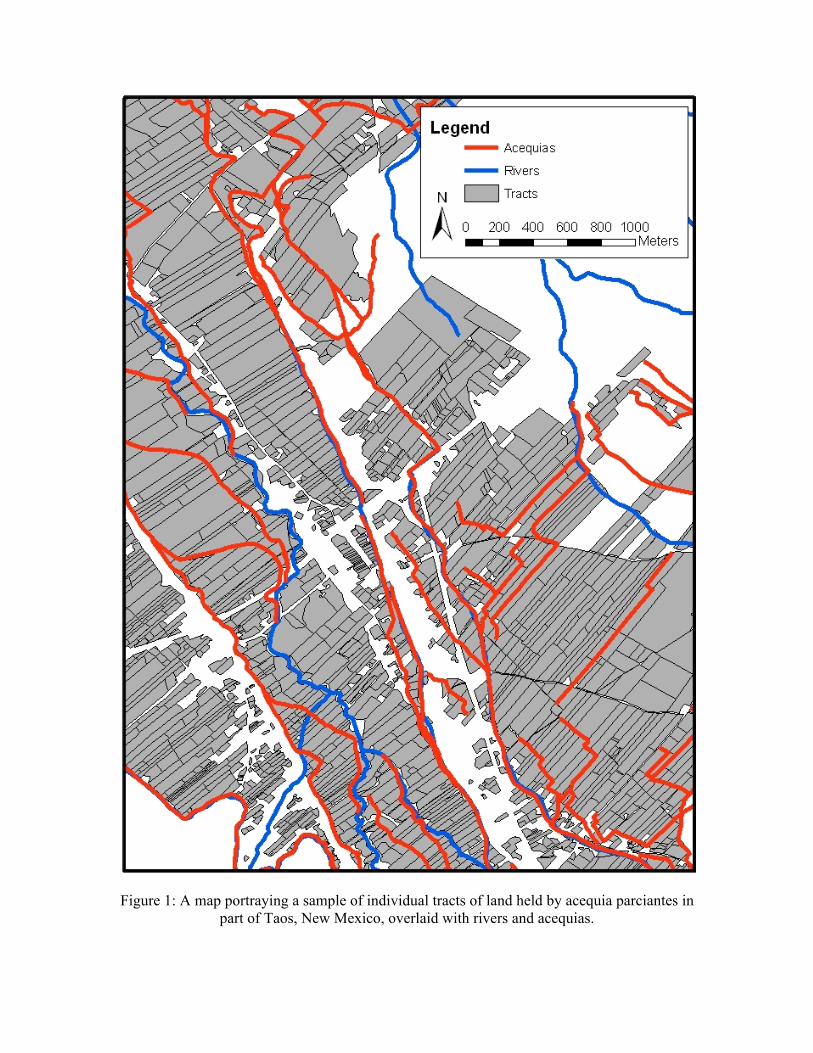
Figure 1: A map portraying a sample of individual tracts of land held by acequia parciantes in
part of Taos, New Mexico, overlaid with rivers and acequias.

Figure 2: A sample screenshot of the graphical user interface.

Figure 3: The structured hierarchy of modeled entities in the simulation, including methods and the parameters which influence their execution.

Figure 4: A flowchart of the model steps.

Figure 5: GIS data for the study area including A) elevation, rivers, and acequias, B) a closer view of part of A), with box highlighting area of interest, C) the relationship between acequias, roads, and urban areas, and D) land use patterns.

Figure 6: A flowchart of the Parciante subroutine.

Figure 7: A flowchart of the Real Estate Agent subroutine.

Figure 8: The water network, after 100 years of regular maintenance (A) and after 100 years of no maintenance (B). The darker the line, the more clear the segment is of sedimentation;
only unmaintained acequias are impacted by sedimentation in this model, and appear in lighter shades.

Type Parameter Description Range Default Parciante Costs
acequiaCostWeight the cost of maintaining an acequia right over the unit of time
[0, 100] units of money per right
5
cropPrices the amount of income generated by a unit of a given kind of crop
[0,1000] units of money
10
Acequia Processes rainfallThisYear annual rainfall [0,100] 15
acequiaDecayRate rate at which unmaintained acequia capacity degrades annually
[0,1.0] 0.99
hydrationCutoff minimum amount of waterflow for land to be ”irrigated”
[0, 100] units of water per tick
20
Real Estate Costs weightUtility importance of utility [0,1.0] 0.5
weightProximity importance of proximity to offering price
[0,1.0] 0.5
budgetStdDev std dev in real estate
agent budgets [0, 25] 10
budgetThisYear mean of real estate budgets
[0,1000] units of money
100
numRealEstateAgents number of real
estate agents [0,1000] 10
Table 1: Parameters of the model.
Loss of
Land (tiles) Loss of
Parciantes Loss in
Acequias Default - 15 506.1 467.8 903.4 Drought - 1 15965.6 467.4 903.5 Flood - 50 89.0 150.0 869.1
Table 2: A comparison of average results of simulation run with varying levels of rainfall.
Loss of
Land (tiles) Loss of
Parciantes Loss in
Acequias Default - 10 506.1 467.8 903.4 0 Realtors 0.0 0.0 849.0 100 Realtors 2517.0 2342.0 1507.0
Table 3: A comparison of average results of simulation run with varying numbers of Real Estate
Agents.

Scenario Price = 1
Loss of Land (tiles)
Loss of Parciantes
Loss in Acequias
Traditionalists 403.1 327.3 889.0 Followers 411. 7 327.8 888.7 Prodigal 406.3 324.3 888.1 Price = 5 Traditionalists 490.8 467.6 901.8 Followers 515.3 468.0 903.1 Prodigal 493.0 468.7 902.1 Price = 15 Traditionalists 516.5 491.6 905.9 Followers 544.1 491.8 905.6 Prodigal 544.5 491.3 904.4
Table 4: A comparison of the results of the nine scenarios with varying acequia maintenance costs and
Parciante attitude distributions. Here, the label “Traditionalist” entails that 80% of the Parciantes were Traditionalists, 10% were Followers, and 10% were Prodigals, and so forth.