abstract - drs.nio.org
TRANSCRIPT

1
Author version: Int. J. Remote Sens., vol.32(22); 2011; 7383-7398
Do the cold and low salinity waters pass through the Indo-Sri Lanka Channel during winter?
R. R. Rao1, M. S. Girish Kumar2, M. Ravichandran2, V.V.Gopalakrishna3 and P.Thadathil4
1 Japan Agency of Marine-Earth Science and Technology, Yokosuka 237 0061, Japan
2 Indian National Centre for Ocean Information Services, Hyderabad 500 055, India 3 National Institute of Oceanography, Goa 403 004, India
4 Embassy of India, Tokyo 102 0074, Japan
Abstract During winter, along the east coast India, the near-surface flow is characterized by the southward
flowing East India Coastal Current (EICC) which bends around Sri Lanka and enters into the
southeastern Arabian Sea (AS). This current carries cooler and low salinity waters from the head Bay of
Bengal (BoB) into the southeastern AS. But due to lack of any direct insitu measurements, it is not clear
whether any part of this current that flows through the Indo-Sri Lanka Channel (ISLC) is significant. An
attempt is made in this study to look for any observational evidence for the southward flow of cooler and
low salinity waters through the ISLC during winter. In the absence of direct insitu measurements on the
observed currents in the non-navigable shallow ISLC, the observed high resolution Advanced Very High
Resolution Radiometer (AVHRR) sea surface temperature (SST), Sea-viewing Wide Field-of-View Sensor
(SeaWiFS) chlorophyll-a and historic sea surface salinity (SSS) data are utilized as tracers to track any
southward water flow through the Pamban Pass and the Adam’s Bridge in the ISLC. The analysis
suggests that both the non-navigable shallow Pamban Pass and the Adam’s Bridge in the ISLC act as
barriers and limit the southward flow of cooler and low salinity waters into the Gulf of Mannar in the
south during winter.

2
1. Introduction
The confluence zone of the AS and the BoB between the southeast coast of India and the west coast of
Sri Lanka known as the Indo-Sri Lanka Channel (ISLC) is an important region on two counts. It offers
the shortest passage for the surface navigation for all the ships sailing between the ports of the Arabian
Sea and the ports on the east coast of India and Bangladesh. Recently the government of India has taken
up Sethusamudram Shipping Channel Project to dredge this channel to facilitate economic surface
navigation of ships through the ISLC, thus saving a sailing distance of about 650 km. The ISLC is also a
region of large productivity of fisheries with abundant occurrence of chlorophyll-a as seen by the
satellites (Yapa, 2000). During winter, along the east coast India, the near-surface flow is characterized
by the southward flowing EICC which bends around Sri Lanka and enters into the southeastern AS
(Shankar and Shetye, 1997). This current carries cooler and low salinity waters from the head BoB into
the southeastern AS (Rao and Sivakumar, 1999, 2003, Shenoi et al., 1999, Han and McCreary, 2001,
Prasanna Kumar et al., 2004, Durand et al., 2007, Thadathil et al., 2008, Rao et al., 2008). During
winter, the ISLC with its complex coastal geometry acts as a duct to the northeasterly surface winds to
converge and intensify in the south resulting in intense localized sea surface cooling which is primarily
attributed to wind driven mixing and the associated turbulent heat losses (Kawamura, 2000, Luis and
Kawamura, 2001 and 2002, Rao et al., 2008). However, no direct current measurements are available to
assess the role of southward advection of the cooler waters that might flow through the Pamban Pass and
the Adam’s Bridge in the ISLC on the intense localized cooling that occurs in the south. Han and
McCreary (2001) in their 4.5 layer model solution suggested that during the northeast monsoon, part of
the river water flows out of the BoB in the shallow channel between India and Sri Lanka: Only when
this channel is opened in the upper layer (of thickness greater than or equal to 10m) do solutions develop
a strong, across-shelf salinity gradient along the west coast, consistent with the observations. In an ocean
GCM solution, Durand et al. (2007) have also shown that the realistic river runoff distribution and the
Indo-Sri Lanka passage have strong impact on the realism of the salinity simulated in the southeastern
AS during winter. In the absence of data available on the directly observed currents in the non-navigable
shallow region, the observed high resolution AVHRR SST, SeaWiFS chlorophyll-a and historic SSS
observations are utilized as tracers to track any southward water flow through the Pamban Pass and the
Adam’s Bridge in the ISLC during winter.

3
2. Observations
All the available historic high resolution satellite derived SST and chlorophyll-a and insitu SSS and ship
drift vector measurements are utilized to describe and understand the observed variability in and around
the ISLC region. The QuikSCAT surface winds (Wentz et al., 2001) and the AVISO merged and
blended sea surface height anomalies are utilized to characterize the observed near-surface circulation
around south India and Sri Lanka (Fu and Chelton, 2000). The observed daily TMI SST data (Wentz et
al., 2000) are utilized to characterize the cooler waters transported by the EICC from the head BoB into
the southeastern AS. The observed daily high resolution AVHRR SST data (Walton et al., 1998,
Kilpatrick et al., 2001, Reynolds et al., 2007) are utilized as a tracer to characterize any southward
advection of cooler waters through the ISLC. As this study is carried out for winter, the atmosphere over
this region being relatively cloud free with minimum moisture content is ideal for examining the
variability of the SST measured with radiometers. The SeaWiFS chlorophyll-a data (O’Riley et al.,
1998) are also utilized as a tracer to track the southward water flow through the ISLC. The mean
monthly (July-August) climatologies of SSS from Simple Ocean Data Assimilation (SODA) analysis
(Carton et al., 2005), TMI SST and SeaWiFS chlorophyll-a are utilized to characterize the intrusion of
high salinity, cooler and high concentration chlorophyll-a AS waters into the BoB. The observed ship
drift vectors (Mariano et al., 1995) are utilized to characterize the surface flow patterns. All the
available historic SSS data are also pooled up from multiple sources for three representative regions to
characterize the observed salinity variability caused by the EICC, the Winter Monsoon Current (WMC)
and the southward flow through the ISLC if any.The SODA which assimilates all available temperature
and salinity observations in the world oceans, satellite altimetry, and sea surface temperature (SST)
observations to constrain a numerical model of the primitive equations of motion. SODA has been used
for studying the heat budgets of the Atlantic and Pacific Oceans (Wang and Carton 2002) and coupled
dynamics in the Indian Ocean (Xie et al. 2002). Xie et al., 2002 further mentioned that SODA
reproduces the seasonal cycle of variability in the Indian Ocean (Xie et al. 2002) The study of Shenoi et
al. 2005 has estimated the accuracy of SODA product for the calculation of Estimating Heat Budgets of
the near-surface layers of the Arabian Sea and Bay of Bengal. Carton and Giese (2006) studied the
reliability of the SODA reanalysis product by comparisons of several to independent data sets. The
sources, periods, accuracies and the resolutions of the data sets utilized in this study are shown in Table–
1.
4
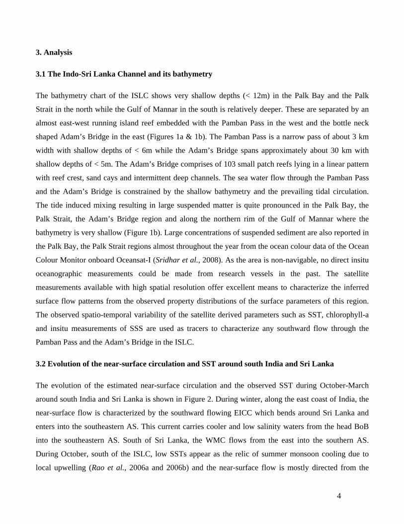
3. Analysis
3.1 The Indo-Sri Lanka Channel and its bathymetry
The bathymetry chart of the ISLC shows very shallow depths (< 12m) in the Palk Bay and the Palk
Strait in the north while the Gulf of Mannar in the south is relatively deeper. These are separated by an
almost east-west running island reef embedded with the Pamban Pass in the west and the bottle neck
shaped Adam’s Bridge in the east (Figures 1a & 1b). The Pamban Pass is a narrow pass of about 3 km
width with shallow depths of < 6m while the Adam’s Bridge spans approximately about 30 km with
shallow depths of < 5m. The Adam’s Bridge comprises of 103 small patch reefs lying in a linear pattern
with reef crest, sand cays and intermittent deep channels. The sea water flow through the Pamban Pass
and the Adam’s Bridge is constrained by the shallow bathymetry and the prevailing tidal circulation.
The tide induced mixing resulting in large suspended matter is quite pronounced in the Palk Bay, the
Palk Strait, the Adam’s Bridge region and along the northern rim of the Gulf of Mannar where the
bathymetry is very shallow (Figure 1b). Large concentrations of suspended sediment are also reported in
the Palk Bay, the Palk Strait regions almost throughout the year from the ocean colour data of the Ocean
Colour Monitor onboard Oceansat-I (Sridhar et al., 2008). As the area is non-navigable, no direct insitu
oceanographic measurements could be made from research vessels in the past. The satellite
measurements available with high spatial resolution offer excellent means to characterize the inferred
surface flow patterns from the observed property distributions of the surface parameters of this region.
The observed spatio-temporal variability of the satellite derived parameters such as SST, chlorophyll-a
and insitu measurements of SSS are used as tracers to characterize any southward flow through the
Pamban Pass and the Adam’s Bridge in the ISLC.
3.2 Evolution of the near-surface circulation and SST around south India and Sri Lanka
The evolution of the estimated near-surface circulation and the observed SST during October-March
around south India and Sri Lanka is shown in Figure 2. During winter, along the east coast of India, the
near-surface flow is characterized by the southward flowing EICC which bends around Sri Lanka and
enters into the southeastern AS. This current carries cooler and low salinity waters from the head BoB
into the southeastern AS. South of Sri Lanka, the WMC flows from the east into the southern AS.
During October, south of the ISLC, low SSTs appear as the relic of summer monsoon cooling due to
local upwelling (Rao et al., 2006a and 2006b) and the near-surface flow is mostly directed from the

5
southeastern AS into the BoB. As the winter sets in and progresses the cooling intensifies from
November both in magnitude and spatial extent reaching its peak by January. The near-surface
circulation also reverses from October to November and persists during the following winter months.
These cooler waters flow primarily southwestward and on occasion branches northwestward by the
Maldives Island Chain. A careful examination of SST and near-surface circulation fields during the
winter clearly reveals that the cooler waters from this mini-cold pool flow into the Lakshadweep Sea and
re-circulate around the Lakshadweep High (Shankar and Shetye, 1997). Although the TMI SST resolves
the spatial features in the open ocean accurately and adequately, it is less reliable near the coastline and
hence it is not possible to map its variability accurately within the ISLC.
3.3 Inferring near-surface circulation patterns from surface property distributions
In the oceans, if the property distributions are influenced by the prevailing horizontal circulation it
would be possible to infer the flow patterns from the observed horizontal gradients of the properties.
One such example is shown in Figure 3 where the Summer Monsoon Current (SMC) shows intrusion of
cooler, high concentration chlorophyll-a and high salinity waters into the BoB during July-August. The
flow patterns clearly show agreement with the observed ship drift vectors of Mariano et al., (1995)
depicting the intrusion of the SMC into the BoB from the AS. From an array of current meter moorings
deployed off the southern coast of Sri Lanka, Schott et al. (1994) have shown that the SMC transports 8
Sv into the BoB. In an OGCM simulation, Vinayachandran et al. (1999) have shown that the intrusion
of the SMC into the BoB is controlled both by Ekman pumping and the westward propagating Rossby
wave radiation. In another model simulation, Jensen (2001) has shown inflow of high salinity waters
from the AS into the BoB is significant and occurs after the mature phase of the summer monsoon.
Advantage of this concept is taken in this study to track any water flow through the Pamban Pass and the
Adam’s Bridge in the ISLC from satellite monitored surface property distributions and where no direct
current measurements are available.
3.4 Evolution of the observed annual cycle of SST in the ISLC
In the absence of direct insitu measurements, and as the TMI SST data are not reliable near the coasts,
all the AVHRR SST data available at higher spatial resolution (9 km) are utilized to map the observed
variability in the ISLC region for all the twelve months (Figure 4). The observed high resolution satellite
AVHRR SST measurements are utilized as tracers to track any flow of cooler waters through the

6
Pamban Pass and the Adam’s Bridge in the ISLC during both the monsoon seasons. The observed
annual cycle of the SST climatology based on multi-year averages shows strong seasonality with two
heating regimes during pre-summer monsoon season and post-monsoon season and two cooling regimes
during winter and summer monsoon season. During winter, the lowest SSTs occur in the Palk Strait
under the influence of the southward flowing cooler EICC. However, during winter with the progress of
the season, there is no sign of any southward flow of the cooler waters from this region through the
Pamban Pass and the Adam’s Bridge into the Gulf of Mannar. This suggests that the southward
advection of cooler waters through ISLC is not an important process for the observed cooling further in
the south. Due to shallow depths, waters in this region warm up very rapidly resulting in the highest
SSTs during April-May. With the onset and the progress of the summer monsoon, the lowest SSTs occur
in the Gulf of Mannar under the influence of the SMC which carries relatively cooler upwelled waters
from the Somalia coast and from the nearby southwest coast of India. However, these cooler waters also
do not show any northward intrusion into the Palk Bay through the Pamban Pass and the Adam’s Bridge
due to the barrier effect. Thus the spatial structure of SST suggests that the island reef comprising the
Pamban Pass and the Adam’s Bridge virtually constrains the water flow across it during the year.
The evolution of the multi-year daily averaged AVHRR SST (ºC) for the zonally averaged grid points in
the ISLC region during winter is examined (Figure 5a). The SST shows a dramatic cooling from
November to January, and this cooling is most pronounced off the southeast coast of India. This strong
cooling is also limited to the region north of the Pamban Pass and the Adam’s Bridge. The demarcation
of the southern limit of the cold SSTs coinciding with 9ºN latitude clearly suggests that not much cooler
water flows southward through the Pamban Pass and the Adam’s Bridge. As seen in Figure 4, there is
also a suggestion of enhanced cooling in the Palk Bay and the Palk Strait regions approximately between
9ºN - 10ºN. This cooling may be attributed to intense tidal mixing in the shallow waters. Similar
analysis of AVHRR SST for the individual years is shown in Figure 5b. The distribution of daily
observed SST during winter of the individual years also shows similar features as seen in the Figure 5a.
In addition, the observed daily evolution of SST during November-February for the years 1985-2007
also clearly shows that the cooling is episodic on intraseasonal time scale with predominant periodicity
of about 12 days. Similar periodicities in the range of 8-15 days were also noticed in the intense
localized mini-cold pool observed south of the ISLC primarily driven by the surface wind and net heat
flux fields during winter (Rao et al., 2008). These cooling episodes also show strong interannual

7
variability in their number, duration, intensity and the spatial extent. The differences in these attributes
of the cooling episodes determine the observed year-to-year variability in this region.
The observed SST climatology during the peak phase of the winter monsoon clearly shows the
southward progress of the EICC and the associated cooler waters off the southeast coast of India and off
the coastline of Sri Lanka (Figure 6). With the progress of the season, the SST progressively drops and
the cooler waters show their southward propagation. However, the arrest of the southward passage of
cooler waters by the island reef embedded with the Pamban Pass and the Adam’s Bridge is also
distinctly seen. The observed cooling south of the Pamban Pass and the Adam’s Bridge is attributed to
strengthened surface wind field and the associated surface heat losses (Kawamura, 2000, Luis and
Kawamura, 2001 and 2002, Rao et al., 2008).
3.5 Evolution of the observed chlorophyll-a in the ISLC
The analysis of Coastal Zone Colour Scanner data at 1-km resolution around Sri Lanka revealed that the
waters in the Gulf of Mannar and the Palk Bay show large concentration of chlorophyll-a throughout the
year (Yapa, 2000). However, these high values may represent other suspended particles and dissolved
organic matter besides chlorophyll-a as this region is shallow (<100m). Occurrence of phytoplankton
bloom in response to summer monsoon forced upwelling around Sri Lanka was reported by
Vinayachandran et al. (2004). In the southwestern BoB, intensification of phytoplankton bloom in the
wake of the cyclones was also reported by Vinayachandran and Mathew (2003) and Rao et al. (2006).
The observed annual cycle of the SeaWiFS chlorophyll-a climatology based on multi-year averages
shows strong seasonality in the Gulf of Mannar region with the highest (lowest) values occurring during
summer monsoon (winter and pre-monsoon) season (Figure 7). However the coastal rim is an exception
where relatively larger concentration of chlorophyll-a is seen throughout the year. During winter, the
distribution of chlorophyll-a concentration along the southern edge of the Pamban Pass and the Adam’s
Bridge does not suggest any southward intrusion into the Gulf of Mannar. During the summer monsoon
season intense blooming of chlorophyll-a is noticed with peak values during July-August off the
southern tip of India under the influence of the monsoon driven coastal upwelling. Although both the
Palk Bay and the Palk Strait regions show larger concentrations of chlorophyll-a throughout the year
when compared to the Gulf of Mannar with the only notable exception off the southeast coast of India
during July-August, the seasonal cycle of these regions shows a bimodal distribution. The primary

8
maxima (minima) occur during the summer monsoon (pre-monsoon) season and the secondary maxima
(minima) occur during post-monsoon season (winter). A sharp fall in the chlorophyll-a concentration is
noticed in the adjacent southwestern BoB throughout the year. Thus the observed annual cycle of the
chlorophyll-a does not indicate any transport through the Pamban Pass and the Adam’s Bridge.
3.6 Evolution of the observed SSS in the ISLC and its surroundings
To assess the passage of low salinity waters carried by the EICC through the Pamban Pass and the
Adam’s Bridge in the ISLC, all the available historic insitu observed SSS data in three representative
boxes (Figure 8) are averaged after quality controlling for outliers. The box ‘N’ represents the SSS of
the waters carried by the EICC off the southeast coast of India. The box ‘C’ represents the SSS of the
waters just south of the Pamban Pass and the Adam’s Bridge. The box ‘S’ represents the region where
the SSS of the waters is influenced by both the EICC and the WMC. The multi-year averages of mean
monthly SSS for these three boxes for the months October-March are shown in Figure 8. The temporal
evolution of the SSS during October-March clearly depicts the seasonal minima during December at all
the boxes. Among the three boxes, the spatial differences are also distinctly seen. The ‘N’ box shows
lowest SSS followed by the ‘S’ box. The relatively larger values of SSS in the ‘C’ box clearly suggest
that the waters in the Gulf of Mannar do not appear to be diluted by any southward flow of low salinity
waters carried by the EICC through the Pamban Pass and the Adam’s Bridge in the ISLC during winter.
4. Summary
An attempt is made to find any observational evidence on the southward transport of cooler and low
salinity waters through ISLC by the EICC during winter. Due to non-navigable shallow depths of this
region, no direct insitu measurements were made in the past. In view of this, all the available high
resolution satellite measurements of AVHRR SST and SeaWiFS chlorophyll-a are utilized as tracers to
track any southward flow through the Pamban Pass and the Adam’s Bridge in the ISLC. The spatio-
temporal variability of these two parameters does not suggest any significant southward flow through
the Pamban Pass and the Adam’s Bridge in the ISLC. The largest winter (November - January) cooling
in SST is confined only to the Palk Bay and the Palk Strait north of the Pamban Pass and the Adam’s
Bridge. In addition, the observed daily evolution of SST during November-February for the years 1985-
2007 also clearly shows that the cooling in the region north of the Pamban Pass and the Adam’s Bridge
is highly episodic on intraseasonal time scale with a predominant periodicity of about 12 days. The

9
chlorophyll-a also occurs in greater abundance again only in the Palk Bay and the Palk Strait regions
north of the Pamban Pass and the Adam’s Bridge throughout the winter. However, just south of the
Pamban Pass and the Adam’s Bridge, the observed variability in the chlorophyll-a concentration during
November-February is not significant suggesting the absence of any southward flow through the
Pamban Pass and the Adam’s Bridge. The mean monthly climatologies of the SSS in three
representative boxes off the southeast coast of India, south of the Pamban Pass and the Adam’s Bridge,
and south of the ISLC during October-March also do not suggest any significant southward flow of low
salinity waters through the Pamban Pass and the Adam’s Bridge. The spatio-temporal evolution of the
three independent oceanographic parameters unambiguously suggests that the non-navigable shallow
Pamban Pass and the Adam’s Bridge in the ISLC act as barriers and limit the southward flow of cooler
and low salinity waters into the Gulf of Mannar during winter. The completion of the Sethusamudram
Shipping Channel Project will provide an opportunity to the oceanographic community to make the
direct in-situ measurements in the ISLC to address this issue in greater detail.
5. Acknowledgements
Highest appreciation is placed on record for the excellent compilation of all the data sets by several
persons and organizations utilized in this study. Graphics are generated using Ferret. The encouragement
and the facilities provided by the Directors of NPOL, JAMSTEC, INCOIS, and NIO are gratefully
appreciated. This research is supported through INDOMOD-SATCORE Project of Ministry of Earth
Sciences, Govt. of India.
6. References Carton, JA, BS Giese, and S.A. Grodsky (2005), Sea level rise and the warming of the oceans in the SODA ocean reanalysis, Journal of Geophysical Research, 110, 10.1029/2004JC002817 Carton, J,A and B.S.Giese, (2006) SODA: A Reanalysis of Ocean Climate 389 Journal of Geophysical Research, -Oceans Durand F., D. Shankar, C. de Boyer Montegut, S.S.C. Shenoi, B. Blanke, and G. Madec, (2007), Modelling the barrier layer formation in the southeastern Arabian Sea, Journal of Climate, 20 (10), 2109-2120. Fu, L.L., Chelton, D.B., 2001. Large Scale ocean circulation, Chapter 2. From Satellite Altimetry and Earth Sciences, A Handbook of Techniques and Applications. Academic Press, pp. 133–169.

10
Han, W. and J.P. McCreary (2001), Modelling salinity distributions in the Indian Ocean, 389 Journal of Geophysical Research, 106(C1), 859-877. Jensen T. G. (2001), Arabian Sea and Bay of Bengal exchange of salt and tracers in an ocean model, Geophysical Research Letters, 28, 20, 3967-3970 Kawamura, H., (2000), Winter time wind forcing and sea surface cooling near the south India tip observed using NSCAT and AVHRR, Remote Sensing of Environment, 73, 55-64. Kilpatrick, K.A., G.P. Podesta and R. Evans (2001), Overview of the NOAA/NASA Advanced Very High Resolution Radiometer Pathfinder algorithm for sea surface temperature and associated matchup database, Journal of Geophysical Research, 106, C5, 9179-9197. Luis A.J., and H. Kawamura (2001), Characteristics of atmospheric forcing and SST cooling events in the Gulf of Mannar during winter monsoon, Remote Sensing of Environment, 77, 139-148 Luis A.J., and H. Kawamura (2002), Dynamics and mechanism for sea surface cooling near the Indian tip during winter monsoon, Journal of Geophysical Research, 107, C11, 3187, doi:10.1029/2000JC000455. Mariano A.J., H.Ryan, B.D.Perkins, and S.Smithers (1995), The Mariano Global Surface Velocity Analysis 1.0, Report No CG-D-34-95, U. S. Dept. of Transportation, Washington D.C., 20593-0001, 55 pp O’Riley, J. E., S. Maritorena, B. G. Mitchell, D. A. Siegel, K. L. Carder,S. A. Garver, M. Kahru, and C. McClain (1998), Ocean color chlorophyll algorithms for SeaWiFS, Journal of Geophysical Research, 103, C11, 24,937– 24,953 Prasanna Kumar S, J Narvekar, A Kumar, C Shaji, P Anand, P Sabu, G Rijomon, J Josia, K A Jayaraj, A Radhika and K K C Nair (2004), Intrusion of the Bay of Bengal water into the Arabian Sea during winter monsoon and associated chemical and biological response, Geophysical Research Letters, 31, L15304, doi:10.1029/2004GL020247 Rao K H., A Smitha and M M Ali (2006), A study on cyclone induced productivity in the southwestern Bay of Bengal during November-December, 2000 using MODIS (SST and chlorophyll-a) and altimeter sea surface height observations, Indian Journal of Marine Sciences, 35, 2, 153-160 Rao.R.R and R.Sivakumar (1999), On the possible mechanisms of the evolution of a miniwarm pool during the pre-summer monsoon season and the onset vortex in the southeastern Arabian Sea, Quarterly Journal of Royal Meteorological Society, 125, 787-809 Rao R.R., and R.Sivakumar (2003), Seasonal variability of the salt budget of the mixed layer and near-surface layer salinity structure of the tropical Indian Ocean from a new global ocean salinity climatology, Journal of Geophysical Research, 108, 3009, doi: 10.1029/2001JC 000907

11
Rao R. R., M. S. Girishkumar, M. Ravichandran, B.K.Samala and S. Nandakumar (2006a), Observed mini-cold pool off the southern tip of India and its intrusion into the south central Bay of Bengal during summer monsoon season, Geophysical Research Letters, 33, L06607, doi:10.1029/2005GL 025382 Rao R.R., M.S.Girish Kumar, M.Ravichandran, B.K.Samala, and G.Anitha (2006b), Observed intraseasonal variability of mini-cold pool off the southern tip of India and its intrusion into the south central Bay of Bengal during summer monsoon season, Geophysical Research Letters, 33, L15606, doi: 10.1029/2006 GL 026086 Rao R.R., M.S.Girishkumar,, M.Ravichandran, V.V.Gopalakrishna and P.Thadathil (2008), Observed mini-cold pool south of Indo-Sri Lanka Channel and its intrusion into the southeastern Arabian Sea during winter, Deep Sea Research Part I: Oceanographic Research Papers, 55, 8, 1009-1020 Reynolds R W, and Chunying Liu,Thomas M. Smith,Dudley B. Chelton and Michael G. Schlax, Kenneth S. Casey, Richard W. Reynolds and Chunying Liu,Thomas M. Smith,Dudley B. Chelton and Michael G. Schlax, Kenneth S. Casey (2007), Daily High-Resolution-Blended Analyses for Sea Surface Temperature, Journal of Climate, 20, DOI: 10.1175/2007JCLI1824.1 Schott F., J Reppin, J Fisher and D Quadfasel (1994), Currents and transports of the Monsoon Current south of Sri Lanka, Journal of Geophysical Research, 99, C12, 25,127-25,141 Shankar, D., and S.R. Shetye (1997), On the dynamics of the Lakshadweep high and low in the southeastern Arabian Sea, Journal of Geophysical Research, 102, 12,551–12,562. Shenoi S S C, D Shankar and S R Shetye (1999), On the sea surface temperature high in the Lakshadweep Sea before the onset of the southwest monsoon, Journal of Geophysical Research, 104, 15,703-15,712 S.S.C. Shenoi, S. S. C., D. Shankar, and S. R. Shetye (2005), On the Accuracy of the Simple Ocean Data Assimilation Analysis for Estimating Heat Budgets of the Near-Surface Arabian Sea and Bay of Bengal,Journal of Physical Oceanography, 35, 3,395-400. Sridhar P N, I V Ramana, M M Ali and B Veeranarayana (2008), Understanding the suspended sediment dynamics in the coastal waters of the Bay of Bengal using high resolution ocean colour data, Current Science, 94, 11, 1499-1502 Thadathil P, T Prasad, R R Rao, P M Muraleedharan, Y K Somayajulu, V V Gopalakrishna, R Murtugudde, G V Reddy and C Revichandran (2008), Seasonal variability of the observed barrier layer in the Arabian Sea, Journal of Physical Oceanography, 38, 3, 624-638 Vinayachandran, P. N., Y Masumoto, T Mikawa and T Yamagata (1999), Intrusion of the Southwest Monsoon Current into the Bay of Bengal, Journal of Geophysical Research, 104, C5, 11,077-11,085 Vinayachandran, P. N.,and S. Mathew (2003), Phytoplankton bloom in the Bay of Bengal during the northeast monsoon and its intensification by cyclones, Geophysical Research Letters, 30(11), 1572, doi:10.1029/2002GL016717.

12
Vinayachandran, P. N., P. Chauhan, and S. R. Nayak (2004), Biological response of the sea around Sri Lanka to summer monsoon, Geophysical Research Letters, 31, L01302, doi:10.1029/2003GL018533. Wang, J., and J. Carton, (2002): Seasonal heat budgets of the North Pacific and North Atlantic Oceans. Jouranl of Physical Oceanography., 32, 3474–3489. Walton C. C., W. G. Pichel, J. F. Sapper, D. A. May (1998), The development and operational application of nonlinear algorithms for the measurement of sea surface temperatures with the NOAA polar-orbiting environmental satellites, Journal of Geophysical Research, 103: (C12), 27999-28012. Wentz, F.J., C. Gentemann, C., D. Smith, D., and D. Chelton (2000), Satellite measurements of sea surface temperature through clouds, Science, 288, 847-850 Wentz, F.J., D.K. Smith, C.A. Mears, and C.L. Gentemann (2001), Advanced algorithms for QuikSCAT and SeaWinds/AMSR Geoscience and Remote Sensing Symposium, IGARSS Vol.3, IEEE 2001 International, 1079-1081 Xie, S., H. Annamalai, F. Schott, and J. McCreary, (2002): Structure and mechanisms of south Indian Ocean climate variability.Journal of Climate., 15, 867–878. Yapa, K. K. A. S., (2000), Seasonal variability of sea surface chlorophyll-a of waters around Sri Lanka, Proceedings of Indian Academy of Sciences (Earth & Planetary Sciences), 109, 427– 432.

13
Table -1: Data sources, periods, accuracies and resolutions
Parameter Source Period Accuracy Spatio-temporal Resolution
QuikSCAT winds www.ssmi.com 2000-2007 2 m/s 0.25°, daily AVISO Blended Sea Surface Height Anomaly
www.aviso.oceanobs.com
1993-2007 2-3 cm
0.33°, 7-day
TRMM TMI Sea Surface Temperature
www.ssmi.com 1998-2007 ~ 0.5°C 0.25°, daily
AVHRR SST las.pfeg.noaa.gov/oceanwatch.php
1998-2005 ~ 0.5°C 9 km, 8-day
AVHRR SST www.ncdc.noaa.gov/oa/climate/research/sst/oi-daily.php
1985-2006 ~ 0.5°C 0.25°, daily
SeaWiFS Chlorophyll-a
oceans.gsfc.nasa.gov/SeaWiFS/Binned/8Day/
1998-2007 --- 9 km, 8-day
Sea Surface Salinity WOA2005 and INODC
1900-2004 0.01 PSU random point measurements
Sea Surface Salinity SODA 1993-2005 0.01 PSU 1°, monthly

14
Legends of figures: Figure 1a: Bathymetry chart (m) of the Indo-Sri Lanka Channel region showing the island reef comprising of the Pamban Pass and the Adam’s Bridge Figure 1b: Landsat-5 satellite imagery of the Indo-Sri Lanka Channel region showing the island reef comprising of the Pamban Pass and the Adam’s Bridge Figure 2: Estimated multi-year averages of near-surface current vectors (Ekman + geostrophic) (cm/s) and the observed SST (°C) around south India and Sri Lanka during October - February Figure 3: Observed multi-year averages of (a) TMI SST (°C), (b) SeaWiFS chlorophyll-a concentration (mg/m3) and (c) SODA SSS (PSU) during July-August with superposed ship drift vectors (black arrows) showing the intrusion of the Summer Monsoon Current into the Bay of Bengal Figure 4: Annual cycle of multi-year (1985-2007) averaged high resolution mean monthly climatology of the AVHRR SST (ºC) in the Indo-Sri Lanka Channel region Figure 5a: Selected grid points off the southeast coast of India and in the Indo-Sri Lanka Channel region for the assessment of southward advection of cooler waters (left panel) and observed daily multi-year (1985-2007) averaged Hovomuller field of AVHRR SST (ºC) for the zonally averaged grid points during winter (right panel) Figure 5b: Hovomuller fields of daily AVHRR SST (ºC) for the zonally averaged grid points shown in Figure 5a off the southeast coast of India and in the Indo-Sri Lanka Channel region during the winters of 1985-2007 Figure 6: Southward advection of multi-year averaged cooler SST by the EICC off the southeast coast of India and around Sri Lanka from 2 December to 16 January at 8-day interval Figure 7: Annual cycle of multi-year (1998-2007) averaged high resolution mean monthly climatology of the SeaWiFS chlorophyll-a (mg/m3) in the Indo-Sri Lanka Channel region Figure 8: Location of the three representative boxes and the schematic tracks of the EICC and the WMC (top) and the observed multi-year averages of mean monthly SSS (PSU) in these boxes during October-March (bottom) (colours of the lines represent the respective colour boxes)

15
Figure 1a: Bathymetry chart (m) of the Indo-Sri Lanka Channel region showing the island reef comprising of the Pamban Pass and the Adam’s Bridge
Figure 1b: Landsat-5 satellite imagery of the Indo-Sri Lanka Channel region showing the island reef comprising of the Pamban Pass and the Adam’s Bridge

16
Figure 2: Estimated multi-year averages of near-surface current vectors (Ekman + geostrophic) (cm/s) and the observed SST (°C) around south India and Sri Lanka during October - February

17
Figure 3: Observed multi-year averages of (a) TMI SST (°C), (b) SeaWiFS chlorophyll-a concentration (mg/m**3) and (c) SODA SSS (PSU) during July-August with superposed ship drift vectors (black arrows) showing the intrusion of the Summer Monsoon Current into the Bay of Bengal

18
Figure 4: Multi-year (1985-2007) averaged high resolution mean monthly climatology of the AVHRR SST (ºC) in the Indo-Sri Lanka Channel region during January-December
Figure 5a: Selected grid points off the southeast coast of India and in the Indo-Sri Lanka Channel region for the assessment of southward advection of cooler waters (left panel) and observed multi-year (1985-2007) daily averaged Hovomuller field of AVHRR SST (ºC) of the zonally averaged grid points during winter (right panel)

19
Figure 5b: Hovomuller fields of daily AVHRR SST (ºC) for the zonally averaged grid points shown in Figure 5a off southeast coast of Indian and in the Indo-Sri Lanka Channel region during the winters of 1985-2007

20
Figure 6: Southward advection of multi-year averaged cooler SST by the EICC off the southeast coast of India and around Sri Lanka from 2 December to 16 January at 8-day interval

21
Figure 7: Multi-year (1998-2007) averaged high resolution mean monthly climatology of the SeaWiFS chlorophyll-a (mg/m**3) in the Indo-Sri Lanka Channel region during January-December

22
Figure 8: Location of the three representative boxes and the schematic tracks of the EICC and the WMC (top) and the observed multi-year averages of mean monthly SSS (PSU) in these boxes during October-March (bottom) (colours of the lines represent the respective colour boxes)