a sweet deal - damassets.autodesk.net · autodesk customer success story morrison-shipley...
TRANSCRIPT
Autodesk Customer Success Story Morrison-Shipley Engineers, Inc.
COMPANY
Morrison-Shipley Engineers, Inc. LOCATIONArkansas and Missouri
SOFTWAREAutodesk® Infrastructure Design Suite PremiumAutodesk® AutoCAD® Civil 3D®
Autodesk® InfraWorks®
Autodesk® ReCap
Autodesk® Vehicle TrackingAutodesk® Revit® Structure
Autodesk Infrastructure Design Suite Premium enables us to virtually test many variations of our designs and more effectively communicate those different design options to our clients. As a result, we have gained the trust and confidence of our clients and the community, helping to increase our market share and expand our business.
— Jeff NicholsCAD ManagerMorrison-Shipley Engineers, Inc.
A sweet dealMorrison-Shipley Engineers uses Autodesk solutions to inform and streamline its design methodology
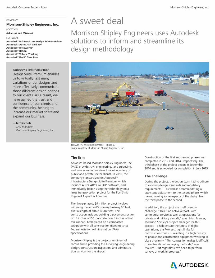
Taxiway “A” West Realignment – Phase 2. Image courtesy of Morrison-Shipley Engineers, Inc.
The firmArkansas-based Morrison-Shipley Engineers, Inc. (MSE) provides civil engineering, land surveying, and laser scanning services to a wide variety of public and private sector clients. In 2010, the company standardized on Autodesk® Infrastructure Design Suite Premium, which includes AutoCAD® Civil 3D® software, and immediately began using the technology on a large transportation project for the Fort Smith Regional Airport in Arkansas.
The three-phased, $9 million project involves widening the airport’s primary taxiway 60 feet, over a length of about 4,000 feet. The construction includes building a pavement section of 14 inches of P.C. concrete over 4 inches of hot mix asphalt, both placed on a compacted subgrade with all construction meeting strict Federal Aviation Administration (FAA) specifications.
Morrison-Shipley is the project’s engineer of record and is providing the surveying, engineering design, construction inspection, and administra-tion services for the airport.
Construction of the first and second phases was completed in 2012 and 2014, respectively. The third phase of the project began in September 2014 and is scheduled for completion in July 2015.
The challengeDuring the project, the design team had to adhere to evolving design standards and regulatory requirements — as well as accommodating a late-stage adjustment to the second phase, which meant moving some aspects of the design from the third phase to the second.
In addition, the project site itself posed a challenge. “This is an active airport, with commercial service as well as operations for private and military aircraft,” says Brian Maurer, Morrison-Shipley’s project manager for this project. To help ensure the safety of flight operations, the FAA sets tight limits for construction zones — resulting in a high density of people and construction equipment working in close proximity. “This congestion makes it difficult to use traditional surveying methods,” says Maurer. “But regardless, we need to perform surveys of work in progress.”
Autodesk Customer Success Story Morrison-Shipley Engineers, Inc.
Streamline design by 40 percent
The SolutionMorrison-Shipley has been using Civil 3D software for design and documentation throughout the project. The dynamic modeling capability of the software enables the creation of automatically adjusting 3D surfaces, alignments, profiles, and corridors for terrain, utilities, and grading. “Using conventional CAD technology, changing our design and documentation to accommodate the project phase adjustment would have seriously jeopardized our deadlines and budgets,” says Jeff Nichols, CAD manager at Morrison-Shipley. “But the dynamic nature of the Civil 3D software enabled us to efficiently make all the necessary adjustments in the model—confident that the changes were automatically reflected in the project drawings.”
To quickly perform onsite surveys, the firm uses laser scanning technology combined with Autodesk® ReCapTM software to process the resulting point clouds for use in Civil 3D. “With laser scanning, we can quickly and safely carry out high-precision data collection at the job site with just one surveyor, greatly reducing risk of rework or delays at the job site,” says Nichols.
Model-based design
“Today, the majority of our work is accomplished using Civil 3D,” says Diogo Carreira, a CAD designer at Morrison-Shipley. “We use the software to design surfaces, alignments, profiles, cross-sections, corridors, and grading objects. We also use it to manage survey data, produce documentation, and calculate quantities.”
Additionally, the firm uses the survey and map features of Civil 3D for survey control and to integrate GIS data with its designs.
“If we adjust a cross-section—whether it’s to see how it impacts earthworks or to adhere to new design standards—the grading automatically updates,” says Carreira. This dynamic change capability has been particularly important on the Fort Smith Regional Airport project. “When the decision was made to incorporate parts of phase three design elements into phase two, we had to adjust both sets of plans,” says Carreira. “But instead of manually updating all the drawings, we just resplit the corridors and profiles, and all the documentation updated automatically.”
“On the Fort Smith Regional Airport project, we estimated that there was a 30 percent (or more) drafting efficiency gain since implementing Infrastructure Design Suite,” says Nichols. “This is primarily due to the dynamic relationship between the design models and the construction plans.”
Capturing Reality
Morrison-Shipley supplemented conventional surveying methods with 3D laser scanning to capture existing conditions of the taxiways and the surrounding environment. The firm is periodically reusing the existing conditions data during the design, avoiding the need for its survey department to make costly return trips to the site. Based on the specific design area, the team uses ReCap to clip out smaller amounts of specific survey data from the point cloud, which reduces the processing burden of their computer hardware.
On the Fort Smith Regional Airport project, we estimated that there was a 30 percent (or more) drafting efficiency gain since implementing Infrastructure Design Suite. This is primarily due to the dynamic relationship between the design models and the construction plans.
— Jeff NicholsCAD ManagerMorrison-Shipley Engineers, Inc.
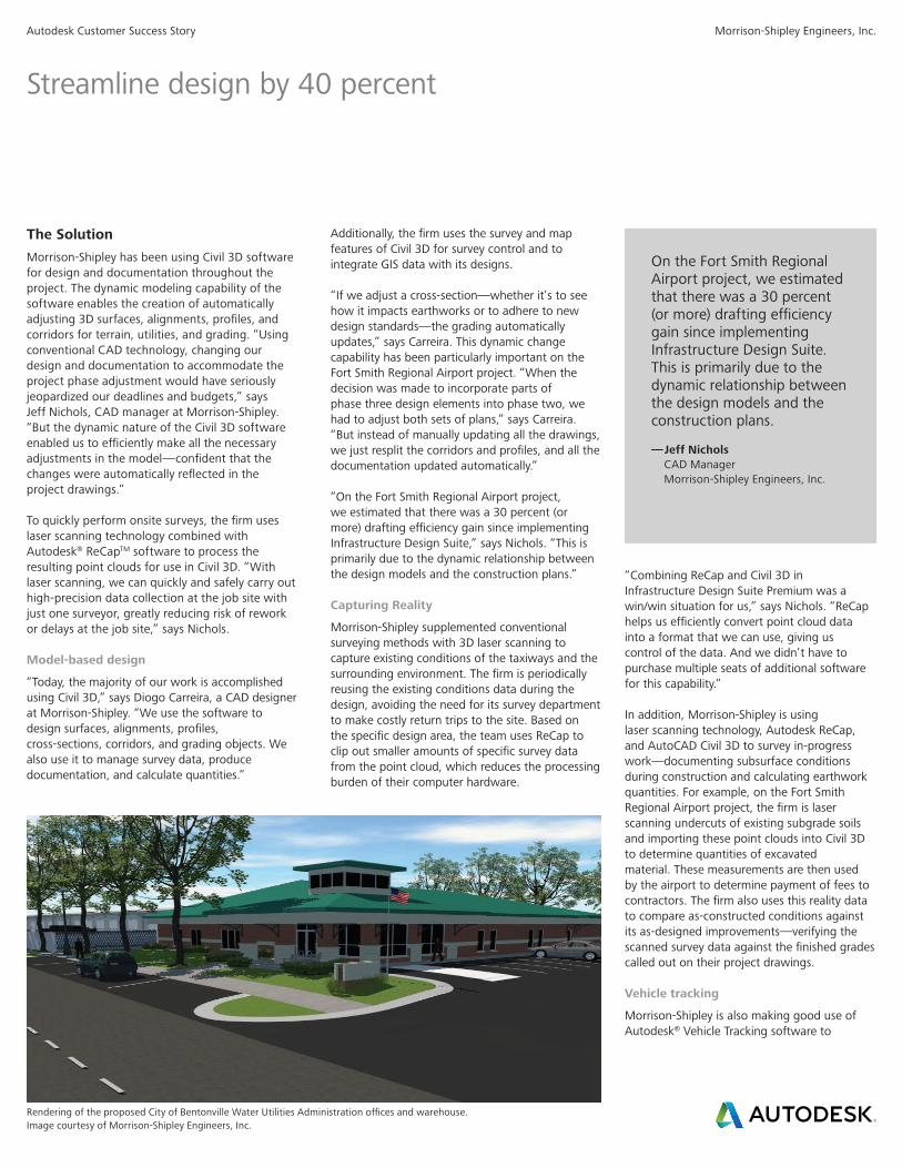
Rendering of the proposed City of Bentonville Water Utilities Administration offices and warehouse. Image courtesy of Morrison-Shipley Engineers, Inc.
“Combining ReCap and Civil 3D in Infrastructure Design Suite Premium was a win/win situation for us,” says Nichols. “ReCap helps us efficiently convert point cloud data into a format that we can use, giving us control of the data. And we didn’t have to purchase multiple seats of additional software for this capability.”
In addition, Morrison-Shipley is using laser scanning technology, Autodesk ReCap, and AutoCAD Civil 3D to survey in-progress work—documenting subsurface conditions during construction and calculating earthwork quantities. For example, on the Fort Smith Regional Airport project, the firm is laser scanning undercuts of existing subgrade soils and importing these point clouds into Civil 3D to determine quantities of excavated material. These measurements are then used by the airport to determine payment of fees to contractors. The firm also uses this reality data to compare as-constructed conditions against its as-designed improvements—verifying the scanned survey data against the finished grades called out on their project drawings.
Vehicle tracking
Morrison-Shipley is also making good use of Autodesk® Vehicle Tracking software to
Autodesk Customer Success Story Morrison-Shipley Engineers, Inc.
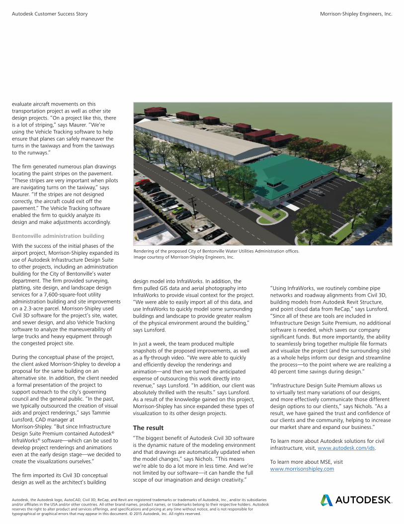
Rendering of the proposed City of Bentonville Water Utilities Administration offices. Image courtesy of Morrison-Shipley Engineers, Inc.
design model into InfraWorks. In addition, the firm pulled GIS data and aerial photography into InfraWorks to provide visual context for the project. “We were able to easily import all of this data, and use InfraWorks to quickly model some surrounding buildings and landscape to provide greater realism of the physical environment around the building,” says Lunsford.
In just a week, the team produced multiple snapshots of the proposed improvements, as well as a fly-through video. “We were able to quickly and efficiently develop the renderings and animation—and then we turned the anticipated expense of outsourcing this work directly into revenue,” says Lunsford. “In addition, our client was absolutely thrilled with the results.” says Lunsford. As a result of the knowledge gained on this project, Morrison-Shipley has since expanded these types of visualization to its other design projects.
The result“The biggest benefit of Autodesk Civil 3D software is the dynamic nature of the modeling environment and that drawings are automatically updated when the model changes,” says Nichols. “This means we’re able to do a lot more in less time. And we’re not limited by our software—it can handle the full scope of our imagination and design creativity.”
“Using InfraWorks, we routinely combine pipe networks and roadway alignments from Civil 3D, building models from Autodesk Revit Structure, and point cloud data from ReCap,” says Lunsford. “Since all of these are tools are included in Infrastructure Design Suite Premium, no additional software is needed, which saves our company significant funds. But more importantly, the ability to seamlessly bring together multiple file formats and visualize the project (and the surrounding site) as a whole helps inform our design and streamline the process—to the point where we are realizing a 40 percent time savings during design.”
“Infrastructure Design Suite Premium allows us to virtually test many variations of our designs, and more effectively communicate those different design options to our clients,” says Nichols. “As a result, we have gained the trust and confidence of our clients and the community, helping to increase our market share and expand our business.”
To learn more about Autodesk solutions for civil infrastructure, visit, www.autodesk.com/ids.
To learn more about MSE, visit www.morrisonshipley.com
evaluate aircraft movements on this transportation project as well as other site design projects. “On a project like this, there is a lot of striping,” says Maurer. “We’re using the Vehicle Tracking software to help ensure that planes can safely maneuver the turns in the taxiways and from the taxiways to the runways.”
The firm generated numerous plan drawings locating the paint stripes on the pavement. “These stripes are very important when pilots are navigating turns on the taxiway,” says Maurer. “If the stripes are not designed correctly, the aircraft could exit off the pavement.” The Vehicle Tracking software enabled the firm to quickly analyze its design and make adjustments accordingly.
Bentonville administration building
With the success of the initial phases of the airport project, Morrison-Shipley expanded its use of Autodesk Infrastructure Design Suite to other projects, including an administration building for the City of Bentonville’s water department. The firm provided surveying, platting, site design, and landscape design services for a 7,600-square-foot utility administration building and site improvements on a 2.3-acre parcel. Morrison-Shipley used Civil 3D software for the project’s site, water, and sewer design, and also Vehicle Tracking software to analyze the maneuverability of large trucks and heavy equipment through the congested project site.
During the conceptual phase of the project, the client asked Morrison-Shipley to develop a proposal for the same building on an alternative site. In addition, the client needed a formal presentation of the project to support outreach to the city’s governing council and the general public. “In the past, we typically outsourced the creation of visual aids and project renderings,” says Tammie Lunsford, CAD manager at Morrison-Shipley. “But since Infrastructure Design Suite Premium contained Autodesk® InfraWorks® software—which can be used to develop project renderings and animations even at the early design stage—we decided to create the visualizations ourselves.”
The firm imported its Civil 3D conceptual design as well as the architect’s building
Autodesk, the Autodesk logo, AutoCAD, Civil 3D, ReCap, and Revit are registered trademarks or trademarks of Autodesk, Inc., and/or its subsidiaries and/or affiliates in the USA and/or other countries. All other brand names, product names, or trademarks belong to their respective holders. Autodesk reserves the right to alter product and services offerings, and specifications and pricing at any time without notice, and is not responsible for typographical or graphical errors that may appear in this document. © 2015 Autodesk, Inc. All rights reserved.