a study on the location of castle and urban structure of...
TRANSCRIPT
1
A Study on the Location of Castle and Urban Structure
of Castle-town by Watershed Based Analysis
LIM Luong1, SASAKI Yoh2 1Department of Civil and Environmental Engineering, Waseda University
(3-4-1 Okubo, Shinjuku-ku, Tokyo 169-8555, Japan) E-mail:[email protected]
2Member of JSCE, Professor, Dept. of Civil and Environmental Eng., Waseda University (3-4-1 Okubo, Shinjuku-ku, Tokyo 169-8555, Japan)
E-mail:[email protected]
This research seeks to identify the urban planning methods for sustainable development by introducting watershed based analysis. From the view point of the ecological aspects, characteristics of Japanese cas-tle-town, JYOKAMACHI, was dedicated as one of important factors to identify urban planning methods. Therefore, the location of castle and its urban structure were investigated. GIS is used to analyze the loca-tion of castle and its urban structure by mean of watershed based analysis. Results showed that among 86 castle locations, about 34% of castle locations of Hilltop, Mountaintop and Flatland is located on the catchment edge, 60% is located near by the catchment edge and 6% is located in the middle of the catch-ment edge. 88% of most of the castle locations was found located at the highest elevation area comparing to its surrounding and within the catchment it’s located. It can be said that most of the castle locations tends to be located at the highest elevation area as a unit of watershed. 10 cases of overlaying maps between urban structure of castle-town in edo period and catchment maps showed that urban structure of castle-town had strong relationship with watershed. Therefore, it can be concluded that watershed is one of the basic factors for urban design, urban planning as well as the landscape planning for JYOKAMACHI.
Key Words : urban planning methods, sustainable development, watershed based analysis, catchment edge.
1. INTRODUCTION
Recent studies show that urbanization is one the
most important human activities that creates enor-mous impacts on the environmental problems related to land degradation, destruction of forest, sediment of river, water pollution and climate change, which generates some natural disasters such as flood, drought, landslide etc. Facing these current trends, which associated with the natural environment, sus-tainable development and sustainability which seek to develop and improve the long-term social and ecological health of cities and towns have become one of the key issues in the matter of urban planning method especially in Asian developing country. Therefore, a proper urban planning method respect-ing the enviornmental aspects should be established in order to prevent and manage the land use, the natural resource and the restoration of natural system efficiency and effectively.
The watershed based analysis has been advocated as an useful method of analysis for urban planning and natural resources management. In general, eve-
ryone lives on the watershed as water flow travels over farmland, forest, city streets, urban areas or it penetrates into the soil and travel as groundwater. High points, such as hills or slope, separate water-sheds from each other. Characteristics of watershed can be used as a tool to improve the city planning which can lead to the sustainable development. JYOKAMACHI, Japanese castle-town, a kind of feudal cities, was selected in this study to emphasize the relationship between the city planning and wa-tershed. It had been found that JYOKAMACHI’s forming and its urban structure had a strong rela-tionship with the topography and water system. As transportation was mainly by mean of water during edo period; urban structure of castle-town was con-sidered related to the water system1)2). It can be said that the location of castle and its urban structure were some how also based on natural environment, espe-cially the water system. It is believed that the wa-tershed analysis method acts as a very important role to clarify the topography and water system in cas-tle-town which seeks to identify the urban planning methods for sustainable development in the future.
2
Based on these reasons, the main purpose of this study is to define the relationship between the loca-tion of castle and urban structure of castle town by mean of watershed based analysis.
2. EXISTING RESEARCH
Some previous research concerning about the
watershed and JYOKAMACHI have been done as below:
1) Watershed based for Sustainable Development
Akiko.I4) “A study on watershed based landscape planning on Babeldaob Island in the republic of Pa-lau”, found that the land use system of traditional villages is a cultural asset and key element for sus-tainable landscape management. Wherase Yukiko. K, Hideya.Y, Mikiko.I.,5) believe that the restoration of water cycle and ecosystem in the watershed is the key issue in the current greenbelt planning and gave the comprehensive view of open space planning and facilities the understanding of characteristics of ur-ban fringe areas where the urban development and natural conservation exists.
2) Urban structure of JYOKAMACHI
On the matter concerning about the JYOKAMACHI, the Japanese Castle-towns, a kind of feudal cities, showed a concentric-zoning structure in the feudal days1). Shigeru S. found out that unique spatial structure and landscaping of Japanese Cas-tle-town were grouped in to 5 categories2). Tsuy-oshi.K, Kyung W. investigated the process of urban modernization, and is believed that the analysis by using Space Syntax could be a powerful methodolo-gy to show how the present conditions differ from the historical layout3).
3) Research Position
This study seeks to define the urban planning methods respecting to the environmental by intro-ducing the watershed based analysis. Analysis methods is conducted differencely from the above mentioned researches, in this study, watershed was conducted by using difference extension. Arc Hydro was applied in this study while a) used the Spatial Analyst-Hydro Modeling. JYOKAMACHI was se-lected for defining the relationship between the city planning and watershed.
3. METHOD (1)The ideas of Catchment, Sub-watershed and Watershed
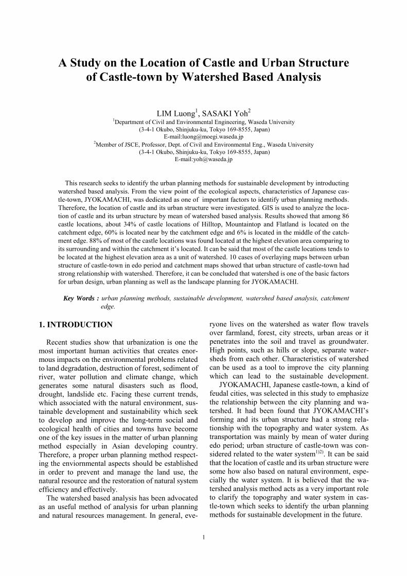
a. Catchment Catchment refers to any points in the landscape
which is an area that provides water to the point through lateral flow over the surface and under-ground. Normally, the catchment is usually deline-ated on the basis of the watersheds determined from surface topography (Fig.1).
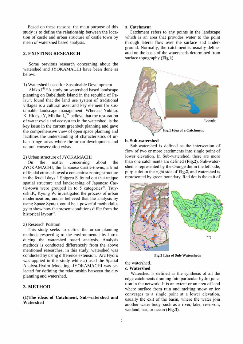
b. Sub-watershed Sub-watershed is defined as the intersection of flow of two or more catchments into single point of lower elevation. In Sub-watershed, there are more than one catchments are defined (Fig.2). Sub-water- shed is represented by the Orange dot in the left side, purple dot in the right side of Fig.2, and watershed is represented by green boundary. Red dot is the exit of
the watershed. c. Watershed
Watershed is defined as the synthesis of all the edge catchments draining into particular hydro junc-tion in the network. It is an extent or an area of land where surface from rain and melting snow or ice converges to a single point at a lower elevation, usually the exit of the basin, where the water join another water body, such as a river, lake, reservoir, wetland, sea, or ocean (Fig.3).
Fig.1 Idea of a Catchment
Fig.2 Idea of Sub-Watersheds
*7)
3
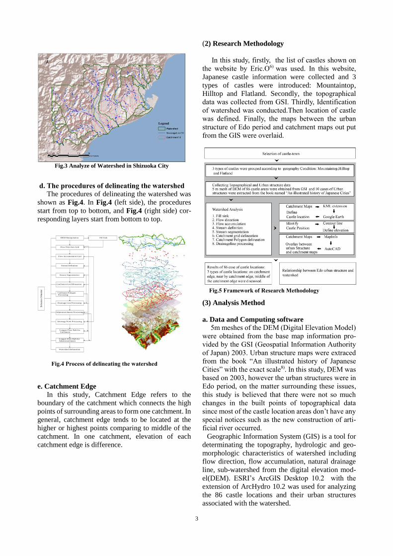
d. The procedures of delineating the watershed The procedures of delineating the watershed was shown as Fig.4. In Fig.4 (left side), the procedures start from top to bottom, and Fig.4 (right side) cor-responding layers start from bottom to top.
e. Catchment Edge In this study, Catchment Edge refers to the boundary of the catchment which connects the high points of surrounding areas to form one catchment. In general, catchment edge tends to be located at the higher or highest points comparing to middle of the catchment. In one catchment, elevation of each catchment edge is difference.
(2) Research Methodology In this study, firstly, the list of castles shown on the website by Eric.O6) was used. In this website, Japanese castle information were collected and 3 types of castles were introduced: Mountaintop, Hilltop and Flatland. Secondly, the topographical data was collected from GSI. Thirdly, Identification of watershed was conducted.Then location of castle was defined. Finally, the maps between the urban structure of Edo period and catchment maps out put from the GIS were overlaid.
(3) Analysis Method a. Data and Computing software 5m meshes of the DEM (Digital Elevation Model) were obtained from the base map information pro-vided by the GSI (Geospatial Information Authority of Japan) 2003. Urban structure maps were extraced from the book “An illustrated history of Japanese Cities” with the exact scale8). In this study, DEM was based on 2003, however the urban structures were in Edo period, on the matter surrounding these issues, this study is believed that there were not so much changes in the built points of topographical data since most of the castle location areas don’t have any special notices such as the new construction of arti-ficial river occurred. Geographic Information System (GIS) is a tool for determinating the topography, hydrologic and geo-morphologic characteristics of watershed including flow direction, flow accumulation, natural drainage line, sub-watershed from the digital elevation mod-el(DEM). ESRI’s ArcGIS Desktop 10.2 with the extension of ArcHydro 10.2 was used for analyzing the 86 castle locations and their urban structures associated with the watershed.
Fig.3 Analyze of Watershed in Shizuoka City
Fig.5 Framework of Research Methodology
Delin
eation
of W
atersh
ed
DEM Manipulation
Flow Direction Grid
Flow Accumulation Grid
Stream Definition
Stream Segmentation
Catchment Grid Dlineation
Catchment Polygon Processing
Drainage Line Processing
Adjointcatchment Processing
Drainage Point Processing
Longest Flow Path for Catchment
Longest Flow Path forAdjointcatchment
Watershed Delineation
Fill Sink
Fig.4 Process of delineating the watershed
4
b. Identification of watershed Watershed shape, size vary according to differ-ence topography and characteristics of each city. In this study, threshold of 1% gave a definition of stream. It means that stream definition equals to 1% of the flow accumulation which is the accumulation of flow direction. Flow direction was obtained on the basis of the slope. Slope was calculated based on the 8-direction pour point model. Finally, the areas of stream having the value less than the definition is not considered as the stream so that the catchment is not established. c. Analysis of castle location In order to determine the castle locations more precisely, the catchment maps and drainage line were exported to google earth by KML extension. Im-porting these extension to google earth then key in the name of the castle name, the location of castle was defined. The location of castle and catchment located the castle showing the Hydro ID were de-fined in Google Earth, then the location of castle can be found easily in ArcGIS. 3 types of castle loca-tions: on the catchment, near by the catchment edge and middle of the catchment edge were discussed. The contour lines were out put to show clearly the elevation of each castle location with its surrounding and within the catchment it’s located. (4) Example of Analysis In order to clarify the process of analysis clearly, In this study, Iyo Matsuyama castle, an original cas-tle, an hilltop castle, was selected as the example. a. Study area 12,013 ha of castle location areas were used for conducting the analysis of watershed. It contains a total of 251 catchments as shown in Fig.6a. The total area of the catchment located the castle is 119 ha.
b. Data Analysis In Fig.6c, pink color denotes the catchment lo-cated the castle with the castle location, green de-notes the surrounding catchments, natural drainage line was represented by blue line color. These data were out put from the ArcGIS. From this figure, the castle location is located on the catchment edge and at the highest elevation area within the catchment its located. Moreover, it was also found as the highest elevation comparing to its surrounding.
4. RELATIONSHIP BETWEEN LOCATION OF CASTLE AND CATCHMENT 1) Three types of castle In this study, the data was categorized according to the geography condition of castle locations: Mountaintop, Hilltop and Flatland. Within 138 cas-tles, 13/18 of Mountaintop, 36/62 of Hilltop, and 37/58 of Flatland castle locations were analyzed. Within one catchement, the location of Mountaintop and Hilltop tend to be located more on the catchment edge and near by the catchment edge position, how-ever, in the case of the Flatland, there is not so much difference between located near by the catchment edge or on the catchment edge.
Fig 6a. Catchment and Drainage line of study area of Iyo Matsuyama castle
Fig.6c Catchment located the castle and its surrounding catchment
Fig. 6b Contour line of study area of Iyo Matsuyama castle in 3D
5
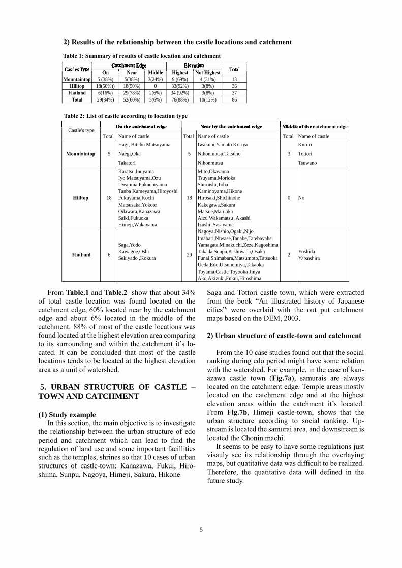
From Table.1 and Table.2 show that about 34% of total castle location was found located on the catchment edge, 60% located near by the catchment edge and about 6% located in the middle of the catchment. 88% of most of the castle locations was found located at the highest elevation area comparing to its surrounding and within the catchment it’s lo-cated. It can be concluded that most of the castle locations tends to be located at the highest elevation area as a unit of watershed. 5. URBAN STRUCTURE OF CASTLE –TOWN AND CATCHMENT (1) Study example In this section, the main objective is to investigate the relationship between the urban structure of edo period and catchment which can lead to find the regulation of land use and some important facillities such as the temples, shrines so that 10 cases of urban structures of castle-town: Kanazawa, Fukui, Hiro-shima, Sunpu, Nagoya, Himeji, Sakura, Hikone
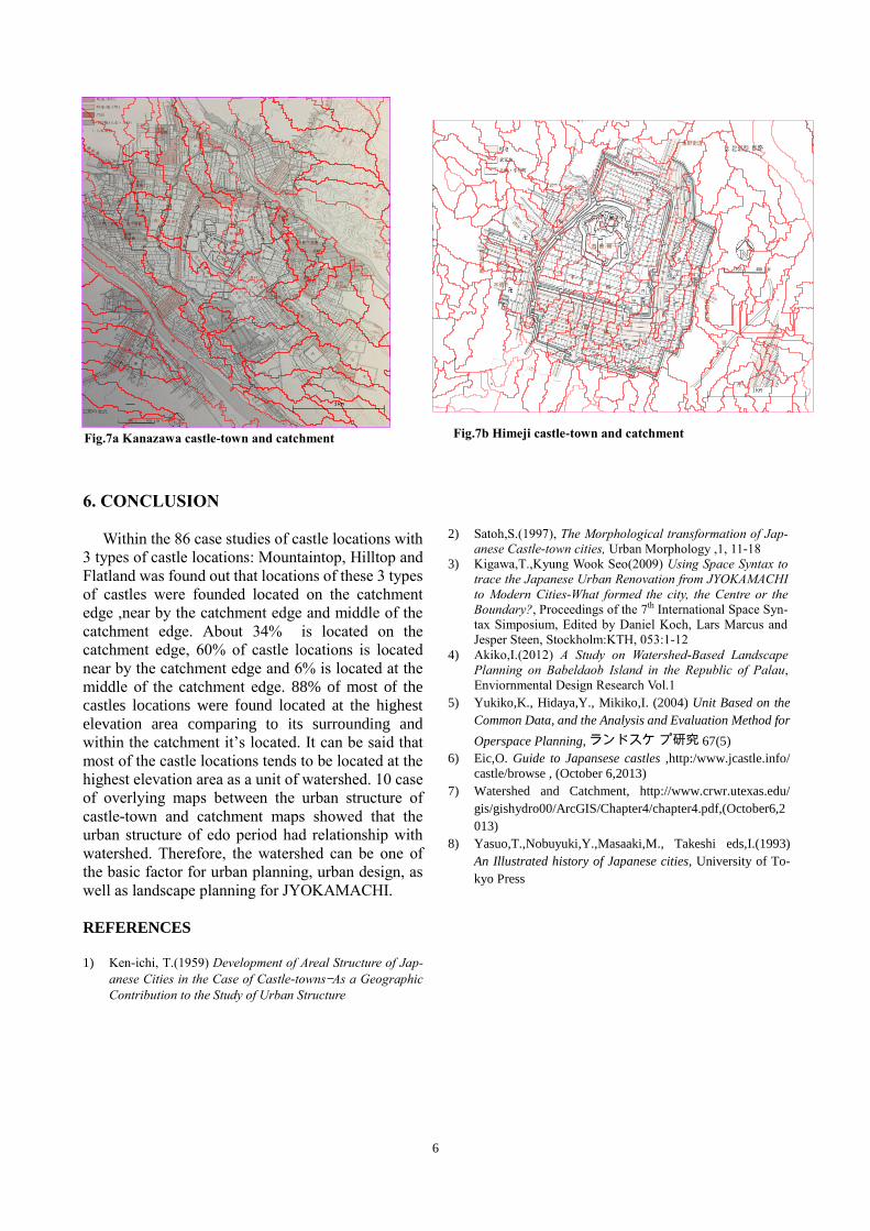
Saga and Tottori castle town, which were extracted from the book “An illustrated history of Japanese cities”, were overlaid with the out put catchment maps based on the DEM, 2003. 2) Urban structure of castle-town and catchment From the 10 case studies found out that the social ranking during edo period might have some relation with the watershed. For example, in the case of kan-azawa castle town (Fig.7a), samurais are always located on the catchment edge. Temple areas mostly located on the catchment edge and at the highest elevation areas within the catchment it’s located. From Fig.7b, Himeji castle-town, shows that the urban structure according to social ranking. Up-stream is located the samurai area, and downstream is located the Chonin machi. It seems to be easy to have some regulations just visauly see its relationship through the overlaying maps, but quatitative data was difficult to be realized. Therefore, the quatitative data will defined in the future study.
On Near Middle Highest Not Highest
Mountaintop 5 (38%) 5(38%) 3(24%) 9 (69%) 4 (31%) 13Hilltop 18(50%)) 18(50%) 0 33(92%) 3(8%) 36
Flatland 6(16%) 29(78%) 2(6%) 34 (92%) 3(8%) 37Total 29(34%) 52(60%) 5(6%) 76(88%) 10(12%) 86
ElevationCatchment EdgeCastles'Type Total
On N Middle High t Not High t
ElevationCatchment EdgeCastles'TypeTypeT TotTotT al
Table 1: Summary of results of castle location and catchment
2) Results of the relationship between the castle locations and catchment
Total Name of castle Total Name of castle Total Name of castleHagi, Bitchu Matsuyama Iwakuni,Yamato Koriya Kururi
Naegi,Oka Nihonmatsu,Tatsuno Tottori
Takatori Nihonmatsu Tsuwano Karatsu,Inuyama Mito,OkayamaIyo Matsuyama,Ozu Tsuyama,Morioka Uwajima,Fukuchiyama Shiroishi,Toba Tanba Kameyama,Hitoyoshi Kaminoyama,Hikone Fukuyama,Kochi Hirosaki,Shichinohe Matsusaka,Yokote Kakegawa,SakuraOdawara,Kanazawa Matsue,Maruoka Saiki,Fukuoka Aizu Wakamatsu ,Akashi Himeji,Wakayama Izushi ,Sasayama
Nagoya,Nishio,Ogaki,NijoImabari,Niwase,Tanabe,Tatebayahsi
Saga,Yodo Yamagata,Minakuchi,Zeze,Kagoshima Kawagoe,Oshi Takada,Sunpu,Kishiwada,Osaka Yoshida Sekiyado ,Kokura Funai,Shimabara,Matsumoto,Tatsuoka Yatsushiro
Ueda,Edo,Utsunomiya,Takaoka Toyama Castle Toyooka JinyaAko,Akizuki,Fukui,Hiroshima
5
18
5
18
Flatland 6 29
Castle's typeOn the catchment edge Near by the catchment edge Middle of the catchment edge
3
0
2
No
Mountaintop
Hilltop
On the catchment edge Near by the catchment edge Middle of the c
Table 2: List of castle according to location type
6
6. CONCLUSION Within the 86 case studies of castle locations with 3 types of castle locations: Mountaintop, Hilltop and Flatland was found out that locations of these 3 types of castles were founded located on the catchment edge ,near by the catchment edge and middle of the catchment edge. About 34% is located on the catchment edge, 60% of castle locations is located near by the catchment edge and 6% is located at the middle of the catchment edge. 88% of most of the castles locations were found located at the highest elevation area comparing to its surrounding and within the catchment it’s located. It can be said that most of the castle locations tends to be located at the highest elevation area as a unit of watershed. 10 case of overlying maps between the urban structure of castle-town and catchment maps showed that the urban structure of edo period had relationship with watershed. Therefore, the watershed can be one of the basic factor for urban planning, urban design, as well as landscape planning for JYOKAMACHI. REFERENCES 1) Ken-ichi, T.(1959) Development of Areal Structure of Jap-
anese Cities in the Case of Castle-towns—As a Geographic Contribution to the Study of Urban Structure
2) Satoh,S.(1997), The Morphological transformation of Jap-
anese Castle-town cities, Urban Morphology ,1, 11-18 3) Kigawa,T.,Kyung Wook Seo(2009) Using Space Syntax to
trace the Japanese Urban Renovation from JYOKAMACHI to Modern Cities-What formed the city, the Centre or the Boundary?, Proceedings of the 7th International Space Syn-tax Simposium, Edited by Daniel Koch, Lars Marcus and Jesper Steen, Stockholm:KTH, 053:1-12
4) Akiko,I.(2012) A Study on Watershed-Based Landscape Planning on Babeldaob Island in the Republic of Palau, Enviornmental Design Research Vol.1
5) Yukiko,K., Hidaya,Y., Mikiko,I. (2004) Unit Based on the Common Data, and the Analysis and Evaluation Method for Operspace Planning, ランドスケ プ研究 67(5)
6) Eic,O. Guide to Japansese castles ,http:/www.jcastle.info/ castle/browse , (October 6,2013)
7) Watershed and Catchment, http://www.crwr.utexas.edu/ gis/gishydro00/ArcGIS/Chapter4/chapter4.pdf,(October6,2013)
8) Yasuo,T.,Nobuyuki,Y.,Masaaki,M., Takeshi eds,I.(1993) An Illustrated history of Japanese cities, University of To-kyo Press
Fig.7a Kanazawa castle-town and catchment Fig.7b Himeji castle-town and catchment