a strategy for salt marsh persistence in an era of … strategy for salt marsh persistence ......
TRANSCRIPT

A Strategy For Salt Marsh Persistence
In An Era Of Climate Change
Blackwater 2100
1655 North Fort Myer Dr. Suite 1300 Arlington, Va 22209 www.conservationfund.org
Principal Investigators and Project Team:For The Conservation Fund: Erik J. Meyers, Jeffrey A. Lerner, Theodore C. Weber, Gregory Baron and William L. Allen IIIFor Audubon MD-DC: Jacquelyn Bonomo and David R. Curson, PhD.For U.S. Fish and Wildlife Service: Matthew Whitbeck For Chesapeake Conservancy (assessment phase): Joel E. Dunn and David G. Burke
Principal Cooperating parties: Maryland Department of Natural Resources and U.S. Fish and Wildlife Service
The Project Team thanks the following advisors who generously shared their views and expertise; however, we take sole responsibility for the contents of this report including any errors.
Technical Advisory Committee: Suzanne Baird (USFWS, Blackwater NWR); Donald Cahoon (USGS –Patuxent Research Center ); Brian Czech (USFWS National Wildlife Refuge System); Zoe Johnson (MD Department of Natural Resources, Office of Sustainable Futures); Dana Limpert (MD DNR, Wildlife and Heritage); Lynn Martin (U.S. Army Corps of Engineers, Institute for Water Resources);Brian Needleman (University of Maryland); Al Rizzo (USFWS Chesapeake Field Office); Deborah Larson-Salvatore (USACE IWR); Michael Slattery (USFWS Chesapeake Field Office/ Chesapeake Bay Program); Chris Spaur (USACE Baltimore District); and Steve Strano (U.S. Department of Agriculture, Natural Resources Conservation Service). Communications Advisory Committee: Martin O’Connor (Friends of Blackwater); Amanda Fenstermaker (Heart of Chesapeake Country Heritage Area); Beth Ann Lynch ( Dorchester Citizens for Planned Growth); Jared Parks (Eastern Shore Land Conservancy); Ray Paterra (Blackwater NWR Visitor’s Center); Anne Roan (City of Cambridge); Megan Ward (Nanticoke Watershed Alliance); Mark Scallion (Pickering Creek Audubon Center); Jim Rapp (Hazel Outdoor Discovery Center); Joe Fehrer (Nature Conservancy); Phil Hesser (consultant); Jeff Allenby (Chesapeake Conservancy); Dan Murphy (USFWS Chesapeake Field Office); Don Webster (MD DNR, Wildlife and Heritage Service); Kelly Collins (MD DNR, Chesapeake and Coastal Service); Joel Dunn (Chesapeake Conservancy); and Zoe Johnson (MD DNR, Office of Sustainable Futures). Suggested citation: Lerner, J.A., Curson, D.R., Whitbeck, M. and Meyers, E.J., Blackwater 2100: A strategy for salt marsh persistence in an era of climate change, 2013, The Conservation Fund (Arlington, VA) and Audubon MD-DC (Baltimore, MD). Publication design by: Whitney Flanagan, The Conservation Fund
Copyright © The Conservation Fund (2013)Permission is granted to make and distribute full copies of the work via printed or electronic media for educational and non-commercial purposes with proper citation and attribution.
BlAckwAter 2100 1
BlAckwAter 2100
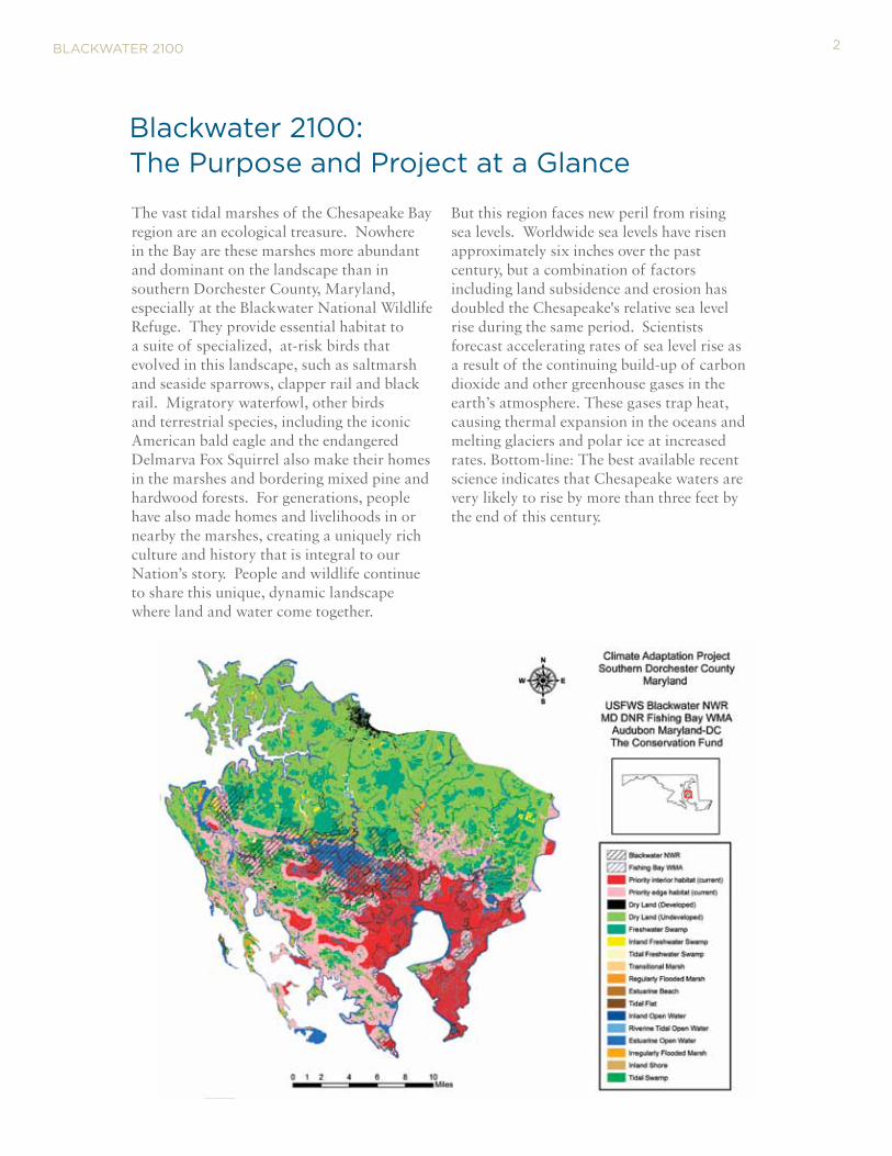
The vast tidal marshes of the Chesapeake Bay region are an ecological treasure. Nowhere in the Bay are these marshes more abundant and dominant on the landscape than in southern Dorchester County, Maryland, especially at the Blackwater National Wildlife Refuge. They provide essential habitat to a suite of specialized, at-risk birds that evolved in this landscape, such as saltmarsh and seaside sparrows, clapper rail and black rail. Migratory waterfowl, other birds and terrestrial species, including the iconic American bald eagle and the endangered Delmarva Fox Squirrel also make their homes in the marshes and bordering mixed pine and hardwood forests. For generations, people have also made homes and livelihoods in or nearby the marshes, creating a uniquely rich culture and history that is integral to our Nation’s story. People and wildlife continue to share this unique, dynamic landscape where land and water come together.
But this region faces new peril from rising sea levels. Worldwide sea levels have risen approximately six inches over the past century, but a combination of factors including land subsidence and erosion has doubled the Chesapeake's relative sea level rise during the same period. Scientists forecast accelerating rates of sea level rise as a result of the continuing build-up of carbon dioxide and other greenhouse gases in the earth’s atmosphere. These gases trap heat, causing thermal expansion in the oceans and melting glaciers and polar ice at increased rates. Bottom-line: The best available recent science indicates that Chesapeake waters are very likely to rise by more than three feet by the end of this century.
Blackwater 2100: the Purpose and Project at a Glance
2
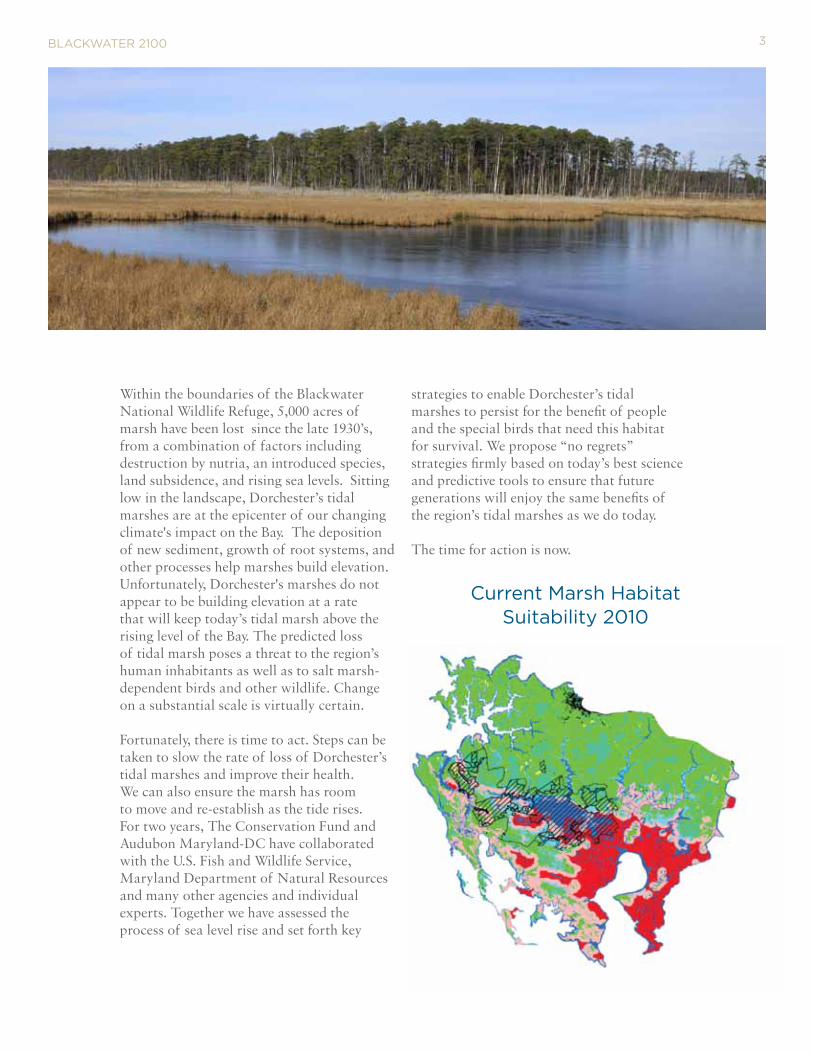
Within the boundaries of the Blackwater National Wildlife Refuge, 5,000 acres of marsh have been lost since the late 1930’s, from a combination of factors including destruction by nutria, an introduced species, land subsidence, and rising sea levels. Sitting low in the landscape, Dorchester’s tidal marshes are at the epicenter of our changing climate's impact on the Bay. The deposition of new sediment, growth of root systems, and other processes help marshes build elevation. Unfortunately, Dorchester's marshes do not appear to be building elevation at a rate that will keep today’s tidal marsh above the rising level of the Bay. The predicted loss of tidal marsh poses a threat to the region’s human inhabitants as well as to salt marsh-dependent birds and other wildlife. Change on a substantial scale is virtually certain. Fortunately, there is time to act. Steps can be taken to slow the rate of loss of Dorchester’s tidal marshes and improve their health. We can also ensure the marsh has room to move and re-establish as the tide rises. For two years, The Conservation Fund and Audubon Maryland-DC have collaborated with the U.S. Fish and Wildlife Service, Maryland Department of Natural Resources and many other agencies and individual experts. Together we have assessed the process of sea level rise and set forth key
strategies to enable Dorchester’s tidal marshes to persist for the benefit of people and the special birds that need this habitat for survival. We propose “no regrets” strategies firmly based on today’s best science and predictive tools to ensure that future generations will enjoy the same benefits of the region’s tidal marshes as we do today. The time for action is now.
BlAckwAter 2100
current Marsh Habitat Suitability 2010
3
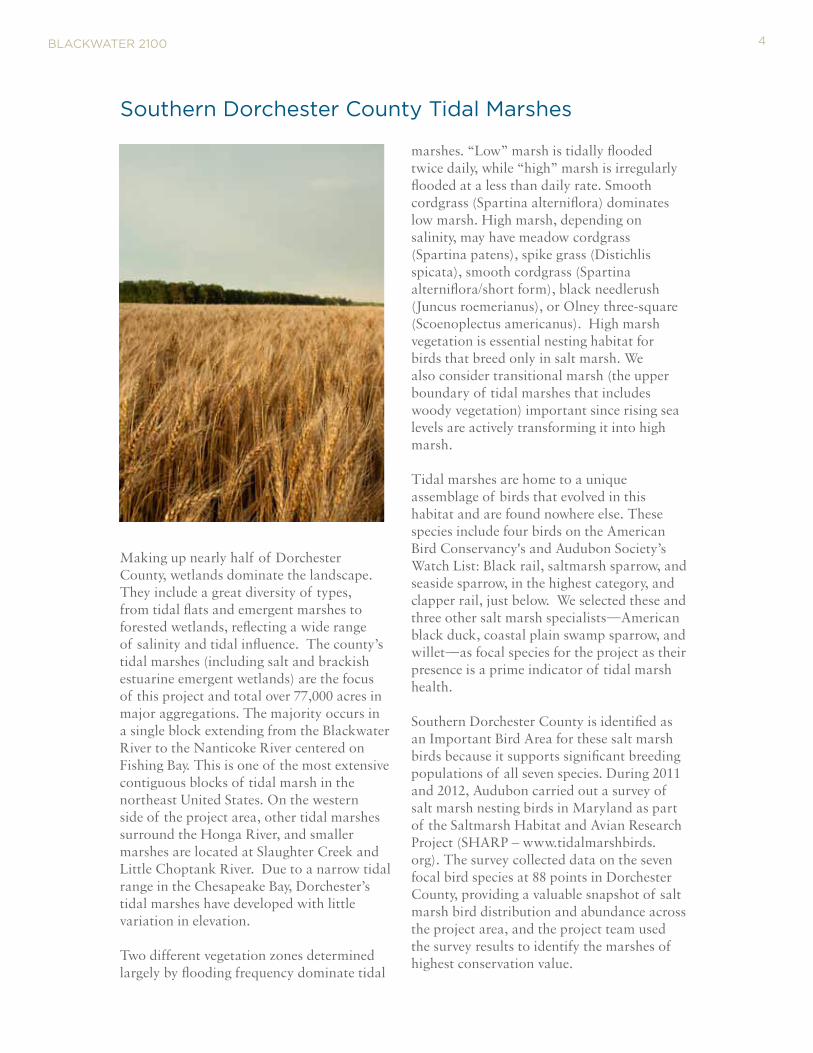
Making up nearly half of Dorchester County, wetlands dominate the landscape. They include a great diversity of types, from tidal flats and emergent marshes to forested wetlands, reflecting a wide range of salinity and tidal influence. The county’s tidal marshes (including salt and brackish estuarine emergent wetlands) are the focus of this project and total over 77,000 acres in major aggregations. The majority occurs in a single block extending from the Blackwater River to the Nanticoke River centered on Fishing Bay. This is one of the most extensive contiguous blocks of tidal marsh in the northeast United States. On the western side of the project area, other tidal marshes surround the Honga River, and smaller marshes are located at Slaughter Creek and Little Choptank River. Due to a narrow tidal range in the Chesapeake Bay, Dorchester’s tidal marshes have developed with little variation in elevation. Two different vegetation zones determined largely by flooding frequency dominate tidal
marshes. “Low” marsh is tidally flooded twice daily, while “high” marsh is irregularly flooded at a less than daily rate. Smooth cordgrass (Spartina alterniflora) dominates low marsh. High marsh, depending on salinity, may have meadow cordgrass (Spartina patens), spike grass (Distichlis spicata), smooth cordgrass (Spartina alterniflora/short form), black needlerush (Juncus roemerianus), or Olney three-square (Scoenoplectus americanus). High marsh vegetation is essential nesting habitat for birds that breed only in salt marsh. We also consider transitional marsh (the upper boundary of tidal marshes that includes woody vegetation) important since rising sea levels are actively transforming it into high marsh.
Tidal marshes are home to a unique assemblage of birds that evolved in this habitat and are found nowhere else. These species include four birds on the American Bird Conservancy's and Audubon Society’s Watch List: Black rail, saltmarsh sparrow, and seaside sparrow, in the highest category, and clapper rail, just below. We selected these and three other salt marsh specialists—American black duck, coastal plain swamp sparrow, and willet—as focal species for the project as their presence is a prime indicator of tidal marsh health.
Southern Dorchester County is identified as an Important Bird Area for these salt marsh birds because it supports significant breeding populations of all seven species. During 2011 and 2012, Audubon carried out a survey of salt marsh nesting birds in Maryland as part of the Saltmarsh Habitat and Avian Research Project (SHARP – www.tidalmarshbirds.org). The survey collected data on the seven focal bird species at 88 points in Dorchester County, providing a valuable snapshot of salt marsh bird distribution and abundance across the project area, and the project team used the survey results to identify the marshes of highest conservation value.
Southern Dorchester county tidal Marshes
BlAckwAter 2100 4

BlAckwAter 2100
Maryland is particularly vulnerable to sea level rise because of its geographic location, elevation and geology. With thousands of miles of coastline and acres of low urban and rural areas, the State is highly vulnerable to sea level rise and coastal storms. The Chesapeake Bay region is frequently subjected to tropical storms and nor’easters. These major storms can produce high tidal surges, heavy wave action, and torrential rainfall. Land subsidence also affects the relative rate of sea level rise. The Chesapeake region is still sinking as the surface of the northern part of the continent rebounds as result of being released from the massive glaciers that covered much of the Northern Hemisphere 10,000 years ago. Other factors contribute to the region’s faster relative sea level rise compared with global levels. However, the greatest factor in future decades will be the warming global climate.
rising Sea levels In the chesapeake
Tide gauges show that sea levels rose in Maryland by a foot or more during the last century, a rate which is twice the global average. In the Blackwater NWR losses of tidal marsh have been documented by aerial photography dating back to the 1930’s. Between 1938 and 2006, the Refuge lost 5,028 acres of its marsh to open water, an average of 74 acres per year. During the same period, the refuge gained 2,949 acres of new marsh at the upland edge, presumably through upslope migration of tidal marsh as sea levels rose. In the Nanticoke estuary, marsh loss has followed a similar pattern and timeline. While these observations indicate new tidal marsh is forming, the data confirm that the area of new marsh is not keeping pace with losses.
Forecasting Accelerating change
Recent projections by the Maryland Climate Change Commission show an accelerating rate of sea level rise through the 21st Century. They predict 1.4 feet of sea level rise by 2050, and 3.7 feet by the end of the century. To examine what such increases in relative sea level would mean for Dorchester’s tidal marshes, the Project Team used the same predictive model for sea level rise, the Sea Level Affecting Marshes Model or SLAMM, that the State uses for its planning and adaption purposes.
5
BlAckwAter 2100
Changes in tidal marsh area and habitat type in response to sea-level rise may be modeled using the Sea Level Affecting Marshes Model (SLAMM) that accounts for the dominant processes involved in wetland conversion and shoreline modifications, including information on land elevation, cover, tidal range, land subsidence, sedimentation and erosion rates and sea level rise to provide a model of future marsh habitat. Each site is divided into units or “cells” of equal area. Within the contiguous United States, most required data are readily available from the Web, including NOAA tidal data, U.S. Fish & Wildlife Service National Wetland Inventory data and USGS Digital Elevation Models (DEM) data. If Light Detection and Ranging (LIDAR) optical scanning DEM data are available, they can also be utilized by the model. Such high-quality elevation data was used by the Project Team. Relative sea level change is computed for each site for each time step. In the SLAMM equation, five primary processes affect wetland fate under different scenarios of sea-level rise:
Our objectives were to identify which areas of current tidal marsh are most resilient to sea level rise and also to identify locations that may support tidal marsh in the future, areas we refer to as “marsh migration corridors." Another objective of the assessment phase of the project was to identify the current marshes of highest value to the seven focal salt marsh bird species. These objectives were based on the rationale that conservation strategies to extend the life of marshes in the face of sea level rise should be targeted on the best habitat for salt marsh birds and the marshes with the greatest likelihood of persistence.
We used the SLAMM model to map predicted areas of tidal marsh suitable for the focal marsh bird species under today’s conditions and at four future elevations (indicated as approximate time intervals through the present century). Because the seven focal salt marsh bird species breed in high marsh and transitional marsh, we focused on these wetland categories, combining them as “priority bird habitat” on our maps. SLAMM results are aggregated and mapped only in patches of priority bird habitat of 160 acres or larger. [Field studies—the SHARP surveys cited previously—indicate birds are not present in smaller patches.]
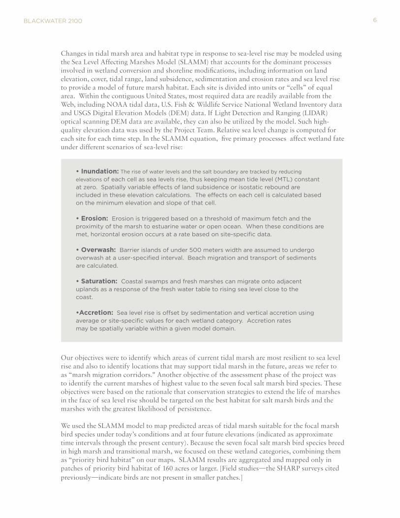
• Inundation: the rise of water levels and the salt boundary are tracked by reducing
elevations of each cell as sea levels rise, thus keeping mean tide level (Mtl) constant at zero. Spatially variable effects of land subsidence or isostatic rebound are included in these elevation calculations. the effects on each cell is calculated based on the minimum elevation and slope of that cell. • Erosion: erosion is triggered based on a threshold of maximum fetch and the proximity of the marsh to estuarine water or open ocean. when these conditions are met, horizontal erosion occurs at a rate based on site-specific data. • Overwash: Barrier islands of under 500 meters width are assumed to undergo overwash at a user-specified interval. Beach migration and transport of sediments are calculated.
• Saturation: coastal swamps and fresh marshes can migrate onto adjacent uplands as a response of the fresh water table to rising sea level close to thecoast.
•Accretion: Sea level rise is offset by sedimentation and vertical accretion using average or site-specific values for each wetland category. Accretion ratesmay be spatially variable within a given model domain.
6
Further, we divided priority bird habitat into interior habitat and edge habitat. SHARP bird survey revealed that our focal species preferred habitat at least a quarter mile (or 500 meters) from the upland, forested edges of the Dorchester marshes.
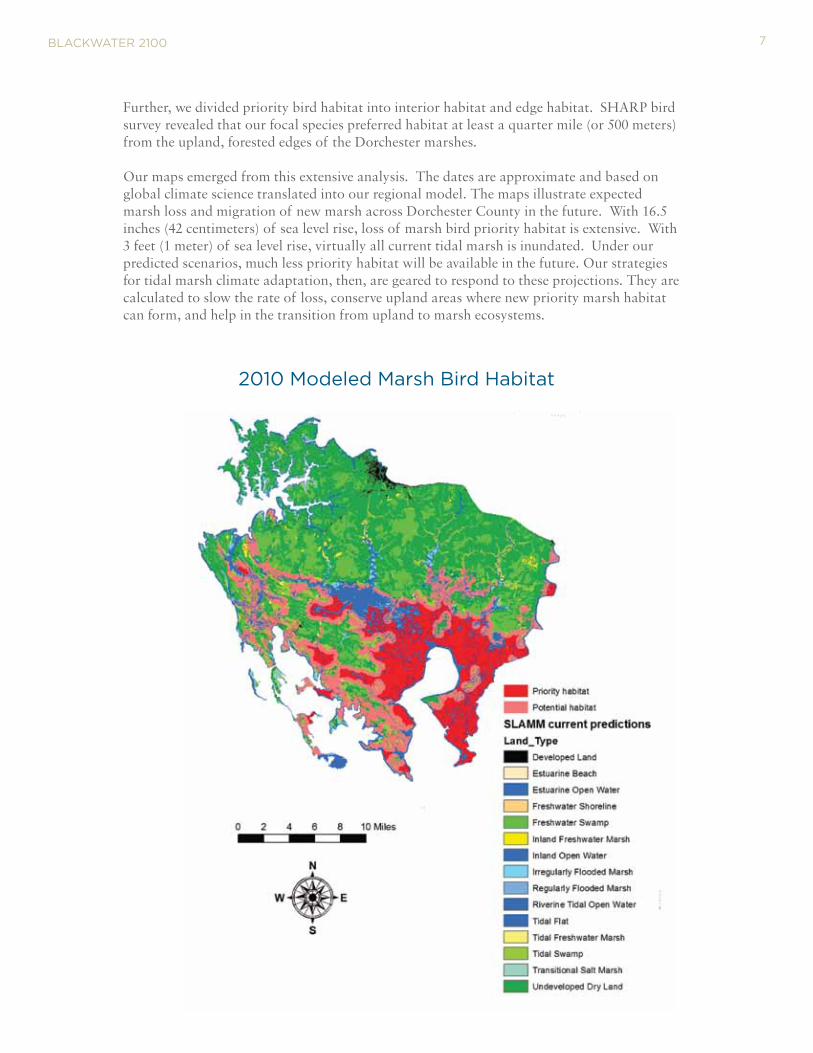
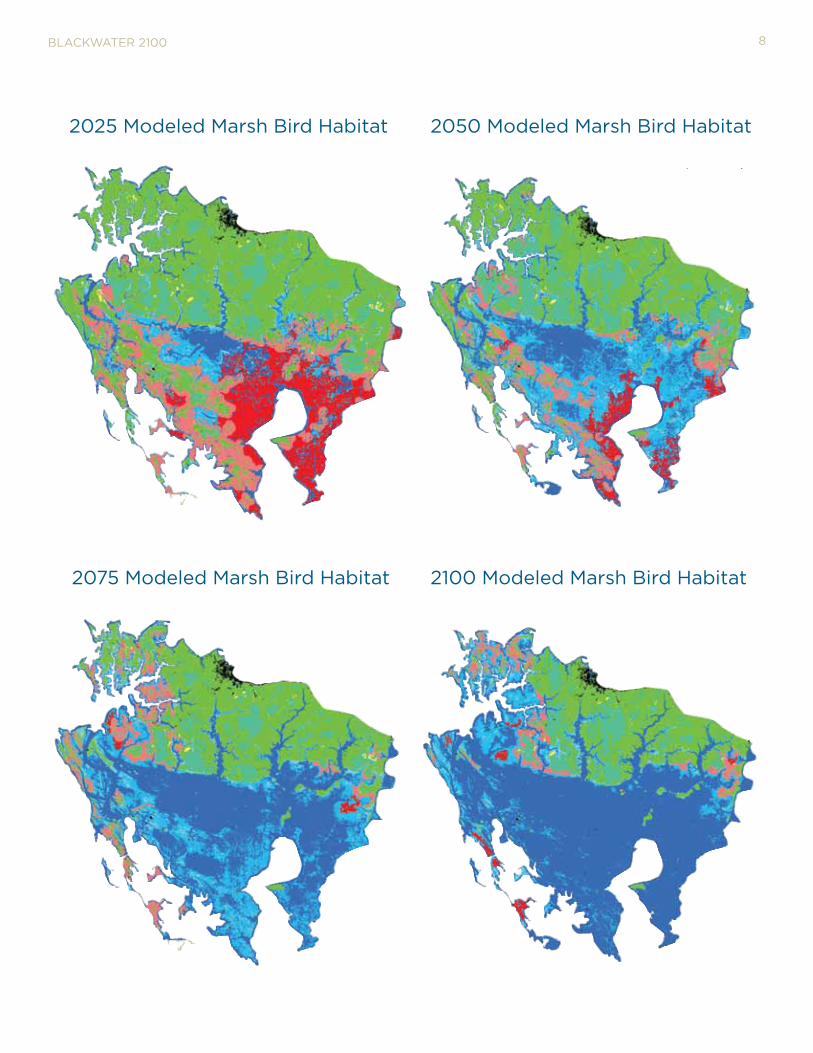
Our maps emerged from this extensive analysis. The dates are approximate and based on global climate science translated into our regional model. The maps illustrate expected marsh loss and migration of new marsh across Dorchester County in the future. With 16.5 inches (42 centimeters) of sea level rise, loss of marsh bird priority habitat is extensive. With 3 feet (1 meter) of sea level rise, virtually all current tidal marsh is inundated. Under our predicted scenarios, much less priority habitat will be available in the future. Our strategies for tidal marsh climate adaptation, then, are geared to respond to these projections. They are calculated to slow the rate of loss, conserve upland areas where new priority marsh habitat can form, and help in the transition from upland to marsh ecosystems.
BlAckwAter 2100
2010 Modeled Marsh Bird Habitat
7
BlAckwAter 2100
2025 Modeled Marsh Bird Habitat 2050 Modeled Marsh Bird Habitat
2075 Modeled Marsh Bird Habitat 2100 Modeled Marsh Bird Habitat
8

To complement SLAMM projections of future marsh area, the Project Team incorporated additional factors in designating desirable marsh migration “corridors” or areas where extensive tidal marsh could re-emerge upslope from its current locations. These additional “suitability” factors include road network density, land use (extent of development), future land use (the amount of land area located in state growth zone), water flow and ponding information, and protection status.
BlAckwAter 2100
Forecasting Accelerating change
We approached the challenge of assuring tidal marsh persistence on several fronts: One, we propose adaptively managing today’s marshes. Next, we advocate securing areas for marsh migration. Third we believe assisting the transition of uplands into marsh will be necessary. As we explain in the following text, we recommend several adaptation management strategies to enable existing priority tidal marsh—those areas with the most favorable characteristics for salt marsh birds—to remain healthy and above advancing tides for as long as possible. At the same time, we recommend conservation protection for the most favorable locations for future tidal marsh. And where tides are
pushing higher into upland fields and forests, we recommend using adaptive management techniques to provide a smoother transition of these upland habitats into productive high salt marsh. Deploying this combination of strategies will require not only the collaboration of policymakers and state and federal agencies but the active engagement of private landowners and the public as well.
9

BlAckwAter 2100
Adaptation Management to Slow Marsh losses
Our assessment concluded that the projected loss of high tidal marsh across the Dorchester County project area would greatly exceed the potential gains in new high marsh from upslope marsh migration. However, changing the status quo in marsh management should help existing tidal marsh to persist longer. Among key conservation actions that can increase marsh resilience to sea level rise are increasing surface elevation, reducing the amount of interior ponding, and eliminating invasive plants.
Considering cost and logistical challenges of marsh restoration, it is infeasible to attempt preserving all tidal marsh in the project area. Instead we identified a key area of existing marsh where management actions are likely to yield the greatest long-term conservation benefits. The proposed Blackwater NWR- Fishing Bay Marsh Conservation Zone includes approximately 20,000 acres of high marsh in a continuous arc surrounding Fishing Bay.
Selection criteria included: • Greatest predicted longevity under
sea level rise scenarios.
• Most intact current condition, defined
by lack of interior of ponding.
• Highest abundance of seven focal
salt marsh birds, measured by SHARP
surveys.
• Extensive area of contiguous interior
10

BlAckwAter 2100
We recommend using the following techniques in this Marsh Conservation Zone to improve marsh health and longevity:
Sediment Enhancement
In the Project area, marsh erosion occurs from prolonged water logging of the root zone of marsh plants. This condition reduces plant vigor and produces open areas. Under these conditions, the process of marsh accretion slows down due to lack of new dead plant material (peat substrate). Since Blackwater NWR marshes receive little mineral sediment, decaying organic matter from dead plants is the primary source of elevation for the marsh grasses and the decline in marsh grass health accelerates inundation rates. We propose adding thin sediment layers through hydraulic pumping in the Marsh Conservation Zone to increase the marsh surface elevation and fill in eroded areas. Local navigation projects or, possibly, onsite locations could be used as sediment sources. The additional sediment will be particularly helpful in maintaining the health of meadow cordgrass and black needlerush, both plant species preferred by the salt marsh birds. Although prior restoration projects at Blackwater NWR targeted large areas of eroded marsh, we believe enhancing largely intact marsh should be more logistically feasible, ecologically beneficial and cost effective. The current nutria eradication program is critical to marsh health to avoid a return to the days when these invasive rodents from Latin America consumed significant amounts of Refuge’s tidal marsh vegetation following their introduction in the mid-20th century.
11
Shallow Drainage
Some areas in the Marsh Conservation Zone appear to be ponding instead of shedding water regularly, despite an elevation above daily tidal flooding. The result is a waterlogged plant root zone. This condition is leading to the type of marsh erosion observed in other areas of this marsh system. If hydrological surveys in these areas indicate that the pooled water can be released through shallow drainage, etching shallow channels could connect the failing marsh areas to existing tidal creeks, and by lowering their water levels, revitalize marsh vegetation.
The Project Team also recommends studying the effect of restoring improved hydrological flows past the Maple Dam Road. Experts currently have mixed opinions about whether restoring flow would improve or exacerbate levels of marsh loss. Further study is needed to develop greater certainty
Control Invasive Plants
When the common reed, Phragmites australis, becomes established in large stands, it can prevent growth or crowd out more desirable native grasses favored by salt marsh birds. We recommend mapping current stands of phragmites, using herbicides to eradicate the plants to the extent possible, and monitoring results.
These management techniques will help keep existing tidal marsh healthier and persist longer than if current processes are simply allowed to run their course. The longer existing marsh can be kept in place and healthy, then the more likely that the salt marsh bird population will remain healthy and the other ecosystem services will continue. However, our predictive model indicates management alone will be insufficient to enable sufficient priority tidal marsh to persist in the face of accelerating sea levels.
BlAckwAter 2100
Identifying the key Marsh Migration corridors
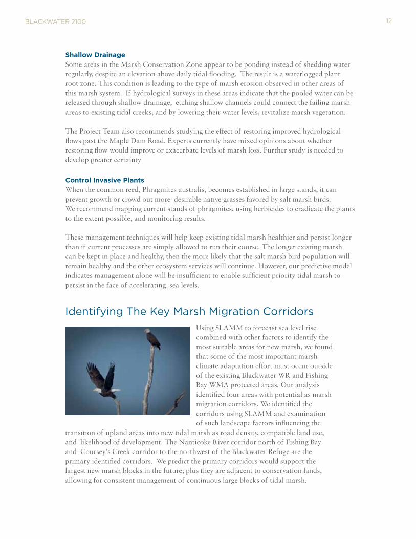
Using SLAMM to forecast sea level rise combined with other factors to identify the most suitable areas for new marsh, we found that some of the most important marsh climate adaptation effort must occur outside of the existing Blackwater WR and Fishing Bay WMA protected areas. Our analysis identified four areas with potential as marsh migration corridors. We identified the corridors using SLAMM and examination of such landscape factors influencing the
transition of upland areas into new tidal marsh as road density, compatible land use, and likelihood of development. The Nanticoke River corridor north of Fishing Bay and Coursey’s Creek corridor to the northwest of the Blackwater Refuge are the primary identified corridors. We predict the primary corridors would support the largest new marsh blocks in the future; plus they are adjacent to conservation lands, allowing for consistent management of continuous large blocks of tidal marsh.
12

BlAckwAter 2100
Southern Dorchester Marsh Migration Corridor Units
13

The Nanticoke marsh migration corridor includes 12,607 acres on the west side of the Nanticoke River in Dorchester County. With one meter of sea level rise, marshes will shift across the corridor and some will convert to open water, but our model predicts approximately 2,300 acres of new priority habitat will persist. Currently three quarters of the area is forested or farmed, a quarter is wetlands. More than half the acreage has some form of conservation protection, including lands managed by the MD Department of Natural Resources as part of the Fishing Bay WMA. Another 2,500 acres is protected currently through conservation easements. Most of the easements are for agricultural preservation through the MD Rural Legacy Program and MD Agricultural Land Preservation Foundation (MALPF). Other easements are held by the Maryland Environmental Trust (MET). This corridor also connects with the southern boundary of the Nanticoke Unit of Blackwater NWR, an area authorized for future conservation acquisitions by the U.S. Fish and Wildlife Service.
The Coursey’s Creek migration corridor on the northwest side of the Refuge contains nearly 14,000 acres, mostly forested or farmed. While presently only 500 acres are tidal marsh, our model indicates the corridor will support approximately 4,000 acres of priority marsh habitat during the latter half of the present century in a dramatic reformation of the landscape.
BlAckwAter 2100
coursey’s creek migration corridor target marsh habitat at different levels of sea level rise
Nanticoke migration corridor target marsh habitat at different levels of sea level rise
14
A quarter of the corridor’s acreage already has some form of conservation protection, including federal and state ownership, and conservation easements on private lands. Although sea level rises are forecast to advance gradually over coming decades, the corridor is ideally suited to continuing current productive forestry and farm uses for decades. These uses would be better protected from land development with more agricultural or similar conservation easements. This corridor is also adjacent to the recently dedicated Harriet Tubman Underground Railroad National Monument and State Park, a nationally significant cultural and historical landscape within the Blackwater Refuge and source of increasing tourism in the County.
BlAckwAter 2100
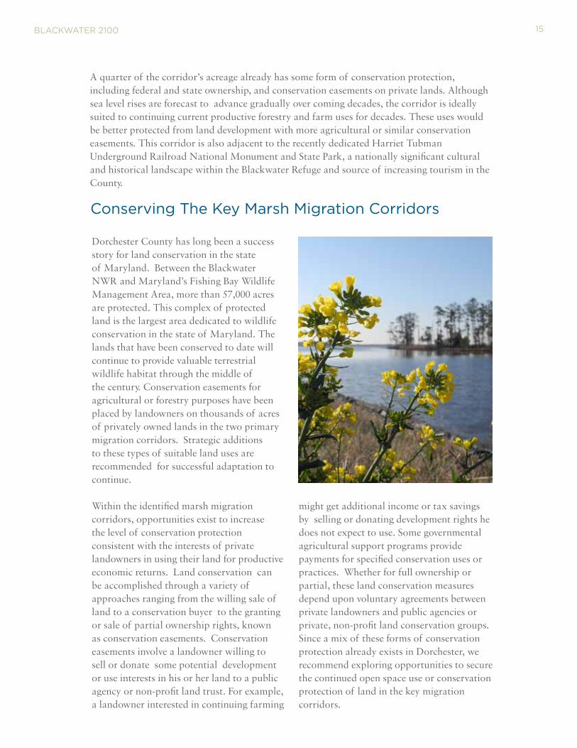
Dorchester County has long been a success story for land conservation in the state of Maryland. Between the Blackwater NWR and Maryland’s Fishing Bay Wildlife Management Area, more than 57,000 acres are protected. This complex of protected land is the largest area dedicated to wildlife conservation in the state of Maryland. The lands that have been conserved to date will continue to provide valuable terrestrial wildlife habitat through the middle of the century. Conservation easements for agricultural or forestry purposes have been placed by landowners on thousands of acres of privately owned lands in the two primary migration corridors. Strategic additions to these types of suitable land uses are recommended for successful adaptation to continue.
Within the identified marsh migration corridors, opportunities exist to increase the level of conservation protection consistent with the interests of private landowners in using their land for productive economic returns. Land conservation can be accomplished through a variety of approaches ranging from the willing sale of land to a conservation buyer to the granting or sale of partial ownership rights, known as conservation easements. Conservation easements involve a landowner willing to sell or donate some potential development or use interests in his or her land to a public agency or non-profit land trust. For example, a landowner interested in continuing farming
might get additional income or tax savings by selling or donating development rights he does not expect to use. Some governmental agricultural support programs provide payments for specified conservation uses or practices. Whether for full ownership or partial, these land conservation measures depend upon voluntary agreements between private landowners and public agencies or private, non-profit land conservation groups. Since a mix of these forms of conservation protection already exists in Dorchester, we recommend exploring opportunities to secure the continued open space use or conservation protection of land in the key migration corridors.
conserving the key Marsh Migration corridors
15
Tools For Land Conservation
BlAckwAter 2100
The federal Land and Water Conservation Fund (LWCF) provides funding to federal,
state and local agencies to acquire conservation interests in land and water property, including
easements. Funds for the lwcF come from off-shore oil and gas development, and projects are
generally for recreation, parks and refuges. lwcF is divided into state grants and federal acquisition
funds. Federal allocations are changing, with more emphasis on landscape scale collaboration among
several agencies. Other amounts are directed to “core” programs, such as the National wildlife
refuge System acquisition needs.
Maryland’s Program Open Space (POS). the MD Department of Natural resources
(DNr) operates Program Open Space (POS) which provides state funds for recreation and open
space acquisition. the Program administers funds made available to local communities for open
and recreational space through the State real estate transfer tax and the federal land and water
conservation Fund. the Program coordinates the acquisition of lands for the use of all units of DNr.
the state employs a targeting System which uses the best scientific information available, first to
conduct an ecological screen that selects high value targeted ecological Areas (teAs), followed by
criteria to identify annual focus areas, and a community Scorecard system at a site level.
Maryland’s Rural Legacy Program. the rural legacy Program provides the focus and
funding necessary to protect large, contiguous tracts of land and other strategic areas from sprawl
development and enhances natural resources, agriculture, forestry, and environmental protection
through cooperative efforts among state and local governments and land trusts. Protection is
provided through the acquisition of easements and fee estates from willing landowners. the
Nanticoke rlA is located in the heart of the Nanticoke watershed in Dorchester county linking
Fishing Bay wildlife Management Area and Blackwater.
Other programs that could help support conservation protection include the Agriculture
Department’s Wetlands Reserve Program, Farm and Ranch Land Protection Program, and Maryland Conservation Reserve Enhancement Program is a federal-
state natural resources conservation program that addresses state and nationally significant
agricultural related environmental concerns related to agriculture. easements can also be donated to
the Maryland Environmental Trust.
Strategies For Managing the transition Of Uplands Into Marsh
Onsite investigations of areas within Blackwater NWR and Fishing Bay demonstrate that the transition of former agricultural fields and forested areas into tidal marsh is already occurring as rising Bay waters inundate or turn soils saline. Cordgrass mixes in with new stands of common reeds in wet fields, and “ghost” trees stand in open marsh areas once part of a pine or mixed hardwood forest. In this changing landscape, we see opportunities to “smooth" the transition for earlier and greater benefit to saltmarsh birds and the environment generally. If sea levels accelerate as climate scientists forecast and recent measurements around the Bay validate, techniques that help former upland habitat transform more rapidly and effectively into functioning tidal marsh will be vital. We are demonstrating several promising techniques within the project area. Briefly summarized, these techniques include:
16
BlAckwAter 2100
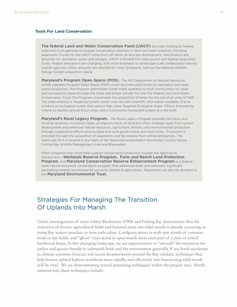
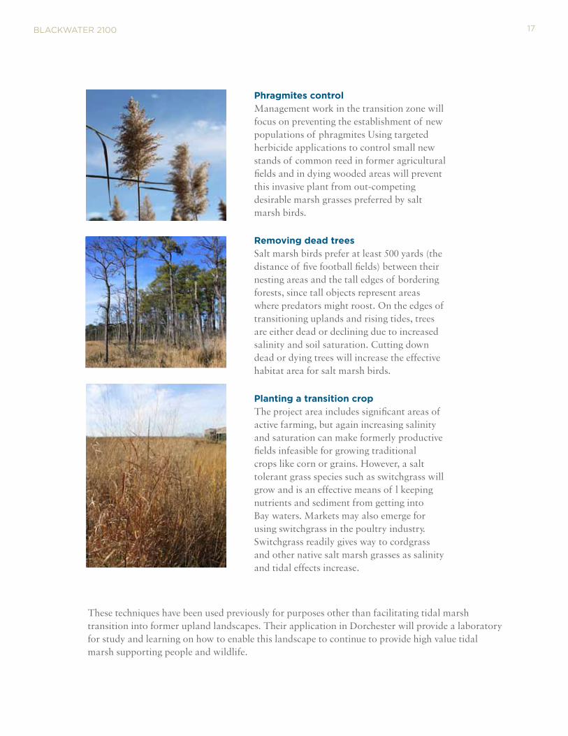
Phragmites control Management work in the transition zone will focus on preventing the establishment of new populations of phragmites Using targeted herbicide applications to control small new stands of common reed in former agricultural fields and in dying wooded areas will prevent this invasive plant from out-competing desirable marsh grasses preferred by salt marsh birds. Removing dead trees Salt marsh birds prefer at least 500 yards (the distance of five football fields) between their nesting areas and the tall edges of bordering forests, since tall objects represent areas where predators might roost. On the edges of transitioning uplands and rising tides, trees are either dead or declining due to increased salinity and soil saturation. Cutting down dead or dying trees will increase the effective habitat area for salt marsh birds.
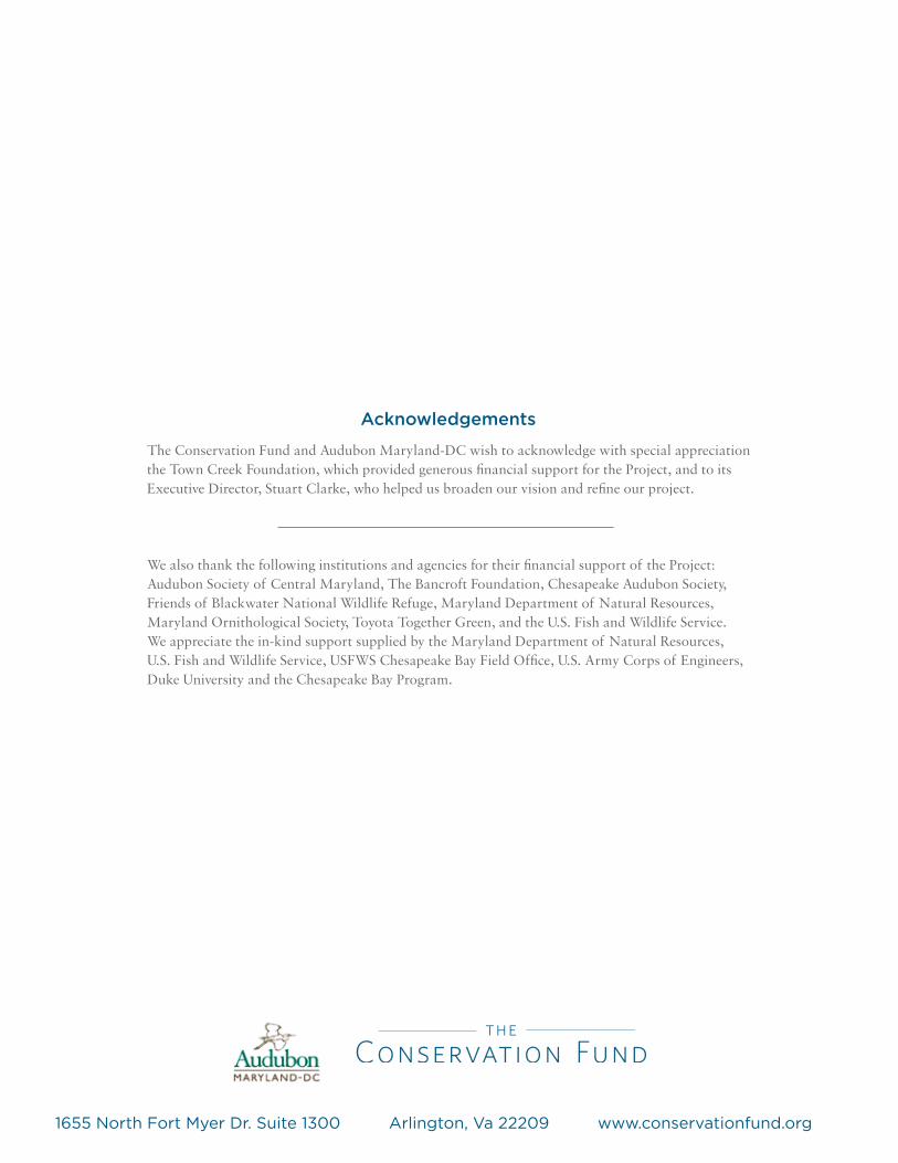
Planting a transition crop The project area includes significant areas of active farming, but again increasing salinity and saturation can make formerly productive fields infeasible for growing traditional crops like corn or grains. However, a salt tolerant grass species such as switchgrass will grow and is an effective means of l keeping nutrients and sediment from getting into Bay waters. Markets may also emerge for using switchgrass in the poultry industry. Switchgrass readily gives way to cordgrass and other native salt marsh grasses as salinity and tidal effects increase.
These techniques have been used previously for purposes other than facilitating tidal marsh transition into former upland landscapes. Their application in Dorchester will provide a laboratory for study and learning on how to enable this landscape to continue to provide high value tidal marsh supporting people and wildlife.
17

BlAckwAter 2100
community Adaptation—Another Frontier
Our project has focused on the transformation of Dorchester’s landscape in response to sea level rise driven by climate change. The high ecological value of the region’s tidal marshes prompted the Service, Fund and Audubon to collaborate on assessing the impact of projected sea level rise and develop a comprehensive set of strategies to shape the best possible future. Each of our organizations cares deeply about conserving and protecting wildlife habitat, such as the habitat required by our focal salt marsh birds. At the same time, we recognized the multiple values that generations of human inhabitants have enjoyed from this now rapidly changing landscape. Strategies and plans for protecting this tidal marsh ecosystem cannot be fully realized without the involvement and understanding of those who live, work and recreate in this region. With more community understanding and engagement, we are confident the region will be up to the challenge of its longer term persistence.
We enlisted a set of community advisers to help us describe the value of tidal marshes in human terms from the aesthetic, cultural and economic, to the ecosystem services such as clean air and water, storm buffering, and recreation. County residents have joined with us in wetland stewardship activities, such as replanting marsh grasses in the Refuge, and we will continue to engage local communities in wetland stewardship and championing climate adaptation of Dorchester's marshes. We are seeking opportunities to integrate these community values into our strategy development. We see opportunities to enhance eco- and cultural tourism, identify replacement crops and markets for them, and implement interim forestry strategies. These are opportunities to align human economic and social needs with the changing regional ecology.
While our efforts on community adaption have not yet been fully developed, we are taking steps to build greater understanding of the value of tidal marshes, the forces that are changing the Eastern Shore landscape more rapidly than ever, and the opportunities to influence that change for the better.
Erik Meyers
Project Director [email protected]
For more details on Blackwater 2100, please contact:
David Curson, PhD
Co-Principal investigator [email protected]
Matt Whitbeck
Co-Principal Investigator [email protected]
References Saving the Tidal Marshes of Blackwater National Wildlife Refuge: Final report on Assessing Sea Level Rise Impact and Recommending Comprehensive Strategies for Marsh Management and Migration in southern Dorchester County, Maryland , Lerner, J.A., Curson, D.A., et al. (2013, The Conservation Fund)
Blackwater 2100: An Assessment of Climate Change Impact on the Tidal Marshes of southern Dorchester County, Maryland, ed. Lerner, J.A. (2012, The Conservation Fund)
18
The Conservation Fund and Audubon Maryland-DC wish to acknowledge with special appreciation the Town Creek Foundation, which provided generous financial support for the Project, and to its Executive Director, Stuart Clarke, who helped us broaden our vision and refine our project.
We also thank the following institutions and agencies for their financial support of the Project: Audubon Society of Central Maryland, The Bancroft Foundation, Chesapeake Audubon Society, Friends of Blackwater National Wildlife Refuge, Maryland Department of Natural Resources, Maryland Ornithological Society, Toyota Together Green, and the U.S. Fish and Wildlife Service. We appreciate the in-kind support supplied by the Maryland Department of Natural Resources, U.S. Fish and Wildlife Service, USFWS Chesapeake Bay Field Office, U.S. Army Corps of Engineers, Duke University and the Chesapeake Bay Program.
Acknowledgements
1655 North Fort Myer Dr. Suite 1300 Arlington, Va 22209 www.conservationfund.org