41 rwrioni^l - argonne national laboratory
TRANSCRIPT
l'Ut' "^ftTj«.^*,'! 3 *^ ^ a".
41
rwrioni^L fOR€<rr
|YMht^G€M€nT VIOLUM€ 2, CH/1PT6R 6
mm ^ -l'asti* -riVfli,^,*»- "^ t -tT^"! —■■'*■,
'^ '
^^
U.S. Department of Agriculture Forest Service
Agriculture Handbook No. 608
Ä iS^
'—SJAÍ',»
l--}^
^^. '^ J?-v
1 -rf*. ■'!^^

iwioniM fOR^ÇT l/lhD9CN>€ |YMni^G€M€hT VIOLUM€2,CH/1PT€R6 FIRG
Warren R. Bacon Landscape Architect National Forest System
John Dell Fuels Management Specialist National Forest System
U.S. Department of Agriculture Forest Service Agriculture Handbook No. 608
April 1985

Acknowledgements
The efforts of many professionals contributed greatly to the preparation of this chapter. Many direct quotes were taken from existing publications; their authors are acknowledged where the quotations occur. In addition, the following persons prepared sections — or parts of several sections — for this chapter:
Raymond J. Collins Landscape Architect
Lauren L. Hillman Wildlife Biologist
Walter Knapp Silviculturist
Dr. Robert E. Martin Fire Management Specialist
James Pollock Landscape Architect
Fred Bell Landscape Architect
Brian Kermeen Landscape Architect and
Graphics Designer
Robert W. Mutch Fire Management Specialist
John V. Puckett Fire Use Specialist
Wayne D. Iverson Landscape Architect
Otis (Buzz) Durham Landscape Architect
Glen McNitt Landscape Architect
Michael J. Rogers National Fire Management
Specialist
Richard A. Henry National Fire Training Center
Director
National Forest System
National Forest System
National Forest System
Research
National Forest System
National Forest System
National Forest System
National Forest System
National Forest System
National Forest System
National Forest System
National Forest System
National Forest System
National Forest System

Contents
Page Introduction 1 Fire Management and Control 2
The Natural Role of Fire 2 The Natural Fire Regime 2 Characteristics of Natural Fire Regimes 3 Fire and Landscape Character 3 The Human Community 9 Fire Behavior 10 Visual Quality Objectives 12
Planning 14 Corridor Viewshed Planning 14 Preattack Planning 15
Managing Vegetation by Prescribed Fire 16 Prescribed Fire: A Definition 16 Uses of Prescribed Fire 16 Effects of Prescribed Fire 21 Analysis of Variables 26 Visual Impact Effects 27 Meeting Visual Quality Objectives 27 Prescribed Fire in Wilderness 38
Managing the Residues 41 Residue Analysis 41 Residue Treatment Methods 42 Special Techniques 50 Burning in Partial Cuts on Steep Slopes 53 Designing Clearcuts for Broadcast Burning 54 Influence on Silvicultural Treatments 56
Hazard Reduction 57 Railroads 57 Structures 57 Roads and Highways 58 Powerlines 59 Application of Hazard Reduction Techniques 59 Hazard Reduction in Recreation Areas 65
Pliysical Facilities for Control and Presuppression 67 Fuelbreaks 67
Fuelbreak Planning 73 Heliports and Helispots 84 Water Sources 87 Fire Towers 87
Bibliography 88 Literature Cited 88 Other References 89
For sale by the Superintendent of Documents, U.S. Government Printing Office Washington, D.C. 20402

Introduction
Fire and fire management activities greatly affect the visual quality of any landscape. For example, wildfire and the suppression of wildfire often leave significant scars that remain visible in the landscape for sometime but the total exclusion of fire in many ecosystems creates landscapes with less visual diversity. Fire management activities such as the construction of fuelbreaks, the disposal of debris, and the use of prescribed fire can also severely diminish visual qualty. If they are carried out with an indepth understanding of the natural role and historical effects of fire on landscape character and if the application of Visual Resource Management Objectives and techniques are used, these management activities can be visually pleasing or perhaps even visually enhancing.
This publication, FIRE, is the sixth chapter in volume 2 of the National Forest Landscape Management series issued in 1973, 1974, 1975, 1977, and 1980 by the Forest Service, U.S. Department of Agriculture. This chapter's purpose is to show how tire management and visual resource management can be integrated and coordinated with other resource objectives. Specifically, the chapter's objectives are to:
Show how fire has historically affected landscape character, with emphasis on the short- and long-term changes that occur;
Outline the positive attributes and negative effects of using fire as a tool to manipulate vegetation in the landscape to achieve visual quality objectives (VQO's), and illustrate how negative effects can be mitigated to meet VQO's;
Discuss fuel treatment methods and modified techniques applications that can be used to develop residue prescriptions for silviculture treatments, similar to those outlined under each VQO and species in the TIMBER chapter of this series, volume 2, chapter 5 (issued in 1980 by the Forest Service, U.S. Department of Agriculture;
Illustrate techniques for achieving hazard reduction of natural fuels to meet VQO's;
Identify presuppression and suppression facilities and activities that affect the visual resource, and show how negative effects can be mitigated so that VQO's can be met.
Fîre Management and Control
Fire management is concerned with managing the effects of fire — both its presence and its absence — on the resources and values found within a given area. Broadly speaking, fire management involves:
Using prescribed fire to manage vegetation; Managing the residues consisting of stumps, limbs,
branches, and whips; Reducing hazards presented by live or dead natural fuels; Using physical facilities in the containment and control of
wildfires; Seeding for erosion control and performing similar post-
wildfire activities
— ''Fire management began with fire control programs stimulated by the disastrous fires of the late 1800's and early 1900's, coincidental with the conservation movement. European concepts of fire protection were accepted as applicable to North America and fire control programs were the first important activity of organized land management. *
"Unfortunately the important natural role of fire in North America was overshadowed by the apparent need to avert severe wildfires. European experience with fire did not provide the broad base required for the complex fire environments found in North America, and policies based on European concepts resulted in considerable controversy (Schiff 1962).
"This limited perspective at the initiation of wildland fire protection combined with larger societal needs has brought the current problem of fire management definition into focus. When the complexity of the problems associated with fire is given careful deliberation, it is apparent that it is equally important to consider the effects of the presence or absence of fire on our natural resources.
The Natural Role of Fire Fire is an important ecological force that nearly all terrestrial ecosystems in North America have adapted to. Fire has been present through evolutionary time periods and, as a result, adaptations to fire are found in the vegetation we wish to manage (Howe 1976).
"Fire is an event controlled by fuels, weather and topography. Regardless of significant variations, fire occurs nearly everywhere fuel is present in sufficient quantities, in flammable condition and when an ignition source is available. Prior to the
appearance of man in North America, these factors were largely controlled by climate. Since the appearance of man, particularly European man, the ignition sources and the fuels have been modified. Early man set fire to enhance his living situation. As a result, the current distribution and composition of vegetation has been greatly influenced by man and seldom reflects the natural condition. The natural role of fire cannot be ignored, however, because:
1. Fire was a major influence in the evolution of the species we wish to manage.
2. Our management programs will largely be confined to managing vegetation with natural genetic origin.
3. Naturally-caused fires continue to occur.
Because of these factors, additional information concerning the natural role of fire must be integrated into land management planning . . . [including integration of fire and managing the visual resource]. We need to develop methods of management that recognize climatic and evolutionary adaptations and the constraints placed on our activities by the natural fire regime.
The Natural Fire Regime The natural role of fire in an ecosystem varies with the characteristics of the natural fire regime under which the ecosystem evolved. Afire regime for a particular land area is a function of the frequency of fire occurrence, the fire intensity, and how much of what fuels are consumed (Irving 1971). Both frequency and intensity vary and are not independent. The interactions of dry weather, fuels and ignition sources will determine the fire regime for a particular land area. Frequency of fire is largely determined by the ignition source(s) and the duration and character of weather favoring the spread of fire; intensity is determined by the quantity of fuel available and the combustion rate (Byram 1959). The significant interaction between frequency and intensity will also be influenced by wind and topography.
"Fuel dynamics play a very important role in determining the natural fire regime. Where fire occurs frequently, fuels will be reduced and subsequent fire intensity may be lowered. When periods between fires are long, fires may be of much greater intensity. It is also important to note that fuel quantity alone does not determine fire intensity. The characteristics of the total fuel complex must be considered as well as the influence of weather and topography on fire behavior. Thus, the natural fire regime for a given land area will be determined by the characteristics of the regional climate and vegetation combined with local microclimate and topography.
'From Natural Fire Regimes and Fire Management by Rodney W. Sando. See Bibliography for complete citation.

''There are four major natural fire regimes present in North America: ^Type One — Frequent fires of low to moderate intensity. Type Two — Infrequent fires of high intensity. Type Three — Frequent fires of high intensity. Type Four — Infrequent fires of low to moderate intensity.
Characteristics of Natural Fire Regimes "The Type One Regime. This natural fire regime is characterized by frequent fires of low to moderate intensity, and occurs in climatic regions that provide a frequent source of ignition combined with regular, recurring periods of weather that encourage the spread of fire. On a regional scale, this regime occurs in the northwestern, southwestern, southern and southeastern areas of the United States. In other regions, local variations are the result of deviations in microclimate commonly associated with aspect or may be the result of frequent natural ignition sources.
''Vegetation responses are particularly notable in this regime: the short grass prairies are found where insufficient moisture for tree growth occurs; where there is sufficient moisture for tree growth, the savannas occur. The trees survive fires through development of thick insulative bark and growth forms that protects the three crowns from excessive damage, i.e., ponderosa pine, the southern pines, certain species of oak.
"The occurence of fire through evolutionary time caused the ecosystems in this regime to adapt to frequent fire and, in the absence of fire, these ecosystems can be expected to be adversely influenced (Loucks 1970).
western hemlock and Englemann spruce are also examples found in this fire regime.] The climate in these regions is characterized by periodic, severe droughts that allow the development of high intensity fires. These droughts are often years apart and, combined with low incidence of natural ignition, will allow individual land areas to be affected by fire at time intervals of 200 years or more.
"The Type Three Regime. This regime is characterized by frequent fires of high intensity, occuring in areas of high annual net productivity and where the climate will encourage the spread fire nearly every year. This regime encourages grasses; the classical example is tall grass prairie (Sauer 1950, Daubenmire 1968).
"The Type Four Regime. This regime is characterized by the infrequent occurence of low intensity fires, and occurs in regions where the net productivity is limited by climate, i. e., deserts, alpine zones, and arctic tundra. The ecosystems are adapted to the occurence of fire, and the presence of fire may be vital to the maintence of plant and animal communities. "
Fire and Landscape Character Plant communities within each regime must be studied in more detail to determine the role fire played in shaping their visual character. Frequent fires provided fairly subtle changes in some, whereas in others major conflagrations brought about dramatic visual changes. Understanding the historic role of fire and its effect on the visual character of each major plant community should help guide the use of fire as a management tool.
"The Type Two Regime. This regime is characterized by infrequency high intensity fires that occasionally have reached very large size. Examples of this particular regime are found in the boreal forest regions, temperate rain forests and high elevation forests. [Douglasfire,
Only a few communities can be discussed here. Those selected for study and illustration later in this chapter are the same as those used in the TIMBER and other chapters in the National Forest Landscape Management series (USDA FS 1973, 1974, 1975, 1977, 1980).
^Definition of terms:
Frequent fire: the average time between natural fires occurring on a given site is 10 years or less.
Infrequent fire: the average time between natural fires occurring on a given site is more than 10 years and may be 200 years or more.
High-intensity fire: a fire with an average intensity greater than 1,200 BTU/ft/sec. This intensity probably causes nearly complete mortality of the vegetation.
Low- to moderate-intensity fire: a fire within the range of 0-1,200 BTU/ft/sec. This range allows variable effects, but most often, complete mortality of overstory vegetation would not occur.
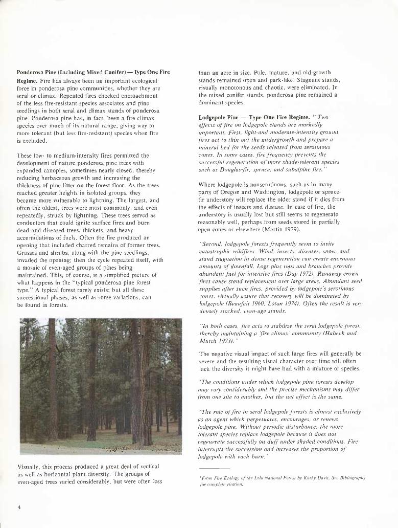
Ponderosa Pine (Including Mixed Conifer)—Type One Fire
Regime. Fire has always been an important ecological force in ponderosa pine communities, whether they are serai or climax. Repeated fires checked encroachment of the less fire-resistant species associates and pine seedlings in both serai and climax stands of ponderosa pine. Ponderosa pine has. in fact, been a fire climax species over much of its natural range, giving way to more tolerant (but less fire-resistant) species when tire is excluded.
These low- to medium-intensity fires permitted the development of nature ponderosa pine trees with expanded canopies, sometimes nearly closed, thereby reducing herbaceous growth and increasing the thickness of pine litter on the forest fioor. As the trees reached greater heights in isolated groups, they became more vulnerable to lightning. The largest, and often the oldest, trees were most commonly, and even repeatedly, struck by lightning. These trees served as conductors that could ignite surface fires and burn dead and diseased trees, thickets, and heavy accumulations of fuels. Often the fire produced an opening that included charred remains of former trees. Grasses and shrubs, along with the pine seedlings, invaded the opening; then the cycle repeated itself, with
a mosaic of even-aged groups of pines being maintained. This, of course, is a simplified picture of what happens in the "typical ponderosa pine forest type." A typical forest rarely exists; but all these successional phases, as well as some variations, can be found in forests.
than an acre in size. Pole, mature, and old-growth stands remained open and park-like. Stagnant stands, visually monotonous and chaotic, were eliminated. In the mixed conifer stands, ponderosa pine remained a
dominant species.
Lodgepole Pine — Type One Fire Regime. ^"Two
effects of fire on lodgepole slands are markedly
important. First, light-aiid moderate-intensity ground fires act to thin out the undergrowth and prepare a
mineral bed for the seeds released from serotinous
cones. In some cases, fire frequency prevents the successful regeneration of more shade-tolerant species
such as Douglas-fir. spruce, and subalpine Jire."
Where lodgepole is nonserotinous, such as in many parts of Oregon and Washington, lodgepole or spruce- fir understory will replace the older stand if it dies from
the effects of insects and disease. In case of fire, the understory is usually lost but still seems to regenerate reasonably well, perhaps from seeds stored in partially open cones or elsewhere (Martin 1979).
"Second, lodgepole forests frequently seem to invite
catastrophic wildfires. Wind, insects, diseases, snow, and stand stagnation in dense regeneration can create enormous
amounts of downfall. Logs plus tops and branches provide
abundant fuel for intensive fires (Day 1972). Runaway crown fires cause stand replacement over large areas. Abundant seed
supplies after such fires, provided by lodgepole s serotinous
cones, virtually assure that recovery will he dominated by lodgepole IBeaufait I960. Lotan ¡974). Often the result is very
densely stocked, even-age stands.
"In both cases, fire acts to stabilize the serai lodgepole forest,
thereby maintaining a 'fire climax' community IHabeck and
Mutch 1973)."
The negative visual impact of such large f"ires will generally be severe and the resulting visual character over time will often lack the diversity it might have had with a mixture of species.
"The conditions under which lodgepole pine forests develop
may vary considerably and the precise mechanisms may differ
from one site to another, but the net effect is the same.
"The role of fire in serai lodgepole forests is almost exclusively
as an agent which perpetuates, encourages, or renews
lodgepole pine. Without periodic disturbance, the more tolerant species replace lodgepole because it does not
regenerate successfully on duff under shaded conditions. Fire
interrupts the succession and increases the proportion of
lodgepole with each burn. "
Visually, this process produced a great deal of vertical
as well as horizontal plant diversity. The groups of even-aged trees varied considerably, but were often less
^ From Fire Ecolngv of I he Loto National Forest hy Kitlhy Davis. See Bibliography for complete citation.
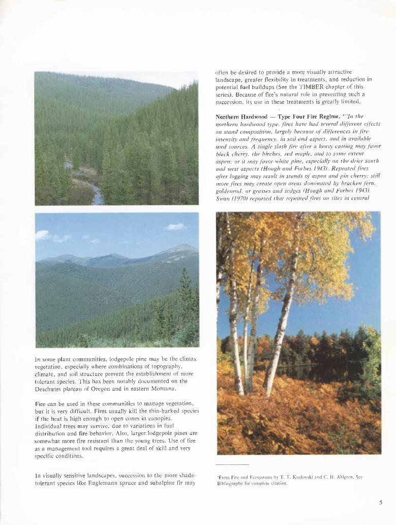
In some plant communities, iodgepole pine may be the climax vegetation, especially where combinations of topography, climate, and soil structure prevent the establishment of more tolerant species. This has been notably documented on the Deschutes plateau of Oregon and in eastern Montana.
Fire can be used in these communities to manage vegetation, but it is very difficult. Fires usually kill the thin-barked species if the heat is high enough to open cones in canopies. Individual trees may survive, due to variations in fuel distribution and fire behavior. Also, larger Iodgepole pines are somewhat more fire resistant than the young trees. Use of tire as a management tool requires a great deal of skill and very specific conditions.
In visually sensitive landscapes, succession to the more shade- tolerant species like Englemann spruce and subalpine fir may
often be desired to provide a more visually attractive landscape, greater flexibility in treatments, and reduction in potential fuel buildups (See the TIMBER chapter of this series). Because of fire's natural role in preventing such a succession, its use in these treatments is greatly limited.
Northern Hardwood — Type Four Fire Regime. '"In I he northern hardwood type, fires have had several different effects on stand composition, largely because of differences in fire intensity and frequency, in soil and aspect, and in available seed sources. A single slash fire after a heavy cutting way favor black cherry, the birches, red maple, and to some extent aspen: or it may favor white pine, especially on the drier south and west aspects (Hough and Forbes 1943). Repeated fires after logging may result in stands of aspen and pin cherry: still more fires tnav create open areas dominated by bracken fern, gohlenrod, or grasses and sedges (Hough and Forbes 19431. Swan (¡9701 reported that repeated fires on sites in central
'From Fire and Ecosystems by T. T. Kozlowski and 0. H. Ahlgren. See Bibliography for complete citation.
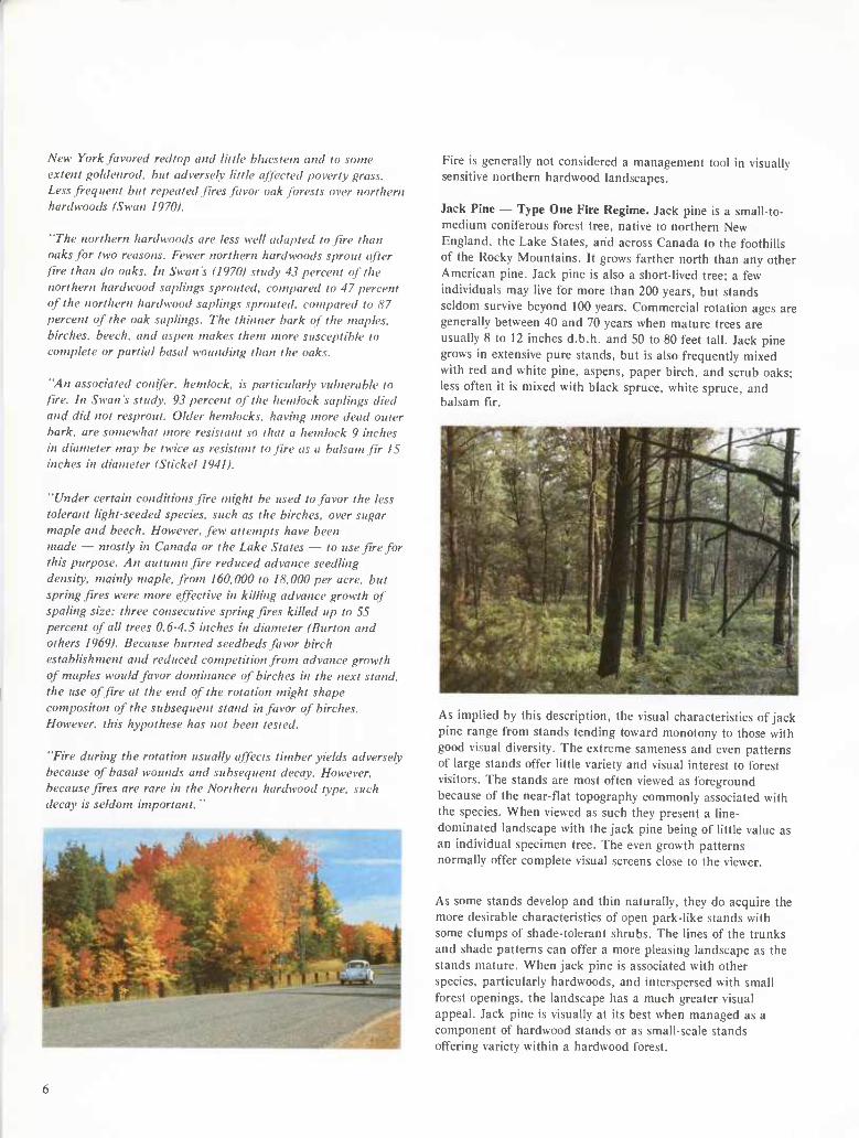
New York favored redtop and little hliiestem and to some
extent goldenrod. hut adversely little affected poverty grass. Less frequent hut repeated fires favor oak forests over northern hardwoods (Swan 1970).
"The northern hardwoods are less well adapted to fire than oaks for two reasons. Fewer northern hardwoods sprout after
fire than do oaks. In Swan's II970I study 43 percent of the
northern hardwood saplings sprouted, compared to 47 percent
of the northern hardwood saplings sprouted, compared to 87 percent of the oak saplings. The thinner hark of the maples,
birches, beech, and aspen makes them more susceptible to complete or partial basal wounding than the oaks.
"An associated conifer, hemlock, is particularly vulnerable to
fire. In Swan's study. 93 percent of the hemlock saplings died and did not resprout. Older hemlocks, having more dead outer
bark, are somewhat more resistant so that a hemlock 9 inches
in diameter may be twice as resistant to fire as a balsam fir 15 inches in diameter (Stickel 1941).
"Under certain conditions fire might be used to favor the less
tolerant light-seeded species, such as the birches, over sugar maple and beech. However, few attempts have been
made — mostly in Canada or the Lake States — to use fire for
this purpose. An autumn fire reduced advance seedling
density, mainly maple, from 160.000 to IS, 000 per acre, but
spring fires were more effective in killing advance growth of spaling size: three consecutive spring fires killed up to 55
percent of all trees 0.6-4.5 inches in diameter (Burton and
others 1969). Because burned seedbeds favor birch
establishment and reduced competition from advance growth
of maples would favor dominance of birches in the next stand, the use of fire at the end of the rotation might shape
compositon of the subsequent stand in favor of birches.
However, this hypothèse has not been tested.
"Fire during the rotation usually affects timber yields adversely because of basal wounds and subsequent decay. However,
because fires are rare in the Northern hardwood type, such decay is seldom important. "
Fire is generally not considered a management tool in visually sensitive northern hardwood landscapes.
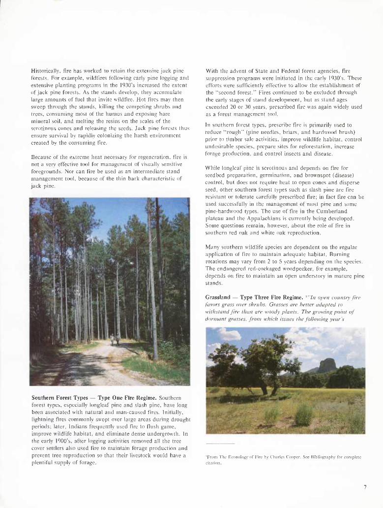
Jack Pine — Type One Fire Regime. Jack pine is a small-to- medium coniferous forest tree, native to northern New
England, the Lake States, and across Canada to the foothills of the Rocky Mountains. It grows farther north than any other American pine. Jack pine is also a short-lived tree; a few individuals may live for more than 200 years, but stands seldom survive beyond 100 years. Commercial rotation ages are generally between 40 and 70 years when mature trees are usually 8 to 12 inches d.b.h. and 50 to 80 feet tall. Jack pine grows in extensive pure stands, but is also frequently mixed with red and white pine, aspens, paper birch, and scrub oaks; less often it is mixed with black spruce, white spruce, and balsam fir.
As implied by this description, the visual characteristics of jack pine range from stands tending toward monotony to those with
good visual diversity. The extreme sameness and even patterns of large stands offer little variety and visual interest to forest visitors. The stands are most often viewed as foreground because of the near-flat topography commonly associated with the species. When viewed as such they present a line-
dominated landscape with the jack pine being of little value as an individual specimen tree. The even growth patterns normally offer complete visual screens close to the viewer.
As some stands develop and thin naturally, they do acquire the more desirable characteristics of open park-like stands with some clumps of shade-tolerant shrubs. The lines of the trunks and shade patterns can offer a more pleasing landscape as the stands mature. When jack pine is associated with other species, particularly hardwoods, and interspersed with small
forest openings, the landscape has a much greater visual appeal. Jack pine is visually at its best when managed as a component of hardwood stands or as small-scale stands offering variety within a hardwood forest.
Historically, fire has worked to retain the extensive jacl< pine forests. For example, wildfires following early pine logging and extensive planting programs in the 1930's increased the extent of jack pine forests. As the stands develop, they accumulate large amounts of fuel that invite wildfire. Hot fires may then sweep through the stands, killing the competing shrubs and trees, consuming most of the humus and exposing bare mineral soil, and melting the resins on the scales of the serotinous cones and releasing the seeds. Jack pine forests thus ensure survival by rapidly colonizing the harsh environment created by the consuming fire.
Because of the extreme heat necessary for regeneration, fire is not a very effective tool for management of visually sensitive foregrounds. Nor can fire be used as an intermediate stand management tool, because of the thin bark characteristic of jack pine.
Southern Forest Types — Type One Fire Regime. Southern forest types, especially longleaf pine and slash pine, have long been associated with natural and man-cau.sed fires. Initially, lightning fires commonly swept over large areas during drought periods; later, Indians frequently used fire to flush game, improve wildlife habitat, and eliminate dense undergrowth. In the early 1900's, after logging activities removed all the tree cover settlers also used fire to maintain forage production and prevent tree reproduction so that their livestock would have a plentiful supply of forage.
With the advent of State and Federal forest agencies, fire suppression programs were initiated in the early I930's. These efforts were sufficiently effective to allow the establishment of the "second forest." Fires continued to be excluded through the early stages of stand development, but as stand ages exceeded 20 or 30 years, prescribed fire was again widely used as a forest management tool.
In southern forest types, prescribe fire is primarily used to reduce "rough" (pine needles, briars, and hardwood brush) prior to timber sale activities, improve wildlife habitat, control undesirable species, prepare sites for reforestation, increase forage production, and control insects and disease.
While longleaf pine is serotinous and depends on fire for seedbed preparation, germination, and brownspot (disease) control, but does not require heat to open cones and disperse seed, other southern forest types such as slash pine are fire resistant or tolerate carefully prescribed fire; in fact fire can be used successfully in the management of most pine and some pine-hardwood types. The use of fire in the Cumberland plateau and the Appalachians is currently being developed. Some questions remain, however, about the role of fire in southern red oak and white oak reproduction.
Many southern wildlife species are dependent on the regular application of fire to maintain adequate habitat. Burning rotations may vary from 2 to 5 years depending on the species. The endangered red-cockaged woodpecker, for example, depends on fire to maintain an open understory in mature pine stands.
Grassland — Type Three Fire Regime. *"//( open coiiiiln' fire favors grass over shrubs. Grasses are better adapted to withstandßre than are woody plants. The growing point of dormant grasses, from which issues the following year's
Trom 'I'he Econology of Fire by Charles Codper. See Bibliography tor complete citation.
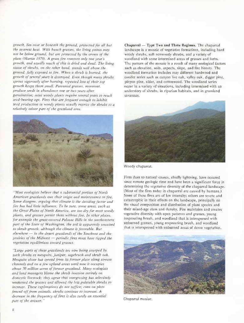
growth, lies near or beneath the ground, protected for all hut the severest heat. With hunch grasses, the living points mav not he below ground, hut are protected by the crown of the plant (Martin 1979). A grass fire removes only one year's growth, and usually much of this is dried and dead. The living tissue of shrubs, on the other hand, stands well above the ground, fully exposed to fire. When a shrub is burned, the growth of several years is destroyed. Even though many shrubs sprout vigorously after burning, repeated loss of their top growth keeps them small. Perennial grasses, moreover, produce seeds in abundance one or two years after germination: most woody plants require several years to reach seed-bearing age. Fires that are frequent enough to inhibit seed production in woody plants usually restrict the shrubs to a relatively minor part of the grassland area.
"Most ecologists believe that a substantial portion of North American grasslands owe their origin and maintenance to fire. Some disagree, arguing that climate is the deciding factor and fire has had little influence. To be sure, some areas, such as the Great Plains of North America, are too dry for most woody plants, and grasses persist there without fire. In other places, for example the grass-covered Palouse Hills in the southeastern part of the State of Washington, the soil is apparently unsuited to shrub growth, although the climate is favorable. But elsewhere — in the desert grasslands of the Southwst and the prairies of the Midwest — periodic fires must have tipped the vegetation equilibrium toward grasses.
"Large parts of these grasslands are now being usurped by such shrubs as mesquite, juniper, sagebrush and shrub oak. Mesquite alone has spread from its former place along stream channels and on a few upland areas until now it occupies about 70 million acres of former grassland. Many ecologists and land managers blame the shrub invasion entirely on domestic livestock: they agrue that overgrazing has selectively weakened the grasses and allowed the less palatable shrubs to increase. These explanations do not suffice: even on plots fenced off from animals, shrubs continue to increase. A decrease in the frequency of fires is also surely an essential part of the answer.
Chaparral — Type Two and Three Regimes. The chaparral landscape is a mosaic of vegetative formations, including hard woody shrubs, soft nonwoody shrubs, and a variety of woodland with some intermixed areas of grasses and forbs. The pattern of the mosaic is a result of many ecological factors such as elevation, soils, aspects, slope, and fire history. The woodland formation includes may different hardwood and conifer series such as canyon live oak, valley oak, digger pine, pinyon pine, alder, and cottonwood. The woodland series occur in a variety of situations, including intermixed with an understory of shrubs, in riparian habitats, and in grassland savannas.
Woody chaparral.
Fires dues to natural causes, chiefly lightning, have occured since remote geologic time and have been a significant force in determining the vegetative diversity of the chaparral landscape. (Most of the fires today in chaparral are caused by humans.) Some of these fires are of low intensity; others are severe and catastrophic in their effects on the landscape, principally on the visual composition and distribution of plant species and their mixed-age class and density. Fire maintains and creates vegetative diversity with open patterns and grasses, young resprouting brush, and woodland that is interspersed with unburned grasses, young resprouting brush, and woodland that is interspersed with unburned areas of dense vegetation.
Chaparral mosiac.
8
'Viîr v:'}^
Pine and oak woodland.
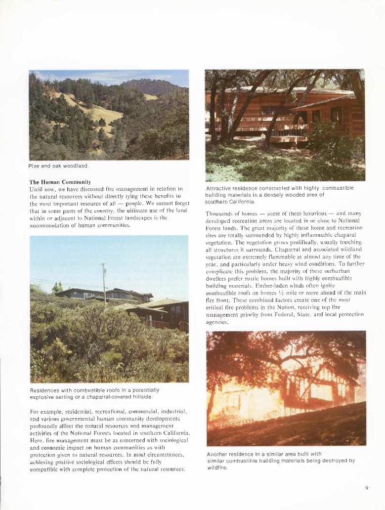
The Human Community Until now, we have discussed fire management in relation to the natural resources without directly tying these benefits to the most important resource of all — people. We cannot forget that in some parts of the country, the ultimate use of the land within or adjacent to National Forest landscapes is the accommodation of human communities.
Residences with cuinuubnüle roofs in a potentially explosive setting or a chaparral-covered hillside.
For example, residential, recreational, commercial, industrial, and various governmental human community developments profoundly affect the natural resources and management activities of the National Forests located in southern California. Here, tire management must be as concerned with sociological and economic impact on human communities as with protection given to natural resources. In most circumstances, achieving positive sociological effects should be fully compatible with complete protection of the natural resources.
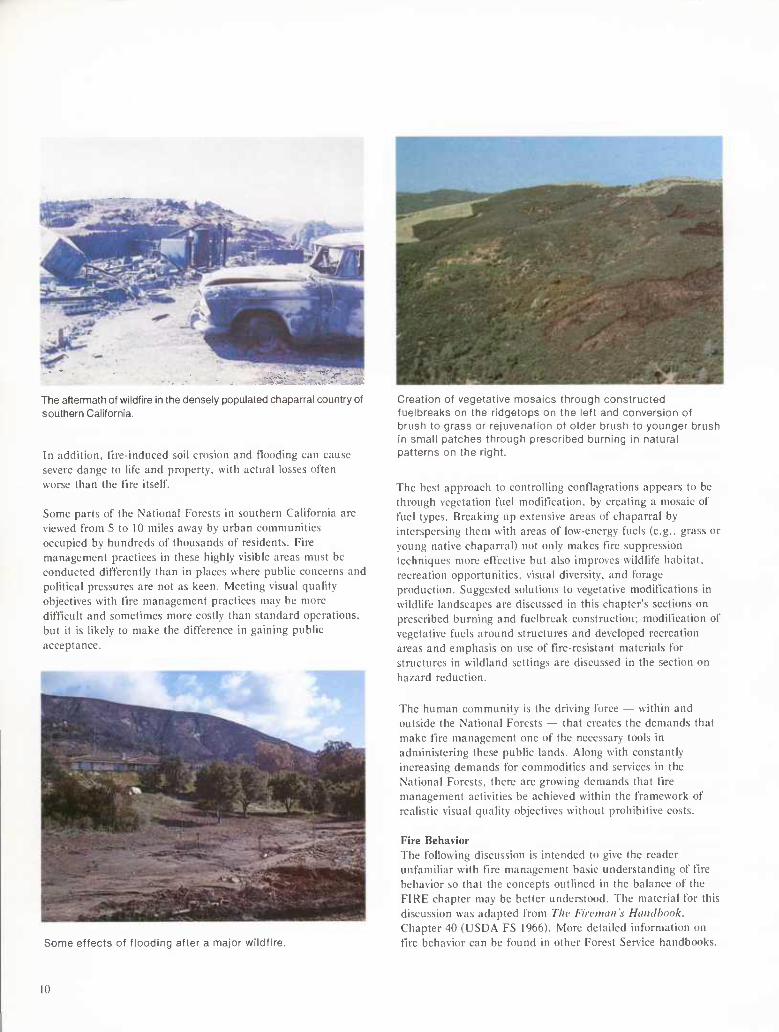
Attractive residence constructed with highly combustible building materials in a densely wooded area of southern California.
Thousands of homes — some of them luxurious — and many developed recreation areas are located in or close to National Forest lands. The great majority of these home and recreation sites are totally surrounded by highly inflammable chaparal vegetation. The vegetation grows prolitlcally, usually touching all structures it surrounds. Chaparral and associated wildland vegetation are extremely tlammable at almost any time of the year, and particularly under heavy wind conditions. To further complicate this problem, the majority of these surburban dwellers prefer rustic homes built with highly combustible building materials. Ember-laden winds often ignite combustible roofs on homes '/¡ mile or more ahead of the main tire front. These combined factors create one of the most critical fire problems in the Nation, receiving top tire management priority from Federal, State, and local protection agencies.
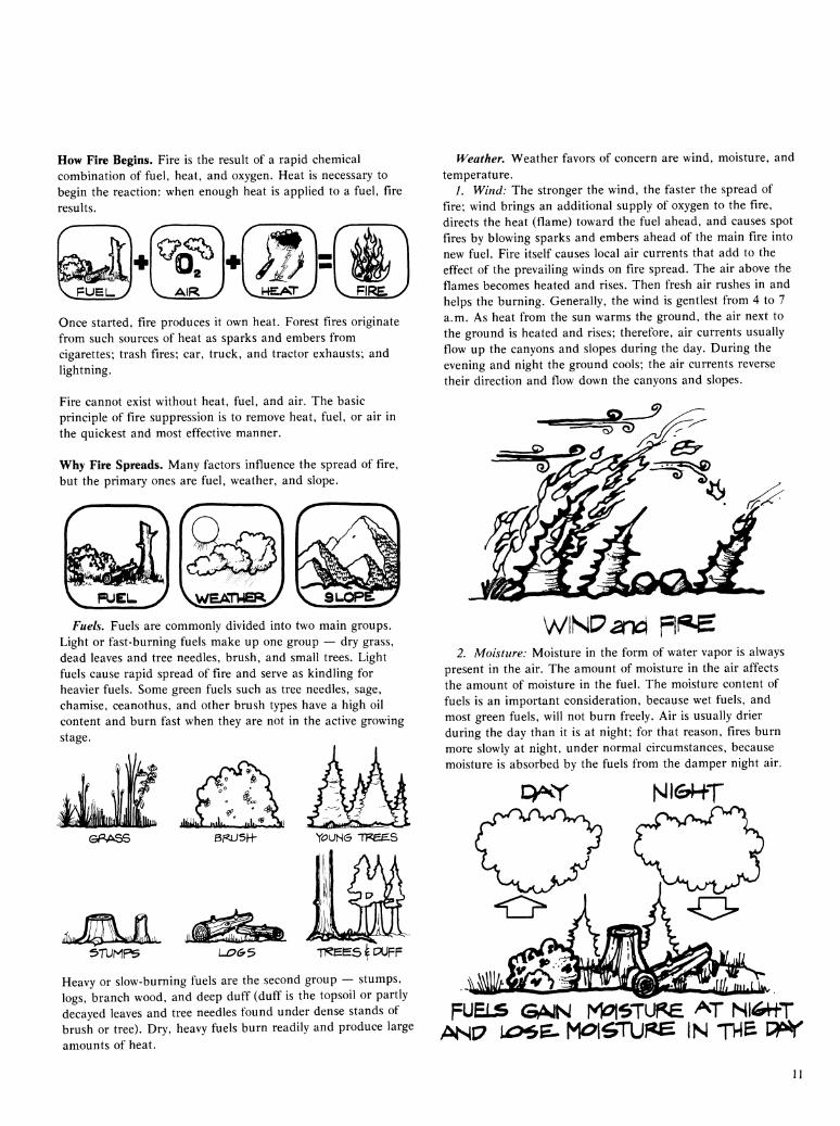
Another residence in a similar area built with similar combustible building materials being destroyed by wildfire.
The aftermath of wildfire in the densely populated chaparral country of southern California.
In addition, fire-induced soil erosion and flooding can cause severe dange to lite and property, with actual losses often worse than the fire itself.
Some parts of the National Forests in southern California are viewed from 5 to 10 miles away by urban communities occupied by hundreds of thousands of residents. Fire management practices in these highly visible areas must be conducted differently than in places where public concerns and political pressures are not as keen. Meeting visual quality objectives with tire management practices may be more difficult and sometimes more costly than standard operations, but it is likely to make the difference in gaining public acceptance.
Some effects of flooding after a major wildfire.
Creation of vegetative mosaics through constructed fuelbreaks on the ridgetops on the left and conversion of brush to grass or rejuvenation of older brush to younger brush in small patches through prescribed burning in natural patterns on the right.
The best approach to controlling conflagrations appears to be through vegetation fuel modification, by creating a mosaic of fuel types. Breaking up extensive areas of chaparral by interspersing them with areas of low-energy fuels (e.g., grass or young native chaparral) not only makes tire suppression techniques more effective but also improves wildlife habitat, recreation opportunities, visual diversity, and forage production. Suggested solutions to vegetative modifications in wildlife landscapes are discussed in this chapter's sections on prescribed burning and fuelbreak construction; modification of vegetative fuels around structures and developed recreation areas and emphasis on use of tire-resistant materials for structures in wildland settings are discussed in the section on hazard reduction.
The human community is the driving force — within and outside the National Forests — that creates the demands that make tire management one of the necessary tools in administering these public lands. Along with constantly increasing demands for commodities and services in the National Forests, there are growing demands that tire management activities be achieved within the framework of realistic visual quality objectives without prohibitive costs.
Fire Behavior The following discussion is intended to give the reader unfamiliar with tire management basic understanding of fire behavior so that the concepts outlined in the balance of the FIRE chapter may be better understood. The material for this discussion was adapted from The Fireman's Haiidhook. Chapter 40 (USDA FS 1966). More detailed information on fire behavior can be found in other Forest Service handbooks.
10
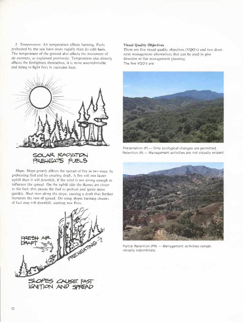
How Fire Begins. Fire is the result of a rapid chemical combination of fuel, heat, and oxygen. Heat is necessary to begin the reaction: when enough heat is applied to a fuel, fire results.
FUEL.^
Q^ ^2
AIR Vi«Ary FIRE,
Once started, fire produces it own heat. Forest fires originate from such sources of heat as sparks and embers from cigarettes; trash fires; car, truck, and tractor exhausts; and lightning.
Fire cannot exist without heat, fuel, and air. The basic principle of fire suppression is to remove heat, fuel, or air in the quickest and most effective manner.
Why Fire Spreads. Many factors influence the spread of fire, but the primary ones are fuel, weather, and slope.
\/ç ^ r
V FUEL y VwEATVJERy V^
Fuels. Fuels are commonly divided into two main groups. Light or fast-burning fuels make up one group — dry grass, dead leaves and tree needles, brush, and small trees. Light fuels cause rapid spread of fire and serve as kindling for heavier fuels. Some green fuels such as tree needles, sage, chamise, ceanothus, and other brush types have a high oil content and burn fast when they are not in the active growing stage.
3rUMFS LC?(^3 -pÇEÊS^n^FF
Heavy or slow-burning fuels are the second group — stumps, logs, branch wood, and deep duff (duff is the topsoil or partly decayed leaves and tree needles found under dense stands of brush or tree). Dry, heavy fuels burn readily and produce large amounts of heat.
Weather. Weather favors of concern are wind, moisture, and temperature.
/. Wind: The stronger the wind, the faster the spread of fire; wind brings an additional supply of oxygen to the fire, directs the heat (flame) toward the fuel ahead, and causes spot fires by blowing sparks and embers ahead of the main fire into new fuel. Fire itself causes local air currents that add to the effect of the prevailing winds on fire spread. The air above the flames becomes heated and rises. Then fresh air rushes in and helps the burning. Generally, the wind is gentlest from 4 to 7 a.m. As heat from the sun warms the ground, the air next to the ground is heated and rises; therefore, air currents usually flow up the canyons and slopes during the day. During the evening and night the ground cools; the air currents reverse their direction and flow down the canyons and slopes.
>__-^
WNP^nd FßB 2. Moisture: Moisture in the form of water vapor is always
present in the air. The amount of moisture in the air affects the amount of moisture in the fuel. The moisture content of fuels is an important consideration, because wet fuels, and most green fuels, will not burn freely. Air is usually drier during the day than it is at night; for that reason, fires burn more slowly at night, under normal circumstances, because moisture is absorbed by the fuels from the damper night air.
P^Y Nli^HT
FUELS GAJN Mi?|6TUf<Ê '^^T Nló+tT ANC7 U>^E. M<:>1^TUPH IN TH£ C^^T
11
3. Temperature: Air temperature affects burning. Fuels preheated by the sun burn more rapidly than do cold fuels. The temperature of the ground also affects the movement of air currents, as explained previously. Temperature also directly affects the firefighters themselves; it is more uncomfortable and tiring to fight fires in excessive heat.
Visual Quality Objectives There are five visual quality objectives (VQO's) and two short- term management alternatives that can be used to give direction to fire management planning. The five VQO's are:
ff^me^iB FUELS
Slope. Slope greatly affects the spread of fire in two ways: by preheating fuel and by creating draft. A fire will run faster uphill than it will downhill, if the wind is not strong enough to influence the spread. On the uphill side the flames are closer to the fuel; this causes the fuel to preheat and ignite more quickly. Heat rises along the slope, causing a draft that further increases the rate of spread. On steep slopes burning chunks of fuel may roll downhill, starting new fires.
Preservation (P) — Only ecological changes are permitted. Retention (R) — Management activities are not visually evident.
:eH-AIP-
^ ^^^^^^Ê^^^^^^^^-?^^'*'" '^"-^-^í h J^S
h'r M ¿S^
M^^Ê L. mm:. -^- . ;_ Hnis^äiMk. "ïMj'nfiMi W¿ ^ BS^-X"? ̂ SWF^'ií^aHB |jjjg^¿2^ia
> .. ^^ Mb lí ',
Partial Retention (PR, visually subordinate.
doiivities remain
12
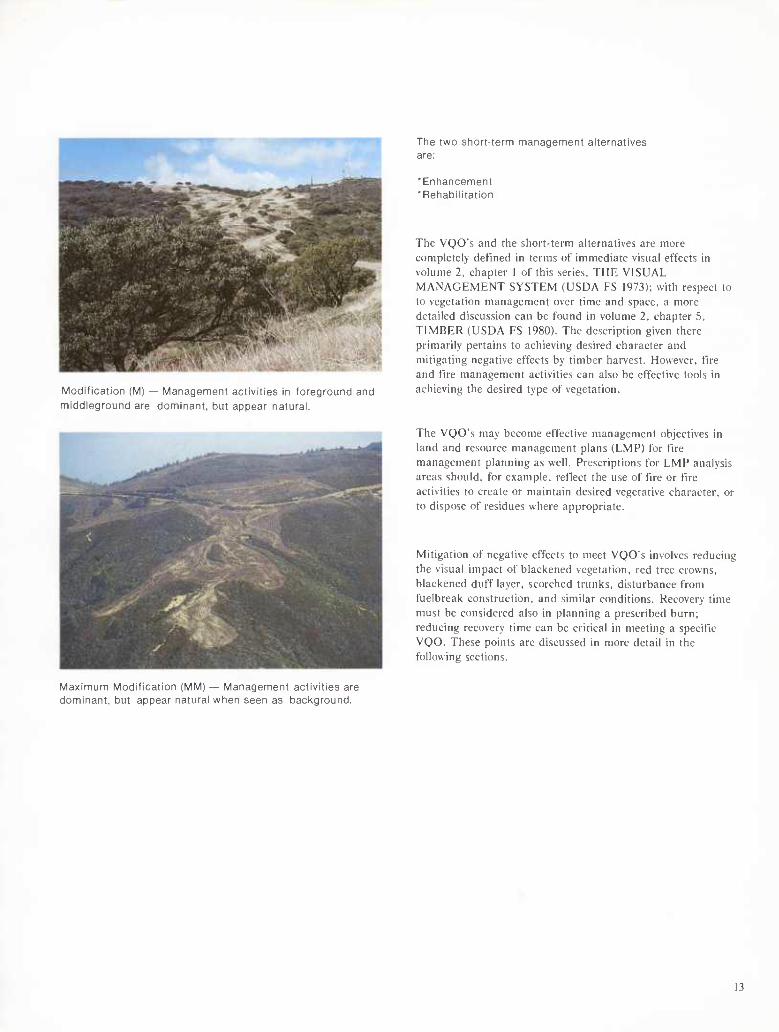
Modification (M) — Management activities in foreground and middleground are dominant, but appear natural.
Ttie two stiort-term management alternatives are:
'Entiancement "Refiabilitation
The VQO's and the short-term alternatives are more completely defined in terms of immediate visual effects in volume 2, chapter I of this series. THE VISUAL MANAGEMENT SYSTEM (USDA FS 1973): with respect to to vegetation management over time and space, a more detailed discussion can be found in volume 2. chapter 5, TIMBER (USDA FS 1980). The description given there primarily pertains to achieving desired character and mitigating negative effects by timber harvest. However, fire and fire management activities can also be effective tools in achieving the desired type of vegetation.
The VQO's may become effective management objectives in land and resource management plans (LMP) for fire management planning as well. Prescriptions for LMP analysis areas should, for example, reflect the use of tire or fire activities to create or maintain desired vegetative character, or to dispose of residues where appropriate.
Mitigation of negative effects to meet VQO's involves reducing the visual impact of blackened vegetation, red tree crowns, blackened duff layer, scorched trunks, disturbance from fuelbreak construction, and similar conditions. Recovery time must be considered also in planning a prescribed burn; reducing recovery time can be critical in meeting a specific WQO. These points are discussed in more detail in the following sections.
Maximum Modification (MM) — Management activities are dominant, but appear natural when seen as background.
13
Planning
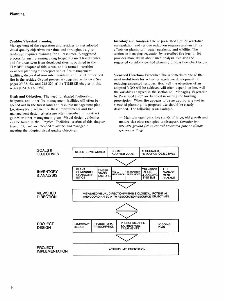
Corridor Vîewshed Planning Management of the vegetation and residues to met adopted visual quality objectives over time and throughout a given landscape requires planning for all resources. A suggested process for such planning along frequently used travel routes, and for areas seen from developed sites, is outlined in the TIMBER chapter of this series, and is termed "corridor viewshed planning." Incorporation of fire management facilities, disposal of unwanted residues, and use of prescribed fire in the residue dispoal process is suggested as follows. See pages 29-32, 63, and 218-220 of the TIMBER chapter in this series (USDA FS 1980).
Goals and Objectives. The need for shaded fuelbreaks, heliports, and other fire management facilities will often be spelled out in the forest land and resource management plan. Locations for placement of these improvements and fire management design criteria are often described in preattack guides or other management plans. Visual design guidelines can be found in the "Physical Facilities" section of this chapter (see p. 67), and are intended to aid the land manager in meeting the adopted visual quality objectives.
Inventory and Analysis. Use of prescribed fire for vegetative manipulation and residue reduction requires analysis of fire effects on plants, soil, water nutrients, and wildlife. The section on managing vegetation by prescribed fire (see. p. 16) provides more detail about such analysis. See also the suggested corridor viewshed planning process flow chart below.
Viewshed Direction. Prescribed fire is sometimes one of the most useful tools for achieving vegetative development or reducing unwanted residues. How well the objectives of an adopted VQO will be achieved will often depend on how well the variables analyzed in the section on "Managing Vegetation by Prescribed Fire" are handled in writing the burning prescription. When fire appears to be an appropriate tool in viewshed planning, its porposed use should be clearly described. The following is an example.
— Maintain open park-like stands of large, old growth and mature size class (canopied landscapes). Consider low intensity ground fire to control unwanted pine or climax species seedlings.
GOALS & OBJECTIVES
SELECTED VIEWSHED BROAD ADOPTED VQOs
ASSOCIATED RESOURCE OBJECTIVES
INVENTORY & ANALYSIS
PLANT COMMUNITY CHARACTER- ISTICS
TIMBER STAND FACTORS
VISUAL RESOURCE
ASSOCIATED RESOURCES
TRANSPOR- TATION & LOGGING SYSTEMS
FIRE MANAGE- MENT ANALYSIS
VIEWSHED DIRECTION
PROJECT DESIGN
VIEWSHED VISUAL DIRECTION WITHIN BIOLOGICAL POTENTIAL AND COORDINATED WITH ASSOCIATED RESOURCE OBJECTIVES.
LANDSCAPE DESIGN
SILVICULTURAL PRESCRIPTION
PRESCRIBED FIRE & OTHER FUEL TREATMENTS
LOGGING PLAN
PROJECT IMPLEMENTATION
ACTIVITY IMPLEMENTATION
14

Preattack Planning Within the past 20 years, a fire control planning and action program called PREATTACK has evolved in the Forest Service and other wildland protective agencies. Originally developed for the brush-covered watersheds of southern California, PREATTACK has also proved valuable in timbered forests and range lands. In recent years, PREATTACK has been implemented on the many acres of managed land in the United States and Canada.
Essentially, PREATTACK is a system for collecting, evaluating, and recording fire intelligence data for a given planning unit, or PREATTACK BLOCK. The planning phase is frequently followed by some degree of development and construction program integrated with other management functions. See supplemental regional PREATTACK guides for detail and local variations.
In the PREATTACK system, both existing and proposed fire control facilities are documented in a PREATTACK plan, which also describes forest fuels and topography. The plan specifies locations for control lines and fuelbreaks, and includes key data on time, manpower, and special equipment needed to construct or improve facilities.
In initial attack on small fires, the PREATTACK plan provides data on local fuels and topography, travel routes.
road and trail conditions, helispot locations, and water sources. When a fire escapes initial attack, PREATTACK can contribute to fast, effective control action by followup forces. It is not a substitute for judgment, but it provides the fire command team with valuable information for strategy decisions. It can also reduce or eliminate confusion as well as eliminate many of the logistical problems of manpower and equipment organization and dispersal. Visual quality objectives adopted as part of land management planning will often overlap the PREATTACK blocks; in some cases, PREATTACK planning and corridor viewshed planning will also overlap. Clearly, all planning processes must be coordinated. The visual quality objectives give visual resource guidance and direction to the location, design, and maintenance; of PREATTACK facilities; the objectives must be coordinated with other adopted resource objectives for the area, and with the functional requirements of fire management.
In most situations, the design, construction, and maintenance of strategically located PREATTACK facilities, such as fuelbreaks, involves the mainpulation of vegetation. If accomplished by using principles of landscape design, the effect can often be an enhanced landscape. The "Physical Facilities for Control and Presuppression" section of this chapter describes many of the design techniques needed to accomplish visual quality objectives and short-term goals.
15
Managing Vegetation by Prescribed Fire
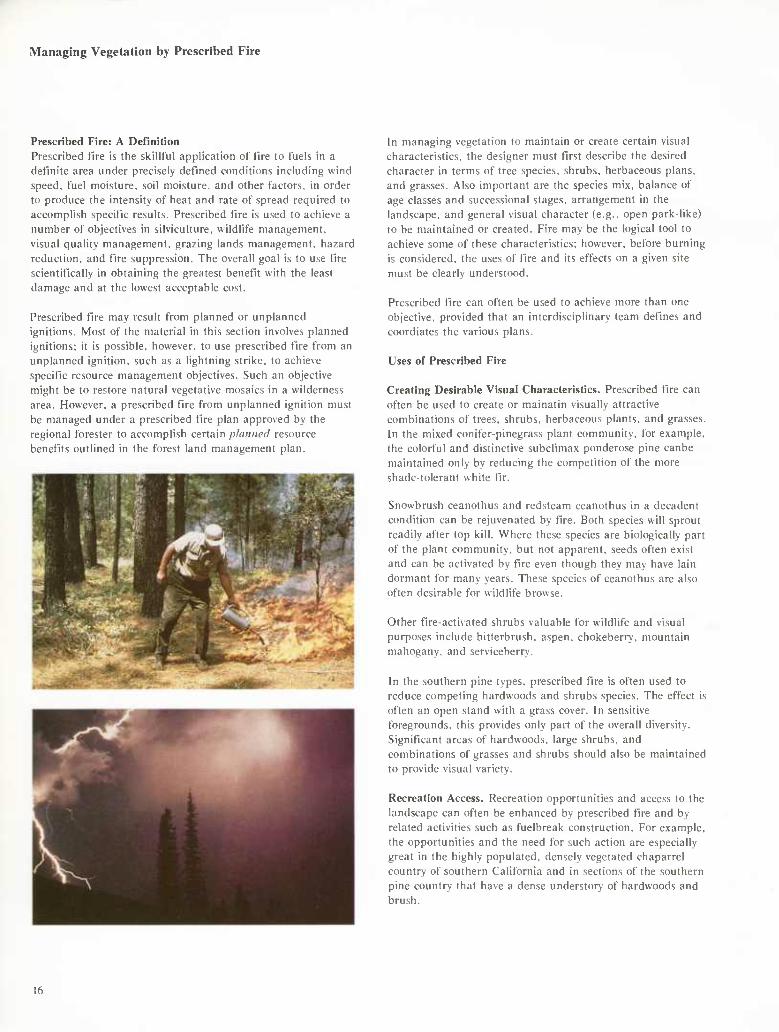
Prescribed Fire: A Definition Prescribed fire is the skillful application of fire to fuels in a definite area under precisely det"ined conditions including wind speed, fuel moisture, soil moisture, and other factors, in order to produce the intensity of heat and rate of spread required to accomplish specific results. Prescribed fire is used to achieve a number of objectives in silviculture, wildlife management, visual quality management, grazing lands management, hazard reduction, and fire suppression. The overall goal is to use fire scientifically in obtaining the greatest benefit with the least damage and at the lowest acceptable cost.
Prescribed fire may result from planned or unplanned ignitions. Most of the material in this section involves planned ignitions; it is possible, however, to use prescribed fire from an unplanned ignition, such as a lightning strike, to achieve specific resource management objectives. Such an objective might be to restore natural vegetative mosaics in a wilderness area. However, a prescribed fire from unplanned ignition must be managed under a prescribed fire plan approved by the regional forester to accomplish certain phiiincd resource benefits outlined in the forest land management plan.
In managing vegetation to maintain or create certain visual characteristics, the designer must first describe the desired character in terms of tree species, shrubs, herbaceous plans, and grasses. Also important are the species mix. balance of age classes and successional stages, arrangement in the landscape, and general visual character (e.g.. open park-like) to be maintained or created. Fire may be the logical tool to achieve some of these characteristics; however, before burning is considered, the uses of fire and its effects on a given site must be clearly understood.
Prescribed fire can often be used to achieve more than one objective, provided that an interdisciplinary team defines and coordiates the various plans.
Uses of Prescribed Fire
Creating Desirable Visual Characteristics. Prescribed fire can often be used to create or mainatin visually attractive combinations of trees, shrubs, herbaceous plants, and grasses. In the mixed conifer-pinegrass plant community, for example, the colorful and distinctive subclimax ponderóse pine canbe maintained only by reducing the competition of the more shade-tolerant white fir.
Snowbrush ceanothus and redsteam ceanothus in a decadent condition can be rejuvenated by fire. Both species will sprout readily after top kill. Where these species are biologically part of the plant community, but not apparent, seeds often exist and can be activated by fire even though they may have lain dormant for many years. These species of ceanothus are also often desirable for wildlife browse.
Other fire-activated shrubs valuable for wildlife and visual purposes include bitterbrush. aspen, chokeberry, mountain mahogany, and serviceberry.
In the southern pine types, prescribed fire is often used to reduce competing hardwoods and shrubs species. The effect is often an open stand with a grass cover. In sensitive foregrounds, this provides only part of the overall diversity. Significant artas of hardwoods, large shrubs, and combinations of grasses and shrubs should also be maintained to provide visual variety.
Recreation Access. Recreation opportunities and access to the landscape can often be enhanced by prescribed fire and by related activities such as fuelbreak construction. For example, the opportunities and the need for such action are especially great in the highly populated, densely vegetated chaparrel country of southern California and in sections of the southern pine country that have a dense understory of hardwoods and brush.
16

1964 1977
White fir has regenerated under a heavy shelterwood of ponderosa pine. Surface fires formerly prevented fir regeneration.
Upper— the suppressed pine has died and been removed.
1974
The same stand 10 years later, with grow/th of the fir and the suppressed ponderosa pine dying (note dead top on ground). Pine v\/ill be replaced naturally by fir if fires are kept out of the stand. Fir grow/s faster in height and diameter than pine; therefore, pine cannot compete under "natural" conditions without fire. Pine could be maintained by thinning out the fir and by controlling the stocking level, so that the pine could grow in height and diameter.
17
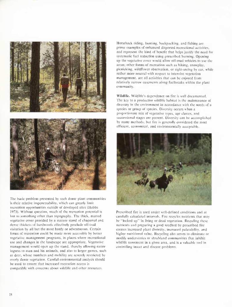
The basic problem presented by such dense plant communities is their relative impenetrability, which can greatly limit recreation opportunities outside of developed sites (Hobbs 1973). Without question, much of the recreation potential is lost to something other than topography. The thick, matted vegetative cover provided by a mature stand of chaparral and dense thickets of hardwoods effectively preclude off-trail visitation by all but the most hardy or adventurous. Certain forms of recreation could be made more accessible by better vegetative management programs, in places where recreational use and changes in the landscape are appropriate. Vegetative management would open up the stand, thereby allowing easier ingress to man and his animals, and also to larger games, such as deer, whose numbers and mobility are severely restricted by overly dense vegetation. Careful environmental analysis should be used to ensure that increased recreation access is compatible with concerns about wildlife and other resources.
Horseback riding, hunting, backpacking, and fishing are prime examples of enhanced dispersed recreational activities, and represent the kind of benefit that helps justify the need for systematic fuel reduction using prescribed burning. Opening up the vegetative cover would allow off-road vehicles to use the areas; other forms of recreation such as hiking, snowplay, picnicking, wildtlower observation, or sight-seeing by car. while rather more neutral with respect to intensive vegetation management, are all activities that can be enjoyed from relatively narrow easements along fuelbreaks within the plant community.
Wildlife. Wildlife's dependence on fire is well documented. The key to a productive wildlife habitat is the maintenance of diversity in the environment in accordance with the needs of a species or group of species. Diversity occurs when a proportionate mix of vegetative types, age classes, and successional stages are present. Diversity can be accomplished by many methods; but fire is generally considered the most efficient, economical, and environmentally acceptable.
Prescribed fire is used under well-defined conditions and at carefully calculated intervals. Fire recycles nutrients that may be "locked up" in living or dead vegetation. Recycling the.se nutrients and preparing a good seedbed by prescribed t'lre creates increased plant diversity, increased palatability, and higher nutritional value. Recycling also serves to eliminate or modify understories or shrubland communities that inhibit wildlife movement in a given area, and is a valuable tool in controlling insect and disease problems.
18
To provide protection for birds and small animals, care must be exercised in carrying out the burn itself. Burning must be avoided during courting, nesting, and fledgling periods in areas with avian populations. Damage to snags and den trees, and to essential dead. down, and woody materials, should be prevented as much as possible. These materials can often be protected by constructing a simple tueline around them or by using fire retardants. Adequate cover must be retained in and around the burned area. Responsible visual resource management is important in mitigating possible negative side effects of a prescribed burn.
Cattle on a Los Padres National Forest fuelbreak maintained by prescribed fire.
After tfie fire and the seeding of grass(es), palatable forage for domestic livestock is greatly improved.
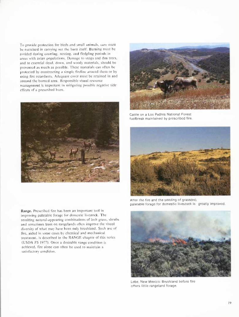
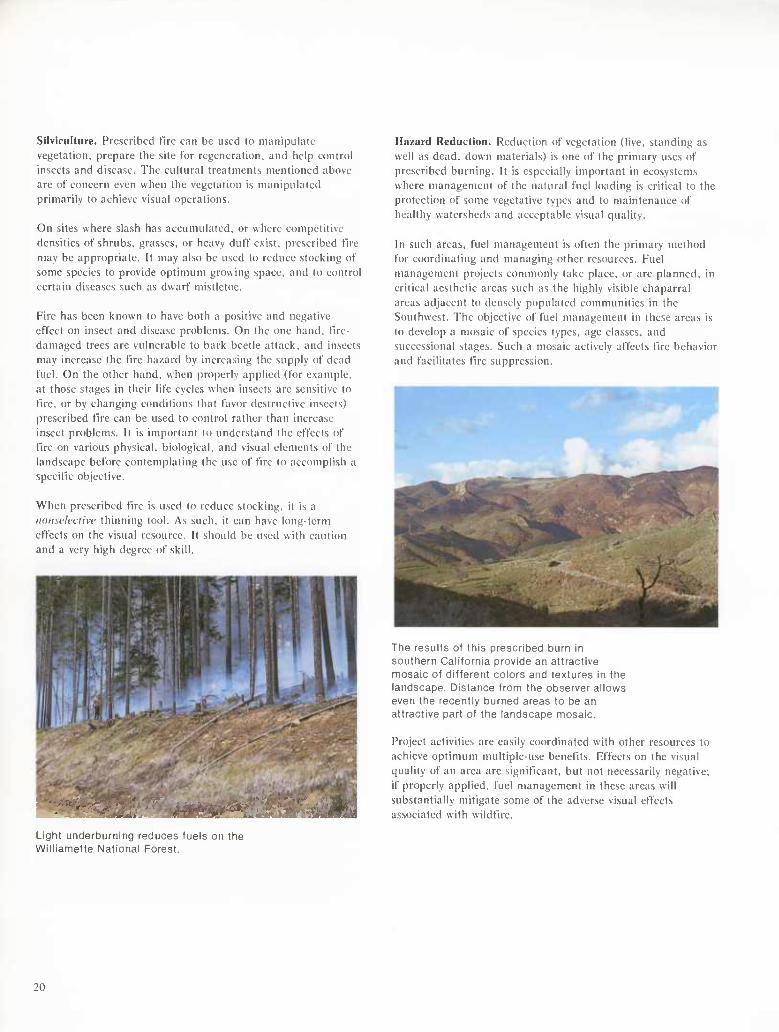
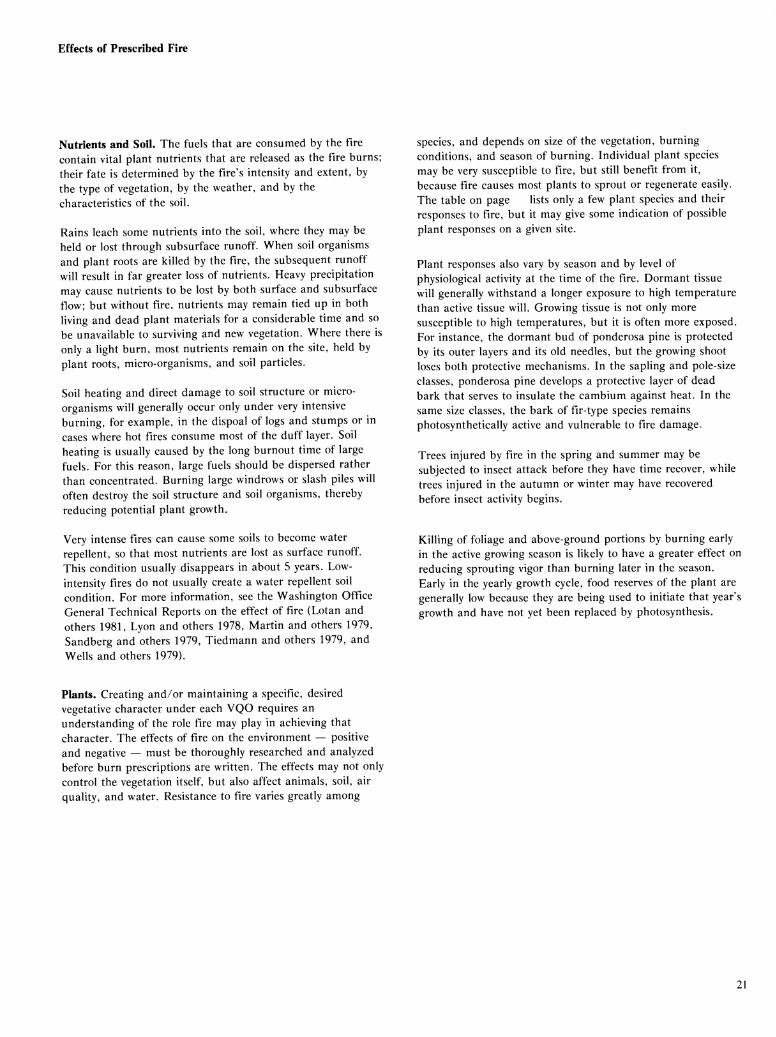
Range. Prescribed tire has been an important tool in improving palatable forage for domestic livestock. The resulting natural-appearing combinations of lush grass, shrubs and sometimes trees on rangelands often improve the visual diversity of what may have been only brushland. Such use of tire, aided in some cases by chemical and mechanical treatment, is described in the RANGE chapter of this series (USDA FS 1977). Once a desirable range condition is achieved, tire alone can often be used to maintain a satisfactory condition.
Lebe. New Mexico: Brushland before fire offers little rangeland forage.
19
Silviculture. Prescribed tue can be used to manipulate vegetation, prepare the site for regeneration, and help control insects and disease. The cultural treatments mentioned above are of concern even when the vegetation is manipulated primarily to achieve visual operations.
On sites where slash has accumulated, or where competitive densities of shrubs, grasses, or heavy duff exist, prescribed lue may be appropriate. It may also be used to reduce stocking of some species to provide optimum growing space, and to control certain diseases such as dwarf mistletoe.
Fire has been known to have both a positive and negative effect on insect and disease problems. On the one hand, fire- damaged trees are vulnerable to bark beetle attack, and insects may increase the fire hazard by increasing the supply of dead fuel. On the other hand, when properly applied (for example. at those stages in their life cycles when insects are sensitive to fire, or by changing conditions that favor destructive insects) prescribed fire can be used to control rather than increase insect problems. It is important to understand the effects of fire on various physical, biological, and visual elements of the landscape before contemplating the use of fire to accomplish a specific objective.
When prescribed fire is used to reduce stocking, it is a iioiisch'clivc thinning tool. As such, it can have long-term effects on the visual resource. It should be used with caution and a very high degree of skill.
Hazard Reduction. Reduction of vegetation (live, standing as well as dead, down materials) is one of the primary uses of prescribed burning. It is especially important in ecosystems where management of the natural fuel loading is critical to the protection of some vegetative types and to maintenance of healthy watersheds and acceptable visual quality.
In such areas, fuel management is often the primary method for coordinating and managing other resources. Fuel management projects commonly take place, or are planned, in critical aesthetic areas such as the highly visible chaparral areas adjacent to densely populated communities in the Southwest. The objective of fuel management in these areas is to develop a mosaic of species types, age classes, and successional stages. Such a mosaic actively affects fire behavior and facilitates tire suppression.
The results of this prescribed burn in southern California provide an attractive mosaic of different colors and textures in the landscape. Distance from the observer allows even the recently burned areas to be an attractive part of the landscape mosaic.
Project activities are easily coordinated with other resources to achieve optimum multiple-use benefits. Effects on the visual quality of an area are significant, but not necessarily negative; if properly applied, fuel management in these areas will substantially mitigate some of the adverse visual effects associated with wildfire.
Light underburning reduces fuels Williamette National Forest.
20
Effects of Prescribed Fire
Nutrients and Soil. The fuels that are consumed by the fire contain vital plant nutrients that are released as the fire burns; their fate is determined by the fire's intensity and extent, by the type of vegetation, by the weather, and by the characteristics of the soil.
Rains leach some nutrients into the soil, where they may be held or lost through subsurface runoff. When soil organisms and plant roots are killed by the fire, the subsequent runoff will result in far greater loss of nutrients. Heavy precipitation may cause nutrients to be lost by both surface and subsurface flow; but without fire, nutrients may remain tied up in both living and dead plant materials for a considerable time and so be unavailable to surviving and new vegetation. Where there is only a light burn, most nutrients remain on the site, held by plant roots, micro-organisms, and soil particles.
Soil heating and direct damage to soil structure or micro- organisms will generally occur only under very intensive burning, for example, in the dispoal of logs and stumps or in cases where hot fires consume most of the duff layer. Soil heafing is usually caused by the long burnout time of large fuels. For this reason, large fuels should be dispersed rather than concentrated. Burning large windrows or slash piles will often destroy the soil structure and soil organisms, thereby reducing potential plant growth.
Very intense fires can cause some soils to become water repellent, so that most nutrients are lost as surface runoff. This condition usually disappears in about 5 years. Low- intensity fires do not usually create a water repellent soil condition. For more information, see the Washington Office General Technical Reports on the effect of fire (Lotan and others 1981, Lyon and others 1978, Martin and others 1979, Sandberg and others 1979, Tiedmann and others 1979, and Wells and others 1979).
species, and depends on size of the vegetation, burning conditions, and season of burning. Individual plant species may be very susceptible to fire, but still benefit from it, because fire causes most plants to sprout or regenerate easily. The table on page lists only a few plant species and their responses to fire, but it may give some indication of possible plant responses on a given site.
Plant responses also vary by season and by level of physiological activity at the time of the fire. Dormant tissue will generally withstand a longer exposure to high temperature than active tissue will. Growing tissue is not only more susceptible to high temperatures, but it is often more exposed. For instance, the dormant bud of ponderosa pine is protected by its outer layers and its old needles, but the growing shoot loses both protective mechanisms. In the sapling and pole-size classes, ponderosa pine develops a protective layer of dead bark that serves to insulate the cambium against heat. In the same size classes, the bark of fir-type species remains photosynthetically active and vulnerable to fire damage.
Trees injured by fire in the spring and summer may be subjected to insect attack before they have time recover, while trees injured in the autumn or winter may have recovered before insect activity begins.
Killing of foliage and above-ground portions by burning early in the active growing season is likely to have a greater effect on reducing sprouting vigor than burning later in the season. Early in the yearly growth cycle, food reserves of the plant are generally low because they are being used to initiate that year's growth and have not yet been replaced by photosynthesis.
Plants. Creating and/or maintaining a specific, desired vegetative character under each VQO requires an understanding of the role fire may play in achieving that character. The effects of fire on the environment — positive and negative — must be thoroughly researched and analyzed before burn prescriptions are written. The effects may not only control the vegetation itself, but also affect animals, soil, air quality, and water. Resistance to fire varies greatly among
21

Table 1. — Summary of the effects of fire on some species in the West^
Species General response to fire Comments
Trees: Ponderosa pine (Pinus ponderosa Laws.)
Probably most resistant to fire of any western tree throughout its life as it is resistant to fire as a small seedling; larch and sequoia would be more resistant as older trees
Often killed by crown damage from intense fires
Western larch (Larix occidental i s Nutt.)
Lodgepole pine (Pinus con torta Dougl.)
Some consider it the most resistant Northwest tree; seedlings more susceptible than ponderosa pine seedlings.
Killed or injured by all surface fires
Able to refoliate after scorching of crown
Seeds prolifically after fire, even where not serotinous
Western white pine (Pinus montícola Dougl.)
Sugar pine (Pinus lambertiana Dougl.)
True firs (Abies spp. Mill.)
Killed or injured by all but light fires
Old trees resistant to fire
Killed or injured by all but light fires
Species generally reduced by fire
Young trees susceptible to fire
Species generally reduced by fire
Douglas-fir (Pseudotsuga menziesii (Mirb. Franco)
Engelmann spruce (Picea engelmannii Parry)
incense-cedar (Libocedrus decurrens Torr.)
Old trees fairly resistant to fire
Susceptible to all but light fires
Old trees resistant to fire
Young trees susceptible to fire through scorching of crown or girdling of tree; fire can be used to control species
Fire can be used to control species
Young trees readily killed and species controlled by fire
Western juniper (Juniperus occidentialis Hook.)
Old trees somewhat resistant to all but intense fire
Fire can be used to control increase in juniper
22

Table 1. — Summary of the effects of fire on some species in the West' (Continued)
Species General response to fire Comments
Quaking aspen (Populus tremuloides Michx.)
Top readily killed by all but but light surface fire
The species root-suckers profusely after fire
Western hemlock (Tsuga lieteroptiylla (Raf.) Sarg.)
Shrubs: Big sagebrush (Artemisia tri den tata Nutt.)
Gray rabbitbrush (Cfirysotliamnus nauseosas (Pall.) Brit.)
Green rabbitbrush (Cfirysotliamnus viscidiflorus (Hook.) Nutt.)
Horsebrush (Tetradymia conescens DC.)
Bitter cherry (Prunus emarginata (Dougl.))
Bitterbrush (Purshia tridentata (Pursh.) DC.)
Greenleaf manzanita (Arctostaphyllos patula Greene)
Snowbrush ceanothus (Ceanotfius velutinus (Dougl. ex Hook.))
Old trees somewhat resistant to fire where extensive root damage not caused by complete duff consumption
Readily killed by fire; does not sprout
Top killed by fire; sprouting depends on burning conditions
Top killed by fire; sprouts more readily than gray rabbitbrush
Top killed by fire; some sprouting after fire
Top readily killed by fire
Top readily killed by fire
Top readily killed by fire; does not sprout in Oregon, but will in California
Top readily killed by fire; sprouts readily
Species generally reduced by fire
Fire useful in controlling species
Fire will control species; burn must be moderately hot
Need more data on sprouting after fire
Need more data on sprouting
Sprouts readily even after intense fires
Up to 30 percent sprouting in cool, moist soil after spring burning; may seed in a few years after fire
Dormancy of seeds in duff and soil broken by fire
Dormancy of seeds broken by fire; repeated burns under timber may reduce ceanothus
23
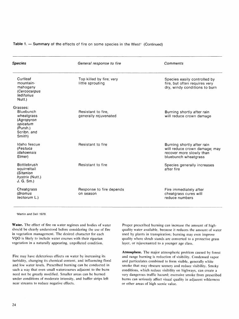
Table 1. — Summary of the effects of fire on some species in the West' (Continued)
Species General response to fire Comments
Curlleaf mountain- mahogany (Cercocarpus ledifolius Nutt.)
Grasses: Bluebunch wheatgrass (Agropyron sp i cat um (Pursh.) Scribn. and Smith)
Idaho fescue (Festuca idalioensis Elmer)
Bottlebrush squirreltail (Sitanion tiystrix (Nutt.) J. G. Sm.)
Cheatgrass (Bromus tectorum L.)
Top killed by fire; very little sprouting
Resistant to fire, generally rejuvenated
Resistant to fire
Resistant to fire
Response to fire depends on season
Species easily controlled by fire, but often requires very dry, windy conditions to burn
Burning shortly after rain will reduce crown damage
Burning shortly after rain will reduce crown damage; may recover more slowly than bluebunch wheatgrass
Species generally increases after fire
Fire immediately after cheatgrass cures will reduce numbers
'Martin and Dell 1978.
Water. The effect of fire on water regimes and bodies of water should be clearly understood before considering the use of fire in vegetation management. The desired character for each VQO is likely to include water courses with their riparian vegetation in a naturally appearing, unpolluted condition.
Fire may have deleterious effects on water by increasing its turbidity, changing its chemical content, and influencing flood and low water levels. Prescribed burning can be conducted in such a way that even small watercourses adjacent to the burn need not be greatly modified. Smaller areas can be burned under conditions of moderate intensity, and buffer strips left near streams to reduce negative effects.
Proper prescribed burning can increase the amount of high- quality water available, because it reduces the amount of water used by plants in transpiration; burning may even improve quality where shrub stands are converted to a protective grass layer, or rejuvenanted to a younger age class.
Atmosphere. The major atmospheric problem caused by forest and range burning is reduction of visibility. Condensed vapor and particulates combined to form visible, generally white smoke that may obscure scenery and reduce visibility. Smoky conditions, which reduce visibility on highways, can create a very dangerous traffic hazard; excessive smoke from prescribed burns can seriously affect visual quality in adjacent wilderness or other areas of high scenic value.
24
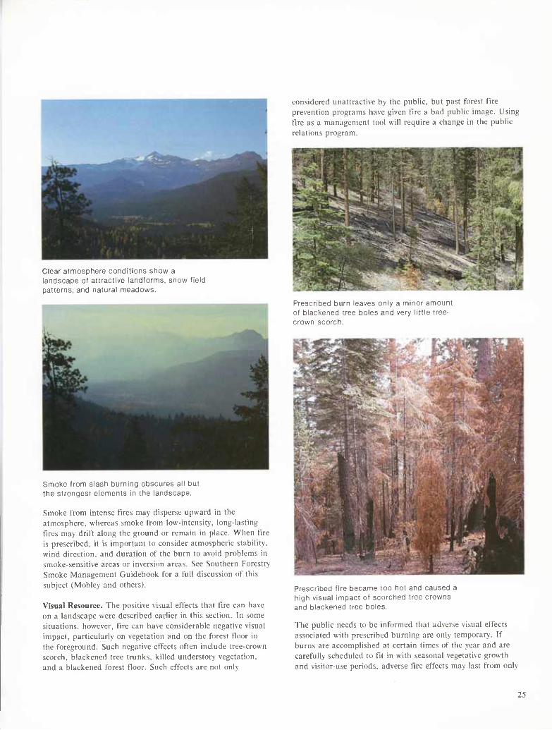
Clear atmosphere conditions show a landscape of attractive landfornns, snow field patterns, and natural meadows.
Smoke from slash burning obscures all but the strongest elements in the landscape.
Smoke from intense fires may disperse upward in the atmosphere, whereas smoke from low-intensity, long-lasting fires may drift along the ground or remain in place. When fire is prescribed, it is important to consider atmospheric stability, wind direction, and duration of the burn to avoid problems in smoke-sensitive areas or inversion areas. See Southern Forestry Smoke Management Guidebook for a full discussion of this subject (Mobley and others).
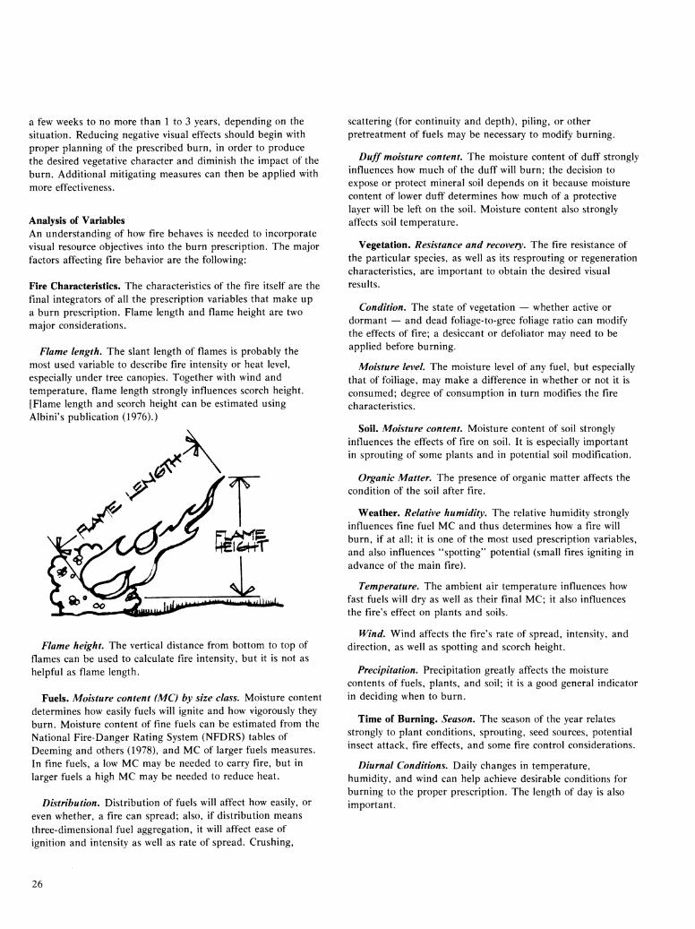
Visual Resource. The positive visual effects that fire can have on a landscape were described earlier in this section. In some situations, however, fire can have considerable negative visual impact, particularly on vegetation and on the forest floor in the foreground. Such negative effects often include tree-crown scorch, blackened tree trunks, killed understory vegetation, and a blackened forest floor. Such effects are not only
considered unattractive by the public, but past forest fire prevention programs have given fire a bad public image. Using fire as a management tool will require a change in the public relations program.
Prescribed burn leaves only a minoi aniuuii of blackened tree boles and very little tree- crown scorch.
Prescribed fire became too hot and caused a high visual impact of scorched tree crowns and blackened tree boles.
The public needs to be informed that adverse visual effects associated with prescribed burning are only temporary. If burns are accomplished at certain times of the year and are carefully scheduled to fit in with seasonal vegetative growth and visitor-use periods, adverse fire effects may last from only
25
a few weeks to no more than 1 to 3 years, depending on the situation. Reducing negative visual effects should begin with proper planning of the prescribed burn, in order to produce the desired vegetative character and diminish the impact of the burn. Additional mitigating measures can then be applied with more effectiveness.
Analysis of Variables An understanding of how fire behaves is needed to incorporate visual resource objectives into the burn prescription. The major factors affecting fire behavior are the following:
Fire Characteristics. The characteristics of the fire itself are the final integrators of all the prescription variables that make up a burn prescription. Flame length and flame height are two major considerations.
Flame length. The slant length of flames is probably the most used variable to describe fire intensity or heat level, especially under tree canopies. Together with wind and temperature, flame length strongly influences scorch height. [Flame length and scorch height can be estimated using Albini's publication (1976).)
Flame height. The vertical distance from bottom to top of flames can be used to calculate fire intensity, but it is not as helpful as flame length.
Fuels. Moisture content (MC) by size class. Moisture content determines how easily fuels will ignite and how vigorously they burn. Moisture content of fine fuels can be estimated from the National Fire-Danger Rating System (NFDRS) tables of Deeming and others (1978), and MC of larger fuels measures. In fine fuels, a low MC may be needed to carry fire, but in larger fuels a high MC may be needed to reduce heat.
Distribution. Distribution of fuels will affect how easily, or even whether, a fire can spread; also, if distribution means three-dimensional fuel aggregation, it will affect ease of ignition and intensity as well as rate of spread. Crushing,
scattering (for continuity and depth), piling, or other pretreatment of fuels may be necessary to modify burning.
Duff moisture content. The moisture content of duff strongly influences how much of the duff will burn; the decision to expose or protect mineral soil depends on it because moisture content of lower duff determines how much of a protective layer will be left on the soil. Moisture content also strongly affects soil temperature.
Vegetation. Resistance and recovery. The fire resistance of the particular species, as well as its resprouting or regeneration characteristics, are important to obtain the desired visual results.
Condition. The state of vegetation — whether active or dormant — and dead foliage-to-gree foliage ratio can modify the effects of fire; a desiccant or defoliator may need to be applied before burning.
Moisture level. The moisture level of any fuel, but especially that of foiliage, may make a difference in whether or not it is consumed; degree of consumption in turn modifies the fire characteristics.
Soil. Moisture content. Moisture content of soil strongly influences the effects of fire on soil. It is especially important in sprouting of some plants and in potential soil modification.
Organic Matter. The presence of organic matter affects the condition of the soil after fire.
Weather. Relative humidity. The relative humidity strongly influences fine fuel MC and thus determines how a fire will burn, if at all; it is one of the most used prescription variables, and also influences "spotting" potential (small fires igniting in advance of the main fire).
Temperature. The ambient air temperature influences how fast fuels will dry as well as their final MC; it also influences the fire's effect on plants and soils.
Wind. Wind affects the fire's rate of spread, intensity, and direction, as well as spotting and scorch height.
Precipitation. Precipitation greatly affects the moisture contents of fuels, plants, and soil; it is a good general indicator in deciding when to burn.
Time of Burning. Season. The season of the year relates strongly to plant conditions, sprouting, seed sources, potential insect attack, fire effects, and some fire control considerations.
Diurnal Conditions. Daily changes in temperature, humidity, and wind can help achieve desirable conditions for burning to the proper prescription. The length of day is also important.
26
Meeting Visual QualiCy Objectives
finition Patterns. The intensity of a prescribed t'lre can be intluenced by the ignition pattern. Persons skilled in prescribed burning can obtain desired tire behavior through proper ignition timing and placement.
Visual Impact Effects It is necessary to be aware of the factors that directly affect the visual quality of an area where a prescribed burn is planned. The following are key factors:
Duration of Impact. The immediate impact of a prescribed burn is usually quite strong, depending on the intensity of burn and techiques of impact reduction. How long the effects will remain depends on the vegetative species, moisture level, soil moisture, and other variables. In some cases, duration of fire impact has been reduced by burning just before a predicted rain to allow for a "washing down" effect.
Low-intensity fires usually have short-term effects; a high- intensity tire requires greater healing time in tree ecosystems. Grass and brush ecosystems probably recover more quickly than tree ecosystems. How serious the impact seems to the observer, and therefore the degree of visual mitigation needed, will depend on how far the observes is from the site and how long the observer looks at it.
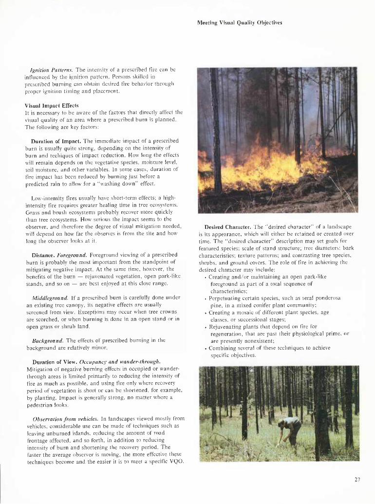
Distance. Foreground. Foreground viewing of a prescribed burn is probably the most important from the standpoint of mitigating negative impact. At the same time, however, the benefits of the burn — rejuvenated vegetation, open park-like stands, and so on — are best enjoyed at this close range.
Middleground. If a prescribed burn is carefully done under an existing tree canopy, its negative effects are usually screened from view. Exceptions may occur when tree crowns are scorched, or when burning is done in an open stand or in open grass or shrub land.
Background. The effects of prescribed burning in the background are relatively minor.
Duration of View. Occupancy and wander-through. Mitigation of negative burning effects in occupied or wander- through areas is limited primarily to reducing the intensity of tire as much as possible, and using fire only where recovery period of vegetation is short or can be shortened, for example, by planting. Impact is generally strong, no matter where a pedestrian looks.
Observation from vehicles. In landscapes viewed mostly from vehicles, considerable use can be made of techniques such as leaving unburned islands, reducing the amount of road frontage affected, and so forth, in addition to reducing intensity of burn and shortening the recovery period. The faster the average observer is moving, the more effective these techniques become and the easier it is to meet a specific VQO.
Desired Character. The "desired character" of a landscape is its appearance, which will either be retained or created over time. The "desired character" description may set goals for featured species; scale of stand structure; tree diameters; bark characteristics; texture patterns; and contrasting tree species, shrubs, and ground covers. The role of fire in achieving the desired character may include:
• Creating and/or maintaining an open park-like foreground as part of a total sequence of characteristics;
• Perpetuating certain species, such as serai ponderosa pine, in a mixed conifer plant community;
• Creating a mosaic of different plant species, age classes, or successional stages;
. Rejuvenating plants that depend on fire for regeneration, that are past their physiological prime, or are presently nonexistent;
• Combining several of these techniques to achieve specific objectives.
27
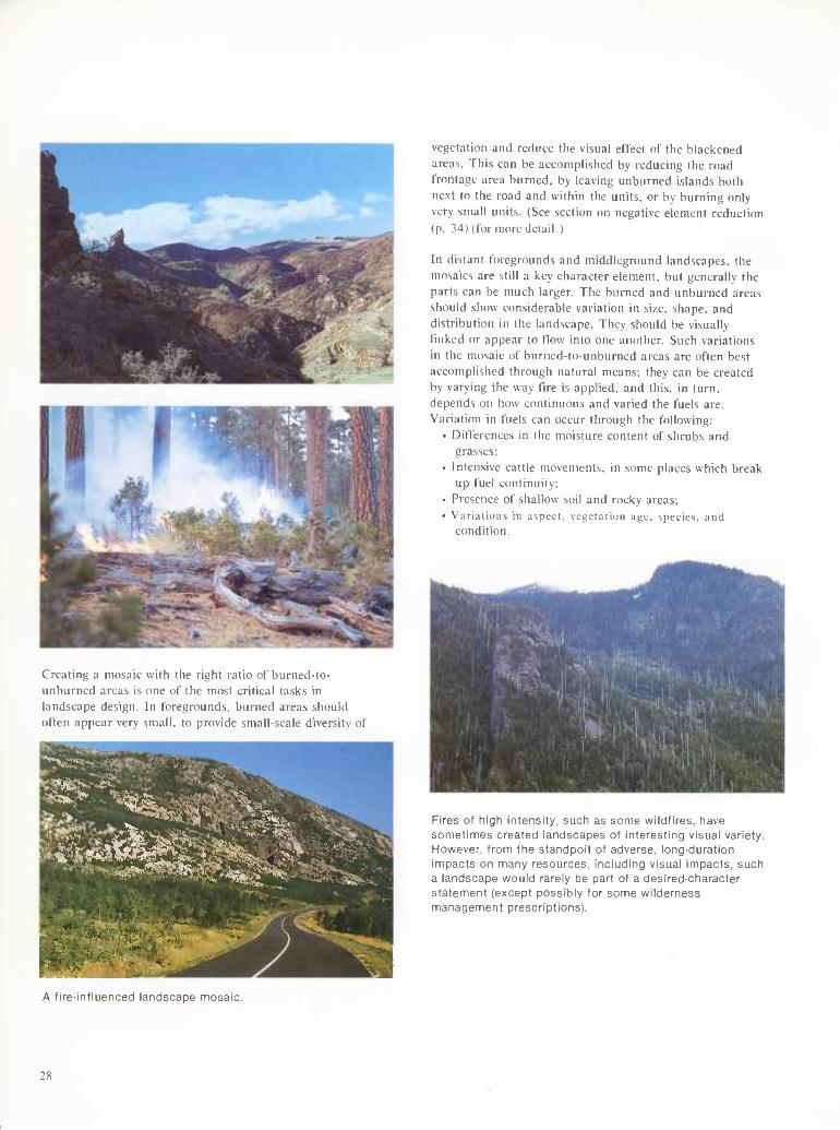
Creating a mosaic with the right ratio of burned-to- unburned areas is one of the most critical tasks in landscape design. In foregrounds, burned areas should often appear very small, to provide small-scale diversity of
vegetation and reduce the visual effect of the blackened areas. This can be accomplished by reducing the road frontage area burned, by leaving unburned islands both next to the road and within the units, or by burning only very small units. (See section on negative element reduction (p. 34) (for more detail.)
In distant foregrounds and middleground landscapes, the mosaics are still a key character element, but generally the parts can be much larger. The burned and unburned areas should show considerable variation in size, shape, and distribution in the landscape. They should be visually linked or appear to flow into one another. Such variations in the mosaic of burned-to-unburned areas are often best accomplished through natural means; they can be created by varying the way fire is applied, and this, in turn, depends on how continuous and varied the fuels are. Variation in fuels can occur through the following:
• Differences in the moisture content of shrubs and grasses;
• Intensive cattle movements, in some places which break up fuel continuity;
• Presence of shallow soil and rocky areas; • Variations in aspect, vegetation age. species, and
condition.
Fires of high intensity, such as some wildfires, have sometimes created landscapes of interesting visual variety. However, from the standpoit of adverse, long-duration impacts on many resources, including visual impacts, such a landscape would rarely be part of a desired-character statement (except possibly for some wilderness management prescriptions).
A fire-influenced landscape mosaic.
28
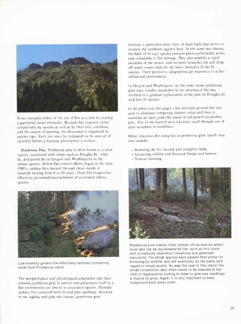
Some examples follow of the use of t'lre as a tool in creating a particular visual character. Because tire response varies considerably by species as well as by their size, condition, and the season of burning, the discussion is organized by species type. Each site must be evaluated on its own set of variables before a burning prescription is written.
Ponderosa Pine. Ponderosa pine is often found as a sera! species, associated with others such as Douglas-tlr, white fir, and grand fir (in Oregon and Washington) as the climax species. Before fire control efforts began in the early 1900's, surface fires burned through these stands at intervals varying from 8 to 20 years. These fire frequencies effectively prevented encroachment of associated climax species.
Low-intensity ground fire effectively removes competing cedar from Ponderosa stand.
The morphological and physiological adaptation that have allowed ponderosa pine to survive and perpetuate itself in a fire environment are absent in associated species. Periodic surface fires removed both fir and pine seedlings. However, in the sapling and pole size classes, ponderosa pine
develops a protective outer layer of dead bark that serves to insulate the cambium against heat. In the same size classes, the bark of fir-type species remains photosynthetically active and vulnerable to fire damage. Pine also exhibits a rapid elevation of the crown, and its lower branches die and drop off much sooner than do the lower branches of the fir species. These protective adaptations are responses to a fire- intluenced environment.
In Oregon and Washington, on the more mesic ponderosa pine sites, conifer succession in the absence of fire has resulted in a gradual replacement of the pine by Douglas-fir and true fir species.
In the photo |on this page] a low-intensity ground fire was used to eliminate competing incense cedar and thus to maintain an open park-like stand of old-growth ponderosa pine. Size of the burned area was kept small through use of clear retardant or handlines.
Other objectives for using fire in ponderosa pine stands may also include:
. Reducing the fire hazard and unsightly fuels;
. Increasing wildlife and livestock forage and browse;
. Natural thinning.
Ponderosa pine stands often contain shrub species which must and can be rejuvenated by fire, such as this stand with snowbrush ceanothus (velutinus) and greenleaf manzanita. The shrub species have passed their prime for browsing by wildlife, and will eventually do the same with regard to visual quality. As was the case in this stand, the shrub competition also often needs to be reduced at the time of regeneration cutting in order to give new seedlings a chance to grow. Again, it is very important to keep foreground burn areas small.
29
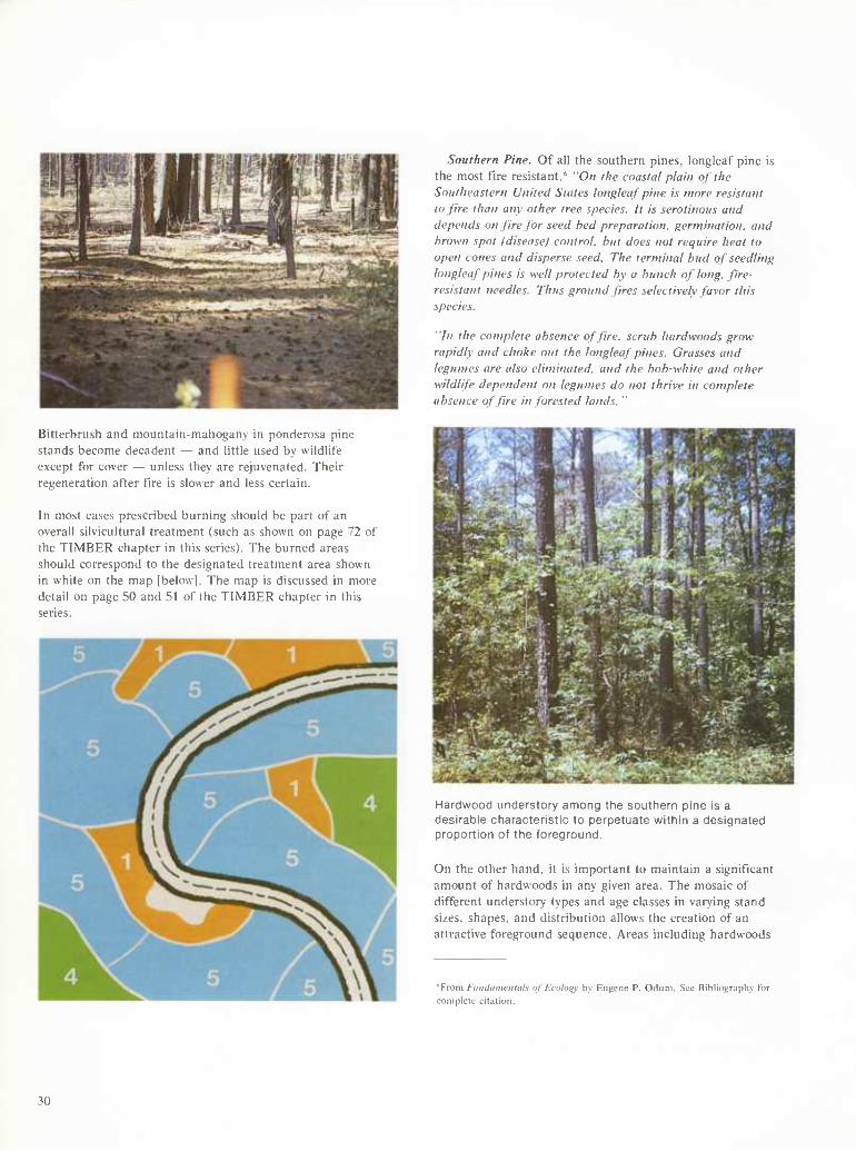
Southern Pine. Of all the southern pines. longleaf pine is the most fire resistant.' "On the coastal plain of the Southeastern United States longleaf pine is more resistant to fire than any other tree species. It is serotinous and depends on fire for seed hed preparation, germination, and brown spot (disease) control, hut does not require heat to open cones and disperse seed. The terminal hud of seedling longleaf pines is well protected by a bunch of long, fire- resistant needles. Thus ground fires selectively favor this species.
"In the complete absence of fire, scrub hardwoods grow rapidly and choke out the longleaf pines. Grasses and legumes are also eliminated, and the hob-white and other wildlife dependent on legumes do not thrive in complete absence of fire in forested lands. "
Bitterbrush and mountain-mahogany in ponderosa pine stands become decadent — and little used by wildlife except for cover — unless they are rejuvenated. Their regeneration after fire is slower and less certain.
In most cases prescribed burning should be part of an overall silvicultural treatment (such as shown on page 72 of the TIMBER chapter in this series). The burned areas should correspond to the designated treatment area shown in white on the map [below]. The map is discussed in more detail on page 50 and 51 of the TIMBER chapter in this series.
Hardwood understory among the southern pine is a desirable characteristic to perpetuate within a designated proportion of the foreground.
On the other hand, it is important to maintain a significant amount of hardwoods in any given area. The mosaic of different understory types and age classes in varying stand sizes, shapes, and distribution allows the creation of an attractive foreground sequence. Areas including hardwoods
"From Fundaitwnials nf Ecology by Eugene P. Odum. See Bibliography for complete citation.
30
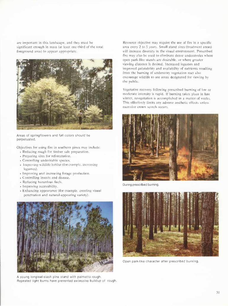
are important in this landscape, and they must be significant enough in mass (at least one-third of the total foreground area) to appear appropriate.
Areas of springflowers and fall colors should be perpetuated.
Objectives for using fire in southern pines may include: • Reducing rough for timber sale preparation. • Preparing sites for reforestation. • Controlling undesirable species. • Improving wildlife habitat (for example, increasing
legumes). • Improving and increasing forage production. • Controlling insects and disease. • Reducing hazardous fuels. ■ Improving accessibility. • Enhancing appearance (for example, creating visual
penetration and natural-appearing variety).
Resource objective may require the use of fire in a specific area every 2 to 5 years. Small stand sizes (treatment areas) will increase diversity in the visual environment. Prescribed fire may also be used to eliminate dense understories where open park-like stands are desirable, or where greater viewing distance is desired. Increased legumes and improved palatability and availability of nutrients resulting from the burning of understory vegetation may also encourage wildlife to use areas designated for viewing by the public.
Vegetative recovery following prescribed burning of low or moderate intensity is rapid. If burning takes place in late winter, revegetation is accomplished in a matter of weeks. This effectively limits any adverse aesthetic effects unless excessive crown scorch occurs.
During prescribed burning.
í^diK-uKe character after prescribed burning.
A young longleaf-slash pine stand with palnnetto rough. Repeated light burns have prevented excessive buildup of rough.
31
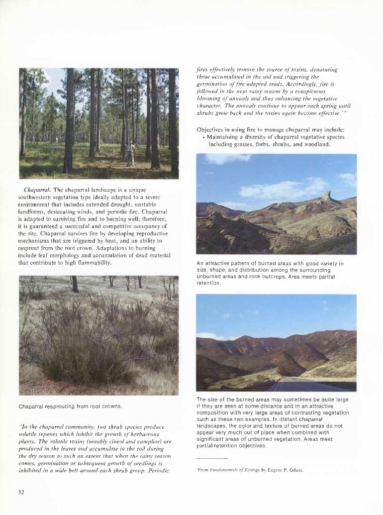
Chaparral. The chaparral landscape is a unique southwestern vegetation type ideally adapted to a severe environment that includes extended drought, unstable landforms, desiccating winds, and periodic fire. Chaparral is adapted to surviving fire and to burning well; therefore, it is guaranteed a successful and competitive occupancy of the site. Chaparral survives fire by developing reproductive mechanisms that are triggered by heat, and an ability to resprout from the root crown. Adaptations to burning include leaf morphology and accumulation of dead material that contribute to high fiammability.
Chaparral resprouting from root crowns.
"In the chaparral community, two shrub species produce volatile tepenes which inhibit the growth of herbaceous plants. The volatile toxins (notably cineol and camphor) are produced in the leaves and accumulate in the soil during the dry season to such an extent that when the rainy season comes, germination or subsequent growth of seedlings is inhibited in a wide belt around each shrub group. Periodic
fires effectively remove the source of toxins, denaturing those accumulated in the soil and triggering the germination of fire adapted seeds. Accordingly, fire is followed in the next rainy season by a conspicuous blooming of annuals and thus enhancing the vegetative character. The annuals continue to appear each spring until shrubs grow back and the toxins again become effective. "'
Objectives in using fire to manage chaparral may include: • Maintaining a diversity of chaparral vegetative species
including grasses, forbs, shrubs, and woodland.
An attractive pattern of burned areas witfi good variety in size, shape, and distribution among the surrounding unburned areas and rock outcrops. Area meets partial retention.
The size of the burned areas may sometimes be quite large If they are seen at some distance and in an attractive composition vi/ith very large areas of contrasting vegetation such as these two examples. In distant chaparral landscapes, the color and texture of burned areas do not appear very much out of place when combined with significant areas of unburned vegetation. Areas meet partial-retention objectives.
'From Futidamvnuils of Ecnlo^v by Eugene P. Odiim.
32
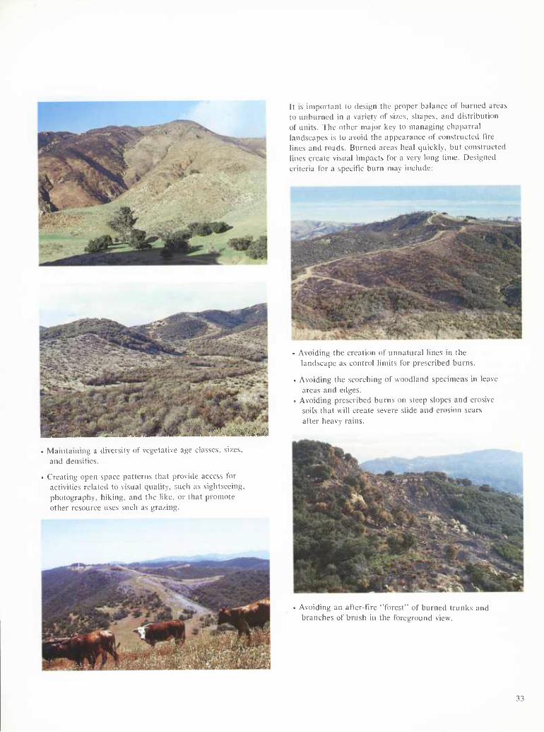
It is important to design the proper balance of burned areas to unburned in a variety of sizes, sliapes, and distribution of units. The other major key to managing chaparral landscapes is to avoid the appearance of constructed fire lines and roads. Burned areas heal quickly, but constructed lines create visual impacts for a very long time. Designed criteria for a specific burn may include:
Avoiding the creation ol unnatural lines in the landscape as control limits for prescribed burns.
Avoiding the scorching of woodland specimens in leave areas and edges.
Avoiding prescribed burns on steep slopes and erosive soils that will create severe slide and erosion scars after heavy rains.
Maintaining a diversity of vegetative age classes, sizes, and densities.
■ Creating open space patterns that provide access for activities related to visual quality, such as sightseeing. photography, hiking, and the like, or that promote other resource uses such as grazing.
Avoiding an after-t'ire "forest" of burned trunks and branches of brush in the foreground view.
33
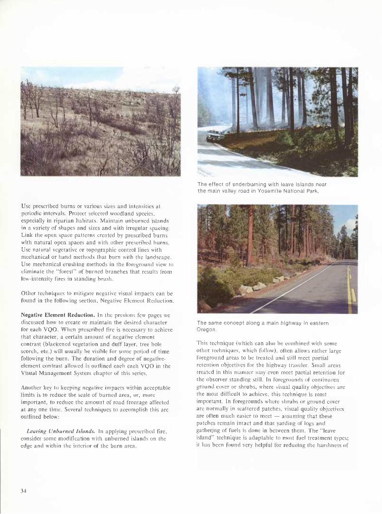
The effect of underburning with leave islands near the main valley road in Yosemite National Park.
Use prescribed burns or various sizes and intensities at periodic intervals. Protect selected woodland species, especially in riparian habitats. Maintain unburned islands in a variety of shapes and sizes and with irregular spacing. Link the open space patterns created by prescribed burns with natural open spaces and with other prescribed burns. Use natural vegetative or topographic control lines with mechanical or hand methods that burn with the landscape. Use mechanical crushing methods in the foreground view to eliminate the "forest" of burned branches that results from low-intensity fires in standing brush.
Other techniques to mitigate negative visual impacts can be found in the following section, Negative Element Reduction.
Negative Element Reduction. In the previous few pages we discussed how to create or maintain the desired character for each VQO. When prescribed fire is necessary to achieve that character, a certain amount of negative element contrast (blackened vegetation and duff layer, tree bole scorch, etc.) will usually be visible for some period of time following the burn. The duration and degree of negative- element contrast allowed is outlined each each VQO in the Visual Management System chapter of this series.
Another key to keeping negative impacts within acceptable limits is to reduce the scale of burned area, or, more important, to reduce the amount of road frontage affected at any one time. Several techniques to accomplish this are outlined below:
Leaving Unhurried Islands. In applying prescribed fire, consider some modification with unburned islands on the edge and within the interior of the burn area.
The same concept along a main highway in eastern Oregon.
This technique (which can also be combined with some other techniques, which follow), often allows rather large foreground areas to be treated and still meet partial retention objectives for the highway traveler. Small areas treated in this manner may even meet partial retention for the observer standing still. In foregrounds of continuous ground cover or shrubs, where visual quality objectives are the most difficult to achieve, this technique is most important. In foregrounds where shrubs or ground cover are normally in scattered patches, visual quality objectives are often much easier to meet — assuming that these patches remain intact and that yarding of logs and gathering of fuels is done in between them. The "leave island" technique is adaptable to most fuel treatment types; it has been found very helpful for reducing the harshness of
34
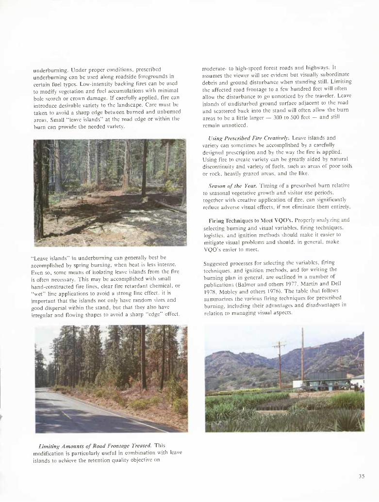
underburning. Under proper conditions, prescribed underburning can be used along roadside foregrounds in certain fuel types. Low-intensity backing tires can be used to modify vegetation and fuel accumulations with minimal bole scorch or crown damage. If carefully applied, fire can introduce desirable variety to the landscape. Care must be taken to avoid a sharp edge between burned and unburned areas. Small "leave islands" at the road edge or within the burn can provide the needed variety.
"Leave islands" in underburning can generally best be accomplished by spring burning, when heat is less intense. Even so, some means of isolating leave islands from the fire is often necessary. This may be accomplished with small hand-constructed fire lines, clear fire retardant chemical, or "wet" line applications to avoid a strong line effect, it is important that the islands not only have random sizes and good dispersal within the stand, but that they also have irregular and flowing shapes to avoid a sharp "edge" effect.
moderate- to high-speed forest roads and highways. It assumes the viewer will see evident but visually subordinate debris and ground disturbance when standing still. Limiting the affected road frontage to a few hundred feet will often allow the disturbance to go unnoticed by the traveler. Leave islands of undisturbed ground surface adjacent to the road and scattered back into the stand will often allow the burn areas to be a little larger — 300 to 500 feet — and still remain unnoticed.
Using Prescribed Fire Creatively. Leave islands and variety can sometimes be accomplished by a carefully designed prescription and by the way the fire is applied. Using t'lre to create variety can be greatly aided by natural discontinuity and variety of fuels, such as areas of poor soils or rock, heavily grazed areas, and the like.
Season of the Year. Timing of a prescribed burn relative to seasonal vegetative growth and visitor use periods, together with creative application of fire, can significantly reduce adverse visual effects, if not eliminate them entirely.
Firing Techniques to Meet VQO's. Properly analyzing and selecting burning and visual variables, firing techniques, logistics, and ignition methods should make it easier to mitigate visual problems and should, in general, make VQO's easier to meet.
Suggested processes for selecting the variables, firing techniques, and ignition methods, and for writing the burning plan in general, are outlined in a number of publications (Balmer and others 1977, Martin and Dell 1978, Mobley and others 1976). The table that follows summarizes the various firing techniques for prescribed burning, including their advantages and disadvantages in relation to managing visual aspects.
Limiting Amounts of Road Frontage Treated. This modification is particulariy useful in combination with leave islands to achieve the retention quality objective on
35
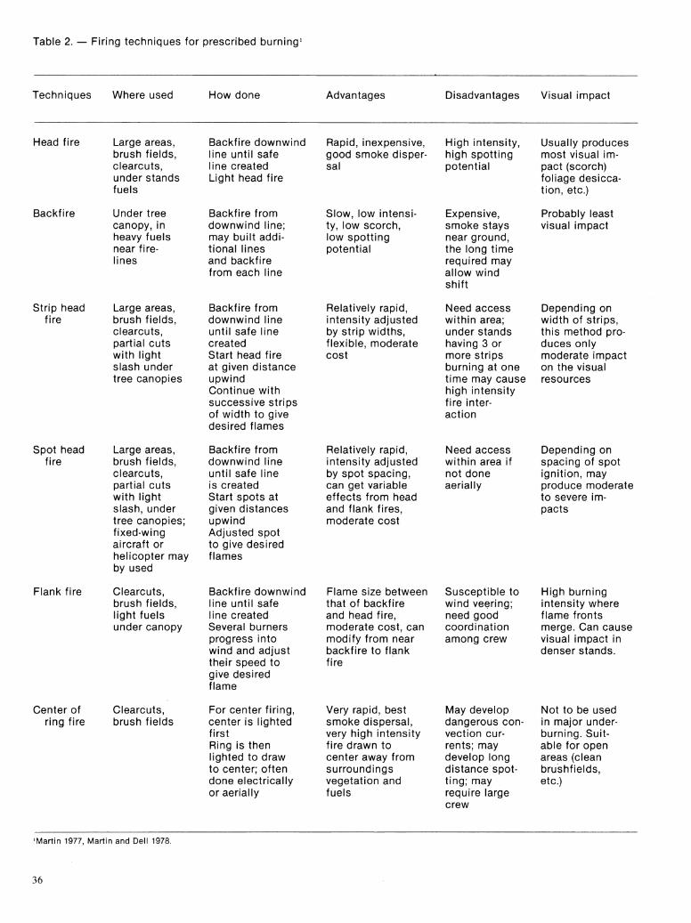
Table 2. — Firing techniques for prescribed burning'
Techniques Where used How done Advantages Disadvantages Visual innpact
Head fire Large areas, Backfire downwind Rapid, inexpensive. High intensity. Usually produces brush fields, line until safe good smoke disper- high spotting most visual im- clearcuts. line created sal potential pact (scorch) under stands Light head fire foliage desicca- fuels tion, etc.)
Backfire Under tree Backfire from Slow, low intensi- Expensive, Probably least canopy, in downwind line; ty, low scorch, smoke stays visual impact heavy fuels may built addi- low spotting near ground. near fire- tional lines potential the long time lines and backfire
from each line required may allow wind shift
Strip head Large areas. Backfire from Relatively rapid. Need access Depending on fire brush fields. downwind line intensity adjusted within area; width of strips.
clearcuts. until safe line by strip widths, under stands this method pro- partial cuts created flexible, moderate having 3 or duces only with light Start head fire cost more strips moderate impact slash under at given distance burning at one on the visual tree canopies upwind
Continue with successive strips of width to give desired flames
time may cause high intensity fire inter- action
resources
Spot head Large areas, Backfire from Relatively rapid. Need access Depending on fire brush fields. downwind line intensity adjusted within area if spacing of spot
clearcuts. until safe line by spot spacing. not done ignition, may partial cuts is created can get variable aerially produce moderate with light Start spots at effects from head to severe im- slash, under given distances and flank fires, pacts tree canopies; upwind moderate cost fixed-wing Adjusted spot aircraft or to give desired helicopter may flames by used
Flank fire Clearcuts, Backfire downwind Flame size between Susceptible to High burning brush fields. line until safe that of backfire wind veering; intensity where light fuels line created and head fire, need good flame fronts under canopy Several burners moderate cost, can coordination merge. Can cause
progress into modify from near among crew visual impact in wind and adjust backfire to flank denser stands. their speed to fire give desired flame
Center of Clearcuts, For center firing, Very rapid, best May develop Not to be used ring fire brush fields center is lighted smoke dispersal. dangerous con- in major under-
first very high intensity vection cur- burning. Suit- Ring is then fire drawn to rents; may able for open lighted to draw center away from develop long areas (clean to center; often surroundings distance spot- brushfields. done electrically vegetation and ting; may etc.) or aerially fuels require large
crew
'Martin 1977, Martin and Dell 1978.
36
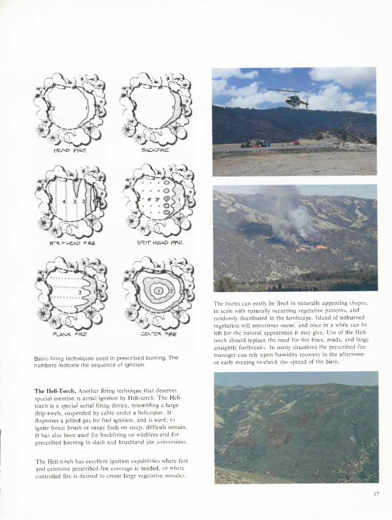
HEAO Ra.E
STXiP HSN? -;R£
FLANl<. =lRE
-^NvvM:
SiiCXrlRE
,<?S^v'^M:
S=»r H5M3 HF£
r3.^v'«Ä
casi-E«. F|pe
Basic firing techniques used in prescribed burning. The numbers indicate the sequence of ignition.
The Heli-Torch. Another firing technique that deserves special mention is aerial ignition by Heii-torch. The Heli- torch is a special aerial firing device, resembling a large drip-torch, suspended by cable under a helicopter. It dispenses a jellied gas tor fuel ignition, and is used; to ignite forest brush or range fuels on steep, difficult terrain. It has also been used for backfiring on wildfires and for prescribed burning in slash and brushland site conversions.
The Heli-torch has excellent ignition capabilities where fast and extensive prescribed fire coverage is needed, or where controlled fire is desired to create large vegetative mosaics.
The burns can easily be fired in naturally appearing shapes, in scale with naturally occurring vegetative patterns, and randomly distributed in the landscape. Island of unburned vegetation will sometimes occur, and once in a while can be left for the natural appearance it may give. Use of the Heli- torch should replace the need for fire lines, roads, and large unsightly fuelbreaks. In many situations the prescribed fire manager can rely upon humidity recovery in the afternoon or early evening to check the spread of the burn.
37
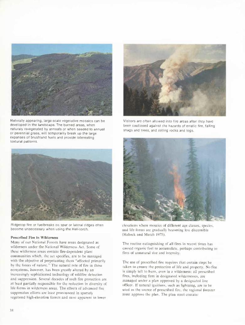
Naturally appearing, large-scale vegetative mosaics can be developed in the landscape. The burned areas, vi/hen naturaly revegetated by annuals or when seeded to annual or perennial grass, m\\ temporarily break up the large expanses of brushland fuels and provide interesting textural patterns.
Ridgetop fire or fuelbreaks on spur or lateral ridges often become unnecessary when using the Hell-torch.
Prescribed Fire in Wilderness Many of our National Forests have areas designated as wilderness under the National Wilderness Act. Some of these wilderness areas contain fire-dependent plant communities which, the act specifies, are to be managed with the objective of perpetuating them "affected primarily by the forces of nature." The natural role of t'lre in these ecosystems, however, has been greatly altered by an increasingly sophisticated technology of wildfire detection and suppression. Several decades of such tire protection are at least partially responsible for the reduction in diversity of life forms in wilderness areas. The effects of advanced fire suppression efforts are least pronounced in sparsely vegetated high-elevation forests and most apparent in lower
Visitors are often allowed into fire areas after they have been cautioned against the hazards of erratic fire, falling snags and trees, and rolling rocks and logs.
elevations where mosaics of different age classes, species, and life forms are gradually becoming less discernible (Habeck and Mutch 1975).
The routine extinguishing of all fires in recent times has caused organic fuel to accumulate, perhaps contributing to fires of unnatural si/e and intensity.
The use of prescribed tire requires that certain steps be taken to ensure the protection of life and property. No fire is simply left to burn, even in a wilderness; all prescribed fires, including fires in designated wildernesses, are managed under a plan approved by a designated line officer. If natural ignitions, such as lightning, are to be used as the source of prescribed tire, the regional forester must approve the plan. The plan must contain:
38
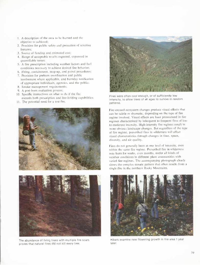
1. A description of the area to be burned and the objective to achieved;
2. Provision for public safety and protection of sensitive features;
3. Source of funding and estimated cost; 4. Range of acceptable results expected, expressed in
quantifiable terms; 5. A fire prescription including weather factors and fuel
conditions necessary to achieve desired fire behavior; 6. Firing, containment, mop-up. and patrol procedures; 7. Provision for preburn coordination and public
involvement where applicable, and burnday notification of appropriate individuals, agencies, and the public;
8. Smoke management requirements; 9. A post-burn evaluation process;
10. Specific instructions on what to do if the fire exceeds both prescription and line-holding capabilities;
11. The potential need for a test fire.
Fires were often cool enough, or of sufficiently low intensity, to allow trees of all ages to survive in random patterns.
Fire-created ecosystem changes produce visual effects that can be subtle or dramatic, depending on the type of fire regime involved. Visual effects are least pronounced in fire regimes characterized by infrequent to frequent tires of low- to-moderate intensity. High-intensity fire regimes result in more obvious landscape changes. But regardless of the type of fire regime, prescribed fires in wilderness will affect visual characteristics through changes in time, space, diversity, and air quality.
Fires do not generally burn at one level of intensity, even within the same fire regime. Prescribed fire in wilderness may burn for weeks, even months, under all kinds of weather conditions in different plant communities with varied fire regimes. The accompanying photograph clearly shows the complex mosaic pattern that often results from a single fire in the northern Rocky Mountains.
The abundance of living trees with multiple fire scars proves that natural fires did not kill every tree.
Hikers examine new flowering growth in fire area 1 year later.
39
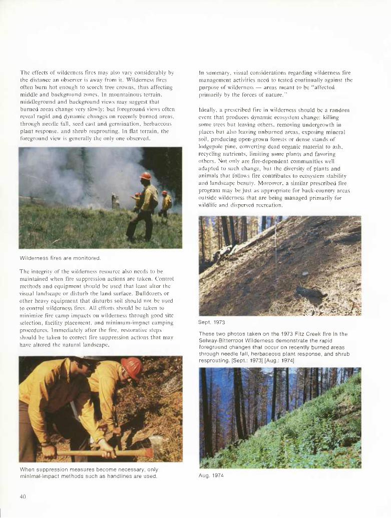
The effects of wilderness fires may also vary considerably by the distance an observer is away from it. Wilderness fires often burn hot enough to scorch tree crowns, thus affecting middle and background zones. In mountainous terrain, middleground and background views may suggest that burned areas change very slowly; but foreground views often reveal rapid and dynamic changes on recently burned areas, through needle fall, seed cast and germination, herbaceous plant response, and shrub resprouting. In fiat terrain, the foreground view is generally the only one observed.
Wilderness fires are monitored.
The integrity of the wilderness resource also needs to be maintained when fire suppression actions are taken. Control methods and equipment should be used that least alter the visual landscape or disturb the land surface. Bulldozers or other heavy equipment that disturbs soil should not be used to control wilderness fires. All efforts should be taken to minimize fire camp impacts on wilderness through good site selection, facility placement, and minimum-impact camping procedures. Immediately after the fire, restorative steps should be taken to correct fire suppression actions that may have altered the natural landscape.
In summary, visual considerations regarding wilderness fire management activities need to tested continually against the purpose of wilderness — areas meant to be "affected primarily by the forces of nature."
Ideally, a prescribed fire in wilderness should be a random event that produces dynamic ecosystem change: killing some trees but leaving others, removing undergrowth in places but also leaving unburned areas, exposing mineral soil, producing open-grown forests or dense stands of lodgepole pine, converting dead organic material to ash, recycling nutrients, limiting some plants and favoring others. Not only are fire-dependent communities well adapted to such change, but the diversity of plants and animals that follows tire contributes to ecosystem stability and landscape beauty. Moreover, a similar prescribed fire program may be just as appropriate for back-country areas outside wilderness that are being managed primarily for wildlife and dispersed recreation.
'^■^»ríZ'^^sSí.^ Sept. 1973
These two photos taken on the 1973 Fitz Creek fire in the Selway-Bitterroot Wilderness demonstrate the rapid foreground changes that occur on recently burned areas through needle fall, herbaceous plant response, and shrub resprouting. [Sept.: 1973] [Aug.: 1974]
When suppression measures become necessary, only minimal-impact methods such as handlines are used. Aug. 1974
40
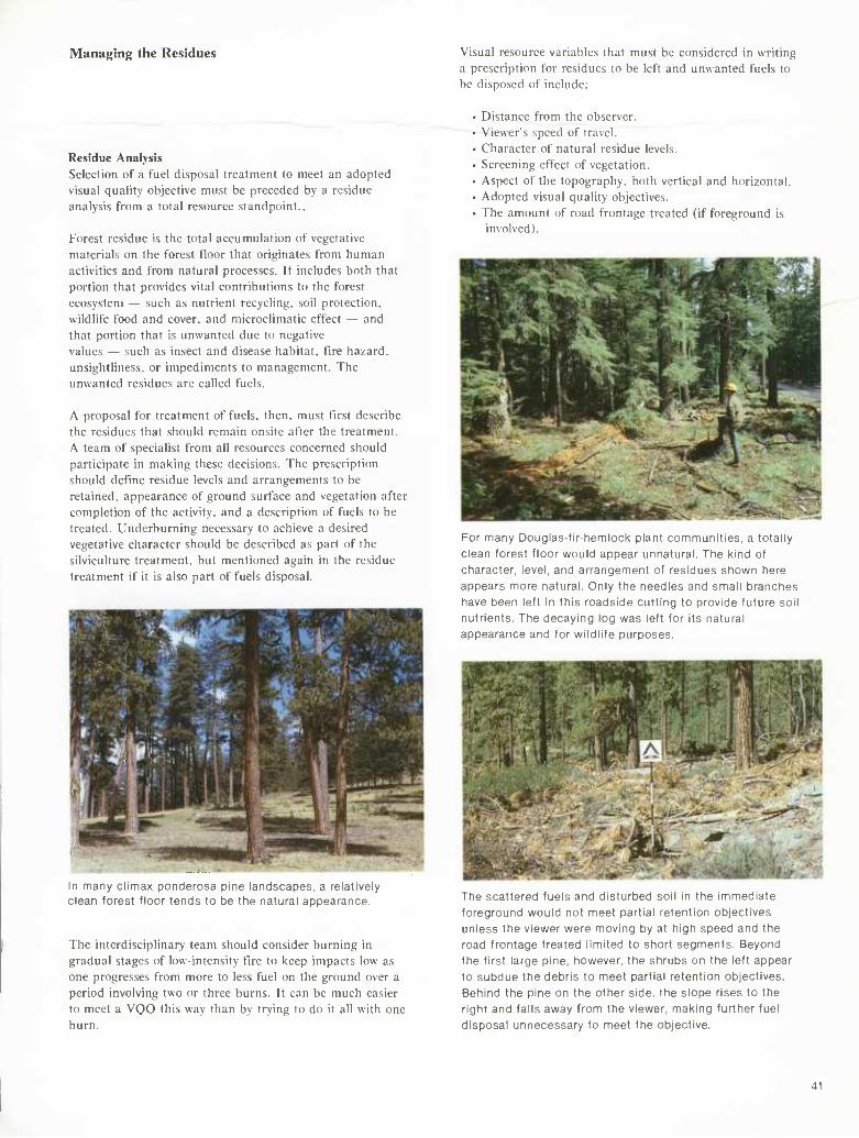
Managing the Residues Visual resource variables that must be considered in writing a prescription for residues to be left and unwanted fuels to be disposed of include:
Residue Analysis Selection of a fuel disposal treatment to meet an adopted visual quality objective must be preceded by a residue analysis from a total resource standpoint..
Forest residue is the total accumulation of vegetative materials on the forest floor that originates from human activities and from natural processes. It includes both that portion that provides vital contributions to the forest ecosystem — such as nutrient recycling, soil protection, wildlife food and cover, and microclimatic effect — and that portion that is unwanted due to negative values — such as insect and disease habitat, fire hazard, unsightliness, or impediments to management. The unwanted residues are called fuels.
A proposal for treatment of fuels, then, must first describe the residues that should remain onsite after the treatment. A team of specialist from all resources concerned should participate in making these decisions. The prescription should define residue levels and arrangements to be retained, appearance of ground surface and vegetation after completion of the activity, and a description of fuels to be treated. Underburning necessary to achieve a desired vegetative character should be described as part of the silviculture treatment, but mentioned again in the residue treatment if it is also part of fuels disposal.
In many climax ponderosa pine landscapes, a relatively clean forest floor tends to be the natural appearance.
The interdisciplinary team should consider burning in gradual stages of low-intensity fire to keep impacts low as one progresses from more to less fuel on the ground over a period involving two or three burns. It can be much easier to meet a VQO this way than by trying to do it all with one burn.
• Distance from the observer. • Viewer's speed of travel. • Character of natural residue levels. • Screening effect of vegetation. • Aspect of the topography, both vertical and horizontal. • Adopted visual quality objectives. • The amount of road frontage treated (if foreground is
involved).
For many Douglas-fir-hemlock plant communities, a totally clean forest floor would appear unnatural. The kind of character, level, and arrangement of residues shown here appears more natural. Only the needles and small branches have been left in this roadside cutting to provide future soil nutrients. The decaying log was left for its natural appearance and for wildlife purposes.
The scattered rueis ana aisturoea son m tne immeaiate foreground would not meet partial retention objectives unless the viewer were moving by at high speed and the road frontage treated limited to short segments. Beyond the first large pine, however, the shrubs on the left appear to subdue the debris to meet partial retention objectives. Behind the pine on the other side, the slope rises to the right and falls away from the viewer, making further fuel disposal unnecessary to meet the objective.
41
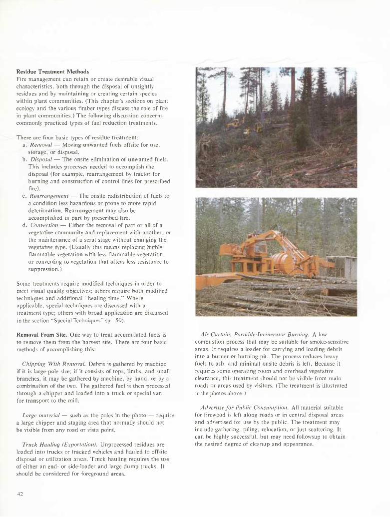
Residue Treatment Methods Fire management can retain or create desirable visual characteristics, both through the disposal of unsightly residues and by maintaining or creating certain species within plant communities. (This chapter's sections on plant ecology and the various timber types discuss the role of fire in plant communities.) The following discussion concerns commonly practiced types of fuel reduction treatments.
There are four basic types of residue treatment: a. Removal — Moving unwanted fuels offsite for use.
storage, or disposal. b. Disposal — The onsite elimination of unwanted fuels.
This includes processes needed to accomplish the disposal (for example, rearrangement by tractor for burning and construction of control lines for prescribed fire).
c. Rearrangement — The onsite redistribution of fuels to a condition less hazardous or prone to more rapid deterioration. Rearrangement may also be accomplished in part by prescribed fire.
d. Conversion — Either the removal of part or all of a vegetative community and replacement with another, or the maintenance of a serai stage without changing the vegetative type. (Usually this means replacing highly flammable vegetation with less flammable vegetation, or converting to vegetation that offers less resistance to suppression.)
Some treatments require modified techniques in order to meet visual quality objectives; others require both modified techniques and additional "healing time." Where applicable, special techniques are discussed with a treatment type; others with broad application are discussed in the section "Special Techniques'" (p. 50).
Removal From Site. One way to treat accumulated fuels is to remove them from the harvest site. There are four basic methods of accomplishing this;
Chipping With Removal. Debris is gathered by machine if it is large-pole size; if it consists of tops, limbs, and small branches, it may be gathered by machine, by hand, or by a combination of the two. The gathered fuel is then processed through a chipper and loaded into a truck or special van for transport to the mill.
Large material — such as the poles in the photo — require a large chipper and staging area that normally should not be visible from any road or vista point.
Truck Hauling (Exportation). Unprocessed residues are loaded into trucks or tracked vehicles and hauled to offsite disposal or utilization areas. Truck hauling requires the use of either an end- or side-loader and large dump trucks. It should be considered for foreground areas.
Air Curtain, Portable-Incinerator Burning. A low combustion process that may be suitable for smoke-sensitive areas. It requires a loader for carrying and loading debris into a burner or burning pit. The process reduces heavy fuels to ash. and minimal onsite debris is left. Because it requires some operating room and overhead vegetative clearance, this treatment should not be visible from main roads or areas used by visitors. (The treatment is illustrated in the photos above.)
Advertise for Public Consumption. All material suitable for firewood is left along roads or in central disposal areas and advertised for use by the public. The treatment may include gathering, piling, relocation, or just scattering. It can be highly successful, but may need followsup to obtain the desired degree of cleanup and appearance.
42
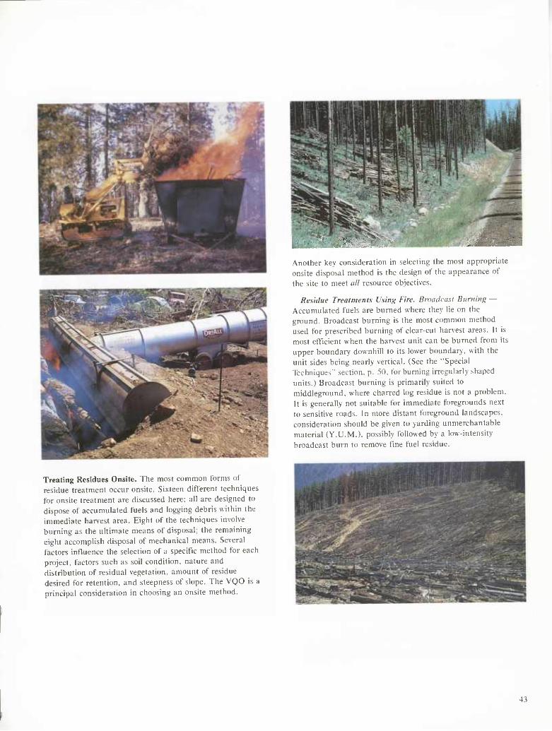
Treating Residues Onsite. The most common forms of residue treatment occur onsite. Sixteen different techniques for onsite treatment are discussed here; all are designed to dispose of accumulated fuels and logging debris within the immediate harvest area. Eight of the techniques involve burning as the ultimate means of disposal; the remaining eight accomplish disposal of mechanical means. Several factors influence the selection of a specific method for each project, factors such as soil condition, nature and distribution of residual vegetation, amount of residue desired for retention, and steepness of slope. The VQO is a principal consideration in choosing an onsite method.
Another key consideration in selecting the most appropriate onsite disposal method is the design of the appearance of the site to meet all resource objectives.
Residue Treatments Using Fire. Broackasi Burning — Accumulated fuels are burned where they lie on the ground. Broadcast burning is the most common method used for prescribed burning of clear-cut harvest areas. It is most efficient when the harvest unit can be burned from its upper boundary downhill to its lower boundary, with the unit sides being nearly vertical, (See the "Special Techniques" section, p. 50, for burning irregularly shaped units.) Broadcast burning is primarily suited to middleground, where charred log residue is not a problem. It is generally not suitable for immediate foregrounds next to sensitive roads. In more distant foreground landscapes, consideration should be given to yarding unmerchantable material (Y,U.M.), possibly followed by a low-intensity broadcast burn to remove fine fuel residue.
43
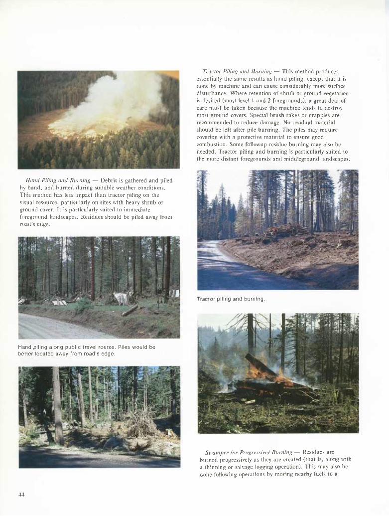
Hand Piling and Burning — Debris is gathered and piled by hand, and burned during suitable weather conditions. This method has less impact than tractor piling on the visual resource, particularly on sites with heavy shrub or ground cover. It is particularly suited to immediate foreground landscapes. Residues should be piled away from road's edge.
Hand piling along public travel routes. Piles would De better located away from road's edge.
Tractor Piling and Burning — This method produces essentially the same results as hand piling, except that it is done by machine and can cause considerably more surface disturbance. Where retention of shrub or ground vegetation is desired (most level 1 and 2 foregrounds), a great deal of care must be taken because the machine tends to destroy most ground covers. Special brush rakes or grapples are recommended to reduce damage. No residual material should be left after pile burning. The piles may require covering with a protective material to ensure good combustion. Some followup residue burning may also be needed. Tractor piling and burning is particularly suited to the more distant foregrounds and middleground landscapes.
Tractor piling and burning.
Swamper for Progressive! Burning — Residues are burned progressively as they are created (that is, along with a thinning or salvage logging operation). This may also be done following operations by moving nearby fuels to a
44
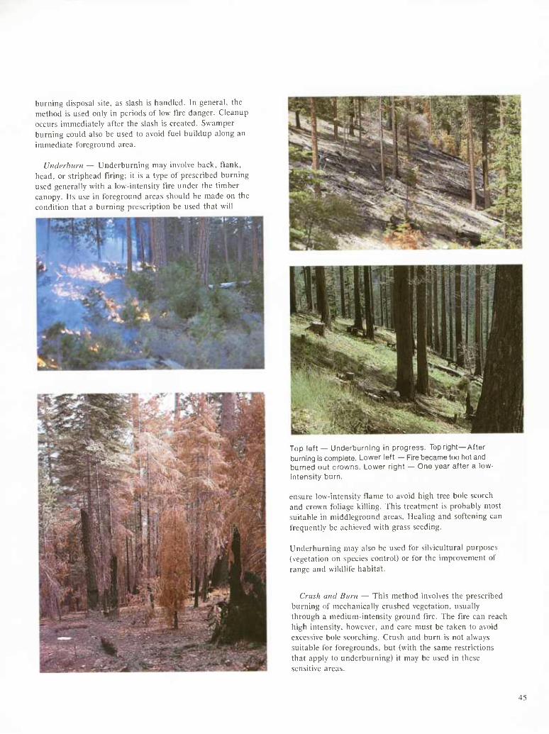
burning disposal site, as slash is handled. In general, the method is used only in periods of low fire danger. Cleanup occurs immediately after the slash is created. Swamper burning could also be used to avoid fuel buildup along an immediate foreground area.
Underhuni — Underburning may involve back, tlank, head, or striphead tiring; it is a type of prescribed burning used generally with a low-intensity fire under the timber canopy. Its use in foreground areas should be made on the condition that a burning prescription be used that will
Top left — Underburning in progress. Top right—After burning is complete. Lower left — Fire became too hot and burned out crowns. Lower right — One year after a low- intensity burn.
ensure low-intensity flame to avoid high tree bole scorch and crown foliage killing. This treatment is probably most suitable in middleground areas. Healing and softening can frequently be achieved with grass seeding.
Underburning may also be used for silvicultural purposes (vegetation on species control) or for the improvement of range and wildlife habitat.
Crush and Burn — This method involves the prescribed burning of mechanically crushed vegetation, usually through a medium-intensity ground tire. The t'lre can reach high intensity, however, and care must be taken to avoid excessive bole scorching. Crush and burn is not always suitable for foregrounds, but (with the same restrictions that apply to underburning) it may be used in these sensitive areas.
45
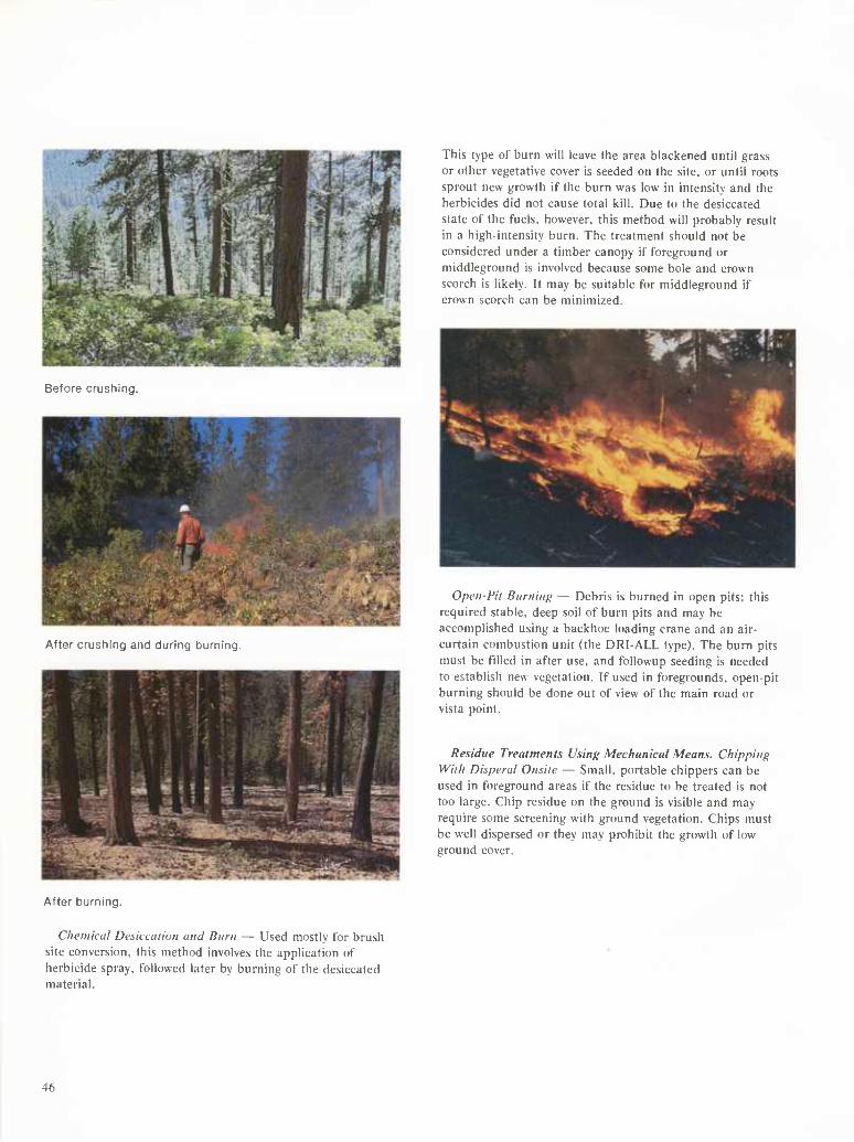
Before crushing.
After crushing and during burning.
This type of burn will leave the area blackened until grass or other vegetative cover is seeded on the site, or until roots sprout new growth if the burn was low in intensity and the herbicides did not cause total kill. Due to the desiccated state of the fuels, however, this method will probably result in a high-intensity burn. The treatment should not be considered under a timber canopy if foreground or middleground is involved because some bole and crown scorch is likely. It may be suitable for middleground if crown scorch can be minimized.
Open-Pit Burning — Debris is burned in open pits; this required stable, deep soil of burn pits and may be accomplished using a backhoe loading crane and an air- curtain combustion unit (the DRI-ALL type). The burn pits must be filled in after use, and followup seeding is needed to establish new vegetation. If used in foregrounds, open-pit burning should be done out of view of the main road or vista point.
Residue Treatments Using Mechanical Means. Chipping With Disperal Onsite — Small, portable chippers can be used in foreground areas if the residue to be treated is not too large. Chip residue on the ground is visible and may require some screening with ground vegetation. Chips must be well dispersed or they may prohibit the growth of low ground cover.
After burning.
Chemical Desiccation and Burn — Used mostly for brush site conversion, this method involves the application of herbicide spray, followed later by burning of the desiccated material.
46
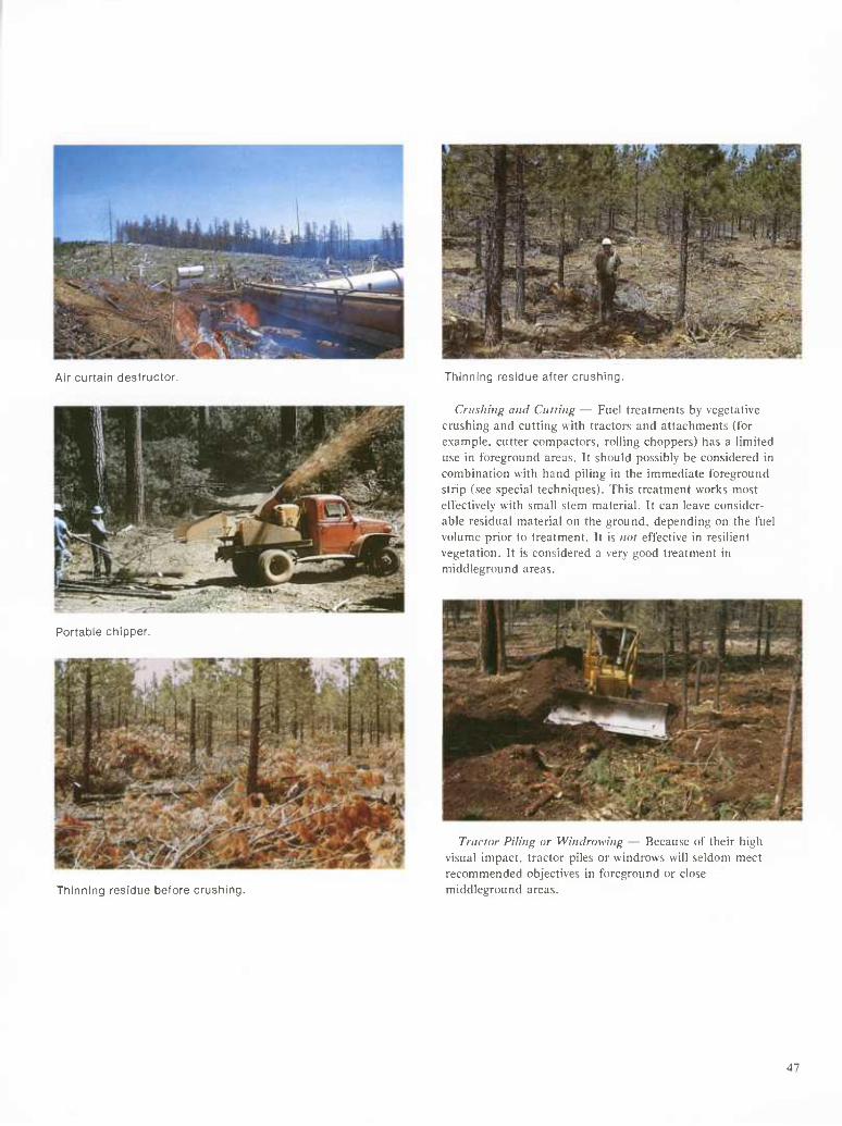
Air curtain destructor. Thinning residue after crushing.
Portable chipper.
Crushing and Culling — Fuel treatments by vegetative crushing and cutting with tractors and attachments (for example, cutter compactors, rolling choppers) has a limited use in foreground areas. It should possibly be considered in combination with hand piling in the immediate foreground strip (see special techniques). This treatment works most effectively with small stem material. It can leave consider- able residual material on the ground, depending on the fuel volume prior to treatment. It is nol effective in resilient vegetation. It is considered a very good treatment in middleground areas.
Thinning residue before crushing.
Traclor Piling or Winclrowing — Because of their high visual impact, tractor piles or windrows will seldom meet recommended objectives in foreground or close middleground areas.
47
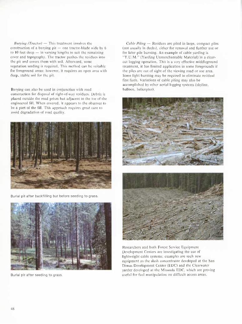
Burying ITractor) — This treatment involves the construction of a burying pit — one tractor-blade wide by 6 to 10 feet deep — in varying lengths to suit the remaining cover and topography. The tractor pushes the residues into the pit and covers them with soil. Afterward, some vegetation seeding is required. This method can be suitable for foreground areas; however, it requires an open area with deep, stable soil for the pit.
Burying can also be u.sed in conjunction with road construction for disposal of right-of-way residues. Debris is placed outside the road prism but adjacent to the toe of the engineered till. When covered, it appears to the observer to be a part of the fill. This approach requires great care to avoid degradation of road quality.
Burial pit after backfilling but before seeding to grass.
Cable Piling — Residues are piled in large, compact piles (not usually in decks), either for removal and further use or for later pile burning. An example of cable yarding is "Y.U.M." (Yarding Unmerchantable Material) in a clear- cut logging operation. This is a very effective middleground treatment, it has limited application in some foregrounds if the piles are out of sight of the viewing road or use area. Some light burning may be required to eliminate residual fine fuels. Variations of cable piling may also be accomplished by other aerial logging systems (skyline, balloon, helicopter).
i^-^.^'-r^ „es..
Burial pit after seeding to grass.
Researchers and both Forest Service Equipment Development Centers are investigating the use of lightweight cable systems; examples are such new equipment as the slash concentrator developed at the San Dimas Development Center (EDC) and the Clearwater yarder developed at the Missoula EDC, which are proving useful for fuel manipulation on difficult access areas.
48
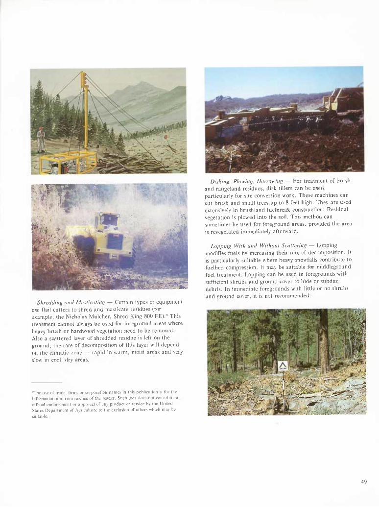
Vil
■ '' '■'•
•.• j ' í
LP& , a
Wiír |gj-..i^>k:-.i&l
^■^ Shredding and Masticating — Certain types of equipment
use flail cutters to shred and masticate residues (for example, the Nicholas Mulcher, Shred King 800 FE)." This treatment cannot always be used for foreground areas where heavy brush or hardwood vegetation need to be removed. Also a scattered layer of shredded residue is left on the ground; the rate of decomposition of this layer will depend on the climatic zone — rapid in warm, moist areas and very slow in cool, dry areas.
"The use of trade, firm, or corporation names in this publication is for the information and convenience of the reader. Such uses does not constitute an official endorsement or approval of any product or service by the United States Department of Agriculture to the exclusion of others which may be
suitable.
Disking. Plowing. Hairowing — For treatment of brush and rangeland residues, disk tillers can be used, particularly for site conversion work. These machines can cut brush and small trees up to 8 feet high. They are used extensively in brushland fuelbreak construction. Residual vegetation is plowed into the soil. This method can sometimes be used for foreground areas, provided the area is revegetated immediately afterward.
Lopping With and Without Scattering — Lopping modifies fuels by increasing their rate of decomposition. It is particularly suitable where heavy snowfalls contribute to fuelbed compression. It may be suitable for middleground fuel treatment. Lopping can be used in foregrounds with sufficient shrubs and ground cover to hide or subdue debris. In immediate foregrounds with little or no shrubs and ground cover, it is not recommended.
í:J^-
49
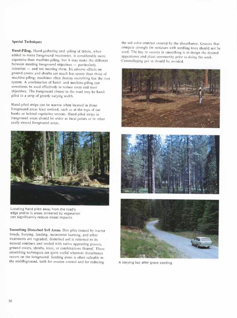
Special Techniques
Hand-Piling. Hand-gathering and -piling of debris, when added to many foreground treatments, is considerably more expensive than machine-piling, but it may make the different between meeting foreground objectives — particularly retention — and not meeting them. Its adverse effects on ground covers and shrubs are much less severe than those of machine-piling; machines often destroy everything but the root system. A combination of hand- and machine-piling can sometimes be used effectively to reduce costs and meet objectives. The foreground closest to the road may be hand- piled in a strip of greatly varying width.
Hand-piled strips can be narrow when located in those foreground areas least noticed, such as at the tops of cut banks or behind vegetative screens. Hand-piled strips in foreground areas should be wider at focal points or in other easily viewed foreground areas.
the soil color contrast created by the disturbance. Grasses that compete strongly for moisture with seedling trees should not be used. The key to success in smoothing is to design the desired appearance and plant community prior to doing the work. Camouflaging per se should be avoided.
Locating hand piles away from the road's edge and/or in areas screened by vegetation can significantly reduce visual impacts.
Smoothing Disturbed Soil Areas. Dirt piles caused by tractor treads, burying, landing, incinerator burning, and other treatments are regraded; disturbed soil is returned to its natural contours and seeded with native appearing grasses, ground covers, shrubs, trees, or combinations thereof. These smoothing techniques are quite useful wherever disturbance occurs on the foreground. Seeding alone is often valuable in the middleground, both for erosion control and for reducing A burying bay after grass seeding.
50
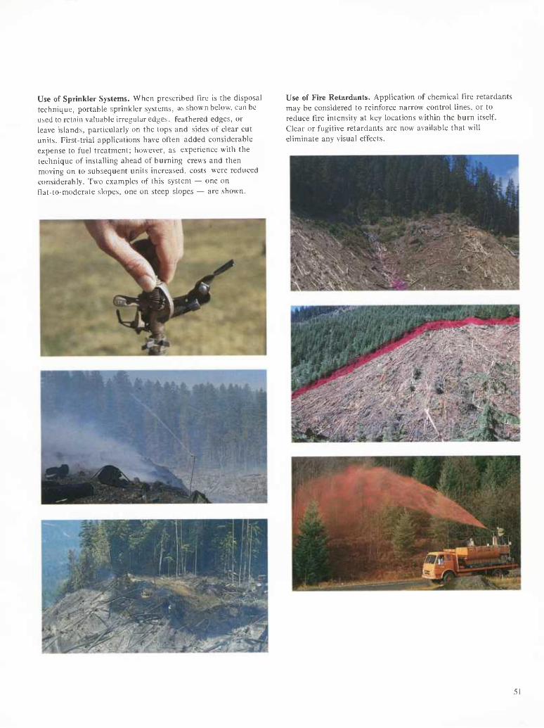
Use of Sprinkler Systems. When prescribed fire is the disposal technique, portable sprinkler systems, as shown below, can be used to retain valuable irregular edges, feathered edges, or leave islands, particularly on the tops and sides of clear cut units. First-trial applications have often added considerable expense to fuel treatment; however, as experience with the technique of installing ahead of burning crews and then moving on to subsequent units increased, costs were reduced considerably. Two examples of this system — one on flat-to-moderate slopes, one on steep slopes — are shown.
Use of Fire Retardants. Application of chemical fire retardants may be considered to reinforce narrow control lines, or to reduce fire intensity at key locations within the burn itself. Clear or fugitive retardants are now available that will eliminate any visual effects.
51
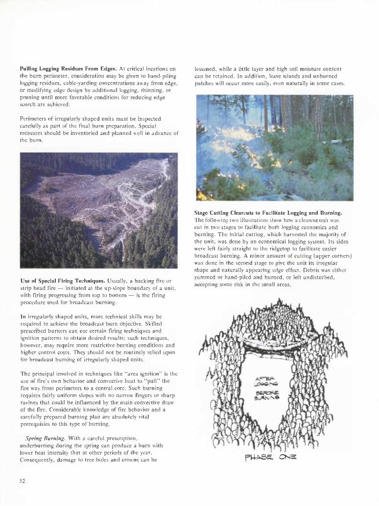
Pulling Logging Residues From Edges. At critical locations on the burn perimeter, consideration may be given to hand-piling logging residues, cable-yarding concentrations away from edge, or modifying edge design by additional logging, thinning, or pruning until more favorable conditions for reducing edge scorch are achieved.
Perimeters of irregularly shaped units must be inspected carefully as part of the final burn preparation. Special measures should be inventoried and planned well in advance of the burn.
lessened, while a little layer and high soil moisture content can be retained. In addition, leave islands and unburned patches will occur more easily, even naturally in some cases.
Use of Special Firing Techniques. Usually, a backing fire or strip head fire — initiated at the up-slope boundary of a unit, with firing progressing from top to bottom — is the firing procedure used for broadcast burning.
In irregularly shaped units, more technical skills may be required to achieve the broadcast burn objective. Skilled prescribed burners can use certain firing techniques and ignition patterns to obtain desired results; such techniques, however, may require more restrictive burning conditions and higher control costs. They should not be routinely relied upon for broadcast burning of irregularly shaped units.
The principal involved in techniques like "area ignition" is the use of fire's own behavior and convective heat to "pull" the fire way from perimeters to a central core. Such burning requires fairly uniform slopes with no narrow fingers or sharp ravines that could be influenced by the main convective draw of the fire. Considerable knowledge of fire behavior and a carefully prepared burning plan are absolutely vital prerequisies to this type of burning.
Spring Burning. With a careful prescription, underburning during the spring can produce a burn with lower heat intensity that at other periods of the year. Consequently, damage to tree boles and crowns can be
Stage Cutting Clearcuts to Facilitate Logging and Burning. The following two illustrations show how a clearcut unit was cut in two stages to facilitate both logging economics and burning. The initial cutting, which harvested the majority of the unit, was done by an economical logging system. Its sides were left fairly straight to the ridgetop to facilitate easier broadcast burning. A minor amount of cutting (upper corners) was done in the second stage to give the unit its irregular shape and naturally appearing edge effect. Debris was either yummed or hand-piled and burned, or left undisturbed, accepting some risk in the small areas.
f|4ASE. ONE
52
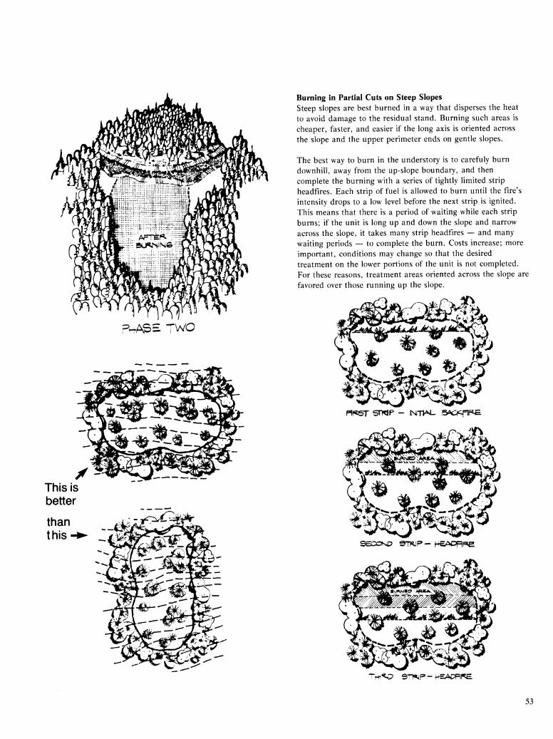
puASE TWO
This is better
than this-i
Burning in Partial Cuts on Steep Slopes Steep slopes are best burned in a way that disperses the heat to avoid damage to the residual stand. Burning such areas is cheaper, faster, and easier if the long axis is oriented across the slope and the upper perimeter ends on gentle slopes.
The best way to burn in the understory is to carefuly burn downhill, away from the up-slope boundary, and then complete the burning with a series of tightly limited strip headfires. Each strip of fuel is allowed to burn until the fire's intensity drops to a low level before the next strip is ignited. This means that there is a period of waiting while each strip burns; if the unit is long up and down the slope and narrow across the slope, it takes many strip headfires — and many waiting periods — to complete the burn. Costs increase; more important, conditions may change so that the desired treatment on the lower portions of the unit is not completed. For these reasons, treatment areas oriented across the slope are favored over those running up the slope.
Pîf^T STWP - MIV^ |5ûC|<flf<E
SECOND en^p-He-ûfcDF=iRe
TH^JP SV^F - ^BAPFIFB.
53
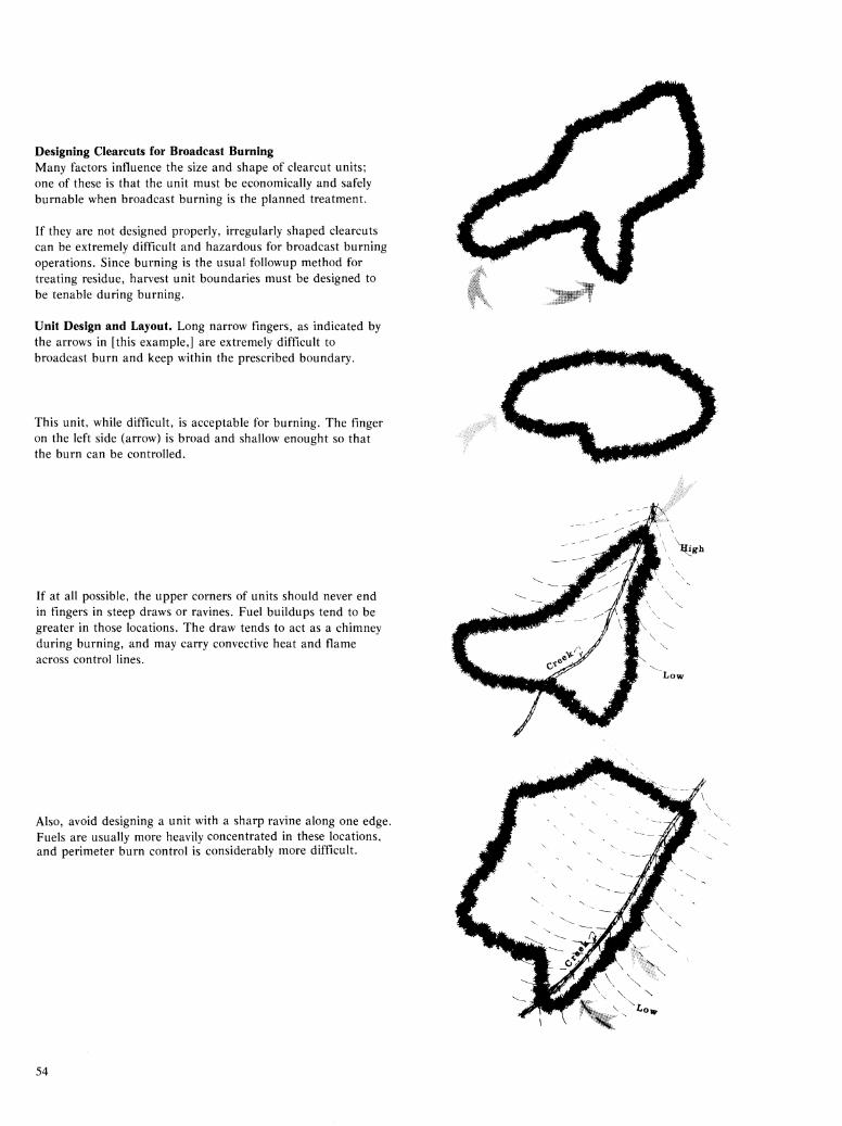
Designing Clearcuts for Broadcast Burning Many factors influence the size and shape of clearcut units; one of these is that the unit must be economically and safely burnable when broadcast burning is the planned treatment.
If they are not designed properly, irregularly shaped clearcuts can be extremely difficult and hazardous for broadcast burning operations. Since burning is the usual followup method for treating residue, harvest unit boundaries must be designed to be tenable during burning.
Unit Design and Layout. Long narrow fingers, as indicated by the arrows in [this example,] are extremely difficult to broadcast burn and keep within the prescribed boundary.
This unit, while difficult, is acceptable for burning. The finger on the left side (arrow) is broad and shallow enought so that the burn can be controlled.
If at all possible, the upper corners of units should never end in fingers in steep draws or ravines. Fuel buildups tend to be greater in those locations. The draw tends to act as a chimney during burning, and may carry convective heat and flame across control lines.
Also, avoid designing a unit with a sharp ravine along one edge. Fuels are usually more heavily concentrated in these locations, and perimeter burn control is considerably more difficult.
54
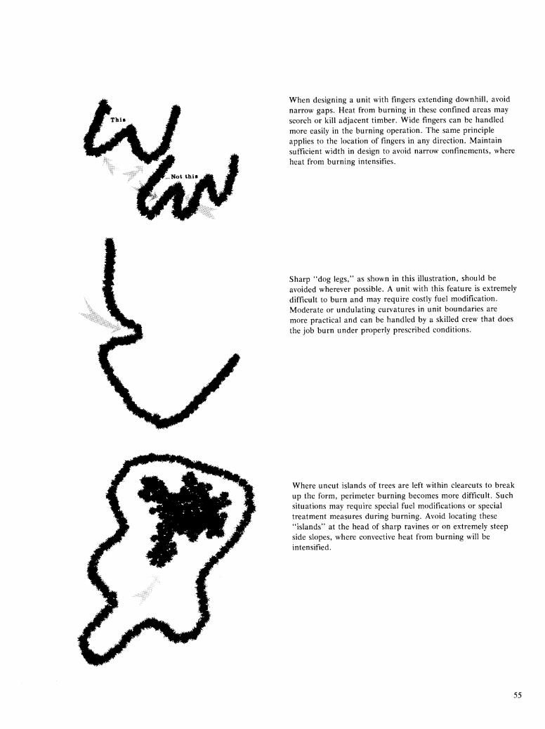
When designing a unit with fingers extending downhill, avoid narrow gaps. Heat from burning in these confined areas may scorch or kill adjacent timber. Wide fingers can be handled more easily in the burning operation. The same principle applies to the location of fingers in any direction. Maintain sufficient width in design to avoid narrow confinements, where heat from burning intensifies.
Sharp "dog legs," as shown in this illustration, should be avoided wherever possible. A unit with this feature is extremely difficult to burn and may require costly fuel modification. Moderate or undulating curvatures in unit boundaries are more practical and can be handled by a skilled crew that does the job burn under properly prescribed conditions.
Where uncut islands of trees are left within clearcuts to break up the form, perimeter burning becomes more difficult. Such situations may require special fuel modifications or special treatment measures during burning. Avoid locating these "islands" at the head of sharp ravines or on extremely steep side slopes, where convective heat from burning will be intensified.
55
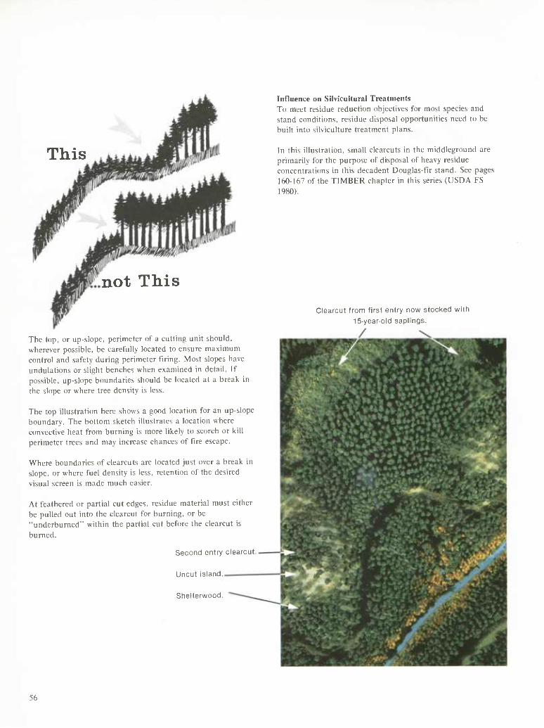
This
not This
The top, or up-slope, perimeter of a cutting unit should, wherever possible, be carefully located to ensure maximum control and safety during perimeter firing. Most slopes have undulations or slight benches when examined in detail. If possible, up-slope boundaries should be located at a break in the slope or where tree density is less.
The top illustration here shows a good location for an up-slope boundary. The bottom sketch illustrates a location where convective heat from burning is more likely to scorch or kill perimeter trees and may increase chances of tire escape.
Where boundaries of clearcuts are located just over a break in slope, or where fuel density is less, retention of the desired visual screen is made much easier.
At feathered or partial cut edges, residue material must either be pulled out into the clearcut for burning, or be "underburned" within the partial cut before the clearcut is burned.
Second entry clearcut
Uncut island.
Shelterwood.
Influence on Silvicultural Treatments To meet residue reduction objectives for most species and stand conditions, residue disposal opportunities need to be built into silviculture treatment plans.
In this illustration, small clearcuts in the middleground are primarily for the purpose of disposal of heavy residue concentrations in this decadent Douglas-fir stand. See pages 160-167 of the TIMBER chapter in this series (USDA FS 1980).
Clearcut from first entry now/ stocked withi
15-year-old saplings.
56
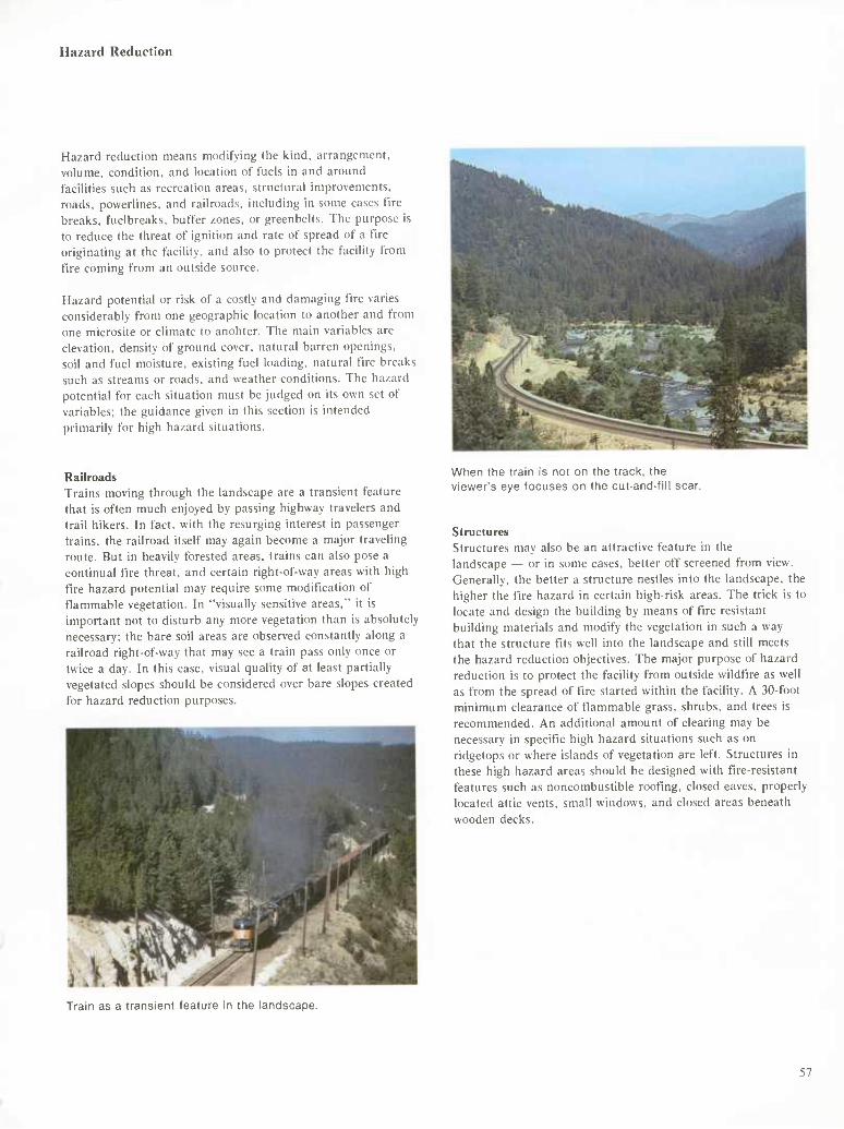
Hazard Reduction
Hazard reduction means modifying the kind, arrangement, volume, condition, and location of fuels in and around facilities such as recreation areas, structural improvements, roads, powerlines, and railroads, including in some cases tire breaks, fuelbreaks, buffer zones, or greenbelts. The purpose is to reduce the threat of ignition and rate of spread of a fire originating at the facility, and also to protect the facility from fire coming from an outside source.
Hazard potential or risk of a costly and damaging fire varies considerably from one geographic location to another and from one microsite or climate to anohter. The main variables are elevation, density of ground cover, natural barren openings. soil and fuel moisture, existing fuel loading, natural fire breaks such as streams or roads, and weather conditions. The hazard potential for each situation must be judged on its own set of variables; the guidance given in this section is intended primarily for high hazard situations.
Railroads Trains moving through the landscape are a transient feature that is often much enjoyed by passing highway travelers and trail hikers. In fact, with the resurging interest in passenger trains, the railroad itself may again become a major traveling route. But in heavily forested areas, trains can also pose a continual fire threat, and certain right-of-way areas with high fire hazard potential may require some modification of flammable vegetation. In "visually sensitive areas," it is important not to disturb any more vegetation than is absolutely necessary; the bare soil areas are observed constantly along a railroad right-of-way that may see a train pass only once or twice a day. In this case, visual quality of at least partially vegetated slopes should be considered over bare slopes created for hazard reduction purposes.
When the train Is not on the track, the vieviier's eye focuses on the cut-and-fii! scar.
Structures Structures may also be an attractive feature in the landscape — or in some cases, better off screened from view. Generally, the better a structure nestles into the landscape, the higher the tire hazard in certain high-risk areas. The trick is to locate and design the building by means of fire resistant building materials and modify the vegetation in such a way that the structure fits well into the landscape and still meets the hazard reduction objectives. The major purpose of hazard reduction is to protect the facility from outside wildfire as well as from the spread of fire started within the facility. A 30-foot minimum clearance of flammable grass, shrubs, and trees is recommended. An additional amount of clearing may be necessary in specific high hazard situations such as on ridgetops or where islands of vegetation are left. Structures in these high hazard areas should be designed with fire-resistant features such as noncombustible roofing, closed eaves, properly located attic vents, small windows, and closed areas beneath wooden decks.
Train as a transient feature in the landscape.
57
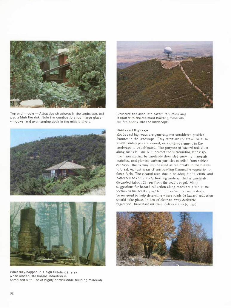
Top and middle — Attractive structures in the landscape, but also a high fire risk. Note the combustible roof, large glass windows, and overhanging deck in the middle photo.
Structure has adequate hazard reduction and is built with fire-resistant building materials, but fits poorly into the landscape.
Roads and Highways Roads and highways are generally not considered positive features in the landscape. They often are the travel route for which landscapes are viewed, or a distant element in the landscape to be mitigated. The purpose of hazard reduction along roads is usually to protect the surrounding landscape from fires started by carelessly discarded smoking materials, matches, and glowing carbon particles expelled from vehicle exhausts. Roads may also be used as fuelbreaks in themselves to break up vast areas of surrounding flammable vegetation or down fuels. The cleared area should be adequate in width, and patterned to contain any burning material that is carelessly discarded (about 25 feet from the road's edge). Many suggestions for hazard reduction along roads are given in the section on fuelbreaks. page 67. Fire occurrence maps should be reviewed to help determine where roadside hazard reduction should take place. In lieu of clearing away desirable vegetation, tlre-retardant chemicals can also be used.
What may happen in a high fire-danger area when inadequate hazard reduction is combined with use of highly combustible building materials.
58
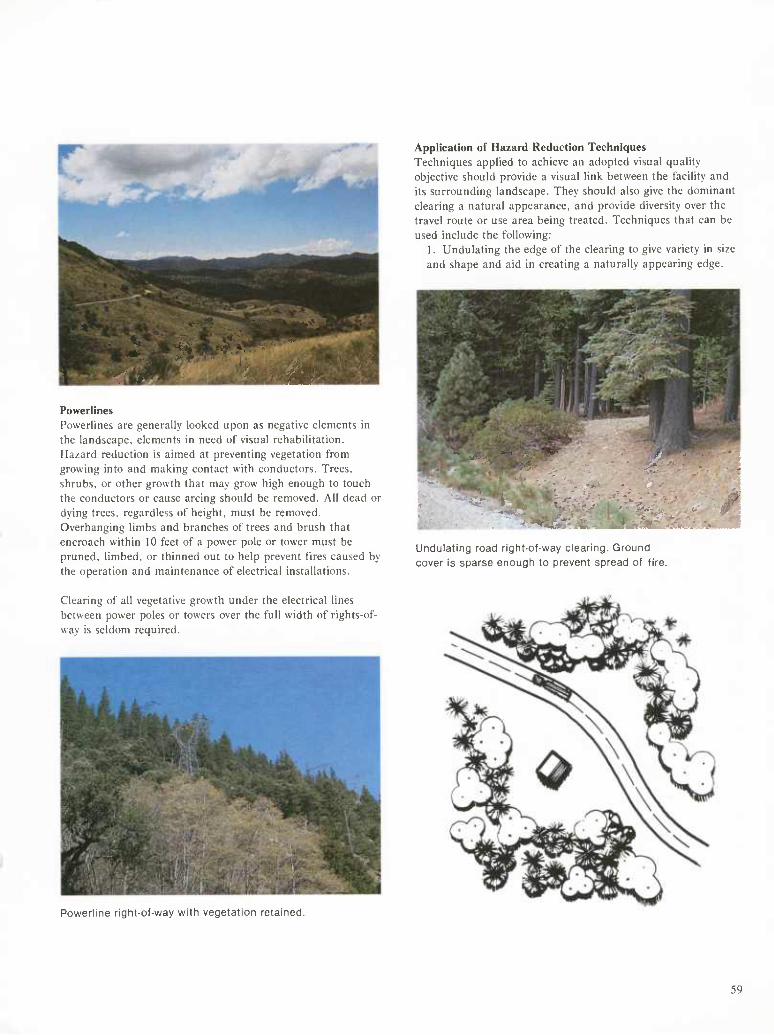
HMlSii
..- ;v t -■.'. ' ",\'. ■■■■' ■■ './"»^H'-':'^
Powerlines Powerlines are generally looked upon as negative elements in the landscape, elements in need of visual rehabilitation. Hazard reduction is aimed at preventing vegetation from growing into and making contact with conductors. Trees, shrubs, or other growth that may grow high enough to touch the conductors or cause arcing should be removed. All dead or dying trees, regardless of height, must be removed. Overhanging limbs and branches of trees and brush that encroach within 10 feet of a power pole or tower must be pruned, limbed, or thinned out to help prevent fires caused by the operation and maintenance of electrical installations.
Application of Hazard Reduction Techniques Techniques applied to achieve an adopted visual quality objective should provide a visual link between the facility and its surrounding landscape. They should also give the dominant clearing a natural appearance, and provide diversity over the travel route or use area being treated. Techniques that can be used include the following:
1. Undulating the edge of the clearing to give variety in size and shape and aid in creating a naturally appearing edge.
Undulating road right-of-way clearing. Ground cover is sparse enough to prevent spread of fire.
Clearing of all vegetative growth under the electrical lines between power poles or towers over the full width of rights-of- way is seldom required.
Powerline right-of-way with vegetation retained.
59
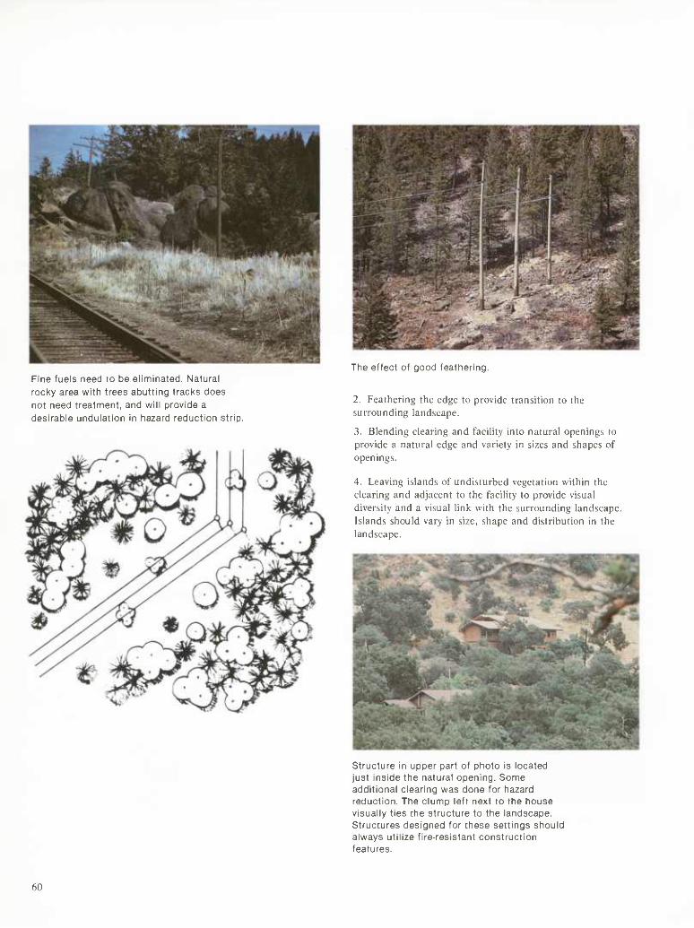
Fine fuels need to be eliminated. Natural rocky area with trees abutting tracks does not need treatment, and will provide a desirable undulation in hazard reduction strip.
The effect of good feathering.
2. Feathering the edge to provide transition to the surrounding landscape.
3. Blending clearing and facility into natural openings to provide a natural edge and variety in sizes and shapes of openings.
4. Leaving islands of undisturbed vegetation within the clearing and adjacent to the facility to provide visual diversity and a visual link with the surrounding landscape. Islands should vary in size, shape and distribution in the landscape.
Structure in upper part of photo is located just inside the natural opening. Some additional clearing was done for hazard reduction. The clump left next to the house visually ties the structure to the landscape. Structures designed for these settings should always utilize fire-resistant construction features.
60
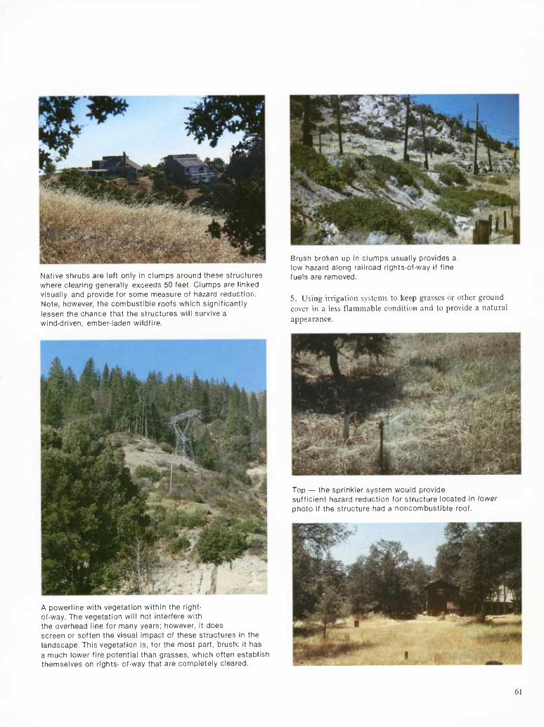
Native shrubs are left only in clumps around these structures where clearing generally exceeds 50 feet. Clumps are linked visually and provide for some measure of hazard reduction. Note, however, the combustible roofs which significantly lessen the chance that the structures will survive a wind-driven, ember-laden wildfire.
Brush broken up in clumps usually provides a low hazard along railroad rights-of-way if fine fuels are removed.
5. Using irrigation systems to keep grasses or other ground cover in a less flammable condition and to provide a natural appearance.
Top — the sprinkler system would provide sufficient hazard reduction for structure located in lower photo if the structure had a noncombustible roof.
A powerline with vegetation within the right- of-way. The vegetation will not interfere with the overhead line for many years; however, it does screen or soften the visual impact of these structures in the landscape. This vegetation is, for the most part, brush; it has a much lower fire potential than grasses, which often establish themselves on rights- of-way that are completely cleared.
61
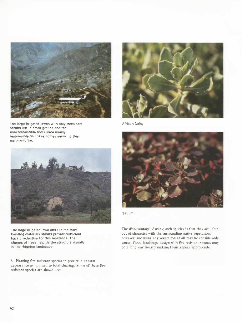
The large irrigated lawns with only trees and shrubs left in small groups and the noncombustible roofs were mainly responsible for these homes surviving this major wildfire.
African Daisy.
The large irrigated lawn and fire-resistant building materials should provide sufficient hazard reduction for this residence. The clumps of trees help tie the structure visually to the ridgetop landscape.
Sedum.
The disadvantage of using such species is that they are often out of character with the surrounding native vegetation: however, not using any vegetation at all may be considerably worse. Good landscape design with fire-resistant species may go a long way toward making them appear appropriate.
6. Planting fire-resistant species to provide a natural appearance as opposed to total clearing. Some of these fire- resistant species are shown here.
62
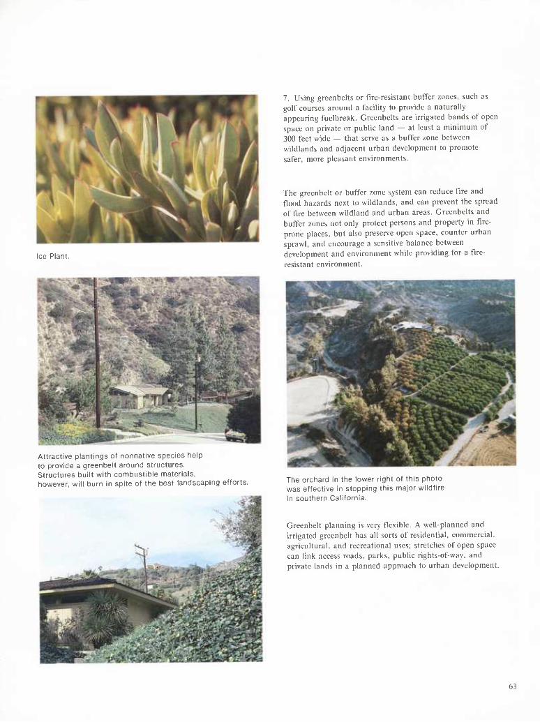
Ice Plant.
Attractive plantings of nonnative species help to provide a greenbelt around structures. Structures built vi/ith combustible materials, however, will burn in spite of the best landscaping efforts.
7. Using greenbelts or t'lre-resistant buffer zones, such as golf courses around a facility to provide a naturally appearing fuelbreak. Greenbelts are irrigated bands of open space on private or public land — at least a minimum of 300 feet wide — that serve as a buffer zone between wildlands and adjacent urban development to promote safer, more pleasant environments.
The greenbelt or buffer zone system can reduce fire and flood hazards next to wildlands, and can prevent the spread of fire between wildland and urban areas. Greenbelts and buffer zones not only protect persons and property in fire- prone places, but also preserve open space, counter urban sprawl, and encourage a sensitive balance between development and environment while providing for a fire- resistant environment.
The orchard in the lower right of this photo was effective in stopping this major wildfire in southern California.
Greenbelt planning is very flexible. A well-planned and irrigated greenbelt has all sorts of residential, commercial, agricultural, and recreational uses; stretches of open space can link access roads, parks, public rights-of-way, and private lands in a planned approach to urban development.
63
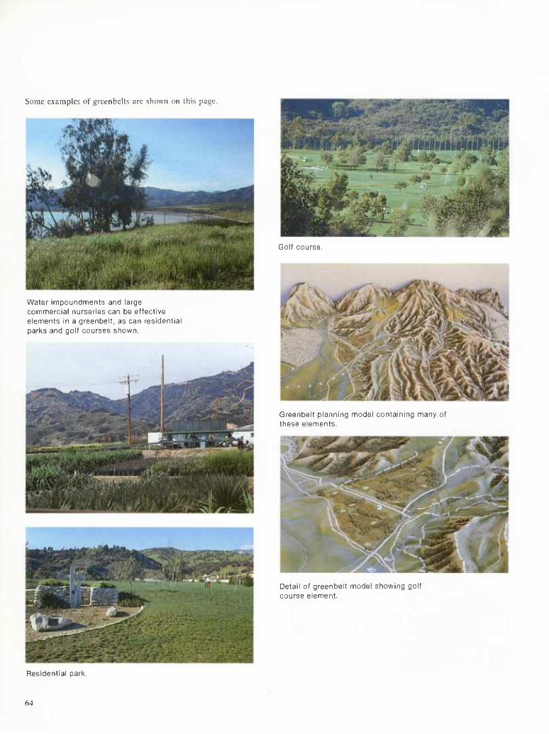
Some examples of greenbelts are shown on this page.
Water impoundments and large commercial nurseries can be effective elements in a greenbelt, as can residential parks and golf courses shown.
Golf course.
Greenbelt planning model containing many of these elements.
Detail of greenbelt model showing golf course element.
Residential parl<.
64
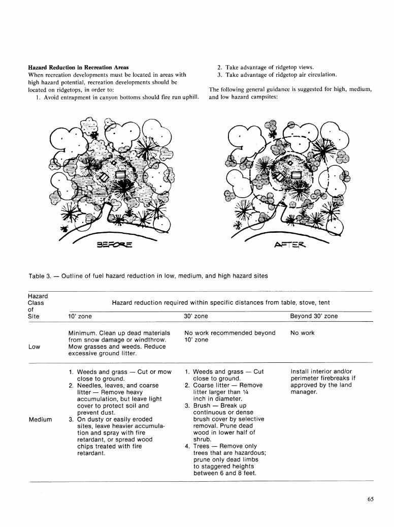
Hazard Reduction in Recreation Areas When recreation developments must be located in areas with high hazard potential, recreation developments should be located on ridgetops, in order to:
1. Avoid entrapment in canyon bottoms should fire run uphill.
2. Take advantage of ridgetop views. 3. Take advantage of ridgetop air circulation.
The following general guidance is suggested for high, medium, and low hazard campsites:
BERXE AprEp.
Table 3. — Outline of fuel hazard reduction in low, nnediunn, and high hazard sites
Hazard Class of Site
Hazard reduction required within specific distances from table, stove, tent
10' zone 30' zone Beyond 30' zone
Low
Mininnum. Clean up dead nnaterials fronn snow dannage or windthrow. Mow grasses and weeds. Reduce excessive ground litter.
No work reconnnnended beyond 10' zone
No work
1. Weeds and grass — Cut or mow close to ground.
2. Needles, leaves,^and coarse litter — Remove heavy accumulation, but leave light cover to protect soil and prevent dust.
Medium 3. On dusty or easily eroded sites, leave heavier accumula- tion and spray with fire retardant, or spread wood chips treated with fire retardant.
3.
Weeds and grass — Cut close to ground. Coarse litter — Remove litter larger than y^ inch in diameter. Brush — Break up continuous or dense brush cover by selective removal. Prune dead wood in lower half of shrub.
4. Trees — Remove only trees that are hazardous; prune only dead limbs to staggered heights between 6 and 8 feet.
Install interior and/or perimeter firebreaks if approved by the land manager.
65

Table 3. — Outline of fuel hazard reduction in low, medium, and high hazard sites (Continued)
Hazard Class of Site
Hazard reduction required within specific distances from table, stove, tent
10' zone 30' zone Beyond 30' zone
1. Weeds and grass — Same as for medium hazard sites.
2. Needles, leaves, and coarse litter — Same as for medium hazard sites.
3. Brush — Prune portions of or remove entire shrub if closer
High than 10 feet from stove. Selectively remove up to 80% of brush cover. Prune all deadwood.
4. Remove only trees that are hazardous; prune dead limbs to staggered heights between 6 and 8 feet.
1. Weeds and grass — Same for medium hazard sites above.
2. Coarse litter — Same as for medium hazard sites above.
3. Brush — Selectively remove up to 60% of brush cover. Prune all dead wood. Thin live limbs in lower half of shrubs.
4. Trees — Same action as for medium hazard sites above.
Install interior and perimeter firebreak system if approved by the land managers.
Other techniques for reducing hazards in recreational areas include:
1. The use of nontoxic durable fire restardants on highly flammable fuels on steep slopes and poor growing sites. Note that this is costly, and would only be justified when a large capital investment must be protected. 2. Irrigation with sewage that has been through a tertiary treatment plant. This will maintain the green vegetation, decrease its flammability, and improve the appearance of the landscape.
Distribution patterns are a key factor in determining where the green areas will be: the more irregular the pattern, the more natural and interesting the view.
66
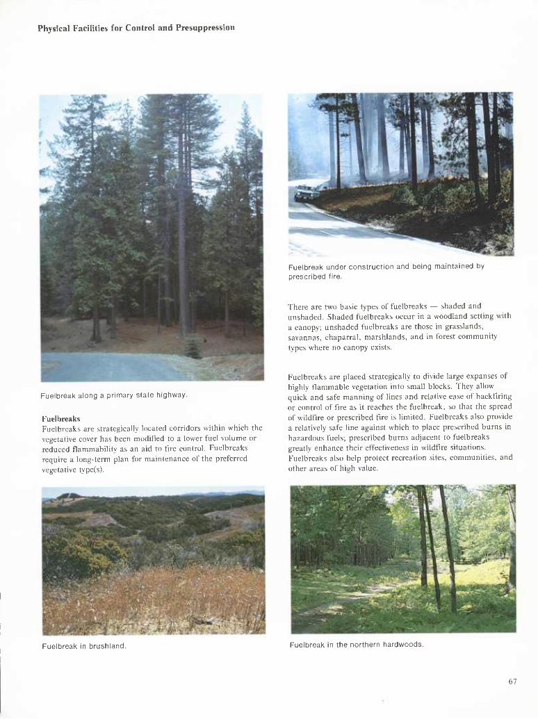
Physical Facilities for Control and Presuppression
Fuelbreak along a primary state highway.
Fuelbreaks Fuelbreaks are strategically located corridors within which the vegetative cover has been modified to a lower fuel volume or reduced flammability as an aid to fire control. Fuelbreaks require a long-term plan for maintenance of the preferred vegetative type(s).
Fuelbreak under construction and being maintained by prescribed fire.
There are two basic types of fuelbreaks — shaded and unshaded. Shaded fuelbreaks occur in a woodland setting with a canopy; unshaded fuelbreaks are those in grasslands, savannas, chaparral, marshlands, and in forest community types where no canopy exists.
Fuelbreaks are placed strategically to divide large expanses of highly flammable vegetation into small blocks. They allow quick and safe manning of lines and relative ease of backfiring or control of fire as it reaches the fuelbreak, so that the spread of wildfire or prescribed fire is limited. Fuelbreaks also provide a relatively safe line against which to place prescribed burns in hazardous fuels; prescribed burns adjacent to fuelbreaks greatly enhance their effectiveness in wildfire situations. Fuelbreaks also help protect recreation sites, communities, and other areas of high value.
Fuelbreak in brushland. Fuelbreak in the northern hardwoods.
67
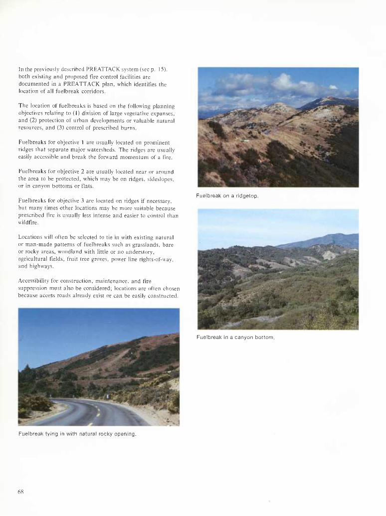
In the previously described PREATTACK system (see p. 15). both existing and proposed fire control facilities are documented in a PREATTACK plan, which identifies the location of all fuelbreal< corridors.
The location of fueibreaks is based on the following planning objectives relating to (1) division of large vegetative expanses, and (2) protection of urban developments or valuable natural resources, and (3) control of prescribed burns.
Fueibreaks for objective 1 are usually located on prominent ridges that separate major watersheds. The ridges are usually easily accessible and break the forward momentum of a fire.
Fueibreaks for objective 2 are usually located near or around the area to be protected, which may be on ridges, sideslopes. or in canyon bottoms or fiats.
Fueibreaks for objective 3 are located on ridges if necessary, but many times other locations may be more suitable because prescribed fire is usually less intense and easier to control than wildfire.
Fuelbreak on a ridgetop.
Locations will often be selected to tie in with existing natural or man-made patterns of fueibreaks such as grasslands, bare or rocky areas, woodland with little or no understory, agricultural fields, fruit tree groves, power line rights-of-way, and highways.
Accessibility for construction, maintenance, and fire suppression must also be considered; locations are often chosen because access roads already exist or can be easily constructed.
Fuelbreak in a canyon bottom.
Fuelbreak tying in with natural rocky opening.
68
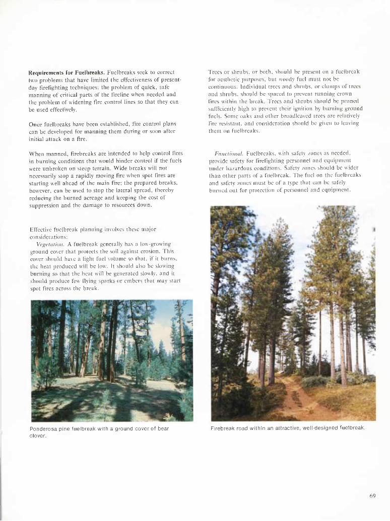
Requirements for Fuelbreaks. Fuelbreaks seek to correct two problems that have Hmited the effectiveness of present- day t'lretlghting techniques: the problem of quick, safe manning of critical parts of the fireline when needed and the problem of widening fire control lines so that they can be used effectively.
Once fuelbreaks have been established, tire control plans can be developed for manning them during or soon after initial attack on a t'lre.
Trees or shrubs, or both, should be present on a fuclbreak for aesthetic purposes, but woody fuel must not be continuous. Individual trees and shrubs, or clumps of trees and shrubs, should be spaced to prevent running crown tires within the break. Trees and shrubs should be pruned sufficiently high to prevent their ignition by burning ground fuels. Some oaks and other broadleaved trees are relatively fire resistant, and consideration should be given to leaving them on fuelbreaks.
When manned, firebreaks are intended to help control fires in burning conditions that would hinder control if the fuels were unbroken on steep terrain. Wide breaks will not necessarily stop a rapidly moving fire when spot fires are starting well ahead of the main fire; the prepared breaks, however, can be used to stop the lateral spread, thereby reducing the burned acreage and keeping the cost of suppression and the damage to resources down.
Effective fuclbreak planning involves these major considerations:
Vem'lalion. A fuclbreak generally has a low-growing ground cover that protects the soil against erosion. This cover should have a light fuel volume so that, if it burns, the heat produced will be low. It should also be slowing burning so that the heat will be generated slowly, and it should produce few flying sparks or embers that may start spot fires across the break.
Fiiiulidinil. Fuelbreaks. with safety zones as needed, provide safety for firefighting personnel and equipment under hazardous conditions. Safety zones should be wider than other parts of a fiielbreak. The fuel on the fuelbreaks and safety zones must be of a type that can be safely burned out for protection of personnel and equipment.
Ponderosa pine fuelbreak with a ground cover of bear clover.
Firebreak road within an attractive, weil-designed fuelbreak.
69
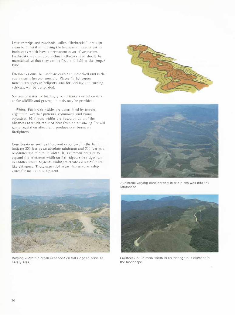
Interior strips and roadbeds, called "tlrebrcaks." are kept clean to mineral soil during the fire season, in contrast to Fuelbreaks which have a permanent cover of vegetation. Firebreaks are desirable within t'uelbreaks. and should be maintained so that they can be Hred and held at the proper time.
Fuelbreaks must be made accessible to motorized and aerial ec|uipment whenever possible. Places for helicopter touchdown spots or heliports, and for parking and turning vehicles, will be designated.
Sources of water tor loading ground tankers or helicopters, or for wildlife and grazing animals may be provided.
Willi II. Fuelbreak widths are determined by terrain, vegetation, weather patterns, economies, and visual objectives. Minimum widths are based on data of the distances at which radiated heat from an advancing fire will ignite vegetation ahead and produce skin burns on firefighters.
Considerations such as these and experience in the field indicate 200 feet as an absolute minimum and 300 feet as a recommended minimum width. It is common practice to expand the minimum width on flat ridges, side ridges, and in saddles where adjacent drainages create extreme funnel- like chimneys, The.se expanded areas also serve as safety zones for men and equipment.
Fuelbreak varying considerably in width tits well into the landscape.
Varying width fuelbreak expanded on flat ridge to serve as safety area.
Fuelbreak of uniform width is an incongruous element in the landscape.
70
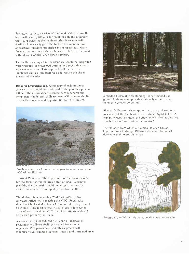
For visual reasons, a variety of fuelbreak widths is usually best, with some parts of a fuelbreak at only the minimum width and others at the maximum that is economically feasible. This variety gives the fuelbreak a more natural appearance, provided the design is nonrepetitious. Many times expansions in width can be used to link the fuelbreak with adjacent natural open-space patterns.
The fuelbreak design and maintenance should be integrated with programs of prescribed burning and fuel reduction in adjacent vegetation. This approach will increase the functional width of the fuelbreak and reduce the visual contrast of the edge.
Resource Considerations. A summary of major resource concerns that should be considered in the planning process follows. The information presented here is general and incomplete; the interdisciplinary team will compose the list of specific concerns and opportunities for each project.
HM^M^M^M^^^J^^!^^.^^
^H ^^^^^^:; ■;. i.i^- ^^
^H . .u.'* ," _ . " ..jfl 1
^^^^^^^^^^^^^^E'> ' 9
tk...
A shaded fuelbreak with standing timber thinned and ground fuels reduced provides a visually attractive, yet functional-protection corridor.
Shaded fuelbreaks, where appropriate, are preferred over unshaded fuelbreaks because their visual impact is less. A canopy screens or softens the effect as seen from a distance Harsh lines and contrasts arc minimi/ed.
The distance from which a fuelbreak is seen has an important role in design. Different visual attributes will dominate at different distances.
Fuelbreak borrows from natural appearance anü :.__._ :' •_ VQO of modification.
Visual Resources. The appearance of fuelbreaks should borrow from natural features within an area. Whenever possible, the fuelbreak should be designed to meet or exceed the adopted visual quality objective (VQO).
Visual absorption capability (VAC) will identify any expected difficulties in meeting the VQO. Fuelbreaks should not be located in low VAC areas unless they cannot be avoided. The most serious visual effects will occur in areas of low or medium VAC; therefore, attention should be focused primarily on them.
A mosaic pattern of reduced fuel along a fuelbreak is preferable to a linear fuelbreak carved from dense vegetation. (See photos on p. 75). This approach will minimize visual contrasts between treated and untreated areas.
Foreground — Within this zone, detail is very noticeable.
71
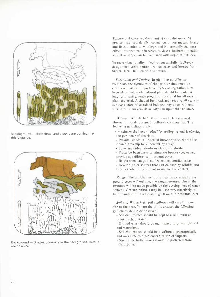
Middleground — Both detail and shapes are dominant at this distance.
/T\A M'ln 'y{\ JV- r^
Background — Shapes dominate in the background. Details are obscured.
Texture and color are dominant at close distances. At greater distances, details become less important and l'omis and lines dominate. Middleground is potentially the most critical distance /one in which to view a I'uelbreak; details as well as shape can be compared with adjacent hillsides.
To meet visual quality objectives suceesslully. luelbreak design nuist subdue unnatural contrasts and borrow from natural tbrm, line, color, and texture.
Vcf;criiiii)ii iiiul Tiiulicr. In planning an elTectivc luelbreak. the dynamics of change over time must be considered. Alter the preferred types of vegetation have been identified, a silvicultural plan should be made. A long-term maintenance program is essential for all woody plant material. A shaded fuelbreak may require 50 years to achieve a state of sustained balance; any uncoordinated short-term management activity can upset that balance.
Wihiliic. Wildlife habitai can usually be enhanced through properly designed fuelbreak construction, fhe following guidelines apply.
• Ma.ximize the linear "edge" by scalloping and feathering the perimeter of clearings; • Provide islands of preferred browse species within the cleared area (up to 30 percent by area); • Leave individual shrubs or clumps of .shrubs; • Prescribe burn areas to stimulate browse species and provide age difference in ground cover; • Retain some snags if no tlrc-control conflict exists; • Develop water sources that can be used by wildlife and livestock when they are not in use for tire control.
Range. The establishment of a healthy perennial grass ground cover will enhance the range resource. Use of the resource will be made possible by the development of water sources. Grazing animals may be used very effectively to help maintain the fuelbreak vegetation at a desirable level.
Soil anil Watershed. Soil attributes w ill vary from one site to the ne.xt. Where the soil is erosive, the following guidelines should be observed.
• Soil disturbance should be kept to a minimum or quickly rehabilitated; • Ground cover should be maintained to protect the soil and watershed; • Soil disturbance should be distributed geographically and over time to avoid concentration of impacts; • Streamside buffer zones should be protected from
disturbance.
72
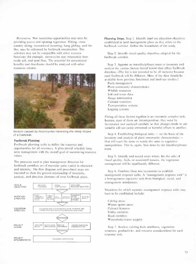
Recreen ion. New recreation opportunities may arise by providing access and opening vegetation. Hiking, cross- country skiing, recreational motoring, hang gliding, and the like, may be enhanced by f'uelbreak construction. The activities may not be compatible with other resource functions; tor example, motorcycles may traumatize deer, erode soil, and start fires. The potential For recreational benefits and drawbacks should be analyzed with other resources criteria.
Erosion caused by motorcycles traversing the steep slopes of a fuelbreak.
Fuelbreak Planning Fuelbreak planning seeks to define the concerns and opportunities for all resources. A plan should schedule long- term management with the overall goal of maximizing resource values.
The processes used to plan management direction for fuelbreak corridors are of necessity quite varied in character and intensity. The flow diagram and procedural steps are intended to show the general relationship of inventory, analysis, and direction elements of most fuelbreak plans.
GOALS OBJECTIVES
INVENTORY & ANALYSIS
FUELBREAK DIRECTION
PROJECT DESIGN
PROJECT IMPLEMENTATION
SELECTED FUELBREAK
BROAD ADOPTED VOOs
ASSOCIATED RESOURCE OBJECTIVES
PLANT COMMUNITY CHARACTER- ISTICS
TIMBER STAND FACTORS
VISUAL RESOURCE
ASSOCIAIED RESOURCES
TRANSPOR- TATION & LOGGING SYSTEMS
RESIDUES & FUELS
FUELBREAK DIRECTION WITHIN BIOLOGICAL POTENTIAL AND COORDINATED WITH ASSOCIATED RESOURCE OBJECTIVES
LANSCAPE DESIGN
SILVICULTURAL PRESCRIPTION
RESIDUE TREATMENTS
LOGGING VEGETATION CONVERSION PLAN
FUELBREAK CONSTRUCTION
Planning Steps. Step 1. Identify land-use allocation objectives established in land management plans as they relate to the fuelbreak corridor. Define the boundaries of the study.
Step 2. Identify visual quality objectives adopted for the fuelbreak corridor.
Step 3. Appoint an interdisciplinary team to inventory and analyze the various factors (listed below) that affect fuelbreak direction. (The list is not intended to be all inclusive because each fuelbreak will be different. Most of the data should be available from previous functional and land-use studies.)
Fuels management Plant community characteristics Wildlife resources Soil and water data Range information Cultural resources Transportation systems Logging systems
Fitting all these factors together is an extremely complex task, because most of them are interdependent; they must be inventoried and analyzed carefully so that changes made in one variable will not cause unwanted or harmful effects in another.
Step 4. Establishing biological units — on the basis of the inventory and analysis of plant community characteristics — that will react the same or nearly the same to vegetative manipulation. This is, again, best done by the interdisciplinary team.
Step 5. Identify and record areas where, for the sake of visual quality, fuels, or associated reasons, the vegetation management will be significantly different.
Step 6. Combine these two inventories to establish management response units. A "management response unit" is a homogeneous vegetative unit from biological, social, and management standpoints.
Situations for which separate management response units may have to be established include:
Calving areas Winter sports areas Cultural features »■ Utility corridors [^oad corridors Watersheds (water supply)
Step 7. Analyze existing fuels attributes, vegetation structure, productivity, and resource considerations for each response unit.
73
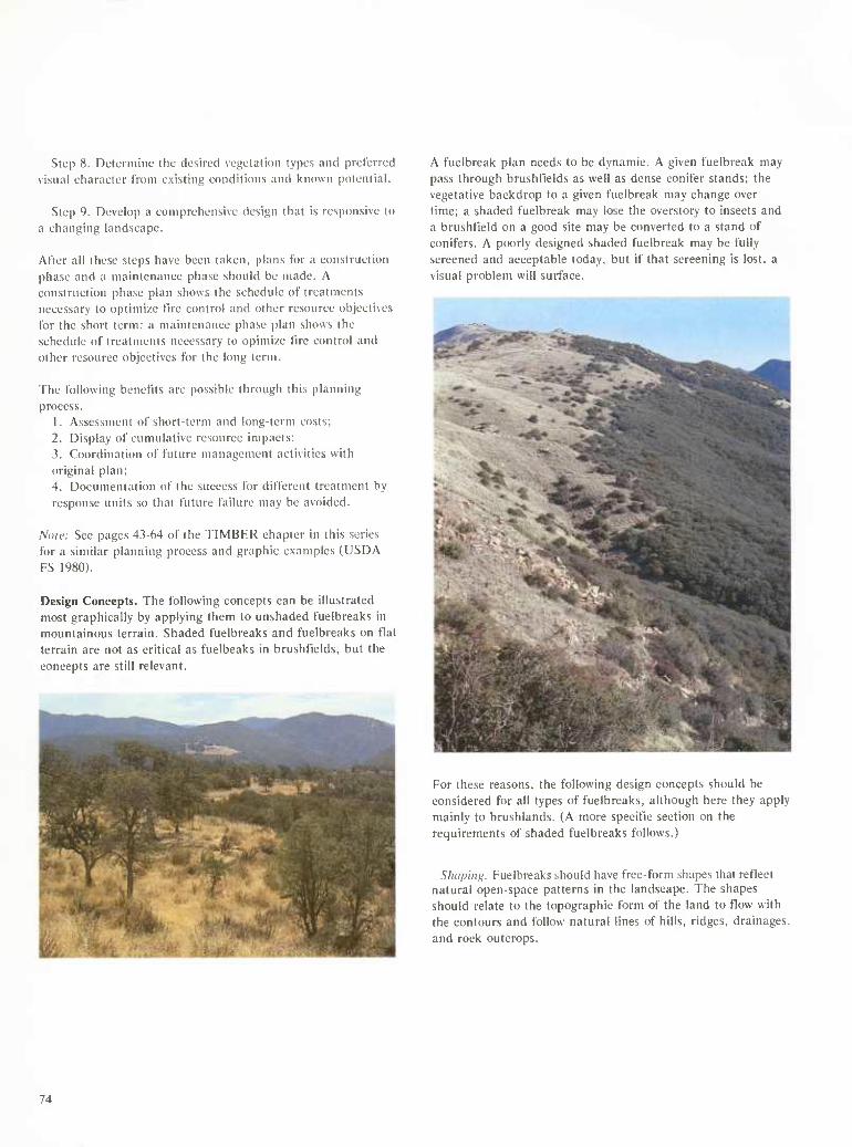
Step 8. Determine the desired vegetation types and preferred visual eharaeter from existing conditions and known potential.
Step 9. Develop a comprehensive design thai is responsive to a changing landscape.
Alter all these steps have been taken, plans tor a construction phase and a maintenance phase should be made. A construction phase plan shows the schedule of treatments necessary to optimi/c fire control and other resource objectives for the short term; a maintenance phase plan shows the schedule of treatments necessary to opimi/e fire control and other resource objectives for the long term.
The following benefits are possible through this planning process.
1. Assessment of short-term and long-term costs; 2. Display of cumulative resource impacts; 3. Coordination of future management activities with original plan; 4. Documentation of the success for different treatment by response units so that future failure may be avoided.
Nole: See pages 43-64 of the TIMBER chapter in this scries for a similar planning process and graphic examples (USDA FS 1980).
Design Concepts. The following concepts can be illustrated most graphically by applying them to unshaded fuelbreaks in mountainous terrain. Shaded fuelbreaks and fuelbreaks on flat terrain are not as critical as fuelbeaks in brusht'ields, but the concepts are still relevant.
A fuelbreak plan needs to be dynamic. A given fuelbreak may pass through brusht'ields as well as dense conifer stands; the vegetative backdrop to a given fuelbreak may change over time; a shaded fuelbreak may lose the overstory to insects and a brushtleld on a good site may be converted to a stand of conifers. A poorly designed shaded fuelbreak may be fully screened and acceptable today, but if that screening is lost, a visual problem will surface.
For these reasons, the following design concepts should be considered for all types of fuelbreaks, although here they apply mainly to brushlands. (A more specific section on the requirements of shaded fuelbreaks follows.)
Shaping. Fuelbreaks should have free-form shapes that reflect natural open-space patterns in the landscape. The shapes should relate to the topographic form of the land to flow with the contours and follow natural lines of hills, ridges, drainages, and rock outcrops.
74
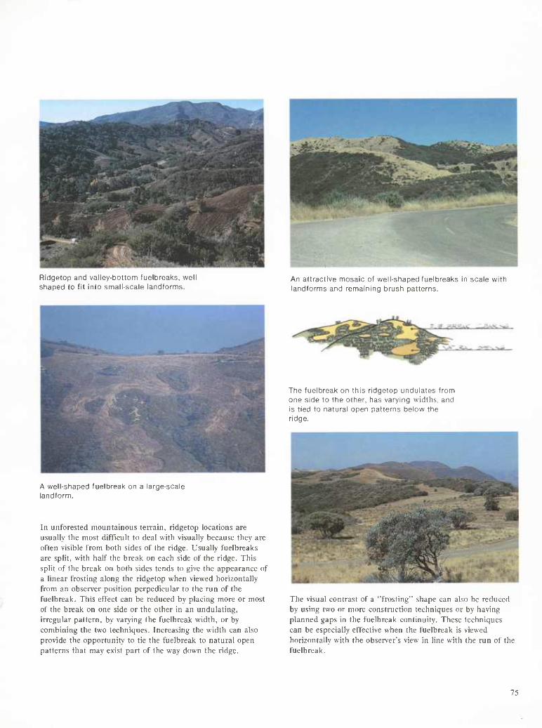
Ridgetop and valley-bottom fuelbreaks, well shaped to fit into small-scale landforms.
An attractive mosaic of well-shaped fuelbreaks in scale with landforms and remaining brush patterns.
A well-shaped fuelbreak on a large-scale landform.
In unforested mountainous terrain, ridgetop locations are usually the most difficult to deal with visually because they are often visible from both sides of the ridge. Usually fuelbreaks are split, with half the break on each side of the ridge. This split of the break on both sides tends to give the appearance of a linear frosting along the ridgetop when viewed horizontally from an observer position perpedicular to the run of the fuelbreak. This effect can be reduced by placing more or most of the break on one side or the other in an undulating, irregular pattern, by varying the fuelbreak width, or by combining the two techniques. Increasing the width can also provide the opportunity to tie the fuelbreak to natural open patterns that may exist part of the way down the ridge.
The fuelbreak on this ridgetop undulates from one side to the other, has varying widths, and is tied to natural open patterns below the ridge.
The visual contrast of a 'Trosting" shape can also be reduced by using two or more construction techniques or by having planned gaps in the fuelbreak continuity. These techniques can be especially effective when the fuelbreak is viewed horizontally with the observer's view in line with the run of the fuelbreak.
75
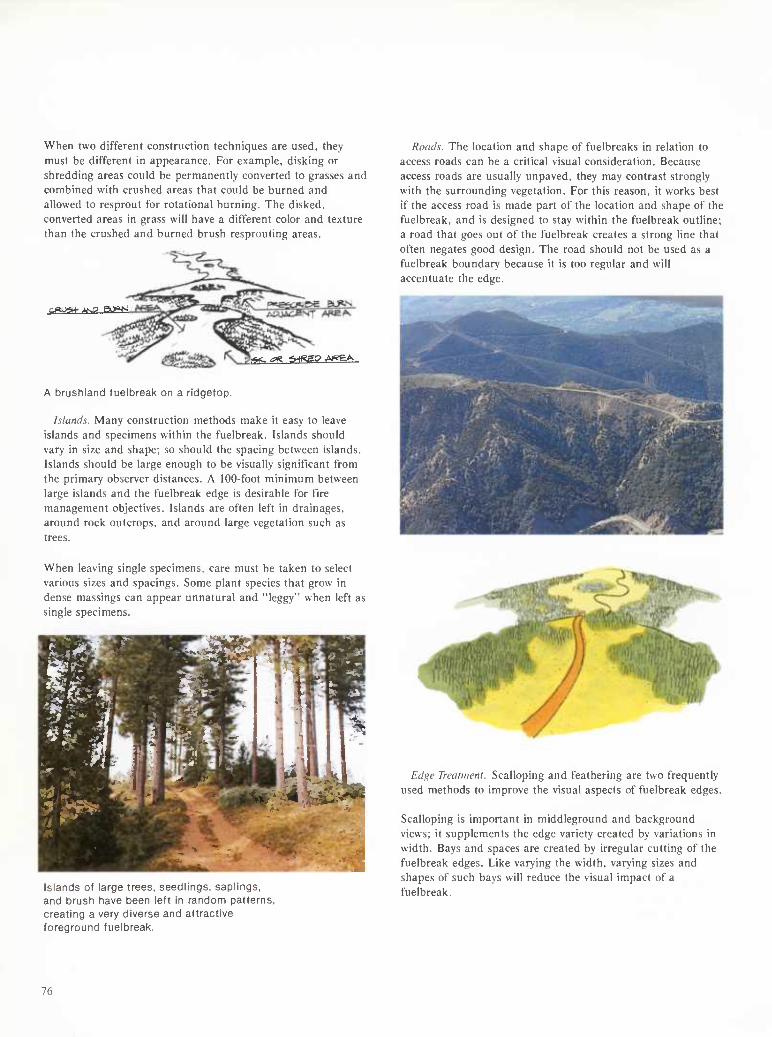
When two different construction techniques are used, they must be different in appearance. For example, disking or shredding areas could be permanently converted to grasses and combined with crushed areas that could be burned and allowed to resprout for rotational burning. The disked, converted areas in grass will have a different color and texture than the crushed and burned brush resprouting areas.
.-jaj^n- ^o Bi>^
y^ an ^.^fgeg A»eA
A brushland fuelbreak on a ridgetop.
Islands. Many construction methods make it easy to leave islands and specimens within the fuelbreak. Islands should vary in size and shape: so should the spacing between islands. Islands should be large enough to be visually significant from the primary observer distances. A 100-foot minimum between large islands and the fuelbreak edge is desirable for fire management objectives. Islands are often left in drainages, around rock outcrops, and around large vegetation such as trees.
Roads. The location and shape of fuelbreaks in relation to access roads can be a critical visual consideration. Because access roads are usually unpaved, they may contrast strongly with the surrounding vegetation. For this reason, it works best if the access road is made part of the location and shape of the fuelbreak, and is designed to stay within the fuelbreak outline; a road that goes out of the fuelbreak creates a strong line that often negates good design. The road should not be used as a fuelbreak boundary because it is too regular and will accentuate the edge.
When leaving single specimens, care must be taken to select various sizes and spacings. Some plant species that grow in dense massings can appear unnatural and "leggy" when left as single specimens.
81 m ■■■■■1 K^^^^^^SSP ^ -v« ' ^^l^^B^
CS^SEBEIBí- r mm ^^?^P^~ f ü^^ HT gfeWik. 1 . \\ j^ll^JBB^H "^«'ÄL
^^^^^BH^^^^ ' l^t^BM i:^4#^- .^S£5i|
rm LLL^*^^ ^
Islands of large trees, seedlings, saplings, and brush have been left in random patterns, creating a very diverse and attractive foreground fuelbreak.
Edge Treatment. Scalloping and feathering are two frequently used methods to improve the visual aspects of fuelbreak edges.
Scalloping is important in middleground and background views; it supplements the edge variety created by variations in width. Bays and spaces are created by irregular cutting of the fuelbreak edges. Like varying the width, varying sizes and shapes of such bays will reduce the visual impact of a fuelbreak.
76
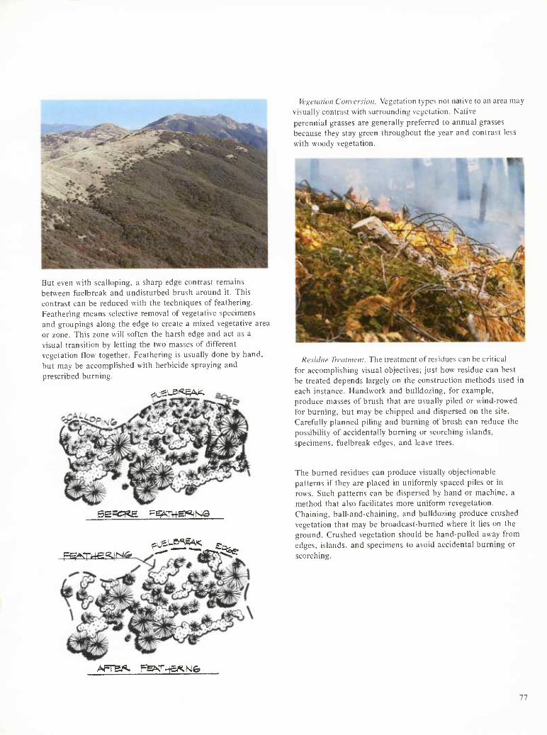
But even with scalloping, a sharp edge contrast remains between fuelbreak and undisturbed brush around it. This contrast can be reduced with the techniques of feathering. Feathering means selective removal of vegetative specimens and groupings along the edge to create a mixed vegetative area or zone. This zone will soften the harsh edge and act as a visual transition by letting the two masses of different vegetation tlow together. Feathering is usually done by hand, but may be accomplished with herbicide spraying and prescribed burning.
.^eus^^A^
gepCKE g^THeSMQ
Fg^THefi
Vegelalitm Conversion. Vegetation types not native to an area may visually contrast with surrounding vegetation. Native perennial grasses are generally preferred to annual grasses because they stay green throughout the year and contrast less with woody vegetation.
Residue Treatment. The treatment of residues can be critical for accomplishing visual objectives; just how residue can best be treated depends largely on the construction methods used in each instance. Handwork and bulldozing, for example, produce masses of brush that are usually piled or wind-rowed for burning, but may be chipped and dispersed on the site. Carefully planned piling and burning of brush can reduce the possibility of accidentally burning or scorching islands, specimens, fuelbreak edges, and leave trees.
The burned residues can produce visually objectionable patterns if they are placed in uniformly spaced piles or in rows. Such patterns can be dispersed by hand or machine, a method that also facilitates more uniform revegetation. Chaining, ball-and-chaining, and bulldozing produce crushed vegetation that may be broadcast-burned where it lies on the ground. Crushed vegetation should be hand-pulled away from edges, islands, and specimens to avoid accidental burning or scorching.
AfTBi<» T=fe&Cia^isiei
77
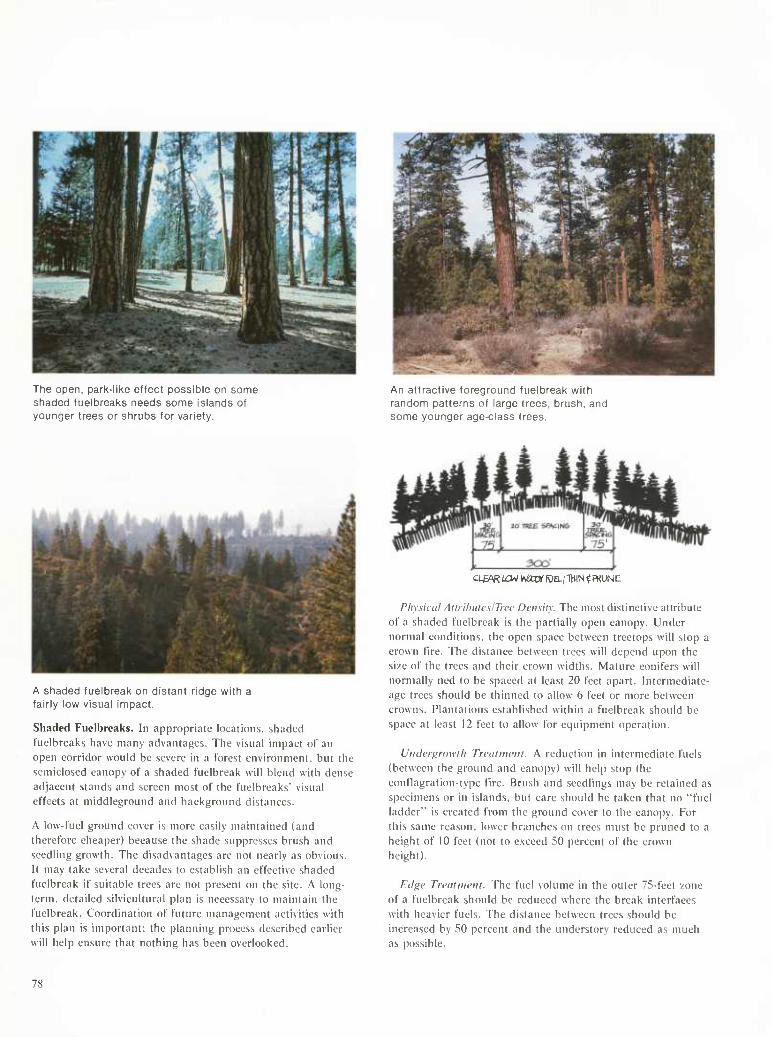
The open, park-like effect possible on some sfiaded fuelbreaks needs some islands of younger trees or shrubs for variety.
An attractive foreground fuelbreak with random patterns of large trees, brush, and some younger age-class trees.
A shaded fuelbreak on distant ridge with a fairly low visual impact.
Shaded Fuelbreaks. In appropriate locations, shaded fuelbreaks have many advantages. The visual impact of an open corridor would be severe in a forest environment, but the semiclosed canopy of a shaded fuelbreak will blend with dense adjacent stands and screen most of the fuelbreaks' visual effects at middleground and background distances.
A low-fuel ground cover is more easily maintained (and therefore cheaper) because the shade suppresses brush and seedling growth. The disadvantages are not nearly as obvious. It may take several decades to establish an effective shaded fuelbreak if suitable trees are not present on the site. A long- term, detailed silvicultural plan is necessary to maintain the fuelbreak. Coordination of future management activities with this plan is important; the planning process described earlier will help ensure that nothing has been overlooked.
a&\R i£w wtornia; THIN Í PKUN E
Phy.sical AtlrihuteslTree Density. The most distinctive attribute of a shaded fuelbreak is the partially open canopy. Under normal conditions, the open space between treetops will stop a crown fire. The distance between trees will depend upon the size of the trees and their crown widths. Mature conifers will normally ned to be spaced at least 20 feet apart. Intermediate- age trees should be thinned to allow 6 feet or more between crowns. Plantations established within a fuelbreak should be space at least 12 feet to allow for equipment operation.
Uiiderfirowth Trcalim'iii. A reduction in intermediate fuels (between the ground and canopy) will help stop the eontlagration-type fire. Brush and seedlings may be retained as specimens or in islands, but care should be taken that no "fuel ladder" is created from the ground cover to the canopy. For this same reason, lower branches on trees must be pruned to a height of 10 feet (not to exceed 50 percent of the crown height).
Eilgc Trcdiiiicni. The fuel volume in the outer 75-feet zone of a fuelbreak should be reduced where the break interfaces with heavier fuels. The distance between trees should be increased by 50 percent and the understory reduced as much as possible.
78
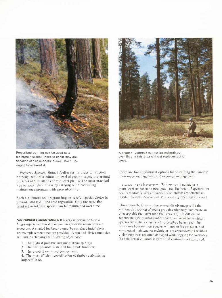
Prescribed burning can be used as a maintenance tool. Incense cedar may die because of fire impacts; a small tiand line mighit have saved it.
Preferred Species. Shaded t'uelbrcaks. in order to Function properly, require a minimum level of ground vegetation around the trees and in islands of mid-level plants. The most practical way to accomplish this is by carrying out a continuing maintenance program with prescribed fire.
Such a maintenance program implies careful species choice in ground, mid-level, and tree vegetation. Only the most fire- resistant or tolerant species can be maintained over time.
Silvicultural Considerations. It is very important to have a long-range silvicultural plan that integrates the needs of other resources. A shaded fuelbreak cannot be sustained indefinitely unless replacement trees are provided. A detailed silvicultural plan will aid in achieving the following objectives:
1. The highest possible sustained visual quality; 2. The best possible sustained fuelbreak function; 3. The greatest sustained timber yield; 4. The most efficient coordination of timber activities on adjacent land.
A shaded fuelbreak cannot be maintained over time in this area without replacement of trees.
There are two silvicultural options for sustaining the canopy: uneven-age management and even-age management.
Uneven-Age Management. This approach maintains a multi-level timber stand throughout the fuelbreak. Regeneration occurs randomly. Trees of various size classes are selected at regular intervals for removal. The resulting openings are small.
This approach, however, has several disadvantages: (1) the random distribution of young growth understory may create an unacceptable fuel level for a fuelbreak; (2) it is difficult to regenerate species intolerant of shade, and most fire-resistant species are in that category; (3) prescribed burning will be hazardous because most species will not be fire resistant, and mechanical maintenance techniques are expensive; (4) residual understory trees are often damaged while logging the overstory; (5) small clear-cut units may result if caution is not exercised.
79
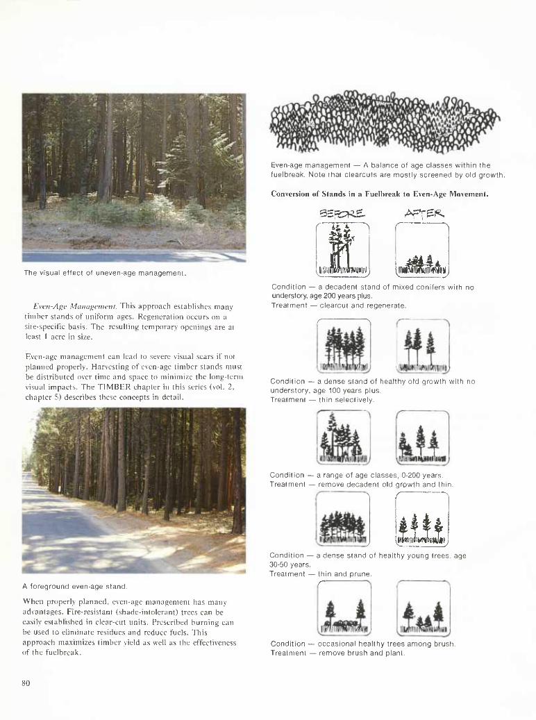
Even-age management — A balance of age classes within the fuelbreak. Note that clearcuts are mostly screened by old growth.
Conversion of Stands in a Fuell)reak to Even-Age Movement.
9E5::R£- AFT^l^
The visual effect of uneven-age management.
Even-Age Maitagemetit. This approach establi.shes many timber stand.s of uniform ages. Regeneration occurs on a site-specific basis. The resulting temporary opennigs are at least 1 acre in size.
Even-age management can lead to severe visual scars if not planned properly. Harvesting of even-age timber stands must be distributed over time and space to minimize the long-term visual impacts. The TIMBER chapter in this series (vol. 2, chapter 5) describes these concepts in detail.
r **¿ ^
1 jiiiiiS
n mwm wSaàu^
Condition — a decadent stand of mixed conifers with no understory, age 200 years plus. Treatment — clearcut and regenerate.
Condition - understory, Treatment -
- a dense stand of healthy old growth with no age 100 years plus. - thin selectively.
Condition - Treatment
a range of age classes, 0-200 years. - remove decadent old growth and thin
WllliilKWllilJllJll^
A foreground even-age stand.
When properly planned, even-age management has many advantages. Fire-resistant (shade-intolerant) trees can be easily established in clear-cut units. Prescribed burning can be used to eliminate residues and reduce fuels. This approach maximizes timber yield as well as the effectiveness of the fuelbreak.
Condition — a dense stand of healthy young trees, age 30-50 years. Treatment — thin and prune.
r
Condition - Treatment
occasional healthy trees among brush. - remove brush and plant.
80
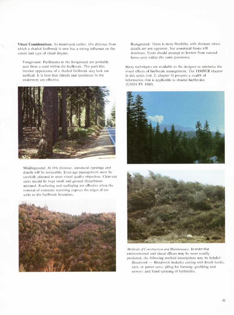
Visual Considerations. As mentioned earlier, this distance from which a shaded fuelbreak is seen has a strong influence on the extent and type of visual impact.
Foreground: Fuelbreaks in the foreground are probably seen from a road within the fuelbreak. The park-like interior appearance of a shaded fuelbreak may look too artifical. It is here that islands and specimens in the understorv are effective.
Middleground: At this distance, unnatural openings and details will be noticeable. Even-age management must be carefully planned to meet visual quality objectives. Clear-cut units should be kept small and ground disturbance minimal. Feathering and scalloping are effective when the removal of overstory screening exposes the edges of cut units or the fuelbreak boundary.
¿Í.1
Background: There is more flexibility with distance views; details are not apparent, but unnatural forms will dominate. Units should attempt to borrow from natural forms seen within the same panorama.
Many techniques are available to the designer to minimize the visual effects of fuelbreak management. The TIMBER chapter in this series (vol. 2, chapter 5) presents a wealth of information that is applicable to shaded fuelbreaks (USDA FS 1980).
Methods ofConsiniclion and Mainiename. In order thai environmental and visual effects may be more readily predicted, the following method descriptions may be helpful:
Handwork — Handwork includes cutting with brush hooks, axes, or power saws; piling for burning; grubbing root crowns; and hand-spraying of herbicides.
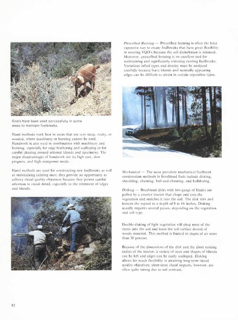
■►♦■I- ' ''•Í«Í'f'Íifí¿t'''''Íj* ¿
•<'■««.
'^.■^l.
Goats have been used successfully in some areas to maintain fuelbreaks.
Hand methods work best in areas that are very steep, rocky, or wooded, where machinery or burning cannot be used. Handwork is also used in combination with machinery and burning, especially for edge feathering and scalloping or for careful clearing around selected islands and specimens. The major disadvantages of handwork are its high cost, slow progress, and high manpower needs.
PrcscrihcJ Burning — Prescribed burning is often the least expensive way to create fuelbreaks that have great flexibility in meeting VQO's because the soil disturbance is minimal. Moreover, prescribed burning is an excellent tool for maintaining and significantly widening existing fuelbreaks. Variations infuel types and density must be analyzed carefully because leave islands and naturally appearing edges can be difficult to attain in certain vegetation types.
Hand methods are used for constructing new fuelbreaks as well as maintaining existing ones; they provide an opportunity to achieve visual quality objectives because they permit careful attention to visual detail, especially in the treatment of edges and islands.
Mrchaiiicul — The most prevalent mechanical fuelbreak construction methods in brushland fuels include disking, shredding, chaining, ball-and-chaining, and bulldozing.
Disking — Brushland disks with two gangs of blades are pulled by a crawler tractor that chops and cuts the vegetation and mulches it into the soil. The disk stirs and loosens the topsoil to a depth of 8 to 16 inches. Disking usually requires several passes, depending on the vegetation and soil type.
Double-disking of light vegetation will chop most of the stems into the soil and leave the soil surface devoid of woody material. This method is limited to slopes of no more than 30 percent.
Because of the dimensions of the disk and the short turning radius of the tractor, a variety of sizes and shapes of islands can be left and edges can be easily scalloped. Disking allows for much flexibility in attaining long-term visual quality objectives; short-term visual impacts, however, are often quite strong due to soil contrast.
82
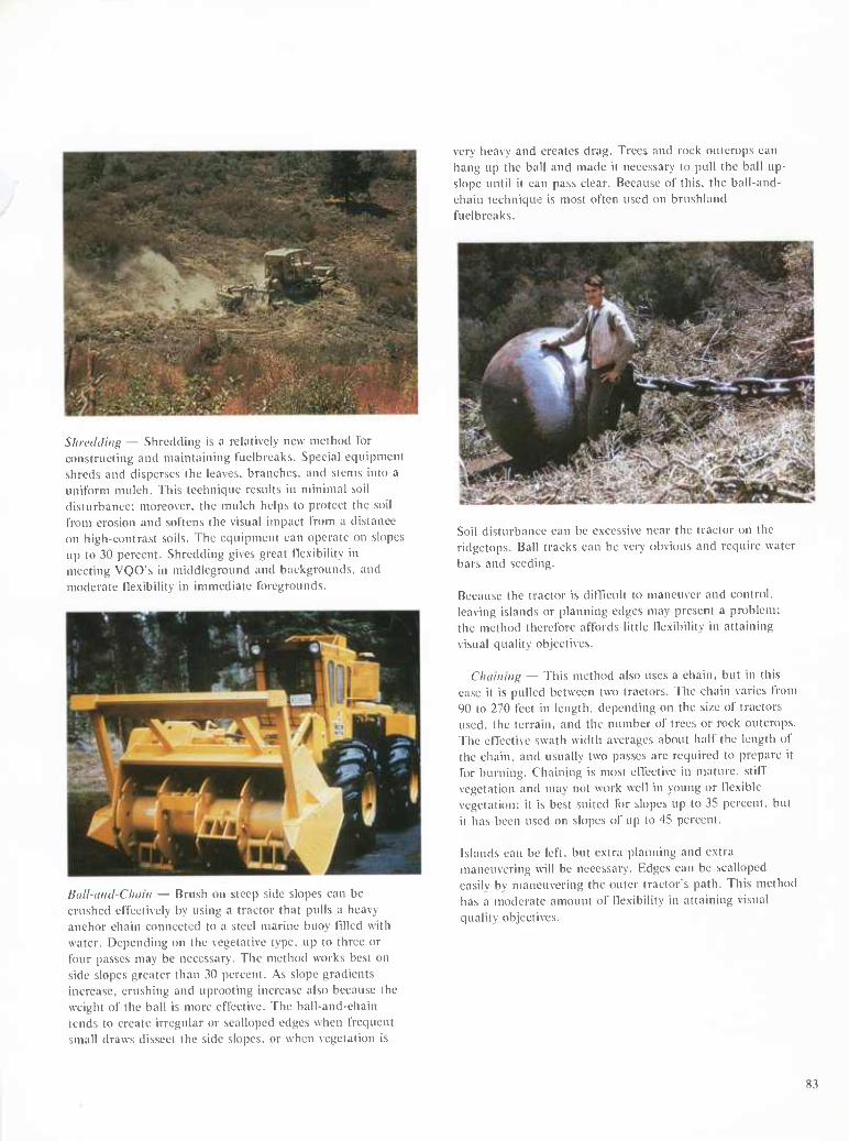
Shrcíhliiifi — Shredding is a relatively new method tor constructing and maintaining t'uelbreaks. Special equipment shreds and disperses the leaves, branches, and stems into a uniform mulch. This technique results in minimal soil disturbance: moreover, the mulch helps to protect the soil from erosion and softens the visual impact from a distance on high-contrast soils. The equipment can operate on slopes up to 30 percent. Shredding gives great tle.xibility in meeting VQO's in middleground and backgrounds, and moderate flexibility in immediate foregrounds.
Ball-ainl-Chiiiii — Brush on steep side slopes can be crushed effectively by using a tractor that pulls a heavy anchor chain connected to a steel marine buoy tilled with water. Depending on the vegetative type, up to three or four passes may be necessary. The method works best on side slopes greater than 30 percent. As slope gradients increase, crushing and uprooting increase also because the weight of the ball is more effective. The ball-and-chain tends to create irregular or scalloped edges when frequent small draws dissect the side slopes, or when vegetation is
very heavy and creates drag. Trees and rock outcrops can hang up the ball and made it necessary to pull the ball up- slope until it can pass clear. Because of this, the ball-and- chain technique is most often used on brushland fuelbreaks.
Soil disturbance can be excessive near the tractor on the ridgctops. Ball tracks can be very obvious and require water bars and seeding.
Because the tractor is difficult to maneuver and control, leaving islands or planning edges may present a problem; the method therefore affords little flexibility in attaining visual quality objectives.
Cliiiiniiif; — This method also uses a chain, but in this case it is pulled between two tractors, 'fhc chain varies from 90 to 270 feet in length, depending on the si/c of tractors used, the terrain, and the number of trees or rock outcrops. The effective swath width averages about half the length of the chain, and usually two passes are required to prepare it for burning. Chaining is most effective in mature, stiff vegetation and may not work well in young or flexible vegetation; it is best suited for slopes up to 35 percent, but it has been used on slopes of up to 45 percent.
Islands can be left, but extra planning and extra maneuvering will be necessary. Edges can be scalloped easily by maneuvering the outer tractor's path. This method has a moderate amount of flexibility in attaining visual quality objectives.
83
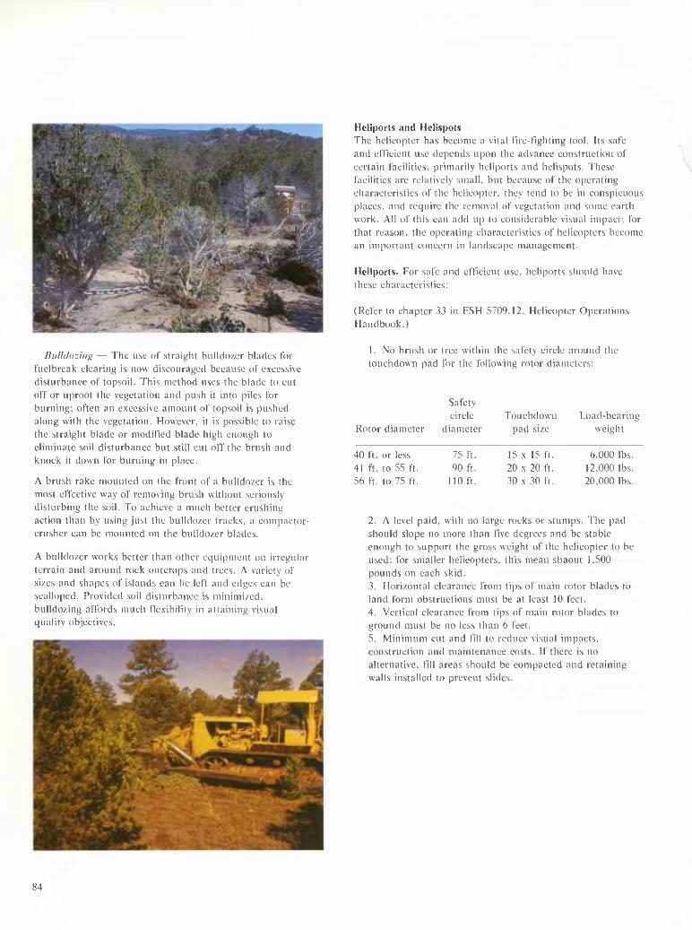
Biillíloziiifí — The use of straight bulldozer blades lor fuelbreak clearing is now discouraged because ot excessive disturbance ol' topsoil. This method uses the blade to cut oft' or uproot the vegetation and push it into piles For burning; often an excessive amount of topsoil is pushed along with the vegetation. However, it is possible to raise the straight blade or modified blade high enough to eliminate soil disturbance but still cut off the brush and knock it down for burning in place.
A brush rake mounted on the front of a bulldo/er is the most effective way of removing brush without seriously disturbing the soil. To achieve a much better crushing action than by using just the bulldozer tracks, a compactor- crusher can be mounted on the bulldozer blades.
A bulldozer works better than other equipment on irregular terrain and around rock outcrops and trees. A variety of sizes and shapes of islands can be left and edges can be scalloped. Provided soil disturbance is minimized, bulldozing affords much tlexibilily in attaining visual quality objectives.
Heliports and Helispots The helicopter has become a vital rire-fighting tool. Its safe and efficient use depends upon the advance construction of certain facilities, primarily heliports and helispots. These facilities are relatively small, but because of the operating characteristics of the helicopter, they tend to be in conspicuous places, and require the removal of vegetation and some earth work. All of this can add up to considerable visual impact; for that reason, the operating characteristics of helicoiJters become an important concern in landscape management.
Heliports. For safe and efficient use, heliports should have these characteristics:
(F^efer to chapter 33 in FSH 5709.12, Helicopter Operations Handbook.)
1. No brush or tree within the safety circle around the touchdown pad for the following rotor diameters:
Rotor diameter
Safety circle
diameter Touchdown
pad size Load-bearing
weight
40 ft. or less 41 ft. to 55 ft. 56 ft. to 75 ft.
75 ft. 90 ft.
110 ft.
15 X 15 ft. 20 X 20 ft. 30 X 30 ft.
6.000 lbs. 12.000 lbs. 20.000 lbs.
2. A level paid, with no large rocks or stumps. The pad should slope no more than five degrees and be stable enough to support the gross weight of the helicopter to be used; for smaller helicopters, this mean sbaout 1,500 pounds on each skid. 3. Horizontal clearance from tips of main rotor blades to land form obstructions must be at least 10 feet. 4. Vertical clearance from tips of main rotor blades to ground must be no less than 6 feet. 5. Minimum cut and fill to reduce visual impacts, construction and maintenance costs. If there is no alternative, fill areas should be compacted and retaining walls installed to prevent slides.
84
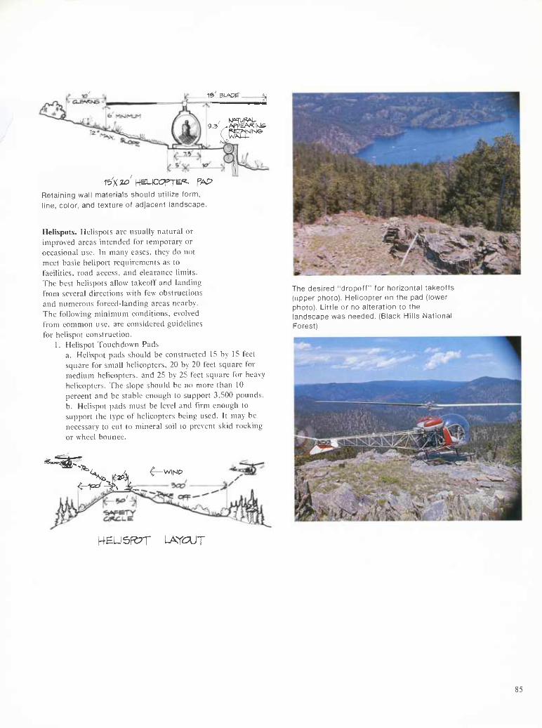
1« BLAC)P_
9.3 .APreARIKlfe
Retaining wall materials shiould utilize form, line, color, and texture of adjacent landscape.
Helispots. Helispots are usually natural or improved areas intended for temporary or occasional use. In many cases, they do not meet basic heliport requirements as to facilities, road access, and clearance limits. The best helispots allow takeoff and landing from several directions with few obstructions and numerous forced-landing areas nearby. The following minimum conditions, evolved from common use. are considered guidelines for helispot construction.
1. Helispot Touchdown Pads a. Helispot pads should be constructed 15 by 15 feet square for small helicopters. 20 by 20 feet square for medium helicopters, and 25 by 25 feet square for heavy helicopters. The slope should be no more than 10 percent and be stable enough to support 3,500 pounds. b. Helispot pads must be level and firm enough to support the type of helicopters being used. It may be necessary to cut to mineral soil to prevent skid rocking or wheel bounce.
Ttne desired 'dropoff" for fiorizontal takeotfs (upper photo). Helicopter on the pad (lower photo). Little or no alteration to the landscape was needed. (Black Hills National Forest)
KEU5F27T LATOJT
85
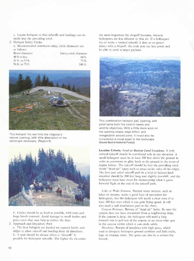
c. Locate helispots so that takeoffs and landings can be made into the prevailing wind.
2. Helispot Safety Circles a. Recommended minimum safety circle diameters are as follows: Rotor diameter Safety circle diameter 40 ft or less 60 ft. 41 ft. to55 ft. 75 ft. 56 ft. to 75 ft. 100 ft.
This helispot fits well into the ridgetop's natural opening, with little alternation of the landscape necessary. (Region 6)
the more important the dropoff becomes, because helicopters are less efficient in thin air. If a hellicopter has to make a vertical takeoff, it does so on power alone; with a dropoff, the craft may use less power and be able to carry a larger payload.
This combination helispot pad, opening, and pond serve both fire control needs and wildlife objectives. With a little more work on the opening shape, edge effect, and revegetatlon around pond, it could also be considered a visual asset in the landscape. (Daniel Boone National Forest)
b. Circles should be as level as possible, with trees and large brush removed. Avoid damage to small bushes and grass cover that may help to reduce the dust. Approach and Departure Path a. The best helispots are located on exposed knobs and ridges to allow takeoff and landing from all directions. b. A spot should be chosen where a "dropoff" is possible for helicopter takeoffs. The higher the elevation.
Location Criteria. Level or Bottom-Land Locations. A truly vertical takeoff should be considered safe at any elevation. A small helicopter must be at least 300 feet above the ground in order to autorotate or glide back to the ground in the event of engine failure. The takeoff should be into the prevailing wind. Avoid "dead-air" spots such as areas on lee sides of the ridges. The best and safest takeoff path in a level or bottom-land situation should be 300 feet long and slightly downhill, and the helicopter must have room for maneuvering when it gains forward flight at the end of the takeoff path.
Liikv or Wide Slrcaws. Natural water sources, such as lakes or streams, make a good base of operations for helicopters, but the helicopter still needs a clear area of at least 300 feet over which it can gain flying speed. It will also need a safe touchdown pad on the shore.
Canyon Bottoms. Beware of "dead-air" holes. Be sure the canyon does not have downdraft from a neighboring ridge. If the canyon is deep, the helicopter will need a long forward run to pull out of the canyon or an extra-wide spot in the canyon within which it can circle safely.
Mcudows. Beware of meadows with high grass, which tend to dissipate helicopter ground cushions and hide rocks, logs, or swampy areas. Dry grass can also be a serious tire hazard.
86
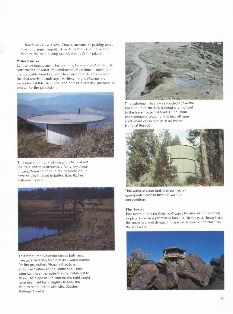
Roads or Truck Trails. Choose turnouts of parking areas that have some dropoff. If no dropoff areas are available, be sure the road is long and wide enough for takeoff.
Water Sources Landscape management factors must be considered during the construction of water impoundments or catchment tanks that are accessible from fire roads to ensure that they blend with the characteristic landscape. Artificial impoundments are useful for wildlife, livestock, and human recreation purposes as well as for fire protection.
^ -^rnggfi p W^M ^ÊêêêÊ^^^ % 31 ^^^^^^ — ■ ■'sra
^^H^M gg 1
K. HI ^HHK^ This catchment tank sits on a cut bank above the road and thus presents a fairly low visual impact. Some coloring in the concrete would have helped it blend in better. (Los Padres
National Forest)
This water impoundment serves both as a livestock watering hole and as a water source for fire protection. Visually It adds an attractive feature to the landscape. Trees were kept near the water's edge, helping it to fit in. The slope of the dam on the right could have been laid back slightly to help the feature blend better with site. (Custer National Forest)
This catchment basis was located above the travel route to the left. It remains unnoticed to the travel route observer. Outlet from underground storage tank is just off spur road where car is parked. (Los Padres National Forest)
This water storage tank was painted an appropriate color to blend in with its surroundings.
Fire Towers Fire tovves dominate their landscapes because of the necessity to place them in a prominent location. In the case shown here, the tower is a well-designed, attractive feature complementing the landscape.
87

Bibliography
Literature Cited
Albini, Frank A. Computer-based models of wildland fire behavior: A user's manuel. Ogden, UT: U.S. Department of Agriculture, Forest Service, Intemountain Forest and Range Experiment Station; 1976. 68 p.
Balmer, William E.; Hough, Walter, A.; Jackson, Robert S.; Mobley, Hugh E.; Ruziska, Wayne E. A guide for prescribed fire in southern forests. Macon, G A: U.S. Department of Agriculture, Forest Service, Southeastern Area State and Private Forestry, Southern Forest Fire Laboratory; 1977. 40 p.
Cooper, Charles F. The ecology of tire. Sei. Am. 204(4): 150-160; 1961.
Davis, Kathy. Fire ecology of the Lolo National Forest. 1978. Unpublished manuscript on tile at Lolo National Forest, Missoula, MT.
Deeming, John E.; Burgan, Robert E.; Cohen, Jack B. National fire-danger rating system. Gen. Tech. Rep. INT-39. Ogden, UT: U.S. Department of Agriculture, Forest Service, Intermountain Forest and Range Experiment Station; 1978. 63 p.
Habeck, James R.; Mutch, Robert W. Forests and forestry. In: McGraw-Hill Yearbook of Science and Technology. New York: McGraw-Hill; 1975.
Hobbs, John A. Recreation aesthetics and the isomorphic tire regime. In: Proceedings of the 1973 living with chaparral symposium; 1973 March 29-30. Riverside, CA. Unpublished manuscript.
Kozlowksi, T. T.; Ahlgren, C. H. Fire and ecosystems. New York: Academic Press; 1974.
Lotan, James E. [and others]. Effects on fire on flora. Gen. Tech. Rep. WO-16. Washington, DC: U.S. Department of Agriculture, Forest Service; 1981. 71 p.
Lyon, L. Jack [and others]. Effects of tire on fauna. Gen. Tech. Rep. WO-6. Washington, DC: U.S. Department of Agriculture, Forest Service; 1978. 22 p.
Martin, Robert E. [and others]. Effects of tire on fuels. Gen. Tech. Rep. WO-13. Washington, DC: U.S. Department of Agriculture, Forest Service; 1979. 64 p.
Martin, Robert E.; Dell, John D. Planning for prescribed burning in the Inland Northwest. Gen. Tech. Rep. PNW-76. Washington, DC: U.S. Department of Agriculture, Forest Service, Pacific Northwest Forest and Range Experiment Station; 1978. 67 p.
Mobley, Hugh E. [and others]. Southern forestry smoke management guidebook. Gen. Tech. Rep. SE-10. Macon, GA: U.S. Department of Agriculture, Forest Service, Southeastern Forest Experiment Station, Southern Forest Fire Laboratory; 1976. 140 p.
Odum, Eugene P. Fundamentals of ecology. New York: Holt, Rinehart, and Winston; 1971.
Sandberg, D. V. [and others]. Effects on tire on air. Gen. Tech. Rep. WO-9. Washington, DC: U.S. Department of Agriculture, Forest Service; 1979. 40 p.
Sando, Rodney W. Natural fire regimes and fire management. West. Wildlands. 4(4): 34-44; 1978.
Tiedmann, Arthur R. [and others]. Effects on tire on water. Gen. Tech. Rep. WO-10. Washington, DC: U.S. Department of Agriculture, Forest Service; 1979. 28 p.
Wells, Carol G. [and others]. Effects of tire on soil. Gen. Tech. Rep. WO-7. Washington, DC: U.S. Department of Agriculture, Forest Service; 1979. 34 p.
U.S. Department of Agriculture, Forest Service. The fireman's handbook. FSH-5109.12. Washington, DC: U.S. Department of Agriculture, Forest Service; 1966. 259 p.

Other References
Green, Lisle R. Fuelbreaks and other fuel modifications for wildfire control. Agrie. Handb. 449. Washington, DC: U.S. Department of Agriculture, Forest Serice; 1977. 79 p.
Green, Lisle R.; Schimke, Harry E. Guidelines for fuelbreaks in the Sierra Nevada mixed conifer type. Berkeley, CA: U.S. Department of Agriculture, Forest Service, Pacific Southwest Forest and Range Experiment Station; 1971. 14 p.
Gutierrez, Veriato; McNitt, Glenn; O'Hara, Richard; Tieck, Art, San Gabriel Foothills greenbelt study. Pomona, CA: California Polytechnic Institute, Department of Landscape Architecture; 1980. 118 p.
Hall, Frederick C. Ecology of natural underburning in the Blue Mountains of Oregon. R-6 Reg. Guide 51-1. Portland, OR: U.S. Department of Agriculture, Forest Service, Pacific Northwest Forest and Range Experiment Station; 1977. 11 p.
Loucks, O. L. Evolution of diversity, efficiency, and community stability. Am. Zool. 10: 17-25.
Modey, Richard E.; Bell, M. M. Landscape management guidelines: Visual and wildlife considerations; 1973. Unpublished manuscript.
Wright, Henry A. The effect of fire on vegetation in ponderosa pine forests: A state-of-the-art review. T-9-199. Lubbock, TX: Texas Tech University, Department of Range and Wildlife Management, and U.S. Department of Agriculture, Forest Service, Intermountain Forest and Range Experiment Station, Odgen, UT; 1978. 21 p.
State of California, Department of Parks and Recreation. Wildland fuel management guidelines for the California State Park System. Sacramento, CA: State of California, Department of Parks and Recreation; 1976. 47 p.
U.S. Department of Agriculture, Forest Service, Pacific Southwest Region, and State of California Division of Forestry. Fire hazard reduction guide for roadsides. San Francisco, CA: U.S. Department of Agriculture, Forest Service; 1968.
U.S. Department of Agriculture, Forest Service. Fire control guide: Conflagration control. Albuquerque, NM: U.S. Department of Agriculture, Forest Service, Southwestern Region; 1973. 124 p.
U.S. Department of Agriculture, Forest Service. Forest interpreter's primer on fire management. TT-53. Washington, DC: U.S. Department of Agriculture, Forest Service; 1978. 72 p.
U.S. Department of Agriculture, Forest Service. Fuels management in the Southwest. Berkeley, CA: U.S. Depart- ment of Agriculture, Forest Service, Pacific Southwest Forest and Range Experiment Station; 1978. 15 p.
89


