3.6 traffic wfoxboro - solano transportation authority traffic_wfoxboro.pdf · leisure town...
TRANSCRIPT

CHAPTER 3.6 TRAFFIC AND TRANSPORTATION/PEDESTRIAN AND BICYCLE FACILITIES 3.6-1 F:\Work\Jepson\DEIR-S\3.6 Traffic_wFoxboro.doc
3.6 Traffic and Transportation/Pedestrian and Bicycle Facilities This section summarizes the original Transportation/Circulation Impacts Report (Transportation Report) prepared for the project. This section also reflects the current availability of the 2030 travel demand model for Solano County.
3.6.1 Regulatory Setting
Caltrans, as assigned by FHWA, directs that full consideration should be given to the safe accommodation of pedestrians and bicyclists during the development of federal-aid highway projects (see 23 CFR 652). It further directs that the special needs of the elderly and the disabled must be considered in all federal-aid projects that include pedestrian facilities. When current or anticipated pedestrian and/or bicycle traffic presents a potential conflict with motor vehicle traffic, every effort must be made to minimize the detrimental effects on all highway users who share the facility.
Caltrans is committed to carrying out the 1990 Americans with Disabilities Act (ADA) by building transportation facilities that provide equal access for all persons. The same degree of convenience, accessibility, and safety available to the general public will be provided to persons with disabilities.
The following regulations pertain to traffic and transportation and apply to the proposed action:
• FHWA Federal Aid Policy Guide for Pedestrians and Bicyclists (23 CFR 652)
• Solano County Land Use and Circulation Element (2001)
• Solano Congestion Management Program (CMP) (2001)
• Fairfield General Plan Circulation Element (2001)
• Suisun City General Plan Circulation and Transportation Element (1992)
• Vacaville General Plan Circulation Element (1992)
3.6.2 Affected Environment
The study area for the transportation analysis, including roadways and intersections, is shown in Figure 3.6-1. The study area includes all the roadways potentially improved by the project alternatives as well as the I-80 freeway segments from the SR 12 interchange to the I-505 interchange.
3.6.2.1 Roadway System
The major roadways in the study area are described below:
• I-80 is a major east-west freeway originating in the Bay Area and continuing east toward Sacramento area and beyond. It crosses Fairfield and Vacaville in southwest-northeast direction. Major interchanges that provide access to the study area from I-80 are SR 12, Air Base Parkway, Alamo Drive, Elmira Road, and Leisure Town Road. Within Solano County, I-80 is a three-to four-lane freeway.

CHAPTER 3.6 TRAFFIC AND TRANSPORTATION/PEDESTRIAN AND BICYCLE FACILITIES 3.6-3 F:\Work\Jepson\DEIR-S\3.6 Traffic_wFoxboro.doc
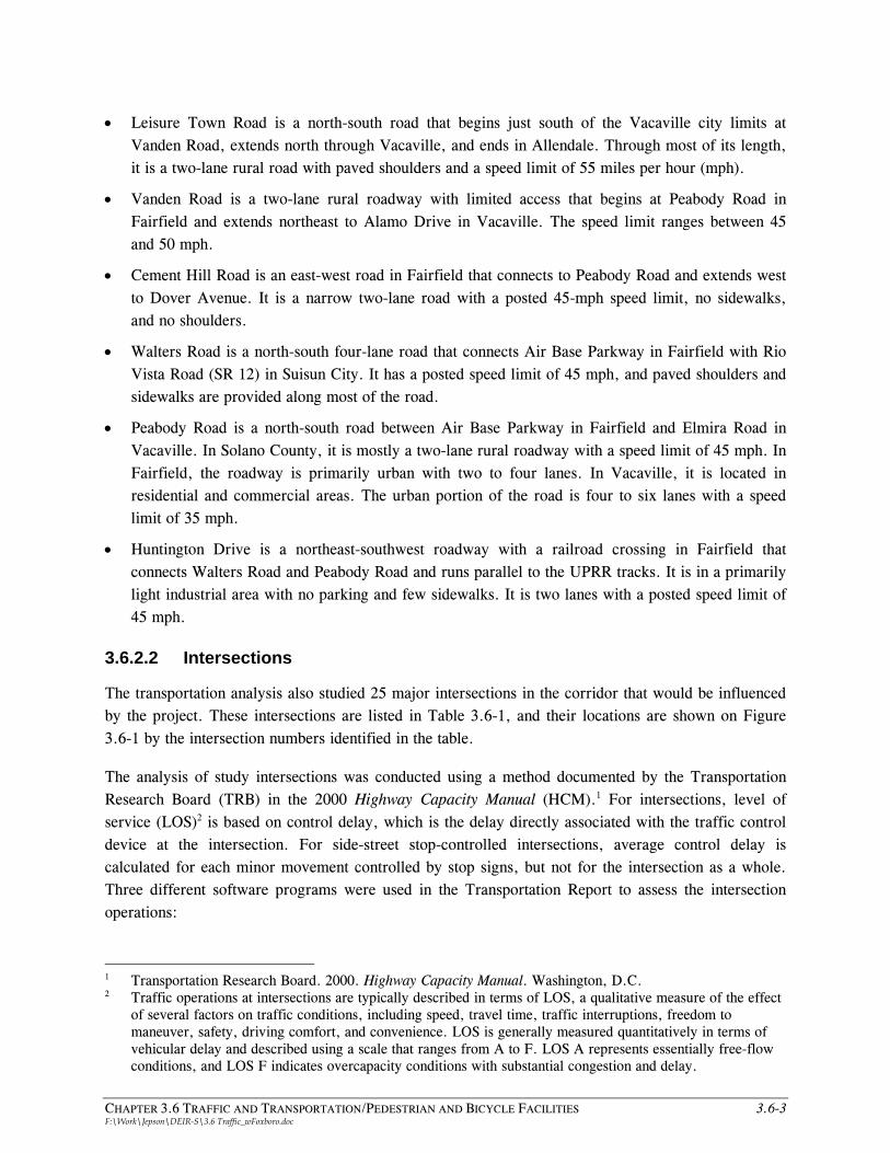
• Leisure Town Road is a north-south road that begins just south of the Vacaville city limits at Vanden Road, extends north through Vacaville, and ends in Allendale. Through most of its length, it is a two-lane rural road with paved shoulders and a speed limit of 55 miles per hour (mph).
• Vanden Road is a two-lane rural roadway with limited access that begins at Peabody Road in Fairfield and extends northeast to Alamo Drive in Vacaville. The speed limit ranges between 45 and 50 mph.
• Cement Hill Road is an east-west road in Fairfield that connects to Peabody Road and extends west to Dover Avenue. It is a narrow two-lane road with a posted 45-mph speed limit, no sidewalks, and no shoulders.
• Walters Road is a north-south four-lane road that connects Air Base Parkway in Fairfield with Rio Vista Road (SR 12) in Suisun City. It has a posted speed limit of 45 mph, and paved shoulders and sidewalks are provided along most of the road.
• Peabody Road is a north-south road between Air Base Parkway in Fairfield and Elmira Road in Vacaville. In Solano County, it is mostly a two-lane rural roadway with a speed limit of 45 mph. In Fairfield, the roadway is primarily urban with two to four lanes. In Vacaville, it is located in residential and commercial areas. The urban portion of the road is four to six lanes with a speed limit of 35 mph.
• Huntington Drive is a northeast-southwest roadway with a railroad crossing in Fairfield that connects Walters Road and Peabody Road and runs parallel to the UPRR tracks. It is in a primarily light industrial area with no parking and few sidewalks. It is two lanes with a posted speed limit of 45 mph.
3.6.2.2 Intersections
The transportation analysis also studied 25 major intersections in the corridor that would be influenced by the project. These intersections are listed in Table 3.6-1, and their locations are shown on Figure 3.6-1 by the intersection numbers identified in the table.
The analysis of study intersections was conducted using a method documented by the Transportation Research Board (TRB) in the 2000 Highway Capacity Manual (HCM).1 For intersections, level of service (LOS)2 is based on control delay, which is the delay directly associated with the traffic control device at the intersection. For side-street stop-controlled intersections, average control delay is calculated for each minor movement controlled by stop signs, but not for the intersection as a whole. Three different software programs were used in the Transportation Report to assess the intersection operations:
1 Transportation Research Board. 2000. Highway Capacity Manual. Washington, D.C. 2 Traffic operations at intersections are typically described in terms of LOS, a qualitative measure of the effect
of several factors on traffic conditions, including speed, travel time, traffic interruptions, freedom to maneuver, safety, driving comfort, and convenience. LOS is generally measured quantitatively in terms of vehicular delay and described using a scale that ranges from A to F. LOS A represents essentially free-flow conditions, and LOS F indicates overcapacity conditions with substantial congestion and delay.

3.6-4 JEPSON PARKWAY PROJECT DRAFT ENVIRONMENTAL IMPACT REPORT/ENVIRONMENTAL IMPACT STATEMENT F:\Work\Jepson\DEIR-S\3.6 Traffic_wFoxboro.doc
Table 3.6-1 2002 Intersection Level of Service
AM Peak Hour PM Peak Hour
Intersection Traffic Controla
LOS Standardb Delayc LOSd Delayc LOSd
1. Leisure Town Road/I-80 Westbound Ramps Signal D 42.5 D >100 F
2. Leisure Town Road/I-80 Eastbound Ramps Signal D 21.7 C 26.9 C
3. Leisure Town Road/Orange Drive SSS C 29.0e D >100e F
4. Leisure Town Road/Sequoia Drive/White Pine Street g SSS C 24.4e C 36.0e E
5. Leisure Town Road/Stonegate Drive SSS C 24.2e C 24.4e C
6. Leisure Town Road/Ulatis Drive/Hawkins Road SSS C 21.3e C 24.6e C
7. Leisure Town Road/Elmira Road AWS C 21.9 C 26.4 D
8. Leisure Town Road/Marshall Road SSS C 18.9e C 21.0e C
9. Leisure Town Road/Alamo Drive Signal C 17.8 B 21.4 C
10. Leisure Town Road/Vanden Road Signal C 9.9 A 5.5 A
11. Vanden Road/Canon Road SSS C 11.6f B 24.1f C
12. Cement Hill Road/Peabody Road Signal D 49.4 D 15.6 B
13. Walters Road Extension/Cement Hill Road h – D – – – –
14. Walters Road/Air Base Parkway Signal D 39.4 D 34.0 C
15. Walters Road/East Tabor Avenue AWS D 29.2 D 47.4 E
16. Walters Road/Bella Vista Road Signal C 23.7 C 12.5 B
17. Walters Road/Peterson Road AWS C 10.8 B 12.0 B
18. Walters Road/SR 12 Signal C 27.7 C 23.9 C
19. Peabody Road/Alamo Drive Signal C 36.5 D 47.1 D
20. Peabody Road/Air Base Parkway Signal D 20.9 C 52.0 D
21. Peabody Road/Huntington Drive Signal D 30.6 C 50.7 D
22. Peabody Road/California Drive SSS C 35.9f E >100e F
23. Peabody Road/Elmira Road Signal C 64.8 E >100 F
24. Peabody Road/Cliffside Drive Signal D 22.7 C 50.8 D
25. Elmira Road/Depot Street Signal D 38.9 D 90.3 F Notes: Shaded intersections represent intersections exceeding locally adopted LOS standards. a. SSS = side street stop, AWS = all-way stop. b. See “Performance Standards” section for sources of LOS standards used. c. Average control delay is in seconds per vehicle. For the worst approach at side-street stop-controlled intersections, delay is
presented with worst approach direction, as indicated by footnote “e” or “f.” d. LOS based on 2000 HCM methodology. e. Eastbound
f. Westbound g. Intersection reconfigured in 2006 with addition of east leg. h. Intersection reconfigured in 2004 with addition of north leg.

CHAPTER 3.6 TRAFFIC AND TRANSPORTATION/PEDESTRIAN AND BICYCLE FACILITIES 3.6-5 F:\Work\Jepson\DEIR-S\3.6 Traffic_wFoxboro.doc
Synchro 6.0, TRAFFIX, and VISSIM. Synchro 7.0 was used to update the results of the Transportation Report based on the 2030 model. Additional detail about the application of these software programs is provided in the Transportation Report.
Vehicle turning movements were counted at each study intersection during the morning (AM) peak period (7:00 to 9:00 a.m.) and the evening (PM) peak period (4:00 to 6:00 p.m.) between January and May 2002. In general, the AM peak hour was identified to be from 7:15 to 8:15 a.m., and the PM peak hour was observed to be from 4:30 to 5:30 p.m. Table 3.6-1 summarizes the operation of the study intersections in the AM and PM peak hours under 2002 conditions as described in the Transportation Report. As shown, nine of the intersections (noted by shading) operate at levels worse than the minimum acceptable thresholds established by local or regional policies in either or both the AM or PM peak hours.
3.6.2.3 Freeways
In the Transportation Report, I-80 freeway segments from SR 12 to I-505 were analyzed using existing traffic volumes published by Caltrans and the HCM methodologies for basic freeway segments. Table 3.6-2 presents the 2002 AM and PM peak hour LOS results for the I-80 mainline segments. Two of the freeway segments, Eastbound I-80 west of the SR 12 Junction and Eastbound I-80 between Travis Boulevard and Air Base Parkway, listed in the table are shown to operate at levels worse than the minimum acceptable thresholds established by local or regional policies. Additionally, just west of these segments, I-80 has junctions with SR 12 and I-680, which may reduce the effective capacity of these segments. Therefore, queues along I-80 from the bottlenecks at SR 12 and I-680 may affect the levels of congestion along the I-80 study freeway segments.
3.6.2.4 Transit System
According to the Transportation Report, public transit service in Solano County consists of fixed-route and demand-responsive transit (paratransit) services. Fixed-route public transit service in the corridor is primarily provided by Vacaville City Coach in Vacaville and Fairfield/Suisun Transit System in Fairfield and Suisun City. Vallejo Transit provides express service between Vacaville, Fairfield, and Suisun City and the Vallejo Ferry Terminal and the San Francisco Bay Area Rapid Transit District (BART) El Cerrito del Norte Station and operates Vallejo Run About which provides paratransit service primarily for disabled riders in the southern part of the county. STA manages Solano Paratransit, which provides paratransit service primarily for disabled riders in the northern part of the county, and two express bus route services (Routes 30 and 90). Regional rail service is provided by Amtrak Capitol Corridor, which connects the Suisun-Fairfield Station to the Bay Area, Sacramento, and beyond. The Transportation Report contains additional detail about the existing transit system.

3.6-6 JEPSON PARKWAY PROJECT DRAFT ENVIRONMENTAL IMPACT REPORT/ENVIRONMENTAL IMPACT STATEMENT F:\Work\Jepson\DEIR-S\3.6 Traffic_wFoxboro.doc
Table 3.6-2 2002 Freeway Level of Service Summary
AM Peak Hour PM Peak Hour
Freeway Segment LOS
Standarda Densityb LOSc Densityb LOSc
Eastbound I-80
1. West of SR 12 Junction D 12.7 B 44.9 E
2. SR 12 Junction to West Texas Street D 11.4 B 34.8 D
3. West Texas Street to Travis Boulevard D 10.7 A 31.3 D
4. Travis Boulevard to Air Base Parkway D 11.5 B 35.6 E
5. Air Base Parkway to North Texas Street D 9.9 A 27.9 D
6. North Texas Street to Pleasants Valley Road D 10.3 A 29.5 D
7. Pleasants Valley Road to Alamo Drive D 10.3 A 29.2 D
8. Alamo Drive to Davis Street D 9.1 A 24.8 C
9. Davis Street to Monte Vista Avenue D 8.8 A 23.9 C
10. Monte Vista Avenue to I-505 North Junction D 8.0 A 21.5 C
11. East of I-505 North Junction D 6.5 A 17.5 B
Westbound I-80
1. East of I-505 North Junction D 15.2 B 11.7 B
2. I-505 North Junction to Monte Vista Avenue D 18.6 C 14.3 B
3. Monte Vista Avenue to Davis Street D 20.5 C 15.7 B
4. Davis Street to Alamo Drive D 21.2 C 16.2 B
5. Alamo Drive to Pleasants Valley Road D 24.3 C 18.4 C
6. Pleasants Valley Road to North Texas Street D 24.5 C 18.5 C
7. North Texas Street to Air Base Parkway D 23.4 C 17.8 B
8. Air Base Parkway to Travis Boulevard D 28.2 D 20.7 C
9. Travis Boulevard to West Texas Street D 25.6 C 19.2 C
10. West Texas Street to SR 12 Junction D 27.8 D 20.5 C
11. West of SR 12 Junction D 32.9 D 23.0 C Notes: a. Freeway LOS performance standard per Caltrans threshold for acceptable freeway operations. b. Density expressed as passenger cars per mile per lane. c. LOS based on 2000 HCM methodology.

CHAPTER 3.6 TRAFFIC AND TRANSPORTATION/PEDESTRIAN AND BICYCLE FACILITIES 3.6-7 F:\Work\Jepson\DEIR-S\3.6 Traffic_wFoxboro.doc
3.6.2.5 Bicycle and Pedestrian Facilities
In the study area, Class II bicycle facilities (striped on-street bicycle lanes) exist on Peabody Road in Vacaville between the southern city limits and Elmira Road; along Air Base Parkway; and on Elmira Road (eastbound only). Portions of Peabody Road, Walters Road, and Leisure Town Road also provide shoulders that are wide enough for bicycle use, although they are not designated as bicycle facilities. Study roadways within developed areas provide sidewalks on at least one side of the roadway. The roadways in the rural parts of the study area (i.e., unincorporated Solano County) often have no curbs, gutters, or sidewalks and are not suitable for pedestrian traffic.
3.6.3 Impacts (including Permanent, Temporary, Direct, and Indirect)
3.6.3.1 Methodology
The Transportation Report used forecast study years of 2005 and 2025. However, STA recently developed a more up-to-date 2030 travel demand model. In order to determine the impact that the newer 2030 model would have on the results of the Transportation Report, further comparisons and analyses were performed. Furthermore, the 2005 opening year volumes have been revised to reflect the now-anticipated 2010 completion of the Jepson Parkway.
Travel Demand Forecasting
Traffic volume forecasts for 2000, 2005, 2025, and 2030 were developed based on travel demand models. The models were developed based on land use development assumptions regarding likely development in the region for the given timeframes, and on reasonably foreseeable roadway improvement projects. The 2025 model was built using the TRANPLAN software platform (by the City of Fairfield) and the 2030 model was built using CUBE software platform (by a consultant for STA); however both models have some differences. The 2025 model is a fiscally constrained model and only includes funded roadway network additions. The 2030 model has a separate network for high occupancy vehicle (HOV) lanes and assumes full buildout of the I-80/I-680 interchange. The 2025 model includes I-80 from the I-680 interchange in the west to SR 113 (Vic Fazio Highway) interchange in the east; while the 2030 model includes I-80 from the I-680 interchange in the west to the City of Sacramento in the east. One of the important conclusions of the 2030 model is that the I-80 PM peak hour traffic between Fairfield and Vacaville interchanges exceeds capacity, which was not shown in the 2025 model.
This information and a comparison of the volumes for the two models were presented to STA. After review of the model information, STA concluded that the 2030 model is the more accurate model due to availability of updated land use data. It was also concluded that the 2030 model numbers should be used for future planning purposes and in the update of the I-80/I-680 corridor study.
Figure 3.6-2 depicts traffic volumes for 2000 that were obtained from the model as presented in the Transportation Report. Traffic volumes for 2010 were interpolated from the 2030 traffic volumes and the most recent existing turning movement counts available for each intersection and are depicted in

3.6-8 JEPSON PARKWAY PROJECT DRAFT ENVIRONMENTAL IMPACT REPORT/ENVIRONMENTAL IMPACT STATEMENT F:\Work\Jepson\DEIR-S\3.6 Traffic_wFoxboro.doc
Figure 3.6-3. Figure 3.6-4 depicts estimated traffic volumes for each alternative based on the 2030 travel demand model. As shown in these figures, the roadways are expected to experience an increase in traffic volumes between 2000 and 2030.
Transportation System Analysis
The transportation impact analysis focused on AM and PM peak hour traffic intersection operations at the study intersections under each alternative, but also considered the potential effects on transit, bicycle, and pedestrian travel. Intersections were analyzed using the methods proscribed by the HCM. In the Transportation Report, intersections operations for 2005 and 2025 conditions were compared to existing conditions. Intersection operations for the 2010 adjusted volumes and 2030 model volumes were also considered to determine potential impacts and additional improvements to intersection lane configurations needed to meet the local LOS standards described below. Transit, bicycle, and pedestrian facilities were evaluated for consistency with local and regional plans and adopted design standards.
The proposed intersection lane geometrics for each alternative, along with other programmed (fully funded) roadway improvements in the area, were used in conjunction with the intersection turning movement volume forecasts to assess intersection LOS under future scenarios. According to the Transportation Report, the following projects have been identified as being fully funded and are assumed to be in place under all project alternatives, including Alternative A:
• Walters Road: Widen to four lanes from Rio Vista Road (SR 12) to Air Base Parkway (project complete)
• Leisure Town Road: Widen I-80 interchange to six lanes from Orange Drive (northern terminus of Jepson Parkway) to Vaca Valley Parkway (project complete)
• Peabody Road: Widen to four lanes between Air Base Parkway and Huntington Road (project complete)
Each of these improvements was completed before construction of the Jepson Parkway Project. The resulting levels of service were compared to the performance standard criteria discussed in the Transportation Report to identify scenarios in which these performance standards would not be met.
The City of Vacaville recently approved the Southtown development project in southeastern Vacaville near Leisure Town Road and Vanden Road. As part of the Southtown project, the Southtown developer would extend Foxboro Parkway from its current terminus at Nut Tree Parkway to the intersection of Vanden Road and Leisure Town Road. The exact timing of this extension is not known, however, it is anticipated that it will be complete by 2030. As described in Section 2, Project Description, the Jepson Parkway Project does not include the extension of Foxboro Parkway. However, under Alternatives B, C, and D, the west approach of the intersection of Vanden Road and Leisure Town Road would be constructed to allow for a connection to the future Foxboro Parkway.


3.6-12 JEPSON PARKWAY PROJECT DRAFT ENVIRONMENTAL IMPACT REPORT/ENVIRONMENTAL IMPACT STATEMENT F:\Work\Jepson\DEIR-S\3.6 Traffic_wFoxboro.doc
Local Agency Performance Standards
Transportation system performance standards, adopted by local agencies, set thresholds for what each agency considers acceptable conditions. The appropriate application of these standards, as discussed in the Transportation Report, to the project is described below:
• A signalized intersection should not exceed a LOS standard established by the county congestion management agency or local jurisdictions for designated roads or highways. Each jurisdiction has identified specific LOS standards, as described below.
Solano Transportation Authority. In the Solano Congestion Management Program, STA has set the minimum LOS standard on all State routes in Solano County, including freeway segments, at LOS E, except those locations where the initial LOS measurement (calculated for the 1991 CMP) was already at LOS F.
City of Fairfield. Fairfield General Plan Objective CI 3 establishes the PM peak hour LOS standard on local streets as LOS B; collector streets as LOS C; and arterials as LOS D. All study intersections are on arterials and therefore, the LOS standard for all intersections in Fairfield is LOS D.
City of Suisun City. Suisun City General Plan Circulation and Transportation Element Objective 2 establishes the LOS standard for the city’s circulation system as LOS C.
City of Vacaville. Vacaville General Plan Guiding Policy 6.1-G 1 establishes LOS C as the minimum standard at all intersections, interchanges, and road links. However, Guiding Policies 6.1-G 2 and 6.1-G 3 allow LOS D, E, or F under special circumstances and with prior public hearings and approval by the City Council.
Solano County. Solano County Road Improvement Standards and Land Development Requirements Section 1-4 establishes LOS C as the standard for all roads and intersections. All projects shall be designed to maintain a LOS of C, except where the existing LOS is already below C.
• An unsignalized intersection should not exceed the level of service criteria described above at locations where expected peak-hour traffic volumes would warrant installation of a traffic signal. All local jurisdictions base their determination on whether a traffic signal should be installed on warrants (i.e., criteria) described in the Manual on Uniform Traffic Control Devices (MUTCD). The MUTCD is the guiding national document for the selection, design, installation, operation, and maintenance of all types of traffic control devices, including traffic signals. Its purpose is to provide uniformity in traffic control devices across the country. FHWA is responsible for the MUTCD. The MUTCD contains eight warrants. The peak-hour signal warrant is evaluated in this report because the peak-hour traffic data is the only data available to provide a comparable analysis for existing and future conditions. The analysis of unsignalized intersections is intended to examine the need to install new traffic signals. The analysis should not serve as the only basis for deciding whether and when to install a signal; the full set of warrants should be investigated based on field-measured traffic data and a thorough study of traffic and roadway conditions by an experienced engineer. Regular monitoring of actual traffic conditions and accident data should be undertaken by

CHAPTER 3.6 TRAFFIC AND TRANSPORTATION/PEDESTRIAN AND BICYCLE FACILITIES 3.6-13 F:\Work\Jepson\DEIR-S\3.6 Traffic_wFoxboro.doc
the jurisdiction responsible for implementation to prioritize and program intersections for signalization.
• Adopted policies, plans, or programs supporting transit and nonmotorized transportation (e.g., bus turnouts, bicycle lanes) should be followed, and the proposed action shall provide for pedestrian, bicycle, or transit travel demand that would not be accommodated by current pedestrian facilities, bicycle development plans, or long-range transit plans.
Intersections
Since a 2030 travel demand model has been recently developed and determined to have more current, generally accepted assumptions, an analysis was performed to determine the potential impacts the newer model would have on the results of the Transportation Report. In order to determine the potential impacts, the following procedure was followed:
• First, the volumes of the base 2025 travel demand model and the base 2030 travel demand model were compared to determine the percent change between the two.
• Second, the volumes in the 2025 Synchro files used to develop the Transportation Report (Alternatives A through E) were adjusted proportional to the increase or decrease observed in the 2025 and 2030 base models. The growth factors for each approach of each intersection were adjusted accordingly in order to maintain similar turning movement proportions use in the Transportation Report. After these adjustments, volumes were balanced where necessary.
• Additionally, the 2010 volumes were interpolated from the most current existing turning movement counts and the newly calculated 2030 turning movement volumes.
• Once the volumes were adjusted, the signal timings were optimized to determine the projected intersection delay and LOS for the 2010 and 2030 conditions.
• The next step was to determine if any additional improvements would be necessary to meet the local LOS standards at each intersection.
As a result, new proposed intersection lane configurations were developed. Figures 3.6-5a and 3.6-5b identify the intersection lane configurations necessary to meet local LOS standards in both 2010 and 2030. The resulting intersection delay and level of service for the 2010 conditions with the proposed 2010 intersection lane configurations are presented in Table 3.6-3. The resulting intersection delay and level of service for the 2030 conditions with the proposed 2030 intersection lane configurations are presented in Table 3.6-4. As shown in Table 3.6-3, most of the unsignalized intersections in 2010 do not meet the LOS standards. However, the addition of a signal (if warranted and deemed necessary) at these unsignalized intersections would likely improve the level of service at these intersections to acceptable levels. Further analysis would be required to determine if a signal would be warranted at these intersections in 2010. As shown in Table 3.6-4, a signal at these intersections is assumed by 2030 to improve operations.

3.6-14 JEPSON PARKWAY PROJECT DRAFT ENVIRONMENTAL IMPACT REPORT/ENVIRONMENTAL IMPACT STATEMENT F:\Work\Jepson\DEIR-S\3.6 Traffic_wFoxboro.doc
Table 3.6-3 Intersection Delay (Seconds per Vehicle) and LOS Summary,a 2010 Conditions with Proposed Intersection Lane Configurations
Alt A Alt B Alt C Alt D Alt E
Intersection Standard
LOSb AM PM AM PM AM PM AM PM AM PM
1. Leisure Town Road/I-80 WB Ramps D 10.3/B 9.3/A 8.1/A 9.1/A 5.8/A 7.2/A 5.7/A 7.2/A 5.6/A 7.3/A 2. Leisure Town Road/I-80 EB Ramps D 6.3/A 8.3/A 5.8/A 7.4/A 6.4/A 8.3/A 6.4/A 8.4/A 6.4/A 8.3/A 3. Leisure Town Road/Orange Drive C 7.5/A 13.8/B 7.9/A 13.7/B 8.2/A 17.8/B 8.2/A 14.7/B 7.8/A 15.0/B 4. Leisure Town Road/Sequoia Drive/White Pine Street C 9.1/A 27.9/C 8.3/A 11.7/B 7.8/A 11.4/B 8.3/A 11.3/B 8.9/A 11.5/B 5. Leisure Town Road/Stonegate Drive C 59.8/Fc >100/Fc 25.6/Dc 56.9/Fc 25.3/Dc 61.7/Fc 24.1/Cc 62.1/Fc 62.2/Fc >100/Fc 6. Leisure Town Road/Ulatis Drive C 76.8/Fc >100/Fc 33.9/Dc >100/Fc 35.0/Dc >100/Fc 33.6/Dc >100/Fc 52.3/Fc >100/Fc 7. Leisure Town Road/Elmira Road C 28.9/C 43.3/D 20.3/C 26.1/C 20.1/C 25.5/C 26.2/C 26.7/C 27.0/C 24.8/C 8. Leisure Town Road/Marshall Road C 48.4/Ec 80.9/Fc 31.2/Dc 48.8/Ec 31.1/Dc 59.6/Fc 29.8/Dc 59.2/Fc 48.1/Ec 68.7/Fc 9. Leisure Town Road/Alamo Drive C 19.4/B 23.2/C 16.7/B 19.7/B 16.5/B 19.7/B 16.4/B 19.9/B 20.2/C 31.3/C 10. Leisure Town Road/Vanden Road C 14.8/B 12.2/B 18.3/B 7.4/A 18.5/B 7.4/A 18.5/B 7.8/A 15.0/B 8.5/A 11. Vanden Road/Canon Road C >100/Fc 31.2/Dc 7.8/A 14.0/B 7.1/A 10.4/B 7.1/A 18.7/B 72.2/Fc 42.2/Ec 12. Cement Hill Road/Peabody Road D 54.7/D 25.1/C 31.4/C 23.5/C 36.8/D 23.6/C 39.2/D 23.7/C 42.1/D 28.8/C 13. Walters Road Ext/Cement Hill Road D 6.3/A 4.7/A 8.8/A 9.4/A 6.3/A 4.7/A 6.3/A 4.7/A 6.3/A 4.7/A 14. Walters Road/Air Base Pkwy D 34.2/C 34.2/C 41.7/D 35.8/D 46.5/D 51.0/D 42.8/D 39.5/D 35.7/D 39.7/D 15. Walters Road/East Tabor Ave D 10.3/B 11.7/B 19.4/B 18.5/B 19.8/C 22.3/C 19.8/B 19.0/B 19.9/B 20.4/C 16. Walters Road/Bella Vista Road C 19.3/B 12.4/B 24.1/C 19.7/B 24.1/C 19.6/B 24.0/C 19.8/B 24.1/C 19.8/B 17. Walters Road/Peterson Road C 2.5/A 2.9/A 5.1/A 6.5/A 6.1/A 6.5/A 7.0/A 6.5/A 6.0/A 6.9/A 18. Walters Road/SR 12 C 20.2/C 16.0/B 21.4/C 20.9/C 21.1/C 19.7/B 21.7/C 30.6/C 21.1/C 19.2/B 19. Peabody Road/Alamo Drive C 40.5/D 40.2/D 23.8/C 29.3/C 23.9/C 29.0/C 29.5/C 29.0/C 28.8/C 33.5/C 20. Peabody Road/Air Base Pkwy D 18.0/B 27.6/C 14.9/B 32.7/C 6.7/A 9.4/A 15.1/B 28.2/C 6.8/A 9.1/A 21. Peabody Road/Huntington Drive D 23.5/C 22.9/C 21.3/C 21.8/C 18.4/B 20.5/C 25.4/C 25.2/C 19.4/B 19.7/B 22. Peabody Road/California Drive C 15.5/B 18.4/B 13.8/B 16.4/B 14.1/B 16.6/B 14.8/B 16.6/B 24.3/C 21.6/C 23. Peabody Road/Elmira Road C 31.7/C 63.2/E 23.1/C 30.4/C 30.8/C 31.1/C 25.0/C 31.2/C 23.7/C 26.7/C 24. Peabody Road/Cliffside Drive D 49.8/D 46.5/D 20.5/C 36.9/D 21.0/C 36.0/D 20.4/C 36.4/D 22.5/C 36.0/D 25. Elmira Road/Depot Street D 25.7/C 47.9/D 25.9/C 40.7/D 25.4/C 44.2/D 25.7/C 39.6/D 25.6/C 43.7/D Notes: Shaded cells indicate intersections expected to exceed local LOS performance thresholds. a. LOS based on 2000 HCM methodology. b. LOS standard as reported in the Transportation Report. c. Unsignalized control - installation of traffic signals would allow intersections to meet LOS standard in 2010.

CHAPTER 3.6 TRAFFIC AND TRANSPORTATION/PEDESTRIAN AND BICYCLE FACILITIES 3.6-15 F:\Work\Jepson\DEIR-S\3.6 Traffic_wFoxboro.doc
Table 3.6-4 Intersection Delay (Seconds per Vehicle) and LOS Summary 2030 Conditions with Proposed Intersection Lane Configurations
Alt A Alt B Alt C Alt D Alt E
Intersection Standard
LOSb AM PM AM PM AM PM AM PM AM PM
1. Leisure Town Road/I-80 WB Ramps D 4.5/A 8.8/A 4.8/A 8.7/A 3.7/A 8.8/A 3.6/A 8.8/A 3.8/A 8.9/A 2. Leisure Town Road/I-80 EB Ramps D 10.8/B 27.6/C 9.5/A 28.2/C 9.8/A 27.7/C 10.0/A 28.3/C 9.5/A 27.2/C 3. Leisure Town Road/Orange Drive C 16.6/B 19.8/B 14.5/B 30.9/C 13.9/B 31.0/C 14.6/B 33.2/C 13.1/B 31.0/C 4. Leisure Town Road/Sequoia Drive/White Pine Street C 13.9/B >100/F 12.9/B 24.9/C 13.1/B 24.7/C 13.3/B 25.5/C 14.7/B 26.8/C 5. Leisure Town Road/Stonegate Drive C >100/Fc >100/Fc 3.7/A 5.5/A 3.7/A 5.5/A 3.6/A 5.5/A 12.8/B 6.1/A 6. Leisure Town Road/Ulatis Drive C >100/Fc >100/Fc 8.3/A 25.8/C 8.4/A 22.6/C 8.1/A 23.9/C 8.5/A 10.6/B 7. Leisure Town Road/Elmira Road C 84.5/F >100/F 12.8/B 34.3/C 14.4/B 32.2/C 12.7/B 34.1/C 15.6/B 24.4/C 8. Leisure Town Road/Marshall Road C >100/Fc >100/Fc 5.3/A 5.8/A 5.4/A 5.7/A 5.2/A 5.3/A 8.7/A 11.1/B 9. Leisure Town Road/Alamo Drive C 40.5/D >100/F 23.4/C 21.0/C 20.3/C 27.0/C 20.6/C 25.8/C 19.3/B 20.5/C 10. Leisure Town Road/Vanden Road C 73.5/E >100/F 34.2/C 7.8/A 34.8/C 8.6/A 32.1/C 7.7/A 25.1/C 13.6/B 10A. Leisure Town Road/Vanden Road/Foxboro Parkwayd
C 45.9/D 17.1/B 31.5/C 14.6/B 31.5/C 14.6/B 31.5/C 14.6/B 45.9/D 17.1/B
11. Vanden Road/Canon Road C >100/Fc 42.0/Ec 13.6/B 13.2/B 10.7/B 11.4/B 13.3/B 9.3/A 20.1/C 17.1/B 12. Cement Hill Road/Peabody Road D >100/F >100/F 28.6/C 30.1/C 43.7/D 40.0/D 39.9/D 38.8/D 37.1/D 53.2/D 13. Walters Road Ext/Cement Hill Road D 7.4/A 48.2/D 13.0/B 22.9/C 7.4/A 48.2/D 7.4/A 48.2/D 7.4/A 48.2/D 14. Walters Road/Air Base Pkwy D 74.7/E 81.2/F 36.5/D 47.0/D 32.5/C 54.0/D 35.6/D 46.3/D 43.8/D 52.9/D 15. Walters Road/East Tabor Ave D 21.9/C 28.0/C 26.6/C 29.3/C 32.1/C 40.0/D 20.2/C 25.8/C 30.5/C 47.5/D 16. Walters Road/Bella Vista Road C 21.3/C 13.3/B 18.2/B 23.1/C 18.9/B 15.3/B 24.0/C 24.0/C 26.1/C 24.0/C 17. Walters Road/Peterson Road C 2.8/A 3.9/A 6.0/A 9.0/A 8.9/A 8.0/A 10.2/B 4.2/A 9.0/A 9.9/A 18. Walters Road/SR 12 C 55.0/D 44.8/D 29.1/C 34.4/C 31.8/C 29.7/C 25.9/C 34.5/C 25.2/C 30.7/C 19. Peabody Road/Alamo Drive C 28.3/C 34.9/C 25.3/C 28.9/C 24.6/C 28.2/C 27.0/C 27.8/C 26.4/C 29.1/C 20. Peabody Road/Air Base Pkwy D 20.5/C 54.0/D 12.1/B 17.1/B 10.1/B 8.2/A 12.2/B 17.1/B 6.6/A 10.4/B 21. Peabody Road/Huntington Drive D 19.5/B 47.6/D 26.4/C 43.3/D 22.8/C 53.9/D 20.4/C 52.3/D 27.6/C 51.4/D 22. Peabody Road/California Drive C 37.5/D 27.6/C 23.7/C 20.8/C 23.9/C 17.9/B 30.0/C 18.2/B 32.4/C 23.5/C 23. Peabody Road/Elmira Road C 21.4/C 77.1/E 19.0/B 34.0/C 18.1/B 25.2/C 19.8/B 31.6/C 14.9/B 22.8/C 24. Peabody Road/Cliffside Drive D 20.8/C 36.6/D 21.7/C 38.4/D 27.2/C 35.6/D 22.1/C 37.0/D 21.0/C 43.1/D 25. Elmira Road/Depot Street D 26.7/C 36.9/D 26.1/C 53.0/D 48.6/D 30.9/C 38.9/D 47.9/D 46.0/D 50.1/D Notes: Shaded cells indicate intersections expected to exceed local LOS performance thresholds. a. LOS based on 2000 HCM methodology. b. LOS standard as reported in the Transportation Report. c. Unsignalized control - installation of traffic signals would allow intersections to meet LOS standard in 2010. d. The future extension of Foxboro Parkway to Leisure Town Road/Vanden Road is not part of the Jepson Parkway Project.

3.6-16 JEPSON PARKWAY PROJECT DRAFT ENVIRONMENTAL IMPACT REPORT/ENVIRONMENTAL IMPACT STATEMENT F:\Work\Jepson\DEIR-S\3.6 Traffic_wFoxboro.doc
The operation of the Vanden Road/Leisure Town Road intersection was also analyzed with the potential future extension of Foxboro Parkway from Nut Tree Parkway to Vanden Road/Leisure Town Road, described above. This potential future intersection is designated 10A in Table 3.6-4 and on Figure 3.6-5a. Implementation of the Southtown project and the extension of Foxboro Parkway would redistribute traffic along Vanden Road so that the majority of traffic that currently uses Vanden Road north of Leisure Town Road would use the future Foxboro Parkway extension. Because the extension of Foxboro Parkway is not included in the Solano County 2030 model, a qualitative analysis based on the redistribution of traffic associated with the Southtown project was performed. Due to the redistribution of traffic, this intersection could be configured to meet acceptable LOS standards, as shown in Table 3.6-4 and on Figure 3.6-5a.
3.6.3.2 Summary of Traffic and Transportation/Pedestrian and Bicycle Facility Impacts
Implementation of any of the four build alternatives would result in substantially improved operation of study intersections in the corridor. As shown in Table 3.6-5, many of the study intersections would operate at below local LOS standards in both 2010 (7 of 25 intersections) and 2030 (13 of 25 intersections) under Alternative A. With implementation of Alternative B, C, D, or E, none of study intersections would operate below local LOS standards in 2030.
Implementation of any of the build alternatives would also result in improved bicycle and pedestrian circulation in the corridor as well as improved transit service.
Each of these potential effects on traffic, pedestrian, and bicycle facilities, and parking are more fully discussed below.
Table 3.6-5 Summary of 2010 and 2030 Intersection Operations by Alternative
Impact Alternative A Alternative B Alternative C Alternative D Alternative E
Number of Study Intersections Operating Below Local LOS Standards in 2010
7 3 3 3 4
Number of Study Intersections Operating Below Local LOS Standards in 2030
13 0 0 0 0


CHAPTER 3.6 TRAFFIC AND TRANSPORTATION/PEDESTRIAN AND BICYCLE FACILITIES 3.6-19 F:\Work\Jepson\DEIR-S\3.6 Traffic_wFoxboro.doc
Impact TRA-1: Would the Alternatives Result in a Change in 2010 Peak Hour Intersection Level of Service?
Alternative A. As shown in Table 3.6-3, under Alternative A conditions in 2010, seven of the study intersections would operate at conditions below local LOS standards in either the AM peak hour, the PM peak hour, or during both peak hours.
Alternatives B, C, and D. Implementation of Alternative B, C, or D would result in an improvement in the level of service at most of the study intersections in the corridor. As shown in Table 3.6-3, all but three of the study intersections would operate at or above local LOS standard. The three intersections that would continue to operate at below local LOS standards during the AM and/or PM peak hours include Leisure Town Road/Stonegate Drive; Leisure Town Road/Ulatis Drive; and Leisure Town Road/Marshall Road. Each of these three intersections is unsignalized. Mitigation is available for this impact (Mitigation Measure TRA-1).
Alternative E. Implementation of Alternative E would have a similar effect on study intersections as Alternatives B, C, and D. Similar to the other build alternatives, implementation of Alternative E would result in improved operating conditions at most study intersections, with most study intersections operating at or above local LOS standards. However, as shown in Table 3.6-3, the Leisure Town Road/Stonegate Drive; Leisure Town Road/Ulatis Drive; Leisure Town Road/Marshall Road; and Vanden Road/Canon Road intersections would operate at below local LOS standards in the AM and PM peak hours. Mitigation is available for this impact (Mitigation Measure TRA-1).
Impact TRA-2: Would the Alternatives Change Truck Egress Capacities along Huntington Drive?
In addition to the isolated intersection analysis, Huntington Drive between Air Base Parkway and Peabody Road was evaluated as an arterial system. Additional attention was placed on this arterial segment in the Transportation Report because of the relatively high level of heavy-vehicle traffic generated by the adjacent industrial area.
Alternatives A, B, C, and E. Implementation of Alternatives A, B, C, or E would not include improvements to Huntington Drive. Therefore, none of these alternatives would have an effect on roadway operations along Huntington Drive.
Alternative D. Construction of roadway improvements along Huntington Drive with implementation of Alternative D could affect numerous industrial land uses along the Huntington Drive segment. These industrial uses are characterized by relatively high amounts of truck traffic. Alternative D improvements along Huntington Drive would include a median with left-turn lanes only at key intersections, limiting access to the driveways on this roadway to right turns in and out. This limitation may result in truck traffic making more circuitous trips to and from their destinations along Huntington Drive. In addition, Alternative D would result in an increase in traffic volumes along Huntington Drive. This increase may reduce the ability for trucks to enter and exit driveways.

3.6-20 JEPSON PARKWAY PROJECT DRAFT ENVIRONMENTAL IMPACT REPORT/ENVIRONMENTAL IMPACT STATEMENT F:\Work\Jepson\DEIR-S\3.6 Traffic_wFoxboro.doc
In addition to a review of intersection operations along Huntington Drive, the Transportation Report evaluated the effect of vehicle “platooning” (due to signals at the endpoints of Huntington Drive) would have on trucks entering the roadway from the industrial driveways along the roadway. VISSIM models were used to conduct this analysis for the study years 2005 and 2025. The truck egress capacities for 2010 and 2030 were estimated using linear extrapolation based on the traffic volumes along Huntington Drive for Alternative D. Those traffic volumes and the resulting truck egress capacities are shown in Table 3.6-6.
Table 3.6-6 Truck Egress Capacities along Huntington Drive under 2010 and 2030 Conditions
AM Peak Hour PM Peak Hour
Northeast Southwest Northeast Southwest
Year Traffic Volume
Egress Capacity
Traffic Volume
Egress Capacity
Traffic Volume
Egress Capacity
Traffic Volume
Egress Capacity
2010 253 132 394 146 391 168 396 133
2030 330 127 786 118 755 132 783 120
Based on the Transportation Report, Alternative D would cause a major reduction in the number of gaps in through traffic on Huntington Drive, thereby impeding access to industrial parcels. In addition, Alternative D could cause a noticeable speed differential between faster through-traffic on Huntington Drive and slower trucks accessing industrial parcel driveways along Huntington Drive. This speed difference would result in potential safety conflicts. Because the many businesses that have driveways along this roadway must use this street to enter the transportation network, no alternative access exists that could be implemented on this roadway segment. However, this is not expected to be an adverse effect.
2010 Conditions: For 2010 conditions, only minor queuing is expected to occur along Huntington Drive in the AM peak hour. The southbound queue from the Air Base Parkway/Huntington Drive/Walters Road intersection may occasionally block the Huntington Court intersection, which is only 165 feet from the signalized intersection. However, these queues are expected to clear every signal cycle, providing sufficient gaps for traffic to access Huntington Drive.
2030 Conditions: For 2030 conditions, queues for southbound Huntington Drive at Air Base Parkway would be similar to those under 2010 conditions, with occasional blockage of the Huntington Court intersection. This blockage is not expected to last for long periods and is expected to clear with each cycle of the signal, resulting in no adverse effect.
Eastbound queues on Huntington Drive at the Huntington Drive/Peabody Road intersection are expected to be as long as 0.5 mile during the PM peak hour, which would sometimes block the Huntington Drive/Stanford Court intersection. This blockage would prevent access to the southern leg of Stanford Court for brief periods of time. Again, this is not anticipated to be an adverse effect.

CHAPTER 3.6 TRAFFIC AND TRANSPORTATION/PEDESTRIAN AND BICYCLE FACILITIES 3.6-21 F:\Work\Jepson\DEIR-S\3.6 Traffic_wFoxboro.doc
Impact TRA-3: Would the Alternatives Have an Effect on Pedestrians and Bicyclists in the Corridor?
Alternative A. The availability of nonmotorized transportation modes would not be affected by Alternative A. The bicycle and pedestrian facilities that would be in place under Alternative A would consist of existing facilities and those that are part of other approved projects that have previously undergone appropriate environmental review
Alternatives B, C, D, and E. All of the build alternatives include the addition of an off-street paved bicycle path along the length of the corridor as well as “activity nodes” at strategic locations to encourage bicycle and pedestrian use for both recreation and transportation purposes. This would be a beneficial impact of the build alternatives. Each build alternative would include connections to bicycle and pedestrian facilities that meet ADA requirements, and all intersections would have curb ramps and pedestrian cross walks and signals that meet current ADA guidelines.
For portions of Alternatives B, C, D, and E, the proposed bicycle path along sections of existing Walters Road would require an exception to the design criteria in the Caltrans Highway Design Manual (HDM). According to HDM design guidelines, a Class I bicycle facility should be separated from a roadway by a minimum of five feet. The proposed facility would not provide the required separation on sections of Walters Road and would not meet HDM design criteria. This would not, however, be considered an adverse effect. Other design constraints and provisions for adequate signage would need to be considered as part of final design.
Impact TRA-4: Would the Alternatives Have an Effect on Transit Service in the Corridor?
Alternative A. The availability of existing transit modes would not be affected by Alternative A.
Alternatives B, C, D, and E. All of the build alternatives include the operation of two new bus routes to provide future transit service along the corridor. This would be a beneficial impact of the project.
Impact TRA-5: Would the Alternatives Result in Short-Term Construction-Related Changes in Circulation and Local Traffic Patterns?
Alternative A. No project-related construction would occur under Alternative A. Therefore, Alternative A would not result in short-term construction-related changes in circulation and local traffic patterns.
Alternatives B, C, D, and E. Construction of any of the build alternatives would cause short-term disruptions in existing circulation patterns, including the use of temporary detours and temporary roads. Temporary construction impacts could affect residents and businesses along the entire length of the project alternative. Mitigation has been identified for this impact (Mitigation Measure TRA-2).

3.6-22 JEPSON PARKWAY PROJECT DRAFT ENVIRONMENTAL IMPACT REPORT/ENVIRONMENTAL IMPACT STATEMENT F:\Work\Jepson\DEIR-S\3.6 Traffic_wFoxboro.doc
Impact TRA-6: Would the Alternatives Impact Parking in the Corridor?
Alternative A. Under Alternative A, the proposed roadway improvements would not be constructed. Therefore, there would be no parking impacts.
Alternative B. Construction of Alternative B would displace no public parking in the study area, but off-street parking associated with a few private businesses would be permanently displaced. In most cases, the loss of parking is minor and the parking can be relocated onsite or the parking can be permanently lost without affecting the viability of the business. These minor losses of parking are described in detail in the CIA. In other cases, the loss of parking may be substantial:
• Along the northwest side of Vanden Road, Alternative B would displace about six lined parking spaces on the property occupied by the Travis Unified School District. The entire facility, including parking, would need to be relocated (see Impact CI-7).
• Immediately south of the Vanden Business Center, an outside storage area currently used to store/park seven to ten recreational vehicles on the Sav-On Storage business property would be displaced. This entire facility, including parking, would need to be relocated.
The two properties with substantial loss of parking would need to be completely relocated under Alternative B. The relocation impacts of the build alternatives and the associated land use impacts are described in Impact CI-7, in Section 3.4. The loss of parking on these relocated lots is not considered substantial.
Alternative C. Alternative C would result in identical parking impacts as described for Alternative B, above. The only parking impacts would be to private parking along Vanden Road.
Alternative D. Under Alternative D, private parking would be displaced at several locations. In addition to the private parking impacts along Vanden Road described above for Alternative B and Alternative C, parking would be displaced at the following businesses along Huntington Drive and Crocker Circle:
• An estimated 21 parking spaces would be displaced along Huntington Road in the parking lot used by Macro Plastics. Field observations and a review of an aerial photograph of this parcel indicate that the loss of the spaces along Huntington Road would substantially reduce the total amount of parking available to this business. The aerial photograph, however, indicates that reconfiguring and restriping the parking lot could recover most of the parking lost as a result of this alternative. Mitigation Measure CI-3 would reduce the impact to the Macro Plastics parking lot.
• An estimated seven parking spaces would be displaced along Crocker Circle in the parking lot used by Sunpol Resins & Polymers. The entire facility, including parking, would need to be relocated.
• An unknown but large amount of parking would be displaced in the parking lot used by Rexam Beverage Can Company. The entire facility, including parking, would need to be relocated.
Mitigation Measure CI-3 would reduce the impact of the loss of parking at Macro Plastics. The two other properties with substantial loss of parking would need to be completely relocated under

CHAPTER 3.6 TRAFFIC AND TRANSPORTATION/PEDESTRIAN AND BICYCLE FACILITIES 3.6-23 F:\Work\Jepson\DEIR-S\3.6 Traffic_wFoxboro.doc
Alternative D. The relocation impacts of the build alternatives and the associated land use impacts are identified in Impact CI-7. The loss of parking on these relocated lots is not considered substantial.
Alternative E. Alternative E would displace no public parking in the study area, but would permanently displace parking associated with several private businesses and an apartment complex. In addition, parking in private lots would be temporarily displaced or made inaccessible for unknown lengths of time by construction activities. Under Alternative E, parking would be displaced at the following locations along Peabody Road:
• An estimated 43 parking spaces would be lost along Peabody Road in the parking lot used by residents of Sommerset Apartments. This loss would substantially reduce the amount of parking available to this 136-unit apartment complex by eliminating overflow tenant parking and visitor parking. Based on a review of an aerial photograph showing developed uses on this parcel, no additional parking could be developed onsite to compensate for the displaced spaces, potentially limiting parking to the covered spaces available to tenants. The lost parking would make continued use and occupancy of several apartments near the front of the complex difficult, if not impossible. Mitigation Measure CI-3 would reduce this effect.
• An estimated 28 parking spaces would be displaced in the California Center parking lot along the west side of Peabody Road. Several businesses use this parking lot, including Oak Animal Hospital, an optometrist, the Mine Safety and Health Administration, and Creekside Orthodontics. Although at least 100 spaces would still available to customers and employees using the lot at this commercial center, the loss of 28 spaces would substantially reduce the amount of parking available to these businesses. However, Alternative E would displace commercial buildings occupied by Oak Animal Hospital and Creekside Orthodontics, thereby reducing the demand for parking in this lot. Remaining parking should be adequate to serve the remaining businesses. Mitigation Measure CI-3 would further reduce this effect.
3.6.3.3 Cumulative Impacts
Impact TRA-7: Would the Alternatives Result in a Change in 2030 Cumulative Peak Hour Intersection Level of Service?
Alternative A. Under Alternative A, no roadway or intersection improvements beyond those described above would be implemented in the corridor. As shown in Table 3.6-4, the majority of the study intersections in the corridor (13 of 24)3 would operate at below LOS standards in either the AM peak hour, the PM peak hour, or both peak hours.
Alternative B. The cumulative analysis for Alternative B assumes all unsignalized study intersections would be signalized by 2030. As shown in Table 3.6-4, implementation of Alternative B would result in improved levels of service at all of the study intersections along the Alternative B alignment. All of the study intersections would operate at or above local LOS standards.
3 The Walters Road/Cement Hill intersection would not be built under Alternative A.

3.6-24 JEPSON PARKWAY PROJECT DRAFT ENVIRONMENTAL IMPACT REPORT/ENVIRONMENTAL IMPACT STATEMENT F:\Work\Jepson\DEIR-S\3.6 Traffic_wFoxboro.doc
Alternative C. The cumulative analysis for Alternative C assumes all unsignalized study intersections would be signalized by 2030. As shown in Table 3.6-4, implementation of Alternative C would result in improved levels of service at all of the study intersections along the Alternative C alignment. All of the study intersections would operate at or above the LOS standard for the respective intersection.
Alternative D. The cumulative analysis for Alternative D assumes all unsignalized study intersections would be signalized by 2030. As shown in Table 3.6-4, implementation of Alternative D would result in improved levels of service at all of the study intersections along the Alternative D alignment. All of the study intersections would operate at or above the LOS standard for the respective intersection.
Alternative E. The cumulative analysis for Alternative E assumes all unsignalized study intersections would be signalized by 2030. Similar to the other build alternatives, as shown in Table 3.6-4, implementation of Alternative E would result in improved levels of service at all of the study intersections along the Alternative E alignment. All of the study intersections would operate at or above the LOS standard for the respective intersection.
3.6.4 Avoidance, Minimization, and/or Mitigation Measures
Mitigation Measure TRA-1: Evaluate Unsignalized Study Intersections in the Corridor for Signal Warrants. A full set of warrants for unsignalized study intersections in the corridor shall be investigated based on field-measured traffic data and a thorough study of traffic and roadway conditions by an experienced engineer under the direction of STA or the local jurisdiction. Regular monitoring of actual traffic conditions and accident data shall be undertaken by the jurisdiction responsible for implementation to prioritize and program intersections for signalization where warrants are met.
Mitigation Measure TRA-2: Implement Traffic Management Plan during Construction. The project sponsors shall prepare and implement a construction phasing plan and Traffic Management Plan (TMP) that defines how traffic operations would be managed and maintained during each phase of construction. The plan shall be developed with the direct participation of the appropriate jurisdiction (Fairfield, Vacaville, Suisun City, and/or Solano County). At least one lane in each direction of the alignment shall be available at all times during the construction process. All cross-traffic lane shall be kept open during construction except for during temporary non-peak-hour closures. At least one lane under flagger control shall be provided at all times during temporary intersection closures. In addition, the property owners of all businesses adjacent to the construction areas shall be consulted. To the maximum practical extent, the plan shall:
• Identify the locations for temporary detours and temporary roads to facilitate local traffic patterns and through-traffic requirements. If temporary roadway or intersection closures are required for construction purposes, the TMP shall specify off-peak timeframes for closures.
• Detail how access shall be maintained to individual businesses, residences, and farmlands where construction activities may interfere with ingress and egress. Any driveway closures shall take place during non-business hours.
• Notify affected businesses and residents at least two weeks in advance of lane or roadway closures or impacts related to access. Personnel of emergency response services such as fire and police

CHAPTER 3.6 TRAFFIC AND TRANSPORTATION/PEDESTRIAN AND BICYCLE FACILITIES 3.6-25 F:\Work\Jepson\DEIR-S\3.6 Traffic_wFoxboro.doc
protection shall also be notified one to two weeks in advance of any lane or road closures so that alternate routes can be taken.
• Specify predetermined haul routes from staging areas to construction sites and to disposal areas of agreement with the appropriate jurisdiction(s) prior to construction. The routes shall follow streets and highways that provide the safest route, minimize truck traffic impacts to sensitive receptors, and have the least impact on traffic.
• Require the contractor to provide information to the public using signs, press releases, and other media tools of traffic closures, detours, or temporary displacement of left-turn lanes.
• Identify a single phone number that property owners and businesses can call for construction scheduling, phasing, and duration information, as well as for complaints.
• Identify construction activities that must take place during off-peak traffic hours or result in temporary road closures due to concerns regarding traffic safety or traffic congestion. Any road closures shall be done at night under ordinary circumstances. If unforeseen circumstances require road closing during the day, the appropriate jurisdiction(s) shall be consulted.