2012 - home - parks and wildlife service
TRANSCRIPT
management plan 72
2012
Perup
Department of Environment and Conservation168 St Georges TerracePerth WA 6000
Phone: (08) 6467 5000Fax: (08) 6467 5562 www.dec.wa.gov.au
© Government of Western Australia 2012April 2012
This work is copyright. You may download, display, print and reproduce this material in unaltered form (retaining this notice) for your personal, non-commercial use or use within your organisation. Apart from any use as permitted under the Copyright Act 1968, all other rights are reserved. Requests and enquiries concerning reproduction and rights should be addressed to the Department of Environment and Conservation.
This management plan was prepared by the Department of Environment and Conservation’s Planning Unit on behalf of the Conservation Commission of Western Australia.
Questions regarding this plan should be directed to:Planning UnitDepartment of Environment and Conservation17 Dick Perry Avenue, Kensington WA 6151Locked Bag 104 Bentley Delivery Centre WA 6983Phone: (08) 9443 0333Email: [email protected]
The recommended reference for this publication is:Department of Environment and Conservation 2012, Perup management plan 2012, Department of Environment and Conservation, Perth.
This document is available in alternative formats on request.
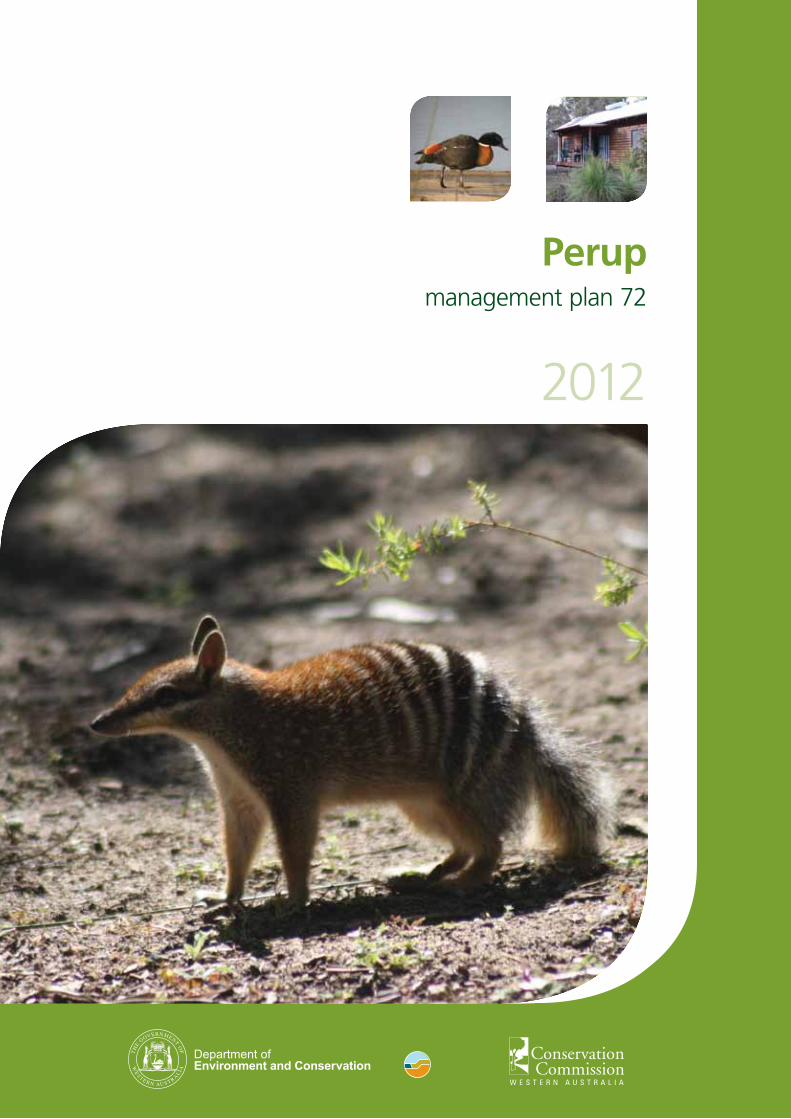
Main cover photo: Numbat (Myrmecobius fasciatus)Other cover photos: Australian shelduck (Tadorna tadornoides) photo by Peter Taylor The ‘Cottage’ located at Perup – Nature’s Guesthouse photo by Tim Foley

management plan 72
2012
Perup
Department of Environment and ConservationConservation Commission of Western Australia

Page ii
Perup management plan
Acknowledgments
Planning team
This management plan was prepared by a Department of Environment and Conservation (DEC) planning team consisting of Paul Roberts, Peter Keppel, John Gillard, Roger Hearn, Dr Lachie McCaw, Tim Foley, Brad Barton, Rod Simmonds and Ian Michael.
The planning team acknowledges individuals past and present for their involvement and input while preparing this management plan, and those who contributed submissions during the preparation of this plan. The planning team would like to thank the many DEC staff who contributed to the preparation of, and commented on, the management plan, particularly Paul McCluskey, Ian Wilson, Adrian Wayne, Beverly Gardiner, Amanda van Loon, Cathy Birch, Laura Sinclair, Trevor Howard, Roger Armstrong, Michael Coote and Ken Wallace. Maps have been produced by Aaron Rivers.
Conservation Commission
Carol Lacroix, formerly from the Conservation Commission of Western Australia (Conservation Commission), was an observer for this plan.
Community involvement
Many individuals and organisations made valuable contributions to the development of this document. The planning team would especially like to acknowledge the contributions of Mr Ray Curo (Shire of Manjimup), Mr Dion Steven (Shire of Boyup Brook, Bridgetown-Greenbushes and Manjimup), Cassandra Stipanicev (Shire of Cranbrook), Leonie Banks (WA Recreational Horserider’s Association), Justin Bellanger (South Coast NRM), R. Crosby, Tom Devries, Jenny Dewing (Blackwood Environment Society), Cheryl Hamence (Blackwood Valley Landcare), Bessel Hanekamp, Emily Lewis (Warren Catchments Council), Ian Moore (Moore Mapping), Bob Morgan (Fire for Life), Geraldine Muir, Graham Muir, Mark Muir, Kelum Pape, Alida Parke, Bev Parke, Les Parke, Keith Prosser, Kim Redman (Bridgetown-Greenbushes Friends of the Forest), June Roberts, Andy Russell, Erica Shedley (Birds Australia WA), Peter Taylor (Birding South West), Helen Tuckett (Tonebridge Progress Association), Noreen Tuckett (Boyup Brook Tourist Bureau), Katherine and Kevin Waddington (Outback Heritage Horse Association of WA).
Aboriginal people
The contribution of Nyoongar people to the preparation of this plan is recognised. Any information presented that has been handed down should not be used outside the context of this management plan.
The term ‘Nyoongar’ refers to Aboriginal people who live in the south-west corner of Western Australia (WA), between Jurien Bay and Esperance. The word ‘Nyoongar’ can be spelt in different ways, and spelling in this form should also be seen to encompass the Noongar, Nyungar, Noongah and Nyungah spellings.
Funding and support
The preparation of this management plan has been partly funded and supported by the Australian Government Department of Sustainability, Environment, Water, Population and Communities.
Images
Main cover photo: Numbat (Myrmecobius fasciatus)Other cover photos: Australian shelduck (Tadorna tadornoides) photo by Peter Taylor The ‘Cottage’ located at Perup – Nature’s Guesthouse photo by Tim Foley Header photo: Migratory waders and other waterbirds at Lake Unicup, photo by Peter Taylor

Page iii
Perup management plan
Contents1. Introduction...............................................................................................................................1
1.1 Management plan area...............................................................................................................11.2 Key values and threats...............................................................................................................21.3 Management directions............................................................................................................6
2. Management purpose................................................................................................................7
2.1 Legislative and policy framework............................................................................................72.2 Management arrangements with Aboriginal people.................................................................82.3 Performance assessment...........................................................................................................92.4 Administration........................................................................................................................102.5 Term of the plan......................................................................................................................10
3. Managing the natural environment........................................................................................11
3.1 Physical environment..............................................................................................................113.2 Biological environment...........................................................................................................143.3 Protecting the natural environment.........................................................................................21
4. Managing cultural heritage.....................................................................................................34
4.1 Aboriginal cultural heritage....................................................................................................344.2 Other Australian cultural heritage...........................................................................................36
5. Managing visitor use................................................................................................................38
5.1 Visitor opportunities and planning..........................................................................................385.2 Visitor access...........................................................................................................................415.3 Visitor activities and use..........................................................................................................425.4 Tourism and commercial operations.......................................................................................44
6. Managing resource use............................................................................................................45
7. Involving the community.........................................................................................................48
8. Research and monitoring........................................................................................................51
9. Glossary ....................................................................................................................................56
10. References ............................................................................................................................. 61
Maps ............................................................................................................................................ 53
Map 1. Management plan area ..................................................................................................... 53Map 2. Vegetation of the Muir-Byenup Ramsar wetland system ................................................ 54Map 3. Visitor management settings ............................................................................................ 55
Tables
Table 1. Existing reserves in the planning area. ............................................................................. 1Table 2. Summary of the ecological character of the Muir-Byenup Ramsar wetland system. ...... 4Table 3. Proposed additions to the planning area......................................................................... 21
Perup management plan
1.1 Management plan areaThis management plan has been prepared by DEC on behalf of the Conservation Commission. The plan covers two national parks (Greater Kingston National Park and Lake Muir National Park) and 17 nature reserves (including Lake Muir Nature Reserve and Tone-Perup Nature Reserve) totalling about 106,889 hectares in the Perup area north and east of Manjimup (Map 1, Table 1). These parks and reserves, henceforth referred to as the ‘planning area’, lie within the local government areas of Manjimup, Bridgetown-Greenbushes, Boyup Brook and Cranbrook (Map 1). This management plan will be the first plan for all the parks and reserves in the planning area.
Table 1: Existing reserves in the planning area
Reserve Name/ Tenure
Reserve no.
Class Area (ha)
Purpose Created3
Alco Nature Reserve 32142 Other2 191.2 Conservation of flora and fauna
July 1973
Bokarup Nature Reserve 14739 A 146.1 Water and conservation of flora and fauna
June 1978
Cobertup1 Nature Reserve 26681 A 151.0 Water and conservation of flora and fauna
October 1978
Cowerup Nature Reserve 33455 Other2 270.5 Conservation of flora and fauna
July 1975
Galamup Nature Reserve 6549 A 221.8 Conservation of flora and fauna
March 1978
Greater Kingston1 National Park 47662 A 21,092.0 National park December 2004Kodjinup Nature Reserve 26678 A 626.0 Water and conservation of
flora and faunaOctober 1978
Kulunilup Nature Reserve 26677 A 612.0 Water and conservation of flora and fauna
October 1978
Lake Muir Nature Reserve 31880 A 11,310.8 Water and conservation of flora and fauna
August 1978
Lake Muir1 National Park 47886 A 9625.0 National park December 2004Noobijup Nature Reserve 26680 A 183.1 Water and conservation of
flora and faunaOctober 1978
Pindicup Nature Reserve 26679 A 281.0 Water and conservation of flora and fauna
October 1978
Pinticup Nature Reserve 26682 A 75.5 Water and conservation of flora and fauna
October 1978
Quindinup1 Nature Reserve 25506 Other2 2653.0 Conservation of flora and fauna
October 1985
Tone-Perup1 Nature Reserve 47879 A 55,935.0 Conservation of flora and fauna
December 2004
Unicup Nature Reserve 25798 A 3296.0 Conservation of flora and fauna
December 1960
Wilgarrup Nature Reserve 12381 Other2 84.6 Conservation of flora and fauna
November 1985
Yarnup Nature Reserve 29601 A 61.6 Water and conservation of flora and fauna
November 1978
Un-named nature reserve 46478 A 72.8 Conservation of flora and fauna
February 2001
Total area 106,8891 Name of reserve is only provisional. 2 Other than class A reserves. 3 Gazettal date for the current purpose.
Page 1
1. Introduction

Page 2
Perup management plan
1.2 Key values and threats
Key values
The planning area has importance for the following specific key values:
• the internationally significant ‘Muir-Byenup system’ Ramsar-listed wetland (Muir-Byenup Ramsar wetland system) (Map 1)
• the nationally and regionally significant system of wetlands that is one of few in the state in a near pristine condition, and contains rare peat swamps and the biggest natural sedgelands in WA
• extensive jarrah (Eucalyptus marginata) old-growth forest
• a high diversity of native plant (flora) and animal (fauna) species in a large undisturbed and intact biological refuge that is contiguous with substantial nearby areas of state forest and national park
• ten threatened flora species
• fourteen threatened fauna species, including one of the last remaining strongholds of the woylie (Bettongia penicillata ogilbyi), numbat, tammar wallaby (Macropus eugenii derbianus), Muir’s corella (Cacatua pastinator pastinator), Australasian bittern (Botaurus poiciloptilus) and Balston’s pygmy perch (Nannatherina balstoni), the biggest remaining non-coastal population of the ngwayir or western ringtail possum (Pseudocheirus occidentalis), the biggest known wambenger or brushtail phascogale (Phascogale tapoatafa ssp. [WAM M434]) population in WA, one of the most abundant chuditch (Dasyurus geoffroii) populations
• many large areas that have a high probability of not being infested by Phytophthora cinnamomi
• Aboriginal sites of mythological, ceremonial, cultural and spiritual significance, and non-Indigenous sites associated with early settlement and the agricultural and forestry industries
• regionally-significant visitor facilities at Perup – Nature’s Guesthouse and Lake Muir Observatory
• an accumulation since the 1970s of long-term ecological research knowledge on a range of species, habitats and threatening processes.
Woylie. Photo – Bert and Babs Wells Rain clouds over Lake Muir. Photo – Paul Roberts

Page 3
Perup management plan
Ecological character
The 10,630 hectare Muir-Byenup Ramsar wetland system is located within Lake Muir Nature Reserve (Map 1). It was listed under the Convention on Wetlands of International Importance especially as Waterfowl Habitat (also known as the Ramsar Convention) in January 2001 on the basis that it meets criteria 2, 4, 5 and 6 (see www.environment.gov.au/wetlands). Since listing, the Ramsar criteria have been revised (Ramsar Convention 2005). An assessment of the Muir-Byenup System Ramsar site (Ramsar site or site) against the nine Ramsar criteria (Cook and Farrell 2009) shows that the Ramsar site meets the following six criteria:
• Criterion1:Awetlandshouldbeconsideredinternationallyimportantifitcontainsarepresentative,rareoruniqueexampleofanaturalornear-naturalwetlandtypefoundwithintheappropriatebiogeographicregion. The Ramsar site is an excellent example of a wetland complex in a relatively undisturbed condition in the South-West Coast Australian Drainage Division (Environment Australia 2001). The peat based wetlands within the Ramsar site are rare in WA and they are also recognised as the most outstanding example in south-western Australia.
• Criterion 2: A wetland should be considered internationally important if it supports vulnerable, endangered, or critically endangered species or threatened ecological communities. Three wetland-dependent orchids (Caladenia christineae, Caladenia harringtoniae and Diuris drummondii) are listed as ‘vulnerable’ under the federal government’s Environment Protection and Biodiversity Conservation Act 1999 (EPBC Act), and occur at the Ramsar site in appreciable numbers. These plants mainly occur on seasonally inundated areas or wetland margins, which have been extensively cleared for agriculture elsewhere in south WA. However, the Ramsar site also supports the ‘endangered’ woylie and the ‘vulnerable’ Balston’s Pygmy Perch, Muir’s corella, forest red-tailed cockatoo (Calyptorhynchus banksii naso), chuditch, numbat and quokka (Setonix brachyurus).
• Criterion3:Awetlandshouldbeconsideredinternationallyimportantifitsupportspopulationsofplantand/oranimalspeciesimportantformaintainingthebiologicaldiversityofaparticularbiogeographicregion. Peat and primary saline wetlands at the Ramsar site support endemic species and populations of plant and animal species important for maintaining the biodiversity of the south-west coast Australian drainage division. The Ramsar site includes 21 ‘priority taxa’, including the following endemic plant taxa Eryngium sp. Lake Muir and Tribonanthes sp. Lake Muir. The plant taxon Astartea sp. Lake Muir is also endemic to the Ramsar site. The majority of the population of Wurmbea sp. Cranbrook also occurs at the Ramsar site. The Ramsar site supports six of the eight endemic south-western Australian freshwater fish species including; the western pygmy perch (Edelia vittata), Balston’s pygmy perch, nightfish (Bostockia porosa), western minnow (Galaxias occidentalis), black-striped minnow (Galaxiella nigrostriata) and mud minnow (Galaxiella munda). The Ramsar site also supports a number of important macroinvertebrate taxa, including 32 endemic taxa (Storey 1998).
• Criterion 4: A wetland should be considered internationally important if it supports plant and/or animal species at a critical stage in their life cycles, or provides refuge during adverse conditions. The open lakes of the Ramsar site regularly support moulting by thousands of Australian shelducks, which is one of the most important moulting sites in south WA. Lake Muir is used as a drought refuge by tens of thousands of waterbirds. However, the Ramsar site also supports ten species identified under international migratory species agreements (see 2.1 Legislative and policy framework and Native animals and habitats), and is also an important breeding site for the little bittern (Ixobrychus minutus), spotless crake (Porzana tabuensis), Australasian bittern, black swan (Cygnus atratus) and Eurasian coot (Fulica atra).
Page 4
Perup management plan
• Criterion 5: A wetland should be considered internationally important if it regularly supports 20,000 or more waterbirds. Up to 52,000 waterbirds have been counted in a full Lake Muir. The annual data on water depth suggest conditions are suitable for use by 20,000 waterbirds at least several times within a 25 year period, which in the context of wetland availability in WA is considered sufficient evidence of regular use by 20,000 waterbirds.
• Criterion 6: A wetland should be considered internationally important if it regularly supports one per cent of the individuals in a population of one species or subspecies of waterbird. At least five, possibly 10, Australasian bitterns occur regularly and possibly breed in the sedge swamps of the Ramsar site, which constitutes more than one per cent (i.e. five) of the south WA population (Wetlands International 2006). The Ramsar site contains the core component of a wider suite of wetlands that constitutes one of the five remaining refuges for the south WA population of this globally threatened species.
The ecological character of the Muir-Byenup Ramsar wetland system has been described by Cook and Farrell (2009) and a summary is provided in Table 2.
Table 2. Summary of the ecological character of the Muir-Byenup Ramsar wetland system.
Component Summary description
Geology Tertiary alluvial flats (Lake Muir) and Tertiary plateau and flat (Byenup Lagoon system).
Hydrogeology Fresh to saline groundwater. Groundwater pH 5.2–6.3. Acidity is due to soluble metals. Potential acidity is present in the form of pyrite (metallic sulphide).
Lake Muir
Hydrology Major sink water – almost exclusively internally draining. Naturally saline wetland – shallow evaporating basin (dry nine years 1998–2008).
Water quality Saline (0.58–96 parts per thousand). pH 6.2–9.9. Lower pH is associated with low water levels.
Flora (habitat) Salt tolerant macrophytes. Fringing vegetation includes Gahnia trifida sedgelands, low shrublands (samphires) and wetland scrub. Flat-topped yate (Eucalyptus occidentalis) occurs at higher elevations. Notable flora includes wetland-dependent orchids and endemic species.
Aquatic invertebrates No information available.
Fish No information available.
Frogs and reptiles No comprehensive surveys. Likely to be rich in reptiles, including oblong tortoises (Chelodinea oblonga) and tiger snakes (Notechis scutatus).
Mammals Believed to contain many species found in adjacent Tone-Perup Nature Reserve, including woylies and chuditch. Also contains suitable habitat for the boodie (Bettongia lesueur lesueur), dalgyte (Macrotis lagotis) and water rat or rakali (Hydromys chrysogaster).
Waterbirds Regularly supports 20,000 waterbirds. Up to 52,000 waterbirds in 1989. Five species listed under international migratory agreements. Used as a drought refuge by large numbers of waterbirds. Black swans, silver gulls (Larus novaehollandiae) and Australasian shoveler (Anas rhynchotis) breed at Lake Muir.
Page 5
Perup management plan
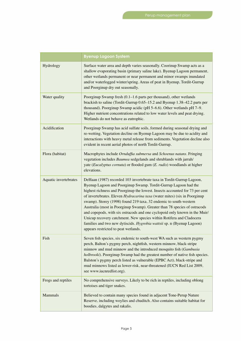
Byenup Lagoon System
Hydrology Surface water area and depth varies seasonally. Coorinup Swamp acts as a shallow evaporating basin (primary saline lake). Byenup Lagoon permanent, other wetlands permanent or near permanent and minor swamps inundated and/or waterlogged winter/spring. Areas of peat in Byenup, Tordit-Gurrup and Poorginup dry out seasonally.
Water quality Poorginup Swamp fresh (0.1–1.6 parts per thousand), other wetlands brackish to saline (Tordit-Gurrup 0.65–15.2 and Byenup 1.38–42.2 parts per thousand). Poorginup Swamp acidic (pH 5–6.6). Other wetlands pH 7–9. Higher nutrient concentrations related to low water levels and peat drying. Wetlands do not behave as eutrophic.
Acidification Poorginup Swamp has acid sulfate soils, formed during seasonal drying and re-wetting. Vegetation decline on Byenup Lagoon may be due to acidity and interactions with heavy metal release from sediments. Vegetation decline also evident in recent aerial photos of north Tordit-Gurrup.
Flora (habitat) Macrophytes include Ornduffia submersa and Schoenus natans. Fringing vegetation includes Baumea sedgelands and shrublands with jarrah/yate (Eucalyptus cornuta) or flooded gum (E. rudis) woodlands at higher elevations.
Aquatic invertebrates DeHaan (1987) recorded 103 invertebrate taxa in Tordit-Gurrup Lagoon, Byenup Lagoon and Poorginup Swamp. Tordit-Gurrup Lagoon had the highest richness and Poorginup the lowest. Insects accounted for 73 per cent of invertebrates. Eleven Hydracarina taxa (water mites) (six in Poorginup swamp). Storey (1998) found 219 taxa, 32 endemic to south-western Australia (most in Poorginup Swamp). Greater than 78 species of ostracods and copepods, with six ostracods and one cyclopoid only known in the Muir/Unicup recovery catchment. New species within Rotifera and Cladocera families and two new dytiscids. Hygrobia wattsii sp. n (Byenup Lagoon) appears restricted to peat wetlands.
Fish Seven fish species, six endemic to south-west WA such as western pygmy perch, Balton’s pygmy perch, nightfish, western minnow, black-stripe minnow and mud minnow and the introduced mosquito fish (Gambusia holbrooki). Poorginup Swamp had the greatest number of native fish species. Balston’s pygmy perch listed as vulnerable (EPBC Act), black-stripe and mud minnows listed as lower-risk, near-threatened (IUCN Red List 2009, see www.iucnredlist.org).
Frogs and reptiles No comprehensive surveys. Likely to be rich in reptiles, including oblong tortoises and tiger snakes.
Mammals Believed to contain many species found in adjacent Tone-Perup Nature Reserve, including woylies and chuditch. Also contains suitable habitat for boodies, dalgytes and rakalis.

Page 6
Perup management plan
Waterbirds Tordit-Gurrup used as a drought refuge by large numbers of waterbirds. Open water important for Australian shelduck moulting (more than 12,000 in 1992). Non-vegetated beaches (Tordit-Gurrup and Byenup) provide habitat for waders, ducks and swans. Poorginup Swamp contains critical habitat for Australasian bitterns (endangered, IUCN Red List 2009). Little bittern, spotless crake, Australasian bitterns, black swans and Eurasian coots breed at the site. Local knowledge suggests grebes, swamp harrier (Circus approximans), blue-billed duck (Oxyura australis), cormorants, sea-eagles and spoonbills also breed at the site (P Taylor, pers. comm.).
Key threats
The major threats in the planning area that have potential to significantly affect the key values include:
• altered hydrological regimes and processes, particularly altered water flows and increasing salinity/acidity
• Phytophthora cinnamomi dieback plant disease, and potentially pathogenic organisms affecting the woylie
• invasive plants and animals, particularly foxes (Vulpes vulpes), cats (Felis catus), pigs, deer, goats and horses
• inappropriate/extreme fire regimes, particularly infrequent, large and intense bushfires and frequent fires that are intense enough to kill fire regime specific species.
1.3 Management directions
Vision
The unique natural and cultural heritage values of the internationally significant Perup area, such as the Ramsar wetlands, threatened species and old-growth forests, and our knowledge of them, are conserved and enhanced for present and future generations.
This vision, which is derived from community input and reflects the key values of the planning area, will be supported by DEC’s implementation of its corporate plan strategic objectives.
Specific desired outcomes and objectives for managing the parks and reserves in the planning area to achieve these strategic objectives, and how these will be achieved and measured, are detailed throughout the plan.
Key directions of this management plan include:• protecting the Muir-Byenup Ramsar wetland system
• protecting large areas of vegetation free of Phytophthora cinnamomi
• gaining local knowledge about and controlling invasive species
• maintaining or improving water balances
• ensuring management is consistent with the Lake Muir/Unicup recovery catchment plan, once it is produced
• managing species of conservation significance and impacts upon them to maintain long-term viability of populations
• fostering and improving community understanding of, and involvement in, management of key values.

Page 7
Perup management plan
2.1 Legislative and policy frameworkDEC administers the Conservation and Land Management Act 1984 (CALM Act), which provides for the management of lands and waters vested with the Conservation Commission, and the Wildlife Conservation Act 1950 (WC Act), which provides for specific protection of native flora and fauna within WA. For information on other environmental legislation see www.slp.wa.gov.au/legislation/agency.nsf/dec_menu.htmlx and for DEC policies see www.dec.wa.gov.au/decpolicies. This management plan provides a summary of operations proposed to be undertaken in the planning area as required under the CALM Act.
Australia is a signatory to a number of important international conservation agreements (for example, Ramsar Convention, Bonn Convention and migratory bird agreements, see Glossary), which affect the management of the planning area. State and federal government agencies collaborate in providing the legislative and policy framework for management and reporting of wetlands listed under the Ramsar Convention. The EPBC Act, through the Environment and Biodiversity Conservation Regulations 2000 (Schedule 6, regulation 10.02), state general standards for Ramsar wetlands in Australia, including principles for management, management planning, and environmental impact assessment and approval (see www.environment.gov.au/wetlands). This CALM Act management plan is the Ramsar management plan for the Muir-Byenup Ramsar wetland system.
Under the EPBC Act, actions that have, or are likely to have, a significant impact on a matter of national environmental significance, such as (i) wetlands of international importance (listed under the Ramsar Convention), (ii) threatened species and ecological communities, and (iii) migratory species protected under international agreements, need approval from the responsible Australian Government Minister, in addition to any approval that may be needed in WA. In terms of (i) above, the matter protected under the EPBC Act is the ‘ecological character’ of a Ramsar wetland, not just features of the wetland located within the site boundary. In addition to promoting the conservation and wise use of wetlands, parties to the Ramsar Convention accept a number of other responsibilities, including managing a Ramsar site to maintain its ‘ecological character’ (see 1.2 Key values and threats).
There is scope to increase the size of the Muir-Byenup Ramsar wetland system to include some parts of Lake Muir Nature Reserve, as well as some adjacent conservation reserves, that are not covered by the listing.
Parts of the planning area also lie within the Lake Muir/Unicup ‘Natural Diversity Recovery Catchment’ (Lake Muir/Unicup recovery catchment) (Map 1), which under the State Salinity Strategy’s ‘Natural Diversity Recovery Catchment’ program (State Salinity Council 2000) helps recover and protect significant natural areas, particularly wetlands, from salinity.
Australian shelduck (Tadorna tadornoides) photo by Peter Taylor
2. Management purpose

Page 8
Perup management plan
Desired outcome
• Key values will be protected and conserved through management that is consistent with relevant legislation, policy and national and international obligations.
Strategies
1. Ensure that management is consistent with Australia’s obligations under the Ramsar Convention, and promote the management of the Muir-Byenup Ramsar wetland system in accordance with the Australian Ramsar Management Principles.
2. Seek an increase in the size of the Muir-Byenup Ramsar wetland system by proposing additions of contiguous areas that have become vested with the Conservation Commission since the site’s Ramsar listing.
3. Ensure that management is consistent with WA’s obligations under the State Salinity Strategy for the management of the Lake Muir/Unicup recovery catchment.
2.2 Management arrangements with aboriginal peopleThe South West Aboriginal Land and Sea Council Aboriginal Corporation is the representative body appointed under the federal government’s Native Title Act 1993 (Native Title Act) for native title holders and other Aboriginal people within the planning area. There are three registered native title claims that cover the planning area: Southern Nyoongar (WC96/109), Wagyl Kaip (WC98/70) and South West Boojarah 2 (WC06/4). Most of the planning area falls within the Wagyl Kaip claim area. No native title determinations have been made at this time, although native title is extinguished over the majority of the existing national parks and nature reserves of the planning area.
Banded stilts (Cladorhynchus leucocephalus) at Lake Unicup. Photo – Peter Taylor
Page 9
Perup management plan
DEC and the Conservation Commission support joint management arrangements with traditional custodians and are now working towards legally enabling joint management arrangements on conservation estate and Aboriginal-held lands, irrespective of native title. Several demonstration park councils have been established throughout WA. These park councils are partnerships between Aboriginal people and DEC for the joint management (in an advisory capacity) of specified areas of the conservation estate. Subject to appropriate resourcing, park council or other forum may be established to assist with management of conservation reserves in the area.
DEC has a memorandum of understanding with the South West Aboriginal Land and Sea Council (signed in 2002) in relation to access and cooperative management agreements between DEC and Aboriginal people. DEC has also worked closely with native title claimants and local Aboriginal people over many years on a number of recreation and heritage projects.
On 14 March 2012 the CALM Act 1984 was amended by the Conservation Legislation Amendment Act 2011 to enable joint management of conservation estate and other types of lands with relevant Aboriginal people (see www.slp.wa.gov.au). During the life of the plan, if joint management is identified as a priority and there are the resources and capacity to undertake it, a formal joint management arrangement may be considered, which may require the revision of the management plan. A joint management arrangement may enable management decisions to be made about:
• the conduct of customary activities and access
• protecting and conserving the value of the land to the culture and heritage of Aboriginal persons
• interpretive material
• employment opportunities
• tourism and commercial opportunities.
2.3 Performance assessmentPerformance assessment is recognised as an essential part of environmental management systems, and the results of performance assessments serve many uses including (i) the promotion of adaptive management which leads to continuous improvement, (ii) improving management planning practice and management outcomes, and (iii) promoting accountability and public support for management actions (Conservation Commission 2008a). The Conservation Commission will measure the success of this plan in accordance with section 19(1)(g) of the CALM Act by using selected key performance indicators that target key components of the plan, and other mechanisms as appropriate. A portfolio of evidence relating to the key performance indicators will be required to be established and maintained by DEC (at the district level) throughout the life of the plan to prove that this management plan has been successfully implemented. A range of information could be used for this purpose, including photographs, maps or figures (to show spatial and temporal changes), checklists, on-ground surveys, incident investigation reports or records, interviews, observations and written correspondence.
The EPBC Act, through the Environment Protection and Biodiversity Conservation Regulations 2000, regulates the reporting of sites in Australia listed under the Ramsar Convention. Specific limits of acceptable change are identified by Cook and Farrell (2009). However, data collection within the Lake Muir/Unicup recovery catchment is in a research phase. As yet many components of the ecological character do not have sufficient baseline information in which to describe natural variation, set limits and provide indicators of change in the key characteristics of the Ramsar-listed wetland.
Desired outcomes
• DEC has developed systems and processes to provide evidence of plan implementation.
• The ecological character of the Muir-Byenup Ramsar wetland system is maintained.
Page 10
Perup management plan
Objective
2.3.1 Establish limits of acceptable change for maintaining the Muir-Byenup Ramsar wetland system’s ecological character during the life of the plan.
Strategy
1. Establish and maintain a portfolio of evidence throughout the life of the plan to prove that this management plan has been successfully implemented.2. Develop limits of acceptable change for maintaining the Muir-Byenup Ramsar wetland system’s ecological character.
Key performance indicator
Performance measure Target Reporting requirements
2.3.1 Limits of acceptable change for maintaining the Muir-Byenup Ramsar wetland system’s ecological character
2.3.1 Limits of acceptable change are developed for the Muir-Byenup Ramsar wetland system
Every five years
2.4 AdministrationThe planning area lies mainly within DEC’s Donnelly District of the Warren Region (Map 1). The day-to-day implementation of the management plan is the responsibility of the district manager. The district manager will coordinate the implementation of this management plan for the parks and reserves in the planning area within allocated budgets and other resources.
2.5 Term of the planThis management plan is for a period not exceeding 10 years and comes into operation from the date that a notice is published in the Gazette. However, the plan shall remain in force until it is revoked and a new plan is approved and substituted for it. At any time, the plan may be amended.
Jarrah forest in flower. Photo – Tim Foley
Page 11
Perup management plan
3. Managing the natural environment
3.1 Physical environment
Climate
The planning area has a Mediterranean climate with cool wet winters and hot dry summers. Annual rainfall ranges from 700–900 millimetres per year, has a strong declining gradient in rainfall variation from south to north and falls mostly during the winter months. As a consequence, the area is prone to bushfires. Annual evaporation ranges from 1400–1600 millimetres per year and has a less marked gradient than rainfall. Mean monthly maximum and minimum temperatures recorded at Rocky Gully over the past 14 years range from 27.4–6.5 degrees Celsius (see www.bom.gov.au/climate/averages/tables/ca_wa_names.shtml).
Climate affects the hydrology of the Muir/Unicup recovery catchment. Rainfall influences groundwater aquifer recharge, which maintains the wetlands, and surface water hydrology. Annual evaporation (1400–1600 millimetres) influences wetlands in the short term through seasonal changes in salinity, and in the long term through increasing groundwater salinity as evaporation exceeds precipitation. A slight gradient of increasing groundwater salinity from south to north reflects the patterns of evaporation and rainfall (Storey 1998).
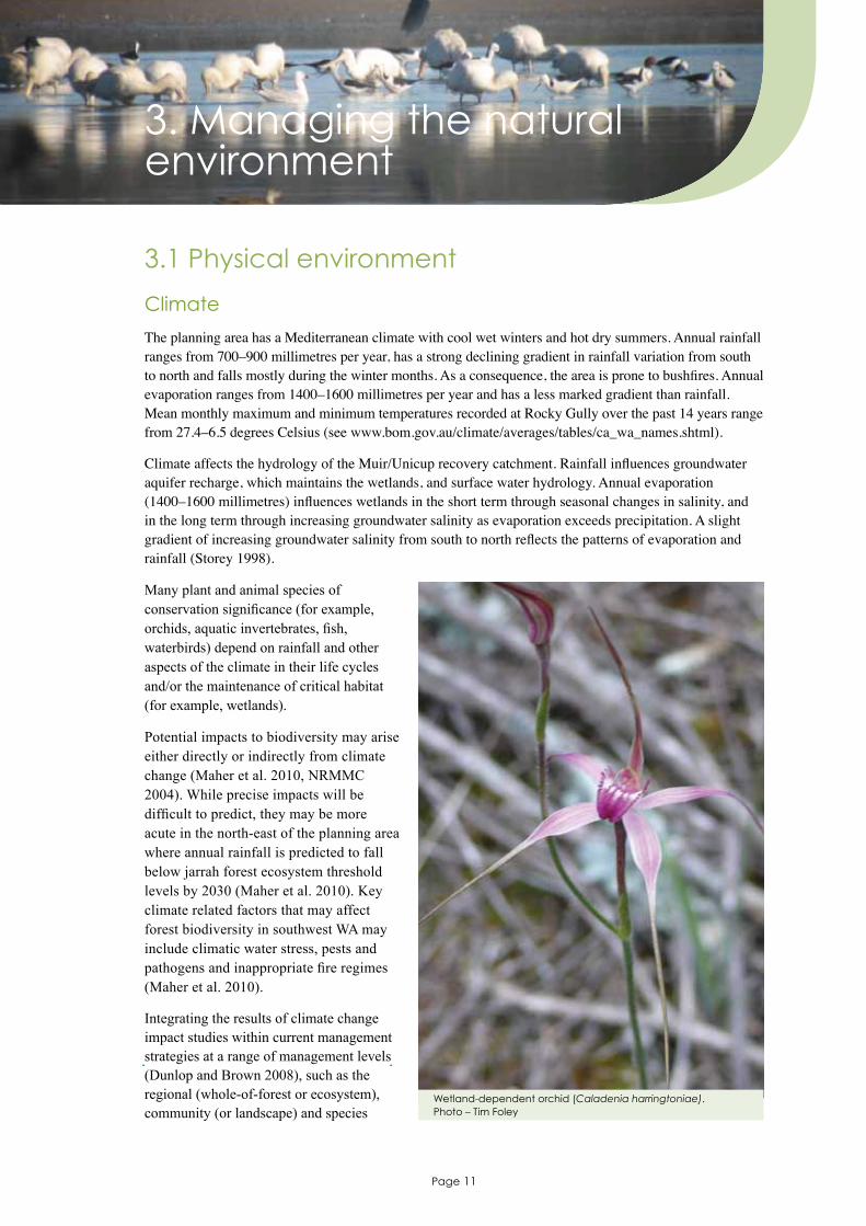
Many plant and animal species of conservation significance (for example, orchids, aquatic invertebrates, fish, waterbirds) depend on rainfall and other aspects of the climate in their life cycles and/or the maintenance of critical habitat (for example, wetlands).
Potential impacts to biodiversity may arise either directly or indirectly from climate change (Maher et al. 2010, NRMMC 2004). While precise impacts will be difficult to predict, they may be more acute in the north-east of the planning area where annual rainfall is predicted to fall below jarrah forest ecosystem threshold levels by 2030 (Maher et al. 2010). Key climate related factors that may affect forest biodiversity in southwest WA may include climatic water stress, pests and pathogens and inappropriate fire regimes (Maher et al. 2010).
Integrating the results of climate change impact studies within current management strategies at a range of management levels (Dunlop and Brown 2008), such as the regional (whole-of-forest or ecosystem), community (or landscape) and species
Wetland-dependent orchid (Caladenia harringtoniae). Photo – Tim Foley
Page 12
Perup management plan
(or operational) level, could help improve the survival and resilience of species, communities and ecosystems, increase the likelihood of successful adaptation and decrease their vulnerability to climate change. At the regional level, conservation strategies include preserving vegetation corridors, increasing the conservation reserve system and implementing species recovery programs. At the community or landscape level, strategies include improving resilience by increasing and refining existing management actions for other threats (such as invasive plants and animals, diseases and inappropriate fire regimes). At the species or operational level, collecting seed and captive fauna breeding programs provide a fall-back mechanism for long-term species survival and potential re-introduction projects. All of the actions currently used to manage protected areas will remain critical for protected area management, although the specific mixture of actions, how they are applied, the information to be managed and the objectives of management may change (NRMMC 2004).
Geology, landforms and soils
The planning area is within the Yilgarn Craton and the Albany-Fraser Orogen, which are partly overlain by sediments of the Bremer Basin. The Manjimup Fault, which runs east–west across the area in the vicinity of Manjimup, divides the Archean (2800–2600 million years old) granites of the Yilgarn Craton north of the fault from the Proterozoic (1300–1100 million years old) rocks of the Albany-Fraser Orogen to the south of it. The Albany-Fraser Orogen in this region consists of granitic orthogneisses, gneisses and migmatites of the Biranup Complex. During the Eocene (54–38 million years old) sandstones, siltstones and spongolites of the Bremer Basin were deposited in a thin veneer over the rocks of the Albany-Fraser Orogen. Tertiary to recent (45 million years old to present) regolith formations cover more than 50 per cent of the planning area. The regolith includes weathering products, drainage related sediments and coast-related sediments. Laterite, a residual product formed by intense weathering to underlying basement, is extensive. The drainage related sediments include sand, silt, clay and conglomerate deposited in creeks, swamps and lakes.
Climatic conditions, slow water movement and a shallow lake basin have resulted in the accumulation of peat deposits in Byenup Lagoon, Tordit-Gurrup Lagoon, Poorginup Swamp and a number of un-named swamps in the Lake Muir/Unicup recovery catchment. These peat swamps, which are rare in Australia and in particular WA, strongly influence water quality and provide an effective filter and buffering capacity and an important habitat for native plants and animals. Organic soils and peat swamps have the potential to become acid sulfate soils.
Hydrology
The planning area is located within the Blackwood, Deep, Frankland, Lake Muir and Warren catchments. Well-defined surface water drainage in the north drains into the Wilgarrup, Yerraminnup, Perup, Tone, Donnelly and Blackwood rivers (Map 1). The Lake Muir/Unicup recovery catchment (Map 1) is a large flat area of internal drainage consisting of a suite of partly inter-connected small to large lakes (Lake Muir is 4600 hectares), swamps and floodplains of varied salinity (saline to fresh), permanence (permanent to seasonal) and substrate (peat and inorganic) (Smith 2003). While the Lake Muir/Unicup recovery catchment is one of 13 inland natural wetland complexes in WA, it is the only wetland complex of its type in near pristine condition.
Wetlands occurring in the lowlands of the Lake Muir/Unicup recovery catchment vary from lakes through to sumplands and damplands, some creeks, palusplains and floodplains and, depending on their position in the landscape, may belong to perched groundwater systems overlying poorly conductive clays or may be ‘windows’ to deeper regional aquifers (P Taylor in Smith 2003). Most of the wetlands have partly cleared catchments and fringing vegetation of varying width. Wetlands possibly contribute to maintenance of groundwater in the catchment, but little is known about the interactions between the shallow and deep groundwater systems and the interaction of these with the surface water systems. Groundwater movement is controlled by geology and topography, with most groundwater slowly discharged from shallow flow systems into dissecting drainages or lakes. Lake Muir and Unicup Lake are surface expressions of the
Page 13
Perup management plan
groundwater. Water recharge of wetlands occurs as a result of precipitation, rising groundwater, local discharge from springs or surface run-off. Seasonal rainfall generally determines wetland water levels and variations in wetland salinity. Inflow surface water is channeled into Lake Muir from northern and eastern wetlands and, while Lake Muir is the final sink for water in the catchment (acting as a large shallow evaporating basin that usually dries up to a salt pan in summer) (Smith 2003), water can also move into the Tone, Deep and Frankland catchments under certain conditions.
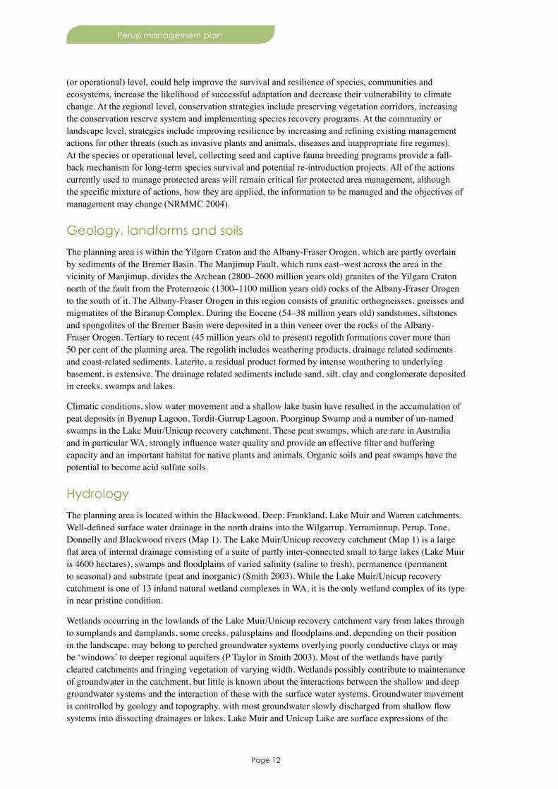
Water quality monitoring has been undertaken at Byenup, Lake Muir, Poorginup, Tordit-Gurrup, Unicup, Yarnup and other local wetlands since the late 1970s (Lane et al. 2009). DEC and Department of Water monitor one water gauging station and 184 groundwater bores at 115 sites in the catchment, as well as about 40 surface water sites. More drilling and installation of water monitoring bores, as well as the installation of gauging stations, weirs and other water sampling points, will occur. Aquatic biodiversity in streams is also being monitored annually at several locations in the planning area as part of a project linked to key performance indicator 20 of the Forest management plan 2004–2013 (Conservation Commission 2004). The Inland Aquatic Integrity Resource Condition Monitoring project (see www.dec.wa.gov.au/content/view/5309/1556/) provides a protocol for monitoring wetlands in WA and standard techniques for measuring indicators of wetland condition.
Desired outcomes
• The area’s geological features, landforms and soils are protected, and the natural surface and groundwater hydrological regimes are maintained.
• The results of climate change impact studies are incorporated into current management strategies at the regional, community and species level.
Objective
3.1.1 Increase knowledge of the natural surface and groundwater hydrological regimes for the reserves in the Lake Muir/Unicup recovery catchment within five years of the plan being gazetted.
Strategies
1. Protect geological features, landforms and soils (such as alluvial soils) vulnerable to environmental disturbance.
2. Establish guidelines for sound earthwork practices and implement these for development works.3. Maintain information on surface and groundwater hydrological regimes, including the integration
of all hydrological data and survey information as a consolidated base for more investigations and monitoring.
4. Develop and calibrate a natural surface and groundwater hydrological model for the reserves in the Lake Muir/Unicup recovery catchment.
5. Describe and quantify the natural variation in hydrological parameters used in the model to facilitate increased accuracy of system thresholds.
6. Protect water sources, wetlands and hydrological processes from damage or disturbance that may affect water quality or quantity.
Water monitoring at Red Lake. Photo – Roger Hearn
Page 14
Perup management plan
7. Assess all development proposals for their potential adverse impacts on geological and hydrological features, landforms, soils, surface water movement, and groundwater quality and quantity, and referring proposals that may impact on key values.
8. Appropriately rehabilitate disturbed areas and monitor to progress restoration of these to a stable condition resembling as close as possible the natural ecosystem function.
9. Where appropriate, map occurrences of peat and organic soils in the planning area, consistent with the nature conservation plan for the Warren Region.
10. Consider the potential for acid sulfate soils in planning and operations (for example, fire, earthworks, rehabilitation and/or planting), and avoid disturbance, compaction or displacement of saturated soils at risk.
11. Monitor hydrological regimes through the measurement of water parameters taken at bores, gauging stations, weirs and other water sampling points.
12. Install more bores, gauging stations, weirs and other water sampling points as necessary.13. Encourage fencing to prevent stock from private property encroaching on the wetlands.14. Adaptively incorporate response strategies to climate change impacts on threatened species,
communities and ecosystems.
Key performance indicator
Performance measure Target Reporting requirements
3.1.1 A wetlands hydrological information system for the Lake Muir/Unicup recovery catchment is developed
3.1.1 Establish a wetlands hydrological information system for the Lake Muir/Unicup recovery catchment within five years of the plan being gazetted
After five years
3.2 Biological environmentThis part of the management plan draws upon species records from DEC’s online, publicly available mapping program Naturemap (see naturemap.dec.wa.gov.au), which consolidates many spatial records associated with the natural biodiversity across the state.
Native plants and plant communities
The planning area is a major centre of plant biodiversity and contains about 925 and 497 native vascular and non-vascular species, respectively. Nature reserves in the Lake Muir/Unicup recovery catchment (totalling 19,888 hectares) alone contain 862 native species in comparison to the 27,000 hectare Lesueur National Park that contains 821 species (Gibson and Keighery 2000).
The planning area contains many plant species of conservation significance, such as:
• seven threatened species listed under the EPBC Act – the endangered Caladenia dorrienii, Verticordia densiflora var. pedunculata and Verticordia plumosa var. vassensis, and the vulnerable Caladenia christineae, Caladenia harringtoniae, tall donkey orchid and Myriophyllum trifidum
• nine threatened species or ‘rare flora’ declared and listed under the WC Act – the critically endangered Andersonia annelsii and Grevillea acropogon, endangered Caladenia christineae, Caladenia dorrienii, Verticordia densiflora var. pedunculata and Verticordia plumosa var. vassensis, and vulnerable Caladenia harringtoniae, tall donkey orchid and Myriophyllum trifidum
• 46 priority species

Page 15
Perup management plan
• 18 locally endemic species (for example, Astartea sp. Lake Muir, Eryngium sp. Lake Muir, Tribonanthes sp. Lake Muir and Wurmbea sp. Cranbrook) (Hearn et al. 2003)
• 14 relictual species (Hearn et al. 2003).
The Warren Region Threatened Flora Recovery Team, as well as DEC’s Declared Rare and Poorly Known Flora in the Warren Region (Hearn et al. 2008), provides guidance for the management and protection of threatened and priority flora in the region to ensure their continued survival.
The planning area lies predominantly within the Menzies botanical sub-district of the Darling Botanical District, a division of the South West Botanical Province. Plant communities mainly comprise medium forest and woodlands of jarrah, marri (Corymbia calophylla), yate, Eucalyptus decipiens and wandoo (E. wandoo) in various combinations; low woodlands and closed forests of paperbarks; scrublands; tea-tree, mohan (Melaleuca viminea) and heartleaf poison (Gastrolobium bilobum) thickets; sedgelands, reed swamps and lakes (Gibson and Keighery 1999). Vegetation within the Muir-Byenup Ramsar wetland system has been mapped by Gibson and Keighery (2000) (Map 2). Permanently wet areas support large dense stands of jointed rush (Baumea articulata) and other sedges, and reserves in the Lake Muir/Unicup recovery catchment have some of the biggest areas of natural sedgelands in WA. There has been no change in the vegetation of most of the 27 wetlands in the Lake Muir/Unicup recovery catchment during a five-year period from 1997 (Gibson et al. 2004).
There are 11 forest ecosystems in the planning area, eight of which meet the agreed target for reservation in a formal conservation system of 15 per cent of the pre-1750 distribution. Jarrah North East, Western Wandoo Forest and Western Wandoo Woodland do not currently meet the target for reservation. However, with the proposed additions in the Forest management plan 2004–2013 they will reach 16 per cent, 18 per cent and 21 per cent reservation respectively. The planning area significantly contributes towards the protection of Jarrah Unicup (99 per cent), Swamps (34 per cent) and Jarrah South (25 per cent) ecosystems.
Protocols for monitoring native vegetation condition have been developed by the Native Vegetation Integrity Project (see www.dec.wa.gov.au/content/category/31/930/2245/).
Heartleaf poison (Gastrolobium bilobum) thicket in Tone-Perup Nature Reserve. Photo – Paul Roberts

Page 16
Perup management plan
Desired outcome
• Native plants and plant communities are identified, protected and conserved.
Objectives
3.2.1 Maintain the baseline extent and condition of vegetation communities in the Muir-Byenup Ramsar wetland system during the life of the plan.
3.2.2 Maintain or improve the number of mature/reproducing plants of Caladenia christineae, C. dorrienii, C. harringtoniae, Myriophyllum trifidum, Verticordia densiflora var. pedunculata and tall donkey orchid during the life of the plan.
Strategies
1. Identify native plants and plant communities that may need special protection, and implement appropriate strategies to minimise the impacts from threatening processes such as climate change, environmental weeds, pest and problem animals, inappropriate fire regimes and proposed developments.
2. Assess and, where necessary, propose statutory protection for species of conservation significance.3. Assess all proposed operations and developments for potential impacts.4. Manage species of conservation significance consistent with priorities established by the Warren
Region Threatened Flora Recovery Team. 5. Where appropriate, develop and implement recovery and translocation plans for species of
conservation significance consistent with priorities established by the Warren Region Threatened Flora Recovery Team, particularly Andersonia annelsii and Grevillea acropogon.
6. Develop and implement condition monitoring and evaluation programs for rare flora species, particularly Caladenia christineae, C. dorrienii, C. harringtoniae, Myriophyllum trifidum, Verticordia densiflora var. pedunculata and tall donkey orchid.
7. Establish baseline information of the extent and biomass of phytoplankton vegetation communities across the Muir-Byenup Ramsar wetland system and the macrophyte vegetation community of Lake Muir.
8. Monitor the extent and condition of phytoplankton, macrophytes, samphire, Gahnia sedgeland and fringing shrubs and trees within the Muir-Byenup Ramsar wetland system (Map 2).
9. Apply the proposed hydrological model for predicting potential change in the extent and health of vegetation with various water regime scenarios.
Key performance indicators
Performance measure Target Reporting requirements
3.2.1 Baseline areal extent and condition of vegetation communities in the Muir-Byenup Ramsar wetland system
3.2.1 Maintain baseline areal extent and condition during the life of the plan
Every five years
3.2.2 The number of mature/reproducing plants of Caladenia christineae, C. dorrienii, C. harringtoniae, Myriophyllum trifidum, Verticordia densiflora var. pedunculata and tall donkey orchid
3.2.2 Maintain or improve the number of mature/reproducing plants during the life of the plan
Every five years, or as per recovery plans if applicable
Page 17
Perup management plan
Native animals and habitats
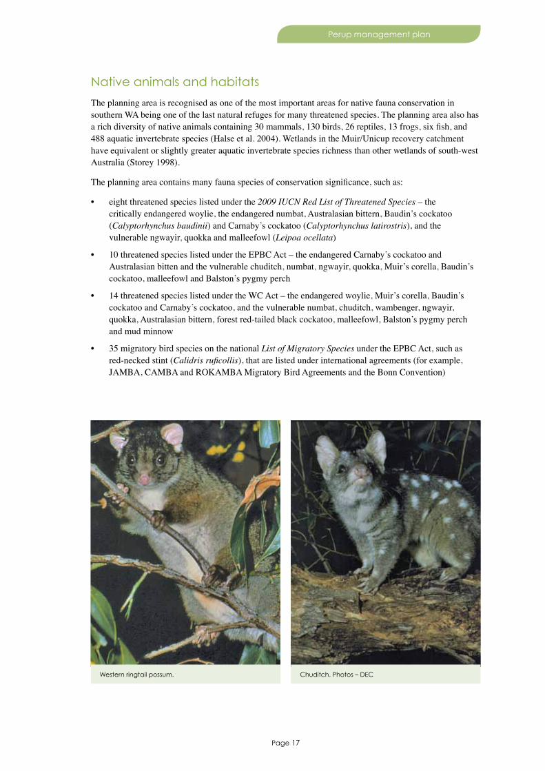
The planning area is recognised as one of the most important areas for native fauna conservation in southern WA being one of the last natural refuges for many threatened species. The planning area also has a rich diversity of native animals containing 30 mammals, 130 birds, 26 reptiles, 13 frogs, six fish, and 488 aquatic invertebrate species (Halse et al. 2004). Wetlands in the Muir/Unicup recovery catchment have equivalent or slightly greater aquatic invertebrate species richness than other wetlands of south-west Australia (Storey 1998).
The planning area contains many fauna species of conservation significance, such as:
• eight threatened species listed under the 2009 IUCN Red List of Threatened Species – the critically endangered woylie, the endangered numbat, Australasian bittern, Baudin’s cockatoo (Calyptorhynchus baudinii) and Carnaby’s cockatoo (Calyptorhynchus latirostris), and the vulnerable ngwayir, quokka and malleefowl (Leipoa ocellata)
• 10 threatened species listed under the EPBC Act – the endangered Carnaby’s cockatoo and Australasian bitten and the vulnerable chuditch, numbat, ngwayir, quokka, Muir’s corella, Baudin’s cockatoo, malleefowl and Balston’s pygmy perch
• 14 threatened species listed under the WC Act – the endangered woylie, Muir’s corella, Baudin’s cockatoo and Carnaby’s cockatoo, and the vulnerable numbat, chuditch, wambenger, ngwayir, quokka, Australasian bittern, forest red-tailed black cockatoo, malleefowl, Balston’s pygmy perch and mud minnow
• 35 migratory bird species on the national List of Migratory Species under the EPBC Act, such as red-necked stint (Calidris ruficollis), that are listed under international agreements (for example, JAMBA, CAMBA and ROKAMBA Migratory Bird Agreements and the Bonn Convention)
Western ringtail possum. Chuditch. Photos – DEC
Page 18
Perup management plan
• 13 priority species – black-stripe minnow, Doeg’s watermite (Pseudohydraphantes doegi), Poorginup Swamp watermite (Acercella poorginup), black bittern (Ixobrychus flavicollis), masked owl (Tyto novaehollandiae novaehollandiae), western brush wallaby (or kwoora) (Macropus irma), water rat, little bittern, bush stonecurlew (Burhinus grallarius), crested shrike-tit (Falcunculus frontatus leucogaster), carpet python (Morelia spilota imbricata), quenda (or Southern brown bandicoot) (Isoodon obesulus fusciventer) and tammar wallaby
• six endemic native fish species, 32 endemic macroinvertebrate species and six locally endemic macroinvertebrate species including Doeg’s watermite and the Poorginup Swamp watermite (Storey 1998)
• some invertebrate species are considered to be relictual species (for example, Huitfeldtia sp. nov).
Wetlands in the Lake Muir/Unicup recovery catchment are important to the survival of many waterbird species, and the presence and abundance of species is strongly influenced by local and regional water availability. Eight species of waterbirds breed in the wetlands, such as little bittern, spotless crake, Australian shelduck, silver gull and Australasian bitterns. Some species congregate in high numbers on undisturbed waters within the Lake Muir/Unicup recovery catchment during moulting and in 1989 up to 52,000 waterbirds were observed on Lake Muir alone with the most abundant species being Pacific black duck (Anas superciliosa) (18,500), grey teal (Anas gracilis) (16,000), Eurasian coot (10,000), black swan (4,000) and Australian shelduck (3,500).
The planning area is uniquely important to the conservation of fauna species and assemblages. The diversity of vertebrate fauna is relatively complete compared with what is known to have occurred about the time of settlement by Europeans. Only the ‘presumed extinct’ Leeuwin’s rail (Rallus pectoralis clelandi), and the endangered boodie and dalgyte are known to have become locally extinct within the planning area. The planning area now supports critically important or key populations of several species that have been lost from much of their former range (for example, woylie, numbat and tammar wallaby).
Perup is a particularly important area for critical weight range mammals (Burbidge and McKenzie 1989). Many of the reserves in the planning area also have remnant and linkage value as they adjoin the wheatbelt to the east, which has been extensively cleared for agriculture. A 400 hectare predator-free enclosure in Tone-Perup Nature Reserve (for example, the ‘Perup Sanctuary’) protects an emergency colony of up to 500 endangered woylies and will enable ongoing scientific research into factors associated with woylie population dynamics. The planning area is also potentially valuable for re-introductions or translocations of fauna, such as the malleefowl, boodie and dalgyte.
Recovery plans exist for the chuditch (Orell and Morris 1994), ngwayir (Burbidge and de Tores 1998), woylie (Start et al. 1995), Muir’s corella (Chapman and Cale 2008), Baudin’s cockatoo (Chapman 2007), Carnaby’s cockatoo (Cale 2003), forest red-tailed black cockatoo (Chapman 2007) and malleefowl (Benshemesh 2007).
Some habitats are particularly important for the survival and persistence of species. Extensive thickets of heartleaf poison have contributed to the existence and value of the conservation reserves for protecting critical weight range mammals from predation by the introduced predators the fox and cat (Christensen et al. 1985). Thickets of mohan, which have a lifespan of about 20 years, provide shelter for the tammar wallaby. Open water, mudflats, Baumea and Gahnia sedgelands, samphire, Melaleuca and Eucalyptus habitats in the Muir-Byenup Ramsar wetland system are important for macroinvertebrates, fish and waterbirds (foraging, nesting, roosting and protection from predators).
Page 19
Perup management plan
Desired outcome
• Native animals and their habitats are identified, protected and conserved.
Objectives
3.2.3 Maintain the baseline composition and abundance of fauna communities in the Muir-Byenup Ramsar wetland system during the life of the plan.
3.2.4 No adverse change in the conservation status of the woylie, numbat, chuditch, wambenger, ngwayir, quokka, Australasian bittern, malleefowl, Balston’s pygmy perch and mud minnow during the life of the plan.
3.2.5 No adverse change in the conservation status of the quenda and tammar wallaby during the life of the plan.
3.2.6 Increase the populations of Muir’s corella, Baudin’s cockatoo, Carnaby’s cockatoo and forest red- tailed cockatoo during the life of the plan.
Strategies
1. Identify native animals that may need special protection, and implement appropriate strategies to minimise the impacts from threatening processes such as climate change, environmental weeds, pest and problem animals, inappropriate fire regimes and proposed developments.
2. Assess and, where necessary, propose statutory protection for species of conservation significance.3. Assess all proposed operations and developments for potential impacts.4. Develop and implement recovery plans for species of conservation significance, particularly the
woylie, Muir’s corella, Baudin’s cockatoo, Carnaby’s cockatoo and forest red-tailed cockatoo.5. Investigate new techniques for managing impacts of cockatoos on rural enterprises for Muir’s corella
and Baudin’s cockatoo.6. Search for new populations, monitor population size and research fire and habitat management for
the Australasian bittern.7. Survey for new populations and update the conservation status of black-stripe minnow, black bittern,
little bittern and masked owl.8. Develop and implement condition monitoring programs for the quenda and tammar wallaby.9. Develop and implement translocation plans for species of conservation significance, particularly the
boodie and dalgyte.10. Identify knowledge gaps relating to fauna composition, abundances and distributions, such as under-
studied taxa (for example, invertebrates and bats) and areas (for example, isolated reserves), and undertake, support or encourage systematic fauna surveys.
11. Establish baseline information on the composition and abundance of invertebrates, frogs, fish, waterbirds and mammals of Lake Muir, and frogs, waterbirds and mammals of other wetlands in the Muir-Byenup Ramsar wetland system.
12. Monitor the composition and abundance of invertebrates, frogs, fish, waterbirds and mammals within the Muir-Byenup Ramsar wetland system.
13. Survey and monitor threatened species and their habitat to assess the effectiveness of management and identify regional trends through space and time (for example, abundance changes of greater than 30 per cent within a period of one-to-two years).
14. Maintain a predator-proof enclosure in Tone-Perup Nature Reserve for the establishment, protection and recovery of sustainable populations of the woylie and other species of conservation significance.
Page 20
Perup management plan
Key performance indicators
Performance measure Target Reporting requirements
3.2.3 Baseline composition and abundance of fauna communities in the Muir-Byenup Ramsar wetland system
3.2.3 Maintain baseline composition and abundance during the life of the plan
Every five years
3.2.4 The conservation status of the woylie, numbat, chuditch, wambenger, ngwayir, quokka, Australasian bittern, malleefowl, Balston’s pygmy perch and mud minnow located in the planning area
3.2.4 No adverse change1 in the conservation status as a result of management activity during the life of the plan
Every five years, or as per recovery plans if applicable
3.2.5 The conservation status of the quenda and tammar wallaby
3.2.5 No adverse change1 in the conservation status as a result of management activity during the life of the plan
Every five years, or as per recovery plans if applicable
3.2.6 Populations of Muir’s corella, Baudin’s cockatoo, Carnaby’s cockatoo and forest red-tailed cockatoo
3.2.6 Increase in the populations of Muir’s corella, Baudin’s cockatoo, Carnaby’s cockatoo and forest red-tailed cockatoo during the life of the plan
Every five years, or as per recovery plans if applicable
1 This KPI is in line with KPI 2 in the Forest management plan 2004–2013, which is examined at a whole-of-forest scale (Conservation Commission 2008b).
Ecological communities
There are no records of threatened ecological communities in the planning area. The ‘aquatic invertebrate communities of peat swamps’ is a priority ecological community (priority 2). Other ecological communities of conservation significance in the area include (i) plant assemblages of primary saline wetlands, (ii) claypans with shrubs over herbs, and (iii) flat-topped yate association (May and McKenzie 2003).
The planning area contains 19,828 hectares of jarrah old-growth forest, principally within Tone-Perup Nature Reserve (10,860 hectares) and Lake Muir National Park (6430 hectares), which represents about 19 per cent of the planning area, and six per cent of the old-growth forest in the south-west of WA.
Desired outcome
• Ecological communities of conservation significance are identified, protected and conserved.
Strategies
1. Identify ecological communities that may need special protection, and implement appropriate strategies to minimise the impacts from threatening processes such as climate change, environmental weeds, pest and problem animals, inappropriate fire regimes and proposed developments.
2. Assess and, where necessary, propose statutory protection for ecological communities of conservation significance.
3. Assess all proposed operations and developments for potential impacts.4. Undertake an assessment of the conservation status of, and threats to, the ‘aquatic invertebrate
communities of peat swamps’ and ‘plant assemblages of primary saline wetlands’ ecological communities and, where appropriate, implement condition monitoring and evaluation programs.
Page 21
Perup management plan
3.3 Protecting the natural environment
Conservation reserve system
The planning area lies within the ‘Jarrah Forest’ IBRA bioregion, and specifically within the central part of the ‘Southern Jarrah Forest’ IBRA sub-region. About 14 per cent (637,238 hectares) of the ‘Jarrah Forest’ IBRA region is protected within conservation reserves and 17 per cent (441,076 hectares) of the ‘Southern Jarrah Forest’ IBRA sub-region is protected within conservation reserves (of which 24 per cent is protected within the planning area).
The creation of a conservation reserve system that is comprehensive, adequate and representative helps meet obligations under the International Convention on Biological Diversity and Australia’s Strategy for the National Reserve System 2009–2030 (National Reserve System Task Group 2009). Proposed additions to existing reserves in the planning area are listed in Table 3 and shown on Map 1. Proposed additions to the planning area will increase the amount of WA’s jarrah forest IBRA region in conservation reserves. As proposed additions become vested with the Conservation Commission, they will be managed in accordance with this management plan. Any reserve additions, or changes in the classification of existing reserves or the category of land, will be subject to government consideration and determination.
Table 3. Proposed additions to the planning area
Proposed additions
Current tenure
Proposed land category1
Proposed class
Area (ha)
Comments
Recommendations from the Forest management plan 2004–2013
Wournbelup / Chowerup UCL (located northeast of Tone-Perup Nature Reserve)
UCL nature reserve
A 2,147.0 ID 1682
reserve 27925 (located along Foley Road east of the Wournbelup / Chowerup UCL)
other reserve nature reserve
A 8.7 ID168, vested with Shire of Boyup Brook for purpose of ‘gravel’.
reserve 30214 (located north of the Wournbelup / Chowerup UCL)
unmanaged nature reserve
A 4.3 ID 168
Dingup (located east of the Wilgarrup River between Balbarrup and Franco roads)
state forest conservation park
A 230.0 ID 180
reserve 10504 (located on the Perup River along Junction Road)
other reserve nature reserve
A 80.0 ID 194, vested with Shire of Manjimup for purpose of ‘Parkland rehabilitation gravel and water’.

Page 22
Perup management plan
Proposed additions
Current tenure
Proposed land category1
Proposed class
Area (ha)
Comments
reserve 10391 (located on the Tone River along Mordalup Road)
other reserve national park A 37.5 ID 196, vested with Shire of Manjimup for purpose of ‘Parkland rehabilitation gravel and water’.
Bokarup UCL (UCL surrounding Bokarup Nature Reserve)
UCL nature reserve
A 155.8 ID 202
Bokarup UCL (UCL surrounding Bokarup Nature Reserve)
UCL nature reserve
A 155.8 ID 202
reserve 35307 (located southeast of Bokarup Nature Reserve)
other reserve nature reserve
A 324.2 ID 202
Chitelup (located east of Lake Muir Nature Reserve)
state forest national park A 310.0 ID 235
Other proposed additions
Red Lake and Cowerup Swamp (Location 12811, located north of Lake Muir Nature Reserve)
UCL nature reserve
A 560.0 Exclusive of the current mining tenements.
Tree hovea (Hovea elliptica) in jarrah forest within Lake Muir National Park. Photo – Tim Foley

Page 23
Perup management plan
Proposed additions
Current tenure
Proposed land category1
Proposed class
Area (ha)
Comments
Department of Water freehold
• Lot 3 on Diagram 82777 (north of Unicup Nature Reserve)
• Lot 6 on Plan 19196 (north of Unicup Nature Reserve)
• Lot 4 on Plan 20201 (north of Kodjinup Nature Reserve)
• Lot 5 on Plan 20201 (north of Kodjinup Nature Reserve)
• Lot 2 on Diagram 72081 (between Unicup and Kulunilup nature reserves)
• Lot 3 on Plan 15956 (south of Kulunilup Nature Reserve)
• Lot 12983 on Plan 173761 (south of Bokarup Nature Reserve)
• Lot 12982 on Plan 173761 (south of Bokarup Nature Reserve)
• Lot 12646 on Plan 208989 (west of Bokarup Nature Reserve)
• Lot 12167 on Plan 206171 (north of Bokarup Nature Reserve)
conservation reserve3
A3
473.1
234.3
783.6
711.8
353.5
341.4
97.9
154.2
264.1
594.2
10 locations adjoining Bokarup, Kodjinup, Kulunilup and Unicup nature reserves
Total area 7,865.6
1 Under the CALM Act.2 The ID number refers to specific reserve proposals in Appendix 2 of the Forest management plan 2004–2013.3 While DEC prefers these parcels of land to become conservation reserve, the specific proposed tenure and class will be subject to government consideration and determination.
DEC has a memorandum of understanding with the Department of Regional Development and Lands in relation to the management of the non-townsite unallocated Crown land (UCL) and unmanaged reserves.
Desired outcome
• Protection of the values of the planning area.
Objective
3.3.1 Increase the area of Jarrah Forest IBRA region in conservation reserves.

Page 24
Perup management plan
Strategies
1. Implement the tenure recommendations as outlined in Table 3, subject to government consideration and determination.
2. Where appropriate, seek to incorporate adjoining or nearby land, if identified as having high conservation significance, and subject to government consideration and determination.
3. Manage any proposed reserve additions in the Perup area that become vested with the Conservation Commission in accordance with this management plan.
4. Investigate and consider upgrading Alco, Cowerup, Quindinup and Wilgarrup nature reserves to ‘class A’ reserves, subject to government consideration and determination.
5. Establish official reserve names for all provisionally named conservation reserves in Table 1.
Key performance indicator
Performance measure Target Reporting requirements
3.3.1 Incorporation of areas identified in Table 3 into the planning area
3.3.1 All identified areas have been incorporated into the planning area
Every five years
Wandoo Woodland. Photo – Paul Roberts

Page 25
Perup management plan
Altered hydrological regimes
Alterations to the natural groundwater and surface water regimes may have a significant impact on wetland values, and are often inter-related with other threats such as invasive plants and animals, diseases, inappropriate fire regimes, and acid sulfate soils.
Changes in the watertable levels and altered seasonal patterns, and the quantity and timing of water draining into the catchment and reserves can have adverse direct or indirect impacts on aquatic ecosystems in the planning area. Recent historic variation in mean annual water depths has been recorded for Lake Muir (0–1.31 metres), Byenup Lagoon (0.4–2.8 metres), Tordit-Gurrup Lagoon (0.15–3.1 metres) and Poorginup Swamp (0–0.72 metres). Rising groundwater in parts of the Lake Muir/Unicup recovery catchment is increasing salinity and affecting vegetation and aquatic ecosystems, and rising watertables, which can adversely affect habitat condition. Declining groundwater in other parts of the catchment is exposing acid sulfate soils with subsequent acidification of wetlands, waters and soils. Changes in surface water flows through artificial drainage can also exacerbate existing impacts (Gibson and Keighery 1999, Cook and Farrell 2009). Proposals to alter drainage on or into lands managed by DEC are assessed in accordance with the Conservation Commission’s Position Statement No. 5 Drainage (see www.conservation.wa.gov.au), and may be acceptable if (i) drainage will not be detrimental to reserve values, (ii) drainage is an essential part of a longer term permanent and whole-of-catchment solution, and (iii) no alternative sites or routes exist.
Potential acid sulfate soils are associated with freshwater peat wetlands in Byenup Lagoon System (because of land clearing and rising watertables associated with plantation harvesting) and Poorginup Swamp (where acid sulfate soils have formed during seasonal drying, although installed artificial drains are causing the swamp to dry out earlier than other wetlands). Cowerup Swamp, which has acid sulfate soils with a pH between 3.4 and 4.9, has been mined for peat, and acidic water drains via artificial drainage channels and Red Lake into Lake Muir. Peat swamps are also at risk of burning during drier parts of the year, exposing acid sulfate soils that then release acid and associated heavy metals into surrounding waters and soils.
Bullrush (Typha orientalis) in a Muir/Unicup peat-based wetland. Photo – Ian Wheeler
Page 26
Perup management plan
A number of physical and chemical properties and processes, such as salinity, acidification, eutrophication, turbidity and levels of dissolved oxygen, have adverse direct or indirect impacts on aquatic ecosystems in the planning area, and are particularly important in the monitoring of water in the Muir-Byenup Ramsar wetland system (Cook and Farrell 2009). Recent historic variation in pH levels has been recorded for Lake Muir (6.2–9.9), Byenup and Tordit-Gurrup lagoons (6.8–9.3) and Poorginup Swamp (4.6–8.3), and in salinity (parts per thousand) levels has been recorded for Lake Muir (0.58–125), Byenup Lagoon (1.38–42.2), Tordit-Gurrup Lagoon (0.65–15.2) and Poorginup Swamp (0.1–1.6). However, knowledge and available data is insufficient at this time to propose water parameter indicators for monitoring alterations to the natural groundwater and surface water quality and hydrological regimes, and more hydrological investigations are needed.
The majority of naturally fresh water wetlands in the Byenup Lagoon system have shown significant, progressive salinisation since 1996–97. Salinisation has adverse direct and indirect impacts on jointed rush (which is characteristic of and responsible for the thick peat deposits), freshwater-adapted fringing and emergent Melaleuca and Eucalyptus vegetation, the composition and richness of freshwater aquatic invertebrate communities, the survival of several native fish species, and waterbird feeding and/or nesting.
Increased release of nutrients (via drainage) can occur from mining, agriculture and forestry activities, as well as from the drying of peat (which particularly releases organic nitrogen), which has caused algal blooms in Byenup Lagoon and has changed invertebrate composition (Cook and Farrell 2009).
A recovery plan is in preparation for the Lake Muir/Unicup recovery catchment that will consider a range of long term strategies, such as revegetation with local native plant species, for maintaining wetland values and ecological health of reserves in the planning area.
Desired outcome
• Minimal alterations to the natural groundwater and surface water quality and hydrological regimes.
Objective
3.3.2 Increase the knowledge of hydrological, hydro-geological and hydro-ecological parameters and relationships of the Lake Muir/Unicup recovery catchment during the life of the plan.
Strategies
1. Protect water sources, wetlands and hydrological processes from damage or disturbance that may affect water quality or quantity.
2. Assess all management activities and development proposals for their potential adverse impacts on surface and groundwater quality and quantity, and refer proposals that may impact on natural, cultural or socio-economic values.
3. Investigate hydrological, hydro-geological and hydro-ecological parameters of the Lake Muir/Unicup recovery catchment.
4. Develop and implement a recovery plan that covers the Lake Muir/Unicup recovery catchment.
5. Establish baseline information of the lake and aquifer levels within the Muir-Byenup Ramsar wetland system.
6. Monitor the change in lake and aquifer levels and water quality parameters of the Muir-Byenup Ramsar wetland system.
7. Develop and implement a condition monitoring program for the Muir-Byenup Ramsar wetland system.
8. Where appropriate, continue with revegetation programs on reserves in the planning area.

Page 27
Perup management plan
Key performance indicator
Performance measure Target Reporting requirements
3.3.2 A hydrological, hydro-geological and hydro-ecological investigation of the Lake Muir/Unicup recovery catchment
3.3.2 Completed report on the Lake Muir/Unicup recovery catchment
Every five years
Invasive plants and animals
Environmental weeds
About 143 species of environmental weeds occur in the planning area. Weeds that are current priorities for control include the ‘declared’ cape tulip (Moraea flaccida), as well as bullrush (Typha orientalis), watsonia (Watsonia spp.), Victorian tea tree (Leptospermum laevigatum) and introduced wattles (Acacia spp.). Watsonia, bullrush (Tordit-Gurrup Lagoon and in Geordinup Swamp), cape tulip, east coast wattles, exotic grasses, blue gums and various clovers (and their allies) are found within the Ramsar site (Cook and Farrell 2009). Exotic pines and eastern states eucalypt species occur in numerous locations including 16 trial plots. Some weeds such as bridal creeper (Asparagus asparagoides), which is a declared plant and a Weed of National Significance (Commonwealth of Australia 2009), and taylorina (Psoralea pinnata) are located on adjacent lands.
Introduced and other problem animals
The most significant introduced animals in the planning area are the fox, cat, pig, red deer, goat, horse and cattle (Bos taurus) (Cook and Farrell 2009).
A long-established 1080 baiting program for the control of foxes and wild dogs under DEC’s Western Shield covers most of the planning area, which has reduced fox and wild dog numbers to the extent that native mammal numbers have increased substantially (Morris et al. 2000). The timing of fox control programs is critical to successfully controlling foxes.
Feral cats are another serious predator of native birds and animals, and cats have been identified as the main predator of woylies in association with the recent woylie declines (Ward et al. 2008). Cat control is not readily achieved by conventional 1080 baiting or trapping, and additional targeted programs may be needed (Denny and Dickman 2010).
Feral pigs have substantially impacted wetlands where diggings have disturbed populations of rare flora and affected water quality (through increased turbidity). It is also thought that pigs are detrimental to quokka populations (de Tores et al. 2007). Annual trapping, baiting and shooting programs are undertaken in association with other land managers and local community groups (for example, Lake Muir-Denbarker Pig Eradication Group and the Sporting Shooters Association of Australia). Illegal release of feral pigs for hunting occurs in the area, which sustains local populations (Higgs and Lyons 2006). Trained domestic dogs aid in the control of feral pigs by locating and flushing feral pigs from thick vegetation (Higgs and Lyons 2006).
Deer, goats and cattle have been reported in various locations across the planning area, and represent significant threats to local biodiversity (DEWHA 2008). Deer exacerbate acid sulfate soils in Baumea sedgelands by oxygenating peat and mobilising acid groundwater, and also cause tree death through ringbarking (Cook and Farrell 2009). Cattle grazing has been known to occur in the Ramsar site, and has resulted in increased weed diversity in the jarrah/yate woodlands and E. rudis woodlands (Gibson and Keighery 2000, Cook and Farrell 2009).
Wild horses have been present in the Lake Muir area for some time and, despite occasional illegal release of horses, may have bloodlines that are considered historically important according to the Outback Heritage Horse Association of WA.
Page 28
Perup management plan
Mosquito fish are common in wetlands of the planning area (Storey 1998), and can (i) directly affect native fish species by fin-nipping and other antagonistic behaviours and (ii) prey on a wide range of food sources such as fish larvae, ‘grazing’ invertebrates (such as Daphnia) and young tadpoles. Redfin perch (Perca fluviatilis) were introduced to the Ramsar site as part of the acclimatization program and may still persist in the area (Cook and Farrell 2009).
The marri spitfire (Perga sp.), gum leaf skeletoniser (Uraba lugens), Helena gum moth (Opodiphthera helena) and the bulls-eye borer (Phoracantha acanthocera) can often impact jarrah and marri forest, but do not appear to be a serious threat to the long-term maintenance of biodiversity in healthy and robust ecosystems. The marri spitfire has caused defoliation and death of marri trees in the south-east part of the Ramsar site. This is likely to affect the balance of jarrah and marri communities and may also result in jarrah deaths due to changed hydrology, as jarrah is intolerant of inundation (Cook and Farrell 2009).
DEC is aware of the significant social and economic impacts that several native animals can and do have on local communities. Western grey kangaroo (Macropus fuliginosus) and emu (Dromaius novaehollandiae) (‘declared’ species) and the tammar wallaby may periodically cause damage to fences and feed on crops on adjoining agricultural land. Muir’s corella (‘declared’ species) aggregates in large flocks around the Lake Muir, Frankland and Rocky Gully area causing significant noise and damage to crops, grain stockpiles and remnant vegetation. While the western grey kangaroo and emu can be controlled by shooting programs (licensed and regulated under the WC Act), the tammar and Muir’s corella are fauna of conservation significance and control of impacts are limited to non-lethal methods.
Desired outcomes
• An improved understanding of the distribution and impacts of invasive plants and animals.
• Minimal impacts of invasive plants and animals on natural, cultural and socio-economic values.
• Prevention of new established invasive plant and animal populations.
Objectives
3.3.3 Decrease in the area and number of populations of cape tulip, bullrush, watsonia, Victorian tea tree and introduced wattles during the life of the plan.
3.3.4 Decrease in the distribution and numbers of foxes, cats, feral pigs, deer, goats and horses during the life of the plan.
Strategies
1. Maintain information on invasive plants and animals including presence, abundance and distribution, relevant biological information and history of control.
2. Assess the invasiveness, distribution and environmental impact of invasive plants and animals in the planning area, particularly feral cats, pigs, deer, goats and horses.
3. Control invasive plants and animals by appropriate methods in accordance with the species, its impact and the resources available.
4. Eradicate new populations of invasive plants and animals before they become established.5. Limit the opportunity for weeds to be introduced and established by (i) applying appropriate hygiene
practices to machinery, (ii) minimising disturbance of soil during management activities, and (iii) importing soil from only sources with strict soil quarantine.
6. Progressively assess and remove exotic trees, including their wildings, and rehabilitate affected areas.

Page 29
Perup management plan
7. Continue Western Shield introduced predator control, and investigate, monitor and review its effectiveness, including:• adequate documentation and timely delivery of the fox control program• cooperation and coordination between DEC and other land-holders and parties undertaking
predator control on and around the planning area• monitoring introduced predator activity and/or abundances in association with the control program• monitoring key native fauna to verify that conservation goals are being successfully achieved and
sustained.8. Allow the use of dogs and/or horses to facilitate hunting of feral pigs, with appropriate authorisation
and training, and other conservation management activities.9. Where appropriate, humanely control feral horses in association with the Outback Heritage Horse
Association of WA and local landholders.10. Investigate and control cattle grazing.
Key performance indicators
Performance measure Target Reporting requirements
3.3.3 The area and number of populations of cape tulip, bullrush, watsonia, Victorian tea tree and introduced wattles
3.3.3 Decrease in the area and number of populations of cape tulip, bullrush, watsonia, Victorian tea tree and introduced wattles during the life of the plan
Every five years
3.3.4 The distribution and abundance of foxes, cats, feral pigs, deer, goats and horses
3.3.4 Decrease in the distribution and abundance of foxes, cats, feral pigs, deer, goats and horses during the life of the plan
Every five years
Diseases
The most significant plant pathogen in the planning area is Phytophthora cinnamomi, which kills susceptible plants (Shearer et al. 2004) and can irreversibly change the composition of many plant and animal communities (Shearer et al. 2009, Wilson et al. 1994) including jarrah forest and woodlands, flats and swamps. P. cinnamomi infestation (strongly related to vegetation, the presence of watercourses and other water gaining sites, and access) is most common where human activities have taken place in the absence of an effective hygiene regime. P. cinnamomi is identified as one of the major threats to the conservation values of the Muir-Byenup System Ramsar site (Gibson and Keighery 1999, Cook and Farrell 2009). Feral pigs may also spread P. cinnamomi.
Wurmbea sp. Cranbrook at Byenup Lagoon. Photo – Roger Hearn
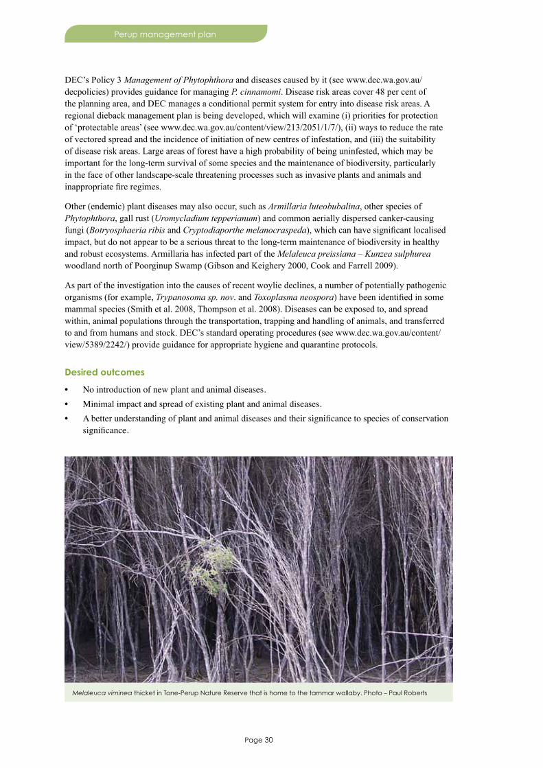
Page 30
Perup management plan
DEC’s Policy 3 Management of Phytophthora and diseases caused by it (see www.dec.wa.gov.au/decpolicies) provides guidance for managing P. cinnamomi. Disease risk areas cover 48 per cent of the planning area, and DEC manages a conditional permit system for entry into disease risk areas. A regional dieback management plan is being developed, which will examine (i) priorities for protection of ‘protectable areas’ (see www.dec.wa.gov.au/content/view/213/2051/1/7/), (ii) ways to reduce the rate of vectored spread and the incidence of initiation of new centres of infestation, and (iii) the suitability of disease risk areas. Large areas of forest have a high probability of being uninfested, which may be important for the long-term survival of some species and the maintenance of biodiversity, particularly in the face of other landscape-scale threatening processes such as invasive plants and animals and inappropriate fire regimes.
Other (endemic) plant diseases may also occur, such as Armillaria luteobubalina, other species of Phytophthora, gall rust (Uromycladium tepperianum) and common aerially dispersed canker-causing fungi (Botryosphaeria ribis and Cryptodiaporthe melanocraspeda), which can have significant localised impact, but do not appear to be a serious threat to the long-term maintenance of biodiversity in healthy and robust ecosystems. Armillaria has infected part of the Melaleuca preissiana – Kunzea sulphurea woodland north of Poorginup Swamp (Gibson and Keighery 2000, Cook and Farrell 2009).
As part of the investigation into the causes of recent woylie declines, a number of potentially pathogenic organisms (for example, Trypanosoma sp. nov. and Toxoplasma neospora) have been identified in some mammal species (Smith et al. 2008, Thompson et al. 2008). Diseases can be exposed to, and spread within, animal populations through the transportation, trapping and handling of animals, and transferred to and from humans and stock. DEC’s standard operating procedures (see www.dec.wa.gov.au/content/view/5389/2242/) provide guidance for appropriate hygiene and quarantine protocols.
Desired outcomes
• No introduction of new plant and animal diseases.• Minimal impact and spread of existing plant and animal diseases.• A better understanding of plant and animal diseases and their significance to species of conservation
significance.
Melaleuca viminea thicket in Tone-Perup Nature Reserve that is home to the tammar wallaby. Photo – Paul Roberts

Page 31
Perup management plan
Objective
3.3.5 All earth-moving activities during the life of the plan with the potential to move soil have a dieback hygiene management plan.
Strategies
1. Document any outbreaks of new plant and animal diseases, and implement management responses as appropriate.
2. Develop where necessary, and implement appropriate hygiene measures for management operations and proposed development, including hygiene management plans before commencing any operation that needs soil or plant material movement.
3. Identify, evaluate and, where practical, implement effective and efficient measures for the maintenance and/or restoration of significant P. cinnamomi infested areas, including (i) treating priority sites of threatened species and communities with phosphite, and (ii) rehabilitating badly affected areas using appropriate local dieback resistant species.
4. Identify ‘protectable areas’ that are at risk of introduction and spread of the disease that will adversely impact on the protectable area, and classify those areas in accordance with the CALM Act.
5. Where appropriate, undertake more detailed mapping of P. cinnamomi occurrence and/or the probability of infestation by P. cinnamomi.
6. Review the appropriateness of existing disease risk areas in the planning area.7. Where knowledge gaps exist and the importance to conservation is high, investigate plant and animal
diseases and their significance to species or ecosystems/habitats of conservation significance, such as determining the role of disease in the decline and limitations of recovery of the woylie or other species where appropriate.
Key performance indicator
Performance measure Target Reporting requirements
3.3.5 New infestations of dieback as a result of management activities
3.3.5 All earth-moving activities during the life of the plan with the potential to move soil have a dieback hygiene management plan
Every five years
Fire
DEC’s management of fire, including prescribed fire and bushfire prevention and suppression, is regulated by legislation (for example, Bush Fires Act 1954, CALM Act and precedents established under common law) and guided by DEC’s Policy No. 19 Fire management policy (see www.dec.wa.gov.au/decpolicies) and DEC’s Code of Practice for Fire Management (DEC 2008). The Conservation Commission’s Position Statement No. 1 also provides guidance on fire management (see www.conservation.wa.gov.au). Fire management, through the use of the ‘master burn plan’ process (see www.dec.wa.gov.au/content/view/128/1870/1/1/), will aim to:
• conserve biodiversity by implementing ecologically appropriate fire regimes in partnership with key fire management stakeholders to maintain a spatial and temporal fire history mosaic
• reduce the threat that bushfire presents to human life, community and fire-vulnerable assets by prescribed burning, fire prevention and fire suppression measures
• increase knowledge through fire research, operational experience and by monitoring and evaluating representative fire regimes across parts of the planning area
• maintain an informed and supportive partnership with relevant stakeholders through effective community engagement in the planning and management of fire.
Page 32
Perup management plan
Implementing ecologically appropriate fire regimes will be based on:• vitalattributesandlifehistoriesoffireregimespecificspeciesandcommunities. While many
species and communities are resilient to a range of fire intensities and fire regimes, some depend on a particular combination of fire interval, frequency, season and intensity for their persistence. For plants, these are species or communities that are readily killed by fire, but often depend on fire to stimulate germination, have long juvenile periods and which store seeds in the canopy. For animals, these are usually species that have specific habitat requirements such as a spatial mosaic of seral stages ranging from long unburnt to recently burnt, or specific vegetation structure requirements that are influenced by fire. Fire regime specific species and communities are typically associated with less flammable parts of the landscape such as rock outcrops, riparian zones, broad valley floors and some wetlands, especially those with peat substrates. Inappropriate fire regimes can have a range of impacts on sensitive flora and fauna species and can also result in the destruction of peat and retardation of regeneration of wetland shrub thickets, which are important for waterbird breeding (Cook and Farrell 2009). Knowledge of the vital attributes and life histories of fire regime specific species and communities can inform how and when to use fire at landscape scales to protect or appropriately manage these communities. For example, specific fire management guidelines have been prepared to accommodate the needs of fire regime specific communities in the planning area (for example, granite outcrops, peat swamps, watercourse reeds and rushes).
• vitalattributesandlifehistoriesofthreatenedspeciesandcommunities. Protecting threatened species and communities from large, intense bushfires and using planned fire to maintain habitat quality and to regenerate threatened plants is fundamental to the ongoing conservation of these species. Understanding the vital attributes and life histories of threatened species, which often have specific fire regime requirements, such as the tammar wallaby that needs fire-regenerated thickets with certain structural characteristics (Christensen 1980), is particularly important. Specific fire management guidelines have been prepared to accommodate the needs of a range of threatened species in the planning area (for example, ngwayir, tammar wallaby, black cockatoos and malleefowl).
• creatingandmaintainingadiversityofpost-firevegetationages(seralstages)acrosseachLandscapeConservationUnit. Planned and unplanned fires since the early 1970s have created patchiness in the age of the vegetation. A mosaic of vegetation and habitats representing a range of fire intervals, intensities, seasons and scales, provides habitat heterogeneity of different ages, which benefits biodiversity at landscape scales (Burrows 2008). Management of fire at this scale is based on landscape conservation units (Armstrong 2004). While the planning area contains seven landscape conservation units (LCU), most of the planning area lies within the Yornup-Wilgarup-Perup, Frankland-Unicup-Muir and South Eastern Upland LCUs. A greater diversity of seral stages result in a greater level of biodiversity, and Burrows and Abbott (2003) and Burrows (2008) describe the most stable form of relationship between proportion of the landscape and seral stage.
• reducingheavyfuelloadsandmaintainanetworkofstrategicfuel-reducedbuffers. A bushfire in 1950 burnt almost the entire planning area, and where lightning strikes or other ignitions coincide with severe fire weather and heavy fuel accumulation, then extensive, damaging bushfires occur. This strategy will reduce the severity and extent of bushfires, providing safer conditions for firefighters, neighbours and visitors as well as protection of biodiversity and community assets. Assets in the planning area considered to be of particularly high-value that should be specifically considered in fire management plans include Perup – Nature’s Guesthouse and Lake Muir Observatory, peat swamps, threatened species (especially fauna) and long-term research sites.
Ongoing research in the planning area is improving knowledge and understanding of fire regimes and the vital attributes of local species and ecosystems. The Perup Fire Effects study in Yackelup (DEC 2009), established in 1986, is examining the long-term effects of different fire regimes on the floristic and structural composition of jarrah forest and on forest productivity measured through tree health and growth. Fire exclusion reference areas deliberately exclude fire to provide reference sites for scientific studies of the effects of fire on the environment, and there are 10 of these in the planning area.
Page 33
Perup management plan
Desired outcomes
• Biodiversity and natural values at the landscape scale are maintained and protected.
• No impact on human life and community assets.
Objectives
3.3.6 All prescribed burn plans during the life of the plan will contain measurable biodiversity objectives and success criteria.
3.3.7 No loss of human life or serious injury attributable to DEC’s fire management during the life of the plan.
Strategies
1. Apply prescribed fire to establish and maintain a mosaic of vegetation post-fire seral stages (time since fire) with a modal grain size of about 250 hectares to protect life and community assets, fire regime specific biota and ecosystems from inappropriate fire regimes.
2. Apply prescribed fire in strategic locations to limit the potential fire run (extent) of bushfires, without intersecting low fuel areas.
3. Apply and maintain the master burn plan process.4. Use specific fire management guidelines to protect and conserve fire regime specific species and
ecosystems.5. Maintain a diversity of post-fire fuel ages across each landscape conservation unit.6. Encourage cooperative and compatible fire management arrangements between relevant agencies,
local government, local bushfire brigades and neighbouring land managers.7. Maintain a representative network of fire exclusion reference areas, consistent with DEC’s guidelines
for management of these areas.8. Ensure all prescribed burn plans during the life of the plan contain measurable biodiversity
objectives and success criteria.
Key performance indicators
Performance measure Target Reporting requirements3.3.6 Measurable biodiversity objectives and success criteria in prescribed burn plans
3.3.6 All prescribed burn plans contain measurable biodiversity objectives and success criteria
Every five years
3.3.7 The impact of fire on human life
3.3.7 No loss of human life or serious injury attributable to DEC’s fire management
Annually

Page 34
Perup management plan
The planning area contains a rich and varied history of both the Aboriginal and other Australian cultures, which is represented at different levels. In the national context, there are no sites on the National Heritage List (see www.environment.gov.au/heritage/places/index.html). Management of Aboriginal and other Australian cultural heritage in the planning area is guided by WA’s Aboriginal Heritage Act 1972, Heritage of Western Australia Act 1990 and DEC Policy 18 Recreation, tourism and visitor services (see www.dec.wa.gov.au/decpolicies). There are no sites in the planning area that are registered on the WA ‘Register of Heritage Places’ database (see www.heritage.wa.gov.au/the-state-register.html). Grevillea Fire Tower and the tramway formation (although the listing refers to Warrup block, the formation extends into Greater Kingston National Park) are the only sites on a ‘Municipal Inventory’ (Shire of Bridgetown-Greenbushes Municipal Inventory) in the planning area. DEC has 13 sites of cultural heritage significance listed on its Recreation and Tourism Information System database. Other sites may occur that are not registered.
4.1 Aboriginal cultural heritage
Heritage sites
There are 16 Aboriginal heritage sites known within the planning area, with three of these located on the Red Lake/Cowerup Swamp UCL (Department of Indigenous Affairs Register of Aboriginal Sites August 2011 data). Only two archaeological and ethnographical surveys have been undertaken in the planning area, mainly associated with Lake Muir and other nearby reserves. C. Dortch and A. Calder did an archaeological survey in 1973 of Cowerup Swamp, the east shore of Lake Muir and Tordit-Gurrup Lagoon, and the sandflats around Red Lake. McDonald, Hales and Associates did an archaeological and ethnographic survey in 1992–4 across various sites in the Southern Forest Region, including Lake Muir,
4. Managing cultural heritage
Bokarup Swamp. Photo – Roger Hearn
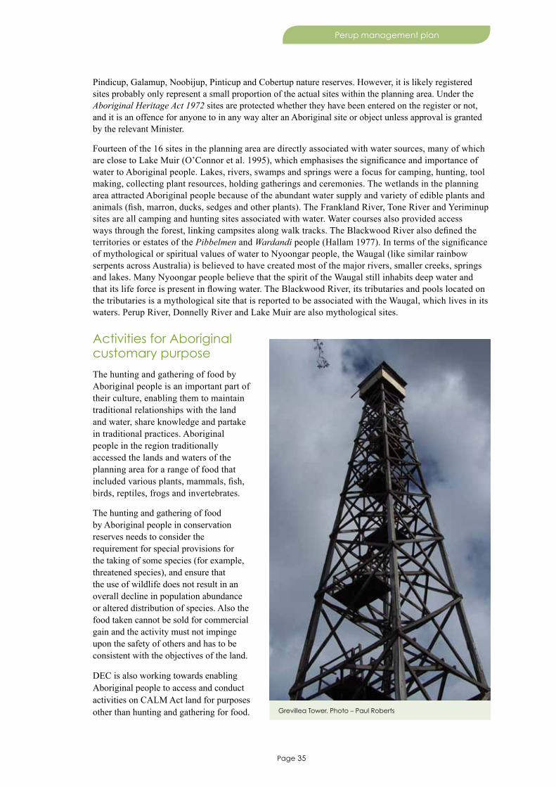
Page 35
Perup management plan
Pindicup, Galamup, Noobijup, Pinticup and Cobertup nature reserves. However, it is likely registered sites probably only represent a small proportion of the actual sites within the planning area. Under the Aboriginal Heritage Act 1972 sites are protected whether they have been entered on the register or not, and it is an offence for anyone to in any way alter an Aboriginal site or object unless approval is granted by the relevant Minister.
Fourteen of the 16 sites in the planning area are directly associated with water sources, many of which are close to Lake Muir (O’Connor et al. 1995), which emphasises the significance and importance of water to Aboriginal people. Lakes, rivers, swamps and springs were a focus for camping, hunting, tool making, collecting plant resources, holding gatherings and ceremonies. The wetlands in the planning area attracted Aboriginal people because of the abundant water supply and variety of edible plants and animals (fish, marron, ducks, sedges and other plants). The Frankland River, Tone River and Yeriminup sites are all camping and hunting sites associated with water. Water courses also provided access ways through the forest, linking campsites along walk tracks. The Blackwood River also defined the territories or estates of the Pibbelmen and Wardandi people (Hallam 1977). In terms of the significance of mythological or spiritual values of water to Nyoongar people, the Waugal (like similar rainbow serpents across Australia) is believed to have created most of the major rivers, smaller creeks, springs and lakes. Many Nyoongar people believe that the spirit of the Waugal still inhabits deep water and that its life force is present in flowing water. The Blackwood River, its tributaries and pools located on the tributaries is a mythological site that is reported to be associated with the Waugal, which lives in its waters. Perup River, Donnelly River and Lake Muir are also mythological sites.
Activities for Aboriginal customary purpose
The hunting and gathering of food by Aboriginal people is an important part of their culture, enabling them to maintain traditional relationships with the land and water, share knowledge and partake in traditional practices. Aboriginal people in the region traditionally accessed the lands and waters of the planning area for a range of food that included various plants, mammals, fish, birds, reptiles, frogs and invertebrates.
The hunting and gathering of food by Aboriginal people in conservation reserves needs to consider the requirement for special provisions for the taking of some species (for example, threatened species), and ensure that the use of wildlife does not result in an overall decline in population abundance or altered distribution of species. Also the food taken cannot be sold for commercial gain and the activity must not impinge upon the safety of others and has to be consistent with the objectives of the land.
DEC is also working towards enabling Aboriginal people to access and conduct activities on CALM Act land for purposes other than hunting and gathering for food. Grevillea Tower. Photo – Paul Roberts

Page 36
Perup management plan
For example, traditional customary purposes may be for medicinal, artistic, ceremonial or other cultural purposes. In addition, it is possible that during the life of this plan the native title rights and interests of Aboriginal people may change, including hunting and gathering. DEC will ensure conformity with any changes to legislation or government policy during the life of the plan.
The MOU signed between DEC and the South West Aboriginal Land and Sea Council recognises the need to negotiate access for traditional hunting and gathering.
4.2 Other australian cultural heritage
The planning area has cultural heritage associated with early settlement, and the agricultural and forestry industries. The area was first explored by Dr Thomas Braidwood Wilson in 1829, who was then followed by Captain Bannister in 1832, Lieutenant Preston, William Nairne Clarke in 1841 and surveyor Augustus Charles Gregory in 1852.
The area was first settled in the 1850s after Thomas and Robert Muir set off from the Hay River, discovered and named Lake Muir in 1852, continued along the Perup River almost to the Wilgarrup junction, then moved their flocks and established properties in the area in 1856. Significant sites associated with early settlement and the agricultural industry include settlers camp and well in Galamup Nature Reserve, Bokarup Homestead in Bokarup Nature Reserve, and sheep pens in Yarnup Nature Reserve.
Timber mills (for example, Unicup Mill in Kodjinup Nature Reserve) were opened up in the area as the timber industry spread south and eastward in the early 1900s. From 1921–58 timber was hauled to the Palgarup mill via an extensive network of 126 kilometres of railway formations extending east and north as far as Greater Kingston National Park. Grevillea fire tower in Greater Kingston National Park, constructed in 1940 and in operation until 1975, was the world’s tallest all timber fire lookout tower at a height of 42.7 metres.
Swan nest and eggs on Lake Muir. Photo – Tim Foley
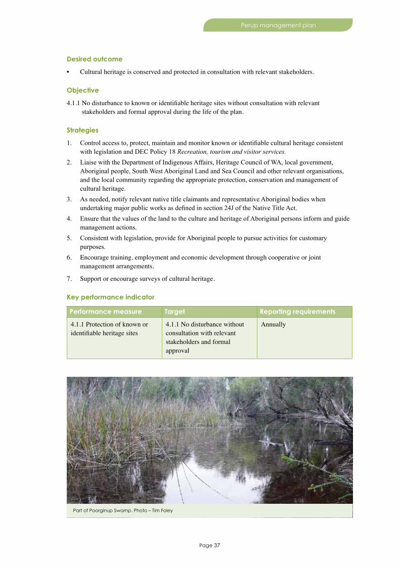
Page 37
Perup management plan
Desired outcome
• Cultural heritage is conserved and protected in consultation with relevant stakeholders.
Objective
4.1.1 No disturbance to known or identifiable heritage sites without consultation with relevant stakeholders and formal approval during the life of the plan.
Strategies
1. Control access to, protect, maintain and monitor known or identifiable cultural heritage consistent with legislation and DEC Policy 18 Recreation, tourism and visitor services.
2. Liaise with the Department of Indigenous Affairs, Heritage Council of WA, local government, Aboriginal people, South West Aboriginal Land and Sea Council and other relevant organisations, and the local community regarding the appropriate protection, conservation and management of cultural heritage.
3. As needed, notify relevant native title claimants and representative Aboriginal bodies when undertaking major public works as defined in section 24J of the Native Title Act.
4. Ensure that the values of the land to the culture and heritage of Aboriginal persons inform and guide management actions.
5. Consistent with legislation, provide for Aboriginal people to pursue activities for customary purposes.
6. Encourage training, employment and economic development through cooperative or joint management arrangements.
7. Support or encourage surveys of cultural heritage.
Key performance indicator
Performance measure Target Reporting requirements
4.1.1 Protection of known or identifiable heritage sites
4.1.1 No disturbance without consultation with relevant stakeholders and formal approval
Annually
Part of Poorginup Swamp. Photo – Tim Foley
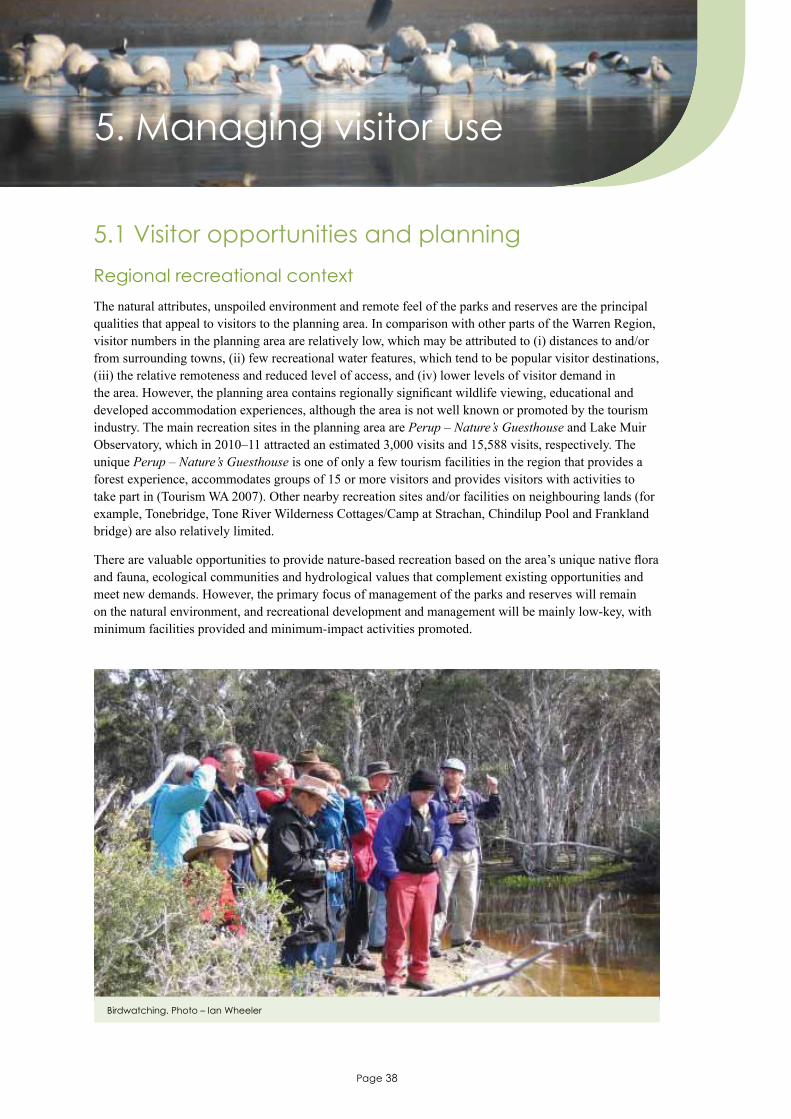
Page 38
Perup management plan
5. Managing visitor use
5.1 Visitor opportunities and planning
Regional recreational context
The natural attributes, unspoiled environment and remote feel of the parks and reserves are the principal qualities that appeal to visitors to the planning area. In comparison with other parts of the Warren Region, visitor numbers in the planning area are relatively low, which may be attributed to (i) distances to and/or from surrounding towns, (ii) few recreational water features, which tend to be popular visitor destinations, (iii) the relative remoteness and reduced level of access, and (iv) lower levels of visitor demand in the area. However, the planning area contains regionally significant wildlife viewing, educational and developed accommodation experiences, although the area is not well known or promoted by the tourism industry. The main recreation sites in the planning area are Perup – Nature’s Guesthouse and Lake Muir Observatory, which in 2010–11 attracted an estimated 3,000 visits and 15,588 visits, respectively. The unique Perup – Nature’s Guesthouse is one of only a few tourism facilities in the region that provides a forest experience, accommodates groups of 15 or more visitors and provides visitors with activities to take part in (Tourism WA 2007). Other nearby recreation sites and/or facilities on neighbouring lands (for example, Tonebridge, Tone River Wilderness Cottages/Camp at Strachan, Chindilup Pool and Frankland bridge) are also relatively limited.
There are valuable opportunities to provide nature-based recreation based on the area’s unique native flora and fauna, ecological communities and hydrological values that complement existing opportunities and meet new demands. However, the primary focus of management of the parks and reserves will remain on the natural environment, and recreational development and management will be mainly low-key, with minimum facilities provided and minimum-impact activities promoted.
Birdwatching. Photo – Ian Wheeler
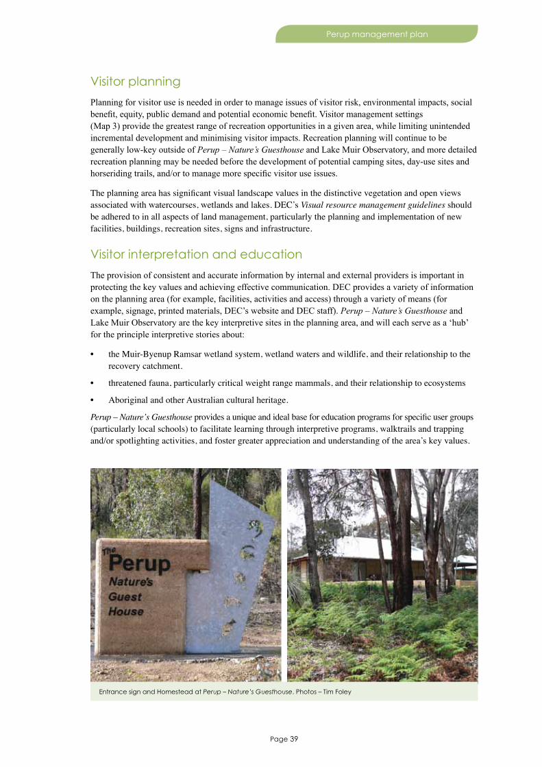
Page 39
Perup management plan
Visitor planning
Planning for visitor use is needed in order to manage issues of visitor risk, environmental impacts, social benefit, equity, public demand and potential economic benefit. Visitor management settings (Map 3) provide the greatest range of recreation opportunities in a given area, while limiting unintended incremental development and minimising visitor impacts. Recreation planning will continue to be generally low-key outside of Perup – Nature’s Guesthouse and Lake Muir Observatory, and more detailed recreation planning may be needed before the development of potential camping sites, day-use sites and horseriding trails, and/or to manage more specific visitor use issues.
The planning area has significant visual landscape values in the distinctive vegetation and open views associated with watercourses, wetlands and lakes. DEC’s Visual resource management guidelines should be adhered to in all aspects of land management, particularly the planning and implementation of new facilities, buildings, recreation sites, signs and infrastructure.
Visitor interpretation and education
The provision of consistent and accurate information by internal and external providers is important in protecting the key values and achieving effective communication. DEC provides a variety of information on the planning area (for example, facilities, activities and access) through a variety of means (for example, signage, printed materials, DEC’s website and DEC staff). Perup – Nature’s Guesthouse and Lake Muir Observatory are the key interpretive sites in the planning area, and will each serve as a ‘hub’ for the principle interpretive stories about:
• the Muir-Byenup Ramsar wetland system, wetland waters and wildlife, and their relationship to the recovery catchment.
• threatened fauna, particularly critical weight range mammals, and their relationship to ecosystems
• Aboriginal and other Australian cultural heritage.
Perup – Nature’s Guesthouse provides a unique and ideal base for education programs for specific user groups (particularly local schools) to facilitate learning through interpretive programs, walktrails and trapping and/or spotlighting activities, and foster greater appreciation and understanding of the area’s key values.
Entrance sign and Homestead at Perup – Nature’s Guesthouse. Photos – Tim Foley
Page 40
Perup management plan
The Commonwealth’s Communication, Education and Public Awareness to Promote Wise Use of Australia’s Wetlands National Action Plan 2001–2005 The Next Step (see www.environment.gov.au/wetlands) provides guidance on the promotion of coordinated communication and education between all levels of government, statutory authorities, community groups, non-government and business organisations involved in wetland and wetland-related management. Possible communication, education and public awareness messages are described by Cook and Farrell (2009), and include:
• the international significance of the Muir-Byenup Ramsar wetland system• hydrological processes within the Ramsar site, including interactions between wetlands• the importance of Lake Muir as an example of a relatively undisturbed primary saline wetland• peat formation and acidification processes of the Byenup Lagoon wetlands• the importance of Baumea sedgelands for Australasian bitterns• ecological relationships between water quality and flora and fauna found within the Ramsar site• the impact of threatening processes such as salinity, acid sulfate soils, Phytophthora and land use
(eutrophication) on biodiversity (waterbirds, vegetation and macroinvertebrates) of the Ramsar site.
Visitor safety
Risks to visitors (for example, adverse weather conditions, falling limbs, bushfire, poisonous snakes and becoming lost) are often present and are managed through a visitor risk management program. Many visitor risks can be overcome through attention to personal safety (including the registration of trip details with friends or family), appropriate maintenance of facilities by DEC staff, and appropriate risk warning signage.
Desired outcome
• Community awareness, understanding and appreciation of key values through the planning and provision of a range of safe and minimal-impact nature-based recreation and tourism opportunities based on visitor demand and trends.
Objectives
5.1.1 Maintain or increase visitor use levels at Perup – Nature’s Guesthouse during the life of the plan.5.1.2 No change to the extent of visitor management settings during the life of the plan.
Strategies
1. Provide visitor services, facilities and experiences in the planning area consistent with DEC Policy 18 Recreation, tourism and visitor services.
2. Ensure existing and future recreation and tourism developments and visitor activities remain consistent with visitor management settings (Map 3), and refer any proposed changes to visitor management settings to the Conservation Commission.
3. Ensure existing and potential recreation and tourism developments and visitor activities minimise environmental, cultural, visual and social impacts and, where relevant, are designed, developed and maintained to DEC standards.
4. Monitor the levels of change and impacts of visitor use on recreation areas and facilities, and adapt recreation and tourism management where appropriate.
5. Provide appropriate information, interpretation and education opportunities for visitors to increase their knowledge, appreciation and understanding of key values and management issues.
6. Undertake formal risk assessment of all recreation sites and facilities as part of the visitor risk management program and in addition to that which occurs on a day-to-day basis, and undertake appropriate action as necessary.
7. Monitor visitor numbers, visitor satisfaction1 and feedback at Perup – Nature’s Guesthouse and, where apppropriate, use visitor data to improve management.

Page 41
Perup management plan
Key performance indicators
Performance measure Target Reporting requirements5.1.1 Visitor use levels at Perup – Nature’s Guesthouse
5.1.1 Maintain or increase visitor use levels at Perup – Nature’s Guesthouse during the life of the plan
Every five years
5.1.2 The extent of visitor management settings
5.1.2 No change to the extent of visitor management settings
Every five years
1 Visitor satisfaction is examined in the Forest management plan 2004–2013 at a whole-of-forest scale (Conservation Commission 2008b).
5.2 Visitor accessMost road and track access on DEC-managed lands is managed by DEC under the CALM Act, except dedicated public roads, which remain a separate Crown land road reserve managed by either Main Roads WA or relevant local government authorities (for example, Muirs Highway and Boyup Brook-Cranbrook Road). A small number of unused Crown road reserves are scattered across the planning area. Management of the parks and reserves often needs access to be temporarily, permanently or seasonally closed to the public, and in the planning area a significant proportion of access is ‘management access only’ because it lies within disease risk areas. Roads and tracks that are designated as ‘management access only’ will be signposted and/or physically closed. A road management policy is being developed that will be used to guide future management of access. Some road and track access is the only viable public access to private property that may be surrounded by DEC-managed lands, and these roads and/or tracks will continue to remain open. Inappropriate vehicle access, which has resulted in the degradation of some wetland shorelines and disturbance to nesting waterbirds at Lake Muir and Lake Unicup (Cook and Farrell 2009), will be controlled through a variety of techniques for managing visitor impacts.
Desired outcome
• Provision and maintenance of safe and effective access that facilitates visitor appreciation of, and minimises significant adverse impacts on, natural, cultural and socio-economic values.
Strategies
1. Provide and maintain strategic road and track access (as shown in Map 3) for management and public use consistent with appropriate visitor management settings, protection of key values, DEC standards and in consultation with visitors and relevant stakeholders.
2. Only allow vehicles driving off dedicated roads and roads and tracks managed by DEC with approval from the regional or district manager.
3. Temporarily, permanently or seasonally close management access roads or tracks to the public, subject to approval by the regional or district manager, and signpost ‘management access only’ accordingly.
4. Ensure that Crown road reserves are best located to protect the natural and landscape values and meet public access needs, and negotiate with appropriate authorities to cancel unnecessary or unused road reserves adding them to the planning area.
5. Close and, where appropriate, rehabilitate access that is poorly located, in poor condition, difficult to maintain, unsuitable for recreation and conservation purposes, no longer needed or where there is an adverse and unacceptable impact on the environment.
6. Where appropriate, improve access to services, information and facilities for people with disabilities.
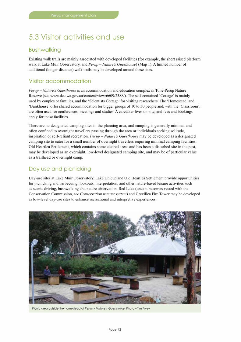
Page 42
Perup management plan
5.3 Visitor activities and use
Bushwalking
Existing walk trails are mainly associated with developed facilities (for example, the short raised platform walk at Lake Muir Observatory, and Perup – Nature’s Guesthouse) (Map 1). A limited number of additional (longer-distance) walk trails may be developed around these sites.
Visitor accommodation
Perup – Nature’s Guesthouse is an accommodation and education complex in Tone-Perup Nature Reserve (see www.dec.wa.gov.au/content/view/6609/2388/). The self-contained ‘Cottage’ is mainly used by couples or families, and the ‘Scientists Cottage’ for visiting researchers. The ‘Homestead’ and ‘Bunkhouse’ offer shared accommodation for bigger groups of 10 to 30 people and, with the ‘Classroom’, are often used for conferences, meetings and studies. A caretaker lives on-site, and fees and bookings apply for these facilities.
There are no designated camping sites in the planning area, and camping is generally minimal and often confined to overnight travellers passing through the area or individuals seeking solitude, inspiration or self-reliant recreation. Perup – Nature’s Guesthouse may be developed as a designated camping site to cater for a small number of overnight travellers requiring minimal camping facilities. Old Heartlea Settlement, which contains some cleared areas and has been a disturbed site in the past, may be developed as an overnight, low-level designated camping site, and may be of particular value as a trailhead or overnight camp.
Day use and picnicking
Day-use sites at Lake Muir Observatory, Lake Unicup and Old Heartlea Settlement provide opportunities for picnicking and barbecuing, lookouts, interpretation, and other nature-based leisure activities such as scenic driving, bushwalking and nature observation. Red Lake (once it becomes vested with the Conservation Commission, see Conservation reserve system) and Grevillea Fire Tower may be developed as low-level day-use sites to enhance recreational and interpretive experiences.
Picnic area outside the homestead at Perup – Nature’s Guesthouse. Photo – Tim Foley

Page 43
Perup management plan
Horseriding
Horseriding in bush settings is part of the cultural heritage of the south-west, and still occurs along some roads and tracks in this planning area, although the demand, use and location often changes. There is some demand for and opportunity to establish a strategic long-distance horseriding trail in the upper Warren area linking horseriding in Boyup Brook and Bridgetown southwards to trails elsewhere in the region. Wherever possible, horseriding should be located outside conservation reserves on state forests and dedicated public roads in the first instance, but may be located in national parks (in preference to nature reserves) along boundary tracks or on some established designated tracks where the impacts of the activity can be minimised. Horseriding trails on some roads and tracks open to the public, with associated facilities and trails, will be investigated and, where permitted, monitored for the prevalence of weeds, erosion, degradation of vegetation and P. cinnamomi.
Water-based activities
There are few water-based activities in the planning area because many of the water bodies are relatively shallow and environmentally sensitive. Waterskiing has historically occurred in Unicup Nature Reserve on Lake Unicup, and the lake was gazetted as a water ski area on 25 October 1991. Waterskiing occurs on two alternate nearby gazetted water ski areas at Lake Poorarecup and Lake Nunijup, which are 43 kilometres and 63 kilometres to the east, respectively.
Wildlife viewing
Perup – Nature’s Guesthouse provides a unique and regionally-significant wildlife viewing and interaction experience with some of Australia’s rarest mammals (for example, chuditch, numbat, woylie and tammar) in their natural habitat, and is the focus for guided nature activities associated with jarrah and wandoo forests. Lake Muir Observatory is also a regionally-significant facility for visitors to observe waterbirds that visit and inhabit Lake Muir. Other sites in the Lake Muir/Unicup recovery catchment may also be suitable for wetland wildlife viewing (for example, Red Lake).
Desired outcome
• A range of recreational activities appropriate to the environment and management settings that facilitates visitor enjoyment and appreciation of key values.
Strategies
1. Provide and maintain a range of recreation opportunities consistent with DEC Policy 18 Recreation, tourism and visitor services, appropriate visitor management settings (Map 3), adequate protection and maintenance of key values, recreational development criteria, site capability, safety standards, and the rights and enjoyment of other visitors.
2. Monitor the impacts of, and demand for, recreational activities, and manage activities in liaison with users where impacts become significant or unacceptable.
3. Maintain built accommodation in order to maintain the visitor experience.4. Do not allow dogs in the planning area, except (with appropriate authorisation) guide dogs and dogs
needed for emergency search and rescue and management purposes.5. Develop more, preferably longer-distance, walk trails, in association with key stakeholders, within
close proximity of Perup – Nature’s Guesthouse and Lake Muir Observatory, as the need arises.6. Maintain a fee and booking system for accommodation at Perup – Nature’s Guesthouse.7. Investigate the establishment of horseriding trails on roads and tracks open to the public, consistent
with the purpose of the land and, where established, monitor to minimise adverse impacts (for example, P. cinnamomi).
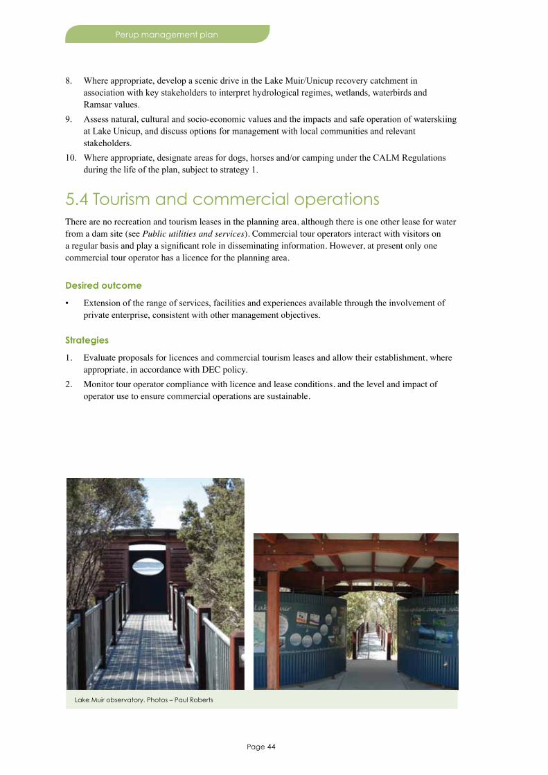
Page 44
Perup management plan
8. Where appropriate, develop a scenic drive in the Lake Muir/Unicup recovery catchment in association with key stakeholders to interpret hydrological regimes, wetlands, waterbirds and Ramsar values.
9. Assess natural, cultural and socio-economic values and the impacts and safe operation of waterskiing at Lake Unicup, and discuss options for management with local communities and relevant stakeholders.
10. Where appropriate, designate areas for dogs, horses and/or camping under the CALM Regulations during the life of the plan, subject to strategy 1.
5.4 Tourism and commercial operationsThere are no recreation and tourism leases in the planning area, although there is one other lease for water from a dam site (see Public utilities and services). Commercial tour operators interact with visitors on a regular basis and play a significant role in disseminating information. However, at present only one commercial tour operator has a licence for the planning area.
Desired outcome
• Extension of the range of services, facilities and experiences available through the involvement of private enterprise, consistent with other management objectives.
Strategies
1. Evaluate proposals for licences and commercial tourism leases and allow their establishment, where appropriate, in accordance with DEC policy.
2. Monitor tour operator compliance with licence and lease conditions, and the level and impact of operator use to ensure commercial operations are sustainable.
Lake Muir observatory. Photos – Paul Roberts
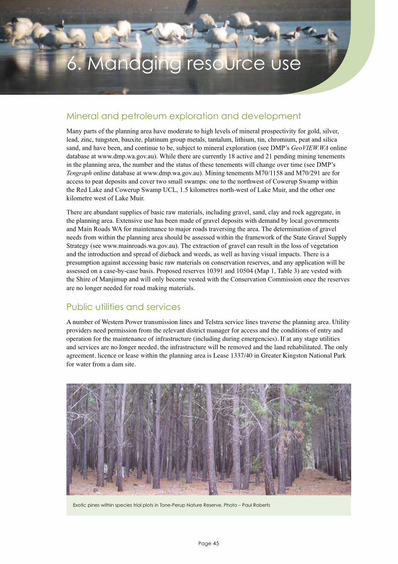
Page 45
Perup management plan
Mineral and petroleum exploration and development
Many parts of the planning area have moderate to high levels of mineral prospectivity for gold, silver, lead, zinc, tungsten, bauxite, platinum group metals, tantalum, lithium, tin, chromium, peat and silica sand, and have been, and continue to be, subject to mineral exploration (see DMP’s GeoVIEW.WA online database at www.dmp.wa.gov.au). While there are currently 18 active and 21 pending mining tenements in the planning area, the number and the status of these tenements will change over time (see DMP’s Tengraph online database at www.dmp.wa.gov.au). Mining tenements M70/1158 and M70/291 are for access to peat deposits and cover two small swamps: one to the northwest of Cowerup Swamp within the Red Lake and Cowerup Swamp UCL, 1.5 kilometres north-west of Lake Muir, and the other one kilometre west of Lake Muir.
There are abundant supplies of basic raw materials, including gravel, sand, clay and rock aggregate, in the planning area. Extensive use has been made of gravel deposits with demand by local governments and Main Roads WA for maintenance to major roads traversing the area. The determination of gravel needs from within the planning area should be assessed within the framework of the State Gravel Supply Strategy (see www.mainroads.wa.gov.au). The extraction of gravel can result in the loss of vegetation and the introduction and spread of dieback and weeds, as well as having visual impacts. There is a presumption against accessing basic raw materials on conservation reserves, and any application will be assessed on a case-by-case basis. Proposed reserves 10391 and 10504 (Map 1, Table 3) are vested with the Shire of Manjimup and will only become vested with the Conservation Commission once the reserves are no longer needed for road making materials.
Public utilities and services
A number of Western Power transmission lines and Telstra service lines traverse the planning area. Utility providers need permission from the relevant district manager for access and the conditions of entry and operation for the maintenance of infrastructure (including during emergencies). If at any stage utilities and services are no longer needed, the infrastructure will be removed and the land rehabilitated. The only agreement, licence or lease within the planning area is Lease 1337/40 in Greater Kingston National Park for water from a dam site.
6. Managing resource use
Exotic pines within species trial plots in Tone-Perup Nature Reserve. Photo – Paul Roberts

Page 46
Perup management plan
Forest produce
Forest produce may be taken in accordance with licences issued under section 99A(1) of the CALM Act for (i) use for therapeutic, scientific or horticultural purposes, (ii) essential works, and (iii) the taking or removal of exotic trees (for example, Pinus and eastern states eucalypt species trial plots), honey, beeswax or pollen (by apiary site permit). Firewood collection and the extraction and sale of craftwood from national parks and nature reserves are not permitted. Under section 33(1)(cb) of the CALM Act, forest produce obtained through the carrying out of necessary operations (on nature reserves) or compatible operations (on national parks or conservation parks) can be used for the purpose of making improvements to the land, where it is consistent with the reserve purpose. Forest produce obtained in this manner may be used by DEC for management purposes.
Water resources
Three public drinking water source areas occur in the planning area: (i) Donnelly River Water Reserve, (ii) Warren River Water Reserve, and (iii) Deep River Water Reserve; none of these have Drinking Water Source Protection Plans. The Department of Water requires access to these public drinking water source areas to conduct investigations into alternate water supplies, and to surface, ground and meteorological monitoring sites in the planning area for data collection and asset maintenance. DEC uses watering points located throughout the planning area for fire control, and these will continue to be maintained.
The Department of Water has a number of freehold properties in the Perup area that have conservation significance. DEC will continue to work with Department of Water with the aim of reserving these properties as conservation reserves for the purposes of conservation and water.
Beekeeping
There are six apiary sites in the planning area: two in Greater Kingston National Park and four in Tone–Perup Nature Reserve. There is also one apiary site on proposed reserves. However, all of these sites have been classified as ‘Not to be re-issued’. There are no apiary sites on existing or proposed reserves that are currently vacant or have been/are being held by any beekeepers.
DEC draft Policy 41 Beekeeping on public land (see www.dec.wa.gov.au/decpolicies) provides guidance on the management of beekeeping in the planning area. An assessment of the suitability for apiary in the planning area based on appropriate ecological and management criteria has been completed. Whole conservation reserves that have no historical apiary use have been classified in the assessment as ‘highly constrained’ and no new sites will be permitted in Alco, Bokarup, Cobertup, Cowerup, Galamup, Kodjinup, Kulunilup, Lake Muir, Noobijup, Pindicup, Pinticup, Quindinup, Unicup, Wilgarrup and Yarnup nature reserves, reserve 46478 and Lake Muir National Park. No new sites will be permitted in other ‘highly constrained’ areas unless reassessment shows a change in category of suitability. Small areas occur in Greater Kingston National Park and Tone–Perup Nature Reserve that have been classified under the assessment as ‘suitable’ and ‘suitable but conditional’ for apiary use. Wherever possible, new apiary sites should be located outside these reserves on nearby state forests in the first instance, but may be located in the ‘suitable’ and ‘suitable but conditional’ areas consistent with DEC’s policy 41, updated ecological and management information and, where appropriate, relevant conditions.
Apiary sites adjoining the planning area may also impact on natural and other values. Where these are located on lands managed by DEC, the same process as that used for the planning area should be applied. Eight apiary sites lie adjacent to the planning area (within a three-kilometre buffer). Of these, site 4418 has been assessed as ‘suitable but conditional’ (due to its proximity to old growth forest), site 5681 is vacant but will be closed (due to rare flora restrictions), and site 2253 is within three kilometres of other sites held by different apiarists and may need to be relocated (preferably outside of disease risk areas).

Page 47
Perup management plan
Desired outcomes
• Minimal impact of resource use on natural, cultural and socio-economic values.
• Disturbances to the natural environment from resource use are appropriately rehabilitated and/or restored.
Strategies
1. Assess the impacts of proposed resource use, referring proposals to the EPA where necessary or appropriate, and permitting proposed uses only where (i) they are consistent with the CALM Act and government policy, (ii) there are no viable alternatives, and (iii) they minimise adverse impacts on DEC operations and key values.
2. Monitor existing resource use/activities to ensure compliance with pre-determined conditions and/or DEC needs, and ensure areas of disturbance from resource use/activity are appropriately rehabilitated and/or restored.
3. Allow access to basic raw materials in accordance with relevant legislation and DEC and Conservation Commission policies.
4. Encourage resource users to be responsible for management of environmental problems, particularly the introduction and spread of weeds and disease.
5. Where necessary, excise land containing utility and service infrastructure and reserve these areas as CALM Act section 5(1)(h) reserves.
6. Recognise the continued access by agencies and utilities to DEC-managed lands for the maintenance of existing assets.
7. Allow the removal of forest produce, such as trial plots, only where it is consistent with the CALM Act and where a licence is granted by the Director General (i) for therapeutic, scientific or horticultural purposes, (ii) as a result of essential works, or (iii) as a result of the removal of exotic trees.
8. Liaise with Department of Water regarding the reservation of lands held by the Department of Water for addition to the conservation reserve system with the purposes of conservation and water.
9. Liaise with Department of Water regarding the management of water resources to ensure sufficient environmental flows are maintained for rivers in the planning area and to ensure that environmental impacts are minimised.
10. Assess water removal permits for the abstraction (taking) of water from the planning area in accordance with the CALM Act and in consultation with the Conservation Commission.
11. Manage apiary sites consistent with DEC Policy No. 41 Beekeeping on public land.12. Cancel apiary site 5681, in consultation with relevant stakeholders.13. Subject to the review of the apiary analysis, renew apiary permits and consider new sites, transfer of
sites, cancellation or relocation of sites in accordance with the assessment criteria.14. Liaise with beekeepers, the Beekeepers Consultative Committee, and the Department of Agriculture
and Food to ensure the most efficient and sustainable use of sites.15. Allow new apiary sites within conservation reserves where that site has been used for that purpose
historically, subject to assessment on a case-by-case basis.
Page 48
Perup management plan
7. Involving the community
A key objective for DEC is to maintain and promote community involvement in, and support for, the protection and conservation of the state’s natural environment (DEC 2007), which can be achieved through:
• public participation and involvement opportunities and programs
• managing cross-boundary issues
• liaising and partnering with other agencies, and groups with similar interests
• expansion of off-reserve conservation that complements management of the reserve system.
Public participation and involvement opportunities
There are numerous opportunities for public participation and involvement in management activities of DEC. Public participation has been a core component of the preparation of this management plan, and six workshops were held in 2009 with local community representatives, with an additional two workshops held with Aboriginal native title working groups.
Volunteer activities increase DEC’s work capabilities and skills base, and also foster communication links and understanding with the community. DEC maintains a volunteer database, and during 2008–09 49 volunteers contributed more than 11,500 hours in DEC’s Donnelly District to activities such as feral animal and weed control. Birds Australia volunteers have been involved with assessments of waterbird usage in reserves of the Lake Muir/Unicup recovery catchment (Jaensch et al. 1988). The Friends of Perup is a community-based non-profit organisation that has been actively involved in the management of Tone-Perup Nature Reserve, raising community awareness and interest in the reserve’s unique natural values.
DEC informs, consults and involves the public on many day-to-day aspects of planning and operational activities including monthly district operations and rolling three-year indicative and annual burn programs.
Management of cross-boundary issues
Management objectives for this plan cannot be achieved in isolation as various land tenures (for example, shire reserves, private property, unallocated Crown land and other Crown reserves) adjoin the conservation reserves. Catchment, weed and feral animal, threatened species and fire management issues need to be approached from the broader integrated land management perspective to achieve management objectives. Ongoing liaison with neighbours, local communities and agencies will aim to facilitate the effective, coordinated management of cross-boundary issues and minimise adverse impacts on key values. Principles for effective neighbour relations outlined in DEC’s Policy 65 Good neighbour policy (see www.dec.wa.gov.au/decpolicies) will be fostered through the development of partnerships with the community.
Liaison with land-holders will be important in implementing recovery actions for some threatened species (for example, chuditch, Muir’s corella, Baudin’s cockatoo and forest red-tailed black cockatoo) that are highly mobile and travel across tenures in search of food or nesting sites, particularly in increasing awareness about their conservation status and to provide information on actions that land-holders can undertake to help in the recovery effort.

Page 49
Perup management plan
The Lake Muir/Unicup recovery catchment plan will need the cooperation and integration of activities by all land managers and stakeholders in maintaining wetland values of reserves and surrounding lands in the catchment.
Liaison and partnerships
DEC liaises with the relevant federal government department administering the EPBC Act concerning the management of the Muir-Byenup Ramsar wetland system, migratory species and threatened plants and animals listed under that Act. Several state government agencies have responsibilities for, or provide advice on, land use practices within the vicinity of the planning area, including drainage and declared invasive species (Department of Agriculture and Food) and water resource use (Department of Water). Liaison with local governments (Boyup Brook, Bridgetown-Greenbushes, Cranbrook and Manjimup) is also particularly important given:
• some proposed reserves identified in Table 3 are vested in local government authorities
• local governments broadly represent the views of local communities within their constituencies
• local governments are able to encourage planning and land management practices that complement management of the reserves through a range of planning instruments (for example, town planning schemes and local planning strategies)
• DEC maintains working arrangements with local governments, local bush fire brigades and volunteers to provide cooperative and coordinated fire fighting that can deal successfully with the full range of fire emergencies on or near DEC-managed lands and can achieve complementary fire management on adjoining lands
• local governments share responsibilities in the provision and maintenance of the public road network.
The reserves are a part of the South West and South Coast natural resources management (NRM) regions, which help deliver, in partnership with other governments, Aboriginal groups, land managers and community groups, the Australian Government’s conservation funding programs. Annual funding programs across sub-catchments, such as the Warren Catchment’s Council, will contribute towards the effective management of the planning area, and interaction with NRM groups is important to provide for integrated natural resource management.
Muir’s corella count at Unicup Hall. Photo – Lee Fontanini
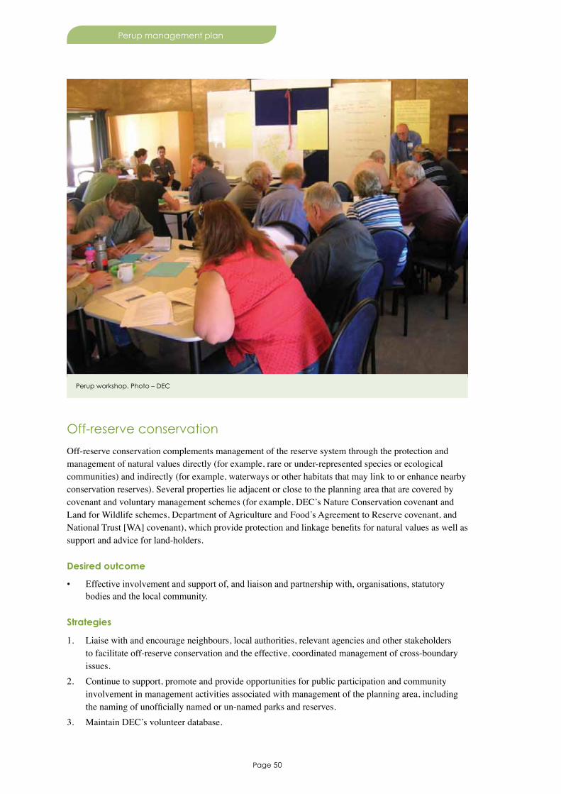
Page 50
Perup management plan
Off-reserve conservation
Off-reserve conservation complements management of the reserve system through the protection and management of natural values directly (for example, rare or under-represented species or ecological communities) and indirectly (for example, waterways or other habitats that may link to or enhance nearby conservation reserves). Several properties lie adjacent or close to the planning area that are covered by covenant and voluntary management schemes (for example, DEC’s Nature Conservation covenant and Land for Wildlife schemes, Department of Agriculture and Food’s Agreement to Reserve covenant, and National Trust [WA] covenant), which provide protection and linkage benefits for natural values as well as support and advice for land-holders.
Desired outcome
• Effective involvement and support of, and liaison and partnership with, organisations, statutory bodies and the local community.
Strategies
1. Liaise with and encourage neighbours, local authorities, relevant agencies and other stakeholders to facilitate off-reserve conservation and the effective, coordinated management of cross-boundary issues.
2. Continue to support, promote and provide opportunities for public participation and community involvement in management activities associated with management of the planning area, including the naming of unofficially named or un-named parks and reserves.
3. Maintain DEC’s volunteer database.
Perup workshop. Photo – DEC

Page 51
Perup management plan
8. Research and monitoring
The planning area is one of the most important areas for long term ecological research in WA. Extensive knowledge on critical weight range mammals (for example, woylie, tammar and ngwayir) has been built up since the 1970s. Studies in the Kingston area continue to examine the impact of forest practices on the jarrah forest ecosystem. The Lake Muir/Unicup recovery catchment has a long history of water, vegetation, invertebrate and waterbird research and monitoring. The planning area will continue to be an important focus for long term ecological research given (i) the relatively intact flora and fauna, (ii) the presence and relatively high abundance of many rare animals, (iii) the knowledge base from which to develop more investigations, (iv) the ecological and international importance of Muir-Byenup Ramsar wetland system, and (v) the extent and impact of threatening processes.
Broad direction for research and monitoring in the planning area is provided by (i) DEC’s Science Division 2008 strategic plan for biodiversity conservation research (see www.dec.wa.gov.au/content/view/3572/1808/), (ii) May and McKenzie (2003), (iii) species recovery plans and Hearn et al. (2008) (see 3.2 Biological environment) and (iv) knowledge gaps and monitoring identified by Cook and Farrell (2009). Major projects in the area that will continue through the life of this plan (DEC 2009), include:
• monitoring of selected vertebrate communities in Tone-Perup Nature Reserve
• Perup Fire Effects study
• woylie conservation research project
• State Salinity Strategy wetland monitoring
• Kingston project
• FORESTCHECK – additional FORESTCHECK monitoring sites may be established in areas identified as vulnerable to climate change (Maher et al. 2010)
• monitoring the state of the Muir-Byenup Ramsar wetland system’s ecological character – much of the current monitoring is in the research phase of establishing baseline information of and the extent of variability in the ecological character. Once this information is known, an appropriate monitoring program can be devised to monitor and report on the state of the ecological character.
Radiotracking. Photo – Adrian Wayne

Page 52
Perup management plan
Desired outcomes
• Knowledge and understanding of natural, cultural and socio-economic values is increased through research and monitoring.
• Any adverse change in the state of the Muir-Byenup Ramsar wetland system’s ecological character is monitored and understood.
Objective
8.1 Develop a monitoring program to monitor and report on the state of the Muir-Byenup Ramsar wetland system’s ecological character.
Strategies
1. Develop and implement an integrated program of survey, research and monitoring aimed at meeting key performance indicators, facilitating management of the planning area, and developing a sound understanding of key values and the significance of threatening processes upon these.
2. Incorporate research and monitoring findings into operational management and interpretive and/or educational material where appropriate.
3. Encourage and support volunteers, educational institutions and other organisations where their research contributes directly to DEC strategies or the implementation and auditing of this management plan.
4. Monitor sites in the reserves of the Lake Muir/Unicup recovery catchment that are subject to detailed biological surveys.
5. Collate water quality data for reserves in the Lake Muir/Unicup recovery catchment, analyse trends and develop and apply hydrological model(s) in the management of hydrological regimes.
6. Continue monitoring critical weight range and other vertebrate fauna in long term ecological research/monitoring sites in the Tone-Perup Nature Reserve.
7. Undertake detailed vegetation/floristic mapping and assessment of Tone-Perup Nature Reserve in the context of a State-wide vegetation information system and mapping project.
8. Encourage research that links plant community coverage, distribution and condition/health to changes in acidity, salinity and surface metal concentrations and other hydrological regimes.
9. Continue monitoring the state of the Muir-Byenup Ramsar wetland system’s ecological character.
Key performance indicator
Performance measure Target Reporting requirements
8.1 Monitoring and reporting on the state of the Muir-Byenup Ramsar wetland system’s ecological character
8.1 Develop a monitoring program following sufficient collection and analysis of baseline information
After five years

Shire of Plantagenet
Shire of Kojonup
Shire of Manjimup
Shire ofBoyup Brook
WARREN
WHEATBELT
SOUTH WEST
Donnelly
Frankland
River
Tone
War
ren
River
Perup
Riv
er
River
River
Gnowergerup
River
Blackwood
River
UnicupLake
ROAD
BROOKBOYUP
MUIRS
HIGHWAY
RO
AD
HIGHWAY
HIG
HW
AY
RO
CK
Y
FRAN
KLAN
DR
OAD
HIGHWAY
WINGEBELLUP
ROAD
ALB
AN
Y
ROAD
WESTERN
SOU
TH
MU
IRS
BOYU
P
HIG
HW
AY
BROOK
ROAD
CRANBROOK
RO
AD
KO
JON
UP
ROAD
BRO
CKMAN
PEMBERTON
FRANKLAND
ROCKY GULLY
NORTHCLIFFE
BRIDGETOWN
Frankland
PEMBERTON
NO
RT
HC
LIFFE
FR
AN
KLA
ND
CRANBROOK
FRANKLAND
LakeMuir
MIDDLETON
Shire ofBridgetown-Greenbushes
GU
LLY
Riv
er
Map 1. Management Plan Area
N
Shire of Cranbrook
WESTERNAUSTRALIA
LOCALITY LEGENDManagement Plan boundary
DEC region boundary
DEC district boundary
Muir-Byenup Ramsar Wetland boundary
Unallocated Crown Land
Local Government Authority boundary
Department of Water freehold
Other Crown reserve
State forest
Proposed additions
Lake Muir/Unicup Natural DiversityRecovery catchment
0 10
Scale
2.5 5 15 20km
Wilgarrup
River
Donnelly
ROAD
Kent
River
GRAPHITE
WE
ST
ER
N
HIGHWAY
MANJIMUP
VASSE
HIG
HW
AY
Planning region boundary
KOJONUP
Shire ofKojonup
Yerra
minnup
River
Tweed
SO
UT
H
TO BOYUP BROOK 11.4KM
PINDICUPNATURE RESERVE
COWERUPNATURE RESERVE
NOOBIJUPNATURE RESERVE
YARNUPNATURE RESERVE
UNICUPNATURE
RESERVE
KODJINUPNATURE
RESERVE
TONE PERUPNATURE RESERVE
ALCONATURE
RESERVE
GREATERKINGSTON
NATIONAL PARK
COBERTUPNATURE RESERVE
WILGARRUPNATURE
RESERVE
R 10504
R 35307
R 30214
R 27925
R 10391
LOT 6
LOT 3
LOT 12982
LOT 12167
LOT12646
LOT 5LOT 4
LOT 4
LOT 2
LOT 3
LAKE MUIRNATIONAL PARK
GALAMUP NR
TONE PERUPNATURE
RESERVE QUINDINUPNATURE
RESERVE
BOKARUPNATURE RESERVE
KULUNILUPNATURE
RESERVE
LOT 12983
PINTICUPNATURE
RESERVE
LAKE MUIRNATURE RESERVE
Chitelupstateforest
Lake MuirObservatory
Wournbelup/Chowerup UCL
Red Lake andCowerup Swamp UCL
R 46478
Perup - Nature’sGuesthouse
Dingupstate forest

RedLake
L a k e
M u i r
MUIRS
ROADMYALGELUP
RO
AD
NA
BA
GU
P
GEORDINUP
ROAD
HIGHWAY
RO
AD
RO
AD
TH
OM
SO
N
MUIRS
UNICUP
HIGHWAY
Jarrah - Marri forest and woodland on laterite
Jarrah - Marri open woodland on sand
Melaleuca cuticularis woodland over wet heath
Jarrah - Marri woodland over Agonis scrub
Jarrah - Yate woodland
Jarrah woodland over Hakea oleifolia heath
Eucalyptus decipiens woodland
Eucalyptus rudis woodland
Eucalyptus rudis woodland on sand dunes
Banksia ilicifolia woodland
Melaleuca cuticularis woodland over Gahnia sedgeland
Melaleuca preissiana - Kunzea sulphurea woodland
Melaleuca preissiana woodland over wet heath
Melaleuca - Kunzea scrub
Melaleuca densa - Melaleuca viminea heath
1
2
3
4
5
6
7
8
9
10
11
12
13
14
15
16
17
18
19
20
21
22
23
24
25
26
27
28
29
30
31
Melaleuca cuticularis complex
Melaleuca rhaphiophylla forest
Melaleuca densa - Melaleuca viminea thicket
Melaleuca spathulata heath
Hakea prostrata heath
Wet heath
Gahnia sedgeland
Open Baumea sedgeland
Closed Baumea sedgelandDying Baumea sedgeland
Riparian vegetation
Samphire flats
Cleared land
Armillaria affected shrubland
Open water
Yate woodland on sand dune
Unsealed Road
Sealed Road
LEGEND
LAKE MUIRNATIONAL PARK
Lake MuirObservatory
COWERUPNATURE RESERVE
TONE PERUPNATURE RESERVE
PINTICUPNATURE
RESERVE
GALAMUPNATURE RESERVE
PINDICUPNATURE
RESERVE
COBERTUPNATURE
RESERVE
N
Map 2. Vegetation of the Muir-Byenup Ramsar Wetland System
Management Plan boundary
Muir-Byenup Ramsar Wetland boundary
Lake Muir/Unicup Natural DiversityRecovery catchment
Vegetation
0 4km321
Scale
LAKE MUIRNATURE RESERVE
UNALLOCATEDCROWN LAND
R 46478
LAKE MUIRNATURE RESERVE
Tordit-GurrupLagoon
Byenup Lagoon
PoorginupSwamp

PEMBERTON
FRANKLAND
ROCKY GULLY
NORTHCLIFFE
MANJIMUP
BRIDGETOWN
ROAD
BROOKBOYUP
MUIRS
HIGHWAY
FRAN
KLAN
D
ROAD
ALB
AN
Y
KOJONUP
WESTERN
SOU
TH
MU
IRS
HIG
HW
AY
BROOK
ROAD
CRANBROOK
RO
AD
KO
JON
UP
BRO
CKM
AN
NO
RT
HC
LIFFE
CRANBROOK
MIDDLETON
GRAPHITE
SO
UTH
WE
ST
ER
N
HIGHWAY
VASSE
HIG
HW
AY
River
Tone
War
ren
River
Perup
Riv
er
River
River
Gnowergerup
River
Blackwood
River
Frankland
Wilgarrup
Kent
River
River
Donnelly
Riv
er
RO
AD
HIGHWAY
HIGHW
AY
RO
CK
Y
HIGHWAY
WINGEBELLUP
BOYU
P
ROAD
FRANKLANDROAD
UnicupLake
LakeMuir
PEMBERTON
LEGENDManagement Plan boundary
Muir-Byenup Ramsar Wetland boundary
0 10
Scale
2.5 5 15 20km
Visitor Management Settings
Highly modified
Recreation
Natural
Natural - Recreation
N
Map 3. Visitor Management Settings
GU
LLY
RD
FR
AN
KLA
ND
Lake MuirObservatory
LakeUnicup
Old HeartleaSettlement
Perup - Nature’sGuesthouse
Yerra
minnup
Page 56
Perup management plan
9. Glossary
Aboriginal heritage site Aboriginal heritage sites can be categorised as archaeological and/or ethnographic sites. Ethnographic sites include: places for current ritual or ceremony, caches of ceremonial objects, sites with mythological associations, or sources of stone, ochre, plants or animals which are known or used. Archaeological sites are often ethnographic sites as well, and include the physical remains of Aboriginal culture, both before and after European settlement. Archaeological sites include shelters, fish traps or weirs, stone or ochre quarries, stone artefact production areas, shell middens, seed grinding patches, engravings, paintings, marked trees and burial sites.
Acid sulfate soils Naturally occurring soils and sediments containing iron sulfides, most commonly pyrite. When acid sulfate soils are exposed to air the iron sulfides in the soil react with oxygen and water to produce a variety of iron compounds and sulfuric acid. The resulting acid can release other substances, including heavy metals, from the soil and into the surrounding environment (see www.dec.wa.gov.au/content/category/31/790/1653/).
Aquifer An aquifer is a layer of rock that holds and allows water to move through it, and from which water can be extracted.
Bonn Convention Australia became a contracting party to the Convention on the Conservation of Migratory Species of Wild Animals (Bonn Convention) in 1991.
Compatible operations Activities conducted by DEC that are approved by the Minister for Environment as being compatible with the purposes for which the park or management area is managed under the CALM Act.
Comprehensive, adequate and representative
These terms together describe the attributes of an ideal conservation reserve system. These terms are defined in the Australian and New Zealand Environment and Conservation Council’s Guidelines for Establishing the National Reserve System as:• comprehensiveness – inclusion of the full range of ecosystems
recognised at an appropriate scale within and across each bioregion• adequacy – the maintenance of the ecological viability and integrity
of populations, species and communities• representativeness – the principle that those areas that are selected
for inclusion in reserves reasonably reflect the biotic diversity of the ecosystems from which they derive.

Page 57
Perup management plan
Contaminated In relation to land, water or a site, the Contaminated Sites Act 2003 defines contaminated as: “having a substance present in or on that land, water or site at above background concentrations that presents, or has the potential to present, a risk of harm to human health, the environment or any environmental value”.
Convention on Biological Diversity
Australia signed the Convention on Biological Diversity (Rio Convention) at the United Nations Conference on Environment and Development (also known as the ‘Rio Earth Summit’) in Rio de Janeiro, Brazil in 1992.
Craftwood Traditionally, craftwood has been restricted to Banksia nuts, Xanthorrhoea bases, sheoak and jarrah timber offcuts, although burls are not craftwood.
Critical weight range mammals
Mammals weighing between 35 grams and 5.5 kilograms.
Declared species Plants or animals that are declared pests under the Agriculture and Related Resources Protection Act 1976 (ARRP Act). Note that the ARRP Act and its instruments will be replaced by the Biosecurity and Agriculture Management Act 2007 once fully proclaimed and this may have altered management requirements for invasive species in the planning area.
Dedicated public roads Public roads that are defined under the Land Administration Act 1997 as “land dedicated at common law or reserved, declared or otherwise dedicated under an Act as an alley, bridge, court, lane, road, street, thoroughfare or yard for the passage of pedestrians or vehicles or both”.
Disease risk areas Any area of public land where the Director General considers that the earth, soil or trees may be, or may become infected with a forest disease.
Disjunct Species with distinctly separate distributions as a result of physical, geological or biological isolation.
Ecological character The combination of the ecosystem components, processes and benefits/services that characterise the wetland at a given point in time. Within this context, ecosystem benefits are defined in accordance with the variety of benefits to people (i.e. ecosystem services). Ecosystem services are defined as ‘the benefits that people receive from ecosystems’ (Ramsar Convention 2005, Resolution IX.1 Annex A). The phrase ‘at a given point in time’ refers to resolution VI.1 paragraph 2.1, which states that ‘It is essential that the ecological character of a site be described by the Contracting Party concerned at the time of designation for the Ramsar List, by completion of the Information Sheet on Ramsar Wetlands’ (as adopted by recommendation IV. 7).
Page 58
Perup management plan
Endemic Native plants or animals that are confined in their natural occurrence to a particular region, with a distribution that ranges less than 150 kilometres.
Essential works Section 99A(2) of the CALM Act defines essential works as including works that are needed to establish or re-establish access to land or to provide fire containment lines.
Environmental weed An introduced plant that establishes in natural ecosystems and adversely modifies natural processes, resulting in decline of invaded communities (see www.dec.wa.gov.au/content/view/5494/2275/).
Eutrophication The enrichment of water by nutrients, such as compounds of nitrogen or phosphorus. It causes an accelerated growth of algae and higher forms of plant life. These consume more oxygen often leading to an oxygen deficit, which can have a major detrimental effect on fish and other aquatic organisms.
Fault A fault (in geology) is a fracture in the earth’s crust resulting in the displacement of one side with respect to the other.
FORESTCHECK DEC’s integrated monitoring system developed to provide information about any changes and trends in key forest organisms, communities and processes associated with a variety of forest management activities (see www.dec.wa.gov.au/content/view/5605/2290/).
Forest ecosystems Forest ecosystems were defined in the south-west by Bradshaw and Mattiske (1997) for use in the Western Australian Regional Forest Agreement to further the establishment of a comprehensive, adequate and representative conservation reserve system (see www.dec.wa.gov.au/content/category/47/870/1828/). Forest ecosystems are at a finer scale than the bioregional approach for the rest of the State, and are based on key species of the overstorey, height of the overstorey, canopy cover and the understorey vegetation communities.
Forest produce Includes trees, parts of trees, timber, sawdust, chips, firewood, charcoal, gum, kino, resin, sap, honey, seed, bees-wax, rocks, stone and soil as per section 3 of the CALM Act.
IBRA Interim Biogeographic Regionalisation for Australia (see www.environment.gov.au/parks/nrs/science/ibra.html).

Page 59
Perup management plan
Invasive species Plants and animals that, as a result of human activities, occur beyond their accepted normal distribution and which threaten valued environmental, agricultural or other social resources by the damage they cause. Invasive species can be either native species that are impacting on natural or agricultural values or introduced species (for example, feral animals) that have become established as wild or naturalised populations. Invasiveness is a species’ ability to invade terrestrial and/or aquatic environments, and depends on factors such as reproduction rates and dispersal ability.
IUCN International Union for Conservation of Nature.
Leases Formal agreements that allow exclusive use of land as a means of providing security to protect significant investments.
Licences Agreements that allow private tour operators conducting commercial tourist activities to access and use DEC-managed lands, and enables DEC to monitor and regulate access and use to ensure key values are maintained.
Limits of acceptable change
Variation that is considered acceptable in a particular component or process of the ecological character of a wetland without indicating change in ecological character that may lead to a reduction or loss of the criteria for which the site was Ramsar listed.
Major public works Public works that include buildings or fixed structures, roads, railways, bridges, water bores or wells or any major earthwork.
Migratory bird agreements
CAMBA = China-Australia Migratory Bird Agreement, JAMBA = Japan-Australia Migratory Bird Agreement, ROKAMBA = Republic of Korea-Australia Migratory Bird Agreement.
Mining tenement A mining tenement under the Mining Act 1978 means a prospecting licence, exploration licence, retention licence, mining lease, general purpose lease or a miscellaneous licence granted or acquired under this Act or by virtue of the repealed Act.
Necessary operations Activities conducted by DEC that are necessary for the preservation or protection of persons, property, land, waters, flora or fauna, or for the preparation of a management plan.
Old-growth forest Ecologically mature forest where the effects of unnatural disturbance are now negligible. The definition focuses on forest in which the upper stratum or overstorey is in a late mature to senescent growth stage (Conservation Commission 2004).
Page 60
Perup management plan
Priority plant and animal species
Species that have not yet been adequately surveyed to be listed under Schedule 1 or 2 of the WC Act are added to the priority flora and priority fauna lists under priorities 1, 2 or 3. These three categories are ranked in order of priority for survey and evaluation of conservation status so that consideration can be given to their declaration as threatened flora or fauna. Taxa that are adequately known, are rare but not threatened, or meet criteria for near threatened, or that have been recently removed from the threatened list for other than taxonomic reasons, are placed in priority 4, and are species that require regular monitoring. Conservation dependent species are placed in priority 5 (see www.dec.wa.gov.au/content/view/852/2010/1/1/).
Public drinking water source area
Area proclaimed/gazetted under the Metropolitan Water Supply, Sewerage, and Drainage Act 1909 or the Country Areas Water Supply Act 1947 as a water reserve, catchment area or underground water pollution control area to define the boundary and protect the water quality of a drinking water source.
Ramsar Convention The Convention on Wetlands of International Importance especially as Waterfowl Habitat (also known as the Ramsar Convention after the Iranian town in which the treaty was developed in 1971) is an intergovernmental treaty that provides the framework for national action and international cooperation for the conservation and wise use of wetlands and their resources.
Relictual Pertaining to an archaic form in an otherwise extinct taxon.
Section 5(1)(h) reserve Section 5(1)(h) of the CALM Act covers “any other land reserved under Part 4 of the Land Administration Act 1997 the care, control and management of which are placed by order under that Part with the Conservation Commission”.
Seral stage The developmental stages of an ecological succession.
Threatened species The WC Act provides for taxa (species, subspecies and varieties) of native plants and animals to be specially protected because they are under identifiable threat of extinction, are rare, or otherwise in need of special protection (see www.dec.wa.gov.au/content/view/852/2010/1/1/).
Vascular Plants that have a specialised circulatory or conducting system.
Vital attributes Vital attributes and life history traits are critical physical characteristics of plants and animals that determine their ability to survive different fire intervals. For plants, it mainly relates to (i) methods of persistence (seeders or sprouters), (ii) conditions to establish and grow to maturity, and (iii) timing of life stages (for example, juvenile period and viable seed set). For animals, it relates to (i) the ability to survive fire and early post-fire period (type of refuge, mobility, scale and intensity of fire), (ii) habitat requirements (seral stage of the vegetation), and (iii) fecundity and dispersal characteristics.
Page 61
Perup management plan
10. References
Armstrong, R. (2004) Ecologically based fire management – integration of multiple land use objectives. 11th Annual AFAC Conference and Inaugural Bushfire CRC Conference, 7-9 October, 2004, Perth.
Benshemesh, J. (2007) National Recovery Plan for Malleefowl Leipoa ocellata. Department for Environment and Heritage, South Australia. Available from www.environment.gov.au/biodiversity/threatened/recovery-list-common.html.
Bradshaw, J. and Mattiske, E. (1997) Forest Ecosystems Mapping for the Western Australian RFA. Report to the Steering Committee for the Regional Forest Agreement in Western Australia.
Burbidge, A.A. and McKenzie, N.L. (1989) Patterns in the modern decline of Western Australia Fauna: causes and conservation implications. Biological Conservation 50: 143-198.
Burbidge, A.A. and de Tores, P. (1998) Western Ringtail Possum (Pseudocheirus occidentalis) Interim Recovery Plan 1997 –1999. Interim Recovery Plan No. 17. Department of Conservation and Land Management, Wanneroo. Available from www.dec.wa.gov.au/content/view/842/2007/.
Burrows, N.D. (2008) Linking fire ecology and fire management in south-west Australian forest landscapes. Forest Ecology and Management 255: 2394-2406.
Burrows, N. and Abbott, I. (2003) Fire in south-west Western Australia: synthesis of current knowledge, management implications and new research directions. In Abbott, I. and Burrows, N. (ed.) Fire in ecosystems of the south-west of western australia: impacts and management. Backhuys Publishers, Leiden: 437-452.
Cale, B. (2003) Carnaby’s Black-Cockatoo (Calyptorhynchus latirostris) recovery plan 2002–2012. Wildlife Management Program No. 36. Department of Conservation and Land Management, Perth. Available from www.dec.wa.gov.au/content/view/842/2007/.
Chapman, T. (2007) Forest Black Cockatoo (Baudin’s Cockatoo, Calyptorhynchus latirostris) and Forest Red-Tailed Black Cockatoo (Calyptorhynchus banksia naso) recovery plan 2007–2016. Wildlife Management Program No. 42. Department of Conservation and Land Management, Perth. Available from www.dec.wa.gov.au/content/view/842/2007/.
Chapman, T. and Cale, B. (2008) Muir’s Corella (Cacatua pastinator pastinator) recovery plan. Department of Conservation and Land Management, Perth. Available from www.dec.wa.gov.au/content/view/842/2007/.
Christensen, P.E. (1980) The biology of Bettongia penicillata Gray 1837, and Macropus eugenii Desmarest 1817 in relation to fire. Bulletin 91. Western Australia: Forests Department.
Christensen, P., Annels, A., Liddelow, G. and Skinner, P. (1985) Vertebrate Fauna in the Southern Forests of Western Australia. A Survey. Forests Department of Western Australia, Bulletin 94.
Commonwealth of Australia (2009) Weeds of National Significance: Update 2009. Australian Weeds Committee, Launceston, Tasmania. Available from www.weeds.gov.au/weeds/lists/wons.html.
Conservation Commission (2004) Forest Management Plan 2004-2013. Conservation Commission of Western Australia. Available from www.conservation.wa.gov.au/.

Page 62
Perup management plan
Conservation Commission (2008a) Conservation Commission policy for the performance assessment of conservation reserve and forest management plans and biodiversity management in WA. Conservation Commission of Western Australia. Available from www.conservation.wa.gov.au/.
Conservation Commission (2008b) Forest Management Plan 2004-2013 mid-term audit of performance report. Conservation Commission of Western Australia. Available from www.conservation.wa.gov.au/.
Cook, B. and Farrell, C. (2009) Ecological Character Description of the Muir-Byenup System Ramsar Site South-west Western Australia. Report prepared for the Department of Environment and Conservation by the Centre of Excellence in Natural Resource Management, University of Western Australia.
DEC (2007) Corporate Plan 2007 – 2009. Department of Environment and Conservation, Western Australia. Available from www.dec.wa.gov.au/content/view/3366/1677/.
DEC (2008) Code of Practice for Fire Management. Department of Environment and Conservation, Western Australia. Available from www.dec.wa.gov.au/content/category/49/867/1869/.
DEC (2009) Science Division annual research activity report and management implications 2008-2009. Department of Environment and Conservation, Western Australia. Available from www.dec.wa.gov.au/content/category/41/873/1829/.
DeHaan, M. (1987) The possible effects of peat mining on aquatic invertebrates in the Lake Muir wetlands, Western Australia. Honours thesis, Murdoch University, Perth, Western Australia.
de Tores, P.J., Hayward, M.W., Dillon, M.J. and Brazell, R.I. (2007) Review of the distribution, causes for the decline and recommendations for management of the quokka, Setonix brachyurus (Macropodidae: Marsupialia), an endemic macropodid marsupial from south-west Western Australia. Conservation Science W. Aust. 6(1): 13–73.
Denny, E.A. and Dickman, C.R. (2010) Review of cat ecology and management strategies in Australia. Invasive Animals Cooperative Research Centre, Canberra. Available from www.invasiveanimals.com/publications/research.
DEWHA (2008) Threat abatement plan for competition and land degradation by unmanaged goats. Department of the Environment, Water, Heritage and the Arts, Canberra. Available from www.environment.gov.au/biodiversity/invasive/ferals/index.html.
Dunlop, M. and Brown, P.R. (2008) Implications of climate change for Australia’s National Reserve System: A preliminary assessment. Report to the Department of Climate Change, February 2008. Department of Climate Change, Canberra, Australia. Available from www.climatechange.gov.au/publications/adaptations/nrs-report.aspx.
Environment Australia (2001) A Directory of Important Wetlands in Australia – Third edition. Environment Australia, Canberra. Available from www.environment.gov.au/wetlands.
Gibson, N. and Keighery, G. (1999) Assessment of the nature conservation values of the Byenup-Muir peat swamp system, south western Australia: flora and vegetation. Department of Conservation and Land Management, 167 p.
Gibson, N. and Keighery, G.J. (2000) Flora and vegetation of the Byenup-Muir reserve system, south-west Western Australia. CALMScience3: 323–402.
Gibson, N., Keighery, G.J. and Lane, J.A.K. (2004) Five years monitoring of the Lake Muir-Unicup wetland system, south western Australia. Journal of the Royal Society of Western Australia 87: 29–33.
Hallam, S. (1977) Fire and Hearth, a study of Aboriginal usage and European usurpation in south western Australia. Australian Institute of Aboriginal Studies. Canberra.
Page 63
Perup management plan
Halse, S.A., Lyons, M.N., Pinder, A.M. and Shiel R.J. (2004). Biodiversity patterns and their conservation in wetlands of the Western Australian wheatbelt. Records of the Western Australian Museum Supplement No. 67: 337-364.
Hearn, R., Stoneman, G.L., Keighery, G., Burrows, N., Yates, C. and Hopper, S. (2003) Management of significant flora values in South West forests and associated ecosystems. Department of Conservation and Land Management. Available from www.conservation.wa.gov.au/.
Hearn, R.W., Meissner, R., Brown, A.P., Macfarlane, T.D. and Annels, T.R. (2008) Declared rare and poorly known flora in the Warren Region, 2006. Department of Environment and Conservation, Kensington, WA. Western Australian Wildlife Management Program No. 40, 310pp. Available from www.dec.wa.gov.au/content/view/842/2007/.
Higgs, T. and Lyons, M. (2006) Cooperative project on feral pig control in the Lake Muir and Denbarker areas of the south coast of Western Australia. Biannual report 2005 and 2006. Department of Agriculture and Food, Western Australia. Available from www.agric.wa.gov.au.
Jaensch, R.P., Vervest, R.M. and Hewish, M.J. (1988) Waterbirds in nature reserves of south-western Australia 1981-1985: Reserve accounts. Report No. 30. Royal Australasian Ornithologists Union.
Lane, J.A.K., Clarke, A.G., Winchcombe, Y.C., Pearson, G.B., Muir, W.P., Johnson, B.W. and Elscot, S.V. (2009) South West Wetlands Monitoring Program Report 1977 – 2007. Report to the Western Australian Department of Environment and Conservation. 332pp. Available from www.dec.wa.gov.au.
May, J.E. and McKenzie, N.L. (2003) A biodiversity audit of Western Australia’s biogeographical subregions in 2002. Department of Conservation and Land Management, Perth. Available from www.dec.wa.gov.au/content/view/960/1814/.
Morris, K., Johnson, B., Rooney, J. and Ward, C. (2000) The short-term impacts of timber harvesting and associated activities on the abundance of medium-sized mammals in the jarrah forest of Western Australia. In Nature Conservation. 5, Nature Conservation in Production Environments: Managing the Matrix (eds. J.L. Craig, N. Mitchell, D.A. Saunders). Surrey Beatty, Sydney. pp. 60–70.
National Reserve System Task Group (2009) Strategy for Australia’s National Reserve System 2009-2030. Prepared by the National Reserve System Task Group convened under the Natural Resource Policies and Program Committee 2009. Australian Government, Canberra. Available from www.environment.gov.au/parks/publications/nrs/nrsstrat.html.
NRMMC (2004) National Biodiversity and Climate Change Action Plan 2004–2007, Natural Resource Management Ministerial Council, Australian Government, Department of the Environment and Heritage, Canberra, ACT. Available from www.environment.gov.au/biodiversity/publications/nbccap/index.html.
O’Connor, R., Quartermaine, G. and Yates, A. (1995) An investigation into the Aboriginal significance of wetlands and rivers in the Busselton-Walpole region. Water Authority of Western Australia.
Orell, P. and Morris, K. (1994) Chuditch recovery plan. Wildlife Management Program No. 13. Department of Conservation and Land Management, Perth. Available from www.dec.wa.gov.au/content/view/842/2007/.
Ramsar Convention (2005) Resolution IX.1 Annex A. A Conceptual Framework for the Wise Use of Wetlands and the Maintenance of their Ecological Character. Paper presented at the 9th Meeting of the Conference of the Parties to the Convention on Wetlands (Ramsar, Iran, 1971) “Wetlands and water: supporting life, sustaining livelihoods”, Kampala, Uganda. Available from www.ramsar.org.
Shearer, B.L., Crane, C.E. and Cochrane, A. (2004) Quantification of the susceptibility of the native flora of the South-West Botanical Province, Western Australia, to Phytophthora cinnamomi. Australian Journal of Botany 52: 435-443.

Page 64
Perup management plan
Shearer, B.L., Crane, C.E., Fairman, R.G. and Dunne, C.P. (2009) Ecosystem dynamics altered by pathogen-mediated changes following invasion of Banksia woodland and Eucalyptus marginata forest biomes of south-western Australia by Phytophthora cinnamomi. Australasian Plant Pathology 38: 417-436.
Smith, R.A. (2003) Hydrogeology of the Muir-Unicup catchments, Western Australia. Water and Rivers Commission, Salinity and Land Use Impacts Series Report SLUI 22, 34p. Available from www.water.wa.gov.au/.
Smith, A., Clark, P., Averis, S., Lymbery, A. J., Wayne, A. F., Morris, K. D. and Thompson, R. C. A. (2008) Trypanosomes in a declining species of threatened Australian marsupial, the brush-tailed bettong Bettongia penicillata (Marsupalia: Potoroidae). Parasitology 135: 1-7.
Start, T., Burbidge, A. and Armstrong, D. (1995) Woylie recovery plan. Wildlife Management Program No. 16. Department of Conservation and Land Management, Perth. Available from www.dec.wa.gov.au/content/view/842/2007/.
State Salinity Council (2000) Natural Resource Management in Western Australia. The Salinity Strategy. Government of Western Australia. Available from www.dec.wa.gov.au/content/view/450/951/.
Storey, A.W. (1998) Assessment of the nature conservation values of the Byenup-Muir peat swamp system, South western Australia: physio-chemistry, aquatic macroinvertebrates and fish. Report prepared for the Department of Conservation and Land Management.
Thompson, A., Knowles, G. and Eden, P. (2008) Disease Synthesis. In Progress report of the Woylie Conservation Research Project: diagnosis of recent woylie (Bettongia penicillata ogilbyi) declines in southwestern Australia: a report to the Department of Environment and Conservation Corporate Executive. (ed A Wayne). Department of Environment and Conservation, Kensington, WA. pp. 271-3. Available from www.dec.wa.gov.au/content/view/3230/1/1/6/.
Tourism WA (2007) Australia’s South West Destination Development Strategy: An Action Plan Approach, Update 2007-2017. Tourism Western Australia. Available from www.tourism.wa.gov.au.
Ward, C., Wayne, A., Ward, B., Maxwell, M., Whittred, B., Vellios, C., Wayne, J. and Flett, J. (2008) Survival and mortality. In Progress report of the Woylie Conservation Research Project: diagnosis of recent woylie (Bettongia penicillata ogilbyi) declines in southwestern Australia: a report to the Department of Environment and Conservation Corporate Executive. (ed. A. Wayne). Department of Environment and Conservation, Kensington, WA. pp. 134-46. Available from www.dec.wa.gov.au/content/view/3230/1/1/6/.
Wetlands International (2006) Waterbird population estimates – fourth edition. Wetlands International, Wageningen, The Netherlands. Available from www.wetlands.org/.
Wilson, B.A., Newell, G., Laidlaw, W.S. and Friend, G. (1994) Impact of plant diseases on faunal communities. In: Plant diseases in ecosystems: Threats and impacts in south-western Australia. Journal of the Royal Society of Western Australia 77: 139-143.
1 References that do not have a referenced website address are publicly available through DEC’s Conservation Library (see www.dec.wa.gov.au/content/view/123/2122/).

20120099-0412-200