2011 project update: tnt c soil remediation at … fuds newsletter.pdf2011 project update: tnt c...
TRANSCRIPT
Summer 2011 Edition
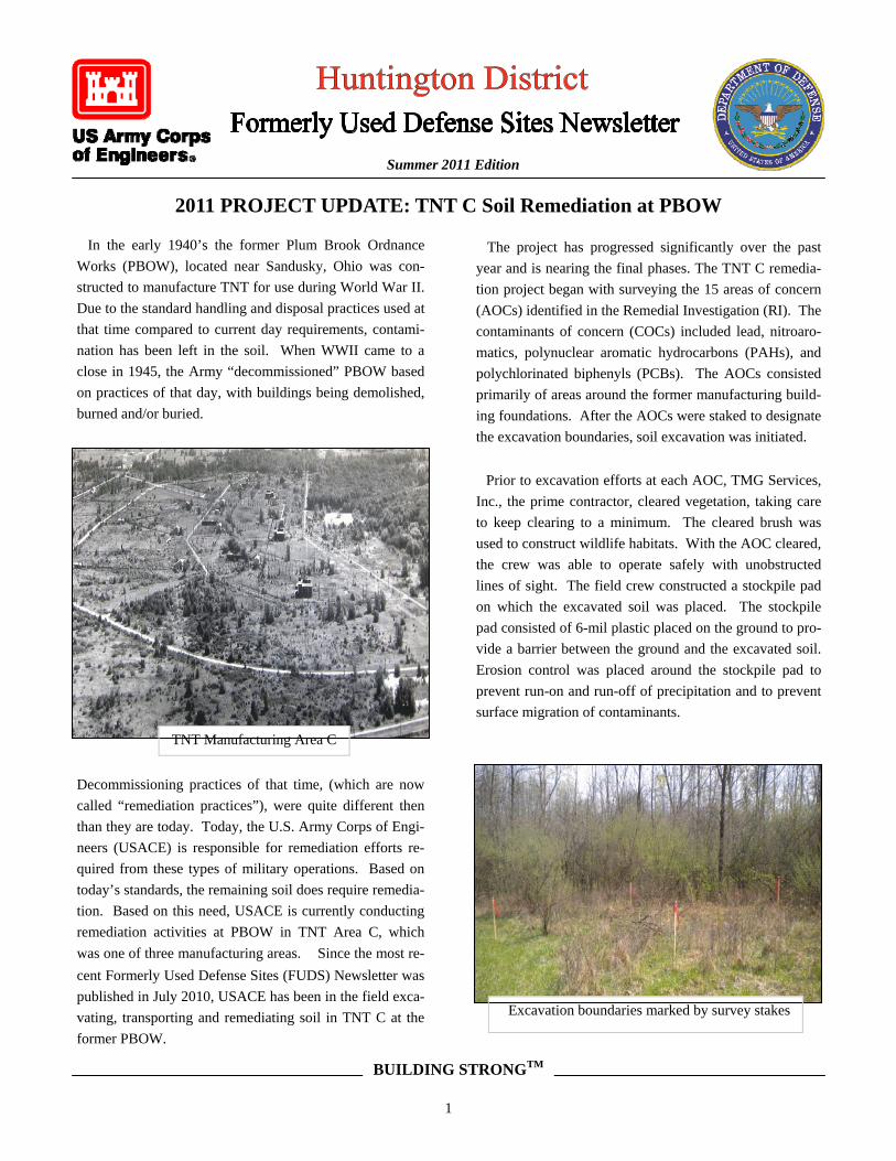
TNT Manufacturing Area C
2011 PROJECT UPDATE: TNT C Soil Remediation at PBOW
In the early 1940’s the former Plum Brook Ordnance
Works (PBOW), located near Sandusky, Ohio was con-
structed to manufacture TNT for use during World War II.
Due to the standard handling and disposal practices used at
that time compared to current day requirements, contami-
nation has been left in the soil. When WWII came to a
close in 1945, the Army “decommissioned” PBOW based
on practices of that day, with buildings being demolished,
burned and/or buried.
Decommissioning practices of that time, (which are now
called “remediation practices”), were quite different then
than they are today. Today, the U.S. Army Corps of Engi-
neers (USACE) is responsible for remediation efforts re-
quired from these types of military operations. Based on
today’s standards, the remaining soil does require remedia-
tion. Based on this need, USACE is currently conducting
remediation activities at PBOW in TNT Area C, which
was one of three manufacturing areas. Since the most re-
cent Formerly Used Defense Sites (FUDS) Newsletter was
published in July 2010, USACE has been in the field exca-
vating, transporting and remediating soil in TNT C at the
former PBOW.
The project has progressed significantly over the past
year and is nearing the final phases. The TNT C remedia-
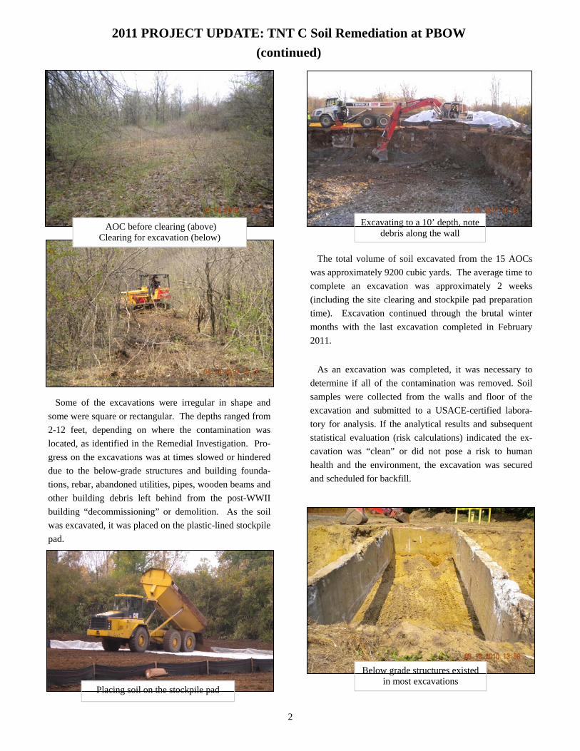
tion project began with surveying the 15 areas of concern
(AOCs) identified in the Remedial Investigation (RI). The
contaminants of concern (COCs) included lead, nitroaro-
matics, polynuclear aromatic hydrocarbons (PAHs), and
polychlorinated biphenyls (PCBs). The AOCs consisted
primarily of areas around the former manufacturing build-
ing foundations. After the AOCs were staked to designate
the excavation boundaries, soil excavation was initiated.
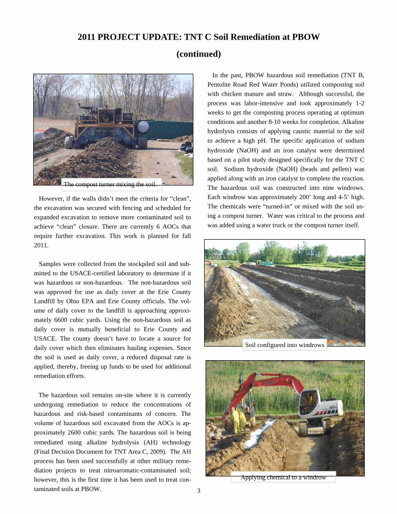
Prior to excavation efforts at each AOC, TMG Services,
Inc., the prime contractor, cleared vegetation, taking care
to keep clearing to a minimum. The cleared brush was
used to construct wildlife habitats. With the AOC cleared,
the crew was able to operate safely with unobstructed
lines of sight. The field crew constructed a stockpile pad
on which the excavated soil was placed. The stockpile
pad consisted of 6-mil plastic placed on the ground to pro-
vide a barrier between the ground and the excavated soil.
Erosion control was placed around the stockpile pad to
prevent run-on and run-off of precipitation and to prevent
surface migration of contaminants.
Excavation boundaries marked by survey stakes
BUILDING STRONGTM
1
AOC before clearing (above) Clearing for excavation (below)
Placing soil on the stockpile pad
Excavating to a 10’ depth, note debris along the wall
Below grade structures existed in most excavations
2011 PROJECT UPDATE: TNT C Soil Remediation at PBOW
(continued)
The total volume of soil excavated from the 15 AOCs
was approximately 9200 cubic yards. The average time to
complete an excavation was approximately 2 weeks
(including the site clearing and stockpile pad preparation
time). Excavation continued through the brutal winter
months with the last excavation completed in February
2011.
As an excavation was completed, it was necessary to
determine if all of the contamination was removed. Soil
samples were collected from the walls and floor of the
excavation and submitted to a USACE-certified labora-
tory for analysis. If the analytical results and subsequent
statistical evaluation (risk calculations) indicated the ex-
cavation was “clean” or did not pose a risk to human
health and the environment, the excavation was secured
and scheduled for backfill.
Some of the excavations were irregular in shape and
some were square or rectangular. The depths ranged from
2-12 feet, depending on where the contamination was
located, as identified in the Remedial Investigation. Pro-
gress on the excavations was at times slowed or hindered
due to the below-grade structures and building founda-
tions, rebar, abandoned utilities, pipes, wooden beams and
other building debris left behind from the post-WWII
building “decommissioning” or demolition. As the soil
was excavated, it was placed on the plastic-lined stockpile
pad.
2
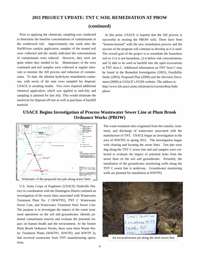
The compost turner mixing the soil.
Soil configured into windrows
Applying chemical to a windrow
2011 PROJECT UPDATE: TNT C Soil Remediation at PBOW
(continued)
However, if the walls didn’t meet the criteria for “clean”,
the excavation was secured with fencing and scheduled for
expanded excavation to remove more contaminated soil to
achieve “clean” closure. There are currently 6 AOCs that
require further excavation. This work is planned for fall
2011.
Samples were collected from the stockpiled soil and sub-
mitted to the USACE-certified laboratory to determine if it
was hazardous or non-hazardous. The non-hazardous soil
was approved for use as daily cover at the Erie County
Landfill by Ohio EPA and Erie County officials. The vol-
ume of daily cover to the landfill is approaching approxi-
mately 6600 cubic yards. Using the non-hazardous soil as
daily cover is mutually beneficial to Erie County and
USACE. The county doesn’t have to locate a source for
daily cover which then eliminates hauling expenses. Since
the soil is used as daily cover, a reduced disposal rate is
applied, thereby, freeing up funds to be used for additional
remediation efforts.
The hazardous soil remains on-site where it is currently
undergoing remediation to reduce the concentrations of
hazardous and risk-based contaminants of concern. The
volume of hazardous soil excavated from the AOCs is ap-
proximately 2600 cubic yards. The hazardous soil is being
remediated using alkaline hydrolysis (AH) technology
(Final Decision Document for TNT Area C, 2009). The AH
process has been used successfully at other military reme-
diation projects to treat nitroaromatic-contaminated soil;
however, this is the first time it has been used to treat con-
In the past, PBOW hazardous soil remediation (TNT B,
Pentolite Road Red Water Ponds) utilized composting soil
with chicken manure and straw. Although successful, the
process was labor-intensive and took approximately 1-2
weeks to get the composting process operating at optimum
conditions and another 8-10 weeks for completion. Alkaline
hydrolysis consists of applying caustic material to the soil
to achieve a high pH. The specific application of sodium
hydroxide (NaOH) and an iron catalyst were determined
based on a pilot study designed specifically for the TNT C
soil. Sodium hydroxide (NaOH) (beads and pellets) was
applied along with an iron catalyst to complete the reaction.
The hazardous soil was constructed into nine windrows.
Each windrow was approximately 200’ long and 4-5’ high.
The chemicals were “turned-in” or mixed with the soil us-
ing a compost turner. Water was critical to the process and
was added using a water truck or the compost turner itself.
taminated soils at PBOW. 3
An excavation/test pit along the steel sewer line
2011 PROJECT UPDATE: TNT C SOIL REMEDIATION AT PBOW
(continued)
Prior to applying the chemicals, sampling was conducted
to determine the baseline concentrations of contaminants in
the windrowed soil. Approximately one week after the
NaOH/iron catalyst application, samples of the treated soil
were collected and the results indicated the concentrations
of contaminants were reduced. However, they were not
quite where they needed to be. Maintenance of the rows
continued and soil samples were collected at regular inter-
vals to monitor the AH process and reduction of contami-
nants. To date, the alkaline hydrolysis remediation contin-
ues, with seven of the nine rows sampled for disposal.
USACE is awaiting results. Two rows required additional
chemical application, which was applied in mid-July and
sampling is planned for late July. This would eliminate the
need/cost for disposal off-site as well as purchase of backfill
material.
At this point, USACE is hopeful that the AH process is
successful in treating the PBOW soils. There have been
“lessons-learned” with the new remediation process and the
success of the program will continue to develop as it is used.
The overall goal of the project is to remediate the hazardous
soil so 1) it is not hazardous, 2) is below risk concentrations,
and 3) able to be used as backfill into the open excavations
at TNT Area C. Additional information on TNT Area C may
be found in the Remedial Investigation (2001), Feasibility
Study (2003), Proposed Plan (2009) and the Decision Docu-
ment (2009) at USACE’s FUDS website. The address is:
http://www.lrh.usace.army.mil/projects/current/derp-fuds/
pbow/
USACE Begins Investigation of Process Wastewater Sewer Line at Plum Brook Ordnance Works (PBOW)
Schematic of the proposed test pits along sewer lines
U.S. Army Corps of Engineers (USACE) Nashville Dis-
trict in coordination with the Huntington District initiated an
investigation of the sewer lines associated with Wastewater
Treatment Plant No. 2 (WWTP2), TNT C Wastewater
Sewer Line, and Wastewater Treatment Steel Sewer Line.
The purpose is to investigate the impact of the waste treat-
ment operations on the soil and groundwater, identify po-
tential contaminant sources and evaluate the potential im-
pact on human health and the environment. At the former
Plum Brook Ordnance Works, there were three Waste Wa-
ter Treatment Plants (WWTP1, WWTP2, and WWTP 3),
that received wastewater from TNT manufacturing opera-
tions.
The waste treatment sites originated from the transfer, treat-
ment, and discharge of wastewater associated with the
manufacture of TNT. USACE began an investigation in the
area of WWTP2 in spring 2011. The investigation began
with clearing and locating the sewer lines. Test pits were
dug along the TNT C sewer line and soil samples were col-
lected to evaluate the impact of potential leaks from the
sewer lines on the soil and groundwater. Presently, the
installation of the groundwater monitoring wells along the
TNT C sewer line is underway. Groundwater monitoring
wells are planned for installation at WWTP2.
4
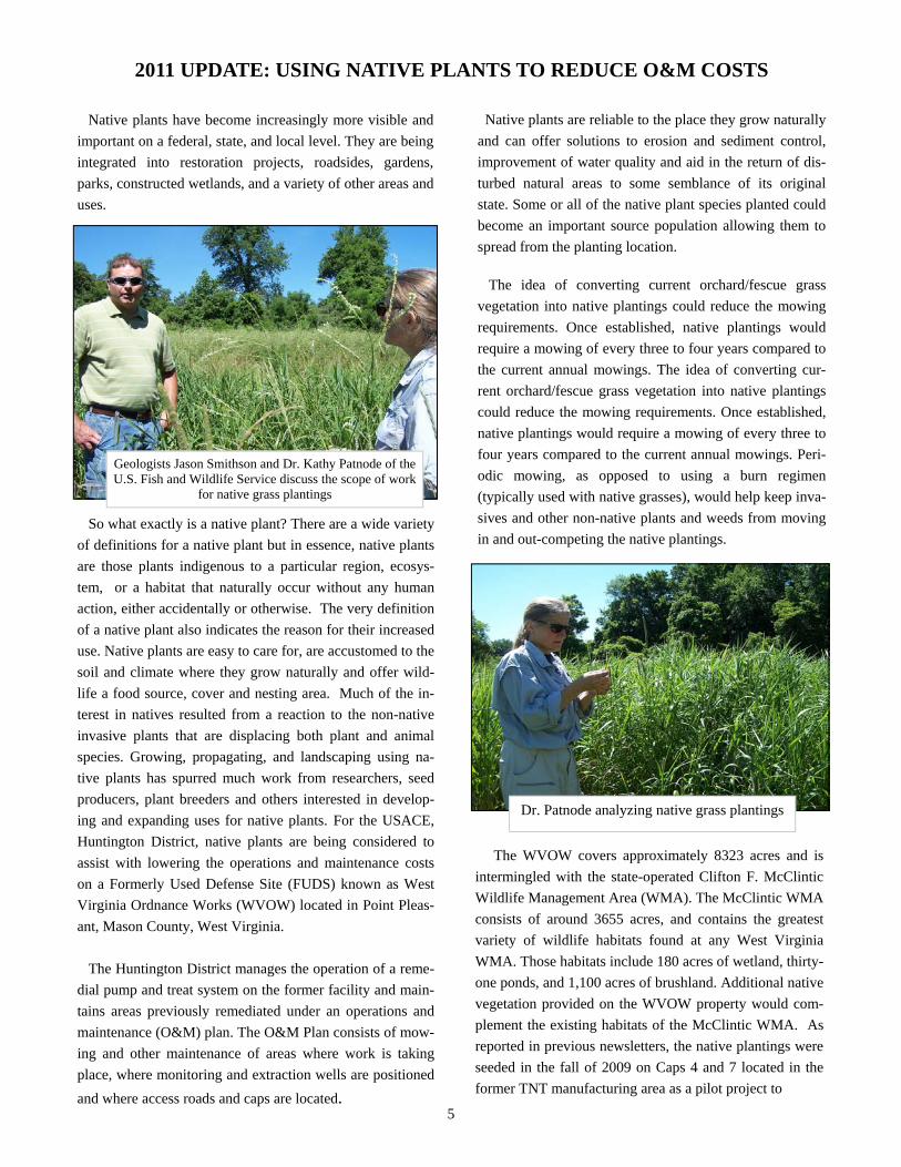
Geologists Jason Smithson and Dr. Kathy Patnode of the U.S. Fish and Wildlife Service discuss the scope of work
for native grass plantings
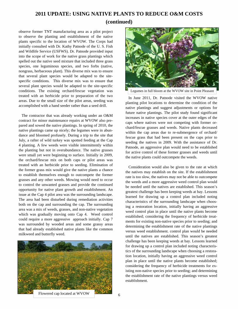
Dr. Patnode analyzing native grass plantings
2011 UPDATE: USING NATIVE PLANTS TO REDUCE O&M COSTS
Native plants have become increasingly more visible and
important on a federal, state, and local level. They are being
integrated into restoration projects, roadsides, gardens,
parks, constructed wetlands, and a variety of other areas and
uses.
So what exactly is a native plant? There are a wide variety
of definitions for a native plant but in essence, native plants
are those plants indigenous to a particular region, ecosys-
tem, or a habitat that naturally occur without any human
action, either accidentally or otherwise. The very definition
of a native plant also indicates the reason for their increased
use. Native plants are easy to care for, are accustomed to the
soil and climate where they grow naturally and offer wild-
life a food source, cover and nesting area. Much of the in-
terest in natives resulted from a reaction to the non-native
invasive plants that are displacing both plant and animal
species. Growing, propagating, and landscaping using na-
tive plants has spurred much work from researchers, seed
producers, plant breeders and others interested in develop-
ing and expanding uses for native plants. For the USACE,
Huntington District, native plants are being considered to
assist with lowering the operations and maintenance costs
on a Formerly Used Defense Site (FUDS) known as West
Virginia Ordnance Works (WVOW) located in Point Pleas-
ant, Mason County, West Virginia.
The Huntington District manages the operation of a reme-
dial pump and treat system on the former facility and main-
tains areas previously remediated under an operations and
maintenance (O&M) plan. The O&M Plan consists of mow-
ing and other maintenance of areas where work is taking
place, where monitoring and extraction wells are positioned
and where access roads and caps are located. 5
Native plants are reliable to the place they grow naturally
and can offer solutions to erosion and sediment control,
improvement of water quality and aid in the return of dis-
turbed natural areas to some semblance of its original
state. Some or all of the native plant species planted could
become an important source population allowing them to
spread from the planting location.
The idea of converting current orchard/fescue grass
vegetation into native plantings could reduce the mowing
requirements. Once established, native plantings would
require a mowing of every three to four years compared to
the current annual mowings. The idea of converting cur-
rent orchard/fescue grass vegetation into native plantings
could reduce the mowing requirements. Once established,
native plantings would require a mowing of every three to
four years compared to the current annual mowings. Peri-
odic mowing, as opposed to using a burn regimen
(typically used with native grasses), would help keep inva-
sives and other non-native plants and weeds from moving
in and out-competing the native plantings.
The WVOW covers approximately 8323 acres and is
intermingled with the state-operated Clifton F. McClintic
Wildlife Management Area (WMA). The McClintic WMA
consists of around 3655 acres, and contains the greatest
variety of wildlife habitats found at any West Virginia
WMA. Those habitats include 180 acres of wetland, thirty-
one ponds, and 1,100 acres of brushland. Additional native
vegetation provided on the WVOW property would com-
plement the existing habitats of the McClintic WMA. As
reported in previous newsletters, the native plantings were
seeded in the fall of 2009 on Caps 4 and 7 located in the
former TNT manufacturing area as a pilot project to
2011 UPDATE: USING NATIVE PLANTS TO REDUCE O&M COSTS
(continued)
observe former TNT manufacturing area as a pilot project to observe the planting and establishment of the native plants specific to the location of WVOW. The Corps had initially consulted with Dr. Kathy Patnode of the U. S. Fish and Wildlife Service (USFWS). Dr. Patnode provided input into the scope of work for the native grass plantings which spelled out the native seed mixture that included three grass species, one leguminous species, and two forbs (native, nongrass, herbaceous plant). This diverse mix was to ensure that several plant species would be adapted to the site-specific conditions. This diverse mix was to ensure that several plant species would be adapted to the site-specific conditions. The existing orchard/fescue vegetation was Legumes in full bloom at the WVOW site in Point Pleasant
treated with an herbicide prior to preparation of the two In June 2011, Dr. Patnode visited the WVOW native areas. Due to the small size of the pilot areas, seeding was planting pilot locations to determine the condition of the accomplished with a hand seeder rather than a seed drill. native plantings and suggest adjustments or options for future native plantings. The pilot study found significant The contractor that was already working under an O&M increases in native species cover at the outer edges of the contract for minor maintenance repairs at WVOW also pre- caps where natives were not competing with former or-pared and sowed the native plantings. In spring of 2010, the chard/fescue grasses and weeds. Native plants decreased native plantings came up nicely; the legumes were in abun- within the cap areas due to re-submergence of orchard/ dance and bloomed profusely. During a trip to the site that fescue grass that had been present on the caps prior to July, a rafter of wild turkey was spotted feeding at the Cap seeding the natives in 2009. With the assistance of Dr. 4 planting. A few weeds were visible intermittently within Patnode, an aggressive plan would need to be established the planting but not in overabundance. The native grasses for active control of these former grasses and weeds until were small yet were beginning to surface. Initially in 2009, the native plants could outcompete the weeds. the orchard/fescue mix on both caps or pilot areas was treated with an herbicide prior to seeding. Elimination of Consideration would also be given to the rate at which the former grass mix would give the native plants a chance the natives may establish on the site. If the establishment to establish themselves enough to outcompete the former rate is too slow, the natives may not be able to outcompete grasses and any other weeds. Mowing would need to occur the weeds and a more aggressive weed control plan would to control the unwanted grasses and provide the continued be needed until the natives are established. This season’s opportunity for native plant growth and establishment. An greatest challenge has been keeping weeds at bay. Lessons issue at the Cap 4 pilot area was the surrounding landscape. learned for drawing up a control plan included noting The area had been disturbed during remediation activities characteristics of the surrounding landscape when choos-both on the cap and surrounding the cap. The surrounding ing a restoration location, initially having an aggressive area was a mix of weeds, grasses, and non-native vegetation weed control plan in place until the native plants become which was gradually moving onto Cap 4. Weed control established; considering the frequency of herbicide treat-could require a more aggressive approach initially. Cap 7 ments for existing non-native species prior to seeding; and was surrounded by wooded areas and some grassy areas determining the establishment rate of the native plantings that had already established native plants like the common versus weed establishment. control plan would be needed milkweed and butterfly weed. until the natives are established. This season’s greatest
challenge has been keeping weeds at bay. Lessons learned for drawing up a control plan included noting characteris-tics of the surrounding landscape when choosing a restora-tion location, initially having an aggressive weed control plan in place until the native plants become established; considering the frequency of herbicide treatments for ex-isting non-native species prior to seeding; and determining the establishment rate of the native plantings versus weed establishment.
Flowered cap located at WVOW 6
Aerial photo of the USEPC along the Kanawha River
Map of the U.S. Naval Ordnance Plant in
South Charleston
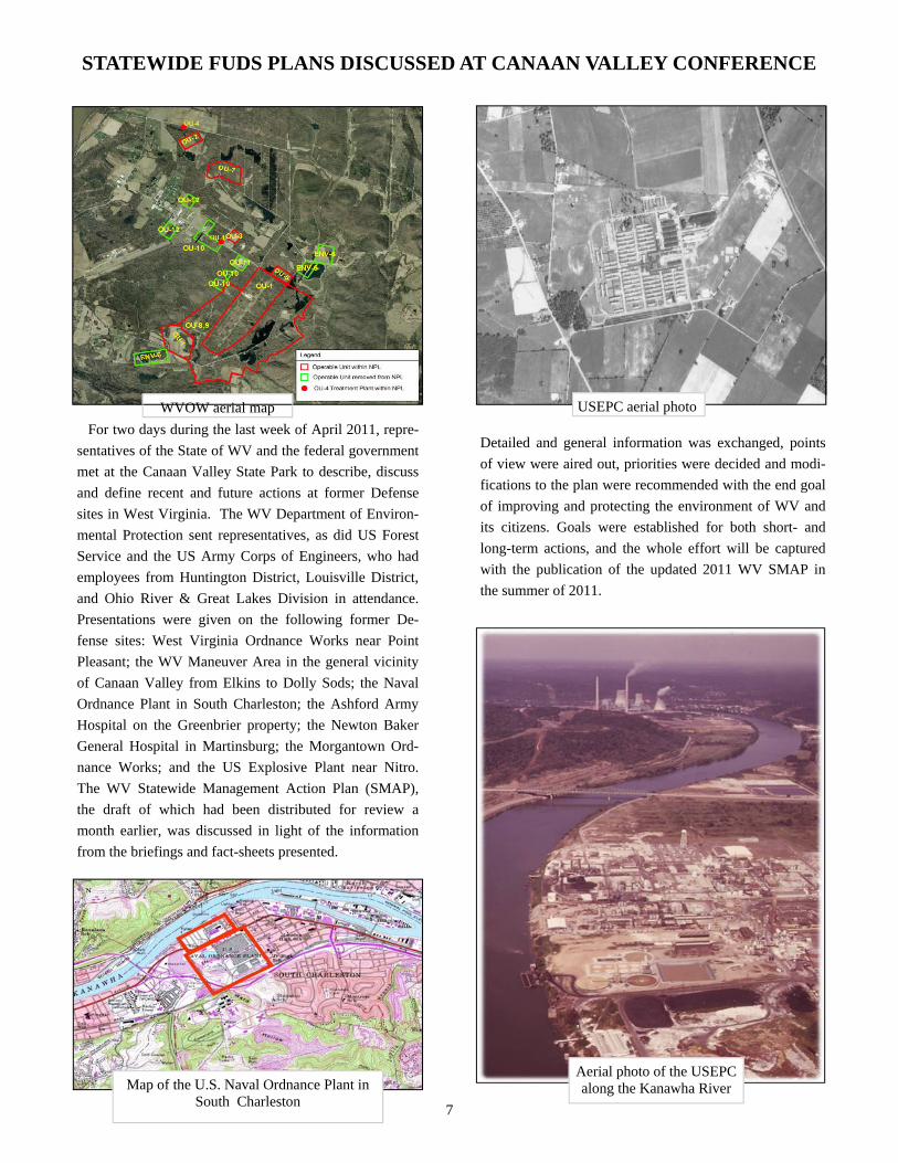
STATEWIDE FUDS PLANS DISCUSSED AT CANAAN VALLEY CONFERENCE
WVOW aerial map USEPC aerial photo
For two days during the last week of April 2011, repre-
sentatives of the State of WV and the federal government
met at the Canaan Valley State Park to describe, discuss
and define recent and future actions at former Defense
sites in West Virginia. The WV Department of Environ-
mental Protection sent representatives, as did US Forest
Service and the US Army Corps of Engineers, who had
employees from Huntington District, Louisville District,
and Ohio River & Great Lakes Division in attendance.
Presentations were given on the following former De-
fense sites: West Virginia Ordnance Works near Point
Pleasant; the WV Maneuver Area in the general vicinity
of Canaan Valley from Elkins to Dolly Sods; the Naval
Ordnance Plant in South Charleston; the Ashford Army
Hospital on the Greenbrier property; the Newton Baker
General Hospital in Martinsburg; the Morgantown Ord-
nance Works; and the US Explosive Plant near Nitro.
The WV Statewide Management Action Plan (SMAP),
the draft of which had been distributed for review a
month earlier, was discussed in light of the information
from the briefings and fact-sheets presented.
Detailed and general information was exchanged, points
of view were aired out, priorities were decided and modi-
fications to the plan were recommended with the end goal
of improving and protecting the environment of WV and
its citizens. Goals were established for both short- and
long-term actions, and the whole effort will be captured
with the publication of the updated 2011 WV SMAP in
the summer of 2011.
7
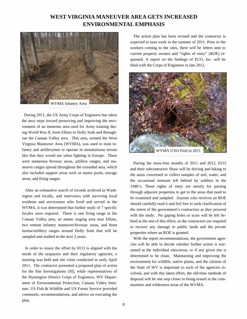
WVMA Infantry Area
WVMA UXO Find in 2011
WEST VIRGINIA MANEUVER AREA GETS INCREASED ENVIRONMENTAL EMPHASIS
During 2011, the US Army Corps of Engineers has taken
the next steps toward preserving and improving the envi-
ronment of an immense area used for Army training dur-
ing World War II, from Elkins to Dolly Sods and through-
out the Canaan Valley area. This area, termed the West
Virginia Maneuver Area (WVMA), was used to train in-
fantry and artillerymen to operate in mountainous terrain
like that they would see when fighting in Europe. There
were numerous bivouac areas, artillery ranges, and ma-
neuver ranges spread throughout the extended area, which
also included support areas such as motor pools, storage
areas, and firing ranges.
After an exhaustive search of records archived in Wash-
ington and locally, and interviews with surviving local
residents and servicemen who lived and served in the
WVMA, it was determined that further study of 7 specific
locales were required. There is one firing range in the
Canaan Valley area, an ammo staging area near Elkins,
two remote infantry maneuver/bivouac areas, and three
mortar/artillery ranges around Dolly Sods that will be
sampled and studied in the next 2 years.
In order to insure the effort by ECO is aligned with the
needs of the taxpayers and their regulatory agencies, a
meeting was held and site visits conducted in early April
2011. The contractor presented a proposed plan of action
for the Site Investigations (SI), while representatives of
the Huntington District Corps of Engineers, WV Depart-
ment of Environmental Protection, Canaan Valley Insti-
tute, US Fish & Wildlife and US Forest Service provided
comments, recommendations, and advice on executing the
plan. 8
The action plan has been revised and the contractor is
expected to start work in the summer of 2011. Prior to the
workers coming to the sites, there will be letters sent to
current property owners and “rights of entry” (ROE) re-
quested. A report on the findings of ECO, Inc. will be
filed with the Corps of Engineers in late 2012.
During the snow-free months of 2011 and 2012, ECO
and their subcontractor Shaw will be driving and hiking to
the areas concerned to collect samples of soil, water, and
the occasional remnant left behind by soldiers in the
1940’s. These rights of entry are mostly for passing
through adjacent properties to get to the areas that need to
be examined and sampled. Anyone who receives an ROE
should carefully read it and feel free to seek clarification of
the intent of the government’s contractors as they proceed
with the study. No gaping holes or scars will be left be-
hind at the end of this effort, as the contractors are required
to recover any damage to public lands and the private
properties where an ROE is granted.
With the report recommendations, the government agen-
cies will be able to decide whether further action is war-
ranted at the individual sites/areas, or if any given site is
determined to be clean. Maintaining and improving the
environment for wildlife, native plants, and the citizens of
the State of WV is important to each of the agencies in-
volved, and with this latest effort, the old-time methods of
disposal will be one step closer to being erased in the com-
munities and wilderness areas of the WVMA.