1. objective (read) swbat explain how gps works. 2. question of the day. (turn objective into a...
TRANSCRIPT

1. Objective (READ)
SWBAT explain how GPS works.
2. Question of the Day.
(TURN OBJECTIVE INTO A QUESTION)
3. Warm-up (ANSWER) A. What is GIS?
B. What would you do to fix the crime problem in Baltimore (or in Houston)?
- Go in order, step 1, step 2, step 3
- directions are in parentheses

Warm-up PageDate Question of the
DayWarm-up
9/1 How does GPS work?
1. GIS – a system that puts information on top of maps.
2. Increase the number of police in high crime areas.

Table of ContentsDate Title Lesson #
**Thinking Like a Geographer**
8/25 Spatial Analysis 1
8/26 5 Themes of Geography 2
8/27 The 5 A’s 3
8/31 Geographer’s Tools 4
1. Turn to your Geographer’s Tools page that we made yesterday, pick up where you left off.
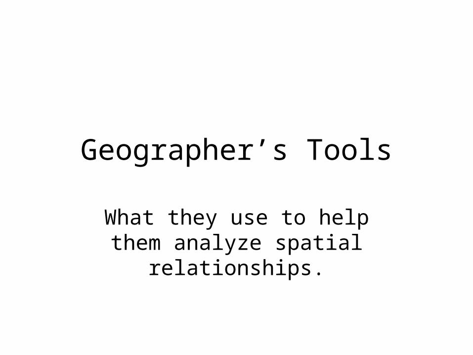
Geographer’s Tools
What they use to help them analyze spatial relationships.

1. GLOBES 2. MAPS
Directions:
- Create this t-chart on your Geographer’s Tools page.
- Make it about a quarter of the page.

1. GLOBES
– Spherical– 3D– Accurate but zoomed
out– Global perspective
2. MAPS
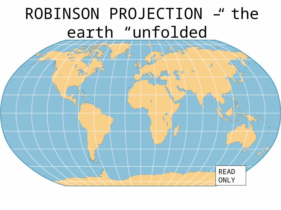
ROBINSON PROJECTION – the earth “unfolded”
READ ONLY

AZIMUTHAL PROJECTION – a picture of the globe
READ ONLY

AZIMUTHAL – a picture of the globe
READ ONLY

Map Flaws
- Which is bigger Greenland or South America?
A. Distortion a loss of accuracy
Greenland
South America
COPY BOX IN THE 웈 ʠP SECTION OF YOUR T-CHART

1. Globes
– Spherical– 3-dimensional– Accurate– Global perspective
2. Maps
– Flat– 2-dimensional– Not accurate– Distorts size, shape,
distance

Longitude/Latitude Clip Questions
1. How can you tell the difference between longitude and latitude?
2. Why is it used?
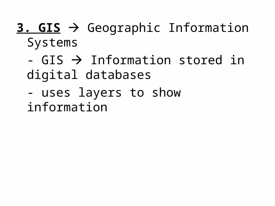
3. GIS Geographic Information Systems
- GIS Information stored in digital databases
- uses layers to show information

Baltimore Crime Map
• As you look at the map. Write your answer to the following questions in your notebook: A. After this information is presented to you as
mayor what is one thing you would do?
B. Who else would make decisions based on this map? (give at least 3)
READ ONLY
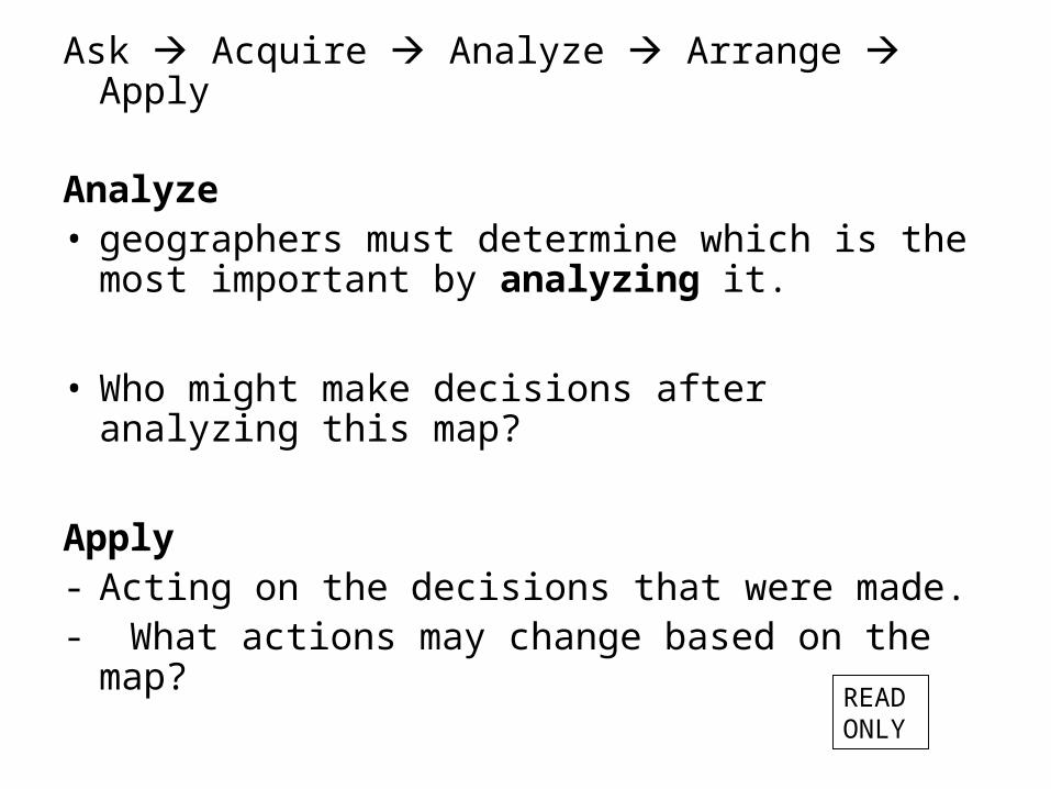
Ask Acquire Analyze Arrange Apply
Analyze• geographers must determine which is the most
important by analyzing it.
• Who might make decisions after analyzing this map?
Apply- Acting on the decisions that were made.- What actions may change based on the map?
READ ONLY

4. Demographics – data collected about the characteristics of a population
• Which of the 5 A’s would this fit under?– Acquire

READ ONLY

Now lets collect some demographics
A. Middle School – Dean = – Campbell = – Truitt = – Other =
B. Family Position- Youngest = - Middle child = - Old cool kids =
C. Age- 13 = - 14 = - 15 = - 16 = - 17 =
D. Gender- Boys - Girls

5. Charts and 6. Graphs
• Which of the 5 A’s does creating charts and graphs fit? – Arrange

READ ONLY

Same data in a chart…
READ ONLY
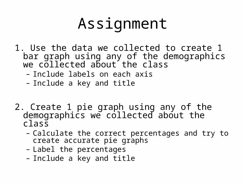
Assignment
1. Use the data we collected to create 1 bar graph using any of the demographics we collected about the class– Include labels on each axis– Include a key and title
2. Create 1 pie graph using any of the demographics we collected about the class– Calculate the correct percentages and try to create
accurate pie graphs– Label the percentages– Include a key and title

Assignment - H
1. Create 1 pie graph using the demographics we collected about the class– Calculate the correct percentages and try to create
accurate pie graphs– Label the percentages– Include a key and title
2. Create another form of a graph (can’t be a bar graph or pie graph) to depict some of the data we acquired about the class.

Write the name of your favorite celebrity in your notebook…
Things he/she will need Things to do for fun
1. Hotel
2.
3.
4.
1. Visit friends
2.
3.
4.

Crisis!
• Your celebrity friend has only one day to spend with you.
• What tool could you use to ensure that you do everything on your list in one day?
READ ONLY

7. GPS Global Positioning System
• Definition – directions are given using satellites to determine absolute location
• Clip: A. How does GPS work?
B. How could you use this to help your celebrity?
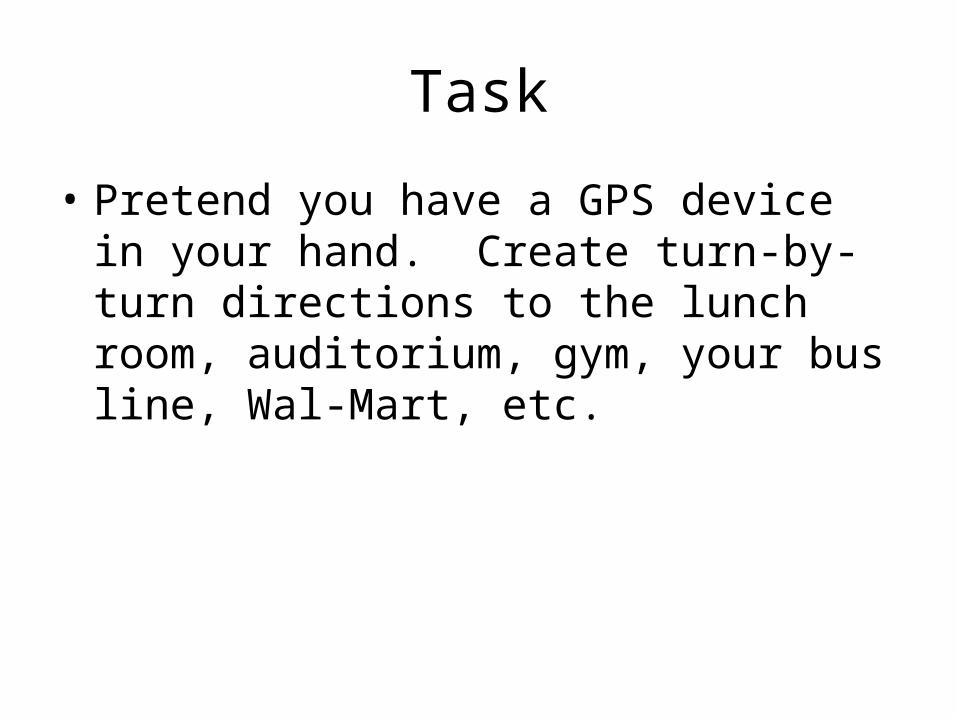
Task
• Pretend you have a GPS device in your hand. Create turn-by-turn directions to the lunch room, auditorium, gym, your bus line, Wal-Mart, etc.
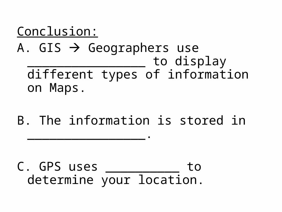
Conclusion:A. GIS Geographers use
________________ to display different types of information on Maps.
B. The information is stored in ________________.
C. GPS uses __________ to determine your location.

After you’re finished…1. Turn in your scantron and quiz at the table in front of my
desk.
2. Pick up a paper titled “Science and Geography”
3. Work on it at your desk silently while other students finish their quizzes.
- You may also work on the following assignments that are DUE. Copies of these are found on the table next to the screen.- Turn in any of these on the table in front of my desk if you have not done so already
A. 5 Themes of Geography HW assignmentB. 5 A’s group assignment – Labeling real-life
examples then come up with your own.

After you’re finished…
1. Turn in your scantron and quiz at the table in front of my desk.
2. Finish your graphs silently at your seat. REMAIN SILENT UNTIL ALL STUDENTS ARE FINISHED, I WILL LET YOU KNOW WHEN THAT IS.
3. Skip your question of the day and write free 100 underneath it.