zoning bylaw no - leask, saskatchewan - … 6-92 the zoning bylaw.pdf · zoning bylaw no. 6-92 of...
TRANSCRIPT
Rural Municipality of Leask No. 464
Zoning Bylaw No. 6-92

TABLE OF CONTENTS
SECTION PAGE
PART I. INTRODUCTION 1
1. Title 1
2. Authority 1
3. Scope 1
4. Purpose 1
5. Severability 1
PART II. ADMINISTRATION 2
1. Development Officer 2
2. Application for a Development Permit 2
3. Application Requirements 2
4. Notification to Applicant 3
5. Referral to Saskatchewan Health 3
6. Building Permit 3
7. Development Appeals Board 3
8. Amendments to the Zoning Bylaw 5
9. Offences and Penalties 5
PART III. GENERAL REGULATIONS 5
1. Licenses, Permits and Compliance with Other Bylaws 5
2. Frontage on Road 5
3. Building to be Moved 6
4. Public Utilities 6
5. Waste Disposal 6
6. Water 6
7. Storage of Chemicals, Fertilizers, and Combustible Materials 6
8. Areas Prohibited for Development 7
9. One Principal Building for Use Permitted on a Site 7
10. Non-conforming Uses 7
11. Regulations for Signs and Billboards 7
12. Home Occupation Standards 9
13. Dwelling Group 10

TABLE OF CONTENTS
SECTION PAGE
PART IV. ZONING DISTRICTS 10
1. Classification of Zoning Districts 10
2. Boundaries of Zoning Districts 10
3. The Zoning District Map 10
DISTRICT 1: AGRICULTURAL RESOURCE DISTRICT (AR) 11
DISTRICT 2: LAKESHORE DEVELOPMENT DISTRICT (LD) 20
DISTRICT 2.1: LAKESHORE DEVLEOPMENT DISTRICT 1 (LD1) 23
DISTRICT 2.2 DUNCAN’S BEACH RESORT DISTRICT (DB) 24
DISTRICT 3: RESORT COMMERCIAL DISTRICT (RC) 26
DISTRICT 4: CONSERVATION DISTRICT (CA) 29
DISTRICT 5: COUNTRY RESIDENTIAL DISTRICT (CR) 31
DISTRICT 5.1: COUNTRY RESIDENTAIL LAKESHORE DISTRICT
(CRLD) 33
DISTRICT 6: PROVINCIAL FOREST DISTRICT (F) 35
DISTRICT 7: LIGHT INDUSTRIAL AND HIGHWAY COMMERCIAL
DISTRICT (M1) 37
PART V. DEFINITIONS 39
PART VI. EFFECTIVE DATE OF THE BYLAW 49

ZONING BYLAW NO. 6-92
OF THE RURAL MUNICIPALITY OF LEASK NO. 464
PART l. INTRODUCTION
1. Title
This bylaw shall be known as the “Zoning Bylaw of the Rural Municipality of Leask No.
464”.
2. Authority
Pursuant to section 67 of The Planning and Development Act, 1983, the Council of the
Rural Municipality of Leask No. 464 hereby adopts Zoning Bylaw No. 6-92 of the Rural
Municipality of Leask No. 464.
3. Scope
All development within the limits of the municipality shall be in conformity with the
provisions of this bylaw.
4. Purpose
This is a bylaw to control the use and development of land in the municipality, and to
assist in implementing the Basic Planning Statement Bylaw No. 5-92.
5. Severability
If any portion of this bylaw, including anything shown on the Zoning District Map, is
declared to be invalid for any reason by an authority of competent jurisdiction, that
decision shall not affect the validity of the bylaw as a whole, or any other part, section or
provision of this bylaw.
1

PART ll. ADMINISTRATION
1. Development Officer
The rural municipal Council shall administer this bylaw. Council or the Planning Committee
of Council shall direct the rural municipal administrator (development officer) respecting the
issuance of development permits.
2. Application for a Development Permit
Every person shall complete an application for a development permit (which is available at the
rural municipal office) before commencing any development within the municipality.
Agricultural developments such as farm residences and intensive livestock operations over 200
animal units as defined by The Pollution (by Live Stock) Control Act, 1984 and associated
regulations will also require a development permit. Developments which do not require a
development permit include:
a. Farm Uses
Farm buildings where applied to a principal agricultural use within the zoning
districts established by this bylaw.
b. Public Utilities
Any operation for the purposes of inspecting, repairing, or renewing sewers, mains,
cables, pipes, wires, tracks, or similar public works as required by a public utility.
3. Application Requirements
Unless otherwise specified in this bylaw, with every application for a development permit, a
copy of a layout, or site plan, showing the dimensions of the site, the site size, the location on
the site of any existing and all proposed development and the method and location of on-site
sewage disposal facilities, shall be submitted as prescribed in No. 2 above, for approval to the
development officer together with such other information as may be required in support of the
application.
3.1 Notification to Public of a Discretionary Use Application
a. At least seven days before the application is to be considered by Council,
Notification to Public of a Discretionary Use Application must be provided
to:
i. the assessed owners of property within 75 metres of the boundary
with the applicant’s land; and
ii. other owners of property required to be notified pursuant to the
zoning bylaw
2

4. Notification to Applicant
a. Written Notification
The applicant shall be notified in writing of the decision regarding the application.
b. Approval
If the proposal conforms to the provisions of this bylaw, a development permit shall
be issued, subject to any development standards, special regulations, or performance
standards that may be required. This development permit shall be effective for one
year from the date of its issuance.
c. Refusal – Right to Appeal
If the proposal is denied, the reasons for the refusal shall be stated and the applicant
shall be advised of the right to appeal the decision to the Development Appeals
Board, subject to the provisions of The Planning and Development Act, 1983.
5. Referral to Saskatchewan Health
A copy of all approved development permit applications, involving the installation of water
and sanitary services, shall be sent to the local office of Saskatchewan Health.
6. Building Permit
Where required, a building permit shall not be issued unless a development permit, where
required has been issued.
7. Development Appeals Board
a. Council shall appoint a Development Appeals Board in conformity with the
provisions of The Planning and Development Act, 1983, within three months from the
date of the coming into force of the bylaw.
b. In addition to any other right of appeal provided by The Planning Development Act,
1983, a person affected thereby, may appeal to the Board where a development
officer:
i. is alleged to have misapplied the bylaw in issuing a development permit; or
3

ii. refuses to issue a development permit because it would contravene this bylaw.
c. An appellant shall make the appeal pursuant to subsection (2) within 30 days of the
date of the issuance of, or refusal to issue, a development permit.
d. In determining an appeal under subsection (2), the Board:
i. is bound by the Basic Planning Statement Bylaw No. 5-92;
ii. may confirm, revoke or vary a decision or development permit, or any
attached condition, or may substitute a decision, or permit, that it considers
advisable;
iii. may make a decision ordering or confirming the issuance of a development
permit notwithstanding that the proposed development does not comply with
this bylaw where, in its opinion, such action would not:
o grant to the applicant a special privilege inconsistent with the
restrictions on the neighboring properties in the same zoning district;
or
o amount to a relaxation of the provisions of this bylaw that would be
contrary to its purposes and intent and would injuriously affect the
neighboring properties.
e. Nothing in this section authorizes a person to appeal a decision of the Council:
i. refusing to rezone their land;
ii. rejecting an application for approval of a discretionary use; however, a
condition required by Council, on a development permit may be appealed.
f. Where a person wishes to appeal to the Development Appeals Board, they shall file a
written notice of their intention to appeal with the secretary of the Board, together
with any sum of not more than $50.00 that the Board may specify, to be applied to the
expenses of the appeal.
g. In making an appeal to the Development Appeals Board, and hearing such appeal, the
provisions of The Planning and Development Act, 1983, shall apply.
4

8. Amendments to the Zoning Bylaw
a. Council may amend this bylaw at any time, upon its own initiative or upon request,
provided that the amendments are in keeping with the intent of the Basic Planning
Statement.
b. Council shall require applicants requesting an amendment to this bylaw, or approval
of a discretionary use that Council wishes to advertise prior to issuance of a
development permit, to pay Council all or part of the cost associated with public
advertisement of the application.
9. Offences and Penalties
Any person who contravenes any of the provisions of this bylaw is guilty of an offence and is
liable, on summary conviction, to the penalties provided by section 203 of The Planning and
Development Act, 1983; namely, a fine of not more than $1,000.00 and, in the case of a
continuing offense, to a further fine not exceeding $250.00 for each day during which the
offence continues. In addition, a person convicted in respect of a development carried out in
contravention of the Act or any order, regulation, bylaw, basic planning statement or scheme
in force pursuant to the Act may be ordered to remove such development.
PART lll. GENERAL REGULATIONS
The following regulations shall apply to all Zoning Districts in this bylaw:
1. Licenses, Permits and Compliance with Other Bylaws
Nothing in this bylaw shall exempt any person from complying with the requirements of a
building bylaw, or any other bylaw in force within the municipality, or from obtaining any
permission required by this, or any other bylaw of the municipality, the province or the
federal government.
Where the provisions in this bylaw conflict with those of any other municipal, provincial or
federal requirements, the higher or more stringent standards shall prevail.
2. Frontage on Road
A development permit shall not be issued unless the site intended to be used, or upon
5

which a building or structure is to be erected, abuts, or has frontage on a graded all-weather
road, or unless satisfactory arrangements have been made with Council for the improvement
or building of a road, where required.
3. Building to be Moved
No building shall be moved within, or into, the municipality without first obtaining a
development permit from the development officer.
4. Public Utilities
Public utilities, excluding solid and liquid waste disposal sites, shall be permitted in every
zoning district, and unless otherwise specified by this bylaw, no minimum site area or yard
requirements shall apply.
5. Waste Disposal
No development or use of land which requires sewage disposal or landfill facilities shall be
permitted unless those facilities are approved by the Saskatchewan Health and/or the
Saskatchewan Water Corporation. Disposal of liquid, solid, or gaseous wastes are governed
by Acts administered by Saskatchewan Agriculture and Food, Saskatchewan Environment
and Public Safety, Saskatchewan Health and the Saskatchewan Water Corporation.
6. Water
No development or use of land shall be permitted where the proposal will adversely affect
domestic and municipal water supplies, or where a suitable, potable water supply cannot be
furnished to the requirements of Saskatchewan Health and/or the Saskatchewan Water
Corporation.
7. Storage of Chemicals, Fertilizers, and Combustible Materials
The storage of chemicals, fertilizers and combustible materials are subject to the
requirements of Labour Canada and Saskatchewan Human Resources, Labour and
Employment. All necessary requirements and permits must be met and obtained prior to
issuance of a development permit.
6

8. Areas Prohibited for Development
a. A development permit shall not be issued for development of a site or a road located
on land that, in the opinion of Council, is hazard land.
Where hazard conditions exist, Council may require the applicant to pay for a
geotechnical or hydrological inspection of the site by a qualified professional
consultant.
b. A development permit for residential, commercial, or industrial buildings shall not
be permitted except in accordance with the recommended separation or buffer
distances listed within the Regulations respecting Anhydrous Ammonia –
Saskatchewan Regulations 361/77 which are administered under The Boiler and
Pressure Vessel Act, R.S.S 1978, c. B-5, by Saskatchewan Environment and Public
Safety. These regulations may be amended from time to time. Residences and
buildings which are an integral part of the fertilizer operation, are not subject to the
foregoing buffer requirements.
9. One Principal Building or Use Permitted on a Site
Not more that one principal building or use shall be permitted on any one site except for:
a. Agricultural uses;
b. Institutional uses;
c. Public utility uses.
d. Dwelling groups.
10. Non-conforming Uses
The provisions of The Planning and Development Act, 1983, sections 113 and 118 inclusive,
shall apply to all non-conforming buildings and uses.
11. Regulations for Signs and Billboards
a. Permit Requirements
The sign regulations of this bylaw will be administered by issuance of a development
permit by the development officer. All signs situated along a highway or in a
highway sign corridor are required to comply with The Erection of Signs Adjacent to
Provincial Highway Regulations, 1986 as may be amended from time to time.
7

b. Signs and Billboards requiring a Development Permit.
Signs and billboards located outside of a highway sign corridor will require a
development permit if the following uses or occupations on municipal premises are
advertised:
o agricultural commercial uses,
o home occupations,
o principal use of a premises, or
o principal products offered for sale.
These signs and billboards are subject to the following requirements:
i) no more than two (2) signs will be permitted on the premises;
ii) each sign may be double faced;
iii) no sign shall be excess of 6 square meters (64.5 square feet) in area, but the
two (2) permitted signs may be combined and the total facial area shall not
exceed 12 square meters (129 square feet);
iv) the maximum height of any sign shall be 6 meters (20 feet); and
v) any other conditions as may be required by Saskatchewan Highways and
Transportation’s The Erection of Signs Adjacent to a Provincial Highway
Regulations, 1986 as may be amended from time to time.
c. Signs Not Requiring a Development Permit
Address Signs – one address designation per use which denotes the
numerical address and/or name of the occupant.
Agricultural Related Signs – agricultural related signs are permitted on
a temporary basis, such as herbicide, or insecticide or seed advertising
promotional signs.
Construction Signs – signs that indicate the impending development of
a site are permitted on a temporary basis.
Directional Signs – signs such as traffic warning signs, parking or no
trespassing signs.
Election Signs – election signs for any level of government are
permitted.
Government Signs – all signs erected by any level of government.
Memorial Signs – memorial signs such as plaques, tablets and
headstones.
8

Real Estate Signs – real estate signs are permitted only on the property
which is being advertised.
Signs in a highway sign corridor.
12. Home Occupation Standards
Home occupations are permitted subject to the discretion of Council and in accordance with
the following conditions:
a. No person other than the occupant’s immediate family and one paid assistant
(approved in principle by the development officer) shall be engaged in such
occupations on the premises.
b. The use should not involve the display or storage of goods or equipment upon or
inside the premises such that these items are exposed to public view from the exterior.
c. No variation in the residential character and appearance of the dwelling, ancillary
residential building, or land shall be permitted.
d. Advertising signs may be limited in size and number by the development officer.
e. The use shall not generate substantially more vehicular and/or pedestrian traffic and
vehicular parking than normal within the district.
f. The permitted use shall be valid only for the period of time the property is occupied
by the applicant for such permitted use.
g. All permits issued for home occupations shall be subject to the condition that the
permit is renewed annually and may be revoked at any time if, in the opinion of the
development officer, the use is or has become detrimental to the residential character
and amenities of the area.
13. Dwelling Group
a. For the purpose of regulation under this bylaw, a dwelling group shall be considered a
single parcel.
b. All service and other common buildings shall be of permanent construction.
c. Before occupancy, a dwelling group site shall provide and a dwelling group shall at
all times maintain the following:
i. Storage facilities necessary for site service and maintenance equipment
ii. Screening in the form of landscaping and fencing around service buildings,
storage compounds and refuse collection points.
iii. A neighborhood sign, not to exceed four square meters of face area.
iv. A key to any locked gates to be retained with the Leask Fire Department
v. A key to any locked gates to be retained in the municipal office to allow for
inspections to be carried out on the property.
9
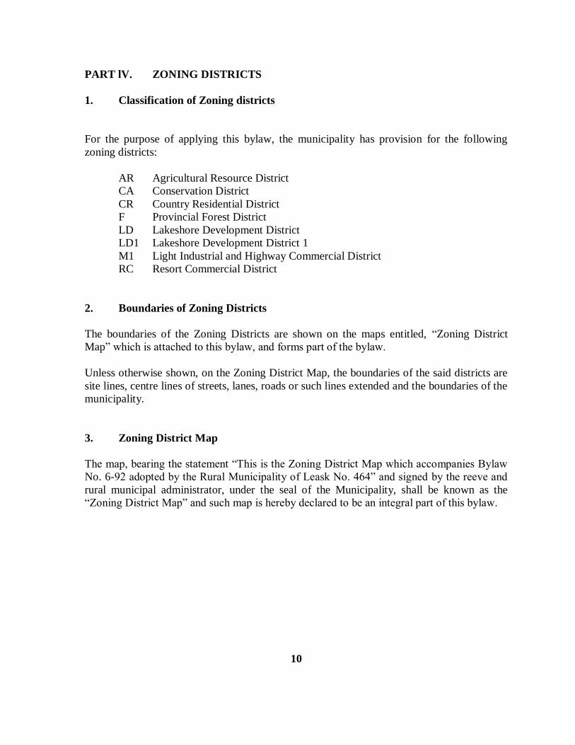
PART lV. ZONING DISTRICTS
1. Classification of Zoning districts
For the purpose of applying this bylaw, the municipality has provision for the following
zoning districts:
AR Agricultural Resource District
CA Conservation District
CR Country Residential District
F Provincial Forest District
LD Lakeshore Development District
LD1 Lakeshore Development District 1
M1 Light Industrial and Highway Commercial District
RC Resort Commercial District
2. Boundaries of Zoning Districts
The boundaries of the Zoning Districts are shown on the maps entitled, “Zoning District
Map” which is attached to this bylaw, and forms part of the bylaw.
Unless otherwise shown, on the Zoning District Map, the boundaries of the said districts are
site lines, centre lines of streets, lanes, roads or such lines extended and the boundaries of the
municipality.
3. Zoning District Map
The map, bearing the statement “This is the Zoning District Map which accompanies Bylaw
No. 6-92 adopted by the Rural Municipality of Leask No. 464” and signed by the reeve and
rural municipal administrator, under the seal of the Municipality, shall be known as the
“Zoning District Map” and such map is hereby declared to be an integral part of this bylaw.
10

DISTRICT 1: AGRICULTURAL RESOURCE DISTRICT (AR)
A. PERMITTED USES
Subject to all other provisions of this bylaw, on any site, in any zoning district defined in this
bylaw as an AR – Agricultural Resource District, only the following uses and their respective
accessory uses shall be permitted:
1. Principal Uses
a. Agricultural
Animal and poultry raising, field crops, grazing, ranching, and other similar uses
customarily carried out in the field of general agriculture, including the sale on the
agricultural holding of any produce grown or raised on the agricultural holding, but
EXCLUDING apiaries, feedlots, greenhousing, hatcheries, intensive livestock and
poultry operations, market gardens, mushroom farms, and tree and garden nurseries.
b. Existing residential uses in the Hamlet of Kilwinning at the time of passage of this
bylaw.
c. Existing recreational uses which include a “primitive day-use area” and seasonal boat
launch site located on the southern shores of Damour Lake (Parcels A and B of
Section 18-47-7-W3). At the time of passage of this bylaw, these uses shall be
considered to exist as conforming uses.
d. Existing recreational uses located in the unsubdivided Iroquois Lake leasehold
recreation development at SW ¼ 26-48-8-3. At the time of passage of this bylaw all
existing residential buildings and uses shall be considered to exist as conforming uses
which allows for their upgrading and improvement.
e. Other
Cemeteries, historical and archaeological sites, institutional uses and facilities, places
of worship, wildlife and conservation management areas.
2. Uses Permitted at Council’s Discretion
The following principal and their respective accessory uses may be permitted, but only by
resolution of Council and only in locations and with development standards specified by
11

Council:
a. Agricultural related commercial uses and other similar uses
b. Apiaries, hatcheries, mushroom farms
c. Country residential use
d. Farmstead residential use
e. Grain elevators, inland grain terminals and accessory buildings
f. Gravel pits and gravel crushing operations
g. Intensive livestock and poultry operations, feedlots
h. Machine shops and accessory structures
i. Private and licenced airstrips
j. Recreational Use, including boat launches, drive-in theatres, golf courses, parks and
sports fields
k. Solid and liquid waste disposal sites
l. Tree and garden nurseries, market gardens and greenhouses
m. Farm vacation, bed-and-breakfast operations and other similar uses.
Items a, b, i, j, and l only, may include residential dwellings as a permitted accessory use.
3. Accessory Uses
Buildings, structures or uses secondary to the principal use and located on the same site are
permitted. Accessory uses include:
a. One single-detached dwelling (including a mobile home on a permanent foundation)
is permitted as an accessory use to a principal agricultural use. Two additional
single-detached dwellings (including a mobile home on a permanent foundation)
required to accommodate full-time workers engaged in a principal agricultural use of
the land will be permitted, subject to a resolution of Council.
b. Dormitory dwelling(s) as required to accommodate full-time workers engaged in a
principal agricultural use of the land is permitted.
12

B. AGRICULTURAL RESOURCE DISTRICT REGULATIONS
1. Site Area Requirements
a. Agricultural Use
i. One quarter section, 64.8 hectares (160 acres) or equivalent, shall be the
minimum site area required to constitute a farm land holding. Equivalent
shall mean 64.8 hectares (160 acres) or such lesser amount as remains in an
agricultural holding because of the registration of road widening, road right-
of-way or railway plans or pipeline development, or natural features such as
streams or bodies of water, or as a result of subdivisions, as permitted herein.
Any agricultural holding which does not conform to the minimum site area
requirement shall be deemed conforming with regard to site area, provided
that a registered title for the site existed in the Land Titles Office prior to the
coming into force of this bylaw.
ii. A reduced site area below 64.8 hectares (160 acres), but not below 14 hectares
(34.5 acres), shall be permitted for the purpose of farmland consolidation and
estate planning settlement, lease-to-own options, farm debt restructuring or
similar situations as per the policy statement and subject to resolution of
Council.
iii. Landholdings in adjoining Rural Municipalities.
A person not meeting the minimum agricultural area requirement of 64.8
hectares (160 acres) or equivalent in the municipality, but who owns land in
an adjoining rural municipality, shall qualify to meet the minimum area
requirements of this bylaw provided that the following conditions are met:
The person is a farmer;
The person is engaged in a principal agricultural use of the land;
The total farm landholding of this person within both the rural
13

municipalities is a minimum of 64.8 hectares (160 acres) or equivalent.
iv. Apiaries, farmstead sites, feedlots, greenhouses, hatcheries, intensive livestock
and poultry operations, market gardens, mushroom farms, and tree and garden
nurseries.
Minimum: 1.0 hectares (2.4 acres)
Maximum: as determined by demonstrated space needs necessary for a
viable principal agricultural use.
b. Agriculturally-related commercial use
Minimum: 1.0 hectares (2.4 acres)
c. Country residential use
Council will permit up to two (2) single site country residential sites per 64.8 hectares
(160 acres) .
Council may permit up to four (4) single site country residential sites per 64.8
hectares (160 acres) unless the land being subdivided abuts a lake on which exists a
lakeshore development or resort commercial district.
Minimum: 1.0 hectares (2.4 acres)
d. Iroquois Lake Leasehold Recreation Development located in SW ¼ 26-48-8-3
i. The municipality will secure from the owner a sketch plan showing
approximate locations of all existing buildings prior to the time of the passage
of this bylaw.
ii. No development permit shall be issued for the renovation of any cottage
which would have the effect of increasing the site coverage if it would
14
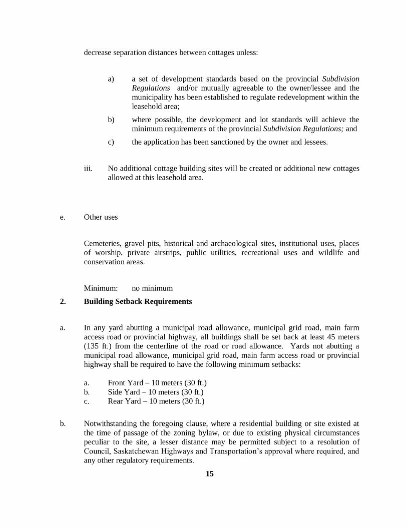
decrease separation distances between cottages unless:
a) a set of development standards based on the provincial Subdivision
Regulations and/or mutually agreeable to the owner/lessee and the
municipality has been established to regulate redevelopment within the
leasehold area;
b) where possible, the development and lot standards will achieve the
minimum requirements of the provincial Subdivision Regulations; and
c) the application has been sanctioned by the owner and lessees.
iii. No additional cottage building sites will be created or additional new cottages
allowed at this leasehold area.
e. Other uses
Cemeteries, gravel pits, historical and archaeological sites, institutional uses, places
of worship, private airstrips, public utilities, recreational uses and wildlife and
conservation areas.
Minimum: no minimum
2. Building Setback Requirements
a. In any yard abutting a municipal road allowance, municipal grid road, main farm
access road or provincial highway, all buildings shall be set back at least 45 meters
(135 ft.) from the centerline of the road or road allowance. Yards not abutting a
municipal road allowance, municipal grid road, main farm access road or provincial
highway shall be required to have the following minimum setbacks:
a. Front Yard – 10 meters (30 ft.)
b. Side Yard – 10 meters (30 ft.)
c. Rear Yard – 10 meters (30 ft.)
b. Notwithstanding the foregoing clause, where a residential building or site existed at
the time of passage of the zoning bylaw, or due to existing physical circumstances
peculiar to the site, a lesser distance may be permitted subject to a resolution of
Council, Saskatchewan Highways and Transportation’s approval where required, and
any other regulatory requirements.
15
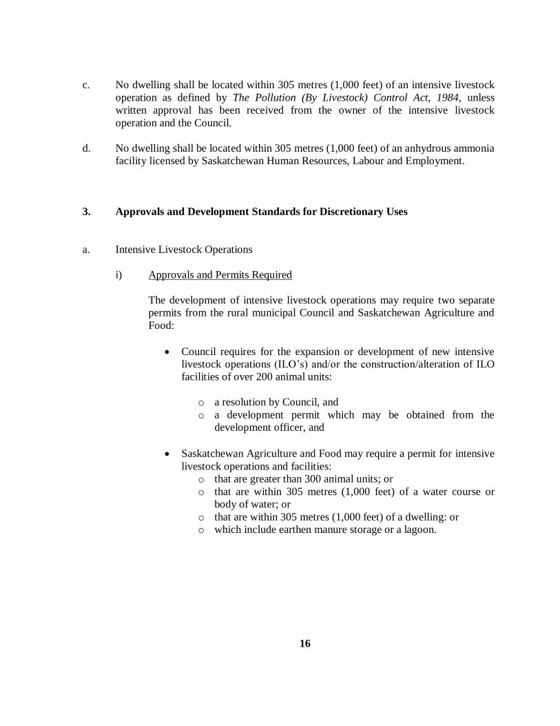
c. No dwelling shall be located within 305 metres (1,000 feet) of an intensive livestock
operation as defined by The Pollution (By Livestock) Control Act, 1984, unless
written approval has been received from the owner of the intensive livestock
operation and the Council.
d. No dwelling shall be located within 305 metres (1,000 feet) of an anhydrous ammonia
facility licensed by Saskatchewan Human Resources, Labour and Employment.
3. Approvals and Development Standards for Discretionary Uses
a. Intensive Livestock Operations
i) Approvals and Permits Required
The development of intensive livestock operations may require two separate
permits from the rural municipal Council and Saskatchewan Agriculture and
Food:
Council requires for the expansion or development of new intensive
livestock operations (ILO’s) and/or the construction/alteration of ILO
facilities of over 200 animal units:
o a resolution by Council, and
o a development permit which may be obtained from the
development officer, and
Saskatchewan Agriculture and Food may require a permit for intensive
livestock operations and facilities:
o that are greater than 300 animal units; or
o that are within 305 metres (1,000 feet) of a water course or
body of water; or
o that are within 305 metres (1,000 feet) of a dwelling: or
o which include earthen manure storage or a lagoon.
16

ii) Review Process
Upon receiving an ILO development proposal, Council will:
refer the ILO development proposal to Extension Services,
Saskatchewan Agriculture and Food (SAF) to establish SAF’s
permit requirements;
coordinate its review with Saskatchewan Agriculture and Food to
enable full consideration of the development proposal;
if considered necessary, require engineering reports to address
concerns such as the storage and disposal of manure; and the
potential effects of the ILO on the ground water supply and surface
water drainage;
if considered necessary, advertise the proposed development and
hold a public meeting for the presentation of the development
proposal by the proponent; and
coordinate its decision on the development proposal in consultation
with Saskatchewan Agriculture and Food.
iii) Development Standards
Intensive livestock operations (ILO) as defined by this bylaw will be required to have
the minimum separation distance(s) from residential uses as listed below. Council in
consultation with Saskatchewan Agriculture and Food and subject to a written
agreement between adjoining landowners may relax these requirements.
17

MINIMUM SEPARATION DISTANCES FROM RESIDENTIAL USES
RESIDENTIAL NUMBER OF ANIMAL UNITS*
POPULATION 200-300 300-500 500-2000 >2000
Single family dwelling
Not owned 305 m 400 m 800 m 1200 m By ILO operator
< 100 400 800 1200 1600
100 – 500 800 1200 1600 2400
500 – 5000 800 1600 2400 3200
>5000 1600 2400 3200 4800
* Animal unit is defined in The Pollution (By Livestock) Control Act. The setback distance is measured
from the nearest edge of the livestock enclosure and/or manure storage area.
b. Solid and Liquid Waste Disposal Facilities
The development and maintenance of solid or liquid waste disposal facilities will be
subject to the following standards:
i) development and site maintenance will be accordance with provincial
environmental and health regulations;
ii) a buffer strip containing trees, shrubs or a berm shall surround the disposal
area;
iii) any solid or liquid waste disposal facility will be fenced;
iv) adequate precautions will be taken to prevent the pollution of ground water by
disposal operations;
v) the siting of any new disposal sites will consider the direction of prevailing
winds;
vi) solid waste disposal facilities will be located 914.4 meters (3,000 feet) from
any residences unless the affected parties agree to a relaxation of this
requirement;
18
vii) solid waste disposal facilities shall be located adjacent to an all-weather road
and in proximity to a provincial highway; and
viii) further regulation of solid waste disposal sites may be achieved by the
adoption and administration of a Waste Management Bylaw.
c. Occupation Standards for Non-farm Enterprises based on the Farm
i) On-farm diversification should not lead to the creation of new lots.
ii) Council may require the scale of the non-farm enterprise(s) be regulated to
alleviate any pressure for the creation of new lots.
iii) Non-farm enterprise(s) should not permanently alter the use of farmland.
iv) Non-farm enterprise(s) should be owned by the agricultural operator(s) who
own the farmland.
v) Council may require non-farm enterprises such as farm vacation and bed-and-
breakfast operations to meet the following provisions:
density provisions
separation distances from livestock operations, and
locational criteria and screening.
4. Removal of Trees
The removal of trees within 90 metres (300 feet) of a shoreline shall not be permitted except
for purpose of the construction of access ways or buildings and the clearing of dead or
diseased trees. Access ways shall not be cleared greater than 3 metres (9.8 feet) in width.
For building construction, removal of trees further than 2 metres (6.5 feet) from the building
shall not be permitted.
19

DISTRICT 2: LAKESHORE DEVELOPMENT DISTRICT (LD)
A. PERMITTED USES
Subject to all other provisions of this bylaw, on any site, in any district defined in this bylaw
as LD – Lakeshore Development District, only the following uses shall be permitted:
1. Principal Uses
a. Residential: single-detached dwellings.
b. Recreational uses including boat launches and docks, golf courses, parks, picnic
grounds, public beaches and sports fields.
2. Uses Permitted at Council’s Discretion
The following uses may be permitted by resolution of Council and in locations and under
conditions specified in such resolution subject to the requirements of this LD – Lakeshore
Development District:
a. Mobile homes following removal therefrom of wheels and axles and following the
placement thereof on a raised permanent foundation.
20

3. Accessory Uses
The following accessory uses are permitted:
a. Buildings, structures or uses secondary and accessory to, when located on the same
site with the principal use.
B. LAKESHORE DEVELOPMENT DISTRICT REGULATIONS
1. Minimum Site, Yard and Building Requirements
a. Residential
i. Width 23 metres (75 feet) – except for non-rectangular sites which
shall meet the minimum frontage requirements of The
Subdivision Regulations, 1983 pursuant to section 136 of The
Planning and Development Act, 1983.
ii. Area 1,115 square metres (12,000 square feet)
iii. Front Yard 3 metres (10 feet)
iv. Side Yard 1.5 metres (5 feet)
v. Rear Yard 3 metres (10 feet)
vi. Floor Area 50 square metres (538 square feet)
vii. Residential lots existing on, or before, the passing of this bylaw, shall be
considered to be conforming with respect to the minimum site area and
frontage requirements of this bylaw.
21

2. Leasehold Cottage Development
Further leasehold cottaging development shall not be permitted within the Lakeshore
Development District (LD).
3. Removal of Trees
The removal of trees within 90 metres (300 feet) of a shoreline shall not be permitted except
for purposes of the construction of access ways or buildings and the clearing of dead or
diseased trees. Access ways shall not be cleared greater than 3 metres (9.8 feet) in width.
For building construction, removal of trees further than 2 metres (6.5 feet) from the building
shall not be permitted.
22
DISTRICT 2.1: LAKESHORE DEVELOPMENT DISTRICT 1 (LD1)

A. PERMITTED USES
Subject to all other provisions of this bylaw, on any site, in any district defined in this bylaw
as LD1 – Lakeshore Development District 1, only the following uses shall be permitted:
1. Principal Uses
(a) All the buildings and uses of buildings and land permitted in the LD –
Lakeshore Development District.
2. Accessory Uses
(a) All the buildings and uses of buildings and land permitted as an accessory use
to a principal permitted or discretionary use in the LD – Lakeshore
Development District.
B. DISCRETIONARY USES
Subject to all other provisions of this bylaw, on any site, in any district defined in this bylaw
as LD1 – Lakeshore Development District 1, only the following uses shall be permitted at the
discretion of council:
(a) All the buildings and uses of buildings and land permitted by resolution of
Council as a discretionary use in the LD – Lakeshore Development District.
C. LAKESHORE DEVELOPMENT DISTRICT 1 (LD1) REGULATIONS
The regulations of the LD – Lakeshore Development District shall apply in the LD1 –
Lakeshore Development District 1 except that subsection B.1.a.i, ii,, and iv shall not apply
and the following regulations shall be substituted and apply:
1. Minimum Site, Yard and Building Regulations
(a) Residential
(i) Width - 18 metres
(ii) Area - 670 square metres
(iii) Side Yard - 3 metres
(iv) Front Yard - 3 metres
(vi) Rear Yard - 3 metres
(vii) Floor Area - 50 square metres
23
DISTRICT 2.2 DUNCAN’S BEACH RESORT DISTRICT (DB)

(1) INTENT
The objective of the Duncan’s Beach Resort District is to provide for existing residential
development for the area known as Duncan’s Beach, located in a portion of Legal
Subdivisions 1 and 2 SW 33-48-7 West of the 3rd
Meridian, which is comprised of Lots 1-20,
Block 1, Lots 1-4 Block 2, MR1, MR2, ER1,ER2, Duncan Drive and the portion of Duncan
road running north, as shown in bold dashed outline on the attached map, to allow existing
buildings to continue as conforming uses and for each dwelling to be upgraded or replaced.
(2) PERMITTED USES
The following uses are permitted in the Duncan’s Beach Resort District:
A. Residential Uses:
(1) Single detached buildings
B. Recreational Uses:
(1) Recreational uses including boat launches and docks, golf courses,
parks, picnic grounds, public beaches and sports fields.
(2) Nature trails and exhibits
C. Accessory Uses:
(1) Buildings, structures or uses accessory to, and located on the same site
with the principal building or principal use.
(3) REGULATIONS:
A. Single detached dwellings:
Minimum site area: 380 square meters
Minimum site frontage: 12.5 meters
Minimum front yard: 1.5 meters
Minimum rear yard: 1.5 meters
24
Minimum side yard: 1.5 meters

Minimum floor area: 50 square meters
B. Accessory buildings:
Minimum front yard: 1.5 meters
Minimum rear yard: 1.5 meters
Minimum side yard: 1.5 meters
C. Private parks, public parks, public recreation facilities, nature trails and exhibits:
No requirements
25

DISTRICT 3: RESORT COMMERCIAL DISTRICT (RC)
A. PERMITTED USES
Subject to all other provisions of this bylaw, on any site, in any district defined in this bylaw
as an RC – Resort Commercial District, only the following uses shall be permitted:
1. Principal Uses
a. Motels and hotels
b. Personal service shops
c. Public utilities
d. Restaurants and take out food establishments
e. Retail merchandise shops
2. Uses Permitted at Council’s Discretion
The following uses shall be permitted, but only by resolution of Council and only in locations
and under conditions specified in such resolution of council:
a. Commercial recreational uses
b. Service stations and gasoline service bars
c. Dwelling Groups – subject to the criteria that a bare land condominium is registered
for the development and that one single detached dwelling only is permitted on each
bare land unit.
d. Tourist Cabins
e. Tourist campgrounds and tourist parks
i. Approval of tourist cabins, campgrounds and parks shall be
based on the following criteria:
(A) the site is located with convenient access to any recreational
features or facilities that it is intended to serve
(B) there is a water source suitable for public consumption at the
campground
(C) there are suitable utilities, sewage disposal systems and
facilities for the campground
(D) the development will not be in conflict with adjacent
uses or uses currently on site
26
(E) the number of existing campsites within the municipality

(F) the density of cabins or campsites requested in relation
to others within the municipality.
3. Accessory Uses
The following accessory uses are permitted:
a. Dwelling units, buildings, structures or uses secondary and accessory to, when
located on the same site with the principal use.
b. On common property within a bare land condominium, the following are permitted
where accessory to the dwelling group:
i. Community Centres
ii. Golf Courses
iii. Parks
iv. Public Sports Fields
v. Maintenance Shops
B. RESORT COMMERCIAL DISTRICT REGULATIONS
1. Minimum Site, Yard and Building Requirements
a. All Uses including each bare land unit, exclusive of any common property in a
dwelling group:
i. Width 15.0 metres (50 feet)
ii. Area 500.0 metres (5,385 square feet)
iii. Front/Rear Yard 6.0 metres (20 feet)
iv. Side Yard 1.5 metres (5 feet)
v. Maximum Height 10.5 metres (35 feet)
2. Removal of Trees
The removal of trees within 90 metres (300 feet) of a shoreline shall not be permitted except
for purposes of the construction of access ways or buildings and the clearing of dead or
diseased trees. Access ways shall not be cleared greater than 3 metres (9.8 feet) in width.
For building construction, removal of trees further than 2 metres (6.5 feet) from the building
shall not be permitted.
27
3. Yard Requirements

In any yard abutting a municipal road allowance, municipal grid road, main farm access road
or provincial highway, all buildings shall be set back at least 45 meters (135 ft.) from the
centerline of the road or road allowance. Yards not abutting a municipal road allowance,
municipal grid road, main farm access road or provincial highway shall be required to have
the following minimum setbacks:
a. Front Yard – 6 meters (20 ft.)
b. Side Yard – 1.5 meters (5 ft.)
c. Rear Yard – 6 meters (20 ft.)
28
DISTRICT 4: CONSERVATION DISTRICT (CA)

A. PERMITTED USES
Subject to all other provisions of this bylaw, on any site, in any district defined in this bylaw
as CA – Conservation District, only the following uses and their respective accessory uses
shall be permitted:
1. Principal Uses
a. Existing uses: those existing activities and their uses are deemed to be conforming
provided that they exist prior to the effective date of this bylaw
b. Afforestation projects, forest management and silviculture
c. Extensive agricultural uses such as community pastures
d. Institutional camps in existence at the time of the passage of this bylaw
e. Nature exhibits and interpretive sites
f. Recreational uses including cross-country skiing, hiking trails, nature trails and
snowmobile trails
g. Wildlife and wildfowl habitat and conservation projects
h. Other passive open space recreational activities
2. Uses Permitted at Council’s Discretion
The following uses shall be permitted, but only by resolution of Council and only in locations
and under conditions specified in such resolution by Council:
a. Residential use, on sites having a registered Certificate of Title thereof in existence at
the time of passage of this bylaw and having access to an all-weather road, in which
case one residence will be permitted.
29
3. Accessory Uses

Buildings, structures or uses accessory to, and located on the same site with main use,
excluding any habitable building or structure. Such accessory uses may include:
a. Related equipment storage structures for pumphouses
b. Shelters
c. Viewing platforms
B. CONSERVATION DISTRICT REGULATIONS
1. Site Area Requirements
No Minimum.
2. Removal of Trees
The removal of trees within 90 metres (300 feet) of a shoreline shall not be permitted except
for purposes of the construction of access ways or buildings and the clearing of dead or
diseased trees. Access ways shall not be cleared greater than 3 metres (9.8 feet) in width.
For building construction, removal of trees further than 2 metres (6.5 feet) from the building
shall not be permitted.
30
DISTRICT 5: COUNTRY RESIDENTIAL DISTRICT (CR)

A. PERMITTED USES
Subject to all other provisions of this bylaw on any site, in any district defined in this bylaw
as CR – Country Residential District, only the following uses shall be permitted:
1. Principal Uses
a. Residential use: single-detached dwellings
2. Discretionary Uses
The following uses of land, buildings, or structures may be permitted, but only by resolution
of Council and only in locations and with development standards specified by Council:
a. Convenience or confectionary uses including gas bars.
b. Institutional uses such as churches, education and/or religious institutions, hospitals
or schools.
c. Recreational uses related to country residential development including community
centres, golf courses, parks and public sports fields.
d. Dwelling Groups – subject to the criteria that a bare land condominium is registered
for the development and that one single detached dwelling only is permitted on each
bare land unit.
3. Accessory Uses
a. Buildings, structures, or uses accessory to, and located on the same site with the main
use, including the keeping and raising of animals and birds, except for pigs and mink,
accessory to the main residential uses.
b. On common property within a bare land condominium, the following are permitted
where accessory to the dwelling group:
i. Community Centres
ii. Golf Courses
iii. Parks
iv. Public Sports Fields
v. Maintenance Shops.
B. COUNTRY RESIDENTIAL DISTRICT REGULATIONS
1. Site Area Requirements
a. Residential Use
Minimum: 1.0 hectares (2.5 acres)
Maximum: 4.0 hectares (10.0 acres)
31
b. Discretionary

Minimum: 1.0 hectares (2.5 acres)
c. Dwelling Groups:
Each bare land unit, exclusive of any common property in a dwelling group shall be:
Minimum: 1.0 hectares (2.5 acres)
Maximum: 4.0 hectares (10.0 acres)
2. Removal of Trees
The removal of trees within 90 metres (300 feet) of a shoreline shall not be permitted except
for purposes of the construction of access ways or buildings and the clearing of dead or
diseased trees. Access ways shall not be cleared greater than 3 metres (9.8 feet) in width.
For building construction, removal of trees further than 2 metres (6.5 feet) from the building
shall not be permitted.
3. Yard Requirements
In any yard abutting a municipal road allowance, municipal grid road, main farm access road
or provincial highway, all buildings shall be set back at least 45 meters (135 ft.) from the
centerline of the road or road allowance. Yards not abutting a municipal road allowance,
municipal grid road, main farm access road or provincial highway shall be required to have
the following minimum setbacks:
a. Front Yard – 10 meters (30 ft.)
b. Side Yard – 10 meters (30 ft.)
c. Rear Yard – 10 meters (30 ft.)
32

DISTRICT 5.1 COUNTRY RESIDENTIAL LAKESHORE DISTRICT
(CRLD)
(1) INTENT
The objective of the Country Residential Lakeshore District is to provide Uses and
Regulations for development of Country Residential along lakeshores in the municipality.
(2) PERMITTED USES
The following uses are permitted in the Country Residential Lakeshore District:
A. Residential Use:
(1) Single detached dwellings
(3) DISCRETIONARY USES
The following uses of land, buildings, or structures may be permitted, but only by
resolution of Council and only in locations with development standards specified by
Council.
(A) Recreational Uses:
(1) Recreational related to country residential development including
public boat launches, public docks, golf courses, public parks,
public picnic grounds, public beaches and public sports fields.
(B) Accessory Uses:
(1) Buildings, structures or uses accessory to, and located on the same
site with the principal building or principal use.
(4) REGULATIONS
A. Minimum Site and Yard Requirements:
i. Lake frontage 100 meters
ii. Area – Minimum 1.0 hectares
iii. Front Yard Setback 20 meters
33

iv. Side Yard Setback 10 meters
v. Rear Yard Setback 10 meters
vi. Lake Front Yard Setback 35 meters
B. Minimum Building Requirements
(a) Residential
i. Footprint 100 square meters
C. Public boat launches, public docks, golf courses, public parks, public
picnic grounds, public beaches and public sports fields, nature trails and
exhibits:
As specified by council.
(5) REMOVAL OF TREES
The removal of trees within 90 meters of a shoreline shall not be permitted
except for purposes of the construction of access ways or buildings and the
clearing of dead or diseased trees. Access ways shall not be cleared greater
than 3 meters in width. For building construction, removal of trees further
than 5 meters from the building shall not be permitted.
34
DISTRICT 6: PROVINCIAL FOREST DISTRICT (F)

A. PERMITTED USES
Subject to all other provisions of this bylaw on any site, in any district defined in this bylaw
as an F – Provincial Forest District, only the following uses shall be permitted:
1. Principal Uses
a. Forestry: logging and processing timber and related resource extraction
b. Botanical resource use: berry picking, grazing, haying, wild rice harvesting
c. Game resource use: angling, hunting, trapping
d. Recreational uses: camp sites, cross-country skiing, hiking trails, nature
interpretation and nature trails, picnic sites, snowmobile trails and other similar uses
e. Seasonal residential use: remote cabins
B. PROVINCIAL FOREST DISTRICT REGULATIONS
1. Minimum Requirements
The requirements of The Forest Act and The Provincial Lands Act and associated regulations
which are administered by Saskatchewan Natural Resources, and the requirements of this
bylaw shall apply.
2. Removal of Trees
The removal of trees within 90 metres (300 feet) of a shoreline shall not be permitted except
for purposes of the construction of access ways or buildings and the clearing of dead or
diseased trees. Access ways shall not be cleared greater than 3 metres (9.8 feet) in width.
For building construction, removal of trees further than 2 metres (6.5 feet) from the building
shall not be permitted.
C. DEVELOPMENT PERMIT
A development permit is required for the following permitted uses:
35

1. Construction of All-weather Roads
A development permit is required for the construction of all-weather roads. Fire roads, minor
access roads, winter roads, or other similar categories do NOT require a Development
Permit.
2. Wildlife Management Areas
A development permit is only required for uses in areas that are established specifically for
wildlife conservation such as game preserves, wildlife management units or wildlife refuges.
36

DISTRICT 7: LIGHT INDUSTRIAL AND HIGHWAY COMMERCIAL DISTRICT
(M1)
A. PERMITTED USES
Subject to all other provisions of this bylaw, on any site, in any district defined in this bylaw
as M1 – Light Industrial and Highway Commercial District, only the following uses and their
respective accessory uses shall be permitted:
1. Principal Uses
a. Automobile and agricultural implement sales and services
b. Automotive service stations and gas bars
c, Convenience stores
d. Drive-in theatres
e. Public utilities
2. Uses Permitted at Council’s Discretion
a. Auction marts
b. Nurseries and greenhouses
c. Restaurants
d. Storage facilities, warehouses, supply and distribution facilities
e. Veterinary clinics
f. Welding and machine shops
3. Accessory Uses
For the purpose of this bylaw, uses customarily incidental and subordinate to principal
permitted and discretionary uses shall be considered an accessory use.
37

B. LIGHT INDUSTRIAL AND HIGHWAY COMMERCIAL DISTRICT REGULATIONS
1. Site Area Requirements (excluding public utilities)
a. Permitted Uses
Minimum: 1,114.8 square metres (12,000 square feet)
b. Discretionary Uses
Minimum: 1,114.8 square metres (12,000 square feet)
2. Site Frontage
a. All uses
Minimum: 30.4 metres (100 feet)
3. Yard Requirements
a. Front yard, all uses
Minimum: 7.5 metres (25 feet)
b. Side yard, all uses
Minimum: 3 metres (10 feet) on each side
4. Removal of Trees
The removal of trees within 90 metres (300 feet) of a shoreline shall not be permitted except
for purposes of the construction of access ways or buildings and the clearing of dead or
diseased trees. Access ways shall not be cleared greater than 3 metres (9.8 feet) in width.
For building construction, removal of trees further than 2 metres (6.5 feet) from the building
shall not be permitted.
38
PART V. DEFINITIONS

Whenever in this bylaw the following words or terms are used, they shall, unless the context
otherwise provides, be held to have the following meaning:
Accessory Building:
Shall mean a separate building or structure normally incidental to the principal
building or structure on the same site.
Accessory Use:
Shall mean a use customarily incidental and subordinate to the principal use or
building and located on the same site with such principal use building.
Act:
Shall mean The Planning and Development Act, 1983, as amended.
Agricultural Holding:
Shall mean the cumulation of all sites owned by an agricultural operator and does no
include a hobby farm or country residence.
Agricultural Operator:
Shall mean a household unit whose principal source of income is derived from the
agricultural production of an agricultural holding.
Agriculturally Related Commercial Use: see Use, Agriculturally Related Commercial.
Alteration:
Shall mean any structural change or addition made to any building or structure.
Animal Unit:
Shall mean the kind and number of animals calculated in accordance with The
Pollution (by Livestock) Control Regulations, 1991.
39
Applicant:

Shall mean a developer or person applying for a development permit under this
bylaw.
Bare Land Condominium:
Shall mean a condominium divided into bare land units as defined within The
Condominium Property Act, 1993.
Bare Land Unit:
Shall mean a bare land unit as defined within The Condominium Property Act,
1993.
Billboard:
Shall mean a poster panel or painted bulletin and includes any structure panel, board
or object designed exclusively to support such poster, panel or a painted bulletin.
Building:
Shall mean a structure used for the shelter or accommodation of persons, animals, or
chattels.
Building Accessory:
Shall mean a subordinate detached building appurtenant to a main building or main
use and located in the same site, the purpose of which is to provide better and more
convenient function of the main building or main use.
Building Permit:
Shall mean a permit issued under a building bylaw of the municipality authorizing the
construction of all or part of any building.
Building Residential:
Shall mean a single-detached, semi-detached, duplex or mobile dwelling unit.
40
Building Site:

Shall mean the specific site on which the principal building is to be erected.
Campground, Tourist:
Shall mean the seasonal operation of an area of land, managed as a unit, providing
temporary short-term accommodation for tents, tent trailers, travel trailers,
recreational vehicles and campers, used by travelers and tourists.
Campsite, Tourist:
Shall mean a site which provides for the location of tents, trailers and trailer coaches
used by travellers and tourists for overnight accommodation.
Cluster:
Shall mean a grouping of lots approved as a country residential development.
Cottage:
Shall mean a single-detached dwelling, mobile home or trailer coach permanently
constructed and placed on a site and used for limited seasonal occupancy.
Council:
Shall mean the Council of the Rural Municipality of Leask No. 464.
Country Residential Use:
Shall mean a dwelling or site whose owner’s principal source of household income is
from a source other than the principal agricultural use of that site.
Developer:
Shall mean the person or corporation, responsible for carrying out development.
Development:
Shall mean the carrying out of any building, engineering, mining or other operations,
in, on, or over land, or the making of any material change in the use of any building
or land.
41

Development Permit:
Shall mean a document authorizing a development issued pursuant to this bylaw.
Discretionary Use:
Shall mean a development which may be permitted in this bylaw only by resolution
of Council and pursuant to section 74 of The Planning and Development Act, 1983.
Dormitory Dwelling:
Shall mean a building, room or set of rooms used for the habitation of one or more
persons, but does not include eating quarters.
Duplex Dwelling:
Shall mean a detached building consisting of two dwelling units as herein defined,
one above the other, each unit being totally separated from the other by an unpierced
ceiling and floor extending form exterior wall to exterior wall, except for a common
stairwell exterior to both dwelling units.
Dwelling, Dormitory: see Dormitory Dwelling.
Dwelling, Duplex: see Duplex Dwelling.
Dwelling Group:
Shall mean two or more single detached dwellings located on a single parcel, and
does not include mobile homes. A dwelling group may be in the form of a bare land
condominium.
Dwelling, Semi-detached: see Semi-detached Dwelling.
Dwelling, Single-detached: see Single-detached Dwelling.
Dwelling Unit:
Shall mean one or more habitable rooms constituting a self-contained unit and used or
intended to be used together for living and sleeping purposes by one or more persons.
Farmer: see Agricultural Operator.
42
Farmstead Site:

Shall mean a site which includes the residence of the farm operator and those
buildings or facilities which are related to the farm operation, and are normally
surrounded by the farmstead shelterbelt.
Floor Area:
Shall mean the maximum habitable area contained within the outside walls or a
building, excluding in the case of a dwelling, any private garage, porch, verandah,
sunroom, unfinished basement, or attic.
Hazard Land:
Shall mean land which may be prone to flooding, slumping, subsidence, landslides,
erosion, any other instability, or is located within a flood plain or watercourse.
Household Unit:
Shall mean one or more persons occupying a dwelling and living as a single
housekeeping unit.
Home Occupation:
Shall mean an accessory use carried on as an occupation conducted for gain in a
dwelling by the resident or residents.
Intensive Livestock Operation:
Shall mean an operation or facilities for the rearing, confinement, or feeding of 200
animal units or more of poultry, hogs, sheep, goats, cattle or horses. Council requires
a development permit under this bylaw.
Mobile Home:
Shall mean a trailer coach:
i. that is used as a dwelling;
ii. that has water faucets and shower, or other bathing facilities, that may be
connected to a water distribution system; and
iii. that is equipped with facilities for washing and water closet, or other similar
facility, that may be connected to a sewage system.
43
Mobile Home Court:

Shall mean any tract or parcel of land on which two or more occupied mobile homes
are harboured or are permitted, and includes any building or structure used or
intended to be used as part of the equipment of such mobile home court.
Municipality:
Shall mean the Rural Municipality of Leask No. 464.
Non-conforming Building:
Shall mean a building:
i. that is lawfully constructed or lawfully under construction, or in respect of
which all required permits have been issued, at the date a zoning bylaw or any
amendment to this bylaw affecting the building or land on which the building
is situated or will be situated becomes effective; and
ii. that on the date this bylaw or any amendment to this bylaw becomes effective
does not, or when constructed will not, comply with this bylaw.
Non-conforming Use:
Shall mean any use of land, building, or structure lawfully existing at the time of the
passing of this bylaw, the use of which does not comply with all the regulations of
this bylaw governing the zoning district in which it is located.
Parcel:
Shall mean a parcel of land as defined in The Land Surveys Act, 2000.
Permanent Foundation (Mobile Home):
As defined by Canada Mortgage and Housing Corporation’s Planning for the Mobile
Home: Advisory Document, NHA 5480 82/03 and Mobile Homes and the National
Housing Act a permanent foundation for a mobile home shall mean posts, piers or
conventional foundations that are strong enough to:
i. hold the weight of the mobile home and its contents without collapsing or
setting;
ii. remain stable despite soil movements caused by local soil conditions and/or
the annual freeze/thaw cycles;
iii. remain stable from wind uplift; and
iv. accomplish items i, ii and iii throughout the life of the mobile home.
44
Permitted Use:

Shall mean those land uses permitted within a zoning district in conformity with the
requirements specified in this bylaw.
Principal Use:
Shall mean the main activities conducted on a site.
Principal Building:
Shall mean the main building in which the principal use of the site is conducted.
Principal Agricultural Use:
Shall mean that the chief reason for the use and development of the land is its use for
agricultural purposes, and that such use constitutes the chief source of income or
anticipated chief source of income or the applicant for a development permit for land.
Public Utility:
Shall mean a government or private enterprise which provides a service to the general
public.
Reeve:
Shall mean the Reeve of the Rural Municipality of Leask No. 464.
Road:
Shall mean a public thoroughfare which affords the principal means of access to
abutting property, but shall not include an easement or lane.
Rural Municipal Administrator:
Shall mean the official administrator for the municipality pursuant to The Rural
Municipalities Act, 1989.
School:
Shall mean a body of pupils that is organized as a unit for educational purposes, that
comprises one or more instructional groups or classes, together with the principal and
45
teaching staff and other employees assigned to such body of pupils, and includes the

land, buildings or other premises and permanent improvements used by and in
connection with that body of pupils.
Semi-detached Dwelling:
Shall mean two dwelling units side by side in one building unit with a common party
wall which separates, without opening throughout the entire structure, the two
dwelling units.
Sign:
Shall mean any writing (including letter or word), billboard (pictorial representation
including illustration or decoration), emblem (including devise, symbol or
trademark), flag (including banner or pennant), or any other figure of similar
character which:
i. is a structure or any part thereof, or is attached to, painted on, or in any
manner represented on a building,
ii. is used to announce direct attention to, or advertised; and
iii. is visible from outside the building.
Single-detached Dwelling:
Shall mean a detached building consisting of one dwelling unit as herein defined, and
occupied or intended to be occupied as a permanent home or residence, but shall not
include a mobile home or trailer coach as herein defined.
Site:
A parcel of parcels of land with fixed boundaries that has been registered in the Land
Titles Office by Certificate of Title, and that is used for a single principle use or
purpose as provided for in Part III Section 9, and as regulated in this bylaw. Parcels
joined by a parcel tie are a single site for regulation under this bylaw and Act.
Site Frontage: see Site Line, Front.
Site Line, Front:
Shall mean the boundary that divides the site from the street. In the case of a corner
site, the front site line shall mean the boundary separating the narrowest street
frontage of the site form the street. Site frontage for a non-rectangular site shall be
defined as the mean of the measured front and rear site lines.
46
Site Line, Rear:

Shall mean a site boundary other that a front or rear site line.
Street:
Shall mean a public thoroughfare which affords the principal means of access to
abutting property, but shall not include an easement or lane.
Structure:
Shall mean anything that is built, constructed, or erected, located in, on, or over the
ground, or attached to something located in or over the ground.
Subdivision:
Shall mean a division of land, and includes a division of a quarter section into legal
subdivisions as described in The Land Titles Act, R. S. S. 1978, c. L-5.
Tourist Campground: see Campground, Tourist.
Tourist Campsite: see Campsite, Tourist.
Trailer Coach:
Shall mean any vehicle used or constructed in such a way as to enable it to be used as
a conveyance upon public roads or highways and includes a self-propelled or non-
self-propelled vehicle designed, constructed or reconstructed in such a manner as to
permit occupancy as a dwelling or sleeping place for one or more persons
notwithstanding that its running gear is removed or that it is jacked-up.
Tree Nursery:
Shall mean the use of land for raising shrubs, trees and bedding plants for the express
purpose of commercial sale.
Use:
Shall mean the purpose of activity for which a piece of land or its buildings is
designed, arranged or intended, occupied or maintained.
Use, Accessory: see Accessory Use.
47
Use, Agricultural Related Commercial:

Shall mean a service to the agricultural community such as auction marts, bulk fuel
sales, fertilizer distribution, grain and seed cleaning and drying, implement and
machinery assemblage, sale and service, stockyards, veterinary clinics and other
similar uses.
Use, Discretionary: see Discretionary Use.
Use, Non-conforming: see Non-conforming Use.
Use, Permitted: see Permitted Use.
Use, Principal: see Principal Use.
Use, Principal Agricultural: see Principal Agricultural Use.
Yard:
Shall mean the open, unoccupied space on a lot between the property line and the
front, rear, or side wall of a building.
Yard, Front:
Shall mean that part of a site which extends across the full width of a site between
the front site line and the nearest main wall of a building or structure.
Yard, Rear:
Shall mean that part of a site which extends across the full width of a site between the
rear site line and the nearest main wall of a building or structure.
Yard, Side:
Shall mean the part of a site which extends from a front yard to the rear yard between
the side line of a site and the nearest main wall of a building or structure.
48
PART VI. EFFECTIVE DATE OF THE BYLAW

1. This bylaw shall come into force on the date of final approval by the Minister of
Rural Development.
2. Council Readings
Read a First time this _____, day of __________, 1992.
Read a Second time this ____, day of ___________, 1992.
Read a Third time this _____, day of ____________, 1992.
_________________________
Reeve
SEAL
_________________________
Rural Municipal Administrator
49