øy place names - shetland heritage · the old place names are a particularly fragile resource ......
TRANSCRIPT

What’s in a name? As you study maps or travel through Shetland, you cannot fail to notice the place names. You may wonder how to pronounce them and what they mean.
As well as helping us find our way in the world, place names are an important component of our cultural heritage, providing vital clues about the environment, history, geography, and the people who lived here in the past: where they came from, what language they spoke and how they used the land.
Origins Shetland’s place names reflect our strong Norse heritage, with subsequent Scottish and English influences. Settlers from Norway arrived around 800 AD onwards, bringing with them a vast repository of highly descriptive words suitable for naming every feature of the landscape (both natural and manmade) as well as a stock of actual place names that were in use in Western Norway. Their names replaced those used by earlier settlers.
The language they used was Old Norse (or West Norse), from which Norwegian, Faroese and Icelandic are derived. In Shetland and Orkney, a language called Norn developed and was spoken until the seventeenth century.
This extensive period of Scandinavian influence resulted in the majority of place names in Shetland today having roots in Old Norse. These place names have many parallels in Orkney and the Western Isles and throughout Scandinavia. However, many names have been modified through time and spelling changes often mask the true origins. Listening to the local pronunciation can help point to the root word and therefore unravel the meaning.Whilst many place names have been lost or forgotten over the centuries, a vast quantity are preserved in a strong oral tradition and are now being collected and recorded. This painstaking work, undertaken by Shetland Amenity Trust’s Place Names Project, is providing an insight into how former residents interacted with the environment and used the landscape in their daily lives.
Recording place names The old place names are a particularly fragile resource in this era of digital maps and satellite navigation. Our modern lifestyle means that increasingly fewer people use coastal landmarks or waypoints through the hills. The Shetland Place Names Project tries to record these names before they are lost forever.
Place names annotated on photographsPlace names are plotted on digital maps
Old aerial photos are particularly helpful to pinpoint rigs and geos
Gateway signs give the Old Norse forms of modern place names Skerries school bairns record local place names
Local History Groups, schools and volunteers are recording names using aerial photos, maps and recording sheets. Older residents are helping to identify names of individual rigs, geos and rocks, both in the field and on maps, to ensure they are permanently preserved.
Archive sources are also very useful, particularly the place name collection of John Stewart gathered in the 1950s. An estimated 30 000 place names were recorded, but only a few of these were mapped. As part of the current project the original lists of names are being transcribed and taken out into the community to try and pinpoint the locations.
All place names are recorded on a database to be linked to a wider
Scottish database. Digital mapping provides immense scope for presenting the data for use by the local resident, student and tourist; through to the historian, linguist and archaeologist; or the historical geographer, writer and official charged with producing maps or road signs.
Place name recording at the Unst Show
Place Names
Contents copyright protected - please contact Shetland Amenity Trust for details.Whilst every effort has been made to ensure the contents are accurate,the funding partners do not accept responsibility for any errors in this leaflet.
Cover Image: Des Isles de Hetland by Jaques Bellin 1764
Place Name PaversTake a look outside the Boat Hall at the Shetland Museum and Archives and you’ll see 46 pavers embedded with Shetland place names. The names on the steps feature coastal names, moving from sea to shore in a wave pattern, while round the corner on the terrace you can take a tour of Shetland from Finniquoy in Fair Isle to Hamar in Unst.
The pavers incorporate both particularly unusual names (eg Winyadepla, Houlastongas and Veltamatas) and names common throughout Shetland (eg Swarta Skerry, Loomishun, Linga and Gorsendi Geo). Names chosen to represent natural features include geos, taings, ayres, scords, stacks and skerries.
All the place names provide clues about Shetland’s history and the habitats of plants and wildlife. Burgataing denotes the location of a broch, and Gulga was once a gallows site. Bragaster features in Shetland’s earliest document, dated 1299, and Cockstool was a place of public punishment and humiliation. Sea Eagles were known to nest at several Ern Stacks, whilst Tara Baa is a submerged rock covered with seaweed. Brimfooster means seafoam, and both Trumba and Bomblaberg describe the sound of the sea crashing against the rocks.
Other interesting names include Hegary’s Böd on Gunnister Voe, named after German trader Simon Harratsay or Hagarskilde; Diggers Rest in Yell, built by Andrew Anderson of Cunnister on his return from the Australian gold mines; and Harley Street in Scalloway, the site of the Scalloway Health Centre.
Glossary of place name elements
Shetlandelement
Old Norse element
Meaning Examples
-a, -ay øy island Foula,Bressay
aith eið isthmus Aith, Mavis Grind
ayre eyrr beach, spit Ireland, Gilsa Ayre
-bister bólstaðr dwelling Fladdabister
burra, -burgh borg fortification Burrafirth, Sumburgh
garth, gardi garðr, gerði enclosure, fence
Kirkigarth, Gardie
geo gjá coastal ravine
Gorsendi Geo
ham,hamna-
höfn haven, harbour
Hamister, Hamnavoe
ness nes headland, promontary
Scatness, Fuglaness
scord skarð ridge, valley crossing
Breglascord, Stourascord
setter, -ster setr, sætr homestead, hill farm
Setter, Swinister
skerry sker skerry Swarta Skerry
-sta staðir farmstead Girlsta
stack stakkr precipitous rock
Ern StackStackhool
taing tangi tongue of land
SkeotaingSkarvataing
-vord, wart varða cairn on hilltop
Saxavord, Wart of Clett
voe, wa(a) vágr sheltered bay
Voe, Waas,Scalloway
wick vík bay Lerwick
ContactShetland Place Names Project: Shetland Amenity Trust, Garthspool, Lerwick, Shetland, ZE1 0NY, Tel: 01595 694688
E-mail [email protected]
www.shetlandamenity.org/shetland-place-names-project
Shetland’s earliest document
Hegary’s Böd on the taing at Gunnister
Signposts to the past
2013
Place names can also help locate deposits of kleber (steatite or soapstone). Used in Shetland from prehistoric times, its heyday was during the Norse period, when it was extensively quarried to produce items both for local use and export . Some of these sites are clearly identifiable from place names such as Clibberswick, Cleber Geo and Kleberg.
Ting names stem from the Old Norse word for a parliament. Tingaholm, at the north end of the Loch of Tingwall, was the site of Shetland’s parliament – the lawting - until the sixteenth century. Throughout Britain and Scandinavia assembly sites carry similar names, for example Tynwald in the Isle of Man and Þingvellir in Iceland.
Shape size and colour
Many place names incorporate elements describing the size, shape or colour of a feature. Names referring to the shape of features include Longavelta (long ploughed strip), Stouraclett (big rock) and Ringla (round piece of ground).
Shetland’s complex geology has resulted in rocks, soil and sand that appear black, grey, brown, red, blue, white or silver. These colours are often used as ways of identifying natural features, such as rocks, hills or geos, as well as plots of ground, rigs and buildings. Svartr (black) features in several names, such as Swarti Shun (small loch or pool) and Swarthoull (small hill).The Old Norse hvíta (white) gives names like Hwita Skerry and Queederins. The granite rocks and sand of Northmavine and Sandsting are reflected in the names North Roe and Reawick (rauð: red) Green places (grœna) include Grunay in Skerries, Mörena Groena in Yell and Northmavine (green moor) and several Grunataings (tongue of land).
People and trade
Reminders of trading links with Europe up to 1700 come through a smattering of place names. “Dutch” names usually signify German activity (ie Deutsch) as opposed to “Hollander” used for the traders from
Holland and the Low Countries. Such place names include Hegary’s Böd, Bremen Strasse, Hollanders Knowe and the Dutch Pool.
Shetland’s reputation for having many excellent seamen made the isles an obvious target for the Press Gang, particularly during the Napoleonic Wars. To avoid impressment, men fled at very short notice to hideouts in the hills or to caves along the shores. Known as press hols or hoidy hols, their names reflect the location or particular individuals. 200 years later, place names can help us locate these hideouts.
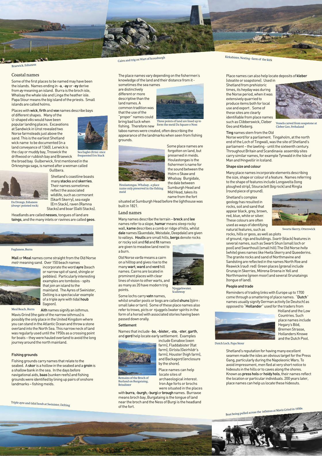
Coastal namesSome of the first places to be named may have been the islands. Names ending in -a, -ay or -ey derive from øy meaning an island. Burra is the broch isle, Whalsay the whale isle and Linga the heather isle. Papa Stour means the big island of the priests. Small islands are called holms.
Places with wick, firth and voe names describe bays of different shapes. Many of the U-shaped víks would have been popular landing places. Excavations at Sandwick in Unst revealed two Norse farmsteads just above the sand. This is the earliest Shetland wick name to be documented (in a land conveyance of 1360). Lerwick is the clay or muddy bay, Troswick the driftwood or rubbish bay and Braewick the broad bay. Gulberwick, first mentioned in the Orkneyinga saga, is named after a woman called
Gullbera.
Shetland’s coastline boasts many stacks and skerries. Their names sometimes reflect the associated wildlife, such as cormorant (Skarfi Skerry), sea eagle (Ern Stack), raven (Ramna
Stacks) and boar (Galti Stacks).
Headlands are called nesses, tongues of land are taings, and the many inlets or ravines are called geos.
Mail or Meal names come straight from the Old Norse melr meaning sand. Over 150 beach names
incorporate the word ayre (beach or narrow spit of sand, shingle or pebbles). Particularly interesting examples are tombolos - spits that join an island to the mainland. The Ayres of Swinister, Delting is a spectacular example of a triple ayre with tidal houb (lagoon).
Aith names signify an isthmus. Mavis Grind (the gate of the narrow isthmus) is possibly the only place in the United Kingdom where you can stand in the Atlantic Ocean and throw a stone overland into the North Sea. This narrow neck of land was regularly used until the 1950s as a crossing point for boats – they were hauled overland to avoid the long journey around the north mainland.
Fishing grounds
Fishing grounds carry names that relate to the seabed. A skor is a hollow in the seabed and a groin is a shallow bank in the sea. In the days before navigational aids, baas (sunken reefs) and fishing grounds were identified by lining up pairs of onshore landmarks – fishing meids.
Boat being pulled across the isthmus at Mavis Grind in 1950s
The place names vary depending on the fishermen’s knowledge of the land and their distance from it - sometimes the sea names are distinctively different or more descriptive than the land names. A common tradition was that the use of the “proper” names could bring bad luck when fishing. Therefore new taboo names were created, often describing the appearance of the landmarks when seen from fishing grounds.
Some place names are forgotten on land, but preserved in meids. Houlastongas is the fishermen’s name for the sound between the Holm o Skaw and Whalsay. Burgidale, the dale between Sumburgh Head and Mid Head, takes its name from the fort
situated at Sumburgh Head before the lighthouse was built in 1821.
Land namesMany names describe the terrain – breck and lee names refer to a slope, hamar means steep rocky wall, kame describes a comb or ridge of hills, whilst dale names (Quendale, Weisdale, Deepdale) are given to valleys. Houlls are small hills, bergs denote rocks or rocky soil and fid and fit names are given to meadow land next to a burn.
Old Norse varða means a cairn on a hilltop and gives rise to the many wart, ward and vord hill names. Cairns are located in prominent places with clear lines of vision to other warts, and as many as 20 have modern trig points.
Some lochs carry vatn names, whilst smaller pools or bogs are called shuns (tjörn : small lake or tarn). Some of these place names also refer to trows, picts or njuggels (water spirits in the form of a horse) with associated stories having been passed down orally.
Settlement
Names that include -bo, -bister, -sta, -ster, garth, and gord help locate early settlement. Examples
include Exnaboe (oxen farm), Fladdabister (flat farm), Girlsta (Geirhildr’s farm), Houster (high farm), and Backagord (enclosure by the shore).
Place names can help locate sites of archaeological interest. Iron Age forts or brochs were situated in the places
with burra, -burgh,- burgi or brough names. Burravoe means broch bay, Burgataing is the tongue of land near the broch and the Ness of Burgi is the headland of the fort.
Fuglaness, Burra
Meal Beach, Burra
Triple ayre and tidal houb at Swinister, Delting
Dutch Loch, Papa Stour
Three points of land are lined up to form the meid Da Square o Noss
Swarta Skerry, Otterswick
Cairn and trig on Wart of Scousburgh Kirkabister, Nesting - farm of the kirk
Braewick, Eshaness
Remains of the Broch of Burland on Burgataing, Brindister
Njuggelswater, Scalloway
Vessels carved from soapstone at Cleber Geo, Fethaland
Sea Eagles (Erns) once frequented Ern Stack
Da Drongs, Eshaness (drangr: pointed rock)
Houlastongas, Whalsay , a place name only preserved in the fishing meid