world regional geography - wordpress.com & ethnicity in the united states immigration and...
TRANSCRIPT

WORLD REGIONAL
GEOGRAPHY
By Brett Lucas

Regions
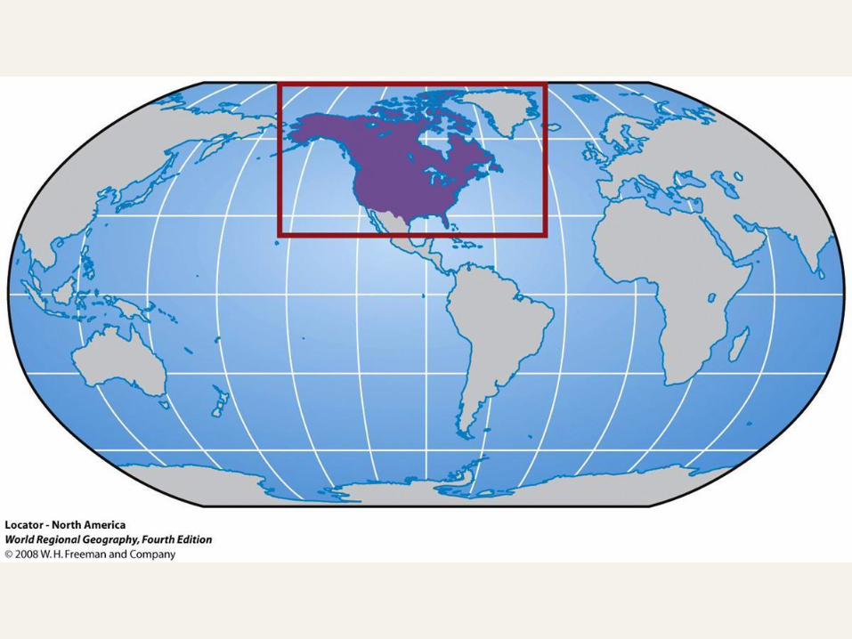
NORTH AMERICA – Part 2


Regions of the Realm
Maritime Northeast
French Canada
Core
Continental Interior
South
Southwest
Western Frontier
Northern Frontier
Pacific Hinge


Regionalism in Canada: Divisive Forces:
Canada’s Spatial Structure
World’s second-largest territory divided into only 13
subnational entities, known as provinces:
4 Atlantic Provinces – 2 core Hudson Provinces
3 central Prairie Provinces – 1 Pacific Ocean Province
3 Arctic North territories
Population is clustered in a discontinuous ribbon along the
coasts and border with the United States:
Settlement conditioned by the environment
Cross-border affinities with American cities


Regionalism in Canada: Divisive Forces:
Cultural Contrasts
Divided by culture and tradition:
English vs. French
Quebec nationalism:
Center of Francophone
Canada
Tests Canada’s federal
system
At times, demand for
outright separation
In decline, due to laws
enacted to reassure primacy
of Québécois culture


Regionalism in Canada: Divisive Forces:
The Ascendancy of Indigenous Peoples
Rising consciousness among indigenous groups:
First Nations
Métis and Inuit groups
Indigenous concerns:
Land claim agreement between Inuit people and federal government led to the newest Territory of Nunavut.
Federal government must help protect aboriginal rights and claims against the provincial governments.
Recognition of land rights allows these groups to share in economic activity and income generated by resources within each province’s territory.

Regionalism in Canada: Divisive Forces:
Centrifugal Forces
Forces of devolution threaten to weaken the state:
Tensions between provinces result from federal concessions
to Quebec.
Western provinces argue that political equality among
provinces is a basic principle.
Economic integration in NAFTA:
Strengthens cross-border linkages between southern
Canadian provinces and the United States.
Functional reorientations create potential for devolutionary
challenges in the future.

Regionalism & Ethnicity in the United States
As compared with Canada…
No serious contemporary
campaign for secession, or
withdrawal for political
independence, since the
Civil War.
Indigenous peoples were
weakened by westward
push of European settlers:
Loss of population and
territory
Little political power


Regionalism & Ethnicity in the United States
Immigration and shaping of U.S. regional geography:
African Americans
Forced migration as slaves into Southeast plantations
Moved from and then back to the Southeast
Hispanic Americans
Legacy of Southwest as Mexican territory
Concentrated in the Southwest, but growing elsewhere
– Asian Americans
• Growing and diverse minority
that is more territorially
clustered than other groups
• Mostly found along Pacific Rim


Regionalism & Ethnicity in the United States
Map Analysis Activity:
Ethnic Pattern Contexts
1. How does each ethnic group’s
pattern illustrate the source
and context of its global
migration?
2. What else can explain these
contemporary patterns?
3. What does the percent
classification reveal about the
relative size of these groups?

The North America Core
Core of both countries:
Contains largest cities, each country’s capital, economic and media centers, hubs of research and education, and major transportation systems
Contains more than 1/3 of each country’s population
Influence extends beyond the realm

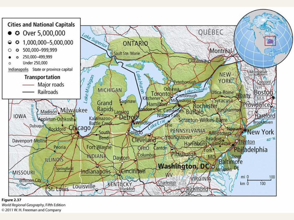

The North America Core
Growth of the core:
The CBDs of thriving manufacturing cities grew upward, while urban peripheries grew outward.
In time, nearby cities coalesced into an expansive metropolitan area known as a megalopolis:
In Canada, the urban axis from Windsor to Quebec is known as Main Street.
In the United States, the Atlantic seaboard from Boston to Washington, D.C., is called Megalopolis or Bosnywash.
Core is center of globalization
Rise of the information economy as the American Manufacturing Belt goes into decline


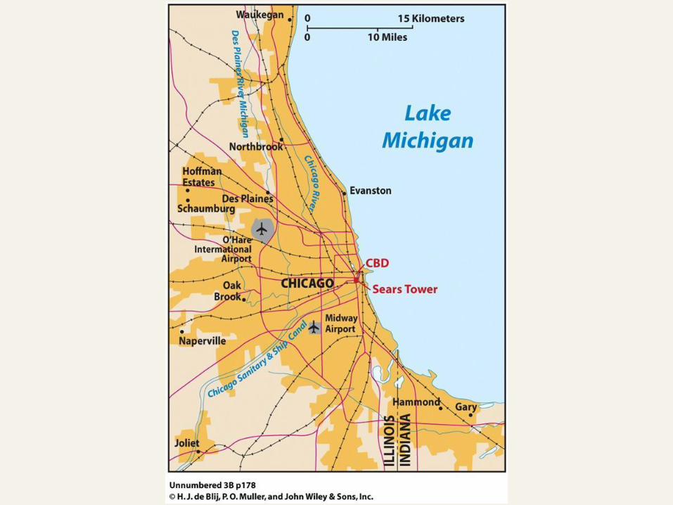
Among the Realm’s Great Cities: Chicago
Crossroads centrality
Lake Michigan connected to Mississippi River via the Chicago River (now a canal)
Hub of air and rail transportation network
Leading manufacturing and industrial technology center
Engendered growth as a commercial center
Post-industrial transition
Grappling with competition from outer city of “Chicagoland”
Reinvention as a service-center and urban playground
Concept Caching: Millennium Park, Chicago IL
© Sarah Goggin

The Maritime Northeast
North of the Core
Relaxed economic development
Maritime orientation and rural character
Difficult environments and limited resources
Primary industries endure alongside growing recreation and tourism
© H.J. de Blij, P.O. Muller, and John Wiley & Sons, Inc.


French Canada
Francophone Canada:
Quebec and Acadians in New Brunswick
Prospects:
Montreal’s technologically advanced economy
Quebec’s uncertainty with nationalist efforts
Acadians’ acceptance of multiculturalism
Wealth from hydroelectricity


Among the Realm’s Great Cities: Montreal
Cultural capital of Francophone Canada
Ethnolinguistic division:
East End French
West End English
Costs to city’s prosperity
Changes today:
Increasing linguistic mixing and intermarriage
Building foreign-trade ties and advanced technologies


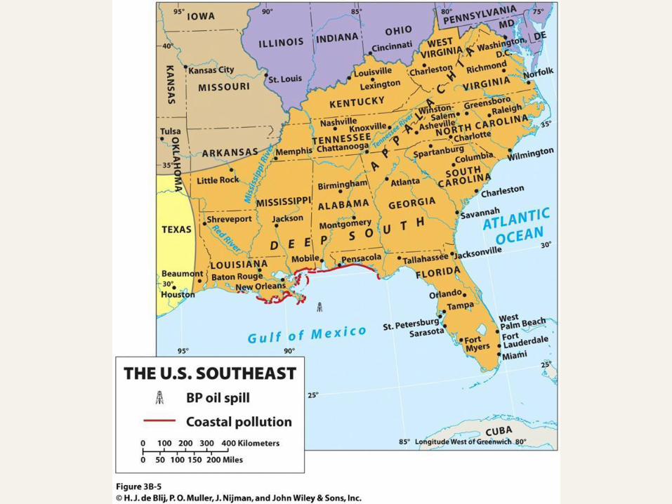
The Southeast
Uneven geography of development:
Sunbelt migration boom hit some cities and agricultural areas, misses others
Wide income gap
Environmental disasters:
Hurricanes
Gulf oil spill
Internationalization of South Florida:
Air conditioning, air travel, and Cubans
Miami as a world city connecting Northern and Southern hemispheres
Concept Caching: Two Years After Katrina, New Orleans, Louisiana
© Alexander B. Murphy

The Southwest
Regional identity: aridity and ethnic diversity
Diverse economies and challenges:
Growing technopoles, or high-technology industrial
complexes, and transnational trading via NAFTA
Concerns over water supplies and limiting dependency on
fossil fuel energy
Border region:
Substantial Mexican populations, legal and illegal
Dangers of racial profiling with state laws aiming to deal
with illegal immigration (e.g., Arizona)


The Pacific Hinge
Economic dynamism,
high-technology, and
industry
Entire west coast
Functional region:
Pacific Rim is a discontinuous
region along the Pacific
experiencing rapid growth and
progress.
Pacific Hinge represents the
interface between the North
America realm and Pacific Rim.
Concept Caching: Seattle, Washington
© Harm de Blij


Among the Realm’s Great Cities: Los Angeles
Immense urban landscape:
Product of the automobile
age and freeway network
Sprawling and multinodal
North American metropolis
Second largest
agglomeration in the realm
Anchor of CA megalopolis
Leader of Pacific Hinge
and eastern Pacific Rim


The Western Frontier
Region’s environment: remote, dry, and sparsely populated
Fastest-growing region
Pull factors: sunny climates, open spaces, lower cost of living, and growing job opportunities
Slowed with 2008 economic crisis
Ultimate frontier city: Las Vegas
More than gambling and amusement
Other attractions: jobs; low-cost; and sunny weather
Concept Caching: New York Casino in Las Vegas, Nevada
© Alexander B. Murphy


The Continental Interior
Dominant agriculture:
Breadbasket and Meat Belt
Shared history of food processing, packing, and marketing
Farming and energy:
Corn for feed, now in need as ethanol
Losing population:
Outmigration of youth and affluent
• Region has weathered the
recession with low
unemployment and strong
incomes.


The Northern Frontier
Territorially large with sparse and isolated settlements; it
includes almost 90 percent of Canada, plus Alaska.
Economic bounty:
Vast mineral resources
Hydropower
Oil reserves
Vast tar sands, of oil mixed with sand, in Alberta
Economic activity and connections infringe on indigenous lands.

The Northern Frontier
Environmental future: Reserves of oil and natural
gas yet to be tapped Demands for preservation Climate change and decline
of Arctic Ocean ice cap Logging moratorium in part
of Canada’s boreal forests
What do you think?
1. Should this sparsely populated region be developed or preserved? Why?
