work-related stress - the institute for employment studies
TRANSCRIPT

Comprehensive Plan Update – Transportation Section Planning Commission Workshop: January 12, 2015
PEOPLE, PLACES AND NATURAL SPACES TEXT AMENDMENT SUMMARY INFORMATION
Application type Publicly initiated
Agency Review Comments Not at this time
Applicable Plan Sections Transportation
Staff Planner Wally Blain, AICP
Staff Recommendation NONE AT THIS TIME
Comprehensive Plan Update – Transportation Amendment This publicly initiated Comprehensive Plan text amendment includes the final section of the Places Chapter, referred to as the Transportation Section, replacing the existing Transportation Element. The Transportation Section has been developed to address the traffic circulation needs both now and in the future for the unincorporated portions of Hillsborough County. The transportation system projects included in this section have been selected to address: the growth projected in the Land Use and Community Character Section; the goal of investing in transportation to support future job growth; and the need to provide mobility options for residents, visitors, and freight shippers. The future transportation systems identified in this section have been coordinated with the Long Range Transportation Plan developed by the Metropolitan Planning Organization. The Transportation section has been reorganized, utilizing the content neutral approach, around central themes and consolidated six goal statements into two. The two goals of this section are to:
Goal 1 - Provide an integrated multimodal transportation system for the movement of people and goods;
Goal 2 - Provide a roadway network that supports desired land use while protecting community integrity and the natural environment.
Developed in conjunction with the MPO’s 2040 Long Range Transportation Plan, the major thoroughfares and transportation routes identified in this section address the mobility needs of Hillsborough County resulting from existing and future population and job centers. This update streamlines the current goals, objectives, and policies by consolidating the existing six goal statements down to just two and reorganizing the policy statements around central themes and related topics. Coordination with other sections of the Comprehensive Plan has resulted in new policies under the Transportation Section which were previously included in other places such as the Future Land Use Element.

Planning Commission Staff Report Page 2 of 2
The content-neutral rewrite to this update also includes the removal of redundant policies. A further effort to reduce the size of this section included identifying polices that are more appropriately placed into operational documents like the Land Development Code or the Transportation Technical Manual, while other policies have been restructured into strategies for implementing and monitoring the identified goals and policies. Finally, consolidation of policies previously included in the Future Land Use Element have been added to the Transportation Section. Below is a summary of that consolidation
Previous FLU Policy Proposed change in Transportation Section FLU Policy 16.4: To prevent the bisecting of established communities, the impact of major roadway and similar corridor projects on existing communities shall be evaluated by citizens and other affected parties through their inclusion in the pre-design evaluation of alternatives, including route selection.
Transportation Strategy 1.1.1.4: To prevent the bisecting of established communities, the impact of major roadway and similar corridor projects on existing communities shall be evaluated by citizens and other affected parties through their inclusion in the pre-design evaluation of alternatives, including route selection.
FLU Policy 12.4: Protect the capacity and integrity of interstate highways as high volume interstate traffic corridors through the development of an adequate arterial and collector support system that meets the adopted levels of service of the Transportation and Capital Improvements Elements.
Transportation Strategy 1.2.6.1: Protect the capacity and integrity of interstate highways as high volume interstate traffic corridors through the development of an adequate arterial and collector support system that meets the adopted level of service standards.
FLU Policy 12.7: Development proposals shall address effective multi-modal transportation systems including provisions for carpooling, vanpooling, mass transit, bicycling, and walking, where needed.
Transportation Strategy 1.4.1.4: Create incentives that support transit, vanpool and carpool usage, such as requiring transit amenities and facilities in development projects, and promoting pedestrian-friendly, disability-friendly environments in new development projects.
This amendment also includes updates to the appendices that accompany this section. This table identifies the currently adopted appendices and the action proposed by this amendment.
Adopted Appendix in Transportation Element
Proposed Action
C - Existing Deficient State Roads Move to Data and Analysis D - Existing Deficient County Roads Move to Data and Analysis G - 2025 Needs & County Corridor plan No Changes Proposed I - Hillsborough County Local Functional Class. Updated list included with amendment J - Map Series Map Series included as separate amendment

PLAN HILLSBOROUGH 2040 COMPREHENSIVE PLAN People, PLACES, Natural Spaces Governance and Implementation
Transportation Page 1
Transportation
Background Due to Hillsborough County’s immense growth, and given that it is the geographic center of the Bay Area, its roadways and transit systems are encumbered with increasing traffic volumes and congestion.
As a result of the county’s large working age population and nearly 25% Hispanic population, Hillsborough’s transportation challenges are focused on commuting, the resulting peak-hour congestion, and on the multimodal needs of diverse demographic groups. More than 1.2 million people call Hillsborough County home and nearly 850,000 are in unincorporated portion of the County – outside of the three incorporated cities.
From 1970 to 2000, Hillsborough County had a growth rate of over 20% which was lower than the State of Florida average during this same period. However from 2000-2010 Hillsborough County’s growth rate surpassed the growth rate of the State of Florida, and it is projected to continue on the trend in the future.
In the growth scenario developed for Imagine 2040, the population of Hillsborough County is projected to grow from approximately 1.2 million people in 2010 to over 1.8 million people in 2040, a gain of over half a million people. Employment is projected to grow from over 700,000 employees within Hillsborough County in 2010 to over 1.1 million in 2040, a gain of over 400,000 new jobs. For more information, please refer to the
2040 Socioeconomic Data Forecasting and Scenario Planning Technical Memorandum.
Tampa Bay Area Commuting Pattern Figure
Hillsborough County is home to the largest employment base in the region. Commuters within the Tampa Bay Metropolitan Area, which include the surrounding counties of Hernando, Pasco, and Pinellas, as well as Hillsborough County, travel on Hillsborough County roads to reach their jobs and/or school, creating more congestion as the region grows in population and employment. Though there is some cross-county commuting, the travel demand between counties is not as strong as it is within the county.

PLAN HILLSBOROUGH 2040 COMPREHENSIVE PLAN People, PLACES, Natural Spaces Governance and Implementation
Page 2 Transportation
Issue #1 – Transportation investments to support future economic growth - After several years of high unemployment, the Hillsborough County Commissioners, the mayors of Tampa and Temple Terrace, the vice-mayor of Plant City, and the chairman of the HART Board formed the Transportation for Economic Development (TED) Policy Leadership Group (PLG). The goal of the TED PLG is to identify transportation issues that may be negatively impacting the economy of Hillsborough County, and to find solutions to those issues, allowing the economy to grow and prosper by attracting new jobs, industries, and residents. This effort resulted in identifying the transportation network connecting all of the activity and economic centers or key economic spaces (KES) in Hillsborough County. This network includes the state Strategic Intermodal System (SIS) and all of the supporting major roads owned or operated by the local governments.
A KES is an activity center that has a high concentration of jobs and/or commercial development, typically at least 5,000 jobs as of 2010. The Policy Leadership Group along with MPO staff identified a number of such job concentration areas,
Issue #2 – Funding for Transportation is uncertain and changing – The County is facing challenges in identifying funding for transportation improvements as a result of recent changes in State Law. Changes in State Law for the calculation of fees associated with new development has resulted in the re-negotiation of development agreements and a reduction in fees. This translates into a reduction in capacity requirements for new development. This becomes a greater long term challenge as
development happens along roadways that are deficient. Concurrency rules previously required the payment of development fees for roadway capacity used by new development. New rules implemented through the community planning act stipulate that the cost of correcting an existing deficiency shall be removed from a project’s proportionate-share calculation.
Outcome #1 – Develop schedule for introducing future revisions – With a streamlined policy framework, several follow-up revisions were identified and place into the following order for needed revisions.
Phase 1 (2015)
Update Multimodal District Analyses: Needs, Costs, Basis for Mobility Fee
Update Hillsborough County Truck Route Plan
Phase 2 (2016)
Update Functional Classification to consider Urban/Suburban Context
Update Hillsborough County Corridor Preservation Plan
Goals, Objectives, Policies and Strategies TRAN GOAL 1: PROVIDE AN INTEGRATED MULTIMODAL TRANSPORTATION SYSTEM FOR THE MOVEMENT OF PEOPLE AND GOODS.

PLAN HILLSBOROUGH 2040 COMPREHENSIVE PLAN People, PLACES, Natural Spaces Governance and Implementation
Transportation Page 3
TRAN OBJECTIVE 1.1: Collaborate with state, regional, and local transportation agencies to implement a comprehensive transportation management program
TRAN Policy 1.1.1: Collaborate with the Florida Department of Transportation (FDOT), Hillsborough Area Regional Transit (HART), the Metropolitan Planning Organization (MPO), and the Cities of Plant City, Tampa, and Temple Terrace to develop and maintain a Corridor Preservation Plan Map. This map will identify right-of-way requirements, general alignments and standards for all transportation corridors primarily within the Urban Service Area to support development patterns as defined in the Future Land Use Element.
TRAN Strategy 1.1.1.1: Regularly review and update the Corridor Preservation Plan, to address the growth and mobility needs of the County.
TRAN Strategy 1.1.1.2: Develop and adopt updated standards for the spacing of arterial, collector, and local roads, to supplement and complement the County Corridor Preservation Plan. These standards shall be implemented through the Land Development Code, Transportation Technical Manual or other appropriate implementation regulations.
TRAN Strategy 1.1.1.3: Ensure that new developments are consistent with the adopted Future Roadway Corridor Plan by reviewing them during the site plan review process.
TRAN Strategy 1.1.1.4: To prevent the bisecting of established communities, the impact of major roadway and
similar corridor projects on existing communities shall be evaluated by citizens and other affected parties through their inclusion in the pre-design evaluation of alternatives, including route selection.
TRAN Policy 1.1.2: Collaborate with the Florida Department of Transportation, Hillsborough Area Regional Transit Authority, the Metropolitan Planning Organization, and Plant City, Tampa, and Temple Terrace to maintain the Future Transit Corridors Plan as Illustrated in Map 5
TRAN Strategy 1.1.2.1: Regularly review and update the Future Transit Corridors Plan, to address the growth and mobility needs of the County.
TRAN Policy 1.1.3: Cooperate with the FDOT on the issuance of permits for driveway curb cuts and median openings on the State Highway System during the site plan review stage of development prior to the issuance or permits.
TRAN Policy 1.1.4: Encourage consolidation of site access points on regulated roadways during the site plan review process.
TRAN Strategy 1.1.4.1: Develop and implement standards for providing cross-access among parcels fronting arterial roads, consistent with access management policies and the need for safe, consolidated access points. These standards shall be implemented through an update to the Land Development Code and the Transportation Technical Manual.

PLAN HILLSBOROUGH 2040 COMPREHENSIVE PLAN People, PLACES, Natural Spaces Governance and Implementation
Page 4 Transportation
TRAN Policy 1.1.5: Collaborate with Port Tampa Bay (PTB) the Hillsborough County Aviation Authority (HCAA), Plant City, Tampa, Temple Terrace, FDOT, the MPO, and other responsible agencies and organizations in the implementation of the Port and Airport Master Plans.
TRAN Strategy 1.1.5.1: Review the PTB and HCAA Master Plans and any subsequent amendments to ensure that they are consistent with the Future of Hillsborough Comprehensive Plan.
TRAN Strategy 1.1.5.2: Collaborate with the MPO, FDOT, TPA, and HCAA, to complete an assessment of the need to provide or improve intermodal links, especially highway and public transit links to airports, seaports, and rail and trucking facilities.
TRAN Strategy 1.1.5.3: Ensure that port, airport and related facility needs identified in their Master Plans and 5-year work programs are considered when prioritizing roadway and transit service improvements in the Capital Improvements Section (CIS).
TRAN Strategy 1.1.5.4: Provide the TPA and HCAA the opportunity to review and comment on Developments of Regional Impacts that affect access to the Port Activity Center or airports.
TRAN Policy 1.1.6: In collaboration with the MPO and FDOT, maintain and update the inventory (including map(s)) of the
major commercial truck and railroad terminals within Hillsborough County documented in the Strategic Freight Plan.
TRAN Policy 1.1.7: Coordinate The Truck Route Plan with the Truck Route Plan of the City of Tampa, the Port Tampa Bay Surface Transportation Plan, and the FDOT Strategic Freight Plan.
TRAN Policy 1.1.8: Regularly review the local emergency preparedness plan with PTB, HCAA, Plant City, Tampa, Temple Terrace, and County first responders, updating as necessary.
TRAN Policy 1.1.9: New development shall not adversely affect aircraft operating procedures as defined in the “Airport Zoning Regulations”.
TRAN Strategy 1.1.9.1: Review existing zoning districts, determine their appropriateness and eliminate or replace them with the new or updated airport compatible districts, based upon updated master plans and airport operational needs sanctioned by the Federal Aviation Authority (FAA) and FDOT.
TRAN Strategy 1.1.9.2: Utilize the most current noise exposure study based upon the Airport Master Plans and Part 150 Noise Compatibility Studies to reassess the appropriate location of compatible and incompatible land uses.
TRAN Policy 1.1.10: Coordinate with MacDill Air Force Base and/or HCAA representatives on the review of all proposed rezonings, plan amendments and development approvals which may encroach into navigable military or civilian air space or obstruct military or civilian aircraft operations. Conversely, MacDill
PLAN HILLSBOROUGH 2040 COMPREHENSIVE PLAN People, PLACES, Natural Spaces Governance and Implementation
Transportation Page 5
or other airport changes that affect neighboring public airports will be subject to review.
TRAN Policy 1.1.11: The County shall ensure that new development including landfills and communication towers and antennas will not obstruct military aircraft operations by penetrating navigable military air space including low level flight routes.
TRA Objective 1.2: Ensure that transportation infrastructure has sufficient capacity to meet transportation demand
TRAN Policy 1.2.1: Maintain the list of Regulated State/County Roadways.
TRAN Strategy 1.2.1.1: On an annual basis, complete an evaluation of the list of regulated roadways (Table 1 in the CIS), and amend the CIS to reflect any additions/deletions.
TRAN Policy 1.2.2: The adopted peak hour/peak direction minimum level of service (LOS) for all regulated State and County roads shall be listed in Table 1 in the CIS. The Level of Service Standards on Strategic Intermodal System (SIS) facilities shall be established by the Florida Department of Transportation.
TRAN Policy 1.2.3: State and County roadways that cannot be widened further due to neighborhood or business impacts, adopted community plans, policy, environmental, or right-of-way constraints, have been identified and designated as constrained. The Constrained Roadway List can be found in Table 2 of the CIS.
TRAN Strategy 1.2.3.1: Prior to each update of the MPO Long Range Transportation Plan (LRTP), reevaluate the listing of Constrained Roadways to maintain a fair balance between community preservation and growing traffic congestion.
TRAN Strategy 1.2.3.2: With each update of the CIP, prioritize the funding parallel facilities to Constrained Roadways, provided that such action will not hinder the achievement of other goals, objectives, and policies of the Comprehensive Plan. Where this action impacts State roads, it will be coordinated with FDOT.
TRAN Policy 1.2.4: Maintain the listing of deficient roads within the transportation system. Deficient roadways, found in Table 2 of the CIS, are those regulated roadways that, based on the Level of Service Report, exceed the adopted LOS standards.
TRAN Strategy 1.2.4.1: Prepare an analysis and report of the vehicle miles of travel (VMT) on deficient roadways. The purpose of this analysis and report is to establish a baseline for measuring progress in reducing VMT on deficient roadways.
TRAN Strategy 1.2.4.2: Develop strategies to reduce automobile travel on deficient roadways. The strategies shall include specific timeframes and measurable goals for reducing the vehicle miles of travel on deficient regulated roadways.
TRAN Policy 1.2.5: Maintain the Concurrency Management System to ensure that transportation facilities needed to support

PLAN HILLSBOROUGH 2040 COMPREHENSIVE PLAN People, PLACES, Natural Spaces Governance and Implementation
Page 6 Transportation
development are in place concurrent with development or that other mitigation strategies have been employed.
TRAN Strategy 1.2.5.1: On an annual basis, update the Level of Service Report to include existing and anticipated capacities and levels of service and publish it for public review and use.
TRAN Policy 1.2.6: Use proportionate share procedures, to help maintain the minimum level of service standard on all regulated County and State roads as set forth in Table 1 in the CIS except for those roads specifically listed as deficient or constrained in Table 2 in the CIS.
TRAN Strategy 1.2.6.1: Protect the capacity and integrity of interstate highways as high volume interstate traffic corridors through the development of an adequate arterial and collector support system that meets the adopted level of service standards.
TRAN Policy 1.2.7: When new development constructs new public facilities, they may be sized to provide additional capacity for future development which must use the same facility. Develop an appropriate repayment mechanism to compensate for the additional costs of the improvements.
TRAN Policy 1.2.8: Define districts where multi-modal strategies will be used to improve mobility, focusing on areas where infill development or redevelopment is desired and roadways are deficient, constrained or not likely to be widened due to social or environmental factors. .
TRAN Strategy 1.2.8.1: Implement multi-modal level of service standards (MMLOS) in designated districts, and create mechanisms for private sector participation in the provision of transit services, pedestrian, bicycle, and transit facilities, street connectivity, traffic calming, and other multi-modal transportation solutions, consistent with FDOT Quality Level of Service Handbook and Model Regulations and Plan Amendments for Multimodal Transportation Districts (MMTD) .
TRAN Policy 1.2.9: Allow for flexibility in using development impact fees for multimodal improvements.
TRAN Strategy 1.2.9.1: Reevaluate the impact fee calculation methodology and ordinance to allow credits for development contributions to multimodal transportation system improvements
TRAN Policy 1.2.10: Incorporate Transportation System Management (TSM) strategies and Transportation Demand Management (TDM) strategies in order to improve operational management and better utilize existing and new roadways.
TRAN Strategy 1.2.10.1: Develop and implement a program to optimize existing signalized intersections to maximize traffic flow
TRAN Strategy 1.2.10.2: Implement an arterial surveillance and management program to achieve improved arterial operations.

PLAN HILLSBOROUGH 2040 COMPREHENSIVE PLAN People, PLACES, Natural Spaces Governance and Implementation
Transportation Page 7
TRAN Strategy 1.2.10.3: Implement an evaluation program for intersections to identify strategies that will improve flow of vehicles and safe passage of pedestrians.
TRAN Strategy 1.2.10.4: Conduct turn prohibition studies for major intersections to determine if additional turning movements should be restricted in order to improve safety for cars, bicyclists/pedestrians and maintain traffic flow.
TRAN Strategy 1.2.10.4: Assess and expand the comprehensive program for County employees to promote the increased use of alternative transportation and the implementation of alternative work sites or alternative work hours for its workforce.
TRAN Strategy 1.2.10.5: Continue to support public/private partnerships such as Transportation Management Organizations (TMOs) to promote TDM strategies and programs in regional activity centers and other densely developed areas.
TRAN Policy 1.2.10.6: Adopt Land Development Code standards for the application of TDM measures in new development proposals. The standards may consider the size and nature of the uses within the development as well as other characteristics that would make the development appropriate for implementation of TDM measures.
TRAN Strategy 1.2.10.6.1: Develop and implement a comprehensive parking management program, allowing for parking reductions in activity centers, MMTDs, overlay
districts, and other designated areas where infill and redevelopment are encouraged.
TRAN Objective 1.3: Improve transportation system safety for all modes by reducing the countywide accident rate.
TRAN Policy 1.3.1: Prioritize safety improvements on high crash corridors on regulated State and County roadways
TRAN Strategy 1.3.1.1: Annually complete a summary report for high crash locations on regulated State and County roadways.
TRAN Policy 1.3.2: Focus investment to implement safety projects in the MPO's crash mitgation and congestion management plans (CM/CMP)
TRAN Strategy 1.3.2.1: Program capital improvements for high crash locations where better physical design or improved traffic controls can be expected to cause a significant reduction in the number of crashes.
TRAN Policy 1.3.3: Monitor and review the maintenance needs of transportation infrastructure in order to ensure safe operating conditions, and to avoid costly reconstruction or replacement.
TRAN Policy 1.3.4: Prioritize non-impact fee transportation improvement funds to ensure that ongoing maintenance needs are balanced with those that increase capacity.

PLAN HILLSBOROUGH 2040 COMPREHENSIVE PLAN People, PLACES, Natural Spaces Governance and Implementation
Page 8 Transportation
TRAN Objective 1.4: Develop a safe, convenient, and efficient transit system.
TRAN Policy 1.4.1: Collaborate with HART to develop and implement measures and standards to increase the overall ridership of the transit system.
TRAN Strategy 1.4.1.1: Coordinate with HART to complete an analysis of transit level of service with each major update of the Transit Development Plan (TDP) transit level of service analysis with each update of the minimum transit level of service standard for areas within the Urban Service Area.
TRAN Strategy 1.4.1.2: Coordinate with HART to update information on route locations, span of service hours and headways by route.
TRAN Strategy 1.4.1.3: Complete a report with recommendations on how to improve transit service to help meet the needs of activity centers and areas designated for infill and redevelopment in the Future Land Use Element.
TRAN Strategy 1.4.1.4: Create incentives that support transit, vanpool and carpool usage, such as requiring transit amenities and facilities in development projects, and promoting pedestrian-friendly, disability-friendly environments in new development projects.
TRAN Policy 1.4.2: Improve public realm and private development design to encourage increased transit use.
TRAN Strategy 1.4.2.1: Develop a program for prioritizing design improvements to constrained and deficient roads to support the prioritization of transit.
TRAN Strategy 1.4.2.2: Create development incentives to encourage higher land-use densities and intensities along Transit Emphasis Local-Service Corridors, and around the express stops of Transit Emphasis Express-Service Corridors, as described in the Future Land Use Element.
TRAN Policy 1.4.3: Collaborate with HART in the development review process to identify opportunities for design and facility improvements to encourage transit use.
TRAN Policy 1.4.4: Improve transit services and existing programs to meet the specialized needs of the transit dependent and transportation disadvantaged populations.
TRAN Strategy 1.4.4.1: In consultation with affected stakeholders, develop a plan and strategies to minimize the cost of providing specialized transportation to new facilities located outside the HART service area that have a high percent of clients who are transportation disadvantaged (i.e. new nursing homes, group homes, and Adult Congregate Living Facilities).
TRAN Objective 1.5: Enhance and expand the transportation system for bicyclists and pedestrians and integrate them with other transportation modes.

PLAN HILLSBOROUGH 2040 COMPREHENSIVE PLAN People, PLACES, Natural Spaces Governance and Implementation
Transportation Page 9
TRAN Policy 1.5.1: Develop and adopt policies and design standards for roadways and other facilities that provide safe and convenient bicycle and pedestrian facilities to increase the use of cycling and walking for all travel purposes.
TRAN Strategy 1.5.1.1: Conduct a review of existing roadway design standards in the Transportation Technical Manual and development recommendations to improve safety and usability.
TRAN Strategy 1.5.1.2: Adopt recommended improvements into the Transportation Technical Manual and the Land Development Code
TRAN Policy 1.5.2: Ensure that new development provides adequate bicycle and pedestrian facilities on site
TRAN Strategy 1.5.2.1: Develop and implement standards and incentives within the Land Development Code that at a minimum, require new commercial developments to provide secure bicycle parking, pedestrian paths traversing the parking lots connecting to the public sidewalk, and provide bus stop shelters with ADA compliant landing pads, shade trees and street furniture.
TRAN Policy 1.5.3: Coordinate agency initiatives related to improving safety for bicyclists and pedestrians. .
TRAN Policy 1.5.4: Develop a program for implementing a comprehensive bicycle/ pedestrian system.
TRAN Strategy 1.5.4.1: Complete a comprehensive update to the Greenways Master Plan.
TRAN Strategy 1.5.4.2: Prioritize funding from the annual capital improvement budget to implement projects and initiatives identified within the Greenways Master Plan.
TRAN Policy 1.5.5: Collaborate with the MPO, FDOT, Hillsborough County Sheriff’s Department and other related agencies to develop a comprehensive bicycle and pedestrian safety education program to improve bike-handling skills, traffic skills, and observance of bicycle and pedestrian traffic laws, and promote safety for non-motorized travelers of all ages particularly adjacent and contiguous to schools
TRAN GOAL 2: PROVIDE A ROADWAY NETWORK THAT SUPPORTS DESIRED LAND USE WHILE PROTECTING COMMUNITY INTEGRITY AND THE NATURAL ENVIRONMENT
TRAN Objective 2.1: Improve system design and to reduce neighborhood and environmental impacts.
TRAN Policy 2.1.1: Continue to utilize appropriate traffic control and traffic calming devices and appropriate roadway design principles to minimize neighborhood traffic intrusion and to protect neighborhoods from adverse impacts of through traffic.
TRAN Strategy 2.1.1.1: Conduct neighborhood traffic studies to analyze traffic volumes, accident rates, operational speed, and traffic characteristics in a continuing effort to protect the quality of life of residential neighborhoods.

PLAN HILLSBOROUGH 2040 COMPREHENSIVE PLAN People, PLACES, Natural Spaces Governance and Implementation
Page 10 Transportation
TRAN Strategy 2.1.1.2: Develop a program for implementing traffic calming measures to protect residential neighborhoods by minimizing traffic intrusion on neighborhood streets. Such measures may include but are not limited to: speed humps and speed tables, raised intersections, neck downs and curb extensions, horizontal traffic diverters such as chicanes, diverter islands, narrowed or striped-down travel lanes, street centerline demarcation, providing for on-street parking, signage marking entrances to residential areas, enforcement of speeding and other moving violations, and other measures as appropriate.
TRAN Strategy 2.1.1.3: Update Land Development Code and the Transportation Technical Manual for the design of new local residential streets and collectors serving residential areas, to limit speeding. Required and/or incentivized elements may include, reduced lane widths, curved roads to limit design speed, neck downs and curb extensions, diverter islands, visual narrowing through tree plantings, signed and marked pedestrian crossings, street centerline demarcation, textured or colored pavement, siting buildings near the street, and other traffic calming strategies in general use.
TRAN Strategy 2.1.1.4: Regularly review and update the truck route ordinance and associated map to ensure neighborhood traffic concerns associated with truck traffic are addressed.
TRAN Strategy 2.1.1.5: Conduct corridor studies prior to any right of way acquisition for new road construction, major
road widening, or major corridor improvements to assess the impacts to adjacent areas and provide appropriate, cost-effective mitigation mechanisms for adverse impacts. As part of the corridor study, solicit input from adjacent property owners and neighborhoods affected by the road.
TRAN Policy 2.1.2: Hillsborough County shall work with the State to evaluate the FDOT criteria for setting speed limits. Within urban and developed rural areas, the criteria that apply to all public roadways should include the consideration of the character of surrounding land uses, existing and potential pedestrian and bicycle traffic and recent accident history.
TRAN Policy 2.1.3: Transportation and other mobility improvements shall be coordinated with public resource agencies to avoid or minimize adverse impacts on publicly owned lands, wetlands, significant wildlife habitats, and other environmentally sensitive lands except in the case of overriding public interest.
TRAN Policy 2.1.4: Coordinate with the Tampa Regional Office of the Division of Historical Resources, Florida Department of State and other interested groups to provide for the consideration of the area’s historic resources when road expansions and new construction of roadways are proposed.
TRAN Policy 2.1.5: The expansion or construction of new port and airport facilities shall ensure the protection, conservation and mitigation of impacts on all natural resources and be located so as to minimize potential impact on environmentally sensitive lands and established neighborhoods.

PLAN HILLSBOROUGH 2040 COMPREHENSIVE PLAN People, PLACES, Natural Spaces Governance and Implementation
Transportation Page 11
TRAN Policy 2.1.6: Create opportunities for public input including neighborhoods, businesses, and other interested groups in all aspects of transportation planning and implementation to minimize impacts to neighborhoods and environmental areas.

PLAN HILLSBOROUGH 2040 COMPREHENSIVE PLAN People, PLACES, Natural Spaces Governance and Implementation
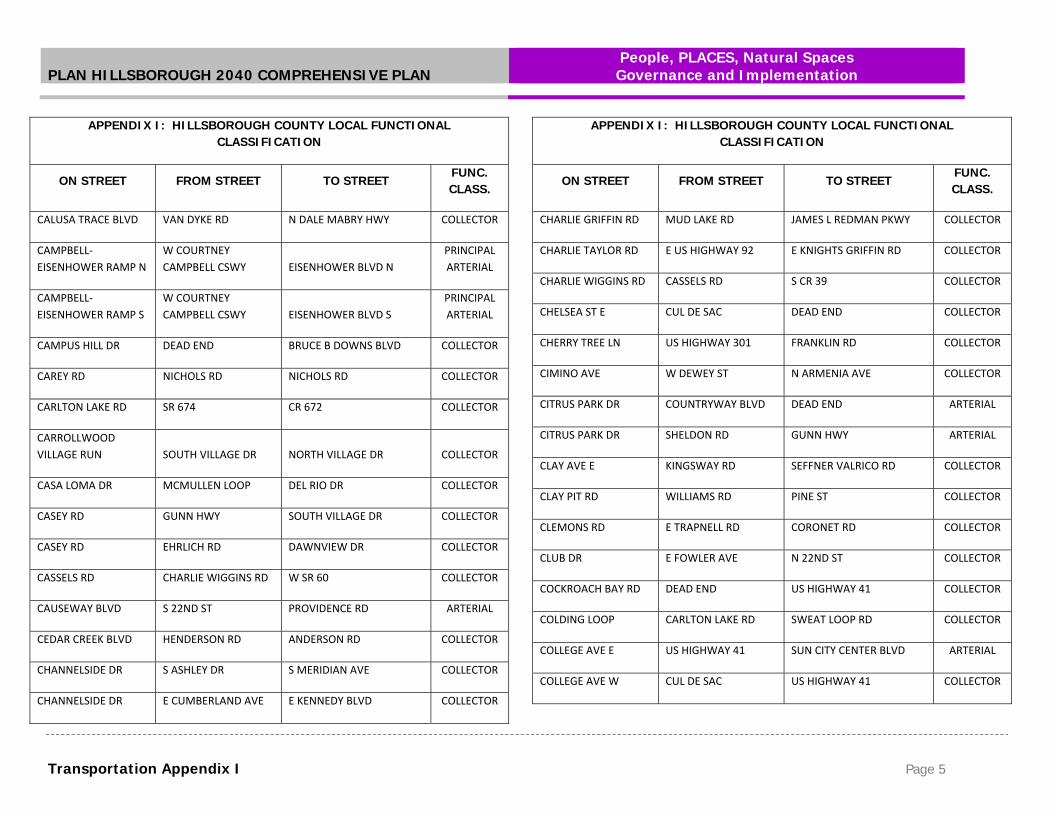
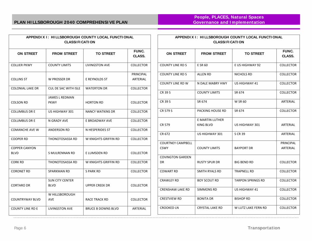
Transportation Appendix I Page 1
APPENDIX I: HILLSBOROUGH COUNTY LOCAL FUNCTIONAL CLASSIFICATION
ON STREET FROM STREET TO STREET FUNC. CLASS.
10TH ST SW US HIGHWAY 41 W COLLEGE AVE COLLECTOR
11TH AVE NE 15TH ST NE 18TH ST NE COLLECTOR
11TH AVE NW YORK DALE DR US HIGHWAY 41 COLLECTOR
12TH ST NE 7TH AVE NE US HIGHWAY 41 COLLECTOR
131ST AVE E N NEBRASKA AVE BRUCE B DOWNS BLVD COLLECTOR
14TH AVE SE 1ST ST SW 36TH ST SE COLLECTOR
14TH AVE SW US HIGHWAY 41 1ST ST SW COLLECTOR
14TH ST NW W SHELL POINT RD 19TH AVE NW COLLECTOR
151ST AVE E N 12TH ST LIVINGSTON AVE COLLECTOR
15TH AVE NW 4TH ST NW US HIGHWAY 41 COLLECTOR
15TH ST N E FOWLER AVE E FLETCHER AVE COLLECTOR
15TH ST SE / NE 21ST AVE SE 11TH AVE NE COLLECTOR
16TH AVE S S 50TH ST WINDERMERE WAY COLLECTOR
17TH AVE E E COLUMBUS DR 29TH PL COLLECTOR
18TH AVE E 29TH PL E 19TH AVE COLLECTOR
18TH ST NE 11TH AVE NE 19TH AVE NE COLLECTOR
APPENDIX I: HILLSBOROUGH COUNTY LOCAL FUNCTIONAL CLASSIFICATION
ON STREET FROM STREET TO STREET FUNC. CLASS.
19TH AVE N 35TH ST E COLUMBUS DR COLLECTOR
19TH AVE NW DICKMAN ISLAND US HIGHWAY 41 COLLECTOR
19TH AVE NE US HIGHWAY 41 US HIGHWAY 301 ARTERIAL
19TH ST N E FOWLER AVE UNIVERSITY SQUARE MALL COLLECTOR
1ST ST NW W SHELL POINT RD 19TH AVE NW COLLECTOR
21ST AVE SE 6TH ST SE 24TH ST SE COLLECTOR
21ST ST SE E COLLEGE AVE E SHELL POINT RD COLLECTOR
22ND ST S MARITIME ST CORRINE ST ARTERIAL
22ND ST N CORRINE ST MARCONI ST ARTERIAL
22ND ST N DURHAM ST N 21ST ST ARTERIAL
22ND ST N CLUB DR E BEARSS AVE COLLECTOR
24TH ST SE DEAD END E COLLEGE AVE COLLECTOR
29TH PL E 17TH AVE E 18TH AVE COLLECTOR
2ND ST ALEY ST NORTH ST COLLECTOR
30TH ST NE E SHELL POINT RD 30TH ST NE COLLECTOR
30TH ST NE CLOVER RIDGE AVE 19TH AVE NE COLLECTOR

PLAN HILLSBOROUGH 2040 COMPREHENSIVE PLAN People, PLACES, Natural Spaces Governance and Implementation
Page 2 Transportation
APPENDIX I: HILLSBOROUGH COUNTY LOCAL FUNCTIONAL CLASSIFICATION
ON STREET FROM STREET TO STREET FUNC. CLASS.
30TH ST SE 40TH AVE SE DEAD END COLLECTOR
30TH ST SE E COLLEGE AVE E SHELL POINT RD COLLECTOR
33RD ST SE PINE NEEDLE DR SUN CITY CENTER BLVD COLLECTOR
36TH AVE S DEAD END S 78TH ST COLLECTOR
36TH AVE S S 50TH ST DEAD END COLLECTOR
36TH ST SE DEAD END 14TH AVE SE COLLECTOR
39TH ST N ADAMO DR E 11TH AVE PRINCIPAL ARTERIAL
40TH ST N E 11TH AVE E HILLSBOROUGH AVE PRINCIPAL ARTERIAL
40TH ST N E HILLSBOROUGH AVE E BUSCH BLVD COLLECTOR
42ND ST N E FLETCHER AVE BRUCE B DOWNS BLVD COLLECTOR
43RD ST N E HILLSBOROUGH AVE E SLIGH AVE COLLECTOR
46TH ST N E FLETCHER AVE SKIPPER RD COLLECTOR
4TH ST SW US HIGHWAY 41 WOODLAND ESTATES AVE COLLECTOR
4TH ST SW / NW DEAD END 15TH AVE NW COLLECTOR
50TH ST S BLOOMINGDALE AVE ADAMO DR PRINCIPAL ARTERIAL
APPENDIX I: HILLSBOROUGH COUNTY LOCAL FUNCTIONAL CLASSIFICATION
ON STREET FROM STREET TO STREET FUNC. CLASS.
50TH ST N ADAMO DR E CHELSEA ST PRINCIPAL ARTERIAL
50TH ST N E FOWLER AVE E FLETCHER AVE COLLECTOR
56TH ST N E CHELSEA ST E FOWLER AVE PRINCIPAL ARTERIAL
56TH ST N E FOWLER AVE E FLETCHER AVE ARTERIAL
58TH ST S CAUSEWAY BLVD PALM RIVER RD COLLECTOR
6TH ST SE 21ST AVE SE E COLLEGE AVE COLLECTOR
70TH ST S DEAD END 20TH AVE S COLLECTOR
78TH ST S RIVERVIEW DR CAUSEWAY BLVD COLLECTOR
78TH ST S CAUSEWAY BLVD E ADAMO DR ARTERIAL
7TH ST SW 24TH AVE SW US HIGHWAY 41 COLLECTOR
ADAMO DR CHANNELSIDE DR ADAMO‐I75 S RAMP PRINCIPAL ARTERIAL
ALEXANDER ST N L H DR E KNIGHTS GRIFFIN RD PRINCIPAL ARTERIAL
ALLEN RD LITHIA PINECREST RD S COUNTY LINE RD COLLECTOR
ALSOBROOK ST E S COLLINS ST S PARK RD COLLECTOR

PLAN HILLSBOROUGH 2040 COMPREHENSIVE PLAN People, PLACES, Natural Spaces Governance and Implementation
Transportation Appendix I Page 3
APPENDIX I: HILLSBOROUGH COUNTY LOCAL FUNCTIONAL CLASSIFICATION
ON STREET FROM STREET TO STREET FUNC. CLASS.
AMBLESIDE BLVD US HIGHWAY 301 CLEMENT PRIDE BLVD COLLECTOR
ANDERSON RD W HILLSBOROUGH AVE HOOVER BLVD COLLECTOR
ANDERSON RD W SLIGH AVE GUNN HWY ARTERIAL
ANGEL LN W LUTZ LAKE FERN RD W COUNTY LINE RD COLLECTOR
APOLLO BEACH BLVD SURFSIDE BLVD US HIGHWAY 41 COLLECTOR
APOLLO BEACH BLVD S SURFSIDE BLVD APOLLO BEACH BLVD COLLECTOR
ARMENIA AVE N W KENNEDY BLVD MAGDALENE SHORES AVE COLLECTOR
BAILEY RD E KNIGHTS GRIFFIN RD HALF MILE RD COLLECTOR
BAKER ST CITY LIMITS N PARK RD PRINCIPAL ARTERIAL
BALM BOYETTE RD CR 672 BOYETTE RD COLLECTOR
BALM RIVERVIEW RD CR 672 US HIGHWAY 301 COLLECTOR
BALM WIMAUMA RD SR 674 CR 672 COLLECTOR
BARRY RD HANLEY RD BENJAMIN RD COLLECTOR
BAY CREST DR GILBERT AVE MEMORIAL HWY COLLECTOR
BAY POINTE DR DEAD END MEMORIAL HWY COLLECTOR
APPENDIX I: HILLSBOROUGH COUNTY LOCAL FUNCTIONAL CLASSIFICATION
ON STREET FROM STREET TO STREET FUNC. CLASS.
BAY TO BAY BLVD W S MANHATTAN AVE BAYSHORE BLVD COLLECTOR
BAYSHORE BLVD W GANDY BLVD W PLATT ST COLLECTOR
BEARSS AVE N DALE MABRY HWY BRUCE B DOWNS BLVD ARTERIAL
BEAUCHAMP RD BRANCH FORBES RD BOOT BAY RD COLLECTOR
BELL SHOALS RD BOYETTE RD LITHIA PINECREST RD COLLECTOR
BELLAMY RD EHRLICH RD DEAD END COLLECTOR
BENJAMIN RD W HILLSBOROUGH AVE W WATERS AVE COLLECTOR
BERKFORD AVE GUNN HWY BINGHAM CT COLLECTOR
BERRY RD SMITH RYALS RD DEAD END COLLECTOR
BETHLEHEM RD MARTIN LUTHER KING BLVD N BETHLEHEM RD COLLECTOR
BETHLEHEM RD N BETHLEHEM RD STAFFORD RD COLLECTOR
BIG BEND RD DICKMAN RD US HIGHWAY 41 COLLECTOR
BIG BEND RD US HIGHWAY 41 US HIGHWAY 301 ARTERIAL
BIG BEND RD US HIGHWAY 301 DEAD END COLLECTOR
BILL TUCKER RD US HIGHWAY 301 WEST LAKE DR COLLECTOR

PLAN HILLSBOROUGH 2040 COMPREHENSIVE PLAN People, PLACES, Natural Spaces Governance and Implementation
Page 4 Transportation
APPENDIX I: HILLSBOROUGH COUNTY LOCAL FUNCTIONAL CLASSIFICATION
ON STREET FROM STREET TO STREET FUNC. CLASS.
BISHOP RD US HIGHWAY 301 WEST LAKE DR COLLECTOR
BLACK DAIRY RD E SLIGH AVE PRUETT RD COLLECTOR
BLOOMINGDALE AVE US HIGHWAY 301 LITHIA PINECREST RD ARTERIAL
BLOOMINGDALE AVE LITHIA PINECREST RD NEW RIVER HILLS PKWY COLLECTOR
BOB HEAD RD COOPER RD N FORBES RD COLLECTOR
BONITA DR US HIGHWAY 301 GLENDALE DR COLLECTOR
BOOT BAY RD BEAUCHAMP RD DEAD END COLLECTOR
BOULEVARD N W COUNTRY CLUB DR LAKE MAGDALENE BLVD COLLECTOR
BOULEVARD OF ROSES W LUTZ LAKE FERN RD REFLECTIONS BLVD COLLECTOR
BOWLES RD DEAD END HARNEY RD COLLECTOR
BOY SCOUT RD RACE TRACK RD TARPON SPRINGS RD COLLECTOR
BOYETTE RD US HIGHWAY 301 BELL SHOALS RD ARTERIAL
BOYETTE RD FISHHAWK BLVD LITHIA PINECREST RD COLLECTOR
BRANCH FORBES RD W US HIGHWAY 92 STAFFORD RD COLLECTOR
BRANDON BLVD W ADAMO‐I75 S RAMP N MOUNT CARMEL RD PRINCIPAL ARTERIAL
BRANDON BROOK RD N MOUNT CARMEL RD N VALRICO RD COLLECTOR
APPENDIX I: HILLSBOROUGH COUNTY LOCAL FUNCTIONAL CLASSIFICATION
ON STREET FROM STREET TO STREET FUNC. CLASS.
BRANDON PKWY W LUMSDEN RD TOWN CENTER BLVD ARTERIAL
BRANDON PKWY BRANDON PKWY PAULS DR ARTERIAL
BROADWAY AVE E N 50TH ST CUL DE SAC COLLECTOR
BROOKER RD BRYAN RD S VALRICO RD COLLECTOR
BROWNING RD BOYETTE RD LITHIA PINECREST RD COLLECTOR
BRUCE B DOWNS BLVD E FOWLER AVE E COUNTY LINE RD ARTERIAL
BRUTON RD N DORMANY RD PAUL BUCHMAN HWY COLLECTOR
BRYAN RD E BLOOMINGDALE AVE E BRANDON BLVD COLLECTOR
BRYANT RD LITHIA PINECREST RD THOMPSON RD COLLECTOR
BUGG RD MUD LAKE RD W SR 60 COLLECTOR
BULLARD PKWY N 56TH ST TEMPLE TERRACE HWY ARTERIAL
BURNETT RD BALM WIMAUMA RD COLDING LOOP COLLECTOR
BUSCH BLVD BUSCH‐DALE MABRY N RAMP N 56TH ST
PRINCIPAL ARTERIAL
BUTCH CASSIDY TRL LIGHTFOOT RD LIGHTFOOT RD COLLECTOR
CALHOUN RD W SR 60 HOLLOWAY RD COLLECTOR
PLAN HILLSBOROUGH 2040 COMPREHENSIVE PLAN People, PLACES, Natural Spaces Governance and Implementation
Transportation Appendix I Page 5
APPENDIX I: HILLSBOROUGH COUNTY LOCAL FUNCTIONAL CLASSIFICATION
ON STREET FROM STREET TO STREET FUNC. CLASS.
CALUSA TRACE BLVD VAN DYKE RD N DALE MABRY HWY COLLECTOR
CAMPBELL‐EISENHOWER RAMP N
W COURTNEY CAMPBELL CSWY EISENHOWER BLVD N
PRINCIPAL ARTERIAL
CAMPBELL‐EISENHOWER RAMP S
W COURTNEY CAMPBELL CSWY EISENHOWER BLVD S
PRINCIPAL ARTERIAL
CAMPUS HILL DR DEAD END BRUCE B DOWNS BLVD COLLECTOR
CAREY RD NICHOLS RD NICHOLS RD COLLECTOR
CARLTON LAKE RD SR 674 CR 672 COLLECTOR
CARROLLWOOD VILLAGE RUN SOUTH VILLAGE DR NORTH VILLAGE DR COLLECTOR
CASA LOMA DR MCMULLEN LOOP DEL RIO DR COLLECTOR
CASEY RD GUNN HWY SOUTH VILLAGE DR COLLECTOR
CASEY RD EHRLICH RD DAWNVIEW DR COLLECTOR
CASSELS RD CHARLIE WIGGINS RD W SR 60 COLLECTOR
CAUSEWAY BLVD S 22ND ST PROVIDENCE RD ARTERIAL
CEDAR CREEK BLVD HENDERSON RD ANDERSON RD COLLECTOR
CHANNELSIDE DR S ASHLEY DR S MERIDIAN AVE COLLECTOR
CHANNELSIDE DR E CUMBERLAND AVE E KENNEDY BLVD COLLECTOR
APPENDIX I: HILLSBOROUGH COUNTY LOCAL FUNCTIONAL CLASSIFICATION
ON STREET FROM STREET TO STREET FUNC. CLASS.
CHARLIE GRIFFIN RD MUD LAKE RD JAMES L REDMAN PKWY COLLECTOR
CHARLIE TAYLOR RD E US HIGHWAY 92 E KNIGHTS GRIFFIN RD COLLECTOR
CHARLIE WIGGINS RD CASSELS RD S CR 39 COLLECTOR
CHELSEA ST E CUL DE SAC DEAD END COLLECTOR
CHERRY TREE LN US HIGHWAY 301 FRANKLIN RD COLLECTOR
CIMINO AVE W DEWEY ST N ARMENIA AVE COLLECTOR
CITRUS PARK DR COUNTRYWAY BLVD DEAD END ARTERIAL
CITRUS PARK DR SHELDON RD GUNN HWY ARTERIAL
CLAY AVE E KINGSWAY RD SEFFNER VALRICO RD COLLECTOR
CLAY PIT RD WILLIAMS RD PINE ST COLLECTOR
CLEMONS RD E TRAPNELL RD CORONET RD COLLECTOR
CLUB DR E FOWLER AVE N 22ND ST COLLECTOR
COCKROACH BAY RD DEAD END US HIGHWAY 41 COLLECTOR
COLDING LOOP CARLTON LAKE RD SWEAT LOOP RD COLLECTOR
COLLEGE AVE E US HIGHWAY 41 SUN CITY CENTER BLVD ARTERIAL
COLLEGE AVE W CUL DE SAC US HIGHWAY 41 COLLECTOR
PLAN HILLSBOROUGH 2040 COMPREHENSIVE PLAN People, PLACES, Natural Spaces Governance and Implementation
Page 6 Transportation
APPENDIX I: HILLSBOROUGH COUNTY LOCAL FUNCTIONAL CLASSIFICATION
ON STREET FROM STREET TO STREET FUNC. CLASS.
COLLIER PKWY COUNTY LIMITS LIVINGSTON AVE COLLECTOR
COLLINS ST W PROSSER DR E REYNOLDS ST PRINCIPAL ARTERIAL
COLONIAL LAKE DR CUL DE SAC WITH ISLE WATERTON DR COLLECTOR
COLSON RD JAMES L REDMAN PKWY HORTON RD COLLECTOR
COLUMBUS DR E US HIGHWAY 301 NANCY WATKINS DR COLLECTOR
COLUMBUS DR E N GRADY AVE E BROADWAY AVE COLLECTOR
COMANCHE AVE W ANDERSON RD N HESPERIDES ST COLLECTOR
COOPER RD THONOTOSASSA RD W KNIGHTS GRIFFIN RD COLLECTOR
COPPER CANYON BLVD S MULRENNAN RD E LUMSDEN RD COLLECTOR
CORK RD THONOTOSASSA RD W KNIGHTS GRIFFIN RD COLLECTOR
CORONET RD SPARKMAN RD S PARK RD COLLECTOR
CORTARO DR SUN CITY CENTER BLVD UPPER CREEK DR COLLECTOR
COUNTRYWAY BLVD W HILLSBOROUGH AVE RACE TRACK RD COLLECTOR
COUNTY LINE RD E LIVINGSTON AVE BRUCE B DOWNS BLVD ARTERIAL
APPENDIX I: HILLSBOROUGH COUNTY LOCAL FUNCTIONAL CLASSIFICATION
ON STREET FROM STREET TO STREET FUNC. CLASS.
COUNTY LINE RD S E SR 60 E US HIGHWAY 92 COLLECTOR
COUNTY LINE RD S ALLEN RD NICHOLS RD COLLECTOR
COUNTY LINE RD W N DALE MABRY HWY US HIGHWAY 41 COLLECTOR
CR 39 S COUNTY LIMITS SR 674 COLLECTOR
CR 39 S SR 674 W SR 60 ARTERIAL
CR 579 S PACKING HOUSE RD SR 674 COLLECTOR
CR 579 E MARTIN LUTHER KING BLVD US HIGHWAY 301 ARTERIAL
CR 672 US HIGHWAY 301 S CR 39 ARTERIAL
COURTNEY CAMPBELL CSWY COUNTY LIMITS BAYPORT DR
PRINCIPAL ARTERIAL
COVINGTON GARDEN DR RUSTY SPUR DR BIG BEND RD COLLECTOR
COWART RD SMITH RYALS RD TRAPNELL RD COLLECTOR
CRAWLEY RD BOY SCOUT RD TARPON SPRINGS RD COLLECTOR
CRENSHAW LAKE RD SIMMONS RD US HIGHWAY 41 COLLECTOR
CRESTVIEW RD BONITA DR BISHOP RD COLLECTOR
CROOKED LN CRYSTAL LAKE RD W LUTZ LAKE FERN RD COLLECTOR

PLAN HILLSBOROUGH 2040 COMPREHENSIVE PLAN People, PLACES, Natural Spaces Governance and Implementation
Transportation Appendix I Page 7
APPENDIX I: HILLSBOROUGH COUNTY LOCAL FUNCTIONAL CLASSIFICATION
ON STREET FROM STREET TO STREET FUNC. CLASS.
CROSBY RD N VALRICO RD N SAINT CLOUD AVE COLLECTOR
CROSS CREEK BLVD BRUCE B DOWNS BLVD MORRIS BRIDGE RD ARTERIAL
CROSSTOWN E‐I75 N RAMP
CROSSTOWN E‐I75 S RAMP I75 N‐BRANDON RAMP
PRINCIPAL ARTERIAL
CROSSTOWN EXPRESS LN N MERIDIAN AVE TOWN CENTER BLVD
PRINCIPAL ARTERIAL
CROSSTOWN EXPY GANDY‐CROSSTOWN E RAMP CROSSTOWN E‐I75 S RAMP
PRINCIPAL ARTERIAL
CRYSTAL LAKE RD GERACI RD US HIGHWAY 41 COLLECTOR
CULBREATH RD DEAD END BLOOMINGDALE AVE COLLECTOR
CUMBERLAND AVE E S MERIDIAN AVE CHANNELSIDE DR COLLECTOR
CYPRESS VILLAGE BLVD
SUN CITY CENTER BLVD 19TH AVE NE COLLECTOR
DALE MABRY HWY S DALE MABRY‐CROSSTOWN E RAMP W COUNTY LINE RD
PRINCIPAL ARTERIAL
DALE MABRY HWY S INTERBAY BLVD W GANDY BLVD ARTERIAL
DAVIS RD HARNEY RD MORRIS BRIDGE RD COLLECTOR
DAWNVIEW DR CASEY RD NORTHDALE BLVD COLLECTOR
APPENDIX I: HILLSBOROUGH COUNTY LOCAL FUNCTIONAL CLASSIFICATION
ON STREET FROM STREET TO STREET FUNC. CLASS.
DEBUEL RD US HIGHWAY 41 HANNA RD COLLECTOR
DEL RIO DR CASA LOMA DR MCMULLEN LOOP COLLECTOR
DEL WEBB BLVD E EMERALD LAKE DR SUN CITY CENTER BLVD COLLECTOR
DEL WEBB BLVD W
SUN CITY CENTER BLVD EMERALD LAKE DR COLLECTOR
DICKMAN RD APOLLO BEACH BLVD BIG BEND RD COLLECTOR
DONNEYMOOR DR BOYETTE RD MCMULLEN RD COLLECTOR
DORMAN RD GANNETDALE DR BROWNING RD COLLECTOR
DORMANY RD N BRUTON RD QUAIL MEADOW RD COLLECTOR
DOVER RD DURANT RD MARTIN LUTHER KING BLVD COLLECTOR
DRAWDY RD HOLLOWAY RD W TRAPNELL RD COLLECTOR
DUNCAN RD US HIGHWAY 301 BLOOMINGDALE AVE COLLECTOR
DURANT RD E LUMSDEN RD TURKEY CREEK RD COLLECTOR
EAGLES ENTRY DR NINE EAGLES DR PATTERSON RD COLLECTOR
EAST BAY RD BLISS RD GIBSONTON DR COLLECTOR
EDEN LN WILLOW WOOD LN W HANNA AVE COLLECTOR

PLAN HILLSBOROUGH 2040 COMPREHENSIVE PLAN People, PLACES, Natural Spaces Governance and Implementation
Page 8 Transportation
APPENDIX I: HILLSBOROUGH COUNTY LOCAL FUNCTIONAL CLASSIFICATION
ON STREET FROM STREET TO STREET FUNC. CLASS.
EDINA ST ALEY ST SR 674 COLLECTOR
EDISON RD ALLEN RD NICHOLS RD COLLECTOR
EGRET VIEW PL DORMAN RD EGRET CROSSING LN COLLECTOR
EHRLICH RD GUNN HWY N DALE MABRY HWY ARTERIAL
EHRLICH RD W BEARSS AVE LAKE MAGDALENE BLVD COLLECTOR
EISENHOWER BLVD N AIRPORT‐EISENHOWER N RAMP
EISENHOWER N‐VETERANS N RAMP
PRINCIPAL ARTERIAL
EISENHOWER BLVD S VETERANS EXPY S MEMORIAL HWY S PRINCIPAL ARTERIAL
EISENHOWER N‐VETERANS N RAMP EISENHOWER BLVD N VETERANS EXPY N
PRINCIPAL ARTERIAL
EISENHOWER‐CAMPBELL RAMP N MEMORIAL HWY N
S EISENHOWER‐CAMPBELL RAMP
PRINCIPAL ARTERIAL
EISENHOWER‐CAMPBELL RAMP S VETERANS EXPY S BAYPORT DR
PRINCIPAL ARTERIAL
EISENHOWER‐INDEPENDENCE RAMP VETERANS EXPY N INDEPENDENCE PKWY
PRINCIPAL ARTERIAL
EL RANCHO DR SUN CITY CENTER BLVD CALOOSA BLVD COLLECTOR
APPENDIX I: HILLSBOROUGH COUNTY LOCAL FUNCTIONAL CLASSIFICATION
ON STREET FROM STREET TO STREET FUNC. CLASS.
ELLIOT DR W HILLSBOROUGH AVE MEMORIAL HWY COLLECTOR
ENGLISH RD NESMITH RD OLD MULBERRY RD COLLECTOR
EXPOSITION DR DEAD END FAWN RIDGE BLVD COLLECTOR
FAIRWAY MEADOW
DR DEAD END HERITAGE GREENS PKWY COLLECTOR
FALKENBURG RD DEER CHASE DR EAGLE PALM DR COLLECTOR
FALKENBURG RD EAGLE PALM DR E MARTIN LUTHER KING BLVD ARTERIAL
FALKENBURG RD E MARTIN LUTHER KING BLVD E US HIGHWAY 92 COLLECTOR
FAWN RIDGE BLVD SHELDON RD EXPOSITION DR COLLECTOR
FISHHAWK BLVD BELL SHOALS RD LITHIA PINECREST RD ARTERIAL
FISHHAWK CROSSING BLVD FISHHAWK BLVD OSPREY RIDGE DR COLLECTOR
FIVE ACRE RD W KNIGHTS GRIFFIN RD QUAIL MEADOW RD COLLECTOR
FLETCHER AVE N DALE MABRY HWY HIDDEN RIVER PKWY ARTERIAL
FLORENCE AVE US HIGHWAY 301 SPANISH MAIN RESORT TRL COLLECTOR

PLAN HILLSBOROUGH 2040 COMPREHENSIVE PLAN People, PLACES, Natural Spaces Governance and Implementation
Transportation Appendix I Page 9
APPENDIX I: HILLSBOROUGH COUNTY LOCAL FUNCTIONAL CLASSIFICATION
ON STREET FROM STREET TO STREET FUNC. CLASS.
FLORENCE AVE CR 579 FORT KING HWY COLLECTOR
FLORIDA AVE S CHANNELSIDE DR N NEBRASKA AVE ARTERIAL
FLOYD RD HUDSON LN N DALE MABRY HWY COLLECTOR
FORBES RD STAFFORD RD MILEY RD COLLECTOR
FORBES RD W TRAPNELL RD W US HIGHWAY 92 COLLECTOR
FORT KING HWY MAIN ST KNIGHTS GRIFFIN RD COLLECTOR
FORT LONESOME PLANT RD S CR 39 DEAD END COLLECTOR
FORT LONESOME PLANT RD DEAD END COUNTY LIMITS COLLECTOR
FOWLER AVE E N FLORIDA AVE US HIGHWAY 301 PRINCIPAL ARTERIAL
FOWLER AVE E US HIGHWAY 301 TOM FOLSOM RD COLLECTOR
FRANKLIN RD CHERRY TREE LN FANNKLIN WOODLAND DR COLLECTOR
FRITZKE RD FRITZKE RD THONOTOSASSA RD COLLECTOR
FRONT ST SEFFNER VALRICO RD N VALRICO RD COLLECTOR
GALLAGHER RD SYDNEY RD PARKING LOT COLLECTOR
GALLAGHER RD GORE RD FRANKLIN RD COLLECTOR
APPENDIX I: HILLSBOROUGH COUNTY LOCAL FUNCTIONAL CLASSIFICATION
ON STREET FROM STREET TO STREET FUNC. CLASS.
GANDY BLVD COUNTY LIMITS S DALE MABRY HWY PRINCIPAL ARTERIAL
GANDY BLVD S DALE MABRY HWY BAYSHORE BLVD COLLECTOR
GARDEN LN E MARTIN LUTHER KING BLVD E US HWY 92‐I4 W RAMP COLLECTOR
GEORGE RD DANA SHORES DR W HILLSBOROUGH AVE COLLECTOR
GERACI RD CRYSTAL LAKE RD N DALE MABRY HWY COLLECTOR
GIBSONTON DR US HIGHWAY 41 US HIGHWAY 301 ARTERIAL
GLENDALE DR BONITA DR JANES DR COLLECTOR
GOLF AND SEA BLVD FAIRWAY BLVD FLAMINGO DR COLLECTOR
GORE RD MCINTOSH RD GALLAGHER RD COLLECTOR
GORNTO LAKE RD BLOOMINGDALE AVE W BRANDON BLVD COLLECTOR
GRADY AVE W HUMPHREY ST MULLINS RD COLLECTOR
GRAND REGENCY BLVD W BRANDON BLVD WOODBERRY RD COLLECTOR
GRANGE HALL LOOP SR 674 SR 674 COLLECTOR
GUILES RD BELL SHOALS RD LITHIA PINECREST RD COLLECTOR
GULF CITY RD COCKROACH BAY RD US HIGHWAY 41 COLLECTOR

PLAN HILLSBOROUGH 2040 COMPREHENSIVE PLAN People, PLACES, Natural Spaces Governance and Implementation
Page 10 Transportation
APPENDIX I: HILLSBOROUGH COUNTY LOCAL FUNCTIONAL CLASSIFICATION
ON STREET FROM STREET TO STREET FUNC. CLASS.
GUNN HWY BUSCH‐DALE MABRY N RAMP COUNTY LIMITS ARTERIAL
HABANA AVE W HILLSBOROUGH AVE W WATERS AVE COLLECTOR
HALF MILE RD E HUNTER RD BAILEY RD COLLECTOR
HAMMERSMITH DR KINGS BLVD KINGS BLVD COLLECTOR
HAMPTON PARK BLVD GUNN HWY LOWELL RD COLLECTOR
HANLEY RD W HILLSBOROUGH AVE HOLLOWELL DR COLLECTOR
HANNA AVE W
TOWN N COUNTRY BLVD WILLOW WOOD LN COLLECTOR
HANNA AVE W EDEN LN YORKSHIRE RD COLLECTOR
HANNA AVE E N 40TH ST HARNEY RD COLLECTOR
HANNA RD VANDERVORT RD SUNSET LN COLLECTOR
HARNEY RD N 56TH ST US HIGHWAY 301 ARTERIAL
HARTFORD ST S 50TH ST S 70TH ST COLLECTOR
HARVEY TEW RD N BETHLEHEM RD BRANCH FORBES RD COLLECTOR
HAVEN BND N ROME AVE HAVEN BND COLLECTOR
APPENDIX I: HILLSBOROUGH COUNTY LOCAL FUNCTIONAL CLASSIFICATION
ON STREET FROM STREET TO STREET FUNC. CLASS.
HEATHER LAKES BLVD W LUMSDEN RD W LUMSDEN RD COLLECTOR
HEATHERFIELD DR HULSEY RD TWELVE OAKS BLVD COLLECTOR
HENDERSON BLVD S MANHATTAN AVE S DALE MABRY HWY COLLECTOR
HENDERSON RD W WATERS AVE GUNN HWY COLLECTOR
HENRY GEORGE RD E KEYSVILLE RD OLD HOPEWELL RD COLLECTOR
HERITAGE GREENS PKWY BIG BEND RD FAIRWAY MEADOW DR COLLECTOR
HESPERIDES ST N W HILLSBOROUGH AVE W SLIGH AVE COLLECTOR
HIGHVIEW RD W WINDHORST RD CLAY PIT RD COLLECTOR
HILLSBOROUGH AVE SANTA LUCIA CIR LENOX DR PRINCIPAL ARTERIAL
HIMES AVE W HILLSBOROUGH AVE W WATERS AVE ARTERIAL
HOBSON SIMMONS RD DEAD END BOYETTE RD COLLECTOR
HOLLOWAY RD TURKEY CREEK RD JAMES L REDMAN PKWY COLLECTOR
HOOVER BLVD W HILLSBOROUGH AVE W SLIGH AVE ARTERIAL

PLAN HILLSBOROUGH 2040 COMPREHENSIVE PLAN People, PLACES, Natural Spaces Governance and Implementation
Transportation Appendix I Page 11
APPENDIX I: HILLSBOROUGH COUNTY LOCAL FUNCTIONAL CLASSIFICATION
ON STREET FROM STREET TO STREET FUNC. CLASS.
HORTON RD RISING SUN RD BERRY RD COLLECTOR
HOWARD AVE W KENNEDY BLVD W DEWEY ST COLLECTOR
HUDSON LN GUNN HWY ORANGE GROVE DR COLLECTOR
HUMPHREY ST N MANHATTAN AVE N HIMES AVE COLLECTOR
HUNTER RD PAUL BUCHMAN HWY HALF MILE RD COLLECTOR
HUTCHISON RD EHRLICH RD NORTH MOBLEY RD COLLECTOR
I4 W‐ALEXANDER RAMP
I4 W‐PAUL BUCHMAN RAMP
PAUL BUCHMAN HWY‐I4 RAMP
PRINCIPAL ARTERIAL
I4 W‐I275 S RAMP INTERSTATE 4 W INTERSTATE 275 S PRINCIPAL ARTERIAL
I4 W‐JEFF/FLORIDA RAMP I4 W‐I275 S RAMP I275 S‐JEFF/ASHLEY RAMP
PRINCIPAL ARTERIAL
I4 W‐PAUL BUCHMAN RAMP INTERSTATE 4 W
I4 W‐PAUL BUCHMAN RAMP
PRINCIPAL ARTERIAL
I75 N‐CROSSTOWN W
RAMP INTERSTATE 75 N CROSSTOWN EXPY W
PRINCIPAL ARTERIAL
INDEPENDENCE‐EISENHOWER RAMP INDEPENDENCE PKWY
S EISENHOWER‐CAMPBELL RAMP
PRINCIPAL ARTERIAL
INTERCHANGE ST E SHELL POINT RD 7TH AVE NE COLLECTOR
APPENDIX I: HILLSBOROUGH COUNTY LOCAL FUNCTIONAL CLASSIFICATION
ON STREET FROM STREET TO STREET FUNC. CLASS.
INTERSTATE 275 PINELLAS COUNTY PASCO COUNTY PRINCIPAL ARTERIAL
INTERSTATE 4 I275 N‐I4 E RAMP POLK COUNTY PRINCIPAL ARTERIAL
INTERSTATE 75 MANATEE COUNTY PASCO COUNTY PRINCIPAL ARTERIAL
JACKSON SPRINGS RD SHELDON RD HANLEY RD COLLECTOR
JAMES L REDMAN PKWY W SR 60 W PROSSER AVE
PRINCIPAL ARTERIAL
JAMESON RD S CR 39 WALTER HUNTER RD COLLECTOR
JANES DR GLENDALE DR WEST LAKE DR COLLECTOR
JAP TUCKER RD E TRAPNELL RD JIM JOHNSON RD COLLECTOR
JEFFERSON RD HARNEY RD E FOWLER AVE COLLECTOR
JERRY SMITH RD E SR 60 S FORBES RD COLLECTOR
JESS WALDEN RD N SMOKEY MOUNTAIN RD GALLAGHER RD COLLECTOR
JIM JOHNSON RD S PARK RD CLEMONS RD COLLECTOR
JOE EBERT RD WILLIAMS RD CR 579 COLLECTOR
JOHN MOORE RD RAMBLING RIVER RD W LUMSDEN RD COLLECTOR

PLAN HILLSBOROUGH 2040 COMPREHENSIVE PLAN People, PLACES, Natural Spaces Governance and Implementation
Page 12 Transportation
APPENDIX I: HILLSBOROUGH COUNTY LOCAL FUNCTIONAL CLASSIFICATION
ON STREET FROM STREET TO STREET FUNC. CLASS.
JOHNS RD SAWYER RD W SLIGH AVE COLLECTOR
JOHNSON RD W MUD LAKE RD JAMES L REDMAN PKWY COLLECTOR
KEENE RD DEAD END GRANGE HALL LOOP COLLECTOR
KEENE RD W SAM ALLEN RD W KNIGHTS GRIFFIN RD COLLECTOR
KELLY RD MEMORIAL HWY W HILLSBOROUGH AVE COLLECTOR
KENNEDY BLVD N ASHLEY DR CHANNELSIDE DR PRINCIPAL ARTERIAL
KENNEDY BLVD W MEMORIAL HWY N ASHLEY DR PRINCIPAL ARTERIAL
KEYSVILLE RD TURKEY CREEK RD VIRGIL HALL RD COLLECTOR
KINARD RD GALLAGHER RD COOPER RD COLLECTOR
KINGS AVE S ALAFIA BLVD VICTORIA ST COLLECTOR
KINGS BLVD KINGS BLVD SUN CITY CENTER BLVD COLLECTOR
KINGS LAKE DR BIG BEND RD LAKE VISTA DR COLLECTOR
KINGSWAY RD E BRANDON BLVD MUCK POND RD COLLECTOR
KINGSWAY RD PRUETT RD THONOTOSASSA RD COLLECTOR
KINNAN ST CROSS CREEK BLVD OAK PRESERVE BLVD COLLECTOR
APPENDIX I: HILLSBOROUGH COUNTY LOCAL FUNCTIONAL CLASSIFICATION
ON STREET FROM STREET TO STREET FUNC. CLASS.
KNIGHTS AVE N W BRANDON BLVD VICTORIA ST COLLECTOR
KNIGHTS GRIFFIN RD STACY RD TOM MATHEWS RD ARTERIAL
KRYCUL AVE RIVERVIEW DR US HIGHWAY 301 COLLECTOR
LAKE CARROLL WAY N DALE MABRY HWY CARROLLWOOD DR COLLECTOR
LAKE KATHY DR W BRANDON BLVD GRAND REGENCY BLVD COLLECTOR
LAKE LE CLARE RD TOBACCO RD LAKESHORE RD COLLECTOR
LAKE MAGDALENE BLVD W FLETCHER AVE W BEARSS AVE COLLECTOR
LAKE MAGDALENE BLVD W BEARSS AVE N FLORIDA AVE COLLECTOR
LAKE REFLECTIONS BLVD VAN DYKE RD FALL CREEK DR COLLECTOR
LAKE SAINT CHARLES BLVD COLONIAL LAKE DR KRYCUL AVE COLLECTOR
LAKESHORE RD WILCOX RD VAN DYKE RD COLLECTOR
LAKEVIEW VILLAGE DR OUTLOOK DR HIGHVIEW RD COLLECTOR
LAKEWOOD DR S BRANDON PKWY W BRANDON BLVD ARTERIAL
LAKEWOOD DR W BRANDON BLVD CLAY PIT RD COLLECTOR

PLAN HILLSBOROUGH 2040 COMPREHENSIVE PLAN People, PLACES, Natural Spaces Governance and Implementation
Transportation Appendix I Page 13
APPENDIX I: HILLSBOROUGH COUNTY LOCAL FUNCTIONAL CLASSIFICATION
ON STREET FROM STREET TO STREET FUNC. CLASS.
LAMBRIGHT ST W N DALE MABRY HWY W SLIGH AVE ARTERIAL
LIGHTFOOT RD VALROY RD DEAD END COLLECTOR
LIGHTFOOT RD TIMBERLEE RD US HIGHWAY 301 COLLECTOR
LIMONA RD LAKEWOOD DR W BRANDON BLVD COLLECTOR
LINEBAUGH AVE RACE TRACK RD N DALE MABRY HWY ARTERIAL
LITHIA PINECREST RD E BRANDON BLVD COUNTY LINE ARTERIAL
LITHIA SPRINGS RD DEAD END LITHIA PINECREST RD COLLECTOR
LITTLE RD BLOOMINGDALE AVE DURANT RD COLLECTOR
LIVINGSTON AVE E BEARSS AVE E COUNTY LINE RD ARTERIAL
LONE OAK RD TURKEY CREEK RD DRAWDY RD COLLECTOR
LONGBOAT BLVD E W LONGBOAT BLVD W HILLSBOROUGH AVE COLLECTOR
LONGBOAT BLVD W E LONGBOAT BLVD MEMORIAL HWY COLLECTOR
LOPEZ DR BAY POINTE DR MEMORIAL HWY COLLECTOR
LOWELL RD DUNHILL DR SOUTH VILLAGE DR COLLECTOR
LULA ST BEACH AVE US HIGHWAY 41 COLLECTOR
LUMSDEN RD PROVIDENCE RD LITHIA PINECREST RD ARTERIAL
APPENDIX I: HILLSBOROUGH COUNTY LOCAL FUNCTIONAL CLASSIFICATION
ON STREET FROM STREET TO STREET FUNC. CLASS.
LUMSDEN RD LITHIA PINECREST RD S MULRENNAN RD COLLECTOR
LUMSDEN RD COPPER CANYON BLVD S DOVER RD COLLECTOR
LUTZ LAKE FERN RD GUNN HWY N DALE MABRY HWY ARTERIAL
LUTZ LAKE FERN RD N DALE MABRY HWY US HIGHWAY 41 COLLECTOR
LYNN RD HENDERSON RD ANDERSON RD COLLECTOR
LYNN RD GUNN HWY TURNER RD ARTERIAL
MADISON AVE S 50TH ST S 78TH ST ARTERIAL
MAIN ST HARNEY RD FORT KING HWY COLLECTOR
MANHATTAN AVE N W HENRY AVE W HUMPHREY ST COLLECTOR
MANHATTAN AVE S W GANDY BLVD HENDERSON BLVD COLLECTOR
MAPLEDALE BLVD NORTHDALE BLVD N DALE MABRY HWY COLLECTOR
MARTIN LUTHER KING BLVD N DALE MABRY HWY WILKINSON DR
PRINCIPAL ARTERIAL
MAYDELL DR CAUSEWAY BLVD ADAMO DR COLLECTOR
MCGEE RD CORK RD PAUL BUCHMAN HWY COLLECTOR
MCINTOSH RD MARTIN LUTHER KING BLVD US HIGHWAY 301 COLLECTOR

PLAN HILLSBOROUGH 2040 COMPREHENSIVE PLAN People, PLACES, Natural Spaces Governance and Implementation
Page 14 Transportation
APPENDIX I: HILLSBOROUGH COUNTY LOCAL FUNCTIONAL CLASSIFICATION
ON STREET FROM STREET TO STREET FUNC. CLASS.
MCMULLEN LOOP CASA LOMA DR PETREL LOOP COLLECTOR
MCMULLEN RD BALM RIVERVIEW RD MCMULLEN LOOP COLLECTOR
MEDULLA RD CORONET RD S COUNTY LINE RD COLLECTOR
MELBURNE BLVD N 50TH ST N 40TH ST PRINCIPAL ARTERIAL
MEMORIAL HWY CUL DE SAC MONTAGUE ST COLLECTOR
MEMORIAL HWY SEAFAIRER DR SHELDON RD COLLECTOR
MEMORIAL HWY W HILLSBOROUGH AVE EISENHOWER BLVD N ARTERIAL
MEMORIAL HWY W KENNEDY BLVD EISENHOWER / COURTNEY CAMPBELL RAMP
PRINCIPAL ARTERIAL
MERIDIAN AVE S E CUMBERLAND AVE CHANNELSIDE DR COLLECTOR
MESSLER RD BLISS RD SYMMES RD COLLECTOR
MICHIGAN AVE LUTZ LAKE FERN RD COUNTY LINE COLLECTOR
MIDWAY RD N WILDER RD CHARLIE TAYLOR RD COLLECTOR
MILEY RD STANLEY RD MCGEE RD COLLECTOR
MILLER MAC RD GOLF AND SEA BLVD US HIGHWAY 41 COLLECTOR
MILLER RD LITHIA PINECREST RD CROSBY RD COLLECTOR
APPENDIX I: HILLSBOROUGH COUNTY LOCAL FUNCTIONAL CLASSIFICATION
ON STREET FROM STREET TO STREET FUNC. CLASS.
MONTAGUE ST DEAD END MONTAGUE ST COLLECTOR
MONTAGUE ST W HILLSBOROUGH AVE CHARLESBERG DR COLLECTOR
MONTAGUE ST CSX RAILROAD DEAD END COLLECTOR
MONTEREY BLVD NIA LN CUL DE SAC COLLECTOR
MOON AVE N W BRANDON BLVD VICTORIA ST COLLECTOR
MOORES LAKE RD MARTIN LUTHER KING BLVD E US HIGHWAY 92 COLLECTOR
MORAN RD N DALE MABRY HWY ORANGE GROVE DR COLLECTOR
MORRIS BRIDGE RD HARNEY RD E FLETCHER AVE COLLECTOR
MORRIS BRIDGE RD E FLETCHER AVE COUNTY LIMITS ARTERIAL
MOUNT CARMEL RD E LUMSDEN RD VALRICO LAKE RD COLLECTOR
MUCK POND RD N KINGSWAY RD MCINTOSH RD COLLECTOR
MUD LAKE RD W SR 60 MAKI RD COLLECTOR
MULLIS CITY WAY W LINEBAUGH AVE GUNN HWY COLLECTOR
MULRENNAN RD S DURANT RD E SR 60 COLLECTOR
MUSHINSKI RD DEAD END HENDERSON RD COLLECTOR

PLAN HILLSBOROUGH 2040 COMPREHENSIVE PLAN People, PLACES, Natural Spaces Governance and Implementation
Transportation Appendix I Page 15
APPENDIX I: HILLSBOROUGH COUNTY LOCAL FUNCTIONAL CLASSIFICATION
ON STREET FROM STREET TO STREET FUNC. CLASS.
NATURES WAY BLVD CULBREATH RD CULBREATH RD COLLECTOR
NEBRASKA AVE N E KENNEDY BLVD E HILLSBOROUGH AVE ARTERIAL
NEBRASKA AVE N E HILLSBOROUGH AVE N FLORIDA AVE PRINCIPAL ARTERIAL
NESMITH RD HORTON RD E TRAPNELL RD COLLECTOR
NEW EAST BAY RD NUNDY AVE GIBSONTON DR COLLECTOR
NEW RIVER HILLS PKWY LITHIA PINECREST RD BLOOMINGDALE AVE COLLECTOR
NEWBERGER RD US HIGHWAY 41 LIVINGSTON AVE COLLECTOR
NEWKIRK DR LAKESHORE RD NORTHDALE BLVD COLLECTOR
NEWPOINT LOOP KINGS BLVD KINGS BLVD COLLECTOR
NICHOLS RD E KEYSVILLE RD COUNTY LINE RD COLLECTOR
NINE EAGLES DR RACE TRACK RD EAGLES ENTRY DR COLLECTOR
NIXON RD W LINEBAUGH AVE GUNN HWY COLLECTOR
NORMANDIE RD DEAD END GUNN HWY COLLECTOR
NORTH LAKEVIEW DR N DALE MABRY HWY N DALE MABRY HWY COLLECTOR
NORTH MOBLEY RD CRAWLEY RD HUTCHISON RD COLLECTOR
APPENDIX I: HILLSBOROUGH COUNTY LOCAL FUNCTIONAL CLASSIFICATION
ON STREET FROM STREET TO STREET FUNC. CLASS.
NORTH ST WEST LAKE DR 2ND ST COLLECTOR
NORTH VILLAGE DR SOUTH VILLAGE DR N DALE MABRY HWY COLLECTOR
NORTHBRIDGE BLVD WOODBRIDGE BLVD W WATERS AVE COLLECTOR
NORTHDALE BLVD N DALE MABRY HWY DEAD END COLLECTOR
NORTHDALE BLVD NORTHDALE BLVD WOODSIDE MANOR DR COLLECTOR
OAKFIELD DR S LAKEWOOD DR S PARSONS AVE COLLECTOR
OCCIDENT ST N W HENRY AVE W SLIGH AVE COLLECTOR
OLD HILLSBOROUGH AVE CR 579 N SMOKEY MOUNTAIN RD COLLECTOR
OLD HOPEWELL RD S CR 39 HORTON RD COLLECTOR
OLD MULBERRY RD S COUNTY LINE RD S WIGGINS RD COLLECTOR
ORANGE GROVE RD W BUSCH BLVD MORAN RD COLLECTOR
ORIENT RD ADAMO DR E SLIGH AVE COLLECTOR
OSPREY RIDGE DR FISHHAWK CROSSING BLVD FISHHAWK BLVD COLLECTOR
OUTLOOK DR LAKEWOOD DR LAKEVIEW VILLAGE DR COLLECTOR
OWENS RD SR 674 SWEAT LOOP RD COLLECTOR

PLAN HILLSBOROUGH 2040 COMPREHENSIVE PLAN People, PLACES, Natural Spaces Governance and Implementation
Page 16 Transportation
APPENDIX I: HILLSBOROUGH COUNTY LOCAL FUNCTIONAL CLASSIFICATION
ON STREET FROM STREET TO STREET FUNC. CLASS.
PALM RIVER RD S 50TH ST S FALKENBURG RD COLLECTOR
PALMETTO RD SURONA RD RIVER RD COLLECTOR
PANTHER TRACE BLVD US HIGHWAY 301 PANTHER TRACE BLVD COLLECTOR
PARK RD JAMES L REDMAN PKWY E SAM ALLEN RD ARTERIAL
PARSONS AVE E LUMSDEN RD W BRANDON BLVD COLLECTOR
PARSONS AVE N E BRANDON BLVD W US HIGHWAY 92 ARTERIAL
PATTERSON RD RACE TRACK RD TARPON SPRINGS RD COLLECTOR
PAUL BUCHMAN HWY N WHEELER ST L H DR PRINCIPAL ARTERIAL
PAUL BUCHMAN HWY KNIGHTS GRIFFIN RD COUNTY LIMITS PRINCIPAL ARTERIAL
PAUL BUCHMAN HWY‐I4 RAMP
I4 W‐ALEXANDER RAMP INTERSTATE 4 W
PRINCIPAL ARTERIAL
PAULS DR BRANDON PKWY W BRANDON BLVD COLLECTOR
PEARSON RD STEARNS RD DURANT RD COLLECTOR
PEBBLE BEACH BLVD N SUN CITY CENTER BLVD CALOOSA BLVD COLLECTOR
PEBBLE BEACH BLVD S EMERALD DUNES DR SUN CITY CENTER BLVD COLLECTOR
APPENDIX I: HILLSBOROUGH COUNTY LOCAL FUNCTIONAL CLASSIFICATION
ON STREET FROM STREET TO STREET FUNC. CLASS.
PEBBLE CREEK DR BRUCE B DOWNS BLVD CUL DE SAC COLLECTOR
PENNINGTON RD EHRLICH RD HUTCHISON RD COLLECTOR
PIERCE HARWELL RD GALLAGHER RD COOPER RD COLLECTOR
PINE CREST MANOR BLVD N MANHATTAN AVE N DALE MABRY HWY ARTERIAL
PIPPIN RD HOLLOWAY RD W TRAPNELL RD COLLECTOR
PLATT ST BAYSHORE BLVD S ASHLEY DR COLLECTOR
PORTER RD E KEYSVILLE RD ALLEN RD COLLECTOR
PROGRESS BLVD S 78TH ST US HIGHWAY 301 ARTERIAL
PROVIDENCE LAKES BLVD S GORNTO LAKE RD LEDGESTONE DR COLLECTOR
PROVIDENCE RD CORLETT RD BLOOMINGDALE AVE COLLECTOR
PROVIDENCE RD BLOOMINGDALE AVE BRANDON PKWY ARTERIAL
PROVIDENCE RD BRANDON PKWY W BRANDON BLVD COLLECTOR
PROVIDENCE RIDGE BLVD S GORNTO LAKE RD PROVIDENCE RUN BLVD COLLECTOR
PROVIDENCE RUN BLVD LIONS CLUB DR PROVIDENCE LAKES BLVD COLLECTOR

PLAN HILLSBOROUGH 2040 COMPREHENSIVE PLAN People, PLACES, Natural Spaces Governance and Implementation
Transportation Appendix I Page 17
APPENDIX I: HILLSBOROUGH COUNTY LOCAL FUNCTIONAL CLASSIFICATION
ON STREET FROM STREET TO STREET FUNC. CLASS.
PRUETT RD BLACK DAIRY RD N KINGSWAY RD COLLECTOR
QUAIL MEADOW RD FIVE ACRE RD N DORMANY RD COLLECTOR
RACE TRACK RD MARSH POINTE DR COUNTY LIMITS COLLECTOR
RACE TRACK RD SOUTH MOBLEY RD GUNN HWY COLLECTOR
RACE TRACK RD W HILLSBOROUGH AVE SOUTH MOBLEY RD ARTERIAL
RAILROAD ST SR 674 NORTH ST COLLECTOR
RALSTON RD S WIGGINS RD S COUNTY LINE RD COLLECTOR
RAWLS RD WILLOWDALE RD PENNINGTON RD COLLECTOR
REFLECTIONS BLVD GARDEN ARBOR DR MORDEN BLUSH DR COLLECTOR
REGENTS PARK DR BRUCE B DOWNS BLVD BRUCE B DOWNS BLVD COLLECTOR
REPTRON BLVD RACE TRACK RD STANWYCK CIR COLLECTOR
REYNOLDS ST W SR 574 N COLLINS ST PRINCIPAL ARTERIAL
RHODINE RD US HIGHWAY 301 BOYETTE RD COLLECTOR
RIDGE RD HIGHLAND RD RIVER RD COLLECTOR
RIVER RD US HIGHWAY 301 WILLOW RD COLLECTOR
APPENDIX I: HILLSBOROUGH COUNTY LOCAL FUNCTIONAL CLASSIFICATION
ON STREET FROM STREET TO STREET FUNC. CLASS.
RIVERVIEW DR US HIGHWAY 41 ALAFIA DR COLLECTOR
ROBERTS RD CRAWLEY RD DEAD END COLLECTOR
ROBINDALE RD WINDERMERE WAY S 78TH ST COLLECTOR
ROME AVE N CITY LIMITS HAVEN BND COLLECTOR
RUSTY SPUR DR DEAD END COVINGTON GARDEN DR COLLECTOR
SADIE ST W N KINGS AVE N PARSONS AVE COLLECTOR
SAFFOLD RD US HIGHWAY 301 S CR 579 COLLECTOR
SAINT CLOUD AVE DURANT RD CROSBY RD COLLECTOR
SALEM CHURCH RD N DOVER RD SYDNEY RD COLLECTOR
SAM ALLEN RD N FORBES RD N WILDER RD COLLECTOR
SAWYER RD W HILLSBOROUGH AVE JOHNS RD COLLECTOR
SEFFNER VALRICO RD FRONT ST E WHEELER RD COLLECTOR
SEMINOLE TRL DEAD END RIVER RD COLLECTOR
SHELDON RD W HILLSBOROUGH AVE GUNN HWY ARTERIAL
SHELL POINT RD 32ND ST NW 21ST ST SE COLLECTOR

PLAN HILLSBOROUGH 2040 COMPREHENSIVE PLAN People, PLACES, Natural Spaces Governance and Implementation
Page 18 Transportation
APPENDIX I: HILLSBOROUGH COUNTY LOCAL FUNCTIONAL CLASSIFICATION
ON STREET FROM STREET TO STREET FUNC. CLASS.
SIERRA PINES BLVD W LUTZ LAKE FERN RD DEAD END COLLECTOR
SIMMONS LOOP BIG BEND RD US HIGHWAY 301 COLLECTOR
SIMMONS RD CRENSHAW LAKE RD CRYSTAL LAKE RD COLLECTOR
SINCLAIR HILLS RD N TALIAFERRO AVE LIVINGSTON AVE COLLECTOR
SINCLAIR HILLS RD N FLORIDA AVE DEAD END COLLECTOR
SITKA ST N HIMES AVE N HABANA AVE COLLECTOR
SKIPPER RD BRUCE B DOWNS BLVD N 46TH ST COLLECTOR
SKIPPER RD N NEBRASKA AVE A ST COLLECTOR
SLIGH AVE W BENJAMIN RD N MANHATTAN AVE ARTERIAL
SLIGH AVE W W LAMBRIGHT ST N FLORIDA AVE ARTERIAL
SLIGH AVE E N FLORIDA AVE N NEBRASKA AVE ARTERIAL
SLIGH AVE E N 43RD ST US HIGHWAY 301 COLLECTOR
SLIGH AVE E EUREKA SPRINGS RD WILLIAMS RD COLLECTOR
SLIGH AVE E DEAD END CR 579 COLLECTOR
SMITH RYALS RD OLD HOPEWELL RD E TRAPNELL RD COLLECTOR
SMITTER RD W BEARSS AVE LAKE MAGDALENE BLVD COLLECTOR
APPENDIX I: HILLSBOROUGH COUNTY LOCAL FUNCTIONAL CLASSIFICATION
ON STREET FROM STREET TO STREET FUNC. CLASS.
SMOKEY MOUNTAIN RD N
E OLD HILLSBOROUGH AVE JESS WALDEN RD COLLECTOR
SOUTH MOBLEY RD RACE TRACK RD GUNN HWY COLLECTOR
SOUTH VILLAGE DR N DALE MABRY HWY EHRLICH RD COLLECTOR
SPARKMAN RD JAMES L REDMAN PKWY S WIGGINS RD COLLECTOR
STACY RD KNIGHTS GRIFFIN RD US HIGHWAY 301 ARTERIAL
STAFFORD RD FRITZKE RD N FORBES RD COLLECTOR
STALL RD ORANGE GROVE DR N DALE MABRY HWY COLLECTOR
STANLEY RD THONOTOSASSA RD MILEY RD COLLECTOR
SR 574 CITY LIMITS (PLANT CITY) W REYNOLDS ST
PRINCIPAL ARTERIAL
SR 60 N MOUNT CARMEL RD S COUNTY LINE RD PRINCIPAL ARTERIAL
SR 674 US HIGHWAY 301 COUNTY LIMITS PRINCIPAL ARTERIAL
STRAUSS RD MILEY RD W KNIGHTS GRIFFIN RD COLLECTOR
SUMMERFIELD BLVD AMBLESIDE BLVD SMOKETHORN DR COLLECTOR

PLAN HILLSBOROUGH 2040 COMPREHENSIVE PLAN People, PLACES, Natural Spaces Governance and Implementation
Transportation Appendix I Page 19
APPENDIX I: HILLSBOROUGH COUNTY LOCAL FUNCTIONAL CLASSIFICATION
ON STREET FROM STREET TO STREET FUNC. CLASS.
SUN CITY CENTER BLVD E COLLEGE AVE US HIGHWAY 301 ARTERIAL
SUNCOAST PKWY VETERANS EXPY COUNTY LIMITS PRINCIPAL ARTERIAL
SUNDANCE TRL US HIGHWAY 301 LIGHTFOOT RD COLLECTOR
SUNLAKE BLVD N DALE MABRY HWY DEAD END COLLECTOR
SUNSET LN US HIGHWAY 41 LIVINGSTON AVE COLLECTOR
SURFSIDE BLVD APOLLO BEACH BLVD S DEAD END COLLECTOR
SURONA RD US HIGHWAY 301 PALMETTO RD COLLECTOR
SWEAT LOOP RD BALM WIMAUMA RD CR 672 COLLECTOR
SWILLEY RD W KEYSVILLE RD S CR 39 COLLECTOR
SWINDELL RD CHARLIE TAYLOR RD N COUNTY LINE RD COLLECTOR
SYDNEY DOVER RD SYDNEY WASHER RD MARTIN LUTHER KING BLVD COLLECTOR
SYDNEY RD N VALRICO RD TURKEY CREEK RD COLLECTOR
SYDNEY WASHER RD E SR 60 SYDNEY RD COLLECTOR
SYMMES RD US HIGHWAY 41 BALM RIVERVIEW RD COLLECTOR
APPENDIX I: HILLSBOROUGH COUNTY LOCAL FUNCTIONAL CLASSIFICATION
ON STREET FROM STREET TO STREET FUNC. CLASS.
TAMPA EAST BLVD TAMPA EAST BLVD US HIGHWAY 301 COLLECTOR
TAMPA EAST BLVD E BROADWAY AVE US HIGHWAY 301 COLLECTOR
TAMPA SHORES BLVD DRUMMOND RD W HILLSBOROUGH AVE COLLECTOR
TARPON SPRINGS RD COUNTY LIMITS GUNN HWY ARTERIAL
TAYLOR GILL RD COUNTY LIMITS SR 674 COLLECTOR
TAYLOR RD DEAD END MAIN ST COLLECTOR
TAYLOR RD W MARTIN LUTHER KING BLVD DEAD END COLLECTOR
TELFAIR RD MOOK ST W WINDHORST RD COLLECTOR
TEMPLE TERRACE HWY BULLARD PKWY HARNEY RD ARTERIAL
THOMPSON RD HINTON RANCH RD S CR 39 COLLECTOR
THONOTOSASSA RD TAYLOR RD N FORBES RD COLLECTOR
THONOTOSASSA RD N FORBES RD MARSHALL DR COLLECTOR
TIMBERLEE RD BUTCH CASSIDY TRL LIGHTFOOT RD COLLECTOR
TOBACCO RD HUTCHISON RD VAN DYKE RD COLLECTOR
TOM FOLSOM RD JOE EBERT RD E FOWLER AVE COLLECTOR

PLAN HILLSBOROUGH 2040 COMPREHENSIVE PLAN People, PLACES, Natural Spaces Governance and Implementation
Page 20 Transportation
APPENDIX I: HILLSBOROUGH COUNTY LOCAL FUNCTIONAL CLASSIFICATION
ON STREET FROM STREET TO STREET FUNC. CLASS.
TRAPNELL RD S FORBES RD OLD MULBERRY RD COLLECTOR
TURKEY CREEK RD W KEYSVILLE RD W US HIGHWAY 92 COLLECTOR
TURNER RD LYNN RD EHRLICH RD ARTERIAL
TURTLE CREEK BLVD BARBY AVE BELLAMY RD COLLECTOR
TWELVE OAKS BLVD HANLEY RD HEATHERFIELD DR COLLECTOR
TWIN BRANCH ACRES RD RACE TRACK RD DEAD END COLLECTOR
UNIVERSITY SQUARE MALL N 19TH ST N 22ND ST COLLECTOR
UPPER CREEK DR CYPRESS VILLAGE BLVD SUN CITY CENTER BLVD COLLECTOR
US HIGHWAY 301 MANATEE COUNTY PASCO COUNTY PRINCIPAL ARTERIAL
US HIGHWAY 41 MANATEE COUNTY BLOOMINGDALE AVE PRINCIPAL ARTERIAL
US HIGHWAY 41 FLORIDA / NEBRASKA WILLOW BEND PKWY PRINCIPAL ARTERIAL
US HIGHWAY 92 E N PARK RD N COUNTY LINE RD PRINCIPAL ARTERIAL
APPENDIX I: HILLSBOROUGH COUNTY LOCAL FUNCTIONAL CLASSIFICATION
ON STREET FROM STREET TO STREET FUNC. CLASS.
US HIGHWAY 92 E E US HWY 92‐I4 E RAMP BETHLEHEM RD
PRINCIPAL ARTERIAL
US HWY 301‐HILLSBORO RAMP
US HWY 301‐I4 W
RAMP E HILLSBOROUGH AVE PRINCIPAL ARTERIAL
VALRICO LAKE RD SEFFNER VALRICO RD N MOUNT CARMEL RD COLLECTOR
VALRICO RD LITHIA PINECREST RD E MARTIN LUTHER KING BLVD COLLECTOR
VALROY RD US HIGHWAY 41 LIGHTFOOT RD COLLECTOR
VAN DYKE RD GUNN HWY N DALE MABRY HWY ARTERIAL
VAN DYKE RD N DALE MABRY HWY SIMMONS RD COLLECTOR
VANDERVORT RD HANNA RD LIVINGSTON AVE COLLECTOR
VARN RD W KNIGHTS GRIFFIN RD PAUL BUCHMAN HWY COLLECTOR
VETERANS EXPY MEMORIAL HWY DALE MABRY HWY PRINCIPAL ARTERIAL
VICTORIA ST LIMONA RD N PARSONS AVE COLLECTOR
VILLEMAIRE RD 19TH AVE NW US HIGHWAY 41 COLLECTOR
VIRGIL HALL RD WALTER HUNTER RD E KEYSVILLE RD COLLECTOR
WALLACE BRANCH RD THONOTOSASSA RD W SAM ALLEN RD COLLECTOR

PLAN HILLSBOROUGH 2040 COMPREHENSIVE PLAN People, PLACES, Natural Spaces Governance and Implementation
Transportation Appendix I Page 21
APPENDIX I: HILLSBOROUGH COUNTY LOCAL FUNCTIONAL CLASSIFICATION
ON STREET FROM STREET TO STREET FUNC. CLASS.
WALTER HUNTER RD JAMESON RD LITHIA PINECREST RD COLLECTOR
WASHINGTON RD N VALRICO RD N SAINT CLOUD AVE COLLECTOR

RESULTS NEUTRAL TABLE This Table is intended to provide a crosswalk, showing the currently adopted text on the right, and the proposed text on the left. The left column shows the proposed updated organization and text amendment for the Section.
1

Results Neutral Revisions Action Action Adopted Element
TRAN GOAL1 : Provide an integrated multimodal transportation system for the movement of people and goods.
GOAL 1: Provide a safe, efficient, environmentally sensitive, and integrated multi‐modal transportation system for the movement of people and goods in Hillsborough County.OBJECTIVE 1.5: Provide for and promote coordinated multimodal transportation planning, right-of-way protection, and project implementation across jurisdictional boundaries, to preserve the corridors for transportation use, to maintain transportation level of service for concurrency, to improve coordination between land use and transportation facilities, and to minimize the adverse social, economic, and environmental impacts of transportation facilities on the community.Policy 1.5.8: Coordinate the implementation of the Hillsborough County Transportation Element with the plans and programs of the Florida Department of Transportation, the Hillsborough County Metropolitan Planning Organization, the Tampa Bay Regional Planning Council, the Hillsborough Area Regional Transit Authority and the plans of adjacent jurisdictions.
Policy 1.5.1: The Corridor Plan Listing, which is adopted as part of this Comprehensive Plan in Appendix G, and Map 25 which is contained in Appendix J, identifies right-of-way requirements, general alignments and standards for all transportation corridors primarily within the Urban Service Area to support development patterns as defined in the Future Land Use Element, for a 30-year timeframe.
Policy 1.5.9: Hillsborough County shall, review the impacts of land use and transportation decisions which cross jurisdictional boundaries with the appropriate jurisdictions and agencies.Policy 1.6.4: Ensure that annual re-evaluations of transportation needs conducted by the County in support of CIE revisions are consistent with the adopted future land uses, goals, objectives, and policies of the Comprehensive Plan.
TRAN Strategy 1.1.1.1: Regularly review and update the Corridor Preservation Plan, to address the growth and mobility needs of the County.
Policy 1.5.2: By September 30th of each year following the adoption of this Corridor Plan, the County shall reviewed the Corridor Plan, and updated it as necessary, to address the growth and mobility needs of the County.
TRAN Strategy 1.1.1.2: Develop and adopt updated standards for the spacing of arterial, collector, and local roads, to supplement and complement the County Corridor Preservation Plan. These standards shall be implemented through the Land Development Code, Transportation Technical Manual or other appropriate implementation regulations.
Policy 1.5.11: Hillsborough County shall strive to develop and adopt standards for the spacing of arterial, collector, and local roads, to supplement and complement the County Corridor Plan. These standards shall be implemented through the Land Development Code, Roadway Design Technical Manuals or other appropriate implementation regulations.
TRAN Strategy 1.1.1.3: Ensure that new developments are consistent with the adopted Future Roadway Corridor Plan by reviewing them during the site plan review process.
Policy 1.5.3: All applications for development approval shall be reviewed for consistency with the adopted Corridor Plan and shall be approved only if they are consistent with the Corridor Plan.
TRAN Policy 1.1.2: Collaborate with the Florida Department of Transportation, Hillsborough Area Regional Transit Authority, the Metropolitan Planning Organization, and Plant City, Tampa, and Temple Terrace to maintain the Future Transit Corridors Plan as Illustrated in Map 15
TRAN Strategy 1.1.2.1: Regularly review and update the Future Transit Corridors Plan , to address the growth and mobility needs of the County.
Policy 1.5.7: Where appropriate, work with the Florida Department of Transportation, Hillsborough Area Regional Transit Authority, and the Metropolitan Planning Organization to reserve a future transit "envelope" within existing or acquired rights-of-way in the following designated future transit corridors (see Map 15).
TRAN Policy 1.1.3: Cooperate with the FDOT on the issuance of permits for driveway curb cuts and median openings on the State Highway System during the site plan review stage of development prior to the issuance or permits.TRAN Policy 1.1.4: Encourage consolidation of site access points on regulated roadways during the site plan review process. TRAN Strategy 1.1.4.1: Develop and implement standards for providing cross-access among parcels fronting arterial roads, consistent with access management policies and the need for safe, consolidated access points. These standards shall be implemented through an update to the Land Development Code and the Transportation Technical Manual.
Policy 1.5.13: Hillsborough County shall continue to implement standards for providing cross-access among parcels fronting arterial roads, consistent with access management policies and the need for safe, consolidated access points.
TRAN OBJECTIVE 1.1 : Collaborate with state, regional, and local transportation agencies to implement a comprehensive transportation management program
TRAN Policy 1.1.1: Collaborate with the Florida Department of Transportation (FDOT), Hillsborough Area Regional Transit (HART), the Metropolitan Planning Organization (MPO), and the Cities of Plant City, Tampa, and Temple Terrace to develop and maintain a Corridor Preservation Plan Map. This map will identify right-of-way requirements, general alignments and standards for all transportation corridors primarily within the Urban Service Area to support development patterns as defined in the Future Land Use Element.
Policy 1.5.10: The County shall continue to encourage consolidation of site access points serving developments, and coordinate the issuance of permits for driveway curb cuts and median openings on the State Highway System with the FDOT, during the site plan review stage of development, prior to local government issuing construction permits for development which will impact the State Highway System.
Transportation Section Results Neutral MatrixHillsborough County Comprehensive Plan
Page 1
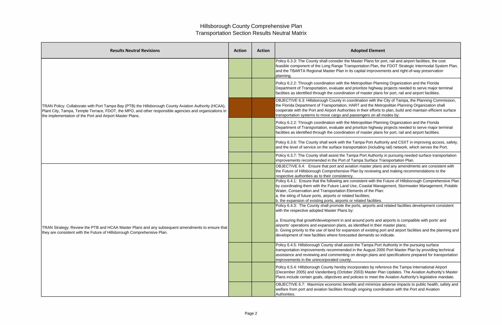
Results Neutral Revisions Action Action Adopted Element
Transportation Section Results Neutral MatrixHillsborough County Comprehensive Plan
Policy 6.3.3: The County shall consider the Master Plans for port, rail and airport facilities, the cost feasible component of the Long Range Transportation Plan, the FDOT Strategic Intermodal System Plan, and the TBARTA Regional Master Plan in its capital improvements and right-of-way preservation planning.
Policy 6.2.2: Through coordination with the Metropolitan Planning Organization and the Florida Department of Transportation, evaluate and prioritize highway projects needed to serve major terminal facilities as identified through the coordination of master plans for port, rail and airport facilities.
OBJECTIVE 6.3: Hillsborough County in coordination with the City of Tampa, the Planning Commission, the Florida Department of Transportation, HART and the Metropolitan Planning Organization shall cooperate with the Port and Airport Authorities in their efforts to plan, build and maintain efficient surface transportation systems to move cargo and passengers on all modes by:
Policy 6.2.2: Through coordination with the Metropolitan Planning Organization and the Florida Department of Transportation, evaluate and prioritize highway projects needed to serve major terminal facilities as identified through the coordination of master plans for port, rail and airport facilities.
Policy 6.3.6: The County shall work with the Tampa Port Authority and CSXT in improving access, safety, and the level of service on the surface transportation (including rail) network, which serves the Port.
Policy 6.3.7: The County shall assist the Tampa Port Authority in pursuing needed surface transportation improvements recommended in the Port of Tampa Surface Transportation Plan.
OBJECTIVE 6.4: Ensure that port and aviation master plans and any amendments are consistent with the Future of Hillsborough Comprehensive Plan by reviewing and making recommendations to the respective authorities as to their consistency.Policy 6.4.1: Ensure that the following are consistent with the Future of Hillsborough Comprehensive Plan by coordinating them with the Future Land Use, Coastal Management, Stormwater Management, Potable Water, Conservation and Transportation Elements of the Plan:a. the siting of future ports, airports or related facilities;b. the expansion of existing ports, airports or related facilities.Policy 6.4.3: The County shall promote the ports, airports and related facilities development consistent with the respective adopted Master Plans by:
a. Ensuring that growth/development in and around ports and airports is compatible with ports’ and airports’ operations and expansion plans, as identified in their master plans;b. Giving priority to the use of land for expansion of existing port and airport facilities and the planning and development of new facilities where forecasted demands so indicate.
Policy 6.4.5: Hillsborough County shall assist the Tampa Port Authority in the pursuing surface transportation improvements recommended in the August 2000 Port Master Plan by providing technical assistance and reviewing and commenting on design plans and specifications prepared for transportation improvements in the unincorporated county.
Policy 6.5.4: Hillsborough County hereby incorporates by reference the Tampa International Airport (December 2005) and Vandenberg (October 2003) Master Plan Updates. The Aviation Authority’s Master Plans include certain goals, objectives and policies to meet the Aviation Authority’s legislative mandate.
OBJECTIVE 6.7: Maximize economic benefits and minimize adverse impacts to public health, safety and welfare from port and aviation facilities through ongoing coordination with the Port and Aviation Authorities.
TRAN Policy: Collaborate with Port Tampa Bay (PTB) the Hillsborough County Aviation Authority (HCAA), Plant City, Tampa, Temple Terrace, FDOT, the MPO, and other responsible agencies and organizations in the implementation of the Port and Airport Master Plans.
TRAN Strategy: Review the PTB and HCAA Master Plans and any subsequent amendments to ensure that they are consistent with the Future of Hillsborough Comprehensive Plan.
Page 2

Results Neutral Revisions Action Action Adopted Element
Transportation Section Results Neutral MatrixHillsborough County Comprehensive Plan
TRAN Strategy: Collaborate with the MPO, FDOT, TPA, and HCAA, to complete an assessment of the need to provide or improve intermodal links, especially highway and public transit links to airports, seaports, and rail and trucking facilities.
OBJECTIVE 6.1: The County shall analyze the need to provide or improve intermodal links, especially highway and public transit links to airports, seaports, and rail and trucking facilities.
TRAN Strategy: Ensure that port, airport and related facility needs identified in their Master Plans and 5-year work programs are considered when prioritizing roadway and transit service improvements in the Capital Improvements Element (CIE).
Policy 6.3.1: Ensure that port, airport and related facilities needs identified in their Master Plans and 5-year work programs are considered when prioritizing roadway and transit service improvements in:
the County’s Capital Improvements or Transportation Improvement Program;the County’s Capital Improvements Element
TRAN Strategy: Provide the TPA and HCAA the opportunity to review and comment on Developments of Regional Impacts that affect access to the Port Activity Center or airports.
Policy 6.3.4: The County shall provide the Port and Aviation Authorities the opportunity to review and comment on Developments of Regional Impacts that affect the transportation or terminal access to the port and airports, and/or significantly impact land uses in their environs.Policy 6.3.2: The County shall ensure that public port and airport Master Plan activity levels are coordinated with key transportation and capital improvement planning years.Policy 6.3.5: The County shall seek ways to feasibly integrate the various modes of transportation (buses, fixed-guideway transit, ships, and bicycles) and noting the intermodal linkage alternatives for each expansion project
TRAN Policy : In collaboration with the MPO and FDOT, maintain and update the inventory (including map(s)) of the major commercial truck and railroad terminals within Hillsborough County documented in the Strategic Freight Plan.
Policy 6.3.8: The County and the Metropolitan Planning Organization shall update the inventory (including map(s)) of the major commercial truck and railroad terminals within Hillsborough County, as needed.
Policy 6.9.1: The County shall continue to coordinate its Truck Route Plan with the Truck Route Plan of the City of Tampa, the Port of Tampa surface Transportation Plan, and the Florida Department of Transportation’s Goods Movement Study.Policy 6.1.5: The County shall continue to monitor the Truck Route Plan to assess the need and suitability of various roadways in unincorporated Hillsborough County to provide for truck borne goods movement to and from intermodal facilities.
Policy 6.3.9: The County shall continue to enforce and update, if necessary, the current Truck Route Ordinance and maintain appropriate signage for the truck route to ensure compliance.
Policy 6.1.3: The County shall work with the Tampa Port Authority, Hillsborough County Aviation Authority, HART and other transportation agencies in the pursuit of efficient passenger connections between TIA and the cruise ship terminals on the Garrison Channel and regional transit.Policy 6.4.4: Each year, during the development of the Capital Improvement Program, Hillsborough County shall ask the Tampa Port Authority and CSXT to provide suggestions for improving access, safety, and the level of service on the surface transportation (including rail) network which serve the Port. These suggestions will be considered, along with other County needs, in allocating transportation improvement funds.
TRAN Policy : Coordinate The Truck Route Plan with the Truck Route Plan of the City of Tampa, the Port Tampa Bay Surface Transportation Plan, and the FDOT Strategic Freight Plan.
Page 3
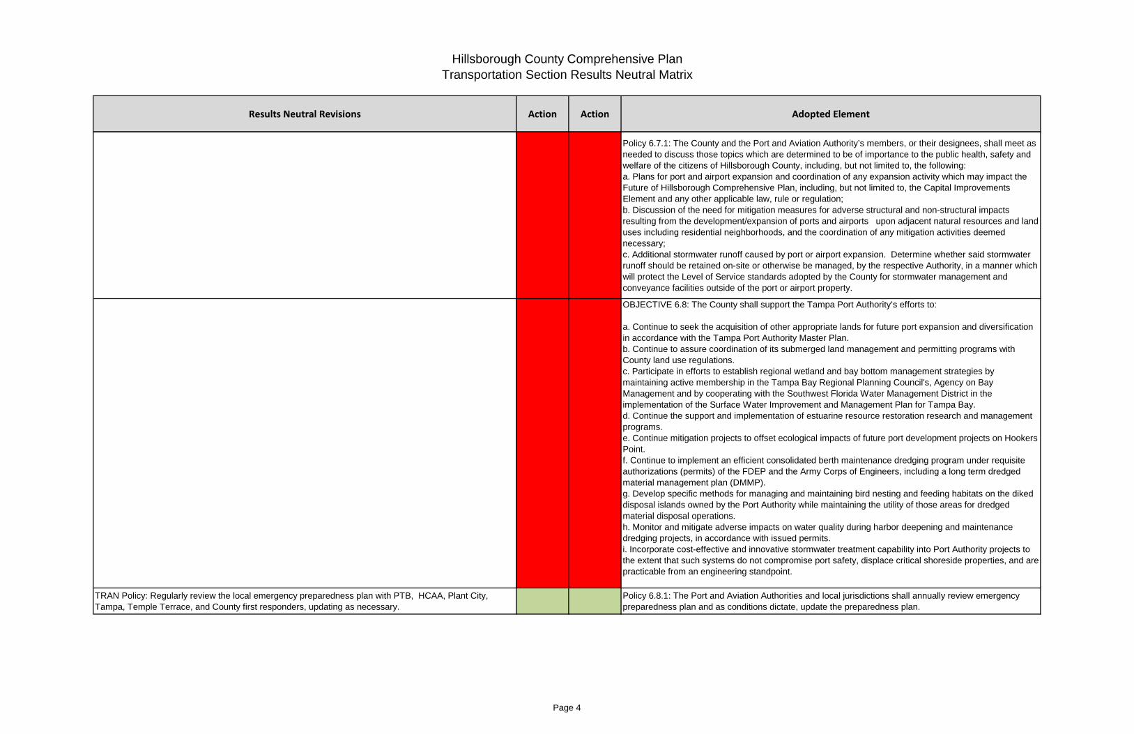
Results Neutral Revisions Action Action Adopted Element
Transportation Section Results Neutral MatrixHillsborough County Comprehensive Plan
Policy 6.7.1: The County and the Port and Aviation Authority’s members, or their designees, shall meet as needed to discuss those topics which are determined to be of importance to the public health, safety and welfare of the citizens of Hillsborough County, including, but not limited to, the following:a. Plans for port and airport expansion and coordination of any expansion activity which may impact the Future of Hillsborough Comprehensive Plan, including, but not limited to, the Capital Improvements Element and any other applicable law, rule or regulation;b. Discussion of the need for mitigation measures for adverse structural and non-structural impacts resulting from the development/expansion of ports and airports upon adjacent natural resources and land uses including residential neighborhoods, and the coordination of any mitigation activities deemed necessary;c. Additional stormwater runoff caused by port or airport expansion. Determine whether said stormwater runoff should be retained on-site or otherwise be managed, by the respective Authority, in a manner which will protect the Level of Service standards adopted by the County for stormwater management and conveyance facilities outside of the port or airport property.
OBJECTIVE 6.8: The County shall support the Tampa Port Authority’s efforts to:
a. Continue to seek the acquisition of other appropriate lands for future port expansion and diversification in accordance with the Tampa Port Authority Master Plan. b. Continue to assure coordination of its submerged land management and permitting programs with County land use regulations. c. Participate in efforts to establish regional wetland and bay bottom management strategies by maintaining active membership in the Tampa Bay Regional Planning Council's, Agency on Bay Management and by cooperating with the Southwest Florida Water Management District in the implementation of the Surface Water Improvement and Management Plan for Tampa Bay.d. Continue the support and implementation of estuarine resource restoration research and management programs. e. Continue mitigation projects to offset ecological impacts of future port development projects on Hookers Point. f. Continue to implement an efficient consolidated berth maintenance dredging program under requisite authorizations (permits) of the FDEP and the Army Corps of Engineers, including a long term dredged material management plan (DMMP).g. Develop specific methods for managing and maintaining bird nesting and feeding habitats on the diked disposal islands owned by the Port Authority while maintaining the utility of those areas for dredged material disposal operations. h. Monitor and mitigate adverse impacts on water quality during harbor deepening and maintenance dredging projects, in accordance with issued permits. i. Incorporate cost-effective and innovative stormwater treatment capability into Port Authority projects to the extent that such systems do not compromise port safety, displace critical shoreside properties, and are practicable from an engineering standpoint.
TRAN Policy: Regularly review the local emergency preparedness plan with PTB, HCAA, Plant City, Tampa, Temple Terrace, and County first responders, updating as necessary.
Policy 6.8.1: The Port and Aviation Authorities and local jurisdictions shall annually review emergency preparedness plan and as conditions dictate, update the preparedness plan.
Page 4

Results Neutral Revisions Action Action Adopted Element
Transportation Section Results Neutral MatrixHillsborough County Comprehensive Plan
OBJECTIVE 6.5: New development shall not adversely affect aircraft operating procedures as defined in the “Airport Zoning Regulations”.
Policy 6.5.1: The County shall coordinate land planning outside airport boundaries and shall protect airports from the development of incompatible uses (e.g., excessive structure height, and location, intense development, high-density development, noise sensitive uses, landfills, trees and retention ponds).
TRAN Strategy: Review existing zoning districts, determine their appropriateness and eliminate or replace them with the new or updated airport compatible districts, based upon updated master plans and airport operational needs sanctioned by the Federal Aviation Authority (FAA) and FDOT.
Policy 6.5.2: The County shall review existing airport zoning districts, determine their appropriateness and eliminate or replace them with the new or updated airport compatible districts, based upon updated master plans and airport operational needs sanctioned by the FAA/FDOT.
TRAN Strategy: Utilize the most current noise exposure study based upon the Airport Master Plans and Part 150 Noise Compatibility Studies to reassess the appropriate location of compatible and incompatible land uses.
Policy 6.5.3: The County shall utilize the most current noise exposure study based upon airport Master Plans and Part 150 Noise Compatibility Studies to reassess the appropriate location of compatible and incompatible land uses.
TRAN Policy: Coordinate with MacDill Air Force Base and/or HCAA representatives on the review of all proposed rezonings, plan amendments and development approvals which may encroach into navigable military or civilian air space or obstruct military or civilian aircraft operations. Conversely, MacDill or other airport changes that affect neighboring public airports will be subject to review.
OBJECTIVE 6.6: MacDill Air Force Base and/or Aviation Authority representatives shall be included in the review of all proposed rezonings, plan amendments and development approvals which may encroach into navigable military or civilian air space or obstruct military or civilian aircraft operations. Conversely, MacDill or other airport changes that affect neighboring public airports will be subject to review.
TRAN Policy : The County shall ensure that new development including landfills and communication towers and antennas will not obstruct military aircraft operations by penetrating navigable military air space including low level flight routes.
Policy 6.6.1: The County shall ensure that new development including landfills and communication towers and antennas will not obstruct military aircraft operations by penetrating navigable military air space including low level flight routes.
Policy 6.1.4: The County and HART shall ensure that rail transit terminals, whether for light rail transit, commuter, or high speed rail, are located so as to be conveniently served by the bus system.
OBJECTIVE 6.9: The County shall continue to coordinate with various public and private agencies to ensure efficient and effective goods movement within the County.
GOAL 6: Maximize connections between transportation modes.OBJECTIVE 6.2: Provide a highway system that assists in integrating other transportation systems including transit, rail, air and water.
Policy 6.2.1: Actively pursue development of adequate highway systems to support airport, rail, and port terminals.
TRA Objective 1.2: Ensure that transportation infrastructure has sufficient capacity to meet transportation demand
OBJECTIVE 1.1: Ensure that transportation infrastructure has sufficient capacity
TRAN Policy: Maintain the list of Regulated State/County Roadways.
TRAN Strategy: On an annual basis, complete an evaluation of the list of regulated roadways (Table XX in the CIE), and amend the CIE to reflect any additions/deletions.
Policy 1.4.5: By December 31st of each year, the County shall reevaluate the listing of Regulated Roadways (Table 2 and Table 4) and submit a proposed amendment to the County’s Comprehensive Plan to add and/or delete specific roadway segments as may be appropriate.
TRAN Policy: New development shall not adversely affect aircraft operating procedures as defined in the “Airport Zoning Regulations”.
Page 5

Results Neutral Revisions Action Action Adopted Element
Transportation Section Results Neutral MatrixHillsborough County Comprehensive Plan
Policy 1.1.3: The adopted peak hour/peak direction minimum level of service for all regulated State roads listed in Table 4 shall be as shown in Table 3 of this Element and as indicated in the adopted Capital Improvements Element. The Level of Service Standards on Strategic Intermodal System (SIS) facilities and facilities funded through the Transportation Regional Incentive Program (TRIP) shall be established by the Florida Department of Transportation.TRAN Policy 1.1.1: Using professionally accepted techniques, and through the Land Development Code and the County's development review process, continue to evaluate development impacts on the transportation system such that the transportation system capacity can support land development at or above the adopted minimum level of service standards.
The County shall maintain the minimum peak hour/peak direction level of service standard as set forth in Table 1 below, except for those roads specifically listed in the adopted Capital Improvements Element, on
all regulated County roads listed in Table 2.
Policy 1.4.3: The County shall utilize the Florida Department of Transportation’s Generalized Peak Hour Peak Direction Level of Service Maximum Service Volumes or other approved methodology to determine highway capacity and level of service.
TRAN Policy : State and County roadways that cannot be widened further due to neighborhood or business impacts, adopted community plans, policy, environmental, or right-of-way constraints, have been identified and designated as constrained. The Constrained Roadway List can be found in Table XX of the CIE.TRAN Strategy: Prior to each update of the MPO Long Range Transportation Plan (LRTP), reevaluate the listing of Constrained Roadways to maintain a fair balance between community preservation and growing traffic congestion. TRAN Strategy: With each update of the CIP, prioritize the funding parallel facilities to Constrained Roadways, provided that such action will not hinder the achievement of other goals, objectives, and policies of the Comprehensive Plan. Where this action impacts State roads, it will be coordinated with FDOT.
Policy 1.1.7: The County shall give priority to funding parallel facilities which will relieve traffic on "constrained" facilities, provided that such action will not hinder the achievement of other goals, objectives, and policies of this Plan. Where this action impacts State roads, such action will be coordinated with the Florida Department of Transportation.Policy 1.1.2: No development orders will be issued that will reduce any County road listed in Table 2 below
the peak hour/peak direction level of service standard indicated in Table 1 and in the Capital Improvements Element, except where the development is vested under law or provides adequate mitigation pursuant to State and County regulations, including but not limited to, proportionate fair share mitigation, or off-site transportation improvements as may be considered appropriate by the County. (Administrative & Stakeholder Input)Policy 1.1.4: No development orders will be issued that cause the Level of Service standard shown in
Table 3 to be exceeded on a regulated state road shown in Table 4, except where the development is vested under law.
Policy 1.1.6: The County shall provide funding, as provided for in the County's Transportation Impact Fee ordinances, to assist the Florida Department of Transportation with road projects within the County.
Policy 1.1.10: The level of service standards contained in this amendment shall become effective and be implemented at the time that implementation regulations are adopted by the County or one (1) year from the date of adoption of this amendment, whichever occurs first.
Policy 1.1.8: Certain State and County roadways that cannot be widened further due to neighborhood or business impacts, adopted community plans, policy, environmental, or right-of-way constraints, have been identified and have been designated as constrained. The identified roadways are shown in the following tables.
TRAN Policy : The adopted peak hour/peak direction minimum level of service (LOS) for all regulated State and County roads shall be listed in Table XX in the CIE. The Level of Service Standards on Strategic Intermodal System (SIS) facilities shall be established by the Florida Department of Transportation.
Page 6

Results Neutral Revisions Action Action Adopted Element
Transportation Section Results Neutral MatrixHillsborough County Comprehensive Plan
TRAN Policy: Maintain the listing of deficient roads within the transportation system. Deficient roadways, found in Table XX of the CIE, are those regulated roadways that, based on the Level of Service Report, exceed the adopted LOS standards.
TRAN Strategy: Prepare an analysis and report of the vehicle miles of travel (VMT) on deficient roadways. The purpose of this analysis and report is to establish a baseline for measuring progress in reducing VMT on deficient roadways.
Policy 1.1.14: Hillsborough County shall prepare an analysis and report of the vehicle miles of travel on deficient roadways. Deficient roadways shall be those roadways that, based on the latest available traffic counts, exceed the level of service standards adopted in the Capital Improvements and Transportation Elements of the Hillsborough County Comprehensive Plan. The regulated roadways included in the analysis are the regulated roadways listed in the Capital Improvements and Transportation Elements of the Hillsborough County Comprehensive Plan. The purpose of this analysis and report is to establish a baseline for measuring progress in reducing the vehicle miles of travel on deficient regulated roadways.
TRAN Strategy : Develop strategies to reduce automobile travel on deficient roadways. The strategies shall include specific timeframes and measurable goals for reducing the vehicle miles of travel on deficient regulated roadways.
Policy 1.1.15: Within one year of the effective date of this policy, Hillsborough County shall develop a strategy for addressing and reducing the percentage of total travel on deficient roadways. This can be accomplished by building new roads, widening existing roads, connecting gaps in the roadway network, significant intersection improvements, improved transit, or land use considerations. The strategy shall include specific timeframes and measurable goals for reducing the vehicle miles of travel on deficient regulated roadways.OBJECTIVE 1.6: Continue to increase the capacity of the transportation system by proceeding with construction of the projects outlined in the CIE. Policy 1.6.1: Reduce existing roadway deficiencies by completing the road improvement projects listed in the Capital Improvements Element, and thereafter provide transportation infrastructure consistent with the policies and standards of this element and the CIE.
TRAN Policy: Maintain the Concurrency Management System to ensure that transportation facilities needed to support development are in place concurrent with development or that other mitigation strategies have been employed.
OBJECTIVE 1.4: The County shall continue to maintain and implement a Concurrency Management System which ensures that transportation facilities and services needed to support development, consistent with the standards adopted in the Transportation Element and the Capital Improvement Element, are available concurrent with the impacts of such development.
TRAN Strategy: On a annual basis, update the Level of Service Report to include existing and anticipated apacities and levels of service and publish it for public review and use.
Policy 1.4.4: The County shall provide the public, upon request, information on existing and anticipated capacities and levels of service.
TRAN Policy: Use proportionate share procedures, to help maintain the minimum level of service standard on all regulated County and State roads as set forth in Table XX in the CIE except for those roads
specifically listed as deficient or constrained in Table XX in the CIE.
TRAN Policy 1.1.1: Using professionally accepted techniques, and through the Land Development Code and the County's development review process, continue to evaluate development impacts on the transportation system such that the transportation system capacity can support land development at or above the adopted minimum level of service standards.
The County shall maintain the minimum peak hour/peak direction level of service standard as set forth in Table 1 below, except for those roads specifically listed in the adopted Capital Improvements Element, on all regulated County roads listed in Table 2.
Policy 1.4.1: For the purpose of issuing Development Orders, the County shall maintain the transportation level of service that is consistent with the standards adopted in the Transportation Element and the Capital Improvement Element.Policy 1.4.2: Within six months of the effective date of this policy, Hillsborough County shall amend its Transportation Concurrency Management Regulations to be consistent with the latest provisions of Section 163.3180 F S.Policy 1.4.6: The County shall provide no de minimis allowance if such allowance would cause the adopted level of service standard of any designated hurricane evacuation route to be exceeded, except that the County shall allow the development of a single-family home on an existing lot on a designated hurricane evacuation route if denial of the single-family home would constitute a taking.Policy 1.4.8: Within one year of the effective date of this policy, Hillsborough County shall reevaluate the size of a development’s “areas of influence” used during concurrency review, in order to improve the consideration of downstream and cumulative impacts.
Page 7

Results Neutral Revisions Action Action Adopted Element
Transportation Section Results Neutral MatrixHillsborough County Comprehensive Plan
Policy 6.1.1: Through its Concurrency Management System, the County will monitor and evaluate the operating level of service of transportation facilities in the unincorporated County leading to airports, seaports, rail and trucking facilities.Policy 6.1.2: During the first quarter of each calendar year, the County shall provide traffic count and Level of Service data to the MPO for use in the prioritization of intermodal transportation facilities to ensure that adequate funding consideration for the planning and programming of these facilities is being given as part of the MPO's Transportation Improvement Program.
TRAN Policy - When new development constructs new public facilities, they may be sized to provide additional capacity for future development which must use the same facility. Develop an appropriate repayment mechanism to compensate for the additional costs of the improvements.
Policy 1.6.3: When new development chooses to construct public facilities, these facilities may be “oversized”, if warranted and feasible, to provide additional capacity for future development which must use the same facility. An appropriate repayment mechanism may be employed by the County to compensate for the additional costs of oversized improvements.
TRAN Policy: Define districts where multi-modal strategies will be used to improve mobility, focusing on areas where infill development or redevelopment is desired and roadways are deficient, constrained or not likely to be widened due to social or environmental factors. .TRAN Strategy: Implement multi-modal level of service standards (MMLOS) in designated districts, and create mechanisms for private sector participation in the provision of transit services, pedestrian, bicycle, and transit facilities, street connectivity, traffic calming, and other multi-modal transportation solutions, consistent with FDOT Quality Level of Service Handbook and Model Regulations and Plan Amendments for Multimodal Transportation Districts (MMTD) .
Policy 1.6.2: New development shall provide land, fees, services, or facilities (per adopted County Land Development Codes) to mitigate the development’s impact on the State and County transportation systems.
TRAN Policy: Allow for flexibility in using development impact fees for multimodal improvements.
TRAN Strategy : Reevaluate the impact fee calculation methodology and ordinance to allow credits for development contributions to multimodal transportation system improvements
Policy 1.4.9 By the end of 2010, Hillsborough County will reevaluate its impact fee calculation methodology and ordinance to consider allowing credits for development contributions to multimodal transportation system improvements, and update its proportionate fair-share ordinance as needed to reflect any changes in multimodal level of service standards.
TRAN Policy: Incorporate Transportation System Management (TSM) strategies and Transportation Demand Management (TDM) strategies in order to improve operational management and better utilize existing and new roadways.
GOAL 4: Incorporate Transportation System Management Strategies and Transportation Demand Management Strategies in order to improve operational management and better utilize existing and new roadways.OBJECTIVE 4.1: The County shall continue to optimize existing signalized intersections and implement the policies identified below:Policy 4.1.1: The County will, in conjunction with FDOT, update or replace existing traffic control devices as needed to ensure that the most efficient equipment available is used.Policy 4.1.2: The County shall continue an ongoing program to update and implement traffic signal timing to correspond to current traffic flow.Policy 4.1.3: The County will establish an ongoing program to evaluate traffic signals to determine if improvements such as interconnected pre-timed signals, traffic actuated signals, interconnected actively managed timing plans or master controls can be utilized to improve traffic flow.OBJECTIVE 4.2: The County will continue to implement an arterial surveillance and management program to achieve better arterial operations through incident detection and follow up action, improvements in signalization and timing and to more fully integrate the freeway and arterial management programs.Policy 4.2.1: The County will use its surveillance and management program to reduce vehicular travel time along travel corridors and increase street/intersection capacity.
Policy 1.1.16: Within two years of the effective date of this policy, Hillsborough County shall define districts where multi-modal strategies will be used to improve mobility, focusing on areas where infill development or redevelopment is desired and roadways are deficient, constrained or not likely to be widened due to social or environmental factors. The county will implement multi-modal level of service standards in these districts, and create mechanisms for private sector participation in the provision of transit services, pedestrian, bicycle, and transit facilities, street connectivity, traffic calming, and other multi-modal transportation solutions, consistent with FDOT Quality Level of Service Handbook and Model Regulations and Plan Amendments for Multimodal Transportation Districts, and in consultation with FDOT regarding
TRAN Strategy: Develop and implement a program to optimize existing signalized intersections to maximize traffic flow
TRAN Strategy: Implement an arterial surveillance and management program to achieve improved arterial operations.
Page 8

Results Neutral Revisions Action Action Adopted Element
Transportation Section Results Neutral MatrixHillsborough County Comprehensive Plan
OBJECTIVE 4.3: On an ongoing basis, the County will evaluate each intersection in the unincorporated County to determine if traffic control devices and strategies including turn prohibitions can be used to improve the flow of vehicles and the safe passage of pedestrians.
Policy 4.3.1: The County will evaluate, and where feasible will reduce the number of conflict points among vehicular movements and control the relative speed of vehicles both entering and leaving an intersection.
TRAN Strategy: Conduct turn prohibition studies for major intersections to determine if additional turning movements should be restricted in order to improve safety for cars, bicyclists/pedestrians and maintain traffic flow.
Policy 4.3.2: The County will conduct turn prohibition studies for major intersections which will consider elements such as the amount of congestion and delay caused by turning movements, the number of collisions involving vehicles making the turning movement and the availability of suitable alternative travel paths if turns are restricted.
TRAN Strategy: Continue to support public/private partnerships such as Transportation Management Organizations (TMOs) to promote TDM strategies and programs in regional activity centers and other densely developed areas.
Policy 4.4.3: The County shall continue to support public/private partnerships such as Transportation Management Organizations (TMOs) to promote TDM strategies and programs in regional activity centers and other densely developed areas.
TRAN Policy : Adopt Land Development Code standards for the application of TDM measures in new development proposals. The standards may consider the size and nature of the uses within the development as well as other characteristics that would make the development appropriate for implementation of TDM measures.
Policy 4.4.2: The County, in consultation with Tampa Bay Area Regional Transportation Authority (TBARTA), shall adopt in its Land Development Code, standards for the application of Transportation Demand Management measures in new development proposals. The standards may consider the size and nature of the uses within the development as well as other characteristics that would make the development appropriate for implementation of Transportation Demand Management measures.
Policy 4.4.4: The County will continue to include Tampa Bay Area Regional Transportation Authority (TBARTA) in the development review process.
Policy 4.4.5: In development review, the County will consider trip generation rate reductions in exchange for a documented program of trip reduction measures, to include: an agreed-on set of TDM measures to be implemented; record-keeping and annual reporting by the implementer; and penalties for failure to implement.Policy 4.4.6: The County will inform other transportation agencies of its policy that all limited-access highways constructed or improved within the County shall be evaluated to determine if HOV/HOT lanes should be included in the improvement.
OBJECTIVE 4.5: Within one year of the effective date of this amendment, and through the Policies listed below, the County will implement a parking management program, allowing for parking reductions in activity centers, multi-modal districts, overlay districts and redevelopment areas, as appropriate.
Policy 4.5.2: Where appropriate, the County will utilize inter-parcel and mixed-use shared parking to increase the development potential of land and to promote walking and transit use, and encourage connections between adjacent parking lots, for both vehicles and pedestrians.
Policy 4.5.5: The parking management program will be sensitive to the economic climate of the regional activity center being served.
Policy 4.5.1: Through incentives or disincentives, the parking management program will reduce the amount of parking available to single occupant vehicles and encourage the use of transit and car or van pooling. If appropriate, the incentives may take the form of transportation impact fee credits.Policy 4.5.3: Within one year of the effective date of this amendment, the County shall amend its Land Development Code to require, where appropriate, the provision of preferential parking for carpool, vanpool and alternative fuel vehicles in office developments and employment centers. The Code shall specify the minimum size of the development where this policy will apply and the characteristics of the required preferential parking.
TRAN Strategy: Implement an evaluation program for intersections to identify strategies that will improve flow of vehicles and safe passage of pedestrians.
TRAN Strategy: Assess and expand the comprehensive program for County employees to promote the increased use of alternative transportation and the implementation of alternative work sites or alternative
TRAN Strategy: Develop and implement a comprehensive parking management program, allowing for parking reductions in activity centers, MMTDs, overlay districts, and other designated areas where infill and redevelopment are encouraged.
Policy 4.4.1: Continue to support ridesharing and transit usage by encouraging County employees to enroll in the ridesharing program of the Tampa Bay Area Regional Transportation Authority (TBARTA), by
Page 9

Results Neutral Revisions Action Action Adopted Element
Transportation Section Results Neutral MatrixHillsborough County Comprehensive Plan
Policy 4.5.4: Allow for parking reductions when bus stop facilities and appropriate access to those facilities are designed into private developments.
Page 10

Results Neutral Revisions Action Action Adopted Element
Transportation Section Results Neutral MatrixHillsborough County Comprehensive Plan
TRAN Objective 1.3: Improve transportation system safety for all modes by reducing the countywide accident rate.
OBJECTIVE 1.3: Improve transportation system safety for all modes by reducing the countywide accident rate by at least 5%. Transportation safety performance shall be assessed prior to the adoption of the MPO’s Long Range Transportation Plan Update.
TRAN Policy: Prioritize safety improvements on high crash corridors on regulated State and County roadwaysTRAN Strategy: Annually complete a summary report for high crash locations on regulated State and County roadways.
Policy 1.3.1: Continue to monitor yearly crashes for high crash locations on State and County roads.
TRAN Policy: Focus investment to implement safety projects in the MPO's crash mitgation and congestion management plans (CM/CMP)
Policy 1.3.3: Ensure transportation system design and construction is consistent with adopted County or State design standards.Policy 1.3.4: Maintain clear signage, consistent with the Manual of Uniform Traffic Control Devices, on all roads on the County highway network and clearly post and maintain signage of designated primary evacuation routes.
TRAN Strategy: Program capital improvements for high crash locations where better physical design or improved traffic controls can be expected to cause a significant reduction in the number of crashes.
Policy 1.3.2: Continue to program improvements for high motor vehicle, bicycle and pedestrian crash locations where better physical design or improved traffic controls can be expected to cause a significant reduction in the number of crashes.OBJECTIVE 1.2: Maintain existing transportation infrastructure to ensure safe operating conditions, and to avoid costly reconstruction or replacement.
TRAN Policy : Monitor and review the maintenance needs of transportation infrastructure in order to ensure safe operating conditions, and to avoid costly reconstruction or replacement.
Policy 1.2.1: Continue the existing monitoring program to review the maintenance needs of transportation infrastructure in order to ensure safe operating conditions, and to avoid costly reconstruction or replacement.
TRAN Policy: Prioritize non-impact fee transportation improvement funds to ensure that ongoing maintenance needs are balanced with those that increase capacity.
Policy 1.2.2: Budgeting of non-impact fee transportation improvement funds shall be considered in the following priority:
a. Appropriate level of funding for maintenance, reconstruction, or safety projects on existing facilities. The County should consider coordinating with the MPO to prioritize transportation maintenance and improvements for critical evacuation routesb. Funds for capacity expansion or improvement of existing facilities to serve existing development. c. Funds for capacity expansion of existing facilities or construction of new facilities to serve new development.
TRA Objective 1.3: Develop a safe, convenient, and efficient transit system. GOAL 2: Develop a safe, convenient, and efficient transit system for the transit dependent, as well as a convenient alternative for persons who choose not to drive their own vehicle.
TRAN Policy: Collaborate with HART to develop and implement measures and standards to increase the overall ridership of the transit system.
OBJECTIVE 2.1: Continue to implement measures to increase the overall ridership of transit systems.
TRAN Strategy: Coordinate with HART to complete an analysis of transit level of service with each major update of the Transit Development Plan (TDP) ransit level of service analysis with each update of theminimum transit level of service standard for areas within the Urban Service Area.
Policy 2.1.1: The minimum acceptable transit level of service standard shall be that at least 25% of the Urban Services Area shall be served by transit level of service D or better.
TRAN Strategy Coordinate with HART to update information on route locations, span of service hours and headways by route.
Policy 2.1.2: Request that HART furnish information to the Planning Commission on route locations, span of service hours and headways by route, when there are service changes or at least annually.
TRAN Strategy: Complete a report with recommendations on how to improve transit service to help meet the needs of activity centers and areas designated for infill and redevelopment in the Future Land Use Element.
Policy 2.1.3: When the transit level of service does not meet the minimum standard, or when the County identifies unmet service needs to growing activity centers designated in the Future Land Use Element or other major destinations, the County shall coordinate with HART regarding the provision of additional service.
Page 11

Results Neutral Revisions Action Action Adopted Element
Transportation Section Results Neutral MatrixHillsborough County Comprehensive Plan
TRAN Strategy. Create incentives that support transit usage, such as requiring transit amenities and facilities in development projects, and promoting pedestrian-friendly, disability-friendly environments in new development projects.
Policy 2.1.4: With respect to development regulation, continue to create incentives that support transit usage, such as requiring transit amenities and facilities in development projects, and promoting pedestrian-friendly, transit-friendly, disability-friendly environments in new development projects.
TRAN Policy: Improve public realm and private development design to encourage increased transit use.
TRAN Strategy: Develop a program for prioritizing design improvements to constrained and deficien roads to support the prioritization of transit.
Policy 2.1.5: With respect to the design of roads and rights of way, establish an on-going program to support transit prioritization treatments in constrained and congested corridors, with a special focus on designated Transit Emphasis Corridors. Incentives that support transit could include: dedicated lanes or transit/HOV use of shoulders on rural section highways; metered freeway ramps with "slip lanes" for transit/HOV; bus bays or pull-outs at key stops; traffic signal preemption or queue jumpers for buses to reduce delays at signalized intersections, and intersections designed specifically to accommodate wide-turning buses.
TRAN Strategy: Create development incentives to encourage higher land-use densities and intensities along Transit Emphasis Local-Service Corridors, and around the express stops of Transit Emphasis Express-Service Corridors, as described in the Future Land Use Element.
Policy 2.1.6: Offer incentives for higher land-use densities and intensities along Transit Emphasis Local-Service Corridors, and around the express stops of Transit Emphasis Express-Service Corridors, as described in the Future Land Use Element.
TRAN Policy : Collaborate with HART in the development review process to identify opportunities for design and facility improvements to encourage transit use.
Policy 2.1.7: Continue to include HART in the development review process.
OBJECTIVE 2.3: Improve transit services and existing programs to meet the specialized needs of the transit dependent and transportation disadvantaged populations.Policy 2.3.1: Continue to work with the designated Community Transportation Coordinator to assist in the provision of transportation services to the transportation disadvantaged.
Policy 2.3.2: Comply with Chapter 427, Florida Statutes, by coordinating services to the transportation disadvantaged among County agencies and non-profit organizations in Hillsborough County.
Policy 2.3.4: Continue to comply with the Americans with Disabilities Act in the construction of sidewalks, crosswalks, wheelchair ramps, and improved access to bus stops on all County-maintained facilities.
TRAN Strategy: : In consultation with affected stakeholders, develop a plan and strategies to minimize the cost of providing specialized transportation to new facilities located outside the HART service area that have a high percent of clients who are transportation disadvantaged (i.e. new nursing homes, group homes, and Adult Congregate Living Facilities).
Policy 2.3.5: By December 31, 2008 and in consultation with affected stakeholders, develop strategies to minimize the county’s cost of providing specialized transportation to new facilities locating outside the HART service area that have a high percent of clients who are transportation disadvantaged, such as new nursing homes, group homes, and Adult Congregate Living Facilities. Cost mitigation strategies could include incentives to locate within the HART service area or disincentives to locate outside it, such as requiring contribution to transportation services through fair-share payments or in-kind provision of services. Incentives should be designed to maximize client mobility options while controlling cost growth.
TRA Objective: Enhance and expand the transportation system for bicyclists and pedestrians and integrate them with other transportation modes.
GOAL 3: Provide a county‐wide bikeway and pedestrian system that is integrated with other transportation modes.
TRAN Policy: Improve transit services and existing programs to meet the specialized needs of the transit dependent and transportation disadvantaged populations.
Page 12

Results Neutral Revisions Action Action Adopted Element
Transportation Section Results Neutral MatrixHillsborough County Comprehensive Plan
OBJECTIVE 3.2: The County shall adopt policies and design standards that provide safe, convenient and enjoyable bicycle and pedestrian facilities to increase the use of cycling and walking for all travel purposes.
Policy 3.2.1: Continue to apply existing standards to include bicycle lanes and sidewalks as part of the typical section for roadway designs, where appropriate.
Policy 3.2.2: Revise existing standards to include bicycle-sensitive traffic control devices, crosswalks, safety islands, lighting and pedestrian activated push-button signals in intersection improvement projects and new construction where appropriate.Policy 3.2.3: Continue to mark and sign existing and new bikeways, according to AASHTO guidelines, to indicate their intended use (i.e. bike lanes should be marked with bicycle symbol, directional arrow, "BIKE ONLY", and have corresponding roadside signage).
OBJECTIVE 3.1: Include appropriate bicycle facilities, trails, and sidewalks in all planning, design, construction and maintenance activities related to transportation.
Policy 3.1.2: Maintain sidewalks, on-road bikeways and trails to keep them clean and in good repair to accommodate adequate and safe bicycling and walking.
Policy 3.1.6: Pursue improvements to the existing roadways that require little capital outlay (i.e., signage, re-striping, shared-use lanes, and appropriate traffic control measures), but will increase the safety of bicyclists and pedestrians.
Policy 3.1.7: Where appropriate provide bike lockers and/or properly designed and constructed bicycle racks, benches, and/or canopies/shading, at County facilities.
Policy 3.2.4: By December 31, 2009, the County shall adopt standards that, where appropriate, will require new commercial developments to provide secure bicycle lock-up facilities, pedestrian paths traversing the parking lots connecting to the public sidewalk, and provide bus stop shelters with ADA compliant landing pads, shade trees and street furniture.Policy 3.1.3: Enforce regulations requiring private developers to include bicycle facilities/trails and sidewalks in private developments to promote bicycle/pedestrian connections, in accordance with adopted policies and standards.
Policy 3.2.6: By December 31, 2009, the County shall provide incentives to include amenities such as secure bicycle storage, weather protection, showers and lockers in private developments.
Policy 3.1.1: Identify staff liaisons from the appropriate County Departments to coordinate with local agencies on development and improvement of facilities in Hillsborough County and serve on the MPO's Bicycle/Pedestrian Advisory Committee.Policy 3.2.5: Work with the BPAC and the MPO's Bicycle/Pedestrian Program Coordinator to identify and address bicycle and pedestrian safety problems, especially on roadways with high levels of current or potential bicycle and pedestrian usage.Policy 3.2.8: Maintain a strong well-coordinated relationship between transportation and greenways planning and design by working closely with the Metropolitan Planning Organization’s Bicycle/Pedestrian Advisory Committee to achieve the objectives of the Hillsborough Greenways Master Plan, last updated in June 2007.
Policy 3.1.5: Seek opportunities to construct multi-use facilities adjacent or parallel to limited access highways, along drainage channels, shorelines and various utility and railroad rights-of-way.
Policy 3.1.4: Continue to provide at least 1% of the annual transportation capital improvement budget to provide bicycle and pedestrian facilities.
TRAN Policy: Develop and adopt policies and design standards for roadways and other facilities that provide safe and conveienent bicycle and pedestrian facilities to increase the use of cycling and walking for all travel purposes.
TRAN Strategy: Conduct a review of existing roadway design standards in the Transportation Technical Manual and development recommendations to improve safety and usability.
TRAN Strategy: Adopt recommended improvements into the Transportation Technical Manual and the Land Development Code
TRAN Policy: Ensure that new development provides adequate bicycle and pedestrian facilities on site
TRAN Strategy: Develop and implement standards and incentives within the Land Development Code that at a minimum, require new commercial developments to provide secure bicycle parking, pedestrian paths traversing the parking lots connecting to the public sidewalk, and provide bus stop shelters with ADA compliant landing pads, shade trees and street furniture.
TRAN Policy: Coordinate agency initiatives related to improving safety for bicyclists and pedestrians. .
TRAN Policy : Develop a program for implementing a comprehensive bicycle/pedestrian system.
TRAN Strategy: Complete a comprehensive update to the Greenways Master Plan
TRAN Strategy: Prioritize funding from the annual capital improvement budget to implement projects and initiatives identified within the Greenways Master Plan.
Page 13

Results Neutral Revisions Action Action Adopted Element
Transportation Section Results Neutral MatrixHillsborough County Comprehensive Plan
OBJECTIVE 3.3: Assist in implementing the bicycle and pedestrian safety education programs to improve bike-handling skills, traffic skills, and observance of bicycle and pedestrian traffic laws, and promote safety for non-motorized travelers of all ages particularly adjacent and contiguous to schools
Policy 3.3.1: Develop and provide bicycle and pedestrian safety information on the proper use of bicycle helmets, lights, reflectors, and proper street crossings by targeting pedestrian groups including elderly and children.Policy 3.3.2: Request that the Hillsborough County Sheriff Department properly cite violators of bicycle and pedestrian-related traffic laws, to include helmet and bicycle light usage on crash reports, to distribute cycling and walking safety information; and to provide bicycle safety inspections, at all bicycle auctions and rodeos.Policy 3.3.4: Encourage local law enforcement agencies to monitor and use the bicycle violation/warning brochure, available from the American Automobile Association, Traffic Safety Division and to patrol bike rack areas as part of their crime prevention efforts.Policy 3.3.3: Support measures to reduce motorists' violation of traffic safety laws, especially those laws enacted by the State of Florida, which define bicyclists' rights to share the roadway, and increased enforcement of these laws.Policy 3.2.7: Work with the BPAC, TMOs and other agencies to develop and implement a public information program to promote bicycling and walking in conjunction with other modes of transportation, including bus, train, air travel, and van/car pooling.
TRA Goal 2: Provide a roadway network that supports desired land use while protecting community integrity and the natural environment
GOAL 5: Provide an effective roadway network and protect the community and the natural environment.
TRA Objective 2.1: Improve system design and to reduce neighborhood and environmental impacts.
TRAN Policy: Continue to utilize appropriate traffic control and traffic calming devices and appropriate roadway design principles to minimize neighborhood traffic intrusion and to protect neighborhoods from adverse impacts of through traffic.TRAN Strategy: Conduct neighborhood traffic studies to analyze traffic volumes, accident rates, operational speed, and traffic characteristics in a continuing effort to protect the quality of life of residential neighborhoods.
Policy 5.2.1: Continue to conduct neighborhood traffic studies to analyze traffic volumes, accident rates, operational speed, and traffic characteristics in a continuing effort to protect the quality of life of Hillsborough County's residential neighborhoods.
TRAN Strategy: Develop a program for implementing traffic calming measures to protect residential neighborhoods by minimizing traffic intrusion on neighborhood streets. Such measures may include but are not limited to: speed humps and speed tables, raised intersections, neck downs and curb extensions, horizontal traffic diverters such as chicanes, diverter islands, narrowed or striped-down travel lanes, street centerline demarcation, providing for on-street parking, signage marking entrances to residential areas, enforcement of speeding and other moving violations, and other measures as appropriate.
Policy 5.2.2: Implement traffic control measures, within acceptable traffic engineering practices, to protect residential neighborhoods by minimizing traffic intrusion on neighborhood streets. Such measures may include but are not limited to: speed humps and speed tables, raised intersections, neck downs and curb extensions, horizontal traffic diverters such as chicanes, diverter islands, narrowed or striped-down travel lanes, street centerline demarcation, providing for on-street parking, signage marking entrances to residential areas, enforcement of speeding and other moving violations, and other measures as appropriate.
OBJECTIVE 5.2: Continue to utilize appropriate traffic control and traffic calming devices and appropriate roadway design principles to minimize neighborhood traffic intrusion and to protect neighborhoods from
adverse impacts of through traffic.
TRAN Policy: Collaborate with the MPO, FDOT, Hillsborough County Sheriffs Department and other related agencies to develop a comprehensive bicycle and pedestrian safety education program to improve bike-handling skills, traffic skills, and observance of bicycle and pedestrian traffic laws, and promote safety for non-motorized travelers of all ages particularly adjacent and contiguous to schools
Page 14

Results Neutral Revisions Action Action Adopted Element
Transportation Section Results Neutral MatrixHillsborough County Comprehensive Plan
Policy 5.2.3: Within one year of the effective date of this policy, establish standards for the design of new local residential streets, and collectors serving residential areas, to limit speeding. Required and/or incentivized elements may include, as appropriate within acceptable traffic engineering practices, reduced lane widths, curved roads to limit design speed, neck downs and curb extensions, diverter islands, visual narrowing through tree plantings, signed and marked pedestrian crossings, street centerline demarcation, textured or colored pavement, siting buildings near the street, and other traffic calming strategies in general use.
Policy 5.1.5: The scale and character of surrounding land use and the livable roadway concepts should be considered in the design and construction of new roadways and the widening of existing roadways.
Policy 5.1.8: Encourage the concept of maintaining the character and viability of urban, suburban and rural villages through site planning and livable human scale roadway design to minimize through traffic and to discourage the use of automobiles for short trips by encouraging and enabling other modes of transportation like transit, walking, and bicycling.
TRAN Strategy: Regularly review and update the truck route ordinance and associated map to ensure neighborhood traffic concerns associated with truck traffic are addressed.
Policy 5.2.4: Continue to review and update the truck route ordinance and associated map to ensure neighborhood traffic concerns associated with truck traffic are addressed.
TRAN Strategy: Conduct corridor studies prior to any right of way acquisition for new road construction, major road widening, or major corridor improvements to assess the impacts to adjacent areas and provide appropriate, cost-effective mitigation mechanisms for adverse impacts. As part of the corridor study, solicit input from adjacent property owners and neighborhoods affected by the road.
Policy 5.1.1: All governmental entities responsible for proposed new road construction, major road widening or other major corridor improvements shall conduct a corridor study prior to any rights-of-way acquisition to assess the impacts to adjacent areas and provide appropriate, cost-effective mitigation mechanisms for adverse impacts. As part of the corridor study, solicit input from adjacent property owners and neighborhoods affected by the road.Policy 5.2.5: Hillsborough County shall encourage the Hillsborough County Sheriff’s Department and the Florida Highway Patrol to strictly enforce traffic speed limits and other moving violations on both major roadways and residential streets.
TRAN Policy: Hillsborough County shall work with the State to evaluate the FDOT criteria for setting speed limits. Within urban and developed rural areas, the criteria that apply to all public roadways should include the consideration of the character of surrounding land uses, existing and potential pedestrian and bicycle traffic and recent accident history.
Policy 5.1.9: Hillsborough County shall work with the State to evaluate the Florida Department of Transportation criteria for setting speed limits. Within urban and developed rural areas, the criteria that apply to all public roadways should include the consideration of the character of surrounding land uses, existing and potential pedestrian and bicycle traffic and recent accident history.
TRAN Policy: Transportation and other mobility improvements shall be coordinated with public resource agencies to avoid or minimize adverse impacts on publicly owned lands, wetlands, significant wildlife habitats, and other environmentally sensitive lands except in the case of overriding public interest.
Policy 5.1.2: New roads shall be routed so as to avoid traversing publicly owned natural preserves, parks and recreation areas and areas identified as significant or essential wildlife habitat, wildlife corridors, or greenways, unless there is no feasible and prudent alternative and the roadway is designed to incorporate features recommended by the Florida Game and Freshwater Fish Commission for the safe passage of wildlife. Improvements to existing roadways (i.e., reconstruction or widening) within these areas shall also incorporate design features for the safe passage of wildlife, if appropriate.
Policy 5.1.3: All road construction projects shall meet or exceed the adopted state or local minimum requirements for stormwater retention and treatment.Policy 5.1.4: Transportation improvements shall be designed to eliminate or mitigate adverse impacts on wetlands and other environmentally sensitive lands.Policy 5.1.6: The County shall consolidate, and shall encourage other public and private entities to consolidate, power, gas, water and wastewater utilities within the same road rights-of-way whenever possible to reduce the overall adverse impacts to the environment.
TRAN Policy : Coordinate with the Tampa Regional Office of the Division of Historical Resources, Florida Department of State and other interested groups to provide for the consideration of the area’s historic resources when road expansions and new construction of roadways are proposed.
Policy 5.1.7: Coordinate with the Tampa Regional Office of the Division of Historical Resources, Florida Department of State and other interested groups to provide for the consideration of the area’s historic resources when road expansions and new construction of roadways are proposed.
TRAN Policy: The expansion or construction of new port and airport facilities shall ensure the protection, conservation and mitigation of impacts on all natural resources and be located so as to minimize potential impact on environmentally sensitive lands and established neighborhoods.
Policy 6.4.2: The expansion or construction of new port and airport facilities shall ensure the protection, conservation and mitigation of impacts on all natural resources and be located so as to minimize potential impact on environmentally sensitive lands and established neighborhoods.
TRAN Strategy: Update Land Development Code and the Transportation Technical Manual for the design of new local residential streets and collectors serving residential areas, to limit speeding. Required and/or incentivized elements may include, reduced lane widths, curved roads to limit design speed, neck downs and curb extensions, diverter islands, visual narrowing through tree plantings, signed and marked pedestrian crossings, street centerline demarcation, textured or colored pavement, siting buildings near the street, and other traffic calming strategies in general use.
Page 15

Results Neutral Revisions Action Action Adopted Element
Transportation Section Results Neutral MatrixHillsborough County Comprehensive Plan
OBJECTIVE 5.3: Provide an opportunity for public input including neighborhoods, businesses, and other interested groups in all aspects of transportation planning and implementation.
Policy 5.3.3: Work with the Florida Department of Transportation and Hillsborough County during all phases of the transportation development process to ensure sensitivity and responsiveness to local needs.Policy 5.3.1: Encourage neighborhood groups to form area committees to assist in developing transportation strategies for their area and act as liaison between government entities and private citizens in representing the neighborhoods' interests.
Policy 5.3.2: Work with neighborhood groups to encourage the use of alternative modes of transportation other than the single occupancy vehicles as a means to reduce the need to continue to widen roads.
Key for Results Neutral
Major Modification / New Delete
TRAN Policy: Create opportunities for public input including neighborhoods, businesses, and other interested groups in all aspects of transportation planning and implementation to minimize impacts to neighborhoods and environmental areas.
Move to Information Move to Implementing Code / ProgramRetain Retain but Modify
Page 16