wilnecote quarry staffordshire noise assessment
TRANSCRIPT

www.wyg.com creative minds safe hands
Wilnecote Quarry
Staffordshire
Noise Assessment
March 2013
Executive Park, Avalon Way, Anstey, Leicester, LE7 7GR
Tel: +44 (0)116 234 8000
Email: [email protected]
www.wyg.com creative minds safe hands
Project: Wilnecote Quarry – Noise Assessment
Client: Hanson Ltd
Job Number: A079290
File Origin: O:\Acoustics Air Quality and Noise\Active Projects\A079290
Document Checking:
Prepared by: Robert Benney Graduate Environmental Scientist
Signed: RB
Checked by: Sam Moran Senior Consultant
Signed: SM
Verified by: Nigel Mann Regional Director
Signed: NM
Issue Date Status
1 30th Jan 2013 First Issue - Draft
2 5th March 2013 Final
3
4
www.wyg.com creative minds safe hands
Contents Page
1.0 Introduction.................................................................................................................................. 1
2.0 Assessment Criteria ....................................................................................................................... 3
3.0 Assessment Methodology .............................................................................................................. 4
4.0 Noise Survey ................................................................................................................................ 7
5.0 Assessment of Key Effects ............................................................................................................. 9
6.0 Conclusions of Noise Assessment ................................................................................................. 12
Appendix Contents
Appendix A – Acoustic Terminology and Abbreviations
Appendix B – Sketches

Noise Assessment Report
Hanson Ltd. 1 A079290
Wilnecote Quarry March 2013
1.0 Introduction
1.1 Purpose of this Report
This report presents the details of a noise assessment undertaken for the proposed modification of the
approved quarry development scheme at an existing quarry in Wilnecote, Staffordshire. The proposals
comprise moving the upper quarry bench approximately 30m in an east/south easterly direction, with
subsequent movement in lower benches by a similar amount down to the quarry floor. This assessment
addresses noise associated with the following operations:
Temporary soil stripping in an area covering approximately 0.1 ha will occur using a dozer or a
similar item of plant for the construction of an internal haul road. The existing screen bund will
then be re-contoured with a new bund aligning the eastern boundary of the quarry. This is
anticipated to involve 1 excavator, 1 dozer, with the possibility of 1 dumper being used. The works
will be undertaken within a period of less than 8 weeks.
These works will enable the development of benches within the sandstone overburden. This is
anticipated to involve 1 excavator, 3 dumpers and 1 dozer over an approximate 8 week duration.
Once the overburden has been removed it will allow existing production benches within the Etruria
Marl to be advanced further to the south east. These benches will continue to be worked on a
‘campaign’ basis, with campaigns undertaken once or twice a year over a typical, assuming no
limiting factors, 5-6 week period by contractors using the plant described previously.
The proposed hours of working are a continuation of existing practice at the site (Planning Permission Ref:
T/02/09/905 MW), namely: no winning and working of clay (including all stockpiling activities) shall take
place except between the hours of 0800 hours to 1800 hours Mondays to Fridays and 0900 hours to 1300
hours on Saturdays. No such operations or activities shall be carried out on Sundays, Bank or Public
Holidays.
A description of the existing environment in and around site is provided and an assessment of the impacts
on nearby sensitive residential properties has been undertaken. The results of a baseline noise survey have
been used to characterise the existing noise environment at residential dwellings surrounding the site and
noise levels from the proposed scheme have been predicted at local representative receptors using CADNA
noise modelling software which incorporates ISO 9613 methodologies and calculations.
A list of acoustic terminology and abbreviations used in this report is provided in Appendix A and a set of
location plans relevant to the assessment are presented in Appendix B.

Noise Assessment Report
Hanson Ltd. 2 A079290
Wilnecote Quarry March 2013
1.2 Legislative Context (England)
MPS2 was replaced by NPPF on 27th of March 2012 and contains one statement regarding noise when
planning facilitation of site for mineral extraction (Section 144):
‘Ensure that any unavoidable noise, dust and particle emissions and any blasting vibrations are
controlled, mitigated or removed at source, and establish appropriate noise limits for extraction in
proximity to noise sensitive properties’
Within the context of the above statement, the NPPF refers to Technical Guidance published alongside this
Framework which sets out how these policies should be implemented. The Technical Guidance to the
National Planning Policy Framework (March 2012), therefore, forms the basis of this assessment. This
document will be referred to as TG NPPF within this assessment.

Noise Assessment Report
Hanson Ltd. 3 A079290
Wilnecote Quarry March 2013
2.0 Assessment Criteria
2.1 Minerals Policy Statement 2
The guidance provided in Chapters 30 and 31 of the TG NPPF will form the basis for assessment of the
potential effects of operational noise upon the nearby identified receptors. The guidance states:
‘Subject to a maximum of 55 dB(A)LAeq,1h (free field), MPAs should aim to establish a noise limit at the
noise-sensitive properties that does not exceed the background noise level by more than 10 dB(A). It is
recognised, however, that this will in many circumstances, be difficult to achieve without imposing
unreasonable burdens on the mineral operator. In such cases, the limit set should be as near that level as
practicable during normal working hours (0700-1900) and should not exceed 55 dB(A) LAeq,1h (free field).’
Further to the above the TG NPPF states that ‘all mineral operations will have some particularly noise short
term activities that cannot meet the limits set for normal operations. Examples include soil stripping, the
construction and removal of baffle mounds, soil storage mounds and soil heaps, construction of new
permanent landforms and aspects of site road construction and maintenance. However, these can bring
long term environmental benefits. Increased temporary daytime noise limits of up to 70 dB(A) LAeq1h (free
field) for periods of up to 8 weeks in a year at specified noise-sensitive properties should be considered to
facilitate essential site preparation and restoration work and construction of baffle mounds where it is clear
that this will bring longer-term environmental benefits to the site or its environs. Where work is likely to
take longer than 8 weeks, a lower limit over a longer period should be considered. In some wholly
exceptional cases, where there is no viable alternative, a higher limit for a very limited period may be
appropriate in order to attain the environmental benefits. Within this framework, the 70 dB(A) LAeq1h (free
field) limit referred to above should be regarded as the normal maximum.’
Consultation has been undertaken with the Environmental Protection Department at Tamworth Borough
Council to agree the proposed scope of works.

Noise Assessment Report
Hanson Ltd. 4 A079290
Wilnecote Quarry March 2013
3.0 Assessment Methodology
3.1 Noise Modelling Methodology
Whilst noise monitoring data is taken as paramount, three dimensional noise modelling has been
undertaken to predict source noise levels at a large number of locations both horizontally and vertically.
CADNA noise modelling software has been used. This model is based on BS 5228 and ISO 9613 noise
propagation methodology and allows for detailed prediction of noise levels to be undertaken for large
numbers of receptor points and different noise emission scenarios.
The modelling software calculates noise levels based on the emission parameters and spatial settings that
are entered. Input data, assumptions and model settings as given in the table below have been used.
Table 3.1 Modelling Parameters Sources and Assumptions
Parameter Source Details
Horizontal distances – around site
Ordnance Survey Ordnance Survey
Ground levels – around site Geoplan Topographical contours
Ground levels – other areas Site Observations and Ordnance Survey
OS NTF 50m height points.
Building heights – around site WYGE Observations 8 m height for two storey residential properties, and 4 m for Bungalows
Barrier heights Geoplan None other than those specified within proposed drawings.
Receptor positions WYGE
1 m from façade, height of 1.5 m for ground floor as daytime only
operation.. 1.5 m height for model grid.
Absorbent Ground CADNA Frequency dependant ground absorption has been applied based on values specified in VDI 2714/16 clause 6.3.
Proposed site plan Geoplan / Hanson Final Face Development. Drawing No. W22/39
It is acknowledged that a number of these assumptions will affect the overall noise levels presented in this
report. However, it should be noted that certain assumptions made, as identified above, are worst case.
3.2 Model Input Data
3.2.1 Quarry Noise Data - Extraction
Information regarding noise emissions from equipment used on construction and open sites has been
obtained from Annex C of BS 5228–1:2009 Code of practice for noise and vibration control on construction
and open sites – Part 1: Noise. This annex presents a range of current sound level data on typical site
equipment and common site activities.
M6 Toll Road
Proposed new access
Proposed Site

Noise Assessment Report
Hanson Ltd. 5 A079290
Wilnecote Quarry March 2013
This data was obtained by field measurements for items of plant in actual use on construction and open
sites in the UK. Levels quoted in the database are based on an average (logarithmic) of measured sound
levels, and where appropriate have been derived from more than one model of similarly sized plant. The
results are presented as un-weighted octave band activity Leq levels, and overall A-weighted activity Leq
levels in dB. All sound pressure levels are standardized to 10 metres from the plant. The noise data used
within this assessment is comparable to manufacturers data for the proposed items of plant, where
available, and data previously collected by WYG at operational quarries.
The items of plant and associated noise levels shown in Table 3.2 have been used for the purposes of this
assessment and consider the range of activities to be employed during the operational phase of the
development. The items of plant have been confirmed by Geoplan as those that are expected to be used
during all the stated activities.
The proposed method of working has been presented within Section 1. The following scenarios have been
assessed to consider a worst case scenario:
Soil stripping and re-configuration of the earth bund: 1 excavator, 1 dozer and 1 dump truck have
been assessed. 10 dump truck movements per hour have been assumed.
Development of benches within the sandstone overburden: 1 excavator, 1 dozer and 3 dump trucks
have been assessed. 30 dump truck movements per hour have been assumed.
Extraction of the Etruria Marl: 1 excavator, 1 dozer and 3 dump trucks have been assessed. 30
dump truck movements per hour have been assumed.
Table 3.2 Noise Levels from Proposed Activity
Equipment
Octave Band Sound Pressure Levels at 10 m (Hz) Noise Level
LAeq at 10 m
Model Input
LW 63 125 250 500 1K 2K 4K 8K
CAT 345c Hydraulic Excavator 85 78 77 77 73 71 68 63 79 dB 107 dB
Volvo A25 Articulated Dumpers 85 80 77 72 74 70 65 58 78 dB 106 dB
Bogmaster Dozer D6R 75 79 77 77 74 71 65 57 79 dB 107 dB
It is understood that, where possible all machinery, used in the proposed operations will be fitted with
proprietary silencers and suitably maintained thus the noise levels presented in Table 3.2 are worst case. It
has been assumed that the items of plant will be working for 100% of the time throughout an operational
day. Primarily, to present a worst case scenario, point sources have been used to represent noise
generation from proposed activities at the closest working positions to identified sensitive receptors. A line
source (moving point source) has been used to represent dump truck movements along the main haul
routes with the calculation methodology in accordance with the guidance provided within BS 5228.

Noise Assessment Report
Hanson Ltd. 6 A079290
Wilnecote Quarry March 2013
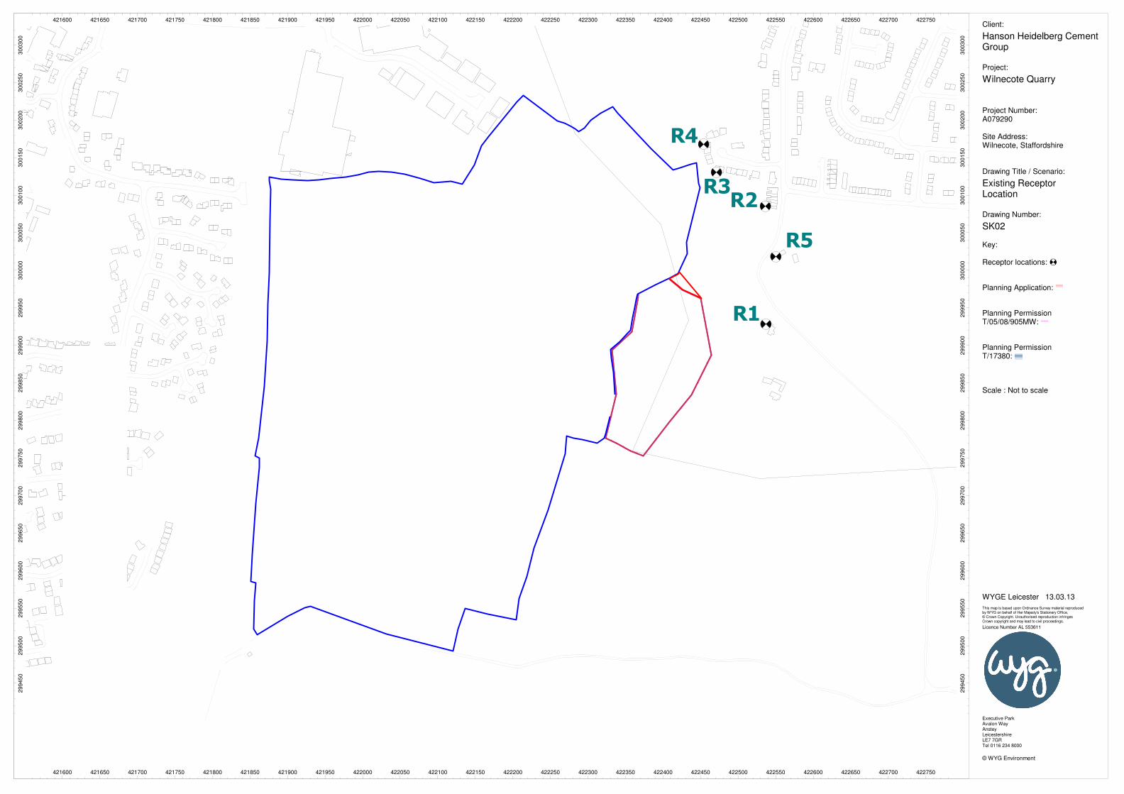
3.3 Sensitive Receptors
Table 3.3 below summarises receptor locations that have been selected to represent worst-case residential
receptors with respect to direct noise from proposed works at Wilnecote Quarry. Ground floor facades
(facing the proposed development) of nearest properties have been represented. The locations of the
receptors are shown on SK02 in Appendix A.
Table 3.3 Existing Receptor Locations (used in the noise model only)
Ref. Description Co-ordinates
X Y Height (m)
R1 Hockley Hall 422538.0 299927.9 1.5
R2 25A Fairway 422537.2 300085.3 1.5
R3 13 Fairway 422471.2 300131.4 1.5
R4 14 Fairway 422455.1 300167.8 1.5
R5 Hillyfields Farm 422551.2 300018.8 1.5

Noise Assessment Report
Hanson Ltd. 7 A079290
Wilnecote Quarry March 2013
4.0 Noise Survey
4.1 Noise Survey Methodology
A monitoring survey was undertaken to characterise baseline ambient noise levels currently experienced at
identified receptor locations.
Equipment used during the survey included:
B&K 2260 Environmental Noise Analyser (WYG1) s/n 2361273
B&K 4231 Calibrator s/n 2176211
Rion NL-32 Environmental Noise Analyser (WYG11) s/n 123729
Rion NL-32 Environmental Noise Analyser (WYG12) s/n 213442
The measurement equipment was checked against the appropriate calibrator at the beginning and end of
the measurements, in accordance with recommended practice and no drift was observed. The accuracy of
the calibrators can be traced to National Physical Laboratory Standards, calibration certificates for which are
available on request.
A baseline monitoring survey was undertaken at six locations (as specified in the following table and shown
in SK01 of Appendix B) from Friday 30th November 2012 to Tuesday 4th December 2012. Attended short
term measurements were undertaken at four locations during the day with two additional locations being
measured unattended over a 64 hour period, with 25 hours during the operational hours of the week. The
raw data collected from the long term monitoring is available upon request.
Measurements were taken in general accordance with BS 7445-1:2003 The Description and Measurement
of Environmental Noise: Guide to quantities and procedures. Weather conditions during the survey period
were observed as being dry with scattered showers. Anemometer readings confirmed that wind speeds
were less than 5 ms-1 at all times during the survey with a predominant westerly wind direction.
Table 4.1 Noise Monitoring Locations
Ref Description Grid Reference
X Y
LT1 In field to the north east of the quarry (working area) boundary 422455.6 299960.1
LT2 In field to the east of the quarry (working area) boundary 422482.6 300107.1
ST1 Bottom Of Fairway 422476.1 300156.6
ST2 Outside Hockley Hall 422563.0 300030.8
ST3 Roseberry Road Near Sefton Road Intersect 421682.9 299854.4
ST4 End of Cadogan Road 421711.2 300123.5

Noise Assessment Report
Hanson Ltd. 8 A079290
Wilnecote Quarry March 2013
4.2 Noise Survey Results
Existing ambient noise levels around the site are influenced by vehicle movement within the quarry, train
movement (at ST4) and road traffic noise.
Ambient and background noise levels are usually described using the LAeq index (a form of energy average)
and the LA90 index (i.e. the level exceeded for 90% of the measurement period) respectively. Road traffic
noise is generally described using the LA10 index (i.e. the level exceeded for 10% of the measurement
period).
The results of the statistical measurements and frequency measurements conducted during the survey are
summarised in the following table. All values are sound pressure levels in dB (re: 2 x 10⁻⁵ Pa).
Table 4.2 Results of Baseline Noise Monitoring Survey (Average Levels)
All values are sound pressure levels in dB re: 2x 10⁻⁵ Pa
During the proposed operating hours, background noise levels ranged from 46 to 51 dBLA90,1h.
Period Duration
(T) Monitoring Date and Times Location
LAeq,T (dB)
LAmax,T (dB)
LAmin,T (dB)
LA10,T (dB)
LA90,T (dB)
Day 07:00 - 18:00
25 hours 30/11/2012 - 04/12/2012
11:10 - 10:25 LT1
50.4 82.2 39.0 50.6 46.8
Night 23:00 – 07:00
32 hours 30/11/2012 - 03/12/2012
23:00 - 07:00 46.3 69.9 34.7 46.4 42.2
Day 07:00 – 18:00
25 hours 30/11/2012 - 04/12/2012
11:18 – 10:33 LT2
52.2 87.9 38.7 49.8 45.9
Night 23:00 – 07:00
32 hours 30/11/2012 - 03/12/2012
23:00 - 07:00 44.6 66.6 35.0 45.0 41.3
Day 07:00 - 19:00
15 Mins 30/11/2012 11:21 ST1 (1) 46.9 70.9 37.6 48.2 41.4
15 Mins 30/11/2012 11:39 ST2 (1) 55.1 78.3 43.2 52.7 45.3
15 Mins 30/11/2012 11:55 ST1 (2) 44.3 71.1 39.0 44.3 41.1
15 Mins 30/11/2012 12:13 ST2 (2) 49.2 68.1 45.0 50.1 47.0
15 Mins 30/11/2012 12:30 ST1 (3) 54.8 71.1 39.2 59.8 41.4
15 Mins 30/11/2012 12:50 ST2 (3) 46.8 70.9 42.9 47.8 44.6
15 Mins 30/11/2012 13:07 ST1 (4) 49.7 70.9 40.9 49.8 42.2
15 Mins 30/11/2012 13:23 ST2 (4) 47.6 63.0 43.7 48.6 45.6
15 Mins 30/11/2012 14:03 ST3 56.6 73.6 44.4 59.7 46.5
15 Mins 30/11/2012 13:45 ST4 60.7 84.5 46.9 55.2 49.1

Noise Assessment Report
Hanson Ltd. 9 A079290
Wilnecote Quarry March 2013
5.0 Assessment of Key Effects
5.1 Soil Stripping and Bund Re-configuration Phases
The assessment shown in the following table compares the worst case average noise levels from quarry
activity during the soil stripping and bund re-configuration phases. The TG NPPF states that ‘increased
temporary daytime noise limits of up to 70 dB(A) LAeq,1h (free field) for periods of up to 8 weeks in a year at
specified noise-sensitive properties should be considered to facilitate essential site preparation and
restoration work and construction of baffle mounds where it is clear that this will bring longer-term
environmental benefits to the site or its environs. As such, the relevant criteria adopted during this phase
is 70 dBLAeq,1h. A noise contour plot is shown in SK03.
Table 5.1 Predicted Noise Levels – Soil Stripping and Bund Re-configuration
Receptor Location
Noise Level from Quarry Activity LAeq,1h
MPS2 Noise Assessment Criteria LAeq,1h
Within NPPF Criteria? (Yes/No)
R1 53.6 70.0 Yes
R2 47.7 70.0 Yes
R3 47.3 70.0 Yes
R4 46.2 70.0 Yes
R5 51.8 70.0 Yes
All values are sound pressure levels in dB re: 2x 10⁻⁵ Pa
The assessment shows that noise levels at nearby residential receptors during the preliminary phases of the
development are predicted to be within TG NPPF criteria at all times.

Noise Assessment Report
Hanson Ltd. 10 A079290
Wilnecote Quarry March 2013
5.2 Overburden Removal Phase
The assessment shown in the following tables compares the worst case average noise levels from quarry
activity during the overburden removal phase. An assessment has been made at the northern most and
eastern most locations where this activity will occur to present a worst case scenario in relation to the
location of the closest identified receptors. Noise contour plots are shown in SK04 and SK05.
Table 5.2 Predicted Noise Levels – Overburden removal – northern part of proposal area
Receptor Location
Noise Level from Quarry Activity LAeq,1h
MPS2 Noise Assessment Criteria LAeq,1h
Within NPPF Criteria? (Yes/No)
R1 52.3 55.0 Yes
R2 47.3 55.0 Yes
R3 49.3 55.0 Yes
R4 50.0 55.0 Yes
R5 52.7 55.0 Yes
All values are sound pressure levels in dB re: 2x 10⁻⁵ Pa
Table 5.3 Predicted Noise Levels – Overburden removal – eastern part of proposal area
Receptor Location
Noise Level from Quarry Activity LAeq,1h
MPS2 Noise Assessment Criteria LAeq,1h
Within NPPF Criteria? (Yes/No)
R1 52.2 55.0 Yes
R2 49.1 55.0 Yes
R3 51.0 55.0 Yes
R4 50.7 55.0 Yes
R5 49.7 55.0 Yes
All values are sound pressure levels in dB re: 2x 10⁻⁵ Pa
The assessment shows that noise levels at nearby residential receptors are predicted to be within TG NPPF
criteria at all times during the overburden removal phase.

Noise Assessment Report
Hanson Ltd. 11 A079290
Wilnecote Quarry March 2013
5.3 Extraction Phase
The assessment shown in the following tables compares the worst case average noise levels from quarry
activity during the extraction phase. An assessment has been made of extraction occurring at the top and
bottom of the face where this activity will occur to present a worst case scenario in relation to the location
of receptors. Noise contour plots are shown in SK06 and SK07.
Table 5.4 Predicted Noise Levels – Extraction – Top of Face
Receptor Location
Noise Level from Quarry Activity LAeq,1h
MPS2 Noise Assessment Criteria LAeq,1h
Within NPPF Criteria? (Yes/No)
R1 51.2 55.0 Yes
R2 45.8 55.0 Yes
R3 49.2 55.0 Yes
R4 50.4 55.0 Yes
R5 50.6 55.0 Yes
All values are sound pressure levels in dB re: 2x 10⁻⁵ Pa
Table 5.5 Predicted Noise Levels – Extraction – Bottom of Face
Receptor Location
Noise Level from Quarry Activity LAeq,1h
MPS2 Noise Assessment Criteria LAeq,1h
Within NPPF Criteria? (Yes/No)
R1 38.7 55.0 Yes
R2 34.5 55.0 Yes
R3 40.6 55.0 Yes
R4 41.8 55.0 Yes
R5 33.4 55.0 Yes
All values are sound pressure levels in dB re: 2x 10⁻⁵ Pa
The assessment shows that noise levels at nearby residential receptors during the extraction of the Etruria
Marl are predicted to be within TG NPPF criteria at all times.
Noise Assessment Report
Hanson Ltd. 12 A079290
Wilnecote Quarry March 2013
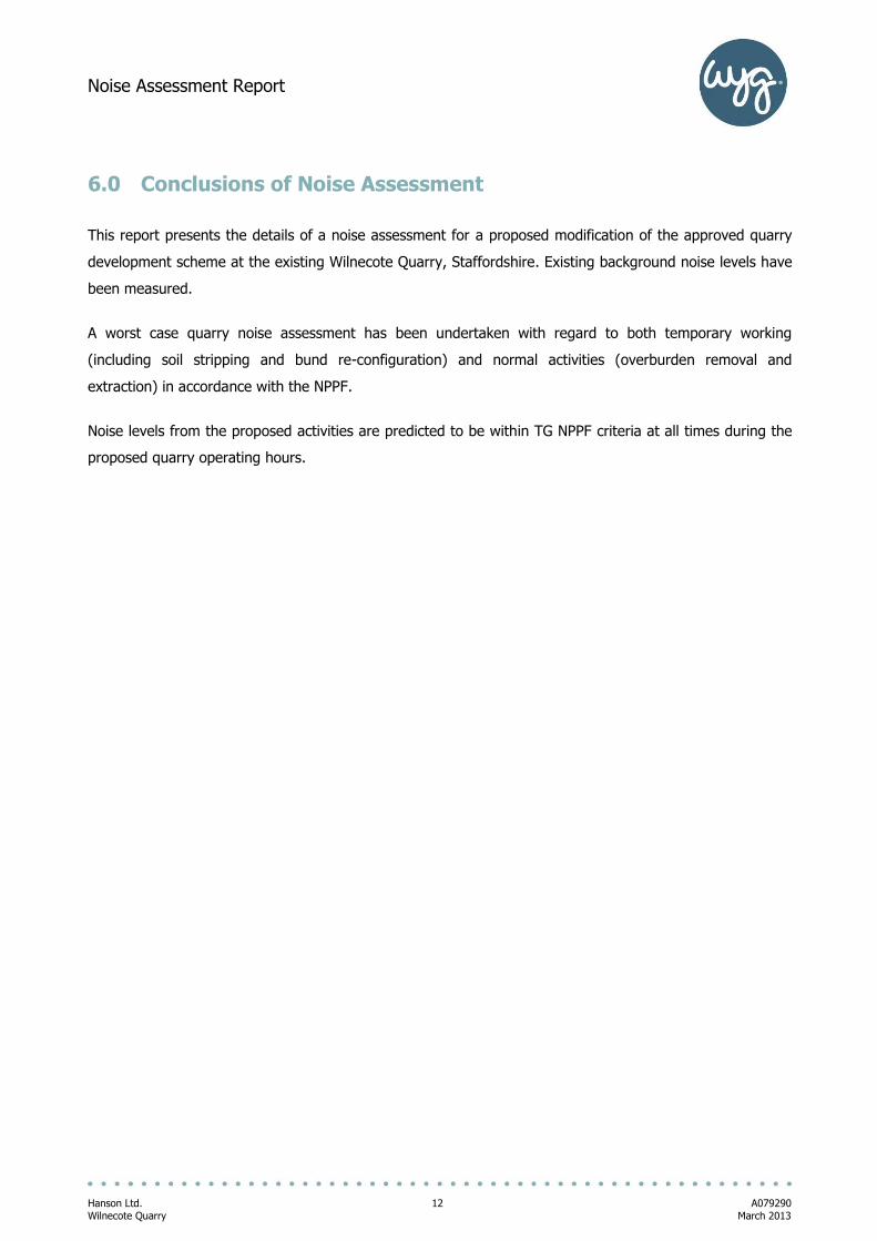
6.0 Conclusions of Noise Assessment
This report presents the details of a noise assessment for a proposed modification of the approved quarry
development scheme at the existing Wilnecote Quarry, Staffordshire. Existing background noise levels have
been measured.
A worst case quarry noise assessment has been undertaken with regard to both temporary working
(including soil stripping and bund re-configuration) and normal activities (overburden removal and
extraction) in accordance with the NPPF.
Noise levels from the proposed activities are predicted to be within TG NPPF criteria at all times during the
proposed quarry operating hours.

Noise Assessment Report
Hanson Ltd. A079290
Wilnecote Quarry March 2013
Appendices

Noise Assessment Report
Hanson Ltd. A079290
Wilnecote Quarry March 2013
Appendix A – Acoustic Terminology and Abbreviations
An explanation of the specific acoustic terminology referred to within this report is provided below.
dB Sound levels from any source can be measured in frequency bands in order to provide detailed
information about the spectral content of the noise, i.e. whether it is high-pitched, low-pitched, or
with no distinct tonal character. These measurements are usually undertaken in octave or third
octave frequency bands. If these values are summed logarithmically, a single dB figure is
obtained. This is usually not very helpful as it simply describes the total amount of acoustic
energy measured and does not take any account of the ear’s ability to hear certain frequencies
more readily than others.
dB(A) Instead, the dBA figure is used, as this is found to relate better to the loudness of the sound
heard. The dBA figure is obtained by subtracting an appropriate correction, which represents the
variation in the ear’s ability to hear different frequencies, from the individual octave or third
octave band values, before summing them logarithmically. As a result the single dBA value
provides a good representation of how loud a sound is.
LAeq Since almost all sounds vary or fluctuate with time it is helpful, instead of having an
instantaneous value to describe the noise event, to have an average of the total acoustic energy
experienced over its duration. The LAeq, 07:00 – 23:00 for example, describes the equivalent
continuous noise level over the 12 hour period between 7 am and 11 pm. During this time period
the LpA at any particular time is likely to have been either greater or lower that the LAeq, 07:00 – 23:00.
LAmin The LAmin is the quietest instantaneous noise level. This is usually the quietest 125 milliseconds
measured during any given period of time.
LAmax The LAmax is the loudest instantaneous noise level. This is usually the loudest 125 milliseconds
measured during any given period of time.
Ln Another method of describing, with a single value, a noise level which varies over a given time
period is, instead of considering the average amount of acoustic energy, to consider the length of
time for which a particular noise level is exceeded. If a level of x dBA is exceeded for say. 6
minutes within one hour, then that level can be described as being exceeded for 10% of the total
measurement period. This is denoted as the LA10, 1 hr = x dB.
The LA10 index is often used in the description of road traffic noise, whilst the LA90, the noise level
exceeded for 90% of the measurement period, is the usual descriptor for underlying background
noise. LA1 and LAmax are common descriptors of construction noise.
Rw The weighted sound reduction index determined using the above measurement procedure, but
weighted in accordance with the procedures set down in BS EN ISO 717-1. Partitioning and
building board manufacturers commonly use this index to describe the inherent sound insulation
performance of their products.

Noise Assessment Report
Hanson Ltd. A079290 Wilnecote Quarry March 2013
An explanation of abbreviations used within this report is provided below.
CADNA – Computer Aided Noise Abatement
DMRB – Design Manual for Roads and Bridges
HGV – Heavy Goods Vehicle
NPPF – National Planning Policy Framework
UDP – Unitary Development Plan
UKAS – United Kingdom Accreditation Service
WYGE – WYG Environment

Noise Assessment Report
Hanson Ltd. A079290 Wilnecote Quarry March 2013
Appendix B – Sketches
SK01 Noise Monitoring Locations
SK02 Existing Receptor Locations
SK03 Noise Contour Plot – Soil Stripping and Bund Re-configuration LAeq,1h
SK04 Noise Contour Plot – Overburden Removal North LAeq,1h
SK05 Noise Contour Plot – Overburden Removal East LAeq,1h
SK06 Noise Contour Plot – Extraction – Top of Face LAeq,1h
SK07 Noise Contour Plot – Extraction – Bottom of Face LAeq,1h

LT1
LT2
ST1
ST2
ST3
ST4
421600
421600
421650
421650
421700
421700
421750
421750
421800
421800
421850
421850
421900
421900
421950
421950
422000
422000
422050
422050
422100
422100
422150
422150
422200
422200
422250
422250
422300
422300
422350
422350
422400
422400
422450
422450
422500
422500
422550
422550
422600
422600
422650
422650
422700
422700
422750
4227502
99
45
0
29
94
50
29
95
00
29
95
00
29
95
50
29
95
50
29
96
00
29
96
00
29
96
50
29
96
50
29
97
00
29
97
00
29
97
50
29
97
50
29
98
00
29
98
00
29
98
50
29
98
50
29
99
00
29
99
00
29
99
50
29
99
50
30
00
00
30
00
00
30
00
50
30
00
50
30
01
00
30
01
00
30
01
50
30
01
50
30
02
00
30
02
00
30
02
50
30
02
50
30
03
00
30
03
00
Client:
Hanson Heidelberg CementGroup
Project:
Wilnecote Quarry
Project Number:A079290
Site Address:Wilnecote, Staffordshire
Drawing Title / Scenario:
Noise Monitoring Locations
Drawing Number:
SK01
Key:
Monitoring locations:
Planning Application:
Planning PermissionT/05/08/905MW:
Planning PermissionT/17380:
Scale : Not to scale
WYGE Leicester 13.03.13
This map is based upon Ordnance Survey material reproducedby WYG on behalf of Her Majesty's Stationery Office, © Crown Copyright. Unauthorised reproduction infringesCrown copyright and may lead to civil proceedings. Licence Number AL 553611
Executive ParkAvalon WayAnsteyLeicestershireLE7 7GRTel 0116 234 8000
© WYG Environment
R1
R2R3
R4
R5
421600
421600
421650
421650
421700
421700
421750
421750
421800
421800
421850
421850
421900
421900
421950
421950
422000
422000
422050
422050
422100
422100
422150
422150
422200
422200
422250
422250
422300
422300
422350
422350
422400
422400
422450
422450
422500
422500
422550
422550
422600
422600
422650
422650
422700
422700
422750
4227502
99
45
0
29
94
50
29
95
00
29
95
00
29
95
50
29
95
50
29
96
00
29
96
00
29
96
50
29
96
50
29
97
00
29
97
00
29
97
50
29
97
50
29
98
00
29
98
00
29
98
50
29
98
50
29
99
00
29
99
00
29
99
50
29
99
50
30
00
00
30
00
00
30
00
50
30
00
50
30
01
00
30
01
00
30
01
50
30
01
50
30
02
00
30
02
00
30
02
50
30
02
50
30
03
00
30
03
00
Client:
Hanson Heidelberg CementGroup
Project:
Wilnecote Quarry
Project Number:A079290
Site Address:Wilnecote, Staffordshire
Drawing Title / Scenario:
Existing Receptor Location
Drawing Number:
SK02
Key:
Receptor locations:
Planning Application:
Planning PermissionT/05/08/905MW:
Planning PermissionT/17380:
Scale : Not to scale
WYGE Leicester 13.03.13
This map is based upon Ordnance Survey material reproducedby WYG on behalf of Her Majesty's Stationery Office, © Crown Copyright. Unauthorised reproduction infringesCrown copyright and may lead to civil proceedings. Licence Number AL 553611
Executive ParkAvalon WayAnsteyLeicestershireLE7 7GRTel 0116 234 8000
© WYG Environment

421750
421750
421800
421800
421850
421850
421900
421900
421950
421950
422000
422000
422050
422050
422100
422100
422150
422150
422200
422200
422250
422250
422300
422300
422350
422350
422400
422400
422450
422450
422500
422500
422550
422550
422600
4226002
99
50
0
29
95
00
29
95
50
29
95
50
29
96
00
29
96
00
29
96
50
29
96
50
29
97
00
29
97
00
29
97
50
29
97
50
29
98
00
29
98
00
29
98
50
29
98
50
29
99
00
29
99
00
29
99
50
29
99
50
30
00
00
30
00
00
30
00
50
30
00
50
30
01
00
30
01
00
30
01
50
30
01
50
30
02
00
30
02
00
30
02
50
30
02
50
Client:
Hanson Heidelberg CementGroup
Project:
Wilnecote Quarry
Project Number:A079290
Site Address:Wilnecote, Staffordshire
Drawing Title / Scenario:
Noise Contour Plot-Soil Stripping and BundRe-configuration LAeq,1hDrawing Number:
SK03
Key:
Planning Application:
Planning PermissionT/05/08/905MW:
Planning PermissionT/17380:
0.0 - 50.0 dB 50.0 - 60.0 dB 60.0 - 70.0 dB >70.0 dB
Scale : Not to scale
Contour Plot Presented For Indicative Purposes OnlyWYGE Leicester 13.03.13
This map is based upon Ordnance Survey material reproducedby WYG on behalf of Her Majesty's Stationery Office, © Crown Copyright. Unauthorised reproduction infringesCrown copyright and may lead to civil proceedings. Licence Number AL 553611
Executive ParkAvalon WayAnsteyLeicestershireLE7 7GRTel 0116 234 8000
© WYG Environment

421750
421750
421800
421800
421850
421850
421900
421900
421950
421950
422000
422000
422050
422050
422100
422100
422150
422150
422200
422200
422250
422250
422300
422300
422350
422350
422400
422400
422450
422450
422500
422500
422550
422550
422600
4226002
99
50
0
29
95
00
29
95
50
29
95
50
29
96
00
29
96
00
29
96
50
29
96
50
29
97
00
29
97
00
29
97
50
29
97
50
29
98
00
29
98
00
29
98
50
29
98
50
29
99
00
29
99
00
29
99
50
29
99
50
30
00
00
30
00
00
30
00
50
30
00
50
30
01
00
30
01
00
30
01
50
30
01
50
30
02
00
30
02
00
30
02
50
30
02
50
Client:
Hanson Heidelberg CementGroup
Project:
Wilnecote Quarry
Project Number:A079290
Site Address:Wilnecote, Staffordshire
Drawing Title / Scenario:
Noise Contour Plot-Overburden RemovalNorth LAeq,1hDrawing Number:
SK04
Key:
Planning Application:
Planning PermissionT/05/08/905MW:
Planning PermissionT/17380:
0.0 - 50.0 dB 50.0 - 60.0 dB 60.0 - 70.0 dB >70.0 dB
Scale : Not to scale
Contour Plot Presented For Indicative Purposes OnlyWYGE Leicester 13.03.13
This map is based upon Ordnance Survey material reproducedby WYG on behalf of Her Majesty's Stationery Office, © Crown Copyright. Unauthorised reproduction infringesCrown copyright and may lead to civil proceedings. Licence Number AL 553611
Executive ParkAvalon WayAnsteyLeicestershireLE7 7GRTel 0116 234 8000
© WYG Environment

421750
421750
421800
421800
421850
421850
421900
421900
421950
421950
422000
422000
422050
422050
422100
422100
422150
422150
422200
422200
422250
422250
422300
422300
422350
422350
422400
422400
422450
422450
422500
422500
422550
422550
422600
4226002
99
50
0
29
95
00
29
95
50
29
95
50
29
96
00
29
96
00
29
96
50
29
96
50
29
97
00
29
97
00
29
97
50
29
97
50
29
98
00
29
98
00
29
98
50
29
98
50
29
99
00
29
99
00
29
99
50
29
99
50
30
00
00
30
00
00
30
00
50
30
00
50
30
01
00
30
01
00
30
01
50
30
01
50
30
02
00
30
02
00
30
02
50
30
02
50
Client:
Hanson Heidelberg CementGroup
Project:
Wilnecote Quarry
Project Number:A079290
Site Address:Wilnecote, Staffordshire
Drawing Title / Scenario:
Noise Contour Plot-Overburden RemovalEastLAeq,1hDrawing Number:
SK05
Key:
Planning Application:
Planning PermissionT/05/08/905MW:
Planning PermissionT/17380:
0.0 - 50.0 dB 50.0 - 60.0 dB 60.0 - 70.0 dB >70.0 dB
Scale : Not to scale
Contour Plot Presented For Indicative Purposes OnlyWYGE Leicester 13.03.13
This map is based upon Ordnance Survey material reproducedby WYG on behalf of Her Majesty's Stationery Office, © Crown Copyright. Unauthorised reproduction infringesCrown copyright and may lead to civil proceedings. Licence Number AL 553611
Executive ParkAvalon WayAnsteyLeicestershireLE7 7GRTel 0116 234 8000
© WYG Environment

421750
421750
421800
421800
421850
421850
421900
421900
421950
421950
422000
422000
422050
422050
422100
422100
422150
422150
422200
422200
422250
422250
422300
422300
422350
422350
422400
422400
422450
422450
422500
422500
422550
422550
422600
4226002
99
50
0
29
95
00
29
95
50
29
95
50
29
96
00
29
96
00
29
96
50
29
96
50
29
97
00
29
97
00
29
97
50
29
97
50
29
98
00
29
98
00
29
98
50
29
98
50
29
99
00
29
99
00
29
99
50
29
99
50
30
00
00
30
00
00
30
00
50
30
00
50
30
01
00
30
01
00
30
01
50
30
01
50
30
02
00
30
02
00
30
02
50
30
02
50
Client:
Hanson Heidelberg CementGroup
Project:
Wilnecote Quarry
Project Number:A079290
Site Address:Wilnecote, Staffordshire
Drawing Title / Scenario:
Noise Contour Plot-Extraction- Top ofFace LAeq,1hDrawing Number:
SK06
Key:
Planning Application:
Planning PermissionT/05/08/905MW:
Planning PermissionT/17380:
0.0 - 50.0 dB 50.0 - 60.0 dB 60.0 - 70.0 dB >70.0 dB
Scale : Not to scale
Contour Plot Presented For Indicative Purposes OnlyWYGE Leicester 13.03.13
This map is based upon Ordnance Survey material reproducedby WYG on behalf of Her Majesty's Stationery Office, © Crown Copyright. Unauthorised reproduction infringesCrown copyright and may lead to civil proceedings. Licence Number AL 553611
Executive ParkAvalon WayAnsteyLeicestershireLE7 7GRTel 0116 234 8000
© WYG Environment

421750
421750
421800
421800
421850
421850
421900
421900
421950
421950
422000
422000
422050
422050
422100
422100
422150
422150
422200
422200
422250
422250
422300
422300
422350
422350
422400
422400
422450
422450
422500
422500
422550
422550
422600
4226002
99
50
0
29
95
00
29
95
50
29
95
50
29
96
00
29
96
00
29
96
50
29
96
50
29
97
00
29
97
00
29
97
50
29
97
50
29
98
00
29
98
00
29
98
50
29
98
50
29
99
00
29
99
00
29
99
50
29
99
50
30
00
00
30
00
00
30
00
50
30
00
50
30
01
00
30
01
00
30
01
50
30
01
50
30
02
00
30
02
00
30
02
50
30
02
50
Client:
Hanson Heidelberg CementGroup
Project:
Wilnecote Quarry
Project Number:A079290
Site Address:Wilnecote, Staffordshire
Drawing Title / Scenario:
Noise Contour Plot-Extraction- Bottom ofFace LAeq,1hDrawing Number:
SK07
Key:
Planning Application:
Planning PermissionT/05/08/905MW:
Planning PermissionT/17380:
0.0 - 50.0 dB 50.0 - 60.0 dB 60.0 - 70.0 dB >70.0 dB
Scale : Not to scale
Contour Plot Presented For Indicative Purposes OnlyWYGE Leicester 13.03.13
This map is based upon Ordnance Survey material reproducedby WYG on behalf of Her Majesty's Stationery Office, © Crown Copyright. Unauthorised reproduction infringesCrown copyright and may lead to civil proceedings. Licence Number AL 553611
Executive ParkAvalon WayAnsteyLeicestershireLE7 7GRTel 0116 234 8000
© WYG Environment