wifi rtt measurements as the gnss companion for indoor
TRANSCRIPT
WiFi RTT measurements as the GNSS companion for Indoor Positioning
presented by [email protected] Task Measurement Workshop, May 28th 2020
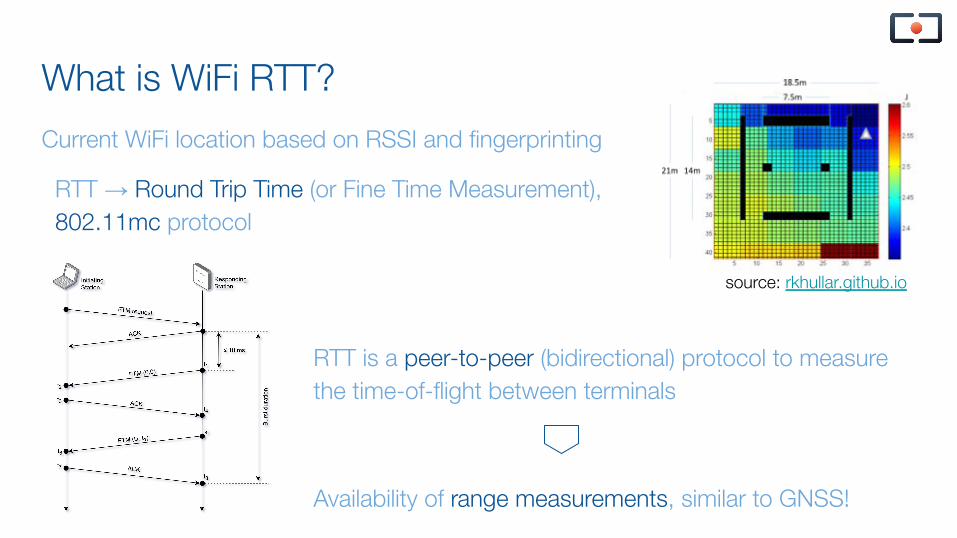
What is WiFi RTT?
RTT → Round Trip Time (or Fine Time Measurement), 802.11mc protocol
source: rkhullar.github.io
RTT is a peer-to-peer (bidirectional) protocol to measure the time-of-flight between terminals
Availability of range measurements, similar to GNSS!
Current WiFi location based on RSSI and fingerprinting
How to obtain WiFI RTT measurements
Main requirement, need support for WiFi RTT 802.11 mc protocol:
Smartphones: Google Pixel
Access Points: Google WiFi, Compulab WILD router
Chipsets: Intel AC 9260, ublox JODY-W2, …
Android API contains entry points to fetch the measurements:
Android: Wi-Fi location: ranging with RTT
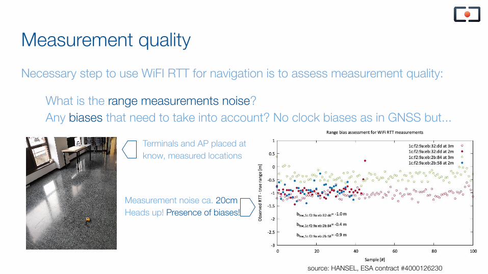
Measurement quality
Necessary step to use WiFI RTT for navigation is to assess measurement quality:
What is the range measurements noise?Any biases that need to take into account? No clock biases as in GNSS but...
Terminals and AP placed at know, measured locations
Measurement noise ca. 20cmHeads up! Presence of biases!
source: HANSEL, ESA contract #4000126230
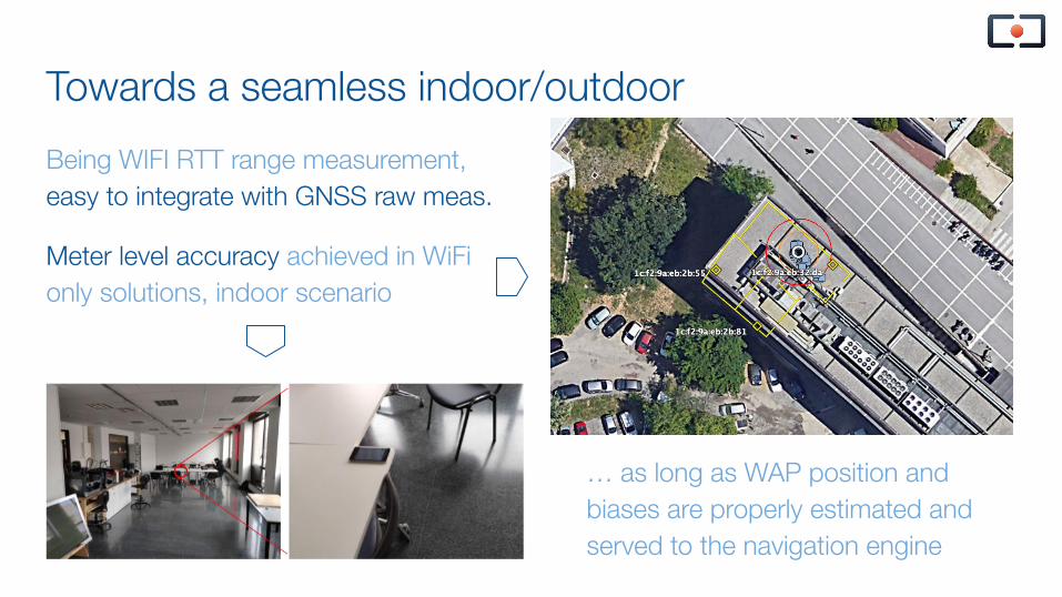
Towards a seamless indoor/outdoor
Being WIFI RTT range measurement, easy to integrate with GNSS raw meas.
Meter level accuracy achieved in WiFi only solutions, indoor scenario
… as long as WAP position and biases are properly estimated and served to the navigation engine
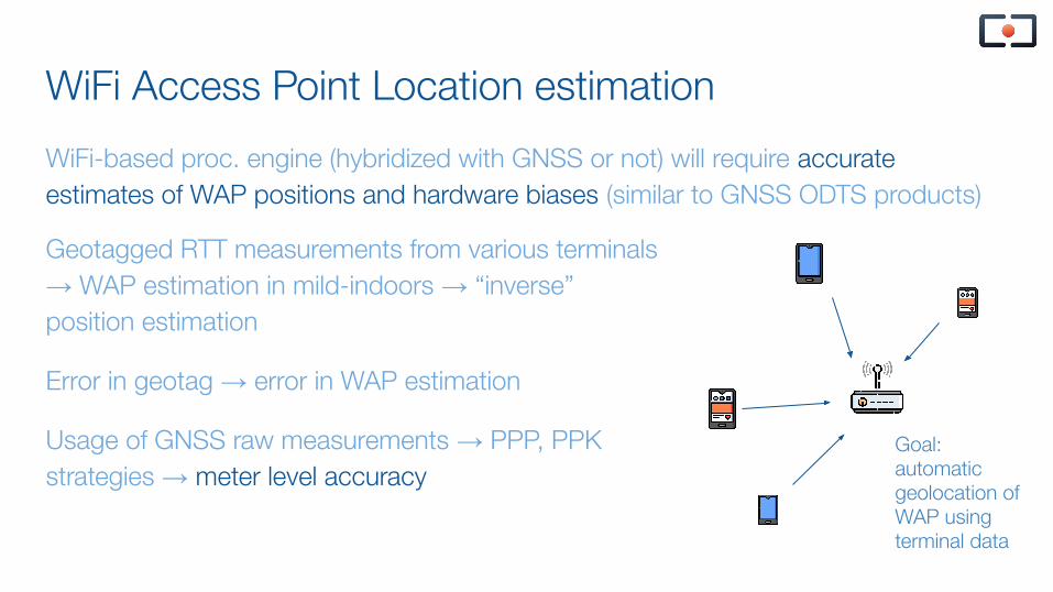
WiFi Access Point Location estimation
WiFi-based proc. engine (hybridized with GNSS or not) will require accurate estimates of WAP positions and hardware biases (similar to GNSS ODTS products)
Geotagged RTT measurements from various terminals → WAP estimation in mild-indoors → “inverse” position estimation
Error in geotag → error in WAP estimation
Usage of GNSS raw measurements → PPP, PPK strategies → meter level accuracy
Goal: automatic geolocation of WAP using terminal data
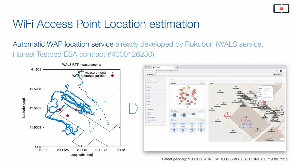
WiFi Access Point Location estimation
Automatic WAP location service already developed by Rokubun (WALS service, Hansel Testbed ESA contract #4000126230).
Patent pending: “GEOLOCATING WIRELESS ACCESS POINTS” EP19382753.2
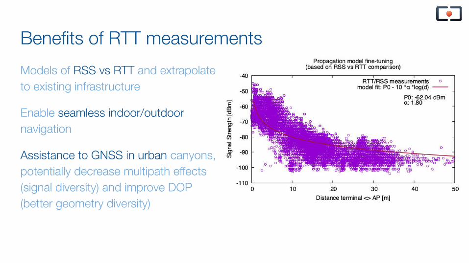
Benefits of RTT measurements
Models of RSS vs RTT and extrapolate to existing infrastructure
Enable seamless indoor/outdoor navigation
Assistance to GNSS in urban canyons, potentially decrease multipath effects (signal diversity) and improve DOP (better geometry diversity)
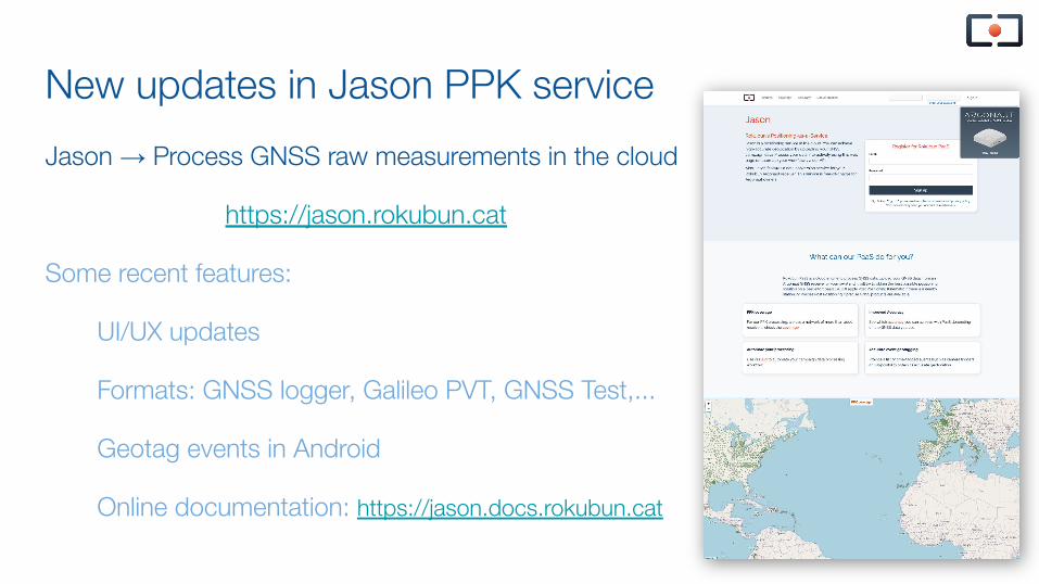
New updates in Jason PPK service
Jason → Process GNSS raw measurements in the cloud
https://jason.rokubun.cat
Some recent features:
UI/UX updates
Formats: GNSS logger, Galileo PVT, GNSS Test,...
Geotag events in Android
Online documentation: https://jason.docs.rokubun.cat
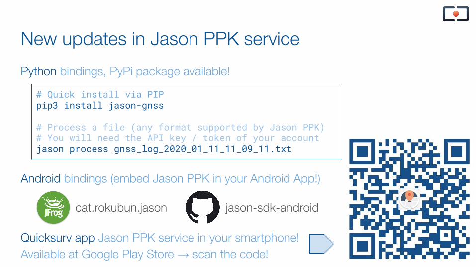
New updates in Jason PPK service
Python bindings, PyPi package available!
Android bindings (embed Jason PPK in your Android App!)
Quicksurv app Jason PPK service in your smartphone! Available at Google Play Store → scan the code!
# Quick install via PIPpip3 install jason-gnss
# Process a file (any format supported by Jason PPK)# You will need the API key / token of your accountjason process gnss_log_2020_01_11_11_09_11.txt
cat.rokubun.jason jason-sdk-android

Thank you!
MediaTIC Bldg, 2nd floorCarrer de Roc Boronat, 117, 08018
Barcelona