widebay burnett regional organisation of councils park beach 20km north of bundaberg a white sandy...
TRANSCRIPT

Widebay Burnett Regional Organisation of Councils

3
Water Trails of the Wide Bay Burnett is a cooperative project between the councils which form the Wide Bay Burnett Regional Organisation of Councils (WBBROC) and steered by the Sports and Recreation Committee of the organisation. The aim is to provide a comprehensive source of information for all water related activities in the region in one guide.
The information is sectioned by region – Bundaberg, North Burnett, South Burnett, Gympie region and Fraser Coast – and then by alphabetical order.
Each listing has a map reference point ( ) to enable you to find the location on the map on the inside back cover. There is also an address or description of where to find the location.
The icons make it easy to see at a glance the activities that are available at each location and provide a general guide of what to expect when you get there.
There is also a calendar of water related events on pages 42 and 43 to assist you in planning your visit to the region, and more information can be found on page 44 where you will see a list of useful websites and contacts.
All of this information and more can be found at www.widebayburnett.qld.gov.au and you can follow Wide Bay Burnett, The Perfect Place on Facebook to keep up to date.
F2
Fishing Boat Ramp
Swimming Scuba Diving
Kayaking/Canoeing
Camping
Scenic
Accommodation

4
BUNDABERGBargara 4Bundaberg 5Bundaberg North Lions Park 5Burnett Heads 6Buxton 7Elliott Heads 7Innes Park 8Lake Gregory 8Lake Monduran 9Miara 9Moore Park Beach 10Riverview 10Walker’s Point 10Winfield 11Woodgate 11
NORTH BURNETTAuburn River National Park 12Claude Wharton Weir 12Jones Weir 13Kirar Weir 13Lake Cania 14Lake Wuruma 15Mingo Crossing 15Paradise Dam 16
SOUTH BURNETTBroadwater Reserve 17Coomba Falls 17Ficks Crossing 18Goodger Wetland 18Gordonbrook Dam 18Lake Barambah and Bjelke-Peterson Dam 19Lake Boondooma 20Wooroolin Wetland 20
GYMPIE REGIONAmamoor Creek 21Borumba Dam 21Carlo Point 22Double Island Point and Wolf Rock 22Inskip Peninsula 23
5
GYMPIE REGION, continuedKinbombi Falls 24Lake Poona 24Mary River 24Mothar Mountain Rock Pools 25Mullins Creek Park 25Poverty Point 26Rainbow Beach 26Seary’s Creek 27Teewah Beach 27Tin Can Bay 28Yabba Creek 29
FRASER COASTBeaver Rock Boat Ramp 30Boonooroo 30Burrum Heads 30Burrum River 31Dickabram Bridge 31Fraser Island 32Hervey Bay 33Hervey Bay Pier 33Lake Lenthall 34Maaroom 34Maryborough Boat Ramps 35Petrie Park 35Poona 35River Heads 36Teddington Weir 36Tinnanbar 37Toogoom 37Tuan State Forest 38Urangan Harbour 38Urangan Pier 39Wongi Waterholes 40Woody Island 41Yengarie Boat Ramp 41
CALENDAR OF EVENTS 42
ADDITIONAL INFORMATION 44

Bargara13km east of Bundaberg
Bargara is a short drive from Bundaberg through lush sugarcane fields. It is a popular seaside area which harbours a peaceful and relaxed community ideal for family holidays away from the hustle and bustle of the city. Bargara boasts two open surf beaches and two still water swimming areas. The Bargara Streetscape project embraces the coastline with an attractive public area of walkways, decks, picnic areas and playgrounds. Cafes and
eateries create an alfresco atmosphere.
Fishing enthusiasts are well catered for at Bargara with an artificial reef guaranteeing good fishing all year round. The Woongarra Marine Park preserves the coastline and offers fishing and snorkelling right on the shore. A first class golf course is located just behind the beach and a bowling green offers outdoor entertainment for people of all ages.
Nearby, the Mon Repos Turtle Rookery provides a fascinating look at the endangered sea turtles during the nesting and hatching season from November to March. Turtles often nest at Bargara on Kelly’s, Rifle Range and Nielson Park Beach offering a special summertime experience for beachgoers.
A full range of accommodation is on offer to suit all tastes and budgets - from ocean front camping, motels and backpacker resorts, through to luxury beachfront apartments and townhouses. Bargara is serviced by bus from Bundaberg weekdays as well as a Saturday service; and via taxi service weekdays, weekends and evenings.
G2
6
Bundaberg385km north of Brisbane via Bruce Highway
Located on the Burnett River, Bundaberg has a range of access points to great fishing and water activities including:
• Fairymead Boat Ramp – River Road, Fairymead
• Four Knots Boat Ramp – Strathdees Road, Bundaberg
• Kalkie Boat Ramp – McGills Road, Bundaberg
• Sandy Hook Boat Ramp – Sandy Hook Road off Branyan Drive, Branyan
• Sharon Boat Ramp – Rustic Road, Sharon.
Bundaberg North Lions ParkQueen Street, Bundaberg
Situated almost underneath the Burnett Bridge, this small park and playground offers the kids somewhere to play while you do some fishing. You will find a children’s playground right next to a barbecue and the toilet block. Although there are limited play facilities, this is the perfect place to drop in a line and entertain the kids at the same time. Lions Park, North Bundaberg is considered a dog “off-leash” area. The car park can get quite busy on weekends when the weather is perfect for boating.
F2
F2
7
Fishing at Elliott Heads

Burnett Heads17km north of Bundaberg via Burnett Heads Road
Burnett Heads/Port of Bundaberg is the ‘Gateway to the Southern Great Barrier Reef’. This relaxed coastal village is located close to Mon Repos Conservation Park and is only 17km from the centre of Bundaberg. Burnett Heads has a variety of caravan parks, marinas, pubs and clubs mixed with waterfront dining and boutique shopping outlets. Burnett Heads has great natural experiences that include:
• The Turtle Trail Walk – enjoy this coastal stroll with majestic views of the coastline between Burnett Heads and Bargara
• Oaks Beach – safe swimming beach with weekend patrols over the summer
• Sharkies Beach – located between the northern end of Mon Repos and Oaks Beach. This secluded beach is enjoyed by the locals for a leisurely stroll, swimming or snorkelling
• Butchers Rocks – enjoying exploring the interesting basalt rock formations left behind after the volcanic eruption of the Hummock. Lava bubbles have left behind rock pools with soft corals and plenty of sea creatures living in and around the pools. This is also a popular spot to wet a line or snorkel in the right conditions
G2
8 9
• Boat Harbour Sea Wall – a popular land based fishing spot
• Wallace Creek – great spot for kayaking, crabbing and fishing.
At low tide, nearby Duchess Rocks has a display of soft coral and it’s here where remnants of an ancient lava flow can be viewed. Snorkel or fish off the rock wall and then check out the marina to see how the other half lives. The Port Marina, with a shipping chandlery as well as fine dining, is a meeting place for international yachties.
Buxton30km east of Childers via Buxton Road
Buxton is a small fishing village situated on the banks of the Burrum River at the southern end of the Bundaberg region. It’s about 20km off the Bruce Highway and upstream from Burrum Heads and Walkers Point. There is a general store, picnic facilities and boat ramp. Buxton offers a relaxed lifestyle with pleasant surroundings.
Boat enthusiasts are able to explore four river systems from this village. The area is known as having some of the best fishing, prawning and crabbing waterways in the south east. There is a boat ramp available off Wharf Street.
Elliott Heads18km from Bundaberg via Elliott Heads Road
Elliott Heads is situated at the Elliott River mouth and offers both surf and calm water swimming. It is also a popular spot for windsurfing and jet-skiing while the fishing is good from the shore or on nearby reefs.
G3
G2
Elliott Heads

Sandstone cliffs form an interesting headland and the rocky foreshore is fun to explore. A shady, landscaped caravan park is adjacent to the beach, as are a number of pleasant picnic spots with barbecue and toilet facilities. Surf lifesavers patrol the designated swimming areas during the summer season.
This is a great family holiday destination. Elliott Heads is one of the southernmost of the local beaches situated at the mouth of the Elliott River, and is surrounded by rural cane and small crop farms. Unit and cabin accommodation is available.
Innes Park15km east of Bundaberg via Elliott Heads Road
Innes Park is situated 15km from Bundaberg city, along the Coral Coast, south of the township of Bargara. Innes Park has a golf course and the rocky coastal waters are home to some of the best shore diving and coral formations.
Dive locations include Barolin Rocks and Butchers Rocks, with local scuba companies using these areas to teach their students.
Lake Gregory24km north of Childers via Voss Road off Isis Highway
Since 1991, Lake Gregory has been stocked with 80,000 bass and 25,000 silver perch. Garfish and eel-tailed catfish occur naturally. Lake Gregory is the closest freshwater storage lake to Bundaberg and is surrounded by the Elliott State Forest.
G2
F3
10 11
Lake MonduranFred Haigh Dam, 20km north west of Gin Gin
Lake Monduran, the body of water behind the Fred Haigh Dam on the Kolan River is no doubt the most reliable southern barramundi impoundment in Queensland. It also boasts the most northerly dam stocked with Australian Bass. Over the past few years it has grown to be a popular spot with locals and visitors alike. It has all amenities, good boat ramps and even kayak to houseboat hire available from the kiosk. Monduran was stocked for a few years in the mid 1980s with yellowbelly, silver perch and a few thousand barra fingerlings before falling quiet until the mid 1990s when a small dedicated group of locals set out to change the dam into a major fishery. That little group formed MASA (Monduran Anglers and Stocking Association) and thanks to their efforts, many anglers from all over Australia and the world have caught their dream fish right here.
Miara45km north west of Bundaberg
Located on the banks of the beautiful Kolan River, Miara is a popular fishing spot with secluded beaches, bush and parklands, and a family friendly fishing village atmosphere.
D2
F2
Lake Monduran

Moore Park Beach20km north of Bundaberg
A white sandy beach that stretches 17kms, Moore Park Beach is a quiet village that features a patrolled beach, paved walkways, bowls club, caravan park and more. A boat ramp is available off Ballies Road, Booyan which provides access to the Kolan River.
Riverview18km east of Bundaberg via Elliott Heads Road
Riverview is one the southernmost of the local beaches situated at the mouth of the Elliott River, and is surrounded by rural cane and small crop farms. A boat ramp is available off Peagram Street.
Walker’s Point10km south of Woodgate via Walker’s Point Road
Walker’s Point is a small fishing village near the mouth of the Burrum River. A boat ramp is available off Manley Smith Drive.
F1
G2
G3
12
Winfield55km north west of Bundaberg
A quiet location with access to fishing in Baffle Creek via boat ramps off Winfield Road and Rocky Point Road.
Woodgate38km east of Childers via Woodgate Road
Woodgate beach offers a stunning curve of white sand over 16km long, backed by a continuous sweep of shady sheoaks. The township offers a quiet and picturesque place to relax, unwind and enjoy a natural experience. The calm ocean waters are protected from strong swells by Fraser Island, and the shallow seas here are home to dugongs and turtles. The town is stretched behind the esplanade and is an eclectic mix of traditional ‘Queenslander’ style homes, 1950s beach shacks, modern homes and some more palatial designs. Kiosks, a restaurant, hotel and accommodation are located here. To the north lies Theodolite Creek; a breathtaking expanse of white silica sand perfect for swimming and fishing and to the south, Walkers Point; a small fishing village near the mouth of the Burrum River. There are two boat ramps available for anglers to access both beach and river fishing at its best. The area is popular with families, bird-watchers, nature lovers, four wheel drivers and those looking for a taste of old fashioned beach holidays, without the bright lights, high-rise and cafe strips.
F2
G3
13
Woodgate
Woodgate

14 15
Auburn River National Park40km south west of Mundubbera via Hawkwood Road
Auburn River features caves, rock pools and superb scenery and provides recreational activities including bush walking, swimming and rock climbing. When the river runs, it cascades over huge salmon coloured boulders and winds through the park.
Claude Wharton Weir2km north of Gayndah via Weir Road
One of the oldest towns in Queensland, Gayndah is situated on the banks of the Burnett River about 160km from Bundaberg. The Claude Wharton Weir is about 2km upstream from the Gayndah Bridge and creates a nice impoundment that is navigable for about 10km up from the wall.
Boat access is from the northern side of the weir. Turn off the A3 Burnett Highway into Weir Road approximately 2km north of Gayndah Township. Boat upstream for good fishing and pleasant views of the famous citrus orchards and abundant bird life.
There is also good fishing to be had along the waterholes below the weir along the town reach. Access to these is gained from the northern side of town down Bushnell Street. 4WD is advised.
Native species such as eel-tail catfish, fork-tail catfish, lungfish and spangled perch have been supplemented with Australian bass, yellowbelly, barramundi and the occasional silver perch.
B5
C5
15
Jones WeirSeligmann Avenue, Mundubbera
Built in 1951, Jones Weir is stocked with Australian bass, barramundi and yellowbelly. Catfish, eel and spangled perch are also present. It is a scenic site for bird watching and fishing. Platypus and ceratodus (or lungfish) may be spotted occasionally. The Mundubbera Apex Ski Area is located 4km from the weir wall and is easily accessible from town by travelling west along Coonambula Road before turning left into Kerle’s Road. It is a popular year-round recreation facility. Boating, swimming, and water skiing all take place on the waters of Jones Weir. Throw in a line and fish off the quaint jetty.
Kirar Weir8km west of Eidsvold via Kirar Weir Road
Kirar Weir was built in 2005 on the Burnett River 8km west of Eidsvold. The name Kirar was given to the weir by local aboriginal group Wakka Wakka. Fish from the shore or just relax by the river in the peaceful surrounds. The abundance of birdlife here makes bird watching (particularly swans) an ideal pastime.
B5
A4
15
Jones Weir

Mingo Crossing
Lake Cania37km north of Monto via Cania Road off the A3 Burnett Highway
Lake Cania is situated north of the Cania Gorge National Park about 11km from the Cania Gorge Picnic Area. The lake sits on the banks of Three Moon Creek which is a tributary of the Burnett River.
The lake has a capacity of 88,500 megalitres and is constructed from earth and rockfill that reach over 44 metres above the level of the dam.
There are numerous facilities available at the dam from great fishing and other water sports with boat ramp access, picnic areas, public conveniences, kiosk and two camping and caravan parks. Fish from the shore or a boat.
Lake Cania is noted for saratoga catches. Other species include bass, golden perch, silver perch, eel-tailed catfish, spangled perch, eel and snub-nosed garfish.
A1
17
Lake Wuruma48km north of Eidsvold via Wuruma Dam Road
Lake Wuruma is a peaceful spot that has produced some excellent fishing over the years. Situated on the Nogo River about 40km north-west of Eidsvold, the lake is a mixture of rolling hills, small bays, rock ledges, standing timber and granite boulders. Wuruma has a good range of species including bass, barramundi, yellowbelly, silver perch, spangled perch and catfish and is known to stock abundant Red Claw. Water levels can fluctuate from month to month due to water releases. There is bush camping with basic amenities. There is a single concrete boat ramp, however, water levels of the lake often mean the ramp is high and dry. There are a few spots you can still get a small boat in, but make sure to thoroughly check the launch site first.
Mingo Crossing30km south of Mount Perry via Gayndah-Mount Perry Road
Mingo Crossing Recreation Area is located between Biggenden and the small country town of Mount Perry. The facilities at Mingo Crossing include powered and non-powered camping sites, amenities, laundry, gas barbecues, picnic areas, concrete boat ramp, fish cleaning stations, information centre and kiosk.
A4
D4
16
Lake Cania

18
The setting along the Burnett River, surrounded by rural countryside, creates a peaceful and relaxing country atmosphere and a perfect spot to cast a line or put in the tinny. It is ideal for canoeing and water skiing or just enjoying the abundant bird life.
Paradise Dam35km north west of Biggenden via Gooroolba Road
The dam lies on the beautiful Burnett River and is renowned fresh water fishing. Other water
sports include boating, skiing, tubing, sailing and swimming. The facilities at Paradise Dam include
non-powered camping sites, environmentally friendly toilets (no showers), covered gas barbecues, concrete boat ramp, fish cleaning stations, information centre and kiosk.
Prior to the construction of the dam, the Burnett River was stocked in this area with Australian bass, barramundi, golden perch and silver perch. There are breeding populations of eel-tailed catfish, fork-tailed catfish, spangled perch and the endangered Queensland lungfish.
The dam is named after the old gold mining township of Paradise which now lies under the waters.
E4
Broadwater Reserve21km north of Nanango via Broadwater Access Road off Burnett Highway
The Broadwater Recreational Reserve a well known birdwatching area on the bank of Barkers Creek.
Coomba Falls2km east of Maidenwell via Coomba Falls Road
Coomba Falls at Maidenwell is 45km south of Kingaroy and an exceptionally beautiful place, featuring a deep natural swimming hole and striking granite cliffs.
The water is icy most of the year, so it’s the ideal site to cool down on a hot day. Located just a few kilometres from the heart of Maidenwell, picturesque Coomba Falls provides the ideal setting for a picnic and a day of swimming and relaxing.
It’s also a lovely spot for photography and birdwatching.
E9
D10
19
Coomba Falls
Paradise Dam

Ficks Crossing8.5km north of Wondai via Bunya Highway
Ficks Crossing is one of the hidden treasures of the South Burnett. Situated on the banks of the Barambah Creek, it is a perfect secluded spot to stop for the day. Take in some bird watching from the tower or simply enjoy a barbecue by the creek. It is a magnificent spot for swimming, kayaking and paddle boarding with easy access to the water’s edge. A perfect spot to throw in a line, sit back and relax and wait for the fish to bite.
Goodger Wetland12km south of Kingaroy via Kingaroy Cooyar Road
Goodger Wetland is the largest ephemeral wetland in the South Burnett and provides essential habitat for a range of plant and animal species. A network of fire trails provides an extensive walking trail that meanders through a variety of vegetation types where you may see a Grey Goshawk or Black Chinned Honeyeater. The recycled plastic boardwalk takes you into the reed bed itself which can be accessed via the old Goodger school grounds by following the information signs.
Gordonbrook Dam15km north west of Kingaroy via Memerambi-Gordonbrook Road off Bunya Highway
The dam is a source of water for Kingaroy; it was built in 1941 to provide water for the Royal Australian Air Force Training Base during WWII.
D8
D9
D8
21
In 1987 due to increased demand the dam wall was raised and the inundated area is now 229 hectares. Take time to enjoy the beautiful views of the dam from either the viewing platform or the variety of walking tracks along the water’s edge. Enjoy a picnic at the tables provided and use the wood fired barbecues.
The dam provides a haven for over 100 different species of birds. Bring your binoculars and camera to record sightings. The area is a significant migratory water bird site with sightings of Jacanas, White Breasted Sea Eagles and Pygmy Geese as well as the more common water birds such as Black Ducks and Egrets. Camping is not permitted at the dam.
Lake Barambah and Bjelke-Peterson Dam13km south east of Murgon via Murgon-Barambah Road
Lake Barambah is a 2150+ hectare inland lake created in the early 1980s when the Bjelke-Petersen Dam was built across Barkers Creek. It supplies water to the upper areas of the South Burnett and offers world-class water-skiing, boating, fishing and water sport facilities as well as the Yallakool Tourist Park on the foreshore.
E8
20
Gordonbrook Dam

Lake Boondooma20km north west of Proston via Boondooma Dam Road
Lake Boondooma is a 1900 hectare inland lake created in the 1980s when Boondooma Dam was built across the Boyne River to supply the needs of the Tarong Power Station 97km to the south. It offers world-class water-skiing, boating, fishing and water sport facilities as well as Lake Boondooma Tourist Park on the foreshore. The Lake has become a popular destination for inland waterway enthusiasts and an annual Boondooma
Fishing Competition (held each February) and a Freshwater Catch and Release Tournament (held each November) draws competitors from right across south-east Queensland.
Wooroolin Wetland17km north of Kingaroy via Bunya Highway
The walking trails can be accessed from the parking area beside the Grand Hotel; head over the railway line and follow the signage. Alternatively, you can access the walking trails via the bird hide by turning right into Sportsground Road from the Bunya Highway on the outskirts of Wooroolin. A bird hide and two walking trails have been established for naturalists to fully appreciate resident and migratory fauna. Over 25 different birds have been sighted including Nankeen Kestrels, Striated Pardalotes and Golden-headed Cisticola. Over 2km of endangered vegetation has been fenced to help restrict access and protect the local and regional species. Revegetation is taking place in this eucalypt woodland and particular attention is being paid to the endangered Queensland Blue Gum.
C7
D9
Amamoor Creek10km west of Amamoor via Amamoor Creek Road
The creek provides important habitat for many animals including the shy platypus and several rare and endangered frogs. The surrounding state forest contains some interesting ironbark trees and produces some of the best plantation hoop pine in Queensland. Walkers can explore the park on several walking tracks and forest roads provide opportunities for horse riders and mountain bike riders.
Camping is available at Cedar Creek and Amamoor Creek and day use facilities are located at Amama.
Borumba Dam11km west of Imbil via Yabba Creek Road
Built across Yabba Creek, the Borumba Dam was originally completed in 1963 and upgraded in 1997. Borumba Dam provides great recreational facilities to the local community and visitors, including boating, water skiing, fishing and camping.
G8
G9
2322
Borumba Dam

Carlo Point3km from Rainbow Beach via Carlo Road
Located minutes from Rainbow Beach, Carlo Point offers access to the calm waters of the Tin Can Bay inlet. Perfect for boating, kayaking, and all water activities as well as wildlife spotting including dolphins, dugongs and turtles who shelter in the inlet.
Double Island Point and Wolf RockEast of Rainbow Beach
The next headland north of Noosa is within the Cooloola section of the Great Sandy National Park and Great Sandy Marine Park at the southern end of Wide Bay. The point was named by Captain Cook when he passed it on 18 May 1770. The Great Beach Drive gives 4WD vehicles access to the beach and joins Rainbow Beach with Noosa Heads. Permits are required and drivers are advised to seek advice. The northern end of Double Island Point is a great surfing location and the heritage listed light house is also a drawcard.
I6
J6
25
Wolf Rock is a set of four volcanic pinnacles off Double Island Point and is a popular scuba diving spot. Wolf Rock is considered by the Queensland Government to be Queensland’s most important habitat area for the critically endangered Grey Nurse Shark. It is a mating area and a high number of females and pregnant females have been seen there.
From 19 December 2003 the rock and three other highly significant areas were declared protected, with no fishing of any kind permitted at Wolf Rock and only very limited fishing at the others, while scuba diving is still permitted.
Inskip Peninsula10km north of Rainbow Beach via Inskip Avenue
Inskip Peninsula is a narrow, sandy finger of land built up by wind and waves. It forms a natural breakwater at the entrance to Tin Can Inlet and Great Sandy Strait. Inskip is the southern gateway to world heritage-listed Fraser Island. Beach sheoaks, cypress pine and other coastal trees and shrubs shade the very popular camping areas ringed by open ocean beaches and sheltered estuary shores. All are within a 15 minute drive of Rainbow Beach. A boat ramp facility is available at nearby Bullock Point.
I6
24
Carlo Point
Inskip Peninsula

26
Kinbombi Falls75km west of Gympie via Kinbombi Road off Wide Bay Highway
Kinbombi Falls are a series of rapids on Kinbombi Creek between Goomeri and Kilkivan. The free camping and day use areas at the top of the ravine provide wildlife and birdwatching. The main waterfall has a beautiful clear pool at the bottom and there are some short bushwalking tracks to explore.
Lake Poona5km south of Rainbow Beach via Freshwater Road
A perched lake formed between the dunes, Lake Poona’s banks are lined with twisted paperbarks, sedges and reeds, while its reddish-tinged waters, stained by the surrounding native tea trees, are surprisingly clear up close. Access is via a 4.2km round trip bushwalk.
Mary RiverVarious access points
A major river system running from the Sunshine Coast hinterland to the port town of Maryborough before emptying into the Great Sandy Strait. The endangered Mary River Turtle (Elusor macrurus) lives in the river. Other marine life native to the river include the Queensland Lungfish (Neoceratodus forsteri), an endangered Mary River Cod and an active community of platypus (Maccullochella mariensis).
F7
H9
I6
H4
27
Access to the river is limited primarily to road and bridge crossings, however there are excellent opportunities for kayaking and other water based activities. For more information visit www.gympie.qld.gov.au/canoe-and-kayak.
Mothar Mountain Rock Pools16km south-east of Gympie via Hall Road
If you are looking for a relaxing, sheltered place to while away some hours, you can’t go past the Mothar Mountain Rock Pools. Located in the Woondum National Park, the Mothar Mountain Rock Pools day area provides the perfect family friendly location for a barbecue or picnic.
Tables, wood fire barbecues, water and public amenities are all provided for your use on site. On a hot day immerse yourself into the pools to cool off.
Mullins Creek Park8km from Tin Can Bay via Bayside Road at Cooloola Cove
A quiet picnic area providing access to the waters of the Tin Can Bay inlet.
H8
I6
Mothar Mountain Rock Pools

Poverty Point20km south of Rainbow Beach via Rainbow Beach Road
Poverty Point offers small, undeveloped coastal camping overlooking the tranquil, tidal waters of the Tin Can Inlet.
Rainbow Beach70km east of Gympie
This is heavenly sub-tropical, coastal country where the fishing, boating, surfing, prawning and crabbing are all sublime. Rainbow Beach is a major entry point to the 41,000 hectare Cooloola National Park, which offers one of the great 4WD excursions in Queensland. Just a short drive north from Rainbow Beach is Inskip Point where there’s a barge to take you and your car across to Fraser Island. Rainbow Beach was originally recorded as Black Beach by the miners who extracted valuable mineral sands from the beach. According to the Kaby Dreaming, Yiningie, the spirit of the gods, often took the form of a rainbow. Yiningie was killed in a fight when he crashed into the cliffs and his spirit coloured the sands.
I6
I6
29
Seary’s Creek7.5km south of Rainbow Beach via Rainbow Beach Road
Boardwalk access to swimming holes bordered by melalueca woodland in the tannin stained waters of Seary’s Creek.
There are also picnic tables near the carpark.
Teewah BeachSouth of Double Island Point via Great Beach Drive
Teewah Beach extends from Double Island Point through to the Noosa River, and is part of the Great Sandy National Park.
The beach extends for approximately 51km and is accessible via 4WD from the north and south and for much of its length is a designated road.
View the coloured sands in a stretch of cliffs along the beach that are up to 200 metres high. The sand is a range of colours created through natural combinations of iron oxide and vegetable dyes.
I6
I7
28
Rainbow Beach

Tin Can Bay53km north east of Gympie via Tin Can Bay Road
Tin Can Bay is home to the Great Sandy Strait which is famous for its safe and calm waterway. There are a large number of water activities to be enjoyed and the abundance of wildlife that also call Tin Can Bay home, such as resident dolphins Mystique, Patch and Squirt.
There is a once in a lifetime opportunity to interact with and feed these rare Indo-Pacific Humpback dolphins at Norman Point from 7:30am every morning for a small fee.
Secluded in the midst of picturesque Tin Can Inlet, experience a tranquil getaway to this area known for its eco-tourism surroundings. Tin Can Bay is a perfect place to unwind and relax. Originally known by the aborigines as Tuncanbar, this peaceful bayside town is well known for its recreational fishing and boating pleasures.
I6
The meandering foreshore of Tin Can Bay provides easy access to the water’s edge for all types of water activities and recreation. Take the Wildflower Walk and also look out for over 130 species of birds that call the area home at various times throughout the year.
Crab Creek (Toolara Road) provides boat ramp access to Tin Can Bay inlet at high tide and excellent access to the creek for kayaking and canoeing. Fish from the shallows or enjoy a barbecue in the park.
Norman Point provides a large picnic area at the end of the peninsula and dual lane boat ramp access to Snapper Creek and the Tin Can Bay Inlet, as well as deep water anchorage, fully serviced marina and a yacht club. Norman Point is also home to the Sandy Strait Coast Guard and numerous fishing vessels.
Yabba CreekWest of Imbil via Yabba Creek Road
A source water for Borumba Dam that runs into the Mary River, Yabba Creek provides a variety of water activities and recreation sites.
G9
3130
Dolphin Feeding at Tin Can Bay
Yabba Creek

Beaver Rock Boat Ramp17km east of Maryborough via Beaver Rock Road
Located north east of Maryborough and providing access to River Heads and Great Sandy Strait for boating and fishing.
Boonooroo25km south of Maryborough
Boonooroo is one of a handful of charming seaside hamlets dotted along the spectacular
shoreline of the Great Sandy Strait - a cluster of small islands and sand bars in the waterway between the Fraser Island and the Fraser Coast mainland. From Boonooroo you can sail, canoe or cruise the protected waterways of the straits which rival the beauty and diversity of the Whitsunday Passage. Boonooroo is home to VMR421 Coast Guard Sandy Straits.
Burrum Heads40km north-west Hervey Bay
Explore the Burrum, Cherwell, Isis and Gregory River systems and creeks by boat or canoe; take advantage of the clear warm water and great fishing.
There is a wealth of rental house accommodation available through the local real estates, as well as caravan parks and camping sites on the beachfront. There are boat ramps available off Burrum Heads Road and Ross Street.
H5
H5
H4
Burrum RiverOff the Bruce Highway at Howard
The river’s extensive sand flats, channels and mangrove-lined banks offer the angler great fishing, crabbing and prawning. It is one of Queensland’s best kept barramundi secrets.
Along with hard-hitting mangrove jacks, barra can be located around the rock bars littering the lower tidal reaches.
Boat ramps are available at Burrum Bridge, Wals Camp and Powerhouse Road.
Dickabram BridgeMiva
The Dickabram Bridge is a heritage-listed road-and-rail bridge over the Mary River near Miva, north-west of Gympie.
G4
G6
32 33
Dickabram Bridge

Fraser IslandFerry from Hervey Bay (River Heads) or Inskip Point
World heritage-listed Fraser Island has the absolute best that one island can offer – cool
towering rainforests to walk through; more than 100 freshwater lakes to swim including the iconic
Lake McKenzie and Lake Wabby, huge sand blows to climb, and an amazing 120km beach highway, complete with the Maheno shipwreck and cliffs of stunning coloured sands.
Lying off the coast of Hervey Bay and just south of the last of the Great Barrier Reef’s coral cays, Fraser Island is the world’s largest sand island and stretches for 123km and spans 166,000 hectares. Fraser Island offers some of the best beach fishing experiences in the world, and provides options for young novice anglers and seasoned fishing professionals.
Be it fishing off 75 Mile Beach on the eastern side of Fraser Island; at Sandy Cape, Indian Head or the Kingfisher Bay Resort jetty, Fraser Island offers a diverse range of fish species that are available all year. Whiting, dart, tailor and jewfish are all common catches off the beaches and jetties.
I6J1
35
Hervey Bay45km east of Maryborough
Hervey Bay is one of Queensland’s best natural holiday destinations offering the world’s closest whale watching encounters with humpback whales as well as easy access to world heritage-listed Fraser Island; the world’s largest sand island and Lady Elliot Island; the first coral cay on the world heritage-listed Great Barrier Reef. Hervey Bay’s safe sheltered waters make it an aquatic paradise perfect for year round swimming, diving, sailing, water sports and fishing. Dotted along the Hervey Bay Esplanade are cosmopolitan and alfresco cafes, shops, parklands, picnic areas, playgrounds, piers and a vibrant marina.
In perfect, stinger-free water enjoy kayaking, yachting, diving, water and jet skiing, wind surfing and snorkelling. Boating and fishing enthusiasts enjoy estuary, beach, jetty, reef and game fishing. Join a tour or charter your own vessel, yacht or houseboat. Enjoy a bicycle ride along the picturesque foreshore, visit places such as the Orchid House within the beautiful Botanical Gardens, the Marina area or one of the many restaurants and cafes situated along the Esplanade.
There are a number of boat ramps available in Hervey Bay including Gatakers Bay and Gables Boat Ramps (off The Esplanade at Point Vernon), Maryborough Sailing Club (off The Esplanade at Scarness), Hervey Bay Sailing Club (off The Esplanade at Torquay) and Urungan Boat Harbour (off Jetty Road at Urungan).
H4
34
Fraser Coast
Hervey Bay Pier

Lake Lenthall20km north west of Maryborough via the Bruce Highway
Lake Lenthall is about 10km off the highway and definitely worth the drive in. The lake has been stocked with bass, yellow belly, silver perch and barramundi. Bass would be the main target species here and the lake has many lilly pad lined bays and banks, making it ideal spinnerbait country. Barra are a bit more sporadic as they move down over the wall during flood events. Golden perch mostly seem to be taken on hard bodies that are cast or trolled.
There is a concrete boat ramp, camping sites and picnic tables. A freshwater SIPs permit is required to fish here and there are also some outboard and speed restrictions on the dam.
Maaroom20km south of Maryborough via Cooloola Coast Road
The tiny inlet of Maaroom is nestled along the spectacular shoreline of the Great Sandy Strait with stunning views across to the world’s largest sand island, Fraser Island. This tranquil seaside hideaway has a caravan park and an all-weather boat ramp with tidal access for fishing.
Down at the water’s edge is a pleasant spot to have a picnic with sheltered gazebos and playground. Maaroom is part of a collection of quaint fishing villages dotted along the water’s edge of the Great Sandy Strait - the waterway between Fraser Island and the Fraser Coast mainland.
G4
I5
37
Maryborough Boat RampsSouth Street, Ann Street and Raglan Street
Access to Mary River in the heart of Maryborough township.
Petrie Park1km from Tiaro via Van Doorn Road
Petrie Park features a public boat ramp accessing the Mary River as well as picnic facilities on the river’s banks. Overnight camping is permitted and the park is located less than 1km from the centre of town with most conveniences.
Poona35km south of Maryborough via Cooloola Coast Road
Poona is nestled along the Great Sandy Strait on the beautiful Fraser Coast, and minutes by boat to Fraser Island. Poona has retained its charm and relaxed lifestyle and is popular with holiday-makers who enjoy the quiet life, quiet water and good fishing.
H5
G5
I5
36
Poona
In the heart of this small community is a passion for relaxation and fishing. Poona offers a great place for children to play and swim safely, and is blessed with abundant birdlife to tempt birdwatchers and an array of wild flowers in the spring.
River HeadsAriadne Street, River Heads
Ferry access to Fraser Island and public boat ramp providing access to River Heads and Great
Sandy Strait for boating and fishing.
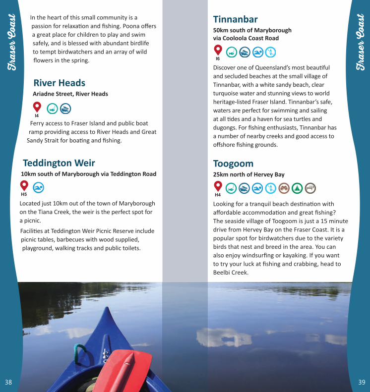
Teddington Weir10km south of Maryborough via Teddington Road
Located just 10km out of the town of Maryborough on the Tiana Creek, the weir is the perfect spot for a picnic.
Facilities at Teddington Weir Picnic Reserve include picnic tables, barbecues with wood supplied, playground, walking tracks and public toilets.
I4
H5
39
Tinnanbar50km south of Maryborough via Cooloola Coast Road
Discover one of Queensland’s most beautiful and secluded beaches at the small village of Tinnanbar, with a white sandy beach, clear turquoise water and stunning views to world heritage-listed Fraser Island. Tinnanbar’s safe, waters are perfect for swimming and sailing at all tides and a haven for sea turtles and dugongs. For fishing enthusiasts, Tinnanbar has a number of nearby creeks and good access to offshore fishing grounds.
Toogoom25km north of Hervey Bay
Looking for a tranquil beach destination with affordable accommodation and great fishing? The seaside village of Toogoom is just a 15 minute drive from Hervey Bay on the Fraser Coast. It is a popular spot for birdwatchers due to the variety birds that nest and breed in the area. You can also enjoy windsurfing or kayaking. If you want to try your luck at fishing and crabbing, head to Beelbi Creek.
I6
H4
38

Tuan State ForestBetween Tin Can Bay and Boonooroo
Tuan State Forest lies on the western edge of the Great Sandy Strait between the Tin Can Bay military training area and the township of Boonooroo. Stretching from Kauri Creek to Boonooroo in the coastal lowlands along the Great Sandy Strait, Tuan State Forest contains some of the most extensive exotic pine plantations in Queensland. The forest also has small remnants of eucalypt forest, coastal wallum, melaleuca wetlands and mangrove
lined estuaries. Tuan State Forest is a low-key holiday destination for people who love boating,
canoeing and fishing in the adjacent creeks and Great Sandy Strait. Choose from two QPWS camping areas off Tinnanbar Road on the edge of Kauri Creek with a boat ramp available at Log Dump camping area.
Urangan HarbourJetty Road, Urungan
Urangan Harbour is home to the Great Sandy Straits Marina with 176 berths, as well as two first class resorts. There are restaurants and cafes within the harbour as well as souvenir and other shops and various accommodation options. Secure parking is available as well as a refuelling pontoon, and the harbour is also home to Hervey Bay Volunteer Rescue Service (VMR466 Marine Rescue Hervey Bay).
Hervey Bay is the whale watching capital of Australia and is located adjacent to world heritage-listed Fraser Island. As well as whale watching, there are charter boats to take you fishing, snorkelling, diving or just cruising.
I6
I4
41
Urangan PierThe Esplanade, Urungan
Urangan Pier is one of the longest in Australia and stretches for almost 1km into the ocean.
A walk to the end will reward you with spectacular views of Hervey Bay and the chance to see schools of fish, stingrays or pods of dolphin just metres out to sea.
It is one of the best fishing spots for people of all ages, and is the perfect place to catch whiting; one of Hervey Bay’s most sought after fish.
Picnic or enjoy fish and chips by the beach in the parkland around the pier and explore the Urangan precinct with its boutique shops, alfresco dining, resorts and clubs.
The water next to the pier is one of the bay’s best locations for windsurfing or kite surfing with conditions suitable for beginners to experts.
I4
40
Hervey Bay Pier Fishing

Wongi Waterholes25km north-west of Maryborough via Bruce Highway
The Wongi Waterholes are 25km north-west of Maryborough. Head 12.5km towards Childers on the Bruce Highway then turn left at the signpost and drive 10km into the picnic and camping areas along a gravel road. A string of beautiful waterholes fringed by paperbarks and surrounded by eucalypt forest and exotic pine plantations make Wongi State Forest and Reserve a special place to visit.
The waterholes are a golden-brown colour from tannins leached from the paperbarks. Reflections can often be seen in the still waters. Hoop pine rainforest, open eucalypt forest, open woodland with a heath understorey, and exotic pine plantations grow in Wongi. The National Bicentennial Trail passes through the forest. Two picnic areas are provided beside the waterholes or you can camp under the shady eucalypt trees at the Wongi camping area, which has sites to suit families, groups, caravans, tents and motorhomes. Picnic tables, toilets, cold showers and tank water are provided.
G4
43
Woody IslandGreat Sandy National Park
In the Great Sandy Strait between Fraser Island and Hervey Bay lie Woody and Little Woody Islands, which together form an undeveloped section of Great Sandy National Park. Rocky Woody Island’s open forests and fringing mangroves are home to a variety of birds.
The twin Woody Island lighthouses and associated buildings built in 1866, remains of telegraph lines and a grave site are heritage-listed for their contribution to the maritime and settlement history of the Maryborough-Hervey Bay area.
Yengarie Boat Ramp10km south eat of Maryborough via Pleasant View Road
This location features a boat ramp and fishing spot.
I4
H5
42
Hervey Bay Marina

44
JanuaryAustackle Fishing Competition, South BurnettHervey Bay Yacht Squadron Kingfisher Bay Cup, Fraser Coast
FebruaryAnnual Reef and Beef Extravaganza, South BurnettYellowbelly Fishing Competition, South BurnettFamily Fishing Competition, North BurnettSLSQ WBC Branch Junior Championships, BundabergBundaberg Regatta, BundabergYamaha Bass Pro Challenge, South Burnett
MarchLake Cania Fishing Classic, North BurnettABT Bass, North BurnettHervey Bay Family Fishing Competition, Fraser CoastLifestyle for Kids Fishing, North BurnettIntercity Sailing Regatta, Fraser Coast
Burrum Heads Wind Fest, Bundaberg
AprilTake a Kid Fishing, North BurnettEaster Sailing Regatta, Fraser CoastEaster Fishing Classic, Bundaberg
MayBay to Bay Yacht Race, GympieAustralian Fishing Competition, North BurnettAustackle Fishing Competition, South BurnettAustralian Bass Tournament, South Burnett
JuneBass Nation, South BurnettABT Bass, South Burnett
JulyOpera by the Lake, BundabergRainbow Beach Fishing Classic, GympieABT Bass, North BurnettDragon Boat Regatta, Gympie
AugustFriendlies Cane 2 Coral Fun Run, BundabergMoore Park Beach Festival of Arts, BundabergRainbow Beach Triathlon, GympieAnnual “Catch a Catty” Family Fishing Competition, North BurnettHervey Bay Seafood Festival, Fraser CoastHydrathon, Fraser CoastHervey Bay Ocean Festival, Fraser Coast
SeptemberSecondary Schools Rowing Regatta, BundabergRiver Festival, BundabergTin Can Bay Seafood Festival, GympieSurf Life Saving Masters Carnival, Fraser CoastABT Bass, South Burnett
OctoberThe Lighthouse Festival, BundabergPier 2 Pub Ocean Swim, Fraser CoastRainbow Beach Nippers Carnival, GympieSpring Sailing Regatta, GympieThree Rivers Fishing Classic, North BurnettFishing Competition, North BurnettVariety Children’s Queensland Fly Fishing Competition, South BurnettMultihull Challenge Queensland Title, Fraser CoastBjelke-Peterson Dam Fishing Classic, South BurnettHervey Bay Sailing Club Cat Challenge, Fraser Coast
NovemberHervey Bay Game Fishing Tournament, Fraser CoastMary River Festival, GympieMary Valley Fishing Classic, GympieCania Dam Fishing Competition, North BurnettBasstastic Finals, South BurnettGolden Lure Competition, South BurnettHervey Bay 100 Triathlon, Fraser Coast
DecemberNYE Celebration Torquay Beach, Fraser CoastTin Can Bay Foreshore Carnival, GympieAustackle Fishing Competition, South BurnettCooloola Cup Sailing Regatta, Gympie
45
Please contact Visitor Information in each Council region for current and up to date information about events.

For more information on the Wide Bay Burnett region please visit: www.widebayburnett.qld.gov.au
BUNDABERGBundaberg Information Centre 271 Bourbong Street, Bundaberg Qld 4670 Ph 1300 722 099www.bundabergregion.orgwww.bundaberg.qld.gov.auwww.facebook.com/VisitBundaberg #visitbundabergwww.instagram.com/VisitBundaberg
NORTH BURNETTGayndah Museum and Information Centre 8 Simon Street, Gayndah Qld 4625 Ph 07 4161 2226www.bundabergregion.orgwww.northburnett.qld.gov.auwww.facebook.com/North.Burnett.Regional.Council
#northburnett
SOUTH BURNETTSouth Burnett Visitor Information Centre, Haly Street
(opposite the peanut silos), Kingaroy Qld 4610 Ph 07 4162 6272
www.tourism.southburnett.com.auwww.southernqueenslandcountry.com.auwww.southburnett.qld.gov.auwww.facebook.com/DiscoverSouthBurnett #discoversouthburnett
GYMPIE REGIONDestination Gympie Region, 24 Bruce Highway (Lake Alfred Parklands), Gympie Qld 4570 Ph 1800 444 222www.visitgympieregion.com.auwww.gympie.qld.gov.auwww.facebook.com/VisitGympieRegion #visitgympieregion
FRASER COASTHervey Bay Visitor Information Centre 227 Maryborough-Hervey Bay Road, Hervey Bay Qld 4655 Ph 1800 811 728www.visitfrasercoast.com.auwww.frasercoast.qld.gov.auwww.facebook.com/VisitFraserCoast #visitfrasercoastwww.facebook.com/FraserCoastEvents #frasercoastevents
CHERBOURGCherbourg Aboriginal Shire Council 22 Barambah Avenue, Cherbourg Qld 4605 Ph 07 4168 1866www.cherbourg.qld.gov.auwww.facebook.com/Cherbourg-Aboriginal-Shire-Council
SEE ALSODept of National Parks, Sport and Racing www.npsr.qld.gov.auMaritime Safety Queensland www.msq.qld.gov.au
46

Kingaroy
Mount Perry
Childers
Maryborough
Monto
Elliott Heads
Buxton Burrum Heads
Goomeri
Maidenwell