what tools do geographers use to study the...
TRANSCRIPT
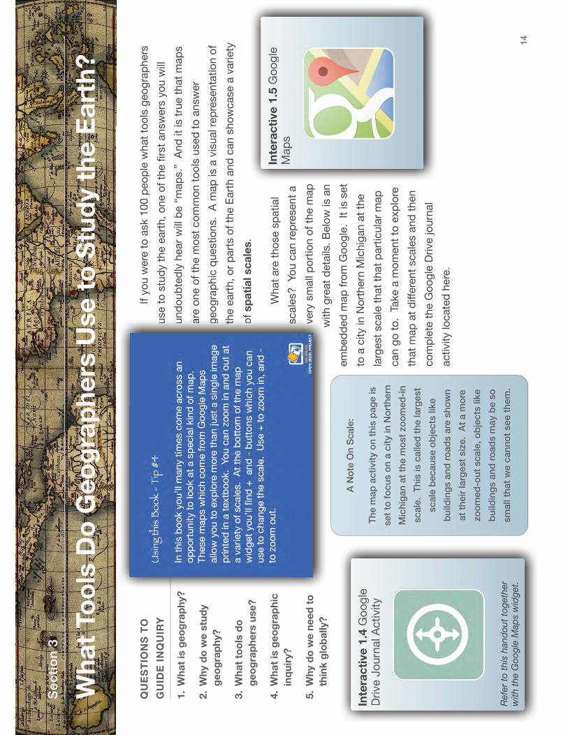
If y
ou
were
to
ask 1
00
peo
ple
wh
at
too
ls g
eo
gra
ph
ers
use t
o s
tud
y t
he e
art
h,
on
e o
f th
e fi
rst
an
sw
ers
yo
u w
ill
un
do
ub
ted
ly h
ear
will
be “
map
s.”
!A
nd
it
is t
rue t
hat
map
s
are
on
e o
f th
e m
ost
co
mm
on
to
ols
used
to
an
sw
er
geo
gra
ph
ic q
uestio
ns. !A
map
is a
vis
ual re
pre
sen
tatio
n o
f
the e
art
h,
or
part
s o
f th
e E
art
h a
nd
can
sh
ow
case a
variety
of
sp
ati
al sc
ale
s.
Wh
at
are
th
ose s
patial
scale
s?
!Yo
u c
an
rep
resen
t a
very
sm
all
po
rtio
n o
f th
e m
ap
with
gre
at
deta
ils.
Belo
w is a
n
em
bed
ded
map
fro
m G
oo
gle
. !It
is s
et
to a
city in
No
rth
ern
Mic
hig
an
at
the
larg
est
scale
th
at
that
part
icu
lar
map
can
go
to
. !T
ake a
mo
men
t to
exp
lore
that
map
at
diff
ere
nt
scale
s a
nd
th
en
co
mp
lete
th
e G
oo
gle
Drive jo
urn
al
activity lo
cate
d h
ere
.
Se
cti
on
3
QU
ES
TIO
NS
TO
GU
IDE
IN
QU
IRY
1.
Wh
at
is g
eo
gra
ph
y?
2.
Wh
y d
o w
e s
tud
y
ge
og
rap
hy?
3.
Wh
at
too
ls d
o
ge
og
rap
he
rs u
se
?
4.
Wh
at
is g
eo
gra
ph
ic
inq
uir
y?
5.
Wh
y d
o w
e n
ee
d t
o
thin
k g
lob
ally?
Wh
at
To
ols
Do
Ge
og
rap
he
rs U
se
to
Stu
dy t
he
Ea
rth
?
14
us
us
un
un
ar
ar
ge
ge
thth of
of
sc
sc
ve
ve
wi
wi
Inte
rac
tive
1.5
Go
og
le
Maapp
ss
Inte
rac
tive
1.4
Go
og
le
Drive J
ou
rnal A
ctivityy
Refe
r to
th
is h
an
do
ut
tog
eth
er
with
th
e G
oo
gle
Map
s w
idg
et.
A N
ote
On
Sc
ale
:
Th
e m
ap
ac
tivit
y o
n t
his
pa
ge
is
se
t to
fo
cu
s o
n a
cit
y in
No
rth
ern
Mic
hig
an
at
the
mo
st
zo
om
ed
-in
sc
ale
. T
his
is c
alle
d t
he
la
rge
st
sc
ale
be
ca
use
ob
jec
ts lik
e
bu
ild
ing
s a
nd
ro
ad
s a
re s
ho
wn
at
the
ir la
rge
st
siz
e.
At
a m
ore
zo
om
ed
-ou
t sc
ale
, o
bje
cts
lik
e
bu
ild
ing
s a
nd
ro
ad
s m
ay b
e s
o
sm
all t
ha
t w
e c
an
no
t se
e t
he
m.

Ma
ps M
ap
s a
re a
ble
to
sh
ow
in
form
atio
n a
bo
ut
geo
gra
ph
ic a
reas.
Every
map
has a
t le
ast
on
e p
urp
ose. !T
hey c
an
rep
resen
t a p
lace
su
ch
as a
neig
hb
orh
oo
d,
a t
ow
n,
a c
ou
ntr
y, o
r th
e w
orld
overa
ll.
So
metim
es t
hey c
an
sh
ow
hu
man
featu
res. !In
th
e v
ery
firs
t m
ap
yo
u lo
oked
at
in t
he G
oo
gle
Map
s lin
k a
bo
ve,
wh
at
hu
man
ch
ara
cte
ristics s
uch
as r
oad
s,
bu
ildin
gs,
etc
. w
ere
yo
u a
ble
to
see?
!W
hen
yo
u z
oo
med
all
the w
ay o
ut,
were
yo
u s
till
ab
le t
o s
ee
an
y h
um
an
ch
ara
cte
ristics?
Wh
en
yo
ur
pare
nts
were
yo
un
ger, t
hey p
rob
ab
ly w
en
t o
n a
trip
with
th
eir f
am
ilies w
hic
h in
vo
lved
usin
g a
map
of
a s
tate
or
reg
ion
to
get
to t
heir fi
nal d
estin
atio
n. !M
od
ern
tech
no
log
y s
uch
as s
mart
ph
on
es h
ave G
PS
bu
ilt in
wh
ich
has m
ad
e t
hese t
wo
dim
en
sio
nal m
ap
s o
bso
lete
fo
r th
at
pu
rpo
se. !A
ro
ad
trip
is n
ot
the o
nly
use f
or
a m
ap
of
a c
ity o
r a s
tate
, h
ow
ever. !
Map
s c
an
rep
resen
t a v
ariety
of
diff
ere
nt
featu
res a
bo
ut
a p
lace. !T
here
is a
sm
all
pro
ble
m w
ith
map
s h
ow
ever…
If y
ou
were
to
take a
ballo
on
an
d in
flate
it,
th
en
dra
w a
map
of
the w
orld
on
it,
yo
u c
ou
ld,
if y
ou
were
care
ful, g
et
a v
ery
clo
se
ap
pro
xim
atio
n o
f w
hat
the w
orld
overa
ll lo
oks lik
e. !If
yo
u w
ere
extr
em
ely
care
ful yo
u c
ou
ld
rep
resen
t th
e c
on
tin
en
ts o
f th
e
eart
h d
raw
n t
o a
pre
cis
e s
cale
d
siz
e. !T
his
is b
ecau
se a
ballo
on
is a
rou
nd
, th
ree-d
imen
sio
nal o
bje
ct.
!A
map
, h
ow
ever, is a
tw
o-d
imen
sio
nal
ob
ject.
!If y
ou
were
to
po
p t
hat
ballo
on
(m
uch
lik
e p
eelin
g t
he
ora
ng
e in
th
e v
ideo
ab
ove) w
hat
yo
u a
re left
with
is a
mu
ch
less
usefu
l re
pre
sen
tatio
n o
f th
e e
art
h.
In
an
att
em
pt
to r
ep
resen
t a t
hre
e d
imen
sio
nal o
bje
ct
in t
wo
dim
en
sio
ns,
map
makers
, kn
ow
n a
s c
art
og
rap
hers
, h
ave c
reate
d
diff
ere
nt
ways t
o r
ep
resen
t th
e e
art
h. !T
hese a
re k
no
wn
as m
ap
pro
jectio
ns. !T
here
are
hu
nd
red
s o
f d
iffere
nt
typ
es o
f p
roje
ctio
ns
an
d e
ach
has p
lusses a
nd
min
uses in
its
usag
e.
15
al
Inte
rac
tive
1.7
Map
P
roje
ctio
ns V
ideo
Learn
mo
re a
bo
ut
map
pro
jectio
ns
with
th
is v
ideo
. (R
eq
uires in
tern
et
co
nn
ectio
n)
Inte
rac
tive
1.6
Th
e O
ran
ge

Ta
ke t
his
map
fo
r
exam
ple
. !T
his
is k
no
wn
as a
Merc
ato
r p
roje
ctio
n.
!A M
erc
ato
r p
roje
ctio
n
wo
uld
be a
n e
xcelle
nt
map
fo
r a n
avig
ato
r o
n a
sh
ip. !In
fact,
th
is k
ind
of
map
was e
xtr
em
ely
usefu
l
in n
avig
atio
n. !O
ne o
f th
e
pro
ble
ms w
ith
th
is m
ap
is
the d
isto
rtio
n o
f siz
e. !If
yo
u lo
ok a
t G
reen
lan
d o
n t
his
map
, it a
pp
ears
to
be h
ug
e.
!Au
str
alia
, th
e s
mall
co
ntin
en
t in
th
e b
ott
om
rig
ht
han
d p
ort
ion
of
the m
ap
, lo
oks lik
e it
is m
uch
sm
alle
r th
an
Gre
en
lan
d. !In
actu
alit
y
ho
wever, G
reen
lan
d is m
uch
sm
alle
r. !
An
tarc
tica a
lmo
st
ap
pears
to b
e a
s larg
e a
s t
he r
est
of
the c
on
tin
en
ts t
og
eth
er. !S
o,
wh
ile a
Merc
ato
r P
roje
ctio
n is a
gre
at
map
fo
r u
se in
navig
atio
n,
it d
oes
no
t p
roje
ct
the w
orld
as it
is d
ue t
o t
he d
isto
rted
siz
e o
f cert
ain
are
as.
An
oth
er
well
kn
ow
n m
ap
pro
jectio
n is k
no
wn
as a
Gall-
Pete
rs
Pro
jectio
n,
or
mo
re c
om
mo
nly
, a P
ete
rs P
roje
ctio
n. !T
here
is a
gre
at
co
ntr
overs
y s
urr
ou
nd
ing
th
e o
rig
ins o
f th
is m
ap
, w
hic
h y
ou
mig
ht
wan
t to
take a
few
min
ute
s t
o lo
ok u
p in
th
e f
utu
re. !In
a
pro
jectio
n s
uch
as t
he o
ne a
bo
ve,
part
s o
f th
e w
orld
are
rep
resen
ted
clo
ser
to
their a
ctu
al
scale
s. !If,
ho
wever,
yo
u
co
mp
are
this
map
to
the M
erc
ato
r
pro
jectio
n,
wh
at
do
yo
u
no
tice a
bo
ut
the s
hap
e o
f la
nd
masses?
!T
here
is a
dis
tin
ct
dis
tort
ion
so
mew
here
on
the m
ap
.
Th
e n
ext
pro
jectio
n w
e
will
take a
lo
ok
at
is k
no
wn
as
a R
ob
inso
n
Pro
jectio
n.
!Gen
era
lly
sp
eakin
g,
a
Ro
bin
so
n
pro
jectio
n is a
n a
ttem
pt
to c
om
pro
mis
e a
nd
sh
ow
th
e
lan
dm
asses a
s c
lose t
o t
heir n
atu
ral siz
e a
nd
sh
ap
e a
s p
ossib
le 1
6
ex
ex
as
as A
A
wo
wo
ma
ma
sh
sh
ma
ma
inin pr
pr
thth
Imag
e s
ou
rce:
htt
p:/
/up
load
.wik
imed
ia.o
rg/w
ikip
ed
ia/c
om
mo
ns/3
/34
/Gall
%E
2%
80
%9
3P
ete
rs_p
roje
ctio
n_S
W.jp
g
Ima
Imag
e
ge s
ou
so
uso
uso
urc
erc
erc
e:
:
:
htt
htt
htt
p:/
p:/
p:/
/up
/up
/up
loa
loa
load
.wd
.wd
.wik
iik
iik
imed
med
med
ia.
ia.
ia.o
rgo
rgo
rg/w
i/w
i/w
ikip
kip
kip
ed
ied
ied
ia/c
a/c
a/c
om
mo
mm
om
mo
ns
on
so
ns/3
//3
//3
/34
/3
4/
34
/Gal
Gal
Gallll
Imag
e s
ou
rce:
htt
p:/
/up
load
.wik
imed
ia.o
rg/w
ikip
ed
ia/c
om
mo
ns/t
hu
mb
/9/9
6/
Ro
bin
so
n_p
roje
ctio
n_S
W.jp
g/1
28
0p
x-R
ob
inso
n_p
roje
ctio
n_S
W.jp
g

on
a t
wo
dim
en
sio
nal re
pre
sen
tatio
n. !It
too
, h
ow
ever, s
uff
ers
fro
m d
isto
rtio
n. !In
th
is c
ase,
mu
ch
of
the w
orld
is s
ho
wn
as c
lose
to s
cale
as p
ossib
le,
bu
t as y
ou
mo
ve t
ow
ard
th
e t
op
an
d b
ott
om
of
the m
ap
, w
hat
do
yo
u n
otice h
ap
pen
ing
?
No
w,
thin
k b
ack t
o t
he v
ideo
yo
u w
atc
hed
at
the b
eg
inn
ing
ab
ou
t
the o
ran
ge. !A
no
ther
pro
jectio
n is k
no
wn
as t
he G
oo
de
Ho
mo
losin
e P
roje
ctio
n,
mo
re c
om
mo
nly
kn
ow
n a
s a
n In
terr
up
ted
Pro
jectio
n. !In
th
is p
roje
ctio
n t
yp
e,
there
is v
ery
little d
isto
rtio
n in
term
s o
f siz
e o
f co
ntin
en
ts,
ho
wever
it is v
ery
diffi
cu
lt t
o c
alc
ula
te
dis
tan
ces o
n a
map
su
ch
as t
his
. !If
yo
u w
ere
takin
g a
pla
ne r
ide
fro
m N
ew
Yo
rk t
o L
on
do
n,
it w
ou
ld b
e d
ifficu
lt t
o fi
gu
re o
ut
the
exact
dis
tan
ce if
this
were
th
e o
nly
map
availa
ble
to
yo
u.
Belo
w is a
galle
ry o
f m
an
y d
iffere
nt
map
pro
jectio
ns. !A
s y
ou
flip
thro
ug
h t
he g
alle
ry,
thin
k a
bo
ut
ho
w e
ach
map
mig
ht
be u
sefu
l,
an
d w
hat
the d
isad
van
tag
es o
f th
e m
ap
mig
ht
be. !
17
Imag
e s
ou
rce:
htt
p:/
/up
load
.wik
imed
ia.o
rg/w
ikip
ed
ia/c
om
mo
ns/f
/f2
/Go
od
e_h
om
olo
sin
e_p
roje
ctio
n_S
W.jp
g
Ga
lle
ry 1
.2 M
ore
Map
Pro
jectio
ns

So
, yes..
.map
s a
re o
ne o
f th
e m
an
y t
oo
ls t
hat
geo
gra
ph
ers
use t
o
stu
dy t
he e
art
h. !B
ut
wh
at
are
so
me o
f th
e o
thers
?
Ae
ria
l P
ho
tog
rap
hs a
nd
Sa
tellit
e I
ma
ge
ry
Wh
en
yo
u lo
ok a
t th
e im
ag
e a
bo
ve,
wh
at
do
yo
u s
ee?
!T
his
is a
sate
llite
im
ag
e c
ap
ture
d o
f th
e U
nited
Sta
tes. !T
he “
go
ld”
on
th
e
map
rep
resen
ts c
ity lig
hts
, w
hic
h in
tu
rn c
an
help
so
meo
ne
stu
dyin
g t
his
im
ag
e u
nd
ers
tan
d w
here
so
me o
f th
e m
ajo
r
metr
op
olit
an
are
as a
re in
th
e U
nited
Sta
tes. !Y
ou
will
no
tice t
hat
on
e p
ort
ion
of
the U
nited
Sta
tes s
eem
s t
o h
ave a
lo
t o
f
these lig
hts
, w
hile
larg
e p
ort
ion
s o
f th
e W
este
rn h
alf o
f th
e
Un
ited
Sta
tes a
re m
uch
sp
ott
ier. !
A “
wh
y”
qu
estio
n a
geo
gra
ph
er
mig
ht
ask a
bo
ut
this
wo
uld
be:
“W
hy a
re t
here
mo
re larg
e u
rban
are
as o
n t
he e
aste
rn h
alf o
f th
e U
nited
Sta
tes
than
th
e w
este
rn h
alf?
” !B
y lo
okin
g a
t th
is im
ag
e,
geo
gra
ph
ers
mig
ht
then
lo
ok a
t m
ap
s a
nd
oth
er
aerial p
ho
tog
rap
hs t
o g
et
an
an
sw
er
to t
his
qu
estio
n. !
18
Imag
e s
ou
rce:
htt
p:/
/pix
ab
ay.
co
m/p
-92
36
7/?
no
_re
direct
Ima
Ima
Ima
Ima
Imag
e
ge s
ou
so
urc
erc
e:
:
htt
htt
htt
p:/
p:/
p:/
/pi
/pi
/pix
ab
xab
xab
ay.
ay.
co
mco
m/p
-/p
-/p
-92
39
23
67
/6
7/
67
/?n
o?
no
?n
o_re
_re
dir
dir
direct
ect
Imag
e s
ou
rce:
htt
p:/
/up
load
.wik
imed
ia.o
rg/w
ikip
ed
ia/c
om
mo
ns/d
/da/W
ash
ing
ton
,_D
.C._
-
_2
00
7_aerial_
vie
w.jp
g
Ima
Ima
Ima
Imag
e
ge
ge s
ou
so
uso
urc
erc
erc
e:
:
htt
htt
htt
p:/
p:/
p:/
/up
/up
/up
loa
loa
load
.wd
.wd
.wik
iik
iik
imed
med
med
ia.
ia.
ia.o
rgo
rgo
rg/w
i/w
i/w
ikip
kip
kip
ed
ied
ied
ia/c
a/c
a/c
om
mo
mm
om
mo
ns
on
so
ns/d
//d
//d
/da/
da/
da/W
as
Was
Wash
inh
inh
ing
tog
tog
ton
,_n
,_n
,_D
.CD
.CD
.C._
-._
-

A s
ate
llite
im
ag
e h
as m
an
y p
urp
oses a
nd
can
be h
elp
ful at
a
variety
of
sp
atial scale
s f
rom
larg
e t
o s
mall.
!A
n a
erial p
ho
tog
rap
h
is s
imila
r to
th
is,
bu
t is
gen
era
lly s
peakin
g a
t a larg
er. !
Th
e a
erial
ph
oto
gra
ph
th
at
sh
ow
s W
ash
ing
ton
, D
C,
sh
ow
s a
zo
om
ed
-in
vie
w o
f a c
ity a
t a larg
er
scale
in
wh
ich
we c
an
see in
div
idu
al
bu
ildin
gs a
nd
str
eets
. A
pic
ture
lik
e t
his
on
e m
igh
t h
elp
so
meo
ne
stu
dy p
att
ern
s o
f d
evelo
pm
en
t fo
r n
eig
hb
orh
oo
d p
lan
nin
g. !It
co
uld
be u
sefu
l in
su
rveyin
g !an
are
a f
or
a p
ote
ntial b
uild
ing
pro
ject.
!O
ther
aerial p
ho
tog
rap
hs c
ou
ld b
e u
sefu
l in
dete
rmin
ing
locatio
n o
f fa
rmla
nd
, w
here
irr
igatio
n s
yste
ms c
ou
ld b
e c
reate
d,
am
on
g m
an
y o
ther
thin
gs. !B
oth
of
these t
oo
ls a
re u
sefu
l fo
r
geo
gra
ph
ers
in
an
sw
erin
g t
heir “
wh
y”
an
d “
wh
ere
” q
uestio
ns. !
GP
S (
Glo
ba
l P
osit
ion
ing
Syste
ms)
Do
yo
ur
pare
nts
have a
sm
art
ph
on
e t
hey s
om
etim
es u
se t
o
get
directio
ns t
o p
laces t
hey h
ave n
ever
been
? !
Wh
at
ab
ou
t yo
u?
Glo
bal P
ositio
nin
g
Syste
ms (co
mm
on
ly
refe
rred
to
as G
PS
)
make u
se o
f sate
llite
s in
orb
it t
o c
olle
ct
info
rmatio
n a
bo
ut
wh
ere
the u
ser
is o
n t
he e
art
h.
Yo
ur
GP
S d
evic
e,
be it
a p
ho
ne o
r a
co
mm
erc
ially
availa
ble
sta
nd
-alo
ne u
nit,
sen
ds in
form
atio
n u
p in
to t
he s
ky w
here
it
co
nn
ects
with
a s
ate
llite
, w
hic
h t
hen
dete
rmin
es y
ou
r p
ositio
n o
n
the p
lan
et.
!T
his
in
form
atio
n is t
hen
rela
yed
back t
o t
he u
ser
an
d
dis
pla
yed
on
a m
ap
. !A
sid
e f
rom
ju
st
locatin
g y
ou
rself o
n a
map
,
ho
w m
igh
t G
PS
be a
usefu
l to
ol fo
r g
eo
gra
ph
ers
?
GIS
(G
eo
gra
ph
ic I
nfo
rma
tio
n S
yste
m)
A g
eo
gra
ph
ic in
form
atio
n s
yste
m,
co
mm
on
ly r
efe
rred
to
as G
IS
utiliz
es s
oft
ware
an
d h
ard
ware
to
co
llect
an
d d
isp
lay d
ata
. !It
can
help
yo
u d
isp
lay f
orm
s o
f in
form
atio
n u
sefu
l fo
r g
eo
gra
ph
ers
to
exp
lore
. !It
is a
co
mb
inatio
n o
f m
ap
makin
g (cart
og
rap
hy), d
ata
19
Imag
e s
ou
rce:
htt
p:/
/up
load
.wik
imed
ia.o
rg/w
ikip
ed
ia/c
om
mo
ns/5
/59
/
GP
S_R
eceiv
ers
_2
00
7.jp
g
Ima
Ima
Ima
Imag
e
ge s
ou
so
urc
erc
e:
:
htt
htt
p:/
p:/
/up
/up
loa
load
.wd
.wik
iik
imed
med
ia.
ia.o
rgo
rg/w
i/w
ikip
kip
ed
ied
ia/c
a/c
om
mo
mm
on
so
ns/5
//5
/59
/5
9/
59
/
Imag
e s
ou
rce:
htt
p:/
/up
load
.wik
imed
ia.o
rg/w
ikip
ed
ia/c
om
mo
ns/3
/33
/GvS
IG_-_
GIS
.jp
gIm
aIm
ag
e
ge s
ou
so
urc
erc
e:
:
htt
htt
p:/
p:/
p:/
/up
/up
/up
loa
load
.wd
.wik
iik
imed
med
ia.
ia.o
rgo
rg/w
i/w
i/w
ikip
kip
ed
ied
ia/c
a/c
a/c
om
mo
mm
on
so
ns/3
//3
//3
/33
/3
3/
33
/GvS
GvS
GvS
IG_
IG_
IG_-_
G-_
G-_
GIS
.IS
.IS
.jp
gjp
gIm
aIm
aIm
aIm
a

ab
ou
t p
laces,
an
d c
om
pu
ter
tech
no
log
y t
o c
reate
a
rep
resen
tatio
n o
f p
laces. !S
om
eo
ne w
ho
uses a
GIS
is t
hen
ab
le
to c
reate
a r
ep
resen
tatio
n o
f p
laces b
y layerin
g in
form
atio
n o
n t
op
of
the m
ap
an
d a
llow
ing
th
e p
eo
ple
usin
g t
hem
to
man
ipu
late
info
rmatio
n in
an
att
em
pt
to b
ett
er
un
ders
tan
d a
pla
ce. !
Oth
er
too
ls
Yo
u m
ay n
ot
initia
lly t
hin
k o
f th
ing
s lik
e s
tories,
peo
ple
, ch
art
s,
tab
les a
nd
gra
ph
s a
s b
ein
g t
hin
gs a
geo
gra
ph
er
mig
ht
use,
ho
wever, e
ven
with
a w
ealth
of
oth
er
too
ls s
uch
as m
ap
s,
sate
llite
imag
ery
, an
d G
PS
an
d G
IS a
vaila
ble
, m
ore
in
form
atio
n is n
eed
ed
in p
urs
uit o
f th
e a
nsw
er
to t
he q
uestio
ns o
f “w
hy”
an
d “
wh
ere
.”
In t
his
case,
geo
gra
ph
ers
use s
om
e o
f th
e s
am
e t
oo
ls a
s
every
on
e e
lse t
o e
xp
lore
an
d learn
mo
re,
su
ch
as d
ata
in
tab
les,
an
d c
hart
s a
nd
gra
ph
s w
hic
h c
an
help
with
nu
merical d
ata
ab
ou
t
a p
lace. !If
a g
eo
gra
ph
er
is t
ryin
g t
o u
nd
ers
tan
d w
hy p
eo
ple
sett
led
in
a g
iven
are
a,
they m
igh
t lo
ok b
ack a
t h
isto
rical d
ata
ab
ou
t w
hen
peo
ple
cam
e t
o a
reg
ion
in
an
att
em
pt
to u
nd
ers
tan
d
wh
y. !
Th
ey m
igh
t als
o lo
ok a
t p
rim
ary
so
urc
e d
ocu
men
ts -
firs
t
han
d a
cco
un
ts f
rom
peo
ple
wh
o liv
ed
du
rin
g t
he t
ime t
o g
et
a
sen
se o
f w
hy p
eo
ple
cam
e t
here
. !If
mo
vem
en
t to
th
is r
eg
ion
was
recen
t, t
hey m
igh
t even
in
terv
iew
liv
ing
peo
ple
to
get
clu
es. !
Wh
at
has b
een
ou
tlin
ed
in
th
is s
ectio
n is b
y n
o m
ean
s a
fu
ll lis
t
that
sh
ow
s y
ou
every
to
ol a g
eo
gra
ph
er
can
use. !It
focu
sed
on
so
me o
f th
e m
ost
co
mm
on
on
es,
an
d y
ou
’ll et
pra
ctice w
ith
th
ese
an
d m
an
y m
ore
th
rou
gh
ou
t th
e b
oo
k.
Retu
rn o
nce m
ore
to
th
e “
Wh
at
Too
ls D
o G
eo
gra
ph
ers
Use t
o
Stu
dy t
he E
art
h”
no
te g
uid
e. !T
here
is o
ne fi
nal q
uestio
n f
or
yo
u
to e
xp
lore
befo
re m
ovin
g in
to t
he n
ext
sectio
n.
20
Inte
rac
tive
1.8
Go
og
le
DDrrivvee DD
iiggittaall JJoo
uurrnn
al A
ccttiivviittyy