wet/dry mapping on the san pedro river: a binational ......wet/dry mapping on the san pedro river: a...
TRANSCRIPT

Wet/dry mapping on the San Pedro River: A binational monitoring project Dale S. Turner The Nature Conservancy
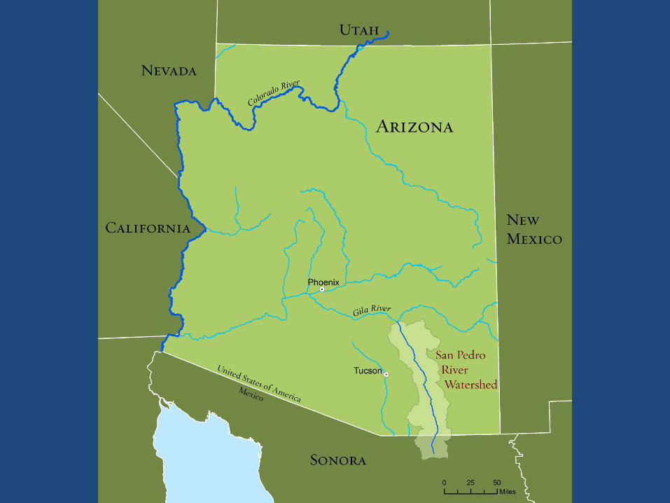

Partners in wet/dry mapping Arizona Game & Fish Department BHP Billiton Bureau of Land Management Borderlands Habitat Restoration Initiative Community Watershed Alliance Cascabel Volunteers Comisión Nacional de Áreas Naturales Protegidas Friends of the San Pedro River National Park Service Naturalia Pima County

Growth of wet/dry mapping

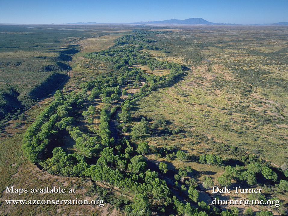
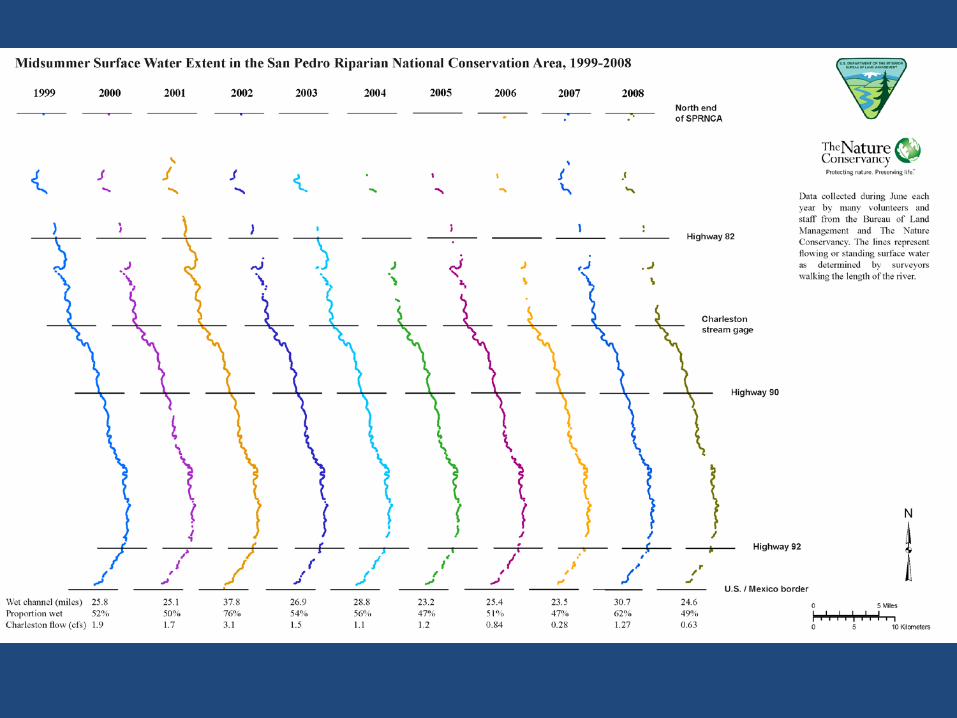
Where does surface water persist during the driest time of year?

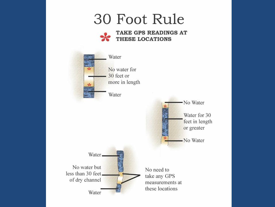
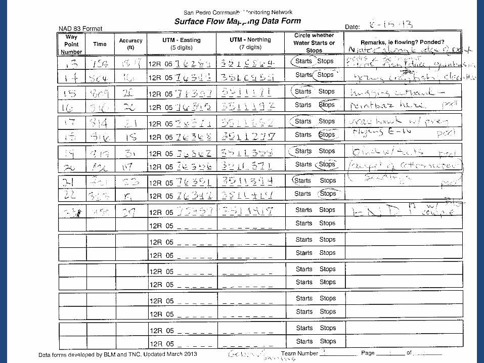

Translating points to lines

Linear referencing

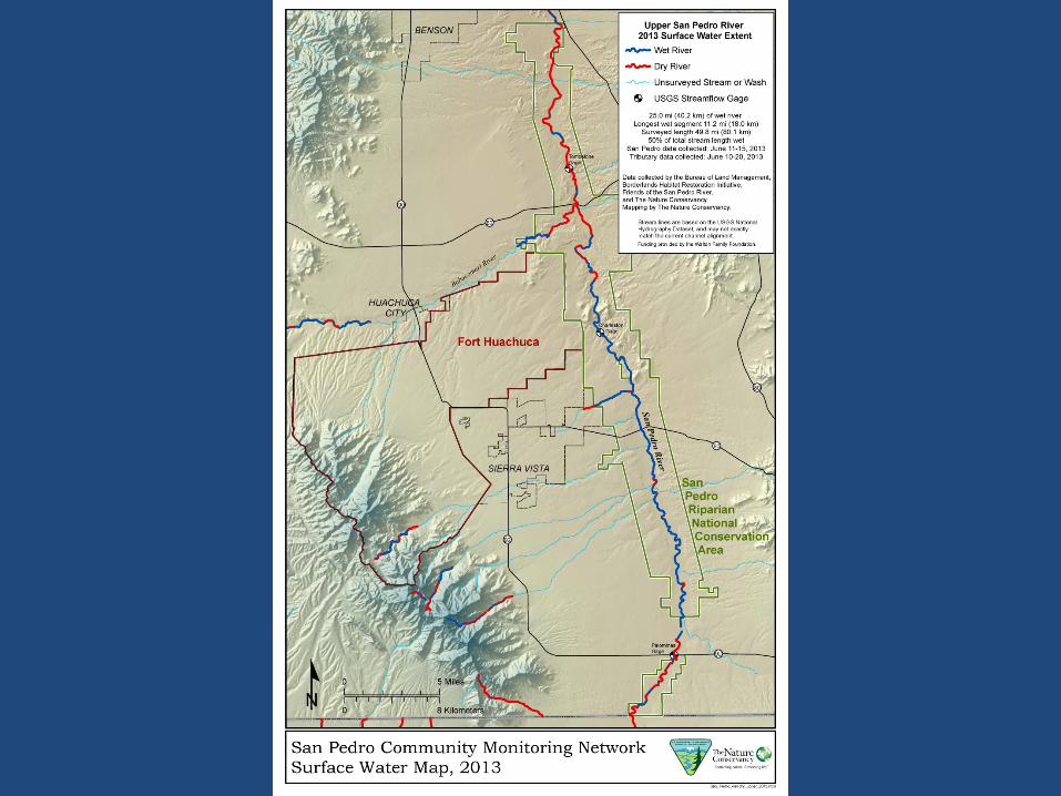
San Pedro River Surface Water Extent June 2013
Overall survey 144 miles of mainstem 165 miles of tributaries Surface water 47 miles of mainstem 51 miles of tributaries

Palominas Recharge
River Stone
Bella Vista
EOP

30
35
40
45
50
55
60
0 0.5 1 1.5 2 2.5 3 3.5
Tota
l map
ped
wet
(km
)
Mean daily flow at Charleston gage (cfs)
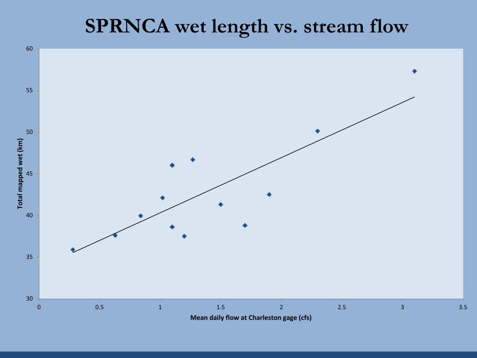
SPRNCA wet length vs. stream flow


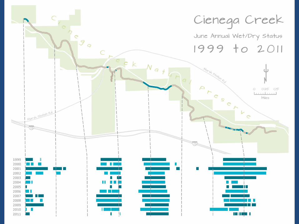
Other wet/dry monitoring sites Saguaro National Park Agua Fria National Monument Las Cienegas National Conservation Area Cienega Creek Natural Preserve

0
20
40
60
80
100
3151
3152
3153
3154
3155
3156
3157
3158
% W
ette
d Le
ngth
RC
-1 G
roun
dwat
er E
leva
tion
(ft)
Wetted length and alluvial groundwater elevation Rincon Creek, Saguaro National Park, Arizona
Flow throughout
No water present