welcome to the open commission 5 meeting - fig 1 welcome to the open commission 5 meeting •...
TRANSCRIPT

21-05-2013
1
Welcome to theOpen Commission 5 meeting
• Welcome
• FIG, FIG Commission 5, its work plan and officers
• Technical programme in Abuja
• Coming events
• Open discussion
Outline
21-05-2013
2
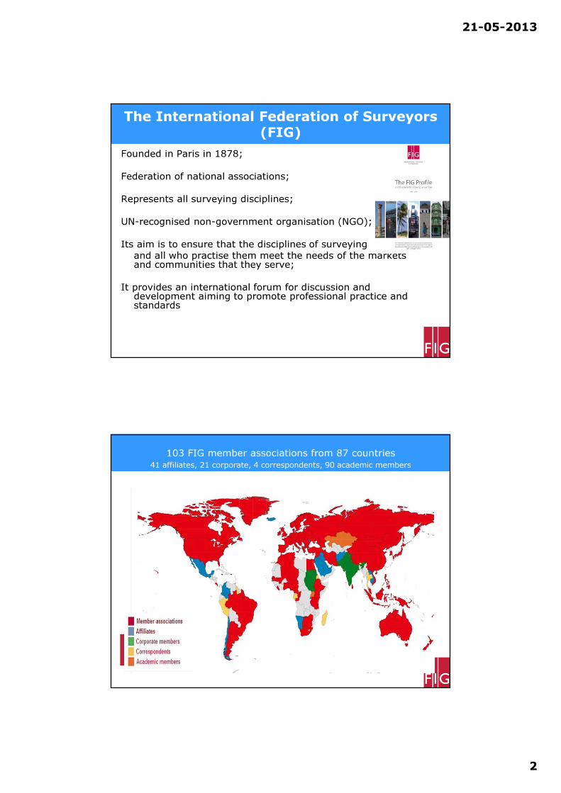
The International Federation of Surveyors (FIG)
Founded in Paris in 1878;
Federation of national associations;
Represents all surveying disciplines;
UN-recognised non-government organisation (NGO);
Its aim is to ensure that the disciplines of surveying
and all who practise them meet the needs of the markets and communities that they serve;
It provides an international forum for discussion and development aiming to promote professional practice and standards
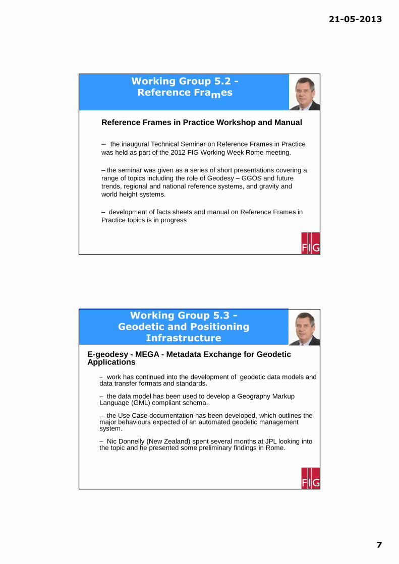
103 FIG member associations from 87 countries
41 affiliates, 21 corporate, 4 correspondents, 90 academic members
300,000 ProfessionalsGlobally!

21-05-2013
3
Organisational Structure
Annual General Assembly
105 member associations (81 countries)
Council
President and 4 Vice-PresidentsFIG Office
Com1Practice Com2
Education
Com3Spat.Inf.ManCom4
Hydrography
Com5Posit.&Map Com6
Eng.Surveys
Com7Cad&LandMan.Com8
Spat.Plan.&Dev.
Com9Valuation Com10
Const Econom.
Chairman, vice-chairs, national delegates,
work plan, working groups, seminars etc
ACCOAdvisory Committeeof Commission Officers
FIG Foundation
The Engine Room of FIG
FIG Commissions
• Com 1: Professional Standards and Practice
• Com 2: Professional Education
• Com 3: Spatial Information Management
• Com 4: Hydrography
• Com 5: Positioning and Measurement
• Com 6: Engineering Surveys
• Com 7: Cadastre and Land Management
• Com 8: Spatial Planning and Development
• Com 9: Valuation and the Management of Real Estate
• Com 10: Construction Economics and Management

21-05-2013
4
FIG Commission 5 2011-14
Mission statement - The five ”F”;
- Focus on modern technologies, technical development and assist surveyors through guidelines and recommendations
- Facilitate and follow technical development through collaboration with other commissions and other international organisations
- Foster and support research and development and stimulate new ideas.
- Formulate and formalise collaboration with manufacturers on the improvement on instruments and associated software
- FIG Events – use these to present and promote the work of the Commission and its working groups
FIG Commission 5 in the past

21-05-2013
5
FIG International Cooperation
With United Nations agencies
e.g. UN Office for Outer Space Affairs (UN OOSA);
in particular the ICG – International Committee on GNSS
With international professional organisations in surveying disciplines as:
International Association of Geodesy (IAG);
International Society for Photogrammetry and Remote Sensing (ISPRS) and
The Institution of Navigation (ION)
FIG Commission 5 -
Positioning and Measurement
2011-2014
WG 5.1: Standards, Quality Assurance and Calibration (David Martin
(France))
WG 5.2: Reference Frames (Graeme Blick (New Zealand))
WG 5.3: Geodetic and Positioning Infrastructure (Neil D Weston (USA))
WG 5.4: Kinematic Measurements (Volker Schwieger (Germany))
WG 5.5: Ubiquitous Positioning (Allison Kealy (Australia)). Joint with IAG
/Com. 6

21-05-2013
6
Working Group 5.1 -Standards, Quality Assurance and
Calibration
• Examine and review the relevant standards, quality assurance, best practice, testing and calibration aspects of surveying.
• Present and promote the use of positioning and measurement standards and guidelines to the surveying profession.
• Provide an interface to the various technical committees (TCs) within the International Standards Organisation (ISO), such as –o ISO TC 211 – Geographic Information / Geomatics,
o TC 172 SC6 – Geodetic and Surveying Instruments
o Guide to Uncertainty in Measurement (GUM) and its
supplements
Working Group 5.2 -Reference Frames
Update on development of 4 dimensional datums
– active discussion group and Email forum discussing ideas
– focusing on time variable component of deformation models to account for the effects of crustal deformation
– the concept of a patch to model the deformation has been refined to incorporate the effects of earthquakes into deformation models
– formats for deformation models are also being refined, and a draft format has been circulated to interested parties for review.
– several papers on the topic were presented at the FIG Working Week meeting in Rome
21-05-2013
7
Working Group 5.2 -Reference Frames
Reference Frames in Practice Workshop and Manual
– the inaugural Technical Seminar on Reference Frames in Practice was held as part of the 2012 FIG Working Week Rome meeting.
– the seminar was given as a series of short presentations covering a range of topics including the role of Geodesy – GGOS and future trends, regional and national reference systems, and gravity and world height systems.
– development of facts sheets and manual on Reference Frames in Practice topics is in progress
Working Group 5.3 -Geodetic and Positioning
Infrastructure
E-geodesy - MEGA - Metadata Exchange for Geodetic Applications
– work has continued into the development of geodetic data models and data transfer formats and standards.
– the data model has been used to develop a Geography Markup Language (GML) compliant schema.
– the Use Case documentation has been developed, which outlines the major behaviours expected of an automated geodetic management system.
– Nic Donnelly (New Zealand) spent several months at JPL looking into the topic and he presented some preliminary findings in Rome.

21-05-2013
8
Working Group 5.3 -Geodetic and Positioning
Infrastructure
Policy issues
•GNSS Developments
– Munich Satellite Navigation Summit
– RTCM – Frankfurt, Washington D.C.
•Positioning Services using CORS
– Access to data and products
– Reference frames – global and regional
– Coordinates – ITRF2008, IGS08, regional
•Automated Positioning Software on WWW
•Positioning Techniques
Projects
•GNSS Advancements
– GPS III
– Galileo
– Compass
– QZSS
•New technologies for surveyors
•Workshops
•Special sessions at FIG regional conferences
•Collaboration – ION, IAG, ISPRS
Working Group 5.3 -Geodetic and Positioning
Infrastructure

21-05-2013
9
Outreach and Education
•Conferences, Seminars and Workshops
•Publications
•Regional Topics
•Consulting and Technology Transfer
Working Group 5.3 -Geodetic and Positioning
Infrastructure
Realised tasks
• Facilitating Special Sessions on FIG Events like FIG
Congress, FIG Working Weeks, FIG Regional Conferences
as well as on additional special events like the
International Conference on Machine Guidance and
Control.
• ⇒ 27-29 March 2012, Stuttgart, Germany, 3rd International Conference on Machine Control Guidance.
⇒ 18 – 19 September 2012, Almaty, Kazakhstan, Innovative
Technologies of Efficient Geospatial Management of Earth
Resources, Com. 5/6 Workshop
⇒ 24-26 April 2013, Novosibirsk, Russian Federation, Interexpo
Geo-Siberia-2013.
• Paper on “Cost-Effective Positioning” by Mikael Lilje and Volker
Schwieger, 08th May, 9:00: Session TS03C - Positioning and
Navigation - Today and Tomorrow, here in Abuja, Nigeria
Working Group 5.4 Kinematic Measurements
Working Group 5.4 – Kinematic Measurements
21-05-2013
10
Foreseen tasks
• Realising tutorials and workshops on interesting topic
related questions.⇒ during the whole period.
• Facilitating Special Sessions on FIG Events like FIG
Congress, FIG Working Weeks, FIG Regional Conferences
as well as on additional special events.
• March 2104, Braunschweig, Germany, 4th International
Conference on Machine Control Guidance.
• April 2014, Novosibirsk, Russian Federation, Interexpo
Geo-Siberia-2014.
• Providing a Special Issue of a well-known scientific journal
e.g. the Journal of Applied Geodesy.⇒ in 2013/14.
Working Group 5.4 Kinematic Measurements
Working Group 5.4 – Kinematic Measurements
Ubiquitous positioning systems typically rely on the fusion of
multiple sensors, signals or measurements to deliver a
position solution in environments that are 'difficult' for Global
Navigation Satellite System (GNSS). To fully deliver a
ubiquitous positioning capability requires an understanding of
the performance capabilities of the sensors used to augment
or replicate that of a GNSS. These activities are the focus of
this Working Group.
Working Group 5.5 / IAG 4.1.1 Ubiquitous Positioning

21-05-2013
11
• FIG Working week in Marrakech. • Mobile Mapping Technology (MMT) Symposium, Krakow Poland. • International Union of Geodesy and Geophysics (IUGG) General
Assembly, Melbourne, Australia. • ION GNSS 2011: 24th Institute of Navigation GNSS Conference,
Portland, Oregon.• International Symposium on Location-Based Services, Vienna,
Austria. • International GNSS Symposium, Sydney, Australia.• Members of working group 5.5 undertook major collaborative
endeavours at Ohio State University, USA and the University of Melbourne, Australia. These field based collaborations have generated significant data sets the analysis of which will form the basis of work in 2012. A priority of the group for the first quarter of 2012 is to have publications and data set available on the FIG official website.
Working Group 5.5 / IAG 4.1.1 Ubiquitous Positioning
Working Group Activities 2012/2013
Special Issue in Journal of Applied Geodesy
jointly organized by WGs 5.4 and 5.5 as well as IAG 4.1.1
Topics: MEMS INS; Cooperative or collaborative positioning;
Indoor positioning systems; Mobile Mapping systems; Multi-
GNSS positioning systems; Pedestrian navigation; Land Mobile
Applications; Kinematic positioning; GNSS Augmentations.
Submitted Papers: 7
Status: Currently in Review
Publication planned for 2013
Publication in Journal of Applied Geodesy

21-05-2013
12
TUESDAY
TS01B – National Geodesy and Geospatial Infrastructure I
14:30 16:00 Hall I, NLH
TS02B – National Geodesy and Geospatial Infrastructure II
16:30 18:00 Hall I, NLH
THURSDAY
TS06B – GNSS Positioning and Measurement II and Remote Sensing
09:00 10:30 Hall I, NLH
WEDNESDAY
Open Commission meeting 08:00 09:00 Conference Hall 3
TS03C – Positioning and Navigation – Today and Tomorrow
09:00 10:30 Hall I, NLH
TS04C – GNSS CORS 14:30 16:00 Hall I, NLH
TS05C – GNSS Positioning and Measurement I 16:30 18:00 Hall I, NLH
Technical Programm in Abuja
• 18-20 June 2013, Manila, Philippine, The 12th South East
Asia Survey Congress
• 21-22 June 2013, Manila, Philippine, FIG/IAG Technical
Seminar
• 1-6 September 2013, Potsdam, Germany, IAG Scientific
Assembly
• 9-11 September 2013, Nottingham, England, The Second
Joint FIG/IAG International Seminar on Deformation
Monitoring
• 8-10 October 2013, Essen, Germany - INTERGEO 2013.
• 18-20 March 2014, Braunschweig, Gemany, Machine
Guidance and Control Symposium
• April 2014, Novosibirsk, Russia, Interexpo Geo-Siberia
• 16-21 June 2014, Kuala Lumpur, Malaysia, XXV FIG
Congress and General Assembly
Coming events

21-05-2013
13
Commission 5 and 6 Technical Seminar –
Reference Frame in Practice, 21-22 June 2013, Manila, Philippines
This event is co-sponsored by - IAG (International Association of Geodesy), - FIG (Fédération Internationale des Géomètres), - UN Global Geospatial Information Management for Asia and the Pacific (UN-GGIM-AP), - ICG (International Committee on GNSS) and - PhilGEGS (Philippines Geodetic Engineering and Geomatic Society).
Information on: http://www.fig.net/commission5/
Coming events
Discussion