welcome everyone and thank you for attending the second
TRANSCRIPT

Welcome everyone and thank you for attending the second Public Information Centre in the Terms of Reference phase for the Scarborough Waterfront Project.
Before we get started we would like to make a few comments on our last Public Information Centre held on September 10, 2014. We chose a format for the meeting that we thought would generate the most feedback, and we did receive over 100 comments from the first meeting. We know that some of you were disappointed that there was not a more public venue to ask questions, however you will see that today’s meeting includes Q&A portion as well as smaller breakout sessions. We are a work in progress and we hope you will feel much better about the Scarborough Waterfront Project when you leave tonight.
We also thank you for your patience with the rescheduling of this meeting from January 14, 2015 to tonight. It became clear after meeting with our Stakeholder Committee that we were not ready to go to the public, therefore we made the decision to postpone the meeting until tonight. We sent notices well in advance, far and wide, to let people know of the reschedule, but we are aware that some people did show up on the 14th and for that we sincerely apologize.
On behalf of TRCA, we would like to thank you for your time and interest in this project, we value your input and we hope you see how your comments have resulted in the new
1
material you will see tonight.
We’d like you to walk out of this meeting tonight with the following thoughts:
• I feel like my voice is being heard and my opinion is valued.
• I understand the decision‐making process and how I can participate going forward.
• I am excited about what we as a community can achieve on the waterfront along the Bluffs!
• I understand what this project is all about and why it’s necessary.
1

2

The City and TRCA are undertaking an Environmental Assessment (EA) to define the problems and opportunities along the Scarborough Waterfront and identify solutions.
To complete this work, they must follow the EA process. This a three phase process that started back in July of 2014.
Since July, TRCA and the City have met with public and agencies to get their input into the Terms of Reference; including the first Public Information Centre in September.
The Terms of Reference creates the road map for the project.
The second phase of the process is actually carrying out the EA.
The third phase involves detailed design work and implementation.
3

4

5

The Scarborough Waterfront Project refers to the section of shoreline, 11km in length, justwest of Bluffers Park moving easterly to the mouth of Highland Creek. The area of influence for the Project will be the shoreline area that includes both top and toe of the Bluffs, primarily publicly owned lands.
The Bluffs range up to 91 m in height, at “Needles or Cathedral Bluffs” just west of Bluffers Park to the average Bluff height of 50 m.
The shoreline has been divided in to 3 shoreline segments due to their distinct characteristics within each segment.
The Segments from west to east are:
• Bluffer’s Park to Meadowcliffe Drive (purple line)
• Meadowcliffe Drive to Grey Abbey (red line)
• Grey Abbey to the mouth of the Highland Creek (green line)
A larger project study area will be considered in the EA when looking at potential effects from the project.
6
7

Why is TRCA doing this study?
TRCA was designated by the Province as lead implementing agency for the Etobicoke to Ajax shoreline leading to the formulation of waterfront plans based on an integrated shoreline management approach. The plans addressed the need to limit high rates of erosion while enabling safe public access and creation of regional scale parkland and waterfront recreation opportunities.
Over the last several decades TRCA has been undertaking a number of erosion control projects to address priority high risk areas. To date these issues have all been addressed, with Meadowcliffe sector being the last high risk area completed.
So now, TRCA is turning our attention to habitat enhancement, the provision of safe public access, the creation of new greenspace and waterfront recreation where possible, within the Project Area.
The provision of a trail along the water’s edge has been identified as a goal of Waterfront Regeneration Trust’s “Lake Ontario Greenway Strategy”, City of Toronto’s Waterfront Plan and TRCA Regeneration Plans.
8

Erosion will occur throughout this area as steep banks stabilize and vegetate, some active erosion on the bluff face will continue, coastal process will continue to erode away the toe of the Bluffs in area where there is no shoreline protection.
The public are using the construction roads to walk, hike and view nature. The provision of safe public access has been identified as an objective of this project.
TRCA has been monitoring the waterfront along this sector for over 35 years and have programs in place to improve habitat, both in the water and on the land.
8
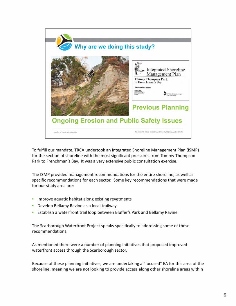
To fulfill our mandate, TRCA undertook an Integrated Shoreline Management Plan (ISMP) for the section of shoreline with the most significant pressures from Tommy Thompson Park to Frenchman’s Bay. It was a very extensive public consultation exercise.
The ISMP provided management recommendations for the entire shoreline, as well as specific recommendations for each sector. Some key recommendations that were made for our study area are:
• Improve aquatic habitat along existing revetments
• Develop Bellamy Ravine as a local trailway
• Establish a waterfront trail loop between Bluffer’s Park and Bellamy Ravine
The Scarborough Waterfront Project speaks specifically to addressing some of these recommendations.
As mentioned there were a number of planning initiatives that proposed improved waterfront access through the Scarborough sector.
Because of these planning initiatives, we are undertaking a “focused” EA for this area of the shoreline, meaning we are not looking to provide access along other shoreline areas within
9

TRCA jurisdiction, we are only focusing on whether it can be achieved along this stretch of shoreline.
9

The next three slides provide a very high level overview of the existing conditions within each segment.
Bluffer’s Park to Meadowcliffe Existing Conditions:
Bluffers Park located at the foot of Brimley Road is a very popular destination. The extent of sand beach you see in this picture has evolved over time since the park was built. This beach is a very popular summer destination – parking lots are always full on the weekends, Brimley Road is often closed to cars by noon on weekends due to capacity.
Bluffers Park hosts range of active and passive recreation: boating, beach volleyball, fishing, boat launches, and it also provides a tremendous view of the Cathedral Bluffs.
There is currently, no safe connection to the Meadowcliffe shoreline in the east where the bluff face continues to actively erode.
Vehicle access to the shoreline is provided in this segment, but it is a very steep road. It is very difficult for pedestrians and cyclists. Currently, there are only public transit options at the top of Brimley Road, near Kingston Road.

Meadowcliffe to Grey Abbey Existing Conditions:
Shoreline protection has been provided along the length of this segment; Meadowcliffe to Grey Abbey, installed between 1980 and 2012. Some of this shoreline includes formal structures such as Meadowcliffe, Sylvan and Southmarine Drive. The shoreline section at Guildwood Parkway is a temporary structure or informal protection. As a result of these construction projects there is construction access road along base of bluffs.
There are many hazards to public access including bluff face erosion and coastal processes (waves, wind etc.)
There is a construction access road to the shoreline located east of Guild Inn and Gardens Property across from Navarre Road – it is very steep and difficult to access.
There are a number of parks & public spaces along the top of the bluffs, but there is a lack of connection to the shoreline.
Stairs from the shoreline up to the Guild Inn and Gardens property have been washed out in a storm and closed due to unsafe conditions. The stairs were considered a very significant resource to the local community.
11

Pedestrian access is also provided through Gates Gully (also known as the Doris McCarthy Trail) however, it is very steep and difficult to travel. It has also been closed due to unsafe conditions resulting from a severe storm event.
Throughout this segment there are opportunities for interpretive features and habitat improvements.
11

Grey Abbey to East Point Park Existing Conditions:
This segment extends from Grey Abbey to the mouth of the Highland Creek, which is just east of East Point Park.
There is pedestrian access to the shoreline via Highland Creek Trail.
East Point Park has a number of features: bird sanctuary, baseball diamonds, waterfront trail and significant natural heritage.
There is also vehicle access to East Point Park via Beechgrove Rd.
From the pictures shown here, you can see that the shoreline has remained in a somewhat natural state, however this was an area subject to significant amounts of stonehooking and the shoreline is very degraded.
The beach at Highland Creek is informally used by pedestrians.
There are no formal connections between the top and base of bluffs throughout this segment.
12

There are significant opportunities for habitat improvements, viewing nodes and potentially a beach walk.
12

13

TRCA and its Project Team are committed to engaging everyone from local community members, general public, agencies and other stakeholders as we develop the project.
Over the last few months we have held a number of consultation activities:
• We received over 100 comments after the first Public Information Centre and they have been incorporated into the panels you saw in the Open House portion of this evening.
• We have held three stakeholder committee meetings to get their input and have meeting summaries for these discussions available on our website.
• We have also had ongoing dialogue with a number of agency that have an interest in our project including the Ministry of Environment and Climate Change (MOECC), the Ministry of Natural Resources and Forestry (MNRF), Metrolinx, Toronto Transit Commission, the Ministry Tourism Culture & Sport, and many others.
All of these conversations and opportunities for input have helped us to refined the Project Vision & Objectives. You will see these changes later in the presentation.
14

15

The project vision that was developed through the consultation process described on the previous slides and is the overriding purpose of the project.
The project vision is to create a system of greenspace along the Lake Ontario shoreline which respect and protect the significant natural and cultural features of the Bluffs, enhance the terrestrial and aquatic habitat, and provide a safe and enjoyable waterfront experience.
The vision and objectives will be used to evaluate the project alternatives.
16

Standard Environmental Assessments look at how to minimize the negative effects. This project will use an “objectives‐based evaluation” which seeks to maximize positive effects and select the alternative that best meets the projects vision and objectives.
Range of Alternatives are developed and then evaluated to find which results in the least amount of impacts
‐ This project is focused on overall benefits...
‐ We are undertaking an Objectives Based Approach
“Objectives based evaluation approach”
This approach was developed for the Don Mouth Naturalization and Port Lands Flood Protection (DMNP) Project EA with Waterfront Toronto
Typically, EAs are used to identify the range of environmental effects through an evaluation of screening criteria when proposing large‐scale infrastructure. By identifying those aspects of the environment that may be impacted by a proposed project, the proponents are typically then able to select the best approach to mitigate for those negative impacts while proceeding with the construction and long‐term operation of infrastructure.
EAs like the DMNP and Lakeview Waterfront Connection project have the goal of trying to improve degraded areas. This differs from a standard EA process that proposes to develop
17

an alternative that mitigates to the extent possible, negative environmental effects pf an undertaking.
The standard approach to EAs provides no explicit way to link how the alternatives reach the goal; instead it’s a comparative evaluation.
In an objectives‐based evaluation approach, evaluation criteria are attributed to specific project objectives that reach the project goal (i.e. examples of objectives could be public access, naturalization, flood protection etc.)
This allows for a clear identification of alternatives that best meet the objectives of the project making it easier to eliminate some alternatives and better differentiate between them
It provides an easily traceable and presentable evaluation process
It provides a clear mechanism for identifying those aspects of the environment that need to be mitigated or addressed
Sets the framework for establishing the long‐term monitoring and adaptive management that is carried through to implementation.
‐ To be based on the Project Vision & Objectives:
‐ Sets the framework for the decision making process
With input from public and stakeholders we have refined the project objectives…
17

Habitat type, health, and sensitivity vary in the study area. There are opportunities to enhance existing terrestrial and aquatic habitat and create new greenspace.
• Opportunities to improve habitat for a range of flora and fauna.
• What can we do to help connect habitat along the shoreline and to the top of the bluffs to the movement of animals?
18

There are varying levels of risk to the public and property in the study area. For example, risk of slope failure, loss of tableland, hazardous access routes, and risk from waves to users of the greenspace. Existing and future risks need to be identified and mitigated.
• Shoreline protection currently exists within the Project Study Area ‐ how do we provide safe public access along the base of the bluffs on existing structures?
• How do we bridge the gaps between existing infrastructure?
• How do we make the landbase suitable for safe public access across the waterfront?
• How do we provide access down to the waterfront, how to we deal with the steep slopes?
19

A number of factors contribute to an enjoyable waterfront experience. For example, diversity of experience, including active/passive recreation; views and vistas; multi‐season use; trail connections; and education/appreciation of the natural and cultural features of the bluffs.
• How to tie into existing parks in project area
20

Significant community planning has occurred in this area. The Project will be consistent with, and coordinate with other initiatives, including the Lake Ontario Greenway Strategy (WRT), Urban Fish Management Plan; Guild Park & Gardens Management Plan; and local community initiatives.
• Includes traffic
21

Maximize the benefits achieved through the project in relation to the estimated Project cost (capital and maintenance).
• Include construction and long term maintenance costs.
• Not necessarily the lowest cost, but rather the best value for cost.
22

Alternatives will be developed for each of the three shoreline segments, and will consider opportunities to improve a range of elements. The Project is seeking a balance between the need for erosion protection and shoreline works with habitat gains, human use, and preservation of the dynamic nature of the bluffs. As the Project moves through the EA phase, Alternative Methods will be developed with a sensitivity to the ecological and cultural history of the shoreline.
The following outlines the key steps to be followed to develop, assess and evaluate the alternatives.
23
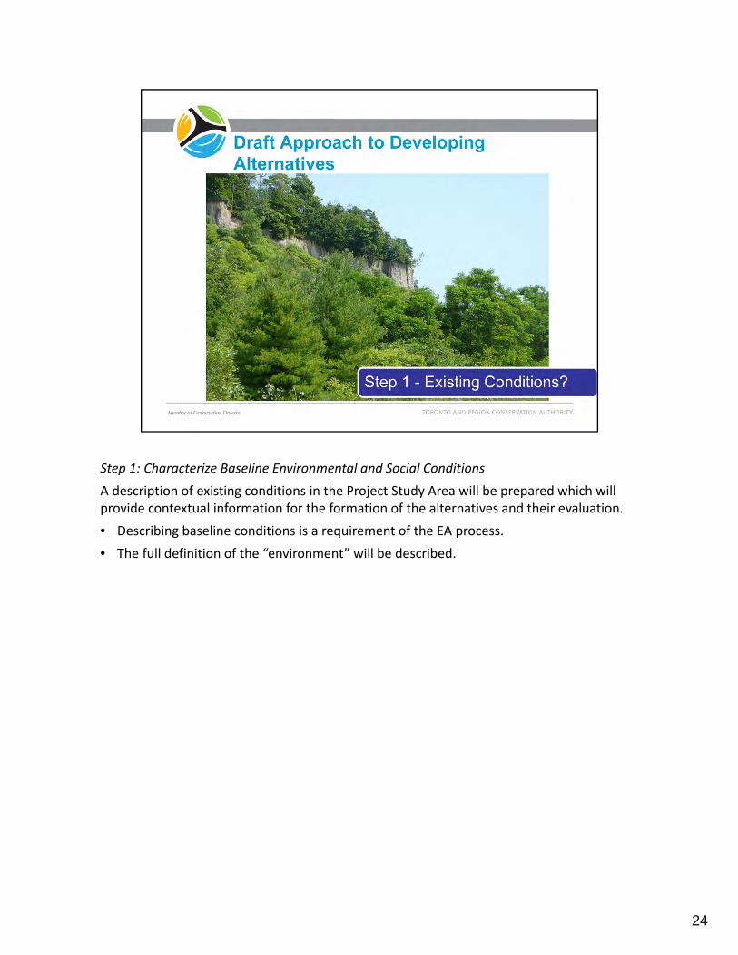
Step 1: Characterize Baseline Environmental and Social Conditions
A description of existing conditions in the Project Study Area will be prepared which will provide contextual information for the formation of the alternatives and their evaluation.
• Describing baseline conditions is a requirement of the EA process.
• The full definition of the “environment” will be described.
24

Step 2: Confirm Challenges and Opportunities by Project Area Segment
Considering the baseline conditions and community input, the challenges and opportunities for each of the three shoreline segments will be confirmed. This will include the preparation of public safety and property risk hazard mapping and list will provide the starting point for the development of the Alternatives.
• The challenges and opportunities will provide direction to alternatives development – to solve challenges and explore ways to take advantage of the opportunities to create benefits
• For example ‐Where is the risk to erosion? (hazard mapping will be undertaken to identify remaining erosion prone areas).
25

Step 3: Develop Alternatives by Project Area Segment
Once we understand baseline conditions and the challenges & opportunities, we will then begin to build the alternatives. Alternatives will be developed for each of the Project Area Segments. To start the process to build alternatives, we will consider the identified risk/hazard areas and then look at where improved and/or new trails could be developed.
• Both access along the waterfront (toe and top of bluff) and to/from the water’s edge will be considered.
• We will also look at where we can provide access that connects the top and bottom of the bluffs.
• We will reach out to stakeholders in the EA to ask where they want the trails to go?
26

Step 3 : Building Alternatives (continued)
Considering the proposed access improvements, we will create Alternatives for each shoreline segment to address the challenges and opportunity, and fulfill the remaining Project objectives.
For example:
• What kind of habitat improvements can we do?
• What new (and where) greenspace and recreation opportunities can be created?
• The development of the alternatives will be an iterative process with input opportunities provides for the public and agencies
27

This image provides a review of the process that was just described in the previous slides.
• Step 1: Review the Existing Conditions by Project Area Segments
• Step 2a: Assess Risk. For example ‐Where is the risk of erosion? What would we need to do to address priority risk areas?
• Step 2b: Review Challenges and Opportunities. Where is the significant habitat? Where would a trail go? Where should access be provided?
• Step 3: Start to Build Alternatives. For example ‐Where could a trail safely go? Where can we provide access points that connect the top and bottom of the bluffs? What kind of habitat improvements can we do? What else can be done to address the challenges and opportunities? How does it all fit together?
28

As a result of Steps 1‐3, we will then have a range of alternatives for each project area segment. The range of feasible alternatives could vary by shoreline segment. Please note, this slide is conceptual and is intended to show how we see the process unfolding. We have not yet developed any Alternatives ‐ this will be determined in the Environmental Assessment phase.
The Alternatives will then be assessed to identify which Alternative for each Shoreline Segment best meets the project objectives.
Depending on the shoreline segment, there may be 1 to 2 Alternatives that are best meet the project objectives and visions, and address the challenges and opportunities for that segment. The Preferred Alternative(s) for each shoreline segment will be combined together. Where necessary, design adjustments will be made to ensure integration among the three shoreline segments. Depending on the Preferred Alternative(s) within each shoreline segment, it may be possible to combine them in different ways to result in more than one “full Preferred Alternative” for the entire shoreline length. If this is the case, then a second evaluation phase may be undertaken.
29

Assess Alternatives within Each Project Area Segment
The draft evaluation criteria will:
• Measure the differences between the Alternatives.
• Identify the Alternative which best meet the Project Objectives.
• Some of the Draft Criteria may not apply to each shoreline segment depending on the focus of the area.
• Please note, the Draft Evaluation Criteria provided for comment as part of the meeting are preliminary, and will be further refined as information becomes known and Alternatives developed during the EA phase.
30

31

TRCA is looking for your input on the information presented tonight by March 10, 2015 in order to include it in the Draft Terms of Reference.
The Draft Terms of Reference will be released for 30 day public and agency review late March 2015/ early April.
The Final Terms of Reference is anticipated to be submitted to the Ministry of Environment and Climate Change (MOECC) by late May 2015.
A decision by the Minister of Environment and Climate Change is hoped for by the Fall of 2015. Assuming a positive decision from the MOECC in the Fall, we will begin the Environmental Assessment (EA).
TRCA and the City of Toronto will continue to consult with the public during the EA process of the project.
32

33
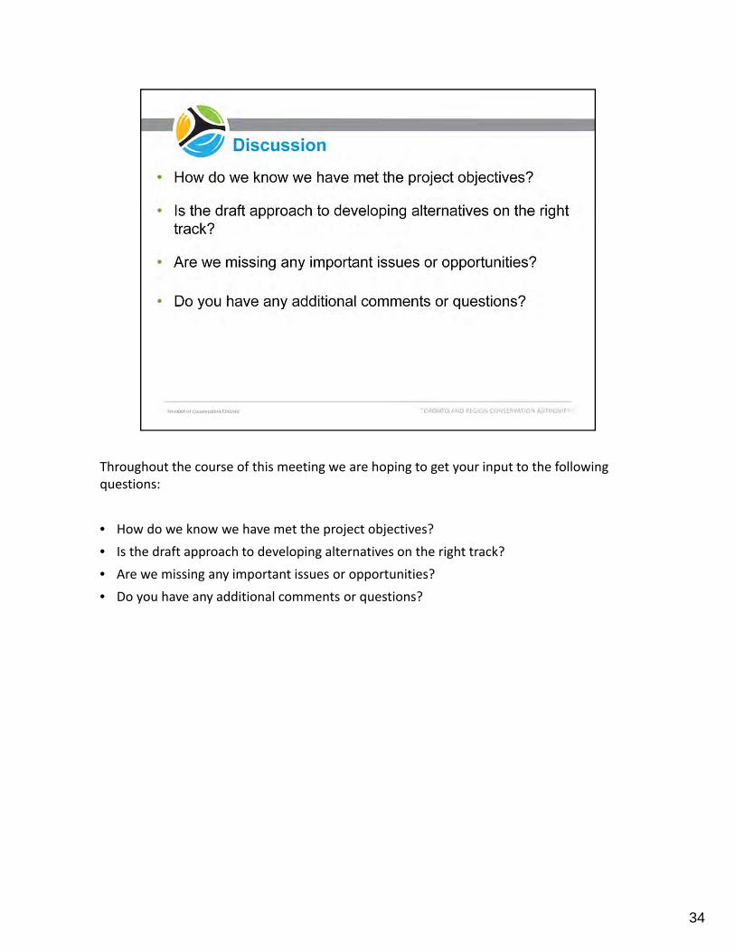
Throughout the course of this meeting we are hoping to get your input to the following questions:
• How do we know we have met the project objectives?
• Is the draft approach to developing alternatives on the right track?
• Are we missing any important issues or opportunities?
• Do you have any additional comments or questions?
34