weather and climate in canada ms. percy cgc1dg
TRANSCRIPT

WEATHER AND CLIMATEIN CANADAMs. PercyCGC1DG


Your Job…
Access the J. BOWLER worksheet online.
As you go to each station, complete the worksheet to learn about each factor that affects climate
Use your textbook to supplement the station information

Weather is…
The short-term, day-to-day conditions in the atmosphere
Examples: rain, sun, sleet, snow, wind
The weather today can be described as…

Climate is…
The weather conditions of a particular region averaged over a long period of time
Example: Prairie, Subarctic, Mountain, Atlantic…

Introducing J. Bowler
I wonder if they have any clue how much I
know about climate in Canada? Hmmmm.
I love my skateboard
I’m the world’s best bowler

Factors That Affect Climate
J – Jet Stream
B – Bodies of water
O – Ocean currents
W – Wind and air masses
L – Latitude
E – Elevation and Landforms
R - Relief

Factor Power
Certain factors have more of an impact in certain regions than in others, depending on geographic location, time of year, etc.
Therefore, some regions are more heavily influenced by 1-2 factors compared to other regions.
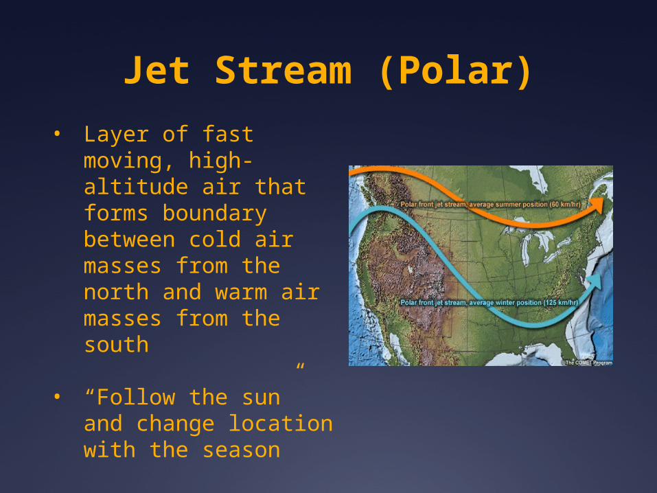
Jet Stream (Polar)
• Layer of fast moving, high-altitude air that forms boundary between cold air masses from the north and warm air masses from the south
• “Follow the sun” and change location with the season

Bodies of Water
Bodies of water heat up and cool down more slowly than land
Consider the desert
Bodies of water affect air temperature in the region

Ocean Currents
Warm and cold ocean currents make coastal locations warmer or colder than normal for its latitude
Ocean current temperatures affect atmospheric conditions

Winds and Air Masses
Air mass is a huge body of air that has the characteristics of where it formed
Winds blow from areas of high pressure to areas of low pressure

Continental = formed over land (dry)
Maritime = formed over water (moist)
Arctic = cold to very cold
Polar = cool to cold
Tropic = warm to hot
cAcPcTmPmT
What type of air mass would form over Regina, SK?

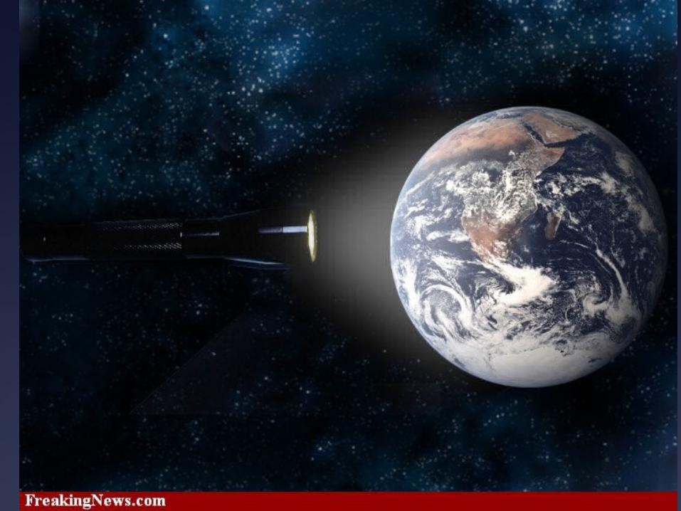
Latitude
Distance from the equator affects climate
Canada is located closer to the north pole than the equator therefore we have a colder climate than say Kenya
Consider the flashlight demonstration

Elevation/Altitude Is the vertical distance (height) of a
landform from sea level to the top of the landform - altitude
What happens to the temperature as you climb up a mountain?
Temperature drops as elevation increases
Air gets thinner and pressure decreases as elevation increases and is less able to retain heat from the sun
Air closer to the earth’s surface has higher pressure = warmer

Relief
The difference in elevation between the highest and lowest points in an area
Change in topography (shape of land)
Mountainous regions tend to have more precipitation. As air rises, it condenses and releases in various forms of precipitation
Example: The Rocky Mountains

Elevation and Relief

Windward Side
Leeward Side
Rain Shadow
Define the terms windward, leeward, rain shadow and relief precipitation
In your own words, how would you describe what this diagram is showing?

Relief/Orographic Precipitation

Work It!
Use pages 145-155 to complete your chart. You can work individually or with your elbow partner.
Compare your charts and diagrams with a classmate