water quality management: case study of golden horn · pdf file1 water quality management:...
TRANSCRIPT
1
Water Quality Management: Case Study of Golden Horn (Halic) – Istanbul-Turkey
1. Study Area
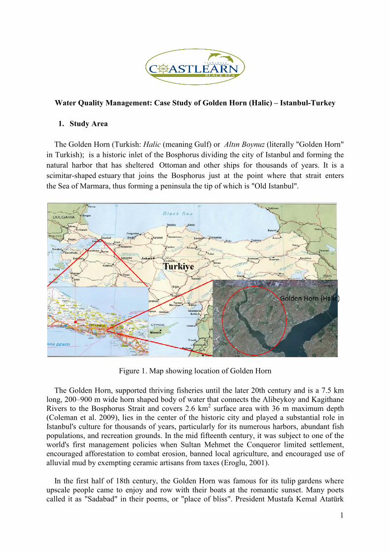
The Golden Horn (Turkish: Halic (meaning Gulf) or Altın Boynuz (literally "Golden Horn"
in Turkish); is a historic inlet of the Bosphorus dividing the city of Istanbul and forming the
natural harbor that has sheltered Ottoman and other ships for thousands of years. It is a
scimitar-shaped estuary that joins the Bosphorus just at the point where that strait enters
the Sea of Marmara, thus forming a peninsula the tip of which is "Old Istanbul".
Figure 1. Map showing location of Golden Horn
The Golden Horn, supported thriving fisheries until the later 20th century and is a 7.5 km long, 200–900 m wide horn shaped body of water that connects the Alibeykoy and Kagithane Rivers to the Bosphorus Strait and covers 2.6 km2 surface area with 36 m maximum depth (Coleman et al. 2009), lies in the center of the historic city and played a substantial role in Istanbul's culture for thousands of years, particularly for its numerous harbors, abundant fish populations, and recreation grounds. In the mid fifteenth century, it was subject to one of the world's first management policies when Sultan Mehmet the Conqueror limited settlement, encouraged afforestation to combat erosion, banned local agriculture, and encouraged use of alluvial mud by exempting ceramic artisans from taxes (Eroglu, 2001). In the first half of 18th century, the Golden Horn was famous for its tulip gardens where upscale people came to enjoy and row with their boats at the romantic sunset. Many poets called it as "Sadabad" in their poems, or "place of bliss". President Mustafa Kemal Atatürk
2
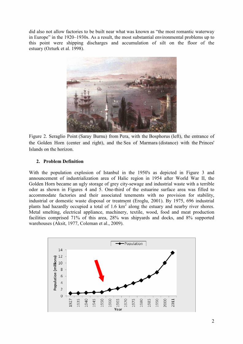
did also not allow factories to be built near what was known as “the most romantic waterway in Europe” in the 1920–1930s. As a result, the most substantial environmental problems up to this point were shipping discharges and accumulation of silt on the floor of the estuary (Ozturk et al. 1998).
Figure 2. Seraglio Point (Saray Burnu) from Pera, with the Bosphorus (left), the entrance of
the Golden Horn (center and right), and the Sea of Marmara (distance) with the Princes'
Islands on the horizon.
2. Problem Definition With the population explosion of Istanbul in the 1950's as depicted in Figure 3 and announcement of industrialization area of Halic region in 1954 after World War II, the Golden Horn became an ugly storage of grey city-sewage and industrial waste with a terrible odor as shown in Figures 4 and 5. One-third of the estuarine surface area was filled to accommodate factories and their associated tenements with no provision for stability, industrial or domestic waste disposal or treatment (Eroglu, 2001). By 1975, 696 industrial plants had hazardly occupied a total of 1.6 km2 along the estuary and nearby river shores. Metal smelting, electrical appliance, machinery, textile, wood, food and meat production facilities comprised 71% of this area, 28% was shipyards and docks, and 8% supported warehouses (Aksit, 1977, Coleman et al., 2009).

3
Figure 3. Population of Istanbul over time (TSI)
Figure 4. Figure showing Golden Horn (Halic) before restoration in 1996 (Ayan, 2008)
Figure 5. Figure showing Golden Horn (Halic) before restoration in 1996 (Ayan, 2008)
Subsequently, 200,000 tons of liquid (67% chemical waste, 27% wash water, 4% cooling water, and 2% wastewater) were discharged into the Golden Horn daily. Additionally, wastes from shipping and passenger transport contributed 3.1 million tons of industrial materials and coal per year (Aksit, 1977; Coleman et al., 2009). Furthermore, the shores of both streams
4
feeding the estuary were also developed, leading to the local annual release of 1.9 million tons of liquid and 49,000 tons of solid waste from 364 industries (Tezcan and Durgunoglu, 1977; Coleman et al., 2009). It has been estimated that in 1980, all of these industries discharged 24,000 tons of chromium, 300 tons of copper, 130 tons of nickel, and 7500 tons of zinc (Tuncer et al.,2001; Coleman et al., 2009). Another major source of pollution, Istanbul’s sewer system, consisted of drains dating to Roman and Ottoman periods, as well as isolated cesspools and septic tanks, until the 1980s. Crude housing developments discharged 100,000 m3 of raw domestic wastewater per day into 123 major and at least 500 minor sewers that led to the Golden Horn (Coleman et al., 2009). Unplanned, uncontrolled urban development around the Golden Horn and its waste production soon gave rise to anoxic sediment buildup, stifling hydrogen sulfide odor, high concentrations of harmful bacteria, mosquitoes, disease and a lack of formerly abundant biota (Coleman et al., 2009 ). Industrial waste, largely due to slaughterhouse activities, shipbuilding, repairing, and dockyard operations, as well as erosion via chaotic urbanization, deforestation, and livestock grazing was the third major source of pollution (Kanat, 2004; Coleman et al., 2009).
3. Environmental Remediation of Golden Horn (Halic)
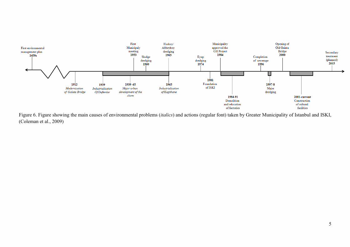
The problems faced in Golden Horn were recognized early, beginning with a meeting in 1953 called to address foul odors in the estuary. However, the only significant action taken for decades included four localized dredging operations and a 1966 plan to limit construction of large facilities in the vicinity of the estuary (Coleman et al., 2009). A timeline showing main causes of environmental problems and action which were taken is depicted in Figure 6.
5
Figure 6. Figure showing the main causes of environmental problems (italics) and actions (regular font) taken by Greater Municipality of Istanbul and ISKI,
(Coleman et al., 2009)
6
One of the greatest projects of environmental protection namely “Halic Environmental Protection Project” was started by the Greater Municipality of Istanbul and ISKI to restore the Landscape of Halic and to regain its historical and cultural characteristics.
3.1. Industrial and Residential Relocation
The first step of rehabilitation project involved the purchase or expropriation, demolition, and relocation of almost all of the 620 industries, 1200 shops, and 5000 shanty homes that lined much of Golden Horn’s shore. Approximately 40% of the factories had illegally paid nothing to operate on public land, and were simply destroyed with city council approval (Eroglu, 2001; Coleman et al., 2009). Most shipyards and dry docks that tended to impede estuarine circulation were also destroyed at this time. These strict actions were necessary because creating industrial and domestic wastewater treatment infrastructure would not have been possible under the previous circumstances. Public approval rates of the restoration project rose due to replacing of industries by parkland (Coleman et al., 2009). Over 5000 new dwellings and a new organized industrial zone (‘‘Ikitelli’’) were constructed for the displaced residents and businesses approximately 15 km to the west of the Golden Horn on a 6 million m2 area (Coleman et al., 2009). In place of much of the old industrial zone, a 1.2 million m2 area was converted into parkland along the shoreline to regain some of its recreational value (Eroglu, 2001).
3.2. Sewerage -etworks and Wastewater Treatment Plants
A number of wastewater treatment plants, sewerage collectors and sea outfall systems have been constructed to avoid wastewater entrance to Halic. These projects were applied in North and South side of Halic.
3.2.1. -orth Halic Wastewater Catchment Area
A number of wastewater collectors, wastewater collection tunnels, a wastewater pumping station, a sea outfall system and a wastewater pre-treatment plant have been constructed to avoid wastewater discharge to Halic. Existing and planned constructions of North Halic wastewater catchment area depicted in Figure 7 are as follows (ISKI):
- Kagithane Left Coast Waste Water Collector
- North Halic Wastewater Collectors and Tunnel
- Kabataş-Baltalimanı Wastewater Tunnels
- Baltalimani Wastewater Pre-Treatment Plant (Figure 8.)
- Baltalimani Sea Outfall System
- North Halic Wastewater Secondary Collectors
- Kagithane Wastewater Collecting System
- Cendere Wastewater Pumping Station
- Kemerburgaz-Gokturk Odayeri Wastewater Collectors
- Kasimpasa Storm Water Tunnels

7
Figure 7. North Halic Wastewater Catchment Area (Ayan, 2008)
Figure 8. Baltalimani Wastewater Pre-Treatment Plant (Ayan, 2008)

8
3.2.2. South Halic Wastewater Catchment Area
Existing and planned constructions of South Halic wastewater catchment area depicted in Figure 9 are as follows (ISKI):
- Zeytinburnu Wastewater Collectors and Pumping Station
- Alibeykoy River Coast Wastewater Collectors
- Kagithane Right Coast Wastewater Collectors
- Kucukkoy Wastewater Tunnel (Figure 10.)
- Unkapani-Ayvansaray Wastewater Collectors
- Eminonu-Unkapani Wastewater Collectors
- Yenikoy Wastewater Pre-Treatment Plant
Figure 9. South Halic Wastewater Catchment Area (Ayan, 2008)
9
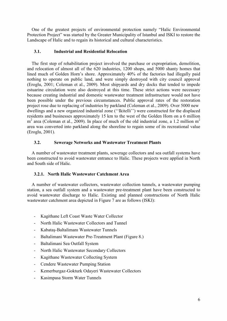
Figure 10. Yenikapi Wastewater Pre-Treatment Plant (©ISKI)
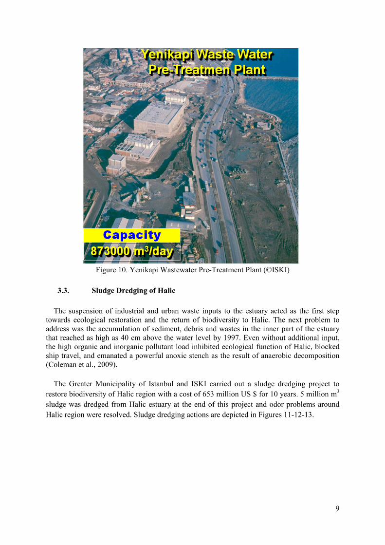
3.3. Sludge Dredging of Halic
The suspension of industrial and urban waste inputs to the estuary acted as the first step towards ecological restoration and the return of biodiversity to Halic. The next problem to address was the accumulation of sediment, debris and wastes in the inner part of the estuary that reached as high as 40 cm above the water level by 1997. Even without additional input, the high organic and inorganic pollutant load inhibited ecological function of Halic, blocked ship travel, and emanated a powerful anoxic stench as the result of anaerobic decomposition (Coleman et al., 2009).
The Greater Municipality of Istanbul and ISKI carried out a sludge dredging project to
restore biodiversity of Halic region with a cost of 653 million US $ for 10 years. 5 million m3
sludge was dredged from Halic estuary at the end of this project and odor problems around
Halic region were resolved. Sludge dredging actions are depicted in Figures 11-12-13.

10
Figure 11. Sludge dredging actions in Halic (Ayan, 2008)
Figure 12. Sludge dredging actions in Halic (Ayan, 2008)
11
Figure 13. Sludge dredging actions in Halic (Ayan, 2008)
4. Results of Halic Environmental Protection Project
Actions taken by the Greater Municipality of Istanbul and ISKI have measurably improved water quality in the entire Golden Horn, even the formerly condemned inner area. Odor and biodiversity problems of Halic have been resolved and Halic’s cultural and historical characteristics have been regained. Figure 14 is representing Halic region before restoration project while Figure 15 is representing Halic region after project.

12
Figure 14. Halic (Golden Horn) before restoration project (Nelleman and Corcoran, 2010)
13
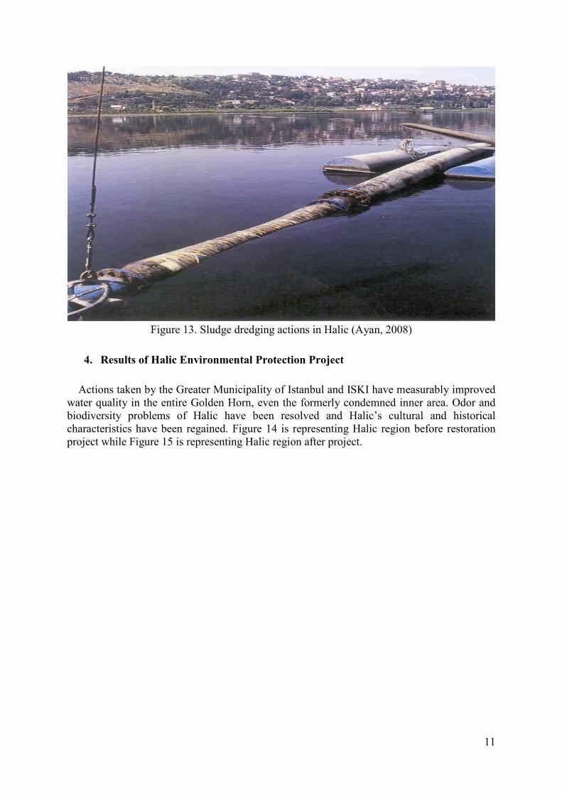
Figure 15. Halic (Golden Horn) after restoration project ((Nelleman and Corcoran, 2010)
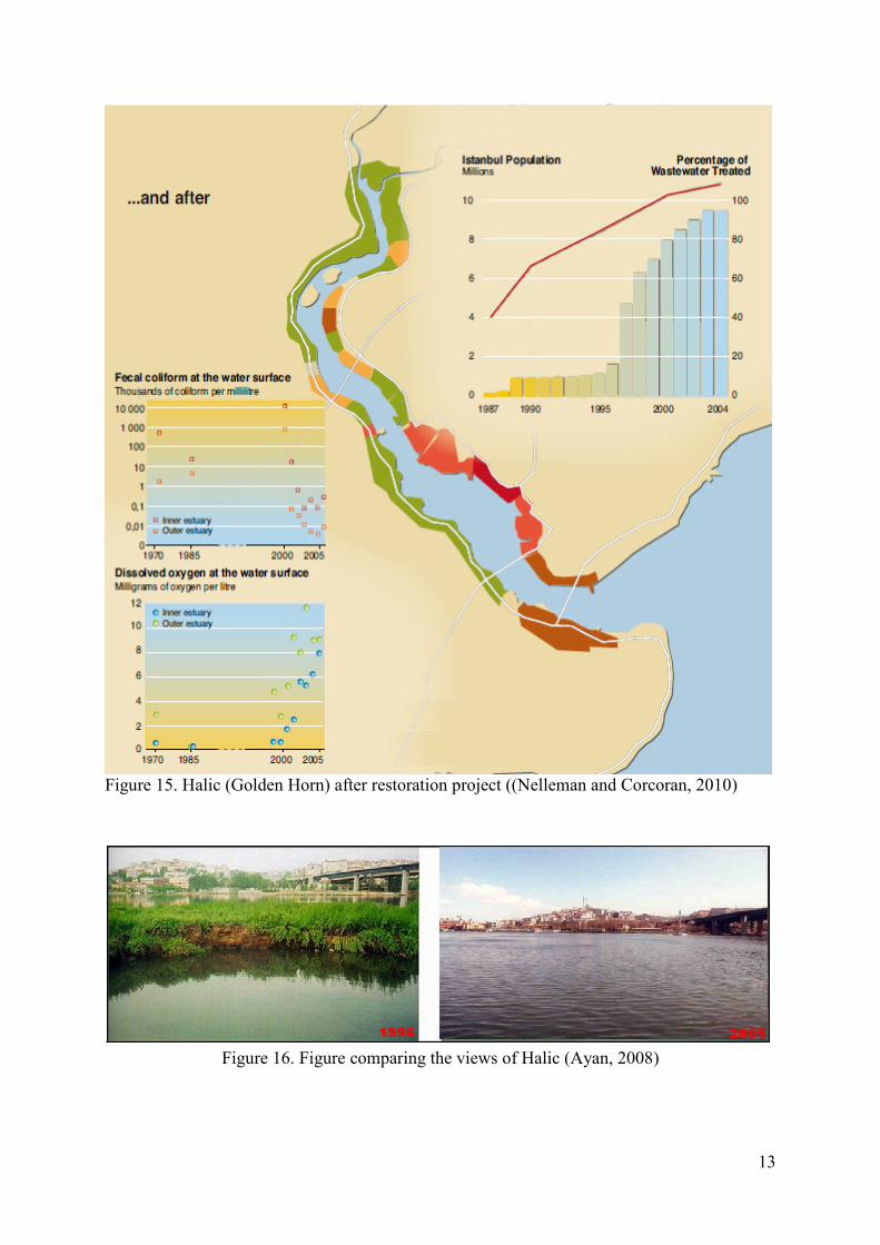
Figure 16. Figure comparing the views of Halic (Ayan, 2008)
14
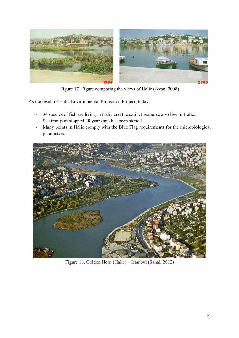
Figure 17. Figure comparing the views of Halic (Ayan, 2008)
As the result of Halic Environmental Protection Project, today:
- 34 species of fish are living in Halic and the extinct seahorse also live in Halic.
- Sea transport stopped 20 years ago has been started.
- Many points in Halic comply with the Blue Flag requirements for the microbiological
parameters.
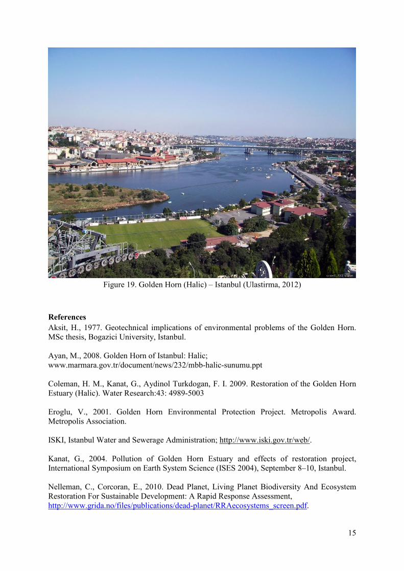
Figure 18. Golden Horn (Halic) – Istanbul (Sanal, 2012)
15
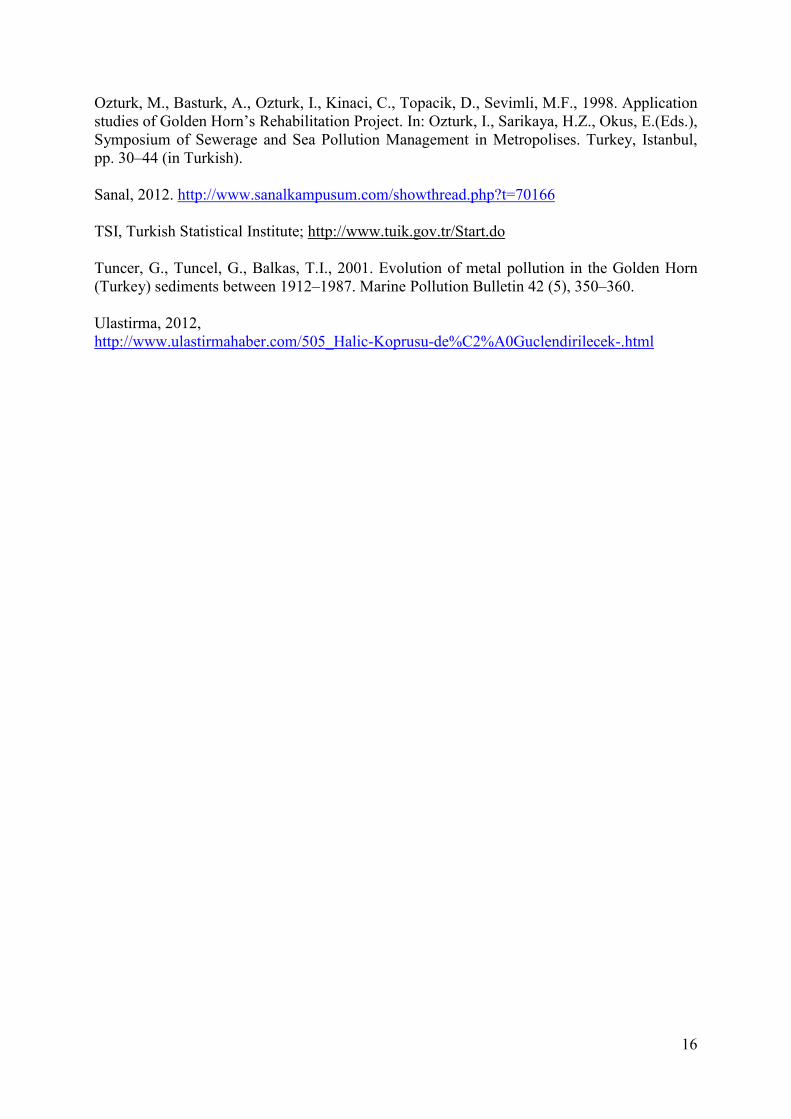
Figure 19. Golden Horn (Halic) – Istanbul (Ulastirma, 2012)
References
Aksit, H., 1977. Geotechnical implications of environmental problems of the Golden Horn. MSc thesis, Bogazici University, Istanbul. Ayan, M., 2008. Golden Horn of Istanbul: Halic; www.marmara.gov.tr/document/news/232/mbb-halic-sunumu.ppt Coleman, H. M., Kanat, G., Aydinol Turkdogan, F. I. 2009. Restoration of the Golden Horn Estuary (Halic). Water Research:43: 4989-5003 Eroglu, V., 2001. Golden Horn Environmental Protection Project. Metropolis Award. Metropolis Association. ISKI, Istanbul Water and Sewerage Administration; http://www.iski.gov.tr/web/. Kanat, G., 2004. Pollution of Golden Horn Estuary and effects of restoration project, International Symposium on Earth System Science (ISES 2004), September 8–10, Istanbul. Nelleman, C., Corcoran, E., 2010. Dead Planet, Living Planet Biodiversity And Ecosystem Restoration For Sustainable Development: A Rapid Response Assessment, http://www.grida.no/files/publications/dead-planet/RRAecosystems_screen.pdf.
16
Ozturk, M., Basturk, A., Ozturk, I., Kinaci, C., Topacik, D., Sevimli, M.F., 1998. Application studies of Golden Horn’s Rehabilitation Project. In: Ozturk, I., Sarikaya, H.Z., Okus, E.(Eds.), Symposium of Sewerage and Sea Pollution Management in Metropolises. Turkey, Istanbul, pp. 30–44 (in Turkish). Sanal, 2012. http://www.sanalkampusum.com/showthread.php?t=70166 TSI, Turkish Statistical Institute; http://www.tuik.gov.tr/Start.do Tuncer, G., Tuncel, G., Balkas, T.I., 2001. Evolution of metal pollution in the Golden Horn (Turkey) sediments between 1912–1987. Marine Pollution Bulletin 42 (5), 350–360. Ulastirma, 2012, http://www.ulastirmahaber.com/505_Halic-Koprusu-de%C2%A0Guclendirilecek-.html