wanaea well intervention environment plan summary · wanaea well interventions environment plan...
TRANSCRIPT

Wanaea Well Interventions Environment Plan Summary
This document is protected by copyright. No part of this document may be reproduced, adapted, transmitted, or stored in any form by any process (electronic or otherwise) without the specific written consent of Woodside. All rights are reserved.
Controlled Ref No: Revision: 0 Native file DRIMS No: 1401138911 Page i
Uncontrolled when printed. Refer to electronic version for most up to date information.
Wanaea Well Intervention
Environment Plan Summary Development Division
May 2019
Revision O

Wanaea Well Interventions Environment Plan Summary
This document is protected by copyright. No part of this document may be reproduced, adapted, transmitted, or stored in any form by any process (electronic or otherwise) without the specific written consent of Woodside. All rights are reserved.
Controlled Ref No: Revision: 0 Native file DRIMS No: 1401138911 Page ii
Uncontrolled when printed. Refer to electronic version for most up to date information.
TABLE OF CONTENTS
TABLE OF CONTENTS ...................................................................................................... II
1. INTRODUCTION..................................................................................................... 5
1.1 Defining the Activity ........................................................................................................... 5
2. LOCATION OF THE ACTIVITY .............................................................................. 6
3. DESCRIPTION OF THE ACTIVITY ........................................................................ 8
3.2 Purpose of the Activity ....................................................................................................... 8
3.4.1 WA-03 Intervention Scope ................................................................................................ 8
3.4.2 WA-11a Intervention Sequence of Operations .................................................................. 9
3.4.3 Light Well Intervention Stack ........................................................................................... 10
3.4.4 Flush Return Kill (FRK) System ....................................................................................... 11
3.4.5 Hydrocarbons to surface. ................................................................................................ 11
3.5 Project Vessels ............................................................................................................... 12
3.5.1 LWIV ............................................................................................................................... 12
3.5.2 Supply Vessels................................................................................................................ 12
3.5.3 Remotely Operated Vehicles ........................................................................................... 12
3.5.4 Helicopters ...................................................................................................................... 12
3.5.5 Vessel refuelling .............................................................................................................. 12
3.5.6 Vessel emissions and discharges.................................................................................... 13
3.6.1 Assessment of Project Fluids .......................................................................................... 13
3.7 Contingent Activities ........................................................................................................ 14
3.7.1 Marine Growth Removal .................................................................................................. 14
3.7.2 Emergency Disconnect Sequence................................................................................... 14
4. DESCRIPTION OF THE RECEIVING ENVIRONMENT ....................................... 15
4.1 Species ........................................................................................................................... 24
5. ENVIRONMENTAL IMPACTS AND RISKS ......................................................... 33
5.1 Risk and Impact Identification and Evaluation ................................................................. 33
5.1.1 Establish the Context ...................................................................................................... 34
5.1.2 Impact and Risk Identification .......................................................................................... 34
5.1.3 Risk Analysis ................................................................................................................... 34
5.1.3.1 Decision Support Framework ...................................................................................... 34
5.1.3.2 Identification of Control Measures ............................................................................... 35
5.1.3.3 Risk Rating Process .................................................................................................... 35
5.1.4 Impact and Risk evaluation ............................................................................................. 37
5.1.4.1 Demonstration of ALARP ............................................................................................ 37
5.1.4.2 Demonstration of Acceptability .................................................................................... 38
5.2 Hydrocarbon Spill Risk Assessment Methodology ........................................................... 38
5.2.1 ZoC and Hydrocarbon Contact Thresholds ..................................................................... 38
5.2.2 Surface Hydrocarbon Threshold Concentrations ............................................................. 39
5.2.3 Dissolved Aromatic Hydrocarbon Threshold Concentrations ........................................... 40
5.2.4 Entrained Hydrocarbon Threshold Concentrations .......................................................... 41
5.2.5 Accumulated Hydrocarbon Threshold Concentrations ..................................................... 42

Wanaea Well Interventions Environment Plan Summary
This document is protected by copyright. No part of this document may be reproduced, adapted, transmitted, or stored in any form by any process (electronic or otherwise) without the specific written consent of Woodside. All rights are reserved.
Controlled Ref No: Revision: 0 Native file DRIMS No: 1401138911 Page iii
Uncontrolled when printed. Refer to electronic version for most up to date information.
5.3 Potential Environment Risks Not Included Within the Scope of the Environment Plan .... 42
6. ENVIRONMENTAL RISK AND IMPACTS SUMMARY ........................................ 43
7. ONGOING MONITORING OF ENVIRONMENTAL PERFORMANCE ................. 46
7.1 Environment Plan Revisions and Management of Change .............................................. 47
8. OIL POLLUTION EMERGENCY RESPONSE ARRANGEMENTS ...................... 48
8.1 Woodside Oil Pollution Emergency Arrangements (Australia) ......................................... 48
8.2 Wanaea LWIV Oil Pollution First Strike Plan ................................................................... 48
8.3 Oil Spill Preparedness and Response Mitigation Assessment ......................................... 49
9. CONSULTATION .................................................................................................. 50
9.1 Ongoing Consultation ...................................................................................................... 51
9.2 Non-Routine Events ........................................................................................................ 51
10. TITLEHOLDER NOMINATED LIAISON PERSON ............................................... 53
11. ABBREVIATIONS ................................................................................................ 54
12. REFERENCES ..................................................................................................... 57
APPENDIX A: ENVIRONMENTAL IMPACTS AND RISKS .............................................. 61
APPENDIX B: CONTROL MITIGATION MEASURES FOR POTENTIAL ENVIRONMENTAL IMPACTS ASSOCIATED WITH SPILL RESPONSE ACTIVITIES ........................................................................................................ 103
APPENDIX C: SUMMARY OF STAKEHOLDER FEEDBACK AND WOODSIDE’S RESPONSE ........................................................................................................ 107
List of Tables
Table 2-1: Approximate Location Details for the Petroleum Activities Program ...................... 6 Table 4-1 Threatened and Migratory Marine Species under the EPBC Act Potentially Occurring within the Operational Area ...................................................................................... 24 Table 4-2: Summary of Established and Proposed Marine Protected Areas (MPAs) and Other Sensitive Locations in the Region Relating to the Operational Area ...................................... 32 Table 5-1: Woodside Risk Matrix (environment and social and cultural) consequence descriptions ................................................................................................................................ 36 Table 5-2: Woodside risk matrix likelihood levels .................................................................... 36 Table 5-3: Summary of Woodside’s criteria for ALARP demonstration .................................. 37 Table 5-4: Summary of Woodside’s criteria for Acceptability ................................................. 38 Table 5-5 Summary of thresholds applied to the quantitative hydrocarbon spill modelling results .......................................................................................................................................... 39 Table 5-6: The Bonn Agreement oil appearance code ............................................................. 39 Table 5-7: Characteristics of the hydrocarbon types used in the modelling scenarios ........ 40 Table 5-8: Summary of total recoverable hydrocarbons NOECs for key life-histories of different biota based on toxicity tests for WAF of Cossack (Okha) crude oil ......................... 41 Table 6-1: Environmental Risk and Impacts Register Summary ............................................. 44 Table 9-1: Relevant Stakeholder Identified for the Petroleum Activities Program ................. 50 Table 12-1: Cossack/Wanaea crude characteristics ................................................................. 86 Table 12-2: Summary of modelled credible scenario – loss of well containment during intervention ................................................................................................................................. 87 Table 12-3: Range of assumed inputs and range of calculated outputs, by OILMAP-Deep model for the surface/subsea well loss of containment (crude) ............................................. 88
Wanaea Well Interventions Environment Plan Summary
This document is protected by copyright. No part of this document may be reproduced, adapted, transmitted, or stored in any form by any process (electronic or otherwise) without the specific written consent of Woodside. All rights are reserved.
Controlled Ref No: Revision: 0 Native file DRIMS No: 1401138911 Page iv
Uncontrolled when printed. Refer to electronic version for most up to date information.
List of Figures
Figure 2-1: Location of the Petroleum Activities Program ......................................................... 6 Figure 4-1: Vessel density map in the vicinity of Operational Area from 2018, derived from AMSA satellite tracking system data (vessels include cargo, LNG tanker, passenger, support and other vessels) ........................................................................................................ 29 Figure 4-2: Established and proposed Commonwealth and State Marine Protected Areas in Relation to the Operational Area ............................................................................................... 31 Figure 5-1: Key steps in Woodside’s Risk Management Framework ...................................... 33 Figure 5-2: Woodside risk matrix: risk level ............................................................................. 37 Figure 12-1: Proportional mass balance plot representing the weathering of 50 m3 from a surface spill of Cossack light crude .......................................................................................... 77 Figure 12-2: Proportional mass balance plot (middle) and volume (bottom) representing the weathering of 50 m3 from a surface spill of Wanaea light crude .............................................. 87 Figure 12-3: Proportional mass balance plot representing weathering of a surface spill of marine diesel as a one-off release (50 m3 over 1 hr) and subject to variable wind at 27 °C water temperature and 25 °C air temperature. .......................................................................... 93

Wanaea Well Interventions Environment Plan Summary
This document is protected by copyright. No part of this document may be reproduced, adapted, transmitted, or stored in any form by any process (electronic or otherwise) without the specific written consent of Woodside. All rights are reserved.
Controlled Ref No: Revision: 0 Native file DRIMS No: 1401138911 Page 5 of 114
Uncontrolled when printed. Refer to electronic version for most up to date information.
1. INTRODUCTION
Woodside Energy Ltd (Woodside), as Titleholder, under the Offshore Petroleum and Greenhouse Gas Storage (Environment) Regulations 2009 (Cth) (referred to as the Environment Regulations), proposes to undertake intervention activities on the Wanaea-03 (WA-03) and the Wanaea-11a (WA-11a) wells, hereafter referred to as the Petroleum Activities Program. The Wanaea Well Intervention Envrionmental Plan (EP) was accepted by National Offshore Petroleum Safety and Environmental Management Authority (NOPSEMA) on 22 May, 2019.
This EP Summary has been prepared to meet the requirements of Regulations 11(3) and 11(4) under the Environment Regulations, as administered by NOPSEMA.
1.1 Defining the Activity
The Petroleum Activities Program to be undertaken involves conducting subsea interventions on the WA-03 and WA-11a wells. These activities are defined as petroleum activities within Regulation 4 of the Environment Regulations and as such an EP is required.

Wanaea Well Interventions Environment Plan Summary
This document is protected by copyright. No part of this document may be reproduced, adapted, transmitted, or stored in any form by any process (electronic or otherwise) without the specific written consent of Woodside. All rights are reserved.
Controlled Ref No: Revision: 0 Native file DRIMS No: 1401138911 Page 6 of 114
Uncontrolled when printed. Refer to electronic version for most up to date information.
2. LOCATION OF THE ACTIVITY
The proposed petroleum activities are located in Commonwealth waters on the North West Shelf (NWS) of Western Australia (WA), in Production Licence Areas WA-9 and WA-11, approximately 100 km north of Dampier, Western Australia (Figure 2-1).
Figure 2-1: Location of the Petroleum Activities Program
The coordinates and permit areas of the wells are presented in Table 2-1.
Table 2-1: Approximate Location Details for the Petroleum Activities Program
Activity Water Depth (Approx. m Lowest Astronomical
Tide)
Latitude Longitude Permit Area
Wanaea-03 well 81 m 19° 34' 41” S 116° 27' 0” E WA-9-L
Wanaea-11a well
79 m 19o 35’ 31” S 116 o 26’ 05” E WA-11-L
2.1 Operational Area
The Operational Area defines the spatial boundary of the Petroleum Activities Program. The area includes (Figure 2-2):
• the Wanaea-03 subsea production well and associated manifold and an area of 500 m around the well

Wanaea Well Interventions Environment Plan Summary
This document is protected by copyright. No part of this document may be reproduced, adapted, transmitted, or stored in any form by any process (electronic or otherwise) without the specific written consent of Woodside. All rights are reserved.
Controlled Ref No: Revision: 0 Native file DRIMS No: 1401138911 Page 7 of 114
Uncontrolled when printed. Refer to electronic version for most up to date information.
• the Wanaea-11a subsea production well and associated manifold and an area of 500 m around the well.
Vessel related activities within the Operational Area will comply with the EP. Vessels supporting the petroleum activities when outside the Operational Area will adhere to all applicable maritime regulations and other requirements.
Figure 2-2: Wanaea-03 and Wanaea-11a Operational Areas

Wanaea Well Interventions Environment Plan Summary
This document is protected by copyright. No part of this document may be reproduced, adapted, transmitted, or stored in any form by any process (electronic or otherwise) without the specific written consent of Woodside. All rights are reserved.
Controlled Ref No: Revision: 0 Native file DRIMS No: 1401138911 Page 8 of 114
Uncontrolled when printed. Refer to electronic version for most up to date information.
3. DESCRIPTION OF THE ACTIVITY
3.1 Overview
The Petroleum Activities Program will involve well intervention activities on Wanaea-03 and Wanaea-11a, two gas lifted oil wells tied back to the Woodside Operated Okha Floating, Production, Storage and Offloading (FPSO). The interventions will be carried out from a Light Well Intervention Vessel (LWIV).
The WA-03 well is currently shut-in. An intervention is required to install two mechanical plugs to re-instate well integrity barriers in line with Woodside standards. No further production is anticipated from this well.
The WA-11a well is currently shut-in due to the identification of a tubing to annulus communication point located above the surface controlled subsurface valve (SCSSV). An intervention is planned to diagnose and repair the annulus leak through installation of a straddle. A successful repair will see this well returned to normal operation. Operation of the well following the intervention will be covered by the Okha Operations EP. Should the repair be found to be not feasible, or the repair in unsuccessful, plugs may be installed in the well using a similar method for WA-03.
3.2 Purpose of the Activity
Woodside proposes to conduct an intervention on the WA-03 and WA-11a wells, to remediate integrity issues.
3.3 Timing of the Activities
The proposed Petroleum Activities Program is scheduled to occur from August to November 2019. It is expected to be completed within a total of 30 days. This includes up to 10 days for each well intervention and an additional contingency of 10 days to complete both wells. Timing and duration of these activities is subject to change due to project schedule requirements, vessel availability, unforeseen circumstances and weather.
This EP has risk assessed the well intervention activities year-round (all seasons), to provide operational flexibility for requirements and schedule changes, as well as vessel availability.
3.4 Well Intervention
3.4.1 WA-03 Intervention Scope
The purpose of the WA-03 intervention scope is to:
• reinstate a minimum of 2 well barriers to reservoir, in accordance with Woodside Engineering Standard – Well Barriers
• establish sufficient barriers to allow future removal of the Xmas Tree
• set well barriers to stop gas bubbles while providing integrity and reservoir isolation.
The following provides the expected sequence of operations for the WA-03 light well intervention (LWI).
A. Tree cap removal and Subsea Intervention Device (SID) Landout
1. ROV performs as-found survey, identifying any obstructions or hazards at location
2. ROV deployed to recover the Tree Cap with Tree Cap Running Tool (TCRT) and perform cleaning of Xmas Tree (XT) interface

Wanaea Well Interventions Environment Plan Summary
This document is protected by copyright. No part of this document may be reproduced, adapted, transmitted, or stored in any form by any process (electronic or otherwise) without the specific written consent of Woodside. All rights are reserved.
Controlled Ref No: Revision: 0 Native file DRIMS No: 1401138911 Page 9 of 114
Uncontrolled when printed. Refer to electronic version for most up to date information.
3. the LWIV SID is deployed onto the XT and locked in place, transferring control of XT valves to the LWIV
4. barriers within the SID and XT are pressure and function tested.
B. Well Kill
1. a well kill pumping spread is then connected to the SID via a 2” umbilical. Up to 500 bbl of well kill fluids are pumped into the well at a rate of 6–8 bpm (well kill fluids will be comprised of a mix of NaCl brine, mixed with an oxy-scavenger (0.15 ppb), corrosion inhibitor (5 ppb) and biocide (0.2 ppb)).
C. Establish Barriers in Lower Completion
1. this stage involves the installation of two ISO 14310 V0 rated mechanical plugs installed in the lower completion via wireline and confirmation of plug integrity.
D. Set Annulus Tubing Hanger Plugs (THP)
1. in order to install the annulus plug, excess pressure must first be vented to reduce pressure from 2,600 psi to ~600 psi.
2. the annulus contains approximately 251.7 bbl of lean gas (gas lift system fluid) and ~75 bbl of diesel, these will be directed to the Okha FPSO.
3. a mechanical annulus THP will then be installed via wireline.
E. Circulate VXT preservation fluid and test VXT barriers
• circulate preservation fluids through VXT cavities back to LWIV via umbilical
• close VXT valves and pressure/integrity test VXT cavities and barriers (e.g. PMV Inflow, Production Cavity, Annulus Cavity).
4. LWIV stack recovery
• ROV to disconnect upper to lower package flying lead and umbilical
• recover Upper SID (USID) and Lower SID (LSID) to parking frame on LWIV deck (each item to be lifted to 20 m, then vessel position in safe location before retrieval commences).
5. install and test Tree Cap with TCRT. At this point the Okha FPSO will be in control of the XT Valves and well control
6. recovery TCRT to LWIV, vessel demobilizes.
The completion of the activity will see the well remain with integrity barriers in place. Well integrity management and operation will then revert to the control from the Okha FPSO.
Should at any time the operations to restore integrity to the well fail or be otherwise deemed unfeasible, subsea equipment will be removed (if safe to do so) and control of the well handed back to the Okha FPSO. Alternate well integrity repair solutions are therefore not considered in the EP.
3.4.2 WA-11a Intervention Sequence of Operations
The purpose of the intervention is to restore production in WA-11a by re-establishing tubing integrity. A leak in the production tubing between the tubing hanger and the SCSSV has been identified and a suitable tubing straddle solution is to be engineered and installed to isolate the leak area.
The following provides the expected sequence of operations for the WA-11a LWI. Further details on key components used in the intervention are outlined in further detail in the next section.
A Tree cap removal and SID Landout
1. ROV performs as-found survey, identifying any obstructions or hazards at location

Wanaea Well Interventions Environment Plan Summary
This document is protected by copyright. No part of this document may be reproduced, adapted, transmitted, or stored in any form by any process (electronic or otherwise) without the specific written consent of Woodside. All rights are reserved.
Controlled Ref No: Revision: 0 Native file DRIMS No: 1401138911 Page 10 of 114
Uncontrolled when printed. Refer to electronic version for most up to date information.
2. ROV deployed to recover the Tree Cap with TCRT and perform cleaning of XT interface
3. the SID is deployed onto the XT and locked in place
4. barriers within the SID and XT are then pressure and function tested.
B Leak Diagnosis
1. run e-line logging tool into well
2. line up XT valves to the choke, and FPSO to restart production to stable, low flow-rate
3. perform e-line production logging over suspected leak area to detect leak zone
4. once leak area is identified, FPSO to stop production. Well to be shut in, isolated and tested via LWI system
5. install straddle over detected leak area
6. repeat e-line production logging (steps 1-3) with flowing well over straddle area to confirm straddle integrity
7. once leak area is confirmed as repaired, FPSO to stop production. Well to be shut in, isolated and tested via LWI system.
C Remove Valve Overrides, circulate VXT preservation fluid and test VXT barriers
1. circulate preservation fluid and pressure test XT barriers
• close VXT valves and pressure/integrity test VXT cavities and barriers (e.g. PMV Inflow, Production Cavity, Annulus Cavity).
2. LWIV stack recovery
• ROV to disconnect upper to lower package flying lead & umbilical
• recover USID and LSID to parking frame on LWIV deck.
3. install and test Tree Cap with TCRT. At this point the Okha FPSO will be in control of the XT Valves and well control
4. recovery TCRT to LWIV
5. vessel demobilises.
Once the TCRT is re-instated, operation and control of the well will revert to the Okha FPSO.
Should at any time the operations to restore integrity to the well fail or be otherwise deemed unfeasible, subsea equipment will be removed (if safe to do so) and control of the well handed back to the Okha FPSO. If the straddle repair solution fails or is deemed unfeasible, the well will be plugged using similar tools and methodology described for WA-03 in Section 3.4.1.
3.4.3 Light Well Intervention Stack
The SID is designed to be deployed in sections or as a complete unit over the side of the vessel using the vessel crane. Once fully deployed the SID permits light well intervention into live or abandoned subsea wells for, including but not limited to, the following:
• real time production logging via smart e-line tools or with memory equipped sensors on dumb tools
• well diagnostics

Wanaea Well Interventions Environment Plan Summary
This document is protected by copyright. No part of this document may be reproduced, adapted, transmitted, or stored in any form by any process (electronic or otherwise) without the specific written consent of Woodside. All rights are reserved.
Controlled Ref No: Revision: 0 Native file DRIMS No: 1401138911 Page 11 of 114
Uncontrolled when printed. Refer to electronic version for most up to date information.
• down hole valve change out
• perforating, tube cutting or punching operations
• general downhole operations (setting/pulling plugs, etc)
• SST deployment or recovery.
The SID provides a pressure containing lubricator section that allows the deployment of wireline / electric line or slickline toolstrings subsea without the requirement of running a ridged riser system back to the surface. The SID interfaces to the Subsea Tree by means of a custom designed Tree Connector. The system is designed to ensure that there are a minimum of two well barriers in place during well intervention. The system is also designed to secure the well by shutting in additional barriers in the event of loss of communication or in the event of vessel drive/drift off through a manual or autonomous emergency shutdown (ESD) 3 level system.
3.4.4 Flush Return Kill (FRK) System
The FRK system provides a means of flushing the lubricator contents back to the hydrocarbon handling package on deck. This is done before returning the wire line mandrel to surface to ensure that no well bore fluid is released to the environment from dirty Toolstrings or lubricator bores. Additional function of the FRK system allows use of the pumps on the vessel to pressure test barriers, equalise pressure across valves and kill the well if required.
The FRK system in conjunction with the hydrocarbon handling system on the vessel provides well barrier and pressure control redundancy for surface and subsea systems combined and in isolation ensuring that all operational and ESD scenarios have a minimum of two independent verified, available barriers between pressure source and environment. This is further enhanced by strictly controlled operating procedures conducted by competent and qualified personnel.
Some of the components within the Flush, Return and Kill System and the well service pump are hired from specialist vendors on a project by project basis. Some of this equipment has been deemed to be a safety critical element. Accordingly, the hired equipment must meet agreed standards.
3.4.5 Hydrocarbons to surface
Hydrocarbons, in the form of hydrocarbon contaminated flushing returns, are handled on the vessel by a dedicated system consisting of a choke manifold, deck connection piping, separator and cold vent boom. The flushed lubricator fluids are transferred to surface through the FRK umbilical to the FRK reeler with the outlets connected directly to the choke manifold on deck.
The flushing, return and kill umbilicals have subsea and surface isolation valves which will be closed when the BOP valves or other well barriers are opened on the well and conversely the BOP valves or other well barriers will be closed when any of these outlet isolation valves are opened to bleed the lubricator back to surface. The volume flushed at any one time is limited to the volume of the SID lubricator.
During a lubricator flushing operation where the well is completely isolated and barriers tested from the direction of pressure before displacement of fluid, controlled circulation within the Lubricator with a known quantity of water glycol mix is carried out. The volume of the lubricator is 0.384 m3 hence with the worst case of total lubricator volume stored as gas then bled back to surface at well pressure, the volume of stored gas brought to the surface and fed through the separator would be less than 0.4 m3.
During lubricator flushing operations if an ESD situation occurs then isolation barriers are automatically affected using accumulated pressure stored subsea after activation of the relevant ESD button.
Typically, International Bulk carriers (IBC) or tote tanks are used to contain the flushed lubricator fluids from the separator.

Wanaea Well Interventions Environment Plan Summary
This document is protected by copyright. No part of this document may be reproduced, adapted, transmitted, or stored in any form by any process (electronic or otherwise) without the specific written consent of Woodside. All rights are reserved.
Controlled Ref No: Revision: 0 Native file DRIMS No: 1401138911 Page 12 of 114
Uncontrolled when printed. Refer to electronic version for most up to date information.
3.5 Project Vessels
A LWIV and support vessel will be required to complete the activities associated with the Petroleum Activities Program.
All project vessels, will be subject to a Marine Assurance Inspection Audit (As per the Marine Offshore Vessel Assurance Procedure) and Offshore Vessel Inspection Database (OVID) inspection. These audits and inspections will assess compliance with the laws of the international shipping industry, which includes safety management requirements, and maritime legislation including International Convention for the Prevention of Pollution from Ships, 1973 as modified by the Protocol of 1978 (MARPOL) and other International Maritime Organisation (IMO) standards. In the case of short term hire, vessel inspections may be replaced by a risk assessment as per Woodside’s Marine Vessel Risk Evaluation Guidelines. This risk assessment considers a variety of vessel parameters including previous audit/inspection outcomes, the age of the vessel, and its incident record. The risk assessment also considers environmental factors such as credible spill scenarios for the vessel and the sensitivity of the area of operation. Description and assessment of vessel environmental impacts and risks, credible spill scenarios and environmental sensitivities for the activities within the scope of the EP are included.
3.5.1 LWIV
The currently selected vessel to conduct Light Well Intervention Operations is the Sapura Constructor (SC). The SC is a 117 m length Subsea Support Vessel equipped with a saturation dive system, 2 x Work Class Remotely Operated Vehicles (ROV), well intervention equipment, a helideck, moon pool and accommodation for 120 personnel. It may be necessary to select a different vessel for commercial or operational reason (e.g. preferred vessel becomes unavailable), in which case a vessel of similar specifications will be engaged.
3.5.2 Supply Vessels
During the Petroleum Activities Program, the LWIV will be supported by various supply vessels. These vessels will be used to provide logistics support, such as the transfer of supplies and equipment. Due to the short duration of the activity, bunkering to the LWIV is not planned. There is no requirement for a stand-by vessel.
Any supply vessel is likely to be selected from the existing fleet of oil and gas support vessels located in the Dampier region. All supply vessels will be subject to a Marine Assurance Inspection Audit (As per the Marine Offshore Vessel Assurance Procedure) and OVID inspection.
3.5.3 Remotely Operated Vehicles
The LWIV and support vessel will be equipped with a ROV system that is maintained and operated by a specialised contractor aboard the vessel. ROVs may be used prior to and during LWIV operations.
The ROV can be fitted with various tools and camera systems that can be used to capture permanent records (both still images and video) of the operations and immediate surrounding environment.
3.5.4 Helicopters
During the Petroleum Activities Program, crew changes will be undertaken using helicopters as required. Helicopter operations within the Petroleum Activities Area are limited to helicopter take-off and landing on the LWIV helideck. No refuelling is planned.
3.5.5 Vessel refuelling
Vessel refuelling is not planned to occur during intervention operations.

Wanaea Well Interventions Environment Plan Summary
This document is protected by copyright. No part of this document may be reproduced, adapted, transmitted, or stored in any form by any process (electronic or otherwise) without the specific written consent of Woodside. All rights are reserved.
Controlled Ref No: Revision: 0 Native file DRIMS No: 1401138911 Page 13 of 114
Uncontrolled when printed. Refer to electronic version for most up to date information.
3.5.6 Vessel emissions and discharges
The LWIV and support vessels will use diesel-powered generators for power generation.
The LWIV and support vessels will display navigational lighting and external lighting, as required for safe operations. Lighting levels will be determined primarily by operational safety and navigational requirements under relevant legislation, specifically the Navigation Act 2012. The LWIV and support vessels will be lit to maintain operational safety on a 24-hour basis.
Seawater is pumped on board and used as a heat exchange medium for the cooling of machinery engines on the LWIV and support vessels. The medium is subsequently discharged from the LWIV and support vessels to the sea surface at potentially a higher temperature. Alternatively, the LWIV and support vessels may utilise closed loop cooling systems.
Potable water, primarily for accommodation and associated domestic areas, may be generated on vessels using a reverse osmosis (RO) plant. This process will produce brine, which is diluted and discharged at the sea surface.
The LWIV and support vessels will also discharge deck drainage from open drainage areas, bilge water from closed drainage areas, putrescible waste and treated sewage and grey water. Solid hazardous and non-hazardous wastes generated during the Petroleum Activity Program (PAP) are disposed of onshore and transported by support vessels.
3.6 Project Fluids
3.6.1 Assessment of Project Fluids
All chemicals that may be operationally released or discharged to the marine environment by the Petroleum Activities Program are selected and approved in accordance with the Chemical Selection and Assessment Environment Guideline. This guideline is used to demonstrate that the potential
impacts of the chemicals selected are acceptable, as low as reasonably practicable (ALARP) and
consistent with the Environmental Performance Standards Procedure.
The chemical assessment process follows the principles outlined in the Offshore Chemical Notification Scheme (OCNS) which manages chemical use and discharge in the United Kingdom (UK) and the Netherlands. It applies the requirements of the Convention for the Protection of the Marine Environment of the North-East Atlantic (OSPAR Convention). The OSPAR Convention is widely accepted as best practice for chemical management.
Chemicals fall into the following assessment types:
• No further assessment: Chemicals with an HQ band of Gold or Silver or an OCNS ranking of E or D with no substitution or product warnings do not require further assessment. Such chemicals do not represent a significant impact on the environment under standard use scenarios and are therefore considered ALARP and acceptable.
• Further assessment/ALARP justification required: Some types of chemicals require further assessment to understand the environmental impacts of discharge into the marine environment, specifically:
o chemicals with no OCNS ranking
o chemicals with an HQ band of white, blue, orange, purple or an OCNS ranking of A, B or C, or
o chemicals with an OCNS product or substitution warning.
If no environmental data is available for a chemical or if the environmental data does not meet the acceptability criteria outlined above, potential alternatives for the chemical will be investigated, with

Wanaea Well Interventions Environment Plan Summary
This document is protected by copyright. No part of this document may be reproduced, adapted, transmitted, or stored in any form by any process (electronic or otherwise) without the specific written consent of Woodside. All rights are reserved.
Controlled Ref No: Revision: 0 Native file DRIMS No: 1401138911 Page 14 of 114
Uncontrolled when printed. Refer to electronic version for most up to date information.
preference for options with an HQ band of Gold or Silver, or are OCNS Group E or D with no substitution or product warnings.
If no more environmentally suitable alternatives are available, further risk reduction measures (e.g. controls related to use and discharge) will be considered for the specific context and implemented where relevant to ensure the risk is ALARP and acceptable.
Once the further assessment/ALARP justification has been completed concurrence from the relevant environment team lead or manager that the environmental risk as results of chemical use is ALARP and acceptable.
3.7 Contingent Activities
The following sections present contingencies that may be required, if operational or technical issues occur during the Petroleum Activities Program. These contingencies have been considered within the relevant impact assessment sections and do not represent significant additional risks or impacts but may generate additional volumes of fluids being operationally discharged.
3.7.1 Marine Growth Removal
Prior to undertaking well intervention activities, it may be required to remove excess marine growth on subsea infrastructure. This may be carried out with an IMR vessel prior to the arrival of the LWI vessel. Marine growth removal is standard practice and usually undertaken with an ROV using either acid (typically sulphamic acid), water jetting or sand/abrasive blasting.
3.7.2 Emergency Disconnect Sequence
An Emergency Disconnect Sequence (EDS) may be implemented if the LWIV is required to rapidly disengage from the well. This can be initiated manually, or autonomously on loss of power / communications.
EDS aims to leave the XT and SID in a secure condition but may result in a release of small volume of fluids during the enactment of the disconnect sequence. Valves on the BOP will automatically shear the tooling and shut-in the well upon enactment of the EDS, providing well integrity and sufficient barriers while the causal event is rectified.
Should the EDS sequence be activated once the cause of the shutdown has been eliminated the LWIV will return to the well and attempt to recommence operations. Integrity of barriers would be confirmed prior to activity recommencement. Should the wireline have been sheared during the EDS, there will be a need to insert a fishing tool to recover the sheared wire and recover any lost tooling, prior to the normal work sequence recommencing.

Wanaea Well Interventions Environment Plan Summary
This document is protected by copyright. No part of this document may be reproduced, adapted, transmitted, or stored in any form by any process (electronic or otherwise) without the specific written consent of Woodside. All rights are reserved.
Controlled Ref No: Revision: 0 Native file DRIMS No: 1401138911 Page 15 of 114
Uncontrolled when printed. Refer to electronic version for most up to date information.
4. DESCRIPTION OF THE RECEIVING ENVIRONMENT
The existing environment characteristics are described in terms of the Operational Area and Zone of Consequence (ZoC). The Operational Area is located within offshore waters approximately 121 km north of Dampier and the wider ZoC which has been identified by hydrocarbon spill modelling of the credible worst-case scenarios (loss of well containment and vessel collision described in Appendix B: Control Mitigation measures for potential environmental impacts associated with SPILL response activitiesA summary of the key existing environment characteristics, in line with the process of identifying and describing the existing environment in relation to the ‘nature and scale’ of the activity is provided in Table 4-1.

Wanaea Well Interventions Environment Plan Summary
This document is protected by copyright. No part of this document may be reproduced, adapted, transmitted, or stored in any form by any process (electronic or otherwise) without the specific written consent of Woodside. All rights are reserved.
Controlled Ref No: Revision: O Native file DRIMS No: 1401138911 Page 16 of 114
Uncontrolled when printed. Refer to electronic version for most up to date information.
Table 4-1: Summary of key existing environment characteristics
Sensitive Receptor Description
Ph
ysic
al
En
vir
on
men
t
lClimate and Meteorology
Operational Area and wider ZoC
• dry tropical climate with hot summers and mild winters
• most rainfall occurs during late summer and autumn
• seasonal wind patterns with south-westerly winds characterising summer months and south easterly winds characterising winter. Winds during transition period between seasons typically more variable
• tropical cyclones most likely to occur in the area during January to March, with an average of approximately one storm per month.
Operational Area
• locally generated wind surface currents are superimposed on geostrophic and tidal currents
• geostrophic flow characterised by the southward flowing Indonesian Throughflow (ITF) and Leeuwin Currents, which strengthens in winter and weakens in summer;
• Water quality is expected to reflect the offshore oceanic conditions of the Northwest Province and wider region
• average surface water temperatures are relatively warm, ranging seasonally from approximately 22 to 30 °C
• offshore waters are expected to be of high quality given the distance from shore and lack of terrigenous inputs.
Wider ZoC
• water quality is regulated by the ITF, which plays a key role in initiating the Leeuwin Current and brings warm, low-nutrient, low-salinity water to the North West Marine Region (NWMR)
• the ITF is the primary driver of the oceanographic and ecological processes in the North West Shelf Province (NWS Province)
• variation in surface salinity throughout the year is minimal (35.2 and 35.7 practical salinity units (PSU))
• during summer, the Leeuwin Current typically weakens, and the Ningaloo Current develops, facilitating upwelling of cold, nutrient-rich waters up onto the continental shelf
• other areas of localised upwelling in the NWMR include the Exmouth Plateau, where these seabed topographical features force the surrounding deeper, cooler, nutrient rich waters up into the photic zone
• turbidity is primarily influenced by sediment transport by oceanic swells and primary productivity.
Bathymetry Operational Area
• located in waters approximately 79–81 m deep along the continental shelf

Wanaea Well Interventions Environment Plan Summary
This document is protected by copyright. No part of this document may be reproduced, adapted, transmitted, or stored in any form by any process (electronic or otherwise) without the specific written consent of Woodside. All rights are reserved.
Controlled Ref No: Revision: O Native file DRIMS No: 1401138911 Page 17 of 114
Uncontrolled when printed. Refer to electronic version for most up to date information.
Sensitive Receptor Description
• generally flat.
Wider ZoC
• numerous KEFs associated with bathymetric features in the wider ZoC.
Marine Sediment Operational Area
• consists of fine sediments (from muds to sands) of high quality (low levels of contaminants).
Wider ZoC
• sediment character changes with depth and distance from shore, with sediments becoming progressively finer with increasing depth and distance, particularly beyond the continental shelf break.
Air Quality There is limited air quality data for the Northwest Province. However, ambient air quality in the Operational Area and wider ZoC is expected to be of high quality.
Hab
itats
Critical Habitat – EPBC Listed
No Critical Habitats or Threatened Ecological Communities, as listed under the EPBC Act, are known to occur within the Operational Area. Refer to the relevant section for each protected species for a description of the critical habitats that may occur within the wider ZoC.
Marine Primary Producers
Operational Area
• given the water depth (79 – 81 m), benthic primary producers will not occur within the Operational Area.
Wider ZoC
Coral Reefs
• nearest coral habitat to the Operational Area will occur within the Glomar Shoal KEF to the east of the Operational Area
Seagrass Beds/Macroalgae
• macroalgae habitat known to occur within Glomar Shoal KEF.
Mangroves
• given the offshore setting, mangroves habitats will not occur within the ZoC.
Lifecycle Stages ‘Critical’ Habitats
Refer to Biologically Important Areas (BIAs) and species descriptions.
Other Communities/Habitat
Operational Area
Plankton

Wanaea Well Interventions Environment Plan Summary
This document is protected by copyright. No part of this document may be reproduced, adapted, transmitted, or stored in any form by any process (electronic or otherwise) without the specific written consent of Woodside. All rights are reserved.
Controlled Ref No: Revision: O Native file DRIMS No: 1401138911 Page 18 of 114
Uncontrolled when printed. Refer to electronic version for most up to date information.
Sensitive Receptor Description
s • plankton communities in the Operational Area are likely to reflect the broader Northwest Marine Region.
Pelagic and Demersal Fish Populations
• fish communities in the Operational Area comprise small and large species pelagic fish, as well as demersal species associated with subsea infrastructure.
Filter Feeders
• filter feeders are generally located in areas with strong currents and hard substratum and have developed on subsea infrastructure in the Operational Area.
Benthic Communities
• sparse assemblage of epifauna and infauna in the proximity of the Operational Area, which included polychaetes and crustaceans.
Wider ZoC
Plankton
• offshore phytoplankton communities in the Northwest Province are characterised by smaller taxa (e.g. bacteria), while shelf waters are dominated by larger taxa (e.g. diatoms)
• peak primary productivity along the shelf edge of the Ningaloo Reef occurs in late summer/early autumn.
Pelagic and Demersal Fish Populations
• key demersal fish biodiversity areas are likely to occur in other complex habitats, e.g. coral reefs
• relatively complex habitats (e.g. Glomar Shoal) support high demersal fish richness and abundance.
Filter Feeders
• filter feeder communities within the ZoC are expected to be associated with areas of hard substrate, including on subsea infrastructure, and within areas of the Glomar Shoal and Ancient Coastline at the 125 m Depth Contour KEFs where there is hard substrate for attachment.
Pro
tecte
d
Sp
ecie
s
Biologically Important Areas (BIAs)
Operational Area
• foraging area for the wedge-tailed shearwater during its breeding season (August–April)
• whale shark foraging area off Ningaloo coast with seasonally high use (April–June).
Wider ZoC
• distribution and migration area for the pygmy blue whale

Wanaea Well Interventions Environment Plan Summary
This document is protected by copyright. No part of this document may be reproduced, adapted, transmitted, or stored in any form by any process (electronic or otherwise) without the specific written consent of Woodside. All rights are reserved.
Controlled Ref No: Revision: O Native file DRIMS No: 1401138911 Page 19 of 114
Uncontrolled when printed. Refer to electronic version for most up to date information.
Sensitive Receptor Description
• internesting buffer for the flatback turtle.
Marine Mammals Operational Area
• sei whale – there are no known key aggregation areas (resting, breeding or feeding) located within the Operational Area
• bryde's whale – tropical and temperate waters, with inshore and offshore morphologies / populations. May be seasonally present between December and June
• blue whale - there are no known key aggregation areas (resting, breeding or feeding) located within the Operational Area
• fin whale – there are no known key aggregation areas (resting, breeding or feeding) located within the Operational Area
• humpback whale – humpback whales may transit through the Operational Area during their northbound and southbound migrations (although typically occur inshore of the Operational Area), likely between June and September (including northbound and southbound migration)
• killer whale, orca – no recognised key localities, expected to rarely occur
• spotted bottlenose dolphin – spotted bottlenose dolphin prefers shallow coastal waters; therefore, their presence is likely to be a rare occurrence and limited to infrequent transiting of the Operational Area.
Wider ZoC
• a range of migratory cetacean species occur, including dolphin species
• resident coastal populations of small cetacean species
• dugong known to occur in tropical coastal environments where seagrasses occur
• sperm whale – unlikely to occur in the Operational Area, but may occur in the wider ZoC.
Marine Turtles Operational Area
• the Operational Area does not contain any known critical habitat or BIAs for any species of marine turtle
• presence of the five species of threatened marine turtles (loggerhead, green, leatherback, hawksbill and flatback) within the Operational Area is likely to be infrequent and limited to individuals or small numbers transiting as they seasonally move in and out of key foraging, inter-nesting and nesting locations.
Wider ZoC
• internesting buffer for the flatback turtle within the wider ZoC.
Seasnakes Operational Area

Wanaea Well Interventions Environment Plan Summary
This document is protected by copyright. No part of this document may be reproduced, adapted, transmitted, or stored in any form by any process (electronic or otherwise) without the specific written consent of Woodside. All rights are reserved.
Controlled Ref No: Revision: O Native file DRIMS No: 1401138911 Page 20 of 114
Uncontrolled when printed. Refer to electronic version for most up to date information.
Sensitive Receptor Description
• given the offshore location and deeper water depths of the Operational Area, seasnake sightings will likely be infrequent and comprise few individuals.
Wider ZoC
• seasnakes frequent the waters of the continental shelf and around offshore islands.
Fishes and Elasmobranchs
Operational Area
• the EPBC Act Protected Matters Search Tool identified nine species of Threatened and/or Migratory sharks (narrow sawfish, grey nurse shark, white shark, shortfin mako, longfin mako, reef manta ray, giant manta ray, green sawfish and whale shark) that may occur in the Operational Area
• the Operational Area overlaps whale shark foraging BIA (although may constitute migration corridor for animals moving to and from annual aggregation off Ningaloo Coast).
Wider ZoC
• grey nurse sharks are likely to be found in shallow waters of the wider ZoC
• sawfish may occur in shallow coastal habitats
• great white sharks, shortfin makos and longfin makos are all known to occur within the wider ZoC.
Birds Operational Area
• ten species of threatened and/or migratory bird species (common sandpiper, common noddy, sharp-tailed sandpiper, red knot, pectoral sandpiper, streaked shearwater, lesser frigatebird, great frigatebird, eastern curlew and osprey) were identified as potentially occurring within the Operational Area.
• no critical habitat associated with these species has been identified within the Operational Area; and
• a BIA for wedge-tailed shearwater, during their breeding season, overlaps the Operational Area.
Wider ZoC
• no overlapping BIAs.

Wanaea Well Interventions Environment Plan Summary
This document is protected by copyright. No part of this document may be reproduced, adapted, transmitted, or stored in any form by any process (electronic or otherwise) without the specific written consent of Woodside. All rights are reserved.
Controlled Ref No: Revision: O Native file DRIMS No: 1401138911 Page 21 of 114
Uncontrolled when printed. Refer to electronic version for most up to date information.
Sensitive Receptor Description S
ocio
-eco
no
mic
Cultural Heritage Operational Area
• there are no known sites of Indigenous or European cultural or heritage significance within or in the vicinity of the Operational Area.
Wider ZoC
• the closest recorded shipwreck to the Operational Area is McDermott Derrick Barge No. 20, approximately 79 km from the Operational Area
• no overlapping Heritage listed places.
Ramsar Wetlands No Ramsar wetlands in Operational Area or wider ZoC.
Fisheries - Commercial
Operational Area
There are a number of Commonwealth and State fisheries designated management areas, however, only the State Pilbara Demersal Scalefish Fishery is expected to be active within the Operational Area:
Commonwealth fisheries:
• Southern Bluefin Tuna Fishery
• Western Skipjack Tuna Fishery
• Western Tuna and Billfish Fishery.
State fisheries:
• Pilbara Demersal Scalefish Fishery
• Pilbara Crab Managed Fishery
• West Coast Deep Sea Crustacean Managed Fishery
• Specimen Shell Fishery
• Onslow Prawn Managed Fishery
• Pearl Oyster Managed Fishery
• Marine Aquarium Fish Managed Fishery
• West Australian Abalone Fishery
• Mackerel Managed Fishery
• South West Coast Salmon Managed Fishery

Wanaea Well Interventions Environment Plan Summary
This document is protected by copyright. No part of this document may be reproduced, adapted, transmitted, or stored in any form by any process (electronic or otherwise) without the specific written consent of Woodside. All rights are reserved.
Controlled Ref No: Revision: O Native file DRIMS No: 1401138911 Page 22 of 114
Uncontrolled when printed. Refer to electronic version for most up to date information.
Sensitive Receptor Description
There are no aquaculture activities within or adjacent to the Operational Area.
Wider ZoC
A number of State and Commonwealth fisheries overlap the ZoC.
Fisheries - Traditional
There are no traditional, or customary fisheries within or adjacent to the offshore Operational Area. Traditional fisheries are typically restricted to shallow coastal waters and/or areas with structure such as reef. Ningaloo Coast, Barrow Island and Montebello Islands and the adjacent foreshores have a known history of fishing, when areas were occupied (as identified from historical records).
Tourism and Recreation
Operational Area
• tourism activities in the Operational Area are not known due to water depths and distance offshore.
Wider ZoC
• recreational fishing is expected to occur throughout wider ZoC, primarily in continental shelf waters including Glomar Shoal.
Shipping • no shipping fairways overlap the Operational Area
• the nearest shipping fairway is approximately 43 km east of the Operational Area
• the coastal and offshore waters of the region support significant commercial shipping activity, the majority of which is associated with the mining and oil and gas industries; and
• major shipping routes are associated with entry to the ports of Barrow Island, Dampier, Onslow and Port Hedland.
Oil and Gas Infrastructure
Operational Area
• no facilities overlap the Operational Area.
Wider ZoC
• numerous Petroleum Titles surrounding the Operational Area
• several facilities near the Operational Area, including Okha FPSO, Angel Platform, North Rankin Complex, Goodwyn Alpha Platform and Pluto Platform.
Defence There are designated defence practice areas in the offshore marine waters off Ningaloo and the North West Cape, beyond the Operational Area and wider ZoC.

Wanaea Well Interventions Environment Plan Summary
This document is protected by copyright. No part of this document may be reproduced, adapted, transmitted, or stored in any form by any process (electronic or otherwise) without the specific written consent of Woodside. All rights are reserved.
Controlled Ref No: Revision: O Native file DRIMS No: 1401138911 Page 23 of 114
Uncontrolled when printed. Refer to electronic version for most up to date information.
Sensitive Receptor Description V
alu
es a
nd
Sen
sit
ivit
ies
Marine Protected Areas
No Marine Protected Areas (MPAs) or Heritage Areas are located within the Operational Area, the Montebello Australian Marine Park (AMP) is located within the ZoC.
Key Ecological Features
Operational Area
• no KEFs overlap the Operational Area.
Wider ZoC
A number of KEFs occur within the wider ZoC, including:
• Continental Slope Demersal Fish Communities
• Glomar Shoal KEF
• Ancient Coastline at 125 m Depth Contour KEF.

Wanaea Well Interventions Environment Plan Summary
This document is protected by copyright. No part of this document may be reproduced, adapted, transmitted, or stored in any form by any process (electronic or otherwise) without the specific written consent of Woodside. All rights are reserved.
Controlled Ref No: Revision: O Native file DRIMS No: 1401138911 Page 24 of 114
Uncontrolled when printed. Refer to electronic version for most up to date information.
4.1 Species
A total of 57 EPBC Act listed species considered to be Matters of National Environmental Significance (MNES) (20 and 37 listed as threatened or migratory respectively) were identified as potentially occurring within the wider ZoC, and within the Operational Area. Note that a number of MNES that were not considered to be credibly impacted (e.g. terrestrial species within the wider ZoC) were identified by the EPBC Act Protected Matters Search Tool reports. These have been excluded from
further consideration (Table 4-2 ).
A review of the Conservation Values Atlas identified that the following BIAs overlap spatially with the Operational Area:
• foraging area for the wedge-tailed shearwater during its breeding season (August–April)
• foraging area for the whale shark, peaking during May-June.
In addition to those above, an internesting buffer BIA for flatback turtles (18 km south-east of the Operational Area), green turtle internesting buffer BIA, hawksbill turtle internesting buffer BIA and migration BIA for pygmy blue whales, overlap the wider ZoC. Additional information on BIAs is provided in the species-specific summaries provided below.
Table 4-2 Threatened and Migratory Marine Species under the EPBC Act Potentially Occurring within the Operational Area
Species Name Common Name Threatened Status
Migratory Status
Ops. Area / ZoC
Mammals
Balaenoptera borealis Sei Whale Vulnerable Migratory Ops Area
Balaenoptera edeni Bryde's Whale N/A Migratory
Balaenoptera musculus Blue Whale Endangered Migratory
Balaenoptera physalus Fin Whale Vulnerable Migratory
Megaptera novaeangliae Humpback Whale Vulnerable Migratory
Orcinus orca Killer Whale, Orca N/A Migratory
Tursiops aduncus (Arafura/Timor Sea populations)
Spotted Bottlenose Dolphin (Arafura/Timor Sea populations)
N/A Migratory
Balaenoptera bonaerensis Antarctic Minke Whale, Dark-shoulder Minke Whale
N/A Migratory ZoC
Physeter macrocephalus Sperm Whale N/A Migratory
Dugong dugon Dugong N/A Migratory
Sousa chinensis Indo-Pacific Jumpback Dolphin N/A Migratory
Reptiles
Caretta Loggerhead Turtle Endangered Migratory Ops. Area
Chelonia mydas Green Turtle Vulnerable Migratory
Dermochelys coriacea Leatherback Turtle, Leathery Turtle, Luth
Endangered Migratory
Eretmochelys imbricata Hawksbill Turtle Vulnerable Migratory

Wanaea Well Interventions Environment Plan Summary
This document is protected by copyright. No part of this document may be reproduced, adapted, transmitted, or stored in any form by any process (electronic or otherwise) without the specific written consent of Woodside. All rights are reserved.
Controlled Ref No: Revision: O Native file DRIMS No: 1401138911 Page 25 of 114
Uncontrolled when printed. Refer to electronic version for most up to date information.
Species Name Common Name Threatened Status
Migratory Status
Ops. Area / ZoC
Natator depressus Flatback Turtle Vulnerable Migratory
Aipysurus apraefrontalis Short-nosed seasnake Critically endangered
N/A ZoC
Sharks and Rays
Anoxypristis cuspidata Narrow Sawfish, Knifetooth Sawfish
N/A Migratory Ops Area
Carcharodon carcharias White Shark, Great White Shark Vulnerable Migratory
Carcharias Taurus (west coast population)
Grey Nurse Shark (west coast population)
Vulnerable N/A
Isurus oxyrinchus Shortfin Mako, Mako Shark N/A Migratory
Isurus paucus Longfin Mako N/A Migratory
Manta alfredi
Reef Manta Ray, Coastal Manta Ray, Inshore Manta Ray, Prince Alfred's Ray, Resident Manta Ray
N/A Migratory
Manta birostris
Giant Manta Ray, Chevron Manta Ray, Pacific Manta Ray, Pelagic Manta Ray, Oceanic Manta Ray
N/A Migratory
Pristis zijsron Green Sawfish, Dindagubba, Narrowsnout Sawfish
Vulnerable Migratory
Rhincodon typus Whale Shark Vulnerable Migratory
Pristis clavate Dwarf Sawfish, Queensland Sawfish
Vulnerable Migratory ZoC
Birds
Actitis hypoleucos Common Sandpiper N/A Migratory Ops. Area
Anous stolidus Common Noddy N/A Migratory
Calidris acuminata Sharp-tailed Sandpiper N/A Migratory
Calidris canutus Red knot, knot Endangered Migratory
Calidris melanotos Pectoral Sandpiper N/A Migratory
Calonectris leucomelas Streaked Shearwater N/A Migratory
Fregata ariel Lesser Frigatebird, Least Frigatebird
N/A Migratory
Fregata minor Great Frigatebird, Greater Frigatebird
N/A Migratory
Numenius madagascariensis Eastern Curlew, Far Eastern Curlew
Critically endangered
Migratory
Pandion haliaetus Osprey N/A Migratory
Calidris acuminata Curlew Sandpiper Critically endangered
Migratory ZoC

Wanaea Well Interventions Environment Plan Summary
This document is protected by copyright. No part of this document may be reproduced, adapted, transmitted, or stored in any form by any process (electronic or otherwise) without the specific written consent of Woodside. All rights are reserved.
Controlled Ref No: Revision: O Native file DRIMS No: 1401138911 Page 26 of 114
Uncontrolled when printed. Refer to electronic version for most up to date information.
Species Name Common Name Threatened Status
Migratory Status
Ops. Area / ZoC
Macronnectes giganteus Southern Giant-Petrel Endangered Migratory
Sternula nereis nereis Australian Fairy Tern Vulnerable N/A
Seabirds
The Operational Area may be occasionally visited by migratory and oceanic birds but does not contain any emergent land that could be utilised as roosting or nesting habitat and contains no known critical habitats (including feeding) for any species. Several species of birds considered to be MNES were identified as potentially occurring within the Operational Area including the common sandpiper, common noddy, flesh-footed shearwater, sharp-tailed sandpiper, red knot, curlew sandpiper, pectoral sandpiper, lesser frigatebird, southern giant petrel, far eastern curlew, osprey, soft-plumaged petrel, and Australian fairy tern.
A BIA for the migratory wedge-tailed shearwater overlaps the Operational Area. This BIA is related to breeding of the wedge-tailed shearwater, which occurs in the Pilbara between mid-August and April. The Protected Matters Search Tool (PMST) report did not identify wedge-tailed shearwaters within the Operational Area.
Based on the results of two survey cruises and other unpublished records, Dunlop et al. (1988) recorded the occurrence of 18 species of seabirds over the NWS. These included a number of species of petrel, shearwater, tropicbird, frigatebird, booby and tern, as well as the silver gull.
Migratory shorebirds may be present in, or fly through the region between July and December, and again between March and April as they complete migrations between Australia and offshore locations (Bamford et al. 2008). No Ramsar wetlands were identified within the Operational Area or ZoC.
Marine Mammals
Blue whales were identified as potentially occurring within the Operational Area and wider ZoC. The pygmy blue whale migration BIA off the coast of Western Australia lies approximately 56 km north of the Operational Area at the closest point (beyond the wider ZoC). Based on pygmy blue whale migration timing, the species may occur in the wider ZoC between April and August (north-bound migration) and October to January (south-bound migration).
The humpback whale migration lies approximately 33 km south (within wider ZoC) from the Operational Area at its closest point. The species undertakes regular seasonal migrations between feeding grounds in Antarctic waters and breeding and calving grounds off the west Kimberley coastline, particularly Camden Sound (Jenner et al. 2001).
Noise logger deployment conducted near Woodside’s Goodwyn Alpha facility (54 km west of the Operational Area) detected humpback whales present at the end of September, likely migrating south, and from June to mid-August in deeper water, nearer to the continental shelf, likely migrating north (RPS Environment and Planning 2012). The southward migration of cow/calf pairs is slightly later during October (extending into November and December). During the southbound migration, it is likely that most individuals, particularly cow/calf pairs, stay closer to the coast than the northern migratory path. Humpback whales may occur within the Operational Area and wider ZoC during these migration periods.
There is the potential that additional species of cetaceans, including sei whale, Bryde’s whale, fin whale, sperm whale, Antarctic Minke whale, killer whale, spotted bottlenose dolphin and indo-pacific humpback dolphin to infrequently transit the Operational Area.
The dugong may be present in the wider ZoC, although was not identified as occurring within the Operational Area. Dugong distribution is correlated with seagrass habitats in which dugong feed,

Wanaea Well Interventions Environment Plan Summary
This document is protected by copyright. No part of this document may be reproduced, adapted, transmitted, or stored in any form by any process (electronic or otherwise) without the specific written consent of Woodside. All rights are reserved.
Controlled Ref No: Revision: O Native file DRIMS No: 1401138911 Page 27 of 114
Uncontrolled when printed. Refer to electronic version for most up to date information.
although water temperature has also been correlated with dugong movements and distribution (Preen 2004, Preen et al. 1997). Dugongs are known to migrate between seagrass habitats (hundreds of kilometres) (Sheppard et al. 2006). Dugongs may occur along the Ningaloo Coast and around islands of the Pilbara Coast, beyond the wider ZoC. The Operational Area or wider ZoC does not encompass dugong BIAs.
Marine Reptiles
Five of the six marine turtle species recorded for the NWMR have the potential to occur within the Operational Area; the loggerhead turtle, green turtle, leatherback turtle, hawksbill turtle and the flatback turtle. Four of the turtle species (green, loggerhead, flatback and hawksbill) have significant nesting rookeries on beaches along the mainland coast and islands (including the Montebello/Barrow/Lowendal Islands, Muiron Islands, North West Cape and Dampier Archipelago), beyond the wider ZoC. No turtle critical habitats1 or BIAs overlap the Operational Area, and a number of BIAs/critical habitats2 have been identified in the wider ZoC, including:
• green turtle: Internesting habitat (the nearest of which is approximately 98 km from the Operational Area at the closest point)
• hawksbill turtle: Internesting buffer (approximately 104 km from Operational Area at closest point)
• flatback turtle: Internesting buffer (approximately 18 km from Operational Area at closest point).
Fifteen species of sea snakes were identified as potentially occurring within the wider ZoC. No threatened EPBC Act listed seasnake species were identified as potentially occurring within the Operational Area. Given the water depth of the Operational Area, sea snake sightings will be infrequent and likely comprise few individuals within the Operational Area.
Sharks, Rays and Fishes
The whale shark was identified as potentially occurring within the Operational Area and a foraging BIA for whale sharks that overlaps the Operational Area. Though the BIA has been defined as a foraging area for whale sharks, it is more likely to be a migration pathway with whale sharks undertaking opportunistic foraging. It is expected that whale sharks may traverse through the Operational Area during their migrations to and from Ningaloo Reef. However, it is expected that whale shark presence within the area would be of a relatively short duration and not in significant numbers given the main aggregations are recorded in coastal waters, particularly the Ningaloo Reef edge (Department of Conservation and Land Management 2005).
Several shark/ray species including the great white, grey nurse shark, shortfin mako, longfin mako, reef manta ray, giant manta ray, narrow sawfish and green sawfish may be present within the Operational Area, for short durations when individuals transit the area.
Of the fish species identified as potentially occurring within the Operational Area, 35 are species of pipefish and seahorse. However, bycatch data indicates they are uncommon in deeper continental shelf waters (50–200 m) and therefore, are unlikely to occur within the Operational Area. Within the wider ZoC, seahorses and pipefish may be encountered in a wide variety of shallow habitats, including seagrass meadows, reefs and sandy substrates.
4.2 Socio-Economic and Cultural
There are no known sites of Indigenous or European cultural heritage significance within the vicinity of the Operational Area.
1 Critical habitat identified in the Recovery Plan for Marine Turtles in Australia 2017–2027 (Commonwealth of Australia 2017)

Wanaea Well Interventions Environment Plan Summary
This document is protected by copyright. No part of this document may be reproduced, adapted, transmitted, or stored in any form by any process (electronic or otherwise) without the specific written consent of Woodside. All rights are reserved.
Controlled Ref No: Revision: O Native file DRIMS No: 1401138911 Page 28 of 114
Uncontrolled when printed. Refer to electronic version for most up to date information.
A search of the National Shipwreck Database indicated that there are no known shipwrecks recorded within the Operational Area. There are three shipwrecks within 100 km of the Operational Area recorded in the National Shipwreck Database, the nearest are the McDermott Derrick Barge No 20 and the McCormack, both lie approximately 79 km from the Operational Area at the closest point.
There are no heritage listed sites within the Operational Area or ZoC.
No Ramsar wetlands overlap the Operational Area or wider ZoC.
A number of Commonwealth and State fisheries are located within the Operational Area and wider ZoC including the following:
• North – West Slope Trawl Fishery
• Southern Bluefin Tuna Fishery
• Western Skipjack Tuna Fishery
• Western Tuna and Billfish Fishery.
State fisheries designated management areas within the Operational Area or ZoC include the following:
• Mackerel Managed Fishery
• Marine Aquarium Fish Managed Fishery
• Nickol Bay Prawn Managed Fishery
• Onslow Prawn Managed Fishery
• Pilbara Demersal Scalefish Fishery
• Pilbara Crab Managed Fishery
• Pearl Oyster Managed Fishery
• South West Coast Salmon Managed Fishery
• Specimen Shell Fishery
• West Australian Abalone Fishery
• West Coast Deep Sea Crustacean Managed Fishery.
There are no aquaculture operations within or adjacent to the Operational Area as these operations are typically restricted to shallow coastal waters.
There are no traditional or customary fisheries within the Operational Area, as these are typically restricted to shallow coastal waters and/or areas with structure such as reef.
Tourism and Recreation
No tourist activities take place specifically within the Operational Area; however, it is acknowledged that there are growing tourism and recreational sectors in Western Australia and these sectors have expanded over the last couple of decades. Growth and the potential for further expansion in tourism and recreational activities is recognised for the Pilbara and Gascoyne regions, with the development of regional centres and a workforce associated with the resources sector (SGS Economics and Planning 2012). Some recreational fishing has historically taken place at Glomar Shoal (13 km east of the Operational Area) and Rankin Bank (approximately 86 km west of the Operational Area). However, due to the distance from access nodes such as boat ramps at Dampier and Port Hedland (approximately 121 km and 240 km from the Operational Area at the closest point respectively)

Wanaea Well Interventions Environment Plan Summary
This document is protected by copyright. No part of this document may be reproduced, adapted, transmitted, or stored in any form by any process (electronic or otherwise) without the specific written consent of Woodside. All rights are reserved.
Controlled Ref No: Revision: O Native file DRIMS No: 1401138911 Page 29 of 114
Uncontrolled when printed. Refer to electronic version for most up to date information.
recreational fishing effort is expected to be restricted to relatively large vessels and hence is considered to be low.
Shipping
The NWMR supports significant commercial shipping activity, the majority of which is associated with the mining and oil and gas industries. The high shipping densities associated with the Operational Area as shown in Figure 4-1, correspond with the Okha FPSO and associated ancillary vessels. As discussed below, other areas of high shipping density are typically associated with shipping lanes and ports, as well as vessels moving between existing oil and gas infrastructure.
The Australian Maritime Safety Authority (AMSA) has introduced a network of marine fairways across the NWMR of WA to reduce the risk of vessel collisions with offshore infrastructure. The fairways are not mandatory but AMSA strongly recommends commercial vessels remain within the fairway when transiting the region. None of these fairways intersect with the Operational Area; the nearest fairway is
approximately 43 km north-west of the Operational Area at the closest point (Figure 4-1).
Figure 4-1: Vessel density map in the vicinity of Operational Area from 2018, derived from AMSA satellite tracking system data (vessels include cargo, LNG tanker, passenger, support and other vessels)
Oil and Gas Infrastructure
The Operational Area is located within an area of established oil and gas operations in the broader NWMR. Several facilities (FPSOs and platforms) are currently in operation in the vicinity of the Operational Area, with the Okha FPSO within 1.1 to 1.2 km of the Operational Areas.

Wanaea Well Interventions Environment Plan Summary
This document is protected by copyright. No part of this document may be reproduced, adapted, transmitted, or stored in any form by any process (electronic or otherwise) without the specific written consent of Woodside. All rights are reserved.
Controlled Ref No: Revision: O Native file DRIMS No: 1401138911 Page 30 of 114
Uncontrolled when printed. Refer to electronic version for most up to date information.
Defence
There are designated defence practice areas in the offshore marine waters off Ningaloo and the North West Cape, beyond the Operational Area and ZoC.
4.3 Values and Sensitivities
The offshore environment of the NWMR contains environmental assets (such as habitat and species) of high value or sensitivity and the associated resident, temporary or migratory marine life including species such as marine mammals, turtles and birds.
Many sensitive receptor locations are protected as part of Commonwealth and State managed areas and have been allocated conservation objectives (IUCN Protected Area Category) based on the Australian IUCN reserve management principles in Schedule 8 of the EPBC Regulations 2000
No Marine Protected Areas (MPAs) or Heritage Areas are located within the Operational Area, the Montebello AMP is located within the ZoC (Table 4-2 and Figure 4-2).
The Montebello AMP is adjacent to the Montebello Islands Marine Park/Barrow Island Marine Park/Barrow Island Marine Management Area, providing a contiguous marine park covering both State and Commonwealth Waters. One of the major conservation values within the Montebello AMP include BIAs for a range of MNES, as well as ecological communities in the NWS Province, historic shipwrecks, social values, foraging areas, migratory pathways, shallow shelf environments, seafloor habitats, and one KEF for the region. The entire Montebello AMP, an area of 341,300 ha, is designated a multiple use zone (IUCN Category IV), allowing for long-term protection and maintenance of the AMP in conjunction with sustainable use, including oil and gas exploration activities.

Wanaea Well Interventions Environment Plan Summary
This document is protected by copyright. No part of this document may be reproduced, adapted, transmitted, or stored in any form by any process (electronic or otherwise) without the specific written consent of Woodside. All rights are reserved.
Controlled Ref No: Revision: O Native file DRIMS No: 1401138911 Page 31 of 114
Uncontrolled when printed. Refer to electronic version for most up to date information.
Figure 4-2: Established and proposed Commonwealth and State Marine Protected Areas in Relation to the Operational Area

Wanaea Well Interventions Environment Plan Summary
This document is protected by copyright. No part of this document may be reproduced, adapted, transmitted, or stored in any form by any process (electronic or otherwise) without the specific written consent of Woodside. All rights are reserved.
Controlled Ref No: Revision: O Native file DRIMS No: 1401138911 Page 32 of 114
Uncontrolled when printed. Refer to electronic version for most up to date information.
Table 4-2 : Summary of Established and Proposed Marine Protected Areas (MPAs) and Other Sensitive Locations in the Region Relating to the Operational Area
Distance from Operational Area to Values / Sensitivity boundaries (km)
International Union for the Conservation of Nature (IUCN) Protected Area Category*
Australian Marine Parks (AMPs) (formerly Commonwealth Marine Reserves)
Montebello 71 VI
State Marine Parks and Nature Reserves
None overlapping the Operational Area or ZoC
Fish Habitat Protection Areas
None overlapping the Operational Area or ZoC
Nature Reserves
None overlapping the Operational Area or ZoC
Heritage
National Heritage Places
None overlapping the Operational Area or ZoC
Key Ecological Features
Ancient Coastline at 125 m Depth Contour 15 Not applicable
Glomar Shoals 13 Not applicable
Continental Slope Demersal Fish Communities 100 Not applicable
*Conservation objectives for IUCN categories in Table 4‐2 include:
• IA: Strict nature reserve – protected from all but light human use
• II: National park – protects ecosystems and natural values, but facilitate human visitation
• IV: Habitat / species management area – conservation of a particular species, taxonomic group or habitat; and
• VI: Protected area with sustainable use of natural resources – allow human use but prohibits large scale development †Modelling indicated shoreline accumulation above impact threshold only (i.e. no surface, entrained or dissolved hydrocarbons above impact thresholds

Wanaea Well Interventions Environment Plan Summary
This document is protected by copyright. No part of this document may be reproduced, adapted, transmitted, or stored in any form by any process (electronic or otherwise) without the specific written consent of Woodside. All rights are reserved.
Controlled Ref No: Revision: O Native file DRIMS No: 1401138911 Page 33 of 114
Uncontrolled when printed. Refer to electronic version for most up to date information.
5. ENVIRONMENTAL IMPACTS AND RISKS
5.1 Risk and Impact Identification and Evaluation
Woodside undertook an environmental risk assessment to identify the potential environmental impacts and risks associated with the Petroleum Activities Program, and the control measures to manage the identified environmental impacts and risks to as ALARP and an acceptable level. This risk assessment and evaluation was undertaken using Woodside’s Risk Management Framework.
Environmental impacts and risks include those directly and indirectly associated with the Petroleum Activities Program, and includes potential emergency and accidental events. Planned activities have the potential for inherent environmental impacts. An environmental risk is an unplanned event with the potential for impact (termed risk ‘consequence’).
Herein, potential impact from planned activities are termed ‘impacts’, and ‘risks’ are associated with unplanned events with the potential for impact (should the risk be realised), with such impact termed potential ’consequence’.
The key steps of Woodside’s Risk Management Framework are shown in Figure 5-1. A summary of each step and how it is applied to the proposed Program is provided below.
Figure 5-1: Key steps in Woodside’s Risk Management Framework

Wanaea Well Interventions Environment Plan Summary
This document is protected by copyright. No part of this document may be reproduced, adapted, transmitted, or stored in any form by any process (electronic or otherwise) without the specific written consent of Woodside. All rights are reserved.
Controlled Ref No: Revision: O Native file DRIMS No: 1401138911 Page 34 of 114
Uncontrolled when printed. Refer to electronic version for most up to date information.
5.1.1 Establish the Context
The objective of a risk assessment is to assess identified risks and apply appropriate control measures to eliminate, control or mitigate the risk to ALARP and to determine if the risk is acceptable.
Hazard identification workshops aligned with NOPSEMA’s Hazard Identification Guidance Note were undertaken by multidisciplinary teams made up of relevant personnel with sufficient breadth of knowledge, training and experience to reasonably assure that risks and associated impacts were identified and assessed.
5.1.2 Impact and Risk Identification
An Environmental Hazard Identification (ENVID) was undertaken by multidisciplinary teams consisting of relevant engineering and environmental personnel with sufficient breadth of knowledge, training and experience to reasonably assure that risks were identified and their potential environmental impacts assessed.
Impacts and risks were identified during the ENVID for both planned (routine and non-routine) activities and unplanned (accidents/incidents/emergency conditions) events.
5.1.3 Risk Analysis
Risk analysis further develops the understanding of a risk by defining the impacts and assessing appropriate controls. Risk analysis considered previous risk assessments for similar activities, review of relevant studies, review of past performance, external stakeholder consultation feedback and review of the existing environment.
The following key steps were undertaken for each identified risk during the risk assessment:
• identification of decision type in accordance with the decision support framework
• identification of appropriate control measures (preventative and mitigation) aligned with the decision type
• assessment of the risk rating.
5.1.3.1 Decision Support Framework
To support the risk assessment process and Woodside’s determination of acceptability, Woodside’s HSE risk management procedures include the use of decision support framework based on principles set out in the Guidance on Risk Related Decision Making (Oil and Gas UK, 2014). This concept has been applied during the ENVID or equivalent preceding processes during historical design decisions to determine the level of supporting evidence that may be required to draw sound conclusions regarding risk level and whether the risk is acceptable and ALARP. This is to confirm:
• activities do not pose an unacceptable environmental risk
• appropriate focus is placed on activities where the risk is anticipated to be acceptable and demonstrated to be ALARP
• appropriate effort is applied to the management of risks based on the uncertainty of the risk, the complexity and risk rating.
The framework provides appropriate tools, commensurate to the level of uncertainty or novelty associated with the risk/impact (referred to as the decision type A, B or C). The decision type is selected based on an informed discussion around the uncertainty of the risk/impact, and documented in ENVID worksheets.
This framework enables Woodside to appropriately understand a risk, determine if the risk or impact is acceptable and can be demonstrated to be ALARP.

Wanaea Well Interventions Environment Plan Summary
This document is protected by copyright. No part of this document may be reproduced, adapted, transmitted, or stored in any form by any process (electronic or otherwise) without the specific written consent of Woodside. All rights are reserved.
Controlled Ref No: Revision: O Native file DRIMS No: 1401138911 Page 35 of 114
Uncontrolled when printed. Refer to electronic version for most up to date information.
Decision Type A
Decision Type A are well understood and established practice, they generally consider recognised good industry practice which is often embodied in legislation, codes and standards and use professional judgment.
Decision Type B
Decision Type B typically involves greater uncertainty and complexity (and can include potential higher order impacts/risks). These risks may deviate from established practice or have some lifecycle implications and therefore require further engineering risk assessment in order to support the decision and ensure that the risk is ALARP. Engineering risk assessment tools may include:
• risk-based tools such as cost based analysis or modelling
• consequence modelling
• reliability analysis
• company values.
Decision Type C
Decision Type C typically has significant risks related to environmental performance. Such risks or impacts typically involve greater complexity and uncertainty, therefore requiring adoption of the precautionary approach. For risks this may result in significant environmental impact; significant project risk/exposure or may elicit negative stakeholder concerns. For these risks or impacts, in addition to Decision Type A and B tools, company and societal values need to be considered by undertaking broader internal and external stakeholder consultation as part of the assessment process.
5.1.3.2 Identification of Control Measures
Woodside applies a hierarchy of control measures when considering Good Practice and Professional Judgement. The hierarchy of control is applied in order of importance as follows; elimination, substitution, engineering control measures, administrative control measures and mitigation of consequences/impacts.
5.1.3.3 Risk Rating Process
The current risk rating process is undertaken to assign a level of risk to each impact measured in terms of consequence and likelihood. The assigned risk level is the current risk (i.e. risk with controls in place) and is therefore determined following the identification of the decision type and appropriate control measures.
The risk rating process considers the environmental impacts and where applicable, the reputational and brand, legal/compliance and social and cultural impacts of the risk. The risk ratings are assigned using the Woodside Risk Matrix (refer to Figure 5-2).
The risk rating process is performed using the following steps:
Select the Consequence Level
Determine the most credible impacts associated with the selected event assuming some controls (prevention and mitigation) have failed (refer to Table 5-1). Where more than one impact applies (i.e. environmental and legal/compliance), the consequence level for the highest severity impact is selected.

Wanaea Well Interventions Environment Plan Summary
This document is protected by copyright. No part of this document may be reproduced, adapted, transmitted, or stored in any form by any process (electronic or otherwise) without the specific written consent of Woodside. All rights are reserved.
Controlled Ref No: Revision: O Native file DRIMS No: 1401138911 Page 36 of 114
Uncontrolled when printed. Refer to electronic version for most up to date information.
Table 5-1: Woodside Risk Matrix (environment and social and cultural) consequence descriptions
Environment Social & Cultural Consequence Level
Catastrophic, long-term impact (> 50 years) on highly valued ecosystems, species, habitat or physical or biological attributes
Catastrophic, long-term impact (>20 years) to a community, social infrastructure or highly valued areas/items of international cultural significance
A
Major, long term impact (10-50 years) on highly valued ecosystems, species, habitat or physical or biological attributes
Major, long-term impact (5-20 years) to a community, social infrastructure or highly valued areas/items of national cultural significance
B
Moderate, medium-term impact (2-10 years) on ecosystems, species, habitat or physical or biological attributes
Moderate, medium term Impact (2-5 years) to a community, social infrastructure or highly valued areas/items of national cultural significance
C
Minor, short-term impact (1-2 years) on species, habitat (but not affecting ecosystems function), physical or biological attributes
Minor, short-term impact (1-2 years) to a community or highly valued areas/items of cultural significance
D
Slight, short-term impact (<1 year) on species, habitat (but not affecting ecosystems function), physical or biological attributes
Slight, short-term impact (<1 year) to a community or areas/items of cultural significance
E
No lasting effect (<1 month). Localised impact not significant to environmental receptors
No lasting effect (<1 month). Localised impact not significant to areas/items of cultural significance
F
Select the Likelihood Level
Select the likelihood level from the description that best fits the chance of the selected consequence actually occurring, assuming reasonable effectiveness of the prevention and mitigation controls (refer to Table 5-2).
Table 5-2: Woodside risk matrix likelihood levels
Likelihood Description
Frequency 1 in 100,000–1,000,000 years
1 in 10,000–100,000 years
1 in 1,000–10,000 years
1 in 100–1,000 years
1 in 10-100 years >1 in 10 years
Experience Remote:
Unheard of in the industry
Highly Unlikely:
Has occurred once or twice in the industry
Unlikely:
Has occurred many times in the industry but not at Woodside
Possible:
Has occurred once or twice in Woodside or may possibly occur
Likely:
Has occurred frequently at Woodside or is likely to occur
Highly Likely:
Has occurred frequently at the location or is expected to occur
Likelihood Level
0 1 2 3 4 5
Calculate the Risk Rating
A likelihood and risk rating is only applied to environmental risks using the Woodside Risk Matrix. This risk level is used as an input into the risk evaluation process and ultimately for the prioritisation of further risk reduction measures. Once each risk is treated to ALARP, the risk rating articulates the ALARP baseline risk as an output of the ENVID studies.

Wanaea Well Interventions Environment Plan Summary
This document is protected by copyright. No part of this document may be reproduced, adapted, transmitted, or stored in any form by any process (electronic or otherwise) without the specific written consent of Woodside. All rights are reserved.
Controlled Ref No: Revision: O Native file DRIMS No: 1401138911 Page 37 of 114
Uncontrolled when printed. Refer to electronic version for most up to date information.
Figure 5-2: Woodside risk matrix: risk level
The ENVID (undertaken in accordance with the methodology described above) identified four sources of environmental risk, comprising three planned, which are all assessed as having a low current risk rating, and one unplanned sources of risk, which is assessed as having a low current risk rating.
The risk analysis and evaluation for the Petroleum Activities Program indicate that all of the current environmental risks and impacts associated with the activity are reduced to ALARP and are of an acceptable level (refer to Figure 5-2: Woodside risk matrix: risk level).
5.1.4 Impact and Risk evaluation
Environmental risks, as opposed to safety risks, cover a wider range of issues, differing species, persistence, reversibility, resilience, cumulative effects and variability in severity. The degree of environmental risk and the corresponding threshold for whether a risk/impact has been has been adapted to include principles of ecological sustainability (given as an objective in the Environment Regulations and defined in the EPBC Act), the Precautionary Principle and the corresponding environmental risk threshold decision-making principles used to determine acceptability.
5.1.4.1 Demonstration of ALARP
Descriptions have been provided below (Table 5-3) to articulate how Woodside demonstrates different risks, impacts and Decision Types identified within the EP are ALARP.
Table 5-3: Summary of Woodside’s criteria for ALARP demonstration
Risk Impact Decision Type
Low and Moderate (below C level consequence)
Negligible, Slight or Minor A
Woodside demonstrates these Risks, Impacts and Decision Types are reduced to ALARP:
• if controls identified meet legislative requirements, industry codes and standards, applicable company requirements and industry guidelines
• further effort towards impact/risk reduction (beyond employing opportunistic measures) is not reasonably practicable without sacrifices grossly disproportionate to the benefit gained.
High, Very High or Severe (C+ consequence risks)
Moderate and above B and C
Woodside demonstrates these higher order Risks, Impacts and Decision Types are reduced to ALARP (where it can be demonstrated using good industry practice and risk based analysis) that:
• legislative requirements, applicable company requirements and industry codes and standards are met

Wanaea Well Interventions Environment Plan Summary
This document is protected by copyright. No part of this document may be reproduced, adapted, transmitted, or stored in any form by any process (electronic or otherwise) without the specific written consent of Woodside. All rights are reserved.
Controlled Ref No: Revision: O Native file DRIMS No: 1401138911 Page 38 of 114
Uncontrolled when printed. Refer to electronic version for most up to date information.
• societal concerns are accounted for
• the alternative control measures are grossly disproportionate to the benefit gained.
5.1.4.2 Demonstration of Acceptability
Descriptions have been provided below (Table 5-4) to articulate how Woodside demonstrates how different risks, impacts and Decision Types identified within the EP are Acceptable.
Table 5-4: Summary of Woodside’s criteria for Acceptability
1. Risk 2. Impact 3. Decision Type
Low and Moderate (below C level consequence)
Negligible, Slight or Minor A
Woodside demonstrates these Risks, Impacts and Decision Types are 'Broadly Acceptable', if they meet legislative requirements, industry codes and standards, applicable company requirements and industry guidelines. Further effort towards risk reduction (beyond employing opportunistic measures) is not reasonably practicable without sacrifices grossly disproportionate to the benefit gained.
High, Very High or Severe (C+ consequence risks)
Moderate and above B and C
Woodside demonstrates these higher order Risks, Impacts and Decision are ‘Acceptable if ALARP’ can be demonstrated using good industry practice and risk based analysis, if legislative requirements are met and societal concerns are accounted for and the alternative control measures are grossly disproportionate to the benefit gained.
In undertaking this process for moderate and high current risks, Woodside evaluates the
following criteria:
Principles of Ecological Sustainable Development (ESD) as defined under the EPBC Act;
• internal context - the proposed controls and consequence/ risk level are consistent with Woodside policies, procedures and standards
• external context – consideration of the environment consequence
• stakeholder acceptability
• other requirements – the proposed controls and consequence/ risk level are consistent with national and international industry standards, laws and policies.
Additionally, Very High and Severe risks require ‘Escalated Investigation’ and mitigation to reduce the risk to a lower and more acceptable level. If after further investigation the risk remains in the Very High or Severe category, the risk requires appropriate business engagement in accordance with Woodside’s Risk Management Procedure to accept the risk. This includes due consideration of regulatory requirements.
5.2 Hydrocarbon Spill Risk Assessment Methodology
Quantitative hydrocarbon spill modelling was undertaken using a three-dimensional hydrocarbon spill trajectory and weathering model which is designed to simulate the transport, spreading and weathering of specific hydrocarbon types under the influence of changing meteorological and oceanographic forces.
5.2.1 ZoC and Hydrocarbon Contact Thresholds
The outputs of the quantitative hydrocarbon spill modelling are used to assess the environmental risk, if a credible hydrocarbon spill scenario occurred, solely in terms of delineating which areas of the marine environment could be exposed to hydrocarbon levels exceeding hydrocarbon threshold concentrations. All areas where hydrocarbon levels are exceeded are evaluated in the impact assessment. As the weathering of different fates of hydrocarbons (surface, accumulated, entrained and dissolved) differs due to the influence of the metocean mechanism of transportation, the locations potentially affected by each fate will differ.

Wanaea Well Interventions Environment Plan Summary
This document is protected by copyright. No part of this document may be reproduced, adapted, transmitted, or stored in any form by any process (electronic or otherwise) without the specific written consent of Woodside. All rights are reserved.
Controlled Ref No: Revision: O Native file DRIMS No: 1401138911 Page 39 of 114
Uncontrolled when printed. Refer to electronic version for most up to date information.
The summary of all the locations where hydrocarbon thresholds could be exceeded by any of the simulations modelled is defined as the ZoC. A stochastic modelling approach was applied to the quantitative hydrocarbon spill modelling. Stochastic modelling is the combination of a number of individual spill trajectory simulations, modelled under a range of historical metocean data considered seasonally and geographically representative for the scenario modelled. The stochastic results indicate the probability of where hydrocarbon might travel, and the time take by the hydrocarbon to reach a given sensitive receptor for all modelled simulations. When considering the ZoC, it is important to understand that the ZoC does not represent the extent of any single spill event, which would be significantly smaller in spatial extent than a ZoC presenting stochastic modelling probabilities.
Surface fate and shoreline accumulation concentrations are expressed as grams per square metre (g/m2), with entrained and dissolved aromatic hydrocarbon concentrations expressed as parts per billion (ppb). Hydrocarbon thresholds are presented in the table below (Table 5-5) and described in the following subsections.
Table 5-5 Summary of thresholds applied to the quantitative hydrocarbon spill modelling results
Surface Hydrocarbon (g/m2) Entrained hydrocarbon (ppb) Dissolved aromatic hydrocarbon
(ppb)
10 500 500
5.2.2 Surface Hydrocarbon Threshold Concentrations
The spill modelling outputs defined the ZoC for surface hydrocarbon spills (contact on surface waters) using the ≥10 g/m2) based on the relationship between film thickness and appearance (Bonn Agreement, 2015) (Table 5-6). This threshold concentration expressed in terms of g/m2 is geared towards informing potential oiling impacts for wildlife groups and habitats that may break through the surface slick from the water or the air (for example: emergent reefs, vegetation in the littoral zone and air-breathing marine reptiles, cetaceans, seabirds and migratory shorebirds).
Thresholds for registering biological impacts resulting from contact of surface slicks have been estimated by different researchers at approximately 10–25 g/m2 (French et al., 1999; Koops et al., 2004; NOAA, 1996). Potential impacts of surface slick concentrations in this range for floating hydrocarbons may include harm to seabirds through ingestion from preening of contaminated feathers or the loss of the thermal protection of their feathers. The 10 g/m2 threshold is the reported level of oiling to instigate impacts to seabirds and is also applied to other wildlife though it is recognised that ‘unfurred’ animals where hydrocarbon adherence is less, may be less vulnerable. ‘Oiling’ at this threshold is taken to be of a magnitude that can cause a response to the most vulnerable wildlife such as seabirds. Due to weathering processes, surface hydrocarbons will have a lower toxicity due to change in their composition over time. Potential impacts to shoreline sensitive receptors may be markedly reduced in instances where there is extended duration until contact.
Table 5-6: The Bonn Agreement oil appearance code
Appearance (following Bonn visibility descriptors)
Mass per area (g/m2) Thickness (µm) Volume per area (L/km2)

Wanaea Well Interventions Environment Plan Summary
This document is protected by copyright. No part of this document may be reproduced, adapted, transmitted, or stored in any form by any process (electronic or otherwise) without the specific written consent of Woodside. All rights are reserved.
Controlled Ref No: Revision: O Native file DRIMS No: 1401138911 Page 40 of 114
Uncontrolled when printed. Refer to electronic version for most up to date information.
Appearance (following Bonn visibility descriptors)
Mass per area (g/m2) Thickness (µm) Volume per area (L/km2)
Discontinuous true oil colours
50 to 200 50 to 200 50,000 to 200,000
Dull metallic colours 5 to 50 5 to 50 5,000 to 50,000
Rainbow sheen 0.30 to 5.00 0.30 to 5.00 300 to 5,000
Silver sheen 0.04 to 0.30 0.04 to 0.30 40 to 300
5.2.3 Dissolved Aromatic Hydrocarbon Threshold Concentrations
The threshold concentration value for dissolved hydrocarbons has been established with reference to ecotoxicological testing undertaken by Woodside, on the crude oil that is produced at the Okha FPSO from the Cossack reservoir (ESA, 2013). As such, ecotoxicological testing results for Cossack crude have been used to inform the selection of the dissolved hydrocarbon impact threshold, as this is expected to be the most similar to the Wanaea/Cossak crude, of the hydrocarbons for which ecotoxicology data is available. A summary of the hydrocarbon characteristics is provided in Table 5-7.
Table 5-7: Characteristics of the hydrocarbon types used in the modelling scenarios
Hydrocarbon Type
Initial Density (g/cm3)
Viscosity (cP @ 20°C)
Component boiling point percentage of total (°C)
Aromatic (%) of whole
oil <380°C BP Volatiles <180°C
Semi volatiles
180–265°C
Low Volatility (%) 265–
380°C
Residual (%) >380°C
Non-Persistent Persistent
Marine diesel 0.837 4.0 6.0 34.6 54.4 5.0 3.0
Wanaea / Cossack Crude
0.7875 1.4 33.4 25.3 15.9 25.4 14.5
Cossack crude (light crude)
0.7875 1.4 46.0 20 21.0 13 5.0
The ecotox testing focuses on the TPH concentration of the water accommodated fraction (WAF) of the hydrocarbon and includes the carbon chains C6 to C36. Typically, C4 to C10 compounds are volatile (BP <180 °C), C11 to C15 compounds are semi-volatile (BP 180–265 °C), C16 to C20 compounds have low volatility (265–380 °C) and C21 compounds and above are residual (BP >380 °C).
The purpose of the threshold is to inform the assessment of the potential for toxicity impacts to sensitive marine biota. The ecotoxicity tests were undertaken on a broad range of taxa of ecological relevance for which accepted standard test protocols are well established. These ecotoxicology tests are focused on the early life stages of test organisms, when organisms are typically at their most sensitive. The ecotoxicology tests were conducted on seven mainly tropical-subtropical species representatives from six major taxonomic groups.

Wanaea Well Interventions Environment Plan Summary
This document is protected by copyright. No part of this document may be reproduced, adapted, transmitted, or stored in any form by any process (electronic or otherwise) without the specific written consent of Woodside. All rights are reserved.
Controlled Ref No: Revision: O Native file DRIMS No: 1401138911 Page 41 of 114
Uncontrolled when printed. Refer to electronic version for most up to date information.
The laboratory-based ecotoxicology tests used a range of WAF concentrations to expose the different test organisms. For each ecotoxicity test, samples of the WAF were analysed to determine the TPH concentration of the solution.
Table 5-8 presents the results of No observed effect concentration (NOECs) for the condensate WAFs tested. The range of NOECs for the organisms tested ranged from 407 ppb to 6895 ppb. These results are consistent with other condensate ecotoxicological testing undertaken by Woodside. Based on these ecotoxicology tests, a dissolved aromatic hydrocarbon threshold of 500 ppb has been adopted. This 500 ppb threshold is well below the NOEC values for five out of the seven sensitive organisms tested. Two tests with a NOEC below the set threshold where the amphipod acute toxicity test (Melita plumulosa) and the sea urchin fertilisation test (Heliocidaris tuberculate). Although these tests indicated acute and chronic effects at dissolved aromatic concentrations less than 500 ppb (NOC 407 and 413) toxicity tests results for all other organisms found no observable effects at concentrations well above the 500 ppb. It is considered reasonable that the 500 ppb thresholds remains applicable and appropriate for delineating chronic and acute effects.
Table 5-8: Summary of total recoverable hydrocarbons NOECs for key life-histories of different biota based on toxicity tests for WAF of Cossack (Okha) crude oil
Biota and Life Stage Exposure duration
NOEC – TRH concentration of unweathered crude showing no direct biological effect (ppb)
Sea urchin fertilisation 1 hour 407 ppb
Sea urchin larval development 72 hours 2496 ppb
Milk oyster larval development 48 hours 1197 ppb
Micro-algal growth test 72 hours 1554 ppb
Amphipod acute toxicity test 96 hours 413 ppb
Copepod acute toxicity test 48 hours 860 ppb
Larval fish imbalance test 96 hours 6895 ppb
Kelp germination test 72 hours 682 ppb
Source: ESA 2009
5.2.4 Entrained Hydrocarbon Threshold Concentrations
The spill modelling outputs are used to define the ZoC by defining the spatial variability of entrained hydrocarbons above a set concentration threshold contacting sensitive receptors (expressed in ppb).
Entrained hydrocarbons present a number of possible mechanisms for toxic exposure to marine organisms. The entrained hydrocarbon droplets may contain soluble compounds, hence have the potential for generating elevated concentrations of dissolved aromatic hydrocarbons (e.g. if mixed by breaking waves against a shoreline). Physical and chemical effects of the entrained hydrocarbon droplets have also been demonstrated through direct contact with organisms, for example through physical coating of gills and body surfaces, and accidental ingestion (National Research Council, 2005).
The threshold concentration of entrained hydrocarbons that could result in a biological impact cannot be determined directly using available ecotoxicity data for WAF of oil hydrocarbons (Table 5-8). However, it is likely these data specific to dissolved oil hydrocarbon represents a worst-case scenario. This is owing to the fact that entrained oil hydrocarbons are less biologically available to organisms

Wanaea Well Interventions Environment Plan Summary
This document is protected by copyright. No part of this document may be reproduced, adapted, transmitted, or stored in any form by any process (electronic or otherwise) without the specific written consent of Woodside. All rights are reserved.
Controlled Ref No: Revision: O Native file DRIMS No: 1401138911 Page 42 of 114
Uncontrolled when printed. Refer to electronic version for most up to date information.
through absorption into their tissues than dissolved hydrocarbons. It is therefore expected that the entrained threshold concentration of 500 ppb will represent a potential impact substantially lower than the NOEC concentrations presented in Table 5-8.
5.2.5 Accumulated Hydrocarbon Threshold Concentrations
Owens and Sergy (1994) define accumulated hydrocarbon <100 g/m2 to have an appearance of a stain on shorelines. French-McCay (2009) defines accumulated hydrocarbons ≥100 g/m2 to be the threshold that could impact the survival and reproductive capacity of benthic epifaunal invertebrates living in intertidal habitat.
5.3 Potential Environment Risks Not Included Within the Scope of the Environment Plan
The ENVID identified a number of sources of environmental risk/impact as a result of the Petroleum Activity Program, that were assessed as not being applicable (not credible) within or outside the Operational Area, and therefore determined to not form part of this EP. This is described in the following section for information only.
Shallow/Near-shore Activities
The Petroleum Activities Program is located in water depths of approximately 80 m and at a distance approximately 95 km from nearest landfall (this being the islands of the Dampier Archipelago), consequently, risks associated with shallow/near-shore activities such as anchoring and vessel grounding were assessed as not credible.
Helicopter Interference with Other Users
Aerial interference with other users is not considered credible as the Operational Area is more than 130 km from Defence Military Training Areas and there are no other identified users of the airspace over the Operational Area, e.g. Royal Australian Air Force.

Wanaea Well Interventions Environment Plan Summary
This document is protected by copyright. No part of this document may be reproduced, adapted, transmitted, or stored in any form by any process (electronic or otherwise) without the specific written consent of Woodside. All rights are reserved.
Controlled Ref No: Revision: O Native file DRIMS No: 1401138911 Page 43 of 114
Uncontrolled when printed. Refer to electronic version for most up to date information.
6. ENVIRONMENTAL RISK AND IMPACTS SUMMARY
Table 6-1 presents a summary of the sources of impact/risk, analysis and evaluation for the Petroleum Activities program.
The risks identified during the ENVID (including decision type, current risk level, acceptability of risk and tools used in the demonstration of acceptability and ALARP) have been divided into two broad categories:
• planned (routine and non-routine) activities
• unplanned events (accidents, incidents or emergency situations).
Within these categories, impact assessment groupings are based on stressor type e.g. emissions, physical presence etc. In all cases the worst credible consequence was assumed.
The analysis and evaluation for the Petroleum Activities Program indicate that all of the current environmental risks and impacts associated with the activity are reduced to ALARP and are of an acceptable level.
A detailed description of credible environmental risks and potential impacts together with a summary of control measures have been presented in Appendix A: Environmental Impacts and Risks.

Wanaea Well Interventions Environment Plan Summary
This document is protected by copyright. No part of this document may be reproduced, adapted, transmitted, or stored in any form by any process (electronic or otherwise) without the specific written consent of Woodside. All rights are reserved.
Controlled Ref No: Revision: O Native file DRIMS No: 1401138911 Page 44 of 114
Uncontrolled when printed. Refer to electronic version for most up to date information.
Table 6-1: Environmental Risk and Impacts Register Summary
Aspect A
pp
en
dix
Refe
ren
ce
Source of Risk Key Potential Environmental Impacts
(Refer to relevant EP section for details)
Current Risk Rating
Acceptability of Risk
Co
nseq
uen
ce
Potential Consequence level of impact2
Lik
elih
oo
d
Cu
rren
t R
isk
Rati
ng
Planned Activities (Routine and Non-routine)
Physical presence
A Presence of LWIV and support vessels causing interference with or displacement to third party vessels (commercial shipping and commercial / recreational fishing).
Isolated social impact potentially resulting from interference with other sea users (e.g. commercial and recreational fishing, and shipping).
F Social and Cultural – Slight, short-term impact (<1 year) to a community or area/items of cultural significance.
- - Broadly acceptable
Routine acoustic emissions
A Generation of acoustic signals from:
- project vessels during normal operations
- generation of noise from helicopter transfers.
Generation of noise from project vessels and helicopters during normal operations
F Environment – No lasting effect (<1 month) localised impact not significant to environmental receptors (e.g. protected species).
- - Broadly acceptable
Routine and non-routine discharges
A Routine discharges from project vessels of:
- sewage
- grey water
- putrescible waste
- bilge water
- deck drainage
- cooling water or brine.
Localised and temporary effects to water quality and marine biota in offshore waters.
F
Environment – No lasting effect (<1 month) localised impact not significant to environmental receptors (e.g. water quality).
- -
Broadly acceptable
A Routine and non-routine discharge of:
- hydraulic control fluid
- BOP control fluids
- sulphamic acid
- well kill brine.
Localised and temporary effects to water quality and marine biota in offshore waters.
E
Environment – slight, short term local impact (<1 Year) on species, habitat (But not affecting ecosystems function), physical or biological attributes.
- -
Broadly acceptable
Routine and Non-routine atmospheric emissions
A Exhaust emissions from internal combustion engines and incinerators on project vessels.
Localised and temporary reduction in air quality. F
Environment – No lasting effect (<1 month) localised impact not significant to environmental receptors (e.g. air quality).
- - Broadly acceptable
Venting off of hydrocarbon gas during well intervention Localised and temporary reduction in air quality. F
Environment – No lasting effect (<1 month) localised impact not significant to environmental receptors (e.g. air quality).
- - Broadly acceptable
Routine light emissions
A External lighting on project vessels. Localised and temporary behavioural disturbance to marine fauna. F
Environment – No lasting effect (<1 month) localised impact not significant to environmental receptors (e.g. species).
- - Broadly acceptable
Unplanned Activities (Accidents/Incidents)
Accidental hydrocarbon release
A Loss of hydrocarbons to marine environment due to dropped objects on flowlines.
Potential significant impacts to the marine environment, including disruption to marine fauna (including protected species), and potential short-term interference with or displacement of other sea users
C
Environment – Moderate, medium-term impact (2–10 years) on ecosystems, species, habitat or physical or biological attributes.
2 M Acceptable if ALARP

Wanaea Well Interventions Environment Plan Summary
This document is protected by copyright. No part of this document may be reproduced, adapted, transmitted, or stored in any form by any process (electronic or otherwise) without the specific written consent of Woodside. All rights are reserved.
Controlled Ref No: Revision: O Native file DRIMS No: 1401138911 Page 45 of 114
Uncontrolled when printed. Refer to electronic version for most up to date information.
Aspect
Ap
pen
dix
Refe
ren
ce
Source of Risk Key Potential Environmental Impacts
(Refer to relevant EP section for details)
Current Risk Rating
Acceptability of Risk
Co
nseq
uen
ce
Potential Consequence level of impact2
Lik
elih
oo
d
Cu
rren
t R
isk
Rati
ng
A Loss of hydrocarbons to marine environment due to loss of well containment as a result of intervention activities.
Potential significant impacts to the marine environment, including disruption to marine fauna (including protected species), and potential short-term interference with or displacement of other sea users
C
Environment – Moderate, medium-term impact (2–10 years) on ecosystems, species, habitat or physical or biological attributes.
1 M Acceptable if ALARP
A Loss of hydrocarbons to marine environment due to a vessel collision (e.g. support vessels or other marine users).
Potential significant impacts to the marine environment, including disruption to marine fauna (including protected species), and potential short-term interference with or displacement of other sea users
C
Environment – Moderate, medium-term impact (2–10 years) on ecosystems, species, habitat or physical or biological attributes.
2 M Acceptable if ALARP
Unplanned discharges
A Accidental discharge to the ocean of hydrocarbons/chemicals from LWIV or support vessel deck activities and equipment (e.g. cranes) including subsea ROV hydraulic leaks.
Localised and temporary effects to water quality and marine biota in offshore waters.
E
Environment – Slight, short term local impact (<1 year) on species, habitat (but not affecting ecosystems function), physical and biological attributes.
2 M Broadly acceptable
A Accidental loss of hazardous or non-hazardous wastes/ equipment to the marine environment (excludes sewage, grey water, putrescible waste and bilge water).
Localised and temporary effects to water quality and marine biota in offshore waters.
F
Environment – No lasting effect (<1 month) localised impact not significant to environmental receptors (e.g. water quality).
2 L Broadly acceptable
Physical presence
A Accidental collision between project vessels and threatened and migratory whale species.
Minor and temporary disruption to marine fauna, including protected species.
E
Environment – Slight, short term local impact (<1 year) on species, habitat (But not affecting ecosystems function), physical or biological attributes.
1 L Broadly acceptable
A Dropped objects resulting in seabed disturbance. Localised short-term damage of benthic subsea habitats in the immediate location of the dropped object.
F
Environment – No lasting effect (<1 month) localised impact not significant to environmental receptors (e.g. benthic habitats).
2 L Broadly acceptable
A Accidental introduction of Invasive Marine Species. Potential for minor impact to marine ecosystem.
F
Environment – No lasting effect (<1 month) localised impact not significant to environmental receptors (e.g. benthic habitats).
0 L Broadly acceptable

Wanaea Well Interventions Environment Plan Summary
This document is protected by copyright. No part of this document may be reproduced, adapted, transmitted, or stored in any form by any process (electronic or otherwise) without the specific written consent of Woodside. All rights are reserved.
Controlled Ref No: Revision: O Native file DRIMS No: 1401138911 Page 46 of 114
Uncontrolled when printed. Refer to electronic version for most up to date information.
7. ONGOING MONITORING OF ENVIRONMENTAL PERFORMANCE
The Petroleum Activities Program will be managed in compliance with the Wanaea Well Interventions EP accepted by NOPSEMA under the Environment Regulations, other relevant environmental legislation and Woodside’s Management System (e.g. Woodside Environment Policy).
The objective of the EP is to identify, mitigate and manage potentially adverse environmental impacts associated with the Petroleum Activities Program, during both planned and unplanned operations, to ALARP and an acceptable level.
For each environmental aspect (risk) and associated environmental impacts (identified and assessed in the Environmental Risk Assessment of the EP) a specific environmental performance outcome, environmental performance standards and measurement criteria have been developed. The performance standards are control measures (available in Appendix A) that will be implemented (consistent with the performance standards) to achieve the environmental performance outcomes. The specific measurement criteria provide the evidence base to demonstrate that the performance standards (control measures) and outcomes are achieved.
The implementation strategy detailed in the Wanaea Well Interventions EP identifies the roles/responsibilities and training/competency requirements for all personnel (Woodside and its contractors) in relation to implementing controls, managing non-conformance, emergency response and meeting monitoring, auditing, and reporting requirements during the activity.
The tools and systems collect, as a minimum, the data (evidence) referred to in the measurement criteria. The collection of this data (and assessment against the measurement criteria) forms part of the permanent record of compliance maintained by Woodside and the basis for demonstrating that the environmental performance outcomes and standards are met, which is then summarised in a series of routine reporting documents.
Monitoring of environmental performance is undertaken as part of the following:
• daily reports which include leading indicator compliance
• use of LWIV contractor’s risk identification program that requires personnel on the LWIV to record and submit safety and environment risk observation cards on a routine basis (frequency varies with LWIV contractor)
• collection of evidence of compliance with the controls detailed in the EP relevant to offshore activities by the Woodside Offshore HSE Adviser (or equivalent) (other compliance evidence is collected onshore)
• environmental discharge reports that record volumes of planned and unplanned discharges downhole (in the well), to ocean and atmosphere
• monitoring of progress against the Developments function scorecard for key performance indicators
• internal auditing and assurance program.
Woodside employees and contractors are required to report all environmental incidents and non-conformance with environmental performance outcomes and standards in the EP. Incidents will be reported using an Incident and Hazard Report Form, which includes details of the event, immediate action taken to control the situation, and corrective actions to prevent reoccurrence. An internal computerised database is used for the recording and reporting of these incidents. Incident corrective actions are monitored to ensure they are closed out in a timely manner.

Wanaea Well Interventions Environment Plan Summary
This document is protected by copyright. No part of this document may be reproduced, adapted, transmitted, or stored in any form by any process (electronic or otherwise) without the specific written consent of Woodside. All rights are reserved.
Controlled Ref No: Revision: O Native file DRIMS No: 1401138911 Page 47 of 114
Uncontrolled when printed. Refer to electronic version for most up to date information.
7.1 Environment Plan Revisions and Management of Change
Woodside’s Commonwealth Environmental Approvals Procedure provides guidance on the Environment Regulations that may trigger a revision and resubmission of the EP to NOPSEMA. The procedure also provides guidance on what constitutes a significant new risk or increase in risk. A risk assessment will be conducted in accordance with the Environmental Risk Management Methodology to determine the significance of any potential new environmental impacts or risks not provided for in this EP. Risk assessment outcomes are reviewed in compliance with Regulation 17 of the Environment Regulations.
Minor changes where a review of the activity and the environmental risks and impacts of the activity do not trigger a requirement for a revision, under Regulation 17 of the Environment Regulations, will be considered a ‘minor revision’. Minor administrative changes to this EP, where an assessment of the environmental risks and impacts is not required (e.g. document references, phone numbers, etc.), will also be considered a ‘minor revision’. Minor revisions as defined above will be made to this EP using Woodside’s document control process. Minor revisions will be tracked in an Management of Change (MOC) register to ensure visibility of cumulative risks changes, as well as enable internal EP updates/reissuing as required. This document will be made available to NOPSEMA during regulator environment inspections.
In accordance with the requirements of Regulation 19 of the Environment Regulations, Woodside will also submit a proposed revision to this EP to NOPSEMA at least 14 days before the end of each period of 5 years commencing on the day on which the original and subsequent revisions of the EP is accepted under Regulation 11 of the Environment Regulations.

Wanaea Well Interventions Environment Plan Summary
This document is protected by copyright. No part of this document may be reproduced, adapted, transmitted, or stored in any form by any process (electronic or otherwise) without the specific written consent of Woodside. All rights are reserved.
Controlled Ref No: Revision: O Native file DRIMS No: 1401138911 Page 48 of 114
Uncontrolled when printed. Refer to electronic version for most up to date information.
8. OIL POLLUTION EMERGENCY RESPONSE ARRANGEMENTS
Woodside’s Oil Pollution Emergency Plan (OPEP) for the Petroleum Activities Program has the following components:
• Oil Pollution Emergency Arrangements (Australia)
• Wanaea LWIV Oil Pollution First Strike Plan
• Oil Spill Preparedness and Response Mitigation Assessment for Wanaea LWIV.
8.1 Woodside Oil Pollution Emergency Arrangements (Australia)
This document outlines the emergency and crisis management incident command structure (ICS) and Woodside’s response arrangements to competently respond to and escalate a hydrocarbon spill event. The document interfaces externally with Commonwealth, State and industry response plans and internally with Woodside’s ICS.
Woodside’s Oil Pollution Emergency Arrangements (Australia) details the following support arrangements:
• access to MODU to drill intervention well via Memorandum of Understanding (MoU) with other industry participants
• master services agreement with Australian Marine Oil Spill Centre (AMOSC) for the supply of experienced personnel and equipment
• access to Wild Well Control’s capping stack, SFRT equipment and experienced personnel for the rapid deployment and installation of a capping stack, where feasible (may require well intervention prior to deployment)
• other support services such as 24/7 hydrocarbon spill trajectory modelling and satellite monitoring services as well as aerial, marine, logistics and waste management support
• Mutual Aid Agreements with other oil and gas operators in the region for the provision of assistance in a hydrocarbon spill response.
8.2 Wanaea LWIV Oil Pollution First Strike Plan
The Wanaea LWIV Oil Pollution First Strike Plan is an activity-specific document which provides details on the tasks required to mobilise a first strike response for the first 24 hours of a hydrocarbon spill event. These tasks include key response actions and regulatory notifications. The intent of the document is to provide immediate oil spill response guidance to the Incident Management Team until a full Incident Action Plan specific to the oil spill event is developed.
The activity vessels will have Ship Oil Pollution Emergency Plans (SOPEPs) in accordance with the requirements of International Convention for the Prevention of Pollution from Ships (MARPOL) 73/78 Annex I. These plans outline responsibilities, specify procedures and identify resources available in the event of a hydrocarbon or chemical spill from vessel activities. The Wanaea LWIV Oil Pollution First Strike Plan is intended to work in conjunction with the SOPEPs.
Woodside’s oil spill arrangements are tested by conducting periodic exercises. These exercises are conducted to test the response arrangements outlined in the Wanaea LWIV Oil Pollution First Strike Plan and to ensure that personnel are familiar with spill response procedures, in particular, individual roles and responsibilities and reporting requirements.

Wanaea Well Interventions Environment Plan Summary
This document is protected by copyright. No part of this document may be reproduced, adapted, transmitted, or stored in any form by any process (electronic or otherwise) without the specific written consent of Woodside. All rights are reserved.
Controlled Ref No: Revision: O Native file DRIMS No: 1401138911 Page 49 of 114
Uncontrolled when printed. Refer to electronic version for most up to date information.
8.3 Oil Spill Preparedness and Response Mitigation Assessment
Woodside has developed an oil spill preparedness and response position in order to demonstrate that risks and impacts associated with loss of hydrocarbons from the Petroleum Activities Program would be mitigated and managed to ALARP and would be of an acceptable level.
The following oil spill response strategies were evaluated and subsequently pre-selected for a significant oil spill event (level 2 or 3 under the National Plan) from the Petroleum Activities Program:
Monitor and Evaluate (Operational Monitoring) – Operational Monitoring commences immediately following a spill and includes the gathering and evaluation of data to inform the oil spill response planning and operations. It includes fate and trajectory modelling, spill tracking, weather updates and field observations. Woodside would implement the following operational monitoring plans to satisfy the requirements of this strategy. The following operational monitoring programs are available for implementation:
- predictive modelling of hydrocarbons to assess resources at risk
- surveillance and reconnaissance to detect hydrocarbons and resources at risk
- monitoring of hydrocarbon presence, properties, behaviour and weathering in water
- pre-emptive assessment of sensitive receptors at risk
- monitoring of contaminated resources and the effectiveness of response and clean-up operations.
Source control - A loss of well control is the identified worst-case spill scenario. Woodside’s primary mitigation strategy is to minimise the volume of hydrocarbons released. Woodside plans to deploy the following response options specific to a loss of well control event:
▪ well intervention - BOP intervention / ROV survey, top kill / mud kill
▪ SFRT - Debris clearance/removal, Subsea dispersant injection
▪ relief well drilling.
Wildlife response - An oiled wildlife response would be undertaken in accordance with Woodside’s Health, Safety, Environment and Quality Policy and values and recognition of societal expectations. The response would involve reconnaissance from vessels, aircraft and shoreline surveys as well as the capture, transport, rehabilitation and release of oiled wildlife.
Scientific monitoring - A scientific monitoring program (SMP) would be activated following a Level 2 or 3 hydrocarbon release, or any release event with the potential to contact sensitive environmental receptors. This would consider receptors at risk (ecological and socio-economic) for the entire predicted ZoC and in particular, the identified Pre-emptive Baseline Areas (PBAs) in the event of a loss of well control from the PAP drilling activities (refer to response planning assumptions). The SMP would be informed by the operational monitoring programs, but differs from the operational monitoring program in being a long-term program independent of, and not directing, the operational oil spill response. Key objectives of the Woodside oil spill scientific monitoring program are:
▪ assess the extent, severity and persistence of the environmental impacts from the spill event
▪ monitor subsequent recovery of impacted key species, habitats and ecosystems.
Waste management - Waste management is considered a support strategy to the response strategies examined above.

Wanaea Well Interventions Environment Plan Summary
This document is protected by copyright. No part of this document may be reproduced, adapted, transmitted, or stored in any form by any process (electronic or otherwise) without the specific written consent of Woodside. All rights are reserved.
Controlled Ref No: Revision: O Native file DRIMS No: 1401138911 Page 50 of 114
Uncontrolled when printed. Refer to electronic version for most up to date information.
9. CONSULTATION
In support of this EP, Woodside conducted a stakeholder assessment and engaged with relevant stakeholders to inform decision-making and planning for the Petroleum Activities Program in accordance with the requirements of Regulations 11A and 14(9) of the Environment Regulations.
Woodside conducted an assessment to identify relevant stakeholders, based on the location of the proposed activities and potential environmental and social impacts. A consultation fact sheet was sent to all stakeholders identified through the stakeholder assessment process prior to commencement of activities with NOPSEMA for assessment and acceptance. Woodside provided information about the Petroleum Activities Program to the relevant stakeholders listed in Table 9-1. Woodside considers relevant stakeholders for routine operations as those that undertake normal business or lifestyle activities in the vicinity of the existing Petroleum Activities Program (or their nominated representative) or have a State or Commonwealth regulatory role.
Table 9-1: Relevant Stakeholder Identified for the Petroleum Activities Program
Organisation Relevance
Department of Industry, Innovation and Science Department of relevant Commonwealth Minister
Department of Mines, Industry Regulation and Safety (formerly Department of Mines and Petroleum)
Department of relevant State Minister
Australian Maritime Authority Maritime safety
Australian Hydrographic Office Maritime safety
Department of Primary Industries and Regional Development (formerly Department of Fisheries (WA))
Fisheries management
Commonwealth Fisheries Association Commercial fisheries (Commonwealth)
Western Australian Fishing Industry Council Commercial fisheries (State)
Department of Transport Hydrocarbon spill preparedness (Western Australian waters)
Director of National Parks Management of Australian Marine Parks and conservation zones
Quadrant North West Adjacent titleholder
Western Australian Fisheries
- Mackerel Fishery
- Pearl Oyster
- Specimen Shell
- Marine Aquarium Fish
- Onslow Prawn
- Pilbara Fish Trawl
- Pilbara Fish Trap
- Pilbara Line fishery
Commercial fisheries – State
Commonwealth Fisheries
- North West Slope Fishery
- Western Skipjack Fishery
Commercial fisheries – Commonwealth

Wanaea Well Interventions Environment Plan Summary
This document is protected by copyright. No part of this document may be reproduced, adapted, transmitted, or stored in any form by any process (electronic or otherwise) without the specific written consent of Woodside. All rights are reserved.
Controlled Ref No: Revision: O Native file DRIMS No: 1401138911 Page 51 of 114
Uncontrolled when printed. Refer to electronic version for most up to date information.
- Western Tuna and Billfish Fishery
- Southern Bluefin Tuna Fishery
Consultation activities conducted for the proposed EP builds upon Woodside’s extensive and ongoing stakeholder consultation for its offshore petroleum activities in the region.
Woodside consultation arrangements typically provide stakeholders up to 30 days (unless otherwise agreed) to review and respond to proposed activities where stakeholders are potentially affected. Woodside considers this consultation period an adequate timeframe in which stakeholders can assess potential consequences of the proposed activities and provide feedback to Woodside as is commensurate with government public review records.
9.1 Ongoing Consultation
In support of this EP, Woodside has sought to:
• ensure all relevant stakeholders are identified and communicated to in a timely and effective manner
• develop communications in response to stakeholder needs and feedback
• analyse stakeholder feedback to inform decision-making and planning.
Prior to commencement of this activity, identified relevant stakeholders were emailed a Consultation Information Sheet (fact sheet), which is also published on Woodside’s website. Communication with specific stakeholders has been tailored to individual requirements. For example, fishing and other marine stakeholders were provided with activity maps that overlay relevant State and Commonwealth fishing zones.
Feedback gathered during the pre-activity consultation informs Woodside’s engagement requirements for ongoing consultation during the activity. Ongoing consultation is used to inform stakeholders on specific activity timing, duration, location and other information relevant to the activity and stakeholder needs.
Woodside uses email notifications to keep relevant stakeholders informed of intermittent activities. Woodside maintains an email database of fishery licence holders contacts to provide details about specific activity timing, duration, location and other relevant information such as vessels and exclusion zones. Woodside also provides the same advice via email to the Australian Hydrographic Services, AMSA and industry bodies, such as WAFIC; who then can cascade advice to other marine users. Consideration of whether stakeholder engagement is required for an intermittent activity, such as maintenance or project activities, will be given prior to the commencement of that activity. If engagement is required, it will be undertaken in a format that is relevant given stakeholder needs.
If a change requiring further engagement occurs, Woodside undertakes an assessment to identify new relevant stakeholders or a potential change to level of relevance for previously identified stakeholders. Previously identified and new relevant stakeholders will be notified of the updated scope.
9.2 Non-Routine Events
The following are stakeholders that have been identified as interested in the Petroleum Activities Program:
• Australian Conservation Foundation
• Australian Customs Service - Border Protection Command
• Australian Fisheries Management Authority (AFMA)
• Australian Marine Oil Spill Centre (AMOSC)
• Australian Maritime Safety Authority (marine pollution)
Wanaea Well Interventions Environment Plan Summary
This document is protected by copyright. No part of this document may be reproduced, adapted, transmitted, or stored in any form by any process (electronic or otherwise) without the specific written consent of Woodside. All rights are reserved.
Controlled Ref No: Revision: O Native file DRIMS No: 1401138911 Page 52 of 114
Uncontrolled when printed. Refer to electronic version for most up to date information.
• Australian Petroleum Production and Exploration Association (APPEA)
• Department of Biodiversity, Conservation and Attractions
• Department of Defence
• International Fund for Animal Welfare
• Pearl Producers Association
• Recfishwest
• Wilderness Society
• World Wildlife Foundation.
Consultation activities conducted for the proposed EP builds upon Woodside’s extensive and ongoing stakeholder consultation for its offshore petroleum activities in the region.
Woodside consultation arrangements typically provide stakeholders up to 30 days (unless otherwise agreed) to review and respond to proposed activities where stakeholders are potentially affected. Woodside considers this consultation period an adequate timeframe in which stakeholders can assess potential consequences of the proposed activities and provide feedback to Woodside as is commensurate with government public review records.

Wanaea Well Interventions Environment Plan Summary
This document is protected by copyright. No part of this document may be reproduced, adapted, transmitted, or stored in any form by any process (electronic or otherwise) without the specific written consent of Woodside. All rights are reserved.
Controlled Ref No: Revision: O Native file DRIMS No: 1401138911 Page 53 of 114
Uncontrolled when printed. Refer to electronic version for most up to date information.
10. TITLEHOLDER NOMINATED LIAISON PERSON
For further information about this activity, please contact:
Andrew Winter
Corporate Affairs Adviser
Australia Operating Unit
Woodside Energy Ltd
Mia Yellagonga, 11 Mount St
Perth WA 6000
T: +61 8 9348 4000
P: 08 9348 4000 Fax Number: 08 9214 2777 [email protected]
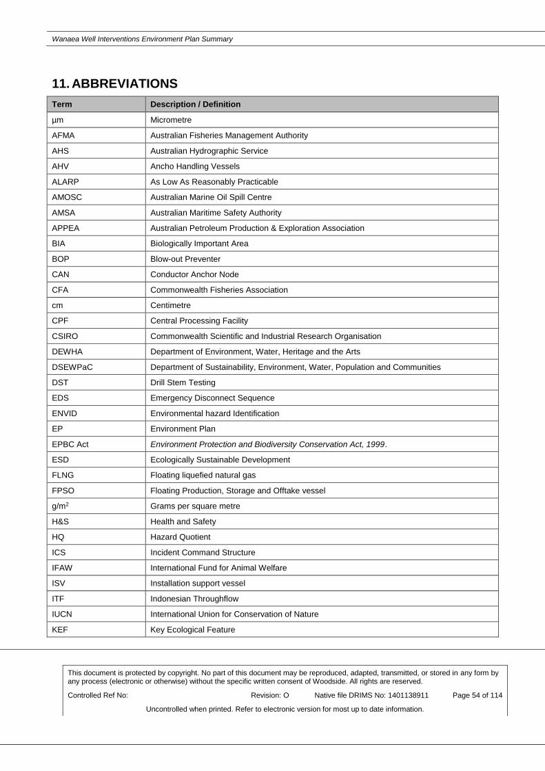
Wanaea Well Interventions Environment Plan Summary
This document is protected by copyright. No part of this document may be reproduced, adapted, transmitted, or stored in any form by any process (electronic or otherwise) without the specific written consent of Woodside. All rights are reserved.
Controlled Ref No: Revision: O Native file DRIMS No: 1401138911 Page 54 of 114
Uncontrolled when printed. Refer to electronic version for most up to date information.
11. ABBREVIATIONS
Term Description / Definition
µm Micrometre
AFMA Australian Fisheries Management Authority
AHS Australian Hydrographic Service
AHV Ancho Handling Vessels
ALARP As Low As Reasonably Practicable
AMOSC Australian Marine Oil Spill Centre
AMSA Australian Maritime Safety Authority
APPEA Australian Petroleum Production & Exploration Association
BIA Biologically Important Area
BOP Blow-out Preventer
CAN Conductor Anchor Node
CFA Commonwealth Fisheries Association
cm Centimetre
CPF Central Processing Facility
CSIRO Commonwealth Scientific and Industrial Research Organisation
DEWHA Department of Environment, Water, Heritage and the Arts
DSEWPaC Department of Sustainability, Environment, Water, Population and Communities
DST Drill Stem Testing
EDS Emergency Disconnect Sequence
ENVID Environmental hazard Identification
EP Environment Plan
EPBC Act Environment Protection and Biodiversity Conservation Act, 1999.
ESD Ecologically Sustainable Development
FLNG Floating liquefied natural gas
FPSO Floating Production, Storage and Offtake vessel
g/m2 Grams per square metre
H&S Health and Safety
HQ Hazard Quotient
ICS Incident Command Structure
IFAW International Fund for Animal Welfare
ISV Installation support vessel
ITF Indonesian Throughflow
IUCN International Union for Conservation of Nature
KEF Key Ecological Feature
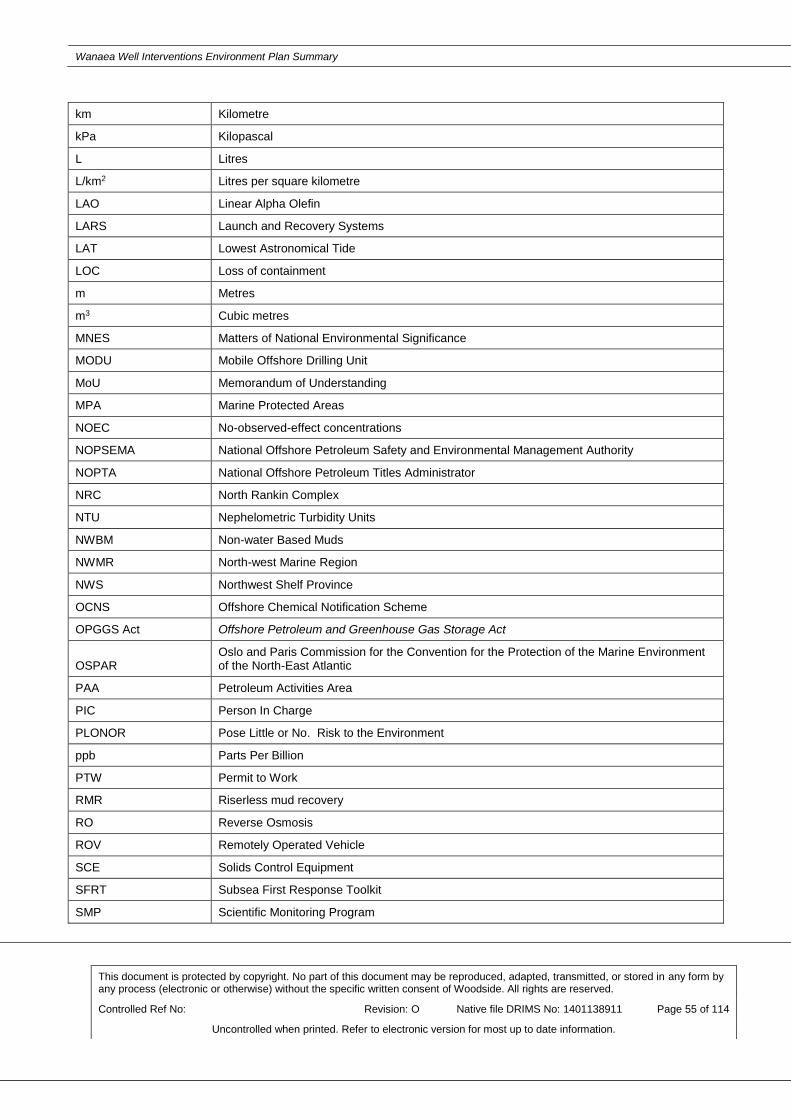
Wanaea Well Interventions Environment Plan Summary
This document is protected by copyright. No part of this document may be reproduced, adapted, transmitted, or stored in any form by any process (electronic or otherwise) without the specific written consent of Woodside. All rights are reserved.
Controlled Ref No: Revision: O Native file DRIMS No: 1401138911 Page 55 of 114
Uncontrolled when printed. Refer to electronic version for most up to date information.
km Kilometre
kPa Kilopascal
L Litres
L/km2 Litres per square kilometre
LAO Linear Alpha Olefin
LARS Launch and Recovery Systems
LAT Lowest Astronomical Tide
LOC Loss of containment
m Metres
m3 Cubic metres
MNES Matters of National Environmental Significance
MODU Mobile Offshore Drilling Unit
MoU Memorandum of Understanding
MPA Marine Protected Areas
NOEC No-observed-effect concentrations
NOPSEMA National Offshore Petroleum Safety and Environmental Management Authority
NOPTA National Offshore Petroleum Titles Administrator
NRC North Rankin Complex
NTU Nephelometric Turbidity Units
NWBM Non-water Based Muds
NWMR North-west Marine Region
NWS Northwest Shelf Province
OCNS Offshore Chemical Notification Scheme
OPGGS Act Offshore Petroleum and Greenhouse Gas Storage Act
OSPAR Oslo and Paris Commission for the Convention for the Protection of the Marine Environment of the North-East Atlantic
PAA Petroleum Activities Area
PIC Person In Charge
PLONOR Pose Little or No. Risk to the Environment
ppb Parts Per Billion
PTW Permit to Work
RMR Riserless mud recovery
RO Reverse Osmosis
ROV Remotely Operated Vehicle
SCE Solids Control Equipment
SFRT Subsea First Response Toolkit
SMP Scientific Monitoring Program

Wanaea Well Interventions Environment Plan Summary
This document is protected by copyright. No part of this document may be reproduced, adapted, transmitted, or stored in any form by any process (electronic or otherwise) without the specific written consent of Woodside. All rights are reserved.
Controlled Ref No: Revision: O Native file DRIMS No: 1401138911 Page 56 of 114
Uncontrolled when printed. Refer to electronic version for most up to date information.
SOPEP Ship Oil Pollution Emergency Plans
SVP Senior Vice President
SWMR South-west Marine Region
TD Total Depth
TPH Total Petroleum Hydrocarbons
TSS Total Suspended Solids
UK United Kingdom
VP Vice President
VSP Vertical Seismic Profiling
WA Western Australia
WA DMP Department of Mines and Petroleum WA DMP
WAF Water Accommodated Fractions
WAFIC Western Australian Fishing Industry Council
WBM Water Based Mud
WOMP Well Operations Management Plan
Woodside
Woodside Burrup Pty Ltd (note references to Woodside may also be references to Woodside
Petroleum Ltd or its applicable subsidiaries.
ZoC Zone of Consequence

Wanaea Well Interventions Environment Plan Summary
This document is protected by copyright. No part of this document may be reproduced, adapted, transmitted, or stored in any form by any process (electronic or otherwise) without the specific written consent of Woodside. All rights are reserved.
Controlled Ref No: Revision: O Native file DRIMS No: 1401138911 Page 57 of 114
Uncontrolled when printed. Refer to electronic version for most up to date information.
12. REFERENCES
Australian Institute of Marine Science, 2014. AIMS 2013 Biodiversity survey of Glomar Shoal and Rankin Bank (Report prepared by the Australian Institute of Marine Science for Woodside Energy Ltd.). Australian Institute of Marine Science, Townsville.
Baker, C., Potter, A., Tran, M., Heap, A.D., 2008. Sedimentology and geomorphology of the northwest marine region: a spatial analysis (Geoscience Australia Record No. 2008/07). Geoscience Australia, Canberra.
Bamford, M., Watkins, D., Bancroft, W., Tischler, G., Wahl, J., 2008. Migratory shorebirds of the East Asian-Australasian flyway: population estimates and internationally important sites. Wetlands International - Oceania, Canberra.
Bauer, G.B., 1986. The behavior of humpback whales in Hawaii and modifications of behavior induced by human interventions (Doctor of Philosophy). University of Hawaii, Hawaii.
BMT Asia Pacific, 2005. Environmental Impact Assessment Study for construction of helipads at Peng Chau and Yung Shue Wan, Lamma Island (Reference). BMT Asia Pacific, Hong Kong.
BMT Oceanica, 2015. Offshore water quality monitoring verification and sediment quality study - Goodwyn A survey report (No. 1178_003/1 Rev 0). BMT Oceanica Pty Ltd, Perth.
Brewer, D., Lyne, V., Skewes, T., Rothlisberg, P., 2007. Trophic systems of the North-west Marine Region. CSIRO Marine and Atmospheric Research, Cleveland.
Bureau of Meteorology, 2017a. Karratha Aero [WWW Document]. Climate data online. URL http://www.bom.gov.au/climate/averages/tables/cw_004083.shtml (accessed 7.7.17).
Bureau of Meteorology, 2017b. Tropical Cyclones Affecting the Karratha/Dampier/Roebourne region [WWW Document]. Tropical Cyclones Affecting the Karratha/Dampier/Roebourne region. URL http://www.bom.gov.au/cyclone/history/wa/roebourne.shtml (accessed 1.23.18).
Department of Conservation and Land Management, 1996. Shark Bay Marine Reserves. Management Plan. 1996-2006 (No. 34), Marine Conservation Branch, Management Plan.
Department of Conservation and Land Management, 2005. Management Plan for the Ningaloo Marine Park and Muiron Islands Marine Management Area 2005 - 2015 (Management Plan No. 52). Department of Conservation and Land Management, Perth.
Department of Environment and Conservation, 2007. Management plan for the Montebello/Barrow Islands Marine Conservation Reserves. Marine Parks and Reserves Authority, Perth.
Department of Sustainability, Environment, Water, Population and Communities, 2012a. Marine bioregional plan for the North-west Marine Region: prepared under the Environment Protection and Biodiversity Conservation Act 1999. Department of Sustainability, Environment, Water, Population and Communities, Canberra.
Dix, G.R., James, N.P., Kyser, T.K., Bone, Y., Collins, L.B., 2005. Genesis and dispersal of carbonate mud relative to late quaternary sea-level change along a distally-steepened carbonate ramp (Northwestern Shelf, Western Australia). Journal of Sedimentary Research 75: 665–678.
Dunlop, J., Wooller, R., Cheshire, N., 1988. Distribution and abundance of marine birds in the Eastern Indian Ocean. Marine and Freshwater Research 39: 661–669.

Wanaea Well Interventions Environment Plan Summary
This document is protected by copyright. No part of this document may be reproduced, adapted, transmitted, or stored in any form by any process (electronic or otherwise) without the specific written consent of Woodside. All rights are reserved.
Controlled Ref No: Revision: O Native file DRIMS No: 1401138911 Page 58 of 114
Uncontrolled when printed. Refer to electronic version for most up to date information.
French-McCay, D., 2009. State-of-the-art and research needs for oil spill impact assessment modeling, in: Proceedings of the 32nd AMOP Technical Seminar on Environmental Contamination and Response. Presented at the 32nd AMOP Technical Seminar on Environmental Contamination and Response, Environment Canada, Ottawa, pp. 601–653.
Hanson, C.E., Waite, A.M., Thompson, P.A., Pattiaratchi, C.B., 2007. Phytoplankton community structure and nitrogen nutrition in Leeuwin Current and coastal waters off the Gascoyne region of Western Australia. Deep Sea Research Part II: Topical Studies in Oceanography 54: 902–924.
Heyward, A., Jones, R., Meeuwig, J., Burns, K., Radford, B., Colquhoun, J., Cappo, M., Case, M., O’Leary, R., Fisher, R., Meekan, M., Stowar, M., 2012. Montara: 2011 offshore banks assessment survey (Monitoring Study No. S5 Banks & Shoals). Australian Institute of Marine Science, Townsville.
Heyward, A., Rees, M., Wolff, C., Smith, L., 2001. Exploration of biodiversity - data report on benthic habitats and biological collections from an initial benthic survey conducted in the region of WA-271-P. Australian Institute of Marine Science, Perth.
Holloway, P., 1983. Tides on the Australian north-west shelf. Marine and Freshwater Research 34: 213–230.
Jenner, K., Jenner, M., McCabe, K., 2001. Geographical and temporal movements of humpback whales in Western Australian waters. APPEA Journal 41: 692–707.
Jensen, A., Silber, G., 2004. Large whale ship strike database (NOAA Technical Memorandum). National Marine Fisheries Service, Silver Spring.
Last, P.R., Lyne, V., Yearsley, G., Gledhill, D., Gomon, M., Rees, T., White, W., 2005. Validation of national demersal fish datasets for the regionalisation of the Australian continental slope and outer shelf (>40m depth). National Oceans Office, Hobart.
Lohmann, K., Lohmann, C., 1996. Orientation and open-sea navigation in sea turtles. Journal of Experimental Biology 199: 73–81.
Lohmann, K.J., Lohmann, C.M.F., 1992. Orientation to oceanic waves by green turtle hatchlings. Journal of Experimental Biology 171: 1–13.
Lohmann, K.J., Salmon, M., Wyneken, J., 1990. Functional autonomy of land and sea orientation systems in sea turtle hatchlings. Biological Bulletin 179: 214–218.
Lorne, J.K., Salmon, M., 2007. Effects of exposure to artificial lighting on orientation of hatchling sea turtles on the beach and in the ocean. Endangered Species Research 3: 23–30.
Mackie, M., Nardi, A., Lewis, P., Newman, S., 2007. Small pelagic fishes of the north-west marine region. Department of Fisheries, Perth.
McCauley, R., 1998. Radiated underwater noise measured from the drilling rig Ocean General, rig tenders Pacific Ariki and Pacific Frontier, fishing vessel Reef Venture and natural sources in the Timor Sea, Northern Australia. (Report). Centre for Marine Science and Technology, Curtin University of Technology, Perth.
McLean, D.L., Partridge, J.C., Bond, T., Birt, M.J., Bornt, K.R., Langlois, T.J., 2017. Using industry ROV videos to assess fish associations with subsea pipelines. Continental Shelf Research 141: 76–97. doi:10.1016/j.csr.2017.05.006

Wanaea Well Interventions Environment Plan Summary
This document is protected by copyright. No part of this document may be reproduced, adapted, transmitted, or stored in any form by any process (electronic or otherwise) without the specific written consent of Woodside. All rights are reserved.
Controlled Ref No: Revision: O Native file DRIMS No: 1401138911 Page 59 of 114
Uncontrolled when printed. Refer to electronic version for most up to date information.
National Oceanic and Atmospheric Administration, 1996. Aerial observations of oil at sea (HAZMAT Report). National Oceanic and Atmospheric Administration, Seattle.
Nowacek, D.P., Thorne, L.H., Johnston, D.W., Tyack, P.L., 2007. Responses of cetaceans to anthropogenic noise. Mammal Review 37: 81–115.
Owens, E.H., Humphrey, B., Sergy, G.A., 1994. Natural cleaning of oiled coarse sediment shorelines in Arctic and Atlantic Canada. Spill Science & Technology Bulletin 1: 37–52.
Pearce, A., Buchan, S., Chiffings, T., D’Adamo, N., Fandry, C., Fearns, P., Mills, D., Phillips, R., Simpson, C., 2003. A review of the oceanography of the Dampier Archipelago, Western Australia, in: Wells, F., Walker, D., Jones, D. (Eds.), The Marine Flora and Fauna of Dampier, Western Australia. Western Australian Museum, Perth, pp. 13–50.
Preen, A., 2004. Distribution, abundance and conservation status of dugongs and dolphins in the southern and western Arabian Gulf. Biological Conservation 118: 205–218.
Preen, A., Marsh, H., Lawler, I., Prince, R., Shepherd, R., 1997. Distribution and abundance of dugongs, turtles, dolphins and other megafauna in Shark Bay, Ningaloo Reef and Exmouth Gulf, Western Australia. Wildlife Research 24: 185–208.
Richardson, W.J., Greene Jr, C.R., Malme, C.I., Thomson, D.H., 1995. Marine Mammals and Noise. Academic Press, San Diego.
Robertson, A., Duke, N., 1987. Mangroves as nursery sites: comparisons of the abundance and species composition of fish and crustaceans in mangroves and other nearshore habitats in tropical Australia. Marine Biology 96: 193–205.
RPS, 2010. Satellite telemetry of nesting flatback turtles from Ashburton Island - Wheatstone Project EIS/ERMP (No. M10604). RPS Environment and Planning Pty Ltd, Perth.
Salmon, M., 2003. Artificial night lighting and sea turtles. Biologist 50: 163–168.
Salmon, M., Reiners, R., Lavin, C., Wyneken, J., 1995a. Behavior of loggerhead sea turtles on an urban beach. I. Correlates of nest placement. Journal of Herpetology 560–567.
Salmon, M., Tolbert, M.G., Painter, D.P., Goff, M., Reiners, R., 1995b. Behavior of loggerhead sea turtles on an urban beach. II. Hatchling orientation. Journal of Herpetology 568–576.
Salmon, M., Witherington, B.E., 1995. Artificial lighting and seafinding by loggerhead hatchlings: evidence for lunar modulation. Copeia 931–938.
Scheidat, M., Friedlaender, A., Kock, K.-H., Lehnert, L., Boebel, O., Roberts, J., Williams, R., 2011. Cetacean surveys in the Southern Ocean using icebreaker-supported helicopters. Polar Biology 34: 1513–1522. doi:10.1007/s00300-011-1010-5
Schianetz, K., Jones, T., Kavanagh, L., Walker, P.A., Lockington, D., Wood, D., 2009. The practicalities of a Learning Tourism Destination: a case study of the Ningaloo Coast. International Journal of Tourism Research 11: 567–581. doi:10.1002/jtr.729
SGS Economics & Planning, 2012. Economic development opportunities for the Gascoyne region associated with resource sector investment and expansion. Gascoyne Development Commission, Fortitude Valley.
Sheppard, J.K., Preen, A.R., Marsh, H., Lawler, I.R., Whiting, S.D., Jones, R.E., 2006. Movement heterogeneity of dugongs, Dugong dugon (Müller), over large spatial scales. Journal of Experimental Marine Biology and Ecology 334: 64–83.

Wanaea Well Interventions Environment Plan Summary
This document is protected by copyright. No part of this document may be reproduced, adapted, transmitted, or stored in any form by any process (electronic or otherwise) without the specific written consent of Woodside. All rights are reserved.
Controlled Ref No: Revision: O Native file DRIMS No: 1401138911 Page 60 of 114
Uncontrolled when printed. Refer to electronic version for most up to date information.
Smallwood, C.B., Beckley, L.E., Moore, S.A., Kobryn, H.T., 2011. Assessing patterns of recreational use in large marine parks: A case study from Ningaloo Marine Park, Australia. Ocean & Coastal Management 54: 330–340. doi:10.1016/j.ocecoaman.2010.11.007
Southall, B.L., Bowles, A.E., Ellison, W.T., Finneran, J.J., Gentry, R.L., Greene, C.R., Kastak, D., Ketten, D.R., Miller, J.H., Nachtigall, P.E., Richardson, W.J., Thomas, J.A., Tyack, P.L., 2007. Marine mammal noise exposure criteria: Initial scientific recommendations. Aquatic mammals 33: 411–414.
Stamation, K.A., Croft, D.B., Shaughnessy, P.D., Waples, K.A., Briggs, S.V., 2010. Behavioral responses of humpback whales (Megaptera novaeangliae) to whale-watching vessels on the southeastern coast of Australia. Marine Mammal Science 26: 98–122. doi:10.1111/j.1748-7692.2009.00320.x
Truax, B. (Ed.), 1978. Handbook for Acoustic Ecology. Simon Fraser University, Burnaby.
Tuxbury, S.M., Salmon, M., 2005. Competitive interactions between artificial lighting and natural cues during seafinding by hatchling marine turtles. Biological Conservation 121: 311–316.

Wanaea Well Interventions Environment Plan Summary
This document is protected by copyright. No part of this document may be reproduced, adapted, transmitted, or stored in any form by any process (electronic or otherwise) without the specific written consent of Woodside. All rights are reserved.
Controlled Ref No: Revision: O Native file DRIMS No: 1401138911 Page 61 of 114
Uncontrolled when printed. Refer to electronic version for most up to date information.
APPENDIX A: ENVIRONMENTAL IMPACTS AND RISKS

Wanaea Well Interventions Environment Plan Summary
This document is protected by copyright. No part of this document may be reproduced, adapted, transmitted, or stored in any form by any process (electronic or otherwise) without the specific written consent of Woodside. All rights are reserved.
Controlled Ref No: Revision: O Native file DRIMS No: 1401138911 Page 62 of 114
Uncontrolled when printed. Refer to electronic version for most up to date information.
PLANNED ACTIVITIES (ROUTINE AND NON-ROUTINE)
Physical Presence: Interference with or Displacement of Other Marine Users
Impacts and Risks Evaluation Summary
Source of Impact
Environmental Value Potentially
Impacted Evaluation
Soil
and
Gro
undw
ate
r
Ma
rin
e S
edim
ent
Wate
r Q
ualit
y
Air Q
ualit
y (
incl
Odour)
Ecosyste
ms/
Habitat
Specie
s
Socio
-Econom
ic
Decis
ion T
ype
Consequence
Lik
elih
oo
d
Curr
ent
Ris
k
Ratin
g
ALA
RP
To
ols
Accepta
bili
ty
Outc
om
e
Presence of LWIV and support
vessels causing interference
with or displacement to third
party vessels (commercial
shipping and commercial /
recreational fishing)
X A F - - LC
S
GP
PJ
Bro
ad
ly a
ccep
table
EPO
1
Description of Source of Impact
Presence of project vessels
In order to undertake well intervention, a LWIV will be on station above the wells within the Operational
Areas. Well intervention, for both wells, is expected to require 20 days to complete with a total of 30 days
for the two wells, (including 10 days contingency).
Support vessels will support the Petroleum Activities Program throughout the activity, with approximately
1-2 trips per week.
The presence of the LWIV and support vessel movements could present a navigational hazard to shipping and commercial fishing activities in the Operational Area.
Impact Assessment
Potential Impacts to Socio-economic Environment
Interference with commercial shipping
The presence of project vessels could potentially cause temporary disruption to commercial shipping.
Consultation with AMSA confirms that vessel traffic may be encountered within the Operational Area,
however, it is noted that no shipping fairways intersect the Operational Areas. The nearest shipping
fairway designated by AMSA lies approximately 43 km east of the Operational Areas. Additionally, tracking
data provided by AMSA indicates that most of traffic in the Operational Area will be vessels associated
with existing oil and gas infrastructure. Well interventions are a relatively short duration activity
(approximately 10 days for each well); in the context of the duration of the Petroleum Activities Program;
the potential for disruption of other users from the activity is expected to be limited.
There may be commercial vessels infrequently in the area. The use of the shipping fairways is strongly
recommended by AMSA, but is not mandatory, and shipping vessels still have to adhere to the
International Regulations for Preventing Collisions at Sea 1972, as implemented under Australian laws
and regulations. The potential impacts could include short-term displacement of vessels as they make
slight course alteration to avoid project vessels. Therefore, the potential impact is considered to be low.
Displacement of commercial and recreational fishing activity
A number of Commonwealth and State managed fisheries overlap the Operational Areas:

Wanaea Well Interventions Environment Plan Summary
This document is protected by copyright. No part of this document may be reproduced, adapted, transmitted, or stored in any form by any process (electronic or otherwise) without the specific written consent of Woodside. All rights are reserved.
Controlled Ref No: Revision: O Native file DRIMS No: 1401138911 Page 63 of 114
Uncontrolled when printed. Refer to electronic version for most up to date information.
• Commonwealth
- Southern Bluefin Tuna Fishery
- Western Skipjack Fishery
- Western Tuna and Billfish Fishery.
• State
- Pilbara Demersal Scalefish Fishery
- Pilbara Crab Managed Fishery
- Specimen Shell Fishery
- Onslow Prawn Managed Fishery
- Pearl Oyster Managed Fishery
- Marine Aquarium Managed Fishery
- West Australian Abalone Fishery
- Mackerel Managed Fishery
- South West Coast Salmon Managed Fishery
- West Coast Deep Sea Crustacean Managed Fishery.
This overlap of the Operational Areas with commercial fishing activity may exclude fishers from the area,
resulting in a perceived loss of catch and potential for loss of equipment.
Of the fisheries managed areas that overlap the Operational Area, none were identified as having
significant activity in the vicinity of the Operational Areas. Additionally, consultation in relation to the
Petroleum Activities Program indicated no claims or objections were raised by participants in fisheries that
overlap the Operational Areas.
The Okha FPSO commenced operations in 2006 and is marked on standard nautical charts. Given the
period in which the facility has been in operation and its location is marked on nautical charts, commercial
fishers are reasonably expected to be aware of the existing facility and associated infrastructure.
Potential impacts to commercial fishing activities within the Operational Areas are considered localised
displacement/avoidance by commercial trawling and line fishery vessels within the immediate vicinity of
the Operational Areas. However, there was no direct response from fisheries licence holders during the
stakeholder consultation period, and as such the potential impact is considered to be localised and of no
lasting effect. A response was received from the Department of Primary Industries and Regional
Development (DPIRD) in relation to interference with fisheries licence holders, DPIRD requested
Woodside to consider the Pilbara Line Fishery (PLF) in addition to fisheries identified by Woodside,
Woodside engaged with Pilbara line Fishery on 4 February 2019, no concerns have been raised by the
Pilbara Line Fishery. Additionally DPIRD also requested impacts to spawning be reduced, however as
spawning periods list by the Department cover a 12 month period, it is not possible to avoid all spawning
periods listed, however due to the short duration of the activity and distance from any demersal fish
habitat, the EP has not identified any risks to fish spawning or habitats as a result of the activity.
Recreational fishing and nature-based tourism in the region is concentrated in shallow coastal waters,
particularly those in proximity to access nodes such as boat ramps. Recreational fishing effort in the
Operational Areas is expected to be minimal to nil, given the water depth (approximately 80 m), lack of
reef habitat hosting sought-after demersal species, and distance offshore (121 km from Dampier).
Additionally, consultation in relation to the Petroleum Activities Program indicated no claims or objections
were raised by recreational fishers. No tourism has been documented in the Operational Areas since
commencement of Okha FPSO operation in 2006. As such, no impacts to recreational fishing and tourism
are expected during the Petroleum Activities Program.
Summary of Potential Impacts to Environmental Value(s)
Vessel-based activities for the Petroleum Activities Program will lead to a small increase in the overall
vessel traffic in the Operational Areas with a peak period expected to be for no more than 30 days,
however, vessels associated with other oil and gas activities are not expected in the Operational Area, and
no cumulative impacts from the interference with or displacement of third party vessels are expected.

Wanaea Well Interventions Environment Plan Summary
This document is protected by copyright. No part of this document may be reproduced, adapted, transmitted, or stored in any form by any process (electronic or otherwise) without the specific written consent of Woodside. All rights are reserved.
Controlled Ref No: Revision: O Native file DRIMS No: 1401138911 Page 64 of 114
Uncontrolled when printed. Refer to electronic version for most up to date information.
Given the adopted controls, it is considered that the physical presence of project vessels will not result in a
potential impact greater than isolated and short-term impact to shipping and commercial/recreational
fishing.
Summary of Control Measures
• Marine Order 30 (Prevention of Collisions) 2016
• Marine Order 21 (Safety of navigation and emergency procedures) 2012
• establishment of a 500 m safety exclusion zone around LWIV and communicated to marine users
• notify AHS before commencement of well intervention
• notify AMSA Joint Rescue Coordination Centre (JRCC) before commencement of well intervention
• Simultaneous Operations Plan (SIMOP) Plan prepared to manage vessel interactions within Petroleum
Activity Program.

Wanaea Well Interventions Environment Plan Summary
This document is protected by copyright. No part of this document may be reproduced, adapted, transmitted, or stored in any form by any process (electronic or otherwise) without the specific written consent of Woodside. All rights are reserved.
Controlled Ref No: Revision: O Native file DRIMS No: 1401138911 Page 65 of 114
Uncontrolled when printed. Refer to electronic version for most up to date information.
Physical Presence: Routine Acoustic Emissions
Impacts and Risks Evaluation Summary
Source of Impact Environmental Value Potentially Impacted
Evaluation
Soil
and
Gro
undw
ate
r
Ma
rin
e S
edim
ent
Wate
r Q
ualit
y
Air Q
ualit
y (
incl
Odour)
Ecosyste
ms/
Habitat
Specie
s
Socio
-Econom
ic
Decis
ion T
ype
Consequence
Lik
elih
ood
Curr
ent
Ris
k
Ratin
g
ALA
RP
To
ols
Accepta
bili
ty
Outc
om
e
Generation of noise from project vessels during normal operations.
X A F - - GP
Bro
ad
ly
acce
pta
ble
N/A
Generation of noise from helicopter transfers
X A F - - GP
Bro
ad
ly
acce
pta
ble
N/A
Description of Source of Impact
Project vessels will generate noise both in the air and underwater, due to the operation of thruster engines,
propeller cavitation, on-board machinery etc. These noises will contribute to and have the potential to exceed
ambient noise levels which range from around 90 dB re 1 μPa [root square mean sound pressure level (rms
SPL)] under very calm, low wind conditions, to 120 dB re 1μPa (rms SPL) under windy conditions.
Project Vessel Noise
The LWIV and support vessels may maintain DP for varying duration during the Petroleum Activities Program,
depending on the activity the vessel is undertaking. The LWIV and support vessels will utilise DP to hold
station during the Petroleum Activities Program. Additionally, the routine operations of LWIV during well
interventions will produce low intensity noise (e.g. machinery noise).
McCauley (1998) measured underwater broadband noise equivalent to approximately 182 dB re 1 μPa at 1 m
(rms SPL) from a support vessel holding station in the Timor Sea; it is expected that similar noise levels will be
generated by the intervention vessel and activity support vessels used for this Petroleum Activities Program.
Note that all project vessels are required to comply with EPBC Regulation 2000 – Part 8 Interacting with
Cetaceans to reduce the likelihood of collisions with cetaceans. Implementing this control may incidentally
reduce the noise generated by vessels in proximity to cetaceans as vessels will be travelling slower; slower
vessel speeds may reduce underwater noise from machinery noise (main engines) and propeller cavitation.
Helicopter Noise
Helicopter engines and rotor blades are recognised as a source of noise emissions, which may constitute a
source of environmental risk resulting in behavioural disturbance to marine fauna. Activities relevant to the
Operational Areas will relate to the landing and take-off of helicopters on the LWIV helideck. During these
critical stages of helicopter operations, safety takes precedence. Helicopter flights are at their lowest (i.e.
closest point to the sea surface) during these periods of take-off and landing from helidecks, which constitutes
a relatively short phase of routine flight operations.
Helicopter noise is emitted to the atmosphere during routine helicopter flights. Noise levels for typical helicopters used in offshore operations (Eurocopter Super Puma AS332) at 150 m separation distance have been measured at up to a maximum of 90.6 dB (BMT Asia Pacific 2005).
Impact Assessment
Potential Impacts to Species

Wanaea Well Interventions Environment Plan Summary
This document is protected by copyright. No part of this document may be reproduced, adapted, transmitted, or stored in any form by any process (electronic or otherwise) without the specific written consent of Woodside. All rights are reserved.
Controlled Ref No: Revision: O Native file DRIMS No: 1401138911 Page 66 of 114
Uncontrolled when printed. Refer to electronic version for most up to date information.
Underwater Noise
The Operational Areas of the Petroleum Activities Program is located in continental shelf waters approximately 80 m deep. The fauna associated with this area will be predominantly pelagic species of fish, with migratory species such as cetaceans present in the area seasonally.
Elevated underwater noise can affect marine fauna, including cetaceans, fish, sharks and rays in three main ways (Richardson et al. 1995):
(1) by causing direct physical effects on hearing or other organs (injury)
(2) by masking or interfering with other biologically important sounds (including vocal communication, echolocation, signals and sounds produced by predators or prey)
(3) through disturbance leading to behavioural changes or displacement from important areas.
The thresholds of recommended root square mean sound pressure level (rms SPL) that could result in behavioural response for cetaceans is expected to be:
• 120 dB (rms SPL) for continuous noise sources
• 160 dB RMS SPL for impulsive noise sources.
These thresholds are consistent with the levels presented by Southall et al. (2007). More permanent injury would be expected to occur at 230 dB re 1 μPa (PK) (Southall et al. 2007).
Project Vessel Noise Impacts
Noise generated by the LWIV and support vessels likely to be used for this Petroleum Activities Program does not exceed permanent injury threshold levels, and therefore permanent injury to protected species is not anticipated. However, noise generated by the LWIV and support vessels may exceed thresholds that could result in a behavioural response. Listed threatened and listed migratory species that could be potentially impacted by noise and vibration may be present within the Operational Areas and primarily include cetaceans. The Operational Areas do not overlap with any BIAs for cetaceans. The following BIAs are however in close proximity (~30 to 50 km):
• Humpback whales (migration BIA): seasonally present June to September
• Pygmy blue whales (migration BIA: seasonally present April to May (northbound) and November to December (southbound).
The likelihood of these species being present within the Operational Areas is increased during the seasonal periods described above. However, even with an increased likelihood of interaction, the potential impacts are considered to be minor given the noise levels associated with routine operations of project vessels. Woodside has undertaken long-term monitoring of humpback whale abundance off North West Cape, which has indicated the majority of seasonally present migrating humpback whales occur south of the Operational Areas (RPS Environment and Planning 2010c). Interactions between blue / humpback whales and vessels typically results in avoidance behaviour, with whales generally moving away from vessels (Bauer 1986, Stamation et al. 2010). It is reasonable to expect that fauna may demonstrate avoidance or attraction behaviour to the noise generated by the Petroleum Activities Program. For example, when transiting through the area, cetaceans may deviate from their migration corridor, but continue on their migration pathway. Note that the Operational Areas are surrounded by open water, with no restrictions (e.g. shallow waters, embayments) to an animal’s ability to avoid the Operational Areas. Therefore, any avoidance or attraction behaviours displayed are expected to be localised and temporary.
Predicted noise levels from project vessels are not considered to be ecologically significant at a population level.
The fauna associated with the Operational Areas will be predominantly pelagic species of fish with migratory species such as marine turtles, whale sharks and cetaceans transiting through the Operational Areas. Therefore, potential impacts from vessel noise are likely to be restricted to temporary avoidance behaviour to individuals transiting through the Operational Area, and are therefore, considered low.
Helicopter Noise Impacts
Helicopter noise is emitted to the atmosphere during routine helicopter flights. Noise levels for typical helicopters used in offshore operations (Eurocopter Super Puma AS332) at 150 m separation distance have been measured at up to a maximum of 90.6 dB (BMT Asia Pacific 2005). Unconstrained point source noise in the atmosphere (such as helicopter noise) spreads spherically (Truax 1978), with noise received at the sea surface decreasing with increasing distance from the aircraft (Nowacek et al. 2007). Based on spherical geometric spreading (and not considering transmission loss from atmospheric absorption), the sound level is

Wanaea Well Interventions Environment Plan Summary
This document is protected by copyright. No part of this document may be reproduced, adapted, transmitted, or stored in any form by any process (electronic or otherwise) without the specific written consent of Woodside. All rights are reserved.
Controlled Ref No: Revision: O Native file DRIMS No: 1401138911 Page 67 of 114
Uncontrolled when printed. Refer to electronic version for most up to date information.
expected to decrease by 6 dB for every doubling of the distance from the source (Truax 1978). Using this model, a maximum sound level of approximately 90 dB at 150 m would be reduced to approximate 76 dB directly below a helicopter travelling at an altitude of 500 m.
Water has a very high acoustic impedance contrast compared to air, and the sea surface is a strong reflector of noise energy (i.e. very little noise energy generated above the sea surface crosses into and propagates below the sea surface (and vice versa) – the majority of the noise energy is reflected). The angle at which the sound path meets the surface influences the transmission of noise energy from the atmosphere through the sea surface; angles ±>13° from vertical being almost entirely reflected (Richardson et al. 1995). Given this, and the typical characteristics of helicopter flights within the Operational Areas (duration, frequency, altitude and air speed), the opportunity for underwater noise levels that may result in behavioural disturbance to marine fauna is considered negligible. Note that helicopter noise during approach, landing and take-off is more likely to propagate through the sea surface due to the reduced air speed and lower altitude. However, helicopter noise during approach, landing and take-off will be mingled with underwater noise generated by the facility hosting the helipad (e.g. thruster noise from vessels, machinery noise from LWIV etc.). Additionally, approach, landing and take-off are relatively short phases of the flight, resulting in little opportunity for underwater noise to be generated.
Helicopter surveys of humpback whales in Antarctic waters noted behavioural responses attributed to the presence of the helicopter on three occasions out of a total of 221 animal sightings, all of which occurred with a separation of <500 m between the helicopter and the animal (Scheidat et al. 2011). Given the standard flight profile of a helicopter transfer and the predominantly seasonal presence of whales within the Operational Area, interactions between helicopters and cetaceans resulting in behavioural impacts are considered to be highly unlikely. In the highly unlikely event that cetaceans are disturbed by helicopters, responses are expected to consist of short-term behavioural responses, such as increased swimming speed; the consequence of such disturbance is considered to have no lasting effect.
A response was received from the Department of Primary Industries and Regional Development (DPIRD) in relation to acoustic emissions; DPIRD requested Woodside to identify seabed disturbance and underwater noise and develop mitigation strategies to reduce impacts. As underwater noise will predominately be limited to the presence of a single vessel for approximately 20 days, and due to the low acoustic source levels associated with the vessel operations there is not likely to be any interaction or potential impacts to fish hearing, feeding or spawning.
Summary of Potential Impacts to Environmental Values(s)
It is considered that noise generated by project vessels and helicopters will not result in a potential impact greater than localised impacts with no lasting effect, not significant to marine fauna. (i.e. Environment Impact - F).
Summary of Control Measures
The potential impacts and risks from routine noise emissions are deemed to be ALARP in its current impact state. No reasonable additional/alternative controls were identified that would further reduce the impacts and risks without grossly disproportionate sacrifice.

Wanaea Well Interventions Environment Plan Summary
This document is protected by copyright. No part of this document may be reproduced, adapted, transmitted, or stored in any form by any process (electronic or otherwise) without the specific written consent of Woodside. All rights are reserved.
Controlled Ref No: Revision: O Native file DRIMS No: 1401138911 Page 68 of 114
Uncontrolled when printed. Refer to electronic version for most up to date information.
Routine Discharges: Project Vessels
Impacts and Risks Evaluation Summary
Source of Impact Environmental Value Potentially Impacted
Evaluation
Soil
and
Gro
undw
ate
r
Ma
rin
e S
edim
ent
Wate
r Q
ualit
y
Air Q
ualit
y (
incl
Odour)
Ecosyste
ms/
Habitat
Specie
s
Socio
-Econom
ic
Decis
ion T
ype
Consequence
Lik
elih
ood
Curr
ent
Ris
k
Ratin
g
ALA
RP
To
ols
Accepta
bili
ty
Outc
om
e
Routine discharge of sewage, grey water and putrescible wastes to marine environment from project vessels
X A F - - LCS
PJ
Bro
ad
ly
acce
pta
ble
EPO 2
Routine discharge of deck and bilge water to marine environment from project vessels
X A F - - LCS
PJ
Bro
ad
ly
acce
pta
ble
Routine discharge of cooling water or brine to the marine environment from project vessels
X A F - - LCS
PJ
Bro
ad
ly
acce
pta
ble
Description of Source of Impact
The project vessels are expected to routinely generate/discharge the following:
• Small volumes (typically 15 m³ per project vessel per day) of treated sewage, grey water and
putrescible wastes to the marine environment
• Routine/periodic discharge of relatively small volumes of bilge water. Bilge tanks on project vessels receive fluids from many parts of the vessel. Bilge water can contain water, oil, detergents, solvents, chemicals, particles and other liquids, solids or chemicals
• Variable water discharge from project vessel decks directly overboard or via deck drainage systems. Water sources could include rainfall events and/or from deck activities such as cleaning/wash-down of equipment/decks
• Cooling water from machinery engines and brine water produced during the desalination process of reverse osmosis to produce potable water on board project vessels.
Environmental risk relating to the disposal/discharges above regulated levels or incorrect disposal/discharge of waste would be unplanned (non-routine/accidental) and are addressed in.
Impact Assessment
Potential Impacts to Water Quality
No significant impacts from the planned (routine and non-routine) discharges that are listed above are anticipated because of the minor quantities involved, short duration of the activity, the expected localised mixing zone and high level of dilution into the open water marine environment of the Operational Areas. The Operational Areas are located more than 12 nm from land, which is beyond the distance required by Marine Order 96 (Marine pollution prevention – sewage) 2009 and Marine Order 95 (Marine pollution prevention – garbage) 2013 at which untreated sewage may be discharged.
Summary of Potential Impacts to Environmental Value(s)

Wanaea Well Interventions Environment Plan Summary
This document is protected by copyright. No part of this document may be reproduced, adapted, transmitted, or stored in any form by any process (electronic or otherwise) without the specific written consent of Woodside. All rights are reserved.
Controlled Ref No: Revision: O Native file DRIMS No: 1401138911 Page 69 of 114
Uncontrolled when printed. Refer to electronic version for most up to date information.
Given the adopted controls, it is considered that routine or non-routine discharges described will not result in a potential impact greater than localised contamination not significant to environmental receptors, with no lasting effect. (i.e. Environment Impact - F).
Summary of Control Measures
• Marine Orders 95 – pollution prevention – Garbage (as appropriate to vessel class)
• Marine Orders 96 - pollution prevention – sewage (as appropriate to vessel class)
• Marine Orders 91 – oil (as relevant to vessel class).

Wanaea Well Interventions Environment Plan Summary
This document is protected by copyright. No part of this document may be reproduced, adapted, transmitted, or stored in any form by any process (electronic or otherwise) without the specific written consent of Woodside. All rights are reserved.
Controlled Ref No: Revision: O Native file DRIMS No: 1401138911 Page 70 of 114
Uncontrolled when printed. Refer to electronic version for most up to date information.
Routine and Non-Routine Discharges: Well Intervention Activities
Impacts and Risks Evaluation Summary
Source of Impact Environmental Value Potentially Impacted
Evaluation
Soil
and
Gro
undw
ate
r
Ma
rin
e S
edim
ent
Wate
r Q
ualit
y
Air Q
ualit
y (
incl
Odour)
Ecosyste
ms/
Habitat
Specie
s
Socio
-Econom
ic
Decis
ion T
ype
Consequence
Lik
elih
ood
Curr
ent
Ris
k
Ratin
g
ALA
RP
To
ols
Accepta
bili
ty
Outc
om
e
Routine and non-routine discharges to the marine environment from:
• subsea control fluids
• well kill brine
• sulphamic acid.
X X A E - - GP PJ
Bro
ad
ly
acce
pta
ble
EPO3
Description of Source of Impact
During the Petroleum Activities Program, small volumes of control fluids or other chemicals may be discharged intermittently and for short durations as a result of planned activities. This includes the following:
• subsea control fluids used to actuate valves in open loop control systems
• sulphamic acid used to remove marine growth from subsea infrastructure
• well kill brine as a contingent activity.
Subsea control fluids.
Subsea control fluid, typically HW443 or HW525, is used to control SID and XT valves remotely from the LWIV. Control fluid is supplied to valves via an open-loop system, designed to release control fluid during operation (e.g. upon valve actuation) of up to 1 m3/day use during the PAP. Hydraulic control fluid is also used onboard the ROV. During certain tasks, for example when changing tools, small releases (100ml to 1L) of fluid may be released to the ocean.
Marine Growth Removal
Marine growth removal from subsea infrastructure may also be required which will lead to small planned discharges. Marine growth removal, from an ROV, typically involves the following activities:
• water jetting using high pressure water to remove marine growth
• use of brushes attached to ROV
• use of acid (typically sulphamic acid) to dissolve calcium deposits
• use of sand/abrasive blasting using staurolite products (naturally occurring mineral).
Well kill brine
Well kill brine (including corrosion inhibitors) will be used to kill wells during intervention activities. Residual hydrocarbons within wells may contaminate the brine. The intent is that all brine will be pumped to the reservoir and left in the well. Discharge of well kill brine may also occur due to an unplanned event such as a hose rupture or an emergency disconnect.
All chemicals that may be released or discharged to the marine environment during the Petroleum Activities Program are assessed as per Woodside Chemical Selection and Assessment Guideline. This guideline is used to demonstrate that the potential impacts of the chemicals that may be released are acceptable and ALARP.
Grease
Standard operation of the SID will lead to small volumes of non-toxic grease being released to the environment from grease injection head.

Wanaea Well Interventions Environment Plan Summary
This document is protected by copyright. No part of this document may be reproduced, adapted, transmitted, or stored in any form by any process (electronic or otherwise) without the specific written consent of Woodside. All rights are reserved.
Controlled Ref No: Revision: O Native file DRIMS No: 1401138911 Page 71 of 114
Uncontrolled when printed. Refer to electronic version for most up to date information.
Impact Assessment
Potential Impacts to Marine Sediment, Water Quality and Species
The release of minor fluid discharges may reduce local water quality through contamination of the water column, resulting in potential adverse effects to marine biota as a result of hydrocarbon and chemical toxicity. The discharges present a risk to the marine environment due to the contaminants within them.
Potential impacts to sensitive receptors may be attributable to dissolved hydrocarbons and suspended oil droplets and nutrients, as well as low residual concentrations of a small number of chemicals such as corrosion and scale inhibitors and biocides. Hydrocarbons however are considered the constituent of most concern to marine fauna, particularly polycyclic aromatic hydrocarbons (PAHs).
Marine growth removal chemicals, the minor discharge of control fluid from subsea valves (e.g. BOP and XT), corrosion inhibitors and small quantities of hydrocarbons may decrease the water quality in the immediate area of the release; however, the impacts are expected to be slight, temporary, and localised due to rapid dilution in the open ocean environment.
A foraging BIA for whale sharks and wedge-tailed shearwaters is within the Operational Area and as such these species may be encountered within the Operational Area. Marine fauna may be affected if they come in direct contact with a release (i.e. by traversing the immediate discharge area), however given the very small expected release quantities it is not likely. Given the small volumes that represent the worst credible releases, water depth of release and the dilution of any such discharge, the likelihood of ecological impacts to these marine fauna is considered to be highly unlikely.
No impacts to commercial or recreational fisheries or KEFs are expected.
Summary of Potential Impacts to Environmental Value(s)
Given the adopted controls, it is considered that routine or non-routine discharges described will not result in a potential impact greater than slight, short term local impact on species, habitat (but not affecting ecosystem function), physical or biological attributes (i.e. Environment Impact - E).
Summary of Control Measures
• all chemicals used and discharged will be approved (i.e. assessed, ALARP and acceptable)
• no planned discharge of well kill brine to the environment.

Wanaea Well Interventions Environment Plan Summary
This document is protected by copyright. No part of this document may be reproduced, adapted, transmitted, or stored in any form by any process (electronic or otherwise) without the specific written consent of Woodside. All rights are reserved.
Controlled Ref No: Revision: O Native file DRIMS No: 1401138911 Page 72 of 114
Uncontrolled when printed. Refer to electronic version for most up to date information.
Routine and Non-Routine Atmospheric Emissions
Impacts and Risks Evaluation Summary
Source of Impact Environmental Value Potentially Impacted
Evaluation
Soil
and
Gro
undw
ate
r
Ma
rin
e S
edim
ent
Wate
r Q
ualit
y
Air Q
ualit
y (
incl
Odour)
Ecosyste
ms/
Habitat
Specie
s
Socio
-Econom
ic
Decis
ion T
ype
Consequence
Lik
elih
ood
Curr
ent
Ris
k
Ratin
g
ALA
RP
To
ols
Accepta
bili
ty
Outc
om
e
Exhaust emissions from internal combustion engines and incinerators on project vessels
X A F - - LCS
GP
Bro
ad
ly
Accep
table
EPO 4
Venting off of hydrocarbon gas during well intervention
X X A F - - LCS
GP
Bro
ad
ly
Accep
table
EPO5
Description of Source of Impact
Internal combustion engines and incinerators
Atmospheric emissions will be generated by the project vessels from internal combustion engines (including all
equipment and generators) and incineration activities (including onboard incinerators) during the Petroleum
Activities Program. Emissions will include SO2, NOx, CO2, CO, particulates and volatile organic compounds
(VOCs).
Release of hydrocarbon gas during well intervention
During well intervention activities, hydrocarbon gas may be accidently released from the well or subsea infrastructure. In the event that gas is released from the well, the gas may bubble to the sea surface (if released at the seabed). As part of planned operations, small quantities of gas (<1m3) will be vented to atmosphere, via the LWIV, while flushing the lubricator.
Impact Assessment
Potential Impacts to Air Quality (incl. Odour)
Fuel combustion has the potential to result in localised, temporary reduction in air quality. Potential impacts include a localised reduction in air quality, generation of dark smoke and contribution to greenhouse gas emissions. Given the short duration and exposed location of project vessels (which will lead to the rapid dispersion of the low volumes of atmospheric emissions), the potential impacts are expected to be localised and minor.
Any release of hydrocarbon gases, may result in a short-lived localised gas plume and a minor contribution to greenhouse gas emissions. There is potential for human health effects for workers in the immediate vicinity of atmospheric emissions and this is considered in the vessel’s safety case. However, the closest sensitive residential receptor is the Dampier Archipelago approximately 95 km south-east of the Operational Area; therefore, any risks associated with off-site human health effects are negligible beyond the immediate zone of release and dispersion.
Given the short duration and isolated location of the Petroleum Activities Program (which will lead to the rapid dispersion of the low volumes of atmospheric emissions) the potential impacts are expected to be localised and minor.
Summary of Potential Impacts to environmental values(s)
Given the adopted controls, it is considered that the release of a small volume of greenhouse gases will not result in a potential impact greater than a temporary decrease in local air quality no lasting effect and no

Wanaea Well Interventions Environment Plan Summary
This document is protected by copyright. No part of this document may be reproduced, adapted, transmitted, or stored in any form by any process (electronic or otherwise) without the specific written consent of Woodside. All rights are reserved.
Controlled Ref No: Revision: O Native file DRIMS No: 1401138911 Page 73 of 114
Uncontrolled when printed. Refer to electronic version for most up to date information.
significant impact to environmental receptors. (i.e. Environment Impact - F).
Summary of Control Measures
• Marine Order 97 (Marine Pollution Prevention – Air Pollution)
• OPGGS (Resource Management and Administration) Regulations 2011: Accepted Well Operations Management Plan (WOMP)
• Woodside Engineering Standards Well Barriers.

Wanaea Well Interventions Environment Plan Summary
This document is protected by copyright. No part of this document may be reproduced, adapted, transmitted, or stored in any form by any process (electronic or otherwise) without the specific written consent of Woodside. All rights are reserved.
Controlled Ref No: Revision: O Native file DRIMS No: 1401138911 Page 74 of 114
Uncontrolled when printed. Refer to electronic version for most up to date information.
Routine Light Emissions
Impacts and Risks Evaluation Summary
Source of Impact Environmental Value Potentially Impacted
Evaluation
Soil
and
Gro
undw
ate
r
Ma
rin
e S
edim
ent
Wate
r Q
ualit
y
Air Q
ualit
y (
incl
Odour)
Ecosyste
ms/
Habitat
Specie
s
Socio
-Econom
ic
Decis
ion T
ype
Consequence
Lik
elih
ood
Curr
ent
Ris
k
Ratin
g
ALA
RP
To
ols
Accepta
bili
ty
Outc
om
e
External light emissions on-board project vessels (LWIV and support vessel)
X A F - - PJ
Bro
ad
ly
acce
pta
ble
N/A
Description of Source of Impact
Project vessels will routinely use external lighting to facilitate navigation and safe operations at night throughout the
Petroleum Activities Program. External light emissions from project vessels are typically managed to maintain good
night vision for crew members. Lighting on project vessels will also be used to communicate activities to other marine
users (i.e. navigation / warning lights). Lighting is required for the safe operation of project vessels, and cannot
reasonably be eliminated. Note that flaring, which is a relatively bright light source, will not occur during the activity.
External lighting is located on the external decks of project vessels, with most external lighting directed towards working
areas such as the main decks, pipe rack etc. These areas are typically lower than 20 m above sea level for the project
vessels whilst in the Operational Areas. The distance to the horizon at which components of the project vessels will be
directly visible can be estimated using the formula below:
Where horizon distance is the distance to the horizon at sea level in kilometres and height is the height above sea level of the light source in metres. Using this formula, the approximate distances at which the highest lit component of all project vessels will be visible at sea level is approximately 16 km (~20 m above sea level).
Impact Assessment
Potential Impacts Species
Light emissions can affect fauna in two main ways:
• Behaviour: many organisms are adapted to natural levels of lighting and the natural changes associated with the day and night cycle as well as the night time phase of the moon. Artificial lighting has the potential to create a constant level of light at night that can override these natural levels and cycles
• Orientation: organisms such as marine turtles and birds may also use lighting from natural sources to orient themselves in a certain direction at night. In instances where an artificial light source is brighter than a natural source, the artificial light may act to override natural cues leading to disorientation.
The fauna within the Operational Areas are predominantly pelagic fish and zooplankton, with a low
abundance of transient species such as marine turtles, whale sharks and large whales within the
Operational Areas. Additionally, there is no known critical habitat within the Operational Areas for EPBC
listed species. Given the fauna expected to occur within the Operational Area, impacts from light emissions
are considered to be remote.
Marine Turtles - Hatchlings
Light emissions reaching turtle nesting beaches is widely considered detrimental owing to interference with
important nocturnal activities including the choice of nesting sites and orientation/navigation to the sea by
post-nesting females and hatchlings (Lorne and Salmon 2007, Salmon 2003, Tuxbury and Salmon 2005).
Hatchling turtles use light as a visual cue to orientate themselves towards the sea during the post-hatching
Wanaea Well Interventions Environment Plan Summary
This document is protected by copyright. No part of this document may be reproduced, adapted, transmitted, or stored in any form by any process (electronic or otherwise) without the specific written consent of Woodside. All rights are reserved.
Controlled Ref No: Revision: O Native file DRIMS No: 1401138911 Page 75 of 114
Uncontrolled when printed. Refer to electronic version for most up to date information.
dash after emerging from the nest, orientating themselves towards the relatively bright horizon above the
sea and away from the relatively dark dunes (Salmon et al. 1995b, Salmon and Witherington 1995).
Artificial light from coastal developments has been identified as potentially disorientating hatchling turtles
during the post-hatching movements, with hatchling turtles orientated towards artificial light sources away
from the sea (Lorne and Salmon 2007, Salmon 2003, Tuxbury and Salmon 2005). Turtles disorientated by
artificial lighting may take longer, or fail, to reach the sea, potentially resulting in increased mortality through
dehydration, predation or exhaustion (Salmon and Witherington 1995).
Once hatchling turtles reach the sea, the primary cue for hatchling turtle orientation is water movement, with
hatchlings swimming directly towards oncoming waves (Lohmann et al. 1990, Lohmann and Lohmann
1992). Hatchling and adult turtles may also use the Earth’s magnetic field for larger scale navigation
(Lohmann and Lohmann 1996). As such, hatchling turtles are only likely to be disorientated by artificial light
between leaving the nest and reaching the sea.
Several islands in the vicinity of the Operational Areas are known to host turtle nesting beaches, including:
• Dampier Archipelago (approximately 100 km from the Operational Areas)
• Montebello Island Group (approximately 127 km from the Operational Area)
• Lowendal Island Group (approximately 145 km from the Operational Area)
• Barrow Island (approximately 157 km from the Operational Area).
Given the nature of the light emitted from project vessels and the distance to the nearest landfall (and
nearest significant rookeries), artificial light is not expected to be directly visible to hatchling turtles.
Disorientation of hatchling turtles in response to artificial lighting from project vessels is not considered
credible.
Marine Turtles - Adults
Artificial lighting may affect the location that turtles emerge to the beach, the success of nest construction,
whether nesting is abandoned, and even the seaward return of adults (Salmon et al. 1995b, 1995a, Salmon
and Witherington 1995). Such lighting is typically from residential and industrial development overlapping
the coastline, rather than offshore from nesting beaches. The Operational Areas does not contain any
known critical habitat for any species of marine turtle nor do any BIAs for turtles overlap the Operational
Areas. It is acknowledged that marine turtles may be present transiting the Operational Areas in low
densities; given the water depth (approximately 80 m) turtles are unlikely to be foraging within the
Operational Area.
Other Marine Fauna
The risk associated with collision from seabirds attracted to the light is considered to be low given the there
is no critical habitat for these species within the Operational Areas and slow moving speeds associated with
activity support vessels. Seabirds may be attracted to project vessels operating at night, including foraging
wedge-tailed shearwaters (for which a foraging BIA overlaps the Operational Area); however, this is not
expected to result in impacts to seabird beyond a temporary change in behaviour.
Demersal fish communities in the Ancient Coastline at 125 m Depth Contour KEF (10 km north-west of the Operational Area) are highly unlikely to be affected by artificial lighting given the distance and water depth (approximately 80 m). Lighting from the presence of project vessels may result in the localised aggregation of fish below the vessel. These aggregations of fish are considered localised and temporary and any long term changes to fish species composition or abundance is considered remote.
Summary of Potential Impacts to environmental values(s)
Light emissions from project vessels will not result in an impact greater than a localised and temporary disturbance to fauna in the vicinity of the Operational Areas with no lasting effect (i.e. Environment Impact – F).
Summary of Control Measures
The potential impacts and risks from routine light emissions are deemed to be ALARP in its current impact state. No reasonable additional/alternative controls were identified that would further reduce the impacts and risks without grossly disproportionate sacrifice.

Wanaea Well Interventions Environment Plan Summary
This document is protected by copyright. No part of this document may be reproduced, adapted, transmitted, or stored in any form by any process (electronic or otherwise) without the specific written consent of Woodside. All rights are reserved.
Controlled Ref No: Revision: O Native file DRIMS No: 1401138911 Page 76 of 114
Uncontrolled when printed. Refer to electronic version for most up to date information.
UNPLANNED ACTIVITIES (ACCIDENTS / INCIDENTS / EMERGENCY SITUATIONS)
Accidental Hydrocarbon Release: Dropped Objects on Flowlines
Impacts and Risks Evaluation Summary
Source of Risk Environmental Value Potentially Impacted
Evaluation
Soil
and
Gro
undw
ate
r
Ma
rin
e
Sedim
ent
Wate
r Q
ualit
y
Air Q
ualit
y (
incl
Odour)
Ecosyste
ms/
Habitat
Specie
s
Socio
-Econom
ic
Decis
ion T
ype
Consequence
Lik
elih
ood
Curr
ent
Ris
k
Ratin
g
ALA
RP
To
ols
Accepta
bili
ty
Outc
om
e
Loss of hydrocarbons to marine environment due to a subsea flowline loss of containment.
X X C 2 M GP
PJ
Accep
table
if
AL
AR
P
EPO 6
Description of Source of Risk
During the Petroleum Activities Program, the LWIV and activity support vessels may be operating in the vicinity of live subsea infrastructure. Consequently, there is the potential for a dropped object (during lifting) or loss of control of a suspended load to impact subsea infrastructure. A dropped object analysis was undertaken, for both WA-03 and WA-11a, which identified (based on the dropped object cone) that the worst case credible scenario was a loss of containment from the Lambert Hermes flowline from lifting activities at WA-03.
The worst credible subsea loss of containment is defined as loss of the entire inventory of the 8” Lambert Hermes flowline (488 m3). This scenario is based on an instantaneous large borehole release (complete rupture of the flowline) and assumes that only the inventory of the flow line is released due to activation of the ESD, thus limiting further release of hydrocarbons supplied from the wellheads.
Quantitative Spill Risk Assessment
Modelling undertaken for the Okha facility (Presented in the Okha Operations Environment Plan) subsea flowline loss of containment (773 m3 instantaneous release from both the 8” Lambert-Hermes flowline and 6” dual purpose flowline production line flowline at 95 m water depth) was to assess the risk of a spill from the Lambert Hermes flowline. This is considered suitable for the risk assessment of a 488 m3 release for the following reasons. The scenario in the Okha EP considers the rupture of the LH 8” and 6” flowlines. There is no longer a risk of oil being released from the dual purpose 6” LH flowline, as this was converted to gas lift (containing dry gas) only in 2015. Furthermore, the water cut of wells producing into this flowline has increased since modelling was last completed, decreasing the amount of oil that might be release. Therefore the release volume is inherently conservative.
Modelling was undertaken over all seasons to address year-round operations. This is considered to provide a conservative estimate of the ZoC and the potential impacts from the identified worst-case credible release volume for a subsea flowline loss of containment.
Hydrocarbon Characteristics
Cossack crude was selected as the hydrocarbon type for the release scenario. It is considered consistent with a worst-case release due to the persistent nature of the hydrocarbon.
Weathering processes under realistic variable wind conditions are illustrated in the example mass balance weathering graph for a discrete spill of 50 m3 of Cossack crude released at the surface (Figure 12-1). The graph demonstrates that approximately 65% of the released hydrocarbons would be expected to evaporate within the first 24 hours. Approximately 15% is expected to entrain after 24 hours, with approximately 10% expected to dissolve in 48, resulting in very little floating hydrocarbons on the surface after the first five days of release.

Wanaea Well Interventions Environment Plan Summary
This document is protected by copyright. No part of this document may be reproduced, adapted, transmitted, or stored in any form by any process (electronic or otherwise) without the specific written consent of Woodside. All rights are reserved.
Controlled Ref No: Revision: O Native file DRIMS No: 1401138911 Page 77 of 114
Uncontrolled when printed. Refer to electronic version for most up to date information.
Figure 12-1: Proportional mass balance plot representing the weathering of 50 m3 from a surface spill of Cossack light crude
Subsea Plume Dynamics
The loss of hydrocarbons from the flexible flowline will result in a buoyant plume of hydrocarbons, which has been modelled using the OILMAP-Deep numerical model. An instantaneous flowline rupture will result in a rapid highly turbulent release and is expected to result in small droplet size with 10% less than 37.5 μm and 90% ranging in size from 37.5 to 200 μm. The expected behaviour of this spill following release is for the oil to gradually rise towards the surface, with a majority of the oil having the potential to surface and become floating under suitable conditions. The smaller droplets may remain entrained by turbulence. The tendency of the crude oil to rise to the sea surface will promote weathering of the oil due to evaporation.
Likelihood
In accordance with the Woodside Risk Matrix, given prevention and mitigation measures in place (i.e. design, inspection and maintenance) and the dropped object analysis undertaken, the likelihood has been taken as 1 (Highly Unlikely). Woodside has also considered industry data for pipeline release frequencies in informing the likelihood assessment (PARLOC 2012).
Consequence
The spatial extent and fate (incl. weathering) of the spilled hydrocarbon were considered during the impact assessment for a worst-case subsea loss of containment (presented in the following section). These considerations were informed primarily by the outputs from the modelling studies undertaken by RPS, available information on environmental sensitivities that may credibly be impacted in the event of a worst-case spill and relevant literature and studies considering the effects of hydrocarbon exposure.
Impact Assessment
Potential Impacts Overview
Surface Hydrocarbons
Floating oil would form down current of the release location with the trajectory dependent on prevailing wind and current conditions at the time. The modelling indicates locations within reach of surface hydrocarbon concentrations above the 10 g/m2 threshold concentration are confined to offshore areas up to as far as approximately 15 km.
Entrained Hydrocarbons
The modelling indicates locations within reach of entrained oil concentrations above the 500 ppb threshold concentration are confined to offshore areas extending up to approximately 40 km.

Wanaea Well Interventions Environment Plan Summary
This document is protected by copyright. No part of this document may be reproduced, adapted, transmitted, or stored in any form by any process (electronic or otherwise) without the specific written consent of Woodside. All rights are reserved.
Controlled Ref No: Revision: O Native file DRIMS No: 1401138911 Page 78 of 114
Uncontrolled when printed. Refer to electronic version for most up to date information.
Dissolved Aromatics Hydrocarbons
There were no predicted instances where the 500 ppb threshold concentration was reached.
Accumulated Hydrocarbons
No sensitive receptors were predicted to be contacted by accumulated hydrocarbons (≥ 100 g/m2).
The credible worst-case hydrocarbon spill scenario that may arise from loss of hydrocarbons from the flexible flowline identifies that the spill remains offshore and contacts the Ancient Coastline at 125 m depth contour KEF and the Glomar Shoal KEF. The biological consequences of such a spill on identified open water sensitive receptors relate to the potential for minor impacts to megafauna, plankton and fish populations (surface and water column biota) that are within the spill affected area
Summary of potential impacts to protected species
Setting Receptor Group
Offshore Cetaceans
Marine mammals that have direct physical contact with surface, entrained or dissolved aromatic hydrocarbons may suffer surface fouling or ingestion of hydrocarbons and inhalation of toxic vapours. This may result in the irritation of sensitive membranes such as the eyes, mouth, digestive and respiratory tracts and organs, impairment of the immune system or neurological damage (Helm et al., 2015). If prey (fish and plankton) are contaminated, this can result in the absorption of toxic components of the hydrocarbons (PAHs).
A range of cetaceans were identified as potentially occurring within the Operational Area and wider ZoC. In the event of a loss of subsea containment surface and entrained hydrocarbons exceeding environmental impact threshold concentrations may drift across habitat for oceanic cetacean species. Suitable habitat for oceanic toothed whales (e.g. sperm whales) is broadly distributed throughout the region and as such, impacts are unlikely to affect an entire population. Physical contact with hydrocarbons to these species is likely to have biological consequences however due to the localised natures of the spill, extending up to 40 km from the release location, no impacts to the overall population viability is expected.
Marine Turtles
Adult sea turtles exhibit no avoidance behaviour when they encounter hydrocarbon spills (National Oceanic and Atmospheric Administration, 2010). Contact with entrained (or floating) hydrocarbon can result in hydrocarbon adherence to body surfaces (Gagnon and Rawson, 2010) causing irritation of mucous membranes in the nose, throat and eyes leading to inflammation and infection (National Oceanic and Atmospheric Administration, 2010). Given the modelling results indicated concentrations of floating hydrocarbons are localised around the release location, the potential for contact with this hydrocarbon phase is very low.
Due to the absence of potential nesting habitat and offshore location, the Operational area is unlikely to represent important habitat for marine turtles. It is, however, acknowledged that marine turtles may be present within the ZoC, and the ZoC would overlap with the BIAs, in particular, the internesting BIAs for flatback turtles which extend for ~80 km from known nesting locations. It is noted that the Petroleum Activities Program may coincide with nesting season for marine turtles in the region.
In the event of a loss of subsea containment, there is potential that surface and entrained hydrocarbons exceeding environmental impact threshold concentrations will be present in offshore waters. Therefore, a hydrocarbon spill may impact on individuals, but is unlikely to reduce overall population viability.
Potential impacts to nesting and internesting marine turtles are not expected based on modelling results (e.g. no shoreline contact).
Sharks and Rays
Hydrocarbon contact may affect whale sharks through ingestion (entrained/dissolved hydrocarbons), particularly if feeding. Impacts to sharks and rays may occur through direct contact with hydrocarbons and contaminate the tissues and internal organs either through direct contact or via the food chain (consumption of prey).
A whale shark foraging BIA overlaps the ZoC, therefore whale sharks may transit offshore

Wanaea Well Interventions Environment Plan Summary
This document is protected by copyright. No part of this document may be reproduced, adapted, transmitted, or stored in any form by any process (electronic or otherwise) without the specific written consent of Woodside. All rights are reserved.
Controlled Ref No: Revision: O Native file DRIMS No: 1401138911 Page 79 of 114
Uncontrolled when printed. Refer to electronic version for most up to date information.
open waters when migrating to and from Ningaloo Reef, where they aggregate for feeding from March to July. Whale sharks are versatile feeders, filtering large amounts of water over their gills, catching planktonic and nektonic organisms (Jarman and Wilson 2004). Therefore, individual whale sharks that have direct contact with hydrocarbons within the spill affected area may be impacted.
In the offshore environment, it is probable that pelagic shark species are able to detect and avoid surface waters underneath hydrocarbon spills by swimming into deeper water or away from the affected areas. Therefore, any impact on sharks and rays is predicted to be minor and localised.
Seasnakes
Impacts to seasnakes from direct contact with hydrocarbons are likely to result in similar physical effects to those recorded for marine turtles and may include potential damage to the dermis and irritation to mucus membranes of the eyes, nose and throat (International Tanker Owners Pollution Federation, 2011a). They may also be impacted when they return to the surface to breathe and inhale the toxic vapours associated with the hydrocarbons, resulting in damage to their respiratory system. Given modelling indicated floating hydrocarbons are localised around the release location, the potential for seasnakes to be exposed to floating hydrocarbons is considered to be very low.
In general, seasnakes frequent the waters of the continental shelf area around offshore islands and potentially submerged shoals (water depths <100 m; see Submerged Shoals below). It is acknowledged that seasnakes may be present in the Operational Area and wider ZoC; however, their abundance is not expected to be high in the deep water and offshore environment. Therefore, a hydrocarbon spill may have a minor disruption to individuals however it is not considered to be a threat to overall population viability.
Seabirds and Migratory Shorebirds
Seabirds and migratory birds are particularly vulnerable to contact with floating hydrocarbons, which may mat feathers. This may lead to hypothermia from loss of insulation and ingestion of hydrocarbons when preening to remove hydrocarbons; both impacts may result in mortality (Hassan and Javed, 2011). The credible loss of subsea containment scenario results in highly localised floating hydrocarbons centred around the release location; hence, the potential for seabird exposure to floating hydrocarbons is considered to be low.
Offshore waters are potential foraging grounds for seabirds associated with the coastal roosting and nesting habitat, which includes the numerous islands along the Pilbara coast. There was one BIAs for seabirds and migratory shorebirds that was identified to overlap with the wider ZoC. Given the relatively low likelihood of encounters between seabirds and floating hydrocarbons, impacts to seabirds in offshore waters are expected to consist of ecosystem-scale effects, such as reduced prey abundance. Impacts from a loss of subsea containment to prey such as small pelagic fish (prey for the birds) are not expected to be significant; hence, subsequent impacts to a significant portion of seabirds are not expected.
Submerged Shoals
Marine Turtles
There is the potential for marine turtles to be present at submerged shoals such as Glomar Shoal. Glomar Shoal, at times, may be foraging habitat for marine turtles, given the coral and filter feeding biota associated with these areas. However, these areas are not known foraging locations. Tagging studies of green turtles did not indicate any overlap of the tracked post-nesting migratory routes and the Operational Area. It is, however, acknowledged that individual marine turtles may be present at Glomar Shoal and the surrounding areas. Therefore, a hydrocarbon spill may have a minor disruption to a portion of the population (see offshore description above); however, there is no threat to overall population viability.
Seasnakes
There is the potential for seasnakes to be present at Glomar Shoal. The potential impacts of exposure are as discussed previously in Offshore – Seasnakes.
A hydrocarbon spill may have a minor disruption to individuals however there is no threat to overall population viability.

Wanaea Well Interventions Environment Plan Summary
This document is protected by copyright. No part of this document may be reproduced, adapted, transmitted, or stored in any form by any process (electronic or otherwise) without the specific written consent of Woodside. All rights are reserved.
Controlled Ref No: Revision: O Native file DRIMS No: 1401138911 Page 80 of 114
Uncontrolled when printed. Refer to electronic version for most up to date information.
Sharks and Rays
There is the potential for resident shark and ray populations to be impacted directly from hydrocarbon contact or indirectly through contaminated prey or loss of habitat. Spill model results indicate potential impacts to the benthic communities of Glomar Shoal, which may host shark and ray populations. Sharks and rays present at the submerged shoals may be exposed to fresh, unweathered hydrocarbons, which may have greater potential for toxic impacts. Any direct impacts are expected to be sub-lethal however no impacts at the population level.
Pelagic sharks and rays are expected to move away from areas affected by spilled hydrocarbons. Impacts to such species are expected to be limited to behavioural responses/displacement. Shark and ray species that have associations with submerged shoals may not move in response to such habitat being contacted by spilled hydrocarbons. Such species may be more susceptible to a reduction in habitat quality resulting from a hydrocarbon spill. Impacts to sharks and rays at Glomar Shoal are likely to be localised as they are comparable to other Australian reefs and the NWMR submerged shoals and banks. It is expected that there will be no impacts at the population level.
Summary of potential impacts to other species
Setting Receptor Group
All Settings Pelagic and Demersal Fish
Fish mortalities are rarely observed to occur as a result of hydrocarbon spills (International Tanker Owners Pollution Federation, 2011b). This has generally been attributed to the possibility that pelagic fish are able to detect and avoid surface waters underneath hydrocarbon spills by swimming into deeper water or away from the affected areas. Fish that have been exposed to dissolved aromatic hydrocarbons are capable of eliminating the toxicants once placed in clean water, hence individuals exposed to a spill are likely to recover (King et al., 1996). Where fish mortalities have been recorded, the spills (resulting from the groundings of the tankers Amoco Cadiz in 1978 and the Florida in 1969) have occurred in sheltered bays.
Fish are perhaps most susceptible to the effects of spilled oil in their early life stages, particularly during egg and planktonic larval stages, which can become entrained in spilled oil. Contact with oil droplets can mechanically damage feeding and breathing apparatus of embryos and larvae (Fodrie and Heck, 2011). The toxic hydrocarbons in water can result in genetic damage, physical deformities and altered developmental timing for larvae and eggs exposed to even low concentrations over prolonged timeframes (days to weeks) (Fodrie and Heck, 2011). More subtle, chronic effects on the life history of fish as a result of exposure of early life stages to hydrocarbons include disruption to complex behaviour such as predator avoidance, reproductive and social behaviour (Hjermann et al., 2007). PAHs have also been linked to increased mortality and stunted growth rates of early life history (pre-settlement) of reef fishes, as well as behavioural impacts that may increase predation of post-settlement larvae (Johansen et al., 2017). However, the effect of a hydrocarbon spill on a population of fish in an area with fish larvae and/or eggs, and the extent to which any of the adverse impacts may occur, depends greatly on prevailing oceanographic and ecological conditions at the time of the spill and its contact with fish eggs or larvae.
Demersal fish species are associated with the both Glomar Shoal and Ancient coastline at 125 m depth contour KEFs which overlap the ZoC and provide habitat for demersal fish species. Fish associated with these features may be exposed to dissolved and entrained hydrocarbons above impact thresholds.
Mortality and sub lethal effects may impact populations located close to the release location and within the ZoC for entrained hydrocarbons (≥500 ppb). Additionally, if prey (infauna and epifauna) surrounding the release location and within the ZoC is contaminated, this can result in the absorption of toxic components of the hydrocarbons (PAHs) potentially impacting fish populations that feed on these. These impacts may result in localised medium/long term impacts on demersal fish habitat, e.g. seafloor.

Wanaea Well Interventions Environment Plan Summary
This document is protected by copyright. No part of this document may be reproduced, adapted, transmitted, or stored in any form by any process (electronic or otherwise) without the specific written consent of Woodside. All rights are reserved.
Controlled Ref No: Revision: O Native file DRIMS No: 1401138911 Page 81 of 114
Uncontrolled when printed. Refer to electronic version for most up to date information.
Summary of potential impacts to marine primary producers
Setting Receptor Group
Submerged Shoals
The waters overlying Glomar Shoal has the potential to be exposed to entrained hydrocarbons above threshold concentrations (>500 ppb). This exposure at or above entrained thresholds is predicted based on modelling resulting in potential biological impacts including sub-lethal stress and, in some instances, total or partial mortality of sensitive benthic organisms such as corals and the early life stages of resident fish and invertebrate species.
Open Water
Productivity/Upwelling: Glomar Shoal is an area associated with sporadic upwelling and associated primary productivity events. Spill model results predict entrained hydrocarbons (at or above the 500-ppb threshold) may reach Glomar Shoal. Therefore, impacts to plankton communities may result in short-term changes in plankton community composition but recovery would occur (see offshore description above). Hydrocarbon contact during the spawning seasons for resident shoal community benthos and fish (meroplankton), particularly exposure to in-water toxicity effects to biota, may result in the loss of a discrete cohort population but would not affect the longer-term viability of resident populations. Therefore, any impacts to resident shoal community benthos and fish (meroplankton) are likely to be localised at the shoals and temporary.
Filter Feeders
Hydrocarbon exposure to offshore filter-feeding communities may occur depending on the depth of the entrained hydrocarbons. Exposure to entrained hydrocarbons (≥500 ppb) has potential to result in lethal or sub-lethal toxic effects. Sub-lethal impacts, including mucus production and polyp retraction, have been recorded for gorgonians exposed to hydrocarbon (White et al. 2012).
Summary of potential impacts to other habitats and communities
Setting Receptor Group
Offshore Benthic Fauna Communities
In the event of a loss of well containment at the seabed, the stochastic spill model predicted hydrocarbons droplets would be entrained in a gas plume, transporting them to the water column and sea surface. As a result, the low sensitivity benthic communities associated with the unconsolidated, soft sediment habitat and any epifauna (filter feeders) are not expected to be exposed to released hydrocarbons. A localised area relating to the hydrocarbon plume at the point of release is predicted, which would result in a small area of seabed and associated epifauna and infauna exposed to hydrocarbons.
Open Water – Productivity/Upwelling
Primary production by plankton (supported by sporadic upwelling events in the offshore waters of the NWS) is an important component of the primary marine food web. Planktonic communities are generally mixed including phytoplankton (cyanobacteria and other microalgae) and secondary consuming zooplankton, such as crustaceans (e.g. copepods), and the eggs and larvae of fish and invertebrates (meroplankton). Exposure to hydrocarbons in the water column can result in changes in species composition with declines or increases in one or more species or taxonomic groups (Batten et al. 1998). Phytoplankton may also experience decreased rates of photosynthesis (Tomajka 1985). For zooplankton, direct effects of contamination may include toxicity, suffocation, changes in behaviour, or environmental changes that make them more susceptible to predation. Impacts on plankton communities are likely to occur in areas where entrained or dissolved aromatic hydrocarbon threshold concentrations are exceeded, but communities are expected to recover relatively quickly (within weeks or months). This is due to high population turnover with copious production within short generation times that also buffers the potential for long-term (i.e. years) population declines (International Tanker Owners Pollution Federation, 2011a). Therefore, impacts on exposed planktonic communities present in the ZoC are likely to be short-term.

Wanaea Well Interventions Environment Plan Summary
This document is protected by copyright. No part of this document may be reproduced, adapted, transmitted, or stored in any form by any process (electronic or otherwise) without the specific written consent of Woodside. All rights are reserved.
Controlled Ref No: Revision: O Native file DRIMS No: 1401138911 Page 82 of 114
Uncontrolled when printed. Refer to electronic version for most up to date information.
Key Ecological Features
Key Ecological Features
Potentially impacted by the hydrocarbon spill from a loss of well containment event are the following KEFs:
• Glomar Shoal
• Ancient coastline at 125 m depth contour.
Although these KEFs are primarily defined by seabed geomorphological features, they are described to identify the potential for increased biological productivity and, therefore, ecological significance.
The consequences of a hydrocarbon spill from a loss of well containment may impact the values of the KEFs affected (for the values of each KEF). Potential impacts include: the contamination of sediments, impacts to benthic fauna/habitats and associated impacts to demersal fish populations and reduced biodiversity as described above and below. Most of the KEFs within the ZoC have relatively broad-scale distributions and are unlikely to be significantly impacted.
Summary of potential impacts to water quality
Setting Aspect
Offshore Open Water – Water Quality
Water quality would be affected due to hydrocarbon contamination which is described in terms of the biological effect concentrations. These are defined by the ZoC descriptions for entrained and dissolved hydrocarbon fates and their predicted extent. Furthermore, water quality is predicted to have minor long term and/or significant short term hydrocarbon contamination above background and/or national/international quality standards.
Submerged Shoals
Open Water – Water Quality
The submerged Glomar Shoal has the potential to be exposed to entrained hydrocarbons at or greater than 500 ppb. The waters surrounding this permanently submerged habitat, would show a reduction in quality due to hydrocarbon contamination above background and/or national/international quality standards.
Summary of potential impacts to marine sediment quality
Setting Receptor Group
Offshore Marine Sediment Quality
In the event of a major hydrocarbon release at the seabed, modelling indicates that a pressurised release of condensate would atomise into droplets that would be rapidly transported into the water column to the surface. As a result the extent of potential impacts to the seabed area at and surrounding the release site would be confined to a localised footprint. Marine sediment quality would be reduced (contamination above national/international quality standards) as a consequence of hydrocarbon contamination for a small area within the immediate release site for a long to medium term.
Submerged Shoals
Marine Sediment Quality
There is potential for the reduction of marine sediment quality due to contact and adherence of entrained hydrocarbons with seabed sediments of the submerged shoals. If this was to occur, marine sediment quality would be reduced (contamination above national/international quality standards) as a consequence of hydrocarbon contamination for a small area within the immediate release site for a long to medium term. However, given the nature of the hydrocarbon, contact with submerged shoals is considered unlikely.
Summary of potential impacts to socio-economic values
Setting Receptor Group
Offshore Fisheries – Commercial
Spill scenarios modelled are unlikely to cause significant direct impacts on the target species of Commonwealth and offshore State fisheries within the defined ZoC. Further details are

Wanaea Well Interventions Environment Plan Summary
This document is protected by copyright. No part of this document may be reproduced, adapted, transmitted, or stored in any form by any process (electronic or otherwise) without the specific written consent of Woodside. All rights are reserved.
Controlled Ref No: Revision: O Native file DRIMS No: 1401138911 Page 83 of 114
Uncontrolled when printed. Refer to electronic version for most up to date information.
provided below (impact assessment relating to spawning is discussed above under ‘Summary of potential impacts to other habitats and communities’).
Fish exposure to hydrocarbon can result in ‘tainting’ of their tissues. Even very low levels of hydrocarbons can impart a taint or ‘off’ flavour or smell in seafood. Tainting is reversible through the process of depuration which removes hydrocarbons from tissues by metabolic processes, although it is dependent upon the magnitude of the hydrocarbon contamination. Fish have a high capacity to metabolise these hydrocarbons while crustaceans (such as prawns) have a reduced ability (Yender et al., 2002). Seafood safety is a major concern associated with spill incidents. Therefore, actual or potential contamination of seafood can affect commercial and recreational fishing, and can impact seafood markets long after any actual risk to seafood from a spill has subsided (Yender et al., 2002). A major spill would result in the establishment of a Petroleum Safety Zone around the spill affected area. There would be a temporary prohibition on fishing activities for a period of time and subsequent potential for economic impacts to affected commercial fishing operators. Additionally, hydrocarbon can foul fishing equipment such as traps and trawl nets, requiring cleaning or replacement.
Tourism including Recreational Activities
Recreational fishers predominantly target tropical species, such as emperor, snapper, grouper, mackerel, trevally and other game fish. Recreational angling activities include shore-based fishing, private boat and charter boat fishing, with the peak in activity between April and October (Smallwood et al., 2011). Limited recreational fishing takes place in the offshore waters of the PAA due to the distance from shore; however, fishing may take place at Rankin Bank and Glomar Shoals. Impacts on species that are recreationally fished are described above and under ‘Summary of potential impacts to other species’ above.
A major loss of hydrocarbon from the Petroleum Activities Program may lead to exclusion of marine nature-based tourist activities, resulting in a loss of revenue for operators.
Offshore Oil and Gas Infrastructure
In the unlikely event of a major spill, surface hydrocarbons may affect production from existing petroleum facilities (platforms and FPSOs). For example, facility water intakes for cooling and fire hydrants could be shut off which could in turn lead to the temporary cessation of production activities. Spill exclusion zones established to manage the spill could also prohibit activity support vessel access as well as tankers approaching facilities on the NWS. The impact on ongoing operations of regional production facilities would be determined by the nature and scale of the spill and metocean conditions. Furthermore, decisions on the operation of production facilities in the event of a spill would be based primarily on health and safety considerations. The closest oil and gas operation is the Okha FPSO, 1.1 km from the closest Operational Area. Other nearby facilities includes the Angel Platform (18 km) and the North Rankin Complex (31 km). All are operated by Woodside. Operation of these facilities is likely to be affected in the event of a worst-case loss of well containment.
Submerged shoals
Tourism and Recreation
In the unlikely event of a major spill, a temporary prohibition on charter boat recreational fishing trips and any other marine nature-based tourism trips to Rankin Bank and Rowley Shoals may be put into effect, depending on the trajectory of the plume, resulting in a loss of revenue for operators.
Summary of potential impacts to environmental values(s)
In the unlikely event of a major hydrocarbon spill due to a loss of subsea containment, the ZoC is localised offshore however it may overlap with including the sensitive marine environments and associated receptors of Glomar Shoal.
The overall environmental consequence is defined as C ‘Moderate, medium-term impacts (2-10 years) on ecosystem, species, habitat, physical or biological attributes. The likelihood of the event is defined as a ‘2’ Highly Unlikely’ resulting in a risk ranking of Moderate.

Wanaea Well Interventions Environment Plan Summary
This document is protected by copyright. No part of this document may be reproduced, adapted, transmitted, or stored in any form by any process (electronic or otherwise) without the specific written consent of Woodside. All rights are reserved.
Controlled Ref No: Revision: O Native file DRIMS No: 1401138911 Page 84 of 114
Uncontrolled when printed. Refer to electronic version for most up to date information.
Summary of Control Measures
• the LWIV work procedures for lifts, bulk transfers and cargo loading
• LWIV and activity support vessels inductions include control measures and training for crew in dropped object prevention
• in the event of a subsea loss of containment a number of safety and environment critical element (SCE) mitigation controls are provided for in Woodside’s current Okha FPSO Facility Operations Environment Plan. These SCEs prevent the escalation or mitigate the effects of a subsea loss of containment
• mitigation – hydrocarbon spill response.

Wanaea Well Interventions Environment Plan Summary
This document is protected by copyright. No part of this document may be reproduced, adapted, transmitted, or stored in any form by any process (electronic or otherwise) without the specific written consent of Woodside. All rights are reserved.
Controlled Ref No: Revision: O Native file DRIMS No: 1401138911 Page 85 of 114
Uncontrolled when printed. Refer to electronic version for most up to date information.
Accidental Hydrocarbon Release: Loss of Well Integrity
Impacts and Risks Evaluation Summary
Source of Risk Environmental Value Potentially Impacted
Evaluation
Soil
and
Gro
undw
ate
r
Ma
rin
e S
edim
ent
Wate
r Q
ualit
y
Air Q
ualit
y (
incl
Odour)
Ecosyste
ms/
Habitat
Specie
s
Socio
-Econom
ic
Decis
ion T
ype
Consequence
Lik
elih
ood
Curr
ent
Ris
k
Ratin
g
ALA
RP
To
ols
Accepta
bili
ty
Outc
om
e
Loss of hydrocarbons to marine environment due to loss of well integrity.
X X X X X C C 1 M GP PJ
Accep
table
if
AL
AR
P
EPO 7
Description of Source of Risk
Background
A loss of well containment can lead to an uncontrolled release of reservoir hydrocarbons or other well fluids to the environment. Woodside has identified a well blowout (subsurface release from a subsea intervention device) as the scenario with the worst case credible environmental outcome as a result of loss of well barrier integrity. A blowout is an event where formation fluid flows out of the well or between formation layers after all the predefined technical well barriers (e.g. the BOP) or activation of the same have failed. The risk of blowout is only applicable to the Wanaea 11a well. A well blowout from the WA03 well was not considered credible as the well will not naturally release hydrocarbons to the seabed at ambient conditions without the aid of artificial lift.
A well blowout from WA11a involving full removal of the XT is not considered credible, because no activities within the scope of this PAP have been identified as credibly being able to cause this event. Beyond the scope of this activity, the operation of the WA03 and WA11a wells are covered under the Okha EP. This plan considers the risks associated with the full wellhead or XT removal of either of these wells.
Industry Experience
The Scandpower 2013 report presents recommended frequencies of blowouts and well releases to be applied as basis values in risk analysis of well operations of North Sea Standard. The frequencies are mainly based on data from the areas of US GoM OCS (US GoM) and North Sea (Norwegian and British sector). The frequencies are established based on a methodology established by the steering committee for the SINTEF Offshore Blowout Database. Woodside’s standards employed in intervention are well aligned to the North Sea standards.
The data demonstrates the very low likelihood of releases caused by intervention work:
• Probability of a blow-out from a well intervention is 4.11 X 10e-6 (0.0000411, or 0.004%), an order of magnitude lower than the same risk occurring from an operational well and two orders of magnitude lower than drilling activities (SINTEF 2013 http://dmslink/?dmsn=9132486)
In accordance with the Woodside Risk Matrix, a blowout event from the PAP has been defined as a ‘highly unlikely’ event as it ‘has occurred once or twice in the industry’ (experience based likelihood).
North Sea standards of well design, operation and intervention are considered to be aligned with those applied by Woodside, as outlined in the Okha WOMP.
Credible Scenario – Loss of Well Containment during Intervention
The Petroleum Activities Program consist of subsea intervention (wireline) operations from a light well intervention vessel. A loss of well integrity leading to well blowout can only occur during intervention on the WA11a well.

Wanaea Well Interventions Environment Plan Summary
This document is protected by copyright. No part of this document may be reproduced, adapted, transmitted, or stored in any form by any process (electronic or otherwise) without the specific written consent of Woodside. All rights are reserved.
Controlled Ref No: Revision: O Native file DRIMS No: 1401138911 Page 86 of 114
Uncontrolled when printed. Refer to electronic version for most up to date information.
The worst case credible scenario, a well blowout, could occur in the following circumstance:
• during wireline operations on WA11, the casing repair straddle and running tool (total length of 14 m) become stuck across the production tree valve and LSID ram cavities
• troubleshooting the stuck tool from the LWIV is unsuccessful
• the wireline cable is then sheared at rope socket and retrieved to surface (while trying to retrieve straddle)
• the LWIV is unable to remotely operate the 7 3/8” Shear Seal Ram in the USID
• the ROV is unable to manually operate the 7 3/8” Shear Seal Ram in the USID
• a leak then develops across the check valve in the grease injection head – the diameter of which is 3/16”.
Should this sequence of events occur, the SCSSCV will then be closed, attempted first remotely and if that fails, manually via activation with the ROV which is planned to present at the intervention location at all times during the PAP. This event would lead to a release of approximately 194 bbls of well fluids, including 21.5 bbl of crude oil (the remainder being water). Should the SCSSCV then fail to operate, there would be no barrier remaining between the reservoir and environment leading to the well blowout scenario, considered as the worst case scenario for in-well operations. Oil Spill Response Mitigation Options (Section Reference) would then be implemented.
It is only considered credible that a well blowout could occur while the SID remains in place. The means flow from the reservoir would be constricted and could only be released to the ocean via an opening at the check valve located at the top of the SID.
When calculating the worst case spill duration, Woodside uses a 77 day base case as this was the time taken to drill a relief well and kill the Montara loss of well control incident in 2009. This is considered conservative for the WA11a well given the shallow water depth and low reservoir pressures and multiple redundant pressure control barriers that are in place as part of existing well infrastructure and the SID that will be utilised as part of this PAP.
Hydrocarbon Characteristics
Wanaea crude is the hydrocarbon type used for modelling for the release scenario as this is the hydrocarbon that would be released in the event of the worst case loss of well containment (Table 12-1). The actual fate of released oil in the marine environment will depend greatly on the amount of oil that reaches the surface, either through the initial release or by rising after discharge in the water column.
Table 12-1: Cossack/Wanaea crude characteristics
Oil Type Density
(g/cm3)
Viscosity
(cP)
Component Volatile
(%)
Semi-
Volatile
(%)
Low
Volatility
(%)
Residual
(%)
Aromatics
(%)
Boiling
point (°C)
<180
C4 to C10
180-265
C11 to C15
265-380
C16 to C20
>380
>C20
Of whole oil
<380 BP
Wanaea
Crude
0.7875
at 15 °C
1.40
at 20 °C
% of total 33.4 25.3 15.9 25.4 14.5
% aromatics 8.6 2.8 3.1
A series of model weather tests were conducted to illustrate the potential behaviour of Wanaea/Cossack Crude when exposed to idealised and representative environmental conditions: one case is indicative of cumulative weathering rates under calm conditions that would not generate entrainment, while the second case may represent conditions that could cause a minor degree of entrainment. Both scenarios provide examples of potential behaviour during periods of a spill event, once the oil reaches the surface (RPS APASA 2019).

Wanaea Well Interventions Environment Plan Summary
This document is protected by copyright. No part of this document may be reproduced, adapted, transmitted, or stored in any form by any process (electronic or otherwise) without the specific written consent of Woodside. All rights are reserved.
Controlled Ref No: Revision: O Native file DRIMS No: 1401138911 Page 87 of 114
Uncontrolled when printed. Refer to electronic version for most up to date information.
Table 12-2: Summary of modelled credible scenario – loss of well containment during intervention
Loss of well containment
Total discharge at Seabed 2,194 m3
Water Depth 81 m
Fluid Wanaea Crude
Weathering processes under realistic variable wind conditions are illustrated in the example mass balance weathering graph for a discrete spill of Wanaea crude instantaneous release at the surface at a discharge
rate of 50 m³/hr (Figure 12-2). The graph demonstrates that just under 60% of the released hydrocarbons
that reach the surface would be expected to evaporate within the first 24 hours. Under variable wind conditions, the winds generate significant entrainment events resulting in very little oil mass predicted to persist on the sea surface (<1% after 7 days).
Figure 12-2: Proportional mass balance plot (middle) and volume (bottom) representing the weathering of 50 m3 from a surface spill of Wanaea light crude
Subsea Plume Dynamics
The well blowout subsea release that has been modelled forecasts the size of the hydrocarbon droplets that would be released from the well as determined by the OILMAP-Deep model. Table 12-3 shows a summary of the results of the OILMAP Deep modelling for the well blowout.

Wanaea Well Interventions Environment Plan Summary
This document is protected by copyright. No part of this document may be reproduced, adapted, transmitted, or stored in any form by any process (electronic or otherwise) without the specific written consent of Woodside. All rights are reserved.
Controlled Ref No: Revision: O Native file DRIMS No: 1401138911 Page 88 of 114
Uncontrolled when printed. Refer to electronic version for most up to date information.
Table 12-3: Range of assumed inputs and range of calculated outputs, by OILMAP-Deep model for the surface/subsea well loss of containment (crude)
Variable Cossack Crude
Assumed discharge Release Depth (m)
Hydrocarbon temp (C°)
Gas:Oil ratio (m3/m3)
Hydrocarbon flow rate (m3/day) [bbl/d]
Diameter of exit hole (m)
81
82
229
28.14 [177]
0.025
Calculated gas plume dynamics
Plume diameter (m)
Plume Trapping height (m ASB)
9.2
38.5
Calculated droplet size distribution
droplets of size 121 μm
droplets of size 283 μm
droplets of size 372μm
droplets of size 490 μm
droplets of size 700 μm
21.4%
31.1%
24.7%
15.1%
7.7%
The loss of containment model calculated that the low discharge velocity and turbulence generated by the expanding gas plume will generate moderately-sized oil droplets (diameter ranging from 120-700 μm). These droplets will be subject to mixing due to turbulence generated by the lateral displacement of the rising plume, as well as vertical mixing induced by wind and breaking waves. The largest droplets have the potential to reach the surface around 1-2 hours after release in the absence of turbulence or strong stratification of the water column. Floating slicks are likely to be formed under typical wind conditions.
Impact Assessment
Potential Impacts Overview
Zone of Consequence
Surface Hydrocarbons
Modelling results indicate, at the surface threshold of 10 g/m2, floating oil is forecast to potentially occur up to 4 km from the release location.
Entrained Hydrocarbons
Transport of entrained hydrocarbons reflects the prevailing current regime in the area. Entrained hydrocarbon concentrations above impact thresholds may occur up to 26 km from the release location.
Dissolved Hydrocarbons
Dissolved hydrocarbon concentrations above impact thresholds may occur up to 4 km from the release location.
Consequence Assessment Summary
The credible worst-case hydrocarbon spill scenario that may arise from loss of well integrity identifies that the spill remains offshore and may contact the Ancient coastline at 125 m depth contour KEF and the Glomar Shoal KEF. However, the entrained hydrocarbon ZoC is >18 km from the 40 m isobath at Glomar Shoal. The biological consequences of such a spill on identified open water sensitive receptors relate to the potential for minor impacts to megafauna, plankton and fish populations (surface and water column biota) that are within the spill affected area. Refer to previous risk description for Accidental Hydrocarbon Release: Dropped Objects on Flowlines, for a description of potential impacts on these receptors.
Summary of Control Measures

Wanaea Well Interventions Environment Plan Summary
This document is protected by copyright. No part of this document may be reproduced, adapted, transmitted, or stored in any form by any process (electronic or otherwise) without the specific written consent of Woodside. All rights are reserved.
Controlled Ref No: Revision: O Native file DRIMS No: 1401138911 Page 89 of 114
Uncontrolled when printed. Refer to electronic version for most up to date information.
• well barrier management to be conducted in accordance with an Accepted WOMP
• subsea LWI package and wireline specification and function testing is undertaken in accordance with internal Woodside Standards and international requirements:
o Original Equipment Manufacturer (OEM) Standards
o Woodside Engineering Standard Riserless Well Intervention Equipment
o Woodside Engineering Manual – Well Control Manual
o Norsok Standard D-002.
• all intervention operations to be undertaken in accordance with Woodside’s ISSOW Permit to Work (PTW) system
• in the event of a loss of well integrity a number of safety and environment critical element (SCE) mitigation controls are provided for in Woodside’s current Okha FPSO Facility Operations Environment Plan. These SCEs prevent the escalation or mitigate the effects of a well loss of containment
• mitigation – hydrocarbon spill response.

Wanaea Well Interventions Environment Plan Summary
This document is protected by copyright. No part of this document may be reproduced, adapted, transmitted, or stored in any form by any process (electronic or otherwise) without the specific written consent of Woodside. All rights are reserved.
Controlled Ref No: Revision: O Native file DRIMS No: 1401138911 Page 90 of 114
Uncontrolled when printed. Refer to electronic version for most up to date information.
Accidental Hydrocarbon Release: Vessel Collision
Impacts and Risks Evaluation Summary
Source of Risk Environmental Value Potentially Impacted
Evaluation
Soil
and
Gro
undw
ate
r
Ma
rin
e S
edim
ent
Wate
r Q
ualit
y
Air Q
ualit
y (
incl
Odour)
Ecosyste
ms/
Habitat
Specie
s
Socio
-Econom
ic
Decis
ion T
ype
Consequence
Lik
elih
ood
Curr
ent
Ris
k
Ratin
g
ALA
RP
To
ols
Accepta
bili
ty
Outc
om
e
Loss of hydrocarbons to marine environment due to a vessel collision (e.g. support vessels or other marine users).
X X X X A C 2 M LCS
GP
PJ
Bro
ad
ly A
cce
pta
ble
EPO 8
Description of Source of Risk
Background
The LWIV has a total marine diesel capacity of approximately 1,300 m3 that is distributed through a number
of isolated tanks. The largest tank is expected to be 165 m³. The marine diesel storage capacity of a support
vessel can also be in the order of 1,000 m³ (total) that is distributed through multiple isolated tanks typically
located mid-ships and can range in typical size from 22 to 105 m³.
In the unlikely event of a vessel collision involving the LWIV during the Petroleum Activities Program, the vessels will have the capability to pump fuel from a ruptured tank to a tank with spare volume in order to reduce the potential volume of fuel released to the environment.
This temporary presence of the project vessels in the area will result in a navigational hazard for commercial shipping within the immediate area. This navigational hazard could result in a third-party vessel colliding with the LWIV.
Industry Experience
Registered vessels or foreign flag vessels in Australian waters are required to report collision events to the Australian Transport Safety Bureau (ATSB), AMSA or Australian Search and Rescue (AusSAR).
From a review of the ATSB marine safety and investigation reports, one vessel collision occurred in 2011-12 that resulted in a spill of 25-30 L of oil into the marine environment as a result of a collision between a tug and support vessel off Barrow Island. Two other vessel collisions occurred in 2010, one in the port of Dampier, where a support vessel collided with a barge being towed. Minor damage was reported and no significant injury to personnel or pollution occurred. The second 2010 vessel collision involved a vessel under pilot control in port connected with a vessel alongside a wharf causing it to sink. No reported pollution resulted from the sunken vessel. These incidents demonstrate the likelihood of only minor volumes of hydrocarbons being released during the highly unlikely event of a vessel collision occurring.
From 2010 to 2011, the ATSB’s annual publication defines the individual safety action factors identified in marine accidents and incidents: 42% related to navigation action (ATSB 2011). Of those, 15% related to poor communication and 42% related to poor monitoring, checking and documentation. The majority of these related to the grounding instances.
Credible Scenario
For a vessel collision to result in the worst-case scenario of a hydrocarbon spill potentially impacting an environmental receptor, several factors must align as follows:
• the identified causes of vessel interaction must result in a collision
• the collision must have enough force to penetrate the vessel hull

Wanaea Well Interventions Environment Plan Summary
This document is protected by copyright. No part of this document may be reproduced, adapted, transmitted, or stored in any form by any process (electronic or otherwise) without the specific written consent of Woodside. All rights are reserved.
Controlled Ref No: Revision: O Native file DRIMS No: 1401138911 Page 91 of 114
Uncontrolled when printed. Refer to electronic version for most up to date information.
• the collision must be in the exact location of the fuel tank
• the fuel tank must be full, or at least of volume which is higher than the point of penetration.
The probability of the chain of events described above aligning, to result in a breach of fuel tanks resulting in a spill that could potentially affect the marine environment is considered remote. Given the offshore location, vessel grounding is not considered a credible risk.
The environmental risk analysis and evaluation undertaken identified and assessed a range of potential scenarios that could result in a loss of vessel structural integrity resulting in damage to fuel storage tank(s) and a loss of marine diesel to the marine environment (Table 5-9). The scenarios considered damage to single and multiple fuel storage tanks in the support vessel and LWIV due to dropped objects and various combinations of vessel to LWIV collisions. It is highly unlikely that the full volume of the largest storage tank on a support vessel or LWIV would be lost.
A collision between the support vessel or LWIV with a third-party vessel (i.e. commercial shipping, other petroleum related vessels and commercial fishing vessels) was also considered This was assessed as being credible but highly unlikely given the standard vessel operations and equipment in place to prevent collision at sea, the short duration of operations.
A vessel collision with the LWIV and another vessel is assumed to result in the loss, in the worst case, of the
full inventory of a single diesel fuel tank, 165 m³. Modelling of a 500 m³ diesel spill was undertaken 45 km
from the closest Operational Area and was used as an analogue. This was considered suitable for the risk assessment as the volume is 3-times larger, therefore making the assessment inherently conservative.
Table 5 9: Summary of credible hydrocarbon spill scenario as a result of vessel collision
Scenario Hydrocarbon Volumes Preventative and Mitigation Controls
Credibility
Breach of LWIV fuel tanks due to collision with third party vessel, including commercial shipping and fishing.
Currently identified LWIV has multiple isolated tanks, largest volume of a single tank is likely to be <165 m3.
Tank locations midship (not bow or stern).
Pumps available to remove inventory from penetrated tank.
Navigation & trader systems
Credible
LWIV – third party vessel collision could potentially result in the release of a fuel tank.
Breach of support vessel fuel tanks due to other vessel collision including commercial shipping/fisheries.
Activity support vessel has multiple marine diesel tanks typically ranging between 22–105 m3 each.
Typically, double wall, tanks which are located midship (not bow or stern).
Vessels are not anchored and steam at low speeds when relocating within the Permit Area or providing stand-by cover. Normal maritime procedures would apply during such vessel movements.
Credible
Activity support vessel – other vessel collision could potentially result in the release from a fuel tank.
Loss of well control due to third party vessel (e.g. large bulk carrier) collision with LWIV activities during intervention activities.
Loss of containment of reservoir fluids – see Loss of Well Integrity for estimated volumes.
Refer to Loss of Well Integrity for preventative and mitigation controls.
Credible
Vessel is only connected via wireline or downline. Intervention is riserless and vessel drive off does not result in LOC from well.
Spill modelling was undertaken by RPS-APASA, on behalf of Woodside, to determine the fate of hydrocarbon released from a ruptured vessel fuel tank, based on the assumptions in Table 5-10. Modelling considered metocean conditions throughout the year; this was done to inform the determination of consequence of a fuel tank rupture during intervention at any time of the year.

Wanaea Well Interventions Environment Plan Summary
This document is protected by copyright. No part of this document may be reproduced, adapted, transmitted, or stored in any form by any process (electronic or otherwise) without the specific written consent of Woodside. All rights are reserved.
Controlled Ref No: Revision: O Native file DRIMS No: 1401138911 Page 92 of 114
Uncontrolled when printed. Refer to electronic version for most up to date information.
Table 5-10: Summary of modelled credible scenario – loss of well containment during intervention
Fuel tank rupture
Total discharge at Surface 500 m3
Depth of discharge (m below MSL) Surface
Duration of spill (hrs) Instantaneous
Fluid Marine Diesel
Hydrocarbon Characteristics
Marine diesel is a mixture of both volatile and persistent hydrocarbons. Predicted weathering of marine diesel, based on typical conditions in the region, indicates that approximately 50% by mass would be expected to evaporate over the first day or two (Figure 5-5). After this time the majority of the remaining hydrocarbon is entrained into the upper water column. In calm conditions entrained hydrocarbons are likely to resurface. Up to 95% of the spill volume is expected to evaporate over time (Figure 5-5). The remaining 5% is persistent and will reduce in concentration through degradation and dissolution.
Given the environmental conditions experienced in the Operational Area, marine diesel is expected to undergo rapid spreading and this, together with evaporative loss, is likely to result in a rapid dissipation of the spill. Marine diesel distillates tend not to form emulsions at the temperatures found in the region.

Wanaea Well Interventions Environment Plan Summary
This document is protected by copyright. No part of this document may be reproduced, adapted, transmitted, or stored in any form by any process (electronic or otherwise) without the specific written consent of Woodside. All rights are reserved.
Controlled Ref No: Revision: O Native file DRIMS No: 1401138911 Page 93 of 114
Uncontrolled when printed. Refer to electronic version for most up to date information.
Figure 12-3: Proportional mass balance plot representing weathering of a surface spill of marine diesel as a one-off release (50 m3 over 1 hr) and subject to variable wind at 27 °C water temperature and 25 °C air temperature.
Impact Assessment
Summary of Potential Impacts to environmental values(s)
Zone of Consequence
Floating Hydrocarbons
Modelling results indicate, at the surface 10 g/m2 threshold of floating oil is forecast to potentially occur up to ~42 km from the release location. Using the modelling results as an analogue for the WA03 and WA11 well locations, no sensitive receptors were predicted to be contacted by floating hydrocarbons (10 g/m2).
Entrained Hydrocarbons
Transport of entrained hydrocarbons reflects the prevailing current regime in the area. Entrained hydrocarbon concentrations above impact thresholds may occur up to 166 km from the release location. The most likely direction of drift is south-westerly, reflecting the prevailing current patterns. Results also indicate that entrained oil may also drift towards the northeast and offshore.
Dissolved Aromatic Hydrocarbons
No dissolved hydrocarbons above impact thresholds are expected to occur.
Accumulated Hydrocarbons
There are no accumulated hydrocarbons, above thresholds, predicted by the modelling.
Consequence Assessment Summary
The credible worst-case hydrocarbon spill scenario that may arise from a rupture fuel tank identifies that the spill remains offshore and entrained hydrocarbons may contact the green turtle internesting BIA, hawksbill turtle internesting BIA Montebello Islands MP, Ancient coastline at 125 m depth contour KEF, Glomar Shoal KEF and Rankin Bank. Floating hydrocarbons are not predicted to contact the coastline or inshore islands such as the Montebello Islands and / or Barrow Island, or the Dampier Archepelago due to the prevailing offshore current regime.
The biological consequences of such a spill on identified open water sensitive receptors relate to the potential for minor impacts to megafauna, plankton and fish populations (surface and water column biota) that are within the spill affected area. Refer to previous risk description for Accidental Hydrocarbon Release: Dropped Objects on Flowlines, for a description of potential impacts on these receptors.
Summary of Control Measures
• Marine Order 30 (Prevention of Collisions) 2016
• Marine Order 21 (Safety of navigation and emergency procedures) 2012
• establishment of a 500 m safety exclusion zone around LWIV and communicated to marine users
• notify AHS before commencement of well intervention
• notify AMSA Joint Rescue Coordination Centre (JRCC) before commencement of well intervention
• SIMOPs Plan prepared to manage vessel interactions within Petroleum Activity Program.

Wanaea Well Interventions Environment Plan Summary
This document is protected by copyright. No part of this document may be reproduced, adapted, transmitted, or stored in any form by any process (electronic or otherwise) without the specific written consent of Woodside. All rights are reserved.
Controlled Ref No: Revision: O Native file DRIMS No: 1401138911 Page 94 of 114
Uncontrolled when printed. Refer to electronic version for most up to date information.
Unplanned Discharges: Loss of Chemicals / Hydrocarbons from Project Vessels
Impacts and Risks Evaluation Summary
Source of Risk Environmental Value Potentially Impacted
Evaluation
Soil
and
Gro
undw
ate
r
Ma
rin
e S
edim
ent
Wate
r Q
ualit
y
Air Q
ualit
y (
incl
Odour)
Ecosyste
ms/
Habitat
Specie
s
Socio
-Econom
ic
Decis
ion T
ype
Consequence
Lik
elih
ood
Curr
ent
Ris
k
Ratin
g
ALA
RP
To
ols
Accepta
bili
ty
Outc
om
e
Accidental discharge to the ocean of non-well based hydrocarbons or chemicals from LWIV or support vessel deck activities and equipment (e.g. cranes) including subsea leaks.
X X X E 2 M LCS
GP
Bro
ad
ly A
cce
pta
ble
EPO 9
Description of Source of Risk
Unplanned discharges may arise from accidental spills from onboard the activity vessels or from hoses or equipment used subsea being utilised to conduct the intervention activity.
Deck spills
Deck spills can result from spills from temporarily stored hydrocarbons/chemicals or equipment. LWIV and support vessels typically store hydrocarbon/chemicals in various volumes (20 L, 205 L; up to 4,000L). Storage areas are typically set up with effective primary and secondary bunding to contain any deck spills. This excludes losses from permanent onboard storage tanks (i.e. fuel or oil tanks).
Releases from equipment are predominantly from the failure of hydraulic hoses, which can either be located within bunded areas or outside of bunded or deck areas (e.g. over water on cranes).
ROV
The ROV hydraulic fluid is supplied through hoses containing approximately 20 L of fluid. Hydraulic lines to the ROV arms and other tooling may become caught resulting in minor leaks to the marine environment. Small volume hydraulic leaks may occur from equipment operating via hydraulic controls subsea (subsea control fluid). Woodside’s operational experience demonstrates that spills are most likely to originate from hydraulic hoses and have been less than 100 L, with an average volume <10 L.
Downline Failure
Well kill brine (including corrosion inhibitors) will be used to kill wells prior to suspension. Residual hydrocarbons within wells may contaminate the brine. Brine is injected into the well via a 2” downline,
typically pumped at rates of up to 1 m³/minute.
Subsea control fluids are typically HW525 or HW443, which may have a dye added to aid in leak detection.
This is supplied to the SID via the control umbilical, typically pumped at rates of up to 1m³/hour.
An umbilical may also be used to supply other chemicals to the SID, typically containing a mix of fluids such as MEG, methanol and dye. These fluids would be used for pressure testing and hydrate control. These are
supplied at low flow rates up to rates up to 0.08 m³/min. Maximum inventory on the LWIV will depend on
requirements identified during detailed design.
The only time a discharge of these chemicals would occur would be in the event of an umbilical/downline rupture, which could be caused by event such as a hose failure or an emergency disconnect. The worst case
discharge during this scenario would be the loss of 4 m³ of brine, or less than 1 m³ of other fluids (e.g.
subsea control fluid or inhibition chemicals).
Other unplanned releases
Other sources of unplanned discharges that may arise during the PAP may include:
• leaks of chemicals or fluids from the SID, including lubricator, stuffing box and hose or fitting failure

Wanaea Well Interventions Environment Plan Summary
This document is protected by copyright. No part of this document may be reproduced, adapted, transmitted, or stored in any form by any process (electronic or otherwise) without the specific written consent of Woodside. All rights are reserved.
Controlled Ref No: Revision: O Native file DRIMS No: 1401138911 Page 95 of 114
Uncontrolled when printed. Refer to electronic version for most up to date information.
• loss of chemicals or other fluids contained onboard vesselin holding tanks
• stuffing box leak/under pressure
• draining of lubricator contents
• failures of hydraulic hoses used on the LWIV on equipment such as deck cranes or the Intervention Compensation System (ICS)
• loss of subsea control fluid or well kill brine from downline failure during intervention operations
• windblown lubricant dripping from cable/on deck
• lubricant used to lubricate hole.
The expected volume of loss associated with any of these releases is expected to be <10 L.
Impact Assessment
Potential Impacts to water quality, other habitats and communities and protected species
Accidental spills of hydrocarbons or chemicals from the LWIV and support vessels will decrease the water quality in the immediate area of the spill; however, the impacts are expected to be temporary and very localised due to dispersion and dilution in the open ocean environment.
MEG is miscible in water and are considered to pose little or no risk to the environment (PLONOR). A maximum credible spill of MEG is expected to mix with the receiving environment with no lasting environmental impact.
The accidental releases of chemicals (e.g. brine, inhibitors, dyes) may decrease the water quality in the immediate area of the release; however, the consequence is expected to be temporary and localised due to the open ocean mixing environment, Operational Area distance from sensitive receptors and relatively low credible release volumes. Depending on the chemical released, the toxicity and/or potential to bioaccumulate may potentially result in impacts to sediment quality, pelagic fish or other marine species in the vicinity of the discharge.
The risk of an accidental chemical release is unlikely to result in consequences greater than a slight, short-term impact on species and water quality.
Summary of Potential Impacts to environmental values(s)
Given the adopted controls, it is considered that other hydrocarbon/chemical spills to the marine environment will not result in a potential impact greater than slight, short term local impacts on species, habitat (but not affecting ecosystems function), physical and biological attributes (i.e. Environment Impact - E).
Summary of Control Measures
• Marine Order 91 (Marine pollution prevention – oil)
• all chemicals used and discharged will be approved (i.e. assessed, ALARP and acceptable).
• Environmental Performance Standards Procedure details expectations on chemical storage and handling to prevent spills.

Wanaea Well Interventions Environment Plan Summary
This document is protected by copyright. No part of this document may be reproduced, adapted, transmitted, or stored in any form by any process (electronic or otherwise) without the specific written consent of Woodside. All rights are reserved.
Controlled Ref No: Revision: O Native file DRIMS No: 1401138911 Page 96 of 114
Uncontrolled when printed. Refer to electronic version for most up to date information.
Unplanned Discharges: Loss of Solid Hazardous and Non-hazardous Wastes/Equipment
Impacts and Risks Evaluation Summary
Source of Risk Environmental Value Potentially Impacted
Evaluation
Soil
and
Gro
undw
ate
r
Ma
rin
e S
edim
ent
Wate
r Q
ualit
y
Air Q
ualit
y (
incl
Odour)
Ecosyste
ms/
Habitat
Specie
s
Socio
-Econom
ic
Decis
ion T
ype
Consequence
Lik
elih
ood
Curr
ent
Ris
k
Ratin
g
ALA
RP
To
ols
Accepta
bili
ty
Outc
om
e
Accidental loss of hazardous or non-hazardous wastes/ equipment to the marine environment (excludes sewage, grey water, putrescible waste and bilge water).
X X X A F 2 L LCS
GP
Bro
ad
ly
acce
pta
ble
EPO 10
Description of Source of Risk
The project vessels will generate a variety of solid wastes including packaging and domestic wastes such as aluminium cans, bottles, paper and cardboard. Hence, there is the potential for solid wastes to be lost overboard to the marine environment. Wastes on-board are managed in accordance with the on-board waste management plan. Based on industry experience, waste items lost overboard are typically wind-blown rubbish such as container lids, cardboard etc. Such losses typically have occurred during back loading activities, periods of adverse weather and incorrect waste storage.
Impact Assessment
Potential Impacts to water quality, other habitats and communities and protected species
The potential impacts of solid wastes accidentally discharged to the marine environment include direct pollution and contamination of the environment and secondary impacts relating to potential contact of marine fauna with wastes, resulting in entanglement or ingestion and leading to injury and death of individual animals. The temporary or permanent loss of waste materials into the marine environment is not likely to have a significant environmental impact, based on the location of the Operational Area, the types, size and frequency of wastes that could occur and species present.
Summary of Potential Impacts to environmental values(s)
Given the adopted controls, it is considered that the accidental discharge of solid waste described will result in localised impacts not significant to environmental receptors (i.e. Environment Impact - F).
Summary of Control Measures
• Marine Orders 95 – pollution prevention – Garbage
• project environment management plan includes consideration of correct waste management
• recovery of hazardous solid wastes lost overboard where safe and practicable to do so.

Wanaea Well Interventions Environment Plan Summary
This document is protected by copyright. No part of this document may be reproduced, adapted, transmitted, or stored in any form by any process (electronic or otherwise) without the specific written consent of Woodside. All rights are reserved.
Controlled Ref No: Revision: O Native file DRIMS No: 1401138911 Page 97 of 114
Uncontrolled when printed. Refer to electronic version for most up to date information.
Unplanned Discharged: Vessel Collision with Marine Fauna
Impacts and Risks Evaluation Summary
Source of Risk Environmental Value Potentially Impacted
Evaluation
Soil
and
Gro
undw
ate
r
Ma
rin
e S
edim
ent
Wate
r Q
ualit
y
Air Q
ualit
y (
incl
Odour)
Ecosyste
ms/
Habitat
Specie
s
Socio
-Econom
ic
Decis
ion T
ype
Consequence
Lik
elih
ood
Curr
ent
Ris
k
Ratin
g
ALA
RP
To
ols
Accepta
bili
ty
Outc
om
e
Accidental collision between project vessels and threatened and migratory whale species.
X A E 1 L LCS
GP
Bro
ad
ly A
cce
pta
ble
EPO 11
Description of Source of Risk
The LWIV and Project vessels operating in and around the Operational Areas may present a potential hazard to cetaceans (e.g. humpback whales, pygmy blue whales) and other protected marine fauna such as whale sharks and marine reptiles. Vessel movements can result in collisions between the vessel (hull and propellers) and marine fauna, potentially resulting in superficial injury, serious injury that may affect life functions (e.g. movement and reproduction) and mortality. The factors that contribute to the frequency and severity of impacts due to collisions vary greatly due to vessel type, vessel operation (specific activity, speed), physical environment (e.g. water depth) and the type of animal potentially present and their behaviours. Support vessels are typically stationary or moving at low speeds when supporting well intervention activities.
Impact Assessment
Potential Impacts to protected species
The likelihood of vessel/whale collision being lethal is influenced by vessel speed; the greater the speed at impact, the greater the risk of mortality (Jensen and Silber 2004, Laist et al. 2001). Vanderlaan and Taggart (2007) found that the chance of lethal injury to a large whale as a result of a vessel strike increases from about 20% at 8.6 knots to 80% at 15 knots.
LWIV and support vessels within the Operational Area are likely to be travelling less than 8 knots (and will often be stationary); therefore, the chance of a vessel collision with protected species resulting in lethal outcome is considered unlikely, as marine fauna have the opportunity to move away from Project vessels. No known key aggregation areas (resting, breeding or feeding) are located within or immediately adjacent to the Operational Area. Although, the Operational Area does not overlap with the migration BIA for pygmy blue whales or humpback whales, the overlap with the distribution BIA for pygmy blue whales, and the close proximity of the Operational Area to the humpback whale migration BIA, it is possible that these species will occur in the vicinity of the Operational Area at various times during the year, with increased numbers during peak periods.
According to the data of Vanderlaan and Taggart (2007), it is estimated that the risk is less than 10% at a speed of 4 knots. Vessel-whale collisions at this speed are uncommon and, based on reported data contained in the US National Ocean and Atmospheric Administration database (Jensen and Silber 2004) there are only two known instances of collisions when the vessel was travelling at less than 6 knots, both of these were from whale watching vessels that were deliberately placed amongst whales. Given the duration of activities within the Operational Area and the slow speeds at which project vessels operate, collisions with cetaceans such as pygmy blue and humpback whales are considered very unlikely.
Whale sharks are at risk from vessel strikes when feeding at the surface or in shallow waters (where there is limited option to dive). Whale sharks may traverse offshore NWS waters including the Operational Areas

Wanaea Well Interventions Environment Plan Summary
This document is protected by copyright. No part of this document may be reproduced, adapted, transmitted, or stored in any form by any process (electronic or otherwise) without the specific written consent of Woodside. All rights are reserved.
Controlled Ref No: Revision: O Native file DRIMS No: 1401138911 Page 98 of 114
Uncontrolled when printed. Refer to electronic version for most up to date information.
during their migrations to and from Ningaloo Reef and the Operational Area overlaps with the foraging BIA for this species. However, it is expected that whale shark presence within the Operational Area would not comprise significant numbers given there is no main aggregation area within the vicinity of the Operational Area, and their presence would be transitory and of a short duration.
Marine mammals and fish are at risk of mortality through being caught in thrusters during station keeping operations (dynamic positioning). The risk of marine life getting caught in operating thrusters is unlikely, given the low presence of individuals, combined with the avoidance behaviour commonly displayed during dynamic positioning operations.
The Operational Area does not overlap any marine turtle BIAs or critical habitat, combined with the absence of potential foraging habitat (e.g. reef habitat or shallow shoals), it is considered that the Operational Area is unlikely to represent important habitat for marine turtles, although individuals may transit the area.
It is unlikely, that vessel movement associated with the Petroleum Activities Program will have a significant impact on marine fauna populations given (1) the low presence of transiting individuals, (2) avoidance behaviour commonly displayed by cetaceans, whale sharks and turtles and (3) low operating speed of the support vessels (generally less than 8 knots or stationary, unless operating in an emergency).
Summary of Potential Impacts to environmental values(s)
Given the adopted controls, it is considered that a collision, were it to occur, will not result in a potential impact greater than minor, temporary disruption to a small proportion of the population and no impact on critical habitat or activity.
Summary of Control Measures
• Regulations 2000 – Part 8 Division 8.1 Interacting with cetaceans, and Woodside Marine Charterers Instructions.

Wanaea Well Interventions Environment Plan Summary
This document is protected by copyright. No part of this document may be reproduced, adapted, transmitted, or stored in any form by any process (electronic or otherwise) without the specific written consent of Woodside. All rights are reserved.
Controlled Ref No: Revision: O Native file DRIMS No: 1401138911 Page 99 of 114
Uncontrolled when printed. Refer to electronic version for most up to date information.
Physical Presence: Disturbance to Seabed from Dropped Objects
Impacts and Risks Evaluation Summary
Source of Risk Environmental Value Potentially Impacted
Evaluation
Soil
and
Gro
undw
ate
r
Ma
rin
e S
edim
ent
Wate
r Q
ualit
y
Air Q
ualit
y (
incl
Odour)
Ecosyste
ms/
Habitat
Specie
s
Socio
-Econom
ic
Decis
ion T
ype
Consequence
Lik
elih
ood
Curr
ent
Ris
k
Ratin
g
ALA
RP
To
ols
Accepta
bili
ty
Outc
om
e
Dropped objects resulting in seabed disturbance.
X A F 2 L GP
Bro
ad
ly a
ccep
table
EPO 12
Description of Source of Risk
There is the potential for objects to be dropped overboard from the LWIV and Project vessels to the marine environment. Objects that have been dropped during previous offshore projects include small numbers of personnel protective gear (e.g. glasses, gloves, hard hats), small tools (e.g. spanners) and hardware fixtures (e.g. riser hose clamp). The spatial extent in which dropped objects can occur is restricted to the Operational Area.
Impact Assessment
Potential Impacts to Other Benthic Communities
In the unlikely event of loss of equipment or materials to the marine environment, potential environmental effects would be limited to localised physical impacts on benthic communities. As a result of recovery of any dropped objects this impact will be temporary in nature, however, if the object cannot be recovered due to health and safety, operational constraints and other factors (locating dropped objects at depth) then the impact will be long term. Any disturbance would be confined to the Operational Area, within which the seabed is flat with no areas of hard substrate or outcrops. The seabed composition in the vicinity of the Okha FPSO is characterised by deep (>5 m) soft silty sediment. Which are widely represented throughout the region.
The temporary or permanent loss of dropped objects into the marine environment is not likely to have a significant environmental impact, as the benthic communities associated with the Operational Area are of low sensitivity and are broadly represented throughout the NWMR.
Summary of Potential Impacts to environmental values(s)
Given the adopted controls and the predicted small footprint of a dropped object, it is considered that a dropped object will not result in a potential impact greater than localised short-term damage of benthic subsea habitats.
Summary of Control Measures
• recovery of hazardous solid wastes lost overboard where safe and practicable to do so
• the LWIV work procedures for lifts, bulk transfers and cargo loading
• LWIV and activity support vessels inductions include control measures and training for crew in dropped object prevention.

Wanaea Well Interventions Environment Plan Summary
This document is protected by copyright. No part of this document may be reproduced, adapted, transmitted, or stored in any form by any process (electronic or otherwise) without the specific written consent of Woodside. All rights are reserved.
Controlled Ref No: Revision: O Native file DRIMS No: 1401138911 Page 100 of 114
Uncontrolled when printed. Refer to electronic version for most up to date information.
Physical Presence: Accidental Introduction of Invasive Marine Species
Impacts and Risks Evaluation Summary
Source of Risk Environmental Value Potentially Impacted
Evaluation
Soil
and
Gro
undw
ate
r
Ma
rin
e S
edim
ent
Wate
r Q
ualit
y
Air Q
ualit
y (
incl
Odour)
Ecosyste
ms/
Habitat
Specie
s
Socio
-Econom
ic
Decis
ion T
ype
Consequence
Lik
elih
ood
Curr
ent
Ris
k
Ratin
g
ALA
RP
To
ols
Accepta
bili
ty
Outc
om
e
Accidental introduction of invasive marine species (IMS).
X X X A F 0 L LCS
GP
PJ
Bro
ad
ly A
cce
pta
ble
EPO 13
Description of Source of Risk
Vessels
During the Petroleum Activities Program, vessels will be transiting to and from the Operational Areas; potentially including traffic mobilising from beyond Australian waters. These project vessels may include the LWIV and Project vessels.
All vessels are subject to some level of marine fouling. Organisms attach to the vessel hull, particularly in areas where organisms can find a good attachment surfaces (e.g. seams, strainers and unpainted surfaces) or where turbulence is lowest (e.g. niches, sea chests, etc.). Commercial vessels typically maintain anti-fouling coatings to reduce the build-up of fouling organisms. Organisms can also be drawn into ballast tanks during onboarding of ballast water as cargo is loaded or to balance vessels under load.
During the Petroleum Activities Program, the following project vessel activities have the potential to lead to the introduction of Invasive Marine Species (IMS):
• vessel to vessel interactions within the Operational Area
• vessel interactions with subsea infrastructure.
Impact Assessment
Potential Impacts to Ecosystems/Habitats, Species and Socio-economic Values
Non-indigenous Marine Species (NIMS) are species that have been introduced into a region beyond their natural biogeographic range and have the ability to survive, reproduce and establish founder populations, resulting in impacts to social/cultural, human health, economic and/or environmental values. NIMS are species that have the ability to survive, reproduce and establish founder populations. However, not all NIMS introduced into an area will thrive or cause demonstrable impacts and the majority of NIMS around the world are relatively benign and few have spread widely beyond sheltered ports and harbours.
Potential IMS have historically been introduced and translocated around Australia by a variety of natural and human means including biofouling and ballast water. Potential IMS vary from one region to another depending on various environmental factors such as water temperature, salinity, nutrient levels and habitat type, which dictate their survival and invasive capabilities. IMS typically require hard substrate in the photic zone; therefore, requiring shallow waters, to become established.
Potential IMS are those that are:
• not native to the region
• are likely to survive and establish in the region

Wanaea Well Interventions Environment Plan Summary
This document is protected by copyright. No part of this document may be reproduced, adapted, transmitted, or stored in any form by any process (electronic or otherwise) without the specific written consent of Woodside. All rights are reserved.
Controlled Ref No: Revision: O Native file DRIMS No: 1401138911 Page 101 of 114
Uncontrolled when printed. Refer to electronic version for most up to date information.
• can spread by human mediated or natural means.
Potential IMS vary from one region to another depending on various environmental factors such as water temperature, salinity, nutrient levels and habitat type. These factors dictate their survival and invasive capabilities.
Once introduced, IMS may predate on local species (which had previously not been subject to this kind of predation and therefore not have evolved protective measures against the attack), they may outcompete indigenous species for food, space or light and can also interbreed with local species, creating hybrids such that the endemic species is lost. These changes to the local marine environment result in changes to the natural ecosystem.
IMS have also proven economically damaging to areas where they have been introduced and established. Such impacts include direct damage to assets (fouling of vessel hulls and infrastructure) and depletion of commercially harvested marine life (e.g. shellfish stocks). IMS have proven particularly difficult to eradicate from areas once established. If the introduction is detected early, eradication may be effective but is likely to be expensive, disruptive and, depending on the method of eradication, harmful to other local marine life.
While LWIV and Project vessels have the potential to introduce IMS into the Operational Area, the deep offshore open waters of the Operational Area (80 m), away from shorelines and/or critical habitat, more than 12 nm from shore, mean the Operational Area is not conducive to the settlement and establishment of IMS. Given this, the likelihood of IMS being introduced and establishing viable populations is low.
Summary of Potential Impacts to Environmental Values(s)
Given the adopted controls and the remote likelihood of the introduction, establishment and impact of an IMS occurring within the Operational Area, IMS is considered to only present a slight potential impact to marine ecosystems or habitats.
IMS Introduction Location
Credibility of Introduction Consequence of Introduction Likelihood
Introduced to operational area and establishment on the seafloor or subsea structures
Not Credible
The deep offshore open waters of the Operational Areas, away from shorelines and/or critical habitat, more than 12 nm from a shore and in waters greater than 80 m deep are not conducive to the settlement and establishment of IMS.
Introduced to operational area and establishment on a project vessel (i.e. LWIV, activity support vessels)
Credible
There is potential for the transfer of marine pests between project vessels within the operational area.
Reputation and Brand – D 2
If IMS were to establish on a project vessel (i.e. LWIV, activity support vessels) this would potentially result in fouling of intakes (depending on the pest introduced), transfer of pests to other support vessels would likely result in the quarantine of the vessel until eradication could occur (through cleaning and treatment of infected areas), which would be costly to undertake.
Such introduction would be expected to have minor impact to Woodside’s reputation and brand, particularly with Woodside’s contractors and would likely have a reputational impact on future proposals.
Remote (0)
Interactions between project vessel will be limited during the Petroleum Activity Program, with 500 m safety exclusion zones being adhered to around the LWIV, and interactions limited short periods of time There is also no direct contact (i.e. they are not tied up alongside) during these activities.
Spread of marine pests via ballast water or spawning in these open ocean environments is also considered remote.
Transfer between project vessels and by extension
Not Credible
2 Note – the translocation of IMS from an “infected” project vessel to shallower environments via natural dispersion is not considered
credible given the distances of the operational area from nearshore environments (ie 12nm/50 water depth).

Wanaea Well Interventions Environment Plan Summary
This document is protected by copyright. No part of this document may be reproduced, adapted, transmitted, or stored in any form by any process (electronic or otherwise) without the specific written consent of Woodside. All rights are reserved.
Controlled Ref No: Revision: O Native file DRIMS No: 1401138911 Page 102 of 114
Uncontrolled when printed. Refer to electronic version for most up to date information.
from project vessels to other marine environments beyond the operational area (i.e. transfer of IMS from LWIV to an activity support vessel and then to another environment).
This risk is considered so remote that it is not credible for the purposes of the activity.
The transfer of a marine pest between project vessels was already considered remote given the offshore open ocean environment (i.e. transfer pathway discussed above).
For a marine pest to then establish into a mature spawning population on the new project vessel (which would have been through Woodside’s IMS process) and then transfer to another environment is not considered credible (i.e. beyond the Woodside risk matrix).
Project vessels will be located in an offshore, open ocean, deep environment, where IMS survival is implausible. Furthermore, this marine pest once transferred would need to survive on a new vessel with good vessel hygiene (i.e. has been through Woodside’s risk assessment process) and survive the transport back from the operational area to shore. In the event it was to survive this trip, it would then need to establish a viable population in nearshore waters.
It is also noted that Woodside has been conducting marine vessel movements between offshore activities and ports (such as Dampier) for a long period of time, and no IMS has been detected in these ports.
Summary of Control Measures
• all project vessels will undertake ballast water exchange or treat ballast water using an approved ballast water treatment system
• Woodside’s IMS risk assessment process will be applied to project vessels which enter the Operational Areas.

Wanaea Well Interventions Environment Plan Summary
This document is protected by copyright. No part of this document may be reproduced, adapted, transmitted, or stored in any form by any process (electronic or otherwise) without the specific written consent of Woodside. All rights are reserved.
Controlled Ref No: Revision: O Native file DRIMS No: 1401138911 Page 103 of 114
Uncontrolled when printed. Refer to electronic version for most up to date information.
APPENDIX B: CONTROL MITIGATION MEASURES FOR POTENTIAL ENVIRONMENTAL IMPACTS ASSOCIATED WITH SPILL RESPONSE ACTIVITIES

Wanaea Well Interventions Environment Plan Summary
This document is protected by copyright. No part of this document may be reproduced, adapted, transmitted, or stored in any form by any process (electronic or otherwise) without the specific written consent of Woodside. All rights are reserved.
Controlled Ref No: Revision: O Native file DRIMS No: 1401138911 Page 104 of 114
Uncontrolled when printed. Refer to electronic version for most up to date information.
Response activities can introduce new impacts and risks. Therefore, it is necessary to complete an environmental risk assessment process to ensure impacts and risks from response activities have been considered, practical control measures are in place to minimise impacts and risks to ALARP. A simplified assessment process has been used to complete this task which covers the identification, analysis, evaluation and treatment of impacts and risks introduced by responding to the event.
Identification of impacts and risks from implementing response strategies
Each of the control measures can modify the impacts and risks identified in the EP. These impacts and risks have been previously assessed within the scope of the EP. Refer to the EP for details regarding how these risks are being managed. They are not discussed further in this document.
• atmospheric emissions
• routine and non-routine discharges
• physical presence, proximity to other vessels (shipping and fisheries)
• routine acoustic emissions vessels
• lighting for night work/navigational safety
• invasive marine species
• collision with marine fauna
• disturbance to seabed.
Additional impacts and risks associated with the control measures not included within the scope of the EP but discussed below include:
• additional drilling impacts from relief well drilling
• additional stress or injury caused to wildlife.
Analysis of impacts and risks from implementing response strategies
Table B-1 compares the adopted control measures for this activity against the environmental values that can be affected when they are implemented.
Table B1 Analysis of risks and impacts
Adopted response Strategies
Environmental Value
So
il a
nd
gro
un
dw
ate
r
Mari
ne s
ed
imen
t
qu
ality
Wate
r q
uality
Air
Qu
ality
Eco
syste
ms
/Hab
itat
Sp
ecie
s
So
cio
-eco
no
mic
Monitor and Evaluate
Source Control X X X
Oiled Wildlife X
Scientific Monitoring
Evaluation of impacts and risks from implementing response strategies
Drill cuttings and Drilling Fluids Environmental Impact Assessment for Relief Well Drilling

Wanaea Well Interventions Environment Plan Summary
This document is protected by copyright. No part of this document may be reproduced, adapted, transmitted, or stored in any form by any process (electronic or otherwise) without the specific written consent of Woodside. All rights are reserved.
Controlled Ref No: Revision: O Native file DRIMS No: 1401138911 Page 105 of 114
Uncontrolled when printed. Refer to electronic version for most up to date information.
The identified effects associated with the discharge of drill cuttings and fluids during a relief well drilling activity include a localised reduction in water and seabed sediment quality, and potential localised changes to benthic biota (habitats and communities). A number of direct and indirect ecological effect pathways are identified for drill cuttings and drilling fluids as follows:
• temporary increase in total suspended solids (TSS) in the water column
• attenuation of light penetration as an indirect consequence of the elevation of TSS and the rate of sedimentation
• sediment deposition to the seabed leading to the alteration of the physico-chemical composition of sediments, and burial and potential smothering effects to sessile benthic biota
• potential contamination and toxicity effects to benthic and in-water biota from drilling fluids
Effects from the discharge of cuttings range from the complete burial of benthic biota in the immediate vicinity of the well site due to sediment deposition, smothering effects from raised sedimentation concentrations as a result of elevated Total Suspended Solids (TSS), changes to the physico-chemical properties of the seabed sediments (particle size distribution and potential for reduction in oxygen levels within the surface sediments due to organic matter degradation by aerobic bacteria) and subsequent changes to the composition of infauna communities to minor sediment loading above background and no associated ecological effects. Predicted impacts are generally confined to within a few hundred metres of the discharge point (International Association of Oil and Gas Producers 2016) (ie within the ZoC for a hydrocarbon spill event).
The discharge of drill cuttings and unrecoverable fluids from relief well drilling is expected to increase turbidity and TSS levels in the water column, leading to an increased sedimentation rate above ambient levels associated with the settlement of suspended sediment particles in close proximity to the seabed or below sea surface, depending on location of discharge. Cuttings with retained (unrecoverable) drilling fluids are discharged below the water line at the MODU location, resulting in drill cuttings and drilling fluids rapidly diluting, as they disperse and settle through the water column. The dispersion and fate of the cuttings is determined by particle size and density of the retained (unrecoverable) drilling fluids, therefore, the sediment particles will primarily settle in proximity to the well locations with potential for localised spread downstream (depending on the speed of currents throughout the water column and seabed) (IOGP 2016). The finer particles will remain in suspension and will be transported further before settling on the seabed.
These conclusions were supported by discharge modelling which was undertaken by Woodside in support of the Greater Enfield Development Environment Plan (Woodside Doc # V1000RF1400289174). Modelling results indicating that the TSS plume of suspended cuttings will typically disperse to the south-west while oscillating with the tide and diminish rapidly with increasing distance from the well locations. Maximum TSS concentrations predicted for 100 m; 250 m and 1 km distances from the wellsite were 7, 5 and 1 mg/L, respectively. Furthermore, water column concentrations below 10 mg/L remain within 235 m of the discharge location for each modelled well. For all well discharge locations (outside of direct discharge sites), TSS concentration did not exceed 10 mg/l. Nelson et al. (2016) identified <10 mg/L as a no effect or sub-lethal minimal effect concentration. The low sensitivity of the deepwater benthic communities/habitats within and in the vicinity of relief well locations, combined with the relatively low toxicity of Water Based Muds (WBM) and Non-Water Based Muds (NWBMs), no bulk discharges of NWBM and the highly localised nature and scale of predicted physical impacts to seabed biota indicate that any localised impact would likely be of a slight magnitude (especially when considering the broader consequence of the LOC event a relief well drilling activity would be responding too).
Additional stress or injury caused to wildlife
Additional stress or injury to wildlife could be caused through the following phases of a response:
• capturing wildlife
• transporting wildlife
• stabilisation of wildlife
• cleaning and rinsing of oiled wildlife
• rehabilitation (e.g. diet, cage size, housing density)
• release of treated wildlife.

Wanaea Well Interventions Environment Plan Summary
This document is protected by copyright. No part of this document may be reproduced, adapted, transmitted, or stored in any form by any process (electronic or otherwise) without the specific written consent of Woodside. All rights are reserved.
Controlled Ref No: Revision: O Native file DRIMS No: 1401138911 Page 106 of 114
Uncontrolled when printed. Refer to electronic version for most up to date information.
Inefficient capture techniques have the potential to cause undue stress, exhaustion or injury to wildlife, additionally pre-emptive capture could cause undue stress and impacts to wildlife when there are uncertainties in the forecast trajectory of the spill. During the transportation and stabilisation phases there is the potential for additional thermoregulation stress on captured wildlife. Additionally, during the cleaning process, it is important personnel undertaking the tasks are familiar with the relevant techniques to ensure that further injury and the removal of water proofing feathers are managed and mitigated. Finally, during the release phase it’s important that wildlife is not released back into a contaminated environment.
Treatment of impacts and risks from implementing response strategies
In respect of the impacts and risks assessed the following treatment measures have been adopted. It must be recognised that this environmental assessment is seeking to identify how to maintain the level of impact and risks at levels that are ALARP rather than exploring further impact and risk reduction. It is for this reason that the treatment measures identified in this assessment will be captured in Operational Plans, Tactical Response Plans, and/or First Strike Response Plans.
Drill cuttings and Drilling Fluids Environmental Impact Assessment for Relief Well Drilling
Relief well activities will be conducted to regain control of the well. The environmental effects associated with drilling the relief well are very low in comparison to any ongoing release of hydrocarbons to the environment. Control measures used to reduce impacts and risks from these activities will be implemented as they would be for any other drilling activities Woodside were to undertake.
Additional stress or injury caused to wildlife Operations conducted with advice from the DBCA Oiled Wildlife Advisor and in accordance with the processes and methodologies described in the WA Oiled Wildlife Response Plan (OWRP) and the relevant regional plan.

Wanaea Well Interventions Environment Plan Summary
This document is protected by copyright. No part of this document may be reproduced, adapted, transmitted, or stored in any form by any process (electronic or otherwise) without the specific written consent of Woodside. All rights are reserved.
Controlled Ref No: Revision: O Native file DRIMS No: 1401138911 Page 107 of 114
Uncontrolled when printed. Refer to electronic version for most up to date information.
APPENDIX C: SUMMARY OF STAKEHOLDER FEEDBACK AND WOODSIDE’S RESPONSE

Wanaea Well Interventions Environment Plan Summary
This document is protected by copyright. No part of this document may be reproduced, adapted, transmitted, or stored in any form by any process (electronic or otherwise) without the specific written consent of Woodside. All rights are reserved.
Controlled Ref No: Revision: O Native file DRIMS No: 1401138911 Page 108 of 114
Uncontrolled when printed. Refer to electronic version for most up to date information.
Relevant Stakeholder feedback for the Petroleum Activities Program
Organisation Method Feedback Woodside assessment Woodside’s response
Department of Industry, Innovation and Science
Email with Information Sheet sent on 18 December 2018.
Feedback summary:
No response at the closing time for stakeholder feedback on 17 January 2019.
The stakeholder raised no claims or objections.
Response/Action:
Woodside will continue to accept feedback from all stakeholders during the assessment of this EP and throughout the duration of the accepted EP.
Department of Mines, Industry Regulation and Safety
Email with Information Sheet sent on 18 December 2018.
Date: 18 January 2019
Feedback summary:
The Department acknowledged Woodside's advice and had no feedback to provide on the activity.
The Department sought additional information on whether the Wanaea-03 leak was internal to the well or if the well was leaking externally.
Date: 12 February 2019
Feedback summary:
The Department acknowledged Woodside's response and had no further comment.
The Department also requested advice from Woodside on commencement and cessation of the activity.
The stakeholder raised no claims or objections.
Response/Action:
Woodside emailed DMIRS on 12 February 2019 providing additional information on the leak, which was last observed in 21014, adding that the weep and remediation requirements were outlined in a NOPSEMA-accepted WOMP.
Woodside also notes the Department’s request to be advised upon commencement and cessation of the activity.

Wanaea Well Interventions Environment Plan Summary
This document is protected by copyright. No part of this document may be reproduced, adapted, transmitted, or stored in any form by any process (electronic or otherwise) without the specific written consent of Woodside. All rights are reserved.
Controlled Ref No: Revision: O Native file DRIMS No: 1401138911 Page 109 of 114
Uncontrolled when printed. Refer to electronic version for most up to date information.
Organisation Method Feedback Woodside assessment Woodside’s response
Australian Maritime Safety Authority
Email with vessel traffic map and Information Sheet sent on 18 December 2018.
Date: 20 December 2019
Feedback summary:
AMSA thanked Woodside for its advice and provided for interest a vessel traffic plot of the area, noting that there would be much support craft activity within the Wanaea and Okha FPSO charted cautionary area throughout the duration of Woodside’s activities.
AMSA requested that for each activity, the Subsea Support vessel should notify AMSA’s Joint Rescue Coordination Centre (JRCC) through [email protected] (Phone: 1800 641 792 or +61 2 6230 6811) for promulgation of radio-navigation warnings 24-48 hours before operations commence.
AMSA confirmed that the JRCC will require the vessel details (including name, callsign and Maritime Mobile Service Identity (MMSI)), satellite communications details (including INMARSAT-C and satellite telephone), area of operation, requested clearance from other vessels
The stakeholder raised no claims or objections.
Response/Action:
Support vessels to notify AMSA’s Joint Rescue Coordination Centre for promulgation of radio-navigation warnings 24-48 hours before operations commence in line with requirements requested by AMSA.

Wanaea Well Interventions Environment Plan Summary
This document is protected by copyright. No part of this document may be reproduced, adapted, transmitted, or stored in any form by any process (electronic or otherwise) without the specific written consent of Woodside. All rights are reserved.
Controlled Ref No: Revision: O Native file DRIMS No: 1401138911 Page 110 of 114
Uncontrolled when printed. Refer to electronic version for most up to date information.
Organisation Method Feedback Woodside assessment Woodside’s response
and advice when operations start and end.
Australian Hydrographic Office
Email with Information Sheet sent on 18 December 2018.
Date: 19 December 2018
Feedback summary:
AHO acknowledged it had received Woodside's advice and it would register, assess, prioritise and validate data in preparation for updating its Navigational Charting products.
The stakeholder raised no claims or objections.
Response/Action:
No further action.
Department of Primary Industries and Regional Development
Email with State fisheries map and Information Sheet sent on 18 December 2018.
Date: 8 January 2019
Feedback summary:
Department acknowledged Woodside's advice and provided by letter the following feedback:
Consider Pilbara Line fishery in addition to fisheries identified by Woodside
Maintain ongoing consultation with WAFIC, Recfishwest and directly to fishers. Include specific start and end dates of activities, and spatial extent (including exclusion zones)
Identify risks to seabed disturbance and underwater noise and develop mitigation strategies to reduce impacts
Request for remediation not to occur during spawning periods
Woodside acknowledged and addressed the stakeholder’s feedback by:
Engaging Pilbara Line Fishery licence holders by way of email and mail on 4 February 2019.
A letter to the Department of Primary Industries and Regional Development on 21 February 2019, addressing all feedback items, these being:
Fishing activities in the region
Remediation activities
Biosecurity
Oil pollution emergency plans
Expectation/Purpose/Implementation
Response/Action:
No further action.

Wanaea Well Interventions Environment Plan Summary
This document is protected by copyright. No part of this document may be reproduced, adapted, transmitted, or stored in any form by any process (electronic or otherwise) without the specific written consent of Woodside. All rights are reserved.
Controlled Ref No: Revision: O Native file DRIMS No: 1401138911 Page 111 of 114
Uncontrolled when printed. Refer to electronic version for most up to date information.
Organisation Method Feedback Woodside assessment Woodside’s response
key species in the North Coast Bioregion
Minimise the risk for translocating marine pests into or within WA waters
Report suspected or confirmed presence of marine pests or disease within 24 hours to the Department, and ensure vessel and asset operators and personnel are aware of the reporting requirements
Ensure oil pollution emergency plans outlined in the EP are reviewed to mitigate impacts on spawning grounds and nursery areas for key species in the area
Request Woodside collect baseline marine data to compare against and post-spill monitoring data and that this data is made available to the Department upon request
All feedback provided by the Department and Woodside's associated mitigation strategies are specifically identified in the EP
Department's advice is valid for the activity, but reserves the right for further consultation in the event of significant or relevant changes

Wanaea Well Interventions Environment Plan Summary
This document is protected by copyright. No part of this document may be reproduced, adapted, transmitted, or stored in any form by any process (electronic or otherwise) without the specific written consent of Woodside. All rights are reserved.
Controlled Ref No: Revision: O Native file DRIMS No: 1401138911 Page 112 of 114
Uncontrolled when printed. Refer to electronic version for most up to date information.
Organisation Method Feedback Woodside assessment Woodside’s response
affecting fisheries management
Commonwealth Fisheries Association
Email with Commonwealth fisheries map and Information Sheet sent on 18 December 2018.
Feedback summary:
No response at the closing time for stakeholder feedback on 17 January 2019.
The stakeholder raised no claims or objections.
Response/Action:
Woodside will continue to accept feedback from all stakeholders during the assessment of this EP and throughout the duration of the accepted EP.
Western Australian Fishing Industry Council (WAFIC)
Email with State fisheries map and Information Sheet sent on 18 December 2018.
Date: 18 December 2018
Feedback summary:
WAFIC acknowledged Woodside's advice and sought further advice if the 500 m exclusion zones were in place during the remediation activities and would be removed following the completion of activities for ongoing open access.
The stakeholder raised no claims or objections.
Response/Action:
Woodside advised by email on 19 December 2018 that
the exclusion zone would apply only around the remediation vessel and only when it is in the field.
No ongoing exclusion zones will be in place with regard to this activity once it is completed.
Notices will also be issued as part of notice to mariners from AHS in advance of the vessel being there.
Department of Transport Email with Information Sheet sent on 18 December 2018.
Date: 2 January 2019
Feedback summary:
The Department requested that it be consulted in line with the Department of Transport Offshore Petroleum Industry
The stakeholder raised no claims or objections.
Response/Action:
Email on 4 January 2019 acknowledging request and for Guidance Note to be shared with relevant Woodside staff.

Wanaea Well Interventions Environment Plan Summary
This document is protected by copyright. No part of this document may be reproduced, adapted, transmitted, or stored in any form by any process (electronic or otherwise) without the specific written consent of Woodside. All rights are reserved.
Controlled Ref No: Revision: O Native file DRIMS No: 1401138911 Page 113 of 114
Uncontrolled when printed. Refer to electronic version for most up to date information.
Organisation Method Feedback Woodside assessment Woodside’s response
Guidance Note – Marine Oil Pollution: Response and Consultation Arrangements (September 2018) as it appeared there was a risk of a spill impacting State waters from the proposed activities.
Director of National Parks
Email with Information Sheet sent on 11 February 2019
Feedback summary:
No response at the closing time for stakeholder feedback at time of EP submission.
The stakeholder raised no claims or objections.
Response/Action:
Woodside will continue to accept feedback from all stakeholders during the assessment of this EP and throughout the duration of the accepted EP.
Quadrant North West Email with titleholder map and Information Sheet sent on 18 December 2018.
Date: 2 January 2019
Feedback summary:
Santos (formerly Quadrant) was not aware of any planned activities in neighbouring permits in 2019. Santos requested an update prior to commencement and to identify any update to activities in WA-208-P, WA-48-R and WA-1-P.
The stakeholder raised no claims or objections.
Response/Action:
Woodside advised by email on 2 January that it committed to ongoing consultation with Santos.
Western Australian Fisheries
- Mackerel Fishery
- Pearl Oyster
- Specimen Shell
- Marine Aquarium Fish
Letter with State fisheries map and Information Sheet sent on 18 December 2018.
Feedback summary:
No response at the closing time for stakeholder feedback on 17 January 2019.
The stakeholder raised no claims or objections.
Response/Action:
Woodside will continue to accept feedback from all stakeholders during the assessment of this EP and throughout the duration of the accepted EP.

Wanaea Well Interventions Environment Plan Summary
This document is protected by copyright. No part of this document may be reproduced, adapted, transmitted, or stored in any form by any process (electronic or otherwise) without the specific written consent of Woodside. All rights are reserved.
Controlled Ref No: Revision: O Native file DRIMS No: 1401138911 Page 114 of 114
Uncontrolled when printed. Refer to electronic version for most up to date information.
Organisation Method Feedback Woodside assessment Woodside’s response
- Onslow Prawn
- Pilbara Fish Trawl
- Pilbara Fish Trap
Western Australian Fisheries
- Pilbara Line Fishery
Emails and letter with State fisheries map and Information Sheet following advice from DPIRD on fishery engagement sent on 4 February 2019, providing additional time for provision of feedback.
Feedback summary:
No response at the updated closing time for stakeholder feedback on 4 February 2019.
The stakeholder raised no claims or objections.
Response/Action:
Woodside will continue to accept feedback from all stakeholders during the assessment of this EP and throughout the duration of the accepted EP.
Commonwealth Fisheries
- North West Slope Fishery
- Western Skipjack Fishery
- Western Tuna and Billfish Fishery
- Southern Bluefin Tuna Fishery
Email sent to Commonwealth Fisheries Association with Commonwealth fisheries map and Information Sheet sent on 18 December 2018.
Feedback summary:
No response at the closing time for stakeholder feedback on 17 January 2019.
The stakeholder raised no claims or objections.
Response/Action:
Woodside will continue to accept feedback from all stakeholders during the assessment of this EP and throughout the duration of the accepted EP.