uttarakhand flood disaster 2013
TRANSCRIPT

CASE STUDY ON
UTTARAKHAND FLOOD
DISASTER
SUBMITTED BY:
VISHNU DUA [12MEU095]
VINEET KUMAR [12MEU093]
SIDDHARTH SOOD [12MEU084]
MOHIT VIJ [12MEU056]

LOCATION OF FLOOD From 14 to 17 June 2013, Indian state of Uttarakhand
and near by received heavy rainfall.
The rainfall was above benchmark which is above 375 percent.
A multi-day cloudburst ,centered on the state Uttarakhand caused devastating floods and landslides.
Due to Continuous Rain the Chorabari Glacier melted and this triggered the flooding of the Mandakini river which led to heavy floods near Gobindghat, KedarDome, Rudraprayag district, Uttarakhand.

CLOUDBURST Though not a regular phenomenon, cloudbursts lead to
exceptionally heavy rainfall and sudden flash floods in the mountainous streams and rivers, leading to breaching of banks and overflowing of dams. The State will take appropriate measures to decrease vulnerability and restrict construction to elevated places in the cloudburst prone areas.


CLOUDBURST IN UTTARAKHAND
2002 Cloudburst in Khetgaon (Pithoragarh) 04 persons died. 2004 Cloudburst in Ranikhet (Almora): 01 casualty 2007 Cloudburst in Pithoragarh & Chamoli: 23 lives lost 2008 Cloudburst in Pithoragarh: 01 casualty 2009 Massive Cloudburst in Tehsil Munisyari district
Pithoragarh: 43 lives lost 2010 Massive Cloudburst Kapkot (Bageshwar) 18 school
children were buried alive Massive Cloud burst in Almora: 36lives lost
2013 Cloudburst (chorabari glacier) Chorabari Glacier melted and this triggered the flooding of the Mandakini river which led to heavy floods near Gobindghat, Kedar Dome, Rudraprayagdistrict, Uttarakhand. 822 Deaths,1800 were Missing ,1520roads got Damaged

CHORABARI GLACIER BURST From 14 to 17 June 2013, the Indian state of Uttarakhand and
adjoining areas received heavy rainfall, which was about 375% more than the benchmark rainfall during a normal monsoon.
This caused the melting of Chorabari Glacier at the height of 3800 metres, and eruption of the Mandakini River which led to heavy floods near Gobindghat, Kedar Dome, Rudraprayagdistrict, Uttarakhand
The upper Himalayan territories of Himachal Pradesh and Uttarakhand are full of forests and snow-covered mountains and thus remain relatively inaccessible. They are home to several major and historic Hindu and Sikh pilgrimage sites besides several tourist spots and trekking trails. Heavy rainfall for four consecutive days as well as melting snow aggravated the floods.


LANDSLIDE HAZARD ZONATION MAPPING Landslides cause widespread damage in the Himalayas.
Landslide Hazard Zonation is important to take quick and safe mitigation measures and make strategic planning for the future.
GIS based mapping to understand the causes and likelihood of a particular hazard. The need for such landslide hazard information may vary according to the future land use.
Landslide hazard zonation mapping at regional level of a large area provides a broad trend of landslide potential zones. These maps are useful for development plans, town planning , master plan for cities , construction of highways etc., land use planning in the sense of avoiding high risk zones & decision making during disaster response.

LANDSLIDE ZONATION MAP

FACTORS RESPONSIBLEUnplanned development is destroying the
ecology of the mountains
There are roughly 70 projects built or proposed on the Ganga, all to generate some 10,000 MW of power. This construction has affected 80% of the Bhagirathi and 65% of the Alaknanda.
Dynamite blasts are required to cut mountains and pave way for the construction of dams. On a Richter scale, such blasts are equivalent to an earthquake of the magnitude of 4.0, which is responsible to aggravate landslides.

Exponential increase in the number of vehicles
As per data shared by the Uttarakhand State Transport Department. In 2005-06, 4,000 vehicles were registered, which jumped to 40,000 in 2012-13.
It is an established fact that there is a straight co-relation between tourism increase and higher incidence of landslides.
Change in the day-and-night temperature
During the 1960s, the day and night temperature on mountains was the same. But in the last decade, the day temperature has increased considerably as compared to the night temperature thus building the situation of cloud bursting and flash floods.

Insufficient resources
The Badrinath-Kedarnath temple administration committee receives Rs. 165 crores every year as donation from devotees.
Only 4,000 army personnel have been deployed on duty. And only 100 police men are trained on emergency medical procedures while there is no one who is trained to manage a natural calamity.
In fact, in a candid interview to CNN-IBN, Uttarakhand Chief Minister Vijay Bahugun said that the disaster management committee in the state had not met for six years and they were not at all prepared to handle such a huge catastrophe.

Absence of tourism management
The Govt. of Uttarakhand spends Rs. 70 crores every year (as per books) in order to manage tourism in Uttarakhand. In 2012, an additional relief fund of Rs. 23.4 crores has also been set aside.
Every year an approx. 3 crores people visit Uttarakhand, but there are only 2 lakh beds as part of the lodging arrangement (out of which 75% are in dharmshalas and 25% are in hotels)
Non-existent governing authority
No governing authority has been set up to manage pilgrim tourists visiting “char dham”. There is not even a Nodal Officer who can monitor the yatraarrangements.

No crowd management
There is a permit system in Amarnath and Mansarovaryatras. Even for Vaishno Devi trip, there is a crowd management in place. But, there is no such system here.
Reduction in forest cover
The forest cover in Uttarakhand in 1970 was 84.9%. This got reduced to 75.4% in 2000.
Inaccurate and incomplete prediction by the Met department
Monitoring, forecasting, and early-warning systems in the Met department are very poor in the whole of India and Uttarakhand specifically.

EFFECTS ON KEDARNATH Although the Kedarnath Temple itself was not damaged, its
base was inundated with water, mud and boulders from the landslide, damaging its perimeter.
Many hotels, rest houses and shops around the temple in Kedarnath township were destroyed, resulting in several casualties. Most of the destruction at Kedarnath was caused by a sudden rapid melting of ice and snow on the Kedarnath Mountain, 6 km (3.7 mi) from the temple, which flooded the Charbari lake (upstream) and then Kedarnath.
The temple was flooded with water resulting in several deaths due to drowning and panic-driven stampede.

Even after a week, dead bodies had not been removed from Kedarnathtown, resulting in water contamination in the Kedarnath valley and villagers who depend on spring water suffered various types of health problems like fever, diarrhoea.
The Uttarakhand Government announced that due to the extensive damage to the infrastructure, the temple will be temporarily closed to regular pilgrims and tourists for a year or two, but the temple rituals will still be maintained by priests The Temple opened for pilgrims on Sunday, 4 May 2014.

Early warning system The Early Warning System purpose is mainly to
prepare for the danger and act accordingly to mitigate against or avoid it.
During the Monsoon Season State Emergency Operation Centre disseminates the monsoon season reports; it includes the following reports that have been gathered from the various departments and resources.

Role of MediaPre disaster: The role of media is to disseminate
information at all stages of Disaster.
Awareness and information to people.
Promotion of training aspects.Keep a check on various agencies.
Planning and encourage people to face the situation.
Removing fear of unknown.
Building partnerships between media and other organizations.

Role of MediaDuring disaster: Media Organizations take lead in relief
and rehabilitation projects. The media plays the roles of relaying the measures being taken.
Providing latest information and update. Broadcast for the assistance of the Medical, Police, Civil
Defence Make Announcements of the disaster and the preventive
measures to be taken by the search & rescue. Food, water, medicines and other immediate need
material. Sanitation and hygiene in the effective area and camps.
Identify needy spots and cautioning the affected people of the do’s & don’ts. Establishing contacts, informing and assuring the affected ones of the assistance and the measures of relief.

Role of MediaPost Disaster: Monitoring re-settlement. Technical
and material aid in reconstruction.
Providing financial aid.
Mobilization of State, National and International Resources.
Thus Media plays an informative role in pre disaster, during disaster and past disaster stage

Natural Causes VS Manmade Causes NATURAL CAUSES: The floods were essentially caused by
heavy rainfall in Uttarakhand in mid-June, with the monsoon having entered the state about a fortnight earlier than usual.
Early monsoon: The early onset of monsoon caught people unawares (hence causing significant damage to life and property), but there is no possible reason for the earliness of monsoon to have intensified the floods.
Extreme rainfall event: High rainfall magnitudes are not very rare in Uttarakhand. While we have not analysed the data, rainfall in the affected districts does not seem to have been so high as to suggest an exceptionally rare event.

Widespread rains: The rainfall events before and during the above floods occurred widely over the catchments of Alaknanda, Bhagirathi and other rivers, thereby sending high runoff into these rivers.
Heavy rains at the start of monsoon: It seems to us that heavy rains rarely occur in Uttarakhand at the very start of monsoon. In the present case, however, the monsoons entered the State with a bang, which may have been a factor that intensified the floods. This is because rains cause landslides/landslips due to unstable slopes and loose rocks/boulders, which tend to (partially) block the stream paths; and when these blockages get blown away, the dammed up water disgorges with high flood peaks.

MANMADE CAUSES:Large number of commentaries have highlighted several factors of significance -rampant deforestation, slope cutting, blasting of rocks, haphazard disposal of debris, and riverbank constructions. These activities invariably tend to enhance landslides (through weakened rock structures and soil stabilities), increase the runoff rates, and/or disrupt river flows. But the increasing number of dams (and barrages) in the region is also considered by many to be a key factor.

TYPES OF CONSTRUCTION Rapid growth of hydroelectricity dams that disrupt
water balances and this also triggered the action of disaster.
More than 220 power and mining projects are running in 14 river valleys in Uttarakhand.
Several rivers are being diverted through tunnels for these projects leading to major disasters in the state.

Evacuation For effective evacuation ensure the following:
Shelter sites should be identified within close proximity (one hour walk and or within 5 km) of dwellings.
Alternate routes should be planned well in advance.
For appropriate security and law and order, evacuation should be carried out with assistance from police, fire brigade, NGOs/CBOs working in the community.

PREVENTION Identification of hazards. Determination of the levels of risk associated with those hazards. Taking action to reduce potential loss or damage to life, property an the
environment. Prevention strategies include legislation and its enforcement, e.g., land
use codes, safety regulations, building codes, hygiene, disease control, flood management.
Strengthening of environmental management and restoration measures.
Training, capacity building and awareness building. Financial protection: e.g. insurance. Community Based Disaster Preparedness Plans, public education and
warning systems. Strengthening of Public infrastructure

MITIGATION STRATEGY To substantially increase public awareness of disaster
risk management for safer communities to live in and work.
To develop a strategy for reducing the impacts of disaster on community, facility or agency.

COMPONENTS OF MITIGATION Risk Assessment and Vulnerability Analysis
Building Bye Laws & Codes
Performance & Conceptual Design of the structures
Retrofitting of the existing structures
Land-use Planning & Management


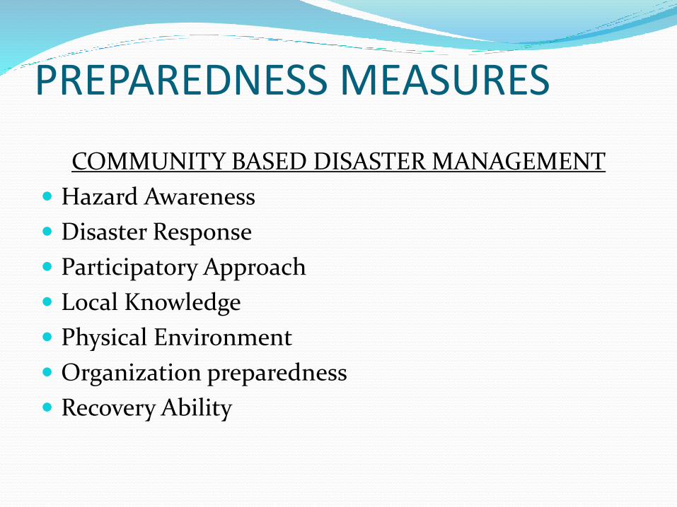
PREPAREDNESS MEASURES
COMMUNITY BASED DISASTER MANAGEMENT
Hazard Awareness
Disaster Response
Participatory Approach
Local Knowledge
Physical Environment
Organization preparedness
Recovery Ability

THANK YOU