using sketches and knowledge bases for geo-spatial image retrieval
TRANSCRIPT

Computers, Environment and Urban Systems
30 (2006) 29–53
www.elsevier.com/locate/compenvurbsys
Using sketches and knowledge bases forgeo-spatial image retrieval
M. Bertolotto a,*, J.D. Carswell b,1, E. McLoughlin a,D. O�Sullivan a, D. Wilson c,2
a Department of Computer Science, University College Dublin, Belfield, Dublin 4, Irelandb Digital Media Centre, Dublin Institute of Technology, Dublin 2, Ireland
c Department of Software and Information Systems, University of North Carolina at Charlotte,
Charlotte, NC 28223, USA
Received 30 March 2003; accepted in revised form 17 March 2004
Abstract
This paper presents research in the field of knowledge management for geo-spatial imagery
including scanned aerial photos and satellite images. We have developed a web-based system
that allows users to query a database of images not only using metadata, but also drawing
sketches of configurations of objects they are interested in as well as inputting textual descrip-
tions of their intended task. Our system integrates case-based reasoning techniques to form a
knowledge base from previously issued queries that can be exploited to improve future query
processing and to build organizational memory through experience capture. The effective
design and implementation of a user-friendly graphic user interface plays an important role
for the system to provide improved human–computer interaction and decision support.
� 2004 Elsevier Ltd. All rights reserved.
Keywords: Geo-spatial imagery; Knowledge base; Sketch-based queries
0198-9715/$ - see front matter � 2004 Elsevier Ltd. All rights reserved.
doi:10.1016/j.compenvurbsys.2004.03.001
* Corresponding author. Tel.: +353 1 716 2913; fax: +353 1 269 7262.
E-mail addresses: [email protected] (M. Bertolotto), [email protected] (J.D. Carswell),
[email protected] (E. McLoughlin), [email protected] (D. O�Sullivan), [email protected]
(D. Wilson).1 Tel.: +353 1 4023264.2 Tel.: +1 704 687 5498.
30 M. Bertolotto et al. / Comput., Environ. and Urban Systems 30 (2006) 29–53
1. Introduction
The purpose of our research is the development of a knowledge management sys-
tem called MaGIK (Managing Geo-Spatial Imagery and Knowledge) for the retrie-
val of geo-spatial imagery matching user-sketched configurations of objects,metadata and task descriptions. The functionality that users require from such a sys-
tem is twofold:
• Be able to retrieve the images and geo-spatial data they need, and
• Be able to use, augment and manipulate the retrieved images and data to highlight
task-relevant information, as well as to capture the results of their interactions in
a knowledge base for future support.
For example, a company that uses geo-spatial data for urban planning projects
may employ such a system to assist in selecting the location for new civil develop-
ments. From a task-based standpoint, the most relevant work product lies not
merely in the applicable visual data, but in descriptions of why and how the infor-
mation has been collected and to what ends it has been successfully (or unsuccess-
fully) employed. A clear advantage is provided by capturing and leveraging
essential underlying information. It is also advantageous to measure and record
the human expertise involved in applying such information as part of the organisa-tional task.
The MaGIK system that we are currently developing extends and augments our
previous work on sketch-based image retrieval (Agouris, Bertolotto, Carswell, & Ste-
fanidis, 2000, 2002; Carswell, 2000) by providing knowledge management support as
well as a user-friendly graphical user interface for improved human–computer inter-
action and decision support. Classical retrieval systems would require the user to for-
mulate his/her query in a given database language, possibly with the use of a
graphical interface where he/she can type in attribute characteristics of the objects.However, these systems would not allow the user to formulate the query in a visual
way (e.g., by means of a sketch) and they would not take the shape of objects into
consideration. A sketch is a very effective and intuitive way of expressing what the
user has in mind. Additionally, sketch-based queries are important in applications
where shape is an essential characteristic and they facilitate human–computer inter-
action by allowing the users to visualise the spatial configuration they want to re-
trieve. An example of a sketch-based query is shown in Fig. 1 below where the
user is interested in retrieving images containing a road intersection, groups ofhouses and a stadium.
The sketch-based query facility is an innovative aspect of our system and provides
users with an option of formulating their queries by drawing sketches (e.g., with the
aid of a pen-based input device) of the spatial configuration of objects they intend to
retrieve.
Our current system, does not rely soley on the sketch-based image matching algo-
rithms developed in (Carswell, 2000), it may be integrated with any sketch-based
retrieval system or algorithms.

Fig. 1. Query by sketch.
M. Bertolotto et al. / Comput., Environ. and Urban Systems 30 (2006) 29–53 31
Therefore besides a sketch of object configurations additional metadata regarding
the geographic area (e.g., Boston, Massachuttes, USA) and scale (e.g., 2 m per pixel)
associated with the query, and task description outlining the specific purpose of thesearch can also be input to the MaGIK system by the user. Fig. 2 illustrates an exam-
ple of a task description a user may enter with regard to the development of a shop-
ping center.
The imagery retrieved by the system in response to such a query consists of a
ranked list of images that match the users requirements according to a computed
Fig. 2. Query by task description.

32 M. Bertolotto et al. / Comput., Environ. and Urban Systems 30 (2006) 29–53
similarity metric. Once the relevant information has been retrieved, the user can
highlight and elucidate the particular aspects of the imagery that address overarching
task-based goals. For example, if a new shopping center is being planned, the user
may annotate a retrieved image by highlighting areas of undeveloped land adjacent
to areas of housing and areas of good infrastructure, in order to justify a proposednew location. The queries, annotations, and rationale can then be stored as an
encapsulated parcel of knowledge in the context of the civil planning task. This par-
cel can be stored in a knowledge base, thus growing corporate knowledge assets, and
can therefore be re-used to support future tasks. For example, if there are records of
how the earlier shopping center locations were chosen, those earlier experiences
could be used to inform the user of the query process involved in these earlier tasks.
This can provide an insight into the rationale behind earlier choices that may apply
to the current task. Fig. 3 schematically shows the addition of the knowledge basefor experience capture and re-use to a sketch-based image retrieval system.
This paper provides an overview of the system as a whole and then focuses on the
latest developments on its knowledge management and task-based querying
capabilities.
The remainder of the paper is organised as follows. Section 2 describes related
work. Section 3 describes the system architecture design. Section 4 is dedicated to
the image retrieval component of our system and the metrics employed in such retrie-
val. Section 5 discusses how the knowledge management techniques have been inte-grated into the system to allow for more intelligent image retrieval. Section 6 focuses
on how we have implemented the outlined system. Section 7 describes some initial
system evaluation and discusses the results of this evaluation. Finally, Section 8 out-
lines some conclusions and future work.
Fig. 3. System overview.

M. Bertolotto et al. / Comput., Environ. and Urban Systems 30 (2006) 29–53 33
2. Related work
The scope of our research ranges from geo-spatial information handling and re-
trieval to human–computer interaction to knowledge management. Within these
areas we focus on specific topics whose related work is described in the following.
2.1. Image retrieval by content
Extensive research is being conducted in the field of geographic information sys-
tems (GIS) to find efficient methods for storing and retrieving geo-spatial informa-
tion. Two different formats are used for the representation of geo-spatial data:
raster and vector. We concentrate on data in raster format including scanned aerial
photos, satellite images, etc. However, additional information can be associated withsuch data in the form of textual descriptions (metadata) and object attribute infor-
mation (semantic meaning of the objects contained in a given image).
Since the advent of digital scanners and sensors beginning in the late 1970s, (Chang
& Reuss, 1978; Zloof, 1975) image database querying has become a major area of re-
search. Most of the efforts during this time have focused on analysing and comparing
the lower-frequency properties of digital imagery. These include: colour, in the form
of histogram matching; texture, in the form of image coarseness and contrast match-
ing and composition, where an image is divided into homogeneous regions of colouror texture and the relative positions of these regions analysed (Carson, Belongie,
Greenspan, & Malik, 1997; Niblack et al., 1997; Forsyth et al., 1996; Frankel, Swain,
& Athitsos, 1996; Gupta, Weymouth, & Jain, 1991; Ogle & Stonebraker, 1995; Pent-
land, Picard, & Sclaroff, 1996; Sclaroff, Taycher, & La Cascia, 1997).
The expression ‘‘image retrieval by content’’ (Gudivada & Raghavan, 1995) in
this paper refers to retrieving images matching to the higher-frequency image char-
acteristics, more specifically, actual shape information (synonymous with outline or
edges) of features contained within the imagery, e.g. the outline of a building orbuildings. Furthermore, we are interested in doing so completely in the raster/spatial
domain.
The majority of work in the area of feature matching has shown some success
through matching the image-objects in the vector domain (Blaser, 1998; Chang,
1997; Cohen & Guibas, 1996; Jagadish, 1991; Mehrotra & Gray, 1993). This requires
that the raster imagery be converted into scenes of vector objects, often together with
attributes and other semantics such as topology before they can be queried. As the
process of converting raster imagery into vector scenes of objects is not yet fullyautomated, this task remains tedious and should not be considered as given.
From a theoretical point of view, to obtain an ‘‘optimal’’ performance in an image
information environment, some operations are better or easier done in the raster do-
main while others are more efficient in the vector domain. Defining spatial relations,
for example, the topological (disjoint, touching, overlapping, etc.), directional
(above, below, north, south, etc.) and metric (distance) relationships between objects
is easier in the vector domain, where properties of the individual objects are known
beforehand, (Blaser, 1998; Chang, 1997; Cohen & Guibas, 1996; Jagadish, 1991;
34 M. Bertolotto et al. / Comput., Environ. and Urban Systems 30 (2006) 29–53
Mehrotra & Gray, 1993), while feature matching is usually done in the raster domain
(Agouris & Schenk, 1996; Gonzalez & Woods, 1992; Mehrotra & Gray, 1995). It is
well known that the integration of the two domains is still an open problem.
Some cases of image retrieval systems automatically extract keywords (metadata)
about the imagery through the analysis of the location (URL) where the image isfound on the WWW or from the text in which the image is embedded. Other seman-
tic and/or metadata information in the form of general image colour, texture, dimen-
sion, shape, file type, size, and date can also be extracted automatically and indeed
are used by some image retrieval systems, e.g. Chabot (Ogle & Stonebraker, 1995),
Candid (Kelly, Cannon, & Hush, 1995), Cypress (Carson et al., 1997; Forsyth et al.,
1996), ImageRover (Sclaroff et al., 1997), Jacob (Ardizzone & La Cascia, 1997),
WebSeer (Frankel et al., 1996), VisualSeek (Smith & Chang, 1996), FIBSSR (Mehro-
tra & Gray, 1995), Nishida (Nishida, 1999), QBIC (Niblack et al., 1997), PICTION(Srihari, 1995), PhotoBook (Pentland et al., 1996), Virage (Hampapur et al., 1997),
Lyco Media Search (http://www.lycos.com/picturethis/), Yahoo Image Surfer (http://
ipix.yahoo.com/) and others (Athitsos, Swain, & Frankel, 1997; Kauppinen, Sepp-
naen, & Pietikaainen, 1995; Persoon & Fu, 1977; Smith & Chang, 1997). This defi-
nition of image ‘‘content’’ however is not the same as that used in this project. For
example, none of the above mentioned systems take into account the actual shape
of the objects contained within the imagery. This is understandable of course since
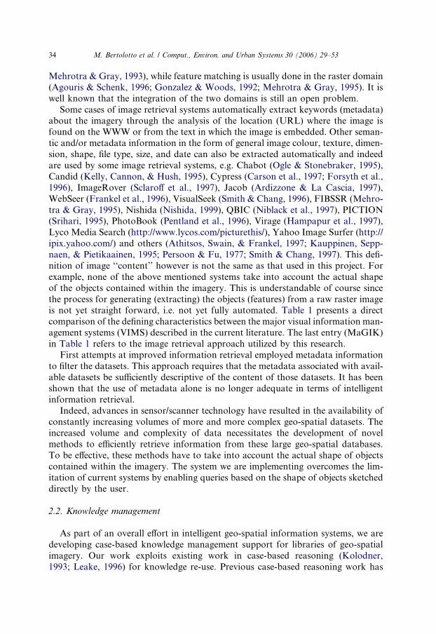
the process for generating (extracting) the objects (features) from a raw raster imageis not yet straight forward, i.e. not yet fully automated. Table 1 presents a direct
comparison of the defining characteristics between the major visual information man-
agement systems (VIMS) described in the current literature. The last entry (MaGIK)
in Table 1 refers to the image retrieval approach utilized by this research.
First attempts at improved information retrieval employed metadata information
to filter the datasets. This approach requires that the metadata associated with avail-
able datasets be sufficiently descriptive of the content of those datasets. It has been
shown that the use of metadata alone is no longer adequate in terms of intelligentinformation retrieval.
Indeed, advances in sensor/scanner technology have resulted in the availability of
constantly increasing volumes of more and more complex geo-spatial datasets. The
increased volume and complexity of data necessitates the development of novel
methods to efficiently retrieve information from these large geo-spatial databases.
To be effective, these methods have to take into account the actual shape of objects
contained within the imagery. The system we are implementing overcomes the lim-
itation of current systems by enabling queries based on the shape of objects sketcheddirectly by the user.
2.2. Knowledge management
As part of an overall effort in intelligent geo-spatial information systems, we are
developing case-based knowledge management support for libraries of geo-spatial
imagery. Our work exploits existing work in case-based reasoning (Kolodner,
1993; Leake, 1996) for knowledge re-use. Previous case-based reasoning work has

Table 1
Comparison between ‘‘content-based’’ VIMS
Color, text and/
or texture
queries
Vector shape
queries
Raster shape
queries
Manual/
semi-auto image
preprocessing
Automatic
image
pre-processing
Aerial/
satellite
imagery
Multimedia
type imagery
Chabot X X X
Candid X X X
VisualSeek X X X
Cypress X X X
Jacob X X X
ImageRover X X X
Yahoo Image Surfer X X X
Lyco Media Search X X X
WebSeer X X X
WebSeek X X X
FIBSSR X X X
Nishida X X X
Fourier Descriptors X X X
QBIC X X X X X
PICTION X X X X
PhotoBook X X X X X
Virage X X X X X
MaGIK X X X X X
M.Berto
lotto
etal./Comput.,
Enviro
n.andUrbanSystem
s30(2006)29–53
35
36 M. Bertolotto et al. / Comput., Environ. and Urban Systems 30 (2006) 29–53
addressed knowledge management (Aarts, 1998; Becerra-Fernandez & Aha, 1999;
Klahr, 1997; Leake & Wilson, 2001), textual case-based reasoning (Lenz & Ashley,
1998; Wilson & Bradshaw, 2000), and geo-spatial and image retrieval (Grimnes &
Aamodt, 1996; Gross, Zimring, & Do, 1994; Holt & Benwell, 1999; Yeh & Shi,
1999). The challenges consist of integrating and tailoring these methods to addressspecific needs for geo-spatial image information management, as well as to develop
hybrid similarity measures that seamlessly integrate very different types of contextual
knowledge afforded by query sketches, result images and metadata, image annota-
tions, textual rationale annotations, and multimedia annotations.
The method of annotating multimedia is related to annotating for the semantic
web (e.g., (Champin, Prie, & Mille, 2001)) and multimedia indexing (e.g., Perry &
Lewis, 1998; Worring et al., 2002), which focus on developing and leveraging anno-
tated descriptions of the media content. Here, we focus rather on a task-centricview of annotation, providing for and employing annotations about how an image
relates to the task at hand, though this will necessarily involve some reference to
image content which may later be used to refine indexing. Multimedia database
approaches such as QBIC (Niblack et al., 1997) provide for image segmentation
and annotation, but also focus on contextualizing individual images, rather than
task experiences.
Previous work in CBR has made use of multimedia cases (e.g., Barber et al., 1992;
Burke & Kass, 1996), but the case media is not employed directly for retrieval;rather, the case indices are crafted semantic representations of the media content,
an overhead we seek to avoid. While we make use of the information as part of task
similarity rather than task structure, the system is instrumented to collect informa-
tion about user interactions in terms of browsing and usage in a manner similar
to the usage model in Egyed-Zsigmond, Mille, and Prie (2003).
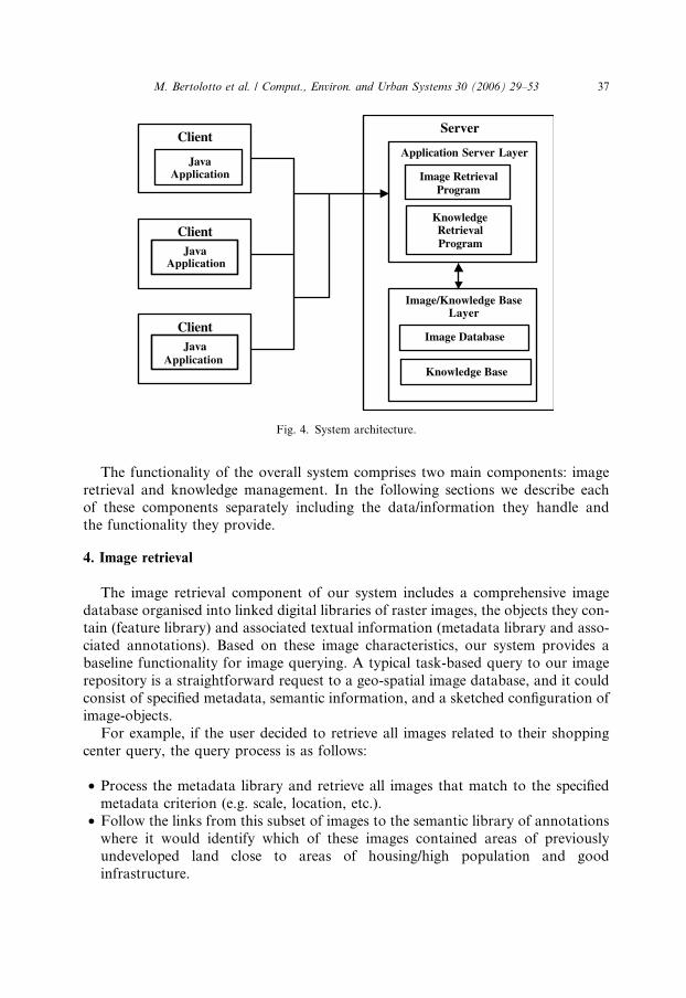
3. System architecture
In this section we describe the architectural components of our system. Such a sys-
tem relies on a three-tier architecture comprising three main layers, namely the Client
Layer, the Application Server Layer, and the Image/Knowledge Base Layer as out-
lined in Fig. 4.
All communications between the client layer and the image/knowledge base layer
are conducted through the application server layer. The application is executed on
the client using an applet that runs in a standard web browser�s Java Virtual Ma-chine (JVM). The applet communicates with the application server using the existing
HTTP networking protocol.
The application server layer contains all executable application programs, includ-
ing: the image matching and processing algorithms, the database updating and main-
tenance routines, as well as the knowledge retrieval and management programs.
The image/knowledge base layer contains all image and query data and other
information manipulated by the system.
Server
Application Server Layer
Image/Knowledge Base Layer
Image Retrieval Program
Knowledge Retrieval Program
Image Database
Knowledge Base
Client
Java Application
Application
Application
ClientJava
ClientJava
Fig. 4. System architecture.
M. Bertolotto et al. / Comput., Environ. and Urban Systems 30 (2006) 29–53 37
The functionality of the overall system comprises two main components: image
retrieval and knowledge management. In the following sections we describe eachof these components separately including the data/information they handle and
the functionality they provide.
4. Image retrieval
The image retrieval component of our system includes a comprehensive image
database organised into linked digital libraries of raster images, the objects they con-tain (feature library) and associated textual information (metadata library and asso-
ciated annotations). Based on these image characteristics, our system provides a
baseline functionality for image querying. A typical task-based query to our image
repository is a straightforward request to a geo-spatial image database, and it could
consist of specified metadata, semantic information, and a sketched configuration of
image-objects.
For example, if the user decided to retrieve all images related to their shopping
center query, the query process is as follows:
• Process the metadata library and retrieve all images that match to the specified
metadata criterion (e.g. scale, location, etc.).
• Follow the links from this subset of images to the semantic library of annotations
where it would identify which of these images contained areas of previously
undeveloped land close to areas of housing/high population and good
infrastructure.
38 M. Bertolotto et al. / Comput., Environ. and Urban Systems 30 (2006) 29–53
• Use the semantic input criteria to further narrow down the list of images to search
within for the required query shapes outlined in the user sketch.
• Use this further subset of imagery to select, through feature linking, a refined sub-
set of features within the feature library to match individual objects in the query
sketch against.• Retrieve all the imagery linked to the best matched features in this refined subset
from the feature library.
• Determine which of these images were returned more than once, i.e. which images
contain all of the objects in the query configuration.
• Process the spatial relations of the query scene on this final subset of imagery and
return a prioritised list of imagery as the query result.
When a feature gets matched to an image, its centroid coordinates within theimage are recorded as well as the top left and bottom right coordinates of the query
feature�s minimum bounding rectangle (MBR), after scaling and rotation have taken
place. Spatial relations on the image are determined through the use of the matched
query features MBRs instead of the actual image-objects because the image is in ras-
ter (non-vectorised) format and therefore no a-priori information is known about
any image-object (in particular, their boundaries). Also, it is straightforward to
determine the MBR containing the pixels composing the translated/rotated/scaled
query object and using their MBRs allows for spatial relations to be built andqueried in real-time.
An important component of the comprehensive digital image database is the fea-
ture library that contains a set of distinct features (i.e. image-object shapes) and links
to relevant images where such features appear. The role of the feature library is to
allow for efficient querying through the optimal organisation of image-object data,
in the form of previously sketched queries, and to provide the crucial link between
this abridged group of raster features and a library of images. Feature-image linking
allows us to avoid matching against the actual images, which can be very time con-suming even for a small library of imagery. Thus real-time image querying and retrie-
val is made possible.
The organisation of the feature library into a tree-like structure (e.g. Agouris,
Carswell, & Stefanidis, 1999) enables it to act like a multi-stage screening mechanism
that minimises the risk of wasting considerable time making passes over extensive
data that have no chance of selection. For example, the first screening criterion will
eliminate as potential matching candidates most of the features within the library. A
secondary screening criterion will eliminate the next greatest number of alternativesand so on down through the feature library tree hierarchy.
The feature library is linked many-to-many with the image library. That is, one
image could be linked to more than one feature within the feature library and one
feature could be linked to more than one image in the image library. Due to the dy-
namic natures of the image library and query building, the feature library is con-
stantly adding, subtracting and otherwise updating its features, links, and internal
organisation. It also therefore needs to be autonomous in that it automatically
M. Bertolotto et al. / Comput., Environ. and Urban Systems 30 (2006) 29–53 39
maintains its own contents depending on the changing states of these external but
integrated components.
5. Knowledge management
Our storage, indexing, and retrieval tools provide a highly effective means for
exploiting geo-spatial image information, and they play a natural role in supporting
the overarching task-based needs of organisations that rely on such information.
Organisations are increasingly concerned about the capture and management of
knowledge assets.
Managing the knowledge implicit in using geo-spatial imagery to address partic-
ular tasks is crucial for capturing and making the most effective use of organisationalknowledge assets. This serves both to facilitate workflow by providing employee ac-
cess to bestpractice examples, as well as to grow a repository of task-based experi-
ence as a resource for support, training, and minimizing organizational knowledge
loss as a result of workforce turnover. Our approach addresses task-based knowl-
edge management by providing:
1. A flexible environment to support analysis and elucidation of relevant geo-spatial
image information that can easily be integrated as part of existing workflow, and2. Intelligent tools to support capture and re-use of encapsulated task-based interac-
tions and context.
When interacting with geo-spatial image information in service of a task goal, the
user needs to be able to tease out the particular informational aspects that support
the task goal. Ideally, two work products emerge – first, the actual information as
applied to the task, and second, a record of the information gathering process that
allows for incremental development and provides a reference for subsequent justifi-cation and refinement if necessary. As the user often needs to make notes and anno-
tations in order to support the former, the latter can be supported in a natural way
by integrating annotation tools tailored to the information gathering environment.
This also supports efficient interaction, as it minimizes the need to divert attention
from the information source.
In order to support the user in constructing the most on-point information ker-
nels, we have designed a task-environment for managing and annotating task-based
information. Within this environment we have developed tools for direct imagemanipulation, such as filters, transformations, highlighting, sketching, and post-it
type annotations. These allow the user to, among other things, locate and define re-
gions of interest in the images. The user-defined regions can then be linked to clar-
ifications or rationale, initially in the form of textual annotations, as well as linking
relevant associated geo-spatial data. The manipulations and annotations do not alter
the underlying images or geo-spatial information, rather they are layered to provide
a task-specific view.

40 M. Bertolotto et al. / Comput., Environ. and Urban Systems 30 (2006) 29–53
Our system provides for the capture and refinement of more general task-based
ideas and rationale by allowing for resources to be attached to this experience pack-
age. A typical interaction with the system then can capture the sketch and geo-spatial
query or queries posed by the user, the results that were found to be useful, as well as
the user�s annotations of the results. All of the contextual knowledge required to ad-dress the task goal can thus be captured as a package or case of experience. These
cases are referred to as sessions.
The capture of task-based experience cases is the foundation of the knowledge
management process. It enables an increasingly powerful cycle of proactive support
that can:
• Make available relevant task knowledge from a user�s own previous work.
• Facilitate knowledge sharing by retrieving potentially relevant knowledge fromother user experiences.
• Provide training support for novice users.
• Enable automatic proactive support by retrieving potentially relevant knowledge
based on the partial task context.
Because the knowledge management system is tightly coupled with the tasks that
the user is performing, the system can make proactive recommendations in a natural
and unobtrusive manner by monitoring the user�s current task context. Based onincrements in the geo-spatial image information accessed and annotations provided,
the system can correspondingly anticipate and update what previous experiential
knowledge would be relevant at that stage, making it available to the user. The
knowledge must be provided unobtrusively, so that it need only be accessed when
required. Thus the process of knowledge retrieval does not distract from the task
at hand, yet makes relevant knowledge available just-in-time.
The development of the task environment leverages tools that are developed for
other parts of the system. The most complicated aspects deal with image manip-ulation and draw on lower-level tools that are used in authoring the geo-spatial
image data. The challenge for the interface development in this aspect of the sys-
tem is to develop a flexible architecture that enables customisation of the user
interface, support for multiple types of annotation, and easily afford contextual
and user interaction information to the knowledge management tools. In addition,
we are investigating human–computer interaction issues in how best to provide
knowledge support in a manner that is unobtrusive, so as not to interrupt ongoing
work, but also effectively convey the presence and type of knowledge supportavailable.
6. Implementation
Our image retrieval system utilises metadata entry, semantic input and the image
matching algorithms developed in (Carswell, 2000) to return relevant imagery. The
system, however, is not dependent on the image similarity algorithms described in
M. Bertolotto et al. / Comput., Environ. and Urban Systems 30 (2006) 29–53 41
(Carswell, 2000), indeed it may be integrated with any such image matching algo-
rithm. We have integrated these components with a graphic user interface (GUI)
through which users may interact easily with the system (O�Sullivan, McLoughlin,
Bertolotto, & Wilson, 2003).
When a user logs in to the application, they are directed to an interface that en-ables them to search directly for images that correspond to their current task needs.
Queries can be constructed using a combination of metadata, semantic information,
and pen-based sketch input. The user can formulate an image library query using
any combination of these elements.
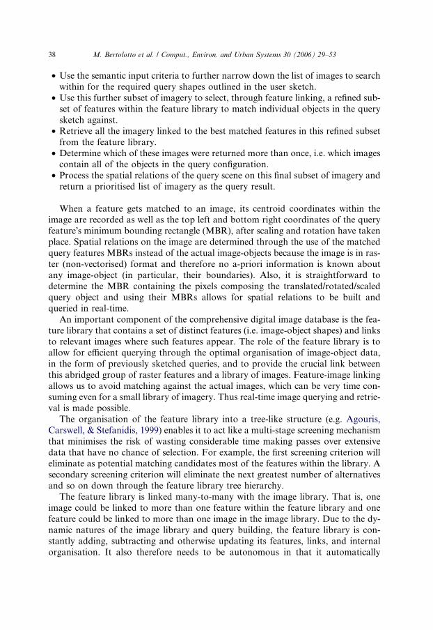
The metadata screen allows a user to formulate a query based on the image
location, scale, creation date, and semantic keys. For example, a user might be inter-
ested in building a shopping center near Boston and wish to view recent images of
possible building sites and related areas. As shown in Fig. 5, the user could enterthe location as Boston and a small scale value, as they wish to view large areas of
land.
Once the user has formulated their query using any combination of the search
screens, they can initiate the search.
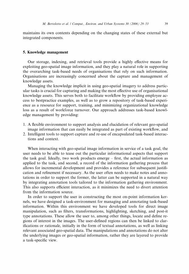
The resulting matching images are returned to the search screen in a new tab.
Matching images are displayed as a list of thumbnails with their associated matching
percentage score, as shown in Fig. 6. A subset of the metadata for each image is
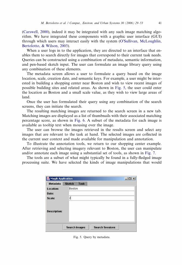
available as tooltip text when mousing over the image.The user can browse the images retrieved in the results screen and select any
images that are relevant to the task at hand. The selected images are collected in
the current user context and made available for manipulation and annotation.
To illustrate the annotation tools, we return to our shopping center example.
After retrieving and selecting imagery relevant to Boston, the user can manipulate
and/or annotate each image using a substantial set of tools, as shown in Fig. 7.
The tools are a subset of what might typically be found in a fully-fledged image
processing suite. We have selected the kinds of image manipulations that would
Fig. 5. Query by metadata.
Fig. 6. Matching images.
Fig. 7. Image manipulation screen.
42 M. Bertolotto et al. / Comput., Environ. and Urban Systems 30 (2006) 29–53
M. Bertolotto et al. / Comput., Environ. and Urban Systems 30 (2006) 29–53 43
be most useful in helping to analyse and focus on image features (e.g., high-pass
filtering). All of the sketching manipulations can be performed in a variety of colours
and brush styles. The architecture has also been designed to facilitate the addition of
new types of image tools as the need arises.
The user can then go on to add personal media annotations to the image as awhole or to particular highlighted image aspects. Currently, the system supports
annotation by text, audio, and video. The system integrates real-time audio and
video capture as well as compression. A wide variety of compression formats are
supported, including QuickTime, Mpeg and H.263. All textual, audio and video
annotations can be previewed before being incorporated as part of the knowledge
base, and once recorded they can be saved and uploaded to the image context as
a knowledge parcel associated with the task in question. Returning to our shopping
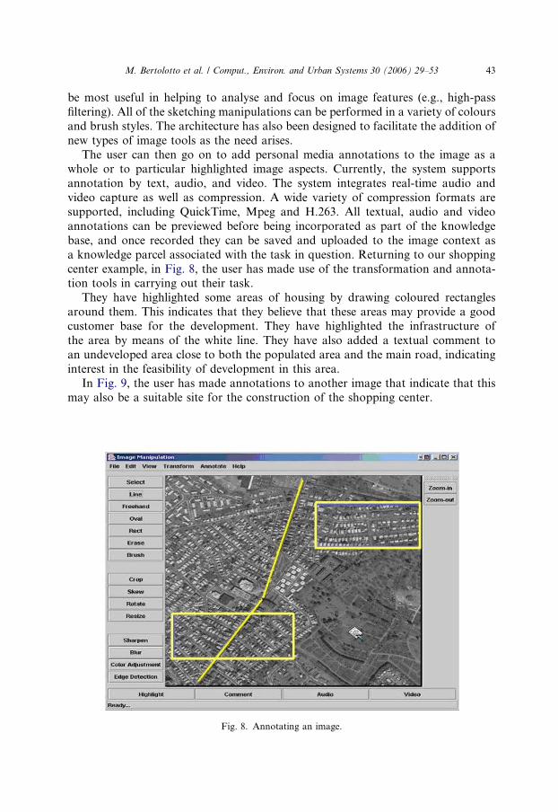
center example, in Fig. 8, the user has made use of the transformation and annota-tion tools in carrying out their task.
They have highlighted some areas of housing by drawing coloured rectangles
around them. This indicates that they believe that these areas may provide a good
customer base for the development. They have highlighted the infrastructure of
the area by means of the white line. They have also added a textual comment to
an undeveloped area close to both the populated area and the main road, indicating
interest in the feasibility of development in this area.
In Fig. 9, the user has made annotations to another image that indicate that thismay also be a suitable site for the construction of the shopping center.
Fig. 8. Annotating an image.

Fig. 9. Annotating an image.
44 M. Bertolotto et al. / Comput., Environ. and Urban Systems 30 (2006) 29–53
Here the user has uploaded a video file to an area of the image that is highly pop-
ulated. They may have recorded this video while they were carrying out their task or
this may have been an existing file that they had in their possession containing infor-
mation specific to shopping center construction. The textual and video media anno-
tations are represented by icons, which are painted on the image. If the user mouses
over any of these icons the region associated with the annotation is emphasized by a
rectangle drawn around the icon. This is shown by the dark rectangle around the
camera icon in Fig. 9. The user can click on any of these icons to display apop-up description as shown in Fig. 10.
The system also supports annotation by cut, copy and paste between a given
image and other images in the dataset, as well as images in any application that sup-
ports clipboard functionality for the given operating system. A user�s entire process
of image interaction in the system is stored as an encapsulated session case. Note that
a session can be saved and re-opened to continue processing later.
6.1. Annotation based retrieval
The capture of task-based experience cases is the foundation of the knowledge
management process. In the first phase of the work, we are focusing our annota-
tion-based retrieval on textual annotations, using information retrieval metrics as a
basis for similarity. We presume that image retrieval is taking place toward some
goal in the context of an overall work flow. Given a textual representation of the
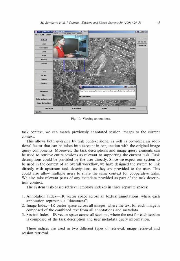
Fig. 10. Viewing annotations.
M. Bertolotto et al. / Comput., Environ. and Urban Systems 30 (2006) 29–53 45
task context, we can match previously annotated session images to the current
context.
This allows both querying by task context alone, as well as providing an addi-
tional factor that can be taken into account in conjunction with the original image
query components. Moreover, the task descriptions and image query elements canbe used to retrieve entire sessions as relevant to supporting the current task. Task
descriptions could be provided by the user directly. Since we expect our system to
be used in the context of an overall workflow, we have designed the system to link
directly with upstream task descriptions, as they are provided to the user. This
could also allow multiple users to share the same context for cooperative tasks.
We also take relevant parts of any metadata provided as part of the task descrip-
tion context.
The system task-based retrieval employs indexes in three separate spaces:
1. Annotation Index––IR vector space across all textual annotations, where each
annotation represents a ‘‘document’’.
2. Image Index––IR vector space across all images, where the text for each image is
composed of the combined text from all annotations and metadata.
3. Session Index––IR vector space across all sessions, where the text for each session
is composed of the task description and user metadata query information.
These indices are used in two different types of retrieval: image retrieval and
session retrieval.

46 M. Bertolotto et al. / Comput., Environ. and Urban Systems 30 (2006) 29–53
6.1.1. Image retrieval
Image retrieval serves two purposes. First, task-based similarity can be used di-
rectly to access annotated images in the image library. Second, it can be integrated
with similarities from the other types of query information, such as by image
content, to provide a more refined overall metric for retrieval.In searching for relevant images, similarity is computed as follows. If the image
passes the metadata filter:
• Compute similarity in the image index.
• Compute and average similarities for each attached annotation in the annotation
index.
• Compute the final image score as the average of overall image and individual
annotation similarities.
6.1.2. Session retrieval
As the system builds up encapsulated user interactions, another type of retrieval is
enabled, retrieving entire previous task-based sessions. This enables a current user to
look for the previous image analysis tasks that are most similar to the current task
both to find relevant imagery and to examine the decisions and rationale that went
into addressing the earlier task. One challenge in retrieving previous sessions hasbeen how to present an entire session to the user in a manner that is compact enough
to allow multiple results to be viewed simultaneously while still providing enough
information for the user to discriminate potential relevancy. Fig. 11 shows an exam-
ple of our results for retrieved sessions.
In order to keep session listings small and still provide enough discriminatory
information, each session result is summarised to include the following:
• Percent similarity score.• The most discriminating query information (if more than one) for the session
(since we have captured which results were actually used, we know which queries
were most fruitful).
• The most important annotations (words, phrases, media buttons that play any
audio or video clips uploaded during the session and are deemed to have the high
similarity to the current user�s context).• Thumbnail versions of the most important images (images that have been an-
notated or browsed as part of the similar users context and bear relevance tothe current users task and have been ranked accordingly).
In searching for relevant sessions, similarity is computed as follows.
For each previous session above a threshold similarity:
• Compute the preliminary similarity session score in vector space across all ses-
sions, where the text for each session is composed of the task description, anno-
tations and user metadata query information.

Fig. 11. Matching sessions.
M. Bertolotto et al. / Comput., Environ. and Urban Systems 30 (2006) 29–53 47
• Compute the number of images annotated and browsed in that session as a frac-
tion of the total number of images returned.
• Compute the final session score as the weighted sum of session similarity, propor-
tion of annotated and browsed images.
The proportions of annotated and browsed images provide a measure of the rel-
ative usefulness of a given session, and they are given a parameterized weighting rel-
ative (currently lower) to the session index similarity component. The scores for theindividual images annotated or browsed in a similar session are calculated by com-
paring any textual annotations made to those images during that session to the meta-
data and textual task description entered by the current user. If the user wishes to
view the annotations made to an image returned in a similar session, they may do
so by clicking on the thumbnail, which brings up the image and all its annotations
in the image manipulation screen. Here the user has an opportunity to read a textual
comment uploaded by the similar user and also to play audio and video clips up-
loaded as part of the similar session. The user may further annotate this image if theywish and/or retain the previous users annotations by adding it to their current ses-
sion image context. The overall similar sessions scores as well as the scores assigned
to individual images belonging to these similar sessions vary dynamically based on
the interaction of the current user. For example if our user annotates or browses
images that another user has already found useful in the context of their task, the
scores assigned to these images will increase as the current user proceeds with their
own task. Conversely session or image scores will decrease if associated queries,
annotations, or images are ignored by our current user.

48 M. Bertolotto et al. / Comput., Environ. and Urban Systems 30 (2006) 29–53
If a user decides to incorporate the work of another user as part of their own ses-
sion, this knowledge is implicitly captured by the system and the scores associated
with that session as well as the re-used annotations are updated to reflect this recy-
cling process. Once the user saves the desired previous/new annotations, all of these
annotations are transferred to the current user�s view of the image. The user may per-form many different queries and annotate or manipulate many images during the
course of a session, and these are all saved as part of the users profile when they exit
the application.
7. Evaluation
For the initial phase of the implementation, we have conducted testing with 17different task scenarios using a library of 50 images with novice task-domain users.
Sessions were completed each in one pass, without engaging in feedback and refine-
ment. The current experiments are designed more to test whether the system is per-
forming as expected rather than to provide an absolute measure of utility. We plan
to carry out more extensive user trials in the near future. The ideal way to test the
system, of course, would be to conduct user trials with task-domain experts, and
we are actively seeking outlets for such testing.
7.1. Image retrieval using annotations
The goal of our evaluation in this instance was to show that with the addition of
annotations to images in the library, image retrieval would improve over time.
Firstly an empty library of sessions and annotations was constructed. Then our
users interacted with the system to create a series of new task sessions. During each
session the users added annotations to selected images that they considered relative
to their task. Six different categories of task description were outlined, correspond-ing to civil development in the following areas: airports, hotels, bridges, hospitals,
stadiums and shopping centers. An example task description might be: ‘‘build a
shopping center in the suburbs of the city where infrastructure is good and land
is inexpensive.’’
The users entered task descriptions for each of the outlined categories and initi-
ated searches on the library. The results were returned to them as a set of ranked
images in each case. The matching scores were recorded for each image, and the user
selected images for annotation that seemed relevant to the task description. Theannotations for each image were recorded, but not indexed, in order to provide a
baseline retrieval performance for the system with annotations. A total of 20 sessions
were added. The experiment was then repeated using the same task descriptions to
evaluate how the image scores change with the addition of indexed textual annota-
tions. Fig. 12(a–d) shows the results for the most relevant 4 images (judged by the
user) for each session. In each graph there are six separate queries represented along
the X-axis where the light/dark columns (e.g. A, A1) give the similarity respectively
without and with indexed annotations for that particular query. As expected, there

Fig. 12. Evaluation.
M. Bertolotto et al. / Comput., Environ. and Urban Systems 30 (2006) 29–53 49
was an increase in the image matching scores, demonstrating the usefulness of
including textual annotations for retrieval.
7.2. Session retrieval
In order to evaluate the retrieval of similar sessions, three new task descriptions
(different from the 17 used for evaluating image retrieval) were then constructed inthree of the predefined categories. The top three similar sessions returned by the
application were analyzed and their results deemed to be relevant or irrelevant.
The first task description corresponded to the ‘‘Airport’’ category. The task descrip-
tion entered by the user outlined that they were interested in viewing images of exist-
ing airports as an aid to developing a new airport facility. They sought general
information concerning airport locations and orientations with regard to the urban
areas which they service, land elevation, infrastructure and the average land space
occupied. The top three similar sessions returned for the airport category were thenrecorded and analyzed. The scores associated with the top three sessions in this in-
stance were 40.68%, 15.14% and 14.82% respectively. The task description of the first
similar session outlined a scenario where the user was interested in constructing a
new airport. It differed from the task description of the current session, however,
in that the user was not interested in retrieving images of existing airports. Rather,
they simply wished to view areas of land that would be appropriate for such a new
development. Both task descriptions contained text associated with the airport do-
main such as elevation and land-space, as did some of the annotations uploaded

50 M. Bertolotto et al. / Comput., Environ. and Urban Systems 30 (2006) 29–53
by the user of the similar session to the images returned in their session. This session
was deemed to be useful in fulfilling the current task description.
In the second similar session the user had entered a task requesting the retrieval of
images in order to analyze general land usage in the selected cities. Some of the
images returned by the similar session depicted airports, and the user had madeannotations in this regard. The session score was higher because some more general
use terminology, such as land and urban appear in both queries. The session was
deemed to be moderately related to the current task. The third most similar session
user was interested in constructing a stadium in an urban area. The tasks are similar
in that the land sites required for both developments are relatively large when com-
pared to many other development domains and this is reflected in the session score.
In both cases it is preferable for the development sites to be located away from the
center of urban areas, given cost and the scale of previous development. This sessionalso seems to see gains in similarity from more general use terminology that parallels
the domains. We expect that there would be more marked differences allowing for
finer distinctions with task-domain experts and more substantial task descriptions.
This session was deemed quite similar, but not very relevant.
Similar evaluations were carried out in the development categories of ‘‘Bridge’’––
top three sessions: 35.59% (relevant), 14.65% (very relevant), and 13.79% (not rele-
vant), and ‘‘Hotel’’––top two sessions: 52.19% (relevant) and 20.14% (relevant). Only
two sessions were retrieved in total for the ‘‘Hotel’’ task. While these initial resultsare only indicative, they do show that the system is performing as expected. We in-
tend to undertake larger scale testing in the near future, and we realize that there are
many factors that will need to be accounted for, including a larger range of catego-
ries, scaling the number of annotations, and refining vocabulary toward more
domain-specific usage.
8. Conclusions
In this paper we presented the geo-spatial image retrieval and knowledge manage-
ment system we are developing. The main contributions of our work consist of pro-
viding an intuitive and effective retrieval environment based on user-drawn sketches
and case-base reasoning and knowledge management techniques for developing and
annotating task-based information. A knowledge base is built from previous experi-
ences to improve future query processing.
Particular attention has been given to the design of a user-friendly graphic inter-face that, besides facilitating the query input phase, also displays the results of the
query with a clear layout.
Experiments show the initial system implementation performing as expected,
and we hope to scale testing as the implementation progresses. As the system
matures, we expect to provide knowledge support in a flexible manner that can
be easily integrated with existing infrastructure, and we intend to make use of
existing standards for communication between system modules and for external
communication.
M. Bertolotto et al. / Comput., Environ. and Urban Systems 30 (2006) 29–53 51
For example, we will incorporate Geography Markup Language (GML) (http://
www.opengis.org) support as the standard develops. Furthermore, we are investi-
gating optimisation strategies in the form of efficient indexing as well as organisa-
tional/storage structures for image databases to obtain the best possible
performance.Once the implementation of the full prototype system nears completion, it will be-
come publicly available over the web. We are currently in the process of transferring
the system to the mobile platform and the system will also be available via this med-
ium. The employment of progressive transmission of raster images (e.g., based on
wavelets, etc.) will be investigated to facilitate access and delivery of large datasets
over slow communication links.
We expect that system capabilities would be enhanced by including more formal
representations such as domain ontologies, and we are particularly interested in thepossibility of automatically deriving and linking categories based on analysis of task
data. We plan to look into adding other resources, such as chaining the supporting
experience cases, as well speech-to-text in order to support expanded media retrieval.
In the longer term, we plan to consider the analysis of matching results of images
corresponding to the same geographic area in order to detect changes. This tech-
nique could be modified to allow for such temporal reasoning on the database. By
loosening up object/relation constraints and by analysing matching percentages,
we will be able to detect temporal changes in some areas, such as: the eliminationof some objects, changes in object shape, and change in location.
Finally, we are planning to integrate personalisation techniques in the feature
library organisation: indeed, different users can sketch the same object in very
different ways. Each user will then have a personalised version of the feature
library.
Acknowledgements
The funding support of the Research Innovation Fund of Enterprise Ireland is
gratefully acknowledged.
References
Aarts, A. (1998). A CBR architecture for project knowledge management. In Proceedings of the fourth
European workshop on case-based reasoning (pp. 414–424). Dublin, Ireland, Berlin: Springer.
Agouris, P., Bertolotto, M., Carswell, J. D., & Stefanidis, A. (2000). A scene similarity metric for matching
configurations of image objects. XIX ISPRS Congress, Amsterdam, The Netherlands.
Agouris, P., Bertolotto, M., Carswell, J. D., & Stefanidis, A. (2002). Scale and orientation-invariant scene
similarity metrics for image queries. International Journal of Geographical Information Science, vol. 16,
Taylor & Francis.
Agouris, P., Carswell, J. D., & Stefanidis, A. (1999). A feature library approach to on-line image querying
and retrieval for topographic applications. Vision Interface 1999.

52 M. Bertolotto et al. / Comput., Environ. and Urban Systems 30 (2006) 29–53
Agouris, P., & Schenk, T. (1996). Automated aero-triangulation using multiple image multipoint
matching. Photogrammetric Engineering & Remote Sensing, 62(6), 703–710.
Ardizzone, E., & La Cascia, M. (1997). Automatic video database indexing and retrieval. Multimedia
Tools and Applications, 4, 29–56.
Athitsos, V., Swain, M., & Frankel, C. (1997). Distinguishing photographs and graphics on the World
Wide Web. IEEE Workshop on Content-Based Access of Image and Video Libraries, Puerto Rico
(pp. 10–17).
Barber, J., Bhatta, S., Goel, A., Jacobsen, M., Pearce, M., Penberthy, L., Shankar, M., & Stroulia, E.
(1992). Integrating case-based reasoning and multimedia technologies for interface design support. In
J. G. Boston (Ed.), Artificial Intelligence in Design, Kluwer Academic Publisher.
Becerra-Fernandez, I., & Aha, D. (1999). Case-based problem solving for knowledge management
systems. In Proceedings of the twelfth annual florida artificial intelligence research symposium
(pp. 219–223). AAAI.
Blaser, A. D. (1998). Spatial-Query-by-Sketch: fundamentals for a sketch-based user interface in GIS.
Ph.D. Thesis, University of Maine, Orono, ME, USA.
Burke, R., & Kass, A. (1996). Retrieving stories for case-based teaching. In D. Leake (Ed.), Case-based
reasoning: experiences, lessons, and future directions (pp. 93–109). Menlo Park, CA: AAAI Press.
Carson, C., Belongie, S., Greenspan, H., & Malik, J. (1997). Region-based image querying. In IEEE
workshop on content-based access of image and video libraries, San Juan, Puerto Rico (pp. 42–49).
Carswell, J. D. (2000). Using raster sketches for digital image retrieval. Ph.D. thesis, Department of
Spatial Information Science and Engineering, The University of Maine.
Champin, P. A., Prie, Y., & Mille, A. (2001). Annotating with uses: a promising way to the semantic web.
In Proceedings K-CAP 2001 workshop on knowledge markup and semantic annotation (pp. 79–86).
Chang, N. S., & Reuss, J. (1978). Design considerations of a pictorial database system. International
Journal Policy Analysis Information Systems, 1, 49–70.
Chang, S. F. (1997). SaFe/VisualSEEk––Automatic Joint Spatial/Feature Based Image Search System.
Cohen, S. D., & Guibas, L. J. (1996). Shape-based indexing and retrieval; some first steps. In Proceedings
1996 ARPA image understanding workshop 2 (pp. 1209–1212).
Egyed-Zsigmond, E., Mille, A., & Prie, Y. (2003). Club (Trefle): a use trace model. In Proceedings of the
fifth international conference on case-based reasoning (ICCBR 03), Trondheim, Norway, LNAI 2689,
Springer-Verlag (pp. 146–160).
Forsyth, D. A., Malik, J., Fleck, M. M., Greenspan, H., Leung, T., Belongie, S., Carson, C., & Bregler, C.
(1996). Finding pictures of objects in large collections of images. In Proceedings of the 2nd International
Workshop on Object Representation in Computer Vision, Cambridge, United Kingdom (pp. 335–360).
Frankel, C., Swain, M., & Athitsos, W. (1996). WebSeer: an image search engine for the world wide web.
Science Technical Report TR-96-14, Department of Computer Science, University of Chicago.
Gonzalez, R. C., & Woods, R. E. (1992). Digital image processing. Addison-Wesley Publishing Company,
Inc, p. 716.
Grimnes, M., & Aamodt, A. (1996). A two layer case-based reasoning architecture for medical image
understanding. In Proceedings of EWCBR-96. Springer.
Gross, M., Zimring, C., & Do, E. (1994). Using diagrams to access a case library of design, artificial
intelligence in design. Dordrecht, Netherlands: Kluwer, pp. 129–144.
Gudivada, V. N., & Raghavan, V. V. (1995). Content-based image retrieval systems. IEEE Computer,
28(9), 18–22.
Gupta, A., Weymouth, T., & Jain, R. (1991). Semantic queries with pictures: the VIMSYS model. In
Proceedings of the 17th international conference on VLDB, Barcelona, Spain (pp. 69–79).
Hampapur, A., Gupta, A., Horowitz, B., Shu, C.-F., Fuller, C., Bach, J. R., Gorkani, M., & Jain, R.
(1997). Virage video engine. In Proceedings SPIE, vol. 3022, San Jose, CA, February 1997
(pp. 188–198).
Holt, A., & Benwell, G. L. (1999). Applying case-based reasoning techniques in GIS. The International
Journal of Geographical Information Science, 13(1), 9–25.
Jagadish, H. V. (1991). A retrieval technique for similar shapes. In Proceedings of ACM SIGMOD
international conference on management of data (pp. 208–217).
M. Bertolotto et al. / Comput., Environ. and Urban Systems 30 (2006) 29–53 53
Kauppinen, H., Seppnaen, T., & Pietikaainen, M. (1995). An experimental comparison of auto-regressive
and Fourier Descriptors in 2D shape classification. IEEE PAMI, 17(2), 201–207.
Kelly, P. M., Cannon, T. M., & Hush, D. R. (1995). Query by image example: the CANDID approach.
SPIE Storage and Retrieval for Image and Video Databases III, 2420, 238–248.
Klahr, P. (1997). Knowledge management on a global scale. In Proceedings of the 1997 spring symposium
on artificial intelligence in knowledge management (pp. 82–85). Stanford, CA: AAAI.
Kolodner, J. L. (1993). Case-based reasoning. San Mateo, CA, US: Morgan Kaufmann.
Leake, D. B. (1996). Case-based reasoning: experiences, lessons, & future directions. AAAI Press/The MIT
Press, ISBN 0-262–62110-X.
Leake, D. B., & Wilson, D. C. (2001). A case-based framework for interactive capture and reuse of design
knowledge. Applied Intelligence, 14(1), 77–94, Kluwer, Boston.
Lenz, M., & Ashley, K. D. (1998). Textual case-based reasoning. In Proceedings of the AAAI-98 Workshop
on Textual Case-Based Reasoning, AAAI, Papers from the AAAI-98 Workshop, AAAI Technical Report
WS-98-12, AAAI Press: Menlo Park, CA.
Mehrotra, R., & Gray, J. (1993). Feature-based retrieval of similar shapes. In Proceedings of ninth
international conference on data engineering, Vienna, Austria (pp. 108–115).
Mehrotra, R., & Gray, J. (1995). Similar-shape retrieval in shape data management. IEEE Computer,
28(9), 57–62.
Niblack, W., Zhu, X., Hafner, J. L., Breuel, T., Ponceleon, D., Petkovic, D., Flickner, M. D., Upfal, E.,
Nin, S. I., Sull, S., Dom, B., Yeo, B., Srinivasan, A., Zivkovic, D., & Penner, M. (1997). Updates to the
QBIC system. In Proceedings of SPIE, vol. 3312 (pp. 150–161).
Nishida, H. (1999). Shape Retrieval from image databases through structural feature indexing. Vision
Interface’99, Trois Rivieres, Canada (pp. 328–335).
Ogle, V. E., & Stonebraker, M. (1995). Chabot: Retrieval from a relational database of images. IEEE
Computer, 28(9), 23–32.
O�Sullivan, D., McLoughlin, E., Bertolotto, M., & Wilson, D. (2003). Capturing task knowledge for geo-
spatial imagery. In Proceedings of the 2nd international conference on knowledge capture, Sanibel Island,
FL, USA (pp. 78–87).
Pentland, A., Picard, R. W., & Sclaroff, S. (1996). Photobook: content-based manipulation of image
databases. International Journal of Computer Vision, 18(3), 233–254.
Perry, T., & Lewis, S. T. (1998). A novel image viewer providing fast object delineation for content based
retrieval and navigation. In SPIE conference on storage and retrieval for image and video databases VI,
vol. 3312 (pp 436–445).
Persoon, E., & Fu, K. S. (1977). Shape discrimination using Fourier descriptors. IEEE Transactions on
System Management, 7(3), 170–179.
Sclaroff, S., Taycher, L., & La Cascia, M. (1997). ImageRover: a content-based image browser for the
World Wide Web. IEEE workshop on content-based access of image and video libraries, San Juan,
Peurto Rico (pp. 2–9).
Smith, J. R., & Chang, S.-F. (1996). VisualSEEk: A fully automated content-based image query system. In
ACM multimedia conference, Boston, MA, USA (pp. 87–98).
Smith, J. R., & Chang, S.-F. (1997). Visually searching the web for content. IEEEMultimedia, 4(3), 12–20.
Srihari, R. K. (1995). Automatic indexing and content-based retrieval of captioned images. IEEE
Computer, 28(9), 49–56.
Wilson, D. C., & Bradshaw, S. (2000). CBR textuality. Expert Update, 3(1), 28–37.
Worring, M., Bagdanov, A., Gemert, J., Geusebroek, J., Minh, H., Schreiber, G., Snoek, C., Vendrig, J.,
Wielemaker, J., & Smeulders, A. (2002). Interactive indexing and retrieval of multimedia content. In
Proceedings of the 29th Conference on Current Trends in Theory and Practice of Informatics, Milovy,
Czech Republic (pp. 135–148).
Yeh, A. G. O., & Shi, X. (1999). Applying case-based reasoning to urban planning: a new planning
support system tool. Environment and Planning B: Planning and Design, 26, 101–116.
Zloof, M. M. (1975). Query by example. In Proceedings of AFIPS (pp. 431–438).