use of geophysics for levee investigation - aeg … horacio... · use of geophysics for levee...
TRANSCRIPT

Use of Geophysics for Levee Investigation
Levee State-of-the-Practice Symposium
April 22, 2016

Horacio Ferriz
California State University Stanislaus
With the collaboration of
Koichi Hayashi, Geometrics
Resham Sandhu, CSU East Bay
Ashley Loogman, Fremont Gold
Use of Geophysics for Levee Investigation

Why geophysics?

Types of levees
Fauchard, C., Mériaux, P., 2007

Anatomy of a levee
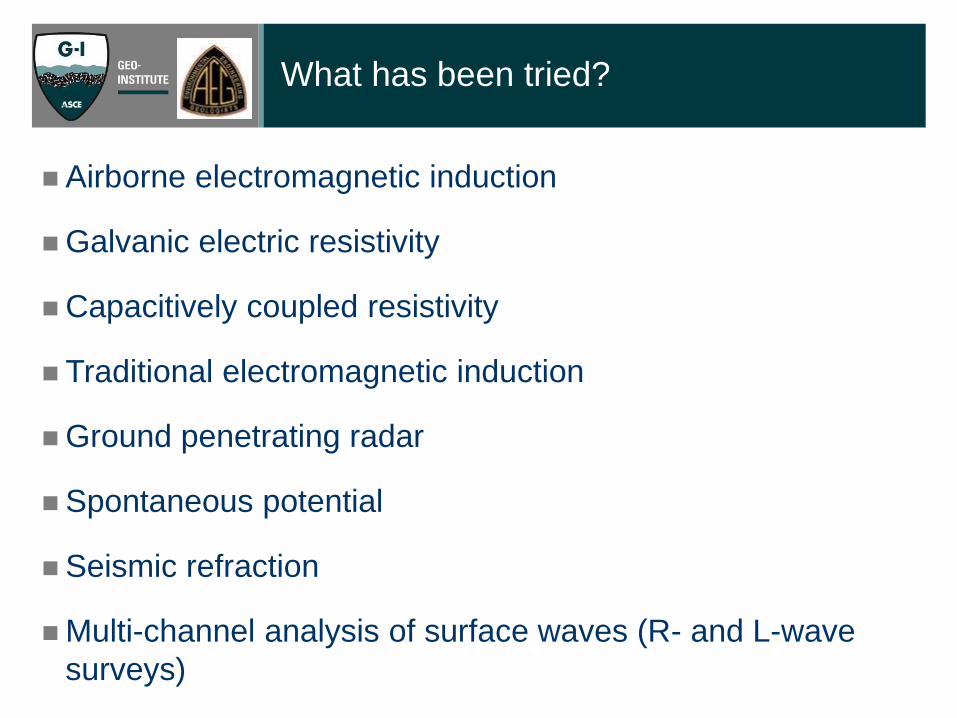
Airborne electromagnetic induction
Galvanic electric resistivity
Capacitively coupled resistivity
Traditional electromagnetic induction
Ground penetrating radar
Spontaneous potential
Seismic refraction
Multi-channel analysis of surface waves (R- and L-wave
surveys)
What has been tried?

Airborne electromagnetic induction


(Hickey, 2012)
Galvanic electric resistivity

Electromagnetic induction
Slingram E-34

Fauchard, C., Mériaux, P., 2007, Geophysical and geotechnical methods for
diagnosing flood protection dikes: Editions Quae, ISBN 978-27592-00313, 128 pp.

The Sacramento-San Joaquin estuary

Capacitively-coupled resistivity

Dipole-dipole CC resistivity surveys

Multi-channel analysis of surface waves
Schematic of the process of
multi-channel analysis of R-
surface waves (reproduced with
permission from Park Seismic
webpage
www.parkseismic.com).


Sherman Island – A case study


Sandhu, 2017
Hayashi et al, 2013
Areas of future research

The Levee Project
The Levee Project is a collaborative
educational project between CSU
Stanislaus, Merced College, and
Delta College. Its goal is to have
students from the different
institutions meet, work collaborative
in the data acquisition, and develop
interest in graduating from college
with a STEM degree. Our
“graduates” have used the data to
prepare posters (AEG, GSA, WRPI,
COAST, NASA, and JPL) and to
apply for graduate school. Besides,
there is nothing like a sunny day in
the estuary!Resistivity mapping

Questions? [email protected]


Capacitively-coupled resistivity is a technique that arose from pioneering work in the US
and Russia [Kuras et al. (2006) provide a good historical perspective]. The technique
was further developed and popularized by Geometrics, through their OhmMapper
instrument, which exploits the capacitor properties of shielded coaxial cables. The
method relies on one transmitter and several receivers that are dragged behind a person
or vehicle. In our case we used one transmitter and five receivers.
The method is comparable to the dipole-dipole method of resistivity surveying, where a
current is injected using two current electrodes separated by a distance a, and the drop
in the voltage of the potential field is measured by a different pair of potential electrodes,
also separated by a distance a, which are placed at varying distances na from the
current electrodes (where n is a number that varies from 0.5, 1.0, 1.5, 2.0, …). The
known current and the voltage drop are used to calculate the resistance of the ground in
ohms, and using a suitable geometric factor, to calculate the resistivity of the ground in
ohms·m. In the case of the Geometrics OhmMapper, the “electrodes” are the woven
metallic shields of coaxial cables on both sides of the transmitter, the geometric function
is a complicated expression (Geometrics, 2009), and the voltage “electrodes” are the
shields of coaxial cables on both sides of each receiver.
CAPACITIVELY-COUPLED RESISTIVITY
OHM-MAPPER - THE DEVIL IS IN THE DETAILS

When the transmitter applies a current to the current “electrodes” one of them develops
a positive charge and the other develops a negative charge. The current cannot flow
through the ground because of the cable insulation. Instead, each cable behaves like a
capacitor, where one plate is the woven metallic shield of the coaxial cable and the other
is the ground. The cable with the negative charge repels electrons in the ground, while
the cable with the positive charge attracts electrons, thus creating an electrical current in
the ground and the instantaneous development of a potential field. At the same time all
this is happening, the transmitter sends a radio signal to each of the potential receivers,
imprinting on them the timing and intensity of the current. Just like in the case of the
current “electrodes”, the potential “electrodes” measure the negative and positive
charges induced in their capacitors to calculate the voltage drop and the corresponding
apparent resistivity. The calculated value is an apparent resistivity in that a very simple
assumption is made about the attribution of the resistivity value in the subsurface; the
assumption is that it is the resistivity of a point at depth located at 45º down from the
center of the current and potential electrodes, a point that we will call “attribution node”

Since there are five receivers, separated from each other by distance a, each electric
pulse of the transmitter generates 5 data points at different depths. The array is dragged
along the ground at a slow speed (say 3.6 km/hr or 60 m/min, or 1 m/sec) and a new
pulse is delivered every 0.5 sec, so apparent resistivities are gathered every half meter
(the precise number is determined by GPS), so in a very short time a dense swath of
five data points at different depths can be acquired over a distance of several hundreds
of meters. Our survey lines had typical lengths or 500 to 1,000 m.
To increase the depth of data collection, the initial distance between the transmitter and
the first receiver (which must be of the magnitude na) can be increased by changing the
spacing to a different value of na. In our case, we used a values of 2.5 m, and n values
of 1, 2, 2.5, and 3.
The last step is to invert the data (Loke, 2013; Loke et al., 2013). We used a least-
squares inversion with a “fast” Jacobian matrix (Loke et al., 2013) implemented by the
program RES2DINV (Loke, 2004). In layman terms, a model of the resistivity distribution
with depth is “guessed”, the apparent resistivity values such model would create at each
of the attribution nodes is calculated, and is then compared with the field value for the
same attribution nodes. The values would of course be different, so the initial “guess” is
refined, with the purpose of minimizing the square of the difference between the field
attributed values and the model calculated values. After several iterations a best fit is
achieved, and the resulting model is presented as the best possible model of resistivity
distributions in a tomogram form (as we know such solutions are not unique, and it is
good practice to produce two or three models by changing the inversion parameters).

Multichannel analysis of surface waves is a technique popularized by Park et al. (1999)
and Miller et al. (2000) for the estimation of seismic velocities at shallow depths. Very
readable explanations of the technique can be found in Park et al. (2007) and the
website www.MASWA.com As explained by Park et al. (2007), the multichannel analysis
of surface waves (MASW) method uses surface waves in the lower frequencies (e.g., 4-
100 Hz), which propagate through a depth of several tens meters, to estimate shear-
wave velocity (Vs) variations with depth. Shear-wave velocity is directly proportional to
the square root of the shear modulus μ and inversely proportional to the square root of
the bulk density ρ [Vs = SQRT(μ/ρ)], which in turn are linked to the stiffness and
compaction of the soil materials.
The method was developed for use with Raleigh waves (R-waves), but in our case we
used Love waves (L-waves) generated by hitting the end of a heavy railroad tie with a 10
lb sledge hammer (our selection was based on the pure shear nature of L-waves. Lane
(2009) compared the phase velocity spectra of repeat surveys using R- and L-waves on
the flood plain of the Tennessee River, where a few meters of soil cover limestone
bedrock, and found that at this particular site the records from the Love wave data
analysis produced a superior phase velocity spectrum in comparison to the spectrum
obtained from Rayleigh wave data.
MULTI-CHANNEL ANALYSIS OF SEISMIC
SURFACE WAVES

For every location, or set, we stacked three “blows” of the hammer to cancel random
noise and enhance the signal, collected the data using 10 horizontal field geophones
with a natural frequency of 4.5 Hz, with a distance of 2.5 m between the source and the
first geophone, and a constant separation of 2.5 m between geophones. For the sake of
ease of data acquisition the geophones were mounted on heavy docking stations on a
landstreamer, both manufactured by Geo Stuff, and the array was advanced by pulling it
with a truck at 5 m intervals. The records of every five sets were gathered by using the
common-depth point technique of seismic reflection.
The sampling depth of a particular frequency component of surface waves is in direct
proportion to its wavelength, so the measured surface wave velocity is both frequency-
and depth-dependent. In other words, the surface waves disperse themselves at
different depths as a function of their wavelengths/frequencies. The multichannel
analysis of surface waves method uses this dispersion property of surface waves for the
purpose of Vs profiling in 1D (depth) under each midpoint of the array. Since the array is
being dragged along and every five sets are gathered, each gather (every 5 m)
generates a 1D velocity profile. By contouring the 1D profiles along the entire length of
the survey line (typically 500 to 1,000 m), a 2D tomogram of shear wave velocities is
created.
To facilitate identification and picking of the surface wave dispersion curve, a wavefield
transform is applied to the seismic record to convert data from the offset-time dimension
(x-t) to the frequency-wavenumber (f-k), frequency-slowness (f-p) or frequency-velocity
(f-v) dimensions. Common schemes for applying this transform include the intercept
time-slowness (tau-p) transform, also referred to as the slant stack transform (Thorson
and Claerbout, 1985), f-k transform (Nolet and Panza, 1976), frequency domain
beamformer (Johnson and Dudgeon, 1993), or phase shift transform (Park et al, 1998).

Dispersive phases show a distinct pattern of normal modes in low-velocity surface
layers: sloping down from high phase velocities at low frequencies, to lower phase
velocities at higher frequencies. The distinctive slope of dispersive waves is a real
advantage of the 1/p-f analysis; other arrivals, such as body waves and air waves,
cannot have such a slope, so the analyst can “ignore” them by picking only the points
along the sloping maxima.
In our case we used a Geometrics Geode exploration seismograph to collect the data,
and the SeisImager/SW software package developed by Hayashi (2009) to process the
data and develop the 2D tomograms. Unlike the normal dispersive pattern, as shown in
Figure 5, in which phase velocity decreases as frequency increases, the data obtained
in this study shows reversed dispersive character. Phase velocity increases with
frequency, probably due to the seismic velocity inversion in which the high-velocity layer
corresponding to levee embankment overlays the low-velocity layers corresponding to
peat or clay. Inversion based on Love waves is still in the research and development
stage, and there is no commercially available processing software for it. Shear-wave
velocity tomograms were created by a simple wavelength transformation (Xia et al.,
1999), in which wavelength calculated from phase velocity and frequency is divided by
three and plotted at depth. Uncertainty is generally large in the surface wave data
processing, including higher modes, even if the inversion is applied. It should be noted
that accuracy and reliability of shear wave tomograms shown in this paper is limited,
particularly in deeper layers beneath embankment. However, the S-wave velocity
contrasts are large so we believe our interpretation of the results is robust.

SOME USEFUL REFERENCES
Asch, T.H., Deszcz-Pan, M., Burton, B.L., Ball, L.B. , 2008, Geophysical
characterization of American River levees, Sacramento, California, using
electromagnetics, capacitively coupled resistivity, and dc resistivity: U.S. Geological
Survey Open-File Report 2008-1109, 12 p.
Dunbar, J.B., 2011, The use of airborne geophysics for levee classification and
assessment: PhD Dissertation, University of Delaware, ISBN 9781124782119
Dunbar, J.B., Llopis, L.B., Sills, J.L., Smith, E.W., Miller, R.D., Ivanov, J., Corwin,
R.F, 2007, Flood simulation study of Retamal levee, Lower Rio Grande Valley, Texas,
using seismic and electrical geophysical models: US Army Corps of Engineers,
Condition Assessment of Levees, U.S. Section of the International Boundary and
Water Commission, Report 5, ERDC TR-03-4, 84 p. plus appendices.
DWR (California Department of Water Resources), 2016, Levee Evaluation Program:
Internet portal http://www.water.ca.gov/levees/evaluation/.
Ferriz, H., Hayashi, K., Sandhu, R, Loogman, A., 2016, Geophysical Investigation of
Flood Control Levees in the Sacramento-San Joaquin Estuary, California: in
Anderson, R.L. and Ferriz, H. (eds.), Applied Geology in California, Star Publishing
(Belmont, California).
Geometrics, 2009, Resistivity surveying – OhmMapper: PowerPoint presentation
available at http://www.geometrics.com/geometrics-products/geometrics-electro-
magnetic-products/electro-magnetic-information-and-case-studies/
Geomterics, 2004, OhmMapper TR1 manual: Geometrics, Inc, San Jose, California.
ftp://geom.geometrics.com/pub/GeoElectric/Manuals/OhmMapper-Manual-TRN-
2004.PDF

Gillip, J.A., Payne, J.D., 2011, Geophysical characterization of the Lollie Levee near
Conway, Arkansas, using capacitively coupled resistivity, coring, and direct push logging:
US Geological Survey Data Series Report 640, 27 p.
Hayashi, K., 2009, SeisImager/SW manual: Geometrics, Inc, San Jose California,
http://www.geometrics.com/downloads/seisimager-sw-manual-request/
Hayashi, K., Inazaki, T., 2013, Integrated geophysical exploration for safety assessment
of levee systems: Proceedings of Geo-Congress 2013, San Diego, CA (March3-6),
Geoinstitute of the American Society of Civil Engineers, 10 p.
Hayashi, K., Inazaki, T., Kitao, K., Kita, T., 2013, Statistical estimation of soil type using
cross-plots of S-wave velocity and resistivity in Japanese levees: Proceedings of the
26th Annual Symposium on the Application of Geophysics to Engineering and
Environmental Problems (SAGEEP 2013), Denver, CO, 10 p.
Hickey, C.J., 2012, Rapid assessment of potential hazards in levees and earthen dams:
Prepared by Oak Ridge National Laboratory, Oak Ridge, Tennessee 37831-6283.
SERRI Report 2010 90034-001
http://www.serri.org/publications/Documents/Ole%20Miss%20Project%2090034%20-
%20Final%20Report%20-%2020%20November%202012%20(Hickey).pdf
Inazaki, T., 2007, Integrated geophysical investigation for the vulnerability assessment of
earthen levee: Proceedings of the 20th Annual Symposium on the Application of
Geophysics to Engineering and Environmental Problems (SAGEEP 2007), p. 250-257.
Inazaki, T., Hayashi, K., and SEGJ Levee Consortium, 2011, Utilization of integrated
geophysical investigation for the safety assessment of levee systems, Proceedings of
the 24th Annual Symposium on the Application of Geophysics to Engineering and
Environmental Problems (SAGEEP 2011), CD-ROM, 9p.

Johnson, D.H., Dudgeon, D.E., 1993, Array Signal Processing: Concepts and
Techniques: Prentice Hall, ISBN 10: 0130485136.
Kuras, O., Beamish, D., Meldrum, P.I., Ogilvy, R.D., 2006, Fundamentals of the
capacitive resistivity technique: Geophysics, v. 71, no. 3, p. G-135 to G-152.
Lane, J.D., 2009, Geotechnical site characterization using multi-channel analysis of
Rayleigh and Love waves: M.Sc.Thesis, The University of Tennessee, Knoxville. 106 pp.
Llopis, J.L., Smith, E.W., and North, R.E., 2007, Geophysical surveys for assessing
levee foundation conditions, Sacramento River levees, CA: US Army Corps of
Engineers, Geotechnical and Structures Laboratory ERDC/GSL TR-07-21, 69 p.
Loke, M.H., 2004, RES2DINV version 3.54 -- Rapid 2D resistivity and IP inversion using
the least-squares method; Geoelectrical Imaging 2-D and 3-D: Penang, Malaysia,
Geotomo Software, 130 p.
Loke, M.H., 2013, Tutorial : 2-D and 3-D electrical imaging surveys: Digital book
available through www.geotomosoft.com
Loke, M.H., Chambers, J.E., Rucker, D.F., Kuras, O., Wilkinson, P.B., 2013, Recent
developments in the direct-current geoelectrical imaging method: Journal of Applied
Geophysics, v. 95, p. 135–156.
Louie, J.N., 2001, Faster, better: Shear-wave velocity to 100 meters depth from
Refraction Microtremor arrays:
http://crack.seismo.unr.edu/ftp/pub/louie/papers/disper/refr-pp.pdf
Miller, R. D., Park, C. B., Ivanov, J. M., Xia, J., Laflen, D. R., Gratton, C., 2000, MASW to
investigate anomalous near-surface materials at the Indian Refinery in Lawrenceville,
Illinois: Kansas Geol. Surv. Open-File Rept. 2000-4, Lawrence, Kansas, 48 pp.
(Electronic version at http://www.kgs.ukans.edu/Geophysics/Reports2/Illinois.pdf)

Fauchard, C., Mériaux, P., 2007, Geophysical and geotechnical methods for diagnosing
flood protection dikes: Editions Quae, ISBN 978-27592-00313, 128 pp.
Nolet, G., Panza, G.F., 1976, Array analysis of seismic surface waves: limits and
possibilities: Pure and Applied Geophysics, v. 114, p. 776-790.
Park, C.B., Miller, R.D., Xia, J., and Ivanov, J., 2007, Multichannel analysis of surface
waves (MASW)-active and passive methods: The Leading Edge, January.
Park, C.B., Miller, R.D., and Xia, J., 1999, Multichannel analysis of surface waves:
Geophysics, v. 64, n. 3, pp. 800-808.
Park, C. B., Miller, R. D. and Xia, J., 1998, Imaging dispersion curves of surface waves
on multi-channel record: Technical Program with Biographies SEG, 68th Annual
Meeting, New Orleans, LA., 1377–1380.
Sorensen, J.C., Chowdhury, K., 2010, Levee subsurface investigation using geophysics,
geomorphology, and conventional investigative methods: Proceedings of the 23th
Annual Symposium on the Application of Geophysics to Engineering and Environmental
Problems (SAGEEP 2010), p. 109-124.
Sotak, M.K, Laymon, D.E., Chapel, T.A., 2010, Geophysical investigations for levee
systems — killing several birds with one stone: Proceedings of the 23th Annual
Symposium on the Application of Geophysics to Engineering and Environmental
Problems (SAGEEP 2010), p. 765-775.
Thorson, J. R., Claerbout, J. F., 1985, Velocity-stack and slant-stack stochastic
inversion: Geophysics, v. 50, p. 2727-2741.
Timofeev, V.M., 1973, Experience in the use of high frequency electrical geophysical
methods in geotechnical and geocryological field studies: 3rd International Conference
on Permafrost, NAUKA, Proceedings, 238–247.

Unruh, J., Hitchcock, C., Blake, K., Hector, S., 2016, Characterization of the southern
Midland fault in the Sacramento-San Joaquin Delta: in Anderson, R.L. and Ferriz, H.
(eds.), Applied Geology in California, Star Publishing (Belmont, California).
URS (URS Corporation), 2008, Phase 1 geotechnical data report (P1GDR), Reclamation
District 17 (RD17) study area: Consultant’s report to California Department of Water
Resources, Urban Levee Geotechnical Evaluations Program Contract 4600007418.
USACE (US Army Corps of Engineers), 2008, Flood Damage Reduction
Segment/System Inspection Report:
http://www.usace.army.mil/Portals/2/docs/civilworks/levee/LeveeInspectionChecklist.pdf
Xia, J., Miller, R.D., Park, C.B., 1999. Estimation of near-surface shear-wave velocity by
inversion of Rayleigh waves: Geophysics. 64, p. 691-700.