u.s. aviation meteorology - international civil aviation ... · u.s. aviation meteorology ......
TRANSCRIPT
U.S. Aviation Meteorology
U.S. Aviation Meteorology
• FAA is U.S. Meteorological Authority for Aviation FAA and NWS share costs and ownership of
observation systems • ASOS/METAR • Weather Radar • ITWS
• NWS is U.S. Meteorological Provider for Aviation Provides all forecast information
• Private contracts with FAA for some movement and display of Met Information
2
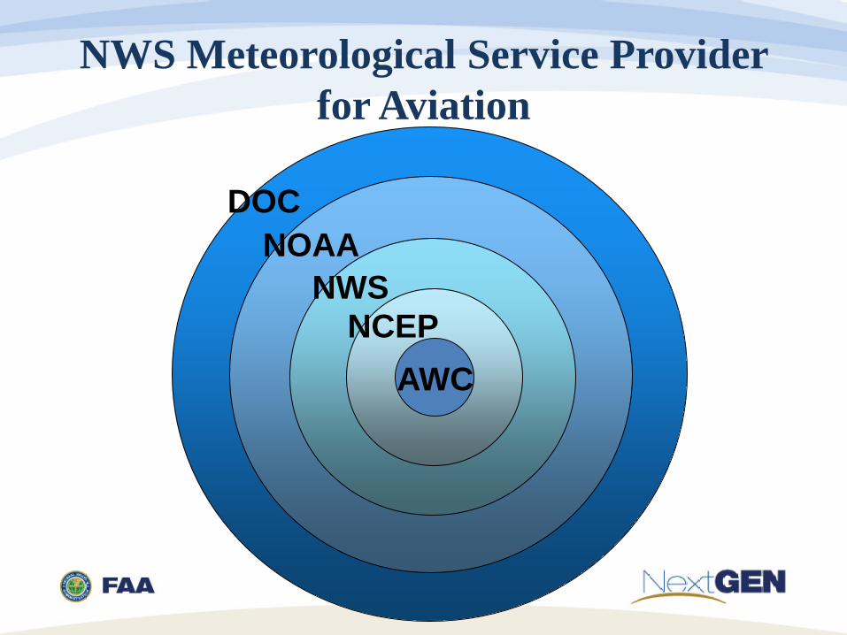
NWS Meteorological Service Provider for Aviation
DOC NOAA
NWS NCEP
AWC
• NOAA 2 Volcanic Ash Advisory Centers 1 Space Weather Center 2 Tropical Cyclone Advisory Centers
4
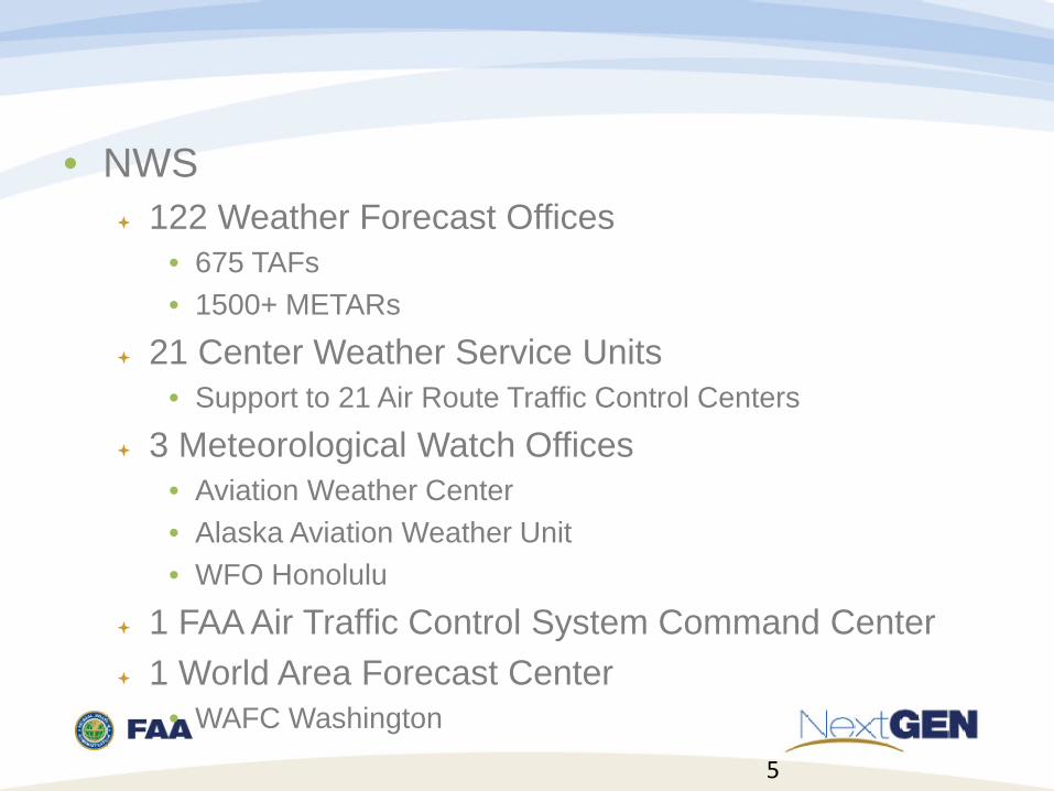
• NWS 122 Weather Forecast Offices
• 675 TAFs • 1500+ METARs
21 Center Weather Service Units • Support to 21 Air Route Traffic Control Centers
3 Meteorological Watch Offices • Aviation Weather Center • Alaska Aviation Weather Unit • WFO Honolulu
1 FAA Air Traffic Control System Command Center 1 World Area Forecast Center
• WAFC Washington
5
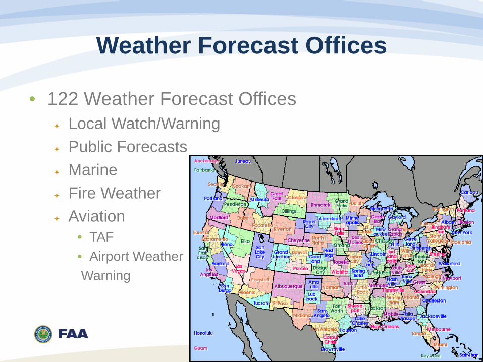
Weather Forecast Offices
• 122 Weather Forecast Offices Local Watch/Warning Public Forecasts Marine Fire Weather Aviation
• TAF • Airport Weather Warning
6
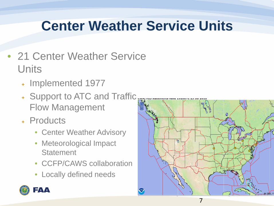
Center Weather Service Units
• 21 Center Weather Service Units Implemented 1977 Support to ATC and Traffic
Flow Management Products
• Center Weather Advisory • Meteorological Impact
Statement • CCFP/CAWS collaboration • Locally defined needs
7
Alaska Aviation Weather Unit
• Alaska Aviation Weather Unit One of 3 U.S. Meteorological Watch Offices Products issued:
• AIRMET • SIGMET • Area Forecast • Low and Mid Level SIGWX
8
WFO Honolulu
• WFO Honolulu Issues TAFS for Hawaii One of 3 Meteorological Watch Offices
• AIRMET • SIGMET • Area Forecast • Low and Mid level SIGWX
9
Aviation Weather Center • 1 of 3 U.S. Met Watch Offices
Areas of Responsibility • Contiguous United States • Northwestern Atlantic • Northeastern Pacific • Gulf of Mexico/Caribbean
Products • AIRMET • SIGMET • Area Forecast • SIGWX • CAWS/CCFP
• WAFC Washington 10
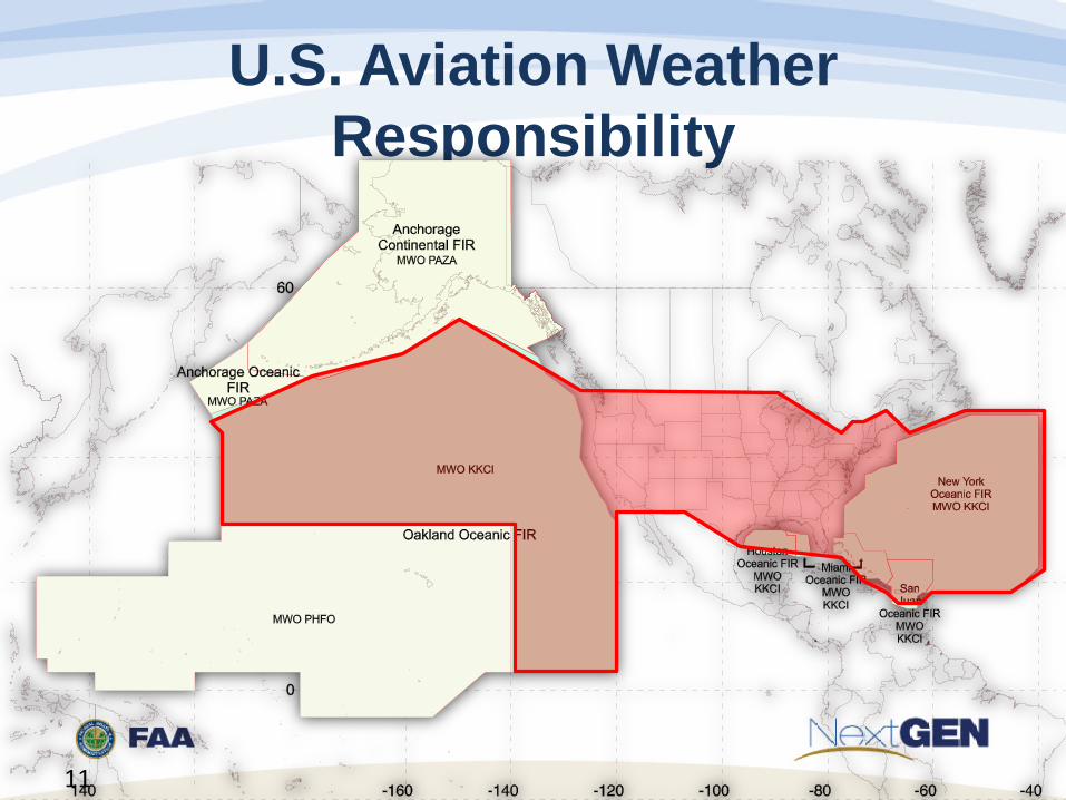
U.S. Aviation Weather Responsibility
11
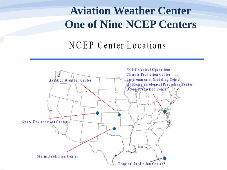
Aviation Weather Center One of Nine NCEP Centers

Typical Forecast Desk
NAWIPS AWIPS
Radar Lightning
PC
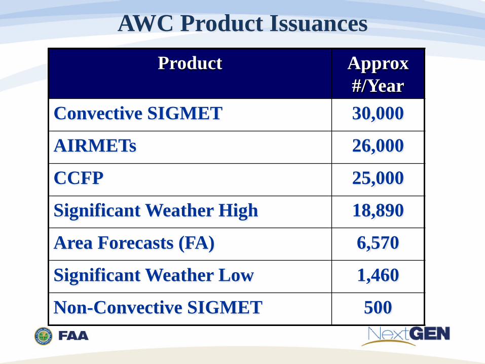
AWC Product Issuances Product Approx
#/Year Convective SIGMET 30,000
AIRMETs 26,000
CCFP 25,000
Significant Weather High 18,890
Area Forecasts (FA) 6,570
Significant Weather Low 1,460
Non-Convective SIGMET 500

Domestic Products
• Tstorms, svr icing, svr turb
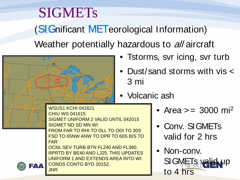
SIGMETs (SIGnificant METeorological Information)
Weather potentially hazardous to all aircraft
WSUS1 KCHI 041621 CHIU WS 041615 SIGMET UNIFORM 2 VALID UNTIL 042015 SIGMET ND SD MN WI FROM FAR TO RHI TO DLL TO ODI TO 30S FSD TO 65NW ANW TO DPR TO 60S BIS TO FAR OCNL SEV TURB BTN FL240 AND FL390. RPRTD BY BE40 AND LJ25. THIS UPDATES UNIFORM 1 AND EXTENDS AREA INTO WI. CONDS CONTG BYD 2015Z. JNR
• Dust/sand storms with vis < 3 mi • Volcanic ash • Area >= 3000 mi2
• Conv. SIGMETs
valid for 2 hrs • Non-conv. SIGMETs valid up to 4 hrs
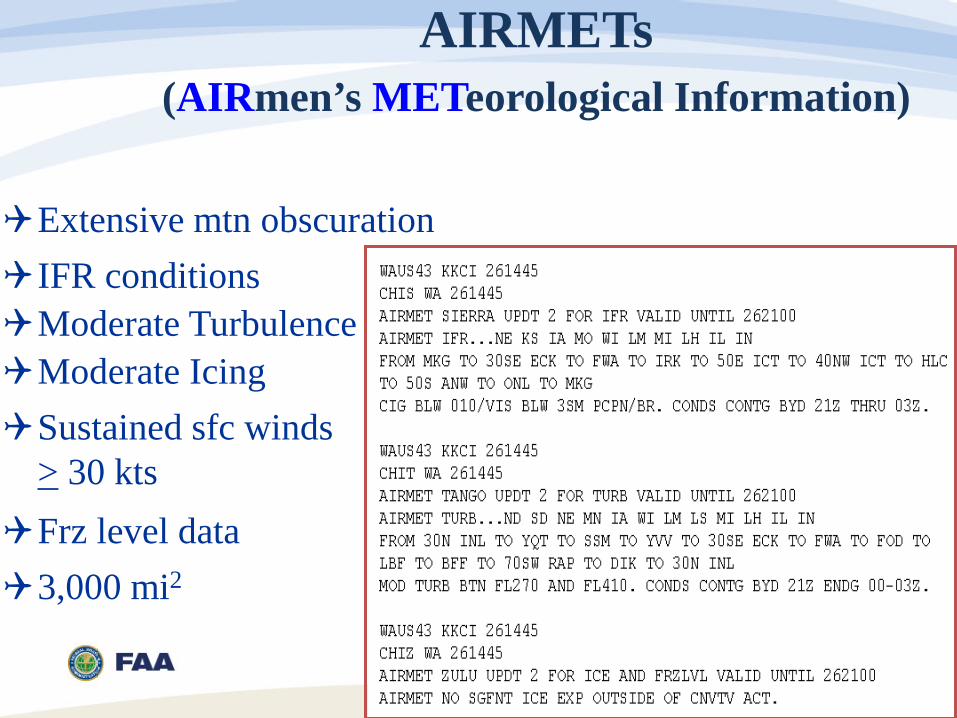
AIRMETs (AIRmen’s METeorological Information)
Sustained sfc winds > 30 kts
Moderate Icing
Extensive mtn obscuration
Moderate Turbulence
Frz level data
3,000 mi2
IFR conditions
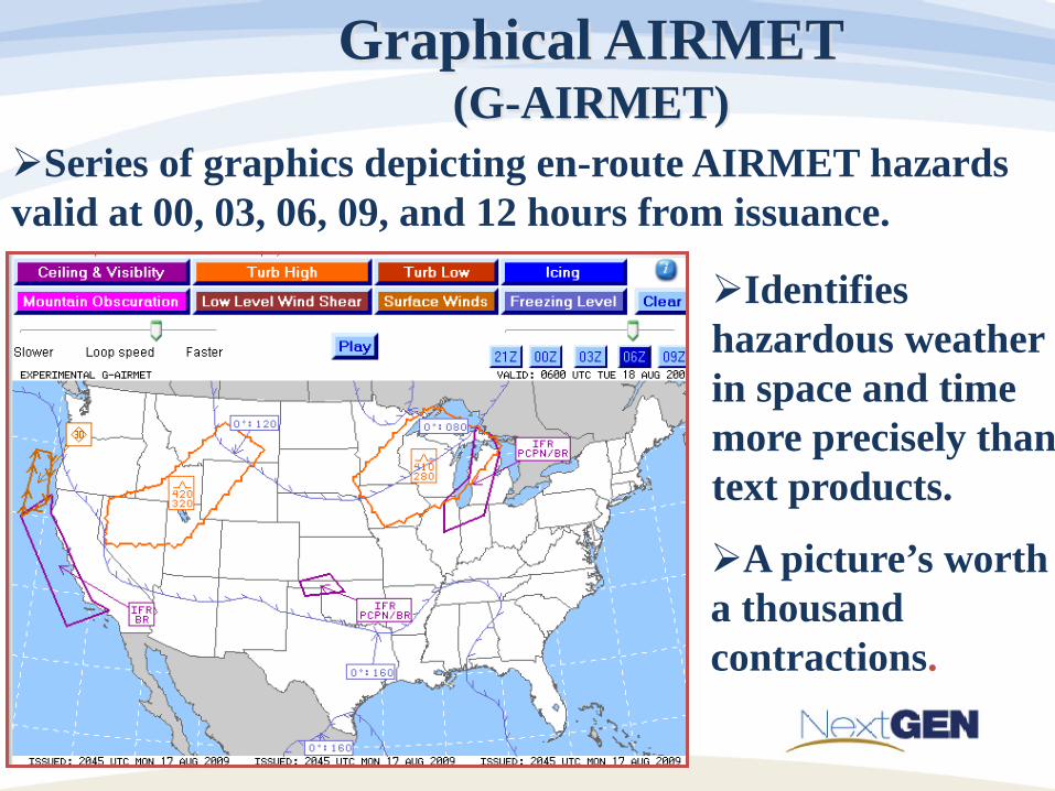
Graphical AIRMET (G-AIRMET)
Series of graphics depicting en-route AIRMET hazards valid at 00, 03, 06, 09, and 12 hours from issuance.
Identifies hazardous weather in space and time more precisely than text products. A picture’s worth a thousand contractions.
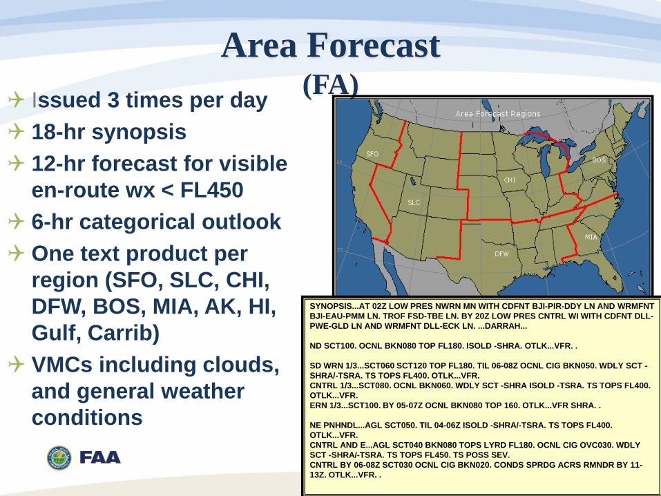
Area Forecast (FA)
SYNOPSIS...AT 02Z LOW PRES NWRN MN WITH CDFNT BJI-PIR-DDY LN AND WRMFNT BJI-EAU-PMM LN. TROF FSD-TBE LN. BY 20Z LOW PRES CNTRL WI WITH CDFNT DLL-PWE-GLD LN AND WRMFNT DLL-ECK LN. ...DARRAH... ND SCT100. OCNL BKN080 TOP FL180. ISOLD -SHRA. OTLK...VFR. . SD WRN 1/3...SCT060 SCT120 TOP FL180. TIL 06-08Z OCNL CIG BKN050. WDLY SCT -SHRA/-TSRA. TS TOPS FL400. OTLK...VFR. CNTRL 1/3...SCT080. OCNL BKN060. WDLY SCT -SHRA ISOLD -TSRA. TS TOPS FL400. OTLK...VFR. ERN 1/3...SCT100. BY 05-07Z OCNL BKN080 TOP 160. OTLK...VFR SHRA. . NE PNHNDL...AGL SCT050. TIL 04-06Z ISOLD -SHRA/-TSRA. TS TOPS FL400. OTLK...VFR. CNTRL AND E...AGL SCT040 BKN080 TOPS LYRD FL180. OCNL CIG OVC030. WDLY SCT -SHRA/-TSRA. TS TOPS FL450. TS POSS SEV. CNTRL BY 06-08Z SCT030 OCNL CIG BKN020. CONDS SPRDG ACRS RMNDR BY 11-13Z. OTLK...VFR. .
Issued 3 times per day 18-hr synopsis 12-hr forecast for visible
en-route wx < FL450 6-hr categorical outlook One text product per
region (SFO, SLC, CHI, DFW, BOS, MIA, AK, HI, Gulf, Carrib)
VMCs including clouds, and general weather conditions
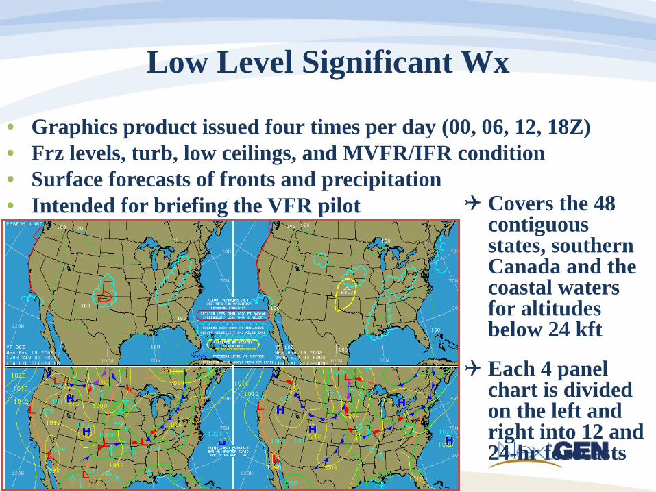
Low Level Significant Wx
• Graphics product issued four times per day (00, 06, 12, 18Z) • Frz levels, turb, low ceilings, and MVFR/IFR condition • Surface forecasts of fronts and precipitation • Intended for briefing the VFR pilot Covers the 48
contiguous states, southern Canada and the coastal waters for altitudes below 24 kft
Each 4 panel chart is divided on the left and right into 12 and 24-hr forecasts
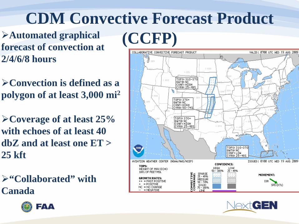
CDM Convective Forecast Product (CCFP)
Automated graphical forecast of convection at 2/4/6/8 hours
Convection is defined as a polygon of at least 3,000 mi2
Coverage of at least 25% with echoes of at least 40 dbZ and at least one ET > 25 kft
“Collaborated” with Canada
Collaborated Aviation Weather Statement (CAWS)
• Event Driven Convective Forecast • Focused on ‘Impact’ to TFM • Collaborated by government and industry
Meteorologists • Used with CCFP
CCFP scheduled, ‘big picture’, Automated • Supports longer range (4-8 hours) and 2 hourly SPO call
CAWS unscheduled, impact-based • Supports decision making (0-4 hours)
22

International Products
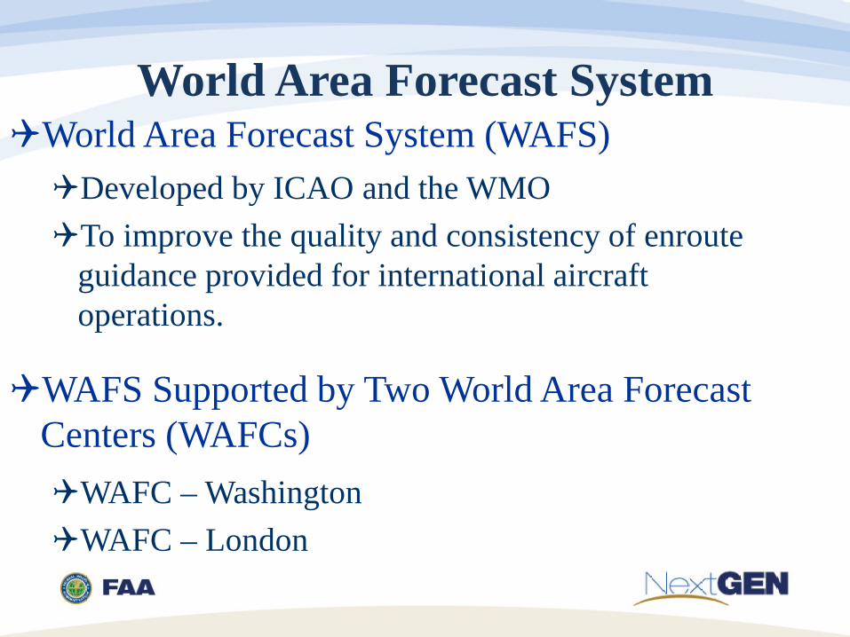
World Area Forecast System (WAFS)
WAFS Supported by Two World Area Forecast Centers (WAFCs)
Developed by ICAO and the WMO To improve the quality and consistency of enroute
guidance provided for international aircraft operations.
WAFC – Washington WAFC – London
World Area Forecast System

25
WAFS Global Grids

International Operations Branch Global graphics High level graphics - FL250 – FL630 Mid level graphics – FL100 – FL180
Oceanic SIGMETs Turbulence Icing Thunderstorms Volcanic ash Tropical cyclones
Area Forecasts for the Gulf of Mexico and the Caribbean
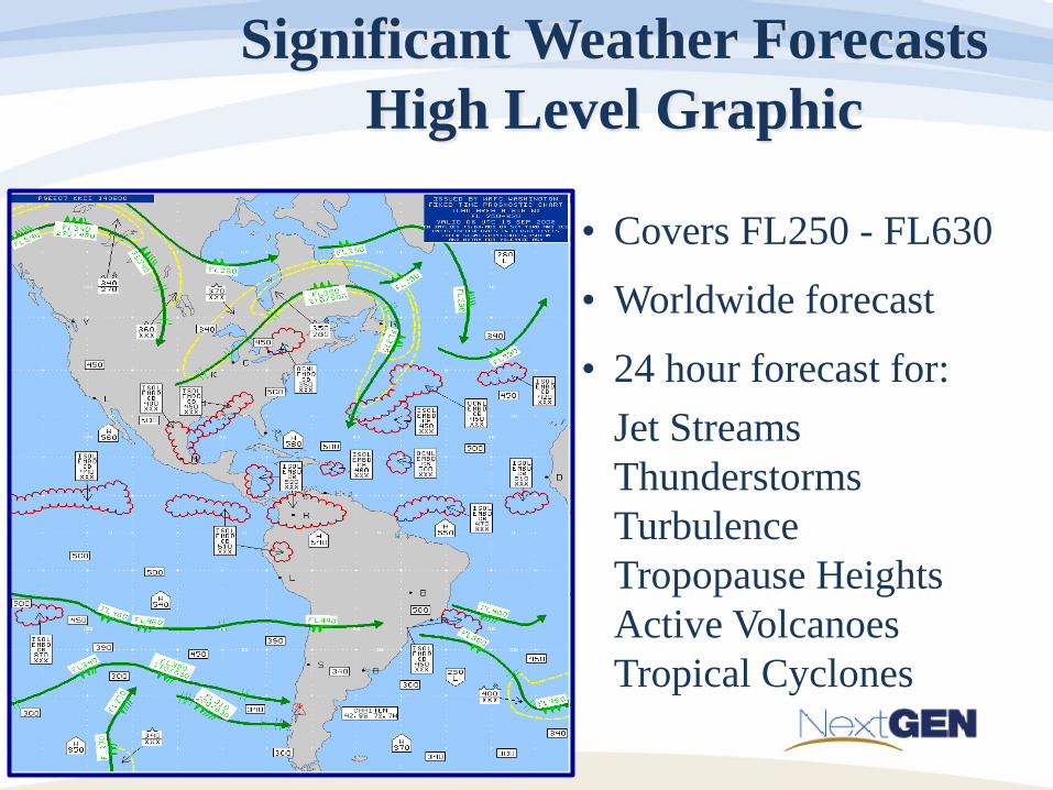
Significant Weather Forecasts High Level Graphic
• Covers FL250 - FL630
• Worldwide forecast
• 24 hour forecast for: Jet Streams Thunderstorms Turbulence Tropopause Heights Active Volcanoes Tropical Cyclones
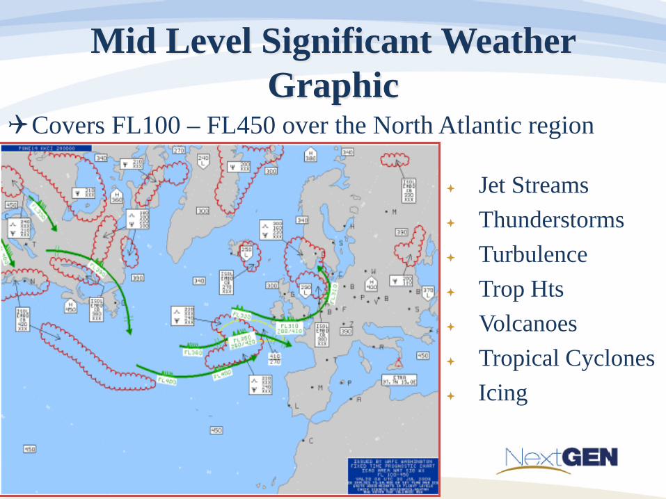
Mid Level Significant Weather Graphic
Jet Streams Thunderstorms Turbulence Trop Hts Volcanoes Tropical Cyclones Icing
Covers FL100 – FL450 over the North Atlantic region
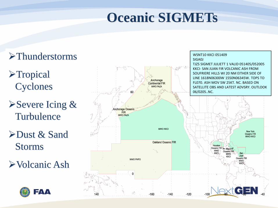
Oceanic SIGMETs
Thunderstorms
Tropical Cyclones
Severe Icing & Turbulence
Dust & Sand Storms
Volcanic Ash
WSNT10 KKCI 051409 SIGA0J TJZS SIGMET JULIETT 1 VALID 051405/052005 KKCI- SAN JUAN FIR VOLCANIC ASH FROM SOUFRIERE HILLS WI 20 NM EITHER SIDE OF LINE 1618N06300W 1550N06345W. TOPS TO FL070. ASH MOV SW 25KT. NC. BASED ON SATELLITE OBS AND LATEST ADVSRY. OUTLOOK 06/0205..NC.
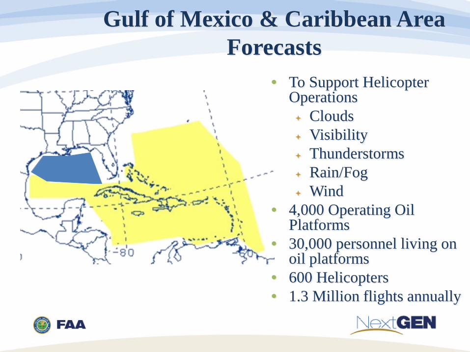
Gulf of Mexico & Caribbean Area Forecasts
• To Support Helicopter
Operations Clouds Visibility Thunderstorms Rain/Fog Wind
• 4,000 Operating Oil Platforms
• 30,000 personnel living on oil platforms
• 600 Helicopters • 1.3 Million flights annually
International Flight Folder Program
• Since 10/1/98 the AWC has provided meteorological information to operators and flight crews for: Dispatch planning Pre-flight briefing En-route guidance
• Wind/temp forecasts, SIGWX, TAFs, METARs, AIRMETs, and much more all available by fax and/or internet
• Became digital internet service 2011 • AWC shares about 40,000 charts per month!
Aviation Digital Data Service (ADDS) www.aviationweather.gov Free publicly accessible web site Full range of meteorological data products tailored to
aviation needs. TAFs and METARs in both text and graphical format Winds/Temps Satellite Radar Model forecasts Interactive Java Tools International Flight Folder data Much more!

Collaborative Decision Making

Collaborative Decision Making
• Weather Evaluation Team (WET) • CDM sub-team • Developing tools and procedures to enhance
Traffic Flow Management Strategic Planning
34

CCFP
35

CAWS
36

CAWS
37
Collaborative Aviation Weather Statement 003 NWS Aviation Weather Center Kansas City MO 1312 UTC Mon 25 Jul 2016 Weather: Thunderstorms Valid: 1900-2100Z ARTCCs affected: ZBW, ZDC, ZID, ZNY, ZOB, ZTL Terminals affected: KBWI, KDCA, KIAD CCFP: 13Z Issuance - Coverage/confidence too low, location adjustment SUMMARY: High confidence areas of thunderstorms over ZBW/ZDC/ZNY/ZOB/ZTL/ZID at 19Z & 21Z. DISCUSSION: High confidence area of thunderstorms over ZBW/ZDC/ZNY/ZOB at 19Z & 21Z with tops FL450+ ((over ZNY/ZOB/ZBW), tops FL350 (over ZDC/ZNY), tops FL350 (over ZTL/ZID). Operations Note - CCFP areas that are not displayed in the CAWS
graphic for the valid times posted are deemed to be accurate unless otherwise stated.
ICAO Weather Exchange Model (IWXXM)
Key IWXXM Issues • November 2016 - ICAO Annex 3 amended to make the exchange of
XML products a recommended practice. • November 2018 - ICAO Annex 3 amended to make the exchange of
XML products a mandatory practice. MIE recommend to METP to push back to 2020 amendment 80
• MIE Leaning toward providing the actual measured value in IWXXM messages Will not affect current FAA or ICAO regulations Human-readable conversions can display “binned” or “rounded”
values as desired Provides higher resolution data for higher end users or more
sophisticated decision makers Higher resolution observed data will enable improved precision
in forecasts and more efficient use of airspace
Key IWXXM Issues
• Many states will not be able to provide IWXXM messages even by 2020
• MIE developing guidance for ICAO regions to transition and implement Bilateral agreements ROC as translation center
41