unmanned aerial systems (uas) factsheetunmanned aerial systems (uas) uas offer several...
TRANSCRIPT
Unmanned Aerial Systems (UAS)
UAS offer several transformative aspects for highway transportation, enhancing safety and productivity and reducing cost.
Unmanned aerial systems (UAS), sometimes referred to as drones, are multi-use aircraft controlled from a licensed operator on the ground. The benefits of UAS are wide ranging and impact nearly all aspects of highway transportation—replacing boots on the ground, increasing accuracy, speeding up data collection, and providing access to hard-to-reach locations.
UAS provide high-quality survey and data mapping that can be collected automatically or remotely. Large areas can be mapped relatively quickly in comparison to traditional survey and mapping practices. Other uses include survey and imagery as part of emergency response events, where traditional surveying and mapping practices may be inadequate or sites impossible to access. UAS can supplement conventional activities, such as bridge safety inspection and routine construction inspection, to increase safety and collect data from otherwise unattainable perspectives.
EYES-IN-THE-SKYUAS improve operations, construction, inspection, and safety by collecting data needed to design, build, and operate the highway system. Bridge inspection enhanced by UAS improves safety for the inspection team and the traveling public by reducing the need for temporary work zones and
specialized access equipment, which can also be very cost effective. Construction inspection with UAS allows for a bird’s eye view of a project’s progress and for the development of three-dimensional (3D) terrain models that document the construction process and assist in assessment of earthwork quantity measurement.
UAS technology gives State departments of transportation (DOTs) eyes-in-the-sky during incident response for roadway disturbances such as rockslides, avalanches, and floods, and for damage assessment following earthquakes, fires, and bridge hits. It allows States to obtain quality data to make better-informed decisions, all collected from a relatively low-cost platform.
BENEFITS ` Safety. Keeping workers out of harm’s way is a
major benefit of using UAS. Traditional bridge inspection requires setting up temporary work zones, detouring traffic, and using special access equipment or even climbing. UAS technology can speed data collection while reducing risk to work crews and the traveling public.
` Accelerated Construction. UAS technology can accelerate the rate of data collection operations, such as survey or aerial photography, and facilitate exact quantity calculation and efficient
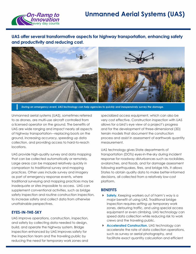
During an emergency event, UAS technology can help agencies to quickly and inexpensively survey the damage.
payment to contractors. It can be used for routine inspections, such as flying a programmed path over silt fencing after a rain event to check for sediment buildup, and high-risk inspections, such as crane or falsework construction.
` Asset Maintenance. The ability to routinely and consistently map terrain and monitor condition offers the potential for isolating problem areas before an emergency occurs, which can both save lives and reduce asset maintenance costs. During an emergency event, UAS technology can quickly and inexpensively survey the damage, allowing for better-informed and efficient recovery operations.
STATE OF THE PRACTICEUAS use is expanding across transportation agencies, and the number of UAS applications is increasing steadily. In a 2018 survey by the American Association of State Highway and Transportation Officials, 20 States are already using high-definition cameras, LiDAR, and other sensors to enhance construction inspection, bridge inspection, and incident response
operations. An additional 15 States are actively researching UAS use to enhance their operations.
` Minnesota DOT has put significant effort into development of UAS use for bridge inspection and has produced several informative reports that advance the understanding of potentially vital applications and current limitations.
` Washington has evaluated UAS applications in aerial roadway surveillance and potentially for situational awareness for avalanche control.
` North Carolina is using UAS to support construction inspections and perform accident scene reconstructions to open travel lanes more quickly.
` New Jersey is currently using UAS to support structural inspections, real-time construction project monitoring, traffic incident management, aerial 3D corridor mapping, emergency response assessments, and traffic congestion assessments.
` Ohio is using UAS technology for traffic monitoring, emergency response operations, and construction inspections.
` Utah is using UAS technology on projects for rapid, high-quality data acquisition from surveys to routine inspections.
` Colorado is using UAS to monitor geohazards in more than 40 mountainous corridors with highly accurate data collection. The accuracy of the data and the lower cost of acquiring it have led to a better understanding and ability to mitigate wide-ranging safety risks.
RESOURCESFHWA EDC-5 Unmanned Aerial Systems (UAS) https://www.fhwa.dot.gov/innovation/everydaycounts/edc_5/uas.cfm
Federal Highway Administration UAS https://www.fhwa.dot.gov/uas
Federal Aviation Administration UAS https://www.faa.gov/uas
Unmanned Aerial Systems (UAS)
www.fhwa.dot.gov/everydaycounts
For additional information, please contact:
James Gray FHWA Office of Infrastructure(703) [email protected]
Connie YewFHWA Office of Infrastructure(202) [email protected]
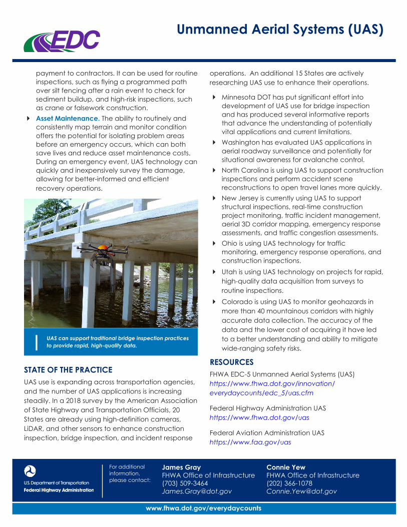
UAS can support traditional bridge inspection practices to provide rapid, high-quality data.