underwater archaeology pickles reef florida...
TRANSCRIPT
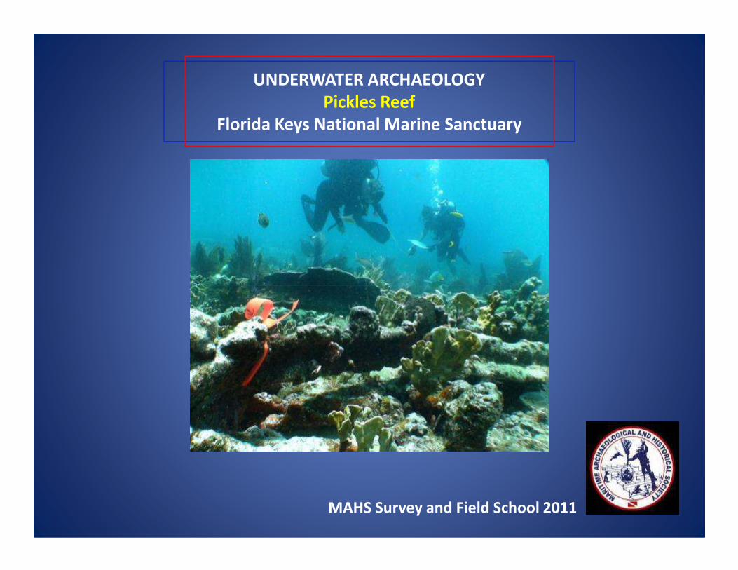
UNDERWATER ARCHAEOLOGY
Pickles Reef
Florida Keys National Marine Sanctuary
MAHS Survey and Field School 2011
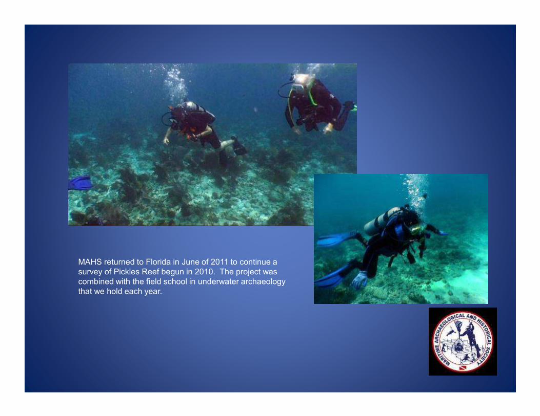
MAHS returned to Florida in June of 2011 to continue a
survey of Pickles Reef begun in 2010. The project was
combined with the field school in underwater archaeology
that we hold each year.
FLORIDA
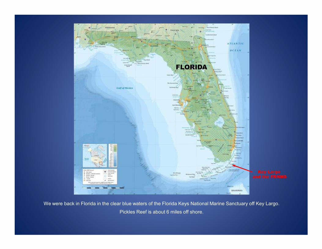
We were back in Florida in the clear blue waters of the Florida Keys National Marine Sanctuary off Key Largo.
Pickles Reef is about 6 miles off shore.
Key Largo
and the FKNMS
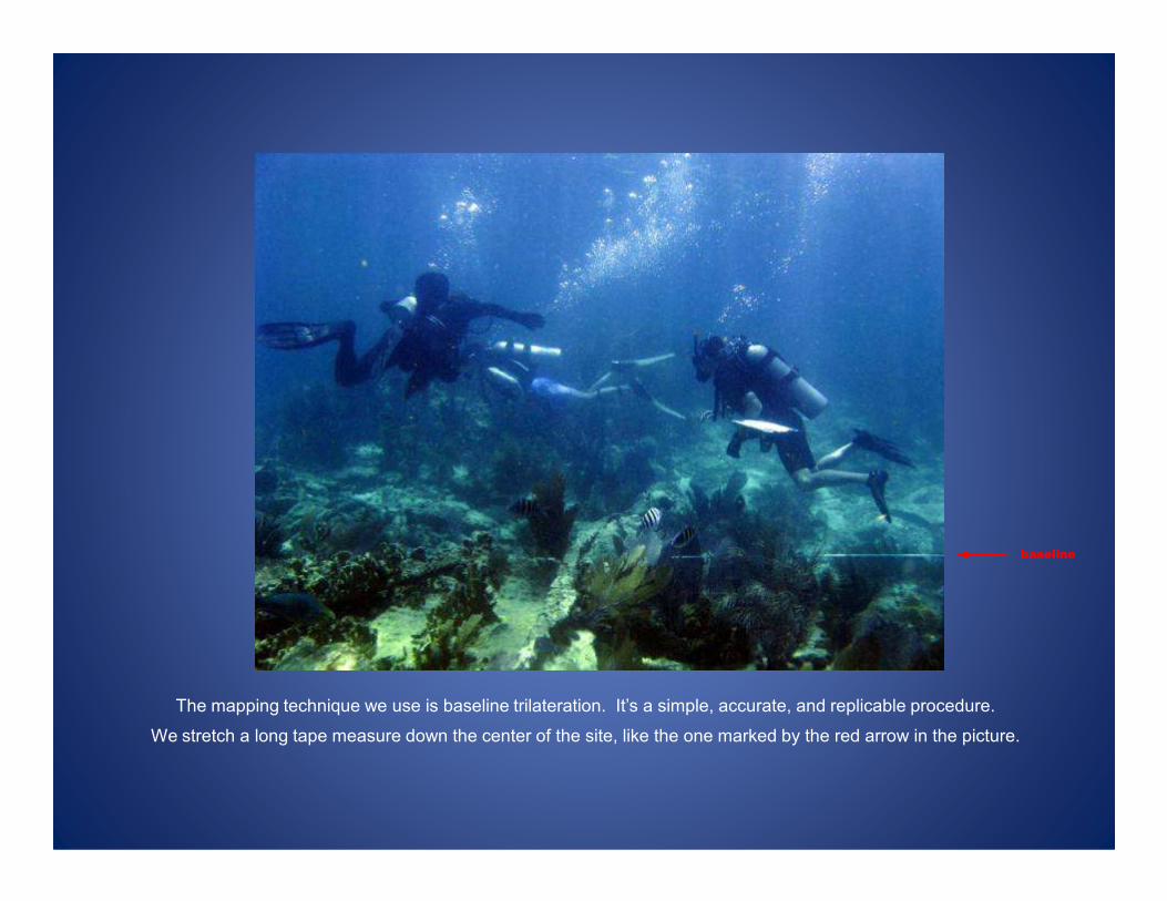
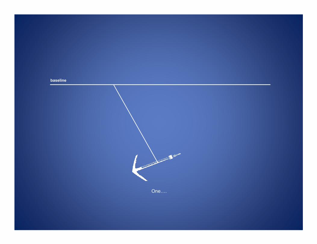
The mapping technique we use is baseline trilateration. It’s a simple, accurate, and replicable procedure.
We stretch a long tape measure down the center of the site, like the one marked by the red arrow in the picture.
baseline

baseline
Then we take two measurements to each object we want to map.
baseline
One0.

baseline
0two.
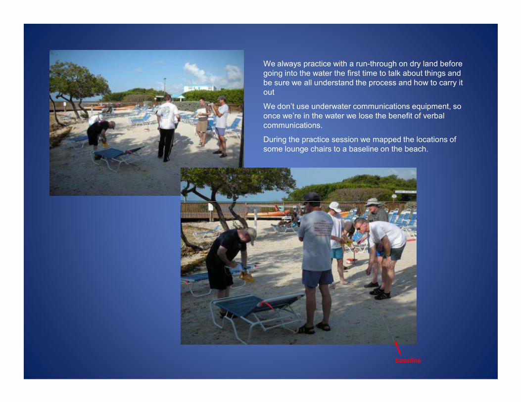
We always practice with a run-through on dry land before
going into the water the first time to talk about things and
be sure we all understand the process and how to carry it
out
We don’t use underwater communications equipment, so
once we’re in the water we lose the benefit of verbal
communications.
During the practice session we mapped the locations of
some lounge chairs to a baseline on the beach.
baseline

Enough practice, already. Time to
gear up and get into the water.
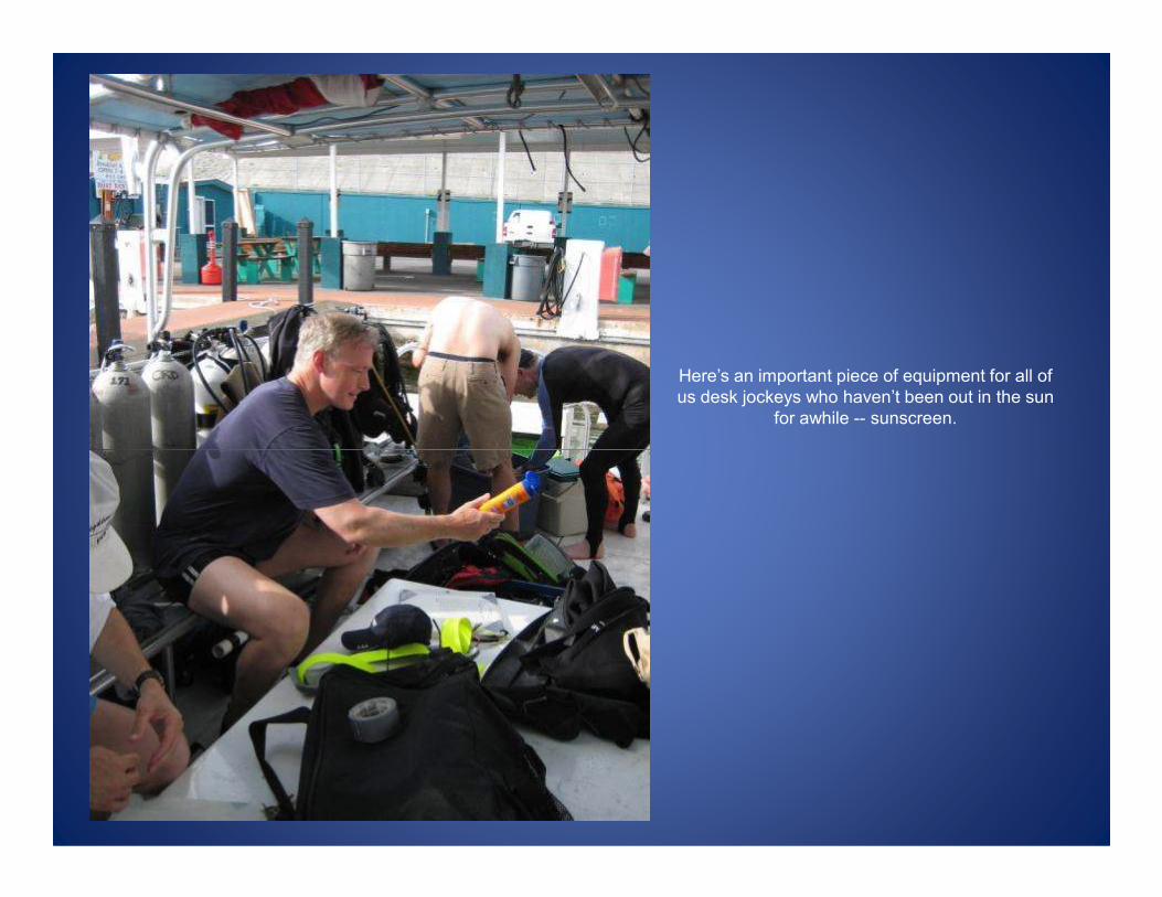
Here’s an important piece of equipment for all of
us desk jockeys who haven’t been out in the sun
for awhile -- sunscreen.
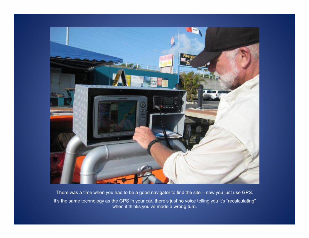
There was a time when you had to be a good navigator to find the site – now you just use GPS.
It’s the same technology as the GPS in your car, there’s just no voice telling you it’s “recalculating”
when it thinks you’ve made a wrong turn.
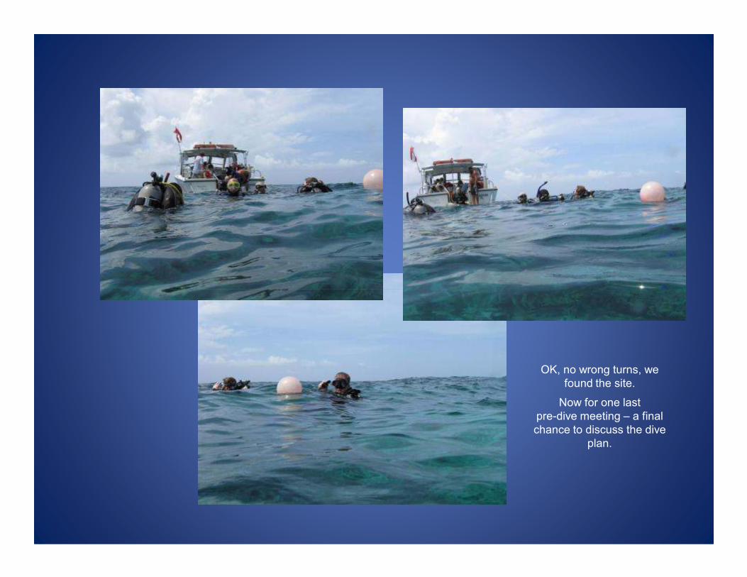
OK, no wrong turns, we
found the site.
Now for one last
pre-dive meeting – a final
chance to discuss the dive
plan.
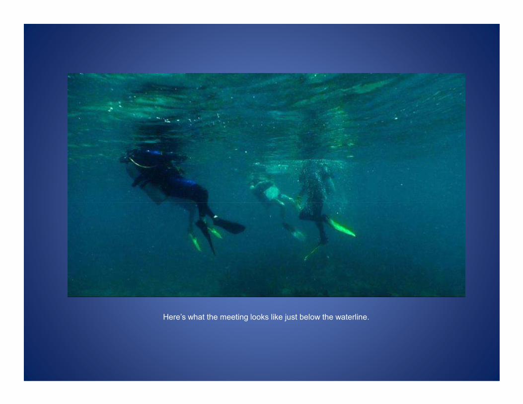
Here’s what the meeting looks like just below the waterline.
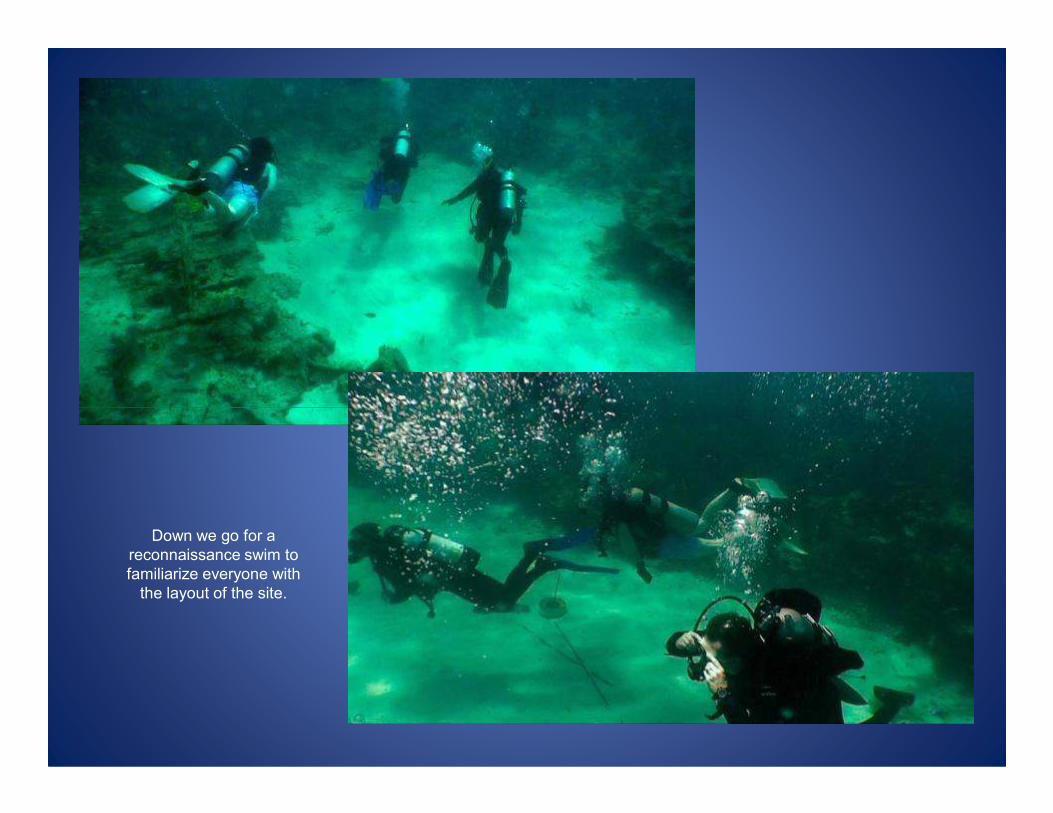
Down we go for a
reconnaissance swim to
familiarize everyone with
the layout of the site.
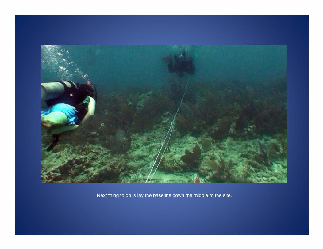
Next thing to do is lay the baseline down the middle of the site.
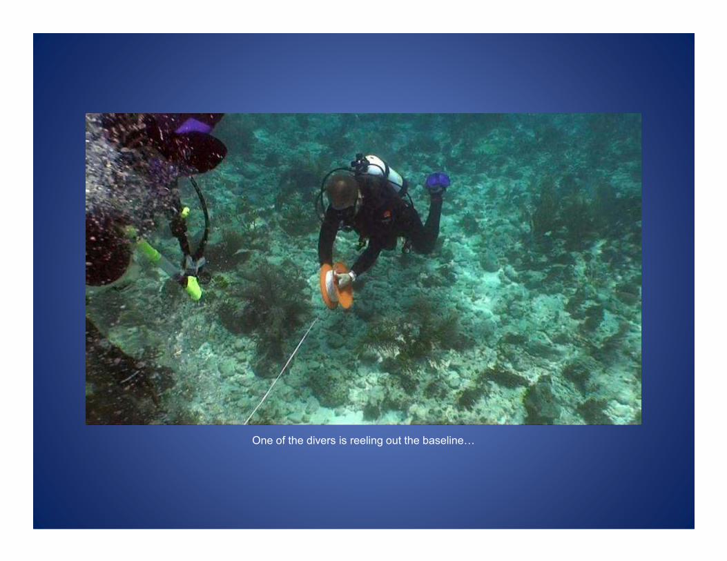
One of the divers is reeling out the baseline0
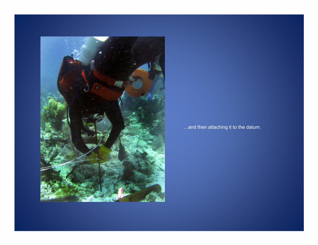
0and then attaching it to the datum.
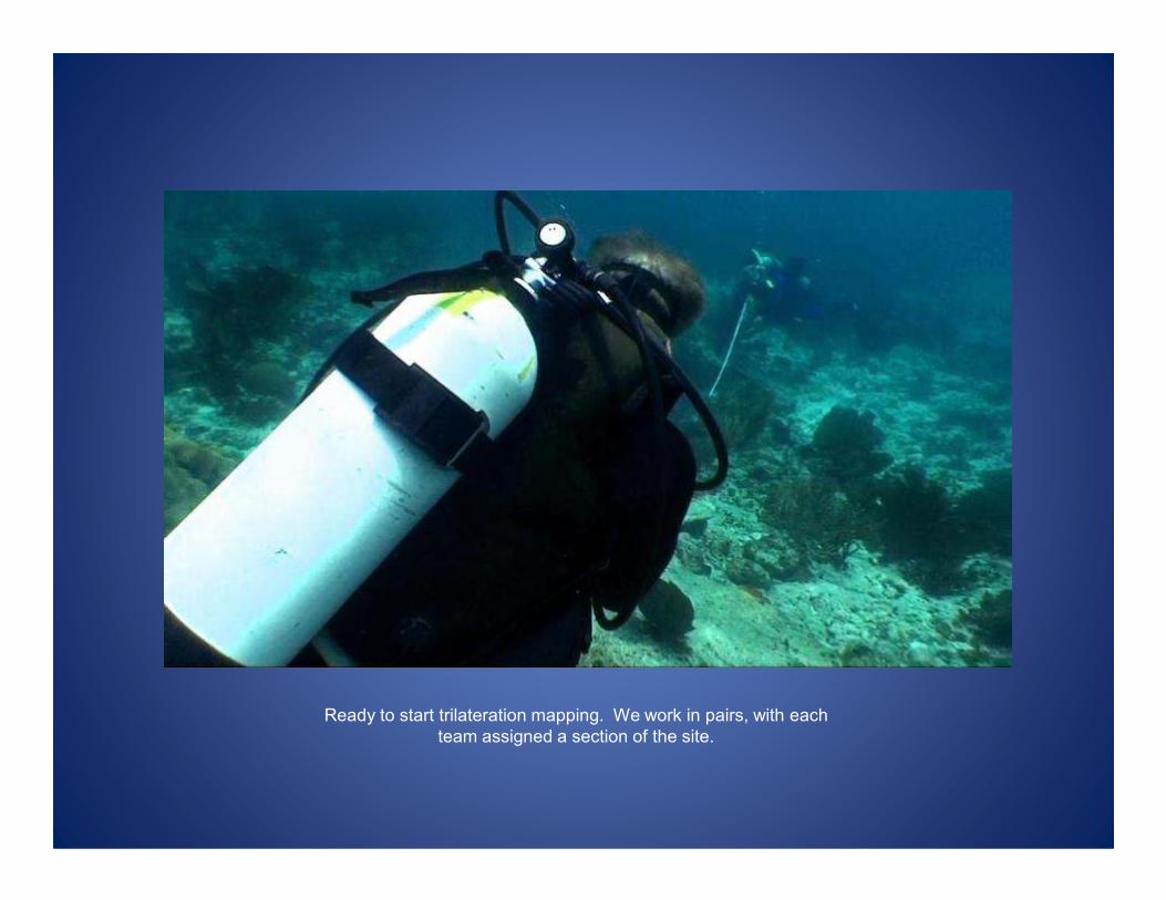
Ready to start trilateration mapping. We work in pairs, with each
team assigned a section of the site.
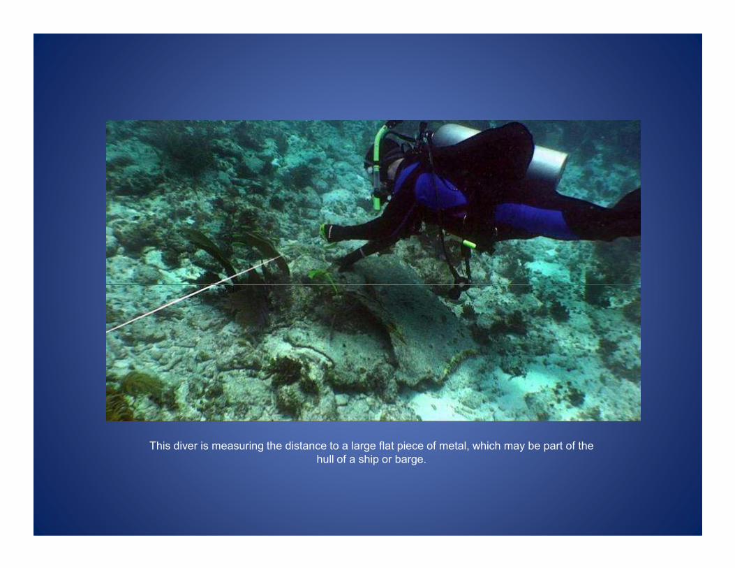
This diver is measuring the distance to a large flat piece of metal, which may be part of the
hull of a ship or barge.
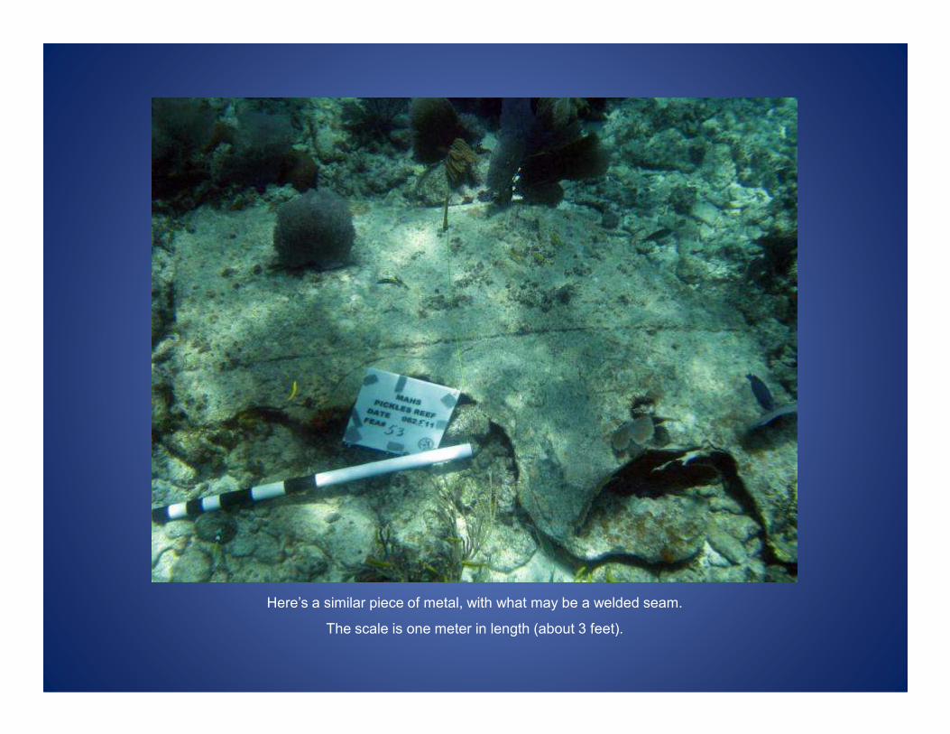
Here’s a similar piece of metal, with what may be a welded seam.
The scale is one meter in length (about 3 feet).
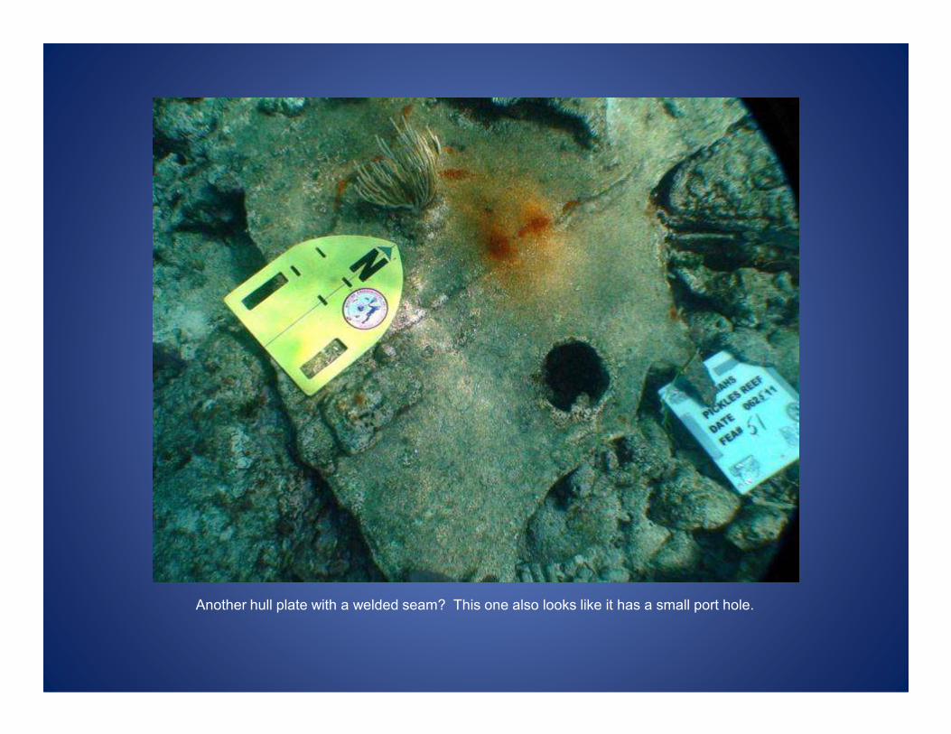
Another hull plate with a welded seam? This one also looks like it has a small port hole.
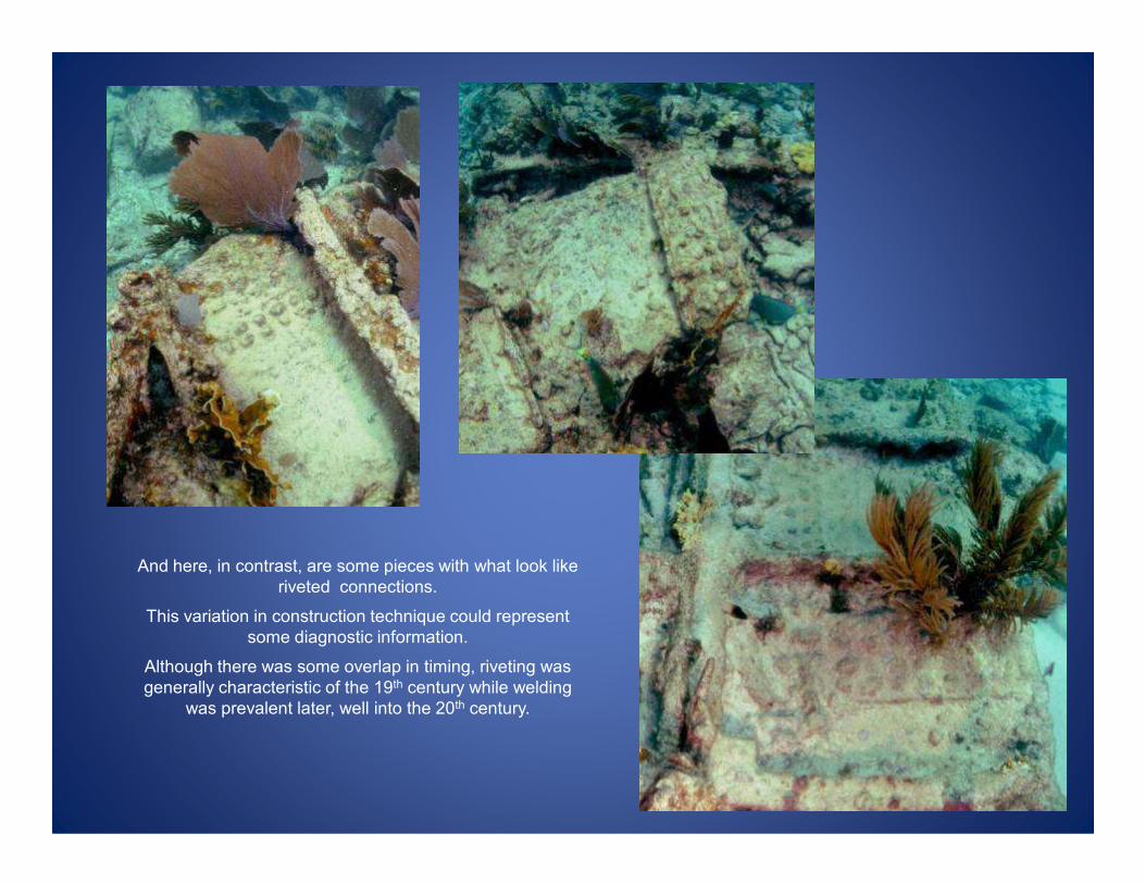
And here, in contrast, are some pieces with what look like
riveted connections.
This variation in construction technique could represent
some diagnostic information.
Although there was some overlap in timing, riveting was
generally characteristic of the 19th century while welding
was prevalent later, well into the 20th century.
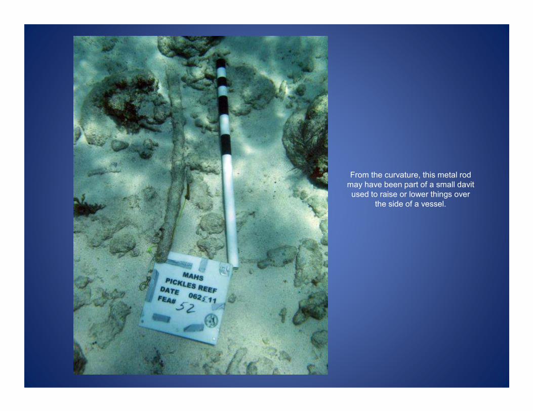
From the curvature, this metal rod
may have been part of a small davit
used to raise or lower things over
the side of a vessel. the side of a vessel.

More metal hull fragments. Left is a large structural piece with knees or braces.
To the right is another wide fragment of hull plating.
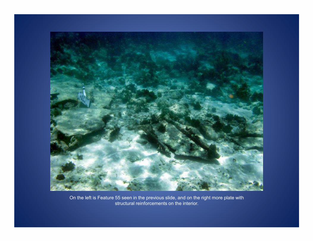
On the left is Feature 55 seen in the previous slide, and on the right more plate with
structural reinforcements on the interior.
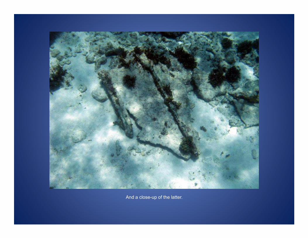
And a close-up of the latter.

This looks like an axle from a tram or small wagon that ran on metal rails. It’s a little
hard to pick out in this image.
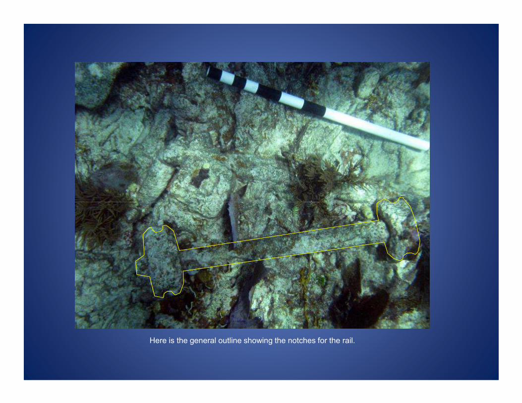
Here is the general outline showing the notches for the rail.

And this is what the site is renowned for
-- barrels0
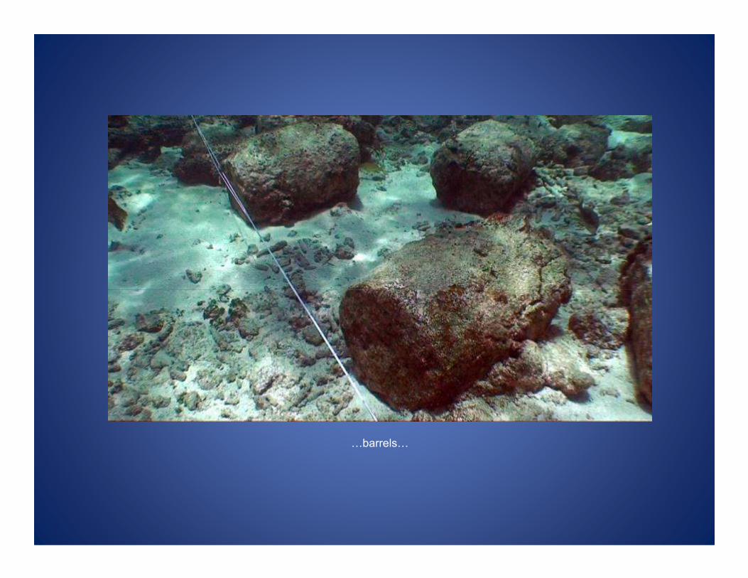
0barrels0
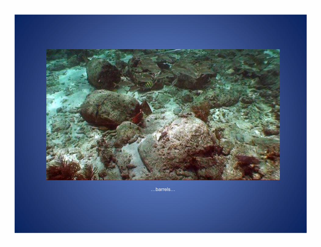
0barrels0

0and more barrels.
Actually, these aren’t really barrels but the contents of some barrels – cement.
The cement was packed in wooden casks. The wood has deteriorated and left behind the hardened
cement that was in them.
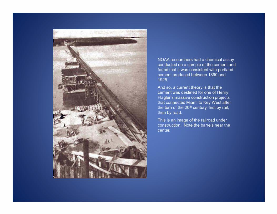
NOAA researchers had a chemical assay
conducted on a sample of the cement and
found that it was consistent with portland
cement produced between 1890 and
1925.
And so, a current theory is that the
cement was destined for one of Henry
Flagler’s massive construction projects
that connected Miami to Key West after
the turn of the 20th century, first by rail, the turn of the 20th century, first by rail,
then by road.
This is an image of the railroad under
construction. Note the barrels near the
center.

We don’t know for certain what was in the
barrels, but the workers appear to be
pouring concrete, so the barrels may well
have contained cement.
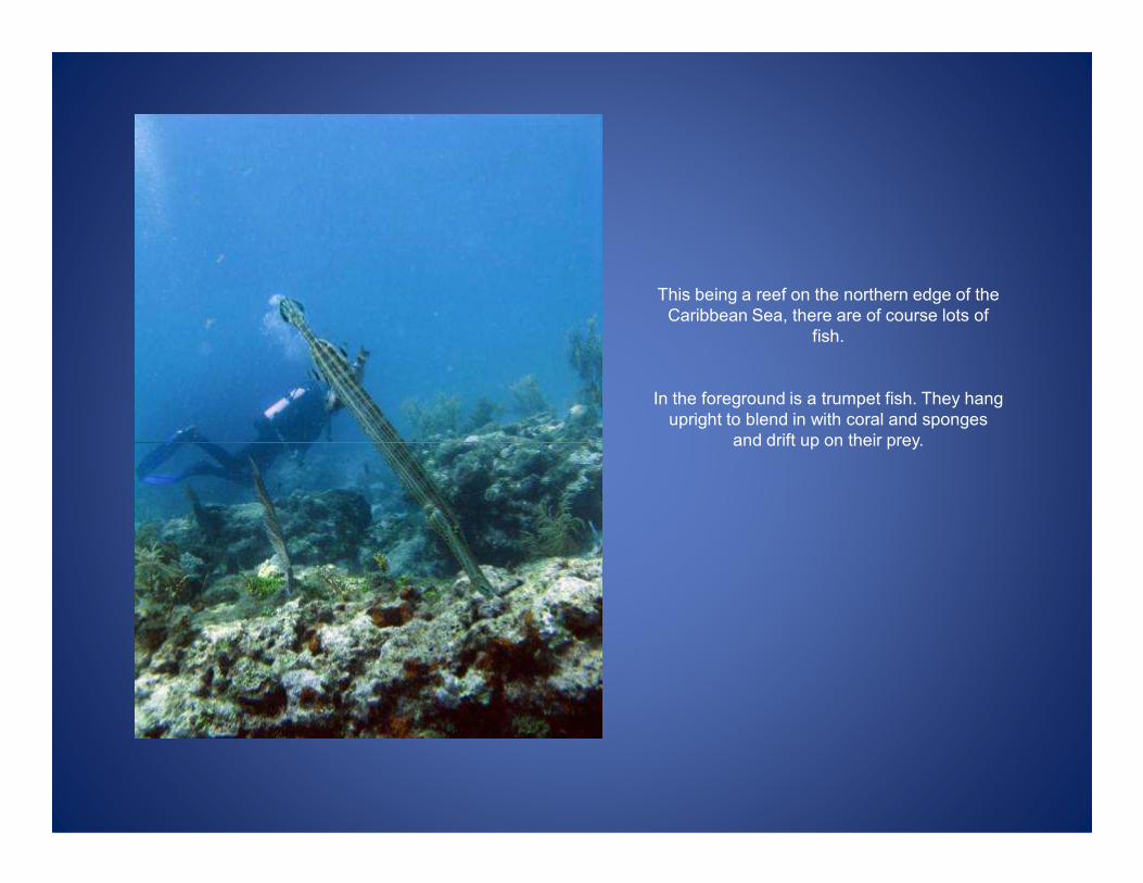
This being a reef on the northern edge of the
Caribbean Sea, there are of course lots of
fish.
In the foreground is a trumpet fish. They hang
upright to blend in with coral and sponges
and drift up on their prey. and drift up on their prey.

More trumpet fish. They’re related to seahorses and are supposedly called trumpet fish
because of their long bodies – kind of an odd looking trumpet.
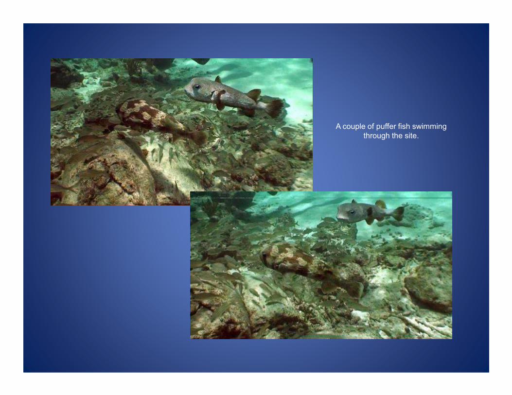
A couple of puffer fish swimming
through the site.

On the right is some brain coral, one of the few corals on the reef that looks healthy.
And just below is a juvenile parrot fish – it’s speckled with a reddish belly.
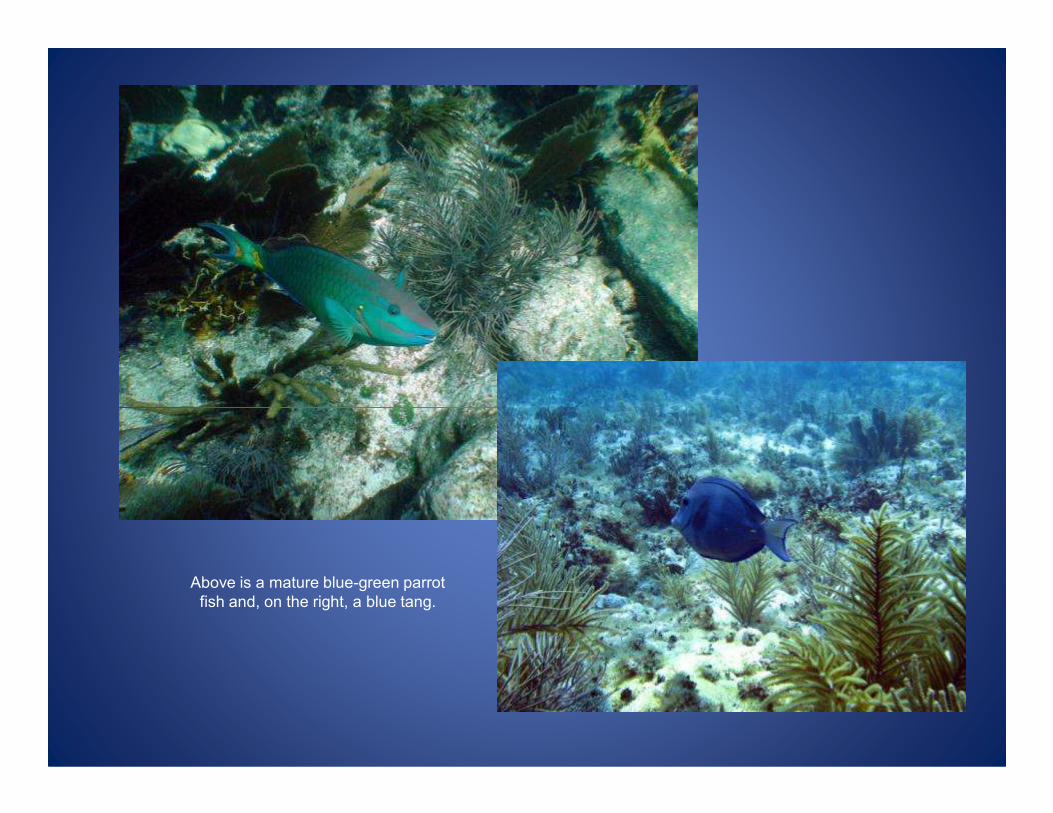
Above is a mature blue-green parrot
fish and, on the right, a blue tang.

Here’s a busy spot on the reef.
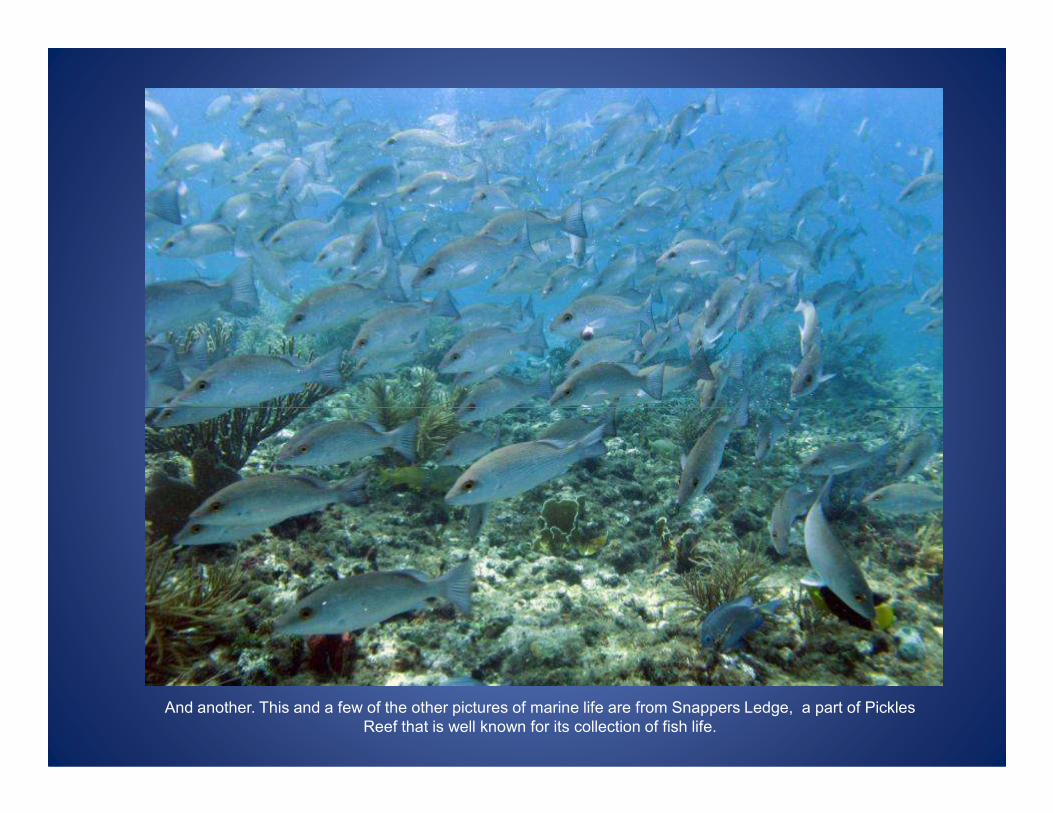
And another. This and a few of the other pictures of marine life are from Snappers Ledge, a part of Pickles
Reef that is well known for its collection of fish life.
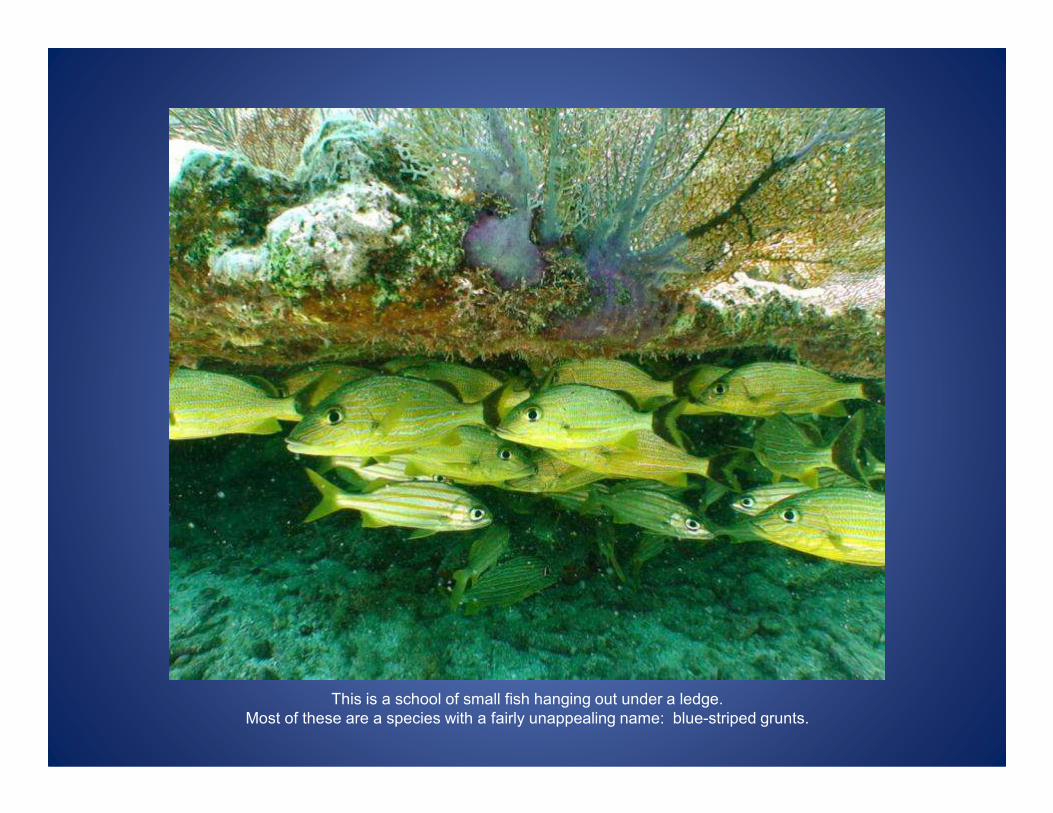
This is a school of small fish hanging out under a ledge.
Most of these are a species with a fairly unappealing name: blue-striped grunts.
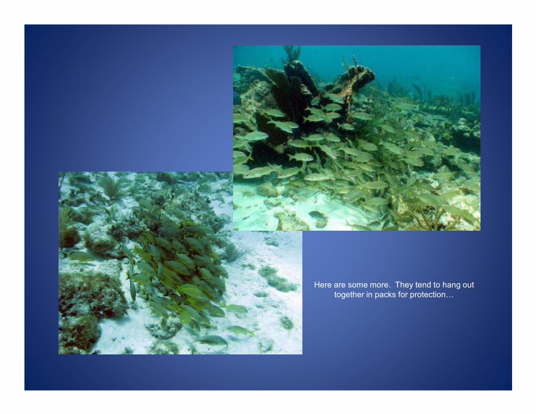
Here are some more. They tend to hang out
together in packs for protection0

0protection from things like this.
This is a nurse shark that came cruising through the archaeological site. Nurse sharks are
pretty harmless to people, but they still look menacing – they’re sharks after all.
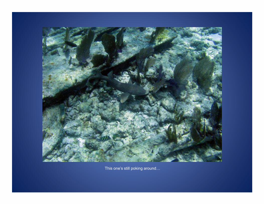
This one’s still poking around0
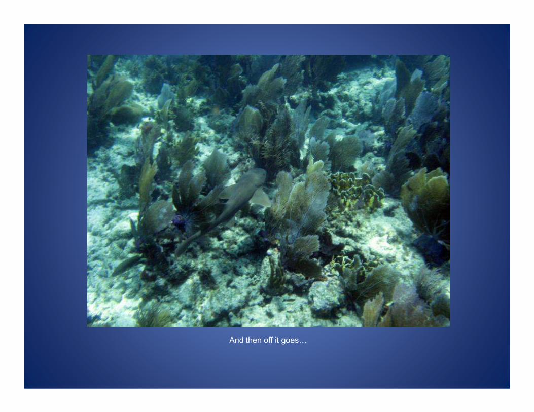
And then off it goes0
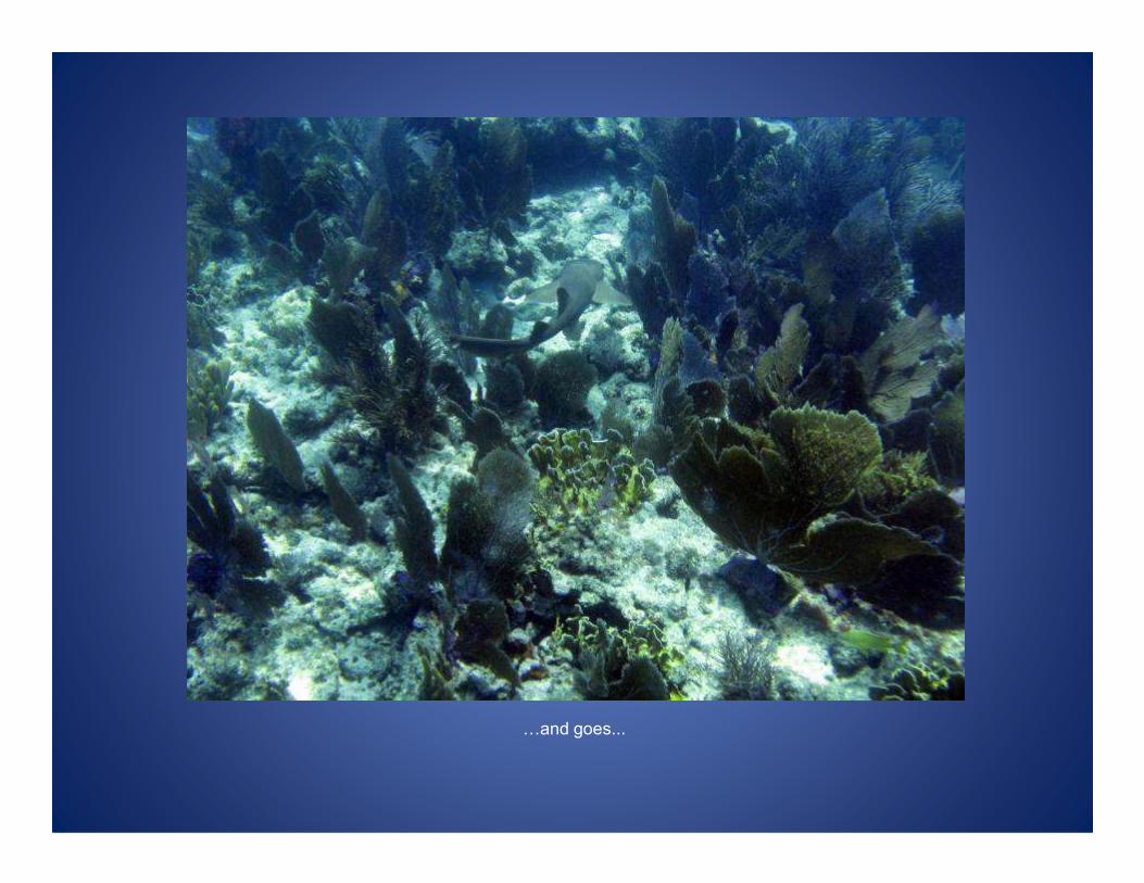
0and goes...
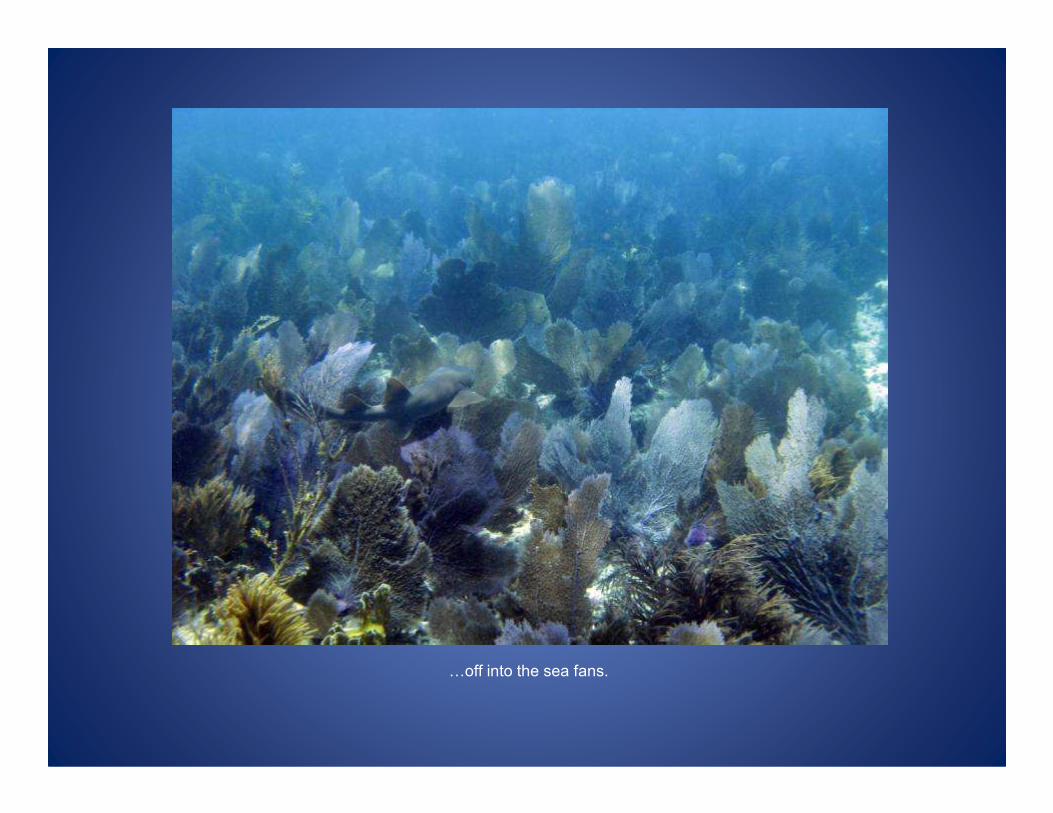
0off into the sea fans.
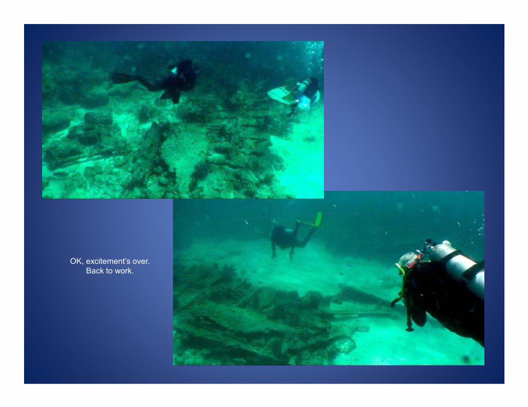
OK, excitement’s over.
Back to work.
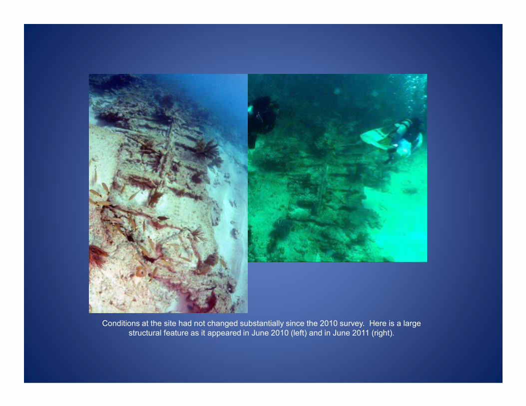
Conditions at the site had not changed substantially since the 2010 survey. Here is a large
structural feature as it appeared in June 2010 (left) and in June 2011 (right).
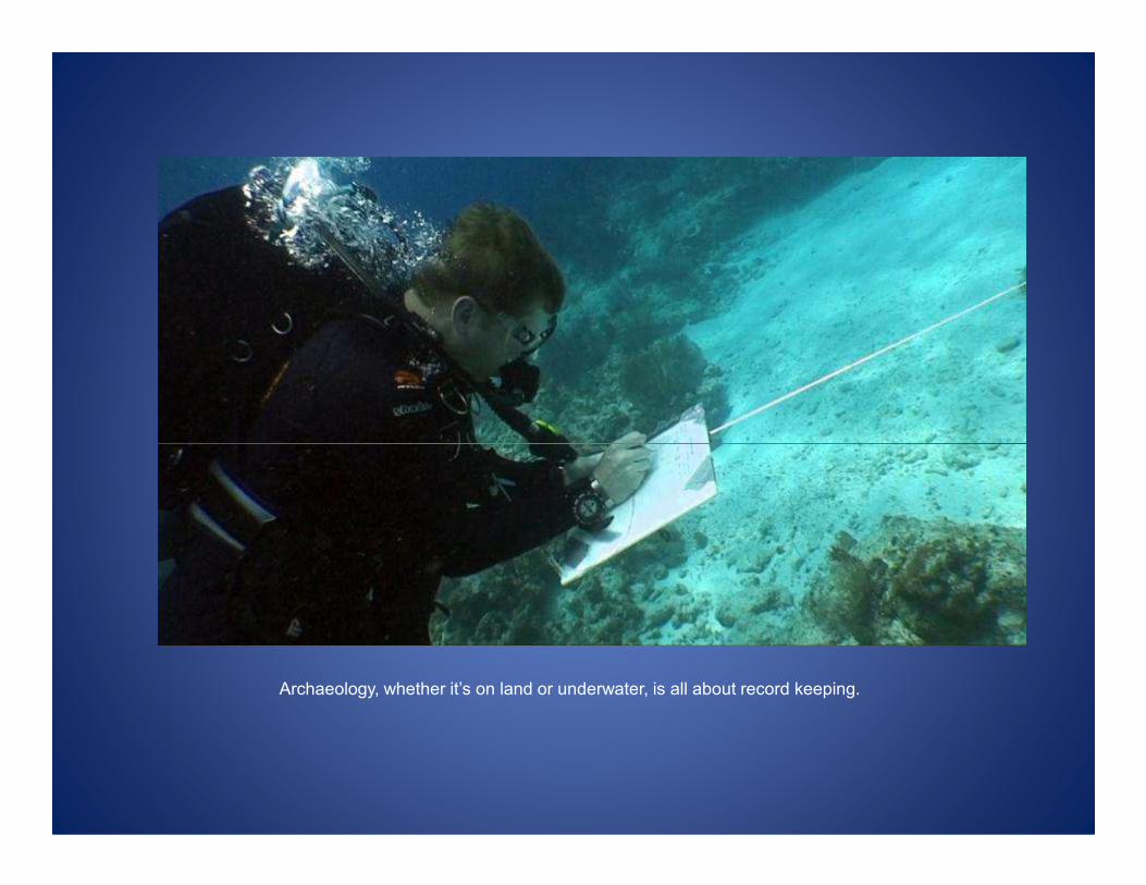
Archaeology, whether it’s on land or underwater, is all about record keeping.

More trilateration work.
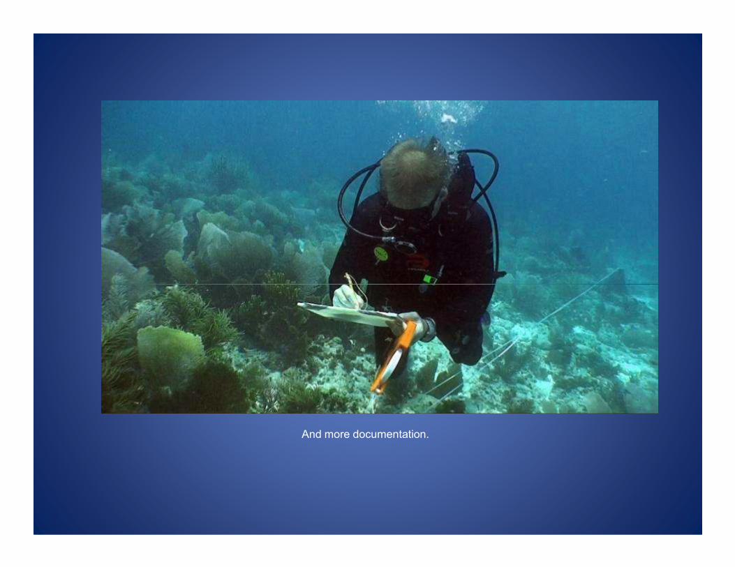
And more documentation.
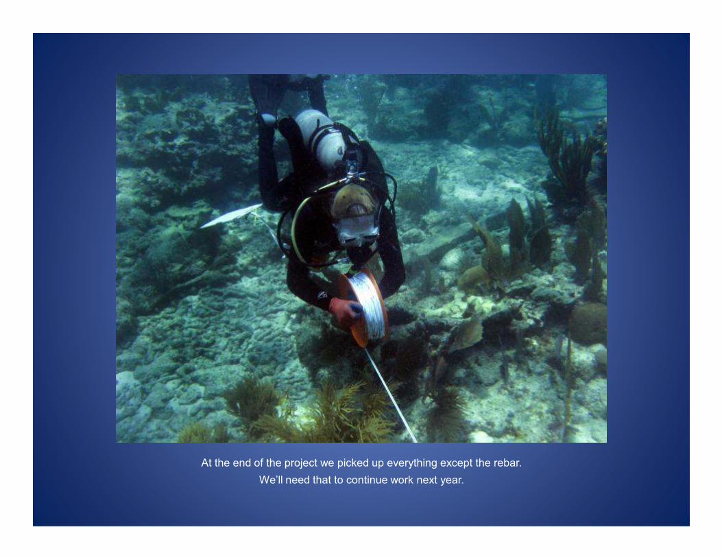
At the end of the project we picked up everything except the rebar.
We’ll need that to continue work next year.

Back to the boat. This is always a welcome site when you’re out in the open ocean. Even
with really good visibility, 30-40 feet, you can’t see it until you’re pretty close, so you have to
remember which way you went in order to get back.
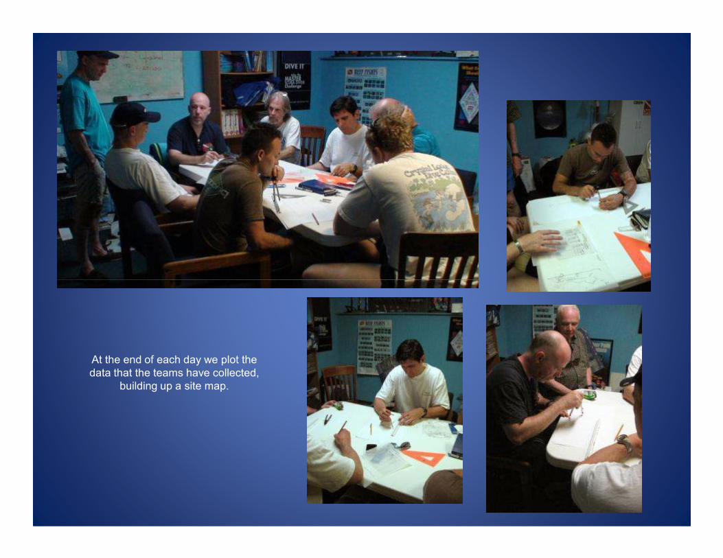
At the end of each day we plot the
data that the teams have collected,
building up a site map.
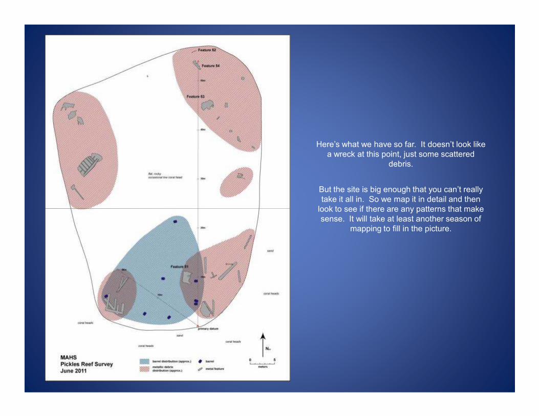
Here’s what we have so far. It doesn’t look like
a wreck at this point, just some scattered
debris.
But the site is big enough that you can’t really
take it all in. So we map it in detail and then
look to see if there are any patterns that make look to see if there are any patterns that make
sense. It will take at least another season of
mapping to fill in the picture.
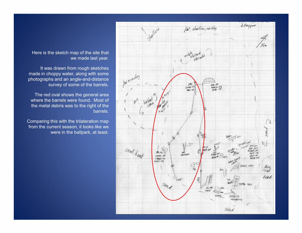
Here is the sketch map of the site that
we made last year.
It was drawn from rough sketches
made in choppy water, along with some
photographs and an angle-and-distance
survey of some of the barrels.
The red oval shows the general area
where the barrels were found. Most of
the metal debris was to the right of the
barrels.
Comparing this with the trilateration map
from the current season, it looks like we
were in the ballpark, at least.
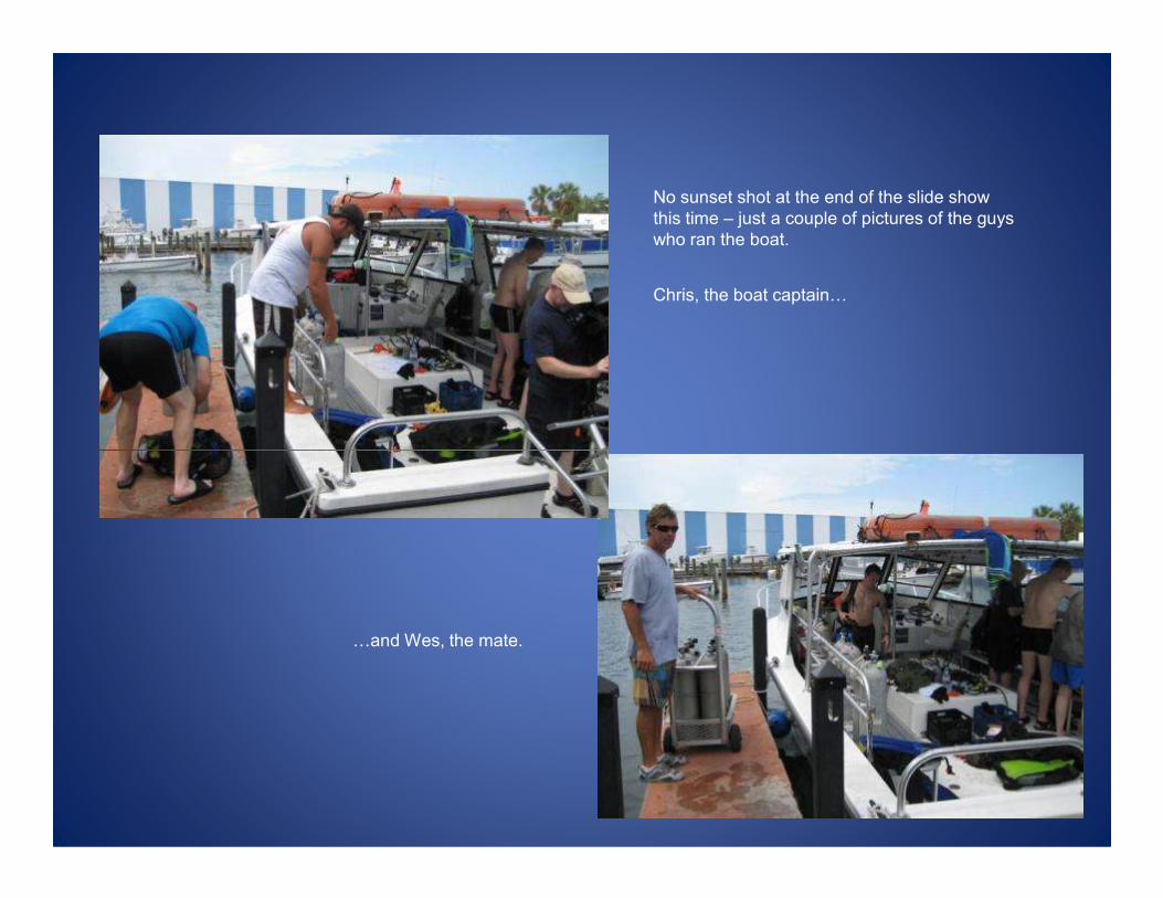
Chris, the boat captain0
No sunset shot at the end of the slide show
this time – just a couple of pictures of the guys
who ran the boat.
0and Wes, the mate.
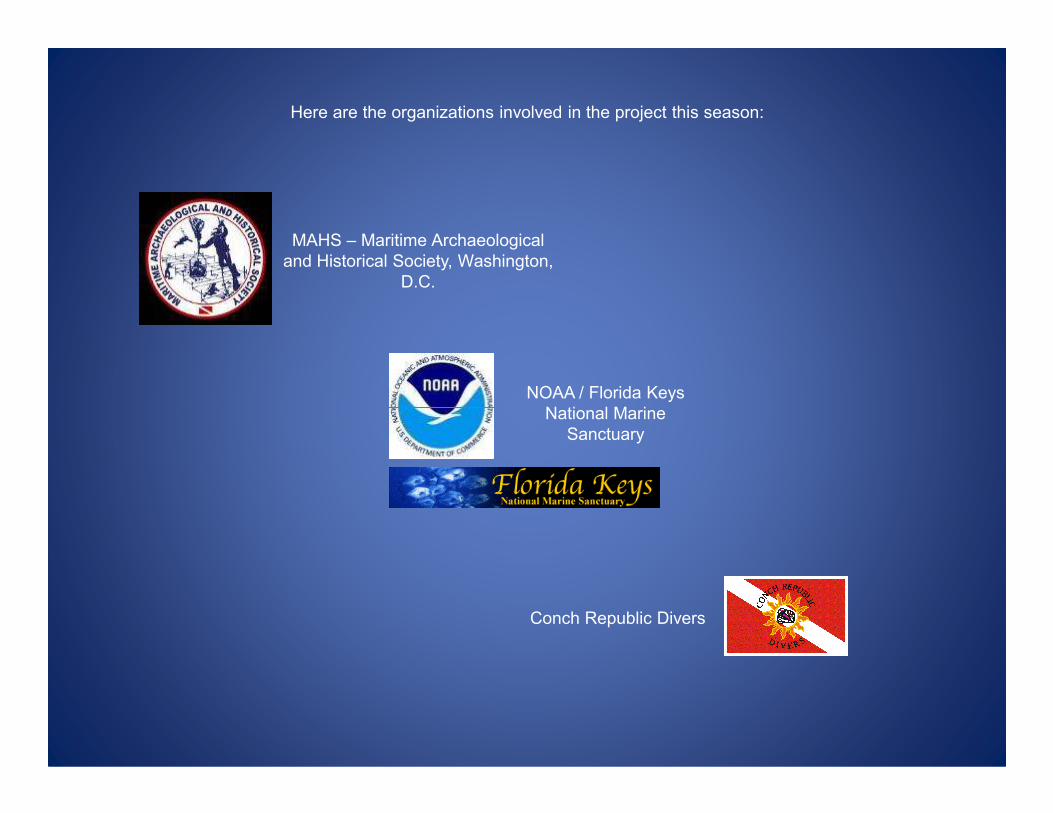
MAHS – Maritime Archaeological
and Historical Society, Washington,
D.C.
NOAA / Florida Keys
National Marine
Here are the organizations involved in the project this season:
National Marine
Sanctuary
Conch Republic Divers

Will Blodgett, Jason Hawkes, Jim Smailes, and Dennis Knepper
contributed photos for this presentation.
Special thanks to John Halas and Brenda Altmeier (FKNMS),
Roger Smith (FBHP), and to Gary and Brenda Mace and the folks
at Conch Republic Divers.at Conch Republic Divers.