training courses 2013 - unisdr.org · introduction to hec-ras ... jba consulting’s experienced...
TRANSCRIPT

Training Courses
2013
Environment • Ecology • Hydrology • Hydraulics • GIS • Water Resources • River Modelling • Land Drainage • Geomatics

1
Introduction
Introduction
Welcome to JBA’s training course brochure for 2013. JBA has been a provider of
a wide range of quality training programmes for all aspects of the water and
environment industry since 1995, and in that time we have delivered over 2,000 days of training to over 8,500 people. We offer a wide range of programmes
covering the theory and practice of environmental management, ecology, flood
risk management, hydrology, hydromorpology, hydraulics, and the use of GIS.
Tutors with years of practical experience will guide you through the course
material, sharing with you their knowledge. The presentations are backed up
with comprehensive course notes, exercises and additional support material.
Our courses are available as part of an open programme with scheduled dates
throughout the year. We are also happy to talk to you about a bespoke
programme, developed to meet your specific requirements, at a venue and time
suited to your exact needs.
Course locations
Our training courses are offered at our offices in Skipton (North Yorkshire),
Edinburgh, Atherstone (Warwickshire), Haywards Heath (West Sussex),
Warrington, Newport (South Wales), and Limerick (Ireland). If you prefer a
different venue, we would be pleased to arrange for any of the courses in this
brochure to be delivered at another location. Training rooms at our offices in
Newcastle and Doncaster are available as alternative venues or we are happy to
come along to your office or hire somewhere specifically for the event.
What people say about our courses!
“A course with detailed knowledge interpreted into an understandable way for someone
with minimal experience of SuDS” – SuDS and Biodiversity course
Tony Martin, Yorkshire Wildlife Trust
“Enjoyable course and good reference notes” – Introduction to Hydromorphology course
Paul Williams, Environment Agency
“Good knowledge gained, will be applied to my job”– FEH Users’ course
Chris Jones, Mott MacDonald
“I found the course both interesting and informative, and would highly recommend it to
anyone involved with the management of rivers” – River Restoration Practices Workshop
Gareth Pedley, Eden Rivers Trust
Very good course, thoroughly enjoyed”- FRA and Model Audit Review
Matthew Penny, Environment Agency
Training venues
Atherstone
Edinburgh
Haywards Heath
Limerick
Newport
Skipton
Warrington
Summary For further information contact us:
T: +44 (0)1756 799919

2
Contents ENVIRONMENTAL MANAGEMENT .................................................................... 3 Environmental Responsibilities of Land Drainage Authorities ................................................. 3 Environmental Awareness – half day course ............................................................................... 4 Introduction to Management of Sensitive Water Environments .............................................. 5 Environment Impact Assessments for Water Level Management........................................... 6 SuDS and Biodiversity ...................................................................................................................... 7 FLOOD RISK MANAGEMENT ........................................................................... 8 Flood Risk Assessment .................................................................................................................... 8 Flood Risk Assessment and Model Audit Review ........................................................................ 9 Land Drainage/Flood Risk Management Law in England & Wales ........................................... 10 Flood Risk Management in Scotland .............................................................................................. 11 Getting started with the Flood and Water Management Act .................................................... 12 Stormwater Modelling with ‘music’................................................................................................ 13 Sustainable Drainage Systems (SuDS) ......................................................................................... 14 HYDRAULICS ............................................................................................ 15 River Modelling Methods .................................................................................................................. 15 Introduction to HEC-RAS ................................................................................................................. 16 Intermediate HEC-RAS ..................................................................................................................... 17 Advanced HEC-RAS .......................................................................................................................... 18 HEC-RAS Master Class ..................................................................................................................... 19 Introduction to ISIS 1D ...................................................................................................................... 20 Introduction to ISIS Mapper ............................................................................................................ 21 Introduction to Flood Modelling using TUFLOW – Part 1............................................................ 22 Introduction to Flood Modelling using TUFLOW – Part 2 .......................................................... 23 2D Modelling for Project Managers ............................................................................................... 24 WinDes: Use in Auditing ................................................................................................................... 25 Survey for River Models ................................................................................................................... 26 HYDRAULIC STRUCTURES............................................................................. 27 Bridge and Weir Design .................................................................................................................... 27 Culvert Design and Operation ........................................................................................................ 28 Bridge Scour ....................................................................................................................................... 29 HYDROMORPHOLOGY ................................................................................. 30 Introduction to Hydromorphology and Fluvial Geomorphology ............................................... 30 Practical River Functioning and Restoration Guidance – Field Visit ....................................... 31 COASTAL FLOODING................................................................................... 32 Coastal Flood Modelling and Extremes ......................................................................................... 32 HYDROLOGY ............................................................................................ 33 Understanding and Assessing Hydrological Drought ................................................................. 33 Flood Hydrology for Non-Specialists ............................................................................................. 34 Flood Estimation Handbook ............................................................................................................ 35 Flood Estimation Handbook Refresher ......................................................................................... 36 The Revitalised Flood Hydrograph Method .................................................................................. 37 The PDM Model – Theory and Application for Flood Forecasting ............................................ 38 Urban Hydrology................................................................................................................................ 39 SOFTWARE TRAINING ................................................................................. 40 Introduction to ArcGIS v10 .............................................................................................................. 40 HEC-RAS SOFTWARE .................................................................................. 41 PUBLICATIONS .......................................................................................... 42 BOOKING DETAILS ..................................................................................... 43
Standard course costs
One day course
£275 + VAT per person
Two day course
£500 + VAT per person
The price for an individual delegate
booking several one day JBA training
courses would be as follows
Two courses £500 + VAT
Three courses £750 + VAT
Four courses £900 + VAT
These prices include lunch and
morning/afternoon refreshments
A comprehensive set of course notes
including spreadsheets and worked
solutions are supplied.
Facilities
All courses at our venues use
purposely-equipped training rooms with
modern audio-visual equipment. Each
delegate has access to a laptop PC with
the various software packages loaded.
Where appropriate example computer
exercises will form part of the formal
presentations.
Our training venues are also available
for hire on a half day or full day basis
for meetings and seminars. Please
contact Felicity Clarke for more details.
Professional development
All JBA courses have been approved by
our Supervising Engineer/Training
Supervisor as suitable for credits
towards Continued Professional
Development (CPD) and Continued
Education and Training (CET)
programmes.
Contents
3
Environmental Management
Training Course
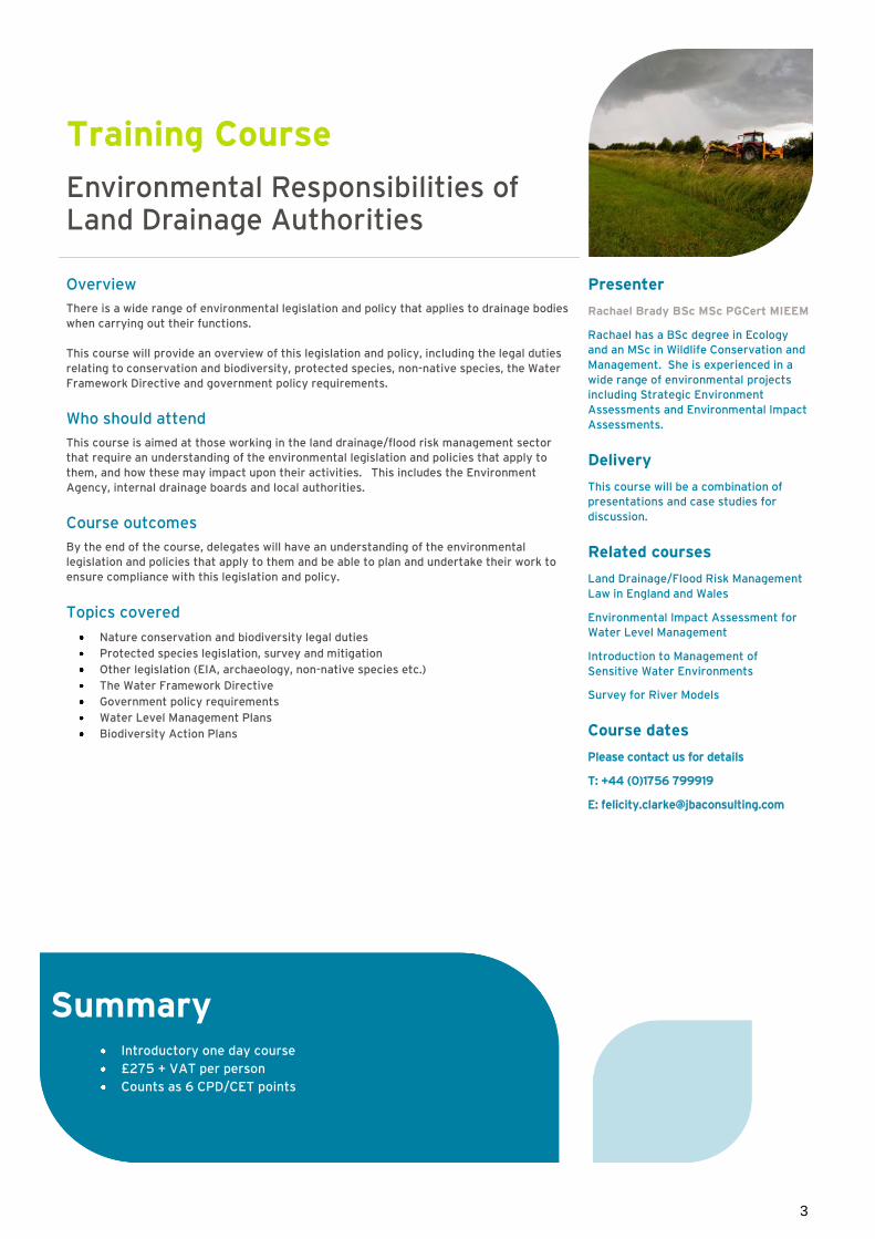
Environmental Responsibilities of Land Drainage Authorities
Overview
There is a wide range of environmental legislation and policy that applies to drainage bodies
when carrying out their functions.
This course will provide an overview of this legislation and policy, including the legal duties
relating to conservation and biodiversity, protected species, non-native species, the Water
Framework Directive and government policy requirements.
Who should attend
This course is aimed at those working in the land drainage/flood risk management sector
that require an understanding of the environmental legislation and policies that apply to
them, and how these may impact upon their activities. This includes the Environment
Agency, internal drainage boards and local authorities.
Course outcomes
By the end of the course, delegates will have an understanding of the environmental
legislation and policies that apply to them and be able to plan and undertake their work to
ensure compliance with this legislation and policy.
Topics covered
Nature conservation and biodiversity legal duties
Protected species legislation, survey and mitigation
Other legislation (EIA, archaeology, non-native species etc.)
The Water Framework Directive
Government policy requirements
Water Level Management Plans
Biodiversity Action Plans
Presenter
Rachael Brady BSc MSc PGCert MIEEM
Rachael has a BSc degree in Ecology
and an MSc in Wildlife Conservation and
Management. She is experienced in a
wide range of environmental projects
including Strategic Environment
Assessments and Environmental Impact
Assessments.
Delivery
This course will be a combination of
presentations and case studies for
discussion.
Related courses
Land Drainage/Flood Risk Management
Law in England and Wales
Environmental Impact Assessment for
Water Level Management
Introduction to Management of
Sensitive Water Environments
Survey for River Models
Course dates
Please contact us for details
T: +44 (0)1756 799919
Summary Introductory one day course
£275 + VAT per person
Counts as 6 CPD/CET points

4
Training Course
Environmental Awareness – half day course
Background
With many years experience in carrying out environmental and ecological work in advance
of engineering schemes, we have a full understanding of the range of issues often
overlooked in the early stages of projects which can result in considerable delay and
additional expense later in the project planning process.
Half day awareness course
JBA Consulting’s experienced ecologists can present a half day training course covering
up-to-date legislative changes and how it can affect individual schemes. The course covers
protected species, designated sites, non-native invasive species and the relevant legislation.
In addition there is discussion of other environmental considerations such as archaeology
and cultural heritage. Discussion of the common pitfalls and how to avoid them is included
based on extensive experience and lessons learned.
Course outcomes
By the end of the course, delegates will have an understanding of the environmental
legislation and policies that apply to them and be able to plan and undertake their work to
ensure compliance with this legislation and policy.
Course Details
Different levels of species protection including Great Crested Newt, bats and other
European Protected Species, licensing and mitigation
Hierarchy of designated sites – Local Wildlife Sites to Special Area of Conservation via
SSSI
Invasive plants and management plans, including dealing with Japanese Knotweed,
and non-native animals, site hygiene and mitigation
Overview of current legislation including Wildlife and Countryside Act 1981,
Conservation of Habitats and Species Regulations 2010, Natural Environments and
Rural Communities Act 2006, Land Drainage Act 1991 and Marine and Coastal Access
Act 2009
Marine licence and Land Drainage/Flood Consent
Works affecting Scheduled Monuments
Timing of surveys and work
We can tailor a training course to suit scheme designers and contractors to ensure all parties are aware of and meet their legal obligations.
Presenter
Christopher Toop BSc
Chris has been instrumental in
delivering EIA for large scale land
drainage pumping schemes and
numerous flood defence schemes. He’s
also been involved in large
infrastructure projects including
surveys for and on behalf of Network
Rail. These have included novel
approaches to project planning,
troubleshooting and navigating a course
through environmental legislation to
allow schemes to proceed on time and
within budget. This experience allows a
pragmatic approach to your own
schemes.
Delivery
This course will be a combination of
presentations and case studies for
discussion.
Course dates
Please contact us for details
T: +44 (0)1756 799919
Summary Half day awareness course
£150 + VAT per person
Counts as 3 CPD/CET points

5
Training Course
Introduction to Management of Sensitive Water Environments
Overview
A hands-on, example driven course that provides an introduction to managing sensitive
water environments. The course looks at a number of types of groundwater and surface
water dependent environments which are often designated as SSSI (Sites of Special
Scientific Interest). A basic introduction to understanding surface water and groundwater
hydrology is provided. This is then applied to a number of hydro-ecological environments.
The basis for site monitoring and the options for site water management are explored.
Who should attend
People involved in site management, whether this is sites with some water-environment
interest, SSSI sites, local or national nature reserves. Those involved in water level
management plans, or managing wetland sites for other purposes such as flood mitigation.
Course outcomes
By the end of the course, participants will have developed a basic understanding of the
processes controlling water within a site and be able to develop a monitoring plan and
outline a water management strategy for a site.
Topics covered
Introduction to sensitive water environments (SSSI, SAC, NNR, LNR, SEGI, WFD etc.) –
targets for favourable condition/recovering to favourable condition
Surface water and groundwater hydrology, hydrogeology
Water environment on sensitive sites
Peat bogs: blanket mires, valley mires, raised mires, wetlands
Worked example to understand the key water processes on a site
Water management for drainage and flooding
Land drainage, Internal Drainage Boards (IDBs)
Washlands
Maximising environmental benefits
Effective monitoring on sensitive sites – what to monitor and how
Effective water management on sensitive sites
Case studies
Presenter
Rachael Brady BSc MSc PGCert MIEEM
Rachael has a BSc degree in Ecology
and an MSc in Wildlife Conservation and
Management. She is experienced in a
wide range of environmental projects
including Strategic Environment
Assessments and Environmental Impact
Assessments.
Delivery
This course will be a combination of
presentations and case studies for
discussion.
Course dates
Please contact us for details
T: +44 (0)1756 799919
Summary One day course
£275 + VAT per person
Counts as 6 CPD/CET hours

6
Training Course
Environment Impact Assessments for Water Level Management
Overview
Almost all land drainage improvement works undertaken by drainage bodies are “permitted
development” under the Town and Country Planning (General Permitted Development)
Order 1995 and therefore exempt from planning permission. Since such works might have
significant effects on the environment, the principles of Environmental Impact Assessment
(EIA) need to be applied to them. This is done through the Environmental Impact
Assessment (Land Drainage Improvement) Regulations 1999 (as amended).
This course considers the EIA process in the context of land drainage/flood risk
management works. It explains the processes and procedures involved, and uses a number
of case studies to illustrate EIA in practice.
Who should attend
This course is aimed at those working in the land drainage/flood risk management sector
that require an understanding of how the EIA Regulations apply to them, the processes
involved and the constraints it may impose on their activities.
Course outcomes
By the end of the course, participants will have an understanding of how the EIA
Regulations apply to land drainage/flood risk management works and be able to identify
when an EIA is required.
Topics covered
Background to EIA legislation
Land drainage improvement works
EIA Process
Determining the level of significance
Scoping
Environmental Statement
Impact Assessment and mitigation
Consultation
Works which may require planning permission
Presenter
Rachael Brady BSc MSc PGCert MIEEM
Rachael has a BSc degree in Ecology
and an MSc in Wildlife Conservation and
Management. She is experienced in a
wide range of environmental projects
including Strategic Environment
Assessments and Environmental Impact
Assessments.
Delivery
This course will be a combination of
presentations and case studies for
discussion.
Related courses
Land Drainage/Flood Risk Management
Law in England and Wales
Environmental Responsibilities of Land
Drainage Authorities
Introduction to Management of
Sensitive Water Environments
Course dates
Please contact us for details
T: +44 (0)1756 799919
Summary One day course
£275 + VAT per person
Counts as 6 CDD/CET hours

7
Training Course
SuDS and Biodiversity
Overview
This one day training course looks at the basics of SuDS and how they are designed
together with examples of how biodiversity can be incorporated into SuDS schemes. The
course focuses more on the ideas rather than the detail and provides case studies of
designs that can be improved to benefit wildlife.
Who should attend?
SuDS Advisory Bodies, local authority planners, engineers and other specialists working in
development control or the design of new infrastructure, would benefit from attending this
course.
Course outcomes
After the course delegates will know:
What is SuDS
Types of SuDS
Examples of SuDS in action
Benefits to biodiversity
Topics covered
Principles of SuDS
Overview and problems of SuDS
SuDS measures
Types of SuDS
Barriers to SuDS
Flood Risk and SuDS – useful tools
Design considerations and guidance
Ecological design and enhancement
Complications and management
Managing urban stormwater using ‘music’
SuDS case studies – SuDS and Biodiversity
Presenter
Kieran Sheehan BSc MSc PGCE MIEEM
MIfL
Kieran is a plant phytosociologist with
an expertise in upland and wetland
ecosystems. He is currently the Project
Manager for the Water Level
Management Plan on Thorne Moors,
England’s largest raised bog, and is a
former member of Scotland’s Moorland
Forum. Kieran has taught ecology at
Bishop Burton College (University of
Hull) and has undertaken ecological
works, including planting schemes, for
local authorities and drainage boards.
Delivery
The course will be a combination of
presentations and case studies.
Related courses
Environmental Impact Assessment for
Water Level Management
Introduction to Water Management for
Sensitive Water Environments
Environmental Responsibilities of Land
Drainage Authorities
Stormwater modelling using’ music’
Course dates
Please contact us for details
T: +44 (0)1756 799919
Summary One day course
£275 + VAT per person
Counts as 6 CPD/CET hours

8
Flood Risk Management
Training Course
Flood Risk Assessment
Overview
This course outlines the requirements for Flood Risk Assessments at a site specific scale for
individual sites and is aimed at those undertaking studies for proposed developments.
Reference will be made to the relevance of Strategic Flood Risk Assessments and
Catchment Flood Management Plans.
Who should attend
The course is designed for professionals carrying out Flood Risk Assessments. It is also
relevant to managers and regulators involved in reviewing and approving FRAs.
Course objectives
To give an overview of the regulatory background behind the need for FRAs, the scope,
content and purpose of FRAs, and the methodologies employed within these studies.
Topics covered
Introduction and overview
Planning Policy and Guidance (main emphasis on England and the NPPF, TAN15, SPP
and PPS15 also briefly mentioned)
Data requirements and reporting
FRA content
Modelling overview
The assessment of risk
Mitigation measures
Surface Water Drainage
Case studies
Do’s and don’ts
What is not covered in the course
The course does not include detailed training on hydrological assessment, hydraulic
modelling, or the design of SuDS, please see ‘Related courses’.
Presenter
Tom Sherwood MphysGeog HND ND
Misc
Tom specialises in producing flood risk
and drainage impact assessments to
support planning applications. He has
experience of the design of culvert
replacement schemes, exceedance
overflow channels, detention ponds,
compensatory floodplain storage
schemes, surface water drainage
systems and other related drainage and
land drainage studies.
Delivery
This course will be delivered through
presentations, exercises and case
studies.
Related courses
Flood Estimation Handbook (FEH)
Introduction to HEC-RAS
Urban Hydrology (for Drainage Impact
Assessment type studies)
Land Drainage/Flood Risk Management
Law in England and Wales
Sustainable Drainage Systems (SuDS)
SuDS and Biodiversity
Flood Risk Management in Scotland
Course dates
28 February 2013 – Skipton
29 May 2013 – Atherstone
17 October 2013 - Warrington
Summary Introductory one day course
£275 + VAT per person
Counts as 6 CPD/CET hours

9
Training Course
Flood Risk Assessment and Model Audit Review
Overview
Computer models are now almost universally used to provide information on flood levels,
flood extents and hydraulic capacity. The range of models is wide from simple ‘shareware’
programs to very complex integrated packages. This course provides a guide to the various
generic model types and their capabilities and limitations. This knowledge is then used to
show how to review the appropriateness of a particular modelling approach and the
corresponding outputs and to assess whether the results are likely to be suitable.
Who should attend
Professionals involved in development control and consenting for flood risk management
and drainage.
Course objectives
To provide the knowledge to undertake ‘high level’ reviews of models used for estimating
flood levels and hydraulic capacity of drainage systems.
Topics covered
Types of computer model (hydrological, hydraulic, 1D, 2D and 3D)
Data requirements (topographic, coefficients, calibration data)
How flood outlines are produced
Review of models for Flood Risk Assessments
Review of models for Drainage Impact Assessments
Review of models for Flood Hazard Maps
The ‘1-Hour Model Review’
Presenter
Jeremy Benn FREng MA MSc FICE
FCIWEM C.WEM MASCE MIEI CEng
CEnv
Jeremy is Chief Executive of JBA and
has over 29 years’ experience of
hydrological and hydraulic modelling
and has published and lectured widely
on these subjects.
Delivery
This course is delivered through a series
of presentations and case studies and
four hands-on exercises.
Related courses
Flood Estimation Handbook
River Modelling Methods
2D Modelling for Project Managers
WinDes: Use in Auditing
Course dates
Please contact us for details
T: +44 (0)1756 799919
Summary Introductory one day course
£275 + VAT per person
Counts as 6 CPD/CET hours
10
Training Course
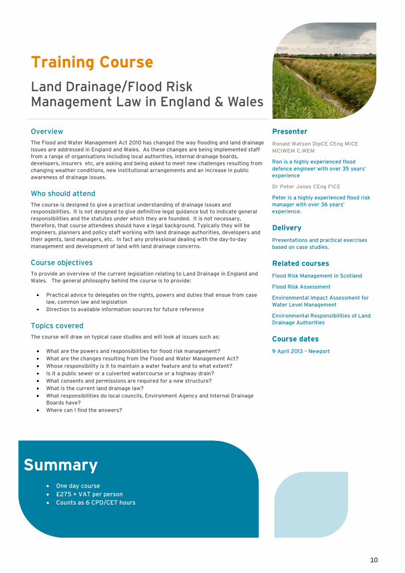
Land Drainage/Flood Risk Management Law in England & Wales
Overview
The Flood and Water Management Act 2010 has changed the way flooding and land drainage
issues are addressed in England and Wales. As these changes are being implemented staff
from a range of organisations including local authorities, internal drainage boards,
developers, insurers etc, are asking and being asked to meet new challenges resulting from
changing weather conditions, new institutional arrangements and an increase in public
awareness of drainage issues.
Who should attend
The course is designed to give a practical understanding of drainage issues and
responsibilities. It is not designed to give definitive legal guidance but to indicate general
responsibilities and the statutes under which they are founded. It is not necessary,
therefore, that course attendees should have a legal background. Typically they will be
engineers, planners and policy staff working with land drainage authorities, developers and
their agents, land managers, etc. In fact any professional dealing with the day-to-day
management and development of land with land drainage concerns.
Course objectives
To provide an overview of the current legislation relating to Land Drainage in England and
Wales. The general philosophy behind the course is to provide:
Practical advice to delegates on the rights, powers and duties that ensue from case
law, common law and legislation
Direction to available information sources for future reference
Topics covered
The course will draw on typical case studies and will look at issues such as:
What are the powers and responsibilities for flood risk management?
What are the changes resulting from the Flood and Water Management Act?
Whose responsibility is it to maintain a water feature and to what extent?
Is it a public sewer or a culverted watercourse or a highway drain?
What consents and permissions are required for a new structure?
What is the current land drainage law?
What responsibilities do local councils, Environment Agency and Internal Drainage
Boards have?
Where can I find the answers?
Presenter
Ronald Watson DipCE CEng MICE
MCIWEM C.WEM
Ron is a highly experienced flood
defence engineer with over 35 years’
experience
Dr Peter Jones CEng FICE
Peter is a highly experienced flood risk
manager with over 36 years’
experience.
Delivery
Presentations and practical exercises
based on case studies.
Related courses
Flood Risk Management in Scotland
Flood Risk Assessment
Environmental Impact Assessment for
Water Level Management
Environmental Responsibilities of Land
Drainage Authorities
Course dates
9 April 2013 – Newport
Summary One day course
£275 + VAT per person
Counts as 6 CPD/CET hours

11
Training Course
Flood Risk Management in Scotland
Overview
A two day course covering the latest legislation including the 2009 Flood Risk Management
(Scotland) Act and the Scottish Planning Policy SPP Planning and Flooding Guidance.
The course highlights the responsibilities of key stakeholders including the Scottish
Government, SEPA, local authorities, developers and land owners. It will concentrate on the
practical implications of the legislation and guidance, what it means in terms of cost and
resource requirements, and how stakeholders need to respond.
Who should attend
Planning staff from Scottish local authorities, consultants and developers involved with
planning applications, flood risk/drain impact assessments, management and maintenance
of watercourses and flood risk management measures.
Topics covered
Day 1
Legal background (including EU Flood Directive and Water Framework Directive)
Responsibility for flooding and drainage
Role of the Government, Local Authorities, SEPA, Scottish Water
Responsibilities on reservoir owners/operators
The framework for co-ordination and co-operation between all organisations involved
in flood risk management
Enabling stakeholders and the public to contribute to managing flood risk
Reference to case law and insurance issues
Day 2
National flood risk data
Flood zones and functional floodplains
Preparation of flood risk management plans
Requirements for Flood Risk Assessments
Requirements for Drainage Impact Assessments
Presenter
David Bassett BSc MSc CEnv MCIWEM
C.WEM
David is a chartered water and
environmental manager with over 19
years’ experience.
Delivery
The course will be a combination of
presentations and hands-on exercises
involving model calibration.
Related courses
Flood Risk Assessment
Course dates
24 and 25 April - Edinburgh
Summary Introductory two day course
£500 + VAT per person
Counts as 12 CPD/CET hours

12
Training Course
Getting started with the Flood and Water Management Act
Overview
The Flood and Water Management Act significantly changes the roles of county councils and
local authorities with respect to flood risk management in England and Wales. In particular
councils must consider mapping, assessment and formulation of strategies for ordinary
watercourses, groundwater and surface water drainage and the “designation” and
registration of features affecting flood risk. This one day training course provides
managers and officers with an appreciation of the institutional, policy, operational and
tactical implications of establishing management structures and practices to efficiently and
effectively meet the needs of Local Flood Risk Management.
Who should attend
Officers, professionals and managers faced with the challenge of preparing for new
responsibilities who want to plan for the future using a good basic understanding of the
technical, institutional and policy aspects of Flood and Coastal Risk Management.
Course outcomes
The course provides attendees with:
A thorough understanding of the key concepts used in the understanding and
management of flood risk
An appreciation of the implications of applying the techniques used to assess flood
risk hazards and the effects on receptors
Guidelines on the approach to preparing Local Flood Risk Management Strategies
Approaches to the designation of features that affect flood risk
Topics covered
The course involves the following topics:
The definition of flood risk, the risk based approach and the implications of climate
change
How Local Flood Risk Management fits in with the bigger picture
The characteristics of flooding from different sources
An overview of the methods used to understand flood risk
What is involved in preparing integrated responses to flood risk
Surface Water Management Plans
Preliminary Flood Risk Assessments and Assessment of Significant Risk
Designation of features affecting flood risk
Funding and Management Plans for Local Flood Risk
Presenter
Alastair Dale BSc PGDip MIAHR
Alastair is a Director with JBA and has
over 29 years’ experience of flood risk.
Delivery
The course will be a combination of
presentations and practical exercises
together with discussion in workshop
sessions.
Related courses
Flood Risk Management in Scotland
Land Drainage/Flood Risk Management
Law in England and Wales
Course dates
Please contact us for details
T: +44 (0)1756 799919
Summary One day course
£275 + VAT per person
Counts as 6 CPD/CET hours

13
Training Course
Stormwater Modelling with ‘music’
Overview
music – “Model for Urban Stormwater Improvement Conceptualisation” – is designed to help
urban stormwater professionals visualise possible strategies to tackle urban stormwater
hydrology and pollution impacts.
music provides the ability to simulate both quantity and quality of runoff from catchments
ranging from a single house block up to many square kilometres, and then simulate and
measure the effect of a wide range of SuDS treatment measures (such as bioretention,
infiltration, wetlands, filter strips and swales) on the quantity and quality of runoff
downstream.
music is an aid to decision-making. It enables users to understand pollutant removal
effectiveness, and flow, of Sustainable Drainage Systems (SuDS) to ensure they are
appropriate for their catchments. music will simulate the performance of a group of
stormwater management measures, configured in series or in parallel to form a “treatment
train”. music runs on an event or continuous basis, allowing rigorous analysis of the merit of
proposed strategies over the short-term and long-term.
Who should attend
music training is aimed at professionals in government, consultancies and waterway and
catchment management agencies seeking to implement SuDS. This workshop is appropriate
for those who have had no prior training in the music software, but an understanding of
hydrologic and water quality processes, preferably within an urban context, are a
prerequisite for the course.
Course outcomes
Delegates attending the course will learn how to simulate and evaluate the performance of
stormwater treatment measures, either singularly or in a treatment train using the music
software.
Topics covered
An overview of the theory and assumptions behind music
An introduction to the music Model
Methodologies to use when applying music to urban stormwater management
scenarios
Strategies to successfully model stormwater treatment
Building, running and reviewing music models
Examination of stormwater management applications
Presenter
Tony Weber
Tony is the Water Quality Practice
Leader in Australia and an Associate at
BMT WBM. Tony is a member of the
eWater music Development Team and is
lead trainer for the software. Tony has
worked in the water industry (including
water supply and laboratory analysis,
stormwater management, and strategic
urban water management) for over 20
years.
Delivery
This course will be presented as a two
day workshop providing hands-on
experience in building models and
configuring music for modelling
different treatment measures
Related courses
Flood Hydrology for Non Specialists
Urban Hydrology
Sustainable Drainage Systems(SuDS)
Course dates
Please contact us for details
T: +44 (0)1756 799919
More information about music, its
capabilities and application is available
at
http://www.music4water.co.uk/
Summary Two day introductory course
£500 + VAT per person
Counts as 12 CPD/CET points

14
Training Course
Sustainable Drainage Systems (SuDS)
Overview
This is a two day course providing an overview of the processes involved in assessing and
controlling runoff from development. Participants may attend either or both days.
The first day concentrates on the key concepts and the key benefits of SuDS and will be
suitable for the drainage engineer needing to understand the performance and key features
of SuDS systems, and also planners, developers and architects who may be interested in the
other benefits of SuDS use, such as amenity, ecology, water harvesting and green
infrastructure. Practical application of SuDS in the context of the emerging guidance and
legislation will be discussed.
The course also provides an introduction to water sensitive urban design and the benefits to
“liveability” which can arise from integrated SuDS use. Examples of SuDS use in a variety
of situations will be given
The second day, will concentrate on the design of SuDs systems, from outline design
concepts to assessment of performance. Data requirements will be discussed and the
estimation of flow and water quality loading. Design examples for swales, attenuation tanks
and ponds and infiltration systems will be covered to enable attendees to undertake
detailed design of these features.
Who should attend
Engineers and other specialists working in development control or the design of new
infrastructure; planners and developers; architects and masterplanners.
Topics covered include
What are SuDS?
The surface water management train Infiltration devices
Planning issues; designing and planning SuDS
UK and Irish Legislation and the adoption of SuDS infrastructure
Swales and filter strips
Permeable surfaces; ponds, basins and wetland
Obtaining consents
The CIRIA SuDS manual
Water Sensitive Urban Design
Presenter/s
Jeremy Benn FREng MA MSc FICE
FCIWEM C.WEM MASCE MIEI CEng
CEnv
Jeremy is Chief Executive of JBA and
has over 29 years’ experience of
hydrological and hydraulic modelling
and has published and lectured widely
on these subjects.
Bob Sargent BSc MBA CEnv CSi
FCIWEM C.WEM
Bob is the water specialist at
Environmental Gain Ltd and has been
involved in the implementation of SuDS
for many years, in both the private and
public sectors. He was a member of the
CIRIA steering group that produced the
first guidance for SuDS in the UK, and
the development of best practice.
Delivery
This course will be a combination of
presentations and case studies.
Related courses
Flood Hydrology for Non-Specialists
Urban Hydrology
Flood Risk Assessment
Stormwater Quality Modelling with
‘music’
Course dates
12 and 13 March 2013 – Haywards Heath
14 and 15 May 2013 – Atherstone
15 and 16 October 2013 - Skipton
Summary Introductory course, either one day or two days
One day £275 + VAT per person
Two days £500 + VAT per person
Counts as 6 CPD/CET points per day

15
Hydraulics
Training Course
River Modelling Methods
Overview
This course provides an overview of the generic types of river model and how to select the
best model for a particular application for flood risk management (flood warning, flood risk
mapping, broad scale models, feasibility and design of flood mitigation measures).
Who should attend
Professionals and managers wanting a non-mathematical and easily understood
introduction to the mysteries of river modelling.
Course outcomes
After the course delegates will:
Understand the key differences between models
Know how to choose the most appropriate modelling approach
Understand the differences between commercial software packages
Know what is good practice in modelling
Topics covered
River modelling applications
Integrating hydrological and hydraulic models
Differences between 1D, 2D and 3D models
Generic model types (routing, steady state, hydrodynamic)
Overview of proprietary software
Modelling of structures (bridges, culverts, weirs, sluices, pumping stations)
Tidal rivers
Modelling large flood plains
Choosing a model for a particular application
What can go wrong with models
Model audit/review
Effective project management of modelling studies
The course includes information from the Environment Agency’s Modelling Specifications.
Presenter
Jeremy Benn FREng MA MSc FICE
FCIWEM C.WEM MASCE MIEI CEng
CEnv
Jeremy is Chief Executive of JBA and
has over 29 years’ experience of
hydrological and hydraulic modelling
and has published and lectured widely
on these subjects.
Delivery
This course will be a combination of
presentations and practical exercises
together with discussion of case
studies.
Related courses
Introduction to HEC-RAS
Introduction to ISIS
Survey for River Models
2D Hydraulic Modelling
Course dates
14 March 2013– Skipton
26 September 2013 - Newport
Summary Introductory one day course
£275 + VAT per person
Counts as 6 CPD/CET hours

16
Training Course
Introduction to HEC-RAS
Overview
A basic course introducing the hydraulic model parts of the HEC-RAS 1D river modelling
package. At the end of the course the delegate should be able to construct a simple steady
state model including in-line structures such as weirs, bridges and culverts.
Who should attend
Engineers and scientists wishing to undertake flood risk assessment and watercourse
design. No prior knowledge or experience of HEC-RAS is required, although some
knowledge of river modelling/hydraulics will be beneficial and delegates should be familiar
with Windows-based software.
Course outcomes
After the course delegates will be able to:
Build a simple model
Develop ratings
View results / spot basic errors
Know whether or not a steady flow model is suitable
Topics covered
Principles of 1D steady state modelling
Data requirements (flows, cross-section survey, roughness and other parameters)
Basic model schematisation (build)
Running a steady model and analysing the output
Model calibration
Modelling bridges
Modelling culverts
Modelling in-line weirs and gates
Delivery
Presentations followed by hands-on exercises using HEC-RAS (version 4.1).
Software
Copies of the HEC-RAS software are available from www.hec.usace.army.mil or can be
purchased from JBA.
Presenter/s
Matthew Scott BSc MSc
Matthew is experienced in hydraulic and
hydrological modelling with particular
emphasis on ISIS, HEC-RAS, TUFLOW
and the FEH.
Jeremy Benn FREng MA MSc FICE
FCIWEM C.WEM MASCE MIEI CEng
CEnv
Jeremy is Chief Executive of JBA and
has over 29 years’ experience of
hydrological and hydraulic modelling
and has published and lectured widely
on these subjects.
Related courses
Intermediate HEC-RAS
Advanced HEC-RAS
HEC-RAS Masterclass
Course dates
6 March 2013 – Skipton
13 May 2013 – Atherstone
17 September 2013 - Warrington
Summary Introductory one day course
£275 + VAT person
Counts as 6 CPD/CET hours

17
Training Course
Intermediate HEC-RAS
Overview
An introductory course to the unsteady hydraulic model within HEC-RAS. At the end of the
course the delegate should be able to construct a simple unsteady state model including
off-line structures such as storage reservoirs and lateral weirs.
Who should attend
Engineers and scientists wishing to undertake flood mapping studies, breach analyses and
flood storage calculations. A basic knowledge of using HEC-RAS for steady state modelling
is assumed.
Course outcomes
After the course delegates will be able to:
Decide when to use unsteady models
Build a simple unsteady model
Convert steady state models to unsteady
Undertake breach analysis
View results
Undertake basic troubleshooting
Know whether or not an unsteady flow model is required
Topics covered
Principles of 1D unsteady state modelling
Data requirements (unsteady flow files)
Running an unsteady model and analysing the output
Lateral weirs and gates
Pumping stations
Approaches to modelling floodplains: extended sector, off-line storage and parallel
conveyance
Modelling dam-breach
HEC-RAS Routing Sections
RAS-Mapper
Optimal computational time step
Delivery
Presentations followed by hands-on exercises using HEC-RAS (version 4.1).
Presenter/s
Matthew Scott BSc MSc
Matthew is experienced in hydraulic and
hydrological modelling with particular
emphasis on ISIS, HEC-RAS, TUFLOW
and the FEH.
Jeremy Benn FREng MA MSc FICE
FCIWEM C.WEM MASCE MIEI CEng
CEnv
Jeremy is Chief Executive of JBA and
has over 29 years’ experience of
hydrological and hydraulic modelling
and has published and lectured widely
on these subjects.
Related courses
Introduction to HEC-RAS
Advanced HEC-RAS
HEC-RAS Master class
Course dates
7 March 2013 – Skipton
14 May 2013 – Atherstone
18 September 2013 - Warrington
Summary Intermediate one day course
£275 + VAT per person
Counts as 6 CPD/CET hours
18
Training Course
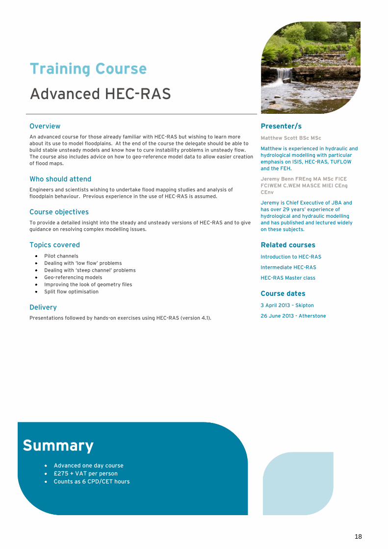
Advanced HEC-RAS
Overview
An advanced course for those already familiar with HEC-RAS but wishing to learn more
about its use to model floodplains. At the end of the course the delegate should be able to
build stable unsteady models and know how to cure instability problems in unsteady flow.
The course also includes advice on how to geo-reference model data to allow easier creation
of flood maps.
Who should attend
Engineers and scientists wishing to undertake flood mapping studies and analysis of
floodplain behaviour. Previous experience in the use of HEC-RAS is assumed.
Course objectives
To provide a detailed insight into the steady and unsteady versions of HEC-RAS and to give
guidance on resolving complex modelling issues.
Topics covered
Pilot channels
Dealing with ‘low flow’ problems
Dealing with ‘steep channel’ problems
Geo-referencing models
Improving the look of geometry files
Split flow optimisation
Delivery
Presentations followed by hands-on exercises using HEC-RAS (version 4.1).
Presenter/s
Matthew Scott BSc MSc
Matthew is experienced in hydraulic and
hydrological modelling with particular
emphasis on ISIS, HEC-RAS, TUFLOW
and the FEH.
Jeremy Benn FREng MA MSc FICE
FCIWEM C.WEM MASCE MIEI CEng
CEnv
Jeremy is Chief Executive of JBA and
has over 29 years’ experience of
hydrological and hydraulic modelling
and has published and lectured widely
on these subjects.
Related courses
Introduction to HEC-RAS
Intermediate HEC-RAS
HEC-RAS Master class
Course dates
3 April 2013 – Skipton
26 June 2013 - Atherstone
Summary Advanced one day course
£275 + VAT per person
Counts as 6 CPD/CET hours

19
Training Course
HEC-RAS Master Class
Overview
An advanced course for those already familiar with HEC-RAS but wishing to be able to build
models faster and also to use the software for river channel restoration or modification and
the design of flood protection and erosion protection schemes. A basic knowledge of using
HEC-RAS for steady state modelling is assumed.
Who should attend
Engineers and scientists undertaking large scale flood mapping studies or detailed channel
design calculations.
Course objectives
To provide a detailed insight into the steady and unsteady versions of HEC-RAS and to give
guidance on resolving complex modelling issues.
Topics covered
Using the channel improvement options
Hydraulic tables and their use in building stable unsteady models
Stable channel design
Bridge scour calculations
Water temperature modelling
Sediment transport modelling
Running models in batch mode
Delivery
Presentations followed by hands-on exercises using HEC-RAS (version 4.1).
Presenter
Jeremy Benn FREng MA MSc FICE
FCIWEM C.WEM MASCE MIEI CEng
CEnv
Jeremy is Chief Executive of JBA and
has over 29 years’ experience of
hydrological and hydraulic modelling
and has published and lectured widely
on these subjects.
Related courses
Introduction to HEC-RAS
Intermediate HEC-RAS
Advanced HEC-RAS
Course dates
Please contact us for details
T: +44 (0)1756 799919
Summary Advanced one day course
£275 + VAT per person
Counts as 6 CPD/CET hours

20
Training Course
Introduction to ISIS 1D
Overview
The course provides an introduction to the ISIS by Halcrow TM modelling suite and a more
detailed overview of the ISISTM Flow hydrodynamic module.
Who should attend
The course is designed for managers, engineers and modellers requiring an overview of the
capabilities of the ISISTM system and practical tuition on the use of ISISTM.
Course objectives
To provide an overview of the ISISTM software and to ensure that delegates can use the
software to build and run 1D hydrodynamic models.
Topics covered
Overview of the ISISTM suite
The Workbench – data entry and data manipulation
Model schematisation
Modelling open channel
Modelling bridges and culverts
Modelling weirs
Modelling spill units and reservoirs
Floodplain mapping and animation
Run-time problems
Interpreting results
Presenter
David Kearney BSc MSc
David is an experienced river modeller
and expert ISIS user.
Delivery
Practical exercises based on actual case
studies will be used as an integral part
of the teaching. Delegates will have
access to the ISISTM software for the
course. Example data files and worked
solutions will be provided to all
participants.
Related courses
River Modelling Methods
Introduction to ISIS MapperTM
Introduction to Flood Modelling using
TUFLOW
Course dates
17 and 18 April 2013 – Atherstone
1 and 2 October 2013 - Skipton
Summary Introductory two day course
£500 + VAT per person
Counts as 12 CPD/CET hours

21
Training Course
Introduction to ISIS Mapper
Overview
This one day course provides an introduction to ISIS Mapper by HalcrowTM, the new GIS
utility which forms part of ISISTM version 3.3. The course will show users how to get the
most out of this new application.
Who should attend
Those already familiar with ISISTM (or who have attended the Introduction to ISISTM course)
and who wish to learn how to link ISISTM (and TUFLOW) models to geo-reference datasets
such as Google Earth, DTMs and aerial photography.
Course outcomes
By attending the course delegates will learn to:
Use ISISTM Mapper to develop 1D models
Post process 1D model results using ISISTM Mapper
Use ISISTM Mapper to set up a simple linked ISISTM -TUFLOW model
Post process 2D model results using ISISTM Mapper
Topics covered
Extending cross-sections
Abstracting data for reservoir units
Import hydraulic model results from ISISTM and TUFLOW into ISISTM Mapper
Create floodplain maps and outlines from ISISTM and TUFLOW output
Linking to ArcGISTM
Presenter
David Kearney BSc MSc
David is an experienced river modeller
and expert ISIS user.
Delivery
Practical exercises based on actual case
studies will be used as an integral part
of the teaching. Delegates will have
access to the ISISTM software for the
course. Example data files and worked
solutions will be provided to all
participants.
Related courses
River Modelling Methods
Introduction to ISIS
Introduction to Flood Modelling using
TUFLOW
Course dates
Please contact us for details
T: +44 (0)1756 799919
Summary Introductory one day course
A comprehensive set of course notes together with example
£275 + VAT per person
Counts as 6 CPD/CET hours

22
Training Course
Introduction to Flood Modelling using TUFLOW – Part 1
Overview
This two day course provides delegates with hands-on use of two-dimensional flow
modelling and a basic understanding of coupled 1D-2D flow modelling using the ISIS and
TUFLOW software. TUFLOW is particularly suitable for modelling flow in coastal waters,
estuaries, rivers, floodplains and urban areas, where flow patterns are primarily 2D in
nature. Coupled ISIS-TUFLOW modelling seeks to combine the best attributes and
functionality of each industry-standard model to provide a software tool capable of
modelling the most complex flood flow problems.
The course provides delegates with an introduction to the mechanics of TUFLOW and guides
delegates through the development and evaluation of a TUFLOW model. No prior
knowledge of TUFLOW is assumed but previous experience of MapInfo Professional GIS
software would be beneficial.
NB Modellers that are proficient in 2D modelling, may wish to attend part 2 of this course
only.
Who should attend
Environmental modellers with reasonable IT and GIS skills.
Course outcomes – part 1
By attending the course delegates will:
Understand when TUFLOW can be used
Understand the basic mechanics of TUFLOW
Learn how to install TUFLOW and associated programs
Learn how to set up, run and evaluate a simple TUFLOW model
Gain an awareness of the advance features of TUFLOW
Understand the limitations of TUFLOW
Course outcomes - part 2
Gain an understanding of the basic principles of coupled 1D-2D flow modelling
Learn how to install the ISIS-TUFLOW link
Learn how to set up, execute and evaluate a simple ISIS-TUFLOW model
Gain an appreciation of the advantages and limitations of coupled 1D-2D flow models
Have the opportunity to discuss any specific modelling questions during the course
‘clinic’
Course structure
Introduction to TUFLOW
How to install TUFLOW and associated programs
Theory and model configuration
Exercise 1 – Model set-up and execution
Exercise 2 – Evaluation of model results
Course clinic – general discussion
Presenters
Dr Neil Hunter BSc MBCS
Neil is a Senior Analyst with JBA and an
experienced modeller. He has worked on
several key national R&D projects
looking at evaluating 2D model
performances.
Guy Dixon BSc MSc
Guy is an Analyst with JBA and has
worked on a range of flood mapping
studies using hydraulic modelling
packages such as ISISTM and TUFLOW.
Summary Introductory course
£275 + VAT per person per day
Discount for booking two days £500 + VAT per person
Counts as 6 CPD/CET points per day

23
Training Course
Introduction to Flood Modelling using TUFLOW – Part 2
Course structure
Part 1
Introduction to TUFLOW
How to install TUFLOW and associated programs
Theory and model configuration
Exercise – Model set-up and execution
Exercise – Evaluation of model results
Course clinic – general discussion
Part 2
Introduction to coupled 1D-2D modelling
Limitations of coupled 1D-2D models
Coupled ISIS-TUFLOW modelling
Exercise 1 – Model set-up and execution
Exercise 2 – Evaluation of model results
Course clinic/improving the cast study models
Summary
Reviewing TUFLOW models
The course includes information from the CIRIA guidance note ‘Development and flood risk –
guidance for the construction industry’ published in 2004 and Environment Agency
guidance on modelling Areas Benefiting from a Defence.
Presenters
Dr Neil Hunter BSc MBCS
Neil is a Senior Analyst with JBA and an
experienced modeller. He has worked on
several key national R&D projects
looking at evaluating 2D model
performances.
Guy Dixon BSc MSc
Guy is an Analyst with JBA and has
worked on a range of flood mapping
studies using hydraulic modelling
packages such as ISISTM and TUFLOW.
Delivery
This course will combine several
presentations and a single ‘start-to-
finish’ modelling case study that will
result in a fit-for-purpose TUFLOW
model. A short course ‘ clinic’ will also
provide delegates with the opportunity
to discuss specific modelling queries
Related courses
2D Hydraulic Modelling
Course dates
26 and 27 February 2013 – Skipton
3 and 4 July 2013 – Warrington
9 and 10 October 2013 - Newport
Summary Introductory course
£275 + VAT per person per day
Discount for booking two days £500 + VAT per person
Counts as 6 CPD/CET points per day

24
Training Course
2D Modelling for Project Managers
Overview
This new one day course is aimed at project managers or commissioners of 1D/2D and 2D
hydraulic models. Through this course, participants will gain confidence matching models
to specific project requirements, developing realistic costs and programmes for their
delivery, and maximising the value of their modelling investment.
Who should attend
Procurers of 2D modelling projects
Project managers with responsibility for delivery of 2D modelling projects
Course objectives
By completing the course, delegates will learn how to:
Match modelling approaches to specific project requirements
Develop realistic costs and programmes for their delivery
Provide intelligent challenge to typical modelling issues that may arise
Maximise the value of their (or their client’s) investment in modelling solutions
Topics covered
The course will help non-technical decision makers to:
Appreciate the range of applications for models (coastal, river, surface water, dam
break and integrated drainage studies
Select the right hydraulic modelling strategy for the job
Understand the process of building 1D/2D and 2D hydraulic models
Successfully procure and specify 2D hydraulic modelling commissions
Competently oversee the model building process, including the main risks and tried
and tested mitigation strategies
Understand the ‘headline’ pros and cons of particular commercial software packages
Make the most of 1D/2D and 2D model results, including analysis, checking and
visualisation of model results
The course is not tied to any particular software program and is intended to provide
transferable lessons that are relevant now and in the foreseeable future. However, the
course contents can be tailored to particular software (e.g. TUFLOW, ISIS-2D, JFlow,
InfoWorks, MIKE FLOOD).
Presenter
Dr Neil Hunter BSc MBCS
Neil is a Senior Analyst with JBA and an
experienced modeller. He has worked on
several key national R&D projects
looking at evaluating 2D model
performances.
George Baker BEng AIEMA CEnv IEng
MCIWEM C.WEM
George is an environmental engineer
specialising in flood risk management,
hydrometry (hydrometric site design +
project management), 3D visualisation,
reservoir inundation, survey
management, and the design, selection
and implementation of flood alleviation
schemes.
Delivery
The course is delivered as a series of
presenter-led workshop sessions that
are designed to provide maximum
opportunity for delegates to ask
questions and share any previous
experiences, lessons learned etc.
Related courses
Introduction to Flood Modelling using
TUFLOW
Course dates
Please contact us for details
T: +44 (0)1756 799919
Summary One day course
£275 + VAT per person
Counts as 6 CPD/CET hours

25
Training Course
WinDes: Use in Auditing
Overview
The course provides an overview of the use of the WinDes® drainage design software
developed by Micro Drainage Limited with a view to auditing drainage calculations.
Who should attend
Those who are involved in development control and in particular in the review of drainage
calculations and the output from WinDes® models. In-depth knowledge of civil engineering
and drainage design is not required (this is not a drainage design course).
Course outcomes
Following the course delegates should be able to:
Understand the capabilities of WinDes and the principles of urban drainage design
Know the key things to look for in auditing a WinDes® / urban drainage model
Topics covered
Estimating greenfield runoff (using IH124, ADAS345 and FEH)
Estimating development runoff (using IH124, ADAS345 and Wallingford Procedure)
Overview of the design, scheduling and analysis of drainage networks with WinDes®
Use of controls and the use of storage functions within WinDes®
Quick balancing storage estimates
Design and analysis of systems to comply with standards for Sewers For Adoption
Introduction to Sustainable Urban Drainage principles
WinDes® Source Control Module (infiltration, dry swales, ponds and tanks)
What to look for in Audits
Presenter
Daryl Taylor BEng MSc
Delivery
The course is delivered as a
combination of presentations and
practical exercises together with
discussion of case studies.
Course dates
Please contact us for details
T: +44 (0)1756 799919
Summary Two day course
£500 + VAT per person
Counts as 12 CPD/CET hours

26
Training Course
Survey for River Models
Overview
This one day course provides practical advice on planning, managing and carrying out
surveys for 1D and 2D river models. The course aims to inform surveyors of how river
models work and to inform modellers and managers of how a survey is planned and
executed. The course does not cover survey principles.
Who should attend
Land surveyors, hydraulic modellers and project managers involved in both topographical
surveys and model building/management.
Course outcomes
By attending the course delegates will:
Know how to specify and undertake an optimum survey for a river model
Appreciate possible pitfalls
Topics covered
Survey requirement for 1D and 2D river models
Location of model boundaries
Location of cross-sections
Survey of floodplains
Survey of hydraulic structures (bridges, culverts, weirs, sluices, pumping stations)
Survey outputs (drawings, model files)
Planning a survey (budget estimation, health and safety, access)
Successful survey management
Post-flood surveys
Integrating DTMs and DEMs with cross-section data
Preparing data for 2D models
Presenter
Robert Cowan BSc MCInstCES MRICS
Robert is a Chartered Land Surveyor
with over 21 years’ experience of
hydrographic survey for asset
management and river modelling.
Delivery
This course will be a combination of
presentations and practical exercises
together with discussion of case
studies.
Related courses
River Modelling Methods
2D Hydraulic Modelling
Environmental Responsibilities of Land
Drainage Authorities
Introduction to ArcGISTM v10
Course dates
26 March 2013 - Warrington
Related publications
The text book ‘Floodplain Modelling
using HEC-RAS’ is a useful addition to
this course see Publications.
Summary Introductory one day course
£275 + VAT per person
Counts as 6 CPD/CET hours

27
Hydraulic Structures
Training Course
Bridge and Weir Design
Overview
One day course providing practical advice on the hydraulic design of bridges and weirs. This
course is ‘stand alone’, but also follows on from the Bridge Scour course to provide the
second day of a two day course.
Who should attend
The course is designed for any professional who is likely to be involved in the design of
hydraulic assessment of bridges and weirs. It is also relevant to managers and regulators
involved in consenting works in watercourses.
Course outcomes
Following the courses, delegates should have a good appreciation of the principles of bridge
and weir hydraulic design plus knowledge of environmental, maintenance and health and
safety issues. Details of current key references and best practice guides will be provided.
The exercises will include hand calculation for weir design and computer analysis of bridge
hydraulics/afflux.
Topics covered
Bridges
Bridge types
Types of bridge flow
Methods of hydraulic analysis
Hydraulic design principles
Scour
Design and construction issues
Health and safety issues
Environmental issues
Maintenance
Debris
Computer modelling
The course includes information from the following guidance
Highways Agency – Design Manual for Road Bridges
Environment Agency River Weirs – Good Practice Guide
Environment Agency – Bridge Afflux System
Presenter
Jeremy Benn FREng MA MSc FICE
FCIWEM C.WEM MASCE MIEI CEng
CEnv
Jeremy is Chief Executive of JBA and
has over 29 years’ experience of
hydrological and hydraulic modelling
and has published and lectured widely
on these subjects.
Delivery
This course will be a combination of
presentations and practical
exercises/calculations together with
discussion of case studies.
Related courses
Bridge Scour
Culvert Design and Operation
Course dates
Please contact us for details
T: +44 (0)1756 799919
Summary Introductory one day course
£275 + VAT per person
Counts as 6 CPD/CET hours
Weirs
Weir types
Types of weir flow
Methods of hydraulic analysis
Hydraulic design principles
Design and construction issues
Environmental issues
Maintenance
Computer modelling
Rehabilitation case studies

28
Training Course
Culvert Design and Operation
Overview
The design and operation of culverts is critical to effective flood risk management.
Inadequate design or neglect can lead to severe flooding. This training, based on CIRIA C689
Culvert design and operation guide, provides guidance on the whole-life cycle of culverts,
recognising that there is an enormous stock of existing culverts of various types, sizes, age
and condition.
Developed by CIRIA in conjunction with JBA Consulting and Royal Haskoning, this two day
training course provides asset managers and designers with a comprehensive understanding
of the whole-life cycle of a culvert, providing guidance on inspection, assessment,
maintenance and renewal of existing culverts, as well as their design. The training is
underpinned by the principles of whole-life asset management and a systems approach to
drainage. Guidance will be given on cutting edge hydraulic assessment techniques, taking
account of developments in hydrology and hydraulic analysis.
Who should attend
The course will be relevant to infrastructure asset managers, flood risk and drainage
engineers, landscape architects, planners, architects, and those working in or with
environmental regulators, local authorities, highway authorities, developers, consultants and
contractors.
Course outcomes
Following the course, delegates will have a good appreciation of the factors affecting culvert
design and the principles of hydraulic design and assessment, as well as good design practice
and methods of improving hydraulic performance. Delegates will be given experience in hand
calculation methods and advice on computer software for culvert assessment.
Topics covered
Setting performance requirements
Hydraulic assessment of culverts and screens
Available computer software
Policy and legal background
Environmental considerations
Health and safety requirements
Good design practice
Improving hydraulic performance
Presenters
Day 1 – Culvert whole-life management
Matthew Balkham – Senior Engineer,
Royal Haskoning
Matthew has significant experience in
river engineering projects and was the
lead author of the CIRIA Culvert design
and operation guide.
Day 2- Culvert design
Dr Amanda Kitchen MEng CEng MICE
Amanda is a chartered engineer with 15
years’ experience of water engineering
including flood risk management and
river and canal engineering. She was a
co-author of the 2010 update to the
CIRIA Culvert design and operation
guide.
Delivery
The course will be delivered through
presentations and exercises, some of
which are numerical.
Course dates
For further information and to book a
place on the course see
http://www.ciria.org/training
This course includes information from
the following guides
CIRIA (2010) Culvert Design and
Operation Guide
Environment Agency (2009) Trash and
Security Screen Guide
Office of Public Works (Section 50
Design Guide)
Summary Two day course
CIRIA Core members/SMEs/Local Authority member £495 + VAT
Non members £595 + VAT
Counts as 12 CPD hours

29
Training Course
Bridge Scour
Overview
One-day training course on the prediction of scour at bridges over water or floodplains due to
hydraulic action and the management of high risk bridges, drawing on international good
practice guidelines. The UK has a large stock of historic bridges with shallow foundations
which can be susceptible to undermining by scour. The prediction of scour and management
of vulnerable bridges can help to prevent the catastrophic failures seem in Cumbria in 2009,
whilst ensuring cost-effective use of resources.
Who should attend
Professionals involved in the assessment of scour or the design of scour protection works at
existing bridges, as well as the design of new bridges over water or floodplains. Owners and
asset managers responsible for the management of bridges over water or floodplains.
Course outcomes By attending course delegates will gain:
An appreciation of the mechanisms of bridge scour and factors affecting scour
An awareness of notable bridge failures and lessons learnt
An awareness of guidance documents, their evolution and limitations
Experience in qualitative and quantitative scour assessment using methods from a
range of guidance documents, including wide abutments
Experience in prioritising and choosing scour management strategies, including flood
warning and emergency response, specialist assessment, monitoring and scour
protection
Awareness of hydrodynamic forces on bridges
Topics covered Mechanisms of bridge scour
Historic bridge failures and lessons learnt
Guidance documents
Data gathering and site inspection
Predicting contraction scour
Predicting local scour at piers and abutments
Assessing priority rating
Scour management strategies
This course includes information from the following guidance
Network Rail Standards and EX2502
Rail Safety and Standards Board Safe management of railway structures
Design Manual for Roads and Bridges BA 74/06
Manual on scour at bridges and other hydraulic structures (CIRIA C551)
Evaluating scour at bridges (HEC-18) (United States Federal Highway Administration)
Bridge scour (Melville and Coleman, 2000)
Presenters
Dr Amanda Kitchen MEng CEng MICE
Amanda is a chartered engineer with 15
years’ experience of hydraulic
engineering and flood risk management.
Her post-graduate studies examined the
mechanism of local scour at bridge
piers.
Delivery
The course will be delivered through
presentations and exercises, some of
which are numerical.
Related courses
Bridge and Weir Design
Culvert Design and Operation
Course dates
5 March 2013 - Skipton
Summary One day course
£275 + VAT per person
Counts as 6 CPD/CET hours

30
Hydromorphology
Training Course
Introduction to Hydromorphology and Fluvial Geomorphology
Overview
Knowledge of river hydromorphology and geomorphological dynamics is essential for
sustainable river design and management. It facilitates the assessment of risk, increases
understanding within the Environmental Impact Assessment process, helps alleviate
flooding impacts and informs in-stream flow requirements system restoration and ecology.
The course has three main objectives:
To introduce a geomorphological approach to sustainable river management
To present the methods used in a geomorphological assessment and fluvial audit
To discuss the situations where river geomorphology can be usefully applied and to
indicate where further guidance/information can be found
Who should attend
The course is aimed at practitioners requiring a basic understanding of geomorphology and
hydromorphology and value to those who are seeking a more catchment-wide perspective
for flood relief planning, Water Framework Directive related compliance and strategic
restoration studies. The course is also an opportunity to discuss with the course presenters
and other attendees, the best practice approaches to (and experiences in) applying methods
in river geomorphology/hydromorphology.
Topics covered
Introduction to river geomorphology/hydromorphology and applications appraisal
The geomorphological approach to river management
UK river types and their significance
Best practice field assessment methods
Introduction to geomorphological design guidance
Introduction to monitoring and post-project
Discussion sessions
Bespoke course option
This course can be combined with the Practical River Functioning and Restoration Guidance
field visit to make a two day course which can be tailored to specific requirements. For
further details and costs contact Felicity Clarke, Training Co-ordinator.
Presenter
Dr George Heritage BSc
George is Head of Hydromorphology
with JBA. He is one of the country’s
foremost experts on fluvial systems
with 25 years of experience linked to
hydromorphic assessment; process
based natural channel design and WFD
compliant practical design
implementation. He specialises in
understanding the sediment transport
system and its effect on channel form
and river response.
Delivery
The structure of the course comprises a
series of presentations and discussions.
The presentations will focus primarily
on the geomorphological approach to
river management and field assessment
methods. Computer programs form
part of the exercises.
Course dates
11 April 2013 – Skipton
18 July 2013 – Atherstone
22 October 2013 - Warrington
Summary Introductory one day course
£275 +VAT per person
Counts as 6 CPD/CET points

31
Training Course
Practical River Functioning and Restoration Guidance – Field Visit
Overview
River managers, riparian land owners, river users and river guardians are faced with local
river instability issues on a day to day basis. Often these issues are difficult to solve or
manage due to their inherent complexity with cause and effect difficult to establish.
Increased awareness and understanding of river form and function would help in this regard
and this is best achieved practically through on-site training. This one day field based
course offers participants the opportunity to build this understanding whilst receiving
advice on a local issue or problem.
A site visit can be organised to a site of the participants choosing linked to a specific river
related issue and an experienced geomorphologist will take the group through the
evaluation progress to define cause and effect and suggest sustainable solutions. The day
will introduce simple readily usable tools to determine appropriate hydromorphology for a
given river, working with current processes to predict and work with probable river
response.
This field day will incorporate full consideration of the Water Framework Directive (WFD) as
one of the most significant pieces of legislation that steers planning and permitting
authorities, providing an overview of what biological, hydromorphological and physio-
chemical elements define the status of a waterbody.
The field visit has four main objectives:
To ensure that we make the most of the opportunities contained within the WFD,
linked to improving the status of our rivers
To introduce simple methods to read our rivers and apply the knowledge to dynamic
channel restoration
To present practical techniques for identifying river issues and probable river
response
To review potential solutions to specific river issues
Who should attend
The course is aimed at anybody with specific or more general river related management
issues and who seek a sustainable environmentally acceptable solution for their problems.
Topics covered
The field visit will be centred around a bespoke issue/set of issues defined by the
participants.
Presenters
Dr George Heritage BSc
George is Head of Hydromorphology at
JBA. He is one of the country’s
foremost experts on fluvial systems,
with 25 years experience linked to
hydromorphic assessment; process
based natural channel design and WFD
compliant practical design
implementation. He specialises in
understanding the sediment transport
system and its effect on channel form
and river response.
Sebastian Bentley BSc FRGS MCIWEM
C.WEM
Seb is a geomorphologist who
specialises in river restoration. He has
developed numerous river restoration
schemes for a variety of clients. He has
successfully designed restoration
schemes that work with natural
processes to fulfil multiple local and
WFD targets.
Delivery
The structure of the course comprises a
field site visit for no more than eight
persons, practical activities and group
discussions.
Summary One day course comprising field site visit
For further information contact:
T: 01756 799919

32
Coastal Flooding
Training Course
Coastal Flood Modelling and Extremes
Overview
This one day course provides delegates with an introduction to the processes that influence
sea level, including tides, storm surges and waves. The course also provides an introduction
to the methods available for estimating extreme sea levels and wave heights and producing
design tidal-graphs for flood inundation modelling. Finally, the course introduces the
approaches available for estimating wave overtopping discharges.
Who should attend
The course is intended for those who will be involved in estimating extreme sea levels and
wave heights for applications such as flood mapping, flood warning and Flood Risk
Assessments. It will also be of interest to professionals and managers who are reviewing
coastal studies, or to those who wish to update their knowledge of extreme sea level
science.
Course outcomes
At the end of this course, delegates will:
Have a fuller appreciation of the processes that lead to coastal flood risk and the
manner in which these processes interact
Understand the complexities involved in estimating extreme sea level and wave
heights and be able to carry out basic calculations
Gain the necessary background required to review extreme sea level and wave height
estimates
Topics covered
Presenter
Dr Mark Lawless BSc MSc CSci CEnv
MCIWEM C.WEM
Mark leads JBA’s Coastal Flood Risk
Management Team, and has developed
and applied expertise related
oceanography, extreme sea level
science, coastal flood modelling and
coastal sea defences.
Delivery
The course will be a combination of
presentations and hands-on exercises.
The exercises will involve the analysis of
sea level and wave data, the calculation
of extreme sea levels and the
estimation of wave overtopping
discharges.
Course dates
16 April 2013 – Skipton
4 September 2013 – Haywards Heath
Summary Introductory one day course
£275 + VAT per person
Counts as 6 CPD/CET hours
Extreme sea level analysis
Analysis of gauge data
Statistical estimation of extreme
sea levels (including GEV and
joint probability approaches)
Estimation of wave
characteristics
Dependence of extreme storm
surge and wave events
Climate change guidance
Coastal processes
Astronomical tides
Storm surges
Wave generation, propagation and
transformation
Interaction of tides, surges and waves
Sources of data available
Wave overtopping discharges
Wave run-up and overtopping of flood
defences
Introduction to the European
Overtopping Manual (Eurotop)
techniques

33
Hydrology
Training Course
Understanding and Assessing Hydrological Drought
Overview
This one-day training course deals with low flow occurrence in rivers in the UK and Ireland.
The course has three main objectives:
To provide an understanding of the flow processes for low flows
To provide an overview of the standard methods of analysing low flows
To provide some understanding and guidance of when and where these methods
should provide useful results
Who should attend
This course is intended for non-specialists who require an overview of the hydrology of low
flows and an introduction to the standard techniques of low flow analysis. It is particularly
relevant to those involved in water resource management, the ecological management of
rivers, licensing of abstractions or discharges to rivers of chemicals or other potential
pollutants.
Course outcomes
After the course delegates will understand:
Hydrological processes and their link to low flows
Flow measurement during low flow conditions
Techniques for analysing low flows
Impacts of low flow
Topics covered
Hydrological and anthropogenic controls on low flows:
Controls on low flow development and how these vary for different UK rivers
Discussion of impacts of river abstractions and reservoir releases on flow regimes
How low is the flow?
Issues associated with measuring river flows during periods of low flow. We will also
look at flow naturalisation and basic data processing
Low flow analysis and characterisation:
Application of key techniques for analysing low flows, including flow duration curves,
flow accretion and depletion relationships, baseflow separation, low flow severity
indices and low flow event frequency estimation. Methodologies for low flow
estimation in ungauged catchments are also briefly covered
Ecological impacts, water resource and water quality management and navigation
Presenter
Dr Maxine Zaidman BSc CEnv MCIWEM
C.WEM
Maxine is a hydrologist with over 17
years’ experience in the water industry.
Her specific areas of expertise include
quantification of hydrological extremes,
hydraulics, hydrometrics and
groundwater-surface water interactions
Delivery
The course will be presented in four
sessions with case studies and hands-on
exercises for each of the sessions. The
hands-on exercises will assume a
working knowledge of Microsoft Excel.
Help will be provided for the exercises.
Related course
Urban Hydrology
Introduction to Management of Sensitive
Water Environments
Course dates
Please contact us for details
T: +44 (0)1756 799919
Summary Introductory one day course
£275 + VAT per person
Counts as 6 CPD/CET hours

34
Training Course
Flood Hydrology for Non-Specialists
Overview
This two day course will consider the hydrological processes involved when river flows are
high, especially when in flood conditions. The course is an introduction to the issues. It
assumes little previous knowledge of hydrology beyond what most have received during,
possibly long forgotten, lessons in school or early university courses. The purpose is to
introduce some of the standard techniques used when carrying out flood design studies but
in the context of the flow processes involved so that some understanding of the limitations,
as well as the strengths, of these techniques will be developed. The course covers all the
main methods within the FEH but excludes more specialised topics such as application to
small, urban or permeable catchments. These topics, together with more exercises and
case studies, are covered in JBA’s two day Flood Estimation Handbook course.
Who should attend
Design engineers, modellers from consultancies involved in flood risk management, highway
and urban drainage designers, development control and consenting officers.
Course objectives
To consider the hydrological processes involved when river flows are high, especially
when in flood conditions
To introduce some of the standard techniques for flood design studies
To apply techniques to real problems
To develop understanding of the limitations, as well as the strengths, of these
techniques
Topics covered
Day 1
Flow processes within the catchment during high flow conditions
Measurement of river flows and rainfall and some standard processing methods for
these data
Statistical analysis of high river flow records
Flood estimation in small catchments
What to look for when reviewing flood estimates
Day 2
Introduces the Flood Estimation Handbook, which is widely used across the UK for
estimating
Presenter/s
Dr Maxine Zaidman BSc CEnv MCIWEM
C.WEM
Maxine is a hydrologist with over 17
years’ experience in the water industry.
Her specific areas of expertise include
quantification of hydrological extremes,
hydraulics, hydrometrics and
groundwater-surface water interactions
Duncan Faulkner MSc DIC MA FCIWEM
C.WEM CSci
Duncan is a specialist in flood hydrology
and has extensive experience both in
research projects and a large number of
consultancy studies. He has developed
JBA’s and the Environment Agency
training courses on flood estimation
methods. He is a former member of the
Flood Estimation Handbook research
team and author of the Environment
Agency’s Flood Estimation Guidelines.
Delivery
This course will be a combination of
presentations, hands-on exercises and
case studies.
Related courses
Flood Estimation Handbook (FEH)
Urban Hydrology
Sustainable Drainage Systems (SuDS)
Course dates
Please contact us for details
T: +44 (0)1756 799919
Summary Two day course
£500 + VAT per person
Counts as 12 CPD/CET hours

35
Training Course
Flood Estimation Handbook
Overview
This course provides hands-on use of the Flood Estimation Handbook (FEH) methods. It
includes all the latest guidance and findings from research, and uses version 3 of
WINFAP-FEH released in September 2009.
Who should attend
The course is aimed at those who will be using the FEH methods to estimate design flows.
Basic knowledge of flood hydrology is expected.
Course outcomes
Understand the key principles of the FEH approach to flood estimation
Understand the steps involved in the FEH statistical and ReFH methods
Know how to use the FEH CD-ROM, WINFAP-FEH and the ReFH spreadsheet
Know what to consider when selecting an appropriate FEH method
Be aware of some of the options for dealing with unusual catchments
Topics covered
Overview of the FEH
Finding and checking flood data
FEH Statistical Method
FEH Rainfall-Runoff Method
ReFH method
Choice of method
Applying FEH to urban catchments
Applying FEH to permeable catchments
Alternative methods for small catchments
Reservoir routing
Applying FEH and recording calculations
Case study exercise
Delivery
Presentations, including a brand new interactive visual demonstration of the FEH Statistical
method. Hands-on exercises using the FEH CD-ROM, WINFAP-FEH(v3) and the ReFH
spreadsheet. Group discussions and use of spreadsheets for simple calculations
Presenter/s
Duncan Faulkner MSc DIC MA FCIWEM
C.WEM CSci
Duncan is a specialist in flood hydrology
and has developed JBA’s and the
Environment Agency training courses
on flood estimation methods. He is a
former member of the Flood Estimation
Handbook research team and author of
the Environment Agency’s Flood
Estimation Guidelines.
Oliver Francis MEng MSc
Oliver has an MSc in Hydrology from
Imperial College London and seven
years’ experience of research and
consultancy in hydrological modelling
and flood estimation.
Related courses
The Revitalised Flood Hydrograph
Method
Flood Estimation Handbook - Refresher
Urban Hydrology
Flood Hydrology for Non-Specialists
The PDM Model – Theory & Application
for Flood Forecasting
Flood Risk Assessment
Course dates
20 and 21 March 2013 – Haywards
Heath
6 and 7 June 2013 – Skipton
11 and 12 September 2013 - Warrington
Summary Two day course
£550 + VAT per person
Counts as 12 CPD/CET hours
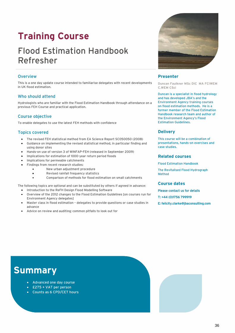
36
Training Course
Flood Estimation Handbook Refresher
Overview
This is a one day update course intended to familiarise delegates with recent developments
in UK flood estimation.
Who should attend
Hydrologists who are familiar with the Flood Estimation Handbook through attendance on a
previous FEH Course and practical application.
Course objective
To enable delegates to use the latest FEH methods with confidence
Topics covered
The revised FEH statistical method from EA Science Report SC050050 (2008)
Guidance on implementing the revised statistical method, in particular finding and
using donor sites
Hands-on use of version 3 of WINFAP-FEH (released in September 2009)
Implications for estimation of 1000-year return period floods
Implications for permeable catchments
Findings from recent research studies:
New urban adjustment procedure
Revised rainfall frequency statistics
Comparison of methods for flood estimation on small catchments
The following topics are optional and can be substituted by others if agreed in advance:
Introduction to the ReFH Design Flood Modelling Software
Overview of the 2012 changes to the Flood Estimation Guidelines [on courses run for
Environment Agency delegates]
Master class in flood estimation – delegates to provide questions or case studies in
advance
Advice on review and auditing; common pitfalls to look out for
Presenter
Duncan Faulkner MSc DIC MA FCIWEM
C.WEM CSci
Duncan is a specialist in flood hydrology
and has developed JBA’s and the
Environment Agency training courses
on flood estimation methods. He is a
former member of the Flood Estimation
Handbook research team and author of
the Environment Agency’s Flood
Estimation Guidelines.
Delivery
This course will be a combination of
presentations, hands-on exercises and
case studies.
Related courses
Flood Estimation Handbook
The Revitalised Flood Hydrograph
Method
Course dates
Please contact us for details
T: +44 (0)1756 799919
Summary Advanced one day course
£275 + VAT per person
Counts as 6 CPD/CET hours

37
Training Course
The Revitalised Flood Hydrograph Method
http://www.jbaconsulting.co.uk/node/647
Overview
The Revitalised Flood Hydrograph Method (ReFH) is a technique for estimating design
hydrographs, designed to overcome many of the problems and limitations of the FEH
rainfall-runoff method. It has superseded the FEH rainfall-runoff method for most
applications in England, Wales and Northern Ireland. The course covers ReFH in detail.
Who should attend
The course is designed for those who already have some understanding of FEH methods (for
example, through attending a Flood Estimation Handbook course) and would like to update
their knowledge to the latest methods and guidance.
Course outcomes
Delegates will have a more detailed understanding of the theory behind ReFH and the ReFH
Design Flood Modelling Software.
Topics covered
Reasons for the development of ReFH
Theory of the ReFH model
Application of ReFH for estimating design events
Simulation of observed events
Estimating model parameters from catchment descriptors and flood event data
Cautionary notes and situations where ReFH performs poorly
Using the ReFH software (both the spreadsheet and the full software package)
Choice between ReFH and alternative methods
Comparison of results from ReFH and other methods
Presenter
Duncan Faulkner MSc DIC MA FCIWEM
C.WEM CSci
Duncan is a specialist in flood hydrology
and has developed JBA’s and the
Environment Agency training courses
on flood estimation methods. He is a
former member of the Flood Estimation
Handbook research team and author of
the Environment Agency’s Flood
Estimation Guidelines.
Delivery
This course will be a combination of
presentations and hands-on exercises
which will use the ReFH spreadsheet
and the full ReFH Flood Modelling
software.
Related courses
Urban Hydrology
Flood Estimation Handbook (FEH)
Course dates
Please contact us for details
T: +44 (0)1756 799919
Summary One day course
£275 + VAT per person
Counts as 6 CPD/CET hours

38
Training Course
The PDM Model – Theory and Application for Flood Forecasting
Overview
This course, which covers the theory and application of the Probability Distributed Moisture
rainfall-runoff model (PDM), concentrates on applications of the PDM in real time flood
forecasting, and the principles of the PDM and how it can be applied effectively for flood
forecasting. Lessons and exercises are based on the theory of the PDM as published by its
original authors at the Centre for Ecology and Hydrology (CEH). The course includes
hands-on use of a version of the PDM model developed by JBA. The course material is
therefore applicable to the PDM as deployed within the Environment Agency’s National
Flood Forecasting System (NFFS).
Who should attend
Flood forecasting specialists, hydrologists or engineers with an interest in continuous
rainfall-runoff modelling. The course is technically rigorous, although it is not necessary to
have prior experience with the PDM.
Course outcomes
Delegates will gain expertise in calibration of the PDM with an emphasis on real time flow
forecasting applications, backed up by theoretical understanding of the model structure and
parameters.
Topics covered
PDM Theory
Model structure
How the ‘original’ PDM works
What the PDM’s parameters mean
Strategies for calibration
Sensitivity to model parameters
Assessing model performance
Specific issues for forecasting
Presenter
Paul Wass BA MSc MBCS MCIWEM
C.WEM
Paul is a professional hydrologist with
nine years’ experience of real-time flood
forecasting model development and the
PDM model.
Delivery
The course will be a combination of
presentations and hands-on exercises
involving model calibration.
Related courses
Flood Estimation Handbook (FEH)
Course dates
Please contact us for details
T: +44 (0)1756 799919
Summary Introductory one day course
£275 + VAT per person
Counts as 6 CPD/CET hours
Practical application
Data preparation
Designing a forecasting
network
Implementation of PDM
within ISIS, FloodWorks &
NFFS/FEWS

39
Training Course
Urban Hydrology
Overview
This course provides an introduction to urban hydrology and is aimed at those involved with
the design and study of urban drainage systems, especially those based on Sustainable
Drainage principles.
Who should attend
The course is designed for engineers, modellers and hydrologists who undertake urban
drainage designs and Flood Risk Assessments for urbanised catchments. No prior
knowledge of hydrology is assumed. Some awareness of Flood Estimation Handbook/Flood
Studies Report and Rational Method techniques would be useful, but is not essential.
Course outcomes
After the course delegates will have an appreciation of:
Standard techniques for estimating design flows in urban drainage systems
How to know which method to choose
How to know what is good practice and which guidance documents to use
Topics covered
Conceptual model of urban and rural runoff processes
Estimating ‘greenfield’ runoff
Critical storm duration
Urban drainage runoff estimation techniques
Limitations of the above methods
Overview of Infoworks-CS, WinDes and music software
Presenter
Dr Jenni Essex BSc MSc CEnv
MCIWEM C.WEM
Jenni is a highly qualified hydrologist
with over eight years’ experience in the
fields of flood risk management and
strategic flood risk mapping, and
expertise in hydrological analysis,
catchment response mechanisms, and
hydrometric network review.
Delivery
The course will be a combination of
lectures and practical exercises.
Related courses
Flood Estimation Handbook
Flood Risk Assessment
The Revitalised Flood Hydrograph
Method
Flood Hydrology for Non-Specialists
Sustainable Drainage Systems
Stormwater Quality Modelling with
‘music’
Course dates
Please contact us for details
T: +44 (0)1756 799919
Summary Introductory one day course
£275 + VAT per person
Counts as 6 CPD/CET hours

40
Software Training
Training Course
Introduction to ArcGIS v10
Overview
This one day introductory course will provide a comprehensive overview of the display and
analysis capabilities of the ArcGISTM Geographical Information System (GIS) version 10.
Who should attend
This course is designed for managers, engineers and technicians with little or no experience
of GIS systems who are required to gain an understanding of the ArcGISTM environment.
Topics covered
Displaying data in ArcMap TM
Querying data and selecting features
Spatial data types and ArcCatalogTM
Working with tables
Creating and editing data
Spatial analysis
Layouts
Background maps and registering
Images
Presenter
Peter Rogers BSc MSc MBCS
Peter has over 10 years' experience in
Geographical Information Systems and
software development for a variety of
clients, including the Environment
Agency, Network Rail and Norwich
Union.
Delivery
This course will be a combination of
presentations and practical exercises.
Related courses
Survey for River Models
Course dates
Please contact us for details
T: +44 (0)1756 799919
Summary Introductory one day course
£275 + VAT per person
Counts as 6 CPD/CET hours
Software Training

41
HEC-RAS Software
Overview HEC-RAS was developed by the US Army Corps of Engineers at the Hydrological Engineering Center. It is an integrated system of hydraulic modelling software designed for the 1D hydraulic analysis of open channels, bridges and culverts. The software allows the simulation of flow in a variety of standard or user-defined channels. The program will resolve both subcritical, supercritical and mixed flow regimes and models both branched (dendritic) and looped channel networks. The system comprises a Graphical User Interface (GUI) steady and unsteady hydraulic analysis components, data storage and management capabilities, graphics and reporting facilities. HEC-RAS replaces the widely used programs HEC-2 and UNET. Version 4.1 includes both steady and unsteady flow modules.
Capabilities The general data formats of the two computational modules are identical and it is possible to use the same system geometry for a steady or unsteady simulation. The software is capable of modelling the following hydraulic features:
Weirs and bridges Culverts, sluices and gates Levees/flood banks Branched/looped channels Inflows/outflows Floodplains Channel encroachments Ineffective/static flow areas Blockages to the channel Channel improvement Ice formation Manning’s and Colebrook-White roughness equations
New features (version 4.1) Several new simulation features have been added to the program since the 4.0 release. Version 4.1 of HEC-RAS includes the following new features:
New RAS Mapper Floodplain Delineation Capabilities Hydrologic Routing Reaches within an unsteady flow model run New Flow Data and Boundary Conditions Editor for unsteady flow Contraction/expansion losses for unsteady flow Minor losses for unsteady flow New junction hydraulics option for unsteady flow Groundwater leakage for storage areas Water Quality Modelling enhancements Sediment Transport Modelling enhancements New User’s Manuals and Help System
Specification
Maintenance
Prices include 12 months’ maintenance.
12 months’ technical support is also
available for £250 per licence.
CD-ROM includes
HEC-RAS Software (v4.1)
GeoRAS (for ArcViewTM, ArcInfoTM and
ArcGISTM
Installation instructions
User manual
Hydraulic reference manual
Applications guide
Example application data files
GeoRAS user guide
System Requirements
32Mb RAM (128Mb for GeoRAS)
12Mb hard disk space
WindowsTM 95/98/NT.2000
Relevant JBA Training
Courses
Introduction to HEC-RAS
Intermediate HEC-RAS
Advanced HEC-RAS
HEC-RAS Master Class
Costs
Single user licence: £100 +VAT CD-ROM and Adobe Acrobat
manuals
Multi-user licence: £250 + VAT CD-ROM and Adobe Acrobat
manuals
Full payment in advance is required for all software
Supporting Materials

42
Publications
Floodplain Modelling Publisher Haestad Methods Inc. Price: £125 plus postage and packing Authoritative text book written by modellers for modellers (including JBA staff). Although concentrating on HEC-RAS and HEC-HMS, much of the advice is generic and applicable to other river models. Topics covered, with examples and exercises include:
Modelling structures
Model documentation
Flood control measures
Design of Flood Storage Reservoirs Publisher CIRIA Price: £40 plus postage and packing A comprehensive reference book for above ground flood storage reservoir feasibility, planning and design. Includes sections on water quality and maintenance aspects of storage facilities.
Roughness Characteristics of New Zealand Rivers Dr Murray Hicks and Peter Mason Price: £75 plus postage and packing This book presents information on roughness coefficients and related hydraulic parameters for 78 reaches representing a broad range of rivers. The information given for each example reach includes photos, cross-section and plans, bed and bank descriptions, and bed surface material plus tables and plots showing how the Manning and Chezny roughness coefficients vary with flow.
Visual Hydrology Peter Manz Price: £40 plus postage and packing This primer for hydrologists explains the structure of object-oriented programming. It provides the source code and worked examples for various flood estimation, hydraulic and water resource problems. Requiring only a basic knowledge of Microsoft ExcelTM, this primer is a valuable resource to students, research workers and consulting engineers in the water sector.
Culvert design and operation guide (C698) Price: £130 available from http://www.ciria.org
The CIRIA C689 Culvert design and operation guide published in spring 2010 replaces the CIRIA R168 Culvert design manual. The new guide is a comprehensive reference document, reflecting the importance of operation, as well as design in effective flood risk management. The guidance covers the life cycle of a culvert, from the planning, design and construction of new culverts, the inspection, assessment and repair of existing culverts, and eventual demolition and replacement. Updated hydrological and hydraulic assessment techniques are given, together with worked examples, case studies, legal and environmental advice.
Summary These publications are available from JBA
Contact Felicity Clarke, Training Co-ordinator
T: +44 (0) 1756 799919 E: [email protected]
Postage and packaging charge of £10 is applicable
Full payment is required in advance for all publication
Supporting Materials

43
Booking Details
Course bookings
You can book a course online at www.jbaconsulting.com. We will then confirm your booking
in writing and issue a formal invoice.
Provisional bookings can be made by contacting:
Felicity Clarke
T: + 44 (0)1756 799919
Please remember that places on the courses are limited. We normally take no more than 12
delegates per course to allow maximum contact time.
Training course booking conditions
Places will be held for 4 weeks, or until 2 weeks before the proposed course date
(whichever comes sooner).
An official purchase order or payment for the full fee is required to confirm a booking.
Without either of these we are, unfortunately, unable to confirm a place on the course.
A charge of 25% of the course booking fee will be made for any confirmed booking
cancelled within 2 weeks of the course date. No refund will be available for any
courses cancelled less than 2 weeks before the course date.
A discount is available for multiple courses made in one booking for the same person.
However in the event of cancellation of an individual course, the full course fee will be
applicable and an invoice will be submitted for the difference.
For bookings transferred to another course date at the delegate’s request, a transfer
fee of 10% of the course fee will apply.
Payment can be by cheque, direct money transfer or by credit card. For credit card
sales please contact us.
Publications and software sale conditions
Full payment is required in advance for all publications and software.
Disclaimer
Should a presenter advertised in the catalogue be unavailable for any reason, an alternative
presenter of equal professional experience will be allocated.
Standard course fees
One day course
£275 + VAT per person
Two day course
£500 + VAT per person
The price for an individual delegate
booking several one day JBA training
courses would be as follows
Two courses £500 + VAT
Three courses £750 + VAT
Four courses £900 + VAT
These prices include lunch and
morning/afternoon refreshments
A comprehensive set of course notes
including spreadsheets and worked
examples are provided.
Booking Details

www.jbaconsulting.com South Barn Broughton Hall Skipton North Yorkshire BD23 3NN T: 01756 799919 E: [email protected]