trail dust - oregon trail, idahoidahoocta.org › trail_dust_volume_31_no_4_2019_october.pdfnote:...
TRANSCRIPT

1
Newsletter of the Oregon-California Trails
Association, Idaho Chapter
Vol. XXXI Issue 4 Nancy Briggs, Editor, October 2019
Calendar of Events for 2020
Feb 21st – 23rd OCTA Symposium, Yuma, AZ Early May IOCTA outing City of Rocks and California Trail
May 9 IOCTA Spring Meeting, Burley June 7th National Trails Day
Sep 19th – 23rd OCTA Convention, Elko, NV Early October IOCTA Fall Meeting
Note: Paper copies of this Trail Dust may omit a few pages due to the large
size of this edition. To see the complete edition, please visit the chapter website at www.IdahoOCTA.org or provide us an email to send you a link.
Trail Dust
Contents Calendar for 2020 1 Message from the President 2 Tour of Jeffreys/Goodale Cutoff 3 Osher Institute at BSU 6 OCTA Annual Convention 6 Oregon Trail Recreation Area, Ada County 8 Devil’s Grave on the California Trail 9 Diaries Across Idaho 10 IOCTA Officers and Directors 12

2
Message from the President By Jerry Eichhorst
Summer flew by and October is almost over with fall well under way. The leaves on the trees are changing color and freezes have killed off the garden. It will soon be time to settle in and watch football and research the Oregon Trail.
Continued meetings with the Northwest Boise Neighborhood Association and the discovery of maps and older aerial photographs have led to the conclusion that the
possible section of Goodale’s North route identified by local residents and brought to our attention earlier in the year is likely not the route Tim Goodale traveled in 1862.
John Briggs and Paul Dinwiddie joined me on a scouting trip in southern Idaho on the California Trail. I have agreed to have the Idaho chapter provide a pre-convention tour on the California Trail for next year’s OCTA convention in Elko, Nevada. We encountered
fresh snow and muddy roads which caused us to abandon our efforts, yet we brought lots of mud back with us. The exploration will continue next spring. I plan to provide a preview of the tour to the chapter next spring or summer.
The IOCTA fall chapter meeting was held Saturday, October 5, in Boise at the Idaho Pizza Company restaurant. A short business meeting included the re-election of chapter
Directors Lyle Lambert and Jim and Dawn Fazio. We were fortunate to have a pair of guest speakers. David Valentine of Idaho Power talked about the work required to get approvals and renewals for power lines in the areas of the emigrant trails. Mike Edwards,
Ada County Open Spaces & Trails Coordinator, talked about ideas and plans to improve the Ada County Oregon Trail recreation area in southeast Boise. After lunch we hiked part of the recreation area.
I taught a pair of classes for the BSU Osher Lifelong Learning Institute earlier in October.
Several participants came to the fall chapter meeting and several more joined OCTA and IOCTA. We welcome them to the chapter and encourage the new members, as well as all others, to join us on activities next year.
Some of the activities being considered for next year include
• Boise Community Education classes in February
• Spring Byway tour in mid-April
• City of Rocks activities in early May
• Spring chapter meeting on May 9 in Burley at Perkins Restaurant
• California Trail activities to preview the pre-convention tour may include going
over Granite Pass, exploring the west side of Granite Pass, and visiting Record
Bluff where emigrants carved their names in the ash sandstone
• Eastern portion of Jeffreys-Goodale Cutoff
I hope all of you have a wonderful winter, enjoy the holidays, and come back ready to
hit the trails in the spring.
3
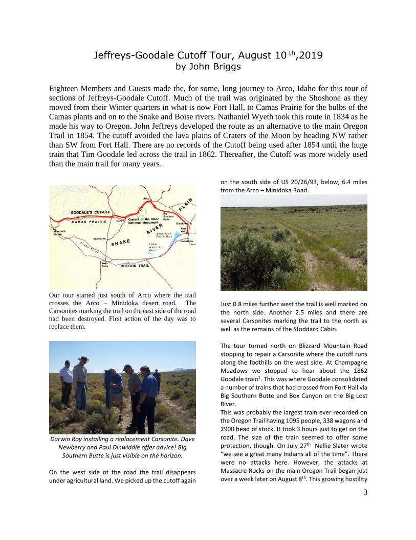
Jeffreys-Goodale Cutoff Tour, August 10 th,2019
by John Briggs
Eighteen Members and Guests made the, for some, long journey to Arco, Idaho for this tour of
sections of Jeffreys-Goodale Cutoff. Much of the trail was originated by the Shoshone as they
moved from their Winter quarters in what is now Fort Hall, to Camas Prairie for the bulbs of the
Camas plants and on to the Snake and Boise rivers. Nathaniel Wyeth took this route in 1834 as he
made his way to Oregon. John Jeffreys developed the route as an alternative to the main Oregon
Trail in 1854. The cutoff avoided the lava plains of Craters of the Moon by heading NW rather
than SW from Fort Hall. There are no records of the Cutoff being used after 1854 until the huge
train that Tim Goodale led across the trail in 1862. Thereafter, the Cutoff was more widely used
than the main trail for many years.
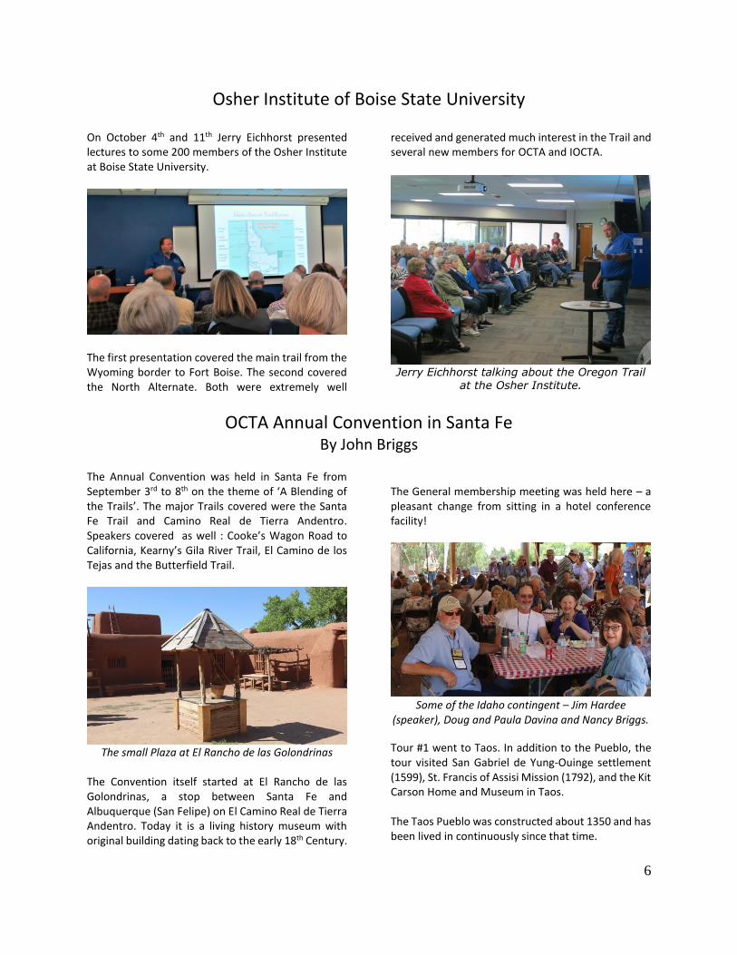
Our tour started just south of Arco where the trail
crosses the Arco – Minidoka desert road. The
Carsonites marking the trail on the east side of the road
had been destroyed. First action of the day was to
replace them.
Darwin Roy installing a replacement Carsonite. Dave
Newberry and Paul Dinwiddie offer advice! Big Southern Butte is just visible on the horizon.
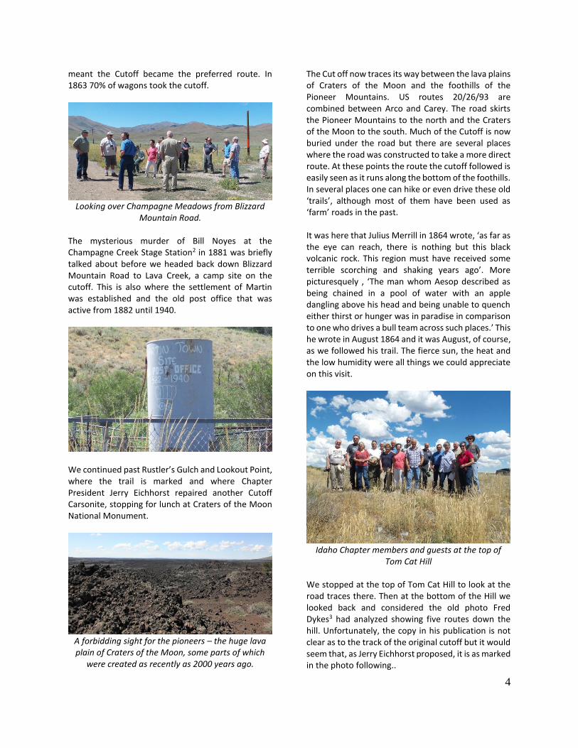
On the west side of the road the trail disappears under agricultural land. We picked up the cutoff again
on the south side of US 20/26/93, below, 6.4 miles from the Arco – Minidoka Road.
Just 0.8 miles further west the trail is well marked on the north side. Another 2.5 miles and there are several Carsonites marking the trail to the north as well as the remains of the Stoddard Cabin. The tour turned north on Blizzard Mountain Road stopping to repair a Carsonite where the cutoff runs along the foothills on the west side. At Champagne Meadows we stopped to hear about the 1862 Goodale train1. This was where Goodale consolidated a number of trains that had crossed from Fort Hall via Big Southern Butte and Box Canyon on the Big Lost River. This was probably the largest train ever recorded on the Oregon Trail having 1095 people, 338 wagons and 2900 head of stock. It took 3 hours just to get on the road. The size of the train seemed to offer some protection, though. On July 27th Nellie Slater wrote “we see a great many Indians all of the time”. There were no attacks here. However, the attacks at Massacre Rocks on the main Oregon Trail began just over a week later on August 8th. This growing hostility
4
meant the Cutoff became the preferred route. In 1863 70% of wagons took the cutoff.
Looking over Champagne Meadows from Blizzard
Mountain Road. The mysterious murder of Bill Noyes at the Champagne Creek Stage Station2 in 1881 was briefly talked about before we headed back down Blizzard Mountain Road to Lava Creek, a camp site on the cutoff. This is also where the settlement of Martin was established and the old post office that was active from 1882 until 1940.
We continued past Rustler’s Gulch and Lookout Point, where the trail is marked and where Chapter President Jerry Eichhorst repaired another Cutoff Carsonite, stopping for lunch at Craters of the Moon National Monument.
A forbidding sight for the pioneers – the huge lava plain of Craters of the Moon, some parts of which
were created as recently as 2000 years ago.
The Cut off now traces its way between the lava plains of Craters of the Moon and the foothills of the Pioneer Mountains. US routes 20/26/93 are combined between Arco and Carey. The road skirts the Pioneer Mountains to the north and the Craters of the Moon to the south. Much of the Cutoff is now buried under the road but there are several places where the road was constructed to take a more direct route. At these points the route the cutoff followed is easily seen as it runs along the bottom of the foothills. In several places one can hike or even drive these old ‘trails’, although most of them have been used as ‘farm’ roads in the past. It was here that Julius Merrill in 1864 wrote, ‘as far as the eye can reach, there is nothing but this black volcanic rock. This region must have received some terrible scorching and shaking years ago’. More picturesquely , ‘The man whom Aesop described as being chained in a pool of water with an apple dangling above his head and being unable to quench either thirst or hunger was in paradise in comparison to one who drives a bull team across such places.’ This he wrote in August 1864 and it was August, of course, as we followed his trail. The fierce sun, the heat and the low humidity were all things we could appreciate on this visit.
Idaho Chapter members and guests at the top of
Tom Cat Hill We stopped at the top of Tom Cat Hill to look at the road traces there. Then at the bottom of the Hill we looked back and considered the old photo Fred Dykes3 had analyzed showing five routes down the hill. Unfortunately, the copy in his publication is not clear as to the track of the original cutoff but it would seem that, as Jerry Eichhorst proposed, it is as marked in the photo following..

5
The other tracks are much clearer including the 1863 improvement, the 1900’s road, the 1920’s road and the current road (just off the photo). Looking a little closer at that area of Tom Cat Hill the route is discernible if not entirely clear!
From Tom Cat Hill we went on to the Lava Lake information board. Cotton Creek, which feeds the lake, was a camp site for the pioneers.
From the Eakin Family Diaries of 1866 ‘ The road winds around the foot of the mountains. Todays drive
was over the worst roads I ever saw. herd (sic) or read of, they were so rocky’. From Lava Lake we elected not to drive up the road to the Little Wood Reservoir where the cutoff crosses the Little Wood River. There is a very rough trail across Bradley Summit but not suitable for a caravan of enthusiasts. Instead we drove round to Picabo to pick up the trail as it descends from Bradley Summit.
View of the Cutoff coming down to Silver Creek from
Bradley Summit The tour concluded at Point of Rocks near Silver Creek. Names painted here are now almost completely eroded.
Very little left of axle grease painted names at Point
of Rocks
1. Rediscovered Frontiersman Timothy Goodale by James W. McGill. 2009. Oregon-California Trails Association.
2. Discovery of the Champagne Creek Stage Station Site by James W McGill and Patricia A. King-McGill. 2002. McGill Publishing and the Arco Advertiser.
3. Jeffrey’s Cutoff by Fred W Dykes. Third Edition, March 1995 published by the author.
4. Research by Jerry Eichhorst.
6
Osher Institute of Boise State University
On October 4th and 11th Jerry Eichhorst presented lectures to some 200 members of the Osher Institute at Boise State University.
The first presentation covered the main trail from the Wyoming border to Fort Boise. The second covered the North Alternate. Both were extremely well
received and generated much interest in the Trail and several new members for OCTA and IOCTA.
Jerry Eichhorst talking about the Oregon Trail
at the Osher Institute.
OCTA Annual Convention in Santa Fe By John Briggs
The Annual Convention was held in Santa Fe from September 3rd to 8th on the theme of ‘A Blending of the Trails’. The major Trails covered were the Santa Fe Trail and Camino Real de Tierra Andentro. Speakers covered as well : Cooke’s Wagon Road to California, Kearny’s Gila River Trail, El Camino de los Tejas and the Butterfield Trail.
The small Plaza at El Rancho de las Golondrinas
The Convention itself started at El Rancho de las Golondrinas, a stop between Santa Fe and Albuquerque (San Felipe) on El Camino Real de Tierra Andentro. Today it is a living history museum with original building dating back to the early 18th Century.
The General membership meeting was held here – a pleasant change from sitting in a hotel conference facility!
Some of the Idaho contingent – Jim Hardee
(speaker), Doug and Paula Davina and Nancy Briggs.
Tour #1 went to Taos. In addition to the Pueblo, the tour visited San Gabriel de Yung-Ouinge settlement (1599), St. Francis of Assisi Mission (1792), and the Kit Carson Home and Museum in Taos. The Taos Pueblo was constructed about 1350 and has been lived in continuously since that time.

7
The Taos Pueblo
Tour #2 went to Fort Union on the Mountain branch of the Santa Fe Trail. William Becknell is generally regarded as the Father of the Santa Fe Trail having pioneered its use from Missouri to Santa Fe in 1821. The Tour started at Watrous, where the Mountain Route and Cimarron Cut-off converge. Good swales were visited just south of Fort Union. Further stops were made in Las Vegas en el Rio de las Gallinas, San Miguel de Vado, Pecos and Glorieta Pass. This pass figured in both the US – Mexico War and in the Civil War.
Idaho Chapter member Jim Fazio in the ruins of the third
Fort Union
Tour #3 went to Chimayo which, like Taos, is on the Old Spanish Trail which went from Santa Fe to California through Colorado and Utah. The Tour took the scenic route to Nambe Pueblo before arriving at El Santuario de Chimayo (1816). This is the site of the largest Holy pilgrimage in the U.S. Each Holy week as many as 40,000 pilgrims make their way here.
El Santuario de Chimayo
The tour ended at the historic Rancho de Chimayo restaurant. Tour #4 was a self-guided tour of Albuquerque, Bernalillo and the ruins of the Kuaua Pueblo which was abandoned in the 16th Century due to the Tiguex War. Tour #5 visited the Cicuye (later Pecos) Pueblo and Mission ruins at the Pecos National Historic Park. Very little remains of the Pueblo, but the Mission has been preserved. It is the second Mission on this site. The original Mission was built in 1621 but destroyed in the Pueblo revolt of 1680. The smaller, replacement was built in the late 17th Century. The site was abandoned in 1838. The Santa Fe Trail runs through portions of the Park.
Chapter members Jim and Cathy Blair Green with Paula
Davina at Pecos.
The Mission at Pecos
This Tour also stopped on the Old Santa Fe Trail at Museum Hill to see the bronze sculpture “Journey’s End”. Altogether an interesting and very rewarding Convention teaching us a great deal about the Trails of the South West and the long history of the Region!

8
Oregon Trail Recreation Area, Ada County October 5th, 2019
By John Briggs
The Idaho Chapter Fall Meeting was held on October 5th in Boise. Following a short Business Meeting there were presentations by David Valentine of Idaho Power and Mike Edwards of Ada County Parks and Waterways. David, an archaeologist, gave an interesting talk about the efforts required of Idaho Power when renewing power lines. Mike spoke of plans the County has for improving the Recreation Area which sits to the south of State Route 21 near SE Boise. The plan for the afternoon was to visit the Recreation Area to get a better idea of what is there and how it will be improved.
Google Earth view of the Recreation Area
The map above shows the area in question. It can be reached by taking Idaho State Route 21 from I 84 East towards Idaho City. The Recreation Area is reached before crossing the Boise River and is on the south side of the road. The Oregon Trail Reservation, a City Park, lies to the north. Neither the Kelton Road nor the Oregon Trail are marked here apart from the place where the Oregon Trail descends the basalt cliff at a rim opening in the center of the map above. Ada County plans to mark the trails and to create an all-weather loop for hikers and runners to use so that they would not damage the Trail or the Kelton Road. Twenty-four people attended the meeting and the majority then went on the tour in the afternoon. We started at the parking lot and information boards before hiking along the rim to the opening down which the Pioneers let their wagons.
Idaho Chapter members above the Rim Opening where the
Oregon Trail descended the basalt cliffs.
Looking over the Rim
A smaller group hiked up the Kelton Road to the top of the bench and then along the Oregon Trail to the remains of the old Stage Station there.
All that remains of the Stage Station

9
We then followed the Oregon Trail down from the top bench …
Finishing up once more at the Information Boards
Devil’s Grave on the California Trail, September 29th 2019 By John Briggs
In 2020 the OCTA Annual Convention will be held in Elko, NV. One of the Pre-Convention Tours planned involves the California Trail over Granite Pass and on to Record Bluff and Thousand Springs Valley. Late September seemed like a good time to scout the options that exist for this tour but that proved not to be the case. Rain, followed by snow, turned the dirt roads into impassable quagmires.
Unnamed Road south-west of Granite Pass close to
the Idaho/Utah border. After struggling to approach Granite Pass we decided to turn around, head back to Goose Creek and take Birch Creek Road to Devil’s Grave. Here the California Trail experienced a steep descent into Birch Creek. Jerry Eichhorst led us to the Trails West marker at the base of the ‘Devil’s Grave’ and we then enjoyed a short, but, strenuous hike up the California Trail where we saw good swales and ruts.
Jerry and Paul Dinwiddie at Devil’s Grave
“We came to …Devil’s Grave …reached the bottom in safety ….It is worse than all the bad places put together that we have found on the road. It is perpendicular in some places …besides being deeply gullied.” Caroline L Richardson Aug 3, 1852.
Paul further up the Trail.
We returned up Goose Creek Road to Oakley and then via farm roads to Jackpot, NV intending to go to Record Bluff. More snow fell that evening and so the adventure was cut short!

10
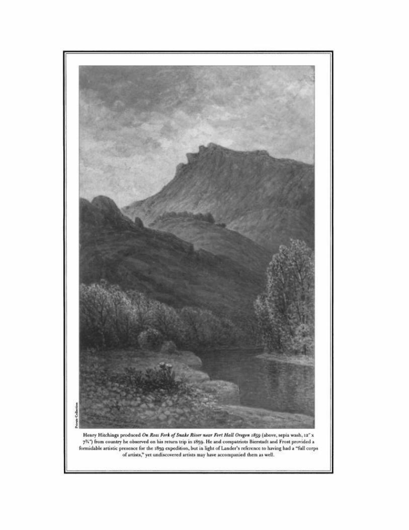
Diaries Across Idaho The Narrows
By Jerry Eichhorst
Continuing down the west side of Mt. Putnam, the Oregon Trail dropped into
a steep canyon of Ross Fork known as “The Narrows”. Excellent trail ruts exist as they descend into the canyon, cross the stream, and travel along a shoulder
on the north side of the canyon. A jagged mountain along the way is a sacred tribal quest site for the Shoshone-Bannock Tribe. It was drawn by Henry
Hitchings from country he observed on his return trip in 1859 and included in On Ross Fork of Snake River near Fort Hall Oregon 1859.
…camped on Ross Fork in deep valley on a beautiful little stream…
Medorem Crawford, August 13, 1842
Continued our journey and after descending
the mountains we followed for some time, the course of a small stream…
Joseph Waring Berrien, June 26, 1849
…Near camp passed through a very romantic gorge between high rugged ridges snow 80 ft high & firm near road, can look down 100 to
150 ft perpindicular & see the stream of a spring above rush through a narrow gorge of wildest character…
Peter Decker, June 28, 1849
We followed this spring branch down two miles
& encamped upon the side of a hill with plenty of wood, grass & water.
Wakeman Bryarly, July 12, 1849
We followed the creek half the day. Soon after we crossed the creek it had the appearance of going under the hill, but it did not – it ran
through a gap. Israel Foote Hale, July 22, 1849 Traveled down a valley a long a small stream gradually widening to a very wide spread valley
Colonel James Tabe, July 24, 1849
Our Panak friend was soon lost to our view in the sinuous descent of the mountain, the character of the mountain, being now, rocks,
precipices, hills, vales, brooks, willows, cedars, ravines, &c. though the road is good.
J. Goldsborough Bruff, August 19, 1849
Idaho Chapter OCTA 2908 Whitehaven Place Eagle, ID 83616
IOCTA Officers and Directors
Jerry Eichhorst President [email protected]
Don Wind VP - East [email protected]
John Briggs VP - West [email protected]
Dan Dunne Treasurer [email protected]
Paul Dinwiddie Secretary [email protected]
Virgel Clark Historian [email protected]
Don Wind Preservation - East [email protected]
Virgel Clark Preservation - West [email protected]
Nancy Briggs TD Editor [email protected]
Jerry Eichhorst Webmaster www.IdahoOCTA.org
Dave & Donna Newberry Director [email protected]
Lyle Lambert Director [email protected]
Bill Wilson Director [email protected]
Jim & Dawna Fazio Director [email protected]
Lynn and Margie Houdyshell Director [email protected]
Visit IOCTA online at www.IdahoOCTA.org